Cave Archaeology of the Lenggong Valley, Malaysia - FLEX
331
Cave Archaeology of the Lenggong Valley, Malaysia: A Heritage Management Perspective Hsiao Mei Goh A thesis submitted for the degree of Doctor of Philosophy Department of Archaeology Faculty of Education, Humanities and Law August 2014
-
Upload
khangminh22 -
Category
Documents
-
view
1 -
download
0
Transcript of Cave Archaeology of the Lenggong Valley, Malaysia - FLEX

Cave Archaeology of the Lenggong Valley, Malaysia: A Heritage Management Perspective
Hsiao Mei Goh
A thesis submitted for the degree of Doctor of Philosophy
Department of Archaeology Faculty of Education, Humanities and Law
August 2014

II
I certify that this thesis does not incorporate without acknowledgment any material previously submitted for a degree or diploma in any university; and that to the best of my knowledge and belief it does not contain any material previously published or written by another person except where due reference is made in the text.
Hsiao Mei Goh

III
Abstract
This dissertation reviews the contemporary cultural heritage management system in Malaysia
with a special focus on three archaeological cave sites – Gua Gunung Runtuh, Gua Kajang
and Gua Harimau—that form part of the World Heritage Listed site, the Archaeological
Heritage of the Lenggong Valley. The study first synthesizes the archaeological data of these
caves and presents a regional synthesis of the cave occupation of the Lenggong Valley during
the Late Pleistocene-Holocene periods in Southeast Asia. The project also investigates the
contemporary heritage management planning for the Lenggong Valley and further explores
the social significances of these caves from a community perspective by adopting a Burra
Charter-inspired heritage assessment process, on the assumption that this significance is the
key to determining management priorities. Results of this study reveal that the cave sites of
the Lenggong Valley were continuously occupied by prehistoric humans from 14,000 to
1,500 years ago. Investigations into the recent use of the caves surprisingly revealed that the
local community associated these caves with several important social and historical episodes,
and these caves are still being used by the local community on a daily basis. However, it is
ironic to discover that contemporary conservation and management of the Lenggong Valley
tend only to emphasize the archaeological values of the area and disregard the other heritage
values associated with the local community. Examination of the contemporary heritage
management plan for the valley showed that the rate of consultation with, and inclusion of,
the local community in management planning is fairly low. The social significance
assessment of the caves has shed new light on the interpretation of the cultural heritage of the
valley, as well as reflected the divergences between the official values ascribed by
professionals, such as archaeologists, to the site and the non-official values. As the present
practice solely relies on heritage professionals ascribing meaning to the sites, the
discrepancies between how such professionals and other officials and local stakeholders
perceive their heritage reflects the domination by professional groups of the cultural heritage
assessment process in Malaysia. This study addresses a need to rethink the old heritage
management approach and urges the need for a greater recognition of the social significance
of the caves of the Lenggong Valley. It also argues that the successfulness of heritage
conservation in the Lenggong Valley is highly dependent on local conservation efforts, and
this can only be achieved if heritage officials acknowledge the importance of local values and
actively incorporate local ideas into the future management planning of the valley.

IV
Acknowledgements
This dissertation would not have been possible without the help of so many people and here I
would like to thank them.
Above all, I would like to express my gratitude to Associate Prof. Dr. Heather Burke for her
support, encouragement and patience over the last 4 years of my Ph.D study. I would also
like to thank my co-supervisors Dr. Mick Morrison, my previous co-supervisors Dr. Lynley
Wallis and Dr. Alice Gorman, and my external supervisor, Prof. Mokhtar Saidin for your
continuous support and advise throughout my candidature. I really appreciate the knowledge
and expertise shared in different aspects of my project.
I would also like to thank Ministry of Higher Education Malaysia for the funding of my study
in Flinders University and Department of National Heritage and University Sains Malaysia
(USM) granted me the research grant to complete my research in the Lenggong Valley.
As my research involves several phases of archaeological investigations and excavations in
the Lenggong Valley, I would like to take this opportunity to express my appreciation to the
staffs from Centre of Global Archaeological Centre, USM, the staffs from Lenggong
Archaeological Museums and Lenggong District Council for your kind cooperation and
assistance in my field investigations and surveys as well as laboratory analyses.
Added to this, I would also like to thank all the participants in my surveys, especially the
residents of the Lenggong Valley for sharing me their personal perspectives about the
contemporary heritage management of the Lenggong Valley.
At last but not least, I would like to express my deepest gratitude to my late father, who
recently passed away. Thank you for your undiviable love and support throughout my study
and your support and encouragement were vital to keep me motivated. I love you and you

V
will always be remembered. I would also like to thank my family members and friends for
always being there for me, thank you very much.

VI
Table of Contents
List of Table .............................................................................................................. IX
List of Figures ............................................................................................................ X
Chapter 1 – Introduction and Overview .................................................................. 1 1.1 Cultural heritage protection in Southeast Asia: a brief introduction .................................... 3
1.1.1 Heritage from top-down .................................................................................................... 6 1.1.2 Legislation, heritage charters and decrees: a regional context .......................................... 7
1.2 Cultural heritage protection in Malaysia: a brief introduction.............................................. 9 1.2.1 Heritage from top-down ...................................................................................................... 10 1.2.2 Legislation, heritage charters and guidelines ...................................................................... 11 1.2.3 The heritage conservation of Malaysia: a recent trend ........................................................ 12
1.3 The background to the project: the Lenggong Valley ........................................................... 13 1.4 The motivation of the research: issues and challenges for the cave archaeology of the Lenggong Valley ............................................................................................................................. 20
1.4.1 Insufficient internationally-published materials .............................................................. 20 1.4.2 On-going site deterioration .................................................................................................. 21 1.4.3 Insufficient heritage conservation management .............................................................. 23 1.4.4 Imbalances in the focus of archaeological research ......................................................... 24
1.5 Research Questions ................................................................................................................... 25 1.6 Significance of the research ..................................................................................................... 26 1.7 Thesis outline ........................................................................................................................ 28
Chapter 2 Malaysian Archaeology: A Heritage Management Perspective ..... 31 2.1 Theoretical Underpinnings: Definition and scope of heritage .......................................... 32
2.1.1 Definitions and scope of heritage in Malaysia................................................................. 34 2.2 The concept of cultural significance .................................................................................... 37
2.2.1 The concept of cultural significance: Implications for Malaysian heritage ..................... 41 conservation ................................................................................................................................. 41 2.2.2 The social significance of the Lenggong Valley: A neglected dimension ....................... 44
2.3 Heritage Management: Implications for Malaysian Archaeology ....................................... 47 2.3.1 Malaysian archaeology: whose heritage for whom? ........................................................... 50 2.3.2 The Protection of Heritage: policies and legislation ........................................................... 52
2.4 Discussion .............................................................................................................................. 61
Chapter 3 Research Methodology ....................................................................... 65 3.1 Identification and documentation – Cave archaeology of the Lenggong Valley ............ 65
3.1.1 Documentary Research .................................................................................................... 66 3.1.2 Artefact Inventories ......................................................................................................... 68 3.1.3 Radiocarbon Dating of Charcoal from Gua Kajang and Gua Harimau ........................... 72 3.1.4 Field Survey ..................................................................................................................... 74 3.1.5 Rescue Excavation ........................................................................................................... 77
3.2 Review of the contemporary heritage management of the Lenggong Valley .................. 79 3.2.1 Content Analysis of the heritage management plan of the Lenggong Valley ..................... 80
3.3 Heritage Assessment of the Cave Sites of Gua Gunung Runtuh, Gua ................................ 86 Kajang and Gua Harimau ............................................................................................................. 86
3.3.1 Questionnaire Survey .......................................................................................................... 87 3.3.2 Interviews ........................................................................................................................ 93
VII
3.4 Conclusion ................................................................................................................................. 96
Chapter 4 Cave Archaeology of the Lenggong Valley ....................................... 97 4.1 Caves and rock shelters in the Lenggong Valley: A geological background ................... 99 4.2 Cave archaeology of the Lenggong Valley: History and development .......................... 102 4.3 Prehistoric Cave Occupation of the Lenggong Valley ..................................................... 105
4.3.1 Cultural sequences ........................................................................................................... 105 4.3.2 Cave Chronology ............................................................................................................. 109
4.4 The Terminal late Pleistocene – early Holocene Occupation ......................................... 115 4.5 The Holocene Occupation ................................................................................................. 122 4.6 Discussion and Conclusion ................................................................................................. 129
Chapter 5 Background to the Study: Gua Gunung Runtuh, Gua Kajang and Gua Harimau 140
5.1 The Lenggong Valley .......................................................................................................... 140 5.2 Identification and Description of Gua Gunung Runtuh, Gua Kajang and Gua Harimau 143
5.2.1 Gua Gunung Runtuh ...................................................................................................... 144 5.2.1.1 Archaeological Research and Findings ....................................................................... 148 5.2.1.2 Present State of Conservation......................................................................................... 151 5.2.2 Gua Kajang .................................................................................................................... 158 5.2.2.1 Archaeological Research and Findings ..................................................................... 163 5.2.2.3 Present State of Conservation .................................................................................... 169 5.2.3 Gua Harimau .................................................................................................................. 178 5.2.3.1 Archaeological Research and Findings ..................................................................... 183 5.2.3.3 Present state of conservation ....................................................................................... 190
5.3 Summary and Discussion ....................................................................................................... 198
Chapter 6 Archaeological Heritage of Lenggong Valley: A Review of its Contemporary Heritage Management ................................................................. 200
6.1 The Archaeological Heritage of the Lenggong Valley: A newly nominated WHS ....... 202 6.2 The Management of AHLV prior to its UNESCO World Heritage Status: A brief highlight ......................................................................................................................................... 205 6.3 The Content Analysis of the CMP of AHLV: motivation and rationale ......................... 209 6.4 The Content Analysis of the AHLV Management Plan: Methodology ............................. 213 6.5 Content Analysis: The results ............................................................................................ 217
6.5.1 Legislation ..................................................................................................................... 220 6.5.2 Site Evaluation and Management Objectives ................................................................ 224 6.5.3 Action and Implementation ............................................................................................... 231 6.5.4 Community Values and Attitude ................................................................................... 238 6.5.5 Stakeholders and Community Participation .................................................................. 240
6.6 Summary and Discussion ................................................................................................... 244
Chapter 7 The Heritage Assessment of Gua Gunung Runtuh, Gua Kajang and Gua Harimau 248
7.1 The Questionnaire Survey: rationale and methods ......................................................... 249 7.2 Questionnaire Surveys in Gua Gunung Runtuh, Gua Kajang and Gua Harimau : results and findings ....................................................................................................................... 250
7.2.1 Gua Gunung Runtuh ...................................................................................................... 253

VIII
7.2.2 Gua Kajang .................................................................................................................... 259 7.2.3 Gua Harimau ..................................................................................................................... 265 7.2.4 Relationships between variables ....................................................................................... 270
7.3 Oral interviews ........................................................................................................................ 274 7.3.1 Gua Gunung Runtuh ......................................................................................................... 274 7.3.2 Gua Kajang ........................................................................................................................ 276 7.3.3 Gua Harimau ..................................................................................................................... 278
7.4 The Social Significance of GGR, GK and GH .................................................................... 280 7.5 Summary and Conclusion ...................................................................................................... 287
Chapter 8 Rethinking the cultural significance of the caves of the Lenggong Valley: A reflection for future heritage management .......................................................... 288
8.1 The divergence between official value and social value .................................................. 288 8.1.1 The "official value" ........................................................................................................ 290 8.1.2 The complexity of the contemporary cultural significance framework ......................... 291 8.1.3 Social depreciation of heritage ...................................................................................... 294
8.2 The divergence of heritage values: Implications for heritage management ...................... 296 8.3 Rethinking the social significance of the Lenggong Valley: A discussion ..................... 298
Bibliography ........................................................................................................... 303 Appendices

IX
List of Table
Table 1.1 UNESCO World Heritage Sites in Southeast Asia……………………………5
Table 3.1 The latest C14 dates obtained from Gua Kajang and Gua Harimau………………………………………………………………………………………73
Table 3.2 The AHLV management plan coding instruments…………………….……..83
Table 3.3 The rationales for the coding responses……………………………………...84
Table 4.1 The radiocarbon dates of cave sites in the Lenggong Valley……………….112
Table 4.2 Late Pleistocene-Holocne cave sites of Southeast Asia.................................135
Table 5.1 The associated finds of the human burial of Perak Man……………………151
Table 5.2 The excavated cultural materials from Gua Gunung Runtuh…………….…152
Table 5.3 The C14 dates of Gua Gunung Runtuh………………………………………153
Table 5.4 The archaeological investigations and finds of Gua Kajang………………..166
Table 5.5 The C14 dates of the cultural remains of Gua Kajang…………………….…168
Table 5.6 The The archaeological investigations and finds of Gua Harimau..................................................................................................................................195
Table 5.7 The C14 dates from Gua Harimau……………………………………….......197
Table 6.1 Results of the content analysis of the AHLV preliminary CMP based on the mean score……………………………………………………………………………….…214
Table 6.2 The rationales for the coding response..........................................................216
Table 7.1 Pearson’s correlation coefficient for responses about Gua Gunung Runtuh………………………………………………………………………………….......272
Table 7.2 Pearson’s correlation coefficient for responses about Gua Kajang…………………………………………………………………………………..…..272
Table 7.3 Pearson’s correlation coefficient for responses about Gua Harimau………………………………………………………………………………….…272

X
List of Figures
Figure 1.1 The location of the Lenggong Valley in Malaysia…………………………...15
Figure 1.2 The current land use pattern of Lenggong Valley…………………………....17
Figure 1.3 The nominated property of the UNESCO World Heritage Site of the Archaeological Heritage of the Lenggong Valley (AHLV)………………………………….19
Figure 3.1 The latest sketch of the floor plan of Gua Harimau in a ratio of 1:100………………………………………………………………………………………….75
Figure 3.2 Pedestrian survey and field recording in Gua Harimau……………………...76
Figure 3.3 Immediate on-site documentation of burial GH12 in Gua Harimau after its discovery……………………………………………………………………………………..77
Figure 3.4 The excavation of GH 12 burial……………………………………….……..78
Figure 3.5 Methacrylate co-polymer in acetone (5-20%) was applied on the surface of the bones……………………………………………………………………………………….…79
Figure 3.6 Mr Shaiful Shahidan from the University Sains Malaysia conducting the questionnaire survey in Kampung Gelok, Lenggong Valley……………………………...…91
Figure 3.7 Mr Shaiful Shahidan reading the verbal consent text to the interviewee…………………………………………………………………………………...95
Figure 4.1 The location of Lenggong Valley in Peninsular Malaysia…………………..99 Figure 4. 2 The limestone hills in the Lenggong Valley………………………………..101
Figure 4. 3 The Prehistoric Cave Chronology of the Lenggong Valley………………...113
Figure 5. 1 An aerial view of the Lenggong Valley…………………………………….142
Figure 5. 2 The location of Gua Gunung Runtuh, Gua Kajang and Gua Harimau in the Lenggong Valley……………………………………………………………………….…...143
Figure 5. 3 The southwestern face of Bukit Kepala Gajah limestone massif…………...144
Figure 5. 4 The access path to Gua Gunung Runtuh……………………………………145
Figure 5. 5 The floor plan of Gua Gunung Runtuh……………………………………..147
Figure 5. 6 The main chamber of the Gua Gunung Runtuh…………………………….148
Figure 5. 7 The 1990 excavation in Gua Gunung Runtuh………………………………149
Figure 5. 8 The excavation of the Perak Man in the Gua Gunung Runtuh…………..…150
Figure 5. 9 Oval unifacial pebble tools buried with Perak Man……….………………..153

XI
Figure 5.10 The information sign erected in front of the southern entrance of Gua Gunung Runtuh………………………………………………………………………………………154
Figure 5.11 The graffiti on the cave wall of Gua Gunung Runtuh……….………….….155
Figure 5.12 Green algae and roots found in Gua Gunung Runtuh….…………..……….156
Figure 5.13 Bats still inhabit Gua Gunung Runtuh……………………………...………156
Figure 5.14 The cave floor of Gua Gunung Runtuh is uneven and scattered with limestone chunks…………………………………………………………………………………….…157
Figure 5.15 Excavation trenches opened in 1990 have been left open without being backfilled………………………………………………………………………………..…..158
Figure 5.16 The front view of Gua Kajang facing north………………………………...159
Figure 5.17 The well-sealed access road to Gua Kajang…………………………..…….160
Figure 5.11 The floor plan of Gua Kajang……………………………….……………...162
Figure 5.19 Some surface finds noted during the field survey in 2010 in Gua Kajang……………………………………………………………………………….……...162
Figure 5.20 The 2007 excavation at the eastern part of the front cave……...……...….165
Figure 5.21 The boardwalk connecting four cave sites in the Bukit Kepala Gajah limestone massif………………………………………………………………….............…169
Figure 5.22 The disturbed area at the front of the cave……………………….................170
Figure 5.23 The area at the cave mouth now partially covered by tar…………...............171
Figure 5.24 The disturbed area in the east bay of Gua Kajang………………..............…172
Figure 5.25 Crude wooden platforms laid to provide passage between the two mouths of Gua Kajang…………………………………………………………...............................…..172
Figure 5.26 Limestone boulders at the southern end of Gua Kajang…….............……...173
Figure 5.27 Illegal diggings in Gua Kajang have severely destroyed the deposits of the cave. The circled area indicates the depth of deposit removed in a two-year period……………………………………………………………………………............….174
Figure 5.28 One of the pottery vessels excavated by a local resident in Gua Kajang as offered for sale in 2010…………………………………………………….....................….174
Figure 5.29 Cultural artefacts scattered in the cave………………………................…..175
Figure 5.30 Large vehicles often access the cave to collect the latex from surrounding rubber estates……………………………………………………....................................….176
Figure 5.31 The cave wall of Gua Kajang covered with modern graffiti…...................177
Figure 5.32 The cave wall has been partially painted with grey paint……….................177

XII
Figure 5.33 The southern face of Bukit Gua Harimau……………………….................178
Figure 5.34 Gua Harimau is now surrounded by rubber plantations………...............…179
Figure 5.35 The footpath access to Gua Harimau…………………………...............….180
Figure 5.36 The front view of entrance A of Gua Harimau facing south……..................180
Figure 5.37 The floor plan of Gua Harimau……………………………….................….182
Figure 5.38 The inner part of Gua Harimau is dim and the cave floor is badly disturbed………………………………………………………………….................………182
Figure 5.39 The excavation in Gua Harimau between 1987 and 1988……….................185
Figure 5.40 The human burial of GH 1 excavated in 1987…………………...................185
Figure 5.41 Burials of GH1, GH 2 and GH 3 and their associated artefacts found during the excavations between 1987 and 1988…………………………………...........................186
Figure 5.42 Human remains discovered in front of the entrance B of Gua Harimau in 2010…………………………………………………………………...................…………187
Figure 5.43 The burial area and associated finds of GH 12…………...............………...188
Figure 5.44 The left portion of the mandible showed a robust mandibular body and a prominent mandibular angle, which indicates GH 12 was a male. As the mandible was too fragile to remove from the soil, it was now consolidated within the soil block for further study…………………………………………………………………...................................189
Figure 5.45 The earthenware vessel reconstructed from the pottery sherds found associated with GH 12………………………………………………………….................................…189
Figure 5.46 (left to right) Pottery sherd and stone tool found on the surface of the cave floor of Gua Harimau……………………………………………………........................….190
Figure 5.47 Fallen stalactites scattered on the cave floor of Gua Harimau…...................192
Figure 5.48 The cave wall of Gua Harimau covered with graffiti…………................….197
Figure 5.49 The cave mouth of Gua Harimau covered with limestone boulders………………………………………………………………………......................193
Figure 5.50 The information sign erected in front of Gua Harimau………................….194
Figure 6.1 The mean reading of the responses collected for each of the evaluation dimension………………………………………………………………………...............…218
Figure 6.2 The mean reading for the each coding item adopted to assess the level of integration of heritage legislation in the AHLV’s CMP………………………....................221
Figure 6.3 The mean reading for the each coding item adopted to assess the effectiveness of the site evaluation and management objectives of AHLV…….....................................…225
Figure 6.4 The mean reading for the each coding item adopted to assess the level competency of the action and implementation of AHLV’s CMP………...............………...233

XIII
Figure 6.5 The mean reading for the each coding item adopted to assess the level of integration of local values and attitudes in the heritage management of AHLV...................239
Figure 6.6 The mean reading for the each coding item adopted to assess the level of local invovement in the AHLV………………………………………………...........................…241
Figure 7.1 The age range of the survey respondents………………………..............….251
Figure 7.2 The occupations of the survey respondents……………………...............….251
Figure 7.3 The educational level of the survey respondents……………..............….….252
Figure 7.4 Length of residence in the Lenggong Valley by survey respondents……………………………………………………………………….................253
Figure 7.5 The first image of GGR portrayed by the respondents…………..............…254
Figure 7.6 Local knowledge about GGR…………………………………….................255
Figure 7.7 The importance of GGR to the local community of the Lenggong Valley…………………………………………………………………………….................256
Figure 7.8 The importance of GGR to the wider community of Malaysia…..................257
Figure 7.9 The social connection between local respondents and GGR…….................258
Figure 7.10 The first image of GK portrayed by the respondents…………..............…...260
Figure 7.11 Local knowledge of GK………………………………………….................261
Figure 7.12 The importance of GK for the local community of the Lenggong Valley……………………………………………………………………….……................262
Figure 7.13 The importance of GK to the wider community of Malaysia…....................263
Figure 7.14 Social connections between local respondents and Gua Kajang…...............264
Figure 7.15 The first image of Gua Harimau as portrayed by the respondents…………………………………………………………………....…................265
Figure 7.16 Local knowledge about Gua Harimau……………………...........................266
Figure 7.17 The importance of GH to the local community of the Lenggong Valley………………………………………………………………………….................…267
Figure 7.18 The importance of GH to the wider community of Malaysia…....................268
Figure 7.19: Social associations between the respondents and Gua Harimau....................269
Figure 8.1 The cultural heritage values typology as stipulated in National Heritage Act 2005……………………………………………………………………........................……293

1
Chapter 1 – Introduction and Overview
In Southeast Asia, the archaeological investigations of caves and rockshelters are thus far
considered as one of the main focuses of archaeological investigation across the region. This
is because previous researches show that many caves and rockshelters comprise clues for the
understanding of cultural development in the human history, especially during the late
Pleistocene and Holocene periods in Southeast Asia (e.g. Anderson, 1997; Barker et al.,
2007; Bellwood, 1997). This recognition of the importance of caves and rockshelters have led
to an urge to conserve and preserve these archaeologically importance sites as a means to
safeguard the past for future generation.
In Malaysia, the conservation and preservation programmes have been put in place to
conserve the archaeological sites particularly the archaeological cave sites since 1990s (e.g.
Chia, 2004; Zuraina, 1997). Archaeological site, in this context, adopted the definition from
Hoi An Protocols as “… a site that comprises any combination of structural remains,
artefacts and ecological elements within a culturally modified soil matrix...” (UNESCO,
2005). Despite nearly a decade of conservation, recent cave surveys conducted by Goh and
Mokhtar (2011), however, revealed that many of the archaeological cave sites of the
Lenggong Valley are subject to on-going deteriorations. Among the others, Chia (2004) and
Goh and Mokhtar (2011) pointed to the low level of heritage awareness among the local
communities as the main threat that challenges the heritage conservation of the Lenggong
Valley at present day.
In seeking for the factors that influence the effectiveness of a heritage conservation
programme in Southeast Asia, Byrne (2011:3) and Karlstrom (2009), through their works in
Thailand and Laos concluded that the successfulness of the heritage conservation in
Southeast Asia is highly influenced by the local support. They argued that the contemporary

2
heritage conservation practice of Southeast Asia which gives greater focus on the tangible or
physical elements of the sites and artefacts has failed to address and acknowledge the
intangible elements (i.e. popular cultures, religious practices, living traditions, and collective
memory) associated with a heritage site. As the result, the local communities are often felt
themselves detached from the heritage site. This has led to a scenario where the local
community refused to involved or support the heritage conservation programmes and thus
make the conservation programme based on the local effort impossible.
Given that the local effort in heritage conservation is now perceived as the key to a successful
and sustainable heritage conservation (Rössler, 2012:29), a good heritage conservation
programme should therefore consider the local ideas especially how the local community
perceived and socially connected to the local heritage. In other words, the heritage
conservation programme should sitting within a social context. As such, the investigation into
the cultural values associated with a heritage sites as well as the cultural continuity from
prehistoric times to the present-day existing of living cultures are among the popular themes
that have to be investigated when one engages with the heritage management across the
Southeast Asian countries.
Corresponding to the above discussion, this thesis, by looking at three archaeological cave
sites of the Lenggong Valley, Malaysia, tends to investigate the level of inclusiveness of the
contemporary heritage management of Malaysia in acknowledging the tangible but also the
intangible elements associated to a heritage site, especially the socio-cultural connection
between the local community and the site within a heritage precinct. Overall, this PhD project
comprises three main components. First is to present a thorough synthesis about the uses of
the caves of Lenggong Valley since late Pleistocene time to the recent past; second is to
investigate the issues surrounded the heritage management of Malaysia as well as explore to
what extent, the contemporary heritage management practices are sufficient to address these

3
issues; and finally, this project also takes the initiatives to incorporate the Burra Charter-
inspired heritage assessment into the identification of the cultural values associated with the
cave sites of the Lenggong Valley and examine whether or not, there is a divergence between
the official values (i.e. the cultural values identified by the government agencies and heritage
professionals) and the values held by the local community as well as explore its implication
for the heritage conservation of Malaysia. Local community, in this context, refers to the
community which presently lives in the Lenggong Valley. Although there are many sources
pointed to Lenggong Valley as an area used to be occupied by the Indigenous people, the
Indigeneous community, however, has been relocated to a new village, approximately 15-
20km away from Lenggong Valley since 1970s-1980s. This thesis, therefore, only collected
the voices of the existing residents of the Lenggong Valley in order to address the
contemporary heritage management issues based on the local social context.
This chapter begins with a brief examination of the development of cultural heritage
protection in Southeast Asian region over the past few decades and discusses how the
emergence of the concept of UNESCO World Heritage influences the orientation of heritage
conservation of the region since 1972. Then, the later parts of the chapter will looking at the
background of this project – the Lenggong Valley, as well as discusses the objectives and
significance of this PhD project in contributing to the understanding of the contemporary
heritage management practice in Malaysia.
1.1 Cultural heritage protection in Southeast Asia: a brief introduction
The preservation and management of archaeological heritage is a subject of increasing
interest in many parts of the world today (e.g. Cleere, 1984, 1989; Karlstrom, 2009;
McManamon and Hatton, 2000). Following the adoption of the UNESCO Convention

4
Concerning the Protection of the World Cultural and Heritage (henceforth referred as the
UNESCO World Heritage Convention) in 1972, concerns over heritage management have
become more evident in the past few decades, as evidenced in the development of legislative
frameworks for the protection of World Heritage. Today, it is notable that, other than
internationally recognized charters, such as the Australia ICOMOS Burra Charter (1999) and
the ICOMOS International Charter for the Protection and management of Archaeological
Heritage (1990), most countries have their own heritage management systems that include
provisions for the protection of their heritage (Cleere, 1989).
In Southeast Asia, the early movement of heritage preservation in archaeology can be traced
back to the 1960s when Thailand and Laos began to include few archaeological impact
assessments in their major constructions project. This led to the discoveries of several major
prehistoric metallurgy sites across that region (e.g. Solheim, 1974). Later in 1970s, some
private research foundations such as the Ford Foundation and Toyota Foundation began to
provide financial and technical support into the heritage projects (i.e. archaeological projects
and training programs) as a means to promote local Southeast Asian’s effort to protect and
conserve their own heritage (Shoocongdej, 2011:713).
In the end of 1980s, interests in the preservation and management of heritage have become
even more evident across the Southeast Asian (SEA) region. Countries such as Philippines,
Malaysia, Laos, Indonesia, Thailand and Vietnam ratified the UNESCO World Heritage
Convention and became the states parties for UNESCO at the end of the 1980s. Later, in
1991, Cambodia also accepted it and the site of Angkor in Cambodia was listed on the World
Heritage List in 1992. At present, the preservation and management of heritage sites have
become major issues in most Southeast Asian countries, especially those under development
from rapid urbanization, such as Thailand and Jakarta (Akagawa & Sirisrisak, 2008).
Working towards World Heritage status for a site, therefore, is perceived as a practical way to

5
protect heritage sites and instill comprehensive management practices to sustain the survival
of sites in Southeast Asian countries facing increasing development pressures (Black and
Wall, 2001:124). According to the statistics published by the UNESCO World Heritage
Centre, as of 2012, a total of 33 sites from SEA are listed on the World Heritage List (Table
1.1). Of these, 21 (approximately 63%) are cultural heritage sites, whereas the remaining12
(37%) are natural heritage sites (UNESCO WHC, 2012).
Country Name of heritage property Nature of property
Year of Inscription
Cambodia Angkor Temple of Preah Vihear
Cultural Cultural
1992 2008
Indonesia Borobudur Temple Compounds Prambanan Temple Compounds Sangiran Early Man Site Cultural Landscape of Bali
Province: the Subak System as a Manifestation of the Tri Hita Karana
Komodo National Park Ujung Kulon National Park Tropical Rainforest Heritage of
Sumatra Lorentz National Park
Cultural Cultural Cultural Cultural Natural Natural Natural Natural
1991 1991 1996 2012 1991 1991 1999 2004
Lao’s People Democratic Republic
Town of Luang Prabang Vat Phou and Associated Ancient
Settlements within the Champasak Cultural Landscape
Cultural Cultural
1995 2001
Malaysia Gunung Mulu National Park Kinabalu Park Melaka and George Town, historic
cities of the Straits of Malacca Archaeological Heritage of the
Lenggong Valley
Natural Natural Cultural Cultural
2000 2000 2008 2012
Philippines Baroque Churches of the Philippines
Cultural Cultural
1993 1995

6
Rice Terraces of the Philippine Cordilleras (in danger)
Historic Town of Vigan Tubbataha Reefs Natural Park Puerto-Princesa Subterranean River
National Park
Cultural Natural Natural
1999 1993 1999
Thailand Historic City of Ayutthaya Historic Town of Sukhothai and
Associated Historic Towns Ban Chiang Archaeological Site Thungyai-Huai Kha Khaeng
Wildlife Sanctuaries Dong Phayayen-Khao Yai Forest
Complex
Cultural Cultural Cultural Natural Natural
1991 1991 1992 1991 2005
Vietnam x Complex of Hué Monuments x Hoi An Ancient Town x My Son Sanctuary x Central Sector of the Imperial
Citadel of Thang Long - Hanoi x Citadel of the Ho Dynasty x Ha Long Bay x Phong Nha-Ke Bang National Park
Cultural Cultural Cultural Cultural Cultural Natural Natural
1993 1999 1999 2010 2011 1994 2003
Table 1.1 UNESCO World Heritage Sites in Southeast Asia
1.1.1 Heritage from top-down
In Southeast Asia, heritage is often used as a source of political legitimacy (Black and Wall,
2001:123; Shoocongdej, 2011:722) and national identity building (Zuraina, 2007). This is
because the past heritage prior to the arrival of colonial powers in Southeast Asia is
fundamental to the national identity building, especially in the post-colonial era. As such, the
government always makes sure that they have full control of the cultural heritage or resources
of the country. The management of cultural heritage or resources is therefore often placed
under the centralized control of the government and the decision concerning what to

7
conserve, how to define and present it are made at the top levels of government with the input
from the professionals (i.e. archaeologists and heritage practitioners) without involving the
local communities in the management planning process.
Generally, this system can be referred as the “functionalist top-down model” in which
authorities codify a specific history (or heritage in this context) for the consumption of the
public to achieve certain political goals (Sommer, 2009:104). In Southeast Asia, Black and
Wall (2001:131) described this scenario as the “heritage from top down” given that the
decisions concerning heritage were made at the top levels of government and then dropped
down on the community that live within a heritage precinct. At present-day Southeast Asia,
Black and Wall (2001:124) further indicate that apart from the local government, the
international organizations such as UNESCO and ICOMOS have also indirectly dominated
the heritage management planning of Southeast Asia. Charters and decrees recommended by
UNESCO and ICOMOS into the heritage management planning of a heritage site have
indirectly imposed their mandate on local community. This creates a struggle between the
authorities and the local stakeholders because there is always a disparity between how local
community and authorities value the heritage site.
1.1.2 Legislation, heritage charters and decrees: a regional context
The contemporary heritage management practice of Southeast Asia in certain extent, are
conform to the principles and recommendations as stipulated in the charters recommended by
UNESCO and ICOMOS. Taylor (2004:421), however, argues that these western-derived
charters might not sit perfectly into the heritage management planning of Southeast Asia
given that there is always a cultural disparity between the western and eastern world. As
such, several protocols or decrees which specifically designed for the cultural heritage

8
protection of Southeast Asia have been established and endorsed by the members of ASEAN1
over the last decade. Among the others, the ASEAN Declaration of Cultural Heritage in
2000 and Hoi An Protocols for best conservation practice in Asia are two important
documents that adopted in the heritage management across the region.
The Association of Southeast Asian Nations (ASEAN) Declaration of Cultural Heritage in
2000, is a decree that provides policies and frameworks for ASEAN cooperation on cultural
heritage (Ahmad, 2006:58-60). This declaration was endorsed by the ASEAN members to
identify, delineate, protect, conserve, promote, develop and transmit to future generations the
significant cultural heritage of the region, and proposed a guideline to protect, preserve and
promote the cultural heritage of ASEAN countries.
Hoi An Protocols for best conservation practice in Asia, on the other hand, was established
through the UNESCO regional workshop held in Hoi An, Vietnam in 2001. In this workshop,
34 heritage experts from 16 countries across the world addressed an urgent need to establish a
regional protocol as operation guidelines for the heritage conservation of Asia. Overall, this
protocols sets to provide guidelines for identification and documentation of heritage of Asia,
with specific focus into the conservation of the cultural authenticity of heritage sites2. The
first part of the protocols provides definition for the concept of cultural significance and
authenticity and later draw attention to the on-going threats to the authenticity of heritage in
Asia. The final part of the protocols proposes conservation recommendations and principles
1 The Association of Southeast Asian Nations (ASEAN) is a geo-political and economic organization of ten countries located in Southeast Asia. At present, there are ten state members include Indonesia, Malaysia, Philippines, Singapore, Thailand, Brunei, Burma (Myanmar), Cambodia, Laos and Vietnam. Generally, this organization aims to accelerate economic growth, social progress, cultural development among its members, protection of regional peace and stability. 2 Heritage sites, according to Hoi An Protocols for best conservation practice in Asia, include archaeological sites, both excavated and unexcavated; monuments and other standing structures, whether ruined or intact; buildings and other structures of historic or other cultural, social, economic, political or ideological significance; architectural ensembles, historic urban areas and townscapes; underwater cultural heritage and landscapes and environments of historical, cultural and/or socioeconomic significance.

9
to five categories of heritage resources, namely cultural landscapes, archaeological sites,
underwater cultural heritage site, historic urban sites and heritage groups, and monuments,
buildings and structures. Each category is clearly defined and the conservation approaches for
each type of heritage resource are stated. As this protocols is perceived as a practical tool
that can effectively guide the heritage conservation of Asia, UNESCO call upon regional,
national and local bodies (governmental and non-governmental) to adopt the standards or
principles as stipulated in this protocols in their handling with the heritage conservation of
heritage in this region (UNESCO Bangkok, 2005).
In addition, there are also some regional organizations that demonstrate their efforts in the
protection and management of heritage within the region. For example, the ASEAN
Committee on Culture and Information (COCI), which was established in 1978, is
functioning as a platform to promote awareness and appreciation of the cultural heritage of
ASEAN and to enhance mutual understanding of the cultures and value systems among the
peoples of ASEAN countries. Since 1978, more than 300 cultural and information projects
have been conducted throughout the region. In 1994, COCI launched a three-year Plan of
Action for Culture and Information, focused on the promotion of ASEAN awareness towards
the preservation and revitalization of cultural heritage (Thumboo, 1996).
1.2 Cultural heritage protection in Malaysia: a brief introduction
In Malaysia, early efforts towards cultural heritage protection began in the late 1960s, when
the First Malaysia Plan (1966-1970) integrated heritage preservation into the country’s
development planning (Sanday, 1987). This initial stage of cultural protection in Malaysia
was mainly pioneered by government agencies such as the Department of Museums and

10
Antiquities Malaysia. Between 1960s and 1970s, the Department of Museums and
Antiquities Malaysia was the only governmental agency involved in the preservation of
cultural heritage. It was not until the 1980s, when the general public started to show their
interest in heritage conservation via the establishment of the Heritage of Malaysia Trust in
1983, which was run entirely by enthusiastic heritage practitioners, such as architects,
curators and town planners. The public heritage movement slowly spread across the country
in the mid-1980s when many other heritage-related non-governmental organizations (NGOs),
such as the Penang Heritage Trust and Friends of the Heritage of Malaysia Trust, were set up
by amateur heritage groups in different parts of the country.
1.2.1 Heritage from top-down
Like many other countries of Southeast Asia, the Malaysian government claims full control
over the heritage resource of the country (Shoocongdej, 2011:715). This is because heritage
is often manipulated by the government agencies as the tools for nation building (Zuraina,
2007:78-81). Prior to 2006, the protection of cultural heritage of the country was placed
under the joint purviews of Department of Museums and Antiquities Malaysia and the
Heritage Division attached to the Ministry of Culture, Arts and Heritage Malaysia. In 2006,
the Department of National Heritage was established and it was appointed by the federal
government as the single agency in this country which possesses full control over the heritage
resources across the country. According to the Article 3 of the National Heritage Act 2005,
the higher commissioner of Department of National Heritage has the mandate to provide or
issuing policies, statements or directives in respect of any matter, business, strategy or
conduct on the conservation and preservation of heritage (National Heritage Act 2005).

11
At present, the heritage research or conservation projects conducted in Malaysia are
monitored and often funded by Department of National Heritage through the collaboration
with several local tertiary institutions. All heritage research or conservation projects are
subject to the permission from the Department of National Heritage. Often, only
professionals such as heritage practitioners and archaeologists are involved in the heritage
research and conservation programmes in which the local people are rarely be consulted or
involved in the heritage management planning. This scenario often led to the inadequate
localization of stewardship responsibility over heritage resource.
1.2.2 Legislation, heritage charters and guidelines
The first heritage related legal document of Malaysia was promulgated in 1976. The
Antiquities Act of 1976 is a document that outlines the responsibility of Department of
Museums and Antiquities in monitoring the heritage-related research and preservation of
ancient and historical monument across the country. This Act, however, was repelled in
December 2005 and replaced with the National Heritage Act 2005 due to the
inconclusiveness of this Act which only focuses on tangible heritage as well as its
geographical boundaries which only apply to Peninsular Malaysia (not endorsed in East
Malaysia).
The National Heritage Act 2005 was established to provide a guideline for the conservation
and preservation of national heritage, natural heritage, tangible heritage and intangible
heritage, cultural heritage, and underwater cultural heritage, as well as treasure troves3. This
piece of legal mechanism is perceived as an effective tool in the overall protection of natural, 3 A “Treasure trove”, according to the National Heritage Act 2005 (Act 645) means any money, coin, gold, silver, plate, bullion jewellery, precious stones or any object or article of value found hidden in, or in anything affixed to, the soil or the bed of a river or lake or the sea, the owner of which is unknown or cannot be found, but does not include any tangible cultural heritage.

12
cultural and underwater cultural heritage of Malaysia given that it recommends a
comprehensive scheme to protect the heritage of the country through the establishment of the
National Heritage Council and Heritage Fund for the identification, documentation and
conservation of heritage across the country (Article 9, National Heritage Act 2005).
Apart from the heritage legislation, the Malaysian government also encourages the adoption
of internationally recognized charters or guidelines in the heritage research or conservation
programmes at national and local level. Soon after the ratification of the UNESCO World
Heritage Convention by the Malaysian government in 1988, the heritage conservation in
Malaysia began to be influenced by the international heritage movement. International
heritage charters, such as the UNESCO Venice Charter 1964 and the ICOMOS Charter for
the Protection and Management of Archaeological Heritage 1990 have been widely adopted
as the main references to guide heritage preservation in the country.
1.2.3 The heritage conservation of Malaysia: a recent trend
In the last three decades, the Malaysian government has undertaken several initiatives
through the Department of National Heritage Malaysia, and the Department of Museums
Malaysia, as well as local authorities and non-government bodies, including the Heritage of
Malaysia Trust, to promote, protect and preserve the heritage of Malaysia (Ahmad, 2002).
Between 2007 and 2009, a total of 37 heritage sites were gazetted as National Heritage Sites
on the National Heritage List4, and 182 sites were placed on the Heritage Register5.
4 The National Heritage List identifies heritage sites or objects of national importance gazetted through the National Heritage Act 2005. 5 The Heritage Register identifies heritage sites or objects of state or local importance gazetted through the National Heritage Act 2005.

13
In 2007, the heritage site of George Town and Malacca gained UNESCO World Heritage
status. This is Malaysia’s first cultural World Heritage Site (WHS), and its nomination took
10 years to prepare (Williams, 2010:197). The massive coverage of the nomination by local
media eventually brought in academic interests (see, for example, Idrus et al., 2010; Izani et
al., 2010; Williams, 2010), and also drew public attention to the importance of heritage
conservation and management in the country. Supporting this statement are the latest results
from a survey conducted in the WHS of George Town, Penang. This survey aimed to
investigate the awareness of conservation among the residents of George Town, and showed
that 71% of the respondents believed that the conservation of the heritage of George Town
was important (Lim et.al., 2008).
Besides heritage buildings, the conservation and management of archaeological heritage has
also become a national interest over the last 15 years in Malaysia (Muhammad, 2009;
Zuraina, 1996). The first foray into the conservation and management of archaeological
heritage commenced in the 1990s, when archaeological impact assessments were first
included in large scale development projects, such as the Petronas Utilisation Project in
Peninsular Malaysia and the construction of the Bakun Dam in Sarawak (Chia, 2004). As a
result, several megalithic sites were excavated and relocated to Kuala Lumpur (Zuraina,
1993). In 2006, the Unit of Conservation and Archaeology was set up by the Department of
National Heritage in order to pioneer archaeological research and take responsibility for the
conservation, restoration and maintenance of archaeological heritage in the country.
1.3 The background to the project: the Lenggong Valley
Thus far, archaeological conservation projects have been launched by the Department of
National Heritage in four major archaeological areas in Malaysia: the Lenggong Valley in

14
Perak, Bujang Valley in Kedah, Niah Cave in Sarawak and East Sabah (Department of
National Heritage, 2011). However, increasing site deterioration of sites and artefacts is one
of the most challenging issues in the conservation of archaeological sites in these areas (Chia,
2004; Goh and Mokhtar, 2011). Given that the issues and problems surrounding heritage
conservation at these sites are still undetermined, this thesis takes the initiative to review the
management of archaeological heritage in Malaysia in order to explore what constrains and
advances the practice of heritage conservation in the country. Of the four aforementioned
archaeological areas, the Lenggong Valley has been selected as the focus of this study
(Figure 1.1).
The Lenggong Valley is a sub-district of the District of Upper Perak, located in the State of
Perak in northern Peninsular Malaysia. It is located about 100km from Ipoh, the capital of
Perak and approximately 120km from the southern border of Thailand. Today, the Lenggong
Valley can be accessed through the North-South Expressway6 via exit No. 143 at Kuala
Kangsar (Figures 1.1). Geographically, this valley is bounded by wet and humid tropical
jungle and has an average elevation 100 metres above sea level. It is situated between two
main mountain ranges in Peninsular Malaysia – the Titiwangsa Range to the east and the
Bintang Range to the southwest and has an equatorial climate, averaging between 27 and 33
degrees Celsius. Previous geological survey in this valley identified eight limestone massifs
over an area of approximately six kilometres square.
6 The North-South Expressway is the longest expressway in Malaysia with the total length of 966 km running from the Malaysia-Thai border to Malaysia-Singapore border at the southern boundary of Peninsular Malaysia.

15
Figure 1.1: The location of the Lenggong Valley in Malaysia.
There are several versions of local folktales that tell the origin of the name of the Lenggong
Valley. Of the many versions, there are currently two that are widespread among the local
communities. Both versions are related to the local indigenous ethnic group. The first version
names the valley after Lenggong, a Semang7 man who found the valley during the pre-
colonial era in Malaya. The second version carries a story that by historic times, the valley
had been settled by the indigenous group. The name Lenggong appears to have come from
the Malay word “terlanggung” which means “hanging” in English. Legend has it that a
Semang man wanted to cut down a five-fathom tree. After much hard work he succeeded in
cutting it down but it fell onto another smaller tree which broke the larger trunk’s fall and
bounced it back
At present, the Lenggong Valley covers an area of approximately 80,324 hectares with a
population of around 15,000. The land use of the Lenggong Valley can be generally divided
into four categories: agricultural use; built environment; industrial use and native forest 7 The Semang is identified as the oldest indigenous group found in Peninsular Malaysia (Carey, 1976).

16
(Figure 1.2). According to the statistical data provided by the Lenggong District and Land
Office (2012), the majority of the residents in this valley still survive on agricultural activities
for which more than 30,000 hectares of land are currently used for agricultural purposes such
as palm oil, rubber and fruit plantations. The urban area (built environment and industrial
area) in the Lenggong Valley covers only 160 hectares of land, whereas the remaining lands
consist of both native forest and wasteland.
Thus far, the records of the settlement of the Lenggong Valley during historic times are fairly
limited. The majority of the early literature dedicated to this valley consists of ethnographical
records that mainly demonstrate the settlement of indigenous groups across the Lenggong
Valley. Between 1913 and 1925, I.H.N. Evans (1914, 1923 and 1927) made several visits to
the indigenous encampments in this valley. From his studies, he recorded the settlement of
Semang people (or Sakai in the local context) in close proximity to several caves in this
valley. The earlier works of Evans (1914) later led him to further his work into the cave
investigations in 1917 which the first important evidence of prehistoric human occupation in
this valley.

17
Figure 1.2: The current land use pattern of Lenggong Valley.
To date, a total of four Palaeolithic open sites and eight cave sites from this valley have been
archaeologically studied in detail (e.g. Chia, 1997; Goh, 2008; Mokhtar, 1997; Zolkurnain,
1998; Zuraina, 1994, 2003), and the findings point to this valley as one of the most important
archaeological sites in the world. This valley is one of the earliest prehistoric settlement areas
in Southeast Asia, dating back to as early as 1.83 million years during the Palaeolithic period,
18
after which human occupation extended into the Neolithic and Metal Periods (Mokhtar,
2012:5).
In July 2012, the Lenggong Valley was inscribed on the UNESCO World Heritage List
(WHL), making it the fifth heritage site in Malaysia to gain UNESCO recognition since 2000
(Figure 1.3). It is also the first cultural property in the country to be listed as a UNESCO
WHS explicitly for its archaeological value. The three open sites and four cave sites that are
collectively known as the Archaeological Heritage of Lenggong Valley (AHLV) were
inscribed as a UNESCO World Heritage Site under a serial nomination. The inscription of the
AHLV was based on criteria III and IV and four themes have been flagged as the main
reasons for the nomination (ICOMOS, 2012):
(i) The AHLV bears one of the longest culture sequences in a single locality in
the world;
(ii) The AHLV comprises undisturbed in-situ stone tool workshops dated in a long
chronological sequence that provide a key to the understanding of the
development of Palaeolithic human culture in Southeast Asia, and
(iii) The AHLV contains evidence of early hominid presence outside Africa.

19
Figure 1.3: The nominated property of the UNESCO World Heritage Site of the Archaeological Heritage of the Lenggong Valley (AHLV).
(Illustration credit: the domination dossier of AHLV).
Of many open and cave sites in the Lenggong Valley, three cave sites: Gua Gunung Runtuh,
Gua Kajang and Gua Harimau, were selected as the context for this study. Together these
sites have occupation dated between 14,000 and 1,500 years ago and were selected because

20
they represent complementary and overlapping periods of human occupation throughout the
Late Pleistocene-Holocene periods.
1.4 The motivation of the research: issues and challenges for the cave archaeology of the Lenggong Valley
In the Lenggong Valley, archaeologists and heritage managers are often engaged with several
issues and challenges in their attempts to manage the archaeological heritage of this area
(Chia, 2004; Zuraina, 1996). Despite several proposals to mitigate the pressures on sites, as
well as the creation of relevant legislative mechanisms (e.g. Chia, 2004; Goh and Mokhtar,
2011), the latest field investigations carried out by the author indicated that many of the
archaeological cave sites in the Lenggong Valley are still under increasing threat. The
following section will examine the issues and challenges to the cave archaeology of the
Lenggong Valley and explore how these problems conflict with the current management and
conservation of the archaeological heritage of the Lenggong Valley.
1.4.1 Insufficient internationally-published materials
Previous archaeological research in the Lenggong Valley shows that it represents one of the
longest sequences of prehistoric cultural continuity in the Southeast Asian region (Zuraina,
2003). Though most research undertaken since 1987 has been published, the majority of the
published reports, articles or theses were written in Bahasa Malaysia (Malay). As such, there
is a notable “language barrier” (a term coined by Bellwood (1997)) that restricts the access of
foreign archaeologists to Malaysian prehistory. This situation happens not only in Malaysia
but is widespread, especially in those Southeast Asian countries where English is the second
spoken language. For example, most of the archaeological work done by local archaeologists

21
is published in the local academic journal Khao Co Hoc, published in Vietnamese. Thus far,
there are about 50 publications on the archaeological research of the Lenggong Valley;
however the archaeological importance of the Lenggong Valley is still not well-recognized
internationally. There is also a widespread misconception that the development of Malaysian
archaeology is rather sporadic (Glover, 1986), due at least in part to the lack of
internationally-published materials, with only a limited number of publications about
Malaysian archaeology appearing in English.
1.4.2 On-going site deterioration
In many Southeast Asian countries, archaeologists and heritage managers increasingly have
to deal with the issue of site deterioration (see for example, Anderson, 1997; Simanjuntak,
2002). In Malaysia, major archaeological site destruction is often brought about through a
lack of awareness of appropriate conservation practice amongst researchers, particularly
when some archaeological sites are left open after excavation without appropriate
conservation strategies (Goh, 2008). In the Lenggong Valley, owing to their easy access,
most of the archaeological sites, especially the cave sites, have suffered from illegal digging
and vandalism. Although the issue of guano digging has been highlighted since the 1990s and
guano collection is strongly prohibited in the Lenggong Valley, traces of illegal digging are
still noticeable due to ineffective law enforcement. The local community of the Lenggong
Valley, on the other hand, often ignores petitions from local authorities to protect the
archaeological sites and rarely becomes involved in the preservation of such heritage due to a
lack of mutual communication between authorities and local residents. It is recognised that
local community involvement in protecting heritage sites is fundamental (Smith, 2003),
however such involvement is still relatively rare among local communities in Malaysia.

22
The agricultural expansion in this valley has also threatened the integrity of the cave sites in
several ways. Extensive land clearance in the lowland, especially the areas surrounding the
limestone massifs that contain the caves. has bulldozed the original landscapes close to the
cave sites. The development of the agricultural sector in this valley has also increased the
local demand for fertilizer, which has indirectly led to the re-activation of illegal guano
mining within the cave sites. Currently, no archaeological cave in this valley has been exempt
from illegal digging.
Currently, access to the archaeological cave sites is not restricted or guarded. This tends to
allow uncontrolled public access to the sites. Although non-local visitors to the caves are
relatively rare, visitor impact is still prevalent because cave sites such as Gua Kajang and Gua
Harimau are accessed by the local residents every day. Failure to control the carrying
capacity of the sites has placed the caves under risk in several ways. Issues such as
vandalism, waste disposal and deterioration of the caves are among the most serious
problems arising from regular public visitation. In Gua Kajang and Gua Badak, for instance,
irresponsible visitors have spread graffiti on the cave walls with various types of inerasable
materials. Some panels of Indigenous rock art in Gua Badak are now superimposed by
modern drawings and writing and the Indigenous rock art discovered by Evans (1918) in Gua
Kajang no longer survives because of vandalism pressures (Mokhtar and Taşon, 2012:461).
Today, solid wastes are found scattered in the cave and no proper waste disposal has been
recommended. Excessive access to the cave sites also stimulates natural decay and leads to
the premature deterioration of the caves. Regular trampling of the sites will compact the soil
in the caves and further reduce water permeability and increase the runoff from the caves.

23
1.4.3 Insufficient heritage conservation management
A shortage of skilled experts in heritage conservation has been identified as one of the key
factors affecting the integrity of the cave heritage of the Lenggong Valley (Chia, 2004).
Maintenance and monitoring activities are not conducted by experienced heritage officers or
conservators from the Department of National Heritage. Instead, contractors are appointed
who are not skilled workers in the heritage field. As such, no standard conservation practices
are implemented on site and often the impacts and damage to the cave sites are not
documented in detailed. Thus far, no proper site monitoring program has been initiated, and
monitoring of the sites often relies on the site inspections carried out by the research team
from the Universiti Sains Malaysia under their own initiative.
Additionally, although the relevant stakeholders have been provided with guidelines which
conform to internationally-recognised modules and principles (e.g. the ICOMOS Burra
Charter 1999, Venice Charter 1964 and ICOMOS Charter for the Protection and
Management of Archaeological Heritage 1990), it is arguable whether such principles and
guidelines can sit perfectly in the management and preservation of archaeological heritage in
the Lenggong Valley, seeing as there is always a discrepancy between western heritage
discourse and local heritage context. This is a widespread issue in the SEA region (e.g.
Karlstrom, 2005).
Ironically, many destructive activities are carried out by the local people who live near to the
heritage sites. Management authorities try their best to preserve the heritage of the valley, but
the locals tend to exploit the resources in the sites for their own economic benefit. This
conflict of interest creates a struggle between the management authorities and the local
community in the conservation of archaeological heritage. Goh and Mokhtar (2011) surmised
that this situation reflects a lack of knowledge among the local people regarding the

24
significance of these heritage sites and the links between the sites and their community, as
well as a lack of understanding about conservation as a priority. Extensive community
surveys conducted for this project reveal that the local people sometimes do not realize that
their activities could damage the cultural values of a particular heritage site. This is because
their rights to engage with the protection of culturally associated sites are never
acknowledged by management authorities and thus a sense of responsibility towards
protecting the sites among the local population is still relatively low. More information on the
survey is provided in Chapter 7.
1.4.4 Imbalances in the focus of archaeological research
Over the last three decades, archaeological investigations in the Lenggong Valley have
demonstrated an imbalance in the focus of research. Thus far, investigations into the cave
archaeology of the valley have been generally rooted in prehistoric studies (e.g. Chia, 1997;
Goh, 2008; Zuraina, 1988, 1989, 1994; Zolkurnain, 1998) and the ultimate goal of these
investigations has been to generate data that would allow the construction of a comprehensive
regional cave chronology (Zuraina, 1995).
While the discovery of prehistoric evidence in the cave sites has been regularly reported,
many records also show that the caves of the Lenggong Valley have been exploited by
different groups of people during the historical period. Evans (1914, 1918, 1924), for
example, discovered traces of Indigenous occupation in the caves during the early 20th
century. Although the caves of the Lenggong Valley seem to be associated with a wide range
of cultural events over different periods of time, contemporary archaeological investigations
have failed to capture the full range of past activities. Prehistoric investigations are given
greater priority in contemporary archaeological research of this area and, as a result, the

25
historical and Indigenous attachments to the caves are often ignored and not integrated into
the interpretation of the “cave culture” of the valley. This situation brings about a potential
loss to the archaeological heritage of the caves in the valley, as well as a potentially distorted
community understanding of their past and the contemporary connections between the local
community and the sites.
1.5 Research Questions
Can you include a sentence which reiterates the overarching research goal of your thesis here
(to remind the reader about what it is)? To achieve this research goal, the following list of
questions was formulated:
i. How can the archaeological findings from the cave sites in the Lenggong Valley
contribute to the regional understanding of the Late-Pleistocene- Holocene
occupation of Malaysia?
ii. What are the challenges and opportunities in the conservation and management of
archaeological sites in the Lenggong Valley?
iii. Does the current legislative framework provide extensive protection and conservation
for heritage sites in Malaysia? What are its strengths and weaknesses?
iv. What is the significance of the cave sites in the Lenggong Valley to the local
communities and what are their concerns for the future delivery of heritage
management in the valley?

26
1.6 Significance of the research
The significance of this project lies in three areas: (i) providing a thorough synthesis of the
cave archaeology of the Lenggong Valley which gives insights into human lifeways during
the Late-Pleistocene and Holocene periods in the valley; (ii) reviewing and exploring the
constraints and opportunities of the contemporary and future heritage management of the
archaeological sites of the Lenggong Valley; and (iii) making an original assessment of the
full range of cultural values embodied in the Lenggong cave sites through applying the
principles of Burra Charter significance assessment.
One major objective of this study is to investigate the social significance of the Lenggong
Valley and examine how this significance affects the heritage conservation and management
orientation of the sites in light of other values. To date, local involvement in the preservation
and management of archaeological sites is still relatively low due to the emphasis placed on
archaeological significance as the management priority and the disregard for other heritage
values associated with local communities. According to international standards, a critical
part of effective heritage management requires an understanding of the significance of sites to
stakeholders, such as local communities, as a core element in the formulation of an effective
conservation plan (Mason, 2008; Sullivan, 1993). One key outcome of this thesis will
therefore be a thorough Burra Charter-inspired heritage assessment to identify other areas of
significance (e.g. social, aesthetic and historical values) associated with the archaeological
sites in the valley, on the assumption that a full assessment of significance should be the key
to determining management priorities. The implementation of such assessment, while
commonplace in some parts of the world, is not common in Malaysia. As of today, no
conservation planning in the country has adopted this approach to investigating the cultural
significance of a heritage precinct. As the Lenggong Valley is now a UNESCO World

27
Heritage Site, a more thorough heritage assessment will contribute to its protection, and
provide a model whereby heritage significance can be assessed for other Malaysian sites.
This assessment is the first community-driven heritage project conducted in the Lenggong
Valley in over nearly a century of archaeological research conducted in this area. For the very
first time, it provides a way for the local community and various stakeholders to voice their
perceptions of their heritage and attribute social meanings to these caves based on their long
term interactions with the sites. The results generated from this assessment are important for
shedding new light on the interpretation of cultural heritage in the country, as well as helping
to reflect the divergences between the official values ascribed by professionals, such as
archaeologists, to the sites and non-official values. As present practice relies exclusively on
heritage professionals ascribing meaning to heritage sites based on the scientific evidence, the
discrepancies between how the official and local stakeholders perceive their heritage will in
part reflect the extent to which professional groups have dominated the cultural heritage
sphere in the country. How this issue should be addressed in the future is a critical issue in
promote the wider social appreciation of heritage and preserving sites for the long term.
A second major objective of this study is to review the contemporary heritage management of
the Lenggong Valley and identify to what extent existing heritage management practice is
sufficient to address the issues and challenges of the cave archaeology of the Lenggong
Valley. This review will identify the strengths and weaknesses of contemporary heritage
management through a content analysis of the AHLV management plan. Two key
frameworks for successful heritage management (Feilden and Jokilehto, 1993; Lee et al.,
2007) have been adopted as the benchmark for this review. The results from this content
analysis will contribute to an understanding of the existing heritage management framework,
as well as assisting in the formulation of a more holistic management practice for the caves
site of the Lenggong Valley.

28
Given that a misconception exists about the underdeveloped nature of Malaysian archaeology
due to a lack of internationally-published materials, a synthesis of the Lenggong Valley’s
prehistory will also be provided by this thesis. This synthesis focuses on reviewing and
evaluating the prehistoric cave occupation of the Lenggong Valley, primarily based on the
results of archaeological excavations of cave site deposits in the region carried out over the
past 90 years. Given that the archaeological investigation of caves and rock shelters is widely
considered to provide important clues for the understanding of cultural development in
Southeast Asia, especially in the study of the relationships between cultural and
environmental changes during the during the Late-Pleistocene and Holocene periods (Barker,
Reynold and Gilbertson, 2005), a synthesis of the cave archaeology of the Lenggong Valley
will contribute to a better regional understanding of the Late Pleistocene–Holocene
occupation of Southeast Asia.
1.7 Thesis outline
Chapter 2 explores the contemporary heritage management discourse and its relevance to the
archaeology of Malaysia and the Lenggong Valley. The discussion first draws attention to the
theoretical framework of heritage management and further discusses heritage management
practices as applied to archaeological sites in Malaysia. This chapter then reviews the
legislation relevant to Malaysian heritage management and provides an in-depth discussion of
the contemporary heritage management system in Malaysia.
Chapter 3 describes the methodologies and approaches implemented in this research,
including the field survey and excavation methods, qualitative and quantitative approaches to
heritage assessment, and the methods used in the benchmarking survey, content analysis,
collection of social significance data, and statistical analysis of the results.

29
Chapter 4 presents a regional synthesis of the Late Pleistocene-Holocene occupation of the
Lenggong Valley which aims to synthesize all published materials from archaeological work
carried out over the last century. As additional field survey and rescue excavation was carried
out for this thesis, this synthesis also integrates the latest archaeological findings with the
data available from previous studies to permit, for the first time, a thorough understanding of
the cave archaeology of this valley.
Chapter 5 contains background information about three cave sites—Gua Gunung Runtuh,
Gua Kajang and Gua Harimau—which are the focus of this study. It presents a detailed
description of each of these sites as well as examine the present state of conservation these
caves.
Chapter 6 reviews the contemporary heritage management of the Lenggong Valley through a
content analysis of the management plan for the UNESCO nominated property, the
Archaeological Heritage of the Lenggong Valley. It discusses the strengths and weaknesses
of this newly-proposed management plan through a systematic quantitative analysis and
explores to what extent the plan advances the conservation and management needs of the
Lenggong Valley.
Chapter 7 presents results from the social and archaeological heritage assessment of the
Lenggong Valley. This chapter evaluates the significance of the three archaeological cave
sites based on the results collected from questionnaire surveys and oral interviews conducted
with local residents in the Lenggong Valley.
Chapter 8 examines the divergence between the official heritage values ascribed to these sites
by heritage professionals and the non-official values attributed to the sites by the local
community. It also explores how the official heritage paradigm has affected the past and

30
present interpretation of heritage in the country, and how, if left unchallenged, this will
continue to have repercussions for the future.

31
Chapter 2 Malaysian Archaeology: A Heritage Management Perspective
At present, there is an increasing concern over the conservation and management of the
archaeological heritage in Malaysia. This has resulted in a switching of research focus, from
initial excavation-oriented archaeological research to the inclusion of post-excavation
conservation and management of archaeological heritage into the mainstream. Archaeological
heritage, in this thesis, refers to any archaeological site or objects discovered through
archaeological research in any parts of Malaysia which are at least 50 years old or more8.
Such efforts in the conservation and management of archaeological heritage are practiced
through the establishment of a set of institutional practices, including heritage charters and
guidelines, as well as law or regulations.
This chapter, by examining the heritage management practice in Malaysia, explores how it
contributes to the overall conservation and management of the archaeological heritage of the
country. The discussion first underpins some theoretical aspects of contemporary heritage
management, particularly the definitions and scope of heritage and further deliberates what
constitutes “heritage” in the context of Malaysia.
The second part of the chapter explores how the emergence of a values system in heritage
assists policy making and its delivery in heritage conservation. The discussion focuses on the
current debates surrounding the heritage values system and examines the implications of this
system in conservation and management of archaeological heritage in Malaysia with special
reference to the Lenggong Valley. The final part of this chapter will review the on-going
heritage management system of Malaysia and addresses how it advances the overall
conservation and protection of archaeological heritage of the country.
8 As defined by the National Heritage Act 2005

32
2.1 Theoretical Underpinnings: Definition and scope of heritage
…“Today, one of the complexities of heritage conservation is the expansion of the concept
and scope of heritage.” (Torre 2005:4)
Over the last three decades, debates about “what heritage is” have occurred regularly within
the heritage discipline. These mainly centered on three key subjects: first, the etymology of
the word “heritage” (Aplin, 2002; Carman and Sørensen, 2009:12; Howard, 2003:6), and how
this term should be defined within the field of heritage studies (Ahmad, 2006; Carman and
Sørensen, 2009:11). The second is about the scope and extent of heritage as a discipline
(Ahmad, 2006; Carman, 2002; Smith, 2006) and the third is to investigate the uses of heritage
in contemporary society (Smith, 2006).
Generally, the word “heritage” carries a relatively straightforward connection with the
concept of “inheritance”, in which heritage always refers to something that has been, or may
be, inherited. Heritage can be regarded as something that is conserved or collected either by
an individual or the public, and later passed on to future generations (Howard, 2003:6;
Holtoft 2005). The concept of “inheritance” in heritage became even more apparent when
UNESCO defined heritage as the “legacy of the past, what we live with today, and what we
pass on to future generations” (UNESCO, 1972).
Although such a definition seems all embracing, it is arguable that “heritage” now means
something different within contemporary society as a result of recent debates (e.g. Ahmad,
2006; Ashworth, Graham and Tunbridge, 2007; Carman and Sørensen, 2009). Traditionally,
heritage is closely tied to material property, which includes sites, monuments, buildings and
artefacts of cultural importance. This is demonstrated in the development of early
international heritage conservation which only focused on physical properties (Ahmad, 2006;
Lennon 2006:448-452). By the end of the 20th century, the nature of heritage had become

33
multifaceted when international cultural organisations such as UNESCO and ICOMOS
(International Council on Monument and Sites) refined and broadened the definition and
scope of heritage to include not only tangible heritage but also intangible and natural heritage
(Ahmad, 2006:298).
More recently, many practitioners started to argue that the nature of heritage changes over
time (Littler and Naido, 2004). Heritage is not solely a legacy of the past; it now has many
uses and multiple producers under different circumstances (Ashworth and Graham, 2005).
For example, heritage can traditionally be concerned with those places, objects or landscapes
that are worth preserving for the benefit of future generations (Holtorf, 2005). However, it
can also be regarded as collective memory that constructs political, social or historical
identity (Smith, 2004:2) or commodified as a tourism product to generate economic capital
(Anderson, 2007). All these examples seem to reflect that heritage has little intrinsic value,
and imply that it can be manipulated and interpreted according to present demand (Ashworth,
Graham and Tunbridge, 2007). Graham and Howard (2008:1) pointed out that oftentimes a
“constructionist perspective” is adopted in contemporary society in which meanings or values
are placed on tangible material from the past to make them into cultural, political and
economic resources for the present. The implications of this concept for archaeology have
also been discussed (e.g. Darvill, 1995; Smith, 2004). Darvill (1995:41) suggests that values
are often placed upon the archaeological resource to develop a certain form of tangible return
based on contemporary, usually tourist consumption. Generally, there are three values placed
upon archaeological resources: use value, option value and existence value. Oftentimes,
contemporary society exploits archaeological resources when they have the “expertise” to
attribute meanings to evidence, records or memories to provoke recognition and appreciation
towards their past (Darvill, 1995:41-47). As such, Carman (2002) and Graham (2002) assert
that what constitute “heritage” always depends on the meanings and values placed upon an

34
artifact or cultural material and the representations which are created from them. This concept
is widely accepted by heritage practitioners, given that “values” define what is heritage and
why a site or an object is important to a person, group or community (Jameson, 2008).
Alternatively, heritage may also be defined through laws or regulations (Cleere, 1989). The
definitions of heritage in legal instruments are normally influenced by the politics and history
of the country, as well as public perceptions of heritage (Ndoro, 2008:25). In the Philippines
for instance, heritage is defined through the Natural Cultural Heritage Act 2009, which refers
to heritage as all products and activities through which a people and a nation reveal their
identity. Although this approach privileges heritage conservation in some ways, it also
highlights the fact that the definition of heritage in every country is influenced by its own
political, historical and cultural background.
Since the 1960s, one of the main concerns of international charters and guidelines has been to
establish a common definition of heritage (Ahmad, 2006). Attempting to clearly define what
“heritage” means to us and what constitutes heritage might be influential in bringing focus
and coherence to the field, but in turn, this might also restrict the expansion of the field
(Carman and Sørensen, 2009:13). Heritage is, therefore, indefinable to a certain extent. As
Carman (2002:12) states, “… there is no commonly accepted definition of what comprises …
heritage… what we think of as … heritage largely depends upon the kind of people we are
and the circumstances in which we work.”
2.1.1 Definitions and scope of heritage in Malaysia
Like other countries in Southeast Asia, the concept of “heritage” only emerged in Malaysia in
the late 20th century; or more precisely, after the ratification of the UNESCO World Heritage

35
Convention by the Malaysian Government in 1988. Prior to that, all cultural properties in the
country were divided into two categories: treasure troves and antiquities. Treasure troves
refer to any money, coin, gold, silver, plate, bullion jewellery, precious stones or any object
of value found hidden in Peninsular Malaysia for which the owner is unknown or cannot be
found (Treasure Trove Act 1957). Antiquities, on the other hand, include ancient and
historical monuments, historical objects and historical sites which are reasonably believed to
be at least 100 years old (Antiquities Act 1976).
With an increasing concern over the protection and preservation of heritage, the provisions in
both the Treasure Trove Act 1957 and the Antiquities Act 1976 failed to provide adequate
protection for Malaysian heritage. The Antiquities Act 1976, for instance, was considered not
conclusive as all provisions were focused upon a single object or a small composite of
interrelated tangible elements. Further examination into the strengths and weaknesses of
Treasure Trove Act 1957 and Antiquities Act 1976 will be discussed in the later part of this
chapter (Section 2.3.3). In 2005 the Malaysian Government repealed the Antiquities Act 1976
and replaced it with the National Heritage Act 2005. Since then heritage has been defined
through this act to include natural, cultural and underwater heritage on both a national and a
local scale. Each of these is defined as follows:
a. Natural Heritage includes natural features of any area in Malaysia which may
consist of earthly physical or biological formations; geographical or physiographical
features or any natural sites of outstanding universal value from the point of view of
nature, science, history conservation or natural beauty, including flora and fauna.
b. Cultural Heritage includes tangible or intangible forms of cultural properties,
structures or artefacts of cultural significance. Cultural significance, in this context,
means aesthetic, archaeological, architectural, cultural, historical, scientific, social,
spiritual, linguistic or technological value that is pertinent to the historical or

36
contemporary way of life of Malaysia. Tangible Cultural Heritage includes areas,
monuments, buildings, objects (antiquities and historical objects) and archaeological
relics. Another form of cultural heritage is the Intangible Cultural heritage. It
includes any forms of expression, language, folksong, oral tradition, poetry,
performing arts, martial arts, that may have existed or exist in relation to the heritage
of Malaysia or in relation to the heritage of a Malaysian community.
c. Underwater Cultural Heritage refers to all traces of human existence having a
cultural, historical or archaeological character which have been partially or totally
under water, periodically or continuously for at least 100 years. This includes sites,
structures, buildings, artefacts, human remains, vessels, aircraft, other vehicles and
prehistoric objects with their archaeological and natural context.
Undoubtedly, the establishment of this act initiated new definitions for heritage in Malaysia.
It also extended the scope of heritage from the initial focus on natural and tangible cultural
heritage, to intangible cultural heritage, as well as underwater heritage. The scope of tangible
cultural heritage, in particular, has been expanded to include various types of cultural
properties, such as areas, monuments, buildings, objects and archaeological relics, as well as
the intangible elements associated with each. Unfortunately, there is no clear physical
attributes for what constitutes an archaeological relic under this act and the age of the
remnants (50-100 years old or more) seems to be the principal, as well as the strongest,
indicator in their identification. In turn, archaeologists or heritage practitioners in Malaysia
still refer to any heritage finds through archaeological research as archaeological relics or, in
more general terms, archaeological heritage.

37
One of the improvements of the National Heritage Act 2005 compared to previous legislation
is that, for the first time, the concept of cultural significance has been recommended as a
means to define and identify the cultural heritage of the country. Since the 1970s this concept
has emerged as a core concept in identifying cultural heritage across the globe. The
underlying idea of the concept of cultural significance is that the interpretation of cultural
heritage should not only emphasize the physical fabric but also other social meanings. At
present, this concept is becoming the guiding idea in heritage conservation because the
ultimate goal of conservation is to retain all the strands in the significance of cultural heritage
(Mason, 2008a:99).
2.2 The concept of cultural significance
The emergence of the concept of “cultural significance” is perceived as a fundamental
development in heritage conservation over the last 30 years. This is because the cultural
significance of a place is now the key element that shapes conservation decisions (Mason,
2008:99). The term “significance” in the context of heritage conservation refers to the
exceptional attributes or qualities of a place that are especially meaningful to a person, group
or community (Carter and Bramley, 2002:181; Pearson and Sullivan, 1995:17). Often, both
terms – “significance” and “values”— are synonymously used in heritage conservation.
In Malaysia, cultural significance is defined through the National Heritage Act 2005 as
aesthetic, archaeological, architectural, cultural, historical, scientific, social, spiritual,
linguistic or technological value (National Heritage Act, 2005). In the Philippines, three main
criteria for value – cultural, artistic and historical —are used to identify cultural heritage
(National Cultural Heritage Act, 2009). Although the proposed criteria of significance vary
between countries and each charter or decree tends to conceptualize cultural significance in

38
different ways, one of the similarities between these documents is to make cultural
significance assessment obligatory in heritage conservation planning and assert that all
conservation planning has to retain the cultural significance of a heritage site or place. With
the increasing focus on the concept of cultural significance in conservation planning, the
values system has also emerged as a subject of intense debate. Generally, there are two
themes central to these debates. The first is to explore what values should be protected and
the second is to examine where the values or significance come from (e.g. Briuer and Mather,
1996; Bryne, Brayshaw and Ireland, 2001; Carter and Bramley, 2002; Darvill, 1995; Lipe,
1984; Mason, 2005, 2008; Tainter and Lucas, 1983; Sullivan, 1993; Zancheti et al., 2009).
As mentioned above, one of the main focuses of the debate is to determine what values
should be protected, given that there are many types of value systems being introduced into
the field and each framework tends to devise different values to fit their own cultural context
(Mason, 2008:101). It is ironic to point out that, thus far, there is no agreed typology of
values accepted across the globe (Bryne, Brayshaw and Ireland, 2001:8; Mason, 2008:102).
Lipe (1984:3), for example, proposed that cultural resources mainly comprise four types of
values, namely economic, aesthetic, associative or symbolic, and informational. Hall and
McArthur (1996) proposed that cultural resources are mainly associated with economic,
socio-cultural, scientific and political values. English Heritage (1997), on the other hand,
divides significance into six criteria – cultural, educational or academic, economic, resource,
recreational and aesthetic.
Such discrepancies between value systems tend to complicate the articulation of heritage
values in a wider geographical context because each heritage place or asset is valued in
different way in different countries. As such, Mason (2008:102) suggests that a common
typology of significance or values should be adopted in heritage assessment. A common
typology would help to identify the cultural values of heritage in a more cohesive fashion and

39
advance comparability in evaluating heritage places or assets under different circumstances,
as well as facilitating better understanding of different valuing processes in heritage
conservation. Ultimately, this would lead to the establishment of benchmarks in cultural
heritage significance assessment.
In terms of the question where do values come from? Carter and Bramley (2002:178-179)
have suggested that values attributed to a heritage place or object can be intrinsic or extrinsic.
Intrinsic value refers to the quality that is inherent in a place or object, whereas extrinsic
value refers to the quality or perception given to a place or object by people. Often, intrinsic
value is seen as being assessed objectively and hence can be used as a means to gain
widespread agreement. Extrinsic value, on the other hand, is attributed to a place or objects
by specific social groups through their interaction with the place or object.
According to the Burra Charter, cultural significance is embodied in the place itself
(ICOMOS, 1999). This concept of inherency in heritage is widely recognized from the
empiricist-positivist perspective, given that significance is present in a physical site or place
and can be objectively determined depending on the state of knowledge and the precision of
the observation methods. Although the principle of inherent significance is said to have
received widespread agreement (Carter and Bramley, 2002:178), this concept is, however,
contested by many practitioners in the heritage field. Tainter and Lucas (1983:714) argue
that cultural significance or value is attributed to, but not inherent, in a place or object. Mason
(2008:100) supports this idea by asserting that value is produced from the interaction between
the social groups and the heritage place or objects because a place or an object has no
meaning by itself without value being ascribed to it by people.
In contemporary society, heritage is becoming a social phenomenon in which the interaction
between social groups and heritage is incessant. Heritage places or objects can inherit certain

40
kinds of value from the past and, at the same time, have new values ascribed to them through
continuous social actions. People are perpetually engaging with their cultural landscape and
creating associations to a place or object. This suggests that heritage value is a dynamic
concept in which the significance of a heritage place or object is not fixed and unchanging,
since the significance or value of a place or object is simultaneously inherited and being
reinvented from time to time (Briuer and Mather, 1996:11; Byrne, Brayshaw and Ireland,
2001:61; Carman, 1995:7, Pearson and Sullivan, 1995).
In responding to the value typology issues, among the many there are to choose from (see
Lipe 1984; English Heritage, 1997; Frey, 1997; Burra Charter 1999), the Australia ICOMOS
Burra Charter is seen as the most suitable typology for adopting in Asia-Pacific context. The
Burra Charter has been influential in changing conservation practices in several Asian
countries over the last decade. This has resulted in the adoption of the concept of cultural
significance in conservation planning through the promulgation of heritage-related charters
and decrees in several Asian countries. Generally, the concept of cultural significance is
adopted to investigate why a place is of significance and how this significance helps to direct
conservation priorities. In China, for example, the ICOMOS Principles for the Conservation
of Heritage Sites in China adopted the concept of cultural significance from the Burra Charter
by referring to cultural heritage as property that carries historical, artistic or scientific value
(China ICOMOS, 2002).
The Australia ICOMOS Burra Charter defines cultural significance as encompassing
aesthetic, historic, scientific, social or spiritual value for past, present or future generations
(ICOMOS, 1999). In 1979, the Australian Burra Charter (Australia ICOMOS, 1979)
advocated the necessity to thoroughly assess the cultural significance embodied in a place
before any conservation measures take place (Australia ICOMOS, 1999). It also asserts that
all conservation planning has to be value-based, and the aim of conservation is therefore to

41
retain the cultural significance of a place (Oz ICOMOS, 1999). This values-based approach
fosters a new dimension in heritage conservation, moving from the traditional approach
rooted in physical conservation (e.g. restoration, repair or reconstruction) to an approach
which makes conservation decisions based on an understanding of the values inherent in a
heritage place or object. The Burra Charter also stresses that cultural significance is embodied
in the place itself and that a place may have a range of values for different individuals or
groups.
2.2.1 The concept of cultural significance: Implications for Malaysian heritage
conservation
In Malaysia, the concept of cultural significance was indirectly introduced into the heritage
sector during the 1970s, through the Antiquities Act’s association between a site or object and
religious, traditional, artistic or historical interest (Antiquities Act 1976). This indirectly
introduced a value system into heritage identification and preservation. However, this initial
concept of value was not defined in the act and no finer conceptual framework presented.
Hence, the adoption of this value system was relatively sporadic, due at least in part to the
ambiguity of the framework. Additionally, the development of heritage conservation in
Malaysia from the 1970s until the early 21st century was rooted in physical conservation, as
part of which the majority of conservation projects focused on preservation and restoration of
tangible elements of heritage sites, monuments and objects.
In was not until 2006 that the term cultural heritage significance was officially introduced
into the heritage sector following the endorsement of the National Heritage Act 2005. This
Act defines cultural significance as aesthetic, archaeological, architectural, cultural,
historical, scientific, social, spiritual, linguistic or technological values attributed to heritage
places or objects (National Heritage Act 2005). Compared to the Antiquities Act 1976, the

42
concept of cultural significance as stipulated in the National Heritage Act 2005 covers a wide
range of values by addressing a necessity to value both tangible and intangible aspects of
heritage, as well as highlighting the importance of the identification of heritage values in
heritage conservation planning.
The practically and validity of this concept in heritage conservation in Malaysia, however,
has yet to be determined. This is because the introduction of the concept of cultural
significance into the field has thus far raised several challenges. Unlike other heritage
charters or decrees, the concept of cultural significance recommended by the National
Heritage Act 2005 is relatively ambiguous given that it does not provide sufficient
explanation or definition for each criterion and the underlying concept of cultural significance
is not clearly deliberated. Additionally, the articulation of ten values in one single cultural
significance framework tends to complicate the identification and assessment of significance
in this context. The underlying meaning of some values is overlapping and one of the
challenges is clearly to identify the attributes of each type of value and make a clear-cut
characterization for it. For example, attempting to objectively distinguish the “cultural” and
“historical” values appears to be a complex task. Generally, cultural value refers to all values
accepted, respected or appreciated by a community. Thus, a heritage object or place which
contains historical value is also considered to have cultural value because it is culturally
valued by, or affiliated to, a particular social group or community. Of course, it is common
for a heritage place or object to have more than one kind of significance given that the nature
of heritage is multivalent (Mason 2008a:100). In this case, historical value somehow
ultimately falls under the larger umbrella of cultural value. This leads to an overlapping of
values within heritage conservation and complicates the heritage assessment process.
Although the importance of cultural significance is receiving increased recognition in
Malaysia, this concept is rarely or inconclusively incorporated into heritage conservation

43
practice. This is because it is not a mandatory component in a heritage conservation project.
It is ironic to point out that some conservation works were launched without assessing or
identifying associated cultural significance. Often, the conservation programmes set out only
to maintain the physical features of the site or monument without examining the cultural
significance attached to it. Additionally, many heritage or archaeological projects launched
within the country are thematically-oriented, resulting in the project only investigating certain
values of a heritage place or object (e.g. Chia, 1997; Zuraina, 1995). For example,
archaeological investigation in a prehistoric cave sets out only to document the
archaeological value embodied in that particular site and a heritage building conservation
project is likely only to emphasize the preservation of the architectural and aesthetic values of
the building. In this case, the cultural and social connection between the local community and
the heritage place or object is often neglected. As Johnston (1992:28) suggests, if significance
or value is transitory then these values may be lost in the future through a change of use. A
thorough and up-to-date assessment and documentation of cultural significance therefore
should be mandatory in every heritage conservation programme to retain the significance and
identity of a heritage place.
In seeking to transform into developed nations, hundreds, if not thousands, of development
projects are launched in Malaysia every year. As a result, many heritage places are threatened
by development pressures. To solve this problem, it was suggested that a heritage assessment
should be conducted by heritage professionals such as archaeologists prior to the
commencement of any development project in a particular area to examine whether or not the
place is of cultural significance to avoid the loss or damage of the country’s heritage (Chia,
2004). Pragmatically, this recommendation seems flawless by assuming that the heritage
assessment conducted will help to identify and retain the full range of values associated with
a place. Paradoxically, this recommendation has at least in part led to an imbalance in

44
heritage assessment where the “professional values” (scientific, architectural, historical and
archaeological) are given greater recognition but the social values of the place neglected
because these social groups are usually not involved in the heritage assessment process. This
tends to distance social connections between people and places and implies that some socio-
culturally important places may be diminished due to an imbalance of focus in the heritage
assessment process.
A recent proposal by the Malaysian government to partially tear down 20 to 30 modern
buildings in Petaling Street, Kuala Lumpur for the expansion of Mass Rapid Transit (MRT)
infrastructure has flagged an urgent need to revise the existing heritage assessment system in
Malaysia (Citrinot 2011). Petaling Street was one of the first settlement areas for Chinese
migrants into Malaya at the end of the 18th century and is better known as “Chinatown”
among Malaysian Chinese. The majority of Chinese communities in Kuala Lumpur protested
against the plan because some of these buildings, though considered to havie little or no
historical significance by heritage authorities, are landmarks for the Chinese and socially
connected to the Chinese communities in Kuala Lumpur. In this case, it is apparent that the
social attachment of the Chinese communities to Chinatown had been undervalued. This
suggests that the contemporary heritage assessment system in Malaysia is too narrow and
failed to address the full range of interests or values present in a society.
2.2.2 The social significance of the Lenggong Valley: A neglected dimension
At present, one of the biggest challenges in the heritage conservation of Lenggong Valley is
the identification and assessment of its cultural significance. This is because the
contemporary archaeological investigation tend to prioritize and appreciate the scientific
values of this valley (i.e. archaeological and historical values), and therefore, the questions

45
about how the past and present community of Lenggong Valley interact with these
archaeological sites are still remained unanswered. As mentioned earlier, the archaeological
importance of the Lenggong Valley is widely recognized. Several archaeological sites in this
valley are now listed on the UNESCO World Heritage List (refer to Section 1.3). To date,
there are more than 15 prehistoric archaeological sites discovered in this valley that have
been inhabited by human as early as 1.83 million years ago (Mokhtar, 2012). Archaeological
investigations have revealed that the Lenggong Valley is one of the few archaeological areas
in the world that holds such a long prehistoric cultural sequence, spanning the Palaeolithic
period to the Metal Age. This area is also important in illuminating the prehistoric culture of
the region and provides rare insights into the understanding of human lifeways during
prehistoric times. Additionally, the study of ancient human migration from Africa to
Australia conducted by Oppenheimer (2004) postulates that the Lenggong Valley was part of
the ancient migration route and that anatomically modern humans arrived in this area before
the last eruption of the Toba volcano, which occurred around 74,000 years ago.
The extraordinary archaeological importance of the Lenggong Valley has resulted in
archaeological conservation programmes, such as workshops, public talks and heritage-
related development initiatives, being launched by the Department of National Heritage,
Universiti Sains Malaysia and the Lenggong Archaeological Museum on a regular basis over
the last few decades. As mentioned by Goh and Mokhtar (2011), the launching of such
programmes is fundamental in promoting local understanding of the archaeological
importance of the area and, at the same time, invoking awareness among the local community
to preserve the archaeological heritage of the valley. Generally, the development of heritage
conservation programmes in the Lenggong Valley can be divided into two major phases. The
first phase (1987-2009) was archaeologically-orientated, often involving only professional

46
groups such as archaeologists or heritage conservators to preserve the physical fabric of the
heritage sites. During this phase, the identification of cultural significance was carried out by
professional groups, and tended to over emphasize the investigation and documentation of
scientific or archaeological values. The local communities had no role in the overall
conservation and identification of heritage.
The second phase of started in 2010, in tandem with the nomination of the Lenggong Valley
to the UNESCO World Heritage List. Given that one global strategy emphasized by
UNESCO is to encourage local involvement in the heritage sector, several community out-
reach programmes were launched in the Lenggong Valley between 2010 and 2011 as a
preparation towards the listing. Despite a focus on archaeological heritage conservation, the
programmes initiated in this phase also set out to encourage local involvement in heritage
conservation and to promote the sustainable use of the archaeological resources for the
economic benefits of local communities. The local tourist-guide training programme, for
example, was launched in November 2011 under the initiative of the Department of National
Heritage and the local government in order to channel local commitment and as a means to
create heritage awareness among the local people for the overall protection of the
archaeological heritage of the Lenggong Valley.
Unfortunately, the archaeological significance of the Lenggong valley has overshadowed
other types of cultural values, such as the historical or social values potentially associated
with these sites. For example, the cultural association between local indigenous groups and
archaeological caves in the Lenggong Valley has thus far rarely been presented or
acknowledged whereas, in fact, some of these caves (e.g. Gua Kajang and Gua Harimau)
were occupied by local Indigenous groups until the early 1950s-1970s. To date, little is

47
known about how the existing social groups of the Lenggong Valley or the previous
Indigenous groups who has been relocated elsewhere perceived, or are connected to, the
surrounding environment because no research gives way to them to value their own heritage.
This situation reflects an imbalance in the identification of heritage in which the existing
approach to cultural heritage failed to address the full stands of the cultural significance of
the Lenggong Valley and flags an urgent need to re-investigate the cultural significance of the
valley through a more holistic approach.
The short discussion above had reflected the weaknesses of the contemporary archaeological
research in addressing the issues surrounded the cultural significance assessment. With the
emergence and expansion of the discipline of heritage management, one could argue that it
might enhance the future archaeological research of the country. However, in what way the
incorporation of the discipline of heritage management into the field of archaeology is still
yet to be explored. The section below, therefore, explores the implications of the heritage
management for Malaysian archaeology as well as examine how effective is the conventional
heritage management practices fit into the local context.
2.3 Heritage Management: Implications for Malaysian Archaeology
Heritage Management is a distinct field which aiming at managing and mitigating conflicts
over heritage sites (Smith, 1994). It is considered as one of the core components at present
day archaeology, given the increase complexity in handling with the heritage conservation,
interpretation and presentation issues. Over the past few decades, a number of literatures have
been dedicated to the formulation of “heritage management” frameworks (Feilden and
Jokilehto, 1993; Kerr, 2000; Lee et al., 2007; Lipe, 1984). This is due in part to the rises of
public concern towards their past and the development of professionalization in heritage field

48
(Carmen and Sörensen, 2009:14-16). Briefly, the concept of heritage management was first
emerged within the Euro-America society at the end of eighteenth century. During the latter
part of the twentieth century, these Euro-America heritage models were exported to other
parts of the world, particularly those Asian nations under the western colonizing power
(Carman and Sörensen, 2009:16).
In Malaysia, the concept of “heritage management” has been transmitted into the region
through the global heritage movement since 1970s. Several international heritage
organizations such as UNESCO, ICOMOS and ICCROM have introduced and encourage the
adoption of the heritage management principles and practices (e.g. Venice Charter) in all
United Nations countries especially those developing nations as a means to safeguard the
cultural and natural heritage of the world under the rapid development pace. Malaysia, as a
member of UNESCO since 1988, ratified the UNESCO convention and began to incorporate
the concept of “development with heritage conservation” into the national development
planning since 1970s (Jenkins, 2008:2; Keromo, 2003). Hitchcock, King and Parnwell
(2010:265) indicated that the heritage management across the Southeast Asian region is
highly influenced by the “outside forces”, which in turn the Southeast Asian’s heritage
management frameworks are deeply rooted in the western-derived models. McKercher and
du Cros (2002), however, argued that each heritage management framework adopted in
different country is somehow in certain extent, subject to the influence from local factors
included the cultural, political, socio-economical and historical context. This explains why
despite the fact that the early stage of heritage conservation in Malaysia was western-centric
in which the western heritage charters such as Venice Charter was highly adopted as the
guidelines in country heritage planning, the development of the heritage management was
also highly affected by the governmental policies.

49
Few decades since the introduction of heritage management into the heritage field, the term
“heritage management” is still relatively new to many of the heritage practitioners who work
across the heritage field in Malaysia because it’s more likely known as “heritage
conservation” in the local context. While the introduction of heritage management has
inevitably impacted the conservation and preservation of the architecture heritage of
Malaysia (e.g. Ahmad, 2002), it’s implication for Malaysian archaeology is also prevalent.
One obvious influence is the shift of research focus from the initial emphasize on physical
sites, monuments or objects towards the examination of these archaeological resources in a
wider social context. This has indirectly triggered a concern into past, present and future use
of the archaeological sites or artefacts within a dynamic political and social context. Another
influence of heritage management in Malaysian archaeology can be seen even more clearly in
the field of law and legislations. Heritage legislation in Malaysia has been evolved from
being concern with the ownership of archaeological site and object to emphasize on the
conservation and presentation of the archaeological heritage. The inclusion of the public in
the management of heritage through outreach programmes and involvement of local
stakeholders in the heritage planning has also resulted in the shift of public perceptions about
archaeological heritage and how these changes of ideas among the public opened up the
divergence in attitudes between the “traditional owners” of heritage and the institutional
guardians towards heritage. As such, the following sections will explore how these changes
and shift of ideas within the field of archaeology have re-directed the orientation and
management of archaeological heritage over the last two decades in Malaysia.

50
2.3.1 Malaysian archaeology: whose heritage for whom?
Generally, the early archaeological investigations conducted in Malaysia since early 20th
century was mainly in the form of antiquarian style diggings. The so-called “new
archaeology” which primarily based on the multidisciplinary approaches included the
management and conservation of archaeological heritage was only imported into the field of
archaeology in Malaysia by the end of 1970s through several western-trained local
archaeologists (e.g. Adi, 1983, 1985; Zuraina, 1988, 1989, 1994). Whereas one may argued
that the introduction of systematic and multidisciplinary practices have marked a new age of
Malaysian archaeology, it is clear that the import of western-derived heritage management
model has also create a domination of heritage by the state under the name of “heritage
management”.
Since 1970s, the state began to promote or encourage the investigation into the nation’s past,
particularly through archaeological and historical research, by providing various funding
mechanisms to the local heritage or archaeological researchers. Under the influence of this
heritage funding scheme, the term “Malaysian Archaeology” has begun to be adopted as a
term that orientated the direction of archaeological research in the country. Malaysian
archaeology, in this context, carries a strong nationalist sentiments which urge a need to trace
back the historical roots of the country, especially those past prior to the arrival of colonial
powers (prior to the arrival of Portuguese at Malacca in 1511). It was, therefore, not surprise
that the archaeological investigations launched in Malaysia by the end of 20th century were
thematically-orientated, with a special focus into the origins of human, the prehistoric cultural
development, as well as the early civilization of the Peninsular Malaysia (e.g. Adi, 1987;
Chia, 1997; Mokhtar, 1997; Zolkurnain, 1998; Zuraina, 1989, 1994).

51
While the state often claims that their involvement in the heritage management and
archaeological research is not related to the political agenda, Jenkins’s investigation into the
cultural heritage and constructions of national identity of Malaysia, however, shows that the
political contrivance plays vital roles in influencing the cultural heritage interpretation and
presentation of the country. She further postulated that the country’s past is one of the
fundamental resources used by the state for national identity reconstruction, particularly in
the post-colonial era (Jenskins, 2008:2). In this context, the country’s past (cultural heritage
such as historical and archaeological records) is perceived as a tool that can be used to evoke
the patriotisms among the pluralist society of Malaysia.
This scenario, however, is not uncommon across the Southeast Asian countries. Scholars
such as Byrne (2011), Hitchcock, King and Parnwell (2010) as well as Shoocongdej (2011)
have previously pointed out that the “heritage resources” such as “archaeological records” are
often manipulated by the state to legitimize their political power, especially in the post-
colonial era (mid-end of 20th century) in Southeast Asia. In Malaysia, however, Zuraina
(2007:79) argued that the domination of archaeological records by the government is a
necessary process of “nations building”, asserting that the search of the country’s past is
fundamental to construct the national identity, especially for a newly-independent nation like
Malaysia.
“Heritage management” or “heritage conservation”, as propagates by Malaysian government
since 1970s, aims to provide full protection for the heritage sites and objects found in the
country. Due to the fact that the early stage of archaeological research conducted in the
country were carried out in antiquarian style digging and the data and results were not
reliable, present archaeological investigations are stressing at applying multidisciplinary
scientific approaches, and the interpretation of the archaeological heritage of the country are
mainly retrieved from the physical evidence. As such, the indigenous or community

52
knowledge, mainly in the form of oral history, had never considered as “reliable” data to be
integrated into the interpretation and presentation of archaeological heritage of the country.
This situation reflects reluctance on the contemporary heritage management or archaeological
research to engage with the intangible narration within a diverse society in Malaysia.
Apart from that, government or state authority, often through the promulgation of heritage
law, always claims full custody or ownership on every discovered or undiscovered antiquity,
heritage monuments, as well as heritage objects found in the country (Article 3, Antiquities
Act 1976). In this context, cultural heritage is perceived as the absolute property of the
country and this ideology is wide-spread among the society. In Lenggong Valley, for
instance, the local communities who engage with the archaeological sites in their daily life
were instilled with the idea which “heritage” is government-owned and they have no rights to
claim their social custody towards “their” heritage (Suhaimi, 2011, personal communication).
The disfranchisement of the community knowledge and the claiming of constitutional
guardianship towards the heritage which traditionally own and look after by the local
community have, consequently, detached the local community or the “traditional heritage
owner” from their heritage.
2.3.2 The Protection of Heritage: policies and legislation
Like many other countries of the world, the development of heritage legislation in Malaysia
was influenced by the historical and political background of the country. In Malaysia, the
beginning of twentieth century had witnessed a growing interest in archaeological
investigations, mainly in the forms of antiquarian style digging or treasure hunting.
Antiquities trades and exports were prevalent during this period and this had led to a major
lost in country’s cultural heritage in which many of these archaeologically valuable objects or

53
materials (i.e. prehistoric human skeleton, pottery collections and etc.) were exported to or
kept in the foreign countries.
In order to safeguard the antiquities and control the export of antiquities, the first heritage-
related legal document – Treasure Trove Act 1957 was promulgated in 1957, not long after
Malaysia gained its independence from British Colonial. Between 1950s and mid-1970s, this
Act was the only available legal mechanism which empowers the state authority to claim full
custody over the treasure troves, historical object and monuments discovered across
Peninsular Malaysia. A Director General, who usually the Director of Musuems and
Antiquities Malaysia is authorized to regulate the issues related to the discovery,
preservation, exports and trades of treasure trove, antiquities such as historical or ancient
objects and monuments. Interestingly, this Act gave greater focus on the treasure trove with
monetary value, with a special emphasize on the items such as money or coin, gold or silver
plate, bullion jewellery and precious stones. Archaeologically, this Act provided minimal
focus into the “archaeological reserve”, what constitute “archaeological reserve”, however, is
not mentioned. Due to the insufficiency of this Act in providing protection for the treasure
troves and antiquities, the Antiquities Act was enacted in 1976 as a supplementary legal
document in safeguarding the country’s heritage. The Treasure Trove Act was later revised in
1995 and few provisions have been deleted by the Antiquities Act 1976.
In comparison to the Treasure Trove Act 1957, the Antiquities Act 1976 is perceived as a
more powerful heritage decree to complement the protection and preservation of Malaysian
heritage. It provided control and preservation of, as well as the research into a wider scope of
heritage which include ancient and historical monuments, archaeological sites and remains,
antiquities object and treasure troves. Also, this document provided clearer definition for each
category of the heritage property compare to the Treasure Trove Act 1957, by delimiting
specific characteristics of each sub-group, and further defines each sub-group by the date of

54
manufacture or age of the heritage property. As stipulated in the Act, the ancient monument
and antiquities refers to those movable or immovable object or monuments which produced
or modified by human agency and has to be reasonably believed to age at least 100 years old
or above.
In terms of the administration and enforcement of the Antiquities Act 1976, similar to the
Treasure Trove Act 1957, this Act also authorized the Director-General to oversee any matter
in related to the cultural heritage. The responsibility of the Director-General has been slightly
expanded, to cover not only the discovery, preservation, conservation and procurement of
heritage object and site in the country, but also monitoring the research into the heritage, by
stressing on the adoption of the scientific and systematic methods in any heritage
investigation (i.e. excavation and documentation). Permission and research permit have to be
obtained from the Director-General when any party intended to engage with any excavation,
digging, or quarry activities within or close to a heritage precinct. It also authorized the
Director-General to gazette or declares any object, monument or site with historical,
archaeological or antiquity value as ancient monument, antiquity or archaeological reserve
which subject to the mandatory documentation and preservative treatment under the purview
of the state authority. Under the Antiquities Act 1976, the Director-General was assigned with
full power to declared or gazette heritage property and can proclaim any antiquities, historical
objects, ancient monuments and historical sites as “absolute property” of the government.
Undoubtedly, this Act served as an important decree in the progress of protection and
preservation of archaeological heritage in Malaysia. For the first time, this Act outlined the
procedures in handling with the new discovery of any antiquity object and ancient
monuments, such as demanding a clear record for any discovery of objects or site and the
adoption of scientific methods in excavation and conservation are obligatory. This Act
claimed full custody upon any antiquities, ancient monuments, historical objects and

55
archaeological reserve, and thus placed all these heritage properties under the centralized
power of the government in which any policy and decision related to heritage protection and
conservation are only made in the top level of government. As such, it secured the on-going
financial support for the protection and conservation of the heritage property from the
government and allowed easier integration of the concept of heritage conservation into the
national development planning.
The aforementioned heritage legislation reflects the situation from 1957 until the
promulgation of the National Heritage Act in 2005. By looking at the heritage legislation
within this period, it shows that both Treasure Trove Act 1957 and Antiquities Act 1976 were
mainly focused on the protection and preservation of the physical attributes of heritage
property. For instance, both Acts define the heritage object or site on the basis of their
monetary value, age of manufacture or other physical attributes that reflect the antiquity or
historical value of particular object, monument or site. Furthermore, it was obvious that all
the provisions stipulated in both of these Acts are centered to the physical conservation of the
heritage property.
Another issue surrounded the heritage legislation during this period of time was the question
of how these legislation treated different forms of knowledge and who could actually identify
or define something as treasure trove or antiquities within the legal framework. Despite the
fact that both documents assigned full power to the Director-General to oversee and
coordinate the discovery, research, procurement, protection and preservation of heritage
properties, these documents however, do not clearly acknowledge or demand any
professional or expert such as archaeologist or historian in handling with the investigation or
interpretation of the “treasure trove” or “antiquities”. As stipulated on both abovementioned
documents, the power to declare a property as “heritage” is placed in the hand of Director-
General and there is no doubt the he or she is capable to identify different types of heritage

56
properties with his expertise and professionalism, however, the domination of professionals
and experts in the identification and interpretation of heritage will somehow, disenfranchised
the indigenous oral knowledge or community knowledge (i.e. social value) associated with a
heritage object or site. This is because professionals and experts tend to prioritize the intrinsic
values or physical attributes and often neglect the intangible aspects or elements associated of
a heritage object or site.
In 2005, both Treasure Trove Act 1957 and Antiquities Act 1976 were repealed following by
the enactment of the National Heritage Act 2005. It was officially become effective as
national law on the 1st of March 2006 and it was the first heritage law that endorsed in both
West and East Malaysia. This Act is perceived as a more powerful heritage decree because
despite the fact that it considered almost all provisions of Treasure Trove Act 1957 and
Antiquities Act 1976, it also expanded the focus of heritage preservation to include not only
tangible but also the intangible aspects of natural, cultural and underwater cultural heritage
found in the country. Compare to the Treasure Trove Act 1957 and Antiquities Act 1976, the
National Heritage Act 2005, for the first time, put forward a clearer definition for the
identification of each category of heritage, and these definitions are almost on par with the
definitions recommended by international heritage organizations such as UNESCO and
ICOMOS. Generally, the National Heritage Act 2005 is divided into 17 parts, with 126
articles comprising provisions for administration of the act, the formation of a National
Heritage Council, Heritage Fund, National Heritage Register, designation of heritage sites,
declaration of heritage objects and underwater cultural heritage, the declaration and
protection of national heritage, treasure troves, licensing, appeals, enforcement powers and
offences.
By examining the National Heritage Act 2005 in detailed, it shows that this Act gives greater
focus into the conservation and management of heritage and many of the management

57
principles are conforms to the recommendations made by some major heritage charters such
as UNESCO Venice Charter and ICOMOS Charter for the Protection and Management of
Archaeological Heritage. Although many argued that the adoption of western-centric
heritage Charters in Southeast Asia might not as effective as it seems to be (Taylor, 2004), it
has however, provided a baseline for the heritage management planning for Malaysia. In
tandem with the establishment of this Act, a special heritage division – the Department of
National Heritage was formed under the Ministry of Culture, Arts and Heritage Malaysia.
This department is headed by a High Commissioner of Heritage who at the same time chairs
the National Heritage Council to oversee and coordinates the conservation, preservation,
restoration, maintenance, promotion, exhibitions, excavation and accessibility of heritage in
the country.
The endorsement of the National Heritage Act 2005 has marked a milestone in the
development of heritage conservation of Malaysia in several ways. Generally, there was a
drawback to the old heritage legislation mainly because these heritage decrees did not
anticipate some contemporary issues in heritage conservation. As such, the National Heritage
Act 2005 took the initiative to propose a more inclusive heritage conservation framework,
through the incorporation of new strategies and policies to address the contemporary heritage
issues such as the heritage funding schemes, administration of heritage, identification and
documentation of heritage and many more. For instance, through the promulgation of the
National Heritage Act 2005, a Heritage Fund consists of Consolidated Funds allocated by the
Parliament was established to secure sufficient funding for the expenses of conservation and
preservation of heritage in the country. The National Heritage Register was also introduced as
a means to keep a clear record of the registration of the heritage items and sites as well as
other forms of intangible heritage such as performing arts, folk songs and traditional dance.
Additionally, this Act also clarifies a requirement for the preparation of conservation

58
management plan for any identified heritage site found within the country. The obligatory
conservation management plan as requested by the National Heritage Act 2005 has to
incorporate proper core and buffer zones and the management planning should prioritize the
promotion of conservation, preservation of the heritage significance (either cultural or
natural) of the sites, as well as promoting community involvement in the management
planning process. Another significant contribution of this document is the introduction of the
concept of “cultural significance” in the identification of the cultural heritage in Malaysia.
Though there is no doubt that the practicality and validity of the concept of “cultural
significance” proposed by this document is still being questioned (refer to Section 2.21), the
introduction of this concept via legislation into the field has inevitably influence the
identification and investigation of cultural heritage in the country.
The study into the heritage legislation of Malaysia shows that a number of strategies have
been adapted to assist in the formulation of heritage policies for the preservation and
conservation of heritage. What has been observed is that since 1957, Malaysian government
began to claim their full custody on the ownership and transfer of heritage properties through
the promulgation of heritage legislation. This led to a scenario where the state authority turn
out to be the only party who dominates the identification and conservation of heritage in
which the decision-making only involved those authorities from the highest level of the
government bureaucracy (more details on section 1.4). Thus far, this policy had received
number of criticisms. For instance, despites many studies indicated that heritage is
manipulated by the governments across Southeast Asia to achieve their political goals (i.e.
Black and Wall, 2001; Byrne, 2011; Hitchcock, King and Parnwell, 2010; Jenkins, 2008),
Freeman (2000:47-49), on the other hand, questioned the capability of the professional
groups (government officers, archaeologists, historians or heritage professionals) in
understanding the culture of people (local communities or public). He argued that in order to

59
understand culture, the voice of people has to be heard because the competency of
government in interpreting the diverse culture or heritage within a diverse society is thus far,
not convincing (Freeman, 2000:49).
Another notable characteristic of the heritage legislation of Malaysia is that the development
of the heritage legislation of Malaysia over the last decade was indeed, highly influenced by
the international heritage movement. The emergence of the “world heritage” concept and the
globalization of cultural heritage had urged a need for all UNESCO members including
Malaysia to introduce heritage policy or legislation which is on par with the
recommendations made by UNESCO or ICOMOS. Often, adopting principles of heritage
charter recommended by UNESCO or ICOMOS into the heritage legislation is considered as
a practical move, by assuming that the effectiveness of these principles and recommendation
as stipulated in these charters are promising. In the case of Malaysia, the National Heritage
Act 2005 claims itself as a more inclusive piece of legal document compared to the Treasure
Trove Act 1957 and Antiquities Act 1976, given that many of the provisions carries by
National Heritage Act 2005 are conforms to the UNESCO’s recommendations and principles.
However, many heritage practitioners are still skeptical about the efficiency of these
principles or charters in addressing the cross-region heritage issues (e.g. Karlstrom, 2009;
Taylor, 2004), and some even argued that the incorporation of the UNESCO and ICOMOS
charters into the local legislation may not have any substantial effect unless the state
incorporate the local factors such as the public supports and social policy into their heritage
legislative framework (Lee at al., 2007).
Thus far, the implications of the national heritage legislation on Malaysian archaeology are
relatively evident. The establishment of the heritage legislation provides an effective
administrative structures and ongoing funding for the archaeological research and
investigation in this country since 1970s. This led to a scenario where most of the

60
archaeological investigations are governmental funded, and mainly conducted by the research
teams or archaeologist appointed by the authority (such as Department of National Heritage).
The authority claimed that this is a great approach to control the integrity of the
archaeological knowledge, by switching the early research approach from the early
antiquarian style digging (pre-1957) to a more systematic and multi-disciplinary
archaeological investigations through the appointment of professionally-trained
archaeologists. Additionally, it also switched the focus on the appreciation of archaeological
heritage based on the monetary value (i.e. Treasure Trove Act 1957) to include the tangible
and intangible aspects of cultural heritage.
As discussed above, all heritage properties especially archaeological sites and objects,
according to the National Heritage Act 2005, are fully monitored by the Department of
National Heritage and subject to mandatory post-excavation protection and conservation. At
present, all government funded archaeological research, including the excavation and
conservation of archaeological objects or sites, is conducted by well-trained archaeologists or
heritage conservators appointed by the Department of National Heritage. The obligatory
conservation management plan for every excavated site had expanded the scope of
archaeological research to adopt standard heritage management practices as part of the post-
excavation procedures. This is to ensure that the identification, documentation, conservation
and preservation, as well as the interpretation or presentation of archaeological heritage
conforms to standard practice and international standards. However, To date, there is no set
of formal guidelines for the management of archaeological heritage in Malaysia. It is
common that each archaeological research institution or authority adopts a different set of
guidelines, despite the fact that they are supposed, to some extent, to conform to the
recommendations of UNESCO or ICOMOS.

61
With the endorsement of National Heritage Act 2005, all excavated artefacts have to be
systematically analyzed, documented and safely stored in appropriate repositories. Scientific
conservation methods, where necessary, must be applied to conserve the integrity of
archaeological objects (e.g. Chia and Sam, 1994). To date, a total of six archaeological sites
and two archaeological objects have been listed on the National Heritage Register
(Department of National Heritage, 2012). The National Heritage Act 2005 also recommends
a conservation planning policy which attempts to balance the conservation and development
of the archaeological site (National Heritage Act 2005). This includes not only the
conservation of the physical attributes of the site, but also the improvement of the physical
living environment and communications, as well as the socio-economic well-being of local
communities.
2.4 Discussion
In summary, existing conservation management guidelines adopted by Malaysian
archaeologists and heritage managers are still insufficient to address heritage management
challenges. Generally, international charters and guidelines such as the Management
Guidelines for World Heritage Sites (Feilden and Jokilehto, 1993), Management Plans for
Archaeological Sites: A World Heritage Template (Cleere, 2010), ICOMOS Charter for the
Protection and Management of the Archaeological Heritage and the UNESCO Venice
Charter, are among the most common adopted by local archaeologists or heritage
practitioners to assist them in conservation planning in order to safeguard the archaeological
heritage of the country. However, the validity of these charters in the local conservation
context has always been questioned. Taylor (2004:420) has previously commented that the
imposition of international standards in the management of heritage places may diminish the

62
local values associated with the place. Thus, it is advisable that conservation planning should
prioritize local values rather than aim for global standardization. In the case of the Lenggong
Valley, it is suggested that the conservation management of archaeological heritage in
Malaysia should be “values-based”, so that the main management goal becomes to preserve
the total significance of a site. This approach advances the conservation of archaeological
sites as it relies on consultation with local communities to understand all values attributed to
a site and thus involves a greater part of society in the decision making (Torre, 2005:5). It
promotes communities’ involvement in conservation planning and would ultimately help to
identify the conflicts of interests among different stakeholders so that they can be resolved
early (Albert, 2012:33).
At present, community and stakeholder involvement is considered to be a key component in
heritage conservation planning. Community involvement, in this context, refers to how local
communities share their values and their experiences during the consultation process, as well
as how their interests in the future delivery of the conservation management of the site are
incorporated into the management process. Over the last decade, many community-driven
conservation projects worldwide have proven successful, especially in World Heritage Sites
such as the Sacred Mijikenda Kaya Forest in Kenya and the Uluru-Kata Tjuta National Park
in Australia (Rössler, 2012:28-29). It is evident that the most effective heritage conservation
practice is formulated based on local values and local experiences and implemented with
local conservation efforts (Black and Wall, 2001; Smith, 2004; Taylor, 2004; Rössler, 2012).
In Malaysia, there is a growing recognition of the importance of local involvement in the
conservation of heritage. Such movements can be seen through the launching of several
community-driven heritage projects, especially those related to heritage tourism. At present,
community and stakeholder involvement in heritage conservation is made mandatory through
the National Heritage Act 2005. The National Heritage Act 2005 states that the Heritage

63
Fund should channel schemes for education and presentation of heritage, and provide
practical and financial assistance to owners and occupiers of a heritage precinct as a means to
promote community involvement in decision making (National Heritage Act 2005). In the
Lenggong Valley for example, the heritage tour-guide training workshop launched at the end
of 2011 set out to provide training to local residents to participate in tour-guiding activities as
a means to promote the sustainable use of heritage. At the same time, it was also perceived as
a precursor to developing the partnership between the heritage authorities and the local
community.
Looking at contemporary heritage management in Malaysia, it is ironic to point out that the
level of stakeholder consultation and participation in the conservation planning is still
relatively low. Heritage management in Malaysia can be described as a “top-down model”,
whereby the power to formulate the conservation and management options is placed in the
hands of federal and state authorities. Local stakeholders oftentimes do not get involved in
consultation and thus the decision making in conservation planning is rooted in justification
from the “experts”, whether archaeologists, historians or heritage managers. Such an
approach has halted local stakeholders from recognizing their own heritage and ultimately
failed to provoke local awareness of, and appreciation towards, heritage. This, in turn, has led
to a misconception among local communities and stakeholders that the government or
heritage authorities are the main agents responsible for the conservation of heritage in the
country (Intan, 2010, personal communication). This has flagged an urgent need to initiate
practical approaches to promote local appreciation of heritage. While much literature covers
the effectiveness of this approach in overall conservation (see for example, Byrne, 2011;
Hodges and Watson, 2000), what should be explored at first are the factors and conditions
that motivate the community and local stakeholder participation in heritage conservation.
How to get the community to recognize and adopt their heritage and how to get the

64
community and stakeholders to contribute to the management of the sites in the long run are
main issues that should be addressed in the early stages of heritage conservation planning.

65
Chapter 3 Research Methodology
How, why and when early humans utilised the cave sites in the Lenggong Valley are
questions that have gained much attention from the archaeologists working across the region
over the last century. However, questions about why the caves in the Valley are important to
local communities and how to conserve and manage them remain unanswered. Seeking to
investigate the cultural significance of the cave sites and to review the effectiveness of the
contemporary heritage management of the Lenggong Valley, this PhD has used various
methods. Overall, this research comprises three major components – identification and
documentation of the cave sites of the Lenggong Valley, review of the contemporary heritage
management of the Lenggong Valley and the assessment of the cultural significance of the
Lenggong Valley. Each component has required adopting a different methodology at
different stages in order to collect, explore and interpret the data, including both qualitative
and quantitative approaches.
3.1 Identification and documentation – Cave archaeology of the Lenggong
Valley
One of the many objectives in this research is to present a thorough synthesis of the cave sites
in the Lenggong Valley; therefore, a detailed study on the cave sites was essential to present
an overview of cave archaeology. Early attempts to obtain information about these cave sites
focussed on documentary research and existing artefact inventories, because most of the cave
sites have been previously archaeologically investigated and the findings published in books,
journals, articles and reports. Additional field surveys, field mapping and rescue excavation

66
have been carried out in Gua Gunung Runtuh, Gua Kajang and Gua Harimau through this
project and the results integrated into the synthesis presented in Chapter 4.
3.1.1 Documentary Research
Documentary research is a form of qualitative research which helps in establishing a
plausible interpretation of, or explanation for, a particular subject of research (Fitzgerald
2002:281). Documents can exist in many forms, including reports, articles, official letters,
plans, diaries, maps, photographs, newspapers, monographs and more. For this project,
documentary sources were mainly sourced from local and foreign libraries, museum archives,
on-line databases and government departments. This documentary research aimed to retrieve
the archaeological data related to the Late Pleistocene–Holocene cave occupation of the
Lenggong Valley. The information retrieved also assisted in forming a baseline for the
cultural significance assessment of the cave sites.
The early archaeological records of the Lenggong Valley (before 1957) were rather scarce
and mainly published in the form of field reports or collection catalogues. Several key
sources can be traced from Evans (1918), Callenfels and Evans (1928), Tweedie (1953) and
Williams-Hunt (1951, 1952). These reports or monographs were mainly published in the old
journals, such as the Journal of the Federated Malay State Museums (JFMSM) and the
Journal of Malayan Branch of the Royal Asiatic Society (JMBRAS). These early journals
provide information about the early picture of prehistoric cave culture in the Lenggong
Valley, as well as bringing to light the early archaeological investigations in the country.

67
Apart from JFMSM and JMBRAS, the study of the cave archaeology in the Lenggong Valley
was also assisted by a number of locally-published journals, such as the Jurnal Arkeologi
Malaysia, Malaysia Museum Journal, Archaeological Heritage of Malaysia, and Jurnal
Persatuan Muzium Malaysia (PURBA), which contain records of the recent archaeological
research in the Lenggong Valley. Recent records of cave archaeology in the Lenggong Valley
were also retrieved from several refereed journals, such as Quaternary Science, Antiquity and
Asian Perspectives. For instance, the cave paintings of the Lenggong Valley were recently
published in 2012 in Antiquity (Mokhtar and Taçon, 2012).
Other than academic journals, there are other useful publications in the form of reports,
theses, monographs and books dedicated to the prehistoric archaeology of Malaysia. Among
others, Archaeology in Malaysia (Zuraina, 2003) and The Prehistoric of Indo-Malaysian
Archipelago (Bellwood, 1997) are two key publications which provide a general overview of
the archaeological sites in this region. In Zuraina (2003), much attention has been given to
the development of archaeology in the Lenggong Valley since 1987. Her discussions also
focus on the current issues surrounding the archaeological research of the valley, as well as
demonstrating how the archaeological finds contribute to the national and regional
understanding of the prehistory of Malaysia. Bellwood (1997), on the other hand, provides a
cross-cultural study of the human prehistory of Indonesia and Malaysia and explores how
these archaeological data provide clues to cultural and biological development in Southeast
Asia.
The archives of the Department of Museums and Antiquities Malaysia, the Lenggong
Archaeological Museum, and Taiping Museum, as well as the library of University Sains
Malaysia, also house a vast collection of theses, books, film slides, photos, maps, plans,

68
reports and newspaper cuttings dedicated to the cave archaeology of the Lenggong Valley.
However, attempted to retrieve some of the early records of the cave investigations of
Lenggong Valley was relatively challenging. This is because many of these documents
included field reports, photo and books especially those produced by the British researchers
during early 20th century were went missing, resulted from several relocations of the museum
archives during the Second World War (1942-1945) in Malaya. Therefore, a brief
documentary also conducted in the State Library of South Australia and the Barr Smith
Library of University of Adelaide, attempted to retrace those early records which is
unavailable in Malaysia. Furthermore, many of the archaeological records produced by the
researcher which pre-date the Malaya’s independence (prior to 1957) were mainly published
in the foreign journals or newspaper. This led to the expansion of the focus of archival
research to include not only the local published materials but also some foreign published
materials in order to collect more information about the cave of Lenggong Valley.
3.1.2 Artefact Inventories
Generally, the artefact inventory is perceived as a useful tool in heritage interpretation. This
is because the artefact itself is a tool that conveys meaning and information of human life in
the past, as well as providing insight into the significance and value inherent in human
activity. Previously, Sullivan (1993:20) pointed out that a thorough inventory of artefacts can
assist the interpretation of a heritage place or site and is also perceived as an essential
component in heritage conservation.
Recognizing the importance of artefacts in constructing a connection to the past, a
compilation of the inventory records of artefacts recovered from the cave sites within the
valley was carried out for this project in order to present an overview of the prehistoric cave

69
culture of the Lenggong Valley. This inventory was compiled between Nov 2009 and Feb
2010, with the focus on the artefacts recovered from three excavated caves, Gua Gunung
Runtuh (GGR), Gua Kajang (GK) and Gua Harimau. These caves were selected because each
of them represents a different period of human occupation throughout the Late Pleistocene-
Holocene. It is noteworthy that most of these artefacts have been analysed by previous
researchers in a preliminary fashion, though the results have not been well-published or
brought together in a cohesive fashion before. This inventory synthesizes all the artefact data
from the archives, although further analysis is required for those artefacts that have been
poorly documented.
Using inventory records, field reports, theses and other documents which recorded the
detailed features of the artefacts, such as date and place of discovery, types and materials of
the artefacts ,as well as cultural context, the inventory is divided into two parts: the first
focusses on the artefacts uncovered from GK and GH before 1987 (these are the prehistoric
cave sites investigated prior to 1987) and the second part on the inventory records of the
artefacts uncovered from GGR GK and GH, recovered from 1987 up until today.
Inventorying the artefacts uncovered from the cave sites before 1987 was a challenging task.
This is because the majority of the physical artefacts recovered from the caves before 1987
are missing, misplaced, under permanent loan or stored at foreign museums. Thus, the early
archival records in museums or field reports are the important sources of reference for this
inventory. Thus far, the records on the artefacts uncovered from the caves through the
earliest investigations carried out by Evans (1918), Evans and Callenfels (1928) and
Williams-Hunt (1951 & 1952) are insufficient, given that those assemblages were poorly-
documented and not much information on the uncovered assemblages has been published.
According to Sieveking (1953), the majority of the artefacts excavated from the Lenggong
Valley during the early 20th century were sent to the Taiping Museum in Perak and the

70
Raffles Museum in Singapore (now known as the National Museum of Singapore) for further
analysis and proper storage. In order to retrace the records of these early collections,
additional archival research was conducted in the National Museum of Singapore, the
Heritage Conservation Centre of Singapore, the National Museum of Kuala Lumpur, and the
Taiping Museum.
Surprisingly, archival research in the National Museum of Singapore and the Heritage
Conservation Centre in Singapore did not provide much information, as there are only two
entries of artefacts – one is the Neolithic adze uncovered from Gua Kajang and another is the
record of stone implements from the Lenggong Valley. According to the curator in the
Heritage Conservation Centre, most of the early collections stored at the Raffles Museum
have been repatriated or loaned to museums in Malaysia (Felix Chong, personal
communication, 2010). However, the records of the repatriation of those collections could not
be accessed due to several relocations of the artefacts over the last 50 years and the records
having gone missing or been misplaced.
In Taiping Museum, on the other hand, none of the records of the artefacts from the
Lenggong Valley can be traced. The Lenggong Archaeological Museum claimed custody of
those artefact collections upon its establishment in 2003. All the artefacts from Lenggong
which were stored at the Taiping Museum were relocated to the Lenggong Archaeological
Museum and a few important artefacts, such as the human remains and burial goods
uncovered from GGR and GH, are currently on display in the National Museum of Malaysia
in Kuala Lumpur. Therefore, the entries for the early artefacts uncovered from GK and GH
depend on publication records and the existing records in the Lenggong Archaeological
Museum and the National Museum.

71
Another source which possibly provides clues to the earlier archaeological finds is the
catalogue published by Glover (2002). This contains a brief record of Southeast Asian
artefacts that are currently stored in UK museums. Glover presents a summary of the SEA
archaeological collections found in 13 museums and archaeological departments throughout
the United Kingdom. According to his summary, the Pitt Rivers Museum currently holds
some archaeological materials from Perak donated by the Taiping Museum. However, the
exact origin of this material is uncertain. More recently, Zuraina (2005) published a detailed
record of all prehistoric human skeletons excavated from the Lenggong Valley which are
currently stored in foreign countries.
The second stage of the inventory was fairly straightforward, since recent records of
archaeological finds from the cave sites could be easily retrieved. Since 1987, the
archaeological research and surveys conducted by the research team from the Universiti Sains
Malaysia in the caves across the Lenggong Valley have produced a great number of
documents in the form of reports, theses, journal articles, books and monographs. Among
these, the monographs by Zuraina (1994) and Chia (1997) and unpublished MA theses by
Zolkurnain (1998) and Goh (2008) present a comprehensive record of archaeological
excavations and finds in Gua Gunung Runtuh, Gua Kajang, Gua Teluk Kelawar, Gua Batu
Tukang, Gua Ngaum and Gua Harimau. Additionally, the Department of Museum Malaysia,
the Lenggong Archaeological Museum and the Centre of Global Archaeological Research
also hold a database that contains artefacts in their custody. Records of the artefacts found
from previous research conducted in GGR, GK and GH over the last century are clearly
stated in Chapter 5.

72
3.1.3 Radiocarbon Dating of Charcoal from Gua Kajang and Gua Harimau
Previously, Zuraina (2003) established a prehistoric chronological framework based on the
radiocarbon dates derived from the caves in the Lenggong Valley. More than 40 radiocarbon
dates suggest that the caves in this valley were occupied between 13,000 and 1,000 years ago
(Zuraina, 1998). However, the accuracy of at least some of these dates has been questioned,
because the majority of them were produced from shell samples (Anderson, 1997; Chia,
2005, Spriggs, 1999). Often, shells are likely to have incorporated older limestone-derived-
bicarbonate into their shell structures, which in turn will influence the accuracy of the
radiocarbon dates in representing a site chronology. In the Lenggong Valley, for example,
Chia (1997) had previously re-dated the Neolithic deposits in Gua Harimau using charcoal
and his sample indicated a discrepancy of 1,700 years between radiocarbon dates derived
from the collected from the same level. Consequently, he suggested a correction factor of ±
1,700 years for those radiocarbon dates produced by the shell samples from the Lenggong
Valley. Although the techniques for correcting and calibrating radiocarbon dates on shells
have become more sophisticated in recent times, dating of different samples is perceived as a
practical way to refine the site chronology (Rick, Vellanoweth and Erlandson, 2005). As
many archaeologists have suggested a need to re-assess the cave chronology of the Lenggong
Valley (e.g. Anderson, 1997; Barker, Reynolds and Gilbertson, 2005), a new program of
dating (using charcoal samples from GGR, GK and GH) has been conducted through this
research in order to establish a more robust site chronology.
At present, many of the cave sites in the Lenggong Valley have been disturbed by
anthropogenic activities. In searching for reliable specimens, several field surveys were
conducted within the cave sites located of the valley. From the surveys it was apparent that
only a small area in Gua Kajang and Gua Harimau still appeared intact. In Gua Kajang, we
retraced one of the previous excavated trenches (Trench C5, measured 1m x 1m, actual depth

73
from the datum, 153cm) in the front cave. A 10cm-wide test pit extending from the west wall
of Trench C5 was opened and excavated according to the spit system (10cm=1 spit).
Throughout the test-pit excavation, only one charcoal sample was collected from spit 10 at a
depth between 95cm-100cm from the datum level.
Table 3.1: The latest C14 dates obtained from Gua Kajang and Gua Harimau.
In Gua Harimau, recent field surveys conducted through this PhD project had discovered a
human burial adjacent to the cave mouth. This fortuitous discovery later required a rescue
excavation between January and February of 2010 to salvage the remains. Only two charcoal
specimens were found associated with these remains Both samples were carefully collected
and handled according to the standards and procedures as recommended by Kra (1986), and
each sample was well-documented and labelled before it was sent to Beta Analytic in Florida.
The latest radiocarbon results from Gua Kajang and Gua Harimau are shown in Table 3.1.
These dates were incorporated with the previous radiocarbon dates from Gua Kajang and Gua
Harimau to refine the prehistoric cave chronology of the Lenggong Valley.
Cave site
Lab Number
Material Area/Depth/ Stratigraphic layer
Archaeological Context
Calibrated Dates (B.C.)
Conventional Dates (B.P.)
Gua Harimau
Beta 275049
Charcoal Collected from spit 7, at a depth around 70-80cm
Found associated with human remains
of GH 12
- 5,080 ± 50
Gua Kajang
Beta 275049
Organic sediments
Collected from layer 5 at a depth around 100cm
Found comingled with the fauna remains
10,730 – 10,190
10,470 ± 60

74
3.1.4 Field Survey
Gathering the physical evidence of a heritage site is fundamental to conservation planning
(Pearson and Sullivan, 1995:131). As a small component of a larger PhD project, a field
survey was proposed to thoroughly document all physical information about or attributes
associated with the research caves. This small project consists of a 4-week field survey and
was carried out in GGR, GK and GH between Oct 2009 and March 2010. It was fully funded
by the Department of National Heritage with the technical assistance of a research team from
the Centre for Global Archaeological Research, University Sains Malaysia. A total of four
archaeologists included three local labours were involved in this survey.
Prior to the commencement of the survey, an application to survey permit was obtained from
the Department of National Heritage. Additional approval was also obtained from the
Lenggong District Council to access the cave sites. Overall, this field survey was conducted
in two different phases. The first phase of the survey consisted two major components: (i)
field recording or inventory and (ii) site mapping, However, these initial field inventory and
site mapping have led to a rescue excavation, soon after the discovery of a prehistoric human
burial during the field mapping. Basically, this field survey was carried by adopting the
standard practices proposed by several archaeologists such as Burke and Smith (2004) and
Hester, Shafer and Feder (1997). Following by the fortuitous discovery of the human burial, a
more complex and sophisticated research methods were adopted especially in handling with
the human bones and teeth and the collection of dating samples. As such, several key
references which are helpful in the identification of human bones and preservation of human
bones such as The Human Bone Manuals by White (2005) were selected to assist the

75
excavation, on-site identification and preservation of the human burial found in Gua
Harimau.
The field survey began with the documentation of the features and current condition of the
sites. This was mainly done through mapping and surface survey. The location of the cave
and its elevation were first determined using a Geographical Positioning System (GPS)
device. After that, the caves were mapped using compass, stadia and theodolite. This
mapping was relatively simple, since the main objective was to produce a 2-D map clearly
illustrating the boundary, as well as the physical settings of the sites. Although GGR, GK and
GH have been previously mapped and published (see Zuraina, 1994; Zolkurnain, 1998; Goh,
2008), new plans were required to get the most accurate and up-to-date spatial information of
the sites. The plans were sketched in a ratio of 1:100 and later cross-referenced with old plans
to trace the changes in the sites’ setting over time (Figure 3.1).
Figure 3.1: The latest sketch of the floor plan of Gua Harimau in a ratio of 1:100.

76
Once the sites were mapped, they were then recorded through a pedestrian survey (Figure
3.2). All features were clearly recorded using the site recording system recommended by the
Museum of London (Museum of London Archaeology Service, 1994). All pits or disturbed
areas in the caves were carefully measured and recorded on the plans. Given that both GK
and GH are often disturbed by guano diggers, artefacts present on the cave floor were
collected, recorded, photographed and carefully packed into bag with appropriate labels (i.e.
types of artefacts and surface locations). Surveys were also conducted in proximity to the
caves in order to yield information about the ecosystem and land use patterns, as well as to
detect potential threats to the sites. All data obtained from the surveys was then integrated
with the existing data from previous research and surveys to present the comprehensive and
up-to-date descriptions of the sites in Chapter 5.
Figure 3.2: Pedestrian survey and field recording in Gua Harimau.

77
3.1.5 Rescue Excavation
Four weeks of field survey in the caves was extended for another week upon the chance
discovery of a human burial in Gua Harimau at the end of January 2010. The burial was
found in a disturbed context and the skeleton had already been partially removed. Upon its
discovery, this burial was temporarily labelled as GH 12 (there were 11 individuals found in
this cave previously) and immediate on-site documentation was carried out (Figure 3.3). This
included documenting (i) the location, position and extent of the burial, (ii) the exposed
skeletal parts of GH 12, and (iii) the potential associated artefacts found within a radius of
1m-2m of the burial. This process was further assisted by sketches and photographs. From the
preliminary survey, two teeth were found in the disturbed area next to GH 12. Each tooth was
photographed, labelled and packed before it was sent to the Centre for Global Archaeological
Research (CGAR) for further identification.
Figure 3.3: Immediate on-site documentation of burial GH12 in Gua Harimau after its
discovery.

78
This excavation adopted the standard excavation system as practiced in previously in the
Lenggong Valley – the spit system, which refers to 10cm as one spit to allow a more detailed
documentation of the horizontal and vertical distributions of artefacts in the deposits. All
artefacts and human bones were carefully exposed using wooden skewers and soft-hair
brushes until the skeleton of GH 12 and associated burial goods could be fully identified
(Figure 3.4). The uncovered human bones and burial goods were preliminarily identified and
labelled, photographed and sketched. The excavated soils were screened through 3-5mm
sieves to capture the minute artefacts. All sieved soils were then packed and labelled for
pollen analyses carried out in the laboratory of USM.
Figure 3.4: The excavation of GH 12 burial.

79
As the human bones of GH12 were found in a very fragile condition, immediate on-site bone
consolidation was recommended. Methacrylate co-polymer in acetone (5-20%) was applied
on the surface of the bones with a 1cm soft-hair brush to strengthen their structures (Figure
3.5). The bones were left to air-dry in-situ for a few hours until the bones had totally dried.
Given that the bones were still too fragile to be removed from the excavation trench, the
excavation team then decided to conserve the human remains of GH 12 in situ and removed
the bones with the soil block before transporting it back to the CGAR laboratory in Universiti
Sains Malaysia, Penang.
Figure 3.5: Methacrylate co-polymer in acetone (5-20%) was applied on the surface of the bones.
3.2 Review of the contemporary heritage management of the Lenggong Valley
The examination of the contemporary heritage management of the Lenggong Valley aimed to
understand the issues and challenges faced in the conservation of the cave sites, as well as
exploring to what extent existing heritage management is sufficient to address the
80
management issues and challenges. This review was conducted in two stages: the first
involved a field survey to examine the present conservation state of each cave and to identify
the factors affecting each cave site (Section 3.1.4); the second stage consisted of a content
analysis of the latest heritage management plan of the Lenggong Valley submitted to the
UNESCO World Heritage Centre.
3.2.1 Content Analysis of the heritage management plan of the Lenggong Valley
Content analysis is one of the most useful techniques for recognising messages in particular
textual or image sources based on explicit rules of coding. Generally, content analysis is
regarded as a flexible method for analysing text data (Cavanagh, 1997). According to Kaid
and Wadsworth (1989), all content analyses are subjected to a seven analytical steps,
including the formulation of research questions, sampling, categorization of coding themes,
identification of coding process, implementation of coding process, determination of the
trustworthiness of the process and the analysis of the results.
As this study seeks to evaluate the effectiveness of the existing management plan of AHLV, I
choose to adopt several heritage management frameworks to develop initial coding themes to
guide the evaluation process. Later, a systematic compression of the text in the management
plan of AHLV into fewer thematic categories based on the identified evaluation themes was
conducted. The initial coding schemes has been developed with a special reference to several
similar works conducted by Landorf (2009) and Simpson (2001) in examining the
effectiveness of heritage management plans and the results are relatively convincing.
Basically, the content analysis of the management plan of AHLV involved two major stages:

81
(a) Stage 1 – Identification of the source for content analysis and evaluation themes
The first stage of the content analysis involved two processes: the identification of the
analysis source and the development of the evaluation themes and coding instruments.
The existing management plan of AHLV submitted to the UNESCO World Heritage
Centre (WHC) was adopted as the analysis source. This management plan was
obtained from the Department of National Heritage Malaysia. Once the plan was
ready, the second process was to develop the evaluation themes or dimensions to be
examined.
Two heritage management frameworks recommended by Lee and his colleagues
(2007) and Feilden and Jokilehto (1993) were adopted as the primary benchmark
models in assessing the effectiveness of AHLV’s heritage management plan. The
framework recommended by Lee and colleagues was formulated based on their
experience of the cultural heritage management of the Pearl Delta in China. This
framework was especially useful as a benchmark for heritage management in the
Lenggong Valley given that, to a certain extent, both sites are culturally and
geographically similar (i.e. demographically, politically and economically). This
framework was also considered as more appropriate compared to some other western-
based heritage management frameworks given that westernised heritage frameworks
might not sit perfectly in the Asian context (e.g. Karlstrom, 2009; Taylor, 2004). The
second heritage management framework selected as a benchmark model for this
assessment was the management guidelines for World Heritage Sites developed by
Feilden and Jokilehto (1993). As the Lenggong Valley is now a UNESCO World
Heritage Site, the effectiveness of its management plan is also subject to the
management requirements of UNESCO.

82
Lee and his colleagues (2007) recommended five management components or
principles for a good heritage management framework: inventory of heritage assets;
legislation; involvement of professionals in management; stakeholder consultation;
and participation and regular review and monitoring of the plan. Feilden and Jokilehto
(1993), on the other hand, suggested that a good management plan for a WHS was
made up of at least three major components: site description; site evaluation and
objectives; and site management. Examination into the existing heritage management
plan of AHLV revealed that the main objective of the management team was to
promote the sustainable development of AHLV, therefore, emphasis was also given to
the examination of community attitudes and participation in the heritage management
of AHLV. Community attitudes and stakeholder participation are perceived as key
criteria in determining the successfulness of sustainability development (Landorf,
2009).
Summarising the aforementioned themes, five themes were selected as the main
evaluation dimensions for the content analysis:
(i) Legislation
(ii) Site evaluation and management objectives
(iii) Action and implementation
(iv) Community values and attitudes
(v) Stakeholder and community participation.
Once the evaluation themes were identified, construction of the coding instruments or
assessment items began. Coding instruments were developed according to each

83
theme. These instruments helped to assess the degree of integration of the identified
management themes in the management plan of AHLV. A total of 31 coding
instruments across five evaluation dimensions made up the framework for content
analysis (Table 3.2). Some of the instruments were adopted from Simpson (2001) and
Landorf (2009) and some were specifically developed for this study. A four point
Likert-scale was adopted in order quantitatively to evaluate to what degree the
assessment items were integrated into the management plan. The responses were
quantified using a numeric scale range from 0 to 3, with each scale justified according
to the criteria in Table 3.3.
Evaluation Dimension
Coding Item
Legi
slatio
n
1. Does the national legislation provide clear definitions about the scope and definitions of heritage, including not only tangible but also intangible heritage and are these described in the plan?
2. Does the national legislation provide a guideline for the identification of the heritage asset, particularly the archaeological sites and artefacts and are these deliberated in the plan?
3. Does the legislation contain a provision about licensing in heritage and does the plan include issues such as: - The trade of antiquities? - Import/export of heritage items? - License to excavate heritage sites?
4. Does the national legislation describe the policy in relation to conservation and preservation of the heritage and is it outlined in the plan?
5. Does the national legislation include provision for the enforcement of the heritage act/decree/enactment and is this included in the plan?
Site
Eva
luat
ion
and
Man
agem
ent O
bjec
tives
6. Are tangible heritage characteristics described? 7. Are intangible heritage characteristics described? 8. Are the land use and ownership patterns identified? 9. Are demographic characteristics identified? 10. Are the cultural significances of the site evaluated? 11. Are heritage tourism activities identified? 12. Is the degree of authenticity and integrity of the site identified? 13. Are the threats and risks towards the heritage site identified? 14. Are the management visions/goals/objectives clearly stated? 15. Do the management objectives prioritize the significance of the
Outstanding Universal Values of the site?

84
Act
ion
and
Impl
emen
tatio
n 16. Is the administrative structure of the management described? 17. Is the management plan integrated into planning policies at national,
regional or local levels? 18. Is the implementation/action and monitoring plan reviewed or
periodically addressed? 19. Are the staffing level and human resources requirements of the
management addressed? 20. Is the financial/funding situation described? 21. Is the involvement of the NGOs in the implementation of the
management described/addressed?
Com
mun
ity
Val
ues a
nd
Atti
tude
s
22. Are local heritage values identified? 23. Are critical issues of residents in relation to heritage identified? 24. Are community attitudes to heritage assessed? 25. Is the attachment/connection between the local residents and the
heritage site described?
Stak
ehol
der a
nd
Com
mun
ity
Part
icip
atio
n
26. Are the stakeholders and their relationship identified? 27. Is the partnership between the administrator board and other
stakeholders addressed in the plan? 28. Are local ideas incorporated into heritage management? 29. Is the level of support from local communities for heritage management
identified? 30. Is the participation of local communities and stakeholders in the
management process addressed?
Table 3.2: The AHLV management plan coding instruments.
Scale Rationale Award 0 if: (i) The item has been ignored/is absent from the management plan Award 1 if: (i) The item is mentioned but not defined, described or integrated into
the management plan Award 2 if: (i) The item is mentioned, defined, described or incorporated into at
least one component in the management plan (e.g. a section heading) Award 3 if: (i) The item is well defined/well deliberated and the descriptions are
unambiguous/unquestionable (ii) The item has been incorporated into more than one component in the
management plan
Table 3.3: The rationales for the coding responses.

85
(b) Stage 2: Content analysis
A total of five heritage practitioners, including two archaeologists and three heritage
officers from Malaysia, were invited to join this content analysis. Prior to the
commencement of this content analysis, the management plan was sent to the
respondents two weeks before the focus group meeting and the objective and
methodology of the study were explained via email. The analysis began with a pre-
focus group meeting session, and each respondent was given a copy of the heritage
management plan of AHLV. Then, a thorough discussion into each evaluation theme
or dimension included it’s underlying concept and component were conducted. The
researcher and participations were later involved in the familiarisation of the
management plan of AHLV according to the themes and evaluation items which will
be assessed in this content analysis. Later, another three focus group sessions were
conducted. Each focus group session took approximately two hours and all
participants were requested to evaluate the content of the management plan according
to the coding items that have been developed for this study (Tale 3.2 and 3.3).
At the beginning of the focus group meeting, a detailed explanation into the aims and
methodology of the study was presented to the participants. The management plan
was explained and each sub-section of every chapter was outlined in detailed. Then,
each participant was requested to categorise the text according to the coding themes.
Basically, the participants evaluate each coding item based on their understanding
about the depth of discussion of the management plan of AHLV with the assistance of
the coding themes. As mentioned earlier, this content analysis adopted a quantitative
approach in which participants have to award the response scores (scale from 0 to 3),
mainly on the basis of: (i) the occurrence of the keyword and phrases of the coding
86
item on the management plan; (ii) the depth of the discussion about each coded
theme; and (iii) the degree of integration of particular coding items into the
management plan.
All responses obtained from the analysis were processed using the IBM SPSS
(Statistical Product and Service Solution) quantitative analytical tool. A mean score
(minimum 0, maximum 3) was used to measure the degree of integration of the
identified heritage management principles into the plan. A higher mean score
reflected higher integration of a particular management principle into the plan,
indicating greater efficiency of the plan in achieving management goals.
3.3 Heritage Assessment of the Cave Sites of Gua Gunung Runtuh, Gua
Kajang and Gua Harimau
As mentioned in Chapter 2, the assessment of cultural significance for the cave sites of the
Lenggong Valley has tended to prioritize archaeological values, while ignoring other values.
The majority of heritage practitioners working across the Lenggong Valley are
archaeologically trained and thus greater focus has been given to the identification and
investigation of archaeological significance. This project, for the first time, adopted a Burra
Charter-inspired heritage assessment to identify all of the strands of cultural significance
associated with the cave sites of the Lenggong Valley. The heritage assessment particularly
investigated how the local communities attributed meanings to the cave sites based on their
past experiences and memories obtained through their long-term interaction with the sites. To
achieve this goal, a questionnaire survey and oral interviews were conducted to gauge local

87
knowledge and to collect information related to Gua Gunung Runtuh, Gua Kajang and Gua
Harimau.
3.3.1 Questionnaire Survey
One of the major components of this thesis was to explore local community knowledge about
the archaeology of the Lenggong Valley and local perceptions of significance at local,
regional and national levels. To obtain such information, community engagement was
necessary and a questionnaire survey was considered to be the most effective tool for
obtaining responses from local residents and relevant stakeholders within a specific
timeframe (Oppenheim, 1992). The questionnaire survey was carried out in four stages –
questionnaire design; ethics application; the administration of questionnaire surveys; and
analysis.
(a) Identification of sampling group and questionnaire design
Prior to the commencement of the questionnaire survey, a sampling group had to be
identified. Identification of a sampling group is a crucial step in driving the direction of
the questionnaire design (Vaus, 2002). For this study, two groups of people were targeted:
heritage professionals (archaeologists, government agents, and cultural heritage
managers), and local residents of two villages where the research caves are located.
Potential stakeholders who had been previously engaged with archaeological or heritage
research on the caves in the Lenggong Valley were identified from amongst the relevant
institutions, such as the National Heritage Department of Malaysia, the Centre for
Archaeological Research Malaysia, the National Museum Department of Malaysia and

88
the Lenggong District Councils. In addition, potential local respondents were primarily
drawn from the residents of the Gelok and Gua Badak Villages in the Lenggong Valley.
The construction of the questionnaire itself took approximately two months. The
questionnaire was nine pages long, prepared in both English and Malay languages, and
was aimed at assessing each respondent’s knowledge about GGR, GK and GH (Appendix
I and II). There were three major themes that guided the construction of the questionnaire:
(i) Local knowledge of the caves;
(ii) The importance of the caves to the local and wider communities; and
(iii) The social connection (i.e. historical, spiritual, economic) between the local
communities and the caves.
The questionnaire was composed of closed and open-ended questions and the types of
questions were later categorised according to Dillman’s model (1978:80), which separates
questions into five distinct types: behaviour questions; belief questions; knowledge
questions; attitude questions; and attribute questions. The questionnaire started with the
attribute questions, which were designed to obtain demographic information about the
respondent, such as their age, sex, ethnic affiliation and nationality. The later sections of
the questionnaire consisted of a mix of knowledge questions and belief questions.
Knowledge questions set out to discover respondents’ knowledge about the archaeology
and values of the GGR, GK and GH, whereas belief questions comprised a list of closed
questions which tended to explore what respondents believed to be true or false.

89
In order to obtain the best results, the construction of the questionnaire employed some
basic principles suggested by Vaus (2002:96-97), such as maximizing reliability, validity
and relevance. All questions were constructed using simple language and avoided
ambiguous or vague wording because these would have affected the consistency and
reliability of the responses. Double-barrelled, negative or leading questions were
excluded from the questionnaire to avoid bias or subjectivity in the responses.
(b) Ethics application
In Australia, any research that involves human subjects is subject to ethics clearance prior
to the commencement of the project. As the researcher is affiliated to Flinders University
of South Australia, an ethics application needed to be submitted to the Social and
Behavioural Research Ethics Committee. An ethics application was submitted in July
2010 and final approval was obtained by the end of September 2010 (Project approval no:
4905) (Appendix III).
(c) The questionnaire survey
Between October 2010 and Feb 2011, a total of 50 participants or informants were
approached to complete the questionnaires. Of these 50, 15 participants were drawn from
professional fields, whereas the remaining 35 participants were local residents from two
villages, Gelok Village and Gua Badak Village. For those who were interested in
providing further information, a short follow-up interview was conducted to collect extra
information. In total there were seven participants who committed to a further semi-
structured interview. The questionnaire survey was administered through two methods:
email survey and face-to-face survey.
The email survey was targeted to those potential participants from professional fields, in
view of the fact that they were more likely to have access to the internet and therefore an

90
email survey might be a time and cost efficient tool to gather their responses. All email
surveys contained an invitation text which outlined the project aims, consent form and
questionnaire (Appendix IV and V). It is important to highlight here that the invitation
text, consent form and questionnaire were all bilingual, in English and Malay. All Malay-
translated copies were translated by the researcher and the accuracy of the translation
copies was validated by the Universiti Sains Malaysia.
A non-probabilistic sampling approach was used to recruit questionnaire participants.
Anyone from either of the two targeted groups was welcome to join the survey and no
selection process was applied. Although many statisticians argue that the individuals in
non-probabilistic samples do not accurately represent the entire population (Weiss, 2012),
this sampling method is fairly popular in the humanities and social sciences, given that
the majority of questionnaire surveys developed within these fields are to collect
voluntary responses and self-selected participants are often preferred in these surveys
(Neuman, 2014). Due to the fact that the targeted participants of the questionnaire survey
for this PhD study included some members of Indigenous groups (considered a high risk
category in research), the non-probabilistic approach based on voluntary responses is
preferred and, to a certain extent, complies with the Social and Behavioural Research
Ethics code of conduct.
A total of 20 questionnaires were sent out via email to government institutions such as
tertiary institutions, heritage departments and museums, and only seven copies of
questionnaires were collected. Face-to-face surveys, on the other hand, were carried out
in two villages in the Lenggong Valley. In this survey, the administration of the survey
was a major concern, given that, (i) most of the local residents were native Malay
speakers, and (ii) there are small groups of respondents who are illiterate or received only
a primary education. Consequently, attempts to invite them to read or understand the

91
questions of the survey were a challenge for the researcher. At the same time, this also
discomfited the respondents. To solve the first problem, the questionnaire was prepared in
both English and Malay and respondents were welcome to answer it in either language.
For those respondents who needed language assistance, two Malay interpreters were
invited into the field to assist in this project.
The second issue was overcome by employing the Paper and Pencil Interview (PAPI)
(Vaus 2002:123). This method refers to an approach where the interviewer reads or
explains the questions to the respondents and further records the respondents’ answers on
paper questionnaires. Most of the PAPIs started with taking a verbal-consent, and the
whole interview process was tape-recorded. All interviewers in PAPIs were native-Malay
speakers and their abilities to appropriately convey the content of questionnaire and
interpret or code the responses were convincing (Figure 3.6).
Figure 3.6: Mr Shaiful Shahidan from the University Sains Malaysia conducting the
questionnaire survey in Kampung Gelok, Lenggong Valley (22nd October 2010)
92
Professional participants all spoke English. Local residents usually did not, and the
services of an interpreter were required. A few research officers from the Centre for
Archaeological Research affiliated to the University of Science Malaysia, were invited
into the field as part of the project to act as interpreters. In this case, the questionnaires
were not filled in by the participants; instead the researcher completed them using verbal
information from the participants. Interpreters were made aware before work began that
confidentiality was paramount and that they would not be in control of any information
(i.e. all notes taken of responses, completed questionnaires and interview tapes and
transcripts are held by the researcher and stored appropriately).
In Gelok Village and Gua Badak Village, an informal meet-and-greet session was held in
the community hall to inform residents about the research and to ask for volunteers to
participate in the survey. Following this, the researcher (and interpreters if required)
visited the participant's house to conduct the questionnaire and the follow-up interview.
For those questionnaires that were completed during a visit to a respondent's house or
village, all completed questionnaires were sealed in an envelope to avoid information
leakage. The participants who expressed an interest in participating in a follow-up
interview (see section 3.3.2) were identified during the survey and usually an oral-
interview was conducted straight after he or she completed the questionnaire survey.
Both quantitative and qualitative approaches were adopted to analyse the questionnaire
responses. All the data obtained from the questionnaire survey were analysed using IBM
Statistical Product and Service Solution (SPSS) 19.0 and QSR Nvivo 9.0. For those data
derived from closed questions, such as demographic details, the frequency of responses
were all processed using SPSS, whereas the open-ended questions were analysed using

93
QSR Nvivo 9.0. To begin the analysis using QSR Nvivo 9.0, all responses obtained from
the open ended questions were first transcribed into an electronic copy and imported into
the Nvivo database in the form of Word, Excel or PDF files. Later, the texts were coded
based on the themes of the questions and the codes were managed using the coding
system in Nvivo. The analytical results of the questionnaire survey are further presented
in Chapter 7.
3.3.2 Interviews
Interviewing people is being increasingly adopted in heritage studies as a means to obtain
extra information and opinions about the value of a place. It is perceived as a useful tool to
trace the relationship or association between a community and a heritage place. In this
research, interviews were a supplement to the questionnaire surveys and were only conducted
when a questionnaire respondent showed their willingness to share more information. Prior to
the commencement of the interview, an interview outline was formulated. Generally, this
comprised a list of topics reflecting the objective of the interview in order to guide the
interview process.
A total of six follow-up interviews were conducted during the questionnaire survey in
Kampung Gelok and Kampung Gua Badak between 0ctober 2010 and February 2011. Given
that the majority of the informants were native speakers of Malay, the interviews were
conducted in Malay. Since the principal researcher is not a native Malay speaker, two Malay
interpreters from the Universiti Sains Malaysia—Mr Shaiful Shahidan and Mrs Normah
Hemat—were appointed to assist. Interviews were conducted in the informant’s house as per

94
advice from Sommer and Quinlan (2009:52) that a familiar environment will positively affect
the interview.
Interviews were semi-structured, and only a brief outline of questions was prepared in order
to keep the interview as dynamic and flexible as possible. Both open-ended and closed
questions were employed throughout the interview process. According to Rithie (2003:92),
open-ended questions allow the informants to volunteer opinions they think relevant to the
subject, whereas closed questions are necessary to elicit more factual information, especially
in response to something mentioned while answering the open-ended questions. Three survey
themes similar to those which guided the questionnaire surveys (refer to section 3.3.1.[a])
were adopted to construct the questions for oral interviews:
1. How many years have you known about the cave or caves in the Lenggong Valley?
2. Do cave sites within the Lenggong valley reflect noticeable/observable changes over a
long time? If yes, what are the changes?
3. What do you know about the caves or any caves in this valley?
4. Are the cave sites in the Lenggong Valley important to you or your community? In what
way and to what extent?
5. Are any of the caves associated with any local stories, histories or any community events?
6. From your understanding/knowledge, are the cave sites in the Lenggong Valley
associated with a particular person or group that is important to you, your community or
the nation?
7. Is there any particular cave site that reflects indigenous significance?
8. Are the local community still using the caves for certain purposes? If yes, for what
purposes?

95
Each interview was tape recorded and a written transcript was produced at the end of the
interview. A written consent or verbal consent was obtained from the interviewee prior to the
commencement of the oral interview (Figure 3.9). The researcher first briefed the
participants on the purpose of the study and the participants could decide whether or not to
voluntarily participate in the interview. The participants were informed that all data collected
from the interview was strictly confidential and the participants were given the option of
remaining anonymous if they wished. Also, participants were advised that could withdraw
from the survey or interview at any time without penalty. All recordings were later
electronically processed and transcribed into text. Participants were allowed to edit the final
transcript of their interview.
Figure 3.7: Mr Shaiful Shahidan reading the verbal consent text to the interviewee (22
October 2010).

96
The data obtained from the interviews were transcribed into text and analysed using QSR
Nvivo 9.0. As the main objective of the interviews was to explore local knowledge about the
caves and investigate people’s past and present social interactions with the cave sites, all
interview transcripts were coded based on the keywords which corresponded to the interview
themes. Detailed analysis of the oral interviews is presented in Chapter 7.
3.4 Conclusion
In summary, this chapter presents a detailed account of the methodologies adopted in this
research. It demonstrates how both quantitative and qualitative approaches were employed in
this study to access, collect and analyse the data through many channels. Each research
component adopted different methodologies to generate useful data, in order to provide an in-
depth understanding of the past and present use of the cave sites, as well as investigating the
constraints and opportunities surrounding conservation management of the cave sites. The
analyses generated for each of the research component are further elaborated in Chapters 4, 5,
6 and 7.

97
Chapter 4 Cave Archaeology of the Lenggong Valley
The archaeological investigation of caves and rock shelters is widely considered to provide
important clues for the understanding of cultural development during the late-Pleistocene and
Holocene periods in Southeast Asia. Barker, Reynolds and Gilbertson (2005) suggested that
caves and rock shelters are important as a focus of archaeological research in this region for a
number of reasons, including: (i) the boundary, size and artifact density, which makes a cave
site easier to tackle than an open site; (ii) caves and rock shelters have more stable
microclimates; and (iii) the nature of caves and rock shelters makes them likely to collect
sequences of deposits that can assist in the study of the relationships between cultural and
environmental changes through time.
Since the early 20th century, archaeological investigations in caves and rock shelters in
Southeast Asia have uncovered stone artefacts, human and animal remains, and pottery, as
well as metal objectss. Although cave deposits were frequently disturbed, however, the
embedded archaeological deposits still provided insights into the culture and lifeways of
prehistoric people during the late Pleistocene –Holocene in this region (Anderson, 1997). In
the past three decades, pilot studies conducted at caves and rock shelters in Southeast Asia
have shed light on some issues regarding the evolution of modern humans in this region (e.g.
Barker et al., 2007; Cuong, 1986; Zuraina, 1994), the development of lithic technology (e.g.
Gorman, 1977; Ha Van Tan, 1994; Zuraina, 1992), and the transitions from foraging to
farming during the Holocene (e.g. Bellwood,1997, 2001; Oppenheimer, 2004).
According to Anderson (1997), the caves and rock shelters in mainland and island Southeast
Asia were generally used as brief campsites during the late-Pleistocene and appeared to

98
function as dwelling sites and later as burial sites during the Holocene (Anderson, 1997). This
has been widely accepted in interpreting the uses of caves in Southeast Asia during the late
Pleistocene and Holocene (e.g. Bulbeck, 2001; Lewis et al., 2008; Simanjuntak, 2001;
Zuraina, 1994). Nevertheless, there are still difficulties in interpreting the function and use of
caves and rock shelters (Barker, Reynolds and Gilbertson, 2005). In more recent years, the
use of caves in Southeast Asia during the late-Pleistocene and Holocene has been studied
more thematically (e.g. Anderson, 2005; Latinis and Stark, 2005;; Veth, Spriggs and O’
Connor, 2005) to resolve questions arising from previous studies relating to the stratigraphy
of the cave deposits, the function of caves and rock shelters, palaeo-environment and the
origins of agriculture in Southeast Asia.
In Peninsular Malaysia, a number of inland caves and shelters have been excavated in
limestone massifs scattered through the northern region (Bellwood, 1997; Chia, 2005;
Zuraina, 2003). These caves and shelters, particularly those found in the Nenggiri Valley in
Kelantan and the Lenggong Valley in Perak, have demonstrated many imprints of human
occupation beginning 15,000-14,000 years ago (Chia, 2005). In the Lenggong Valley, like
many parts of Southeast Asia, caves have been a focus for research interest since the early
20th century (e.g. Evans, 1918, 1920; Callenfels and Evans, 1928). Previous archaeological
investigations in this valley indicated that cave occupation started around 13,000 years ago
and extended throughout the Holocene period. Thus far, eight cave sites have been
archaeologically investigated and the results partially published in detail (e.g. Chia, 1997;
Chia and Zolkurnain, 2005; Goh, 2008; Mokhtar, 1997; Zolkurnain, 1998; Zuraina, 1988,
1994, 1996, 1998, 2003, 2005).
In order to create a regional understanding of the cave archaeology of the Lenggong Valley,
this chapter will present a thorough synthesis of cave archaeology, primarily based on results

99
obtained from previous archaeological research. At the same time, new data obtained by the
author from the latest field surveys and excavations in the site of Gua Harimau in the valley
will be integrated with the data available from previous studies to present the most complete
overview to date of Late-Pleistocene-Holocene occupation in the valley. Additionally, the
discussion will further underpin the challenges and prospects of cave archaeology in the
valley and discuss how the cave archaeology of the Lenggong Valley contributes to the
cultural development of Malaysia and Southeast Asia.
4.1 Caves and rock shelters in the Lenggong Valley: A geological background
The Lenggong Valley is located between two mountain ranges: the Titiwangsa Range and the
Bintang Range in the northern region of Peninsular Malaysia (Figure 4.1). It is situated
approximately 100km from Ipoh city and approximately 120km from the southern border of
Thailand. It is one of three districts in Upper Perak, in the state of Perak, and is located
between 101º 03´E, 5º 20´N and 100º 55´ E, 5º 00´ N.
Figure 4.1: The location of Lenggong Valley in Peninsular Malaysia.

100
The Lenggong Valley covers an area of 9,733 hectares, with a population of around 7,000
people. Currently, the Lenggong Valley is best described as an agricultural valley, with
smallholdings of oil palm and rubber plantations scattered throughout. This valley, with an
average elevation of around 100 metres above sea level, follows the northwest-southeast axis
of Peninsular Malaysia. The valley also comprises limestone hill complexes and gravel
deposits on lakeshores or river banks in the midst of tropical savannah or forests. The
Lenggong Valley is easily accessible via two main highways: the North-South highway and
the East-South highway.
Both the Titiwangsa and Bintang Ranges are made up of Porphyritic biotite granitic rock
(Mokhtar, 2005) and numbers of isolated limestone hills cover an area about six kilometres
square, or approximately 30 percent of the land surface of the Lenggong Valley. In 1988,
geological survey carried out in the valley mapped eight limestone hills (Figure 4.2)
comprising Lower Palaeozoic rock under the Baling Formation. The topography of these
complexes comprises steep-to-vertical walls with rounded tops and houses caves at different
levels, which originate from both phreatic (formed underwater) and vadose (formed by
running water) processes (Mokhtar, 2005).
The ESR (electron spin resonance) dating of stalactites from the caves in the Lenggong
Valley shows that the oldest cave is considered to be Gua Gunung Runtuh, which was formed
by running water (vadose cave) between 54,000 and 145,000 years ago (Mokhtar, 2005;
Yoshida et al., 2002). However, the archaeological record shows that the oldest human
occupation in this cave appears only 13,600 years ago (Zuraina, 1994). Further
geomorphological studies suggested that, prior to 13,600 years, there was no, or little, soil
preserved on the cave floor of Gua Gunung Runtuh due to the occasional sheet wash that

101
could have swept out the soil or due to strong wind action during drier climatic periods in the
Late Quaternary (Mokhtar and Tjia, 1994; Mokhtar, 2005). Supporting this is the suggestion
made by Verstappen (1975) that the heart of Sundaland (which includes Peninsular Malaysia)
should have been subjected to strong winds that correlated to the dry continental climates
during the Last Glacial Maximum. Uranium series dating of the stalagmites in a cave located
at the foothills of Bukit Gua Badak – Gua Badak C—gave a date between 31,000 and 62,000
years ago (Ros Fatihah and Yeap, 2002). According to Mokhtar (2005), all caves at the
foothills of the limestone complexes in the Lenggong Valley developed in the same period; in
other words, these caves were formed between 31,000 and 62,000 years ago.
The largest cave found so far is Gua Harimau, which covers an area of about 350 metres
square. Many of the smaller caves have entrances that are less than one metre wide
(Mokhtar, 2005). To date, of the many caves and rock shelters spread over the Lenggong
Valley, 72 have been mapped and eight of these have been archaeologically investigated.
Figure 4. 2: The limestone hills in the Lenggong Valley

102
4.2 Cave archaeology of the Lenggong Valley: History and development
Generally, archaeological research within the cave sites of the Lenggong Valley can be
divided into two phases:
i. Phase I – Early 20th Century to the 1960s
ii. Phase II – 1987 to the present
The first phase, between 1917 and 1960, was a series of archaeological investigations mainly
conducted by British amateurs or officers during the British colonization period in Malaysia.
During this period six cave sites were investigated, beginning with the first archaeological
excavation by I.H.N. Evans in Gua Kajang in 1917. Archaeological research at Gua Kajang
involved two seasons of excavations which uncovered an area about 90 metres square. The
first season, which took place at the back and front cave simultaneously, exposed a total area
of about 82 square metres. High densities of freshwater shells, stone artefacts, hematite, fauna
and human remains, as well as earthenware pottery, were uncovered. The second season of
excavations, however, uncovered only some earthenware pottery comprising both plain and
decorated pieces (Evans, 1918).
After the initial discoveries in Gua Kajang, Callenfels and Evans (1928) conducted another
series of investigations in Gua Badak between 1926 and 1927. These attempted to examine
the spread of early lithic culture from Indo-China to Peninsular Malaya and into Sumatra.
Excavation in a section of this cave was halted soon after it started due to the scarcity of
cultural deposits. This excavation failed in its search for the development of early lithic
traditions, where only a few pieces of cord-marked potsherds and two pieces of polished
implements from the upper Neolithic were documented. The cave investigation was
suspended in the following decade, due in part to a shift in archaeological interest from caves

103
to open sites (e.g. Collings, 1934). Between 1945 and 1950, a few attempts were made by
Williams-Hunt to re-investigate the caves in the valley. As a result, he conducted
reconnaissance surveys at seven caves: Gua Kajang, Gua Batu Tukang (I&III), Gua Harimau,
Gua Gelok, Gua Jepai, Gua Badak (I, II &IV) and Gua Dayak. From his survey, Williams-
Hunt produced a catalogue of the collections of the surface finds. Generally, these collections
comprised large amounts of cord-marked potsherds, the “Sumatralith” tools (oval unifacial
tools), quadrangular stone axes, flake tools and Neolithic stone chisels (Williams-Hunt,
1951). A further detailed examination was made by Williams-Hunt, again at Gua Harimau,
Gua Kajang and Gua Batu Tukang, in 1952. The investigation of Gua Harimau uncovered
some fragmentary juvenile human remains, stone adzes and earthenware pottery (Williams-
Hunt, 1952). A charcoal sample from this excavation, the first in Peninsular Malaysia, was
sent for radiocarbon dating and provided a result of 3450 ± 150 BP (e.g Chia and Zolkurnain,
2005; Zuraina, 1989). The survey at Gua Kajang, on the other hand, revealed a few
Mesolithic axes and some potsherds, whereas only a small collection of potsherds was
documented at Gua Batu Tukang (Williams-Hunt, 1952). The first phase of cave
investigation in the Lenggong Valley ended with the exploration by Matthews of Gua Batu
Berdinding in 1960. Matthews did not publish his work but the artefacts collected were
recorded in a publication of the National Museum of Malaysia (Adi, 1983, 1987).
The second phase of archaeological research in the cave sites of the Lenggong Valley began
in 1987, when Zuraina Majid re-investigated the cave site of Gua Harimau in order to resolve
some questions arising from Williams-Hunt’s previous research (Zuraina, 1988). This
investigation shed new light on Malaysian prehistory. For the first time, evidence of Bronze
Age occupation was discovered in the Lenggong Valley, indicating that the tradition of
Bronze Age culture was not restricted to Peninsular Thailand. Additionally, the 1987-88
excavation in Gua Harimau also revealed seven human burials associated with various types

104
of mortuary goods, including food remains, potsherds and stone artefacts (Zuraina, 1989). In
searching for the evidence of local manufacturing of bronze and attempting to establish an
early time frame for the Bronze Age occupation of Peninsular Malaysia, another excavation
took place in Gua Harimau in 1995. Altogether, a total of 11 human burials dated to between
4,000 and 1,700 years ago were excavated from Gua Harimau between 1988 and 1995 (Chia
and Zolkurnain, 2005; Zolkurnain, 1998; Zuraina, 1988).
Recognizing the importance of caves as a key for the understanding of Malaysian prehistory,
an increasing focus has been given to cave investigations in the valley. Since the 1990s eight
cave sites—Gua Gunung Runtuh (Zuraina, 1994), Gua Kajang (Chia, 1997), Gua Teluk
Kelawar (Zuraina, 1996), Gua Ngaum and Gua Batu Tukang (Zolkurnain, 1998), Gua Badak
and Gua Dayak (Chia, 1997) and Gua Harimau (Zolkurnain, 1998, Zuraina, 1989)—have
been systematically excavated and a more comprehensive cave chronology has been
established based on chronometric dating derived from either charcoal or shell samples from
the excavated deposits.
In short, most of the excavations during the first phase of research were in the form of
antiquarian style “digging”, with no absolute dating carried out (Chia, 1997; Goh, 2008;
Mokhtar, 1997; Zuraina, 1996). These excavations were generally done without using what
would be considered appropriate methods, and the documentation was often sparse (Zuraina,
1996). In contrast, the second phase witnessed a major shift in archaeological research from
“initial digging” to research-oriented investigation. With the emergence of archaeological
sub-disciplines, archaeological research in the Lenggong Valley during this phase has
produced important findings that contribute to our broader understanding of the occupation
sequence in the valley in particular and of the archaeology of Malaysia more generally.

105
4.3 Prehistoric Cave Occupation of the Lenggong Valley
4.3.1 Cultural sequences
The periodisation and classification of prehistoric cultural sequences in Malaysia has been the
focus of archaeological research since the early 20th century. Generally, this is a widespread
issue faced by most archaeologists in Southeast Asia, where many of the prehistoric
chronological frameworks seem to be confined by western cultural classification models
which traditionally divide cultural development into the archaic Paleolithic, Mesolithic,
Neolithic, Bronze Age and Iron Age periods (Gorman, 1971; Hutterer, 1985). In Southeast
Asia, the early construction of prehistoric cultural sequences was developed through two
approaches. The first was to synthesize data from several sites in Vietnam, Indonesia, Burma,
Thailand and Malaysia and develop tentative cultural sequences that were later extrapolated
to the whole region; and the second was to correlate similar cultural assemblages with a
distinctive culture (Shoocongdej, 2011:711).
The earliest prehistoric chronologies in Malaysia (e.g. Heine-Gelden, 1932; Tweedie, 1953)
were established through comparative studies of other cultural assemblages found within the
Southeast Asian region. These were created by reference to particular kinds of technology or
types of tools found elsewhere and then labelled accordingly (e.g. Pajitan culture, Hoabinhian
culture etc.). In contrast, today Malaysian archaeologists characterize each cultural phase
through typology, artefact correlations, or cross dating. To a certain extent, the uniqueness of
some specific cultural artefacts has been used to indicate the presence of a certain cultural
period. Previously, Zuraina (1995) had proposed the concept of periodicity in the prehistoric
cultures of Malaysia, a framework that has been recently revised by Chia (2009). According
to Chia (2009), the Paleolithic culture of Malaysia (which includes the Epi-Paleolithic
according to Zuraina [1995]), is characterized by the use of stone technology, lake shore

106
adaptation, hunting and gathering, a nomadic way of life and flexed burials. The Neolithic
culture in Malaysia, on the other hand, is characterized by a settled way of life, the beginning
of agriculture, an increase in human population, stratification, extended and supine burials,
and the beginnings of maritime trade and exchange, as well as the introduction of new forms
of cultural artefacts, such as earthenware pottery, polished stone adzes, stone bark-cloth
beaters, and ornaments and tools made of stone, shell and bone. Attempting to identify the
characteristics of the Metal Age in Malaysia still remain a challenge for archaeologists due to
the paucity of archaeological evidence obtained from mostly undated sites and private
collections. Some characteristics of Metal Age culture in Malaysia as highlighted by Chia
(2009) include the introduction of bronze and iron technologies, long-distance maritime trade
and exchange, extended burials with metal artefacts, cist graves, jar burials and the presence
of log coffins.
In the context of the Lenggong Valley, the first phase of archaeological research established a
brief chronology for cave sites in the valley on the basis of recovered artefacts. According to
Callenfels and Evans (1928) and Williams-Hunt (1951, 1952), results from the comparative
studies done on the stone assemblages found from the cave deposits at Gua Kajang, Gua
Badak and Gua Harimau indicated human occupation within the cave sites over the
“Mesolithic” and “Neolithic” periods. Some sites (e.g. Gua Kajang) were culturally defined
as “Hoabinhian” by the presence of “Sumatralith” pebble tools deposited in their pre-
Neolithic layers (e.g. Bellwood, 1997; Tweedie, 1953). The “Hoabinhian” was initially used
to represent the flaked-pebble tool assemblages at the site of Hoabinh in Vietnam first
recorded in the 1920s (Colani, 1930). However, this term was then widely adopted by some
archaeologists to represent a distinctive culture that primarily depended on a hunting and
food gathering economy with flaked stone artefacts made of pebbles throughout the Southeast
Asian region (e.g. Dunn, 1970; Gorman, 1971; Matthew, 1964).

107
Due to the complex nature of the classification of prehistoric cultural sequences in Malaysia,
the archaeological records of early human settlements and cultures in Peninsular Malaysia
have been recently revised and classified into three cultural phases: Palaeolithic, Neolithic
and Metal periods (Chia, 2005, 2009; Zuraina, 1995, 2003). The terms “Mesolithic” and
“Hoabihian” have been excluded from the classification of cultural phases since the 1990s,
when the key defining artefacts of these so-called phases – unifacial or bifacial pebble tools –
were also found in Palaeolithic stone assemblages in the site of Kota Tampan and dated to ca
70,000 years ago (Hamid, 2008; Zuraina, 1987, 2003). Thus, Zuraina (1987, 1995, 2003)
indicated that the Palaeolithic and Mesolithic cultural periods co-existed in the Lenggong
Valley. Consequently, Zuraina (1995) proposed that the term “Mesolithic” was not suitable to
represent a particular cultural phase in Malaysian prehistory, especially in the prehistory of
the Lenggong Valley.
The appropriateness of using a construct such as the “Hoabinhian” to represent a cultural
phase in Malaysia has been questioned for several reasons (Zuraina, 1995). Firstly, the
geographical extent of Hoabinhian has always been questioned, as it covers a huge area from
Indochina to Indonesia, all defined by one distinctive assemblage found in Hoabinh without
further linking it to the local cultural context where the particular assemblage was found and
there are still discrepancies in defining the Hoabinhian culture in Southeast Asia. For
instance, some archaeologists defined it as a “techno-complex” (Gorman, 1970: page), as an
“industry” (Heekeren, 1972) or as a “tradition” (Dunn, 1970). Considering all aforementioned
issues, Zuraina (1995, 1996) suggested excluding the use of “Hoabinhian” and “Mesolithic”
in representing the early Holocene culture in Malaysia. In order to fill the gap of cultural
difference between Palaeolithic and Neolithic, Zuraina (1995) further adopted the use of the
term “Epi-Palaeolithic” to represent the Palaeolithic tradition that survived in the early
Holocene prior to the Neolithic.

108
In the context of the Lenggong Valley, archaeological data generated since 1987 indicates
that cave sites within this region were predominantly occupied by early humans from the Epi-
Palaeolithic to Metal periods (Zuraina, 2003), covering a time span from 13,000 to 1,000
years ago. The earliest cave occupation, dated to the Late Palaeolithic or Epi Paleolithic
period, started around 13,000 to 10,000 years ago at four cave sites: Gua Gunung Runtuh,
Gua Kajang, Gua Batu Tukang and Gua Teluk Kelawar. Archaeological excavations at these
caves revealed high densities of cultural assemblages, such as stone artefacts, flexed human
burials and animal remains. Thus far, a total of four human burials were uncovered, all dated
to between 11,000 and 7,000 years ago (Goh, 2008; Zuraina 1994, 1998; Zuraina et al.,
2005). These burials were found in situ, mostly in a flexed position and were associated with
various types of mortuary goods. In fact, the earliest archaeological evidence for flexed burial
so far found is at Gua Kajang and Gua Gunung Runtuh, dated to 10,820 ± 60 BP and 10,120
± 110 BP respectively. The stone artefact assemblages found within these caves were
predominantly pebble tools, ranging from hammer stones, unifacially and bifacially flaked
pebbles, to cores and large flake tools made of quartz and quartzite.
The Neolithic in the Lenggong Valley shows the emergence of new forms of technology and
tools, such as earthenware, polished adzes, stone bark-cloth beaters, and extended burials.
Neolithic cultural remains have been found in the upper layer of almost all excavated cave
sites in the Lenggong Valley. The earliest reliable radiocarbon date for the commencement of
the Neolithic period in the Lenggong Valley is 3,620 ± 50 BP at Gua Batu Tukang and 3,170
± 60 at Gua Harimau (Chia, 2005). These Neolithic cultural remains are often found in the
upper layers of caves. At Gua Harimau, at least four extended Neolithic burials associated
with plain and cord mark pottery, polished adzes, shell ornaments and stone bark-cloth
beaters were found in the upper layers of the cave, at a depth of between 15 and 40cm (Chia
and Zolkurnain, 2005).

109
Up until now, the Metal Period occupation in the Lenggong Valley has only been represented
by the archaeological finds at Gua Harimau. The 1988 excavation at Gua Harimau exposed
two human burials associated with bronze celts and their clay moulds. The earlier riverine
shells associated with these burials were sent for radiocarbon dating and gave uncalibrated
radiocarbon dates of 4,920 ± 270 BP and 1,760 ± 195 BP (Zuraina, 1988).
4.3.2 Cave Chronology
Although the archaeological evidence and radiocarbon dates derived from the cave sites of
the Lenggong Valley have demarcated the timeframe of each cultural phase, discussions
according to cultural phases is too restrictive and the interpretations of cultural development
are not absolutely reliable when most of the inferences are founded on typological studies or
comparative analysis. Alternatively, some researchers have classified cave occupation in the
Lenggong Valley according to the Quaternary period, which indicated that cave occupation
started from the late-Pleistocene at approximately 14,000 -13,000 years ago and extended
throughout the Holocene period (Goh, 2008).
In Malaysia, the old chronological implications (as proposed by Heine-Geldern, 1945;
Tweedie, 1953) have been revised and a new cultural chronological framework proposed
(Chia, 2009; Zuraina, 1996, 2003). Questions concerning cave chronology, however, are still
widely discussed. For instance, Anderson (1997) has questioned the cave chronology within
Peninsular Malaysia, suggesting that the chronology for most cave sites needs to be re-
assessed, given that the previous excavated or reported Holocene sites might contain
Pleistocene deposits that are yet to be discovered. In more recent years, efforts have been
made to search for evidence of late-Pleistocene occupation within the cave sites in the

110
Lenggong Valley. It is no surprise that traces of late-Pleistocene occupation have been
documented in some cave sites, such as Gua Kajang (Goh, 2008) and Gua Gunung Runtuh
(Zuraina, 1994, 2005), however the late Pleistocene layers were not as thick as in other cave
sites within Southeast Asia (e.g. Anderson, 2005). Additionally, radiocarbon dating for the
late-Pleistocene layers from these two sites appears to be relatively young, falling between
13,000 and 10,000 years ago.
Within the Lenggong Valley in general, most cave sites have been disturbed by guano
diggers since the 1950s. As such, the selection of locations for excavation trenches is
essential in archaeological research. Archaeologists who work in the Lenggong Valley often
select the most intact parts of a cave for further excavation, assuming that all the
archaeological deposits uncovered in these areas are in their original context. However,
Anderson (1997) hypothesized that there might be some disturbed but re-compacted deposits
arranged in spatial patterns that are identical to undisturbed features in the cave sites in
Southeast Asia. Supporting this were the findings from Gua Kajang (Goh, 2008), where
materials in different cultural layers were found partially mixed within what first appeared as
an intact deposit. In this circumstance, cave chronology made on the basis of correlations
between the radiocarbon dates and depth below surface, need to be re-assessed. To generate
more reliable data, interpretations of cave chronology should be made in an extensive way,
by considering not only the correlation between radiocarbon dates and the stratigraphy of the
deposits, but also by linking chronology to typological sequences and artefact correlations
within archaeological deposits.
Over the last two decades, approximately 15 archaeological excavations have been
undertaken within cave sites in the valley and an absolute chronology has been established
based on the chronometric dating derived from organic samples embedded in the cultural
deposits. However, the majority of these radiocarbon dates are derived from shell samples

111
(Zuraina, 1998) and the accuracy of using these riverine shells has always been questioned
because such shells tend to be contaminated by old carbon (Chia, 2005; Spriggs, 1984). To
solve this issue, Chia and Zolkurnain (2005) re-dated the earthenware-bearing levels at Gua
Harimau using charcoal, and the result provided a date of 3, 170 ± 60 BP compared to the
previous 4,920 ± 270 BP derived from shell samples. Based on these results, Chia (2005)
later suggested that shell dates should be corrected by a local correction factor of at least
1,700 years.
Since 1987, the main objective for archaeological research in the Lenggong Valley has been
to fill the archaeological lacuna in time and space, with the aim of constructing a local and
national prehistoric chronological sequence (Zuraina, 1998). Attempting to present a clearer
picture of prehistoric cave occupation in the Lenggong Valley, it is crucial to understand the
absolute dating of the cultural assemblages and how the dates correlate from one to another.
The following section, therefore, will focus on the cave chronology of the Lenggong Valley,
primarily based on the previous radiocarbon dates derived from the cave deposits in seven
cave sites in this region (Table 4.1). As additional effort has been made to collate the
radiocarbon dates from Gua Kajang and Gua Harimau, the latest radiocarbon dating results
will be integrated with the data available from previous studies. To avoid any discrepancies
in the chronological interpretations, this discussion will also consider the issues as flagged in
the discussion above in order to put forward a comprehensive cave chronological framework
for the Lenggong Valley.

112
Cave Site
Limestone Massifs
Radiocarbon date (uncalibrated BP) Sample Lab No. Reference
Gua Gunung Runtuh
Bukit Kepala Gajah
13,600 ± 120 12,930 ± 100 10,170 ± 90 10,120 ± 110 10,100 ± 80 10,010 ± 70 9,930 ± 140 9,460 ± 90 9,290 ± 70 9,210 ± 80 8,480 ± 70 8,070 ± 80 7,920 ± 110 7,880 ± 80 2,620 ± 80
Shells Shells Shells Shells Shells Shells Shells Shells Shells Shells Shells Shells Shells Shells
Charcoal
Beta-38338 Beta-49850 Beta-38294 Beta-38394 Beta-49849 Beta-49851 Beta-46813 Beta-37818 Beta-46814 Beta-49853 Beta-49854 Beta-49852 Beta-49855 Beta-50831 Beta-37817
Zuraina 1994 Zuraina 1998
Gua Kajang
Bukit Kepala Gajah
10,820 ± 60 10,470 ± 60 8,970 ± 140 7,890 ± 80 6,380 ± 60
Shells Charcoal Charcoal Shells
Charcoal
Beta-227446 Beta-275049 Beta-28156 Beta-227445 Beta-28157
Goh 2008 *
Zuraina 1998 Goh 2008
Zuraina 1998
Gua Teluk Kelawar
Bukit Kepala Gajah
10,245 ± 80 10,240 ± 70 9,450 ± 70 9,390 ± 80 8,640 ± 80 8,400 ± 40 7,780 ± 90 7,160 ± 60 7,020 ± 140 6,890 ± 80 6,550 ± 70 6,100 ± 100
Charcoal Shells Shells Shells Shells Shells Shells Shells Shells Shells Shells Shells
Beta-41365 Beta-87286 Beta-87287 Beta-87285 Beta-38295 Beta-193000 Beta-87285 Beta-49845 Beta-38298 Beta-49844 Beta-38296 Beta-49846
Zuraina 1998 Zolkurnian
1998
Zuraina 1998
Gua Ngaum
Bukit Kepala Gajah
6,370 ± 90 5,990 ± 80
- Beta-66232 Beta-66233
Zuraina 1998
Gua Batu
Tukang
Bukit Gua Batu
Tukang
8,830 ± 80 7,850 ± 80 6,230 ± 80 3,620 ± 50
Shells Shells Shells
Charcoal
Beta-87289 Beta-87290 Beta-87288 Beta-46809
Zolkurnian 1998
Zuraina 1998 Gua Bukit Gua 14,140 ± 795 Shells GX-13509 Zuraina 1998

113
\latest radiocarbon dates obtained by the author
Table 4. 1: The radiocarbon dates of cave sites in the Lenggong Valley
Figure 4. 3: The Prehistoric Cave Chronology of the Lenggong Valley
The cave chronology (Figure 4.3) established on the basis of radiocarbon dates shows that the
earliest cave occupations began around 14,000 and 10,000 years ago at Gua Gunung Runtuh,
Gua Kajang and Gua Teluk Kelawar, during the transition from the late Pleistocene to the
Holocene. Three of these caves are located in the same limestone hill of Kepala Gajah.
Although Gua Gunung Runtuh gives the earliest date of 13,600 ± 120 BP, the direct
archaeological evidence of human remains found in this cave provide a slightly younger date
of 10, 120 ± 110 BP. The human remains found in the lowest cultural layer in Gua Kajang
were previously given a radiocarbon date of 10,820 ± 60 BP by riverine shells and this date
has been re-affirmed by a charcoal sample derived from the same cultural layer, dated to 10,
Harimau Harimau 5,080 ± 50 4,920 ± 270 3,170 ± 60 3,080 ± 60 1,760 ± 195
Charcoal Shells
Charcoal Charcoal Charcoal
Beta-275680 GX-13508 Beta-81771 Beta-81772 GX-13506
* Zuraina 1998 Zolkurnian
1998
Zuraina 1998 Gua Dayak
Bukit Gua Dayak
1,610 ± 140 Charcoal
Beta-46808 Zuraina 1998

114
470 ± 60 BP. In Gua Teluk Kelawar the earliest occupation is contemporaneous to Gua
Gunung Runtuh and Gua Kajang, where the earliest cultural remains were securely dated to
10,245 ± 80 BP.
Based on the archaeological evidence, Gua Gunung Runtuh, Gua Kajang and Gua Teluk
Kelawar were consecutively occupied by early people from the late Pleistocene until the end
of the early Holocene, from 11,000 or 10,000 to around 6,000 years ago based on the
chronometric dates derived from the lower and middle cultural layers of the cave deposits.
Archaeologists who work within these sites (e.g. Zuraina, 1994, 1996; Goh, 2008) assumed
that the human activities in these caves became sporadic after 6,000 years ago due to the
drastic decrease in the numbers of artefacts found in the upper layers of these caves. The
upper layers have been relatively dated to between 3,000 and 4,000 years ago, however, until
now archaeologists have failed precisely to date the upper layers of the cave deposits at Gua
Kajang and Gua Gunung Runtuh due to the paucity of reliable samples.
During the transition from the early to mid Holocene, archaeological evidence shows that the
early occupiers of the Lenggong Valley started to reside at Gua Ngaum and Gua Batu
Tukang. The former cave site is situated in the limestone hill of Kepala Gajah, whereas the
latter is situated in the Gua Batu Tukang limestone complex. Both hills lie about 1.5km from
each other. The archaeological record shows that Gua Ngaum has only been occupied for a
relatively short period from 6,000 to 6,500 years ago, whereas Gua Batu Tukang
demonstrates evidence of human occupation from the early Holocene to the late Holocene
between 8,000 and 3,500 years ago.

115
The mid Holocene witnessed a wider geographical spread of people in the Lenggong Valley
when early humans started to occupy the cave sites in other limestone hill complexes, such as
the Bukit harimau and Bukit Gua Dayak (refer to Figure 4.3). While Gua Batu Tukang and
probably Gua Kajang continued to be occupied, the cave site of Gua Harimau, at a distance of
about 4-5 kilometres from Gua Batu Tukang and Gua Kajang, was occupied by early hunter-
gatherers approximately 5,000 years ago. The latest radiocarbon dates obtained from the
human burial at Gua Harimau provide a firm date of 5,080 ± 50 BP from a charcoal sample
(Beta 275680). This has extended the early occupation of this cave from the presumed date of
3,000-4,000 years ago back into the mid Holocene. Thus far, archaeological evidence at Gua
Harimau shows that this cave has been consecutively used by early humans as a cemetrey
from 5,000 to 1,700 years ago, while the site of Gua Dayak recorded the occurrence of
human activities by the end of the late Pleistocene at around 1,500 years ago.
4.4 The Terminal late Pleistocene – early Holocene Occupation
Our understanding of the terminal late Pleistocene–early Holocene occupation of the
Lenggong Valley is derived from only three cave sites, namely Gua Gunung Runtuh, Gua
Kajang and Gua Teluk Kelawar. With elevations between 124 and 74 metres above sea level,
these caves are located in the limestone massif of Kepala Gajah, approximately 5 kilometres
from the town of Lenggong. Three of these caves are varied in size but share a similarity in
that all of them were occupied during the late Pleistocene-early Holocene period, between
13,000 to 7,000 years ago (e.g. Goh, 2008; Zolkurnain, 1998; Zuraina, 2003).
Gua Gunung Runtuh is a small, high level limestone cave with four entrances. It is made up
of three chambers and is approximately 96 square metres in size. Archaeological excavations
over two seasons between 1990 and 1991 have uncovered an approximately 1.5 metre–thick

116
archaeological deposit here, however the deposit above 50cm in this cave has been disturbed.
The lowest level of the cave deposit was dated to 13, 600 ± 120 BP and the human burial
found embedded at the middle of the deposit (80cm from the surface) was given a
radiocarbon date of 10,120 ± 110 BP (Zuraina, 1994:16). Within walking distance from Gua
Gunung Runtuh, Gua Kajang is a natural limestone tunnel situated in the foothill of the
Kepala Gajah limestone hill. This cave is approximately 60 metres long and the 2007
excavation revealed three late Pleistocene-early Holocene layers dating from 10, 820 ± 60 BP
to 7,890± 80 BP (Goh, 2008). Another rockshelter of Gua Teluk Kelawar provided a cultural
deposit which was more than one metre-thick, and dated from 10, 245 ± 80 BP to 7,020 ±
140BP (Zolkurnain, 1998; Zuraina, 1998; Zuraina et al., 2005).
In Gua Gunung Runtuh, Gua Kajang and Gua Teluk Kelawar, the cultural assemblages found
from the late Pleistocene-early Holocene layers were mainly composed of human remains,
stone artefacts and faunal remains (Goh, 2008; Zolkurnain, 1998; Zuraina, 1994). According
to the archaeological record, these cave sites have revealed at least four prehistoric human
burials since 1987. Of these, Gua Gunung Runtuh and Gua Teluk Kelawar have each
revealed one burial (Zuraina, 1994; Zuraina et al., 2005), with two being unearthed in Gua
Kajang (Goh, 2008). Therefore, the discussion on late Pleistocene-early Holocene burials in
the Lenggong Valley will only focus on the four burials mentioned above. Stone artefacts
found vary from cores, hammerstones and anvils, to flakes and pebble tools, while the faunal
remains are dominated by small to medium size mammals, reptiles and riverine mollusks
(Goh, 2008; Zuraina, 2003).
The presence of in-situ human burials associated with various types of mortuary goods in
Gua Gunung Runtuh, Gua Kajang and Gua Teluk Kelawar has undoubtedly provided insights
into the lifeways and cultures of prehistoric people during the late Pleistocene–early
Holocene periods in the Lenggong Valley. In Gua Gunung Runtuh, an intact burial was found

117
embedded at a depth between 60cm and 110cm in trench A2. This skeleton was found almost
complete, with only a few missing bones, such as metatarsals, costa and several parts of the
face. This skeleton was named “Perak Man”. Perak Man was found buried in a flexed
position with both legs folded up to the chest, while the right hand was placed at the shoulder
and the left arm was flexed, with the hand placed on the stomach. A shell sample derived
from the burial provided a date of 10,120 ± 110 BP, and pointed to Perak Man as a late
Pleistocene burial. In terms of the cultural association, Zuraina (1994:23) suggested that this
burial was an Epi-Palaeolithic burial, whereas Bellwood (1997:168) claimed it as a
Hoabinhian burial. Perak Man was buried with stone artefacts, riverine shells and animals.
Further analysis of the skeleton assessed Perak Man as an adult man between 40-45 years old
with a stature of around 154cm. It is noteworthy that Perak Man suffered from the
antemortem genetic deformity known as Brachymesophalangia A2. Brachymesophalangia
A2 is a genetic anomaly that causes the abnormal shortness of the middle phalanges of the
digits. The palaeoanthropological study of Perak Man carried out by Jacob and Soepriyo
(1994:48) observed a shortness and abnormal shape of the second and third middle phalanges
of the third digit of the left hand of Perak Man. Jacobs and Soepriyo (1994) also observed
that Perak Man had shorter lower arm bones and compensatory scoliosis of the spinal
column. All these suggest a genetic malformation. Based on the morphological
characteristics of the dentition, Loh (1994:87-88), through his dental-anthropological study,
suggested that Perak Man was of Australomelanesioid affinity (Loh, 1994:88).
Evidence of human burials in Gua Kajang was first reported in 1918, following two seasons
of cave explorations carried out by I.H.N. Evans in 1917 (Evans, 1918). In physical
morphology Evans thought that the jaws and teeth resembled the features of the Australian
Aborigine, as indicated by Duckworth (1934). As these remains were not found in situ, they
don’t allow further reconstruction of the burial associations and no material that could be

118
used for chronometric dates was collected. In 2007, two human burials, GK 1 and GK 2, were
excavated from the eastern part of the cave. The burial associations of both were partially
disturbed, but the skeletons were still considered in situ, as indicated by the intact bone
articulations. GK 1, a 50% female skeleton, was laid face down in a flexed position (prone-
flexed) with both legs folded up to the chest, while both arms were folded up to the shoulder
at a depth of 80cm to 100cm. Shell samples collected in association with the burial gave a
radiocarbon date of 10, 820 ± 60 BP, whereas the charcoal sample from the same cultural
level was dated to 10, 470 ± 60 BP. GK 1 was buried with stone artefacts, riverine shells and
animals. GK 1 was assessed as an adult with a stature of around 155-163cm. Approximately
one metre away and southeast of GK 1, the burial of GK 2 was uncovered at a depth of 70cm
– 80cm. Unfortunately, the excavation only managed to rescue the leg bones of GK 2, some
associated stone artefacts and faunal remains because it had been badly disturbed by guano
collectors. GK 2 was dated to 7, 890 ± 80 BP by shells and its original position, but the sex
and age at death could not be identified due to the absence of strong indicators (Goh and
Mokhtar, 2009).
Another early Holocene burial was found in Gua Teluk Kelawar, a rockshelter about two
kilometres from Gua Kajang. In 2004, a burial known as GTK 1 was found in a flexed
position. Its bones were extremely fragile and were in part crushed beyond recognition
(Zuraina et al., 2005). Two limestone blocks weighing about 20kg each were found overlying
the head-neck and the pelvic area of GTK 1. It is surmised that these were stalactites that had
fallen from the cave ceiling after the burial had taken place and disarticulated the GTK 1
skeleton (Zuraina et al., 2005). The associated mortuary items were stone artefacts, animal
bones and riverine shells that were extremely similar to the mortuary goods of Perak Man and
GK 1. The associated shell sample provided a radiocarbon date of 8,400 ± 40 BP. GTK 1 was
indicated to be a female who probably died at an age of 45 to 50 years. The stature of GTK 1

119
was estimated at between 143 and 151cm through the measurement of the fibula; a
palaeoanthropological study showed that GTK 1 was of Australomelanesoid stock, similar to
Perak Man (Bulbeck and Zuraina, 2007).
The evidence from Gua Gunung Runtuh, Gua Kajang and Gua Teluk Kelawar allows a
reconstruction of the method of burial during the late Pleistocene-early Holocene and sheds
light on people’s beliefs. Perak Man, GK 1 and GTK 1 were all given a burial according to
certain rituals and were not just abandoned at death. The bodies of Perak Man, GK 1 and
GTK 1 were buried in a flexed position, indicating preparation for burial before rigor mortis
set in. Thus far, archaeologists across Southeast Asia believe that the flexed burial tradition is
contemporary to the late Pleistocene and early Holocene in this region (Treeratapiwat, 2005).
This is evidently demonstrated through the discoveries of flexed burials in other cave sites in
Malaysia (e.g. Adi, 1985), Indonesia (e.g. Sémah et al., 2004; Simanjuntak, 2001) and
Thailand (e.g. Anderson, 1990, 1997; Shoochongdej, 2006).
In terms of mortuary goods, the burial items associated with Perak Man, GK 1 and GTK 1
included stone artefacts, such as hammerstones, and oval unifacial and bifacial pebble tools,
animal meats and shellfish (Zuraina, 1994; Zuraina et al., 2005). Despite the overlap of stone
tool types, the assemblage in the burial of GK 1 marked some differences to those of Perak
Man and GTK 1. In Gua Gunung Runtuh and Gua Teluk Kelawar, pebble tools and
hammerstones were found in the burial assemblages, but apparently none of the flaked tools,
anvils or cores that were found in Gua Kajang (Goh, 2008). The faunal remains identified
from the burial assemblages were those of tropical small to medium size mammals, reptiles
and some freshwater riverine shellfish deposited throughout the cave deposits.
The lithic artefacts found throughout the deposit in Gua Gunung Runtuh, Gua Kajang and
GuaTeluk Kelawar strongly resembled the Kota Tampan Paleolithic tools (e.g. Goh, 2008;

120
Zolkurnain, 1998; Zuraina, 1989, 2003), which form two distinctive groups: toolmaking kits
(hammerstone, anvil and core) and finished tools (pebble tools, flake tools and palaeoadzes),
included unutilized waste (debitage). All stone tools were made of locally available materials
such as quartz, quartzite and limestone. The presence of cores, anvils, hammerstones and
debitage indicated that these tools were made in the caves and almost 90 percent of these
tools show traces of use-wear. The lithic artefacts from the late Pleistocene-early Holocene
cultural layers were dominated by flaked tools or oval unifacial and bifacial pebble tools (the
so-called “Sumatralith” tools). This type of tool is characterized by flaking over all of one or
both surfaces of a pebble (Bellwood, 1997:158) and is usually found in the late Pleistocene or
early Holocene cultural layers in caves and rockshelters spread across the mainland of
Southeast Asia, such as Gua Cha in northern Peninsular Malaysia (Adi, 1985), Tham Lod
Cave in north Thailand (Shoocongdej, 2006), Ban Rai Rockshelter in northwestern Thailand
(Treerayapiwat, 2005), and Tien Cave in Vietnam (Trinh, 2009), all of which predate the
middle Holocene.
The faunal remains uncovered from Gua Gunung Runtuh, Gua Kajang and Gua Teluk
Kelawar indicate a dietary dependence on mammals, particularly primates, wild boar and
deer; reptiles such as monitor lizards and tortoises; and freshwater shells. In Gua Gunung
Runtuh, a total of 18 mammal species and eight reptile species were identified from the
faunal assemblages (Davison, 1994). Seven mammal species and three reptile species were
found in Gua Kajang (Goh, 2008), whereas a total of 11 mammal species and four reptile
species were identified from the faunal assemblages excavated in Gua Teluk Kelawar (Goh
and Mokhtar, 2008). This indicates a hunter-gathering subsistence strategy that depended
upon a diverse range of mammal fauna identical to that which occurs in the rainforests of
Peninsular Malaysia today (Davidson, 1994). Based on the identified species, Bujeng
(2009:69) postulated that the late Pleistocene–early Holocene populations in the Lenggong

121
Valley were fairly skillful in hunting. The discovery of a wide range of animal species from
these caves suggests that hunting activities covered both lowland and highland areas. It also
demonstrates that the early hunters of the Lenggong Valley could hunt from the forest floor
(for medium size animals such as deer and wild boar) to the canopy (for small size animals
including monkeys and tree shrews), probably using both traps and wooden spears. Many of
the animal remains found in Gua Gunung Runtuh, Gua Kajang and Gua Teluk Kelawar were
fragmentary and usually found associated with stone tools (Zolkurnain, 1998), further
suggesting that butchering or food preparation might have taken place prior to the
consumption of these animals.
Apart from hunting, the early populations of the Lenggong Valley also gathered food
resources during the late Pleistocene and early Holocene periods. High densities of
freshwater riverine shells of Brotia costula and Brotia spinosa were found in these caves.
Most of the apices of the Brotia shells were chopped off to allow easier consumption. Other
shell species include the Unionidae bivalves, which were occasionally found in the cultural
deposits of Gua Kajang and Gua Teluk Kelawar. Bujeng (2009:70) also pointed to molluscs
being gathered during the dry season in this area. This is because the water level is low in the
dry season, making the gathering process easier. To date, these Brotia and Unionidae shells
can still be easily collected from the rivers or streams of the Lenggong Valley. The nearest
source for these types of shellfish is the Sungai Temelong (Temelong River), about 2-3km
east of the limestone hill of Kepala Gajah.
The excavations at Gua Gunung Runtuh, Gua Kajang and Gua Teluk Kelawar suggest that
these sites were not permanently occupied for long stretches of time but repetitively used as
short-term habitation sites or campsites from time to time throughout the late Pleistocene-
early Holocene (Goh, 2008; Zuraina, 1994, 1996). This is suggested on the basis that the
density of cultural remains in these caves is less than that found in the primary–long term

122
habitation sites of northern Peninsular Malaysia, such as the Kota Tampan in the Lenggong
Valley and Guar Kepah in Seberang Perai, Penang. Kota Tampan is a middle Pleistocene
open site which contains a dense accumulation of stone artefacts scattered across an area
more than 1km square (Zuraina, 1989; Hamid, 2007), whereas Guar Kepah site is a middle
Holocene coastal shell midden with more than three metres of deposited shell remains (Adi,
1983:53-54). Kota Tampan and Guar Kepah were perhaps selected as long-term habitation
sites owing to their location near the ancient lakeshores (Zuraina, 1989) or the coast of the
western Peninsula, which provided resources such as stone raw materials (river gravels),
water and food resources. Apart from this, Gua Gunung Runtuh, Gua Kajang and Gua Teluk
Kelawar also seem to have functioned as burial sites for at least four individuals during he
late Pleistocene–early Holocene. According to other archaeological studies, the selection of
caves as burial sites was a relatively common practice throughout Southeast Asia in the late
Pleistocene to Holocene, as demonstrated in Lang Rongrien, Southern Thailand (Anderson,
1997), Broholo Cave in Java, Indonesia (Simanjuntak, 2001), and Con Moong Cave in
Vietnam (Demeter et al., 2005).
4.5 The Holocene Occupation
Chronologically, most of the caves sites in the Lenggong Valley bear evidence of occupation
beginning in the Early Holocene, except Gua Harimau which was only occupied at the end of
the mid Holocene and Gua Dayak at the end of Holocene, between 5,000 and 1,500 years
ago. During the Holocene period, the settlement of early foragers began to spread as people
moved northward from the cave sites at Kepala Gajah to other cave sites located in the Batu
Tukang limestone hill, Gua Harimau limestone hill and Dayak limestone hill in the northern
region of the valley (see Figure 4.3).

123
During the Holocene period, the early population of the Lenggong Valley continued to
exploit Gua Gunung Runtuh, Gua Kajang and Gua Teluk Kelawar, which are located in the
Bukit Kepala Gajah limestone hill. In Gua Gunung Runtuh, there is no firm record of Middle
or late Holocene occupation reported thus far. Although a few pottery sherds have been
uncovered from the upper layer of the cave, the soil layers above 50cm tend to be disturbed
and the soil deposits are probably partially mixed (Zuraina, 1994:18). In Gua Kajang and Gua
Teluk Kelawar, human activities were apparent throughout the Holocene period (Goh, 2008;
Zolkurnain, 1998). The early Holocene in these sites is also well represented by the human
burials of GTK 1 and GK 2, which date to 8, 400 ± 40 BP and 7, 890 ± 80 BP respectively.
The associated cultural assemblages from the same level as these burials yielded stone
artefacts and faunal remains, and are very similar to the assemblages found in the late
Pleistocene cultural layers at the same sites (Goh, 2008). Although the upper layers of Gua
Kajang and Gua Teluk Kelawar were not chronometrically dated, the typological changes in
cultural assemblages through time, with the emergence of new forms of technology in the
upper layers of the cave, has led Zuraina (1996) to speculate that there were cultural
transitions during the mid-late Holocene period in Gua Kajang and Gua Teluk Kelawar. Chia
(1997) further examined the pottery assemblage from the upper layers of Gua Kajang and
relatively dated it to 3,000 to 4,000 years ago (Chia, 1997).
Approximately 1km away from Gua Kajang, there is another mid-Holocene site known as
Gua Ngaum. Gua Ngaum is a small cave covering an area of 38 metres square. It was first
explored during the 1990s and the excavation uncovered a 60cm-thick Holocene deposit. The
cultural remains in this cave were scarce, consisting of only some stone artefacts, animal
bones and shell remains. A few pottery sherds were found in the upper layer of the cave.
Some attempts have been made to date the deposits of this cave, suggesting that human

124
activity began in Gua Ngaum during the mid Holocene period, around 6, 370 ± 90 BP
(Zolkurnain, 1998: 91).
Human activity at Gua Batu Tukang began in the early Holocene, at around 8, 500 years ago.
Gua Batu Tukang is a large cave situated in the limestone hill of Bukit Gua Batu Batu
Tukang and covers an area of 112 metres square. It was found partially disturbed when
archaeological investigations took place in 1950 and 1951 (Williams-Hunt, 1951). Two
seasons of investigations at Gua Batu Tukang revealed a large collection of pottery sherds
and vessels with both plain and cord-marked decorations. In fact, stone artefacts such as
polished adzes and chisels were also uncovered, but the ‘Sumatralith” tools were only found
in the deeper pits (Williams-Hunt, 1951, 1952). Unfortunately, these artefacts were not found
in stratigraphic context. In the 1990s, this cave was re-investigated and excavation uncovered
cultural deposits that were approximately 1.3 metres thick. The radiocarbon dates from these
contexts span between 8,830 ± 80 BP and 3,620 ± 50 BP (Zolkurnain, 1998: 131). The lower
layers in this cave contained cultural remains, such as stone artefacts and faunal remains,
which conformed to the assemblages found in Gua Gunung Runtuh, Gua Kajang, Gua Teluk
Kelawar and Gua Ngaum that predate 5,000 BP. The cultural remains in the upper layers of
Gua Batu Tukang were diverse, including plain and cord-marked pottery and well-developed
types of stone artefacts, such as polished adzes, with pebble tools, hammerstones and flaked
artefacts also present throughout the deposits (Zolkurnain 1998). The pottery assemblages
found in Gua Batu Tukang were the earthenwares formed from the local clay that are well
distributed throughout the upper layers of the caves in the Lenggong Valley. The charcoal
from direct associations securely dated these earthenwares to 3,620 ± 50 BP (Chia,
2005:203).
The mid Holocene and late Holocene in Peninsular Malaysia witnessed few episodes of
climatic change. A study on the Holocene shorelines along the straits of Malacca postulated

125
that sea level along the Straits of Malacca rose four metres above modern level at 6,800 BP
and dropped to 3.5 metres around 4,000 BP and later to 2.5 metres at c. 3,000 BP (Tjia, Fujii
and Kigoshi, 1983). Some other palaeo-environmental studies suggest that sea levels in
Southeast Asia reached ca. 1-5 metres above modern levels by c 5,000 – 6,000 years ago
(Grindrod, Moss and Kaars, 2002; Woodroffe, 2000). Sea level rise during the mid and late
Holocene would have submerged the caves nearest to the coast, causing dramatic shifts in
early populations to higher altitude caves or shelters further inland. The inland caves
scattered through the Lenggong Valley, on average at elevations of 70 metres above sea level,
would have been available for use during these periods.
The mid–late Holocene occupation of the Lenggong Valley is best represented by Gua
Harimau, the largest cave found thus far in the valley. This cave is 133 metres above sea level
and covers an area of approximately 350 metres square. Gua Harimau was investigated by
Williams-Hunt in the early 1950s and the site was reported as intact during that time. Among
the finds that Williams-Hunt uncovered were skeletal remains of a juvenile, pottery vessels
and sherds with cord-marked decoration, and Neolithic polished adzes. A charcoal sample
was submitted to the British Museum for analysis (Williams-Hunt, 1951, 1952), and later
provided a radiocarbon date of 3, 450 ± 150 BP (Zuraina 1989). Overall, Williams-Hunt’s
investigations in Gua Harimau did not produce any stratigraphic data and no further results of
the artefact analysis were reported. Gua Harimau was re-investigated in 1987, and, to date, at
least 12 Holocene human burials have been uncovered, all with numerous mortuary goods.
Other significant finds included collections of locally evolved earthenware vessels, metal
objects and ornaments (Chia and Zolkurnain 2005).
The 1987-88 investigations in Gua Harimau have uncovered seven human burials containing
at least eight individuals. These were extended burials recovered from the upper layers of the
caves and dated to between 1,700 and 4,900 years ago. Later in 1995, four more human

126
burials dated between 3,000 and 3,200 years were revealed in the cave deposits. These
burials, labeled Burial 1 to Burial 11, were found incomplete and in very fragile condition. A
variety of mortuary items, such as earthenware vessels, stone artefacts, stone adzes, bark-
cloth beaters, shell and stone ornaments, bronze celts and clay moulds, were associated with
these burials (Chia and Zolkurnain 2005; Zolkurnain 1989, 1998; Zuraina 1988). Burial 1
contained the most complete skeleton, an extended burial discovered at a depth of 30cm. The
body was buried in a north-south direction with the head facing the cave floor and turned
eastwards. Along with it were some pottery sherds on one shoulder, a sickle-shape stone tool
and a D-shaped bark-cloth beater made of pebble in between the thighs. Another significant
find was the discovery of a bronze celt with its clay mould found associated with Burial 5.
The skeletal remains of Burial 5 were powdery and encrusted with lime and estimations of
sex and age at death were therefore not possible. Burial 5 was associated with numerous
mortuary goods of Neolithic and Metal Age periods and a shell sample from the burial
context gave it a radiocarbon date of 4,920 ± 270 BP. A bronze celt was probably placed near
the wrist and a piece of a bivalve clay mould for casting of the bronze celt was uncovered
from the left shoulder. Additional to this, a limestone bangle, food shells, animal remains,
potsherds and a shell necklace placed in a bowl were also recovered from the burial area of
Burial 5 (Chia and Zolkurnain 2005; Zolkurnain 1998; Zuraina 1988).
In 2010, another burial, labeled Burial 12, was uncovered at the smaller, eastern cave
entrance, adjacent to the cave mouth This burial, found at a depth of 30–55 cm, was probably
extended and followed a north-south orientation. The southeast of the burial area was
disturbed, but the northwest area still remained intact. Interestingly, the associated mortuary
items were scarce compared to the previous burials. Only an earthenware vessel of cord-
marked and plain decoration and a few pieces of potsherd were uncovered. Whether these
differences indicate variations in burial practices, or whether there might have been other
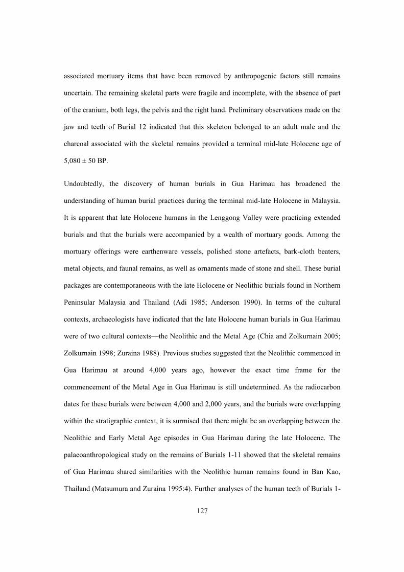
127
associated mortuary items that have been removed by anthropogenic factors still remains
uncertain. The remaining skeletal parts were fragile and incomplete, with the absence of part
of the cranium, both legs, the pelvis and the right hand. Preliminary observations made on the
jaw and teeth of Burial 12 indicated that this skeleton belonged to an adult male and the
charcoal associated with the skeletal remains provided a terminal mid-late Holocene age of
5,080 ± 50 BP.
Undoubtedly, the discovery of human burials in Gua Harimau has broadened the
understanding of human burial practices during the terminal mid-late Holocene in Malaysia.
It is apparent that late Holocene humans in the Lenggong Valley were practicing extended
burials and that the burials were accompanied by a wealth of mortuary goods. Among the
mortuary offerings were earthenware vessels, polished stone artefacts, bark-cloth beaters,
metal objects, and faunal remains, as well as ornaments made of stone and shell. These burial
packages are contemporaneous with the late Holocene or Neolithic burials found in Northern
Peninsular Malaysia and Thailand (Adi 1985; Anderson 1990). In terms of the cultural
contexts, archaeologists have indicated that the late Holocene human burials in Gua Harimau
were of two cultural contexts—the Neolithic and the Metal Age (Chia and Zolkurnain 2005;
Zolkurnain 1998; Zuraina 1988). Previous studies suggested that the Neolithic commenced in
Gua Harimau at around 4,000 years ago, however the exact time frame for the
commencement of the Metal Age in Gua Harimau is still undetermined. As the radiocarbon
dates for these burials were between 4,000 and 2,000 years, and the burials were overlapping
within the stratigraphic context, it is surmised that there might be an overlapping between the
Neolithic and Early Metal Age episodes in Gua Harimau during the late Holocene. The
palaeoanthropological study on the remains of Burials 1-11 showed that the skeletal remains
of Gua Harimau shared similarities with the Neolithic human remains found in Ban Kao,
Thailand (Matsumura and Zuraina 1995:4). Further analyses of the human teeth of Burials 1-

128
11 indicated that the prehistoric humans of Gua Harimau were of Mongoloid ancestry, which
is widely found during the Neolithic in Southeast Asia (Bulbeck 2005; Chia and Zolkurnain
2005), in contrast to the Australomelanesoid individuals from Gua Gunung Runtuh and Gua
Teluk Kelawar (Bulbeck and Zuraina 2007; Jacob and Soepriyo 1994). According to
Matsumura and Zuraina (1995: 31), it is generally assumed that the Austramelanesoid
population occupied many parts of Southeast Asia before the migration of Mongoloid people
into this area from the north during the late Pleistocene.
The stone artefacts from Gua Harimau are typical Neolithic types, mainly comprising
polished stone adzes and bark-cloth beaters. However, flaked artefacts and hammerstones
were also occasionally found in the deposits. The stone adzes were mostly rectangular in
shape, polished and with sharpened edges. The bark-cloth beaters are made from pebbles and
have distinct criss-crosses or circles engraved at one end. The adzes and beaters are made of
quartz and quartzite—choices of material which are locally available. The faunal assemblage
from Gua Harimau was almost identical to those uncovered from late Pleistocene or early
Holocene sites, leading to assumptions that there may have been no drastic climatic changes
throughout the Holocene period in the Lenggong Valley. Bishop (1994), however, has
postulated that there was climatic warming in Peninsular Southeast Asia during the Holocene.
The late Holocene in the Lenggong Valley witnessed the emergence of pottery making
technology around 3,000–4,000 years ago. The earthenware assemblage of Gua Harimau is
considered to be one of the most representative prehistoric earthenware collections found so
far in this area and helps to define the earthenware culture of the Lenggong Valley. The Gua
Harimau earthenware consists of footed vessels, carinated bowls, and single globular vessels,
either left plain or with decorated designs (Chia 1997; Williams-Hunt 1951, 1952; Zolkurnain
and Chia 2005). An investigation by Chia (1997) to trace the sources of the earthenware
shows that they were locally evolved and mainly used as household vessels or burial goods

129
(Chia 2005). The earthenware vessels found in Gua Harimau are well-developed types and
appear to be more recent than 1,500 BC (Chia 2005). Morphological studies of the
earthenware from Gua Harimau, Gua Kajang, Gua Teluk Kelawar and Gua Batu Tukang
indicate that the pottery was sand-tempered, hand moulded using the slow wheel, and fired
under high temperatures between 600–800⁰ C. Thus far, all earthenware assemblages found
in the caves in the Lenggong Valley are of late Neolithic design (plain or incised or cord-
marked decorated) and were all formed from local clay (Chia 1997:). In fact, the typology of
the earthenware of the Lenggong Valley seems comparable to the Southern Thai earthenware
from Sakai Cave, Lang Rongrien, Khao Tao, Pak Om and Ban Kao (Anderson 1988;
Pookajorn et al. 1995; Srisuchat 2003). Such similarity, and the fact that Lenggong’s pottery
was locally made, seems to suggest that pottery making technology was brought into the
Malay Peninsula by the movement of people rather than through trade or exchange with the
north (Chia 2005, 2007, 2009).
4.6 Discussion and Conclusion
Undoubtedly, archaeological research and investigation in the caves and rockshelters has
broadened the regional understanding of prehistory and cultural developments during the late
Pleistocene and Holocene times in Southeast Asia (Anderson 1997). In the Lenggong Valley,
years of study have revealed that early humans started to occupy caves and rockshelters for
habitation and burial purposes during the late Pleistocene and later extending into the
Holocene period, spanning approximately 13,000 to 1,000 years ago. Out of seven excavated
caves, three—Gua Gunung Runtuh, Gua Kajang and Gua Teluk Kelawar—show the traces of
early human activities which began during the terminal late Pleistocene-early Holocene at
around 13,000 to 9,000 years ago; whereas the cultural artifacts and radiocarbon dates

130
yielded from Gua Batu Tukang, Gua Ngaum, Gua Harimau and Gua Dayak suggest that these
caves were only consecutively occupied by early people starting from early to late Holocene,
between 8,000 and 1,000 years ago.
Generally, the late Pleistocene and early Holocene of the Lenggong Valley can be
represented by a hunter-gatherer way of life which used lithics and settled in or around the
caves or rockshelters. This is a typical adaptation pattern found across mainland Southeast
Asia during the late Pleistocene period (Higham 2002). The evidence of such adaptation can
also be found in many caves across the region, such as Tham Hang Rockshelter in Northern
Laos (Demeter et al. 2010) and Ban Rai Rockshelter in Thailand (Treerayapiwat 2005). The
lithic assemblage found from the late Pleistocene-early Holocene cultural layers in Gua
Gunung Runtuh, Gua Kajang and Gua Teluk Kelawar does not represent a distinctive
industry but rather resembles the assemblage found in the Paleolithic site of Kota Tampan
dated to between 70,000 and 30,000 years ago. Although the lithic assemblage from the caves
shares some morphological and technological similarities with the Kota Tampan assemblage,
the cultural connections between these two assemblages are not cogent, because there was an
obvious cultural hiatus of approximately 17,000 years between these two occupations. Thus
far, there is no evidence of occupation dated anywhere between Kota Tampan and the cave
occupations found in this valley (Bellwood 1997:160).
Detailed studies on the faunal remains from Gua Gunung Runtuh, Gua Kajang and Gua Teluk
Kelawar have provided information on the diet and subsistence activities of early human.
Analysis carried out by Davidson (1994) and Bujeng (2009) on the animal bones uncovered
from Gua Gunung Runtuh and Gua Teluk Kelawar indicated a dietary dependence on tropical
mammals, reptiles and shellfish. This led them to surmise that early humans had extensively
exploited the tropical resources of Peninsular Malaysia through hunting-gathering activities
during the late Pleistocene-early Holocene.

131
Our current knowledge of prehistoric humans in Peninsular Malaysia is mainly derived from
the human remains uncovered from the cave sites in the Lenggong Valley. Undeniably, the
discovery of Perak Man has extended our knowledge on evolution of modern humans in this
region, as well as provided rare insights into the burial traditions, beliefs and lifeways of the
late Pleistocene and early Holocene. Detailed study of Perak Man (Zuraina, 1994), GTK 1
(Zuraina et al., 2005) and GK 1 (Go, 2008) revealed the cognitivity of early humans in their
handling of the deceased for flexed burials. It also shows that the late Pleistocene and early
Holocene populations of the Lenggong Valley were practicing certain burial rituals. This is
noticeable in the clear burial associations of various types of goods.
Based on the thickness of the Holocene deposits (averaging more than 1 metre),
archaeological research suggests that the cave sites were more intensively and continually
occupied during the Holocene compared to the Late Pleistocene. Primarily, cultural
assemblages uncovered from the early Holocene cultural layers in Gua Gunung Runtuh, Gua
Kajang and Gua Teluk Kelawar conformed to those found in the late Pleistocene layers. The
cultural remains from the late Pleistocene-early Holocene layers generally consist of flexed
human burials. stone artefacts resembling Palaeolithic cultures and faunal remains of tropical
animals and shellfish. In fact, examinations of the early and middle Holocene layers in Gua
Kajang, Gua Teluk Kelawar and Gua Batu Tukang indicate an absence of distinctive
typological differences between early and middle Holocene assemblages. This suggests there
was no distinct stratigraphic separation between these periods in the cave sites of the
Lenggong Valley, unlike other cave sites in Peninsular Southeast Asia (e.g. Anderson 1990;
Pookajorn 1991). As a result, this suggests that there might be cultural continuity from the
late Pleistocene into the Holocene in the Lenggong Valley until the emergence of new forms
of technology and tools, such as earthenware, polished adzes and stone bark-cloth beaters,

132
and the development of extended and supine human burials, during the terminal mid-late
Holocene, around 4,000 to 5,000 years ago.
The discussion above provides an overview of cave archaeology in the Lenggong Valley and
explains how it developed through time. Culturally, the artefacts asemblages uncovered from
the cave sites of the Lenggong Valley are contemporaneous to many of the Late Pleistocene-
Holocene cave sites found across the Southeast Asia region (Table 4.2).
In sum, there are several issues that need further attention. The first relates to the construction
of the cultural sequence of cave occupation and how it can be fitted into the regional context.
As mentioned earlier, Zuraina (1995) had previously proposed to divide the cultural sequence
in the Lenggong Valley into four cultural phases: Palaeolithic, Epi-Palaeolithic, Neolithic and
Metal periods. She excluded the use of the Mesolithic in representing the early Holocene, and
considers the “Epi-Palaeolithic culture” more appropriate in representing the transition period
between the Palaeolithic and Neolithic in the Lenggong Valley Although the term “Epi-
Palaeolithic” became more accepted and started to be adopted by archaeologists to represent
the early Holocene in other countries across Southeast Asia (e.g. Shoocongdej 1996), a
disparity in defining the transitional cultural phase between Palaeolithic and Neolithic still
widely exists in this region. Today in Southeast Asia, some foreign archaeologists still refer
to this cultural stage as “Hoabinhian” (Anderson 1997, 2005; Bellwood 1997; Higham 2002),
whereas local archaeologists will label this cultural stage as a distinctive culture based on its
geographical context. In Southern Java, Indonesia, for example, the cultural phase dated
between the early Holocene and 2,000 years ago is referred to as the “Keplek culture” (name
after Keplek Cave located in the Gunung Sewu, Southern Jawa) (Simanjuntak 2001). This
disparity has created confusion about the prehistory of Southeast Asia (Shoocongdej 2011),

133
and more cross-cultural studies should be carried out between the Lenggong Valley and other
archaeological sites across the region to propose a better-defined prehistoric cultural
framework that can be put in place in a wider geographical context.
The second issue in the cave archaeology of the Lenggong Valley is cave stratigraphy.
Understanding cave stratigraphy is a challenging task in investigations throughout Southeast
Asia (Anderson 1997). This is because the cave deposits often exist in a disturbed setting due
to anthropogenic activities such as illegal digging. In the Lenggong Valley, guano digging
activities have been reported in several cave sites since the 1950s (e.g. Williams-Hunt 1952,
1952). This creates difficulties for archaeologists in differentiating between primary and
secondary cultural materials in the deposits, as sometimes the deposits are partially mixed
between layers As such, the traditional approach in interpreting the relationships between the
radiocarbon dates and depth of material below the surface of a cave deposit should be re-
assessed and the interpretation of cave stratigraphy made through the careful assessment of
cave depositional process, correlations of artifacts and cross dating.
Another issue is related to the prehistory of the Lenggong Valley, where there is the distinct
cultural lacuna between 30,000 and 13,000 years ago. Thus far, the evidence of the last
occupation in the Lenggong Valley predating the LGM (Last Glacial Maximum) is found in
the Palaeolithic open sites of Bukit Bunuh and Kota Tampan, dated to approximately 30,000
years ago (Mokhtar 2006; Zuraina 1989). After that date, no evidence of human occupation is
recorded until the occurrence of the first cave occupation in the valley approximately 13,000
years ago. This cultural hiatus raises the question of prehistoric cultural continuity in this
area, as well as draws attention to the early movements of humans. Anderson (1997) has
postulated that there might still be cultural deposits underlying the basal layer in caves across
the Malay Peninsula, arguing that archaeologists need to return to previously excavated caves
and re-excavate them.

134
In conclusion, the cave archaeology of the Lenggong Valley can provide considerable
information on lifeways and cultural development during the late Pleistocene and Holocene.
By incorporating these archaeological data into a Southeast Asian context, it shows that
cultural development in Malaysia during these periods is contemporaneous with that in other
countries, especially with the cave sites in Thailand. Such parallels might seem to suggest a
cultural contact or link between Peninsular Malaysia and Thailand during the late Pleistocene
and Holocene and might shed light on the early movement of human populations in mainland
Southeast Asia. Considering the issues of cave archaeology in the Lenggong Valley as
mentioned above, more research and investigation should be initiated in this area to generate
more concrete data in order to provide clues to a better understanding of the early
development of human culture during prehistoric times in the Lenggong Valley.

135
Country Site Cultural Period/Dating
Lab No. Cultural Materials Reference
Thailand Spirit Cave Late Pleistocene – Pre Neolithic 11,690 ± 560 BP
FSU 315
Pebble tools resembling “Sumatralith”, flake tools and agriculture evidence. The pottery sherds found are mainly cord-marked decorated, relatively dated to 8,500-7,000 years ago.
Gorman, 1970 Solheim, 1970
Lembah Banyan Cave
Late Pleistocene-Neolithic
- Pebble tools resembling “Sumatralith”, flake tools, cord-marked pottery, faunal remains and polished adzes.
Gorman 1977
Lang Rongrien Late Pleistocene-Neolithic 37,000 – 7,500 BP
- Pebble tools, flake tools and faunal remains found at the lower layers. Human remains, pottery sherds and polished adzes found in the upper layers.
Anderson 1997
Lang Kamnan Cave
Late Pleistocene-Late Holocene 30,880 ± 760 15,640 ± 150 6,110 ± 60
GX 20068 OAEP 1181 Beta 70984
Pebble tools, flake tools, faunal remains and pottery sherds.
Shoocongdej 2006
Moh Khiew Cave Late Pleistocene-Early Holocene 30,000 – 3,300BP
- Unifacial and bifacial pebble tools, flake tools, faunal remains and pottery sherds. A flexed human burial, relatively dated to 9,600 years ago was uncovered.
Pookajorn 1992
Tham Lod Cave Late Pleistocene – 300 years ago. 12,100 ± 60 BP
Beta 168224
Flake tools, hammerstones, “Sumatralith” tools, faunal remains and a flexed human burial.
Shoocongdej 2006

136
10,582 ± 49 BP Beta 168223
Vietnam Con Moong Cave Late Pleistocene-Early Holocene 12,021 ± 50 BP
- Hoabihn pebble tools, faunal remains Pham Huy Thong 1979
Nguom Cave Late Pleistocene-
Early Holocene 18,000-9,000 years ago
- Unifacial pebble tools, shell remains Ha Van Tan 1985
Bac Bo Cave Late Pleistocene-Early Holocene 12,000-7,000 years ago
- Unifacial pebble tools resembling Sumatralith, faunal remains
Ha Van Tan 1976
Myanmar Padah Lin Cave Early Holocene – Mid Holocene
- Flake tools, Hoabihn pebble tools, pottery sherds
Aung Thaw 1971
Malaysia Gua Cha
Late Pleistocene-Holocene 10,000-1,000 years ago. 6,300±170BP 3,020±230BP
ANU 2219 ANU 2217
Flake tools, unifacial and bifacial pebble tools, faunal remains, pottery sherds. More than 30 human burials were reported by Sieveking (1954) and later excavations conducted by Adi found another 3 human burials.
Adi 1985, Bulbeck 2001
Gua Chawas Late Pleistocene – Holocene 12,550 BP
ANU 9937
Unifacial pebble tools, flake tools, faunal remains
Adi 1983

137
Gua Sagu Late Pleistocene – Early Holocene 14,410±180 BP
Beta 33181
Unifacial and bifacial pebble tools, flake tools and faunal remains
Zuraina 1998
Gua Teluk Kelawar
Late Pleistocene – Holocene 10,245±80BP 9,450 ±70 BP 8,640 ± 80 BP 8,400 ± 40 BP 7,780 ± 90 BP 6,890 ± 80 BP
Beta-41365 Beta-87287 Beta-38295 Beta-19300 Beta-49848 Beta-49844
Unifacial and bifacial pebble tools, a flexed human burial dated to 8,400 ± 40 BP, and pottery sherds.
Zuraina 1998, Zuraina et.al. 2005
Gua Agop Atas Late Pleistocene-Holocene 11,000-7,000 years ago 10,800±120BP
ANU 3088
Flake tools and faunal remains Bellwood 1987
Pulau Balambangan
Late Pleistocene – Early Holocene 16,800 ±210 BP 10,790±90 BP 8,930 ± 150 BP
Beta 105172 Beta 105171 Beta 109140
Bifacial pebble tools, flake tools, faunal remains and bone tools.
Jaffrie 2000
Indonesia
Tianko Panjang Cave
Late Pliestocene-Early Holocene
- Obsidian tools, fauna remains, human remains and pottery sherds.
Bronson and Asmar 1975
Lau Biang Valley Late Pleistocene-Early Holocene
- 9-10 metres thick shell midden, 12 human burials, unifacial pebble tools, flake tools and faunal remains.
McKinnon 1991

138
Pandan Cave Holocene, 9,000 – 6,500 years ago
-
“Sumatralith” pebble tools and fauna remains Forestier et. al. 2006
Keplek Cave Late Pleistocene-Holocene 24,420 ± 1000 BP 15,880 ± 540 BP 8,230 ± 220 BP 7,580 ± 210 BP
P3G 2000 P3G 1998 P3G 1996 P3G 1996
Flakes, pebble tools, faunal remains, pottery sherds and a human burial dated to 7,020± 180 BP (P3G 1996).
Simanjuntak 2001
Philippines
Sohoton Cave Late Pleistocene-Late Holocene 10,500± 160 BP 385 ± 105 BP
-
Flake tools, faunal remains, cord-marked and red-slipped pottery sherds.
Tuggle and Hutterer 1972
Tabon Cave Late Pleistocene – Early Holocene 30,000 – 8,000 years ago
- Flake tools, faunal remains and a thick layer of shell deposits
Fox 1970
Musang Cave Late Pleistocene – Holocene 11,450 BP 4,000 BP
ISGS – 496 Gak – 7043b
Flake tools, amorphous tools, faunal remains. Thiel 1986
Naulan Cave Late Pleistocene – Early Holocene 12,010 ± 150 BP 9,590 ± 120 BP
SUA – 989 SUA – 1739
Flake tools, hammerstones and faunal remains.
Coutts 1983

139
7,460 ± 100 BP SUA – 1738
Ille Cave Late Pleistocene-
Mid Holocene 10,000 – 5,000 years ago 10,577 BP
ANU 11871
Two human burials dated to 10,000, flake tools resembling Tabon Cave’s lithic assemblage and faunal remains.
Szabó et al. 2004
Table 4.2 : Late Pleistocene-Holocene cave sites of Southeast Asia

140
Chapter 5 Background to the Study: Gua Gunung Runtuh, Gua Kajang and Gua Harimau
This chapter presents the latest results of the field surveys conducted in Gua Gunung Runtuh,
Gua Kajang and Gua Harimau in the Lenggong Valley between September 2009 and March
2010. The preliminary aim of these field inspections was to identify and document all
existing features of these cave sites, as well as to investigate the present state of their
conservation. Generally, this field inspection consisted of several components, including site
mapping, field recording, and community survey and rescue excavation. The first part of the
chapter will present a detailed identification and description of Gua Gunung Runtuh, Gua
Kajang and Gua Harimau. The second part will explore the present state of conservation of
each site, as well as address the existing threats and pressures that affect the integrity of these
sites.
5.1 The Lenggong Valley
The Lenggong Valley is a sub-district of the District of Upper Perak, located in the State of
Perak in northern Peninsular Malaysia. It is located about 100km from Ipoh, the capital of
Perak and approximately 120km from the southern border of Thailand. Today, the Lenggong
Valley can be accessed through the North-South Expressway9 via exit No. 143 at Kuala
Kangsar. Geographically, this valley is bounded by wet and humid tropical jungle and has an
average elevation of 100 metres above sea level. It is situated between two main mountain
ranges in Peninsular Malaysia – the Titiwangsa Range to the east and the Bintang Range to
the southwest and has an equatorial climate, averaging between 27 and 33 degrees Celsius.
9 The North-South Expressway is the longest expressway in Malaysia, with a total length of 966 km, and runs from the Malaysia-Thai border to the Malaysia-Singapore border at the southern boundary of Peninsular Malaysia.

141
Previous geological survey in this valley identified eight limestone massifs over an area of
approximately six kilometres square.
There are several versions of local folktales that tell the origin of the name of the Lenggong
Valley. Of the many versions, there are currently two that are widespread among local
communities. Both versions are related to the local Indigenous ethnic group. The first version
names the valley after Lenggong, a Semang10 man who found the valley during the pre-
colonial era in Malaya. According to the second version, by historic times the valley had been
settled by the Indigenous group. The name Lenggong appears to have come from the Malay
word “terlanggung” means “hanging”. Legend has it that a Semang man wanted to cut down
a five-fathom tree. After much hard work he succeeded in cutting it down but it fell onto
another smaller tree which broke the larger trunk’s fall and bounced it back upright. This
extraordinary event gave its name to the town and the valley.
At present, the Lenggong Valley covers an area of approximately 80,324 hectares with a
population of around 15,000 (Figure 5.1). The land use of the Lenggong Valley can be
generally divided into four categories: agricultural use; built environment; industrial use and
native forest. According to the statistical data provided by the Lenggong District and Land
Office (2012), the majority of the residents in this valley still survive on agricultural activities
which use more than 30,000 hectares of land for purposes such as palm oil, rubber and fruit
plantations. The urban area (built environment and industrial area) in the Lenggong Valley
covers only 160 hectares of land, whereas the remaining lands consist of both native forest
and wasteland.
10 The Semang is identified as the oldest Indigenous group found in Peninsular Malaysia (Carey, 1976).

142
Thus far, the records of the settlement of the Lenggong Valley during historic times are fairly
limited. The majority of the early literature dedicated to this valley consists of ethnographical
records that mainly demonstrate the settlement of indigenous groups across the Lenggong
Valley. Between 1913 and 1925, I.H.N. Evans (1914, 1923, 1927) made several visits to the
indigenous encampments in this valley. From his studies, he recorded the settlement of
Semang people (or Sakai in the local context) in close proximity to several caves in this
valley. From the literature, there were many Indigenous tribes such as Semang, Sakai, Kintak,
Lanoh and few more camped across the caves and limestone hills across the Lenggong Valley
(Carey, 1976); however, these Indigenous tribes have been relocated to a new village – the
Kampung Air Bah, which is located approximately 15-20km from the valley.
Figure 5. 1: An aerial view of the Lenggong Valley

143
5.2 Identification and Description of Gua Gunung Runtuh, Gua Kajang and
Gua Harimau
Of many caves in the Lenggong Valley, three cave sites – Gua Gunung Runtuh, Gua Kajang
and Gua Harimau - were selected as the focus for this project (Figure 5.2). These caves were
selected because they have been extensively investigated by archaeologists and the data
generated from previous research have provided significant information about the uses of the
caves in this valley from prehistoric times until the recent past. The section below presents a
detailed description of each cave site to offer an overview of their current setting, as well as
to explore how these caves have been used through time.
Figure 5. 2: The location of Gua Gunung Runtuh, Gua Kajang and Gua Harimau in the Lenggong Valley

144
5.2.1 Gua Gunung Runtuh
Gua Gunung Runtuh is situated in Kampung (village) Ulu Jepai, a small village about six
kilometres from Lenggong Town. It is located at latitude 5°07’ 594” N and longitude 100°58’
195”E, in the Bukit Kepala Gajah limestone massif (Figure 5.3), approximately 124 metres
above sea level. This cave is surrounded by dense secondary forest, whereas the
smallholdings of rubber estates and fruit orchards are found in the foothills. This cave is
difficult to access given that the walking trail connected to the cave from the foothills is
craggy, wet and slippery. Leeches are occasionally found along the trail, especially during the
wet season and the whole journey from the foothill to the cave on foot takes about 25 minutes
(Figure 5.4).
Figure 5.3: The southwestern face of Bukit Kepala Gajah limestone massif
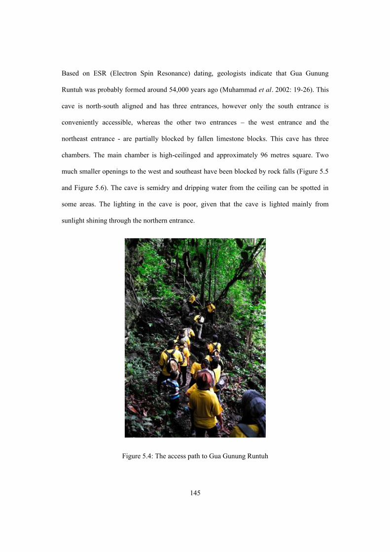
145
Based on ESR (Electron Spin Resonance) dating, geologists indicate that Gua Gunung
Runtuh was probably formed around 54,000 years ago (Muhammad et al. 2002: 19-26). This
cave is north-south aligned and has three entrances, however only the south entrance is
conveniently accessible, whereas the other two entrances – the west entrance and the
northeast entrance - are partially blocked by fallen limestone blocks. This cave has three
chambers. The main chamber is high-ceilinged and approximately 96 metres square. Two
much smaller openings to the west and southeast have been blocked by rock falls (Figure 5.5
and Figure 5.6). The cave is semidry and dripping water from the ceiling can be spotted in
some areas. The lighting in the cave is poor, given that the cave is lighted mainly from
sunlight shining through the northern entrance.
Figure 5.4: The access path to Gua Gunung Runtuh

146
The cave floor is uneven and scattered with stalagmites and fallen stalactites. In 2010, four
disturbed areas were noted, as indicated by large holes in the ground surrounded by piles of
loose soil. Given that a colony of bats still lives in the cave, these holes are highly likely to
have been dug by the guano diggers to collect the guano. This cave was excavated in 1990
and 1991 by Zuraina (1994). Currently, six excavation trenches from the 1990 excavation are
still preserved in situ (Figure 5.7). The latest survey in the cave indicated a low potential for
future research because there is no intact area left for further excavation.
Apparently, Gua Gunung Runtuh is popular among the local communities and is closely
associated with several historical episodes in this area. According to the villagers, this cave
was used as an asylum during the Second World War in Malaya (1942-1945) and later
sporadically occupied by the communists during the Malayan Emergency11 between 1948
and 1960. Also, the local population believes that this cave was used for hoarding gold during
the Second World War, because according to one of the local residents, one of his family
members found a piece of gold when he attempted to collect the guano from the cave
(Ahmad, personal communication, 2010). Soon after the Malayan Emergency, the local
residents of the Lenggong Valley started to collect the guano from Gua Gunung Runtuh
following the establishment of a guano processing plant in this valley in the early 1960s.
However, due to the location of Gua Gunung Runtuh, which is not very accessible, guano
collecting activities in this cave are less frequent than those in lowland caves such as Gua
Harimau and Gua Kajang.
11 The Malayan Emergency was a guerrilla war fought between Commonwealth Armed Forces and the Malayan National Liberation Army (MNLA), the military arm of the Malayan Communist Party after the Second World War, from 1948 to 1960.

147
Figure 5.5: The floor plan of Gua Gunung Runtuh

148
Figure 5.6: The main chamber of the Gua Gunung Runtuh
5.2.1.1 Archaeological Research and Findings
This cave was first investigated over two seasons in 1990 and 1991 as a collaboration
between the Universiti Sains Malaysia and the Department of Museum and Antiquity
Malaysia (Figure 5.7). The 1990 and 1991 excavations revealed the oldest most complete
human skeleton in Southeast Asia, dubbed the Perak Man, chronologically dated to 10, 120 ±
110 B.P. (Beta 38394).
Previous excavation in Gua Gunung Runtuh excavated 16 excavation trenches, each
measuring four square metres. Perak Man was recovered from Trench A1 in the main
chamber, at a depth of 80-90 cm, lying in an east-west orientation. He was laid face up, with
his head slightly inclined to the right. He had his right arm folded up to the shoulder and the

149
left arm was flexed with the hand placed on the stomach, then both legs were folded over the
chest (Zuraina 1994:30). Perak Man was later assessed as an adult with Australomelanesoid
affinity, aged between 40 and 45 years old, with a stature around 154cm (Jacob and Soepriyo
1994:57-59) (Figure 5.8).
Figure 5.7: The 1990 excavation in Gua Gunung Runtuh

150
Figure 5.8: The excavation of the Perak Man in the Gua Gunung Runtuh.
Analyses of the burial showed that Perak Man was buried with stone tools and food. Perak
Man was found buried with ten stone tools including one oval unifacial pebble tool, three
hammerstones, two slabs and four miscellaneous tools (Zuraina et al. 1994: 23-47) (Figure
5.9). Ninety percent of the animal bones uncovered from the burial area were fragmentary
and unidentified. Analysis of the faunal remains suggested that more than five species of
animals and two species of freshwater shells were buried with Perak Man (Zuraina 1994)
(Table 5.1). A total of seven organic samples consisting of both shells and charcoal were
retrieved from the deposit of Gua Gunung Runtuh for radiocarbon dating. Radiocarbon dates
from Gua Gunung Runtuh suggest that humans occupied this cave for habitation and burial
purposes beginning about 13,000 years ago and continued to occupy it until the Holocene
period. Further details on the excavated cultural materials and the radiocarbon dates from
Gua Gunung Runtuh are elucidated in Table 5.2 and 5.3.

151
Component C14 Dating Stratigraphic layer/ Depth
Stone Artefacts, N=10
Animal Bones,
1.261kg
Shellfish, N=2,878
Flexed human burial – the Perak Man
9,460 ± 90 (Beta 37818) 10,120 ± 110 (Beta 38394) 10,010 ± 70 (Beta 49851)
Layer 4, 60-110cm
Hammerstone (N=3) Pebble Tool (N=5) Slab (N=3)
Pig Monitor lizard Rusa Monkey Tortoise Gibbon Kijang
Brotia Costula Brotia Spinosa
Table 5. 1: The associated finds of the human burial of Perak Man
5.2.1.2 Present State of Conservation
Gua Gunung Runtuh is now gazetted as a National Heritage Site (Gazette No: P.U. [B] 494)
and is currently maintained and monitored by the Department of National Heritage with
occasional assistance from the Universiti Sains Malaysia. Thus far, No physical facilities
have been developed on the site, except for an information sign which is erected in front of
the cave (Figure 5.10).

152
Year of Excavation
Excavation Archaeological Finds Cultural Interpretation Analysis undertaken by Storage Key Reference Types of Artefacts Frequency
(pcs) 1990 and 1991
by Zuraina Majid
Excavation took place in the main chamber. A total of 14 trenches, each measuring 4m were excavated.
Stone Artefacts
Core Anvil Hammer stone Oval Unifacial tool Oval Bifacial tool Palaeo adze Chopper Perimeter flake Miscellaneous tool Flake tool
8 15 86 52 25 3 4 3
21 6
The earliest occupation in this cave started 10,000 years ago. It was continuously used by the early humans of the Lenggong Valley until the early Holocene. This cave was also used as a cemetery during the late Palaeolithic period. A flexed human burial was found in the main chamber and this individual was later named Perak Man. Perak Man was buried with various choices of mortuary goods which demonstrated the burial culture and the rituals of early human populations. Perak Man was later assessed as a male who died at his 40s, with a stature around 154cm. He is the only known prehistoric man born with the congenital deformity Brachymesophalagia A2 thus far found in the world.
Zuraina et al. (1994)
LAM i, NMM ii and CGAR iii
Zuraina (1994) Zuraina (2005)
Faunal Remains
Brotia Shells Animal Bones
20,722 *4,924
Davidson (1994)
Human Remains
An almost complete human skeleton
Jacob and Soepriyo (1994)
Loh (1994) Matsumura & Zuraina
(1999)
* the faunal remains are calculated by bone weight (grams) i - Lenggong Archaeological Museum ii - National Museum of Malaysia iii – Centre for Global Archaeological Research, University Sains Malays
Table 5. 2: The excavated cultural materials from Gua Gunung Runtuh

153
Lab Number Material Area / Depth Archaeological Context Calibrated Dates Conventional Dates (B.P.)
Reference
Beta 37818 Freshwater gastropod shells
Collected at a depth of 70cm in Trench A2
Shells associated with the human skeleton, stone tools and animal bones.
No details 9,460 ± 90 Zuraina (1994) Mokhtar and Tjia (1994)
Beta 38394 Freshwater gastropod shells
Collected at a depth of 80cm in Trench A2
Shells associated with the human skeleton, stone tools and animal bones.
No details 10,120 ± 110 Zuraina (1994) Mokhtar and Tjia (1994)
Beta 49851 Freshwater gastropod shells
No details No details No details 10,010 ± 70 Zuraina (1994)
Table 5. 3: The C14 dates of Gua Gunung Runtuh
Figure 5.9: Oval unifacial pebble tools buried with Perak Man.

154
Figure 5.10: The information sign erected in front of the southern entrance of Gua Gunung Runtuh
Access to Gua Gunung Runtuh is not restricted or guarded. However, major rock falls in
front of the cave entrance makes this site unsafe for unsupervised visits. At present, Gua
Gunung Runtuh is one of the most visited sites in the valley and visitation to the site is
normally supervised by staff from the Universiti Sains Malaysia or the Lenggong
Archaeological Musuem for free. Local tourist guides can be hired from the neighboring
villages but the charge varies between RM 15 and RM 50 (USD 4.50 – USD 15.00),
depending on the numbers of visitors in a trip. Visitation to the cave by both local residents
and outsiders has its impact on the cave. During the survey, several recent waste items such
as plastic drinking bottles and cigarette butts, were found scattered on the cave floor. Graffiti
was also found on the cave wall (Figure 5.11)

155
Figure 5.11: The graffiti on the cave wall of Gua Gunung Runtuh
Although Gua Gunung Runtuh is bounded by dense tropical jungle, the climate inside the
cave is relatively stable, ranging between 23.5 and 24.5 degrees Celsius. The humidity of the
cave is moderate, but water dripping in several parts of the cave has increased humidity over
the years. Green algae covers several parts of the cave wall and ceiling. Also, plant roots are
found growing out of limestone ceilings inside the cave (Figure 5.12). The growth of these
microorganisms and plants are the main agents that stimulate deterioration of the cave. As the
cave is located deep in the jungle and is not well lit, this makes it a suitable area for the
habitation of bats. At present, bats still inhabit Gua Gunung Runtuh and produce guano,
which in turn promotes illegal guano diggings in the cave (Figure 5.13)

156
Figure 5.12: Green algae and roots found in Gua Gunung Runtuh.
Figure 5.13: Bats still inhabit Gua Gunung Runtuh.

157
The cave floor of Gua Gunung Runtuh is uneven and covered with chunks of fallen stalactites
and limestone blocks (Figure 5.14). Several areas in the cave show traces of quarrying,
suggesting that illegal diggings are still taking place. Also, some cultural artefacts, such as
shells and small stone artefacts, are visible on the cave floor. Previous excavation trenches
still remain open without being backfilled (Figure 5.15) or being fenced. So far, no safety
order has been generated for the site and visitors are visiting Gua Gunung Runtuh at their
own risk. To date, all movable artefacts have been transferred to the Lenggong
Archaeological Museum for preservation and display. Perak Man, the most significant find
from this cave, is currently on display in the National Musuem of Kuala Lumpur.
Figure 5.14: The cave floor of Gua Gunung Runtuh is uneven and scattered with limestone chunks.

158
Figure 5.15: Excavation trenches opened in 1990 have been left open without being backfilled.
5.2.2 Gua Kajang
Gua Kajang is a natural limestone tunnel through the Bukit Kepala Gajah limestone massif,
located in Kampung Gelok, approximately 4.5 kilometres from Lenggong Town (Figure
5.16). It is situated at latitude 5°07’ 571’ N and longitude 100°58’ 883”, 72 metres above sea
level. Both Gua Kajang and Gua Gunung Runtuh are located in the same limestone massif
and Gua Kajang is about two kilometres by trail from Gua Gunung Runtuh. This cave is
surrounded by low land suitable for agriculture. During the 1960s and 70s, Gua Kajang was
surrounded by paddy fields, but now the area around the cave is used for rubber and banana
plantations. This cave is easily accessible by a sealed road from the surrounding small
holdings. It takes about 20-25 minutes on foot from the entrance of Kampong Gelok to the
cave (Figure 5.17).

159
Figure 5. 12: The front view of Gua Kajang facing north.
Gua Kajang is a 60 metre long limestone tunnel with two openings. The main entrance is
facing north and there is another at the southern end. The mouth of the northern entrance
measures about 25 metres wide, with a height of 12 metres. The cave comprises two
chambers: the main chamber is divided into the front cave and the back cave by a limestone
column and the second chamber is small and dark, and is found adjacent to the east of the
southern entrance (Figure 5.18). At present, the original cultural landscape of Gua Kajang as
described by Evans (1918) is untraceable, as the cave floor is interspersed by deep man-made
holes. Three disturbed pits, each measuring about 25-30 metres square, are visible in the main
chamber. These pits have been dug by local guano diggers because Gua Kajang is one of the
best spots in this village to harvest guano. The cave floor is uneven, and some artefacts, such
as stone tools and pottery sherds, are evident on the surface (Figure 5.19). The front cave is
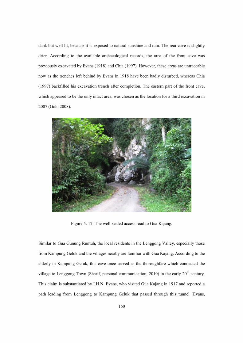
160
dank but well lit, because it is exposed to natural sunshine and rain. The rear cave is slightly
drier. According to the available archaeological records, the area of the front cave was
previously excavated by Evans (1918) and Chia (1997). However, these areas are untraceable
now as the trenches left behind by Evans in 1918 have been badly disturbed, whereas Chia
(1997) backfilled his excavation trench after completion. The eastern part of the front cave,
which appeared to be the only intact area, was chosen as the location for a third excavation in
2007 (Goh, 2008).
Figure 5. 17: The well-sealed access road to Gua Kajang.
Similar to Gua Gunung Runtuh, the local residents in the Lenggong Valley, especially those
from Kampung Gelok and the villages nearby are familiar with Gua Kajang. According to the
elderly in Kampung Geluk, this cave once served as the thoroughfare which connected the
village to Lenggong Town (Sharif, personal communication, 2010) in the early 20th century.
This claim is substantiated by I.H.N. Evans, who visited Gua Kajang in 1917 and reported a
path leading from Lenggong to Kampung Geluk that passed through this tunnel (Evans,

161
1918:227). Apart from being known as part of the old route, this cave is also notorious among
the locals as the campsite of the Indigenous or Aboriginal (known as Orang Asli in the local
context) tribes who lived in this valley from the early 1900s until the 1980s. The earliest
record of indigenous settlement in Kampung Gelok was reported in 1914, when Evans (1914)
visited the encampments of the Semang group in this village.
Later in 1917, Evans (1918:228) reported Indigenous occupation in Gua Kajang when he
found bamboo sleeping platforms and sections of blowpipes inside the cave that showed clear
signs of having been recently used. Evans (1918) further confirmed Indigenous occupation
through the discovery of selections of paintings on the cave wall. According to Evans (1918),
these were monochrome charcoal figurative drawings consisting of elephants and four-
wheeled wagon figures. However, these drawings have not survived into the modern era
(Taçon and Mokhtar 2012:461). The evidence of Indigenous occupation in this cave became
even more apparent when an Indigenous man recently claimed that his family had probably
camped within the proximity of Gua Kajang during the 1950s and 1960s. Recent
conversations with this man (En Bahari, in his 60s), who is now relocated in the Kampung
Air Bah, revealed that his older brother, who passed away a few years ago, was told by their
parents that he was born in Gua Kajang. However, the exact birth date of his brother is
undetermined.
Like other caves in the Lenggong Valley, Gua Kajang served as an asylum for the local
communities during the Second World War in Malaya. This cave was then extensively
exploited by the locals for guano until the end of the 1980s when the Minerals and
Geoscience Department of Malaysia banned guano mining in the valley. However, illegal
digging is still widely practiced in this valley because, according to some villagers, guano
mining has been their main source of income for the past three decades.

162
Figure 5.18: The floor plan of Gua Kajang.
Figure 5.19: Some surface finds noted during the field survey in 2010 in Gua Kajang.

163
5.2.2.1 Archaeological Research and Findings
Archaeologically, Gua Kajang holds the longest history of archaeological investigations in
the valley, from 1917 until now. Over the last 95 years, this cave has been investigated by
Evans (1918), Williams-Hunt (1951, 1952), Chia (1997) and Goh (2008). The earliest
investigation carried out by Evans (1918) discovered fragments of pottery, stone tools, food
remains and human skeletal remains. Based on the thickness of the cultural deposits, Evans
(1918) concluded that this cave might have been used at intervals during the Neolithic.
Further investigation of the human remains from Gua Kajang by Duckworth (1934) indicated
an anthropological connection between the early occupants of Gua Kajang and the Australian
Aborigines.
Later in the 1950s, the reconnaissance survey by Williams-Hunt (1951, 1952) produced a
catalogue of surface finds which recorded the discovery of several Mesolithic axes and
pottery fragments. In 1990, Chia (1997) excavated the front area of the cave in search of
prehistoric pottery samples. All research prior to 2000 pointed to Gua Kajang as a
Mesolithic-Neolithic site, although no chronometric evidence was ever provided.
Further research was undertaken in Gua Kajang in early 2007 soon after the chance discovery
of a human burial by the local residents (Figure 5.20). Two in situ human burials dated to 10,
820 ± 60 B.P. (Beta 227446) and 7, 890 ± 80 B.P. (Beta 227445) were found in the deposits.
Both burials were partially disturbed, with several parts of the skeletons missing. The parts
that remained, however, were still in situ as indicated by the intact bone articulation. These
burials, later labelled GK 1 and GK 2, were found associated with various types of mortuary
offerings. GK 1 was found buried in a flexed position, but the burial position of GK 1 was
unable to be determined. Both GK 1 and GK 2 were found incomplete but were identified as

164
adults. Their ages at death, stature and sex remained uncertain due to the absence of good
indicators.
The stone tools uncovered from Gua Kajang are attributed to the late-Palaeolithic and
Neolithic periods, and include unifacial and bifacial pebble tools, hammerstone, anvils, cores
and flake tools. This stone assemblage is well distributed among the caves in the valley and
shares many similarities with those stone artefacts uncovered from cave sites in Thailand
(Goh 2008). The pottery of Gua Kajang is of typical Neolithic type (Chia 1997), consisting of
plain, cord marked and red-slipped pieces. The 2007 excavation later led Goh (2008) to
suggest that this cave had been consecutively used from 11,000 to 4,000 years ago during the
late Paleolithic and Neolithic periods. Further information on the archaeological research and,
including the radiocarbon dates yielded from Gua Kajang are detailed in Tables 5.4 and 5.5.

165
Figure 5.20: The 2007 excavation at the eastern part of the front cave.

166
Year of Excavation
Excavation Archaeological Finds Cultural Interpretations Analysis undertaken
by
Storage Key Reference Types of Artefacts Frequency
(pcs) 1917 by
I.H.N. Evans
1st season of excavation uncovered an area approximately 82m
Stone artefacts Sumatralith pebble tools, flakes, polished stone adze
No exact quantity recorded
Evans (1918) suggested that this cave was occasionally used by early people during the Mesolithic and Neolithic periods.
Evans (1918)
NMS, NMM and LAM
Evans (1918)
Fauna remains
Unio and Melania Shells, animal bones (deer, muntjac, squirrel, rhinoceros, bamboo rat, wild pig)
Human remains
Human jaw, fragments of skull, ribs and finger bones
No exact quantity recorded
Duckworth (1934), through his analyses of the human teeth and jaw, suggested that the dental features of the Gua Kajang’s remains resembled features of Australian Aborigines.
Duckworth (1934)
Laboratory of Duckworth, University
Cambridge of London
Duckworth (1934)
Zuraina and Pfister (2005)
2nd season of excavation uncovered an area of 9m to search for evidence of earthenware
Stone artefacts a. Rough stone tools b. Flakes c. Core
No exact quantity recorded
Evans (1918)
NMS, NMM and LAM
Evans (1918)
Fauna Remains Animal bones and shells
Earthenware pottery Black-coloured ware and fragments of pottery
1945-1951 by Williams-
Hunt
Reconnaissance surveys were conducted in Gua Kajang between 1945 and 1951. No excavation was conducted. The interpretation of culture was made based on the surface finds.
Stone artefacts Mesolithic tools – oval pebble tools.
No exact quantity recorded
Pointed to Gua Kajang as a Mesolithic-Neolithic site.
Williams-Hunt (1951,
1952)
No detail Williams-Hunt (1951, 1952)
Earthenware pottery Pottery vessels and sherds including cake-stand ware and red-slipped ware

167
Year of Excavation
Excavation Archaeological Finds Cultural Interpretations Analysis undertaken
by
Storage Key Reference
Types of Artefacts Frequency (pcs)
1990 by Chia Only one trench measuring 1m was excavated in searching for pottery samples.
Earthenware pottery Fragments of pottery 5 The pottery sherds of Gua Kajang were relatively dated to 3,000-4,000 years old. However, no further documentation was carried out on the stone artefacts and faunal remains found in this excavation because this research was designated to collect pottery samples.
Chia (1997) NMM, LAM and CGAR
Chia (1997)
Stone artefacts and fauna remains
-
No exact quantity recorded
2007 by Goh This excavation took place in the east corner of the front cave. Nine trenches, each measuring 1m were excavated.
Stone artefacts
Core Anvil Hammerstone Flake tool Bifacial and Unifacial Slab Miscellaneous tool Debitage
2 31 66
118 12
1 1
467
Gua Kajang was interpreted as a late Pleistocene – Holocene site. On the basis of artefact types and typology as well as the C14 dates, this cave is said to have been occupied by early humans from 11,000 years ago extending to the recent past.
Goh (2008) CGAR Goh (2008, 2009)
Fauna Remains
Bone fragments of: Mamalia Reptilia Malacostraca Brotia Shells
309 27
1 14255
Earthenware pottery
Pottery sherds: Plain Decorated Red-slipped
22 14
1
Human remains
Two incomplete skeletons were uncovered. -
Table 5. 4: The archaeological investigations and finds of Gua Kajang.

168
Lab Number Material Area / Depth/ Stratigraphic layer
Archaeological Context Calibrated Dates (B.C.)
Conventional Dates (B.P.)
Reference
Beta 28157 Freshwater gastropod shells
Collected from depth of 30cm
No details No details 6,380 ± 60 Zuraina (1998)
Beta 28156 Freshwater gastropod shells
Collected from depth of 60cm
No details No details 8,970 ± 140 Zuraina (1998)
Beta 227445 Freshwater gastropod shells
Collected from layer 3, at a depth of 70-80cm
These shells were associated with the human
burial of GK 1
7,050 – 6,580 7,890 ± 80 Goh (2008)
Beta 227446 Freshwater gastropod shells
Collected from layer 6, at a depth of 120-140cm
These shells were associated with the human
burial of GK 2
10,950 – 10,830 10, 820 ± 60 Goh (2008)
Beta 229005 Freshwater gastropod shells
Collected from layer 6, at a depth of 154cm
These shells were associated with stone
artefacts and animal bones
9,810 – 9,300 10,000± 60 Goh (2008)
Beta 275049 Organic sediments
Collected from layer 5 at a depth around 100cm
Found comingled with the faunal remains
10,730 – 10,190 10,470 ± 60 *
* C14 date obtained through this project.
Table 5. 5: The C14 dates of the cultural remains of Gua Kajang

169
5.2.2.3 Present State of Conservation
Gua Kajang is now placed under the monitoring of the Department of National Heritage
(DNH). The maintenance team appointed by DNH inspects the site on a twice-weekly basis.
In 2009, a program to upgrade the facilities of archaeological sites was launched in the
Lenggong Valley under the 9th Malaysia Plan. In Gua Kajang particularly, a gazebo with
information board was built in front of the cave and a two-kilometre boardwalk was built to
connect four caves in the Bukit Kepala Gajah limestone massif – Gua Kajang, Gua Ngaum,
Gua Puteri and Gua Asar - to enhance the visitor’s experience (Figure 5.21).
Figure 5.21: The boardwalk connecting four cave sites in the Bukit Kepala Gajah limestone massif.
The latest survey of Gua Kajang shows that this cave is severely disturbed, where almost 90
percent of the surface area has been excavated, either for research purposes or other activities,
such as illegal digging and treasure hunting (Figure 5.22). The only intact area in this cave
that was previously earmarked for further investigation in 2007 was covered by tar (bitumen)

170
during the construction of a metal road to connect the village to the cave in 2008. No further
excavation has been carried out in Gua Kajang since 2007 and some of the cultural artefacts
on the surface have been covered in tar (Figure 5.23).
Figure 5.22: The disturbed area at the front of the cave.
The cave floors in both of the chambers are uneven, and covered with man-made pits and
holes (Figure 5.24). Three large disturbed pits – each measuring about 25 – 30 metre square -
were observed in the main chamber of the cave. Two large pits were found at both bays of the
front cave and another disturbed area is visible in the corridor which serves as the main
channel that allows access from one end of the tunnel to the other. At present, a crude
wooden platform has been laid over the pits to provide passage between the two mouths of
the tunnel (Figure 5.25). Large limestone boulders are also obvious in the northwest and
southern end of the tunnel (Figure 5.26).

171
Figure 5.23: The area at the cave mouth now partially covered by tar.

172
Figure 5.24: The disturbed area in the east bay of Gua Kajang.
Figure 5.25: Crude wooden platforms laid to provide passage between the two mouths of Gua Kajang.

173
Figure 5.26: Limestone boulders at the southern end of Gua Kajang.
Given that Gua Kajang is easily accessible, intruders often enter this cave to dig for guano,
hunt for artefacts or engage in other activities (Figure 5.27). In 2007, a local resident
conducted illegal diggings in this cave and exposed a prehistoric human burial (Goh, 2008).
More recently in 2009, several pottery vessels attributed to the Neolithic were found by local
residents in Gua Kajang and these vessels were later being offered for sale (Figure 5.28).

174
Figure 5.27: Illegal diggings in Gua Kajang have severely destroyed the deposits of the cave. The circled area indicates the depth of deposit removed in a two year period.
Figure 5.28: One of the pottery vessels excavated by a local resident in Gua Kajang as offered for sale in 2010.
Following uncontrolled digging in Gua Kajang since 2007, hundreds of cultural artefacts,
including stone artefacts, food remains and pottery sherds, have been scattered on the cave
floors (Figure 5.29). As the original context of these artefacts cannot be traced, subsequent
archaeological work has had to treat the majority of these artefacts as surface finds. All
The east bay of the Gua Kajang in 2007 The east bay of the Gua Kajang in 2009

175
cultural artefacts uncovered from Gua Kajang are now kept in the Lenggong Archaeological
Musuem. Remnants of excavation trenches opened by Goh (2008) in 2007 are still traceable
in the east bay of the cave, but illegal excavation has destroyed the original archaeological
settings of the 2007 excavation. These trenches are now left open on site without proper
fencing.
Figure 5.29: Cultural artefacts scattered in the cave.
Gua Kajang is used by local villagers as their daily access route to the rubber estates located
to the south of the cave. Vehicles such as motorcycles, cars and trucks frequently drive into
the cave to collect the latex from the surrounding estates (Figure 5.30). Apart from public
visitation, it is also regularly visited by school groups for educational purposes on weekends.
Due to its accessibility, Gua Kajang is highly exposed to vandalism activities. Modern wastes
are found scattered all over the cave floor and almost 80 percent of the cave wall is covered

176
in graffiti from paints, marker pens, charcoal and other media. These graffiti included modern
writing in different languages and some figurative drawings (Figure 5.31). The cave wall of
Gua Kajang was also vandalized by a local film crew when this cave was selected as the
filming location for a local movie. For unknown reasons, the film crew repainted several
portions of the cave wall with grey emulsion paints (Figure 5.32).
Figure 5.30: Large vehicles often access the cave to collect the latex from surrounding rubber estates.

177
Figure 5.31: The cave wall of Gua Kajang covered with modern graffiti.
Figure 5.32: The cave wall has been partially painted with grey paint.

178
5.2.3 Gua Harimau
Gua Harimau is the only cave found in the Bukit Gua Harimau limestone massif (Figure
5.32). It is located at latitude 5°08’ 895’ N and longitude 100°58’ 856” E, about 133 metres
above sea level. This cave is situated in the Kampung Gua Badak - about 10km from
Lenggong Town. Previously, this cave was bounded by a dense secondary tropical jungle,
however, the surrounding lowland was turned into rubber estates and fruit orchards in the
1980s (Figure 5.33). Today, Gua Harimau is occasionally used as a rest station for the rubber
tappers who work in the surrounding estates. Access to Gua Harimau is not difficult, as there
is a narrow footpath stretching from the junction at the entrance of the village to the cave
(Figure 5.34). The whole journey from the entrance of the village to the cave takes about 30
minutes on foot. Some villagers, however, alternatively access the cave by a bicycle or
motorcycle.
Figure 5.33: The southern face of Bukit Gua Harimau.

179
Of the myriad caves in the valley, Gua Harimau is the largest cave found so far, covering an
area of approximately 350 metres square (Mokhtar 2005) (Figure 5.35). Gua Harimau has
two entrances – the main entrance is well-lit and facing south (Entrance A) with a horizontal
opening about 18 metres wide, whereas another one metre wide opening is found to the west
(Entrance B) (Figure 5.36). The cave is deep and comprises two chambers. The main
chamber is spacious and semidry. The front area of the main chamber is well lit compared to
the inner part of the cave, which is dimmer. There is another chamber stretching out from the
western wall and connected to the west entrance of the cave. This chamber is small and low
ceilinged, approximately 1.5 metres wide and 10 metres long. This small chamber is dark and
some areas are wet, caused by dripping water from the ceiling. Another small opening was
found in the roof of the cave, 20 metres above the floor.
Figure 5.34: Gua Harimau is now surrounded by rubber plantations.

180
Figure 5.35: The footpath access to Gua Harimau.
Figure 5.36: The front view of entrance A of Gua Harimau facing south.

181
Almost 90 percent of the cave floor in the main chamber is disturbed. The floor is uneven and
covered with chunks of stalactites (Figure 5.37). The cave floor in the small chamber is
craggy and also shows signs of disturbance. From the survey in 2010, two major disturbed
areas were observable in the inner part of the cave. The soil in these areas has been dug out
and some artefacts are visible on the cave floor. Previously, a total of 12 excavation trenches
stretching over an area of about 48 metres square were excavated in the front cave
(Zolkurnain 1998). At present, several excavation trenches (approximately 15-16 metres
square) have been left in situ and the remaining trenches have been backfilled.
The term Gua Harimau is a Malay phrase meaning “Tiger Cave”. The Malayan Tiger12 (or
harimau belang in the local context) is occasionally found in this cave, especially during the
dry season. Traces of tiger in Gua Harimau have been reported since the early days of the 20th
century and the latest discovery was reported in 2011 by a rubber tapper who works on the
neighboring estates.
Apart for being signaled as an unsafe area, Gua Harimau is also marked as an important area
for Indigenous activities. Prior to the 1980s, Gua Harimau was occasionally occupied by an
Indigenous group who survived on jungle resources. A community survey conducted in the
village where Gua Harimau is located in 2010 found a wooden house that incorporates an
engraved wooden pillar made by the Indigenous. The owner of the house, Mr Hamid, said
that he had bought the wooden pillars from an Indigenous man called “Kunyit” (turmeric)
who camped around the vicinity of Gua Harimau during the 1970s. According to him, each
seven-foot pillar cost him four Malaysian dollars at that time (Hamid, personal
communication, 2010).
12 The Malayan Tiger, scientifically known as Panthera tigris jacksoni, is a tiger subspecies that inhabits the jungle of Peninsular Malaysia.

182
Figure 5.37: The floor plan of Gua Harimau
Figure 5.38: The inner part of Gua Harimau is dim and the cave floor is badly disturbed.

183
5.2.3.1 Archaeological Research and Findings
The first two investigations in Gua Harimau took place between 1945 and 1951 and were
conducted by Williams-Hunt (1951, 1952), who discovered the human burial of a juvenile
with some stone implements and pottery attributed to the Mesolithic and Neolithic periods. In
1987-1988, two seasons of archaeological excavations uncovered seven human burials from
the Neolithic-Bronze period, with radiocarbon dates spanning from 4,900 to 1,700 years ago
(Zuraina, 1989) (Figure 5.38, 5.39 5.40 and 5.41). This cave was later re-investigated by
Zolkurnain (1998) in 1995 and this research yielded another four Neolithic human burials
associated with an abundance of mortuary offerings, including stone tools and pottery vessels
(Figure 5.42). These burials were dated to between 3,200 and 1,500 years ago.
After 15 years, another excavation was conducted in Gua Harimau in early 2010 following
the chance discovery of a Neolithic human burial in the outer part of the western entrance.
GH 12 was found lying in the supine position in a north-south orientation with the head
pointing north. Several fragments of earthenware were found east of the skeletal remains
(Figure 5.43). The skeletal remains were incomplete and found in a fragile condition, but
based on the appearance of the bones and teeth, they belonged to a human adult. Most of the
fragmentary bones in this burial were from the upper body, as there were no lower limbs
preserved. The left portion of the mandible showed a robust mandibular body and a
prominent mandibular angle, giving a masculine impression, and suggests a male (Figure
5.44). On the mandible, the second and third molars were present in their sockets, which
means that he would have been older than 20 years. The enamel had a reddish brown
discolouration while the roots still retained their natural colour, which may suggest a habitual
consumption of betel nut. Sex estimation was made on the sexually dimorphic features of the
mandible as the rest of the remains were severely fragmented.

184
A total of 15 pottery sherds weighing 352.3 grams were found scattered on the left side (east)
of GH 12 at a depth of about 60 – 80cm in trench GH 10-A. These sherds were found in two
clusters and further laboratory analyses indicated that they y all belonged to a single vessel.
The reconstructed vessel is a round-bottomed globular vessel with cord marked decoration on
its base (Figure 5.45). The vessel is dark brown in colour, grog tempered with a plain everted
rim. It is approximately 24cm high and 16.5cm wide with a large orifice of 14cm. Further
study on this vessel indicats that it is comparable to the pottery collections previously found
in the Lenggong Valley where vessels of similar shape, decoration and finish have been
found in other cave sites including Gua Harimau, Gua Teluk Kelawar and Gua Kajang
(Figure 5.58).
Attempting to date the burial of GH 12 was a challenging task because the presence of a
reliable sample within the deposits was relatively rare. There were only two charcoal samples
collected for radiocarbon dating from the excavation. Sample 1 was found comingled with
the soil and the skeletal parts of GH 12 at spit 7 in trench GH 10-A whereas Sample 2 was
collected from the northern end of trench GH 10-A. Both samples were sent to Beta Analytic
for radiocarbon dating. Sample 1 later provided an AMS (Accelerator Mass Spectrometry)
radiocarbon date of 5,080 r 50 B.P. (Beta 275680). Sample 2, however, was unable to
provide an age for GH 12 because it was a contaminated specimen. The details of the
radiocarbon date for Sample 1 are shown in Table 5.7.
Over six seasons of investigations in Gua Harimau, archaeologists have revealed that this
cave was used as a cemetery during the Neolithic and Bronze Periods in Malaysia (Chia and
Zolkurnain 2005). The latest investigation through this project shows that the earliest
occupation probably began in this cave 5,000 years ago, which is slightly earlier than the
presumed date of 4,000 years as postulated by Chia and Zolkurnain (2005). Thus far, it is the

185
only Bronze Age site found in this valley and the pottery of Gua Harimau is one of the most
distinctive prehistoric pottery collections found in Malaysia.
Figure 5.39: The excavation in Gua Harimau between 1987 and 1988.
Figure 5.40: The human burial of GH 1 excavated in 1987.

186
Figure 5.41: Burials of GH1, GH 2 and GH 3 and their associated artefacts found during the excavations between 1987 and 1988.

187
Figure 5.42: Human remains discovered in front of the entrance B of Gua Harimau in 2010.

188
Figure 5.13: The burial area and associated finds of GH 12.

189
Figure 5. 14: The left portion of the mandible showed a robust mandibular body and a prominent mandibular angle, which indicates GH 12 was a male. As the mandible was too fragile to remove from the soil, it was now consolidated within the soil block for further
study.
Figure 5.: The earthenware vessel reconstructed from the pottery sherds found associated with GH 12.
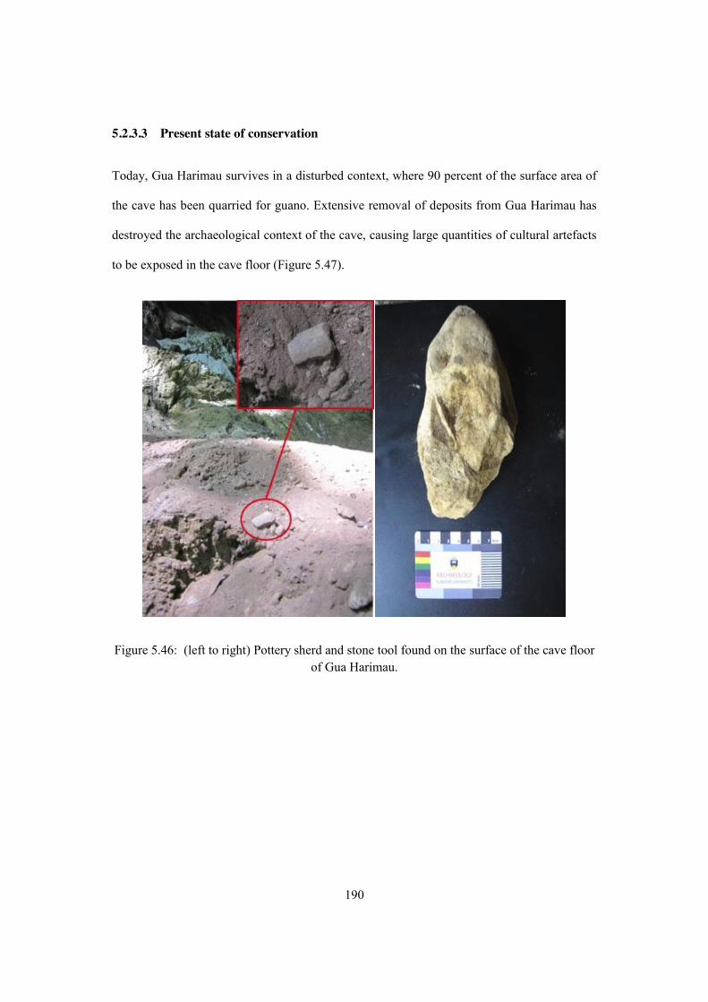
190
5.2.3.3 Present state of conservation
Today, Gua Harimau survives in a disturbed context, where 90 percent of the surface area of
the cave has been quarried for guano. Extensive removal of deposits from Gua Harimau has
destroyed the archaeological context of the cave, causing large quantities of cultural artefacts
to be exposed in the cave floor (Figure 5.47).
Figure 5.46: (left to right) Pottery sherd and stone tool found on the surface of the cave floor of Gua Harimau.

191
Guano mining activities in Gua Harimau were believed to have started during the 1960s and
reached a peak in the following decades. Based on the field report of Williams-Hunt (1951,
1952), no signs of disturbance were detected in this cave between 1945 and 1951. However,
in the 1980s the inner part of the main chamber of Gua Harimau was found severely
disturbed (Zuraina 1988; Zolkurnain 1998). The latest survey of Gua Harimau reveals that the
villagers still illegally collect the guano from Gua Harimau, although this activity has been
prohibited since the late 1980s. According to the locals, a sack (10Kg) of guano can sell for
up to RM 12 – RM 15 (equivalent to USD 3 – 4.50) and many of the villagers collect guano
from the cave to gain extra income.
Gua Harimau is also deteriorating as a result of natural weathering. In 2010, fallen stalactites
were found scattered all over the cave floor (Figure 5.48) and water dripping from the ceiling
has increased humidity in certain parts of the cave. Uncontrolled access and visitation to Gua
Harimau have also affected the integrity of the site. Often, irresponsible visitors spread
graffiti on the cave wall with charcoal, inerasable marker pen and paint (Figure 5.49). In Gua
Harimau, almost 50% of the cave wall is now superimposed with various styles of modern
writing and drawing. The front area of the main chamber is currently covered with rubble
from cave-ins, and two disturbed areas were spotted in the main chamber (Figures 5.50).
Previous excavation trenches were partially backfilled but several trenches still remain open.

192
Figure 5.47: Fallen stalactites scattered on the cave floor of Gua Harimau.
Figure 5. 48: The cave wall of Gua Harimau covered with graffiti.

193
Figure 5. 49: The cave mouth of Gua Harimau covered with limestone boulders.
The site is currently maintained and monitored by the Department of National Heritage.
Nowadays, site maintenance relies on very simple strategies, such as undergrowth trimming
and trash collection. All movable artefacts uncovered from Gua Harimau, on the other hand,
were sent to the Lenggong Archaeological Musuem for proper storage and display.
Additionally, regular animal encroachments have been detected within the surrounding areas,
particularly traces of elephants and tigers. At present, no physical facilities have been
constructed for this cave except for a sign containing background information that has been
erected in front of the cave (Figure 5.50).

194
Figure 5. 50: The information sign erected in front of Gua Harimau.

195
Year of Excavation
Excavation Archaeological Finds Cultural Interpretations Analysis undertaken
by
Storage Key Reference Types of Artefacts Frequency
(pcs) 1945 – 1951 by Williams-
Hunt
Reconnaissance surveys conducted between 1945 and 1951. No excavation was conducted. The interpretation of culture was made based on surface finds.
I. Cord-marked shallow bowls, burnished ware and pottery fragments
II. Neolithic adze III. Human remains of a juvenile
No details Interpreted Gua Harimau as a Neolithic site.
Williams-Hunt (1951,
1952)
No details
Williams-Hunt (1951, 1952)
1987 by Zuraina
Stone artefacts Animal bones Shells Shell ornaments Pottery
No exact quantity recorded
This cave was a prehistoric cemetery during the Neolithic and Metal periods in the Lenggong Valley. The radiocarbon dates derived from shells and charcoals associated with the burials indicated that the cave was occupied by humans between 1,700 and 4,900 years ago.
Zuraina (1988)
Zolkurnain
(1989)
NMM, LAM and
CGAR
Zuraina (1988)
Zolkurnain (1989)
Human remains 7
incomplete individuals (labelled as GH 1-GH 7)
1995 by Zolkurnain
The excavation was carried out at the cave mouth. A total of six trenches, covering an area of 20m were excavated.
Stone artefacts Anvil Hammerstone Falke tool Bark-cloth beater Polished adze Pebble tool Debitage
2 4 3 1 1 3
37
Gua Harimau is the only Neolithic-Bronze Age site in
the Lenggong Valley and it was used for burial purposes during
the late Holocene period, around 3,000 years ago.
Zolkurnain (1998)
NMM, LAM and
CGAR
Zolkurnain (1998)
Earthenware pottery Plain sherds Cord-marked Red-slipped
*7,374 *5,828 * 656

196
Faunal Remains Animal bones Freshwater shells Marine shells
*557 450
3
Metal objects 2
Human remains
4 incomplete individuals (labelled as GH 8 –GH 11)
2010 The latest excavation was conducted in 2010 when a field survey initiated through this research discovered a human burial in a disturbed context. The excavation was launched on a small-scale basis to rescue the remaining burial assemblage which has been partially dug out.
Earthenware pottery Round-bottom vessel
1 GH 12 was assessed as an adult male and the radiocarbon dates derived from a charcoal sample associated with the skeletal remains identified GH12 as an early Neolithic burial dated to 5,080 ± 50 BP (Beta 275680). The pottery vessel is comparable to the previous pottery collections found in this cave. The C14 date of 5,000 suggests that Gua Harimau was occupied by early human starting from the Mid Holocene, which is earlier than the previously presumed date of 3,000-4,000 years ago.
- CGAR -
Human remains 1 incomplete individual (labelled as GH 12)
Table 5. 6: The archaeological investigations and finds of Gua Harimau.

197
Lab Number Material Area / Depth/ Stratigraphic layer
Archaeological Context Calibrated Dates (B.C.)
Conventional Dates (B.P.)
Reference
GX 13506 Charcoal No details
No details No details 1,790 ± 195 Zuraina (1998)
GX 13508 Freshwater gastropod shells
No details
No details No details 4,920 ± 270 Zuraina (1998)
GX 13509 Freshwater gastropod shells
No details No details
No details 14,140 ± 795 Zuraina (1998)
Beta 81771 Charcoal Collected from trench 95A, layer 5, at a depth of 40cm
Found associated with the burial assemblage of GH 9
1,435 – 1,135 3,170 ± 60 Zolkurnain (1998)
Beta 81772 Charcoal Collected from trench 95G, layer 5, at a depth of 45cm
Found associated with the burial assemblage of GH
10
1,440 – 1,145 3,080 ± 60 Zolkurnain (1998)
Beta 275049 Charcoal Collected from spit 7, at a depth around 70-80cm
Found associated with GH 12
- 5,080 ± 50 *
* C14 date obtained through this project.
Table 5. 7: The C14 dates from Gua Harimau.

198
5.3 Summary and Discussion
The investigations the Gua Gunung Runtuh, Gua Kajang and Gua Harimau through field
surveys and recording, mapping and excavation have generated much new data for the
understanding of the past and present use of these cave sites. Examination of the present state
of the conservation of Gua Gunung Runtuh, Gua Kajang and Gua Harimau revealed that
these cave sites are badly damaged and exposed to various threats and pressures, including
development pressure, tourism pressure, anthropogenic activities such as illegal guano
digging and vandalism, as well as environmental pressure.
Many of the low-lying areas surrounding the limestone massifs have been cleared for
agricultural purposes. This has bulldozed the original landscape close to the cave sites.
Additionally, none of the cave sites have been exempt from illegal diggings and this is
causing extensive damage to the cave deposits and their original settings. Uncontrolled
access by local villagers and visitors to these caves has placed the caves under risk in several
ways. Issues such as vandalism, waste disposal and premature deterioration of the caves are
among the most serious problems arising from regular visitation. Furthermore, these sites are
poorly-maintained and the excavated trenches are not being backfilled or fenced.
As these caves are now listed as a UNESCO World Heritage Site, the newly-proposed
conservation management plan could be expected to address these issues, as well as provide
strategies for mitigating the impacts and threats on these cave sites. As such, this project took
the initiative to assess to what extent the newly-proposed management plan for the Lenggong
Valley is adequate to preserve and sustain the integrity of the cave sites of the Lenggong

199
Valley. The review of the contemporary heritage management plan of the Lenggong Valley
will be presented in Chapter 6.

200
Chapter 6 Archaeological Heritage of Lenggong Valley: A Review of its Contemporary Heritage Management
As discussed in the previous chapters, Lenggong Valley is one of the few archaeological
areas in the world that holds the longest stretch of prehistoric sequences, spanning from the
Paleolithic period to the Metal Age. Recognizing the archaeological importance of the
Lenggong Valley, this area was nominated as a UNESCO World Heritage Site (WHS) in July
2012. The early examination into the heritage management of the Lenggong Valley
conducted through this PhD project (between 2009 and 2012) found out that none of any
formal heritage management plan has been put in place to address the heritage management
issues of the Lenggong Valley prior to its nomination to the UNESCO World Heritage Centre
(refer to Section 1.5).
Soon after the arrival of the UNESCO World Heritage Status (WHS) by mid of 2012, the
heritage management of the valley has been restructured by adopting a preliminary
conservation management plan (CMP) (in Malaysia, the plan that outline the management of
a heritage site is known as conservation management plan, Article 46, National Heritage Act
2005) that conforms to the requirements of the UNESCO World Heritage Centre (WHC). The
official CMP, according to the Department of National Heritage Malaysia (DNH), can only
expected to be formally endorsed by 2014. In one of the recent interview, the Higher
Commissioner of Heritage Malaysia stated that the DNH is now liaise with at least twelve
agencies from Federal, State and District levels to prepare a detailed Special Area Plan (SAP)
and a CMP which aim to address all heritage management and development issues of the
Lenggong Valley and these two plans will be submitted to UNESCO and endorsed in
Lenggong Valley by 2014 (Dermawan 2012).

201
Given that one of the main objectives of this PhD project is to investigate the social
significance of the Lenggong Valley and recommend a more holistic management practice
which shows appreciation of the local values and recognizes their ideas to promote
sustainable management through local conservation effort, this project took the initiative to
examine the effectiveness of present heritage conservation and management of AHLV in
addressing the overall conservation constraints, particularly in relation to the community
values and involvement. Basically, this was done through systematic field surveys in few
archaeological caves (refer to Chapter 5) and a systematic content analysis of the preliminary
CMP currently adopted in the heritage management of the Lenggong Valley.
While this newly adopted preliminary CMP is expected to bring improvement to the overall
heritage management of the Lenggong Valley, a follow-up field survey conducted in three
cave sites (GGR, GH and GK) by the end of 2012 shows that many of the archaeological sites
in the Lenggong Valley still engages with heritage management issues, particularly those
related to the local heritage awareness and stakeholder participation in heritage management.
As such, this project took the initiative to review the competency of the preliminary CMP of
Lenggong Valley by looking at five distinct dimensions included the accuracy of this CMP in
conveying the information about the heritage sites and its management objectives; the
legislation in related to the heritage conservation and management; the action and
implementation of the management strategy, as well as investigate how this CMP integrates
the local values and ideas into the management planning through the consultation to and
participation and involvement of, the local community in the management planning.

202
The results obtained from this content analysis show that the contemporary heritage
management planning of Lenggong Valley tends to prioritize the conservation of the
archaeological values of AHLV compared to other values (i.e. social, historical and aesthetic
values) and that planning has been placed in the hand of the governmental agencies with
limited involvement from local communities in the decision making. Further results of the
content analysis will be discussed in-depth in this chapter.
6.1 The Archaeological Heritage of the Lenggong Valley: A newly nominated WHS
The preparation for the nomination of the Lenggong Valley as a UNESCO World Heritage
Site began in year 2010 under the initiatives of the Department of National Heritage
Malaysia, Perak State Government and University Science Malaysia. Since then, continuous
surveys and research were conducted across the valley and relevant stakeholders, such as the
government agencies, research institutes, non-governmental organizations (NGOs), and the
several identified stakeholders were consulted in the preparation of the nomination dossier.
The nomination dossier was submitted to the UNESCO World Heritage Center by January
and the nominated property was enlisted on the UNESCO World Heritage Tentative List
since then. In July 2012, the Lenggong Valley was awarded with the UNESCO World
Heritage Status, made it as the fourth site in Malaysia to have earned this recognition.
The nominated property is named the Archaeological Heritage of the Lenggong Valley
(AHLV). This nominated property is described as “… the remnants of cultural landscape
comprising river gravels, open air stone tool workshop sites , limestone massifs and caves...”
in the nomination dossier. It is a serial nomination formed by two major clusters and consists

203
of seven individual archaeological sites (Figure 1.3). This serial nomination consists of three
open sites and four cave sites, covering a core area of 399 hectares and a buffer zone of
approximately 1787 hectares. Cluster 1 consists of two Palaeolithic open sites – Bukit Bunuh
and Kota Tampan. Bukit Bunuh bears the evidence of early human-mad stone tool, dated to
as early as 1.83 million years ago whereas the archaeological research conducted in Kota
Tampan pointed to it as an early undisturbed stone tool workshop dated to 74,000 years ago.
The uncovering of the stone tool workshop in the Kota Tampan, in particular, contributes to
the regional understanding of the early lithic technology and revealed that the diversity and
sophistication of the tools found in this workshop indicated that the early tool-making
technology of Southeast Asia was as sophisticated as anywhere in the world. At present, this
site is an important reference site for Palaeolithic stone making across the globe.
The Cluster 2 comprises a Palaeolithic open site of Bukit Jawa, and four cave sites, namely
Gua Gunung Runtuh, Gua Kajang, Gua Teluk Kelawar and Gua Harimau. The Bukit Jawa
was accidentally uncovered in 1997 following an expressway construction in Lenggong
Valley and this in situ stone tool workshop site has been relatively dated to approximately
200,000 years based on the comparative study conducted by Zuraina (1997). Similar to the
Kota Tampan, this site is located on the ancient lake shores, and the quartz and quartzite
stone tools found in this site are morphologically similar to those stone tools from Kota
Tampan, with only technologically slightly underdeveloped in comparison (Zuraina 1997).
The cave sites, on the other hand, bear the evidence of human occupation during the late
Palaeolithic and Metal Age, spanning from 13,000 to approximately 1,500 years ago. All
aforementioned caves contains prehistoric human burials, prehistoric stone tools and food
remains, indicated that these caves were used for habitation and burial purposes, especially

204
during the Holocene period (Chia 1997; Chia and Zolkurnain 2005; Goh 2008; Zolkurnain
1998; Zuraina 1994; Zuraina et al 2005).
Despite many evidence show that the human occupation are dated back to as early as 1.83
million years in the Lenggong Valley, however, the direct skeletal evidence of the prehistoric
anatomically modern human (AMH) has thus far only found in several cave sites across the
valley. The archaeological investigation in the Gua Gunung Runtuh, for instance, revealed a
90% complete human skeleton, radiocarbon dated to 10, 120 BP. This skeleton, best known
as the Perak Man, is the oldest most complete human skeleton found in South-east Asia and
was identified with a genetic deformity known as Brachymesophalangia type A2. The Perak
Man has also been identified as the Australomelanesoid, a hominid population occupying
many parts of indo-archipelago and Southeast Asia at the end of Pleistocene and early
Holocene. More discussion of the significance of the cave archaeology of the Lenggong
Valley is presented in the Chapter 3.
As briefly discussed above, all nominated sites have been archaeologically studied and the
results show that these sites have been occupied by early humans between 1.83 million and
1,000 years ago (Mokhtar 2012:5). According to the UNESCO World Heritage Committee,
the AHLV is inscribed on the UNESCO World Heritage List (WHL) based on criteria (iii)
and (iv) of Outstanding Universal Value (OUV). The justifications for the OUV of AHLV are
stated as follows:
Criterion (iii): The series of cave and open air sites along the Perak River in the Lenggong
Valley is an exceptional testimony to occupation of the area particularly during the

205
Palaeolithic era, but also during the Neolithic and Bronze Age periods from 1.83 million
years ago to 1,700 years ago.
Criterion (iv): The undisturbed in situ Palaeolithic stone tool workshops located on the
shores of a paleolake and Ancient River gravel beds and dated in a long chronological
sequence are an outstanding ensemble of lithic technology.
6.2 The Management of AHLV prior to its UNESCO World Heritage Status:
A brief highlight
Between 1980s and 2003, the conservation and management of the archaeological heritage of
the Lenggong Valley were co-monitored by the Department of Museums and Antiquities and
Lenggong District Council. This stage of conservation and management was relying on a
very simple practice, mainly through the control of archaeological investigations (i.e.
research grants and excavation license) and periodical site maintenances carried out by the
staffs from Taiping Museum, located approximately 80km away from the Lenggong Valley.
In early 2004, a more comprehensive conservation and management practice was introduced
into the valley following by the establishment of the Division of Heritage, a division branches
from the Ministry of Culture, Arts and Heritage Malaysia (KEKKWA). This division was
later restructured and upgraded to the Department of National Heritage (DNH) in 2006.
Since 2006, the DNH began to channel sufficient funding and technical assistance for the
archaeological research of the Lenggong Valley. The heritage conservation management of
Lenggong Valley has also been systematized in accordance to the provisions and guidelines
provided by the National Heritage Act 2005 (NHA 2005) and other international charters
with minor enhancements by the local government and authorities since then. Between 2004
and July 2012 (Lenggong Valley was nominated as the UNESCO World Heritage Site in 30th

206
June 2012), the administration of the heritage management in Lenggong Valley was then
placed under the purview of DNH and Lenggong District Council. The DNH Central Zone
Branch is setting up in the central of Peninsular Malaysia to provide direct support services to
the heritage conservation and management of the Lenggong Valley (e.g. site maintenance,
technical services, professional consultation).
In the local level, the Lenggong District Council was authorized by DNH as the main agency
to coordinate the management of the local archaeological sites according to the established
guidelines (i.e National Heritage Act 2005, UNESCO Venice Charter). Apart from this, the
Lenggong District Council also actively involved in the local development planning and
worked with different state authorities such as the Department of Town and Country
Planning, the Perak Economic Planning Unit and the local land office in the formulation of an
integrated management planning to achieve a balance and integrated development in
Lenggong Valley. Another statutory agency that takes part in the heritage management
during this stage was the Lenggong Archaeological Museum. This museum was established
in 2003 and mainly responsible for the conservation, storage and exhibition of the artefacts
uncovered from the archaeological sites in this area.
Prior to the arrival of UNESCO World Heritage Status, there was no formally written
conservation management plan put in place. Often, the conservation management of the
archaeological heritage of this valley was mainly relied on the archaeologists who carried out
the archaeological investigations or the conservationists who handle the conservation of the
archaeological materials excavated from the sites. It was common that most of the
archaeological investigation was conducted by professionally-trained archaeologists with the

207
application of multi-disciplinary approaches and all uncovered cultural materials were
scientifically studied, analyzed and conserved either in situ or in the laboratory.
To date, the interpretation and presentation of the heritage of Lenggong Valley are mainly
drawn from the archaeological data generated by the archaeologists. As such, the
interpretation of the heritage of Lenggong Valley is mainly focused on its archaeological
value (or scientific value) which mainly derived from the tangible elements associated to an
archaeological site or object. The intangible elements such as the social connection, living
traditions and spiritual beliefs associated with the sites are often been neglected given that the
interpretation of the cultural heritage of Lenggong Valley are based on the professional-
objective values.
Looking at the conservation management practices in Lenggong Valley for the past two
decades, there were two major trends that can be observed. First is the domination of the
professionals such as archaeologists and government authorities in the management of the
cultural heritage through the constitutional control or governmental bureaucracy. As
discussed in Section 1.4 and Section 2.3, the heritage management system in Malaysia can be
referred as a “top-down” model given that all heritage-related policies or decisions were
mainly formulated or made by the professionals without the consultation to or inclusion of
local community and non-governmental organizations. Furthermore, the contemporary
heritage legislations and policies seems to also advance the domination of authority in
heritage sphere as these legislative documents empower the authorities to claim full custody
towards the cultural heritage discovered across the country.

208
The second obvious trend was the imbalances of the focus of conservation management
which tends to prioritize the tangible or physical conservation of the cultural materials. Up
until now, little acknowledgement has been given to the intangible heritage of the Lenggong
Valley. Historically, the cave sites of Lenggong Valley are associated with several important
historical episodes during the Second World War and early archaeological records (e.g.
Evans 1917) also show these caves have been extensively occupied by the Indigenous tribes
of Peninsular Malaysia in the recent past. However, the heritage conservation and
management of the Lenggong Valley prior to the 2012 never integrated these important
cultural associations into the interpretation of the cave culture of the Lenggong Valley and
how the local community culturally connected to these caves is thus far remain unknown.
The absence of a formally written CMP prior to July 2012 has led to a scenario in which the
heritage conservation and management of the Lenggong Valley was inadequate to address the
management issues. Among the others, the uncontrolled anthropogenic activities,
development and tourism pressures and the imbalances in the focus of archaeological
research are few of the major challenges to the heritage conservation and management of the
Lenggong Valley (Refer to Section 1.5). For instance, the uncontrolled anthropogenic
activities such as illegal digging in the caves and the illegal logging within the proximity of
the cave sites believed to have caused the deterioration of these cave sites. As all the cave
sites are located within plantation areas and the secondary forest surrounding the caves has
been cleared for rubber and fruit plantations, the original landscapes within proximity of the
caves have also been bulldozed. Following by the inscription on the UNESCO World
Heritage List, the ICOMOS also pointed out that the existing main hreats to the Lenggong
Valley are change of land use, housing development, quarrying activities, increased tourism
activities and graffiti at cave sites due to increased visitation (ICOMOS 2012:164). As such,

209
the state party has been urged by the UNESCO and ICOMOS to produce a CMP which
integrates a Special Area Plan as a mean to address the aforementioned issues.
Considering the present state of conservation and management of the Lenggong Valley still
subject to several problems and threats, the formulation of an effective CMP to oversee these
issues is important in the near future. A thorough review of the existing CMP of the
Lenggong Valley, is therefore, considered as a practical way to figure out the strengths and
weaknesses of the existing CMP to allow appropriate recommendations for the future
delivery of the heritage conservation management for Lenggong Valley.
6.3 The Content Analysis of the CMP of AHLV: motivation and rationale
The nomination dossier submitted to the UNESCO World Heritage Convention contains a
detailed description of the nominated property as well as a proposal for its future
management based on the requirements as stipulated in the UNESCO World Heritage Centre
Operation Guidelines. It comprises seven distinct chapters to provide sufficient information
related the archaeological sites of the Lenggong Valley which includes the identification of
the nominated property, a detailed description of the archaeological records of the sites, the
justification for the inscriptions included a clear statement of Outstanding Universal Value
(OUV) of the each nominated property and a brief proposal for the conservation management
of the nominated property (http://whc.unesco.org/uploads/nominations/1396.pdf). Along
with this nomination dossier, a separate copy the preliminary Conservation Management Plan
(CMP) has also been submitted to the UNESCO as a measure to safeguard the archaeological
heritage of the Lenggong Valley. As a newly-nominated World Heritage Site, the preliminary
CMP of AHLV is prepared with the assistance of the consultation from UNESCO Bangkok
office and the plan was developed with a special reference to the CHMP of the heritage site

210
of Plain of Jars in Lao People’s Democratic Republic prepared for the nomination of the
UNESCO WHS. Generally, this CMP details the short and long-term management goals and
sets forth the management strategies for the conservation of the outstanding universal values
of AHLV.
As one of the newly nominated UNESCO World Heritage Site, the conservation management
of the AHLV is now has to be comply with the conservation standards and strategies imposed
by UNESCO (e.g Venice Charter 1964; Feilden and Jokilehto 1993). However, what
constitute a “standard” or “good” heritage management guideline or framework is still
relatively vague. Despite the fact that the preliminary CMP of AHLV is prepared by adopting
proper principles and guidelines as recommended by UNESCO, the effectiveness of this
CMP in addressing the management issues of AHLV is still questionable. This study
therefore, takes the initiative to explore the effectiveness of this newly proposed management
plan in assisting the contemporary and future management and development of the WHS of
AHLV.
In searching for suitable evaluation criteria for the assessment of the effectiveness of the
preliminary CMP of AHLV, several literatures dedicated to the management of World
Heritage Sites were found useful. For example, Feilden and Jokilehto (1993) first published a
Management Guideline for World Cultural Heritage Site to assist with the formulation of a
proper cultural heritage management plan (CHMP). This management guideline provided a
summary of guiding principles recommended by UNESCO and proposed three core
components for a CHMP included site description, site evaluation and objectives of the plan
and the overall site management. Later, McKercher and du Cros (2002) introduced a Cultural
Heritage Management (CHM) framework that carries five major components, including
inventory and evaluation of the heritage property, legislation, involvement of professionals or

211
experts in the management process, stakeholder consultation and participation and an on-
going review and monitoring of the management plan. One of the strengths of the McKercher
and du Cros’s (2002) model compare to the framework proposed by Feilden and Jokilehto
(1993) is that their CHM framework recognized the contemporary global and local factors as
the underlying influences that shaped the CHM development in different region.
In 2010, Cleere (2010:4-12) proposed a World Heritage Template as a reference for the
development of management plans for archaeological sites across the globe. This template
provides basic parameters for the management planning for a World Heritage Site
(particularly archaeological site) and many of the principles and procedures and conforms to
the recommendations made by UNESCO and ICCROM. Cleere’s proposal of a good World
Heritage Management planning comprises nine major components. That included a basic
guideline to the management planning process, identification of stakeholders, investigation
and understanding of the site, conservation and monitoring of the archaeological site,
presentation and interpretation of the archaeological heritage, tourism and visitor
management as well as a valid and achievable action plan with regular review.
Apart from these heritage management guidelines and frameworks proposed by different
heritage practitioners based on their experiences in handling with different conservation
projects, there is also a general agreement that the contemporary heritage conservation should
integrate the idea of “sustainable development” into the conservation management planning.
The term “sustainable development” was first properly defined in the Brundtland Report as
“… development that meets the needs of the present without compromising the ability of
future generations to meet their own needs..’’. Generally, the idea of sustainable development
carries two key principles, emphasizing on the holistic planning and strategic decision-
making and to promote environmental, economic and societal growth that can be sustained

212
over the long term (Landorf 2009:54). Given that one of the recent global strategies is to
promote the sustainable use of heritage for the local development, the contemporary heritage
management planning of AHLV is therefore, expected to have been adopted a more holistic
and integrated approach towards the sustainable heritage conservation planning. In the
recently published “Strategic Action Plan for the Implementation of the UNESCO
Convention, 2012-2022”, the UNESCO World Heritage Convention put forward the concern
for sustainable development, which aimed to promote the idea which heritage protection and
conservation should consider present and future environmental, societal and economic needs
of the local community and the community-driven heritage conservation is recommended as a
key to a success heritage conservation program.
The contemporary heritage management of the Lenggong Valley, apart from being
challenged by the low local involvement in heritage conservation, one of the major issues
since it obtained its UNESCO World Heritage status is the growth of heritage tourism
activities across the valley. According to the latest source announced by the National
Heritage Department Malaysia, the numbers of visitors to Lenggong Valley have been
increased by 150% for the past 12 months (Kumaran 2013). Additionally, the issues of local
preparedness in coping with the drastic socio-economic development with the arrival of
UNESCO world heritage status is still relatively apparent given that the local community are
still skeptical about the future of the valley (Ahmad Suhaimi, 2011, personal
communication).
As discussed above, it is notable that majority of the frameworks proposed by different
heritage practitioners or institutions suggest that good legislation framework, thorough site

213
identification and description and achievable implementation plan as three core components
that should be adopted into a conservation heritage management planning. A primary
examination of the existing CMP of AHLV shows that the management planning tends to
prioritize the conservation of the archaeological values of AHLV compared to other values
(i.e. social, historical and aesthetic values) and that planning has been placed in the hand of
the governmental agencies with limited involvement from local communities in the decision
making. In order to examine to what extent, the contemporary CHMP of AHLV is sufficient
to address the management issues, a total of five major aspects have been identified as the
key to a success cultural heritage management planning for AHLV, namely:
(i) Legislation
(ii) Site evaluation and management objectives
(iii) Action and implementation
(iv) Community values and attitudes
(v) Stakeholders and Community Participation
Each aspect will be evaluated through a quantitative content analysis with the assistance of
the coding items specially developed for the study and the results generated from the content
analysis will be presented in later sections of this chapter.
6.4 The Content Analysis of the AHLV Management Plan: Methodology
Usually, the first step in the content analysis is to identify the themes or dimensions which to
be assessed via systematic coding. In the case of Lenggong Valley, five dimensions have
been identified as the key components to a successful and sustainable heritage management
plan, namely legislation, site evaluation and management objectives, action and

214
implementation, community values and attitude and stakeholder participation (refer to
Chapter3, section 3.2.1(a)). Each dimension was assessed through the systematic coding
process to explore to what extent, these dimensions have been well-integrated into the
management planning of AHLV. A total of 30 coding items across five evaluation
dimensions were adopted for this study. Generally, some of these evaluation instruments are
adopted from Simpson (2001) and Landorf (2009) and some were specifically developed for
this study (Table 6.1). In this content analysis, a four-point Likert scale was adopted in order
to quantitatively evaluate to what degree the assessment items were integrated into the
management plan. The responses are quantified using the numeric scale range from 0 to 3,
and the rationales for the coding responses are elucidated in Table 6.2.
Evaluation Dimension
Coding Item
Legi
slatio
n
1. Does the national legislation provide clear definitions about the scope and definitions of heritage, including not only tangible but also intangible heritage and these are described in the plan?
2. Does the national legislation provide a guideline for the identification of the heritage asset particularly the archaeological sites and artefacts and these are deliberated in the plan?
3. Does the legislation contain a provision about licensing in heritage and the plan included the issues such as: - The trade of antiquities? - Import/export of heritage item? - License to excavate the heritage site?
4. Does the national legislation describe the policy in relation to conservation and preservation of the heritage and it is outlined in the plan?
5. Does the national legislation include the provision for the enforcement of the heritage act/decree/enactment and this is included in the plan?
Site
Eva
luat
ion
and
Man
agem
ent
Obj
ectiv
es
6. Are tangible heritage characteristics described? 7. Are intangible heritage characteristics described? 8. Are the land use and ownership patterns identified? 9. Are demographic characteristics identified? 10. Are the cultural significances of the site evaluated? 11. Are heritage tourism activities identified?

215
12. Is the degree of authenticity and integrity of the site identified? 13. Are the threats and risks towards the heritage site identified? 14. Are the management visions/goals/objectives clearly stated in the
management plan? 15. Do the management objectives prioritize the significance of the
Outstanding Universal Values of the site?
Act
ion
and
Impl
emen
tatio
n 16. Is the administrative structure of the management described? 17. Is the management plan integrated into planning policies at national,
regional or local levels? 18. Is the implementation/action plan reviewed or monitored periodically 19. Are the staffing level and human resources requirements of the
management addressed? 20. Is the financial/funding situation described? 21. Is the involvement of the NGOs in the implementation of the
management described/addressed?
Com
mun
ity
Val
ues a
nd
Atti
tude
s
22. Are local heritage values identified? 23. Are critical issues of residents in relation to heritage identified? 24. Are community attitudes to heritage assessed? 25. Is the attachment/connection between the local residents and the heritage
site described?
Stak
ehol
der a
nd
Com
mun
ity
Part
icip
atio
n
26. Are the stakeholders and their relationship identified? 27. Is the partnership between the administrator board and other
stakeholders addressed in the plan? 28. Are local ideas incorporated into the heritage management? 29. Is the level of support from local communities for heritage management
identified? 30. Is the participation of local communities and stakeholder in the
management process addressed? Table 6.1: The AHLV management plan coding instruments.

216
Scale Rationale
Award 0 if: (ii) The item has been ignored/absent from the management plan
Award 1 if: (ii) The item is mentioned but not defined, described or integrate into the
management plan
Award 2 if: (ii) The item is mentioned, defined, described or incorporated into at
least one component in the management plan (e.g. a section heading)
Award 3 if: (iii) The item is well defined/well deliberated and the descriptions are
unambiguous/unquestionable
(iv) The item has been incorporated into more than 1 component in the
management plan
Table 6.2: The rationales for the coding response.
The content analysis was conducted in two stages. At stage 1, five heritage practitioners (two
archaeologists and three heritage officers) were invited to attend two sessions of focus group
meeting (each took approximately 2 hours) to run the document familiarization and code the
text according to the assessment themes and coding items. Each participant was given a hard
copy of AHLV management plan and the coding item sheet and they were allowed to code
the text based on their own knowledge while I run through the content of the plan. After the
participants completed the text-coding process, we moved to the second stage where the
participants started to evaluate the coded data and analyzed to what degree or extent these
principles or items were integrated into the management planning of the site. The assessment
of the content of the plan was conducted in another separate focus group session.
In this analysis, each of the coding items was awarded a response scaled between 0 and 3
based on the extent of the integration of coding items into the AHLV management plan. All
responses obtained from the analysis were processed using the IBM SPSS (Statistical Product

217
and Services Solution) quantitative analytical tool. A mean score (minimum 0, maximum 3)
was used to measure the degree of integration of these principles into the plan.
6.5 Content Analysis: The results
Figure 6.1 and Table 6.1 present the results of the content analysis of the AHLV preliminary
CMP based on the mean reading for each assessed dimension. Overall, the result shows that
the management plan of AHLV gives a greater focus on the legislation and its action and
implementation. With a mean reading of 1.9, it demonstrates that this management plan
generally adopted an average legislation framework and the important legislative policies are
elucidated and incorporated into the plan. The action and implementation of the management
strategies gained a mean of 1.93 out of 3, indicates that the integration of this dimension into
the management plan is relatively evident, with only few key aspects of implementation
being excluded from the plan. Site evaluation and the management objectives are provided in
the plan, but with a mean score of 1.66, it suggests that these aspects are not well integrated
into the planning process. Stakeholder’s participation obtained a mean score of 0.6,
demonstrating a failure of this plan to address the issues related to the identification and
involvement of stakeholders in the planning and management process. Finally, examination
of concerns about community values and attitudes shows that this plan makes no effort to
identify the local values and attitudes, with a mean score of 0 for this dimension. The
detailed assessment results obtained for each of the coding items will be deliberated in the
following section.

218
Figure 6.1: The mean reading of the responses collected for each of the evaluation dimension.
Assessment Item Results
(mean
score)
Legi
slatio
n
1. Definition and scope of heritage (tangible and intangible
heritage)
2. Guideline for the identification and documentation of the
heritage asset
3. Provisions about the heritage licensing
4. Conservation policies stipulated in the international, national and
local decrees and charters
5. The enforcement of heritage legislation
1.4
1.8
2.8
2.0
1.5
1.9
1.66
1.93
0
0.6 0
0.51
1.52
2.53
Legislation
Site Evaluation andManagement
Objectives
Action andImplementation
Community Valuesand Attitudes
Stakeholder andCommunity
Participation

219
Site
Eva
luat
ion
and
Man
agem
ent
Obj
ectiv
es
6. The tangible heritage characteristics
7. The intangible heritage characteristics
8. The land use and ownership patterns
9. The demographic characteristics / patterns
10. The cultural significances(i.e. social, historical and aesthetic) of
the sites
11. Tourism activities
12. Authenticity and integrity of the site
13. Threats and risks towards the site
14. Management visions/goals/objectives
15. Outstanding Universal Values of the site
3.0
0
0.6
0
1.8
3.0
1.2
1.2
3.0
2.8
Act
ion
and
Impl
emen
tatio
n
16. Administrative structure 3.0
17. Integrated planning 2.8
18. Staffing / human resource levels 1.0
19. Financial and funding mechanisms/situation 1.8
20. Involvement of NGOs 0
21. Monitoring and review of management 3.0
Com
mun
ity V
alue
s
and
Atti
tude
s
22. Local heritage values 0
23. Issues for local residents 0
24. Community goals in heritage management/conservation 0
25. Community attitudes towards heritage 0
26. Local connection/ attachment (i.e. social, historical or spiritual)
to the sites
0
Stak
ehol
der a
nd
Com
mun
ity
Part
icip
atio
n
27. Identification of stakeholders and their relationship 1.0
28. Stakeholder partnerships 1.0
29. Local ideas incorporated into management planning 1.0
30. Level of support of the local community in heritage management 0
31. Local stakeholders involved in the consultation and decision
making.
0
Table 6.1: Results of the content analysis of the AHLV preliminary CMP based on the mean score.

220
6.5.1 Legislation
Legislation plays an important part in an effective heritage management plan given that much
heritage planning is influenced by the legislative policy (Cleere, 1989). Pearson and Sullivan
(1995:34) have previously pointed out that the management orientation of a heritage place is
highly dependent on the legal framework established by the local government. Generally,
many heritage practitioners agreed that a good legislative framework as suggested by Pearson
and Sullivan (1995) and Prott (1993) should make provisions or policies for:
(a) the identification or definition of heritage;
(b) the conservation and management of heritage;
(c) integrated heritage planning and,
(d) the international standards for heritage preservation.
In this content analysis, a total of five coding items were developed based on the
aforementioned themes to examine the effectiveness of legislation and policy delivery in
AHLV (Figure 6.2). These coding items were developed to explore to what extent, the
legislative framework established by the Malaysian government is well integrated into the
management planning of AHLV.

221
Figure 6.2: The mean reading for the each coding item adopted to assess the level of
integration of heritage legislation in the AHLV’s CMP
The existing management of AHLV conforms to the common principles of practice that are
undertaken and enforced by the various government agencies such as the Department of
National Heritage, the Department of Museums (both within the Ministry of Information,
Communications and Culture), the Department of Town and Country Planning and various
local authorities (both within the Ministry of Housing and Local Government) across the
whole of Peninsular Malaysia. Overall, four legal instruments have been adopted into this
management plan. The content analysis shows that the national legislation documents are not
sufficient to assist the management and conservation of the archaeological heritage of AHLV,
with an average mean score of 1.9 (Figure 6.2). Five aspects of the legislations have been
examined and the result of each is discussed as follows:
(i) Definitions and scope of heritage (mean score=1.4)
From the content analysis, it shows that the national heritage legislation fails to
provide clear definitions for heritage, with a mean score of only 1.4. Of four legal
1.4
1.8
2.8 2
1.5 00.5
11.5
22.5
3
Definition andScope of Heritage
Identification andDocumentation of
the Heritage
Heritage LicensingHeritage
ConservationPolicy
Enforcement oflegislation

222
documents, only the National Heritage Act (NHA) 2005 contains brief definitions
of what constitutes heritage. The NHA postulates that the heritage comprises of
tangible and intangible elements. Generally, the heritage in Malaysia can be
subdivided into three main categories: natural heritage, cultural heritage and
underwater heritage. However, the Act does not provide sufficient guidelines or
criteria for what constitutes each category. According to the NHA, archaeological
artefacts, remains and materials aged 50 years or over are referred to as
archaeological relics. This definition is relatively vague given that there is no
physical attribution recommended to classify what is an archaeological relic. The
analysis shows that the definition of archaeological heritage is rarely mentioned in
the management plan of AHLV and that no definition of “archaeological heritage”
is given in the plan.
(ii) Guideline for the identification and documentation of the heritage (mean =
1.8)
The analysis shows that the guidelines for the identification and protection of the
heritage asset are not well integrated into the management plan of AHLV, with a
mean score of 1.8. This is because the existing legislation is insufficient to enable
the identification of the heritage asset given that there is an absence of official
charters or guidelines. Although certain parts of the plan state that internationally-
accepted charters such as the UNESCO Venice Charter or ICOMOS Charter for
the Protection and Management of Archaeological Heritage should be adopted as
the principle documents to assist in the identification and documentation of the
heritage, the relevant guidelines or principles recommended by these charters,
however, are not recorded in the plan.

223
(iii) Heritage Licensing (mean score = 2.8)
The integration of information about heritage licensing into the management
planning of AHLV is evident, reflected in a high mean score of 2.8 from the
content analysis. Of all four legislative documents, only the National Heritage Act
2005 contains provisions relevant to heritage licensing. The NHA, provides
sufficient support to address licensing issues such as the trade in heritage items,
licenses or permissions to excavate a heritage site and the registration of heritage
items and dealers. This component is very important in heritage management
planning especially in Southeast Asian countries where the illicit trading of
antiquities is still active across the region (e.g. Brodie 1999; Stark and Griffin
2004).
(iv) Heritage Conservation Policy (mean score=2.0)
Generally, the national legislation established a number of policies in relation to
the conservation and preservation of heritage. The NHA, for instance, has
proposed a set of heritage conservation policies to guide the designation of
heritage sites, conservation zone planning and the inspection and monitoring of
heritage sites. However, the integration of these conservation policies into the
management plan is somehow evident, in the policy about the land acquisition and
zoning, but few provisions for the conservation of archaeological sites and the
procedures for applying for planning permission were mentioned and incorporated
into the plan. These policies are not thoroughly detailed in the plan and some
policies do not conform to international standard practice as recommended by
UNESCO and ICOMOS.

224
(v) Enforcement of Heritage Legislation (mean score=1.5)
At present, the enforcement of the heritage legislation is in the hands of National
Heritage Council. Overall, each heritage legal document contains provisions for
such enforcement and this provision is generally comprehensive, covering the
appointment of enforcement officers to the investigation of heritage offences, as
well as seizure of the heritage objects. However, the integration of the
enforcement of legislation into the management plan of AHLV is not evident,
given that the management plan only covers a small section of the function of the
National Heritage Council.
6.5.2 Site Evaluation and Management Objectives
A thorough evaluation of a heritage site and clear management objectives are considered to
be the keys to an effective management plan (Pearson and Sullivan1995:82). This is because
the detailed investigation of a heritage site will provide useful baseline information for the
formulation of future management orientation and will ensure that management objectives
are based on the cultural significance or attributes of a heritage site. According to the
literatures (Feilden and Jokilehto 1998; Pearson and Sullivan1995), the identification and
documentation of a heritage site has to be holistic and as detailed as possible, so that every
aspect of the site can be investigated in the early stages of the management planning process.
This will include the examination of the tangible and intangible elements of a heritage
property, the land use and demographic patterns, the identification of its cultural significance,
and existing heritage tourism activities, as well as the factors that affected the heritage
property and its management goals and objectives. Overall, the AHLV provides only an
average coverage of and explanation about the characteristics of the Lenggong Valley sites,

225
scoring only 1.66 out of 3 (Figure 6.3). Some important information such as the demographic
details and intangible heritage elements have been totally left out of the management plan.
The management objectives are comprehensive and were mainly established to retain the
OUV of the Lenggong Valley.
Figure 6.3: The mean reading for the each coding item adopted to assess the effectiveness
of the site evaluation and management objectives of AHLV.
(i) Tangible Heritage (mean = 3.0)
From the analysis, it shows that the tangible heritage of the AHLV is well
deliberated in the plan and the description of each of the archaeological sites
within the nominated area is firmly supported by the scientific data. Basically, the
chapter 1 of this management plan provides an in depth discussion of the tangible
elements of each nominated archaeological site with a clear presentation of its
geographical and geomorphological settings, physical attributes and records of
archaeological findings. The boundary of each archaeological site has been well
defined with sufficient zoning information (i.e. core and buffer zone) and clear
inventory of the archaeological artefacts uncovered from each site is also
3
0
0
0.6
1.8
3
1.2
1.2
3
2.8
0
0.5
1
1.5
2
2.5
3Tangible Heritage
Intangible Heritage
DemographicCharateristics
Land use andOwnership patterns
Cultural Significance
Heritage Tourism
Authenticity andIntegrity of the sites
Threats and Riskstowards the sites
ManagementGoals/Visions/Objecti
ves
Outstanding UniversalValue

226
provided. The interpretation of the tangible aspect of the archaeological heritage
of each nominated site is well presented and described in the plan. This had
inevitably allow better understanding into the archaeological significance of the
nominated property and the Outstanding Universal Value (OUV) of the tangible
heritage of AHLV is well justified through a comparative analysis with 16
heritage property from other parts of the world .
(ii) Intangible Heritage (mean = 0)
The Lenggong Valley is an area which possesses a long human occupation history
and some contemporary living traditions such as the subsistence patterns and local
beliefs have been inherited from the previous generations and still in practice up
until today (will be discussed in depth in Chapter 7). Heritage surveys conducted
through this PhD project reveals that the Indigenous heritage still influence the
contemporary lifeways of Lenggong’s community up until now even the majority
of the Indigenous tribes have been relocated in Kampung Air Bah, a village
distance about 15km from the valley. Over the last century, many studies have
been conducted to investigate the indigenous heritage of the Lenggong Valley,
primarily emphasize on the ethnography and the arts of the Indigenous tribes who
used to camped across the area prior to the late 1990s (i.e. Evans and Callenfels
1928; Tason and Mokhtar 2012). This PhD project further reveals that many of
these archaeological sites are associated with the several historical and social
episodes of the local community since the beginning of 20th century (see Chapter
7). However, it is ironic that all of these intangible elements of the local heritage
have not been included at all in the management plan.

227
(iii) Demographic characteristic (mean = 0)
In view of the effect which the inscription of a property on the World Heritage
List could have on its future, the local community is therefore considered as the
most important stakeholders in the heritage management planning. As such, a
detailed identification of the demographic characteristic is essential to
acknowledge the cultural and ethnic diversity associated with a heritage property.
As argued by Black and Wall (2001) based on their study conducted in Indonesia,
the acknowledgement of the cultural diversity within a local community is a
cornerstone to a good heritage conservation program given that oftentimes, the
successfulness of a heritage conservation program is highly depend on how much
the management team integrate the cultural background of the local community
into the management planning. Added to this, Bryne (2011:3) flagged up that if a
heritage management planning didn’t take into account the cultural and ethnic
diversity of the local society, it will be problematic to enact effective heritage
conservation policies and program at local level. In the case of AHLV, it is
surprising that the existing demographic characteristics of the Lenggong Valley
are not included in the management plan of AHLV. The estimation of population
size is not mentioned and other demographic details such as the gender, age or
ethnicity of the residents of the Lenggong Valley are also absent from the plan.
(iv) Landuse and Ownership Pattern (mean = 0.6)
A clear identification and documentation of the landuse and ownership patterns
for a heritage site is fundamental in every heritage management planning. This is
partly due to the fact that the change of the landuse pattern and ownership is one

228
of the major factors that potentially threatened the integrity and authenticity of a
heritage property. Examination into the existing CMP of AHLV however, shows
the landuse and ownership patterns of the AHLV, are not detailed in the
management plan. Overall, only a small section in the management plan (section
4.2) explaining the procedures in negotiating with the owners of the designated
heritage sites about the compensation and transition plans for ownership. The
major categories of the land ownership within the core and buffer zone whether it
is State, Provincial, private, community, traditional, customary or non-
governmental owned is not mentioned in the management plan. The significant
changes in the landuse or ownership over the past few years or in the near future
are also not elaborated in the plan. This demonstrates a possibility in which the
contemporary management arrangement of AHLV might not sufficient to tackle
the issues of changes in landuse and ownerships in a long run.
(v) Cultural Significance of the site (mean = 1.8)
The management plan of AHLV identified the archaeological values of the site
and justified each component of archaeological significance with scientific data
generated from archaeological research. The plan acknowledged that the
archaeological importance of the Lenggong Valley is measurable at a global scale
and the main objective of the management plan is to adopt appropriate strategies
to retain this archaeological significance. However, other dimensions of cultural
significance, such as social significance and historical significance, are not
discussed in the plan. The historical and social background of the site, as well as
social interactions between the locals and the sites, are not presented in the plan
and thus other elements of cultural significance could not be traced from the plan.

229
(vi) Heritage Tourism (mean = 3.0)
Undoubtedly, the management plan of AHLV is placing greater focus on tourism
activities within the core and buffer zones of AHLV. The plan details existing
heritage tourism activities and provides a thorough inventory of the attractions of
AHLV and past annual statistic on visitation. The plan also proposes strategies to
promote a sustainable heritage tourism development in AHLV. Such strategies
include infrastructure development, visitor management, and risk management, as
well as collaboration with the local tourism planning authorities. It also puts
forward a proposal to promote local participation and partnership in heritage
tourism of AHLV. As the tourism activities within the AHLV is projected to be
increased by at least 100% within a year after its inscription, a series of outreach
programmes have been proposed aiming at increasing the local capacity building
in local heritage tourism sector.
(vii) Authenticity and Integrity of the site (mean = 1.2)
A detailed examination of the present state of authenticity and integrity of a
nominated property is a mandatory component of any World Heritage Site
management plan. This is because understanding the authenticity and integrity of
a site will reflect on the present state of conservation and thus provides a baseline
for the designation of appropriate strategies to improve the state of conservation
(Jokilehto 2006; Stovel 2007). In the case of AHLV, the management plan failed
to define the concept of authenticity and integrity and explain how these concepts
should be integrated into the context of AHLV. The integrity and authenticity of
the nominated property is not thoroughly presented in the management plan.
Basically, the plan only gives a brief examination of the present state of

230
conservation, and highlights the importance of the heritage management team to
liaise with the relevant bureaucracies in order to conserve the authenticity and
integrity of the property in accordance to the international standards as
recommended by the World Heritage Convention.
(viii) Threat and Risk (mean = 1.2)
The threats and risks towards the heritage site of AHLV were identified through
the Heritage Impact Assessment (HIA) conducted by the Department of National
Heritage. However, the management plan of AHLV did not clearly deliberate the
results obtained from the HIA. The potential threats and risks that might affect the
integrity and authenticity of AHLV were briefly outlined in the plan. For instance,
a list of potential threats and pressures such as development pressures and changes
of land use pattern were identified and earmarked as indicators for monitoring,
however, no mitigation strategy is recommended.
(ix) Management Goals, Visions and Objectives (mean = 3.0)
The management plan of AHLV provides clear and detailed management goals,
visions and objectives by giving extended explanations of each component in a
separate chapter. Overall, this management plan aims to propose effective
management strategies to preserve the integrity and authenticity of the AHLV in
order to promote sustainable development within the framework of the World
Heritage Convention. A comprehensive implementation plan has also been
proposed to achieve the goals, visions and objectives of the heritage management
of AHLV. As this preliminary CMP will be only adopted for a short time of
period until the endorsement of new CMP in 2014, the management goals of this

231
preliminary CMP is therefore tend to be present-oriented, with no long term
management goals and strategies deliberated in the plan.
(x) Outstanding Universal Value (OUV) ( mean = 2.8)
From the analysis, it shows that the preliminary CMP of AHLV provides an in
depth discussion of the OUVs of the property, and each of the OUVs is justified
based on the scientific data generated from years of archaeological research in this
valley. Generally, the OUVs of the nominated property are central to its
archaeological significance, it is therefore, the core of the whole CMP is to
enhance the effort in protecting the archaeological significance of the AHLV. In
order to retain the OUVs of AHLV, this CMP proposes to integrate the local
planning into the conservation management as well as recommends few
sustainable development measures such as the control of developments within
core and buffer zones. Added to this, this CMP also tends to promote the future
research into the archaeology of the valley as a means to enhance and strengthen
the OUVs of the Lenggong Valley.
6.5.3 Action and Implementation
The action and implementation is considered as one of the core components of a good CMP.
The action and implementation plan normally outlines the administration structures of a
management team and how the team launches the conservation policies and programs in short
and long-run (Pearson and Sullivan 1995:220). Normally, the implementation of a CMP
makes use of a number of management practices, such as the strategies to oversee the
recruitments and training of professionals and personnel, funding mechanisms for the

232
implementation of the conservation management, as well as the short and long-term reporting
and review of the management and conservation projects. Each of these components is
crucial to ensure that the conservation and management policies are competently
implemented to achieve the management goals. In the case of the Lenggong Valley, I
evaluated the effectiveness of its action and implementation based on six themes or
components as shown in Table 6.1. These themes are chosen based on the assumption that the
implementation of a CMP is rooted in a good administrative structure with sufficient staffing
level and financial support. On top of this, the role of different stakeholders included NGOs
in the management planning is also a key to the success of a CMP. Of course, the
implementation of conservation management of the Lenggong Valley also requires a regular
monitoring and review mechanism.
From the analysis, it demonstrates that the action and implementation strategies adopted by
the management team of AHLV are fairly mediocre, with a mean score of 1.93 out of 3.0
(Figure 6.4). Out of six evaluated components, only three – administrative structures,
integrated planning and monitor and review are well deliberated in the plan. The financial
situation and the staffing level of the management team of the Lenggong Valley are
mentioned and described, but not in depth whereas the involvement of the NGOs is totally
absent from the action and implementation of the conservation management.

233
Figure 6.4: The mean reading for the each coding item adopted to assess the level
competency of the action and implementation of AHLV’s CMP
(i) Administrative Structures (mean = 3.0)
Inevitably, the preliminary CMP of AHLV adopted an excellent administrative
structure to oversee and coordinate the heritage management of AHLV. A chapter
focuses on the administration of the management of AHLV before and after the
inscriptions have been presented in the CMP. It details the statutory and non-
statutory bodies that are involved in the administration at Federal, State and Local
levels and the function of each body is well deliberated and incorporated into the
plan. Upon the inscription, an on-site World Heritage Office (WHO) was
established and among the others, the responsibilities of WHO lies in two major
areas: first is to oversee the implementation of this preliminary CMP in order to
protect and retain the OUV of the Lenggong Valley. The second is to promote the
integrated management planning through the liaison with Department of National
Heritage and other government agencies. Additional to this, a Heritage Technical
3
2.8
1.8
2
0
3
00.5
11.5
22.5
3Administrative Structure
Integrated Planning
Financial and FundingMechanism
Staffing
Involvement of NGOs
Monitor and Review

234
and Scientific Committee (HSTC) was established to provide technical and
scientific support to WHO. The formation of this special committee is an
advantage to the delivery of the conservation management of the Lenggong
Valley given that majority of the committee are professional from different fields
and thus can provide concrete consultation and support to the WHO.
(ii) Integrated Planning ( mean = 2.8)
The analysis shows that the management planning of the AHLV is highly focused
on collaborative efforts from different planning units such as the Town and
County Planning Department, the Economic Planning Unit and the Lenggong
District Council. The management plan of AHLV also complements plans
embedded in the Ninth and Tenth Malaysia Plan, Northern Corridor Economic
Region (NCER) Initiatives, Perak Spatial Development Strategy, Perak State
Seventh Structural Plan and District of Hulu Perak Local Plan.
The founding of a special committee board known as the Heritage Steering
Committee (HSC) prior to the arrival of the UNESCO World Heritage status was
in fact the first initiative shown by the management team to adopt an integrated
planning policy in their management planning. This special committee comprises
14 representatives from different governmental and non-governmental agencies to
monitor the statutory and non-statutory development plans in order to ensure
continued protection of the property. In order words, HSC plays and important
role to influence the policymaking and integrated planning of the conservation
management of the Lenggong Valley.

235
(iii) Financial and Funding Mechanism (1.8)
The identification of the funding mechanism is an extremely important component
in the heritage management planning because appropriate funding will ensure that
the conservation management of a heritage site can be performed to the best of its
ability. In the case of the Lenggong Valley, the content analysis found out that the
financial situation and the funding mechanisms of the conservation management
are not well identified in the contemporary CMP. Basically, the plan indicates that
the contemporary conservation management of the Lenggong Valley is supported
by two major funds, namely the Operation Fund and the Development Fund. The
Operation Fund is granted by the state government and mainly aiming at
supporting the management of the human resource. The Development Fund, on
the other hand, is granted by both Federal and State governments for the practice
of conservation programmes. How these incentives are distributed, however, are
not mentioned in the plan.
One of the weaknesses of the existing funding mechanisms of AHLV is that the
management team failed to identify the short and long term strategies to enhance
the funding or grants programmes in the future. This might resulted in creating a
compromised environment for the conservation management. Added to this, the
plan also failed to clearly identify the alternative funding mechanism such as how
to invest in and profit from the contemporary conservation. The existing plan only
mentions that a “visitor fee” system will be implied and the money collected from
the visitors will be channeled into a “Special Fund” for conservation and outreach

236
programme at the Lenggong Valley. Further details about this fund, however, is
totally left out from the plan.
(iv) Staffing (mean = 1.0)
Oftentimes, the effectiveness of the action and implementation of a CMP are
highly depended on the staffing level. As what Feilden and Jokilehto (1993:47)
recommended, adequate number of properly trained personnel is one of the keys
to the successfulness of a conservation management of a world heritage site. The
analysis shows that the existing CMP of AHLV carries very limited staffing
information. Generally, the management plan acknowledges the importance of
having adequate staffs to fulfill the management requirements and proposed a plan
to recruit volunteers to assist in the conservation management. However, the
existing staffing level and the capacity of human resources needed to achieve the
management objectives are not identified in the plan. Failure in addressing such
issues will lead to a possibility of over or under utilized the human resource in the
future.
Depending to the nature of a heritage property, the personnel who works in the
heritage site should be equip with different expertise and professionalisms in order
to support different management requirements. It is disappointed to find out that
the contemporary conservation management of AHLV does not clearly identify
the expertise needed to implement the conservation strategies and the roles and
responsibilities of staffs are not clearly deliberated in the plan. At present, the
staffs that work in the conservation management of the AHLV is mainly from the
government agencies. It is understandable that many governments agencies may

237
want to manage the site directly for the reasons of political prestige, however, this
can at least in part against the interests of interpreting the inherent cultural values
of the sites. Additionally, the training opportunities for capacity building are also
absent from the plan.
(v) Involvement of NGOs (mean = 0)
The importance of NGOs in the action and implementation of heritage
conservation and management has been widely discussed in heritage field (e.g.
Page and Hall 2003). Oftentimes, NGOs represents wide range of interests from
the local level and the involvement of NGOs in a heritage conservation and
management is a key to a sustainable management of the heritage through long-
term partnership based on the local effort and involvement. At present, there are
few local NGOs such as the Perak Heritage Society and Lestari Asia that have
demonstrated their interest in engaging with the conservation and management of
the AHLV (Perak Heritage News, 2011). However, the analysis into the existing
CMP of AHLV shows that the management plan of AHLV has not mentioned the
involvement of NGOs in any phase of the management. This indicates that up
until now, the management team show no effort in identifying relevant NGOs as
potential stakeholders in the management planning and the importance of NGOs
in the total conservation management of AHLV is not recognized.
(vi) Monitoring and Review (mean = 3)
The management plan of AHLV presents excellent and systematic monitoring and
review strategies to oversee the implementation of the plan and its implications.

238
The monitoring and review of the plan are to be conducted on a six-monthly or
annual basis. According to the monitoring plan, there are a total of six major
components to be monitored and reviewed, including the condition of the sites,
conservation of artefacts, development control, research and outreach, visitor
impact and overall conservation efforts. Each component comprises several
assessment indicators and the authorities to conduct the monitoring and reviewing
of the management have also been appointed. Overall, monitoring and review
planning are sufficient responses to the management objectives.
6.5.4 Community Values and Attitude
Since 2007, UNESCO began to emphasize on the role of local communities in the
implementation of the World Heriatge Convention which encourage the involvement of local
communities in the identification, nomination, management and protection of World Heritage
Sites (World Heritage Committee Decisions 31.COM/13A and 31.COM/13B, 2007). This is
because conflicts always emerged between the management team and local communities due
to the different pursed interests (Albert 2012:32). As such, the development of a management
process that acknowledges local values and ideas has become increasingly important. Many
community-driven heritage projects that incorporated local ideas and values into the
management planning has claimed tremendous success (e.g. Smith, Morgan and der Meer
2003; Rössler 2012). Bryne (2012:11), based on his work in Southeast Asia, argued that a
conservation policy which failed to address the local heritage values and issues would make
heritage conservation almost impossible. Given that the AHLV is a newly nominated WHS,
and thus the policy making and management planning should consider the local heritage
values and what are the local attitudes (i.e. preparedness and expectation) towards the World

239
Heritage Status. This is because the investigation into the local values will evoke the local
awareness through the creation of sense of place and the management planning should sit
within a sphere in which the resident issues community values and ideas are highly
acknowledged.
Figure 6.5: The mean reading for the each coding item adopted to assess the level of
integration of local values and attitudes in the heritage management of AHLV.
(i) Local Heritage Values (mean = 0)
The management plan of AHLV does not address local heritage values in any
depth. The management planning of AHLV is mainly focused on the conservation
of the archaeological values without any further assessment of community or local
heritage values (i.e. historical value, social value) associated with the site.
(ii) Resident Issues (mean = 0)
The issues of residents in relation to the heritage sites of AHLV are not identified
in the plan. This restricts the public understanding of existing issues facing the
00.20.40.60.8
1Local heritage values
Residents issues
Community attitudes
Local connections tothe sites

240
local residents following the inscription of the Lenggong Valley as a World
Heritage Site, as well as undermining how the management team is going to cope
with these issues.
(iii) Community Attitudes (mean = 0)
From the analysis, it shows that community attitudes towards the heritage sites of
AHLV were not assessed and therefore not integrated into the management
planning. This indicates a scenario where the community voice is totally neglected
in the management planning process.
(iv) Local Connection to the Site (mean = 0)
The management plan of AHLV shows no traces of local connection to the
archaeological sites located within the core and buffer zones. The local activities
which engaged with the archaeological precinct were not identified and the
current trend of cave exploitation among the local communities was not recorded
in the plan.
6.5.5 Stakeholders and Community Participation
There is a growing acceptance that community involvement is an effective measure in
successful heritage conservation management (Rössler 2012:30). However in practice, local
communities are largely left out from the consultation and decision making processes
associated with management planning at many world heritage sites (Millar 2009:38). The site
surveys conducted through this PhD project show that the local communities of the Lenggong
Valley are actively engaged with the archaeological cave sites on a daily basis. As such, they

241
can be considered to be one of the major stakeholders in its heritage conservation
management. This dimension sets out to explore the relationship among the identified
stakeholders and investigate to what extent the local communities are involved in the
management planning process. Overall, the analysis shows that community participation in
heritage management is not a main component adopted in the management plan. With a mean
score of 0.6, this analysis demonstrates that the existing heritage management plan of AHLV
is failing to address and integrate local ideas into the management planning (Figure 6.6).
Figure 6.6: The mean reading for the each coding item adopted to assess the level of local
invovement in the AHLV
(i) Identification of Stakeholders (mean=1.0)
The major stakeholders of the AHLV are identified in the plan, however these
stakeholders are mainly from statutory authorities, rather than special interest
groups or non-governmental agencies. The major identified governmental
stakeholders of AHLV are the Department of National Heritage, the Government
of the State of Perak, the Department of Town and Country Planning, the
1
1
0 0
1 00.20.40.60.8
1
Identification ofstakeholders
Partnership betweenadministrater and
stakehoders
Local ideasLocal support
Local participation

242
Department of Tourism, the Land Office, the Economic Planning Unit, the Centre
for Global Archaeological Research affiliated to the University Science Malaysia
and the Lenggong District Council. The function and role of each of these
stakeholders, however, is not detailed in the plan. It is noteworthy that the local
communities have also been identified as one of the major stakeholders, but
whether they have been consulted during the planning process is not clearly stated
in the plan. One of the weaknesses of this CMP when it comes to the identification
of stakeholder is that none of any NGOs is involved in the conservation planning
(refer to Section 6.4.3. [v]). As NGOs always perceived as the amateurs in
creating public awareness and as the representatives of the local community’s
voice, the exclusion of NGOs from the conservation management planning has led
to a possibility in which the future involvement of the local communities or non-
governmental agencies in the delivery of the CMP is infeasible.
(ii) Partnership (mean= 1.0)
The management plan of AHLV identifies the major stakeholders but the
relationships and interactions among the stakeholders is not well-defined. There is
a section in the plan which details the functions of each governmental stakeholder
and how they interact to oversee and coordinate the heritage management of
AHLV. There is also a short paragraph inferring that the management team is
actually aware of the importance of stakeholders in the management plan.
However, the partnership between the stakeholders, especially the partnership
between the government agencies and the local communities is not presented.

243
(iii) Local Ideas (mean=0)
The management plan of AHLV shows that no effort has been taken by the
management team to include local ideas in management planning. Local
communities were not involved in the consultation process and the management
plan has been drafted and prepared by an expert consulting group consisting of
representatives from government agencies and tertiary institutions.
(iv) Local Support (mean=0)
The level of local support for the implementation of heritage management in
AHLV is not identified in the management plan. Likewise, the local preparedness
towards UNESCO World Heritage Status is not recorded. The management plan
basically establishes a community outreach framework aiming to gain local
support in the management and conservation of AHLV, but the framework is not
explained in the plan.
(v) Local involvement in the consultation and decision making process (mean=0)
The heritage management plan of AHLV shows that no effort has been taken by
the management team to involve the local communities in any consultation and
decision making in regards to heritage conservation and management of the
Lenggong Valley. The plan acknowledges local communities as one of the major
stakeholders, however, the role and function of local communities in the planning
and implementation of the heritage conservation and management are not defined.

244
6.6 Summary and Discussion
The previous sections of the chapter present the results of the content analysis of the
contemporary CMP of AHLV through the examination into five different dimensions which
considered as the major components that should be contemplated in a standard CMP. The
analysis adopted a qualitative 4-Likert scales (0-3) to assess to what extent, each of the
assessed dimension is incorporated into the conservation management planning of the
Lenggong Valley. From the analysis, it shows that the existing CMP of the AHLV is fitted
within a legislation framework (1.9 out of 3) in which the all heritage-related legislative
policies are elaborated and incorporated into the management planning. However, the
analysis shows that the heritage legislation of Malaysia is not sufficient to assist the
management and conservation of the AHLV. At present, the National Heritage Act is adopted
as the core legal document that provides guidelines for the identification, conservation and
preservation of the heritage of the country. Due in part to the uncontrolled excavation and
illicit trading of antiquities for the past decades, this piece of Act generally emphasizes more
on the heritage licensing to control the heritage research and trading in the country. In
contrary, little focus ahs been given on the other aspects of heritage such as the definition and
scope of heritage, enforcement of heritage and the heritage conservation policy.
Many argue that a thorough identification of the heritage property and having a valid and
well-defined management objectives are the cornerstone of an effective CMP (e.g. Pearson
and Sullivan 1995; McKercher and du Cros 2002). In the case of the Lenggong Valley, the
examination into its CMP shows that the conservation management planning gives greater
focus on the identification and conservation of the tangible heritage of the valley. The
intangible heritage of the valley (i.e. living traditions, indigenous cultures) area totally left out

245
and the management planning failed to provide details on the existing demographic
characteristics and the land use pattern of the Lenggong Valley. The management objectives,
on the other hand, are detailed in the plan but solely central to how to retain the OUVs of the
Lenggong Valley – the archaeological value of the property. Other cultural significances
associated with the Lenggong Valley (i.e. social or heritage values) are totally ignored.
Added to this, the identification of the authenticity and integrity of the Lenggong Valley
presented in the CMP are fairly vague as only a brief examination of the present state of the
conservation was conducted. Thus far, the management team claimed that a Heritage Impact
Assessment (HIA) has been conducted, but the result of the HIA has never been published
elsewhere.
The implementation of the CMP of the Lenggong Valley is generally relying on a good
administrative structure with the establishment of a World Heritage Office on-site which also
provide a good monitoring and review mechanisms for the AHLV. Although the
contemporary CMP of the Lenggong Valley stated that the integrated planning is one of the
priorities of the conservation management team, it is however, ironic to find out that none of
any NGOs has been involved in the consultation or planning process. This demonstrates a
scenario in which the non-governmental voices are not acknowledged by the management
team.
Thus far, the most disappointing results obtained from the content analysis is that the existing
CMP failed to acknowledge the community values and attitudes. As discussed earlier, the
acknowledgement of the local values and ideas has become increasingly important given that
a conservation management that solely rely on the governmental effort without local support
can hardly claim it success. In the Lenggong Valley, the local community is not consulted or

246
being involved in any management planning process. The collective values of the local
community associated to the sites, the local attitudes such as the level of preparedness
towards the World Heritage status as well as the residents issues have never been explored by
the management team. As such, it turned out that the community involvement in the
conservation management are extremely low. At present, most of the identified stakeholders
are those governmental agencies. This has made the local partnership and local support in the
conservation management of AHLV almost impossible.
In conclusion, the content analysis of the CMP of the AHLV indicates that the contemporary
conservation management is inadequate to address many of the management issues especially
those related to the community values and involvement. One of the biggest obstacles in the
future delivery of the conservation management of the Lenggong Valley is how to promote
the local heritage awareness and local involvement in heritage conservation given that the
local community has been left out from the management planning and thus the community
voices has never been heard. From a heritage management perspective, consultation with the
local communities is not only useful, but it is a crucial process to create partnership with the
local communities to manage the site in a long run. When there is a close interaction between
the local values and the conservation management, it reflects back to the local communities
that their heritage is recognized.
To date, our knowledge about the cultural significance of the Lenggong Valley is fairly
limited given that years of research only focus on the identification of its archaeological
value. The other dimension of cultural significance such as the social values and historical
values has never been explored. In fact, the Lenggong Valley used to be one of the major
areas which occupied by the indigenous people and the interaction between the local

247
community with the archaeological sites are somehow prevalent (e.g. Evans, 1917; Williams-
Hunt 1952; Taçon and Mokhtar 2012). With the arrival of the World Heritage Status in the
Lenggong Valley, the conservation management is solely focus on how to retain its OUVs
which justified by its archaeological significance. This creates a tension between the official
OUVs and the local values, where the contemporary heritage management of the Lenggong
Valley tends to depreciate the local cultural values and living tradition from a community
perspective (Ahman Suhaimi, 2011, personal communication). The divergence between the
official values and local values illustrates the imbalance of focus of the contemporary
heritage management of the Lenggong Valley and the thus possibly create a conflict of
interests among different stakeholders within a heritage management sphere.

248
Chapter 7 The Heritage Assessment of Gua Gunung Runtuh, Gua Kajang and Gua Harimau
Previous chapters have discussed the issues pertaining to the assessment of contemporary
cultural significance in Malaysia through several examples derived from the archaeological
sites of the Lenggong Valley. Johnson (1992:4) argues that significance evaluations carried
out by professional groups often fail to present the full range of values associated with a
heritage place because these groups are more inclined to examine the professional-objective
values, such as scientific value (e.g. archaeological value) or aesthetic value. In the case of
the Lenggong Valley, it is evident that the social significance of the sites is not given much
recognition and therefore thus far, little is known about how the local community is socially
and culturally connected to these sites.
This chapter seeks to explore the social significance of the Lenggong Valley by presenting
the results of a heritage assessment on the three cave sites - Gua Gunung Runtuh, Gua Kajang
and Gua Harimau. This assessment was carried out between October 2010 and March
2011.in two villages via questionnaire surveys and interviews. Given that all of these cave
sites have been archaeologically investigated and the archaeological importance of these sites
has been identified, this heritage assessment is therefore aiming to understand the social
connections of the local communities with these cave sites. The introduction of the idea of
social significance into heritage assessment will help to reinforce people’s social and cultural
connections to these caves and ultimately, promote heritage awareness among local
communities. As this project is the first project in Malaysia to investigate the social
significance of a heritage precinct, the introduction of this approach will also provide a model
whereby heritage significance, especially the social significance, can be assessed at other
Malaysian sites in the future.

249
7.1 The Questionnaire Survey: rationale and methods
In this heritage assessment, the questionnaire surveys were chosen as the primary data
collection mechanism. Thus far, this method is considered to be the most time and cost
effective method in obtaining respondents’ responses in the research field (Oppenheim,
1992). Overall, there are three general themes that guided the construction of the
questionnaire that explore:
(a) The local knowledge of the caves,
(b) The importance of the caves to the local community and wider community, and
(c) The social connections, including spiritual, traditional, economic, political or
historical associations, between the local communit and the caves.
The questionnaire contains a mix of closed and open questions and all questions were aimed
at gauging levels of knowledge about the caves and the community perceptions of their
significance. Each respondent was asked to provide basic demographic details and then to
complete three separate sets of questions about the three different caves. Each set of
questions comprised three sections as delineated below:
(a) Section 1 comprised a mix of 6 open and 6 closed questions investigating local
understandings about each cave.
(b) Section 2 was composed of 14 closed questions assessing the importance of each
particular cave to the local and wider communities.
(c) Section three consisted of 10 questions exploring how the local communities were
socially connected to the caves and therefore was a follow-up section that was only
answered by the respondents who were local residents of the Lenggong Valley. All

250
questions in this section were formulated to examine how the local residents of the
Lenggong Valley interact with the caves, as well as how the cave sites were
associated with particular events or beliefs within the community.
A total of 50 questionnaire surveys were collected over a period of three months from two
groups of stakeholders: heritage professionals (archaeologists, government agents and
heritage managers and etc.) and local residents. Of these 50 participants, 15 were drawn from
professional fields and the remaining 35 were invited from the local communities of two
villages, Kampung Gelok and Kampung Gua Badak. Follow-up interviews were conducted
with four participants who showed an interest in providing more detailed information about
the cave sites. Given that the questionnaire contained a mixed of closed and open questions,
both qualitative and quantitative approaches were adopted in the analysis of the data. All
responses collected from the questionnaires were processed using the SPSS (Statistical
Package for Social Sciences) and QSR Nvivo 9.0, qualitative data analysis software. The
results and findings of the questionnaire surveys are presented in the next section of the
chapter.
7.2 Questionnaire Surveys in Gua Gunung Runtuh, Gua Kajang and Gua
Harimau : results and findings
Demographic details
Overall, the questionnaire was answered by 55 respondents, however only 50 were fully
completed by the respondents. Of these 50 completed questionnaires, 36 (72%) were
answered by male respondents and 14 (28%) by female respondents. The majority (XX%) of
the respondents were less than 50 years of age, 28% were between 26 and 35 years old
(N=14), 26% between 36 and 50 years old (N=13) and 24% between 18 and 25 years old

251
(N=12). Only 22% of the respondents were older than 50 years of age (N=11). Of these, 10%
were aged between 51 and 65 years and 12% of the 22% were older than 65 years.
Figure 7.1: The age range of the survey respondents.
The study found that respondents worked in different sectors. A total of 13 respondents
(26%) were self-employed, 11 respondents (22%) were government officers, eight
respondents (16%) worked as farmers, five respondents (10%) were students, and four
respondents (8%) were archaeologists who engage with the archaeological work at the sites;
the remaining nine respondents (18%) were not working.
Figure 7.2: The occupations of the survey respondents.
0
5
10
15
20
25
30
18-25 26-35 36-50 51-65 Above 65
perc
enta
ge
05
1015202530
Self employed Gov officer Agriculture Students Archaeologist Others
perc
enta
ge

252
Education levels of the respondents ranged from primary to tertiary, with 16% (N=8) having
completed primary school education, 50% (N=25) having completed high school and 34%
(N=17) of the respondents having pursued study into tertiary institutions.
Figure 7.3: The educational level of the survey respondents.
Many of the respondents were residents of the Lenggong Valley or at least had stayed in this
area for a short period of time. Of the 50 survey respondents, 16% (N=8) had lived in
Lenggong Valley for less than one year, 16% (N=8) for one to five years, 10% (N=5) for six
to ten years, 14% (N=7) for 16 to 20 years, 10% (N=5) for 21 to 25 years, 6% (N=3) for 26 to
30 years, 4% (N=2) for 31 to 35 years, 2% (N=1) for 36 to 40 years, 2% (N=1) for 41 to 45
years, 4% (N=2) for 46 to 50 years, 4% (N=2) for 51 to 55 years, 2% (N=1) for 56 to 60
years and 10% (N=5) for more than 60 years.
0102030405060
Primary Secondary Tertiary
perc
enta
ge

253
Figure 7.4: Length of residence in the Lenggong Valley by survey respondents.
7.2.1 Gua Gunung Runtuh
Section 1 – Public knowledge about GGR
Attempting to determine the level of local understanding about Gua Gunung Runtuh,
the first section of the questionnaire examined public knowledge about the cave. Out
of the 50 respondents who participated in the survey, 98% (N=49) of them were
aware of the existence of GGR and 78% (N=39) had visited the cave at least once.
Generally, more than half of the respondents (58%, N=29) knew about GGR from
family or friends, whereas the rest had obtained their information from site visitation
(16%, N=16), the Lenggong Archaeological Museum (8%, N=4), websites (2%,
N=1), or newspapers or magazines (2%, N=1). The remaining 14% (N=7) knew about
GGR through other channels.
(a) What is your first image of GGR?
Two open ended questions were developed to capture local knowledge about GGR.
Respondents were asked to express their first image about GGR and what they knew
05
1015202530
< 1 year 1-10 years 11-20years
21-30years
31-40years
41-50years
51-60years
>60 years
perc
enta
ge

254
about GGR; the results are presented in Figure 7.5. There were a total of 10 images
from respondents when asked to give their first image of GGR. Some of them
portrayed GGR as a place containing high archaeological values (8.1%), some
represented it as an ordinary or dark cave (7.52%), or as the place where Perak Man
was found (5.78%), while still others highlighted its role as a place of asylum during
the Second World War in Malaya (5.13%). There were also respondents who saw
GGR as an important prehistoric site (4.05%), and some viewed it as a sacred place
because human remains had been found there (3.9%). GGR was also viewed as a
place which contains guano (1.3%) and treasures (1.16%).
Figure 7.5: The first image of GGR portrayed by the respondents
0 1 2 3 4 5 6 7 8 9
Ancient man
Archaeological value
Cave
Place to collect guano
Human remains found in GGR
Hard to access
Perak Man
Prehistoric site
Treasures
Asylum during WWII
percentage coverage in the text based on the coding
Firs
t im
age
of G
GR

255
(b) What do you know about GGR?
In exploring what respondents knew about GGR, the questionnaire surveys showed that
the majority tended to relate GGR with the Perak Man (27.27%), or knew it as an
archaeological heritage site (10.79%), as a prehistoric settlement area (10.6%), or as a
place with prehistoric burials (5.44%). Some respondents, especially those from the local
villages, described GGR as a place with supernatural power (8.6%), as a place to collect
guano (1.65%) or as a tourist spot (2.77%). Only a few respondents thought that GGR
was just an ordinary cave (1.75) and a few pointed to it as a place which was hard to
access (1.17%) (Figure 7.6).
Figure 7.6: Local knowledge about GGR.
(i) Section 2 – The Importance of GGR
The importance of GGR was examined through 14 closed questions, targeted at
assessing the importance of GGR to the local and wider communities (Figure 7.7).
0 5 10 15 20 25 30
Place to collect guanoHeritage/Archaeological site
CavePlace which contains supernatural power
Indigenous people live therePerak Man
Prehistoric burialPrehistoric settlement area
Hard to access
TreasuresA tourist spot
percentage coverage in the text based on Nvivo coding
Know
ledg
e ab
out G
GR

256
Figure 7.7: The importance of GGR to the local community of the Lenggong Valley.
The questionnaire surveys showed that local evaluations of GGR’s archaeological
value were relatively high, with 92% (N=46) of respondents thinking that GGR was
important to provide insights into the lifeways of prehistoric humans. GGR was also
important for the local community because it is associated with community historical
events (90%). In terms of its representativeness and identity, 72% of respondents
thought that GGR was important in representing local identity, whereas 38% of
respondents viewed GGR as an important local signature or landmark. The surveys
also revealed that the local residents still engage with GGR in their daily life, with
50% of respondents stating that GGR was a source of local income. A total of 44% of
respondents considered GGR to be a place of community pride but only 16% of
respondents appreciated GGR as their childhood playground.
0 10 20 30 40 50 60 70 80 90 100
GGR is a local signature or landmark
GGR was my playground when I was young
GGR represents the local identity
GGR is a source if community's pride
GGR provides insights into the previous human lifeways
GGR is associated with the community history
GGR is a source of income
Percentage (%)

257
Figure 7.8: The importance of GGR to the wider community of Malaysia
In assessing the importance of GGR to the wider community of Malaysia, more than 85% of
respondents considered GGR to be an important prehistoric site for three reasons: (i) it bears
high national heritage value (94%); (ii) it provides insight into prehistoric lifeways (90%);
and (iii) it records prehistoric imprints (90%). GGR was also perceived as an important cave
on a countrywide scale because it demonstrated the development of Malaysian history (84%).
Eight-four percent of respondent indicated that the discovery of Perak Man in GGR was
important for providing clues into human origins in this area. Overall, 78% of the respondents
considered GGR to be a source of national pride (Figure 7.8).
(c) Social Associations between the Respondents and GGR
In order to explore the social connections between the local residents and GGR, 35
questionnaires were collected in the Lenggong Valley. Overall, nine closed questions
covering various themes were formulated to assess the social significance of GGR to the local
community (Figure 7.9).
0 20 40 60 80 100
GGR provides insights into the prehistoric lifeways
GGR is important in representing Malaysian prehistory
GGR is important in the development of Malaysian history
GGR records the prehistoric imprints
GGR is a source of national pride
GGR is an important National Heritage Site
The discovery of Perak Man from GGR revealed the humanorigin
Percentage (%)

258
Figure 7.9: The social connection between local respondents and GGR.
The results of this section of the questionnaire largely accorded with the results of previous
sections recording people’s first impressions of GGR and asking respondents what they knew
of GGR. This section of the questionnaires showed that more than half of the respondents
(57.1%) viewed GGR as a cave with aesthetic qualities, and many stated that GGR was the
main subject of local folklore and myth. From the surveys, many of the respondents
expressed their appreciation of GGR as a spiritual place which was important to maintaining
community health (54%), and some respondents believed that the cave contained supernatural
power (20%). It is also occasionally used for prayer ceremonies (20%) and some believe that
GGR is the final resting place of their ancestors (17.1%). Previous interactions between the
respondents and GGR pointed to this cave as having been associated with Indigenous
activities (48.6%) and 37.1% of local respondents stated that this cave was important for
Indigenous people. Additionally, GGR was also socially significant to the local community
because it was once served as an asylum for the local residents during the Second World War
0 10 20 30 40 50 60
GGR is associated with the current work
GGR was the asylum during the Second World War
GGR is associated with the indigenous activities
GGR is the final resting place of my ancestors
GGR is the place where prayer/religious ceremony takes place
GGR is spiritually important in maintaning the communityhealth
GGR is a place which contains supernatural power
GGR is important for the indigenous groups
GGR is associated with aesthetic quality
Percentage %

259
(1942-1945) in Malaya (34.3%). Investigation into the current use of the cave shows that only
8.6% of respondents engaged with GGR due to the nature of their occupation.
7.2.2 Gua Kajang
(a) Section 1 – Public knowledge about Gua Kajang
The first section of the questionnaire explored public knowledge about Gua Kajang.
Out of 50 respondents, 98% (N=48) of them knew about Gua Kajang and 80%
(N=40) had visited it at least once. Fifty-six percent (N=28) of them knew GK
through family and friends, 28% (N=14) of them had obtained information about GK
from site visitation, 4% (N=2) from on-line resources and 16% (N=8) through other
channels, such as school curricula and museums.
This section also adopted two open-ended questions to capture local knowledge about GK.
Respondents were asked to provide their first image of GK and to share their knowledge
about GK (Figure 7.10 and Figure 7.11).

260
(a) The first image of GK
Figure 7.10: The first image of GK portrayed by the respondents.
This question tended to explore how the local residents portrayed GK. Responses revealed
nine different images of GK: as a beautiful cave (24.4%); as a prehistoric archaeological site
(23.1%); as an ancient or old access road to Lenggong town (14.58%); as a place which used
to be occupied by Indigenous people (9.55); and as a cave that was associated with
supernatural power (6.22%). Among the responses, only some respondents portrayed GK as
a tunnel (2.42%), as a tourist spot (2.23%) or as a filming spot (1.18%). Some respondents,
on the other hand, did not associate GK with any subject but an accessible cave (3.21%).
0 5 10 15 20 25 30
Ancient/Old access road to Lenggong town
A beautiful cave
Easy to access, place to hang out
A tourist spot
Filming spot
Indigenous people lived there
Prehistoric archaeological site
A cave which associated with supernatureal power
A tunnel
Percentage coverage in the text based on Nvivo coding
Firs
t im
age
of G
K

261
Figure 7.11: Local knowledge of GK.
In exploring what respondents knew about GK, the responses showed that the majority of
interviewees knew GK as a prehistoric archaeological site (34.02%). The place was also well-
known among the local residents as a place to collect guano (13.09%) and some respondents
identified this tunnel-like cave as the old access road to Lenggong town (8.59%). Gua
Kajang was also known as a place where human burials were found (4.68%) and some
respondents knew of the site through local folktales or stories (4.42%). This cave was also
said to have been associated with Indigenous activities (2.92%) and local people congregated
in this place (2.92%). There were a few respondents who stated that they knew GK as a place
that was easy to access (2.88%) and some stated that the cave was used as a place of asylum
during the Second World War (1.46%) and was once used as the filming spot for a local
movie (1.16%) (Figure 7.11).
0 5 10 15 20 25 30 35 40
Ancient/ Old access road to Lenggong town
Asylum during the WWII
Cave/ beautiful cave
Easy to access
Filming spot
Place to collect guano
Local folktale
Indigenous people lived there
Place to hang out
Human burial found there
Prehistoric archaeological site
percentage coverage in the text based on Nvivo coding
Kno
wle
dge
abou
t GK

262
(b) Section 2 – The importance of Gua Kajang
Figure 7.12: The importance of GK for the local community of the Lenggong Valley.
Figure 7.12 shows the survey results for the importance of Gua Kajang to the local
community. A total of 82% of respondents indicated that Gua Kajang (GK) was a place that
provided insight into previous human lifeways (i.e. prehistoric people, Indigenous groups). It
was also considered as an important place associated with the community’s history (80%).
Gua Kajang was recognized as a local landmark by 72% of respondents and 54% stated that
GK represented local identity. More than half of the respondents (60%) expressed their
appreciation of GK and felt proud to have lived close to this cave (60%). The surveys also
revealed that 54% of respondents agreed that GK was a source of income for the local
residents, and 46% of respondents were connected to Gua Kajang through their living
memory, as this cave was their playground during childhood.
0 10 20 30 40 50 60 70 80 90
GK is a local signature or landmark
GK was my playground when I was young
GK represents the local identity
GK is a source if community's pride
GK provides insights into the previous human lifeways
GK is associated with the community history
GK is a source of income
Percentage (%)

263
Figure 7.13: The importance of GK to the wider community of Malaysia.
Examination of the importance of GK to the wider community of Malaysia showed that more
than 80% of respondents agreed that GK was an important heritage site (86%), and
recognized it as an outstanding archaeological site that recorded prehistoric imprints (84%),
as well as providing rare insights into the prehistoric lifeways of Malaysia (84%). This cave
was also considered important in representing Malaysian prehistory (82%). A total of 74% of
respondents indicated that GK contributed to the development of Malaysian history, whereas
66% of them referred to GK as a source of national pride (Figure 7.13).
(c) Social association between the respondents and GK
Overall, nine closed questions covering various themes were formulated to assess the social
significance of GK to the local community (Figure 7.14).
0 10 20 30 40 50 60 70 80 90 100
GK provides insights into the prehistoric lifeways
GK is important in representing Malaysian prehistory
GK is important in the development of Malaysian history
GK records the prehistoric imprints
GK is a source of national pride
GK is an important National Heritage Site
Percentage (%)

264
Figure 7.14: Social connections between local respondents and Gua Kajang.
Figure 7.14 shows that 71.4% of respondents viewed GK as a cave that had associated
aesthetic qualities, and that it was related to many folktales and myths which were wide
spread among the local community. The surveys also showed that this cave was spiritually
connected to the local community because it was viewed as an important element for
maintain community health (48.6%). From local residents’ point of view, this cave contained
supernatural power (22.9%) and the local community still occasionally used it for spiritual
activities (17.11%). In contrast only 8.6% of respondents believed that GK was the final
resting place of their ancestors. Previous interactions between respondents and the cave
indicated that GK was associated with some Indigenous activities (37.1%), but only some
assumed that GK as important to Indigenous groups (14.3%). Interestingly, some respondents
appreciated GK as having provided protection for local residents during the Second World
War (34.3%) and 20% of respondents were currently engaging with GK through their work.
0 10 20 30 40 50 60 70 80
GK is associated with the current work
GK was the asylum during the Second World War
GK is associated with the indigenous activities
GK is the final resting place of my ancestors
GK is the place where prayer/religious ceremony takes place
GK is a place which contains supernatural power
GK is important for the indigenous groups
GK is spiritually important in maintaning the community health
GK is associated with aesthetic quality
Percentage %

265
7.2.3 Gua Harimau
(i) Section 1 – Public knowledge about Gua Harimau
The responses collected from the questionnaire surveys showed that 96% (N=48) of
the 50 respondents knew about Gua Harimau and were willing to share their
knowledge in this survey. Among the 50 respondents, 62% (N=31) of them had
visited GH at least once. The majority of them got to know GH through their friends
and family (62%, N=31), and only 14% (N=7) of them obtained information about
GH from site visitation. Some respondents stated that they obtained information about
GH from on-line resources (4%, N=2), as well as through media such as radio and
television (2%, N=1), and newspaper and magazines (2%, N=1). A total of 16%
(N=8) were exposed to information about Gua Harimau from other channels, such as
local stories, museums and the school curriculum.
Knowledge about Gua Harimau was also examined through two open-ended
questions, as it was for Gua Gunung Runtuh and Gua Kajang (Figures 7.15 and 7.16).
Figure 7.15: The first image of Gua Harimau as portrayed by the respondents.
0 5 10 15 20 25 30 35 40 45
Asylum during WWII
Place to collect guano
Indigenous people lived there
Neolithic and Metal Age site
Prehistoric burial site
Ancient people lived there
Tigers live there
percentage coverage in the text based on Nvivo coding
Firs
t Im
age
of G
H

266
Figure 7.15 shows the first image portrayed by the respondents when they were asked about
Gua Harimau (GH). The majority of them associated GH with its archaeological importance
by portraying it as a Neolithic or Metal period site (38.87%), as a prehistoric burial site
(7.04%) or even as a place which was occupied by ancient people (1.93%). Some respondents
viewed GH as a dangerous place because tigers lived in this cave (6.53%) and some recalled
the fact that Indigenous people used to live there (2.79%). Some respondents recalled the site
as a place of past historical community events because GH had been used as a place of
asylum during the Second World War (2.98%). Others remembered it as a guano collecting
spot between the 1950s and the 1980s (2.35%).
Figure 7.16: Local knowledge about Gua Harimau.
In exploring what respondents knew about GH, the coding responses showed that the
majority of them were aware of the archaeological values of this cave (20.16%), of the
prehistoric burials in the cave (12.01%) and of the fact that ancient people had once lived
here (4.82%). Some respondents expressed their concern about the safety of the place, given
0 5 10 15 20 25
Ancient people lived there
Cave
Indigenous people lived there
Neolithic or Metal Age site
Prehistoric burial site
Tigers live there
percentage coverage in the text based on Nvivo coding
Kno
wle
dge
abou
t GH

267
that GH is occasionally occupied by tigers (9.38%) and some pointed to this cave as having
been associated with Indigenous activities in the past (3.16%) (Figure 7.16).
(a) Section 2 – The importance of Gua Harimau
The importance of GH was assessed through 13 closed questions exploring the
significance of GH to the local and wider communities. The results of the
questionnaires are presented in Figures 7.17 and 7.18.
Figure 7.17: The importance of GH to the local community of the Lenggong Valley.
Figure 7.17 demonstrates that that majority of respondents thought GH was
significant to the local community because it was closely associated with community
history (84%) and was important to providing clues about previous human lifeways in
this area. Sixty percent (60%) of respondents viewed this cave as a local signature,
58% of respondents stated that GH was a source of community pride and 52% of
them agreed that GH represented in some way local identity. Only 32% of
respondents were engaging with GH through economic activities (i.e. by collecting
0 10 20 30 40 50 60 70 80 90
GH is a local signature or landmark
GH was my playground when I was young
GH represents the local identity
GH is a source if community's pride
GH provides insights into the previous human lifeways
GH is associated with the community history
GH is a source of income
Percentage (%)

268
guano, or acting as a tourist guide) and 12% of respondents appreciated GH as a
childhood playground.
Figure 7.18: The importance of GH to the wider community of Malaysia.
The importance of GH to the wider community of Malaysia was examined through
six closed questions and the results are shown in Figure 7.18. The majority of the
respondents acknowledged GH as an important national heritage site (84%), as well
as recognizing it as an important prehistoric cave with significant evidence of
prehistoric occupation (80%) that provides insights into prehistoric lifeways of the
area (78%). A total of 76% of respondents stated that GH was important for
Malaysian prehistory, whereas 66% of them indicated that this cave also contributed
to the development of Malaysian history. Overall, only 62% of respondents
considered GH as a source of national pride.
0 10 20 30 40 50 60 70 80 90
GH provides insights into the prehistoric lifeways
GH is important in representing Malaysian prehistory
GH is important in the development of Malaysian history
GH records the prehistoric imprints
GH is a source of national pride
GH is an important National Heritage Site
Percentage (%)

269
(b) Section 3 – Social associations between respondents and Gua Harimau
Social connections between the local community and Gua Harimau were examined
through nine closed questions. A total of 35 local respondents participated in this
survey and the results are presented in Figure 7.19.
Figure 7.19: Social associations between the respondents and Gua Harimau
The surveys showed that the majority of local respondents indicated that Gua Harimau was
associated with Indigenous activities (42.9%) and was important as an Indigenous site
(25.7%). The cave was also viewed as a sacred place with supernatural power (14.3%) and
was very important in maintaining community health (40%). A total of 14.3% of respondents
indicated that this cave had been used by the local community for religious activities and only
5.7% of respondents stated that GH was the final resting place of their ancestors.
Additionally, 28.6% of respondents expressed their appreciation of the aesthetic values of
GH, whereas 14.3% appreciated GH for providing protection to the local community during
World War Two. At present, a total of 20% of respondents from this survey were working in
this cave or in close proximity to it (Figure 7.19).
0 5 10 15 20 25 30 35 40 45 50
GH is associated with the current work
GH was the asylum during the Second World War
GH is associated with the indigenous activities
GH is the final resting place of my ancestors
GH is the place where prayer/religious ceremony takes place
GH is a place which contains supernatural power
GH is important for the indigenous groups
GH is spiritually important in maintaning the community health
GH is associated with aesthetic quality
Percentage%

270
7.2.4 Relationships between variables
Examination of the relationships between variables explored whether or not the responses
collected from the questionnaire surveys were biased by the age, educational level or length
of residence of the respondents. Three linear relationships were assessed in this assessment:
(i) Relationship between age and responses:
The effect of the age of the respondent on the responses was tested to reveal whether
or not the older the respondent, the more likely he or she was to be socially connected
to the cave, and vice-versa.
(ii) Relationship between length of residence in the Lenggong Valley and responses:
This analysis tested whether or not the length of residence in the Lenggong Valley
influenced respondents’ level of understanding of, social associations with and
appreciation of the cave sites.
(iii) Relationship between educational level and responses
This aimed to explore whether or not the education level influenced levels of
understanding about, social associations with and appreciation of the cave sites.
SPSS (Statistical Package for Social Sciences) was chosen as the primary analytical tool to
examine the relationships between the variables and responses. Specifically, the linear
relationship between the variables of age, education, length of residence and responses to
some of the survey questions were tested using Pearson’s correlation coefficient (Pearson’s r
value). The Pearson’s r has a value range from -1 to +1. A positive r value indicates a
positive correlation, while a negative r value shows that an increase in one variable
corresponds to a decrease in another. Both -1 and +1 indicates a perfect relationship between
the variables, while 0 indicates no relationship. In this assessment, the measuring guideline
for r value recommended by Cohen (1988) for social science research was adopted.

271
According to Cohen’s guideline, the strength of the r value can be sub-divided into three
categories: 0.1–0.23 which indicates a weak relationship between the variables; 0.24-0.36
which indicates a moderate relationship, and an r value greater than 0.36 which shows a
strong relationship between the variables. Overall, a total of eight questions were selected for
this analysis to examine the effect of age, educational level and length of residence on the
“yes” responses for these questions. The selected questions, according to numerical order,
were:
1. GGR/GK /GH represents a local identity.
2. GGR/ GK/GH is a source of community pride.
3. GGR/GK/GH is associated with community history.
4. GGR/GK/GH provides insights into the lifeways of a previous community.
5. GGR/GK/GH is important in representing Malaysian prehistory.
6. GGR/GK/GH is important in representing the country’s recent history.
7. GGR/GK/GH records prehistoric imprints.
8. GGR/GK/GH is an important heritage site.
The results from this analysis are presented in Tables 7.1, 7.2 and 7.3.

272
*P-value < 0.05 Table 7.1: Pearson’s correlation coefficient for responses about Gua Gunung Runtuh.
Variables / questions 1 2 3 4 5 6 7 8
Age r value 0.102 0.129 0.316 0.436 0.230 0.404 0.569 -0.146
p value 0.483 0.372 0.025 0.002 0.107 0.004 0.000 0.312
Educational level
r value 0.227 0.143 -0.205 -0.123 -0.276 -0.023 -0.274 -0.022 p value 0.114 0.321 0.154 0.394 0.053 0.876 0.054 0.880
Length of residence
r value -0.216 -0.236 0.190 0.257 0.404 0.245 0.433 0.007
p value 0.131 0.099 0.185 0.072 0.004 0.086 0.002 0.960
Table 7.2: Pearson’s correlation coefficient for responses about Gua Kajang.
Variables / questions 1 2 3 4 5 6 7 8 Age r value -0.108 0.224 0.109 0.092 0.141 0.168 0.222 0.029
p value 0.457 0.117 0.451 0.527 0.168 0.250 0.121 0.843
Educational level
r value 0.167 -0.197 0.306 0.128 -0.216 -0.039 -0.274 -0.173 p value 0.263 0.302 0.134 0.039 0.131 0.789 0.054 0.231
Length of residence
r value -0.129 -0.013 0.296 0.433 0.414 0.164 0.024 0.343
p value 0.371 0.928 0.037 0.002 0.003 0.261 0.870 0.015
Table 7.3: The Pearson’s correlation coefficient for responses about Gua Harimau.
Tables 7.1, 7.2 and 7.3 show the results of Pearson’s correlation test (r-value) and
demonstrate that age, educational level and length of residence were not significant factors
affecting survey responses relating to Gua Gunung Runtuh (Table 7.1).
Variables / questions 1 2 3 4 5 6 7 8 Age r
value 0.031 0.121 0.265 0.154 0.265 0.228 0.222 0.280
p value
0.833 0.403 0.063 0.285 0.063 0.111 0.121 0.049
Educational level r value
0.162 -0.097 0.205 0.138 -0.185 0.045 -0.022 -0.190
p value
0.262 0.502 0.154 0.339 0.198 0.758 0.880 0.187
Length of residence
r value
-0.167 0.048 0.143 0.085 0.190 -0.029 0.075 0.369
p value
0.247 0.740 0.323 0.559 0.187 0.843 0.604 0.008

273
However, different correlation patterns were observed for the responses to Gua Kajang
(Table 7.2). Analysis showed that there was a strong relationship between age and responses
about the importance of Gua Kajang. The analysis found a significant relationship between a
respondent’s age and their answer to questions 4, 6 and 7. In assessing the relationship
between the age of respondents and their opinion on the importance of Gua Kajang for the
local community (Question 4) and wider community (Question 6 and 7), the r values of
0.436, 0.404 and 0.569, with a p value <0.05 obtained from Pearson’s correlation coefficient
tests, indicated that the older the respondent, the more likely he or she was to acknowledge
the importance of Gua Kajang. This may show that, to a certain extent, older respondents
tend to recognize their local heritage more than younger respondents. The analysis also
showed that length of residence was a factor which affected survey responses. The r values of
0.404 and 0.433 (Questions 5 and 7), where p<0.05, indicated that the longer the length of
residence in the Lenggong Valley, the more likely the respondent was to acknowledge the
importance of Gua Kajang as a place which contributed to Malaysian prehistory.
The analysis using Pearson’s correlation coefficient for the responses relating to Gua
Harimau showed that length of residence obviously influenced the respondents’ responses
(Question 4 and Question 5). The analysis found that there was a correlation between length
of residence and local perceptions of the archaeological importance of Gua Harimau. The r
value of 0.433 obtained for Question 4 and 0.414 for Question 5 (p value<0.05) showed that
the longer the length of residence by a respondent, the more likely he or she was to agree that
Gua Harimau was important in providing insights into previous human lifeways, as well as
being significant in representing Malaysian prehistory. Also, the analysis showed that the
respondents were more likely to recognize Gua Harimau as an important heritage site if they
had lived longer in the Lenggong Valley (>10 years) (Question 8, r value = 0.343, p<0.05).

274
7.3 Oral interviews
As mentioned earlier (see sections 3.32 and 7.1), a series of oral interviews were conducted
with local residents in Kampung Gelok and Kampung Gua Badak, where Gua Gunung
Runtuh, Gua Kajang and Gua Harimau are located. Four interviews were undertaken with Mr
Shariff bin Ahmad (64 years old), Mr Hamid Suhaimi (47 years old), Mr Ahmad Tajuddin
(51 years old), and the late Tuan Haji Talha bin Haji Ismail (74 years old). These
interviewees were invited to participate in an oral interview because of their willingness to
share their knowledge about the cave sites and were selected for this study after they had
completed the questionnaire survey. The author and an interpreter attempted to guide the
interviewees throughout the interview process according to our questionnaire themes and
some pre-structured questions; however, most of the interviewees were not able to understand
the questions and felt uncomfortable responding to a guided oral interview. In order to collect
as much data as possible, the interview strategy was altered to ask the interviewees to share
anything they knew about the caves. Throughout the interviews, keywords were occasionally
flagged, such as “past landscapes”, “supernatural power”, “spiritual beliefs”, “Indigenous
people and activities”, “economic activities” and “community events” in seeking some
information which might correspond to our interview themes. Most of the interviewees have
visited these caves and some even lived and worked closed to these caves. The section below
presents the results from the interviews according to each cave.
7.3.1 Gua Gunung Runtuh
When the interviewees were asked about what he or she knew about GGR, none of them
hesitated to share their knowledge about the cave, as well as sharing information about how
these caves influenced local beliefs and culture. Mr Hamid Suhaimi stated that:

275
… many people conducted research there and I know very little about their research. I
have known GGR since I was young. Many villagers collected guano in this cave in
the 1950s. It was once used as an asylum during the Second World War. There were
plenty of clay cooking ware found in the cave many years ago and some villagers
have borrowed some wares from the cave (Hamid Suhaimi, 26 October 2010).
The second interview, conducted with the late Tuan Haji Talha b. Haji Ismail, provided some
insights into economic activities around GGR back in the 1950s:
… Gua Gunung Runtuh was very popular among the villagers. We (the villagers)
collected guano from every cave (including GGR) when we were young (during the
1950s) because there was a guano processing plant close to the village at that time. It
was run by a Chinese man. His name was Ah Poh. This cave is dangerous. It contains
supernatural power. A long time ago, a few villagers saw a fairy-snake in this cave.
This giant snake stayed in GGR for quite a long time until it disappeared one day. My
family and I hid there for a short period of time during the Second World War until
the Japanese officially took over Malaya (Tuan Haji Talha bin Haji Ismail, 14 October
2010).
Interestingly, Mr Ahmad Tajuddin recalled that he first came to know about GGR during the
1960s when people began to dig in this cave searching for gold:
… According to some villagers, there was a Chinese man who hoarded a huge amount
of gold in GGR during the war (Second World War). He went back to China during
the war and wrote his friend a letter about the treasure in GGR. This news was spread
among the villagers and people started to dig in the cave for gold between the 1960s
and 1970s. This is a true story because a villager found a piece of gold there (Ahmad
Tajuddin, 26 October 2010).

276
Of all interviews, Mr Shariff bin Ahmad was the only interviewee who shared information
about Indigenous activities in GGR:
… we call GGR the Perak Man cave. We used to collect guano from this cave in the
1950s as the fertilizer for tobacco plantations. Many of the villagers believe there is a
fairy-fox who lives in this cave. She turns humans into stone statues. We feel scared
to go near to the cave at night (Shariff bin Ahmad, 20 October 2010).
Another casual conversation with a young villager, Ms Acu Intan who works as an eco-
tourist guide, hinted about existing threats to GGR:
… I am a local eco-tourist guide and I provide cave exploration services to the general
public. GGR is not a good destination for any cave exploration because there were
few minor rocks falls that happened in that area (the surrounding areas of GGR) over
the past few years. We previously found a small chamber underneath GGR, the locals
named it “the dark cave”. There were some paku aji plants found at the outer wall of
the cave. This plant can sell up to RM 1500 (USD 500). A lot of villagers are risking
their life climbing on the outer wall of GGR to get the plant (Acu Intan, 22 October
2010).
7.3.2 Gua Kajang
Gua Kajang is one of the famous caves found in the valley and almost all of the interviewees
visited this cave at least once every month. Tuan Haji Talha bin Haji Ismail stated that he had
known this cave for more than 65 years and he shared some important information about the

277
previous landscape inside and around Gua Kajang, as well as explaining some of the previous
community events associated with this cave. He stated that:
… This cave was surrounded by paddy fields back in the 1950s. Villagers worked in
the paddy field and I worked there. In the 1970s, the paddy field dried out and the
villagers started to plant rubber trees there under the government scheme. During the
1950s, villagers collected guano from Gua Kajang. Many people dug in that cave. We
(the villagers) dug up some human bones from this cave a very long time ago. The
villagers started to pray in the cave to beg for fortune (ask for lotto numbers). Some
people won the lotto prize. But I knew this cave when I was young because it was the
main access road that connected the village to Lenggong town. During the war, we
hid in Gua Kajang to avoid aerial bombing (Tuan Haji Talha bin Haji Ismail, 14
October 2010).
The interview with Mr Hamid Suhaimi indicated that Gua Kajang was important for the local
community. He stated that:
… I don’t know what the researchers found in this cave. Gua Kajang is important
because many people asked for fortune from there (the lotto numbers) (Hamid
Suhaimi, 26 October 2010).
Mr Ahmad Tajuddin, on the other hand, shared his knowledge about historical events in
Malaysia during the 1950s and hinted as to how Gua Kajang was associated with these
events. According to him:
… I was so young at the time (the late 1960s). My parents told me that they hid
themselves in the cave during the war (Second World War, 1942-1945). When the

278
communists fought with the government (1948-1969), communists sometimes stayed
in this cave (Ahmad Tajuddin, 26 October 2010).
The interview conducted with Shariff bin Ahmad explained in more detail how Gua Kajang
served as the main access road to Lenggong town before the 1970s:
… There was no road access to the town except that tunnel (Gua Kajang) when I was
young. The villagers used this tunnel to go to the town before the 1970s. There is a
local story that tells that back in ancient times, the king of this village travelled to
Siam (Thailand) on an elephant through this tunnel (Shariff Bin Ahmad, 20 October
2010).
7.3.3 Gua Harimau
The interviews showed that Gua Harimau, out of all three caves, was the cave that was most
associated with Indigenous activities. The interview with Hamid Suhaimi revealed that:
… Indigenous people lived in Gua Harimau. Villagers used to collect guano from this
cave but Indigenous people were okay with that. There were some villagers who told
us that they saw some Indigenous people staying and cooking in this cave. They ate
bats. Then, later in the 1980s, I mean the late 1980s, we were so angry because the
government stopped us from collecting guano here. That was terrible. We collected
guano here. We knew the Indigenous people who stayed here. Look at that wooden
pillar in my house, I bought it from an Indigenous man for four Ringgit back in the
1970s. [It’s a] Seven foot pillar. There was a guano processing plant at Bukit Sapi.
We sold them the guano. I always see a tiger in the cave, he (the tiger) never disturbs
the villagers, he (the tiger) looks after the cave (Hamid Suhaimi, 26 October 2010).

279
When Mr Suhaimi was asked whether he was aware of the archaeological findings in Gua
Harimau, he stated that:
… the story they made was wrong. Those (the human remains) are not prehistoric
people. They are Sakai (Indigenous people). They date to the 1950s but are not
Neolithic. If they were ancient people, they should have huge stature. I believe that
those (human remains) were Indigenous remains. That’s why Indigenous people left
the place because they will leave the place after their people died there (Hamid
Suhaimi, 26 Oct 2010).
On the other hand, Mr Ahmad Tajuddin shared information about Gua Harimau by stating
that this cave had been occupied by Indigenous people. He also hinted about the previous
landscape and economic activities close to this cave:
… Indigenous people lived in this cave until the 1980s. Many people have seen tigers
around the cave, especially during the fruit season (March to July). This cave is now
surrounded by rubber plantations. But before that, there was a goat pen next to the
cave run by a guy called Mr Yaacob. He built a wooden hut close to the cave.
Sometimes, during rainy days, he kept his goats in the cave (Ahmad Tajuddin, 26
October 2010).
Before we ended our interview, Mr Ahmad Tajuddin mentioned a petition he had made to the
authorities and asked us to send his message to the official agencies responsible for the
development of the village. He stated that:

280
... the Government tried to develop the caves for tourism purposes. But they (the
government) never develop the village. If they develop and beautified the village, we
might consider looking after the cave for them (Ahmad Tajuddion, 26 October 2010).
When we attempted to find out local stories related to Gua Harimau, Mr Shariff bin Ahmad
told us:
… Indigenous people lived in this cave. Before the Indigenous people came in, this
cave was actually looked after by two giant cobras. One was grey and one was
yellow. They (the cobras) owned the cave (Gua Harimau) (Shariff bin Ahmad, 20
October, 2010).
When we asked Mr Shariff about previous activities in Gua Harimau, he stated that:
… Activities? Guano. This cave produced guano. But sometimes it is dangerous to
collect guano in this cave. There are tigers in the cave, especially during the hot
season. The tiger still exist in this cave (Shariff bin Ahmad, 20 October 2010).
7.4 The Social Significance of GGR, GK and GH
Gua Gunung Runtuh
Gua Gunung Runtuh (GGR) is important to the local community of Lenggong Valley for its
social and historic associations with the development of the living tradition and local lifeways
of the area. From the local perspectives, the social importance of GGR lies in three areas:
(i) GGR is spiritually important to the local community
Over the past few decades, the local people believed that Gua Gunung Runtuh is a
sacred place which contains supernatural power. The local community also
281
believed that this cave has spirits residing at them and therefore some local beliefs
and religious practices are closely related to this cave. For instance, many of the
local people believed that GGR is dominated by fairy or spirit (their ancestors)
that looks after the wellness (i.e. wealth and health) of the local community.
Prayers ceremonies were occasionally conducted near to the cave to pay respect to
the “spirit” and sometimes, the local people seek for fortune and prosperity from
the spirits of the cave. Surprisingly, this social practice is firmly rooted in the local
community even after the arrival of mainstream religions such as Islam and
Buddhism. At present, local community still believed that there are local
mediums (i.e. witch) who can communicate with the fairy or spirits (their
ancestor) of Gua Gunung Runtuh.
(ii) GGR is closely associated with past social events
Tracing back the community history, Gua Gunung Runtuh is said to have been
associated with several community events and social collective memory. For
example, it was served as one of the major asylums for the local people during the
Second World War (1942-1945) in Malaya. Local people hid themselves in this
cave to avoid from aerial bombing, as well as believed that this sacred place can
provide protection to the local community. At present, the local people who
survived from the war and their families appreciated this cave as a sacred
sanctuary. Apart from this, GGR is also considered as an important Indigenous
site given that this cave has been occasionally occupied by the Indigenous people
of Lenggong Valley before late 1980s. Despite the fact that the Indigenous people
are no longer lived in this area, the past interaction between the local community

282
and Indigenous people has created social memory which records the social contact
between the local people and Indigenous group.
(iii) GGR is a source of community income
At present, one of the direct records of the social interaction between the local
people and the Gua Gunung Runtuh is the history of guano collection took place
in this cave over the last five decades. Since 1950s, local people have been
actively engaged with the landscapes of GGR by collecting guano from this cave
as a source of income. Regular diggings in this cave have unintentionally
unearthed various types of cultural artefacts which unconsciously exposed the
local people to the previous human culture or lifeways of Lenggong Valley.
During the peak of the guano collecting activities in the Lenggong Valley (1950s-
1960s), GGR has undoubtedly provides economic benefits to the local
community. Given that many of the local believed that this cave is dominated by
spirits, they always asked for permission before they dig in the cave.
At present, Gua Gunung Runtuh is important to the local community as an expression of the
community identity. The site facilitates the social interaction between the local people with
the spiritual elements and Indigenous people of the cave as well as essential in representing a
visible link between the local community with the past.
Gua Kajang
Of three caves selected for this study, Gua Kajang is the most highly engaged caves by the
local community. It is socially linked to many past community events and significant in
representing the cultural landscape changes over the last few decades in this village

283
(Kampung Gelok). Overall, the social significance of Gua Kajang can be traced from four
aspects:
(i) Gua Kajang was part of the old access route to the Lenggong Town
Prior to the physical development of the Kampung Gelok, Gua Kajang was mainly
used by the local community as the only access route to the Lenggong Town on a
daily basis prior to 1970s. There is even a local story that acknowledges the
importance of this cave to provide access for the ancient king of the village to
travel up to Siam (Thailand) during the ancient time. The long term social contacts
between the local community and the cave have created collective memories
among the local people which indirectly provoke the sense of appreciation to this
cave. Despite the fact that this tunnel-like cave is no longer use as the access route
to Lenggong Town, Gua Kajang still important in representing a significant
landmark of the previous cultural landscape of the village. At present, this cave is
still termed as “the old access route” among the local people and some elderly of
the village still attempted to access to Lenggong town by using Gua Kajang.
(ii) Gua Kajang is closely associated with past social events
Gua Kajang has had particular associations with the local community of
Lenggong Valley since 1940s. It was used as an asylum during the Second World
War (1942-1945) in Malaya. Later in 1960s, this cave was occasionally dominated
by the communists who fought with the government in a gorilla war during the
Malaya Emergency (1948-1969). During the Malaya Emergency time, this cave
still being used as the access road in the morning and no one was allowed to
access to this cave within the curfew period. Today, this cave is significantly
important to the local people especially to those who have been involved in the

284
wars. Additionally, Gua Kajang also closely linked to the hardship of the local
people during the wars as well as treated as one of the subjects of living memory
among the local community of Lenggong.
(iii) Gua Kajang is important in representing the local and Indigenous beliefs
At present, Gua Kajang is highly associated with the local beliefs in which many
of the local people still believed that this cave is the final resting place of their
ancestors. The local stories and folktales have animated the features of the caves
and ascribed spiritual meanings to these features. For example, the huge limestone
column formed in the cave has been animated as the “cave keeper” which
associated with supernatural power. Local community also believed that this cave
is essential in maintaining the community health and some locals performed
prayers in this cave to ask for fortune (i.e. lottery numbers). Despite the fact that
many of the local residents are bonded to different religions such as Islam,
Buddhism or Hinduism, they accepted this similar local belief associated to Gua
Kajang as an alternative faith that maintain the well-being of local society. Apart
from this, Gua Kajang is closely associated with Indigenous activities and the
cave itself provides a rich illustration of Indigenous beliefs and culture. Evans
(1917) recorded the findings of Indigenous rock arts in this cave that illustrated
the daily activities of Lenggong’s community. The rock arts of Gua Kajang have
inevitably demonstrated the interaction between the Indigenous people and local
community. Many of the local people pointed to this cave as an important spiritual
site for Indigenous people who used to live here. Thus, Gua Kajang also provides
insights into Indigenous culture and beliefs that no longer survived in Lenggong.

285
(iv) Gua Kajang is economically significant to the local community
One of the essential importance of the Gua Kajang is that it is a cave that
associated with many economic activities over the past few decades. This cave
was surrounded by paddy field back in 1950s and the local people who worked in
the paddy field used it as rest station. The area was later transformed into the
rubber estates since 1970s and Gua Kajang turned out to be the latex collection
station for the neighbouring estates. Since 1950s, this cave was used as the main
guano collecting spot. The changes of the use of landscapes in the surrounded area
have continually changed the uses of Gua Kajang to feed the needs of the local
people. This created a close social association between Gua Kajang and the local
community as this cave has been engaged in their daily economic activities since
1950s.
Gua Harimau
Gua Harimau means “the cave of Tiger”. It was named after the tiger with the discovery of a
Malayan Tiger in this cave in early 20th century. Generally, the social significance of this
cave is demonstrated through two aspects:
(i) Gua Harimau is spiritually important for the local and Indigenous people
At present, Gua Harimau is popular among the local community as a sipritual
place, which associated with supernatural power. According to the local
folktales and stories, this cave is dominated by the fairy tigers and the local
community is not allow to access the cave or taking anything from the cave

286
without the permission from the “tiger”. The local community believed that
these tigers are the transformation of the spirits of jungle. Therefore, this cave
is forbidden among the local community and they never hunt the tigers found
in the cave because these tigers are perceived as the superstitious object that
maintained the local well being. Many of the local people believed that
something bad would happen to the village if they killed the tigers found in
Gua Harimau. Apart from this, Gua Harimau is also considered important for
the Indigenous people who previously lived here. Many of the local people
have witnessed some Indigenous spiritual activities in this caves but the exact
records of these activities could not be traced. However, the local community
believed that this place was the final resting place of some Indigenous people
who used to live here.
(ii) Gua Harimau as an important Indigenous site
According to the literature records, Gua Harimau was a major Indigenous site
since early 1900s (e.g. Williams-Hunt 1952). Over the past few decades, the
local community has been actively engaged with the Indigenous people who
reside in Gua Harimau through mainly through trading. Previously, the
Indigenous people of Gua Harimau exploited the jungle resources such as
animals, wood and plants and traded them with the local community in
exchange for money or other forms of food. Despite the fact that the
Indigenous people has been relocated and no longer occupied Gua Harimau,
the local people started to ascribe social meanings to this cave based on their
previous interaction with the Indigenous people. From the local perspective,

287
this cave is extremely important in representing the interaction between the
local people and Indigenous people of the Lenggong Valley.
7.5 Summary and Conclusion
This chapter presents the statistical results collected from the questionnaire surveys and oral
interviews conducted in Gua Gunung Runtuh, Gua Kajang and Gua Harimau. The
questionnaire surveys and interviews were aimed at investigating the social significance of
the caves by examining how the long-term interaction between the local community and the
caves influenced local traditions, beliefs, lifeways and community collective memories.
Overall, the questionnaire surveys showed that these caves were associated with many social
events, as well as affecting local living traditions, economic activities and beliefs in many
ways. The questionnaire surveys and interviews also revealed how local people ascribe
meanings to these caves through local stories, as well as how they appreciate the caves
through their past interactions with them. Added to this, the oral interviews revealed different
insights into how these caves influenced local beliefs and how contemporary living traditions
were closely associated with these caves.

288
Chapter 8 Rethinking the cultural significance of the caves of the Lenggong Valley: A reflection for future heritage management
The previous chapters of this thesis discussed the contemporary interpretation, presentation
and management of the cultural heritage of the Lenggong Valley, which demonstrated that
the focus of heritage management has, so far, only acknowledged the archaeological heritage
of the valley. The heritage assessment which has been conducted through this PhD project,
however, suggested that there has been long-term interaction between the local communities
and many of the archaeological cave sites spread across the Lenggong Valley and that these
caves, to some extent, have influenced contemporary local lifeways. This divergence of the
interpretation of heritage values has inevitably created a struggle over the heritage
management and conservation of Lenggong Valley.
This chapter, therefore, sets out to present an overview of the findings of this PhD project, as
well as making recommendations for the future delivery of heritage management in the
Lenggong Valley based on the results of this thesis. The discussions mainly aim to explore
how contemporary heritage management practice in Malaysia creates a gap between the
officials (i.e. government agencies and heritage professionals) and the local valuations of the
heritage, with a special reference to the UNESCO World Heritage Site of the Lenggong
Valley. It further explores how this disparity in heritage valuation between these two major
stakeholders has affected the contemporary and future delivery of heritage management and
conservation in the Lenggong Valley.
8.1 The divergence between official value and social value
As discussed earlier, the archaeological investigations of the caves conducted in the

289
Lenggong Valley over the past 95 years have established a concrete interpretation into the
human past of Malaysia. Each archaeological research project conducted in the caves has
detailed the archaeological value of these places and the importance of these caves is now
nationally and internationally recognized. However, this study argues that the archaeological
significance of the Lenggong Valley has over-shadowed other types of cultural value. This is
because the contemporary heritage interpretation and presentation of the cave sites in the
Lenggong Valley is very archaeologically-oriented and tends to ignore associations between
the local community and the cave sites, despite much of the historical literature repeatedly
indicating a strong social association between the local communities and the cave sites (e.g.
Evans 1917, Callenfels and Evans 1928; Zuraina 1988).
The results from the latest social significance assessment conducted in three selected cave
sites through this PhD project, however, has provided a new dimension into the valuation of
the heritage significance of the Lenggong Valley. Thus far, the results show that social
connections to these caves are still prevalent, however, the social value of the caves is
somehow underrepresented, indicating that there is a divergence between how the officials
(i.e. archaeologists, heritage authorities, etc.) interpret the heritage of the Lenggong Valley
and how the local communities value "their own heritage". This demonstrates a scenario in
which, to some extent, the heritage sphere is dominated by the officials, and suggests a need
to revise the validity of the official values in representing the cave heritage of the Lenggong
Valley.

290
8.1.1 The "official value"
In Malaysia, the interpretation of heritage is placed in the hands of professional groups.
Oftentimes, their custody of heritage properties across the country is proclaimed through
heritage legislation (i.e. National Heritage Act 2005; Local Government Act 1976) and the
professional group is given the mandate to value and interpret the country's heritage, claiming
that they are equipped with better knowledge and rationales to ascribe meaning to, or value,
our unknown past. This scenario can be referred to as a top-down model, in which decisions
concerning heritage interpretation are highly reliant on input from the authorities or
professionals and those decisions will later be ‘dropped’ on the local stakeholders or
community, assuming that the local stakeholders and community are acquiescent to the
officials’ decisions.
This domination of professional groups in the heritage sphere of Malaysia, particularly in the
field of the archaeology, began in 1980s following the adoption of the idea of "new
archaeology" (processual archaeology in the modern context) into the field by several
western-trained local archaeologists, such as Zuraina Majid and Adi Haji Taha. The
underlying philosophy of this idea argues for the use of the objective, scientific method in
understanding past cultural systems (e.g. Binford 1962), and results in professional groups
tending to prioritise the extrinsic value of heritage. Zuraina (1996, 2007), for instance, argued
that the adoption of the scientific approach in the archaeological interpretation of the country
was the only practical way to control the reliability of archaeological data. As such, over
many years, the role of local communities in heritage interpretation has been neglected
because, oftentimes, the validity of oral history from local communities has been contested.
This approach empowers professional groups in the heritage discourse, but at the same time

291
detaches local communities from their heritage.
The adoption of the top-down model in producing the "official value" for the country's
heritage is important in many countries across Southeast Asia. This is because this model
allows officials to dominate heritage in order to fulfill their political agenda and this subject
has been previously discussed in some detail elsewhere (e.g. Reynold 1991; Shoocongdej
2005; Zuraina 2007). As a new former British Colony, Malaysia is still in the process of
shaping its national identity and cultural integrity; and heritage, in general, is always
perceived as a tool for national identity building (Zuraina 2007; Jenkins 2008).
8.1.2 The complexity of the contemporary cultural significance framework
In Malaysia, contemporary archaeological research and cultural heritage significance
assessment is still firmly rooted in an interpretation of culture that is dependent on the
physical material or attributes of a heritage site. This approach over-emphasizes material
culture and has led to the neglect of the social dimensions of cultural heritage significance
assessment. The adoption of this approach in heritage interpretation is common across
Southeast Asian countries because the field of heritage is still very materialistic and object-
oriented in this region (Byrne 2011:9). One could argue that this practice, of course, would
advantage the identification and recognition of the material culture of the past. Nevertheless,
it also reflects a general reluctance on the part of mainstream archaeology to appreciate or
acknowledge the intangible elements associated with an archaeological site.
The imbalances in the cultural significance identification of the caves of the Lenggong Valley

292
are also due partly to the complications of the existing cultural significance assessment
framework adopted in Malaysia. According to the National Heritage Act 2005, cultural
heritage significance is defined as: “…aesthetic, archaeological, architectural, cultural,
historical, scientific, social, spiritual, linguistic or technological values.”
These ten sub classes of value seem to cover all of the strands of heritage value that could be
articulated within a heritage discourse, however, the identification of each sub-category of
value is fairly difficult because no further justification or identification criteria are provided
for each category of value. Moreover, the existing administration of heritage in the country
has also complicated the cultural significance assessment process. At present, there is a clear-
cut division between the identification of tangible heritage and intangible heritage in
Malaysia. The identification of heritage is clearly placed in the hands of two main divisions:
the Division of Conservation and Archaeology and the Division of Intangible Heritage. The
first division is responsible for the identification of the archaeological value of a heritage site
or object, whereas the second is mainly responsible for the research and documentation of
intangible heritage, such as living heritage, performing arts and visual arts in Malaysia. Under
the influences of this system, the identification of the social significance of the Lenggong
Valley is considered as intangible heritage and has always been neglected by archaeologists
because archaeological research tends to prioritize the tangible values of the site.
Such a situation suggests that there is a flaw in the existing cultural heritage significance
assessment framework of Malaysia. This is because tangible and intangible values might
sometimes overlap (Figure 8.1). For example, social significance is often categorized as an
intangible value (i.e. oral history, collective memory, spiritual), but it can also be presented
through tangible elements (i.e. aesthetic elements such as rock art or engraved stones).

293
Therefore, heritage practitioners (i.e. archaeologists or heritage managers) who work across
heritage sites in Malaysia need to adopt a more integrated approach to exploring all heritage
values associated with a heritage site, and searching for a framework for better understanding
of the articulation and interaction of tangible and intangible values within a heritage sphere.
Figure 8.1: The cultural heritage values typology as stipulated in the National Heritage Act
2005.
Attempting to assess the social significance associated with a heritage site in Malaysia raises
another issue in that what constitutes social significance remains unanswered. According to
the Burra Charter (2013), social significance is defined as the qualities of a place that have
become a focus of spiritual, political, national or other cultural sentiment for a majority or
minority group. The New South Wales Heritage Office guidelines for assessing significance,
on the other hand, argue that the definition of social significance should be extended to
include not only spiritual, but also aesthetic or historical values associated with a site that are
meaningful for a community (NSW Heritage Office 1996). Both models have acknowledged
the role of the community in giving value to a heritage site based on their social interaction.

294
Compared to these models, the existing cultural heritage significance framework of Malaysia
is undoubtedly not sufficient to interpret how local society perceives and appreciates heritage
for two reasons: (i) there is no clear definition provided for the understanding of what
constitutes social significance, nor how it should be measured and assessed?, and (ii) the
existing value system doesn’t provide a clear typology to explain the tangible and intangible
elements and how the interaction between tangible and intangible need to be further explored.
8.1.3 Social depreciation of heritage
The Lenggong Valley is a small suburban area in the state of Perak - a state that records a
GDP (Gross Domestic Product) of less than 5000 USD per capita (Department of Statistic
Malaysia 2000). One can assume that the average GDP per capita of the Lenggong Valley is
far below the state’s GDP, given that this area is still under-developed. With a population of
approximately 7,000 people, the majority of the residents of the Lenggong Valley are
involved in three major agricultural sectors - oil palm, rubber and tobacco plantations. At
present, the Lenggong Valley’s community is still firmly rooted in a patriarchal system and,
economically, the tendency to practice the one household-one income system is evident.
To date, the precise average household income of the Lenggong Valley’s community remains
unknown. However, several conversations with local residents indicated clearly that they are
generally struggling with low incomes. Mr Rosli, for instance, is paid at RM1300 (Approx.
420USD) per month and he needs to support a big family of 11 members (per com with Rosli
Abdullah, 20 October 2012). Such a scenario reflects a reality in which local heritage is
always perceived as a “dispensable need” within the local community. Over the past few
years, many have pointed out that the heritage awareness of the local community of the
Lenggong Valley is fairly low, and there is a widespread idea that “heritage” is the

295
government’s property and therefore local residents are not responsible for the conservation
and preservation of local heritage (Goh and Mokhtar, 2009). Based on the results of this
study, the domination of professional and other authority groups over heritage is a significant
contributor to the local community’s depreciation of their own heritage. However, what I
would like to argue here is that the relatively poor economic situation appears to be another
indicator that influences the level of heritage appreciation held by the local community.
The social depreciation of heritage is highly influenced by the socioeconomic situation of a
community, especially in the case of the Lenggong Valley. In a recent heritage tourism
workshop conducted in the Lenggong Valley in Nov 2012, the major concern of the local
participants centred on the economic benefits of heritage tourism to the Lenggong Valley. At
the end of the session, many local participants indicated their interest to be involved in the
local heritage watch, on the condition that local economic benefits are guaranteed by the
authorities (Hamid, Shaiful and Goh, 2014). Among the others who did not want to be
involved, Mr Suhaimi, a food hawker, stated that it was unpractical for him to spend his time
and effort on something (heritage conservation and preservation in this context) that do did
generate anything (monetary value) in return. Such a scenario reflects a local perspective in
which heritage is a “luxury product” that is secondary to their needs and thus local
appreciation of their own heritage is not a priority in such a constrained economic situation.
One might argue that the results of the social significance assessment conducted through this
study are relatively positive, since the majority of the respondents expressed their social
associations with the cave sites in some way. However, this does not represent the level of
heritage appreciation in the local community as a whole. Subconsciously, local people are

296
intangibly connected to the caves through their long-term interactions with these places. In
reality, the social valuation of their heritage is not a community priority and that, in part,
gives way to the domination of official values over the heritage sphere.
8.2 The divergence of heritage values: Implications for heritage management
Today, heritage management or conservation is seen as a values-based activity (Pendlebury
2012). Mason (2008), for instance, stated that every heritage object or place has a different
value to different stakeholders and a thorough understanding of all of the strands of value
associated with a heritage object or place is essential in good decision making. This concept
is totally contradicted in the case of the Lenggong Valley, where officials and professionals
tend to dominate heritage valuation and the inclusion of, and consultation with, the local
community in the decision making process in relatively low. Generally, the discrepancy
between how officials and locals perceived heritage has several implications for heritage
conservation in the Lenggong Valley.
Present heritage conservation practices adopted in the cave sites of the Lenggong Valley have
attempted to retain and preserve the archaeological value of the caves. Conservation policies
and programmes address the need to promote adequate understanding about the
archaeological heritage of the caves and access to, and utilization of, the caves by local
people are now subjected to permission from the authorities. However, it is evident that the
local people still engage with the caves through a wide range of social activities. For
example, local people still believe that these caves belong to a superstitious power or their
ancestors and therefore they claim the rights to exploit the caves’ resources (guano).

297
The conflict between conservation practices and local beliefs and practices has inevitably
created tension in the heritage conservation of the Lenggong Valley. From the professional’s
point of view, the guano collecting activities in the caves have destroyed and modified the
cultural settings of the caves; however, the local community, on the other hand, believe that
the guano is a “gift” from nature. With the conferral of World Heritage Status on the
Lenggong Valley, authorities, such as the Department of National Heritage, have taken the
extreme measure of stopping local access to the cave sites by gating the entire cave
compound with a security lock. At present the local people are not allowed to enter the caves,
which is a part of their living landscape, without the permission from the Department of
National Heritage. This reflects a pattern of exclusion in the contemporary heritage
management of the Lenggong Valley and in part leads to local resistance to heritage
conservation programmes.
Thus far, local people have not been consulted on any matters of heritage interpretation or the
presentation of the Lenggong’s cave culture. Often, local people refuse to acknowledge
archaeological interpretations as they claim that they “know the cave better than the
archaeologist” (Hamid Suhaimi, personal communication, 26 October 2010). Such a
confident claim was made by some local people because they have been engaged with the
caves for a long time and this reflects that they perceive, value and ascribe meaning to the
caves in a distinctive way. For example, Mr Hamid claimed that the archaeological
interpretation of Gua Harimau was not accurate and stated that identified Neolithic human
remains instead are the skeletons of Indigenous people. He added that archaeologists should
consult with local people and not rely solely on science for their interpretations of the past.

298
Moreover, orthodox beliefs spread among the local community indicate that archaeological
investigations in the caves could potentially bring harm to the community. This is because
many of the caves are considered to be the final resting places of local ancestors, and
excavation and research in these caves will disturb the “spirits” and thus might affect the
wellness of the local community.
The disparity between how professionals and local people value the caves has led to
resistance to heritage conservation programmes launched by the authorities. Heritage
conservation that is deeply focused on the conservation of archaeological values has
gradually detached the local people from the caves and thus made future heritage
management based on local conservation efforts highly unfeasible.
8.3 Rethinking the social significance of the Lenggong Valley: A discussion
Over the years, much of the literature dedicated to the values system has addressed the
importance of recognizing the social significance of a place in relation to its heritage
conservation (e.g. Bryne, Ireland and Brayshaw 2001; Bryne 2011; Karlstrom 2009). As local
effort in heritage conservation is now considered to be the key to the success of a
conservation programme, it is important to understand why a society values a place before
any conservation decisions take place.
Previous discussions in this thesis presented the cultural significance of the cave sites of the
Lenggong Valley and revealed how the official values have overwhelmed local values under
the influence of the “top-down” model adopted by the contemporary heritage management
sphere of the country. Through this study it is evident that the local community perceives and

299
values the caves of Lenggong Valley in a distinctive way. Several social meanings have been
ascribed to the caves. These caves have been associated with important historical, spiritual
and economic events, as well as treated as a special medium that provide protection to the
local community. The long-term social interactions between the local community and the
caves have continually recycled the past social connections into the present and form an
integral part of their present day lifeways. The changes to the landscape settings of the caves
over time might be an alarm signal that has affected the integrity of the caves from a heritage
management perspective; however, these changes are especially meaningful for the local
community, as every change of the landscape records an interaction between the local people
and the caves and these social contacts are essential to creating the sense of place among the
local community.
At present, these caves are still spiritually important to the local community. The local beliefs
associated with superstitious power have provided clues into the spiritual system of the past
community prior to, or after, the arrival of mainstream religions, as well as demonstrating
how the contemporary society of the Lenggong Valley appreciates these social beliefs by
giving them an equal standing with modern rationalism.
The disparity between conservation concerns and community practices has inevitably created
a tension between heritage officials and local community members. The contemporary
heritage management practices of the Lenggong Valley, rooted as they are in the conservation
of the physical attributes of the sites, have gradually detached the local people from their
heritage, restricting their access to these caves which previously they used as playgrounds,
asylums or access routes. The domination of heritage resources by heritage officials seems to

300
depower the local community from owning their own heritage. The conservation policies and
programmes tend to disregard the social meaning of these caves, as well as decentre local
roles in preserving and conserving their social heritage values. This pattern of exclusion
reflects the immature state of heritage management and encourages a rethinking of old
approaches to heritage management in Malaysia.
The current study suggests that the official cultural significance assessment failed to address
the social significance of the cave sites of the Lenggong Valley. Over the last few decades,
conservation programmes launched across the valley have not been successful, and the cave
sites of the Lenggong Valley are still deteriorating. This is partly due to a lack of local
participation in the daily conservation of the sites. The recognition of the social significance
of the caves is therefore perceived as a practical way to reconcile the social connections
between the local community and the cave sites as a means to promote collective
responsibility for the heritage conservation of the cave sites of the Lenggong Valley.
The arrival of UNESCO World Heritage Status has complicated the valuation of the social
significance of the Lenggong Valley. UNESCO, as an external agent, introduces a set of
standards and guidelines in preserving the Outstanding Universal Value (OUV) of the
archaeological heritage of the Lenggong Valley. As such, local social values tend to be
subordinated to concerns about OUV. The existing “top-down” system with external forces
from UNESCO has undoubtedly influenced the direction of the contemporary heritage
management to become even more officially-value-oriented. Consequently, the heritage sites
of the Lenggong Valley become less and less integral for local people and the local identity
of the Lenggong Valley is gradually weakened. This scenario is not uncommon across
Southeast Asian countries, where the arrival of UNESCO World Heritage Status has tended
to create a new social space, new value and borders by imposing different sets of mandates
and rules, all in the name of conservation (Black and Wall 2001; Miura 2010). That said, the

301
effectiveness of the heritage conservation standards recommended by UNESCO may have
been widely proven in many other heritage sites, but, as argued by Karlström (2009) and
Taylor (2004), those western-centric heritage principles or policies may not sit perfectly
within the Southeast Asian context. Therefore, a balanced interaction between international
agents, local officials and local communities is fundamental in the formulation of the delivery
of integrated and sustainable heritage management across the region.
As discussed above, the neglect of social significance is due to the complexity and
inadequacy of the contemporary cultural significance assessment framework adopted in
Malaysia. Social significance is often considered as an intangible element and thus “object-
oriented” archaeological research has excluded these elements from being recognized as part
of our heritage. Like other countries in Southeast Asia, the current heritage practice adopted
in Lenggong is closely associated with a political agenda that prioritizes the identification of
national heritage as a representation of the national identity (e.g. Shoocongdej, 2011:722).
This reflects a need to rethink the existing cultural significance framework in Malaysia.
Although dealing with multiple perceptions and voices regarding the past is one of the most
complicated yet significant processes in developing a conservation management plan, I would
argue that the recognition of social significance in light of other cultural significances
associated with the cave sites of the Lenggong Valley is an offset for a more effective and
accountable heritage management in the future. The local ideas and local attitudes towards
heritage conservation should be assessed and integrated into management planning as a
means to promote sustainable management with local conservation efforts. This is very
important because the local knowledge should be acknowledged and the locals should be able
to tell their own stories as part of the heritage interpretation of the Lenggong Valley.

302
Thorough understanding of the full range of heritage values should be integrated into local
and national policies and the local stakeholders, government authorities, professional groups
and international organizations should ensure that heritage values are defined broadly and
applied objectively.
As addressed in this thesis, local involvement in overall decision making is still fairly low.
This scenario forms a pattern of exclusion, and oftentimes, the cooperation between the
authorities and local communities in heritage management is correspondingly low. Therefore,
the future delivery of heritage management in the Lenggong Valley should stress the
importance of finding a way to achieve greater public involvement in heritage decision-
making and the input from the local community should integrate into the existing heritage
policy framework. This can be done through the promotion of cultural sectors that stress local
partnerships and networks as means to build mutual cooperative bridges or through the
launching of education and outreach programmes to promote the public heritage awareness.
Additionally,
In the long run, the heritage management of the Lenggong Valley can be potentially
improved through capacity building. Given that UNESCO and ICOMOS are playing active
roles in the conservation management of the valley, capacity-building programs should be
introduced as a means to strengthen the skills, abilities and resources of the local community
to assist in improving the local economy and quality of life. This strategy is aligned with
ICOMOS’s vision for sustainable heritage management that benefits the host community.

303
Bibliography
Adi, H. T. (1983). Recent archaeological discoveries in Peninsular Malaysia. Journal of Malayan Branch of the Royal Asiatic Society 56 (1).
Adi, H. T. (1985). The re-excavation of the rockshelter of Gua Cha, Ulu Kelantan, West Malaysia. Federation Museums Journal 3.
Adi, H. T. (1987). Recent archaeological discoveries 1983-1985. Journal of the Malayan Branch of the Royal Asiatic Society 60 (1).
Ahmad, G. (2002). Tropical Architecture and Preservation in Malaysia. SPAFA Journal , 12 (1): 41-50.
Ahmad, G. (2006) Cultural Heritage of Southeast Asia: Preservation for world recognition. Journal of Malaysian Town Plan , 3 (1): 52-62.
Ahmad, Y. (2006). The Scope and Definitions of Heritage: From Tangible to Intangible. International Journal of Heritage Studies , 12 (3), 292-300.
Akagawa, N. and Sirisrisak, T. (2008). Cultural Landscapes in Asia and the Pacific: Implications of the World Heritage Convention. International Journal of Heritage Studies , 14 (2): 176-191.
Albert, M.-T. (2012). Perspectives of World Heritage: towards future-oriented strategies with five “Cs”, IN M.-T. Albert, M. Richon, M.J. Viñals and A. Witcomb (Ed.), Community Development through World Heritage (pp32-38), UNESCO.
Anderson, D. D. (1990). Lang Rongrien Rockshelter: a Pleistocene-early Holocene archaeological site frm Krabi, Southwestern Thailand. University of Pennsylvania.
Anderson, D. D. (1997). Cave archaeology in Southeast Asia. Geoarchaeology , 12 (6): 607-638.
Anderson, D. D. (2005). The use of caves in Peninsular Thailand in the Late Pleistocene and Early and Middle Holocene. Asian Perspectives 44 (1): 137-153.
Anderson, W. (2007). Commodifying Culture: Ownership of Cambodia’s Archaeological Heritage. LIMINA - A journal of Historical and Cultural Studies , 13, 102-112.
Aplin, G. J. (2002). Heritage : identification, conservation, and management. South Melbourne: Oxford University Press.
Ashworth, G., Graham, B., & Tunbridge, J. E. (2007). Puralising Pasts: Heritage, Identity and Place in Multicultural Societies. London: Pluto Press.
Ashworth, G., & Graham, B. (Eds.). (2005). Sense of Place: Sense of Time. London : Ashgate.

304
Aung Thaw, U. (1971) The “Neolithic” culture of the Padah-Lin caves. Asian Perspectives, 14: 123-133 Barker, G., Barton, H., Bird, M., Daly, P., Datan, I. and Dykes, A. (2007) The ‘human revolution’ in lowland tropical Southeast Asia: the antiquity and behavior of anatomically modern humans at Niah Cave (Sarawak, Borneo). Journal of Human Evolution , 52, 243-261.
Barker, G., Reynolds, T., & Gilbertson, D. (2005). The human use of caves in Peninsular and Island Southeast Asia: Research Themes. Asian Perspectives , 44 (1), 1-15.
Bellwood, P. (1987). The Polynesians: Prehistory of an Island People. New York: Thames and Hudson.
Bellwood, P. 1997 The Prehistory of Indo-Malaya Archipelago. Canberra: ANU Press.
Binford, L. R. (1962). Archaeology as anthropology. American antiquity, 28(2), 217-225.
Bishop, P. (1994). Late Quaternary environments in Australia. Quaternary Stratigraphy of Asia and the Pacific , ICGP 296, 8-27.
Bujeng, V. (2009). Zooarchaeological evidence from the late Pleistocene-Late Holocene in the Lenggong Valley, Perak. (S. Mokhtar, & S. Chia, Eds.) Archaeological Heritage of Malaysia , 2, 63-76.
Bulbeck, D. (2001). The Gua Cha Burials: Concordance, Chronology, Demography. Perth: Department of Archaeology, University of Western Australia.
Bulbeck, D. (2005). The Gua Cha burials. In M. Zuraina (Ed.), The Perak Man and other prehistoric skeletons of Malaysia (pp. 253-309). Penang: Universiti Sains Malaysia Press.
Bulbeck, D., & Zuraina, M. (2007). Gua Teluk Kelawar 1 and Holocene human evolution in Peninsular Malaysia. In S. Mokhtar, & S. Chia (Eds.), Archaeological heritage of Malaysia (Vol. 1, pp. 17-39). Centre for Archaeological Research Malaysia, Universiti Sains Malaysia.
Black, H., and Wall, G. (2001). Global-Local inter-relationships in UNESCO World Heritage Sites. In P. Teo, T. Chang, & K. Ho (eds), Interconnected Worlds: Tourism in Southeast Asia (pp. 121-136). Oxford: Elsevier Science, Pergamon.
Bronson, B. and Tegur, A. (1975) Prehistoric Investigation at Tianko Panjang Cave, Sumatra, Asian Perspectives, 18(2): 11-37. Briuer, F.L. and C. Mathers (1996). Trends and Patterns in Culture Resource Significance: A Historical Perspective and Annotated Bibliography. Vicksburg, Mississippi: US Army Corps of Engineers, Center for Cultural Site Preservation Technology.
Byrne, D., H. Brayshaw and T. Ireland (2001). Social significance: a discussion paper. NSWNational Parks and Wildlife Service, Research Unit, Cultural Heritage Division.

305
Budiharjo, E. (1997). Preservation and Conservation of Cultural Heritage in Indonesia. Yogyakarta: Gajah Mada University Press.
Byrne, D. (2011). Thinking about popular culture and heritage. Rethinking Cultural Resource Management in Southeast Asia: Preservation, Development, and Neglect, pp 3-14, In Miksic, J. N., Goh, G. Y., & O'Connor, S. (Eds.). (2011). Rethinking Cultural Resource Management in Southeast Asia: Preservation, Development, and Neglect. Anthem Press.
Callenfels, P. S., & Evans, I. H. (1928). Report on cave excavations in Perak. Journal of the Federated Malay Srare Museum , XXII: 145-159.
Carey, I. (1976). Orang Asli: the aboriginal tribes of peninsular Malaysia. Kuala Lumpur: Oxford University Press.
Carmen, J. (1995). Managing archaeology. Routledge.
Carmen, J. (2002). Archaeology and Heritage: An introduction. London: Continuum.
Carman, J., & Sorensen, M. L. (2009). Heritage Studies: an outline. In M. L. Sorensen, & J. Carman, Heritage Studies: Method and approaches (pp. 11-28). Routledge.
Carter, R. W. and Bramley, R. (2002). Defining heritage values and significance for improved resource management: an application to Australian tourism. International Journal of Heritage Studies 8(3): 175-199.
Cavanagh, S. (1997). Content Analysis: concepts, methods and applications, Nurse Researcher 4, pp 5-16.
Chia, S. (1997). Prehistoric pottery sources and technology in Peninsular Malaysia based on compositional and morphological studies. Monograph of Malaysia Museums Journal , 33.
Chia, S. (2004). Conservation of archaeological sites for ecotourism in Malaysia: Issues and challenges. In N. Chan, & N. Chan (Eds.), Ecotourism: Issues and Challenges (pp. 93-97). Penang: University Sains Malaysia Press.
Chia, S. (2005). Prehistoric earthenware of Malaysia. Journal of Sophia Asian Studies , 23, 201-235.
Chia, S. (2009). The Concept of Culture in Malaysia. In N. Rofli, & E. Khoo (Eds.), Malaysian Culture: An Introduction. Department of Culture and Arts.
Chia, S. and T.W. Sam (1994). The Removal, Reconstruction and Conservation of the Gua Gunung Runtuh Skeleton: A Practical Guide. In M. Zuraina (ed.), The Excavation of Gua GUnung Runtuh and the Discovery of the Perak Man in Malaysia, pp.97-112. Department of Museum and Antiquities Malaysia.
Chia, S., & Zolkurnian, H. (2005). Gua Harimau, a prehistoric cemetery in Lenggong, Perak. In M. Zuraina (Ed.), The Perak Man and other prehistoric skeletons of Malaysia (pp. 363-383). Universiti Sains Malaysia Press.
306
Chia, S. and Zuraina, M. (2002). The Conservation And Preservation Of Perak Man From Gua Gunung Runtuh Site In Lenggong, Perak, Malaysia. In: The International Symposium on the Conservation and Preservation of Java Man Site (Indonesia) and Peking Man Site (China), 15 - 20 April 2002, Solo, Indonesia.
Chong, T. N. (2009). Archaeological Sites in Ba Be National Park. Bulletin of the Indo-Pacific Prehistory Association , 29, 53-55.
Citrinot, L. (2011) Malaysia’s government wants to tear down heritage attraction, Petaling Street. Malaysia Today Online News, viewed 8th November 2011, <www.malaysia-today.net/malaysias-government-wants-to-tear-down-heritage-attraction-petaling-street/>
Clark, C. W. (2010). Mathematical bioeconomics: the mathematics of conservation 91. Wiley
Cleere, H. (Ed.) (1984). Approaches to the Archaeological Heritage. Cambridge: Cambridge University Press.
Cleere, H. (Ed.) (1989). Archaeological Heritage Management in the Modern World. London: Unwin Hyman.
Cleere, H. (2010). Management plans for archaeological sites: a world heritage template. Conservation and Management of Archaeological Sites, 12(1), pp4-12.
Cohen, J. (1988). Statistical power analysis for the behavioral sciences. Routledge Academic.
Colani, M. (1930). Researches sur ie prehistorique Indochinois. Bulletin de l’Ecole Française d’Extreme Orient , 30, 299 – 422.
Collings, H. D. (1938). Pleistocene site in the Malay Peninsula. Nature , 142, 575-576.
Costin, C. L. (1993). Legal and Policy Issues in the Protection of Cultural Heritage in South Asia and the Pacific . Cultural Heritage in Asia and the Pacific: Conservation Policy, Preceedings of a symposium held in Honolulu, Hawaii, sept 8-13, 1991 (pp. 27-62). Honohulu: The J. Paul Getty Trust.
Coutts, P.J.F. (1983) An Archaeological Perspective of Panay Island, Philippines, University of San Carlos, Cebu City. Culture and Infomation. (n.d.). Retrieved from Association of Southeast Asian Nations: http://www.aseansec.org/10373.htm
Cuong, N. L. (1986). Two early Hoabihnian Crania from Thanh Hoa Province, Vietnam. Zeitschrift fur Morphologie und Anthropologie , 77, 11-17.
Davidson, G. (1994). Some Remarks in the Vertebrate Remains from Gua Gunung Runtuh. In M. Zuraina (Ed.), The Excavation of Gua Gunung Runtuh and the Discovery of the Perak Man in Malaysia (pp. 141-148). Department of Museum and Antiquities Malaysia.

307
Darvill, T. (1995). Value systems in archaeology. In Cooper, M.A., A. Firth, J. Carman and D. Wheatley (eds), Managing Archaeology, pp.38-48.
Demeter, F., Bacon, A.-M., Nguyen, K. T., Long, V. T., Duringer, P., Rousse, S., et al. (2005). Discovery of a second human molar and cranium fragment in the late Middle to late Pleistocene cave of Ma U'Oi (Northern Vietnam). Journal of Human Evolution , 48 (4), 393-402.
Demeter, F., Sayavongkhamdy, T., Patole-Edoumba, E., Coupey, A.-S., bacon, A.-M., Vos, J. D., et al. (2010). Tam Hang Rockshelter: Preliminary Study of a Prehistoric Site in Northen Laos. Asian Perspectives , 48 (2), 291-308.
Dillman, D. A. (1978). Mail and telephone surveys (Vol. 3). New York: Wiley.
Duckworth, W. L. (1934). Human remains from rock-shelters and caves in Perak, Pahang and Perlis and from Selinsing. Journal of the Malayan Branch of the Royal Asiatic Society , XII, 149-167.
du Cros, H., & Lee, Y.-s. F. (2007). Cultural Heritage Management in China - Preserving the Cities of the Pearl River Delta. Routledge.
Dunn, F. (1970). Cultural Evolution in the Late Pleistocene and Holocene of Southeast Asia. American Anthropologists , 72, 1-28.
Evans, I.H.N. (1914) Notes on the Aborigines of Lenggong and Kuala Kenering, Upper Perak. Journal of the Federated Malay State Museums, v. 5, p. 64-73.
Evans, I.H.N. (1918) Preliminary Report on Cave Exploration near Lenggong, Upper Perak. Journal of the Federated Malay State Museums, v. 7, p. 227-234.
Evans, I.H.N. (1924) Some beliefs of the Lenggong Negritos. Journal of the Federated Malay State Museums, v. 12, p. 12-21.
Evans, I.H.N. (1927) Further notes on Lenggong Negritos. Journal of the Federated Malay State Museums, v. 12, p. 101-104.
Fairclough, G., Harrison, R., Jameson, J., & Schofield, J. (Eds.). (2008). The Heritage Reader. London: Routledge.
Feilden, B. M., & Jokilehto, J. (1993). Management guidelines for world cultural heritage sites. ICCROM
Forestier, H., Driwantoro, D., Guillaud, D., Budiman and Siregar, D. (2006) New Data for The Prehistoric Chronology of South Sumatra, in Simanjuntak, T. (eds.) Archaeology: Indonesian Perspective R.P. Soejono’s Festschrift, Indonesian Institute of Sciences, 212 – 227. Fox, R. (1970) The Tabon Caves: Archaeological Explorations on Pahlawan Island,

308
Philippines. National Museum, Manila, Philippines. Frey, B. S. (1997). The evaluation of cultural heritage: some critical issues. Economic perspectives on cultural heritage. London: Macmillan, pp. 31-49.
Glover, I. (1986). Some European contributions to prehistory of Indonesia: a personal view. Indonesia Circle , 40: 5-16.
Glover, I. (2003). Southeast Asian Archaeological Collections in United Kingdom Museums, in A. Karlström and A. Kăllén (Eds.), Fishbones and Glittering Emblems – Proceeding of the 9th International Conference of the EurASEAA in Sigtuna, Sweden. Stockholm: Museum of Far Eastern Antiquities, pp.417-433.
Goh, H. M. (2008). Late Pleistocene-early Holocene cultural evidence in Gua Kajang, Perak, Lenggong. Universiti Sains Malaysia. Penang: Unpublished Master Thesis.
Goh, H. M. & Mokhtar, S. (2009). Palaeolithic-Neolithic Transition in Kajang Cave, Lenggong Valley, Perak. In S. Mokhtar, & A. Kamaruddin (Ed.), International Seminar on Sharing Our Archaeological Heritage (pp. 98-111). Yayasan Warisan Johor.
Goh, H. M., & Mokhtar, S. (2011). Pengurusan Warisan Arkeologi di Lembah Lenggong, Perak. In Proceeding of the 1st National Heritage and Preservation Symposium, 26th -28th Febuary, Langkawi, Malaysia. National University Press, Kuala Lumpur.
Goh, H.M. (2013). The latest discovery of a Neolithic human burial in Gua Harimau, Lenggong Valley, Malaysia. DigIt, New Series 1 (1):6-7. Flinders University Archaeological Society Bulletin.
Gorman, C. F. (1970) Excavations at Spirit Cave, North Thailand: Some Interim interpretations, Asian Perspectives, 13: 79-108. Gorman, C. (1971). The Hoabinhian and after: subsistence patterns in Southeast Asia during the late Pleistocene and early recent periods. World Archaeology , 2 (3), 300-320.
Graham, B. (2002). Heritage as knowledge: capital or culture? Urban Studies , 39, 1003-1017.
Graham, B., & Howard, P. (2008). Heritage and identity. The Ashgate Research Companion to Heritage and Identity, 1-15.
Grindrod, J., Moss, P., & Kaars, S. v. (2002). Late Quaternary mangrove pollen records from continental shelf and ocean cores in the northern Austraian-Indonesia region. In P. Kershaw, B. David, N. Tapper, D. Penny, & B. J (Eds.), Bridging Wallace's Line: The Environmental and Cultural Dynamics of the SE-Asian-Australian Region (Vol. Advances in Geoarchaeology 34, pp. 119-146). Reiskirchen:Catena Verlag.
Ha, V. T. (1976) The Hoabinhian in the Context of Vietnam, Vietnamese Studies, 46: 127-

309
197. Ha, V. T. (1985) The Late Pleistocene Climate in Southeast Asia: New Data from Vietnam, Modern Quaternary Research in Southeast Asia, 81-86. Ha, V. T. (1994). The Hoabinhian and Before. Paper presented in the 15th Indo-Pacific Prehistory Association Congress, January 5 – 12, 1994, . Chiang Mai, Thailand.
Hall, S. (Ed.). (1997). Representation: Cultural Representations and Signifying Practices. London: Sage.
Hall, C. M. and S. McArthur (1996). The human dimension of heritage management: different values, different interests, different issues. Heritage management in Australia and New Zealand: The human dimension, pp.2-21.
Hamid, I. (2008). Middle Pleistocene (70,000 years ago) stone tools workshop in Kota Tampan, Lenggong, Perak. Universiti Sains Malaysia. Penang: Unpublished Master Thesis.
Harun, S., Ahmad, A. and Haron, S. (2005). Pengurusan Tapak Warisan dan Pelancongan. Paper presented in Seminar Kontemporari, Universiti Teknologi MARA, 23th Feb 2005.
Heekeren, H. v. (1972). The Stone Age of Indonesia. Nijhoff:The Hague.
Heine-Geldern. (1932). Ancient Homeland and early wandering of the Austronesians. Anthropos , 543-619.
Heine-Geldern. (1945). Prehistoric Research in the Netherlands Indies. In Science and Scientists in the Netherlands (pp. 129-167). New York.
Hester, T.R., Shafer, H.J., and Feder, K.L. (1997). Field Methods in Archaeology.
Higham, C. (2002). Early Cultures of Mainland Southeast Asia. Bangkok: River Books.
Hitchcock, M., King, V. T., & Parnwell, M. (2010). Heritage tourism in southeast Asia. NIAS Press.
Hodges, A., & Watson, S. (2000). Community-based heritage management: A case study and agenda for research. International Journal of Heritage Studies, 6(3), pp231-243.
Holtorf, C. (2005). From Stonehenge to Las Vegas: Archaeology as Popular Culture. AltaMira Press.
Howard, P. (2003). Heritage: Management, intepretation, Identity. London: Continuum.
Hutterer, K. (1985). The Pleistocene archaeology of Southeast Asia in regional context. Modern Quaternary Research in Southeast Asia , 9, 1-23.
ICOMOS. (1990). Charter for the Protection and Management of the Archaeological Site. International Council on Monuments and Sites.

310
ICOMOS. (1999). Australian Burra Charter. International Council on Monuments and Sites.
Idrus, A., Khamidi, F. and Sodangi, M. (2010). Maintenance management framework for conservation of heritage building in Malaysia. Modern Applied Sciience , 4, pp66-77.
Izani, M., Bridges, A., Grant, P., Razak, A. and Rafi, A. (2010). 3D Modelling of the A Famosa Fortress in Melaka, Malaysia. Digital Heritage: Lectures Notes in Computer Science , 6436: 373-380.
Jacob, T., & Soepriyo, A. (1994). A Preliminary Palaeoanthropological Study of the Gua Gunung Runtuh Human Skeleton. In M. Zuraina (Ed.), The Excavation of Gua Gunung Runtuh and the Discovery of the Perak Man in Malaysia (pp. 48-69). Department of Museum and Antiquities Malaysia.
Jaffrie, I. (2000) Pulau Balambangan dan Sumbangannya kepada Zaman Paleolitik Akhir di Asia Tenggara, Unpublished MA Thesis, USM, Penang. Jameson, J. H. (2008). Presenting Archaeology to the Public, Then and Now: An introduction. In G. Faircough, R. Harrison, J. H. Jameson, & J. Schofield, The Heritage Reader (pp. 427-456). Routedge.
Jenkins, G. (2008). Contested space: cultural heritage and identity reconstructions: conservation strategies within a developing asian city (Vol. 20). LIT Verlag Münster. Johnston, C. (1992). What is social value?: a discussion paper. Australian Government Publishing Service.
Johnston, C. (1992). What is social value?: a discussion paper. Australian Government Publishing Service.
Jokilehto, J. (2006). Considerations on authenticity and integrity in World heritage context. City & time, 2(1), 1.
Kaid, L. L., & Wadsworth, A. J. (1989). Content analysis. Measurement of communication behavior, pp197-217.
Karlstrom, A. (2005). Spiritual materiality: Heritage preservation in a Buddhist world. Journal of Social Archaeology , 5 (3): 338-355.
Karlstrom, A. (2009). Preserving Impermanence: The creation of heritage in Vientiane, Laos. Uppsala University Press.
Keromo, P. b. (2003). The national conservation programs for netional heritage in Malaysia. Paper presented in the 2nd IFSAH 2003 & International Symposium on Asian Heritage, 22 August to 10 September 2003.
Kerr, J. S. (2000). The conservation plan. Auckland City Council.
Kerr, D. (2004). Environmental Monitoring of our Cultural Heritage: Sustainable Conservation Solutions. Indoor and Built Environment 13(2): 157-158.

311
King, V. T. and Parnwell, M. J. (2010). UNESCO World Heritage Sites in Thailand: a comparative and critical appraisal. Leeds East Asia Papers, New Series, Paper 1 .
Koob, S. P. (1986). The use of Paraloid B-72 as an adhesive: its application for archaeological ceramics and other materials. Studies in Conservation, 31(1), 7-14.
Kra, R. (1986). Standardizing procedures for collecting, submitting, recording, and reporting radiocarbon samples. Radiocarbon, 28(2A), 765-775.
Landorf, C. (2009). A framework for sustainable heritage management: a study of UK industrial heritage sites. International Journal of Heritage Studies, 15(6), 494-510.
Latinis, D. K., & Stark, K. (2005). Cave Use Variability in Central Maluku, Eastern Indonesia. Asian Perspectives , 44 (1), 119-136.
Lee, Y. S., du Cros, H., Distefano, L., & Logan, W., (2007). Introduction: Why reflect on cultural heritage management? IN Du Cros, H., & Yok-shiu, F. L. (Eds.), Cultural heritage management in China: preserving the cities of the Pearl River Delta. Routledge.
Lennon, J. L. (2006). Natural and cultural heritage. theme commentary prepared for the, 13.
Lewis, H., Paz, V., Lara, M., Barton, H., Piper, P., Ochoa, J., et al. (2008). Terminal Pleistocene to mid-Holocene occupation and an early cremation burial at Ille Cave, Palawan, Philippines. Antiquity , 82, 318–335.
Lim, Y., Lee, L., N.Yusof, & Tan, S. (2008). Georgetown as a heritage city: the voices if the residents. Paper presented at 14th Pacific Rim Real Estate Society Conference, 20th-23rd Jan, 2003. Kuala Lumpur.
Lipe, W. D. (1984). Value and meaning in cultural resources. Approaches to the archaeological heritage, pp.1-11.
Littler, J., & Naidoo, R. (2004). White past, multicultural present: heritage and national stories. In H. Brocklehurst, & R. Phillips (Eds.), History, Nationhood and the Question of Britain (pp. 330-341). Basingstoke: Palgrave Macmillan.
Loh, H. S. (1994). Dentofacial Features of the Man from Gua Gunung Runtuh. In M. Zuraina (Ed.), The Excavation of Gua Gunung Runtuh and the Discovery of the Perak Man in Malaysia (pp. 77-96). Department of Museum and Antiquities Malaysia.
Long, C. (2003). Feudalism in the service of the Revolution: reclaiming heritage in Hue. Critical Asian Studies , 35, pp. 535-558.
Lowenthal, D. (1998). The Heritage Crusade and the Spoils of History. London: Viking.
Mason, R. (2002). Assessing values in conservation planning: methodological issues and choices. Assessing the values of cultural heritage, pp. 5-30.
Mason, R. (2005) Museums, galleries and heritage: Sites of meaning- making and

312
communication. Routledge.
Mason, R. (2008). Be interested and beware: joining economic valuation and heritageconservation. International Journal of Heritage Studies 14(4): 303-318.
Mason, R. (2008a). Assessing Values in Conservation Planning: methodological issues and choices. In G. Faircough, R. Harrison, J. H. Jameson, & J. Schofield, The Heritage Reader, pp. 99-124. Routledge.
Matsumura, H., & Zuraina, M. (1995). Metrical analaysis of the dentition of Perak Man from Gua Gunung Runtuh in Malaysia. Bulletin of the National Science Museum , Series D (21), pp. 1-10.
Matthews, J. (1964). The Hoabinhian in Southeast Asia and Elsewhere. Unpublished Ph.D. Dissertation, Australian National University, Canberra, Australia.
McKercher, B., & du Cros, H. (2002). Cultural Tourism: The Partnership between Tourism and Cultural Heritage Management. Bingamton, New York: The Haworth Press.
McKinnon, E.E. (1991) The Hoabinhian in the Wampu/ Lau Biang Valley of Northeastern Sumatra: An Update, Indo-Pacific Prehistory Association Bulletin, 10: 132-142. McManamon, F. P., & Hatton, A. (Eds.). (2000). Cultural Resource Management in Contemporary Society: perspective on managing and presenting the past. London: Routledge.
Millar, S., (2006). Stakeholders and Community Participation, IN A. Leask & A. Fyall (Ed.), Managing World Heritage Site, pp37-54: Elsevier.
Miura, K. (2010). World heritage sites in Southeast Asia: Angkor and beyond. Heritage Tourism in Southeast Asia, 103-129.
Mokhtar, S. (1997). Palaeolithic culture in Malaysia - The contribution of sites Lawin, Perak and Tingkayu, Sabah. Universiti Sains Malaysia. Unpublished PhD Thesis.
Mokhtar, S. (2005). Cave formation of sites with skeletal remains in Lenggong, Perak. In M. Zuraina (Ed.), The Perak Man and other prehistoric skeletons of Malaysia (pp. 119-130). Penang: Universiti Sains Malaysia Press.
Mokhtar, S. (2012). From Stone Age to Early Civilisation in Malaysia: Empowering Identity of Race. USM Press.
Mokhtar, S., & Tjia, H. (1994). Gua Gunung Runtuh: the cave. In M. Zuraina (Ed.), The Excavation of Gua Gunung Runtuh and the Discovery of the Perak Man in Malaysia (pp. 9-22). Department of Museum and Antiquities.
Muhammad, A. (2009). Arkeologi dalam kerja pemuliharaan: cabaran terhadap masa depan. Sari: Jurnal Alam dan Tamadun Melayu , 27, 185-197.

313
Nafziger, J. A. (1983). Comments on the relevance of law and culture to cultural property law. Syracuse J. Int'l L. & Com., 10, pp323.
Ndoro, W. (2008). Legal Definitions of Heritage. In W. Ndoro, A. Mumma, & G. Abungu, Cultural Heritage and the Law: Protecting Immovable Heritage in English-speaking countries of Sub-Saharan Africa (pp. 25-36). ICCROM.
Oppenheimer, S. (2004). The Express Train from Taiwan to Polynesia: on the congruence of proxy lines of evidence. World Archaeology , 36 (4), 591 — 600.
Pearson, M. and Sullivan, S. (1995). Looking after heritage places: The basics of heritage planning for managers, landowners and administrators. Melbourne University Press.
Pham, H. T. (1979). Con Moong Cave, A noteworthy Archaeological Discovery in Vietnam. Asian Perspectives , 23 (1), 17-21.
Pendlebury, J. (2013). Conservation values, the authorised heritage discourse and the conservation-planning assemblage. International Journal of Heritage Studies, 19(7), 709-727.
Pookajorn, S. (1992). Recent evidences of a late Pleistocene to a middle Holocene archaeological site at Moh Khiew Cave, Krabi Province, Thailand. Paper presented at the Second Franco-Thai Symposium on Recent Researches in Thai Archaeology. Silpakorn University, Bangkok.
Prott, L. V. (1993). The impact of policy on cultural heritage protection. Cultural Heritage in Asia and the Pacific: Conservation and Policy.
Rick, T. C., Erlandson, J. M., Vellanoweth, R. L., & Braje, T. J. (2005). From Pleistocene mariners to complex hunter-gatherers: The archaeology of the California Channel Islands. Journal of World Prehistory, 19(3), pp169-228.
Ritchie, D. A. (2003). Doing oral history: A practical guide. Oxford University Press.
Ros-Fatimah, M., & Yeap, E. (2002). Potential conservation on some important karst sites in Kinta Valley and Lenggong: A preliminary Study. Geological Heritage of Maalaysia , 1, 258-268.
Rössler, M. (2012). Partners in site management. A shift in focus: heritage and community involvement, IN M.-T. Albert, M. Richon, M.J. Viñals and A. Witcomb (Ed.), Community Development through World Heritage (pp27-31), UNESCO.
Saidin, M., & Taçon, P. S. (2011). The recent rock drawings of the Lenggong Valley, Perak, Malaysia. Antiquity, 85(328), 459-475.
Sanday, J. (1987). Bujang Valley and Kuala Kedah Fort : Proposal for a Master Plan. UNESCO.

314
Schouten, F. (1995). Improving visitor care in heritage attractions. Tourism Management, 16(4), 259-261.
Sémah, F., Sémah, A.-M., C.Falguères, F.Détroit, Simanjuntak, T., A.-M.Moigne, et al. (2004). The Significance of the Punung Karstic area (Eastern Java) for the chronology of the Javanese Palaeolithic, with special reference to the Song Terus Cave. Modern Quaternary Research in South East Asia , 18, 45-61.
Shoocongdej, R. (1996). Forager Mobility Organization in Seasonal Tropical Environments: A view from Lang Kamnan Cave, Western Thailand. Unpublished PhD Dissertation, University of Michigan.
Shoocongdej, R. (2006). Late Pleistocene activities at the Tham Lod Rockshelter in Highland Pang Mapha, Mae Hong Son Province, Northwestern Thailand. In E. Bacus, I. Glover, & V.Pigott (Ed.), Uncovering Southeast Asia's Past: Selected Papers from the 10th International Conference of the European Association of Southeast Asian Archaeologists (pp. 22-37). Singapore: NUS Press.
Shoocongdej, R. (2011). Contemporary Archaeology as a Global Dialogue: Reflections from Southeast Asia. In L. Lozny (Ed.), Comparative Archaeologies: A Social View of the Science of the Past (pp. 707-729). Springer.
Sieveking, G. de G. (1955). Recent Archaeological Discoveries in Malaya (1954). by G. de G. Sieveking. Journal of the Malaysian Branch of the Royal Asiatic Society: Vol 28, 196.
Simanjuntak, T. (2001). The Chronology of Prehistoric Settlements in Braholo & Keplek Caves, Gunung Sewu. Paper presented in the XIV Kongress UISPP, 2-8 September 2001. Liège, Belgium.
Simanjuntak, T. (2002). Gunung Sewu in prehistoric times. Yogyakarta: Gadjah Mada University Press.
Simpson, K. (2001). Strategic planning and community involvement as contributors to sustainable tourism development. Current Issues in Tourism, 4(1), 3-41.
Smith, C., & Burke, H. (2007). Digging it Up Down Under: A Practical Guide to Doing Archaeology in Australia. Springer.
Smith, L. (1994). Heritage Management as Post-processual Archaeology? Antiquity , 300-309.
Smith, L. (2003). Community-driven research in Cultural Heritage Management: the Waanyi Women's History Project. International Journal of Heritage Studies , 9 (1), 65-80.
Smith, L. (2004). Archaeological Theory and the Politics of Cultural Heritage. London: Routledge.
Smith, L. (2006). Uses of Heritage. London: Routledge.

315
Solheim II. W.G. (1970). Northern Thailand, Southeast Asia and World Prehistory, Asian Perspectives 13: 145-57.
Solheim, W. (1974). Borneo archaeology, past and future. Sabah Society Journal, 6(2), 1973-74.
Sommer, B. W., & Quinlan, M. K. (2009). The oral history manual. Rowman Altamira.
Sommer, U. (2009). Investigating the use of the past in the formation of regional identities (pp103-120) In Sørensen, M. L. S., & Carman, J. (Eds.). (2009). Heritage studies: Methods and approaches. Routledge.
Sukuran, M., & Ho, S. (2008). Planning System in Malaysia. Retrieved 2011 йил 25th-November from http://eprints.utm.my: http://eprints.utm.my/6320/1/MohdSukuran_HCSiong2008_PlanningSystemInMalaysia.pdf
Spriggs, M. (1984). The Lapita cultural complex: Origins, distribution, contemporaries and successors. The Journal of Pacific History, 19(4), pp202-223.
Spriggs, M. (1999). Archaeological dates and linguistic subgroups in the settlement of the Island Southeast Asian-Pacific region. Bulletin of the Indo-Pacific Prehistory Association, 18, pp17-24.
Srisuchat, A. (2003). Earthenware from archaeological sites in Southern Thailand: the first century BC to the twelfth century AD. In J. Miksic (Ed.), Earthenware in Southeast Asia (pp. 249-260). Singapore: NUS Press.
Stark, M. T., & Griffin, B. (2004). Archaeological research and cultural heritage management in Cambodia’s Mekong Delta: The search for the “Cradle of Khmer Civilization.” In Rowan, R. & Baram, U., (eds) Marketing Heritage: Archaeology and Consumption of the Past, 117-141.
Stovel, H. (2007). Effective use of authenticity and integrity as world heritage qualifying conditions. City & Time, 2(3), 3.
Sullivan, S. (1993). Conservation Policy Delivery. In Margaret G. H. Mac Lean (Ed.), Cultural Heritage in Asia and the Pacific: Conservation and Policy, Proceedings of a symposium held in Honolulu, Hawaii, Seprember 8-13, 1991 (pp. 15-26). Honolulu: The J. Paul Getty Trust.
Szabo, K., and Penalosa, A. (2004) Prelimilary Results from Excavation in the Eastern Mouth of Ille Cave, Northern Pahlawan in Paz. V. (ed.), Southeast Asian Archaeology, W.G Solheim II Festchrift, University of Philippines. Tainter, J. A. and G.J. Lucas (1983). Epistemology of the significance concept. American Antiquity, pp.707-719.

316
Taylor, K. (2004). Cultural heritage management: A possible role for charters and principles in Asia. International Journal of Heritage Studies 10(5): 417-433.
Thiel, B. (1986) Excavations at Musang Cave, Northeast Luzon, Philippines, Asian Perspectives, 28 (1): 61-81. Thumboo, E. (1996). Cultures in ASEAN and the 21st Century. Singapore: Centre for the Arts, National University of Singapore Press.
Tjia, H., Fujii, S., & Kigoshi, K. (1983). Holocene shorelines of Tioman Island in the South China Sea. Geologie en Mijnbouw , 62, 599-604.
Torre, M. (Ed.). (2005). Heritage values in site management: Four case studies. Getty Publications.
Treerayapiwat, C. (2005). Patterns of Habitation and Burial Activity in the Ban Rai Rock Shelters, Northwestern Thailand. Asian Perspectives , 44 (1), 231-245.
Trinh, N. C. (2009). Archaeological sites in Ba Be National Park. Bulletin of the Indo-Pacific Prehistory Association, Vol.29, 53-55.
Tuggle, H.D. and Hutterer, K.L. (1972) Archaeology of the Sohoton area southwestern Samar. Leyte-Samar Studies, VI (2), Divine World University, Tacloban City, Philippines. Tweedie, M. (1953). The stone age in Malaysia. Journal of the Malayan Branch of the Royal Asiatic Society , 26 (2).
UNESCO (1964). Venice Charter, United Nations Educational, Scientific and Cultiral Organization.
Vaus, D. (2002). Surveys in social research. Psychology Press.
Verstappen, H. (1975). On palaeo-climates and landform development in Malesia. Modern Quaternary Research in Southeast Asia , 1, 3-35.
Veth, P., Spriggs, M., & O'Connor, S. (2005). Continuity in Tropical Cave Use: Examples from East Timor and the Aru Islands, Maluku. Asian Perspectives , 44 (1), 180-192.
White, T. D., & Folkens, P. A. (2005). The human bone manual. Academic Press.
Williams-Hunt, P. (1951). Recent archaeological discoveries. Journal of the Malayan Branch of the Royal Asiatic Society , 24, 186-191.
Williams-Hunt, P. (1952). Archaeological discoveries in Malaya. Journal of the Malayan Branch of the Royal Asiatic Society , 25 (1), 181-190.
Williams, T. (2010). Melaka and World Heritage Status. Conservation and Management of Archaeological Sites , 12 (3), 197-208.

317
Woodrofe, C. (2000). Deltaic and estuarine environments and their late Quaternary dynamics on the Sunda and Sahul shelves. Journal of Asian Earth Science , 18, 393-413.
Yoshida, D., Tani, A., Ikeya, M., Leman, M. S., Ros-Fatihah, H. M., & Tjia, H. (2002). ESR Dating of some stalactites from the Kinta and Lenggong Valleys in Perak, Peninsular Malaysia. Geological Heritage of Malaysia , 1, 183-195.
Zancheti, S.M., L.T.F. Hidaka, C. Ribeir and Aguiar, B. (2009). Judgement and Validation in the Burra Charter process: introducing feedback in assessing the cultural significanceof heritage. City & Time 4 (2).
Zolkurnian, H. (1998). Urutan kebudayaan prasejarah lembah Lenggong, Hulu Perak, Perak pada Zaman Holosen. Universiti Sains Malaysia. Penang: Unpublished MA Thesis.
Zuraina, M. (1988). Indigenous Malaysia bronze manufacture or not? Short notes of new evidence from Gua Harimau in Perak, North Malaysia. Paper presented at the International Conference of Ancient Bronze Drums and Bronze Cultures in Southern China and Southeast Asia. Kunming, China.
Zuraina, M. (1989). Kota Tampan, tapak Pleistosen akhir dalam Paleolitik di Asia Tenggara: pentarikhan dan klasifikasi baru. Kumpulan Makalah dan Abstrak Simposium dan SeminarPaleoanthropologi Indonesia.
Zuraina, M. (1993). Archaeological excavations of three megalithic sites in Negeri Sembilan and Melaka. Jurnal Persatuan Muzium Malaysia , 12.
Zuraina, M. (1994). The Excavation of Gua Gunung Runtuh and the Discovery of the Perak Man in Malaysia, Department of Museum and Antiquities, Kuala Lumpur.
Zuraina, M. (1995). Prasejarah dalam Pembentukan: Penemuan-penemuan di Malaysia dan Sumbangannya terhadap beberepa isu. In Professor Dr. R.P. Soejono Felicitation Volume, Jakarta, Indonesia.
Zuraina, M. (1996). Prasejarah Malaysia: sudahkah zaman gelap menjadi cerah? Penang: Universiti Sains Malaysia Press.
Zuraina, M. (1997). The discovery of Bukit Jawa, Gelok, a middle-late Palaeolithic site in Perak, Malaysia. Journal of the Malayan Branch of the Royal Asiatic Society , 49-52.
Zuraina, M. (1998). Radiocarbon dates and culture sequences in Lenggong Valley and beyond. Malaysia Museums Journal , 34, 246-258.
Zuraina, M. (2003). Archaeology in Malaysia. Jurnal Arkeologi Malaysia , 11-16.
Zuraina, M. (2005). The Perak Man and other Prehistoric Skeletons of Malaysia. Penang: Universiti Sains Malaysia Press.

318
Zuraina, M. (2007). Archaeology as a Science: Its role in Nation Building, IN S. Mokhtar and S. Chia (Ed.), Proceeding of the International Seminar on Archaeology and Nation Building, (78-81), Penang: Universiti Sains Malaysia Press.
Zuraina, M., & Tjia, H. (1988). Kota Tampan, Perak: the geological and archaeological evidence of a late Pleistocene site. Journal of the Malayan Branch of the Royal Asiatic Society , 61 (2), 123-134
Zuraina Majid, Johan Arif, Lim, A., Mokhtar Saidin, Jeffrey Abdullah and Chia, S. (2005). GTK 1: a skeleton from Gua Teluk Kelawar, Lenggong, Perak, dated 8,400 +/- 40 BP. In Zuraina Majid (Ed.), The Perak Man and other prehistoric skeletons of Malaysia, 345-362. Penang: Universiti Sains Malaysia Press.