BEYOND RECOGNITION: INDIGENOUS LAND RIGHTS AND ...
201
BEYOND RECOGNITION: INDIGENOUS LAND RIGHTS AND CHANGING LANDSCAPES IN INDONESIA A DISSERTATION SUBMITTED TO THE GRADUATE DIVISION OF THE UNIVERSITY OF HAWAI‘I AT MĀNOA IN PARTIAL FULFILLMENT OF THE REQUIREMENTS FOR THE DEGREE OF DOCTOR OF PHILOSOPHY IN GEOGRAPHY MAY 2019 By Micah Radandima Fisher Dissertation Committee: Krisnawati Suryanata, Chairperson Reece Jones Jefferson Fox Jonathan Padwe Ehito Kimura Keywords: Agrarian change, indigenous [adat] rights recognition, youth studies, social forestry, Indonesia
-
Upload
khangminh22 -
Category
Documents
-
view
1 -
download
0
Transcript of BEYOND RECOGNITION: INDIGENOUS LAND RIGHTS AND ...

BEYOND RECOGNITION: INDIGENOUS LAND RIGHTS AND CHANGING LANDSCAPES IN INDONESIA
A DISSERTATION SUBMITTED TO THE GRADUATE DIVISION OF THE UNIVERSITY OF HAWAI‘I AT MĀNOA IN PARTIAL FULFILLMENT OF THE REQUIREMENTS FOR
THE DEGREE OF
DOCTOR OF PHILOSOPHY
IN
GEOGRAPHY
MAY 2019
By
Micah Radandima Fisher
Dissertation Committee:
Krisnawati Suryanata, Chairperson Reece Jones
Jefferson Fox Jonathan Padwe Ehito Kimura
Keywords: Agrarian change, indigenous [adat] rights recognition, youth studies, social forestry, Indonesia

ii
To all the families that took me in, and most of all, to my own:
To my mother: Thanks for the unwavering moral compass;
To my sister: For believing;
To my father: Anything did happen to us;
And to Wiwik and Renaya: May you continue to be driven by what matters and by what might be, with passion, joy, and a sense of humor for it all

iii
Acknowledgements: The magic of learning new languages
I always liked reading acknowledgements. In my imagination, most people skip them.
But for me there is always something really personal and vulnerable about reading them.
Similarly, writing this is a humbling reminder, realizing just how much help I had along the way.
When I first began to undertake this dissertation, I had no idea what I was in for. In a way I knew
what I was getting into, but there’s so many elements that range from the logistic to the
conceptual, that fitting all the pieces together seems in hindsight more like magic than anything
else. In a lot of ways, it begins with a leap of faith knowing I’d be able to hack it out in a small
patch of wilderness and not get lost. Some days I really felt I was onto something, other days I
felt really lost. But as lonely as writing a dissertation can feel at the best of times, getting to this
stage for me has always depended on, and been guided by the magic of learning languages with
the people that help you navigate them. It’s about coding, no – learning to code-switch – and all
the generosity of the people that help you to learn to listen and to speak. As an acknowledgement
section I divide these languages as follows: the language of theory, the language of bureaucracy,
the language of languages, and the language of partnership and relationships.
First, the language of theory. Even if I never finished, I could at least walk away having
learned how to think and I don’t think I could have had any better group of people to help lead
me along. For this, I thank my committee: Krisna Suryanata, Reece Jones, Jeff Fox, Jonathan
Padwe, and Ehito Kimura. I feel so lucky to have had the opportunity to work with such a
breadth of knowledge, experience, and backgrounds, all preparing me to deal with my greatest
shortcomings in manifold ways. The comprehensive exams first opened up entire new worlds for
me. And sure, overcoming that hurdle may have stated that I was now on my way; that I had the
language to engage, to begin to ask the right questions. But this required a great deal of patience
from a committee willing to smile at my naivetes at first, believing that I could eventually get
there. I always felt, and still do feel the extreme weight of the antecedents; under the thumb of
giants that came before, always reminding us how little we know. As if so-and-so already did
that decades ago, and has since uncovered so many new layers on the topic that, well, what’s the
point? But then, there’s the privilege of being able to reflect and engage on those same issues in
slightly different ways, in ways that inspire a truly unique sort of excitement, a pulsating
glimmer of possibility, reminding us that well, there are still many important and timely

iv
questions to ask. For providing me the confidence and the tools, guiding me through the right
approaches, I thank my committee profoundly. But a special thanks goes to Krisna. There’s a
reason she’s won the top mentoring award at the university and that so many have turned to her.
She has a way of providing steadfast support while intellectually opening up entire new worlds
of possibility as I moved along.
Then there’s the language of bureaucracy, which at first feels like fighting a mosquito in
the dark, one that was buzzing in my ear, and over time the voice in the back of my head began
to question whether this one carried malaria. My research permit process began as a major
setback. Although initially supported by the Center for International Forestry Research
(CIFOR), I was required to re-apply due to a processing error, meaning I had to engage with a
dizzying number of institutions. Although at first it felt like nine months of frustration, it turned
out to be a valuable lesson not just about doing research, but also about the research topic itself.
Learning to enjoy this aspect of research meant a change in mindset, in which I learned not to
swat the mosquito, but to befriend her. In the end what this taught me was the importance of the
language of the state, its ubiquity in the lives of everyday politics. Undergoing the process was
instructive not only in eventually getting me a permit, but also taught me about the key terms of
access and exclusion. I could more easily appreciate how large a hurdle it would be for a rural
Indonesian without connections to get access to basic services.
Dealing with the four ministries and the national police in Jakarta, as well as making trips
to embassies in D.C. and Singapore on several occasions was complicated enough, but that was
only the beginning. I thank the great staff at the American Institute for Indonesian Studies, Annas
Bentari and Johan Purnama for helping me see the layers of the state and walk through the right
halls to follow the right procedures. I also thank Professor Pujo Semedi at UGM’s Fakultas Ilmu
Budaya for his patience and support. The subsequent roadblock I encountered in the Immigration
office in South Sulawesi resulted in creating three crucial partnerships, ones that would go well
beyond the administrative. I thank all of the staff at Balang Institute, Oase, and Hasanuddin
University that provided tremendous support.
Moving down a layer I found myself with new challenges at the district(s), Kajang
subdistrict, the villages and hamlets, and the security apparatus that always invariably showed
themselves at strange junctures along the way. I thank Ibu Misbawati Wawo former head of the
Forestry Agency for all her support. She indeed helped ease the logistics of doing research, but

v
also became a close friend and gracious host, opening her office and assigning staff to work with
me at every turn. I have profound admiration for her pioneering approach to make government
more responsive to local people’s needs. I also thank her intrepid cadre of forest rangers that
were fortunately always having fun on the job, making even the work of setting up tables for a
meeting full of laughter.
Then there’s the work of learning the actual language of languages. I was lucky to speak
Indonesian before I began fieldwork, but little did I know of the pre-requisite of learning Coastal
Konjo. After two months thinking I was learning it patiently with friends from Bantaeng, it
turned out that I had put together a rather thick dictionary of a dialect from a neighboring region,
one that in Kajang would only reinforce alliances that I had thought I was breaking down. Key
components of language structures changed with surprising regularity over a small geographic
region. Dih!?
Then there’s the wonderful and revealing language of history. In peeling back the stories
of family generations I found myself going further and further back. Learning the importance of
history was perhaps the most instructive part of my learning experience. The more I learned the
more it seems as today could not be explained without somehow decoding the 17th century,
followed by learning the different periods of Dutch colonial policy, the promises of national
liberation and independence struggle, and the contestations of nationalist ideology from Islamic
movements. In the current revival of adat for example, Willem van der Muur at Leiden
University showed me a language of liberation that was profoundly similar to colonial welfare
policies of a century ago. Overall, across the centuries, I was moved by how the gentlest
scratching of the surface revealed shuddering incidences of violence. So quickly forgotten; so
important to remember. On numerous occasions I read about and listened to stories reinforcing
the thinness of the scars that cover these wounds, and so are equally thin the narratives that stitch
together liberation ideologies, nationhood, and the state. Going around Amsterdam, Leiden,
Tanjung Gusta, and Bulukumba mostly on motorbike or bicycle with Willem always revealed
new insights into the past that contextualized the present moment. Working with Willem,
Jacqueline Vel, and Kathryn Robinson on the adat special issue for the Asia-Pacific Journal of
Anthropology gave me tremendous insight about what Indonesia is today.
But most of all, the most important language I’ve learned along the way was guided by
the language of partnership and relationships. That’s not just where I found my most profound

vi
and humbling discoveries, but also encompasses the spaces that I believe we can mutually
continue to cultivate for a long time to come. This, no doubt, has been the greatest lesson of them
all for me.
In Bogor, I was adopted by both Agus Mulyana and his family, as well as Moira
Moeliono. They gave me a place of refuge, offered reflection, challenged me, and provided
constant opportunities for learning. I also benefitted tremendously from the sages, colleagues,
and staff at CIFOR, including: E. Linda Yuliani, Hasantoha Adnan, Putri Lubis (Pugit), Tuti
Syukur, Sinta Lestari, Ani Nawir, James Roshetko, Terry Sunderland, Timothy Workman,
Miguel Piñedo-Vasquez and Christine Padoch’s (particularly at Miguel’s warteg), and with
Carol Colfer and her support far away in Ithaca. I am grateful to have been a part of the ICRAF
and CIFOR CIDA-funded AgFor project and the USAID-funded PEER project on integrated
watershed management, as well as the Global Land Forum event in Citalahab, West Java. This
network of scientists and professionals committed to multi-stakeholder collaboration for
improved natural resource management also opened up opportunities to engage on comparative
issues with organizations from across Indonesia, including Teras in Southeast Sulawesi, Samawa
Center in NTB, and Riak Bumi in West Kalimantan.
In Jakarta, Justin Snyder, Tiara Sianturi, and their daughter Kinara provided a steadfast
home away from home, providing crucial friendship and support. In Makassar, Urban El-Fatih
Adam, Dewi Lestari, and their daughter Lailani took me in as family. Muhammad Alif K. Sahide
at Hasanuddin University has been a tremendous colleague, providing me an institutional home
that has fostered much growth for me. I am eager to see where our common project – the Forest
and Society journal – will take us. In Bantaeng, I thank the staff at Oase and Balang Institute.
Specifically, Andi Adriadi (Ardi) and his family became another place that felt just as
comfortable as being home, enriched by brother- and sister-hood of Junaid Judda, Kamaluddin,
Marina Umar and their vision in building the organization Oase. Ardi, Junaid, and Kamal were
my bridge and made fieldwork such an exciting and rewarding experience. The good friends
Habir (Abi), Dimas Pangestu, Adam Kurniawan, Hasri Asri, and other close colleagues from
Balang Institute are also a source of great gratitude for me in conducting my research, including
Saleh, Reza, Tobo, and the numerous others that began with the vision and taken it elsewhere. I
also thank some of the audacious activist representatives from across South Sulawesi, especially
my friendship with sombaku Muhlis Paraja in Pattallassang. In Bulukumba I thank the Multi-

vii
stakeholder Policymaking Taskforce (the Gugus Tugas) that was truly committed to something
extraordinary. May it continue to provide a symbolic and material guiding light for Kajang and
beyond.
In Kajang, Pak Jumarlin Muslim and his family Sunarti, Dina, Shifa, and Sumingi,
allowed me to keep coming back and be part of their lives. Pak Jumarlin always facilitated my
connections with all the right people making all the necessary introductions, with grace,
shrewdness, and humor. He never tired of my questions and my presence, and indeed have
become an extension of my own family. They seemed as surprised by my never leaving as I was
by those moments where I questioned myself about why I was still there. Thanks also to Pak
Camat, the Labiriyya, Andi Buyung Saputra, as well as all the village heads and their staff that
became close friends and colleagues. They took my partnership seriously in the material impacts
and symbolic meaning of defining village development for the future. I hope my role lived up to
their expectations. I appreciate so much all the pemangku adat that sat with me patiently. Most of
all, I thank all the farmers for letting me spend so much time with them, and I apologize for all
the clumsiness of just learning to be normal.
I would also like to thank some of the key panels, special issues, and other intellectual
projects that helped to shape my thinking since I began this project. I thank Cari Tusing, Monica
Hernandez, and Irina Wenk for bringing together our panel on post-titling at the AAG and to
Tania Li for her support in guiding us, as well as her help in reviewing several versions of my
proposal and draft manuscripts. I also thank Jenny Goldstein for helping me revive the One Map
work and hope that our comparative stuff leads somewhere. Thanks also to Ben White whose
conversations about youth at the Bandung Agro-Food conference encouraged me to write
Chapter 4. Thanks to Amanda Stek at Social Impact for the discussions on evaluation
methodologies and for introducing new possibilities for coding. Thanks to Melvyn Liliana for the
amazing opportunity to work on the Human Rights Watch visit. There’s also the long list of
special issues Alif and I have put together at Forest and Society, which provided much
frustration but a constant stream of learning of research taking place across the region.
Dolores Foley had the greatest influence on my understanding of how to strategically
build partnerships, as well as providing constant support for me and just continuing to believe in
me. The Research Assistantships I held with the NOAA project in American Samoa, the USAID
OFDA disaster management, and in the Dean’s office for the Indonesia collaborations allowed

viii
me to continue to be part of ongoing projects that supported my studies, providing different
learning opportunities along the way. We also did a lot of really interesting vulnerability
assessments with local partners and it’s always inspiring to work on meaningful projects for local
capacity development. Working with a great team, Keith Bettinger, Kem Lowry, Karl Kim,
Ridwan Lessy, and Wilmar Salim, always felt like timely and pioneering work, filled with new
learning opportunities. I also owe a debt of gratitude to the greatest listener I’ve ever met, Bob
Agres, for his endless and inspiring humility. Similarly, my thanks goes to Kem Lowry who
stayed with me after my master’s, always making himself available, and giving me the privilege
of working with the most reasonable and respected person I’ve ever met.
I would not have been able to support my field work without the generous contributions
of the Matsunaga Institute for Peace and Conflict Resolution and the wonderful people there,
including Anne Smoke, José Barzola, and especially Maya Soetoro-Ng. Grants from the
Nobumoto Tanahashi Fellowship and the David and Susan Chandler Fellowship. East-West
Center Graduate Degree Fellowships sustained me four years and provided tremendous
opportunities in engaging in education and development in unique ways. Additional travel grants
from the East-West Center and research support from the UH Foundation, as well as the
Geography Department supported me at crucial times, including support from the Paul S. Honda
Scholarship and the Ann Dunham Scholarship.
On the North Shore, Bob Leinau taught me about the ways that the land and ocean are
interconnected, and importantly the many languages to understand land- and sea-scapes. The
mentorship was made complete by a nurturing family home with Agnes and all the Leinaus near
and far. Beginning this journey in Aunt Ruth’s home with her love and support, and all the
wisdom imparted by my grandfather, Harold Hill, certainly feels like a great void as I write this.
My father Larry was always supportive, particularly offering some profound insights along the
way. Hopefully I’ve been able to move the conversation a long at least a little bit, from “beyond
the berugaq” to “beyond recognition.” My mother Lucy always challenged me to think from
farmer perspectives and also constantly pushed me to remember that the outcomes matters, that
there are solutions. Between me and my sister Kiva I know we will always be each other’s
greatest supporters, and there’s no greater gratitude than that.
As I always say, there is no place like the East-West Center. To the coffee and food clubs
in the Kitchens at Hale Mānoa, the Vietnamese corner, and dizzying perspectives of life that

ix
enliven its halls, there is no greater teacher. Some people that I would like to thank include Ben
Schrager, Sayaka Sakuma, Matt Berry, Bryan Bushley, Wendy Miles, Miguel Castrence and Jeff
Fox’s environmental lab, Han Tseng, Dylan Beatty, Yu-Fen Huang, Hril Siu, Chinh Cong Tranh,
Kha Minh Ly, Megumi Chibana, Desiree Simandjuntak, Aurora Kagawa-Viviani, Kerrie
Littlejohn, Hillary Strasser, Sam King, Mona Nakihei, and by extension, Chris “Butters” Rosado.
Soccer always sustained me and opened up new worlds in unlikely ways, from Kanewai to
Bantaeng. Thanks to the Regulators, Tanah Toa FC, Papuan Pickup at Puputan, and the Livit
crowd. I conclude with the most important support of all, the gentle nudging and the constant
partnership from Wiwik and Renaya, challenging me in their own ways to keep at it, and
providing the most profound insights throughout.

x
Abstract
This dissertation examines the applications of transnational movements advocating for
indigenous land rights recognition as a solution for addressing rapid land use change taking place
across Indonesia. Such initiatives are also framed as part of a growing and increasingly powerful
discourse around the world on the possibility of indigenous land rights to support decolonization
and social justice, that at once assumes environmental benefits. This research applies a political
ecology approach centered around the Kajang community in South Sulawesi, the first
community to gain indigenous land rights recognition since the landmark constitutional court
decision that stated historical indigenous land enclosures were unconstitutional. The research
took place over a period of 21 months by combining geospatial analysis with ethnographic
engagement among policymakers, advocacy organizations, village development authority, and
farmer groups. By following the processes of how certain crops are fixed, legitimated, and
reproduced on the landscape, and contextualizing indigenous recognition with land relations, this
research finds that the way social movements connect with local authority to secure land rights
serves to reinforce and accelerate the terms of dispossession among those most in need of land.

xi
Table of Contents ACKNOWLEDGEMENTS: THE MAGIC OF LEARNING NEW LANGUAGES ......................................... III ABSTRACT ....................................................................................................................................................... X TABLE OF CONTENTS .................................................................................................................................. XI LIST OF TABLES .......................................................................................................................................... XIV LIST OF FIGURES AND MAPS ..................................................................................................................... XV LIST OF ABBREVIATIONS AND KEY TERMS ......................................................................................... XVI CHAPTER 1 – RE-MAPPING PEOPLE BACK INTO THE POLITICAL FOREST ...................................... 1
I. RESEARCH CONTEXT ............................................................................................................................................. 1 The Ammatoa and our secrets ............................................................................................................................. 1 Global land grabbing .......................................................................................................................................... 3 Solutions to land grabbing? ................................................................................................................................ 4 A politics of erasure and discovery ..................................................................................................................... 6
II. METHOD AND RESEARCH SETTING ..................................................................................................................... 14 Finding Kajang ................................................................................................................................................. 14 Research across scales ...................................................................................................................................... 16 Building landscape partnerships ....................................................................................................................... 17
III. THEORETICAL ENGAGEMENT: COUNTER EXCLUSIONS, CAPITALIST RELATIONS, AND LANDSCAPES OF POTENTIAL ............................................................................................................................................................................... 19
A political ecology framework ........................................................................................................................... 19 Indigeneity as the leading strategy of counter-movements and its many sharp edges (chapter 2) .................... 22 Capitalist relations: Development authority, tenure institutions, and landscape production (Chapter 3 and 4) ........................................................................................................................................................................... 23 Landscapes of potential (chapter 5) .................................................................................................................. 24 Rights, livelihoods, and conservation in social forestry: A comparative perspective (chapter 6) ..................... 25
IV. BEYOND RECOGNITION AND THE NEW KAJANG FRONTIER ................................................................................ 26 CHAPTER 2 – THE MULTIPLE EDGES OF INDIGENOUS RECOGNITION: DILEMMAS IN THE ROOM FOR MANEUVER ............................................................................................................................... 28
I. MOVEMENTS FOR RECOGNITION .......................................................................................................................... 28 II. ENGAGING INDIGENEITY ..................................................................................................................................... 30 III. APPROACHING FORMALIZATION ........................................................................................................................ 34
A modern history of indigenous recognition ..................................................................................................... 34 IV. THE MAKING OF AN ICON IN KAJANG: FOUR KEY REASONS ............................................................................... 37
History of violent conflict, symbolic victories, and articulating indigeneity ..................................................... 38 A large region amidst a small land area: Shifting focus to the sacred forest .................................................... 41 Close facilitation among powerful external actors ........................................................................................... 42 Local government support: Tourism, forestry, and the legislature ................................................................... 45 A Win-win-win situation .................................................................................................................................... 46
V. “WE NEVER ASKED TO BE RECOGNIZED:” POSITIONS AT THE PUBLIC CONSULTATION ........................................ 47 Kajang cultural leadership: “The Adat is important, not the regulation” ........................................................ 49 Farmer groups: Threats to the forest from within, and the need for land ......................................................... 50 The provincial forestry agency and rights activists: “Keep it a forest or have it taken away?” ....................... 52 The forest rangers: “Who will protect the forest?” .......................................................................................... 53 Former activist: “Indigeneity is just another fishpond” ................................................................................... 55
VI. MULTIPLE SHARP EDGES OF RECOGNITION AND TITLE ...................................................................................... 56 The double edge of rights and responsibilities: Gaining, maintaining, or losing the forest? ............................ 57

xii
The double edge of redrawing boundaries: In, out, and who gets to decide? ................................................... 59 The double edge of local authority: Undermining or in support of contesting plantation land? ...................... 61 Sharp edges elsewhere: Comparatives from Sumatra, Kalimantan, and Sulawesi ........................................... 62
VII. ROOM FOR MANEUVER? ................................................................................................................................... 64 CHAPTER 3 – GENEALOGIES OF DEVELOPMENT AUTHORITY IN KAJANG .................................... 66
I. COMING HOME WITH INDIGENOUS TITLE AND ENTERING THE LANDSCAPE ........................................................... 66 II. STATE FORMATION IN KAJANG: FROM PRE-COLONIAL POLITIES TO THE MODERN VILLAGE ............................... 68
From forests to tree crops, the powers that change landscapes ........................................................................ 68 Ancestral claims to authority ............................................................................................................................. 71 The Dutch colonial state .................................................................................................................................... 73 Islamic rebels in South Sulawesi: A continuing ideological battle in Kajang ................................................... 76 Village development in the New Order and its legacy ....................................................................................... 78
III. SEEING LANDSCAPES AMIDST DEVELOPMENT AUTHORITY ................................................................................ 82 CHAPTER 4 –LAND TENURE, COMMODITIZING AGRICULTURE, AND THE VOLATILITY OF CROP BOOMS IN KAJANG ........................................................................................................................... 85
I. INTRODUCING LAND TENURE INSTITUTIONS ......................................................................................................... 85 II. A FRAMEWORK OF CAPITALIST RELATIONS AND INTIMATE EXCLUSIONS ............................................................ 88 III. AGRICULTURAL RELATIONS: GILLIRANG IN CORN AND RICE .............................................................................. 90
Gillirang ............................................................................................................................................................ 90 Land and labor relations in corn ....................................................................................................................... 93 The Increasing primacy of rice: Staple and social debt .................................................................................... 98
IV. CAPITALIST RELATIONS AND CROP BOOMS AT THE MARGIN: RUBBER AND PEPPER .......................................... 102 Making a go at rubber ..................................................................................................................................... 103 A pepper village .............................................................................................................................................. 106
V. CALCULATING ACCUMULATION AND EXCLUSION ............................................................................................. 108 CHAPTER 5 – LANDSCAPES OF POTENTIAL: YOUTH, CHANGING LAND RELATIONS, AND CONNECTIONS TO RECOGNITION .......................................................................................................... 112
I. STUDYING FUTURE LAND RELATIONS ................................................................................................................. 112 II. PLACING YOUTH IN THE AGRARIAN QUESTION .................................................................................................. 114 III. THE GENERATIONING APPROACH AND INTERSECTIONALITY ............................................................................ 116 IV. ENGAGING YOUTH: ARRIVING AT VISIONS OF THE FUTURE IN KAJANG ........................................................... 117 V. IDEAL TYPES OF POSSIBILITY AMONG KAJANG YOUTH ..................................................................................... 120
Becoming an adult: Of weddings, gift-giving, and inheritance ....................................................................... 120 Imagined trajectories ...................................................................................................................................... 121
VI. EMERGENT LEADERSHIP ON THE LAND ............................................................................................................ 122 Aco: On becoming an influential rice farmer .................................................................................................. 122 Baso: Private rubber groves ........................................................................................................................... 125
VII. LANDSCAPES OF POTENTIAL .......................................................................................................................... 128 Preserving tradition while cultivating science and technology ....................................................................... 128 The private land and gillirang squeeze: Risky opportunities and increasing claimants ................................. 131
VIII. LIMITING VISIONS ......................................................................................................................................... 133 CHAPTER 6 – ASSESSING THE NEW SOCIAL FORESTRY PROJECT IN INDONESIA: RECOGNITION, LIVELIHOOD AND CONSERVATION? ........................................................................ 135
I. INTRODUCTION .................................................................................................................................................. 135 Social Forestry’s discursive power: Land for people ...................................................................................... 136 Chapter outline ................................................................................................................................................ 137
II. SOCIAL FORESTRY – A BROAD CONCEPT ........................................................................................................... 138 Social Forestry in Indonesia ........................................................................................................................... 140
III. METHODS ........................................................................................................................................................ 144

xiii
Sustained data collection ................................................................................................................................. 144 CASE 1: COMMUNITY FORESTRY (HKM) IN BULUKUMBA (BORONG RAPPOA) .................................................... 146
Background on Community Forests (HKM) .................................................................................................... 146 Designating Community Forests in Borong Rappoa ....................................................................................... 147
CASE 2: THE VILLAGE FOREST IN BANTAENG (PATTENETEANG) .......................................................................... 151 Background on Village Forests (HD) .............................................................................................................. 151 Designating Village Forests in Patteneteang .................................................................................................. 151
CASE 3: INDIGENOUS FOREST IN BULUKUMBA (KAJANG) ..................................................................................... 154 Background on Indigenous Forests as Social Forestry ................................................................................... 154 Designating Indigenous Forests in Kajang ..................................................................................................... 155
IV. DISCUSSION .................................................................................................................................................... 157 Rethinking boundaries ..................................................................................................................................... 158 The role of institutions ..................................................................................................................................... 159
V. CONCLUSION .................................................................................................................................................... 160 CHAPTER 7 – CONCLUSION: BEYOND RECOGNITION ........................................................................ 163 REFERENCES ............................................................................................................................................... 171

xiv
List of tables
Table 1. Area of Adat Forests…………………………………………………………………………... 36 Table 2. Categorizing Youth Options in Kajang……………………………………………………..121 Table 3. Social Forestry Mechanisms, Total Area, and Change Since Jokowi…………………..137

xv
List of figures and maps
Map 1. The Kajang Indigenous Region, Plantation Land, Saukang, and the Inner Territory…..37 Map 2. Development in the Kajang region from built-up areas and road infrastructure………..83 Map 3. Agriculture based on areas of rice and corn cultivation………………………………….. 91 Map 4. Tree crops and privatizing lands……………………………………………………………...103 Figure 1. A gravesite in Kajang surrounded with stakes from gliricida with pepper vines…….107 Figure 2. Social Forestry permitting process………………………………………………………...143 Map 5. Borong Rappoa and the various versions of jurisdictional boundaries………………….149 Map 6. Village Forest in Patteneteang based on considerations of Jurisdictional Authority, settlement areas, and access points…………………………………………………………………….135 Map 7. Jurisdictional and management of Kajang indigenous forests and areas of strict adherence of the pasang code…………………………………………………………………………...156

xvi
List of abbreviations and key terms
A note on language, where relevant: [i] indicates translation from the Indonesian language while [k] indicate translation from the Coastal Konjo language of the Kajang. All names and identities have been changed, except in situations in which individuals were acting in their formal capacity in a public setting. Adat : Indigeneity /custom / customary law Atta’ / Kambasahaya [k] : Historically the caste of slaves across regions of South Sulawesi AMAN : The indigenous people’s alliance of the archipelago Aliansi
Masyarakat Adat Nusantara – an NGO / advocacy network Ammatoa : The spiritual and cultural leader of the Kajang Ara [k] : A unit of land in which 100 ara equals one hectare Bappeda : The planning agency (district/province level) [Badan
perencanaan pembangunan daerah] Baroga [k] : A structure where public meetings are held Bagi hasil [i] : Division of yield after harvest BoschWezen : Boundary markers from the dutch era commonly pointed to as a
legitimating boundary BPN : The Land Agency [Badan Pertanahan Negara], merged in 2014
with a newly created ministry on Agrarian Affairs and Spatial Planning
BRWA : The Agency for Registering Adat Regions [Badan Registrasi
Wilayah Adat] BUMDes : Village Enterprises [Badan Usaha Milik Desa] CBNRM : Community Based Natural Resource Management CBF : Community Based Forestry CIFOR : Center for International Forestry Research CSR : Corporate Social Responsibility

xvii
DGM : Dedicated Grant Mechanism DI/TII : Muslim rebel movement of the 1950s and 60s [Darul Islam /
Tentara Islam Indonesia] DPRD : Regional Parliament [Dewan Perwakilan Rakyat Daerah] Dwifungsi : Literally of “dual function,” which described the role of military
in civil affairs during the New Order period (1966-1998) FMU / KPH : Forest Management Unit [Kesatuan Pengelolaan Hutan] FPIC : Free-prior-informed-consent Galla : Indigenous leadership in Kajang Gapoktan : Ketua gabungan kelompok tani [head of the farmer groups] Gillirang : Private rotational tenure across kin groups GNRHL : National reforestation and land restoration program [Gerakan
Nasional Rehabilitasi Hutan dan Lahan] Gotong royong / Kasihiang : Voluntary work parties – the latter is the forced labor during the
Dutch colonial period in South Sulawesi HA : Indigenous forests [Hutan adat] HD : Village Forests [Hutan Desa] HKM : Community Forestry [Hutan Kemasyarakatan] Ilalang embaya : “Inside the gate” – the inner area of Kajang where traditional law
is strictly followed, also called the enclosed area [rambang seppang]
Jagung [batara] : Corn Kabupaten / Bupati : District / Head of District Kalomba : Coming of age ceremony for young children in Kajang Karaeng : Aristocrats in Kajang Kecamatan / Camat : District / Head of Subdistrict

xviii
Limited Production Forest : The previous formal land category of the Kajang sacred forest
[Hutan Produksi Terbatas] MK35/2012 : The Constitutional Court ruling stating that enclosure of
indigenous lands by the state are unconstitutional MOEF : Ministry of Environment and Forestry National forests : Also described as the Forest Estate (Kawasan Hutan) amounting
to 2/3rds of Indonesia’s territory (126 million hectares) NGO : Non Governmental Organization Pa’bassing [k] : A song played on the flute in Kajang, important for funeral events pa’bitte passapu [k] : A Kajang dance performance PAK : Zoning area for a concession Pare [k] : Rice Pasang [k] : The “message” or oral code of law in Kajang Penyuluh [i] : Extension worker PIAPS : Indicative map of social forestry areas [Peta indikatif areal
perhutanan sosial] PNPM : National community empowerment program now part of the
village law [Program nasional pemberdayaan masyarakat] PT Lonsum : A large corporation that owns a large rubber plantation
concession in Kajang and other neighboring subdistricts of Bulukumba
Racun : Literally “poison” but in Kajang is intended to mean herbicides
and pesticides RECOFTC : The Center for People and Forests, an NGO REDD+ : Reducing emissions from deforestation and forest degradation,
and the plus indicates a biodiversity and sustainability component Reformasi : The period of political upheaval and change beginning in 1997/98
that guided the transfer of power from the New Order era

xix
Saukang / Matang [k] : Ritual sites and objects in Kajang Sawah [i] : Irrigated rice fields Social Forestry : A policy intended for joint land management arrangements with
local communities in, but not limited to national forests Songkolo : A glutinous rice cake in Kajang SPPT : Land tax receipt used in many instances in Indonesia to claim
rights of access and ownership [Surat pemberitahuan pajak terhutang]
Tesang [k] : A way to generate capital from land without losing ownership TGHK : An effort to re-delineate and designate forest lands in the 1980s
[Tata Guna Hutan Kesepakatan] TORA : Lands identified for title to local claimants as part of the land
reform initiatives [Tanah Objek Reforma Agraria] Ulayat : Reserve and communal lands associated with adat communities UNHAS : Hasanuddin University

1
Chapter 1 – Re-mapping people back into the political forest
I. Research Context
The Ammatoa and our secrets
Throughout my time in Kajang I observed this conversation unfold again and again.
Researchers, activists, staff from national and local government offices across Indonesia,
regional and international study delegations, had all came to ask the same questions. How did the
Kajang become the first site to gain indigenous recognition and land title to a piece of
Indonesia’s political forest? Furthermore, after this victory in Kajang, they would go on to ask in
national and international forums: how can we support the recognition of indigenous people’s
land, and expand rights for joint land management rights through social forestry? Moreover, the
motivation of such inquiries also implied bigger questions: How can we temper the rapid land
use change taking place across Indonesia, and by extension, all over the world? They all sought
out answers to confirm the seemingly confounding secrets of Kajang, all arriving at the gate of
the inner areas of the sacred forest and inner territory, turning off and putting away their phones
respecting the rules of entry, walking barefoot and gingerly on the cobblestone pathway towards
a non-descript wooden home with thatched roofing, raised on stilts, without one piece of
furniture inside. Albeit modest, the Ammatoa’s home received a flood of visitors every day for
various reasons. Most sought local customary arbitration or came to request blessings. But more
recently, visitors began coming from further afield, intrigued by the political dimensions and
implications of recognizing indigeneity and conferring land title.
On my first visit to the Ammatoa’s home in 2014, I arrived with the policy making
taskforce, a multi-stakeholder team of local government agencies, local NGOs, and activist
groups. We were seeking guidance from the Ammatoa on the mechanics of drafting the local
regulation that would eventually recognize Kajang indigeneity and confer local management
authority through land title of the sacred forest. The triumph of this regulation across Indonesia
represented a symbolic victory against systematic historical enclosures in administering the
state’s vast national forests. Kajang recognition therefore not only represented a symbolic
triumph of placing people back into the political forests, but meanwhile provided the first
concrete victory in protecting forests amidst some of the fastest changing landscapes in the
world.

2
Upon my first visit, I found myself unexpectedly in line of those consulting the
Ammatoa. I learned that my turn had come when the Ammatoa motioned to me to sit cross-
legged facing him to introduce myself. I described myself as a researcher and explained my
interest in the multi-stakeholder Taskforce efforts to formalize the first policy of recognition to
gain local title for the sacred forest. But I also found myself asking what would eventually
become the research question that drives this dissertation, namely: what happens after
recognition? Once the land is titled, how will it affect local governing institutions and land
relations?
To this, the Ammatoa decided to answer my question with a question. Through a Konjo
Indonesian translator he began: “you’re a learned man, a man of higher education. What do you
think are the biggest challenges facing humanity today?” I found myself rehashing much of the
social and environmental justice narratives driving land use and climate change, dispossession
and conflict. I also presented the case for land rights recognition, the reason for being here and
the opportunity to provide precedence elsewhere in Indonesia. The question may have been
rhetorical given that the Ammatoa quickly interjected to share his own answer.
He began systematically, to explain what he believes are the four main challenges facing
humanity today. First, is a resource problem, he says. Simply put, “the people increase, while the
land stays the same [Ka’tambaang tau, tang katambaang tana’]” a phrase that I would hear
repeated often throughout my next three years in Kajang. But this was not simply an
overpopulation narrative, as he clarified through a corresponding second problem, describing a
growing sense of greed and entitlement. “Individual success,” he explained, “is now measured by
the accumulation of material wealth. It is what our children learn to value and emulate.” Over the
many times I thereafter sat in the Ammatoa’s home, I would become aware that much of the
complaints heard in this room related to the legitimate access to land. “A third problem,” the
Ammatoa continued, “is of the competing ideologies between nationalism and religion. Although
the basic values uphold the same principles of governing harmoniously, Christianity, Islam, and
the government are increasingly driven into conflict against one another.
“The fourth,” leaning forward, he whispered for dramatic effect but concluded with a
loud glottal “dih’” – a verbal suggestive in South Sulawesi commonly accompanied by eyebrows
raised – “is a deep secret I cannot reveal at this time.” He let out a deep guttural laugh and
3
motioned to the next person waiting in line, on what I was later told involved a case of stolen
chickens.
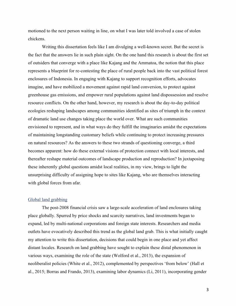
Writing this dissertation feels like I am divulging a well-known secret. But the secret is
the fact that the answers lie in such plain sight. On the one hand this research is about the first set
of outsiders that converge with a place like Kajang and the Ammatoa, the notion that this place
represents a blueprint for re-contesting the place of rural people back into the vast political forest
enclosures of Indonesia. In engaging with Kajang to support recognition efforts, advocates
imagine, and have mobilized a movement against rapid land conversion, to protect against
greenhouse gas emissions, and empower rural populations against land dispossession and resolve
resource conflicts. On the other hand, however, my research is about the day-to-day political
ecologies reshaping landscapes among communities identified as sites of triumph in the context
of dramatic land use changes taking place the world over. What are such communities
envisioned to represent, and in what ways do they fulfill the imaginaries amidst the expectations
of maintaining longstanding customary beliefs while continuing to protect increasing pressures
on natural resources? As the answers to these two strands of questioning converge, a third
becomes apparent: how do these external visions of protection connect with local interests, and
thereafter reshape material outcomes of landscape production and reproduction? In juxtaposing
these inherently global questions amidst local realities, in my view, brings to light the
unsurprising difficulty of assigning hope to sites like Kajang, who are themselves interacting
with global forces from afar.
Global land grabbing
The post-2008 financial crisis saw a large-scale acceleration of land enclosures taking
place globally. Spurred by price shocks and scarcity narratives, land investments began to
expand, led by multi-national corporations and foreign state interests. Researchers and media
outlets have evocatively described this trend as the global land grab. This is what initially caught
my attention to write this dissertation, decisions that could begin in one place and yet affect
distant locales. Research on land grabbing have sought to explain these distal phenomenon in
various ways, examining the role of the state (Wolford et al., 2013), the expansion of
neoliberalist policies (White et al., 2012), complemented by perspectives ‘from below’ (Hall et
al., 2015; Borras and Frando, 2013), examining labor dynamics (Li, 2011), incorporating gender

4
and youth (Park and White, 2017), as well as sectoral work on particular commodities (e.g. palm
oil McCarthy and Cramb, 2009), and various clusters of regional engagement (e.g. Hall et al.,
2011; Schoenberger et al., 2017 on Southeast Asia). These studies have delivered nuance and
depth, refocusing attention away from the land grab, and redirecting inquiry towards grabbing as
a process; thus highlighting how projects materialize to enclose land and exclude in
contemporary ways.
When I began to look for sites to study, Indonesia incurred the label as the fastest
deforesting country in the world, confirmed in much cited global research on remote sensing
(Hansen et al., 2013). In the next decade following the 2008 financial crisis, the global narrative
on Indonesia described forests repeatedly ablaze (World Bank, 2015), ‘exploding’ carbon (WRI,
n.d.), and more violent land conflict (KPA, n.d.). In this context of research that have thoroughly
examined land grabbing, my research turns to the much lesser studied but corollary emerging
phenomenon, namely the imaginaries, practices, articulations, and applications of projects that
seek to materialize land outcomes in defense against land grabbing. Thus, my study refocuses
literature on land grabbing by centering around the forces of counter-movements, those touted as
the solutions; the concerted efforts at grabbing back on behalf of local authority. I do so by
examining the forces and practices that lead to such outcomes and juxtapose them with the land
relations taking place at the sites described to have succeeded through recognition and land title.
Solutions to land grabbing?
The acceleration of land grabbing has resulted in powerful mobilizations of opposition,
identifying and redirecting outcomes among unfair practices across state boundaries. Well-
funded international alliances and multinational organizations have come to track land grabbing
processes in interactive global maps supporting human rights and environmental goals. The land
matrix, for example, currently catalogs large scale land investments by sector, country, and
region on information about up to 50 million hectares of land deals covering 1,600 projects
worldwide.1 Meanwhile, groups like the Global Forest Watch identifies “eye-in-the-sky”
monitoring of land conversion, classifying the different culprits of commodity change and their
environmental effects, further including crowd-sourced platforms allowing opportunities for
1 www.landmatrix.org

5
users to tell stories about these changes. Their promotional video in 2015 claimed: “Now if a tree
falls in the forest, everyone can hear it.” Although this characterization is still a far cry from
what these technologies are capable of, they are part of a growing call for accountability,
fairness, justice and environmental stewardship. Global regulatory responses and concerted
policy agendas are emerging as a result.
International monitoring tools like these examples are supported by networks that help to
cry foul at violations, and consequently develop corresponding guidelines for international best
practices. They help to address unfair and exclusionary business deals by multi-national
corporations. Lenders like the International Finance Corporation, for example, famously began to
cancel large scale agribusiness loans due to complaints raised by community groups around
concerns of “customary lands, displacement, compensation and security issues.”2 The private
sector has also embraced voluntary accountability mechanisms, expressions of good will
embodied by FPIC consultations and Corporate Social [and environmental] Responsibility (CSR)
programs for local service delivery and development support (Welker, 2014). Unilever, as one of
the largest consumer goods corporations in the world, is a main proponent, with a large CSR
portfolio and in Indonesia, has promoted forums for certification schemes and more stringent
sustainability standards.
On the other hand, states are also proactive in advocating the recognition of land,
emergent through political negotiations and populist messaging reinforced by global
commitments for human rights. More formal regulatory contestations have taken place in three
main ways: on the premise of identity as representative of global indigenism, environmental
stewardship embodied by discourses of community-based natural resource management, and
agrarian movements advocating land access for rural populations (Brosius et al., 1998; Niezen,
2003; Dove, 2006). Since the 1980s, from Canada to New Zealand, settler colonies and
industrialized nations created commitments allowing native and indigenous rights to claim rights
to land and natural resources. More recently still, indigeneity has also found footing in countries
with diverse populations in a variety of contexts in the global south. From Paraguay to
Colombia, Cambodia to Indonesia, policies are emerging to support and expand opportunities for
indigenous rights recognition. Meanwhile, corresponding commitments are also emerging to
advocate formal possibilities in defense of peasant rights, and mixed-use arrangements under
2 http://www.cao-ombudsman.org/cases/case_detail.aspx?id=177

6
programs broadly described as community-based forestry. Some of this is due to international
pressure from global policy reforms for social and environmental justice, and also a testament to
the increasingly powerful ability among foreign states and non-state actors to pressure governing
bodies to incorporate particular reforms.3
A large group of civil society and multilateral organizations are tied together in
advocating indigenous recognition, land rights, and joint resource management. At various
scales, they have learned and incorporated tools of the state to make counter-claims to land. They
justify claims through institutional processes to formalize land rights by applying the tools of the
state, contesting regulatory and bureaucratic processes in courts and active involvement in
drafting legislation, through approaches made available by the greater accessibility of mapping
and survey technology, and flooding communication mediums with advocacy campaigns. They
draw sophisticated maps, apply survey tools, utilize state-sanctioned official documents,
identifying sites of dispossession and marginalization, and seek to empower through recognition
and title, or provide some form of joint access. In sum, although land grabbing enclosing lands
from afar are taking place across the world, so have efforts concomitantly grown to counter such
practices by preempting enclosures and initiating practices that support claims in defense of the
local. My research is a political ecology of these counter-movements at the sites of triumph.
How do sites get selected, in what ways do they gain recognition and achieve land titles, what
rights are conferred to whom and by whom, how do they interact with existing land relations,
and how do people see the implications of recognition and title for the future?
A politics of erasure and discovery
Indonesia provides a unique example between the convergences of land grabbing and
counter-movements seeking to grab back, creating a perplexing contradiction of most’s: most
deforestation (Hansen et al., 2013), most land degradation, most wildland fires (World Bank,
2015), most plantation expansion (McCarthy and Cramb, 2009), and most carbon emissions
(WRI, 2018); while also the site of the most indigenous peoples (Perkasa and Evanty, 2014),
with the most progressive indigenous rights legislation (AMAN, n.d.), most ambitious
3 Political scientists Keck and Sikkink (1998) describe this as the boomerang effect whereby international advocates and local claimants can pressure national governments to expose and reconsider policies. It is also important to note that a backlash against local and indigenous rights in these ways has also emerged in recent years, cf. Duterte’s policies in the Philippines, Bolsonaro’s policies in Brazil.

7
implementation of spatial monitoring systems (Samadhi, 2014), and most number of carbon
sequestration projects for REDD+ (Miles, 2015). But to further present the context of these
development changes I must first turn to the broader political economy of development and
transition in Indonesia.
Indeed, in many ways the very DNA of the Indonesian state is premised on the primary
sector consisting of extractive industries in mining and logging, accompanied by plantation
concessions (Anderson, 1983). The state is therefore administratively structured by the vast land
areas set aside as political forest by the state, either for supporting development through land
concessions or through the protection of other natural resources and species (Peluso and
Vandergeest, 2001). Meanwhile, as global attention centers on Indonesia as a site of dramatic
land-based emissions as a priority for climate mitigation among peatlands with high carbon-
content, combined with the concomitant attention calling for social justice, the moment seems to
have arrived at the opportunity to consider the place of rural people in these vast landscapes. As
a result, Indonesia is at once a site of longstanding primary sector land investments for natural
resources and plantations, as well as an attractive site for defending against land grabbing,
drawing notable attention and resources for both.
Indonesia’s historical political economy: Erasure by designating political forests
In the pre-colonial era, early states in Southeast Asia at once highlighted parallels to early
European state formation, while also embodying a uniquely vibrant interconnectivity and system
of exchange (Reid, 1988; Tilly, 1992; Winichakul, 1994; Lieberman 2003). State formation
emerged in what is often described in an oversimplified notion of riverine-upland interactions
(Hutterer, 1977), but which provides a window into what Anderson (1983) describes as dynamic
inward-looking states of the archipelago. Territorial imaginings of the pre-colonial era saw a
great deal of mobility across the region, and state rule and authority were not imagined in terms
of territorial extent but rather through the ability to control labor. The South Sulawesi political
economy of this era, for example, was indicative of a racialized upland – lowland binary, which
was premised on slave trading and the different fluctuations in markets of that time, particularly
defined by global trade in pepper, coffee, teak, and others, with regional trade in rice (Bigalke,
2005). The coastal and seafaring communities connected a vast geographic region and eventually
consolidated in part under Sriwijaya reign that lasted until the 13th century, thereafter reorienting

8
to the regional Javanese empires, and eventually making way to the control of trade by the
Portuguese, Dutch, and British fleets, and finally establishing colonial regimes.
In the 18th century Dutch primacy took shape through VOC traders engaged in an
‘indirect policy,’ a hands-off, but highly coercive approach to local affairs. The policy
efficiently, and often violently, extracted resources by traders partnering with those willing to do
their bidding, structuring political patronage in hierarchical ways with regional vassals (Vickers,
2013). Once the VOC declared bankruptcy at the turn of the 18th century however, the Dutch
state formally intervened and laid down the foundation for administrative and military affairs in
the East Indies, especially as exports from the Indies had come to shape such a major part of the
Dutch and European economy. Commodity production expanded further into rural areas, by
Governors-general policies based in Batavia reorienting new mechanisms of rule across the vast
archipelago. In the 1830s, for example, Van den Bosch instituted the Culture System obligating
rural communities in Java to set aside a fifth of their land to fulfill a vast array of products for the
export market (Fasseur, 1986; Van Vollenhoven et al., 2013). By the turn of the 20th century,
Java had a highly complex administrative system, one of the most sophisticated infrastructure
networks in the world outside of Europe, and a complex legal system that ordered populations
into separate categorizations including natives, Europeans, Indo-Europeans and foreign oriental
(Arabs, Indian, and Chinese), each with their corresponding courts and legal systems (Stoler,
1989). Alongside establishing a common administrative language for the region, the Dutch
instituted a singular currency, and instituted land and economic relations that would later provide
the unifying foundation of nationhood (Nasution, 1992; Ricklefs, 1993; Djalins, 2015).
Albeit a site of sophisticated economic activity in the early 20th century, populations
remained poor as much of the wealth was extracted and sent off to the Netherlands. These
conditions led to a period of Dutch reckoning, described as the “ethical policy,” which promoted
welfare programs for Indonesian development. The hallmark of the ethical policy were embodied
by the recognition of adat (native) rights, alongside the protection of ulayat (reserve lands) (Von
Benda Beckmann, forthcoming; Van Vollenhoven et al., 2013). On the one hand, late colonial
period administrators saw native rights as a way to appease local actors, divide and rule, and as a
tool for social control. On the other hand, more socially progressive administrators viewed legal
recognition as having emancipatory potential by honoring and upholding more locally-
appropriate governing systems. This notion of adat would provide the basis for connecting to

9
discourses of international social movements on indigeneity that I will discuss in the subsequent
section.
Although colonial administrators may have genuinely sought to create welfare policies
and improve livelihoods in the colonies during the late colonial period, such reforms also took
place amidst the economic primacy of the colony as a revenue generator premised on natural
resources, of which Anderson (1983) contextualizes as follows:
In 1928, the last good year before the Depression, the state derived roughly 10 percent of its income from state monopolies in salt, pawnbroking, and opium (which it sold to its customers at 10 times the open-market Singapore rate) … 20 percent [were derived] from the profit of state-owned mines, plantations, and industries; 16 percent from import duties; 10 percent from corporation taxes; 6 percent from land-rent; and 9 percent from income taxes. Various excise and other regressive indirect taxes made up the remainder … If we remind ourselves that this was an economy that then produced 90 percent of the world's quinine, 80 percent of its pepper, 37 percent of its rubber, and 18 percent of its tin-to say nothing of petroleum-it is clear that, like the old VOC state, the late colonial state derived its financial strength largely from its own monopolistic operations and an efficient exploitation of local human and natural resources. (Anderson, 1983: 479) When Indonesia finally and formally wrest away control from the Dutch, the post-
independence era ushered in some of the most dramatic land conflict of the region, eventually
further entrenching dependence on the primary sector economies (Bigalke, 2005; Kimura, 2012).
The consolidating powers of the state took shape amidst much violence and sought to maintain
land management regimes in Java under pre-existing administrative mechanisms, but further
extended control to the outer islands by delineating vast territories as national forests (Barr et al.,
2006). Anderson’s (1983) apropos description called these changes an “Old State, New Society;”
and the New Order era (1966-1998) would go on to intensify the duality of land administration
categories, placing larger areas under the control of particular management regimes. The state
delineated between national forests and areal penggunaan lain (land for all other uses). The
category of national forests set aside two thirds of Indonesia’s territory by delineating them
through more sophisticated technologies. They applied emerging survey capabilities to set aside
sites for their precious resources, both for extraction and protection (Lucas and Warren, 2003).
The second land category instituted a western style of land ownership hierarchies (Bedner,
2016). The Basic Forestry Law (1967), and the Basic Agrarian Law guided administration in
each, which were accompanied by foreign investment laws that could help to extract resources

10
justified for the good of national development (Tsing, 2005). For three decades this duality
guided state development regimes under Suharto’s centralized management approach, backed by
coercive military involvement. Nearing the turn of the 21st century, however, the political
oligarchy of the New Order era re-ordered under a new political system (Aspinall, 2005) opening
up opportunities to contest land rights, particularly amidst these long-controlled and enclosed
political forests.
Adat Deployments and Social Forestry Policy: Re-discovering people in the political forest
In the wake of the fall of Indonesia’s authoritarian regime that controlled heavy handed
development policy for much of the second half of the 20th century, a surprising dynamic had
emerged, namely through approaches of contesting land and political authority in national forests
on the basis of tradition and indigenism. Scholars have described this process as “adat
revivalism” (volume by Davidson and Henley, 2007; Tyson, 2011). Such research perspectives
explained how a concept that was formalized as part of the late Dutch colonial welfare period
had re-emerged as a powerful deployment for contesting political legitimacy, particularly in the
political forest.
Davidson and Henley (2007) provide four main reasons. First, a global indigenism
movement had formed, connecting environmental and social justice political activism with
international development priorities and safeguard policies. Second, the very origins of
Indonesia’s sovereign ideology emerged out of colonial welfare policies under the rubric of adat,
and thus presented the opportunity to claim the highest legitimating authority of the newly
reforming Indonesian state. Third, the language of protest of the New Order era was incubated
within more nonpolitical environmental terms that connected to global priorities on community
based natural resource management, and by extension, legitimated cover for human rights
injustices for rural communities (see also Li, 1999). Fourth, in the era of Indonesia’s political
reform at the end of the 20th century, referred to as reformasi, adat provided a way to claim local
legitimacy amidst global movements, and also allowed outlets of local authority long suppressed
under Suharto’s authoritarian regime.

11
A decade after reformasi, adat’s influence had been expected to wane,4 but on the
contrary, intensifying logging and plantation development, wildland fires with destructive
geopolitical and climate impacts, resulted in a further expansion of networks connecting with
environmentalism narratives in support of global indigenism, thus reinforcing the political
legitimacy of adat (Afiff, 2016). The expanded coalition of what some had termed
“environmental adat” expanded influence that ushered in landmark legal decisions contesting
state lands through a “one map” policy for spatial transparency and a series of constitutional
court decisions ruling that state enclosures of indigenous land were unconstitutional. This
coalition connected national and international political realms, including: the Indonesian
president’s office, key cabinet members, well-financed donor organizations, parliament, and
activists intent on advocating for a national law on adat (Rachman and Siscawati, 2016). There
was a sense that a consolidated map provided the basis for accountability, and finally, a legal
basis could be made for making claims to land for rural and the marginalized.
This period of adat revivalism has indeed empowered in various ways. It has provided a
site of struggle by drawing attention to local concerns and connecting to global narratives of
environment and social justice in regions experiencing rapid land use change to land
expropriation for primary resource extraction and plantation agriculture. In this light, Davidson
and Henley describe adat as a deployment, stating that: “in many modern contexts adat refers not
so much to a concrete body of rules and practices inherited from the past, or even to a coherent
discourse concerning history, land, and law, but rather to a set of loosely related ideals which,
rightly or wrongly, are associated with the past. These ideals can be summed up as: authenticity,
community, harmony, order, and justice.” Thus, its political power is that it “represents a
vaguely defined but powerful set of ideas or assumptions regarding what an ideal society should
be like” (2007: 3-4) The coalition of networks sympathetic to adat revivalism also saw
momentum from drawing attention to indigenous community rights on environmental terms,
allowing opportunities to demand state accountability. Hall et al. (2011) for example, highlight
that counter-movements, both for peasants and indigeneity, such as those unfolding with adat in
Indonesia, do not so much as seek to make claims to national sovereignty, but rather demand that
the state legitimately respond to their concerns within the framework of the common project of
4 This was revealed in a statement presented by adat scholar David Henley at Leiden University on May 22nd, 2017.

12
the state. In other words, it was a grievance not against the nation, but rather for the legitimate
decision-making discourse of the nation.
Meanwhile, scholars also highlight the unintended consequences of such deployments,
pointing to its exclusionary effects and the new injustices that emerge once policy ideals are
translated into local politics. Adat deployments show that its many interpretations and the goals it
is used to promote do not necessarily match with the broader imaginary of social justice
supported by proponents among global movements and national actors. Indeed, these
deployments show numerous reactionary applications, ranging from a further entrenchment of
inequality, land conversion, non-inclusivity, evictions, and violence. One of the more gruesome
experiences was the movement to expel migrant Madurese and their locally born children by
indigenous Dayaks in West and Central Kalimantan. In other places awkward outcomes include
the sultanates of the Maluku’s, reviving an old class of leadership representing the antithesis of
movements promoting greater equality, and rather, calling for a return to old hierarchical
patronage systems based on local aristocracies (Van Klinken, 2007). In Bali, adat revivalism
emerged in several contexts, surprisingly dissociating with international movements of
indigeneity because of the local control that the banjar already commanded. On the one hand,
adat in Bali served as a tool to extract additional state resources by creating mirror village
institutions, and on the other, served to drum up nativist sentiment against migrants and foreign
investment to exact extortionist fees. In a case from Tapanuli, Sumatra, adat claims took place in
the context of plantation booms, particularly for oil palm and pulpwood ventures, in which local
leaders invoked adat land claims as a way to gain rights to forests for oil palm conversion that
clashed awkwardly with activist notions of an environmental adat. Finally, adat claims for
conservation also have their own contradictions (Fisher, 1999). In Central Kalimantan (Astuti
and Macgregor, 2016) and Papua, such claims initiate their own exclusionary effects, couched in
mechanisms for green grabbing, promoting a narrative of forest-dwelling actors that present a
narrow definition of the type of people that can benefit from such claims.
Nevertheless, adat as a national policy initiative and as a claims-making instrument has
expanded markedly in Indonesia. The Indigenous People’s Alliance of the Archipelago (AMAN)
a national NGO made up of prominent environmental adat activists that formed in the late 1990s,
fashions itself as a network organization of regional offices across Indonesia. As of 2019,
AMAN consists of 21 regional offices [pengurus wilayah], and 117 local offices [pengurus

13
daerah] consisting of 2,366 adat communities, representing what they claim as approximately 18
million people, making them the largest indigenous rights organization in the world.5 They also
have a sister organization, the Adat Registration Agency (BRWA), which fashions itself as a
quasi-governmental agency to register lands. They have surveyed over ten million hectares of
potential land claims, listed claims into online interactive maps, and otherwise state that claims
amount to over 40 million hectares of national forest.
AMAN, and the coalition of environmental adat organizations have had a significant
influence on the past two presidential administrations (Afiff, 2016). President Yudhoyono’s
(2004 – 2014) main taskforce (UKP4) helped to convene the international donor community for
key reforms of accountability in mapping and indigenous rights recognition alongside prominent
climate change policies. Then came national legislation, first in the form of a national law on
geospatial mapping centralizing mapping authority under one agency (Law 4/2011), followed by
a series of constitutional court decisions – MK35/2012 being the most prominent – which
presents the opportunity to justify concrete mechanisms to reclaim land by indigenous
communities to national forests (Myers et al., 2017). The election in 2014 subsequently ushered
in a populist president that was strongly backed by environmental adat organizations. AMAN
lobbied for inclusion in President Joko Widodo’s Nawacita – a guiding manifesto of campaign
promises – and formalized adat policy interests as part of the administration’s key objectives.
The victory also ushered in activists into formal positions in the presidential cabinet and
recruited as key advisory staff positions and had a direct line to lobby the president to follow
through on adat commitments.
By 2016, formal commitments by the highest office in Indonesia had translated into
material efforts for recognizing adat. Although still a powerful tool for contestation against
corporate land enclosures, the focus of the adat movement at the national level transitioned to
making claims for formal recognition sanctioned by bureaucratic and government processes (see
Chapter 2). Activists themselves stated that at the AMAN congress of 2016 that the period of
contesting the government had shifted into a phase of partnership with formal institutions. What
has emerged are a concerted effort to define, map, and legislate adat through state supported
mechanisms, thus providing a site for “institutionalizing” adat.
5 www.aman.or.id

14
Amidst the coalition of environmental adat organizations also came a set of
corresponding reforms to contest land in the political forest under the headings of social forestry
and agrarian reform (See chapter 6). Unlike claims made by activists that adat land recognition
would remove authority from national forests, social forestry policy suggests mechanisms for
joint management responsibilities between the state and local communities. Indeed much of the
policy discourse of adat has blended with, and shifted into policy negotiations on social forestry.
Social forestry is discursively strategic in the current policy enabling environment for its populist
ideals to empower rights, support livelihoods, and partner for conservation outcomes. President
Widodo has hence promised a total designation of 12.7 million hectares under social forestry
schemes, a dramatic increase from the approximately 1 million hectares currently under such
designations. Finally, the Widodo administration has also promoted a land reform policy that
includes another 9 million hectares of the national forest to be distributed as land title to rural
Indonesians, specifying site selection for those under intense conflict.
Up to this point, much of the research on reclaiming people’s rights to national forests
has focused on adat and its revivalism, examining origins, deployments, discourse, legal
interpretations, and activism (Davidson and Henley, 2007; Hauser-Schäublin, 2013; Vel et al.,
forthcoming). Policy attention furthermore has largely focused on the legal considerations for
making land claims based on adat, social forestry and agrarian reforms. Advocacy has required a
host of elements that legitimates claims into official regulatory processes and implementation
mechanisms. This includes building the networks to support recognition, the maps to make the
claims, the formal institutions, and the awareness and interest of local governing bodies to
interpret and apply them. In this context, as formal recognition and land titling initiatives are still
relatively new in selecting and legitimating sites – as indigenous communities, social forestry
farmer groups, and as land reform title claimants – this research engages on the local
implications of succeeding in achieving the outcomes of recognition and title.
II. Method and Research Setting
Finding Kajang
Selecting a representative site was a matter of fortuitous timing. In 2014, I received an
opportunity with the Center for International Forestry Research (CIFOR) to support a
participatory action research initiative for joint policy drafting in Kajang, Bulukumba. At that
15
time, the MK35 Constitutional Court ruling had just been decided in 2013 and advocacy groups
were eager to put the ruling into practice by recognizing indigenous rights to land in national
forests. I was able to observe and participate in developing the policy with the Bulukumba multi-
stakeholder policy making taskforce while reflexively engaging in the broader ideals of the
movement being discussed in national forums. On the one hand, I gained insight into the day-to-
day aspects of meeting the practical considerations of implementing a policy locally. Meanwhile,
central government agencies across Indonesia were eager to understand the implications of such
precedence, and to gauge the extent to which the site in Kajang might affect titling efforts
elsewhere, which also allowed me access into national policy discussions.
The site involved a unique situation of an indigenous community in Kajang and their
sacred forest. In chapter 2, I detail how Kajang strategically became an icon as a precedent-
setting site. Briefly, the forest included a small uncontested area of 331 hectares (later designated
as 314 hectares). Local government agencies had long supported Kajang rights to their sacred
forest. Designating Kajang was thus seen as an easy win, one to provide a model for regulatory
mechanisms elsewhere so that other indigenous communities could also follow a legal
precedence to make a similar claim. Kajang was also symbolic for its historical memory as a site
of land conflict against a large rubber plantation that still occasionally flares up. Violent clashes
peaked in 2003 when security forces claimed three casualties amidst protest in rubber groves.
Although, more recent protests also took place in 2019, these lands were not part of the
discussion for recognition of land title. Furthermore, the distinct outward appearance of the
Kajang as a traditional community following their custom of strictly wearing black made it a
convincing case of an indigenous group staking legitimate claims to national forest land. Having
participated in drafting a policy I was eager to learn what happens after land is recognized and
returned. In this context, I began my research in May 2014 as part of the policy making
taskforce. After making periodic scoping visits I relocated to the research sites between October
2015 – April 2017, continuing to follow along in policy-making discussions through early 2019.
The phases of my research approach took place at several governing scales, in the following
phases:
• Phase 1: Participating in the district policymaking taskforce to draft and pass a legislation
on the Kajang recognition.

16
• Phase 2: Partnering with village governments across the Kajang adat region on their local
development planning processes, mapping out administrative boundaries, key
infrastructure and natural resources (7 formalized partnerships for spatial planning). Also
engaging with indigenous leadership on land governance considerations and priorities for
land management.
• Phase 3: Working with farmer groups on the production and reproduction of the
landscape using a follow-the-thing approach on key crops and mapping out land cover in
2016-7. The land cover maps were used as a basis for conducting interviews with local
farmer groups on land use change.
• Phase 4: Comparative analysis of social forestry in neighboring regions and national
level engagement in policy forums.
Research across scales
As the research question revolves around what happens after rights recognition and post-
land title, I needed to both understand the framing of recognition at various governing scales
while also situating the existing land relations at those targeted sites. I therefore spent time
among national policy-making forums, conducting interviews with key government offices at the
national level.6 I also joined in several national forums convening multinational corporations,7
engaging with multilateral agencies on policies of reform such as one map and indigenous rights
safeguards,8 as well as joining in various events by advocacy organizations like AMAN, Walhi,
Huma, and Epistema.9 I also attended various gatherings at the provincial capital of South
Sulawesi in Makassar, as numerous events have taken place there in the past five years regarding
indigeneity and social forestry across Eastern Indonesia.
The bulk of this research however, took place among Bulukumba district agency staff,
with village and indigenous institutions, and among the households of local farmers in Kajang.
6 With the President’s office (Kantor Staf Presiden), in key national ministries including the Ministry of Environment and Forestry, the Ministry of Home Affairs, the Ministry of Agrarian Affairs and Spatial Planning, the Geospatial Information Agency, and the Peatlands Restoration Agency 7 I attended several forums on community engagement and conflict resolution strategies by the wood fiber corporation Asia Pulp and Paper and a series of facilitations put on by the Meridien Institute 8 Specifically involving the World Bank’s support of the Dedicated Grant Mechanism – Indonesia to support small grants to local and indigenous communities 9 I also supported planning and joined the South Sulawesi delegation in attending the National Congress (KMAN-V) held in Tanjung Gusta North Sumatra in 2017.

17
Doing this required a strategy to develop institutional partnerships with various partnerships,
particularly engaging with those influencing landscape production and reproduction. I call this a
landscape political ecology, which involved incorporating remote sensing analysis, ground-
truthing of individual land plots using GPS, mapping out jurisdictional boundaries, incorporating
a follow-the-thing methodology across commodity supply chains (Cook, 2004), following the
full cycles of production and re-production on the landscape, and incorporating historical
analysis through archival materials and oral histories of land use change. Indeed, my analysis
was not bounded to the titled sites, but rather following Dove et al. (2012) “beyond the sacred
forest” I have sought to analytically explore broader dynamics of the landscape.
Building landscape partnerships
The Bulukumba Policy Making Taskforce
As I will describe in Chapter 2, interpretations about “stipulation” or the release of land
title to national forests is still contested. Nevertheless, due to the decentralized governing
authority of the Indonesian state, the policy onus falls upon the district government to prove
recognition prior to national agencies relinquishing land titles. The Bulukumba bupati therefore
created a Policy Making taskforce, which uniquely included multi-stakeholder representation,
extending membership to advocacy organizations and NGOs that provided support through
facilitating local data collection, policy drafting, legal interpretation, and participatory mapping.
I was embedded in the Taskforce and joined their regular meetings. Attending their
planning meetings in Bulukumba, and being based in Kajang, allowed me to conveniently
support Taskforce teams in the field. I regularly joined NGO and agency teams assigned to
collect data to fulfill the rigorous guidelines of drafting a highly politicized regulation about
recognition and title. I helped to train Taskforce staff on the use and consolidation of geospatial
data, which also allowed me to collect spatial data such as shpfiles helpful in conducting a
landscape analysis. I helped design and implement surveys delivered across 150 households in a
purposive random sample of Kajang villages. I attended, supported, and conducted Taskforce
interviews and focus group discussions, and supported numerous other initiatives deemed a
foundational component for policy drafting. I collected hundreds of pages of minutes from
meeting, which I coded and analyzed to get a better sense of how these actors engaged in
supporting recognition, envisioned its outcomes.

18
Village planning
I also sought to develop partnerships with local village and indigenous institutions. To
ensure that I was understanding the broader terms of authority as initiatives for indigenous rights
recognition and land title were formalized, I partnered with the local governing systems. My
main interlocutors consisted of village governments, the elected heads and their staff. Of the 19
villages in the Kajang subdistrict, I created formal partnerships with seven of them, selecting
strategically to map out villages at the upstream, midstream, and downstream areas. During my
time in Kajang, villagers were busy trying to fulfill the regulatory mandates of the new village
law (Law 6/2014). In this way I was able to support villages conduct their planning processes.
We examined the thick planning books about how to conduct village planning processes and
learned how to apply the policy. We then worked together to undertake the various steps of
village planning. We walked village boundaries with GPS units cataloging official village
boundaries. We facilitated and convened the mandated bottom-up village planning processes
[musrenbang], and also went to the district and subdistrict capitals to advocate for certain
mechanisms to ensure that regulations had been met and disbursements could be made. I
completed full maps to national standards and provided complete drone imagery for seven
villages. Throughout, we had vibrant discussions about village development priorities ranging
from health to education, infrastructure to resource management. As plans shifted into
disbursement programs, I went around with village staff supporting construction of water towers,
and went around monitoring road development and irrigation contracts, and also became friends
with local leadership. We went to the seaside together for fishing and barbecues, and I often
attended family ceremonies. Although this level of engagement provided insight into the official
governing processes and development approaches, it still created a distance between the official
elements of governing with the realities of landscape production and reproduction. This would
require getting my hands and feet dirty.
Working with farmers, living among households
Much of the analysis and the data provided in this dissertation is presented as an
ethnography through the lens of local farmers in Kajang. As virtually everyone in Kajang takes
part in farming one way or another, gaining trust in the community also came concomitantly with

19
my willingness to take part in people’s lives and livelihoods in the fields. I hoed, planted,
sprayed, fertilized, harvested, brought yield to markets, engaged with middlemen, and undertook
a follow-the-thing approach for the five key commodities on the landscape. On occasion I would
print out satellite imagery maps and conduct focus group discussions with farmer groups to ask
more specific questions about land use change and the land relations that govern them.
Finally, I also participated in local youth organization activities. This began by
connecting among a group of young men through our mutual love of playing soccer in the
afternoons at the local schoolyard. Over time, these young men were eager to invite me in their
own youth organizations. I attended several planning meetings of local organizations that young
college students were putting together and often discussed issues late into the night with them
while playing the popular game of dominoes. Several young women, on the other hand,
approached me as part of their interest in learning English, often at the encouragement of their
mothers, and I was able to gain insight into lives of a group of girls in their late teens that
consistently came over to the family home that was my residence for much of my stay.
III. Theoretical engagement: Counter exclusions, capitalist relations, and landscapes
of potential
A political ecology framework
My research draws on a political ecology tradition that examines the nexus of
development, environment, and social justice (Peet et al, 2010; Robbins, 2012; Forsyth, 2013).
This means I emphasize three key components to approaching my analysis by focusing on (i)
historical antecedents, that are grounded in (ii) political economy, and viewed through the lens of
(iii) discursive political legitimation.
First, I place a strong emphasis on historical factors, particularly by identifying key
moments that set new trajectories in motion. In this way I contextualize how the landscape has
come to be as it is today, and the terms of authority that legitimated such outcomes. These
include reaching as far back as the pre-colonial period of the Gowa polity in South Sulawesi, the
subsequent periods of colonial encounter that reshaped and reinforced terms of authority among
the political elite, the arrival of larger plantation commodity projects such as rubber, the

20
Indonesian state-making project, influence of political Islam, as well as the more recent
invocation of adat, tourism development, and village planning.
Secondly, I see the nested political economy and the reflexive influence of global markets
and national policies interacting with decision-making processes at multiple scales as affecting
local practices and shaping ecological outcomes. My political economy approach centers on a
classical agrarian change methodology, which I implement through a follow-the-thing method
(Cook, 2004). The agrarian change questions follow a tradition of research engaging on land
dilemmas of Southeast Asia (Scoones et al, 2011; Hall et al, 2011), examining both formal
aspects of property and authority (Sikor and Lund, 2010), and less formalized processes of
access and power (Ribot and Peluso, 2003). My line of inquiry thus follows framings formulated
by Henry Bernstein, and taken further by Borras et al (2011: 211) to include these six
overarching questions: “i) who owns what; ii) who does what; iii) who gets what; iv) what do
they do with the surplus wealth that has [or has not] been created; v) what do they do to each
other; vi) how are political changes shaped by dynamic ecologies, and vice versa?” I also bound
these questions by asking them in relation to land decisions that are taking place in and around
the sites slated for recognition and land title. Cook’s (2004) follow-the-thing approach provides a
guideline for following a particular commodity by examining the sites of engagement throughout
the supply chain. In Kajang I followed the phases of production and reproduction of five
commodity supply chains, including: rice, corn, cloves, pepper (Piper nigrum, as opposed to
chili peppers), and rubber. I also engaged with other commodities but not as extensively,
including timber species, coconut (and what is locally called “hybrid coconut”), cacao, and other
agroforestry planting systems as they fit into overall household livelihood strategies.
Thirdly, although the understanding of local commodity production is central to my
analysis, I also identify the discursive legitimating factors associated with notions of land
relations. Why are particular practices allowed over time, and how does that then legitimate new
possibilities taking shape on the landscape, and under what terms? The landscapes in Kajang that
I examine at the comparative social forestry sites all embody certain meanings of sacred power
and ancestral legitimacy. With the arrival of adat and social forestry policies as a new process
for legitimating land, new visions of the landscape emerge, get redefine, recoil, and are contested
in ways that invoke tradition while creating new possibilities for the future. Particularly with a
community as distinct as the Kajang, incorporating how knowledge and meaning are generated is

21
essential, whether invoked internally by cultural leaders or influenced externally by overarching
discourses about land. This in turn mobilizes and justifies particular territorializing effects.
Counter exclusions: Powers of exclusion in counter-movements
I introduced the topic of land grabbing as a dichotomy between the land grabbers and
those grabbing back. But research on land dilemmas in Southeast Asia have theorized a more
comprehensive notion of the powers that exclude, pointing to the false dichotomies of external
grabbers and internal defenders (Hall et al., 2011). Hall et al. discuss the powers of exclusion and
the processes of enclosure as a double-edged sword in which decisions governing land benefit
some at the expense of others. Defining exclusion as the inability to benefit from land resources
presents a heuristic that emerges across four different inter-related powers that help to explain
and foreground my analytical framing.
The first of the Hall et al. (2011) power heuristic is regulation, which describes powers
that exclude through formal regulatory processes sanctioned by the state and upheld by actors
that define its enforcement. A second, the power of markets, excludes through the inability to
afford access, which usually take place through increasing land prices or barriers to meeting the
costs of production. A third power, force, excludes through the threat of harm. Finally, a fourth
power that they describe under the broader heading of legitimation, excludes based on relational
notions of meaning, namely the determination that it would not be appropriate to do so. Each of
these factors are mobilized in varying capacities in different, but often overlapping ways, but that
when taken together, help to explain the widespread land dilemmas taking place in Southeast
Asia, whether it is in the name of land reform, urbanization and tourism projects, plantations and
extractive industries, or increasingly environmental (and carbon) enclosures. Across all of these
very different projects, these powers of exclusion are at work in some capacity or another.
Therefore, although counter-movements for land recognition are presented as antithetical
to land grabbing by external forces, when seen from a perspective of the powers of exclusion, the
powers themselves orient the focus of analysis influencing changes on the landscape. Indeed, as
the discursive goals among proponents for land rights for rural communities might be different
than, for example a plantation or a mining project, the actors, outcomes and effects on who gain
access and who gets excluded can be surprisingly similar (cf. Zerner, 1994; Scoones et al., 2011;

22
Astuti and McGregor, 2016). In the remainder of this introductory chapter I highlight the
particular theoretical engagements by chapter.
Indigeneity as the leading strategy of counter-movements and its many sharp edges (chapter 2)
Indigeneity has found footing as one of the most powerful ways for making counter-
claims to land grabbing amidst the realities of the contemporary state political systems (Niezen,
2003). Indeed, I have illustrated the current moment leading to Indonesia’s formalized
approaches to indigenous land rights recognition, social forestry, and land reform policies. Upon
sharing my early findings on the main thesis of chapter 2 with an activist friend during AMAN’s
2017 national congress – stating my argument about the double edges of recognition – one
activist cautioned me about the dangers of sharing such a conclusion. In urging me to reconsider,
he stated “It is the only policy mechanism we have standing in the way of the large-scale
development plans proposed by the state and corporations.” He then went on to describe the long
list of planned developments, vividly explaining the backroom trading among contractors that
have carved up much of the outer islands for major investments. Seen from this perspective, the
achievements of the movement to be able to obtain a regulatory mechanism to make land claims
are clearly notable. My intent in this dissertation is not to undermine these achievements and I
take seriously the implications that indigenous rights recognition can provide a defense of the
local against powerful external interests. Nevertheless, the strategies promoting recognition
require closer scrutiny about who benefits and who loses when the imaginaries of global
indigenism and the strategies of rights recognition are deployed. Hall et al.’s heuristic describes
the powers of exclusion as a double edge. In this chapter I extend this conceptualization beyond
a double edge, but rather when seen from the perspective of various interests, are more akin to
multiple sharp edges.
In chapter 2 I am particularly interested in taking a closer look at what factors determine
the selection of sites, why they are singled out for recognition, the implications locally, and the
initiatives that can emerge elsewhere as a result. Indeed global indigenism has long been
critiqued for the leaky policy umbrella that it shields (Dove, 2006), its vulnerabilities to
neoliberal cooptation (Hale, 2006), and the increasingly limiting ways it defines inclusivity
(Niezen, 2003). Other have also shown through Stuart Hall’s theory of articulation, how
deploying indigeneity are contingent upon powerful networks to fulfill and defend particular

23
imaginaries of the traditional (Li, 2000; and Hirtz 2003). Meanwhile more recent political
ecology analysis (Yeh and Bryan, 2015) suggest that indigeneity presents new decolonizing
future, or what Anna Tsing (1999) once described as a “room for maneuver.” Amidst the current
policy moment to invoke indigeneity and reclaim authority premised on the local, chapter 2 takes
these debates one step further by seeking to explain what unfolds after recognition.
In this chapter, I present these debates amidst the newly formed “institutional” or
“reified” indigeneity as an official state policy to be proven and fulfilled through regulatory and
bureaucratic means. I thus highlight how the various actors came together to strike the terms of
recognition in Kajang, how they viewed its outcomes, and the implications for the forest and
surrounding landscapes. Using a framing of the powers of exclusion I present empirical findings
in terms of exclusions double edges, orienting the discussion towards who benefits, while
considering a comparative lens for what might be possible elsewhere.
Capitalist relations: Development authority, tenure institutions, and landscape production
(Chapter 3 and 4)
In a similar line of analysis engaging with the powers of exclusion, I also take on the
notion that activists seem to promote, that gaining land title and rights recognition is of utmost
importance. Activists like to invoke the popular phrase that the long arc of history bends towards
justice. Amidst this viewpoint proponents work to catalyze efforts that secure title and
recognition, believing the foundation of legality secures subsequent institutional rights and
initiates management responsibility. In chapter 3, I keep the focus on land relations after the
triumph of securing victories of recognition and land title. To what extent does recognition and
title affect, and interact with, existing land relations post-recognition, post-title?
In order to do so, I engage with Li’s (2014) notion of capitalist relations. In her example
from neighboring Central Sulawesi, she describes a scenario whereby indigenous highlanders
eagerly embraced the promise of capitalism, incorporating tree crops into the landscape and
enclosing the frontier. As a result, a process of accumulation and dispossession ensued,
compelling highlanders into particular market relations, structuring wealth among successful
elites, relegating others to sell their labor at the margins, and in the worst scenarios, leaving some

24
destitute and completely outside of the market. The latter, unable to access markets, found
themselves no longer able to grow or produce food.
Following Li’s approach on capitalist relations, I foreground the historical notions of
authority in Kajang amidst the terms of landscape change. To do this, I examine tenure relations
in agricultural production systems and the intensifying priorities to plant tree crops. The types of
tree crops and terms of production followed price booms that initially challenged the historical
aristocracy and landed elite. In more recent years however, particularly as the frontier was fully
enclosed, capitalist relations began to accelerate among an emergent landed elite. Indeed, amidst
the overwhelming attention in formal negotiations regionally concerned with recognition and
title to Kajang’s sacred forest, similar processes of accumulation and dispossession as described
by Li in Central Sulawesi are also unfolding in parallel, yet distinct ways in Kajang. Although
her work focuses mostly on the arrival of cocoa – a singular tree crop commodity – I also
incorporate analysis which highlights the corollary entry of capitalist relations through seasonal
agricultural production systems. This chapter also points to discoveries about what happens after
the boom subsides, and the frontier is enclosed, the shift to new commodities and intensifying
capitalist land relations that consolidate among those that succeeded with profitable harvests.
Landscapes of potential (chapter 5)
In chapter 5, I follow the implications of recognition described in chapter 2, combined
with the historical analysis and capitalist relations that foreground sites of recognition in chapters
3 and 4. Taken together, I am able to further consider how youth view their future place in the
landscape. I call this landscapes of potential, and describe the imaginaries of future land relations
by delineating trajectories between two ideal types of successful young men poised to fill an
outsized leadership role in the two main tenure categories in Kajang. Although these imaginaries
are not yet fully materialized, nor will they necessarily come to be, youth visions nevertheless
represent the broader priorities, desires, and possibilities in Kajang.
One story revolves around Aco, who having firmly situated himself in rice production,
finds himself amidst increasingly contested and protectionist practices among a certain network
of families controlling access to land. He thrives as a result of his reliability to perform and
coordinate labor, but which he recognizes are contingent upon the exclusionary practices of
family relations. Regardless of his privilege in rice production, household demands still require

25
him to coordinate labor teams to migrate regionally seeking out employment harvesting rice,
rewarded in yield. As rice has found a firmer stronghold in rules of reciprocity and ceremonial
function so has its capital value risen in surprising and exclusionary ways.
The second story revolves around Baso, who will someday inherit the vast landholdings
that his father, a prominent local leader, has accumulated through successful rubber and clove
harvests. As a young man attending college in the provincial capital of Makassar, Baso also
aspires to be a politician, which as he explains, led him to study political science. Baso actively
participates in youth organizing at his university, and on regular visits home applies the formal
skills he has learned to create his own youth-led organizations in Kajang. The bureaucratic
capabilities learned from forming and establishing local organizations not only prepares him to
establish the network and legitimacy to run for future office, but also creates the necessary types
of institutional structures that can connect with social movement initiatives that have come to
Kajang to support recognition. The creation of such relational networks also highlights an
inherent contradiction among the imaginaries of social movements that come to support
indigenous communities rooted in communal land relations. In other words, those with the
capabilities and institutional know-how to connect with social movements supporting the
recognition of indigeneity further reinforces the very institutions that stand for the local landed,
and accumulating elite.
Rights, livelihoods, and conservation in social forestry: A comparative perspective (chapter 6)
Given that Kajang is often described as an unusual site, that some might say is unlikely
replicable elsewhere, in the final empirical chapter I incorporate a comparative analysis on the
processes of recognition at social forestry sites. Indeed, social forestry has emerged as part of a
broader strategy among social movements to formalize land rights for rural populations in
national forests. Moreover, much of the policy attention by 2018 had shifted from indigenous
land designations to opportunities for administering social forestry, as President Joko Widodo
reinforced commitments to expand social forestry schemes from less than 1 million hectares in
2014 at the start of his administration, to a sharp increase of 12.7 million hectares by 2019.
In chapter 6, I apply a common policy framework in social forestry to juxtapose policy
imaginary with implementation reality. The attractiveness of social forestry across numerous
stakeholders is no doubt indicative of its ability to capture multiple discourses and fulfill

26
overlapping goals across numerous actors. Maryudi et al. (2012) categorizes these multiple
interests in social forestry under a three-legged stool consisting of rights recognition, livelihoods
empowerment, and conservation outcomes. In other words, social forestry encapsulates multiple
discourses: not only do communities regain opportunities to reclaim formal legitimacy to their
ancestral lands, development programs can also support livelihoods assistance, and meanwhile,
the broader environmental goals can be met through local forest conservation efforts.
In these early phases of indigenous recognition and social forestry implementation,
Bulukumba and neighboring Bantaeng had some of the first approved schemes. I provide a close
examination of designation across three different social forestry mechanisms, including a village
forest scheme in Patteneteang, Bantaeng; a community forest designation in Borong Rappoa,
Bulukumba; and the indigenous forest claims in Kajang. The broader comparative analysis
highlights some new revelations about the promises and applications of mapping and boundary
setting processes, as well as the new approach to administering institutions. On the one hand,
setting boundaries and creating management plans created confusion in ways that undermined
trust-building between local community members and formal institutions. More specifically, the
new bureaucratic means for achieving social forestry designation outcomes not only undermined
the legitimacy of local and customary institutions, but furthermore, created new barriers to
access its benefits, privileging the creation of new hollow institutions that functioned as
intermediary bodies to access resources.
IV. Beyond recognition and the new Kajang frontier I conclude the dissertation by returning to the initial research questions encapsulated in
the discussion about the open secrets with the Ammatoa. I provide two short examples about
how social movements advocating for indigeneity and social forestry designations continue to
intensify their lobbying. Indeed, these advocates continue to push for a broader law on
indigeneity, and to do so they highlight the landscape analysis that I conducted but changed the
narrative to an economic valuation of the wealth of indigenous communities. Tried as I might, I
was unable to get across that the tree crops at the basis of their analysis was the very source of
inequality emerging from intensifying capitalist relations. Indeed the politics of recognition,
when seen from among the Kajang landscapes highlight a politics of advocacy that are beyond
recognition.

27
The second examines the rupture of local land tenure relations unfolding in Kajang by
following migrants to new frontiers of land conversion elsewhere. What happens after land’s end
in Kajang? Does the march of accumulation compelled by capitalist relations continue its
exclusionary trajectories after every spike of each new crop boom? Here my analysis is
incomplete and would be the logical entry point for were I to continue a new phase of research.
The frontier has indeed moved beyond the Kajang region. As some leave in search of labor,
others have followed streams of opportunity about what they know best, through the networks of
possibility creating opportunities to convert forest lands in the neighboring province of Southeast
Sulawesi to plant cloves, the tree crop boom taking place there. Indeed, some of the recent
village elections in Kajang have been contested based on capital obtained from lucrative harvests
from there.

28
Chapter 2 – The multiple edges of indigenous recognition: Dilemmas in the room for maneuver
On my way to the National Palace this morning I am filled with mixed feelings. Moved, joyful, and blessed. It is indeed very personal and emotional for me. But this was not predetermined. I allow tears to fall. The recognition of Indigenous Forest claims taking place in just a few hours holds so much meaning for our friends and family of the indigenous communities of this nation. For us, in this brief time, we are able to share this moment with them. This is a struggle of decades, or even centuries if we reach back to the colonial era. Going forward the challenges loom greater. Indigenous forests are the stakes for which we can prove our responsibility to the environment, community, and for this nation.
–Myrna Safitri10
When a project attains the status of a model or icon, one touted as a success and worthy of study and emulation, its portrayal is informed by the rhetorics, needs, debates, and plans of project-building contexts and purposes (i.e., development, conservation, state power). Multiple stories develop as the model is fitted into new contexts and used in different ways. What is the process by which one project comes to be held up as an exemplary model of community-based natural resource management? How do such community-based natural resource management icons work their way into institutions that then seek to replicate that model? How does the idea of a "model" create or restrict opportunities for experimentation in the face of local contingencies?
– Brosius et al., 1998
I. Movements for recognition As the leading epigraph above illustrates, recognition of indigenous lands in national
forests has come to symbolize so much. It at once represents decolonization from the Dutch
origins of the Indonesian state as well as reparations against the breached promises of nationhood
that saw generations of evictions and land enclosures (Davidson and Henley, 2007).
Furthermore, indigenous land rights recognition also represents something more forward
10 Public Facebook Post by Myrna Safitri, long time Indonesian indigenous rights activist, posted on December 30, 2016. The text is translated from the original: “Perjalanan menuju Istana Negara pagi ini diliputi perasaan yang campur-aduk. Terharu, bahagia dan bersyukur. Sangat personal dan emosional memang. Tapi toh ini tak bisa terelakkan. Saya membiarkan air mata ini meleleh. Penyerahan SK Hutan Adat dalam beberapa jam ke depan memberikan banyak arti bagi sahabat dan kerabat masyarakat adat di negeri ini. Pula kami yang dengan segenap keterbatasan mendampingi mereka. Ini adalah perjuangan puluhan tahun, atau bisa jadi ratusan tahun jika ditarik mundur dari masa colonial. Ke depan tantangan akan lebih besar. Hutan Adat adalah pertaruhan untuk menunjukkan tanggungjawab pada lingkungan, komunitas dan pada bangsa ini.”

29
looking, suggesting a new path into the future, one premised on both downward state
accountability and environmental sustainability.
Indeed, around the world, similar policy pronouncements have taken place, shaping
international ideals and national polices. The United Nations Working Group on Indigenous
Populations was established in 1982, followed by the UN ILO Charter 169, the UN declaration
of the decade of indigenous people in 1995, the UN Declaration for the Rights for Indigenous
Peoples (UNDRIP) in 2008, among other global initiatives all seeks to legitimate and ensure
rights to land for indigenous people, supported across international development organizations
like the World Bank (Hale, 2002; Niezen, 2003; Muur, 2019). In turn, numerous country
contexts have passed, and continue to pass legislation recognizing and formalizing indigenous
rights to land.11 These policies of indigenous rights recognition are premised on a set of
assumptions: that recognition will help to address land conflicts by providing access to land for
rural dispossessed and marginalized communities, and that land recognition will furthermore
lead to better conservation of land and natural resources. As a result, the policy ideals and
approaches to recognition now translate into particular strategies and practices at transferring
land rights for new forms of management control.
Such notions of social justice and environmental stewardship through indigenous land
rights are not without critique. In many cases, trends towards indigenous land rights recognition
results in some uncomfortable outcomes and unintended consequences. This chapter engages
with these debates through the most recent push for implementing policies on indigenous rights
recognition in Indonesia. Through a close analysis of land rights recognition of the Kajang
community in South Sulawesi, a precedent-setting case, I examine how indigenous land rights
recognition results in its multiple sharp edges when examined from below. Furthermore, the
analysis also shows emerging complications from the effects of formalizing recognition that are
beginning to take place elsewhere in Indonesia. This chapter addresses the following question in
the dissertation:
i. In what ways are sites for land recognition and title – in this case on indigeneity –
selected and gain legitimacy as a potential site?
11 See forthcoming special issue in the Journal of Peasant Studies on post-titling for empirical cases from Cambodia, Malaysia, Paraguay, and Indonesia (Wenk et al., forthcoming)

30
ii. How do various actors understand the implications of land recognition and how does
that influence their roles promoting, or tasked with implementing, its outcomes?
iii. In what ways are the terms of authority at the sites of implementation being
contested?
iv. To what extent do precedent setting sites shape outcomes elsewhere?
The chapter proceeds as follows. In section 2, I provide a broad overview of the tensions
and experiences among broader movements, narratives, and mobilizations of indigeneity. In
section 3, I describe the Indonesian context by exploring the origins of adat as indigenous rights
policy, which in turn shape the current administrative approaches to designating indigenous land
rights. In section 4, I describe the Kajang case through its strategic discovery and selection as an
iconic site. My analysis then turns to section 5, which focuses on the final public consultation in
Kajang, which brought together the key stakeholders from across various governing scales to
support recognition and land title of national forests as indigenous lands. This political
conjuncture,12 highlights the different perceptions, interpretations, and imagined implications of
recognition and title, particularly among those involved in promoting its success. The approach
to analysis through this juxtaposition of perspectives provides the basis for section 6, in which I
point to some of the multiple sharp edges that emerge from indigenous land rights recognition. I
conclude by presenting a brief set of comparative experiences emerging from Sumatra,
Kalimantan, and other sites in Sulawesi.
II. Engaging indigeneity The notion of indigeneity is becoming an increasingly powerful political approach in
negotiations over land claims. Indigeneity has seen an expansion into the realm of identity
politics (Niezen, 2003), symbolizes and convenes a strategy for decolonization (Hale, 2008), and
seeks to protect against the “delocalizing impacts” of modernization and globalization
(Appadurai, 1996; Dove, 2006). Indigeneity is at once a call for greater local authority silenced
by influence from external forces and a challenge to the broader development discourse
transforming rural spaces around the world (Dove, 2006). Indigeneity is a complex idea
12 I mean conjuncture in the way described by Stuart Hall, namely a convening of key actors that come together at a particular time and struggle, of which set distinct new trajectories for the future through their ability to articulate ideological and discursive entanglements become possible (Li, 2000; Bennet, 2016).

31
however, embodying multiple lines of thought and imaginaries, defined and applied in various
contexts, understood, interpreted, and mobilized in perplexing and inchoate ways.
Political ecologists have especially noted the rise of indigeneity as a reaction to the blame
assigned to rural people against land degradation. The classic example, among many, is Piers
Blaikie’s (1985) examination of soil erosion in Nepal, in which rural farmers incur blame for soil
erosion after being pushed to the very margins of economic opportunity. Similarly, Fairhead and
Leach’s (1996) exploration of deforestation in West Africa, directly confronts the blame
assigned to rural villages, showing that in fact wooded groves are a result of, rather than a relic
of community management.
Although such narratives have redirected attention to more inclusive approaches to
development, political ecologists have also pointed to the problematic mobilizations of
indigeneity in its essentializing forms. These critiques highlight the strategic omissions of the
contextual political economic dynamics that shape natural resource management. Systems theory
analysis in particular described how rural places are rarely exempt from engagement with global
market forces, and that in fact, such factors indelibly shape local identity and power relations
(Wolf, 2010). Indeed, early critiques of the limits to indigeneity highlighted the imaginary of
green primitivism, narratives such as the “noble savage” or the “fallen angel,” and the notion that
indigenous people were somehow independent from global market influences (Ellen, 1986;
Berkes, 1999).
Other critiques also highlight the limiting potential of mobilizing indigeneity for the
marginalized groups that are left out of its narrative, and worse, that can leave some groups more
vulnerable. Gupta (1998) for example, shows these limits by pointing to the reification of
indigenous politics and the resultant omission of vast populations of the marginalized as they do
not fit the elements that define indigeneity. Examples of the excluded are categories of groups
such as urban squatters, migrants, and frontier colonists (Dove, 2006).
Indeed, a particular defining characteristic and a new cultural concept around indigeneity
has emerged, which Niezen (2003) ironically describes as ‘international indigenism.’ This new
form of indigenism has created a presupposition of a set of common cultural practices, actions,
and simplifications that make up distinct embodiments of the indigenous. In some cases, local
wisdom is redefined to fulfill an international perception of an indigenous community, thus
changing local practices to fit imaginaries created among international forums (Zerner, 1994;

32
Dove, 2006; Astuti and MacGregor, 2016). Meanwhile, these redefined cultural practices also
serve to reinvent community attitudes, transforming into disciplining narratives that redefine
what is acceptable and allowable with respect to land and resource access (Agrawal, 2005).
Nevertheless, indigeneity continues to encapsulate various political ideals that demand greater
attention, particularly for its commitment to defend local people against land dispossession from
external powerful actors.
Other examinations of indigeneity pay closer attention to the processes, networks, and
possibilities from invoking indigeneity. Tania Li’s work (2000) from Central Sulawesi, for
example, points to the relational factors that shape indigeneity through particular conjunctures,
employing Stuart Hall’s framing of articulation to more systematically explain dynamics from
below. Her analysis shows that some sites and certain characteristics are privileged over others
by directing her analysis at two distinct communities. The comparative of the Lauje and the
Lindu of Central Sulawesi shows that one site, the Lindu, is privileged over the other, the Lauje,
even if the latter more closely fits with the international imaginary of indigenism as an agrarian
community. This example thus shows that sounding claims to indigeneity that can be heard are
contingent upon narratives and networks, whereas others are unable to advocate for themselves
due to their lack of alliances and inability to draw attention. Frank Hirtz (2003) has further
extended the framework for the contemporary articulation of indigeneity, explaining that success
is contingent on three enabling factors being present, which are i) strong external advocacy, ii)
committed facilitation by intermediary NGOs, and iii) supportive local governments. Achieving
such alliances and support for making indigenous claims thus requires significant resources,
sophistication, and partnerships, to which has led him to famously declaring that “it takes
modern means to be traditional.”
Further analysis on the effects of recognition also highlights the precarity of its outcomes,
such that once obtained, can render a community defined in static ways. Recognition as
indigenous invites external judgment of distinct characteristics, requiring people to walk a fine
line of being considered either too primitive or inauthentic (see also Dove, 2006). This can
influence the expectations of how indigenous people dress, judgement over their cultural and
religious beliefs, as well as the subsequent decisions made about land. Furthermore, the potential
implications of the narrow definition by external powerful actors about indigeneity also exposes

33
them to sanction, for which deviance to strict norms could render their status, legitimacy, or land
stripped away.
Amidst these critiques, however, Anna Tsing (1999) points to the potential power that
some deployments of indigeneity can succeed in, often in unexpected ways. She describes this as
a messy process that provides “room for maneuver.” From a case among the Meratus Dayaks of
Kalimantan for example, she discusses how environmentalist interventions and local desires for
autonomy converged to create new possibilities amidst restrictive bureaucratic and
administrative processes, by proving the imperative of implementing global sustainable
development agendas. Such interventions can thus create new priorities in unexpected ways
amidst formal processes, blurring administrative requirements and introducing new forms and
approaches to prioritization that opens up room for increasing local legitimacy and authority.
This room for maneuver coined by Tsing (1999), which political ecologists have more
recently described as a politics of possibility amidst indigeneity (Yeh and Bryan, 2015)
underpins the strategy of a broader global network of advocacy against large-scale land
expropriation by external actors discussed in the introduction to this dissertation. The policy
outcomes of such advocacy coalesce as support for the formalization of recognition within state
contexts. During the past two decades in Indonesia, the struggle amongst advocacy groups is
embodied by indigenous land rights recognition. As I will detail in Section 2, AMAN13 and their
partner NGOs made it their foremost priority to contest land categories in the courts, advocating
in high-level national government institutions, drafting regional regulations with local
governments, facilitating the creation of local indigenous organizations, and more recently,
succeeding in formal transfer of land to indigenous communities.
As a result of these policy successes for indigeneity and formalizing recognition, in
Indonesia the state has accommodated incorporation of a reified and formalized approach to
indigenous rights and land recognition with its own contingent processes of identification,
selection and approval (Erb, 2007; Dhiaulhaq and McCarthy, forthcoming). This research thus
shifts the focus beyond articulation to the effects after formalization. Do these new forms of
recognition and approaches to conferring local authority facilitate the “room for maneuver?” Or
conversely, does the new administrative rules being placed on communities undermining local
13 AMAN (Aliansi Masyarakat Adat Nusantara) stands for the Alliance of Indigenous Communities of the Archipelago. AMAN-Sulsel, which will also be discussed in this chapter as the regional branch in South Sulawesi.

34
indigenous authority? If one way or the other, in what ways and under whose terms?
Furthermore, does recognition, in the current ways it is being imagined and materialized, still
help to temper the march of land expropriation by external actors in the sites identified for
recognition? Is it indeed a stand against land grabbing? Or, rather, do the justifications for
recognition allow for greater legitimacy for enclosures elsewhere, focusing on one site as a
gesture of goodwill while externally driven enclosures entrench elsewhere? To what extent are
these processes creating unforeseen pathways and shaping new trajectories? As such, I turn my
attention to the Indonesian case and begin by historically foregrounding the emerging
conventions resulting in formal approaches to recognition and indigenous land title.
III. Approaching formalization
A modern history of indigenous recognition
Across Indonesia, adat holds various meanings, but overall invokes local authority over
land, history, and culture (Davidson and Henley, 2007). As a policy however, adat was initially
shaped as a Dutch colonial construct. In the 19th century Dutch officials used adat – of Arabic
origin and meaning custom – as a way for colonial authorities to understand and negotiate with
regional polities and practices across the diverse East Indies (Van Vollenhoven et al., 2013). In
the late colonial period however, adat became part of a distinct Dutch colonial welfare policy
that sought to acknowledge local legal systems and protect against land expropriation. These
welfare policies included intensive codification systems that were never fully realized, but its
effect also embodied a sense of collective sovereignty for Indonesians to frame a language of
independence for drafting an independent Constitution and convening ideology to unite a diverse
and vast archipelago (Djalins, 2015; Burns, 1989).
In the Suharto era (1966-1998) adat maintained an important role for Indonesian identity,
but development of the primary sector economy largely overshadowed any formal policy to
recognize regional identities as adat (Anderson, 1983). Cultural difference was thus relegated for
its extent as a uniting ideology of Indonesian-ness or otherwise for its potential cultural
development in song and dance geared towards tourism development (Li, 2001; Davidson and
Henley, 2007). Indeed, forest dwelling, upland, and rural people were defined as “primitive” and
“isolated” [terasing] relegated to social welfare policies to “enlighten” [penerangan] them into
the modern Indonesian state, resettling communities into patterns codified in the Java-centric

35
village law. As indigenous rights gained international attention in the late 1980s however,
bolstered by narratives of community-based natural resource management and indigenous
knowledge, linking indigeneity to adat helped serve as a vehicle for claiming political difference.
Differentiating Indonesians as adat communities akin to indigeneity elsewhere was rebuffed in
the Suharto era. The Suharto administration’s official stance responded that either all or no
Indonesians were indigenous (Kusumaatmadja: in Li, 2001). Adat as indigeneity, which is now a
presumed translation, only occurred through a concerted effort by activist organizations, a
struggle that cultivated some of the strongest challenges to Suharto’s rule; and upon his ouster,
sought to redefine the state by invoking adat the original social contract of the Indonesian state
(Moniaga, 2007; Bettinger et al., 2014).
The fall of Suharto in 1998 and the subsequent democratic decentralization project that
reshaped the state allowed for an expanded role of civil society organizations (Aspinall, 2005).
Harking back to adat in the Constitution as the pure foundational ideology of the nation provided
a convening narrative for a network of NGOs to advocate for social justice and began to
reinforce of adat as indigeneity. Advocacy organizations like AMAN succeeded in raising the
profile of land use change, expropriation by state agencies and corporate actors, and violent land
conflict between rural communities and plantations. Rapid rates of land conversion in
Indonesia’s lowland peatland forests also became linked to high levels of carbon emissions,
which resulted in widespread attention internationally. These combined factors provided further
legitimacy for NGOs to demand land access to enclosed national forest lands. Specifically, they
began to demand the recognition of indigenous communities on the basis that not only was
recognition reparation for past injustices, but that furthermore, local authority among indigenous
communities could act as more sustainable environmental stewards (Afiff, 2016). Such a
message resonated across increasingly influential policy makers, and numerous former activists
sit in high level policy advisory positions (Rachman and Siscawati, 2016). This further facilitated
the opportunity to contest indigenous rights to land in legal terms, successfully bringing cases in
front of the highest courts in the land. The landmark decision at the Constitutional Court (case
MK35/2012 decided in 2013) ruled that state enclosure of adat forests were unconstitutional and
thereupon meant that national forest land authority could be challenged on the basis of
indigeneity.

36
As the MK35 ruling provided legal authority to make claims to the vast state lands
controlled by the forestry ministry, the policy questions shifted to discussions around how to
recognize indigenous land. Proving adat forests has been subject to various interpretation and
intense deliberation. As of June 2018, 24,379 hectares of adat forests are, or are close to being
formally stipulated14 (MOEF, 2018 – see Table 1). Although this is far from activist demands
implicating mapping of close to 10 million hectares, these formally recognized sites provide
precedence for making additional claims.
Table 1. Area of Adat Forests
Designation Stage Area (hectares) Adat forests in the pipeline 10,627 Adat forests in the process of being stipulated 2,174 Formally stipulated as Adat forest 11,578 TOTAL 24,379
Source: The State of Indonesia’s Forests Book, MOEF (June, 2018)
So how does adat land get stipulated? Due to associated policy interpretations related to
decentralization laws, institutionally, the burden of proof is placed upon regional governments
(districts) to act as the main proponent for recognition. This is done through a variety of
mechanisms, the strongest of which is a regional regulation passed by the district legislature
(Mancayo and Firmansyah, 2014). Stipulation must first fulfill a specific definition of adat and
land uses, which is often taken from the precedence of adat forests in article 67 of the 1999
Basic Forestry Law (UNORCID, 2013). The regional regulation must first prove a bounded
territorial area of the adat community. Second, the regulation must prove the adat community is
governed by adat law and that adat communities still adhere to their customs. Third, the
regulation must also show that their cultural and livelihood practices are connected to the
territory. Once these elements are proven and legislated by the district government, these claims
are proposed to the Forestry Ministry for recognition. The Ministry thereafter conducts an
evaluation of the site and reviews the claim, either approving or rejecting the proposal. The
Ministry also maintains that this is not a full transfer of rights, requiring management plans
similar to other land concessions that must strictly follow existing land use designations (MOEF,
14 Stipulated [terms by the Forestry Ministry as written in their English reports] is used to describe the handover of national forest land authority.

37
2018: 90-91). These interpretations are still contested however, and hence, I now turn to the
processes and strategies undertaken to achieve recognition at various scales.
Map 1. The Kajang Indigenous Region, Plantation Land, Saukang, and the Inner Territory
IV. The making of an icon in Kajang: Four key reasons The leading epigraph taken from Brosius et al. (1998) shows that we have much to learn
from a movement’s icons.15 At that time, notions of recognition and indigenous knowledge were
often embodied amidst and complemented by policies of community based natural resource
15 The notion of connecting indigeneity to icons was a joint analytical framing that I engaged in with Willem van der Muur, to which I am thankful for highlighting this connection. We also published Fisher and Muur (2019 forthcoming) that more explicitly takes on the analytical framing of “misleading icons,” which is also based on research from this chapter.

38
management (CBNRM), which have since been complemented by, and subsumed into other
programmatic priorities (e.g. adaptation, resilience, social forestry, and indigeneity). Although
CBNRM is still prominent as a mobilizing narrative in and of itself, Brosius et al.’s framing
helps to point to some of the antecedents among current trends in formalizing indigenous land
rights policy and social forestry recognition (see Introduction to the dissertation for more on
this). Following Brosius et al.’s approach, a closer examination of the icons of a movement
proves instructive.
In this section, I highlight how Kajang became one of the most prominent cases of
indigenous rights recognition at the national level in Indonesia. The site provided among the first
examples of proving recognition and stipulation to state land under Forestry Ministry authority.
The site met all the highest procedural standards and subsequently became a precedent-setting
example. National and international proponents envisioned that the successful stipulation in
Kajang could serve as a model to be replicated elsewhere for contesting national forest land on
behalf of local and indigenous communities. In this section I discuss four key reasons how
Kajang became an icon.
History of violent conflict, symbolic victories, and articulating indigeneity
In 1906, Harrison’s and Crossfield received Erpacht land cultivation rights for a
plantation concession in the upland hills of Bulukumba (Tyson, 2011; Muur, 2019). As a British
holding company working in Dutch territory, they sought to support commodities trading by
partnering with the colonial government and officials in South Sulawesi to set aside land in
Kajang to initiate potential cultivation. The plantation began by planting rubber and kapok in
1918. Plantation operations stalled however with the political volatility during the periods of
struggles for independence, followed by a regional Islamic rebellion that brought the supply
chains to a standstill (1938 – 1965). As the New Order re-established political primacy in the
mid 1960s, by 1968, plantation operations began anew focusing entirely on rubber.
The area initially delineated as the plantation concession in the early 1900s marked sites
of under-utilized land, which were approved by local Kajang officials, appointed under Dutch
colonial control. Plantation officials often point to the rights conceded from original approval by
local Kajang authority for land access. The concessionaire, currently PT Lonsum, have
subsequently renewed this original concession under the HGU category with state agencies.

39
Today this amounts to approximately 5,200 hectares. Lonsum has always viewed local Kajang
expansion of settlement and cultivation areas into the previously demarcated underutilized zones
as encroachment on their concession areas, labeling trespassers illegal squatters encroaching on
formal claims negotiated with state offices. Various local Kajang interpretation however,
considers these lands as ancestral frontier areas available for future cultivation and settlement
based on local customary rules governing land relations. Further bolstering Kajang frontier
territory claims are the numerous ritual sites dispersed throughout the HGU concession.16 In the
1970s and 80s, the Lonsum plantation began to expand operations, cultivating new areas that
they considered within the formal boundaries of their HGU concession. As a result, they began
forcibly evicting anyone standing in their way, burning settlements and taking over smallholder
cultivation plots.
These aggressive advances of plantation expansion were challenged in court in a series of
proceedings in the early 1980s. In the first challenge, the courts awarded land parcels to local
Kajang plaintiffs. The plantation subsequently appealed in higher courts and the decision was
overturned. A final appeal to the Supreme Court however, ruled in favor of the Kajang plaintiffs.
This ruling represented a unique victory at the height of the Suharto era’s control, in which
challenging a large plantation rarely sided with local plaintiffs. This decision thus made Kajang a
symbolic site of victory for local land rights in Indonesia (Muur, 2018). Nevertheless, as with
many legal decisions and law enforcement at that time, local plaintiffs complained that
enforcement of the ruling remain unfulfilled. The process stalled due to problems of
interpretation, such as inaccurate data, a common strategy that concessionaires cite allowing
them to ignore elements of the rulings or only partially return land authority. Although some land
was in the end returned to Kajang claimants, they noted that the land area was reduced or
unfulfilled, and the benefit sharing outcomes led to further horizontal conflict in the community.
In the early 2000s, Lonsum staff again began to repossess land and expand operations,
evicting local settlements and increasing the presence of security forces to patrol the plantation
areas. They also sought to control the rising incidence of theft within rubber plantation groves
during periods of high rubber prices. In response to these aggressive tactics, local community
members also began to organize and occupy lands, supported by a large network of NGOs in the
region, and threatening to cut down rubber stands to lands they claimed as their own. On July
16 see Map 1 for sites labeled saukang that overlap the area delineated as plantation areas

40
21st, 2003, 243 security personnel convened in Bonto Mangiring from three different regional
offices. Amidst varying accounts of provocations, shots were fired and ended in four casualties
and dozens of other injuries. Up to 21 villagers were apprehended and a human rights
commission reported abusive practices among the detained.17
On a national scale, the plantation conflict received notable attention, and was symbolic
for various reasons. First, it was the site of a significant legal victory in the 1980s at the Supreme
Court, an unusual outcome siding with local plaintiffs. Secondly, violence in 2003 also
highlighted various coercive practices that continued in the post-reformasi era, enacted by a
plantation corporation that had partnered with the state to forcibly remove local people from their
ancestral lands. Muur (2018) shows that the post-2003 violence also converged with the
increasing articulation of indigeneity taking place at a national level. Local plaintiffs therefore
began invoking the unique cultural difference of the Kajang, citing their local cultural leadership
as holding distinct authority to land claims. AMAN, and a regional network of NGOs, began to
support local Kajang to assert territorial claims through participatory mapping efforts,
articulating local customary leadership authority and areas of territorial sovereignty. Thirdly,
critics of the violence also highlighted the financial situation of Lonsum as receiving repeated
state bailouts to remain solvent. These critics, forcefully noted that the Indonesian state in the
post-Suharto period continued to violently punish indigenous and rural people, meanwhile
supported the culprits among the plantation corporation that were not being disciplined, but
rather rewarded through continued financial support.
Overall, the history of plantation presence and conflict matched closely with the national
and international narrative of land expropriation by powerful state and plantation actors. The
violence also received notable media attention and mobilized investigations by the National
Commission on Human Rights. Furthermore, the coupling of the narrative of land dispossession
of rural communities with the presence of a distinct indigenous community also resulted in
greater attention to the site. The Kajang, dressed in their unique traditional black sarong and
passapu, articulating indigenous forms of authority and ancestral claims, and armed with new
alliances presented an iconic symbol of struggle against the violence enacted by a plantation
corporation backed by the state security apparatus.
17 For a detailed description of the conflict, see the SNUB report (2003) and two varying accounts from studies by Tyson (2010) and Muur (2019).

41
A large region amidst a small land area: Shifting focus to the sacred forest
The violence in 2003 led to a participatory mapping effort to remap claims. Several
NGOs mobilized, including support by AMAN to remap Kajang ancestral lands (Fisher, 2017).
AMAN provided support through the purchase of satellite imagery and participatory mapping
teams that redrew boundaries using GIS coordinates based on Kajang interpretations of the
pasang moral code. The map included a total area of 22,593 hectares, which crossed into two
districts, covered four different sub-districts in Bulukumba, and in Kajang subdistrict alone,
included 19 village administrations.18 As district and provincial governments intervened with
mediation efforts for settling the plantation conflict, attention began to shift to broader
recognition of Kajang for their unique cultural practices and claims to indigeneity.
The forestry agency in particular became a local champion of formalizing recognition. In
2008, the agency began to partner with Hasanuddin University to work out the administrative
and practical elements to reclassify Kajang sacred forests. The sacred forests are at the center of
the Kajang ancestral area, and entry into the forest follows strict rules that also prohibit
cultivation and harvest. The original state classification of Kajang sacred groves took place in
1992, designating 331 hectares as Limited Production Forest (HPT). As a result of formal
forestry agency authority, agency officials had also recruited local forest rangers to help police
the forest boundary. The rangers began to partner with indigenous authority, coordinating
directly with the Ammatoa to ensure adherence to strict rules of forest access. After the
plantation clashes and subsequent mediation interventions of the early-mid 2000s, the new
forestry agency approach sought to reclassify Production Forest designation as an Adat Forest.
At that time however, adat forests were still part of national forest administration authority, and
although the forestry agency supported efforts to convene local villages and adat leaders to
provide input for drafting legislation on the recognition of the sacred groves, recognition efforts
stalled due to what formal authorities described as unclear guidelines for administering adat
forests.
This changed in 2013, after Constitutional Court decision MK35 ruled that if local
governments could prove adat status on national forest land, authority would be returned to
18 Due to poor spatial data on villages it is difficult to determine how many villages actually fall within the mapped area of Kajang ancestral domain.

42
indigenous claimants. The early preparation of adat forest designation in Kajang was again
revived by the forestry agency. Joint agreement about the strict rules of non-disturbance of the
forest, its small area and uncomplicated land tenure distinctions also meant that the site became a
strategic one nationally as one of the most advanced cases to be considered. Indeed, Kajang
would go on to be the first site recognized for indigenous recognition of national forest land.
In this way, attention pivoted from the plantation conflict and access to land among rural
farmers to the goodwill of local government agencies supporting formal recognition of Kajang
indigenous land authority. An area initially described for its historical land conflict of rural
peasants contesting vast plantation enclosures of ancestral land shifted focus to recognition of
uncontested land. This uncontested land, though designated as Production Forest, had already
long received support for its preservation among formal authorities. In sum, the land area of
participatory mapping that took place after the plantation conflict became redefined as a
symbolic region of influence, but the focus of land rights authority narrowed to a much smaller
area of forest. Redefining Production Forest to Indigenous Forest became the common project.
Close facilitation among powerful external actors
In 2012, the Center for International Forestry Research (CIFOR) began working in
Bulukumba as part of a larger development project grant from the Canadian government for
sustainable livelihoods and governance of land and natural resources in Sulawesi. The
governance aspects of the project aimed to work with sites to support development of policy
arrangements on social forestry. The project followed principles of adaptive collaborative
management (Adnan et al., 2007; Colfer et al., 2011) and in South Sulawesi began working with
the Bulukumba and Bantaeng district governments. Both of these districts were significant for
their progress on social forestry designation permits, and in particular, the Kajang case had the
potential for engaging on policies for indigenous rights recognition.
In Kajang, CIFOR governance scientists were initially interested in facilitating conflict
resolution efforts over plantation clashes. However, policy momentum for recognition redirected
discussions to fulfilling land recognition to the sacred forest. These narrowed interests sought to
fulfill broader national policy imperatives of proving precedence to the MK35 ruling that would
open up mechanisms for indigenous communities across Indonesia to do the same. In
Bulukumba, CIFOR continued to facilitate and shape the values and membership of the multi-

43
stakeholder policy drafting team, formalized in a regulation by the Bulukumba district head.19
This ‘Taskforce’ included formal government agencies headed by the Tourism Agency, and
included membership from the Forestry Agency, Legal Bureau, and local subdistrict and village
leadership representative of Kajang membership. NGO representatives included CIFOR, Balang
Institute, OASE, and AMAN-Sulsel.
CIFOR scientists facilitated meetings and introduced principles of mutual learning and
cooperation, guiding joint fact-finding initiatives as part of the policy drafting process. CIFOR
also helped to convene meetings and continued to maintain presence through sub-contracts with
two local NGOs, Balang and OASE, that would support data collection in Kajang villages. The
NGOs collected information on local livelihoods, conducted interviews, and worked with local
community groups to produce detailed participatory mapping efforts on sacred sites and water
resources. These multi-stakeholder fact-finding missions were then presented in a total of four
community-wide public consultations to encourage broader community input.
In the final stages of policy drafting, two key questions remained to fulfill the draft policy
for recognition. The Taskforce convened a set of joint fact-finding teams including broad
membership from the different member-agencies to identify remaining questions that were
deemed necessary to strengthening the draft policy (Fisher et al., 2017). The first priority sought
to ensure greater accuracy on the spatial extent of recognition, which resulted in field verification
of boundaries and other areas of interest (see Map 1). The second included a household survey,
developed by CIFOR to help guide questions for understanding the broader livelihood dynamics
across communities that identified as Kajang. The questionnaires were delivered across a set of
purposively sampled villages to also clarify the extent to which communities living in the region
still adhere to Kajang values. These two priority issues corresponded directly with national laws
for stipulating forest lands as indigenous local authority.
CIFOR scientists closely involved in high level national networks and policy forums also
advocated for the Kajang case. Their close partnerships with key staff in the Forestry Ministry
also allowed for a reflexive policy-drafting process, ensuring that local practices fulfilled
national policy and legal interpretations. CIFOR scientists could raise the local issues
experienced in Kajang, highlight the progress they had achieved in their policy drafting efforts,
19 Bulukumba Bupati Decision Letter No: 760/VII/2013 to form “The Taskforce for the designing and drafting of the local regulation on recognition of the Kajang indigenous communities of Bulukumba district”

44
and in turn could support data collection to fulfill strict interpretations of policy drafting. They
provided significant funding for convening key actors, developed frameworks for data collection,
and supported mechanisms for collaboration across various institutions. CIFOR, as an
international research institution, furthermore, provided legitimacy to the data collection process
as experts upholding the highest standards. During the invitation of Kajang representatives to
attend the recognition ceremony at the presidential palace, CIFOR representatives also joined as
advocates and attended preparation meetings with the Forestry Minister.
As an activist group included in the policymaking Taskforce membership, AMAN also
played an important legitimating role. They provided support by guiding the legal drafting
process and ensuring the draft regulation had met the standards set forth in the MK35
Constitutional Court ruling. AMAN also provided legal drafting support through their experts,
mobilizing human rights lawyers and providing legal interpretation of policies in ways that
would be deemed acceptable among the activist community during national review. In other
words, they legitimated that language as a process that was not seen to be coopted by
government agencies. They helped to shape the discussion about what formalization was about
and engaged at various levels to influence formal government staff about their interpretations
around the intricacies of legal recognition. AMAN’s partner organization, HUMA, also followed
up by conducting field level verifications, as well as accompanying Forestry Ministry officials on
site visits.
In all, legitimacy was triangulated and reinforced in several ways, buttressing the success
of Kajang as the first site of recognition and land stipulation. CIFOR scientists both provided
intellectual legitimacy over process and data collection, meanwhile advocating behind the scenes
through their well-connected governance experts. They applied a system of adaptive
collaborative management that promoted inclusiveness, mutual learning and respect, and all
parties involved could attest to the deliberative process that took place in Kajang. They also
provided significant funds for local NGOs to conduct facilitation and data collection that
provided the basis of drafting the policy. Meanwhile, AMAN’s role and close involvement in
drafting legal language of the policy draft provided legitimacy among activists to meet the high
standards of scrutiny of the policy. Although the land area was small, the priority shift to proving
precedence so that sites elsewhere could also submit similar claims. High-level visits by the

45
Forestry Ministry were also accompanied by these legitimizing external actors, which also
helped to redefine the terms of recognition within official ministerial procedural mechanisms.
Local government support: Tourism, forestry, and the legislature
Although the multi-stakeholder Taskforce was shaped by the support of powerful
external actors and experts, the foundational legitimation took place through the administrative
authority among the district government. The Taskforce was created by the District head, who
assigned lead Taskforce convening authority to the Tourism Agency. The selection of this
leading role is significant for several reasons. The first is that Bulukumba has well-known
tourism assets, including Bira and Kahaya. The Southeastern part of the district has the historical
Phinisi ships and the long stretches of white sand beaches, which is already established as a
popular tourism destination. The district spatial planning document (inscribed as Law 21/2012),
designates Kajang future development for particular uses. In the spatial plan, the Kajang
Ammatoa site is listed as a strategic region [kawasan strategis], which also receives special
attention from the provincial government. The spatial plan also lists the Kajang Ammatoa as a
site for cultural tourism [parawisata budaya]. Therefore, as Kajang had received national
attention for recognition, district government interests justified establishing the Taskforce under
the rationale of allocating resources for potential future tourism development due to the unique
cultural practices of the Kajang.
Throughout the policy drafting efforts however, the more actively involved, and de facto
convener of the Taskforce became the district forestry agency. As the administrator of the 331-
hectare Production Forest that consisted of the Kajang sacred grove, the main issue became the
re-designation of forest management authority. Misbawati Wawo, who had served an unusually
long tenure as head of the forestry agency (2008-2016) was especially aware of the national
efforts for indigenous forest designation and openly promoted the Kajang site as an opportunity
to be among the first to showcase recognition to the Ministry. Indeed, her formal advocacy led to
distinct national attention, including numerous invitations to national forums, repeated visits
from ministerial staff, and culminating in a high-profile visit from the Minister,
The district head also became aware of the national and international attention supporting
the recognition process. This became especially apparent in 2015 when the newly elected head of
the district sought to promote the Taskforce. Even after designation was completed, the

46
Taskforce was re-established to address the management aspects of post-recognition.
Involvement also extended to the district legislature, who had the final authority to pass the law.
They had a special committee to deliberate the final draft of the policy, and also took study tours
to other provinces to consult on the final implications of the law. Far from a policy engaging
with land rights and access as part of a legacy of plantation enclosures, recognition had been
redefined as a potential opportunity across various incentives in formal government planning
processes. This included tourism development planning and justifications for new policies to
create subsequent projects that garner attention among powerful external actors.
A Win-win-win situation
Overall, the win-win-win propositions made Kajang an icon. It was a win for advocacy
organizations, for national, and local government institutions. Win 1: National activists and
international observers were eager to see formal handover of land rights to an indigenous
community. This victory connected to a deeply emotional struggle around the narrative of
historical plantation expropriation and violence, thus representing a change of authority in favor
of downward accountability. Formal recognition further provided the blueprint for a local
regulation that could be followed by other communities across Indonesia. The Dedicated Grant
Mechanism (DGM), a partnership fund between the global Climate Investment Fund, The World
Bank, and Conservation International has subsequently visited with international observers to
showcase the case of first recognition in Kajang. Win 2: Meanwhile, recognition was a win
across local government agencies. The Taskforce provided attention and benefits to the district
head and became an exemplary case nationally, showcasing specific local government agencies.
The subdistrict head was extended an invitation to attend the UNFCCC as a formal delegate of
indigenous communities. Win 3: Finally, both the Forestry Ministry and the President were able
to highlight their fulfillment of a national policy mandate for recognizing indigenous land rights
to national forests. The activists, formal local Kajang representatives, and national and local
government officials could thus all get behind recognition.
And yet, recognition did not require changing land relations in any direct and meaningful
way. Herein emerges the main catalyst for analysis, an examination of the effects of recognition.
I thus turn my analysis toward the main event that convened various stakeholders, leading up to
the last administrative requirements of formal approval embodied by the final public consultation

47
in Kajang that took place in November 2015. In the subsequent section, I bring together the
various stakeholders of the recognition process. I juxtapose their main viewpoints to showcase
the multiple sharp edges of recognition.
V. “We never asked to be recognized:” Positions at the public consultation Officials of various agencies, from the central government to the village, gathered at the
main entrance of the Kajang traditional area, taking photos under the signs of the lontaraq script
adorned underneath the large sago-thatched roofing. “Welcome to the inner-gate of the Kajang
Ammatoa” the sign read. To the left of the gathering there were two additional signs. One black
and green sign indicated that “the forest is the source of life,” and that “conserving the forest
protects the Kajang indigenous community.” An adjacent green metallic sign also indicated that
this is 331.17 hectares of “limited production forest.” In other words, the size of this forest is just
over a square mile. Changing the wording of limited production forest however, was the reason
for this event: a public consultation to finalize the Local Regulation to “acknowledge, empower,
and protect” [pengakuan, pengukuhan, dan perlindungan] the Kajang and return their rights of
forest management. A two-and-a-half-hour flight from Jakarta, and a six-hour drive from the
provincial capital of Makassar, this gathering had come to encapsulate the current discourse of
social justice and forest protection efforts in Indonesia: formal recognition of indigenous
community rights to national forest land.
The last cars with official plates arrived at the main gate. The public officials included a
director from the Ministry (MOEF), the head of the district (bupati), the head of the subdistrict
(the camat, who also serves a dual role as adat leader), the head of the district police, the local
Military representative, Kajang village representatives, the head of the provincial forestry
agency, forest rangers, local legislators, and various other heads of agencies from the district of
Bulukumba. AMAN-Sulsel — the lead indigenous rights advocacy group for the region — had
assumed the role of convener as this was the most prominent national case of indigenous
community land rights recognition. Ministry officials and the bupati received gifts from
traditional leaders, offerings of Kajang customary black cloth, and several local administrators
helped dress the dignitaries with black sarongs and fitted them with passapu head coverings. The
group posed for the media outlets that had made the long trip to the event. Away from the clicks
of the cameras, school girls dressed in white shirts and matching jilbab (Islamic headscarves)
looked on at the pageantry. Between the schoolgirls and the officials, a lone Kajang farmer

48
walked past, heading home, seemingly unaware of the event. He wore muddied black shorts and
black shirt, walked barefoot, presumably returning from the typical work of this time of year:
plowing rice fields prior to planting. Neither he, nor the young schoolgirls, knew that land was
being returned, and if it was, they knew it was not for their families.
After the photos, the officials prepared to enter the main gate. They removed their shoes
and put away any sign of modern technology as prohibited by custom in these inner Kajang
areas. They walked 200 meters toward the Baroga, a large wooden structure on stilts down the
footpath. Those unaccustomed to the uneven stones walked gingerly. Arriving at the Baroga, a
bucket sat at the base of the wooden stairs compelling those that entered the stilted structure to
wash your feet before approaching. Black cloth draped the walls and kretek cigarette smoke
filled the air. Women busied in the back, preparing the customary snacks and food for the event.
As the crowd of observers settled and seated themselves on the floor, a man entered in a colorful
shirt. The subdistrict head immediately scolded the man, ensuring this disciplining act a
spectacle to shame any others in violation, to reinforce that strict Kajang customary rules would
be enforced here. The official demanded the man in violation vacate the premises and return only
when he could respectfully follow the rules of the Kajang by wearing black colors.
The moderator, an AMAN representative, opened the event with the increasingly
common welcome of an Islamic greeting,20 and presented the forestry ministry official the honor
of speaking first. The official spoke in a heavy Javanese accent noting his delight at having the
opportunity to see an “intact” indigenous community protecting its forests [masyarakat adat
masih utuh, yang melestarikan hutannya]. He also expressed his excitement to share about this
event with the Minister upon return to Jakarta, and in the current national policy mood he
suggested the possibility of a visit by Indonesian President Joko Widodo. One after another, the
officials spoke about this momentous regulation, acknowledging the importance of local
communities as partners, stating their concerns about deforestation across the country, and even
noting the global importance of such protections for social justice and climate change. After
allowing the dignitaries opportunities to speak in turn, the legal bureau introduced the main
agenda: the public consultation of the draft regulation. The head of the legal bureau then
proceeded to read and explain each article of the draft regulation in Indonesian. Late into the
20 South Sulawesi is one of the more conservative Islamic provinces in Indonesia. The District of Bulukumba was also one of the first districts in Indonesia to pass a local regulation on Sharia Law (Buehler, 2008).

49
public consultation, the moderator opened the floor for public comment, switching to speaking in
the local Konjo language and motioning to the Ammatoa to respond.21
Kajang cultural leadership: “The Adat is important, not the regulation”
The Ammatoa first noted the importance of the forest for regulating the climate and
protecting water sources. His explanations cited the pasang — the orally interpreted legal code
passed down from the ancestors — sayings like “The forest is the blanket of the world. Without
the forest, there is no Kajang, and without the Kajang, there is no forest.” Then surprisingly
however, the Ammatoa changed his tone in addressing the regulation. He insisted that neither he
nor the Kajang community had sought recognition, but that they had responded to government
initiatives to do so. As always, he noted, the Kajang will respect the will of formal authorities.
The Ammatoa continued by expressing disapproval should the regulation change any
territorial designation of areas where custom must be closely followed. It seemed odd to me that
amidst the narratives of local recognition and empowerment against historical dispossession
described by advocates from Jakarta and Makassar, one described as a return to local indigenous
authority, that the cultural leader of the Kajang was expressing disapproval in this way. Although
he seemed to agree to go along with the initiative, his tone expressed a request for assurance that
the regulation would not make any further changes to territory and authority.
During the public consultation there was no further explanation about how recognition,
an act of recognizing local institutions, might reduce the extent of territory and authority. At a
later date, I sought to consult with the Ammatoa and his top advisor [Galla Puto] what he had
meant by the request that territorial area not be redefined. I discovered that finalizing the district
regulation had meant clarifying and reinforcing administrative boundaries previously under
various interpretations. As the Taskforce had worked with village heads to map various boundary
designations, new distinctions emerged over the extent of governing authority where strict
customary rules applied.
The head of the subdistrict, and the heads of villages in Malleleng and Bonto Baji (all of
whom also hold indigenous leadership status) took the opportunity of the policymaking
Taskforce to redefine boundaries for residents in their administrative areas. These elected village
21 The Kajang speak a Coastal Konjo as distinct from upland Konjo, which are part of the family of Makassar languages of South Sulawesi (Friberg, 1995).

50
leaders also constructed new gates of entry into the inner Kajang seeking to redirect visitors
through their village. Gates further redefined the boundary of inner Kajang authority, extending
and strengthening village authority relative to informal indigenous authority. The new entrance
gates and re-delineated village boundary not only justified development projects to construct the
gates, it also suggested potential tourism attraction through these villages in the future.
Extending the boundary of village authority created new rules for residents that were now
redrawn outside of the inner territory. This act in turn expanded village administration authority
to deliver road building projects, introduce electricity, and propose other various forms of
development. These elements on the rising authority of the village are further discussed in
chapters 3 and 4.
For now, the reactions by the Ammatoa on the regulation for recognizing his and other
cultural leadership authority, prove instructive. Although official forest land boundaries
remained relatively unchanged in the verification and recognition process, village administrators
took the opportunity to redraw boundaries of their cultural and formal authority as part of the
Taksforce’s designation process. Such concerns were particularly evident during a study tour
from Boven Digoel, Papua. When the representatives from Boven Digoel came to learn from the
Kajang about drafting a regulation, they asked the Ammatoa about the keys to gaining
recognition. The Ammatoa responded by saying “it’s not the regulation that’s important, but the
adherence to adat that determines the outcome.” If your communities follow the adat, then the
regulation will be of no consequence.
Farmer groups: Threats to the forest from within, and the need for land
Besides the Ammatoa, only one other local community member had the opportunity to
provide input during the public consultation. Speaking in Konjo, cross-legged and rocking back
and forth as he spoke in the tone of an impassioned plea, Sembang directed his comments to the
Ammatoa. He proceeded to give a spirited rebuke against the regulation. He began by noting his
disagreement with the idea that the forest was somehow threatened from the outside and needed
to be ceded to local authority for protection. He spoke of the changing practices taking place in
Kajang. He said: “these days numerous people are quick to reprimand others for breaking the
rules while they themselves do not follow them. People freely break norms like bringing

51
cellphones into sacred and prohibited areas. The inner territory gets smaller and smaller. As the
forest loses its sacredness, the more likely it will be destroyed from within.”
Although Sembang’s message focused on the changing cultural norms affecting Kajang
settlement areas and forests, my subsequent discussions with him revealed a more serious
dynamic unfolding governing local land relations. Sembang is most active among farmer groups,
especially on the important role of rice cultivation. My discussions with him highlighted a focus
on the decreasing access to land in Kajang. His comments about changing cultural norms were
also situated within one of the more common refrains that I heard during my research in Kajang:
katambaang tau tang katambaang tana (people are increasing, but the land stays the same). In
chapter 3 I provide a detailed description of the tenurial dimensions governing land relations in
Kajang. At this juncture, the important issue to highlight is that the increasing land pressures
among local Kajang create increasing challenges to enforce forest management protection. From
a local perspective this was obvious. I did not come across any local perspectives in Kajang that
believed recognition and devolution of sacred forest authority was somehow an act of local
empowerment or reparations against past injustices. On the contrary, local perspectives found it
unsurprising that ceding sacred forest authority to local authority would only embolden various
local interests, more likely accelerating conversion of areas in and around the sacred forest.
Indeed, Sembang described the various types of encroachment already taking place around the
sacred forest boundaries, including slow processes of removing timber stands and introducing
tree crops as a symbolic act to claim ownership.
During Sembang’s input at the public consultation, a local legislator motioned to
interject. He explained that they had come too far in the process, and that any further negotiation
of the draft local regulation would be procedurally too onerous during this late stage. The
AMAN representative, as moderator, resumed the discussion speaking in Indonesian, and
deferring to ministerial and district officials presented them one final opportunity to speak. It is
unclear whether the national and regional officials, or the NGO and other advocacy groups in
attendance understood the interjections delivered in the local language. Closing pronouncements
among officials were self-congratulatory, reinforcing positive elements about the regulation.
Ironically, the stated goal of the public consultation sought to garner final input prior to the
passage of the regulation, to address any further concerns among the broader local publics.
Sembang, who I learned in numerous subsequent public settings is an outspoken voice in the

52
community, telling me that he always speaks at least once in a meeting, was the only individual
at the public consultation without a position of authority that had an opportunity to provide input.
Amidst the pronouncements of four years of public engagement by the Taskforce, one noted as
the most participatory regulation ever conducted in Bulukumba, even Sembang’s very clear
concerns went unheeded. Too many alliances across formal agencies and external organizations
wanted this to happen.
The provincial forestry agency and rights activists: “Keep it a forest or have it taken away?”
Nearing the close of the public consultation, the provincial forestry agency moved to
speak. He expressed his gratitude for all those involved in the pathbreaking initiative in Kajang.
He was also encouraged by the opportunities to expand tourism to this unique, and using the
language of planning documents, “strategic region.” However, he also noted that the work of
maintaining the forest is also critical. Using the legal language of land concessions to describe
the change of forest status – in this case from production to Indigenous Forest – he also invoked
the possibility of the state to repossess land authority should the forest be converted to other
uses. He noted that now local indigenous authority had the responsibility to maintain the land as
a protection forest [kewajiban mempertahankan sebagai fungsi lindung]. The Subdistrict Head
moved to respond assuring that the Kajang sacred forest is at the center of their cosmology
stating that as long as there are Kajang, there will always be the sacred forest. The moderator
thanked those in attendance and formally closed the consultation.
Plates of food were served in the customary manner for all in attendance. I joined a
discussion among AMAN activists that had taken up the provincial forestry official’s point for
further discussion. They contested the legal language by the provincial official on the land
category of rights to forest [hutan hak] relative to the authority of a legal indigenous community
[kewenangan Masyarakat Hukum Adat]. Using the two categorical differences, they began to
undermine the argument made by the provincial official. They noted that perhaps at the province,
classical perspectives on forestry had not fully understood the implications of the MK35 ruling.
Upon finishing our meals, we walked back to the main gate. Officials returned to their
vehicles, removing the black sarongs and passapu head coverings, putting on their shoes, and
began the fifty-kilometer drive back to the district capital of Bulukumba, and for the officials
from further afield, began the long trip back to Makassar and Jakarta. The forest rangers,

53
assigned by the head of the agency to attend the event and several of whom ethnically identify as
Kajang had planned a gathering at one of the homes of the local staff. I was invited to join.
The forest rangers: “Who will protect the forest?”
The forest rangers gathered cross-legged on the floor sipping coffee and eating fried
bananas on the porch of one of the officer’s homes. Now that recognition meant they would no
longer have a role in patrolling the Kajang forest, they discussed potential reassignments to other
forests in Bulukumba, such as some of the more contentious sites at the Community Forestry site
in Borrong Rappoa (see chapter 5) or policing the increasing encroachment among merchants in
Bira catering to the emerging tourism market along the borders of the Tahura [Taman Hutan
Raya, Forest Park]. They also debated the potential effects of new structural changes taking place
in the forestry ministry around a 2014 law recentralizing natural resource management functions
to the provincial level, thus abolishing forestry agencies in the district. Once the law is in place it
would mean they will either report directly to the provincial capital in Makassar or to the new
forest management unit in Bantaeng (Sahide et al., 2016). They discussed how recentralization
would impact each of them, especially those still working under contract arrangements,
wondering whether the new law would help or hinder them obtaining in obtaining formal civil
servant positions. They also discussed their status with irony, frustration and humor. One,
reflecting on their role as the lowest of the hierarchy in the forestry agency stated: “we get none
of the credit for success but all the blame for failure.” This was in response to all the on the
ground work they had done to facilitate the regulation in the community, while agency officials
make intermittent visits from district offices in Bulukumba, 50 kilometers to the South. At the
same time, the rangers also noted their pride in their work and enjoyed having the freedom to
work in the field.
Then the conversation shifted to the implications of indigenous land recognition to the
Kajang sacred forest. Three among the rangers present patrolled the sacred forest since 2009.
They began to work closely with the Ammatoa on enforcing violations to protect the sacred
forest (Workman et al., 2015). The pasang states that someone in violation cannot be subject to
double jeopardy: once a person is punished for a violation by one set of rules they cannot be
punished by another. For example, if a fine is determined by local customary law, they cannot
receive additional sanction by the state, and vice versa. As a result, the forestry agency, through

54
the locally recruited rangers, had developed a close relationship with the Ammatoa coordinating
the most appropriate course of action. These forest rangers would report any infractions to the
Ammatoa to seek guidance on how to address a particular issue, while also reporting to the head
of the agency. They would then jointly discuss the corrective course of action, whether sanction
would be enforced locally, or taken up through formal means at the district level. This
arrangement also provided effective enforcement of those attempting to encroach on the forest
boundary.
The forest rangers in recent months had reported to the Ammatoa on the increasing
violations of chainsaw usage in prohibited areas near the borders of the sacred forest. I was
present at one of these formal enforcement patrols in the field. At the discussion after the
consultation at the home of the local forest ranger, they raised this case of enforcement on the
use of heavy machinery. They surmised that without anybody to enforce the ban on power tools
to fell trees on the boundaries of the sacred forest, that chainsaw usage will likely encroach
further among and within sacred forest areas.
They also raised a more serious case under investigation of illegal logging taking place
on the Western areas of the sacred forest. The forest rangers had confiscated logs and equipment
and stored them for safekeeping at the forestry agency offices in Bulukumba. Now that the forest
status had changed to local authority, how would the case proceed? They took up different
positions on whether the court case would be subject to the laws during the time of the violation
or whether the new customary laws would apply. If the latter, they noted that Kajang leadership
authority would be powerless to respond to violations, especially as the case involved those that
are most emboldened to log in the forest. These individuals systematically refuse to attend
customary hearings by the Ammatoa to discuss violations. They also remarked on the increasing
incidence of girdling taking place on several forest boundary areas, a common practice to slowly
kill large trees and clear a forest area. Once the larger canopy is removed, farmers will begin
planting fruit trees, timber stands, and cash crops, which they can later claim as their property.
The forest rangers active in enforcing boundaries stated that during their tenure, boundary areas
shrunk by about one meter per year. Since the regulation was passed the rate of conversion has
accelerated.
The three forest rangers assigned to patrol the forest were all from Kajang, and thus
closely integrated as a part of the community. They had developed a sense of responsibility for

55
protecting the forest and had come to enjoy the position of helping to uphold customary law
through their working relationship with the Ammatoa. They also knew that the threat of state
authority and enforcing formal laws were especially persuasive in disincentivizing potential
encroachers and violators, especially in cases where local influence determines outcomes.
Former activist: “Indigeneity is just another fishpond”
Some months later I began to seek out former activists,22 those once active in protesting
the plantation. They began their involvement in broader movements in support of peasant rights,
and also helped engage on the early articulation of indigeneity to promote land rights
recognition. They had traveled to regional and international meetings and conferences, ones
highlighting culture (like traditional Kajang instruments pa’bassing, and dances like pa’bitte
passapu), others on plantation evictions and environmental conservation, and others on the
formal processes of indigenous land rights recognition. These former activists described those
times as an era of struggle, exciting times of speaking truth to power, meeting like-minded
activists facing power imbalances, traveling and learning about other sites of dispossession and
contestation, and developing pride in their identity as Kajang.23
The former activists I spoke to had moved on to an array of new professions as they took
on greater household responsibility, including: staff of the civic police, an electrician, a local
elected officials, a community development facilitator, and others. All were engaged in planting
tree crops to some degree. One former activist however, Hama’, also noted how activism had
changed since his involvement. He specifically highlighted the public consultation and described
several features of how outside organizations have come to interact with the Kajang. In turn
these interactions also shape the motivations among local people interested in activism work. He
says those that become active in NGOs promoting indigenous rights recognition today are driven
not by defending something local but rather for interests in achieving some personal gain,
usually for rising within those organizations to move to regional or national offices, or as a
pathway for gaining support for local political influence.24
22 Six individuals locally from Kajang, and numerous others from across South Sulawesi that were involved in protesting the plantation. 23 It is important to note that activism against the plantation was also rife with its own dynamics of corruption, often garnering support by promising unrealistic promises. The purpose is not to essentialize activism of the past but to describe the nostalgic renderings of former activists in the context of current practices among land rights activists. 24 I address the new activism of local organizations in more detail through youth perspectives in Chapter 5

56
Hama’ expressed even greater frustrations at the motivations among outside
organizations and the way they engage locally to provide support. They arrive and connect with a
local administrator, fill out their worksheets, and rarely ever engage on local issues. I also
experienced this project-style approach on several occasions whereby regional NGOs call
together a focus group discussion among community members. Attendance seems forced, with
local representation skeptical of the motives of such gatherings, and indeed geared towards
filling out reports without any clear purpose save to submit documentation and disburse funds.
According to Hama’, they do not make an effort to understand the problem, and then try to
educate local people about how they are supposed to act. The end goal is then geared towards
procurement and disbursement, in which benefits are divided amongst local administrative
alliances to justify the project. Hama’ expressed that the culture of their engagement had become
no different from the proposal development strategies among formal bureaucracies. He summed
up his frustrations as follows:
What bothers me so much is that there are so many organizations that don’t want to understand what’s going on and they take the Kajang story for their own purposes. Trust me. We are just like another empang. [What do you mean by that?] A fishpond, you know. The place where people fatten fish and once they mature, they harvest again [panen lagi]. They make money again and again, and they make it on the Kajang name [atas nama masyarakat adat Kajang]. I am from here. Those NGO representatives, and all those people that go to Jakarta to speak for us, they are not us. They are not the lineage of our ancestors. These organizations now have us surrounded. You are adat for the practices of adat. What do these people who speak on behalf of us know about our adat?
VI. Multiple sharp edges of recognition and title Outwardly the message of community resource management and rights to indigenous
communities are often simplified into a dualism between the greedy corporations supported by
the bureaucrats versus what Berkes (1999) describes as the indigene, represented by the fallen
angel or the noble savage. Other scholars have long examined the motivations and strategies of
these narrative simplifications (Li, 2002; Ellen, 1986; Sylvain, 2014). These scholars have shown
that local conditions rarely fit the imaginary of the broader movement narrative. In the case of
South Africa, Sylvain has also shown the growing tension between scholars and academics, or
what she calls essentialism versus constructionism. The former seeks to gain recognition as a
prerequisite to achieving social justice, while the latter opt to complicate the local conditions to

57
highlight the vulnerabilities that communities face. As per my initial intent in this research
however, I sought to take into consideration the implications of recognition one step further. I
have thus extended the line of inquiry to examine perspectives of various stakeholders about the
implications after recognition.
The previous section closely examined actors and institutions at the public consultation,
describing the messiness of recognition when seen in light of the pre-conceived notions about
what recognition is imagined achieving. In this section, I shift to a set of categories that rest upon
the multiple sharp edges of recognition by focusing on what was given, what was taken away,
and the new emergent terms of engagement. I must note however, that each of these outcomes
remain inchoate, that although clear new courses have been set by indigenous land rights
recognition, new conjunctures can certainly reorient them in altogether new trajectories.
The double edge of rights and responsibilities: Gaining, maintaining, or losing the forest?
For those not from Kajang, the incidence of a concrete case recognizing national forests
as indigenous land remains a major symbolic victory. In terms of the area recognized in Kajang,
maps developed by activists more liberally present a much larger area than the title conferred.
These NGO maps tend to highlight the broader cultural Kajang region mapped as 22,593
hectares. At this time however, this larger region has not undergone any meaningful changes of
leadership authority outside of the 314 hectares of national forests formally transferred and ceded
to Kajang authority. Regardless, the re-interpretations about formal and indigenous authority
have undergone changes in some perplexing ways. Scholars on land relations focused on land
access, authority, property, and exclusion have long engaged on the notion of a bundle of rights
to more fully understand implications of land management responsibilities (Schlager and
Ostrom, 1990; Ribot and Peluso, 2003; Hall et al., 2011). In this way the multiple sharp edges of
‘returning’ the sacred forest come into clearer focus around what is gained, maintained, or lost.
First, at the national and international level, the momentous event of formalizing
recognition in Kajang, redefining a part of national forests under indigenous authority represents
a victory that activists have struggled to achieve for generations. Therefore, the precedence
signified by recognition in Kajang, and the opportunity it opens up for contestations elsewhere
provides a significant boost for the movement of indigenous rights in Indonesia and beyond.
Recognition is therefore discursively described as legitimation to contest national forest lands

58
elsewhere. In this way, the Kajang regulation represents a significant gain, emboldening
contestations elsewhere. How this is translated at other sites is a topic I take on in a subsequent
section. For now, in keeping the focus on Kajang not only do implications matter locally, they
also define the terms that recognition can take elsewhere. In this way, the multiple sharp edges of
recognition represent a situation unchanged, or a loss of resources to protect the forest.
Second, for some policy observes, those eager to gain material victories for land rights
see Kajang recognition as an opportunity missed, and merely an extension of existing governing
systems. The assumption in this perspective is that the sacredness of the forest will ensure its
protection. Before designation the forest was a limited protection forest under state authority.
Meanwhile de facto forest management indicated that the forest had always been a sacred forest.
Recognition meant a change in status, not a change of rule or access. This is still debated
however, as I noted that point of friction between the head of the provincial forestry agency and
activists. The former noted that the forest must remain a forest or be subject to repossession,
while the latter believed this a misinterpretation, that local customary law would prevail without
the coercive involvement of the state. I thus turn to the final edge, a third perspective that
recognition comes with the responsibility to protect forests without the resources to do so.
A third perspective, focused on rights and responsibilities conferred in the recognition
process, suggest more severe implications of not being able to move beyond a simplified
discussion of recognition. Due to the political interests guiding the discussion of indigenous
recognition of national forests, concrete mechanisms for management responsibility were never
meaningfully considered. How would the void of forest rangers affect the forest? Who would
take on these responsibilities given that a co-management arrangement had developed over many
years between formal and informal institutions? As I (and others, Workman et al., 2015) have
shown, the co-management arrangement between the forestry agency and indigenous leadership
helped to dissuade those seeking claim to forest land for personal uses. For those previously
involved in land management interested in maintaining the sacred forest in its current form,
recognition represented a loss, weakening an effective mechanism for protecting its boundaries.
Indeed, since recognition, I have received several calls by local Kajang informing me that several
hectares of the forest have been converted in ways that were anticipated with recognition: a
section was subdivided for paving a small cement pathway, and local village plans seek to

59
contest parts of the forest for development purposes, justified for a community center and a
soccer field.
Across these three perspectives, the multiple sharp edges come into focus in between the
desires to achieve political victories at broader governing scales versus the material political
contestations taking place locally. In gaining recognition to set national precedence, local
management considerations guiding future land use discussions superseded the more practical
discussions of land management responsibility. For the increasingly emboldened movement on
indigenous rights across Indonesia, Kajang did represent the legitimacy to contest political
forests elsewhere. For others, recognition only took place in name only, without any meaningful
changes to a land category that had already long upheld the sacredness of Kajang no matter state
classification. For others still, the unstitching of co-management responsibility between formal
state and indigenous leadership represented a loss to effective longstanding forest management
responsibility, thus threatening its protection from emboldened local forest encroachers. Next, I
turn to a new perplexing set of multiple sharp edges that emerges from around the sacred forest,
namely the emergence of decision-making authority among village officials that are increasingly
emboldened in their authority as holding indigenous leadership authority.
The double edge of redrawing boundaries: In, out, and who gets to decide?
In Indonesia, the map is a main site of contestation, particularly amidst a long history of
land enclosures to the political forest (Peluso, 1995). Detailed data is tightly controlled by
government institutions and line agencies, and although participatory mapping has made strides
in exposing territorial inaccuracies, such maps generally do not present pathways for ensuring
accountability (Fisher et al., 2018). The Taskforce was unusual in that agency representatives
openly shared their maps.
The mapping process that the Taskforce undertook to draft the regulation recognizing
Kajang indigenous land rights had two major effects. The first is that it provided a visual
representation of territorial considerations of recognition. The various layers of the map assured
signatories that land authority would remain unchanged beyond the sacred forest. In other words,
although transparency of mapping data provided openness in the policymaking effort, the
political effects of this data transparency and exchange resulted in very limited outcomes
affecting existing institutional authority. The maps provided a semblance of authority without the

60
corresponding mechanisms to provide access of means for contesting its continued validity. The
remapping process did have one unanticipated result whereby village heads eagerly participated
in the boundary delineation surveys. The boundary areas of the inner territory – the area called
ilalang embaya, where customary practices are strictly followed – actually shrunk through the
opportunity of village heads to access and redefine spatial data, justifying the need for spatial
corrections and presenting the basis for expanding their management authority.
These boundary changes took place under the purview of village heads that claimed
indigenous leadership authority. The village heads thus used the opportunity to remap boundaries
by guiding the GPS data collection process, and reducing the area of traditional customary
authority in ilallang embaya. Specifically, the Malleleng village head, closely involved in the
Taskforce, redrew 48 households in the Sapiri hamlet outside of ilallang embaya. In neighboring
Bonto Baji the village head similarly redrew 80 households out of the boundary areas of ilallang
embaya. They both used their status as Galla, conducting the ceremony of burning the passaung
to legitimize these new boundary changes, while administering the boundary areas into the
Taskforce local regulation. Being within the boundaries meant that the Ammatoa could provide
his blessings for a virtuous life fulfilled through the pasang moral code. However, once taken out
of ilallang embaya, all modern amenities are suddenly allowable. This means that village heads
can extend road construction, electricity, and other development projects into those areas. Some
households implicated by these changes wished to remain within the boundaries of ilallang
embaya to maintain the full blessings of the Ammatoa, while others were happy about the
opportunity to access development projects. Regardless, the Taskforce local regulation and
titling initiative created a scenario whereby justifications by formal government offices,
especially village heads using their status as indigenous leadership, and creating a scenario where
boundaries had to be redrawn resulting in undermining traditional customary authority in order
to change the rules for accessing government assistance. At these new boundary sites, the village
heads also subsequently received assistance for constructing new entrance gates further
reinforcing the new boundaries, explaining that they were anticipating potential future tourism
initiatives that could pass through their jurisdictional areas.

61
The double edge of local authority: Undermining or in support of contesting plantation land?
The regulation acknowledging Kajang as a distinct in the region covered an area of
cultural influence of 22,593 hectares. The Taskforce, and most would argue that the only land
rights transferred to this region included an area of 314 hectares, applying only to the sacred
forest. On the other hand, some have suggested that recognition for the region provided
regulatory justification to contest land rights in the future. This is particularly politicized in
regards with the upcoming renewal of the PT Lonsum rubber plantation concession set to expire
in 2023. Therefore, activists have noted the possibility of legitimating authority from recognition
to propose reclaiming areas to the plantation concession. Indeed, some protests have taken place
regarding the concession, highlighting the territorial area of Kajang influence relative to the
plantation concession, and suggesting the possibility for reclaiming those overlapping areas.
Although a compelling argument, viewpoints among the multi-stakeholder Taskforce
suggest the opposite. The Taskforce had always maintained that any efforts at recognition to
fulfill MK35 not breach the issue of the Lonsum conflict. In other words, recognition would not
have been possible if the outcomes implicated lands beyond the sacred forest. Rather, those
involved in the recognition process point to the titling of forests as a major concession in support
of local authority and a gesture of good will by the government to support titling of the sacred
forests. Furthermore, the increasing power that formal authorities obtained through the
recognition process, especially the subdistrict and village heads that also hold dual posts as
indigenous leadership, are also those more closely aligned to regional political dynamics.25 In
other words, the negotiations to attract and maintain large scale capital investment like the
Lonsum plantation, follow the set of constellations that structure the power relations with the
district capital in Bulukumba, which to a large degree decide what is acceptable among these
formal positions. As a result, these authorities are much less likely to challenge district level
politics, and in fact, contacts I spoke to from the local government and several NGOs indicate the
plantation extension approvals were already underway.
25 In chapter 3, I discuss the origins of the layered forms of authority across formal government positions with indigenous leadership authority

62
Sharp edges elsewhere: Comparatives from Sumatra, Kalimantan, and Sulawesi
In December 2016, the Indonesian President invited nine indigenous communities to
attend a ceremony at the national palace. The indigenous communities consisted of those that
were to receive recognition and title to their land. The Kajang was among the first candidates for
selection. Internal plans from the President’s office had initially sought to conduct the ceremony
in Kajang. Indeed, in legal terms, Kajang met the highest standards for gaining recognition and
making the case for land title to the sacred forest by fulfilling a district regulation passed through
the local legislature.26 The language of the Kajang regulation was drafted and vetted through
close support and partnership among AMAN’s human rights lawyers, facilitated by CIFOR
scientists, cross checked by local NGOs, and received close scrutiny by the legal bureau and
forestry agency. The regulation made the unimpeachable case that the Forestry Ministry had to
sign a Decision Later to “stipulate” 314 hectares of Forestry Ministry lands to the Kajang. In this
sense, Kajang was an exemplary case in fulfilling administrative standards. At this juncture, I
want to briefly examine emerging cases elsewhere to highlight whether the effects described
herein are unique to Kajang, or whether similar sharp edges are taking place elsewhere.
Although I have noted other examples in section 2 above (and in chapter 1), here I look to
three recent examples that are applying the same framework to recognition as in Kajang. These
apply to the distinct approaches emergent in the post MK35 Court (2013) ruling era. In Sumatra,
Dhiaulhaq and McCarthy (forthcoming) conducted a comparative analysis of making claims to
land. The research examined a site of agrarian reform claims in Jambi with a second site in Riau
claiming indigeneity. Both sites involved land enclosed by wood fiber plantations. The authors
conclude that the comparison of the two sites highlights some exclusionary and limiting
outcomes from an approach of indigenous land rights recognition. Calling the indigenous claim a
“reified adat,” or similar to what Erb (2007) describe as “adat formalization,” the Riau case
shows that alliances between indigenous and migrant communities presented opportunities by
the plantation to undermine the claim based on an impure notion of indigeneity. Although the
migrants and indigenous communities had long worked together on land dispossessed by the
plantation, the plantation used the indigenous framing as a means to delegitimize the authenticity
of their claims. Although land was indeed returned to local claimants, it involved a more limited
area than the initially sought by the claimants, undermining the rights of migrant to join claims.
26 For other mechanisms for gaining recognition see Mancayo and Firmansyah (2014)

63
In a case presented by Astuti and MacGregor (2016) from Central Kalimantan, the
opposite was true. In this case, there was no outside authority undermining indigenous claims.
Rather community members themselves actively sought to redefine what constituted indigeneity
internally by creating new terms to prove oneself indigenous. In this case, a successful claim
supported by the regional AMAN organization led to exclusionary practices taking place
between families. The terms of recognition sought to identify a very narrow definition of
indigeneity so that only certain members with particular characteristics from the community
could benefit from claiming indigeneity, effectively excluding alternative interpretations even
among those with legitimate local claims.
Van der Muur (2018) has also compared Kajang with a case in a neighboring district. In
his analysis, local farmers in Sinjai were encouraged by the regional AMAN organization to
pursue opportunities for recognition by following the momentum and precedence from Kajang.
They thus began to articulate indigeneity extending rights by enclosing and cultivating land. As
certain individuals began to make these land claim however, local authorities responded by
apprehending them. An individual I spoke to from this community noted that his father had
served over a year of jail time from their failed attempts at claiming land as indigenous lands,
expressing disappointment at the inaccurate information that had put them at risk.
Relative to the precedence set by Kajang, these three cases from Sumatra, Kalimantan,
and Sulawesi highlight the multiple sharp edges of recognition, each in different ways. The cases
also show that the effects of an iconic example from the Kajang can both empower a claim or
undermine it in distinct ways. In Sumatra, the wood fiber company challenged indigenous
claimants for their loose definition of indigeneity that welcomed migrants into their alliance.
Local claimants initially anticipated that the broader alliances would only strengthen their
claims. On the other hand, In Central Kalimantan, community members themselves actively used
indigeneity as a wedge to exclude their neighbors, enforcing particular subjectivities as
prerequisites for access. Finally, in South Sulawesi, a community near Kajang, inspired by
activist NGOs pointing to the success of Kajang, sought to make similar claims. However, due to
their lack of alliances and political influence, the outcomes labeled them illegal and landed them
in jail.
64
VII. Room for maneuver? This chapter demonstrates the multiple sharp edges that come along with recognition.
These multiple sharp edges manifest in various ways both at the site of recognition, as well as the
ways that policies are being interpreted elsewhere. I initially began by laying out the broader
issues in the literature on indigeneity and indigenous rights recognition, particularly those
associated with making land claims. I thereafter highlighted the historical antecedents in
Indonesia that eventually led to the coupling of adat with the international movements on
indigeneity. Rights advocates strategically connected indigeneity to the symbolism and existing
policy possibilities embodied by adat that was taking place during a period of contentious
political upheaval reshaping the Indonesian nation-state. The empirical material herein thereafter
culminated in the exemplary icon of the Kajang, which has further created new trajectories for
indigenous politics in Indonesia.
The first sharp edge highlights varying degrees of wins and losses at different scales. For
rights activists, the Kajang precedence to make land claims and stipulate land out of national
forests allowed for the possibility to propose similar claims elsewhere. However, I have also
shown the other side of the implications of this victory, namely the negotiations necessary to
make similar claims. I have shown that the goal for recognition and land title create very rigid
ways of defining land access from within and without. Although many activists and
policymakers point to Kajang as a precedent-setting case, the type of precedence it sets takes
place in bounded and particular ways, necessitating exceptional scenarios through powerful
external actors. For plantation conflict in Sumatra it was a justification to reduce claims. For
locals in Kalimantan, it was a wedge to exclude by saying that some people were not indigenous
enough. In Kajang, the multiple sharp edges for recognition also weakens opportunities to claim
land for imagined beneficiaries that social movements support, namely those that are in need of
access to land. The standards for recognition therefore, become a technical bureaucratic exercise
that strengthen administrative rule and do not provide any new pathways for local claimants to
gain access to land.
I have also shown a distinct set of sharp multiple edges over a set of issues taking place
in Kajang, in ways that actually rebalance power away from local cultural authority. Depending
on the perspective forest land recognition could be considered a gain, a loss, or maintaining the
status quo. For example, in the participatory mapping process different agencies come together

65
to transparently share spatial data, an unusual collaboration across institutions. However, I have
also shown that these efforts were used by local formal authorities to extend their political
influence and undermine notions of indigenous spaces. The change of village boundaries further
into parts of ilallang embaya show that the formal actors eager to expand opportunities to exert
influence, were able to shape outcomes. The multiple edges also raise tensions between local
demands for land among farmer groups and the responsibilities placed on local institutions to
provide stronger protection of forests, with diminished resources and enforcement power.
Therefore, although Tsing has described indigeneity as strategic for its “room for
maneuver” among local authority, I have shown that this maneuvering is contingent upon which
interests are able to determine outcomes. Empowering local authority to administer indigenous
rights and land title based on their positions in formal state-sanctioned elected office –
particularly positions that are accessible largely to those that have accumulated land and capital –
does not serve to support more equitable terms to land. It is this dynamic that I turn to next, to
highlight how local authority negotiated local development, amidst agricultural change, and the
introduction of tree crops.

66
Chapter 3 – Genealogies of development authority in Kajang
I. Coming home with indigenous title and entering the landscape Among the nine groups to receive the first Decision Letters of indigenous land rights
recognition and title,27 five Kajang representatives were invited to attend the ceremony at the
Presidential Palace on December 30th, 2016. Their invited delegates included two elected village
heads,28 a district-appointed subdistrict head of Kajang,29 a local representative of the NGO
AMAN who was previously a longtime local legislator (DPRD), and the daughter of the
Ammatoa, at that time an aspiring politician running for a DPRD seat in the 2019 elections. In
other words, each of these representatives invited to attend the ceremony at the presidential
palace were either elected officials, aspiring ones, or appointed to formal state positions. As I
will show in this chapter, these formal positions have always been relationally contingent. In
many cases formal positions are also indigenous leadership positions, and vice versa. If these
actors are imagined as the representation of authority formalizing indigeneity and receiving the
material title of land transfer, how are they situated as part of local development authority? What
are the roles do such positions play in shaping landscapes and negotiating access to land?
Finally, what does it mean for social movements to support these actors?
This chapter (3), and the two subsequent chapters (4 and 5), seeks to address these
questions. The series of chapters follows along the heels of the last, namely after the dust settles,
the lights turn away, and upon completion of the ceremonious events of public consultations,
ministerial site visits, and presidential recognition. I thus seek to situate indigenous recognition
and land titling beyond the national policy forums and attention of international news media.
Chapter 2 already examined the translation of policy into a material possibility in the form of a
regulation and land title. Therein I highlighted the various justifications, the approaches to site
selection, the mechanisms for implementation, as well as the negotiations among actors that
came together to set the terms. I thus already presented the multiple sharp edges that emerge as a
27 Kajang received the key first step of indigenous rights recognition through a Bulukumba district regulation (9/2015) passed by the local legislature, which provided the possibility for the Forestry Ministry to release the land title for local authority in a Decision Letter (SK.6746/MENLHK-PSKL/KUM.1/12/2016. 28 The two village heads were Kepala Desa Tanah Toa, or Galla Lombo’; Kepala Desa Malleleng, or Galla Malleleng 29 The head of Kajang subdistrict, or Labiriyya (the first of the Karaeng Tallua)

67
result – the benefits, contradictions, and drawbacks – of current approaches to policy advocacy,
and the new potential trajectories initiated by recognition and land title. The discussion in the
previous chapter also described the differences at scale between other national mobilizations and
at comparative sites, as well as some of the immediate implications unfolding locally in Kajang.
But why was a policy framed as an approach to supporting rural populations and empowering
those in need of access to land unable to accomplish these goals in Kajang? Indeed, as
surprisingly as the question of land access was ignored in the recognition and titling processes,
was it equally obvious that there would never be any discussion about land relations. I thus
transition from the broader political dimensions of recognition and titling presented in chapter 2
by entering into the landscape to understand the extent to which recognition and title re-shaped
tenure relations and might continue to do so in the future.
In order to provide a more deliberate discussion on land relations, I separate the narrative
into three distinct chapters. This chapter historically situates the ways that power and authority
are negotiated in the Kajang region by foregrounding the antecedents of more recent political
economic dimensions governing land uses. Chapter 4 thereafter engages literature on capitalist
relations on indigenous frontiers (Hall et al., 2012; Li, 2014) to make sense of the more
immediate land relations unfolding in Kajang in the last generation. Rather than following the
literature on a singular crop boom however, I examine the two main land tenure categories across
the five main crops in Kajang. These include rotational private tenure amongst kin that governs
agriculture (rice and corn) contrasted with the expanding primacy of private individual
landholdings, which must be secured as a pre-requisite for planting tree crops (in Kajang these
tree crops include rubber, cloves, and black pepper). In this way, chapter 4 shows how
development authority presented in this chapter (3) connects with the day-to-day dynamics that
produce and reproduce the landscape. Many global land rights activists, however, also point to
the longer-term objectives of recognition. Indeed, it is difficult to determine the effects of
recognition and title if the policies are still so new. Therefore, in chapter 5, I extend the analysis
to consider future land imaginaries by engaging youth in what I describe as landscapes of
potential. I present a framework for analysis that seeks to place youth visions into the broader
realities unfolding on the landscape. Taken together, by focusing the analysis in these three
chapters on tenure relations, I am able to further contextualize how the formal approaches to
indigenous rights recognition and land title – as they are currently being approached and

68
supported – gain traction and legitimation locally. I thus am able to provide a fuller picture
governing the arrival of formal land rights recognition based on indigeneity. Indeed, the findings
herein highlight that recognition and title, do not present a challenge to exclusion among the few,
but rather reinforce the actors consolidating land in the first place.
This chapter (3) is based on an examination of archival materials, secondary research on
Kajang (particularly ethnographies), sustained engagement with local leadership, and oral
histories among individuals that experienced turbulent periods of change on local leadership
authority. Chapters 4 and 5 are rooted in my day-to-day participation with local farmers to
produce and reproduce the landscape and I present the approaches to data collection in each
chapter accordingly. The analysis of these three chapters are also premised on the three
subsequent maps that highlights how development, agriculture, and tree crops are spatially
situated on the landscape. Although the maps visually appear as a simplistic and static set of
polygons portraying land cover categories, the way the landscape looks at one point in time
provides entry into describing the spatial patterns – the rules of access and acts of exclusion – as
they have taken shape over time. In short, the maps paint a dynamic picture when read through
the eyes of local development authority and land tenure institutions, contextualized by historical
antecedents, government policies, and emergent economic strategies. Contextualizing these
factors sets the course for understanding the authority that emerges to negotiate recognition and
title, particularly as subsequent chapters will describe how decisions are made about how
landscapes are produced and reproduced.
II. State formation in Kajang: From pre-colonial polities to the modern Village
From forests to tree crops, the powers that change landscapes
“In the past there were lots of forests here.” Sattu begins to list them “Batu Panoang, 10
hectares; Pangi-pangi, 20 hectares; Campaga Puang, 10 hectares. They all had different functions
and uses: protecting water sources, foraging for firewood, seedling cultivation, ceremonial and
ritual sites. Those forests are all gone. Sure, parts of them still remain, like Tama’dohong, where
a sacred site and water sources are still protected, but the remaining forest around the site is now
less than a hectare.” Sattu worked in village governments since the mid 1980s, in several
different villages and under a series of village heads. He likes to share his encyclopedic

69
knowledge of local place names and the decisions that either changed or sustained them. He then
turns his attention to the last remaining forest.
“The Ammatoa already lost out with the Production Forest designation in the early
1990s.”
“The one that they now say they are giving back?” I ask.
Nodding he responds, “The forest was split up by the Forestry Ministry and a lot of it has
already been sold off.” I think about my own experience joining the boundary-setting teams to
take GPS points of the forest boundary, the meandering boundaries repositioned around recently
converted small tree plantations. Not only did re-designation projects legitimize past takings
subsuming them into past administration systems, formal initiatives provided opportunities to
redraw shrinking boundaries, and for administrators to make new claims to land.
I gained further insight into the administration of these initiatives a few weeks later. Sattu
and I walked the boundaries of the sacred forest. I learned about the small fire that spread in the
western boundaries, which provided justification for government intervention in the form of a
reforestation [reboisasi] program. “To replant the forest, they said they were planting kayu biti,”
Sattu explained. Biti was justified as a native tree species customarily important for building
houses in Kajang. “The local farmer groups planted some of the Biti, but you can also see what
else they did here,” he said. “In between the Biti stands, they planted cloves. Since the ten years
of that government program you do not see much Biti. There are some individual trees here and
there, but it is almost all cloves now.”
Sattu then conceded, “You see, even I have claims to a plot here. I was a member of the
farmer group for the reforestation program, and I joined them planting cloves.” We were
standing in his carefully lined rows, but I did not see any cloves remaining. He pointed to a patch
of subsided dirt, remnants of missed opportunity. “The cloves died during the long drought of
2015.” Crouching down he looked for any signs of fungal disease at the stalk of the pepper vines
just beginning to take hold and said, “I’m hoping that I can begin harvesting this pepper next
year.”
He openly acknowledged this would have once been part of the old sacred forest. The
designation of indigenous land title to Kajang forests helped to take this land out of its
boundaries. “The forests used to be connected all the way down to Bulukumba and Ujung Loe,”
he continued. “But they won out with money.”

70
“What do you mean with money? Who?” I ask.
“First, the plantation came and bought the forests. They bought it from the government,
which are the powerful people from here. For the plantation, they called it the HGU.” — he
expands the contraction saying each word: “hak guna usaha, [the rights to use]. Then when the
HGU nears expiration, they invite the District Head from Bulukumba and renew the lease. Then
they get another 10 or 20 years.30 The Bupatis work with the Subdistrict and village heads. If you
are in those positions, you benefit. It’s been that way for a hundred years.”
We walk back out of what used to be part of the sacred forest towards the main road.
Sattu explains further, “In the past it was the Karaeng that benefitted, collecting benefits
in the form of land and money by facilitating transactions. It is the same way they built these
roads. One of them still owns about 20 hectares in a nearby village from that legacy. Now we use
the same approach at a smaller scale. When a government project comes in, those with formal
authority help themselves by dividing the margins up for their own benefit. If you have family
connections to the village heads, or helped to elect them, then you can get something too.” He
gestured back to the pepper fields. “For us, if we have relationships to those positions, we can get
into the farmer groups, then we can also benefit in the same ways when they implement a
project. That’s when we can try to stake a small claim.”
-------
This conversation embodies the processes of land use change over time in Kajang. It
specifically highlights the institutional and patronage systems that tie together large-scale
development projects like plantation expansion and road development, but also that connects
with the mechanisms of formal authority embodied in the State that legitimate smaller scale
development projects through the common practice of administrating and creating farmer groups.
These terms of authority in a place like Kajang reach back several centuries.
To get us to the present, I begin with the pre-Dutch polities of regional Kingdoms and
describe how the Kajang maintained independent authority in the South Sulawesi region in what
Usop (1978) describes as “cultural diplomacy” amidst Kajang’s political submission to the
kingdom of Gowa. Gowan influence initiated the integration of the Karaeng aristocracy,
instituting caste-like hierarchies into Kajang’s culturally egalitarian system. As the 19th century
saw the arrival of Dutch colonial rule, the latter periods of colonial administration also gave way
30 HGU leases are generally for 35 years

71
to the first industrial scale plantation agriculture in Kajang. The political economic conditions to
negotiate such projects strengthened the position of Karaeng as local administrators. Although
Kajang cultural authority still remained, it was again challenged in the post-independence era by
the counter-insurgency of an Islamic rebellion that had an indelible impact on shaping local
systems of authority, ones which are still very much contested today. Suharto’s New Order
regime (1966-1998) thereafter consolidated power across Indonesia instituting new governing
mechanisms and development practices under the oversight of military rule. This period
redefined village institutions, and the Karaeng began to occupy posts in the security apparatus
and as village administrators. Much of these institutions and their practices are still in force today
and I conclude this section with the reflections of current administrators as they see their role in
enacting development. This descriptive historical explanation provides the context for leadership
authority and the way it is invoked and legitimated in Kajang, which thereafter allows me to turn
to the productive land systems and the way access and exclusion are unfolding today.
Ancestral claims to authority
Prior to Dutch colonial rule across the Indonesian archipelago, Kajang was under the
broader influence of the regional polities of Gowa and Bone. These constituted some of the
larger kingdoms of Southeast Asia, areas with vast rice-growing valleys that fit the model of
being able to fix populations and accumulate wealth and influence (Hutterer 1977; Scott, 2009).
As one of these great kingdoms, Gowa extended political and cultural influence across
South Sulawesi by re-appropriating regional origin stories (Cummings, 2003). They expanded
their power by destroying kalompoang31 of communities that claimed distinct autochthonous
origins, requiring them to submit to Gowa’s sphere of influence. First, they introduced and
expanded the written word. These texts served as symbolic power, replacements of the local
origin stories in the absence of the destroyed Kalompoang, thus archiving their unequivocal
legitimacy of regional dominance. Second, they also legitimated cultural expansion by claiming
their role as the first to introduce Islam to the region.
31 Local artefacts, symbol of sacred power, also known in Kajang as matang

72
Kajang’s origin stories also reflect Gowa’s influence, albeit singularly being able to
maintain authority from the spiritual and cultural power of the Ammatoa (Usop, 1978).32 Indeed,
Kajang is described as the last of the patuntungs, adherents to an oral tradition passed down by
ancestors embodied by egalitarian ideologies of the upland priests from a pre-Islamic era
(Rössler, 1990). Kajang survived by formally accepting Islam and incorporating Gowan princes
into their local leadership authority. I encountered elements of these power dynamics in the
remaining symbolism of the cosmographies of Kajang’s past, including the sulappa appa’ [the
four directions], the setting of gravestones, and the siting of ritual functions.33 The clearest
evidence I encountered however, were in the markers present in the various versions of Kajang
origin stories, which I heard during my time there. These origin stories presented particular
interpretations of local power and authority. They often came footnoted with the phrase lalang
minjo (too deep), forbidden stories reserved for discussion only in certain settings and among
particular people.34
It is not my intention to divulge local secrets as I recognize the power of interpretation
important among the Kajang. Indeed, there are often markers that indicate forbidden acts of
capturing images and documenting local moral codes. I have been careful to maintain anonymity
of individuals and protect sensitive information. Without going into too much detail about the
various origin stories, of importance to the analysis herein is that these origin narratives situate
the power of rightful authority of the Kajang on the landscape. A couple of common recurrences
in these stories are of note. First, authority centers around the creation of land alongside the
arrival of the first human, the Ammatoa, at the sacred forest of Tombollo. Thereafter, various
renditions among origin stories also include additional elements that indicate the contested terms
of legitimate authority over territory and decisionmaking processes. Notable are the influence of
the regional kingdoms and the arrival of Islam. For example, one origin story places the
Ammatoa alongside the arrival of the first woman, emerging from the bamboo groves that would
go on to shape the great kingdoms of neighboring regions. This narrative presents a
32 Ammatoa translates literally as eldest father and is also affectionately called Bohe Amma (grandfather). He is the cultural and spiritual leader of the Kajang, to which Kajang seek guidance, and communities throughout the region also often visit to request his blessing. The selection of the Ammatoa follows an elaborate process as described in Maarif (2012) 33 Winichakul’s (1994) Siam Mapped describes pre-modern maps as cosmographies that describe the way local populations thought about space and power. 34 I also encountered collected versions of origin stories in the following studies (Cense, 1931; Usop, 1978; Rössler, 1991; Maarif, 2012)

73
corresponding claim to rightful justifications of authority among the galla and karaeng detailed
below. A further distinction is made with the arrival of Islam, which describes a shift from the
arrival of the first human (the Ammatoa), to the first gravestone. This crucial distinction embeds
the identity of Kajang authority with the influence and arrival of modernist ideals and Islam,
reconstructing space and legitimacy in modernist ideals and embedding Islamic authority.
Although cultural and spiritual authority in Kajang centers around the Ammatoa,
buttressed by Islam and modernization narratives of South Sulawesi, another set of family
lineages emerge from the origin stories that also determine political authority and legitimate land
management claims. The five Galla [Galla Limayya] hold positions of authority to regions
encircling sacred sites and take on different societal functions and cultural responsibilities,
hosting purification ceremonies at regular intervals. The Galla also in the past held key societal
responsibilities, guiding for example agricultural time schedules by reading the constellations
and other indicators. As the Gowa kingdom expanded authority in the 17th century however,
another layer of authority was introduced alongside the Galla. These were the Karaengs (i.
Bangsawan), which are common as the aristocratic caste across South Sulawesi. In Kajang,
Karaeng positions assigned emissaries of Gowa princes to occupy administrative affairs with the
Kajang. Overtime three Karaeng were incorporated into Kajang positions of authority (the
Karaeng Tallua, consisting of the Labirriya, Sulehatang, and Moncongbolloa). This is how, for
example, although the Kajang moral code professes egalitarian ideals and a modest life – one
that social movement activists often point to as the inherent ideology of local identity –
meanwhile the legacy of emissaries assigned as local administrators came to occupy distinct
hierarchical castes through bloodlines. It is also how a cultural system premised on egalitarian
ideals in Kajang also changed to incorporate the broader political economic conditions of South
Sulawesi’s past, one that was influence by the incorporation of slaves (atta’, kambasahayya),
both as a caste and a system of trade.35
The Dutch colonial state
As the Dutch came into power and formalized colonial rule in the wake of the VOC’s
Bankruptcy of 19th century Indonesia, their administrative influence also expanded beyond the
35 See Bigalke (2005) for a description about one of the most lucrative industry of the 19th century: trade of humans.

74
main locus of Java and the eastern spice islands. In Kajang, the Karaengs welcomed expanded
Dutch authority through their strengthened negotiating powers. These aristocratic positions also
consolidated greater wealth and authority in their relations with the Dutch by moving into the
logical negotiators and administrators of Dutch indirect rule, tasked with generating taxes and
mobilizing labor.
The first formal descriptions of the Kajang in the historical record that I was able to
identify are among surveyors seeking to expand Dutch plantation interests describing conditions
in which the local Karaengs were eager to reciprocate. Donselaar, in 1851 expressed Dutch
colonial designs to expand teak, kapok, and coffee into new regions. He notes the ideal
conditions of the vast rice valleys, the calm coastlines, and fertile soil in this part of South
Sulawesi. Although Donselaar describes ideal ecological and geographical conditions, he
anticipated that organizing labor would present a much more difficult challenge however. His
descriptions cite the difficulties of mobilizing a reliable labor pool locally or getting local
populations to accept the arrival of migrants from elsewhere. In his words: “The coffee grows
very luxuriantly, and although treated with little care, does very well because of the favorable
condition of the soil. It would be amenable to great expansion. However, labor scarcity and the
unwilling nature of the population make it difficult to overcome barriers.” (Donselaar, 1855:
179). Extending his observations more specifically to Kajang, Donselaar notes that “At a short
distance from Wero is the capital of Kajang, a kind of free state, which is, however, subordinate
to the Bone empire. This landscape, which contains a large population, is notorious for the bad
nature of its inhabitants. It is the refuge of thieves and murderers from all around, who find a safe
stay there. They continue out their shameful business in the neighborhoods. The area of the
Bulukumba division, which borders it next to this landscape, suffers a lot from this bad scum by
stealing cattle and goods and not infrequently by killing. The people of Kajang are known to
have strong amphibious abilities, a forest-dwelling people that are enthusiasts of dice and
cockfighting.” (Donselaar, 1855: 177)
Over half a century later, by the early 1900s, early designs for plantation-scale rubber
production began with a British trading company purchasing a large tract of land, negotiated
with the Karaengs of Kajang and through the Dutch Governor in Makassar for areas described as
vast savannah, underutilized fallow, and unproductive tracts of forestland (Muur, 2019). As
described in chapter 2, plantation land claims would not become a source of conflict until much

75
later. Indeed, the local Kajang administrators at that time – the Karaengs and the Galla – eagerly
facilitated these investment plans, believing that plantations would provide wealth and
opportunity to their region. In 1909 rubber plantations began to establish limited operations.
In 1931, a Dutch anthropologist A.A. Cense arrived to catalogue Kajang language and
adat systems. The context of the envoy’s arrival is poignant for three key reasons. First, Cense
was invited to investigate the Kajang region for the plantation economy’s strategic role in Dutch
colonial policy. Although not explicitly stated in Cense’s reporting, these economic interests and
the understanding of troublesome populations amidst and around the plantation concession were
of strategic informational value. Secondly, Dutch policies of the time began to reflect concern for
the welfare and rights of native populations. Amidst reports of land and plantation expropriation
in the colonies, a sense of shame entered Dutch parliamentary discussions, resulting in passage
of social welfare policies to protect native rights by recognizing their distinct legal systems and
protecting ulayat lands (Burns, 1989; Davidson and Henley, 2007; Van Vollenhoven et al.,
2013). Third, Dutch envoys like Cense were tasked to extend missionary work alongside the
concern of a rapid spread and deeper conservatism of Islam. Detailed explicitly throughout
Cense’s 1931 account include descriptions of the Kajang as a native community that although
self-identifying as Muslims, in fact rejected core Islamic teachings in favor of their animist and
ancestral practices. He provided assurances that Islam practiced in Kajang was an interpretive
one not to cause worry, describing local customs of the sacred grove at Tombolo as their Mecca.
During this early period, Cense noted the rifts of authority between the Ammatoa’s
cultural and spiritual influence with the development authority among the Karaeng and Galla.
Cense’s account concludes by noting the Ammatoa’s displeasure of the destruction of the
Tamparang forests, converted for roadbuilding and plantation expansion, causing him to retreat
deeper into the sacred forest, unwilling to accept any visitors at that time (Cense, 1931: 32).
Even close to a century ago, or especially so, the distinction between the Ammatoa’s rule and the
political-economic authority commanded by the Karaeng were intertwined, but already fraught.
Furthermore, under the Dutch, the Karaengs gained additional access to the terms of authority by
gaining sole access to the formal schooling systems, a condition that would extend well into the
years of the sovereign Indonesian state.

76
Islamic rebels in South Sulawesi: A continuing ideological battle in Kajang
The Muhammadiyah movement began in 1915 and spread to South Sulawesi where it
gained a strong following. The movement promised a modern Islam free from the restrictive
cultural system that allowed for limited upward mobility. Indeed, Gibson et al. (2005) has gone
as far as describing the nobility in South Sulawesi as one of the most hierarchical in Southeast
Asia. The Muhammadiyah movement thus offered escape from the entrenched caste systems of
aristocracy and slavery, promised egalitarianism in the eyes of god, and promoted a compelling
vision of modernist meritocracy. Islam also gained significant strength in the late Dutch colonial
period as one convening ideology for national sovereignty. However, the Muhammadiyah vision
excluded some key constituents across the archipelago, namely the Christians and Balinese
Hindu, and also represented a radical break from syncretism ubiquitous across Indonesia.36
Nevertheless, although the more hardline Muhammadiyah initially allied with the eventual
victors for independence in their struggle against the Dutch, disgruntled freedom fighters among
them in the post-independence era continued to fight for an Islamic ideology of the nascent state.
Prominent splinter groups formed under the banner of Sharia, allying West Java and South
Sulawesi to form the Darul Islam / Tentara Islam Indonesia (DI/TII) [the Islamic Army of
Indonesia]. In the late 1950s and early 1960s these movements – labeled rebel groups
[pemberontak] – gained considerable strength in the regions. They cut off economic supply
chains, terrorized and converted rural regions, and handed out especially heavy punishment on
Kajang cultural practitioners.
I spoke to several Kajang elders that experienced the period in different ways, each
recalling horrifying memories of violence. A former legislator I often met, Rizal, now in his
eighties and a self-proclaimed local historian, described the Islamic insurgency as a period where
“We lived in fear. The roads and bridges were broken, the economy was at a standstill. It also
took a serious psychological toll among those growing up during this period.” Sunia, a young
girl living through that time period, and now in her early 70s, told me about the three years of
terror: “The Islamic guerrilla army came here. They came to destroy saukang and matang [holy
sites and objects of worship for the Kajang]. They would also force us [the women] to pray and
wear the jilbab, even while we were working in the hot fields. If they thought that there were any
36 Burns (1989) suggests that adat eventually provided the foundational ideology of the nation, but this thesis is also debated among Dutch scholars.

77
matang or black sarongs in our homes, they would break in and burn them. If they found out
people were baca doang [reciting pasang or other Kajang prayers] and practicing traditional
ceremonies, they identified them as people of influence and took them away. The military that
eventually came up from Java to fight the Islamic rebels, although they drove away the rebels,
they were not aligned with us either. They bothered us. They were suspicious. They
routinely killed people from here. The Javanese military division [tentara 710] were also the
worst because they would go after the girls.” This history continues to shape Sunia’s notion of
being Kajang. She spends much of her time at home weaving the black cloth sarongs but when I
see her tending the family stall of sembakau [basic foods] at the market, she continues to wear all
black, but in public spaces presents herself with the additional attire of the jilbab covering.
The legacy of this history of violence is still expressed in local ideas of powerful
alliances on how one relates as Kajang, Muslim, and Indonesian. Pak Haji, as he is commonly
referred – identifying him as someone that had taken the pilgrimage to Mecca – told me he
enlisted in the Islamic rebel army after he had seen them line up Kajang leadership that refused
to comply, and one by one they were beheaded. He has been a strict practicing Muslim ever
since. I was surprised how openly he shared this history, that he was at once compelled by the
ideas of Islamic liberation, but also as a strategy for aligning himself through pragmatic survival
instincts.
On the opposing side, Bassi’, now in his mid 90s joined the Dompe army, a Kajang
uprising that banded together to dirve out the Islamic rebels. Gibson (2000) says “the Dompe
Army was armed only with swords, spears, and magic,” and local legend describes them as
weaponized with swarming bees. The Dompe army were initially successful in suppressing the
Islamic rebels. But when the leader of the rebels, Kahar Muzakkar heard of this small uprising,
he mobilized forces in a swift elimination of the Dompe. Bassi explained to me “everyone was
suspicious of each other at that time. If you met someone in the forest or on the road that you did
not know, you had to quickly decide which side they were on. If you got it wrong, they would
kill you. I had misjudged a member of the Islamic rebel army officers as one of us,” Bassi said.
He turned gingerly to show me the scar leading from his neck far down to his back, “I don’t
know how I escaped alive.”
The accounts among those that experienced these turbulent and violent times are still
engaged in similar ideological contestations that shape local terms of authority. On the one hand,

78
Kajang today are viewed as a mystical community, dressed in their all black robes following a
secretive oral ancestral code under the cultural guidance of the Ammatoa, who conjure up spirits
from their sacred forest and once stood up fiercely against the Islamic rebels. Meanwhile the
Kajang are insistent in their Islamic identity as well, and very conservative Islamic movements
continue to expand through missionaries assigned to decry local practices, accusing the Kajang
of blasphemy, and extending investments in the form of mosque-building projects. Relational
historical lineages among Kajang with regional kingdoms of South Sulawesi also reinforce local
terms of authority, particularly as these legacies have shaped political economic considerations.
Although established before the Dutch era, the colonial period also served to renegotiate
alliances of power and local terms of authority that still very much are in place today. Layered
upon these forms of identity are also the modernist development promises of the Indonesian
state, which has in recent years had the most profound influence. I next turn to this period.
Village development in the New Order and its legacy
The mid 1960s saw a new form of governing authority arrive in Kajang as part of
Suharto’s centralized military state, also known as the New Order regime (1966-1998). The
hallmark of Suharto’s development agenda was based on the continuation of the colonial policies
driven by the primary sector and backed by close oversight among military personnel.37 The
early New Order regime, short on resources, enacted extortionist practices under the guise of
security services to capture wealth while also facilitating development of the national economy
by expanding large-scale primary sector industries in natural resource extraction and plantation
development (Barr et al., 2006). This was commonly known as dwifungsi, or literally the ‘dual
function’ that the police/military state approached governing.
Meanwhile, the New Order enacted nation-building through the institution of the village
(desa) and the 1979 Village Law had an indelible effect across Indonesia (See Vel and Bedner,
2015). The Law instituted a set of programs, including resettlement of communities into the
idyllic imaginary of the Javanese village, complete with new spatial orientation and positions of
authority. The law at once restructured villages as the final administrative node of the
statemaking project, in the way that James Scott (1998) might have described as making legible
37 See Benedict Anderson’s (1983) work entitled “Old State, New Society,” which highlights how the Dutch colonial state was repurposed under the rhetoric of nationalism

79
diverse populations across the archipelago. Regimented categorizations to join men’s, women’s,
and youth groups were required, and rural, illegible populations were coaxed out of the uplands
into settlement patterns around planned village patterns that connected to broader road networks.
National reform programs remapped lands into two distinct categories, those within the political
forest, and those outside.38 Land administrations split into categories of protection, production,
and conservation forests, large land concessions, and these new village administration systems.
Meanwhile the state’s standardizing processes, the new institutions, currency, and state
propaganda converged to create a sense of an imagined community around a distinct idea of
Indonesian-ness (Anderson, 2006).
With the defeat of the Islamic rebels and a new national government in power, in Kajang
this translated into a new phase of consolidation and reinforcement of institutional power among
the Karaeng. The Karaeng actively pursued and secured police and military posts, and
subsequently occupied village administrative positions. They thus claimed legitimacy in the new
wave of enacting development policies. By the early 1980s, carrying out Suharto’s dwifungsi
mandate, the Karaengs creatively sought ways to conduct development with little funds, relying
heavily on extortion and the threat of violence. While those from Tanah Toa village and
surrounding areas acknowledge the benefits from development that came during this time, they
also describe it as an oppressive one. The nation building concept of gotong royong – envisioned
as an idyllic system of mutual support for village development – in Kajang felt to most as a
return to the forced labor of the Dutch era [Kasihiang], in which certain quotas of road needed to
be built per individual in the village. Sallasa, described village gotong royong as follows:
“People would be required to gather and then be given a quota.” He gestured with his hands
mimicking two blocked squares. “You have to work two meters of this road, or you have to
compile one cubic meter of rock. You couldn’t go home until it was done. If you didn’t show up
the military would come find you at your house.” Under the roadbuilding projects conducted by
village heads in the 1980s, those that refused to take part were punished and intimidated. Sallasa
also described instances among those that had foregone participation, as they were lined up on
38 Political forest is a term used by Peluso and Vandergeest (2001) to describe forest management areas that are not necessarily covered with forest. Indeed, as mentioned in the introduction, 2/3rds of Indonesia (126 million hectares) is under Forestry Ministry management authority.

80
the ground and the children of local administrators were invited to walk on them alongside other
acts of public humiliation.
Over time, the Karaengs profited handsomely – in capital and land enclosures – in their
role as the extension of the state. They helped to negotiate Lonsum rubber plantation operations
and undertook efforts to expand road networks throughout the region. Haking, who I will
introduce later as a rubber smallholder explained the way that Lonsum and development came
hand in hand: “In the past there was a good reason to be afraid of Lonsum. But there were only
specific people that would come around and intimidate people. It was the District Head [Bupati]
and his alliances to be afraid of back then. It wasn’t really Lonsum. It was the people here of
influence. Just like in the villages of Bonto Biraeng where the demonstrations took place; also
over in Sangkala. The leaders of the communities were friends with the powerful people in
Lonsum. It was the village heads that signed up the lands to be included in the plantation. And
they were the ones that legitimized taking people’s land. That’s why they then went to demo in
Bulukumba and then people tried to sue the plantation because they could not turn to their local
leaders. Lonsum was able to take a lot of land that way. But for Lonsum, they always said it was
your village heads that sold it to us. The village heads were the liars [i. pembohong]. It wasn’t
Lonsum.”
In parallel, the state moved further into Kajang as part of increasing village budgets
translating into roadbuilding and other development initiatives. Larger village administrations
splintered into smaller ones, further distributing fund allocations and increasing the number of
local state representation that could mobilize resources. In 1985 the former police officer-turned-
village head of Tanah Toa relocated from the much longer circular route to Malleleng and
repositioned his office in the heart of Kajang territory. They dug a 15 meter well, a practice still
prohibited in the Kajang inner areas, built a school, a local clinic, and cut down one of the most
sacred forest sites at Kajapoa to build a local market. A mosque followed closely thereafter. As a
part of the Karaeng families and their lineage, a village head of that time openly boasts about
how he civilized their primitive ways, bringing them education and religion from their drunken
and backwards practices. Ironically, these descriptions were not much different from the ones
documented by Donselaar, the Dutch colonial administrator more than a century prior.
Aside from applying development in this way and the associated disciplining tactics,
local administrators also benefitted in other ways. To overcome the high cost of roadbuilding,

81
beyond forced labor, the routes also followed the most valuable pathways. Justified by the aims
of development, a strategic form of eminent domain guided the directions of roadbuilding.
Sallasa, who so vividly described the public humiliation by those that refused forced labor
assignments, also explained why the road unexpectedly turns up a hill at one section. The route,
he explains, “was built at that location because there were lucrative timber stands of Biti. To
build the road, they would choose the routes with the best potential harvests. Unclaimed or
communal land were also registered as private property for the administrators that implemented
these projects, thereafter securing and registering those lands as their own under official legal
titles.”
Indeed, mixed feelings accompany this fraught history of development, ones that drove a
painful wedge between families. There were those that embraced the rapid pace of development
once the roads opened up, and there were those that retreated behind the spiritual and cultural
protection of the Ammatoa. A current village staffer, Bahri, at once saw the opportunity and
privilege of his personal gains from that period, but also lamented the losses, the permanent
cleavages dividing right through his own family. “These changes tore my family apart,” Bahri
recalls. “Those working in the village used to bother my mother. She retreated deeper into the
inner Kajang, splitting with my father and later remarrying. After 1987, my life was never the
same. I was in the third grade at that time and if I had chosen to live with my mother, I would not
be sitting with you now. Instead I chose school and walked the eight kilometers to cappa gatta
(literally, “edge of the rubber”) to the nearest primary education facilities. I boarded there and
returned here once a week. As I grew older I saw that every new development plan moved the
Kajang boundary further in. One was justified as extending the roads as part of a visit by
important state officials, another to bring electricity for school construction, for a tourism
homestay, another as part of an irrigation project, yet another for a mosque.39 Working for the
village, I now get to direct where the roads go. Although much has changed since I was younger,
that’s still the main thing we do as a village government: build roads and bring development.”40
One of Bahri’s staff, contracted to help build roads, ironically chimes in with his own
family story, a word of caution from his grandmother. “She used to tell me about the black snake
39 See Maarif (2012) for the political dimensions of boundary changes in Kajang 40 Maarif (2012) also provides additional descriptive analysis of the politics of boundary changes that take place alongside road development.

82
that would come into our communities and divide us. When I asked her when the snake would
arrive, she responded by saying it’s already here: it is the asphalt that splits our communities and
changes our way of life.” These current village staff members, describing experiences that
ushered in dramatic changes during the long and coercive era of the New Order era, still define
their role as village administrators in similar ways. Their official apparatus and function are still
most equipped to build roads and to implement projects that benefit the implementers, be it
through individual contracting or in other ways. They certainly express guilt in conducting
projects that undermine Kajang traditional authority, but also see their responsibility to enact
such development policies.
However, the benefits of village governance today differ in distinct ways from the
Suharto era. Now village elections are lively and bitterly contested affairs, often secured by the
highest bidder, which is commonly described in Kajang as in many parts of Indonesia as “money
politik”. The authority of the village head, in securing their position by purchasing it in this way
still structures the expectations of conduct and its benefits. One major difference however, is that
in contemporary times, it is not only the Karaeng that have come to fill these positions. Although
still holding much power, a new aristocracy have emerged, those not necessarily of Karaeng
lineages but who have succeeded in different ways, namely through the structuring of capitalist
relations that I will detail in chapter 4 and 5.
III. Seeing landscapes amidst development authority In sum, this chapter has shown how the contested terms of authority continue to play out
in ways that support a distinctly Kajang identity, but one that is situated in the history of South
Sulawesi, which over time changed due to new trajectories of governing systems across periods
of Dutch colonial rule, shaken and contested by political Islam, and subsequently redefined
during the New Order regime. As a result, these layers of memory and identity are still invoked
in various ways. The 1979 Village Law introduced new forms of political administration that
provide the blueprint for local governance today. With the further consolidation of power of the
Indonesian state, the Karaeng aristocracy initially controlled the posts among security forces,
while others began to move into civil service positions as village administrators. The Karaeng
thus interpreted and applied the state mandate, benefitting handsomely through the control of
development projects and its material benefits, including the enclosures for land. Indeed the

83
civil-military relations delivered the Indonesian development agenda through coercive practices
common across the state system of that era.
I concluded the narrative in this chapter by highlighting how the expectations for
governing in Kajang remain rooted in the delivery of development through the state agenda as
established by the Karaeng. They brought the state and Islam closer to Kajang, by extending
ideologies through the construction of schools, mosques, and Pancasila. The Karaeng
established the road networks, structured settlement patterns, and supported plantation
expansion. In this way, expectations about the overall function of the state and role of those
occupying formal positions were established and, in many ways, continue. However, in the
1990s village units splintered into smaller units, presenting opportunities for a new emergent
landed elite to challenge leadership positions.
Map 2. Development in the Kajang region from built-up areas and road infrastructure
Indeed, what I have shown thus far are the precursors that created the polygons listed in
Map 2, namely the capillaries of road networks and settlement areas that connect Kajang. In

84
chapter 4, I will explain how the remainder of the landscapes are managed, which in turn allowed
for a new class of elite to emerge, at once contesting the power and authority of the Karaeng but
also enacting a new process of enclosures and exclusions compelled by capitalist relations. I will
thus enter into the broader landscape by highlighting land relations through changes in
agricultural practices. This includes the production of corn and rice, as well as the rise of private
individual property and the enclosure of the frontier through the expansion of tree crops.

85
Chapter 4 –Land tenure, commoditizing agriculture, and the volatility of crop booms in Kajang
I. Introducing land tenure institutions Back from a tiring morning in the fields preparing rice fields, Sattu turns to me and says
“In the past we just had corn. The people of influence back then were the Karaengs and the
Gallarang. They controlled the rice fields and collected rents from our fields. They were
powerful and could tell people what to do. Otherwise, there was plenty of land to live on and we
practiced a system of shifting cultivation planting many different things. But that is long gone.
The only lands that had title in the old days were the flat lands with accessibility or the rice fields
[sawah] that were located with access to water sources. They called these lands the C(P)1
because of the land title. Otherwise, at that time you could have as much land as you wanted so
long as you could work it. But it was a lot of work and you needed to work together with a lot of
people for the planting and harvests … [Once land became more scarce], you could make a
claim to land if you could prove your ancestors worked to clear those areas. Today all lands are
titled and owned. There is gillirang [where multiple family claims are recognized] and there is
private land.”
This chapter covers these two tenure categories: gillirang and private property. Indeed,
these tenurial institutions structure land relations across most of the Kajang landscape. Gillirang
and private property therefore not only determine terms of land access, also define what type of
crops can be planted on a particular parcel of land. It is the explanatory factor to the mosaic of
the landscape described in Maps 3 and 4. Understanding these two land categories therefore are
fundamental to contextualizing the implications of land rights recognition in Kajang. In other
words, any effort at titling lands and recognizing indigenous land rights are likely to be
interpreted through the framework of these two tenure institutions.
Not only are the rules to these two tenure institutions different, they also determine what
can be planted on a parcel of land. Gillirang lands almost always means agricultural production,
and private property means tree crops. In Kajang, agriculture [pertanian] means crops planted
and harvested multiple times a year. This specifically refers to rice and corn cultivation. Other
crops – those that require multi-year management, such as tree crops – are categorized as
plantation [perkebunan] crops. Support for cultivation practices across Indonesia also follow

86
along different ministry support programs implemented by a distinct set of agency staff and
extension workers along the lines of agriculture and plantation categories. To implement
programs, target communities form pre-requisite farmer groups for disbursement and
implementation. The process requires accounting proof that the programs went to local
beneficiaries, administered by extension workers collecting signatures among farmer group
membership. As described in chapter 3 on local development authority, those that get to occupy
farmer groups are contingent on relations to local village heads, formed by networks among
family relations. The type of tenure category thus structures the crops that can be planted, and
furthermore structures the networks of support programs from the government. These dynamics
as I describe the particulars of crop production in each commodity.
Gillirang lands are often described as communal lands by indigenous land rights
activists. In fact, gillirang is more restrictive in that access is limited to kin negotiated on a
rotational basis through claims of inheritance. Plantation crops on the other hand, fall into the
category of individual private ownership. There is intense pressure to break gillirang
arrangements however, which can only be achieved by buying out other claimants rights to
secure private ownership. Only upon land privatization can an individual convert land uses to
tree crops.41 Land privatization occurs when one sibling can buy out the rights of other
claimants, which I will show in several cases in the empirical sections below. The broader
objective of this chapter is to connect local authority as described in chapter 3 to the land
relations that determine crop production, thus further contextualizing the overall implications of
indigenous land rights recognition in Kajang.
This chapter proceeds in three parts. Part one steps back to contextualize my broader
framework and approach to analysis by engaging reflexively on land dilemmas from across
Southeast Asia. In particular, I focus on the notion of capitalist relations, namely how particular
changes compelled commoditization and accumulation. A framing of capitalist relations
showcases the implications of land tenure changes independent from indigenous land rights
recognition, but also in ways that structures the very possibilities of recognition and title.
In part 2, I detail the innerworkings of gillirang as a tenurial institution in rice and corn. I
begin by providing a description of gendered labor relations in corn cultivation and harvest. As
the frontier has long been enclosed in Kajang, and populations increased by a factor of four in
41 The exception is for housing construction.

87
the past three decades, gillirang land claims are more crowded and contested. Meanwhile, the
increased demand for land also creates changes in the rules of access and exclusion, redefining
cultural understanding of labor and reciprocity. The full enclosure of the frontier and
corresponding population increases also interacts with the introduction of new agricultural
technologies and production systems – in the form of chemical fertilizer, herbicides, and
mechanization – reducing labor requirements. Finally, the increasing importance of rice as staple
and as a cultural commodity for ritual has also added a new dimension of household
responsibility to fulfill the increasing quotas onset by the local system of social debt. In this way,
I will show how intimate exclusions take place between kin, vis-à-vis the capitalist relations
prioritizing particular outcomes in Kajang agricultural practices. These exclusionary practices
are deployed through the forms of authority that legitimate land claims, combined with emergent
forms of labor and reward, and the changing price ratios of crop production, as well as the
overall demands to fulfill gift-giving practices in rice.
In part 3, I shift to the increasingly coveted strategies in Kajang to secure private land for
tree crop production. In contrast to the surprising processes of commoditization taking place in
agriculture and systems of reciprocity described in part 2, land conversion to tree crops is more
closely related to processes of capitalist relations. These capitalist relations are commonly
associated with factors that compel farmers into the treadmill of accumulation or dispossession.
In Kajang however, the pace of conversion highlights a much more frenzied process not around
one crop like cacao, but rather production that follows spikes in prices in a series of tree crops. In
part 3 I focus on one transition from rubber to black pepper. I show one farmer, Haking, has
waited five years to begin harvest and his current anxiety about future prices. This stands in
contrast to the beginning of the subsequent boom, as Haking watches some of his neighbors
march towards black pepper. They have foregone the years leading up to rubber harvest in favor
of replanting their individual plots as black pepper, hedging their bets to be on the leading edge
of the boom. Furthermore, I also focus on a village administrator that has actively pushed
farmers into the boom, encouraging them to convert agricultural plots of corn into individual
property to pursue what at the time of my research looked like handsome rewards.
Across the three parts in this chapter, I bring together a more nuanced perspective of land
relations taking place within and around the site of recognition in Kajang. Throughout the
chapter I pinpoint the emergence of capitalist relations through the processes that compel

88
accumulation and the pitfalls that lead to dispossession, situating them amidst markets and
cultural practices. The positions of authority emergent alongside increasingly contested
agricultural land access, combined with intensifying enclosures from planting tree crops,
highlights a more surprising effect that foregrounds indigenous rights recognition. As social
movement actors in Indonesia and their support networks internationally place hopes in
recognizing indigenous communities and formalizing their lands as a challenge to inequitable
land enclosures from afar, herein I show how such strategies might look like from within the
landscape. To illustrate this point, I end the chapter by conducting a rough calculation of the
number of households in a given village relative to the amount of land available. I first define
what Kajang consider enough land to succeed per household (in terms of agriculture and tree
crops) and contrast this value with the number of households and total village area. This estimate
further helps to contextualize that even in what activists consider a model case such as the
Kajang, recognition only serves to reinforce processes of accumulation and dispossession guided
by a select few.
II. A framework of capitalist relations and intimate exclusions Tania Li’s (2014) work introducing the notion of capitalist relations in the context of
indigenous frontiers provides a key area for reflexive engagement in this chapter. Exploring a
case in the neighboring province of Central Sulawesi, Li shows how indigenous highlanders
eagerly embraced the promise of capitalism by incorporating tree crops into their landscapes.
With the benefits of two decades of longitudinal engagement, she demonstrates how processes
over time resulted in a totalizing enclosure of the frontier through the arrival of cacao and
concomitant land privatization.
Land’s End tells a story of how markets shifted from one of opportunity, to one of
compulsion, a process Li describes as capitalist relations. Li shows that Lauje highlanders had
long engaged in the market, growing tobacco as far back as to Dutch colonial times. In the past,
claims to land and rights to resources were based on personal initiative and sweat equity.
Households could choose to engage in markets on their own terms. Those that took the initiative
to cultivate a plot of land for example, could claim legitimacy of its outputs. Rules about the
commons were not required, because she argues they never needed to. There was always a
frontier to exploit when households needed land. The notion of the absence of a frontier was thus
foreign to local customary systems, which Li describes is not uncommon among rural indigenous
89
communities with access to nearby forest lands. Therefore, as households rushed to plant cacao,
the landscapes solidified into place, structuring how highlanders could set their terms of
engagement to that market. Engaging in cacao in this way also place the farmer on the treadmill,
without an exit option. Those that succeeded had to continue to accumulate, or else risk their
own futures against the market.
Those that did not have enough land to be on the leading edge of these capitalist
relations, or misjudged their risks, found themselves relegated to selling their labor. Lacking
access to land took away their ability to grow food. Over time cacao’s low land and labor ratio
also shifted reciprocity and reward mechanisms, leaving those that did not have access to cacao
plots without anything to do. The few, those with strategic family relations and were healthy
enough might still find opportunities to sell their labor. Others, as Li forcefully shows in her
opening vignette, leaves those pushed to the margins without a safety net in ways that can render
them destitute.
Elsewhere, also as part of Li’s work, Hall et al. (2011) describes these processes of
enclosure in terms of intimate exclusions amongst kin. They describe these intimate exclusions
as “the ways in which processes of accumulation and dispossession work at close quarters,
among neighbors and kin who share common histories and social interaction” (2011:145). They
described these as “everyday,” ones that do not capture broader attention but that over time can
result in dramatic landscape changes and also reorient governing authority over tenure relations.
In Southeast Asia, intimate exclusions take place through the expansion of
commoditization (also see Nevins and Peluso, 2008), and are particularly poignant in cases such
as smallholder crop booms. Amidst these intimate exclusions that occur as commoditization
finds new sites of entry, Hall et al. (2011) further explains that “it takes human agency—socially
situated practice—to create and sustain the conditions necessary for a market to operate, and to
insinuate “the market” into intimate relations to the point where it overrides other
considerations.” They continue that “…markets are mediated by social calibrations of many
kinds, and discourses that attempt to legitimate exclusion are routinely contested” (147). These
intimate exclusions are what I highlight in this chapter. These intimate exclusions form a larger
process of what Li defines as capitalist relations, a shorthand for the way that market as
opportunity makes way to market as compulsion. However, different from Li’s cacao example in

90
Central Sulawesi, capitalist relations in Kajang take place unfold within agricultural and tree
crop production in a much more variegated landscape.
In the story of Land’s End, cash crops existed amongst food crops and amidst
agroforestry shifting cultivation fields. However, over the past two decades these agricultural
systems transformed into singular cacao plots, resulting in a loss by many in the means of
production and thereafter reducing labor possibilities on the landscape. In this chapter, I describe
a similar but more chaotic process, one that includes an increasingly contested land category of
agricultural tenure designed to sustain staple foods and fulfill ritual responsibility, alongside
different tree crop trials. These tree crops are not just a singular commodity fixing their roots into
the landscape, but rather consist of waves in a series of transformations, trials and failures that
accelerate capitalist relations.
Finally, In Land’s End, the implications of land enclosures are also tied to two additional
elements that connect to the political dimensions I have described in the preceding chapters. On
the one hand, Li challenges those that suggest that the uncritical promotion of capitalism
provides the solution for development and progress. On the other, Li also critiques the simplistic
ideals promoted by social movements about uncritical attempts at recognizing indigeneity,
namely the view that empowering indigeneity through recognition of community land rights
recognition will protect them from the market, translating further into forest conservation. This
chapter extends this argument in the context of emergent strategies of formalizing indigenous
land rights recognition.
III. Agricultural relations: Gillirang in corn and rice
Gillirang
It is worth restating that rather than what indigenous rights advocates like to describe as
communal land relations, gillirang is actually more like a private land ownership category
divided amongst kin that follow ancestral lineage. Gillirang can be a confusing concept, and I
again return to Sattu, who so clearly captures the tenure relations as follows:
“In the past you had to get your water buffalo, head down to the field, pull out the weeds
by hand and it could take over ten days to get all the work done. Gillirang is the way it works
here. There is a specific structure to it. Some gillirang lands these days can take up to 20 years
before your get your turn again. Imagine you have three siblings and you each have three

91
children. You and your siblings still have rights to claim gillirang, and each of your children, as
cousins, also gain gillirang rights. This means that after one gillirang, accounted as one year
where you usually get two harvests, it will be another twelve years before you ever get a chance
to plant again on that same plot of land. I have one hectare of sawah [irrigated rice] that I am
always planting, but on a good gillirang year, I have two hectares.
Map 3. Agriculture based on areas of rice and corn cultivation
“99% of everyone who lives here are farmers …42 But here’s the trick with gillirang. The
smart ones know how to keep count of which gillirang lands they have a right to. You make a
claim to land based on your ancestors that first cleared that land. The big problem for most
42 In the longer exchange of this discussion, we also discussed land ownership. I wanted to understand how many people owned land and how much. I also have quantitative data of summary statistics that describe land ownership across five villages. However, the important additional point to highlight on gillirang is that Sattu also explained that most farmers [petani] are working other people’s lands [penggarap].
92
people is that they don’t know their rights to the land. But if you know who you’re 10th cousin is
for whatever reason then you know how to say I have 1/6 right to this, for example.
“My father did not do a good job of this. This was back in the 1940s when it was still the
colonial era. Over time I figured out which lands I had a right to. So the way it works is at the
farmer forums we will meet and ask who is your ancestor [Kallabini/Nenek] and which lands do
you claim? How many years do you have a right to those claims and which ones have you
worked? If you do not know this information you miss out on gillirang.
“These lands are not just claimed without permission either. If there are disagreements,
lower level discussions take place first – like court proceedings – before it arrives at the
Ammatoa. If and when it does go to the Ammatoa they do not mess around [tidak main-main].
He knows exactly all the ancestral connections and how the rules should be settled. But in
reality, it is behind the scenes how we work it all out. We have a good sense that goes back all
the generations but it gets fuzzy and so we get together and decide beforehand — which years do
you want, and you, and you? Some get paid out because they do not want to work the field that
year. That is the calm way of doing things and also the most effective. Some people try a much
more heavy-handed approach and bring their machete [parang] to the field to demand their land.
When they take this approach, they usually get it, but they will be sorry down the road because
they have marginalized themselves from the process in the way that it really works, during the
forums.”
This longer passage from Sattu highlights a few key elements about gillirang. First, are
the obvious conflicts emergent from the increasing number of claimants every year. The four-
fold increase in population in Kajang over the past three decades indicates increasing pressure to
access the same amount of land as previous generations. Second, Sattu also describes the terms
of authority in which gillirang lands are claimed. Sattu shows that although gillirang is based on
ancestral claim, in fact, there are gatekeepers to the process that legitimate claims. Terms of
authority are controlled as an internal process among what people in the community have come
to describe as a mafia gillirang, but they attain their legitimacy by articulating inheritance
claims. Therefore, in the rice valleys that I worked in, Sattu and a network of farmers control the
process of who can gain access to sawah. If those from outside these networks makes a claim,
they present their gillirang inheritance rights to the farmer groups. Often other farmers will make
claims to the same land. There are other ways to make claims, as Sattu notes through acts of

93
intimidation or taking claims to arbitration systems to the Ammatoa. They may gain access here
and there in the short term as Sattu notes, but more often, his network of rice farmers decides
who gets access. To highlight the more day-to-day factors that restructure exclusionary practices
on gillirang land, I next enter into the landscape through the process of corn and rice production.
Land and labor relations in corn
I participated in every phase of rice and corn cultivation, mostly as a field laborer. I first
approached the farm economy from the top of the village authority, by engaging with the
coordinating head of the farmer groups, the Gapoktan [kepala gabungan kelompok tani]. I then
scaled down to the smallholders and the laborers, and up to the suppliers and buyers. With corn,
this included engaging with extension officers as well as their bosses at the agriculture agency,
joining in various farm labor assignments, participating in harvest and yield distribution, and
taking yield to market.
When I first arrived in Kajang, I noticed on the Gapoktan’s porch a set of cardboard
boxes labeled Dekalb 85, prominently printed with the green leafy Monsanto logo on the
packaging. When I began to ask about seed origins, the Gapoktan explained the Agriculture
Agency requested each packet be sold for 2,000 rupiah (USD 0.12). He knew farmers would
never accept this arrangement however, and began distributing the seed packets for free, mostly
through family networks. He knew that if he asked for reimbursement for the seed packets, the
farmers would first get suspicious about his personal involvement in collecting the funds, a risk
he was unwilling to take. Second, the Gapoktan mimicked an anticipated farmer response, saying
“this is a government subsidy program [literally bantuan, or help] so why would we pay for the
government trying to help us?” The Gapoktan also knew that the agriculture agency would be in
a difficult position to demand payment/reimbursement, especially if the alternative were that the
seeds did not get distributed. The farmers noted the superiority of the Dekalb seed in comparison
to a second iteration of seed subsidy program. The latter seeds were distributed by the local
police department’s community relations department, which surprised me, but to which the
Gapoktan responded in the language of CSR that it was the police department’s version of
seeking goodwill among the community. Pointing to the police department-sponsored seed
packets he whispered to me as if divulging a widely known secret that they do not grow very
well.

94
The Gapoktan was surprised when I asked him if I could join him to plant corn, to which
he responded by saying he does not plant corn anymore. Then he mentioned that he had made
arrangements to plant some of the Dekalb seed in the near future and I would be welcome to join
the farmers working his land. He seemed amused at the thought of my joining as a corn field
laborer. Pointing to the Dekalb packets distributed by the extension agents, the Gapoktan told me
this is what the Kajang call yellow corn [i. jagung kuning / k. batara didi]. Yellow corn is grown
as a cash crop and not grown for food. This is different from white corn [i. jagung putih / k.
batara pulu or puteh], a traditional variety in which seeds are obtained locally, and which are
stockpiled primarily for food. For those with limited land, white corn provides the cheapest
access to staple food, with the most nutrition. The type of corn planted depends on the season
and household need. During the first rotation [January/February] those with limited land will
plant white corn to meet their food supply for the year, selling excess rations for additional
foodstuffs at the market. This is followed by a second rotation for income generation, in which I
am told farmers will make a go at the slightly higher yielding and better priced yellow corn.
The Gapoktan explained that livelihood strategies for those with limited land are as
follows: “For the majority of people, corn is most important. Rice is also important, especially
for ceremonial responsibilities. But corn is, at least historically, the main staple. If you have half
a hectare of corn, that can ‘keep alive’ [menghidupkan] six people in one home for an entire
year. That’s just for food consumption. That is why nobody around here sells their white corn,
except in very small volumes enough to buy fish at the market to put food on the table. Excess
income is obtained when they plant again [the second rotation around July/August]. They can
predict what they need based on existing supply, plan for the second rotation, and then sell
through the next harvest. In January, those dependent on corn as food, plant white corn. The only
ones planting yellow corn are those that have made their family food quota for the year in white
corn, or those that have access to rice as a staple. In the subsequent crop rotation they seek to
benefit from yellow corn as a cash crop. This occurs on gillirang land because after an annual
rotation of two harvests, another family member will gain access to that land. If, however, the
land can be privatized by buying out other family member claims to gillirang, they will
immediately shift over to a tree crop.” During my research, numerous patches along the corn
landscape transformed into Pepper [merica], breaking gillirang arrangements as I will further
describe in section 3.

95
Sharecropping
We were preparing to plant yellow corn, the cash crop, financed as a business venture led
by the Gapoktan. He provided the land. In preparing to plant the Dekalb “yellow” corn from the
boxes on his porch, the Gapoktan described to me his sharecropping arrangement with a distant
cousin, Bolong. Bolong had come to him with plans to plant corn on a neighboring plot of land
and asked whether he could also plant the Gapoktan’s land in exchange for bagi hasil [division
of yield]. In this arrangement, the Gapoktan would finance the venture by providing seed and a
certain quota of chemical inputs. Bolong on the other hand, was responsible for labor and then
calculates who he can call together, mostly among family members.
Labor is gendered. Citing a man’s “muscle strength” versus a woman’s “dexterity and
concentration,” the Gapoktan explains to me that the men use a hand hoe to dig the hole while
the women follow behind, select the seed, and place them into the hole. In the double pocketed
sacks that women carry, they select two seeds of corn from the large pocket and a bean seed
from the small pocket to place in the hole. As a legume, the bean fixes nitrogen into the soil, and
also provides additional food to harvest.
This sharecropping arrangement also sets the terms of compensation between the land
owner (or gillirang claimant), the land manager, and laborers. The Gapoktan had private
property rights to the land in this scenario, which Bolong combined with a neighboring plot of
gillirang which he currently had access. The Gapoktan put up the capital for his two hectares and
Bolong managed the land and labor. Bolong had gathered a team together of family members –
eight women in total to plant the corn and seven men to dig the holes.43 In the scenario between
the Gapoktan and Bolong, after all expenses for labor were covered, they split the remaining
profits. Therefore, for the 50 sacks44 harvested on two hectares 16 sacks [karung] would go for
women’s labor, measured based on a full day of work either planting or harvesting. An
additional labor exchange commitment goes to the men at a future date, which amounted to
seven total labor days to those that helped dig holes. The remaining 34 sacks then get divided
43 This arrangement is also described in old colonial texts as tesang, which is still the common term used across South Sulawesi that describes a division of yield in thirds – a third to the landowner, one third to the land manager, and the final third spread across the labor (Scheltema, 1931). 44 Corn per kilo in 2016 averaged approximately IDR 2,000 in Kajang measured in fertilizer bags that weigh approximately 25 kilograms per sack

96
evenly between the landowner (in this case the Gapoktan) and the manager (Bolong). “For failed
crops,” the Gapoktan concluded, “there is no reward [for anybody]. Bolong and I lose the
investment and the women lose the yield. With agriculture there are always so many risks. So
many things can go wrong: the weather, pests, seed, inputs, and price.”
This sharecropping model I am describing – between the Gapoktan, Bolong, and
Bolong’s family relations that support labor – also highlights the divisions between the winners
and losers when it comes to land. In particular, the divisions between these roles point to how
land accumulation and dispossession takes place between those with limited land against those
that can cover the risk. The increasing importance of cash to support certain cultural activities
plays a particularly important role in land relations. For example, often a landowner will put up
their land as collateral in moments when they most needs cash, which I am told usually takes
place to support the parental responsibility for financing their son’s wedding. Land as collateral,
or i. gadai [literally, to pawn] k. tesang, allows for the opportunity to borrow capital while
continuing to work that same piece of land in Bolong’s role, as the land manager. Upon harvest,
the yield theoretically affords the opportunity to repay the loan and regain full control of the
land. This is a common practice throughout Southeast Asia and a way to keep land rights in the
community, particularly during times of need for cash collateral.
This tesang scenario however, can mean more precarious financial concerns, particularly
with changing relations with the role of the cash economy. While we were planting, Bolong
pointed out a neighboring plot of land. A man named Bungko had put up the tesang for 2/3rds of
a hectare at a price of 10 million rupiah (~$700). Unable to pay back the loan for an unspecified
reason, and requiring more capital after two seasons, Bungko requested an additional loan under
the same arrangement. Still unable to pay the loan, Bungko finally ceded the land to the lender
for a total of IDR 50 million (~US$3,500). This scenario is not uncommon, and although tesang
is designed as a safety net, indeed a way to maintain land rights within the community,
proceeding with this option indicates a vicious cycle. The cycle can leads to a buyout and loss of
future access, relegating owners as laborers to land that once belonged to them.
Managing the fields: The introduction of chemical inputs
I also joined in the preparation and maintenance phases of crop production in Kajang.
Surprised by the dependency and amount of chemical inputs, the Gapoktan replied that

97
everybody sprays. Hearing my interest in the role of chemical inputs, Samsul, eagerly shared his
own experiences. A man in his early fifties, Samsul, with calloused hands from a lifetime of
alternating between fieldwork in Kajang and working construction in regional cities, and hoarse
from smoking two cartons a month, began a version of a story that I repeatedly heard described
in a very personal way by many others. In the numerous times I heard this same story, the
scenario always placed the storyteller as the innovator. Samsul’s version is as follows:
“In the past our ancestors [nenek] were very suspicious of fertilizer and racun [literally,
poison – the term used in Kajang to describe herbicides and pesticides]. I remember a time in the
1980s when my parents used to just dump the fertilizer sacks into the river to get rid of them. But
one year I went to Makassar to do some work and when I returned to Kajang I did not have
enough time to prepare my fields and plant corn. I figured I only had four days remaining to get
seeds in the ground. The winds were changing, and I knew if I did not time the rains correctly, I
would lose an opportunity for an entire harvest. The fields were full of weeds and it would have
taken weeks and numerous people to be able to clear the overgrown plot for planting. I had heard
what the extension officers [penyuluh] said, that by spraying the herbicides I could clear an entire
hectare and plant my fields. I decided to try it. I used the herbicide mix and sprayed. Within two
days, the cover had died back enough to plant. I planted and then just before the corn shoots
sprouted, I sprayed again to weed out the competition. Within ten days I had the best-looking
plot of corn. Others who saw this transformation described it like magic. They asked me how I
was able to do it so fast. I then thought if the racun could do this, what could the fertilizer do? I
decided to try it and I probably had the best corn yield of anyone that season and also did far less
work than everyone else. Ever since, I’ve never gone back, and now everyone uses racun and
fertilizer. We can still get the same yield we used to, if not more, and we can also use the time
we save to look for work elsewhere. Look at how we’ve been able to develop [maju, literally
move forward] ever since. But [laughter] now we are all addicted to poison [kecanduan racun]!”
As I inquired further about Samsul’s experience with chemical inputs he tells me that
these days he typically uses various concoctions. “The insecticides (seppeng) take care of the
ants,” he said, confirming my experience with the Dekalb seed. Without it, I am reassured, the
ants would devour the entire crop before any shoots sprouted.
I also often stopped in at the market stall at Kajapoa to see the numerous mixtures of
pesticides on display. Most popular are the herbicides for their ability to reduce labor during field

98
preparation for weeding. As I speak to Samsul further, he tells me that these pest-management
strategies, combined with the three recommended applications of fertilizer on a hectare of land
for one rotation of corn cultivation prove an “expensive part of the addiction.” Samsul continues,
“Most of us only apply fertilizers twice these days because of the cost, but if you only apply
once, the corn may flower, but no ears will grow.” The relative stability of yield prices against
the increasing costs for inputs are a common complaint in Kajang. Others also describe
increasing awareness of pest resistance, soil degradation, water pollution, and health effects.
When I press Samsul why he continues such practices amidst awareness of all these factors,
Samsul responds “Nobody has time to go back to the way it used to be.”
The Increasing primacy of rice: Staple and social debt
I could have stayed my entire time in Kajang and not eaten any of the corn-rice mix [k.
kanre batara] or the cornmeal [k. kampo’do]. People were surprised I wanted to eat it, at once
suspicious at my request that I perhaps knew something I should not, or amused that I was
interested in their secret. Not having enough rice symbolizes poverty and shame. I also began to
recognize some of the pressure I brought on local families by visiting them in their homes, which
always comes with the customary responsibility of providing a meal and proving their dignity by
serving rice to their guest. On the other hand, although I was aware of this dynamic, refusing a
meal can also be seen as a very disrespectful act, making engaging on household level interviews
more challenging. In this sub-section I take a closer look at rice, mostly under gillirang land
arrangements. Although I will provide a more detailed account of rice production in chapter 5,
this section introduces the various land contestations related to sawah, as well as the role of rice
as a staple and its ceremonial importance. The changing contestations for rice, the cost and labor
dynamics of production, and the increasing responsibility to provide rice as a form of gift-giving
highlights the intensifying intimate exclusions through the commoditized values of the price of
rice and the central function it holds in daily life.
The primacy, and symbol of status associated with rice is nothing new. According to
Boomgard (1999, 48) the Dutch had “prejudices against maize: it was regarded as a crop for lazy
people, and civil servants were always trying to make the indigenous population grow rice on
sawahs.” Throughout Dutch rule, followed by a brief period heightening rice production during
Japanese occupation, the Indonesian sovereign state also framed its foundational role in terms of

99
rice production and provision. This legacy continues today, an indicator measuring food security
and pulse of prosperity for the nation, a topic commonly heard in everyday conversations
assessing the efficacy of the state. The question is often posed throughout rural Indonesia: Did
the state produce enough rice to feed the country this year? Although this question directs
attention to national level production figures and state subsidies, when scaled down to the
landscape level of rice growing communities, this question of rice production also has parallel
connotations about local capacity, access, wealth, and dignity. Inadequate rice supply means that
you are not only poor, but also unable to fulfill your status as an Indonesian.
As noted in the previous section, corn still plays an important role in Kajang, but in the
past three decades rice has gained a much more important role as part of daily consumption, for
its ceremonial role, and as a crucial symbol of reciprocity. In the late 1970s, Usop’s (1978)
account in Kajang states that “only 10% of the population in Kajang eat rice, whereas 30% eat a
corn-rice mix. Most of the people of Tanah Toa,” he also notes “eat cornmeal” (37). Usop also
writes that state-led efforts have not been able to “convince people in kajang to follow extension
program and form farmer groups [mem-Bimas-kan]45 for their sawah. They prefer to plant corn
twice a year” (Usop: 1978).
In contrast, Sattu explains that today “Wherever there is water, there is sawah.” He also
suggests that sawah is more valuable than cash crops, because without rice harvests one would
be required to buy rice quotas to bring to family events, a prospect that many describe could
bankrupt you. Several state-supported irrigation projects since the time of Usop’s writing have
extended the area of sawah. However, area under rice cultivation still fall short of local demand,
and furthermore, irrigation networks do not always assure adequate water supply for sawah
irrigation infrastructure.
Although home consumption is predominantly white rice, and the quota for gift giving at
ceremonies can be delivered in white rice, other local varietals are also very important,
particularly for their role in ceremony. I initially discovered four broad categories of rice
varietals, but in actuality there are more complex sub-categories among traditional and family
strains. The first among the rice varietals are those devoted to home consumption. This usually
45 This was part of the Suharto era movement for swasembada pangan [food self-sufficiency] to meet rice quotas nationally. It was also a large program for introducing chemical inputs and increasing crop rotations as part of the green revolution

100
consists of government subsidized rice, in which seedlings are distributed by extension officers
peddling the latest national program. Farmers are eager to enroll into farmer groups for the
various benefits from government subsidies. In these groups they have opportunities to gain
access to the fast-growing seeds selected from national research laboratories, which also tend to
come alongside occasional fertilizer and pesticide handouts. Farmer groups are especially keen
to gain access to the larger development programs that might distribute hand tractors to till the
soil. These are commonly given out through political patronage networks from legislators
seeking political support.46 Sattu explains that “In the past three years everyone has been asking
for tractors. We’ve gotten one.” I point out there are 15 farmer groups in this village alone, to
which he responds “everyone wants access and we try to share by only a few people get to use it.
But it is difficult to share because everyone has to prepare the fields for planting at the same
time.”
The three additional cluster of varietals include black, red, and white glutinous rice [K.
pare pulu le’leng, pare sahe eja, and pare pulu putteh]. These local varietals take a longer time
to grow – from four to six months – but play a crucial role in local ceremonies. A family plants
these traditional varietals to coincide with an upcoming ceremony. Rice from these glutinous
varietals are ubiquitous at every family ceremony or ritual event, wrapped in coconut leaves,
steamed, and symbolize sharing in the abundance of harvest. As the Gapoktan explained to me:
“Everything here is songkolo [the prepared version of traditional varietals] and that’s why sawah
is so important. Think about all the different rituals we must prepare for here...” He begins to list
just the wedding process that we attended together during the past weeks. “Remember Nengah’s
wedding: the wedding proposal [i. lamaran]; the dowry [k. mahar]; the parties [i. pesta; k. jaga]
at each of the homes for about a week. The actual wedding. Each one of those gatherings all
must use songkolo.”
Rice also enters the family ceremony in an additional way. Rice has begun to symbolize
household responsibility for your role in reciprocity amongst kin and peers. If one is invited to
attend a ceremony, like a wedding, they are required to bring a certain quota of gifts. For the man
of the household this is in cash, and in 2016, the common rate was IDR 50,000 per man. The
46 I also came across a village in the Kajang region with rice planting technology. However, after several trials the head of the farmer group that manages the machine told me that they are reluctant to use it because it makes labor obsolete on the landscape. He noted that he does not like to use it because he feels bad [kasihan] that people will not have work.

101
woman, on the other hand, must provide a minimum equivalent of 30-50 liters of rice (~35 kg).
For closer kin the expectation is a higher amount. This is because a family ceremony – a
wedding, kalomba, or others – is also part of a cultural practice to help a family stockpile
resources to invest in their future. However, each of these gifts also demand a return, which for
the future host of an event compel reciprocation at the same level or higher. Indeed, many
complain of the numerous family gatherings they are required to attend and the extreme pressure
these expectations place on households for both cash and rice.
In chapter 5, I provide a more detailed and ethnographic description of landscape
relations governing sawah. For now, there are a couple of key factors that highlight the intimate
exclusions that are taking place amidst various dynamics governing land relations. The first is a
mere quantitative observation around the common phrase in Kajang “the people increase but the
land stays the same [k. katambaang tau, tang katambaang tana].” This phrase points to the
greater difficulty among many to gain access to the same amount of land in the same ways as
previous generations. Access to land is increasingly scarce and contested by more and more
claimants. As a result, people in Kajang are willing to sell their labor for yield in seasonal
migration patterns to neighboring regions. Villagers from the Tanah Toa area are especially
noted for their aggressive purchase of any available sawah throughout the region. In neighboring
Possitana for example, the village head that administers land states that those from Tanah Toa
control 60-70 percent of the sawah in their village. These purchases are also conducted in the
application of gillirang arrangements elsewhere, a practice whereby a group will get together to
pool funds and purchase periodic access to that land. For example, four individuals will get
together to buy rice land in outer areas with the hopes that they can access it once every four
years. But these slow rewards can also raise tensions among these ventures as the investments
can take a long time to materialize. Secondly, although crop production may have increased due
to green revolution technologies, and individuals are planting more rotations of rice (generally
two per year as opposed to one in the past), there are also concomitant challenges. Farmers
complain of the rising cost of inputs alongside stagnant prices, and also the negative long-term
effects of reliance on chemical inputs. Farmers express more challenging production conditions
due to soil degradation and pest resistances. These higher production costs combined with lower
yield and less demand for labor are increasing the need for cash amidst a growing demand for
rice. Third, the role of rice in ceremony is also increasingly associated as a local commodity that
102
accelerates capitalist relations in a unique way. As rice is a required household gift to attend a
ceremony and an even heavier burden to host one, reduced access takes place alongside
increased demand, which in turn has placed a higher monetary value on rice. Capitalist relations
in this way extends not only in the process of rice production but also through acts of ceremony
and reciprocity.
IV. Capitalist relations and crop booms at the margin: rubber and pepper In Li’s Land’s End she describes capitalist relations as a process that compels
involvement, a trajectory of a new structured system that no longer allows one to opt out. The
stakes are high as loss of land also means loss of opportunity, and when combined with lack of
labor opportunity, one can find themselves outside of any livelihoods system. This system is
totalizing, and even among those successful, opting out for instances of generosity can lead to
being susceptible from the vulnerabilities of not accumulating. In Kajang, the process is chaotic
and there is no one culprit like cacao to highlight the processes that compels a farmer’s terms
with the market. Rather, as I have shown in previous sections, they enter through various cultural
system around rice and reciprocity for example. In this section. As Rizal, the former legislator
and self-proclaimed local historian, describes the moment as such: “Our communities, they are
all welcoming this new economy, and we are all in a race to plant these crops. We are growing
them alongside rice, which we need for daily life, but now you can already see all the corn
disappearing.” Alongside Sattu’s earlier observation, so have all the forests. But the crops that
initiate these changes are by no means singular, and the variegated processes of land use change
makes it extremely difficult to track dynamics in Kajang. In the lowlands, coconut groves were
established from extension programs in the early 1980s alongside waves of cashew extension
programs. Cacao then came in the 1990s, alongside rubber, cloves, and others. It is these waves
of change that I describe as crop booms at the margin, or the wake that further deepens
engagement in the market and initiates dispossessory land relations.
In this section I contrast a set of interactions between the dominant changes taking place
during my research, namely the switch from rubber to pepper. I begin with Haking’s experience
inheriting converted forest lands that were subsequently cultivated as corn fields during his
parent’s generation, and which he has since privatized and planted with rubber. He planted in
2011 but is currently dealing with the reality of low rubber prices in 2016. The second example
is Ahmad, a village head actively promoting corn conversion to pepper. He got in early and made

103
windfall profits from pepper, allowing him to finance his election campaign and become village
head. Pepper prices remained high in 2016, and Ahmad was aggressively promoting pepper
cultivation for all of his villagers. He is helping them switch out of their rubber stands, decrying
corn as a poor man’s crop and providing services to those interested in planting rubber.47
Map 4. Tree crops and privatizing lands
Making a go at rubber
Sitting on his porch looking at the boundaries of the sacred forest, Haking and I discuss
the various species in the groves across the street along the boundaries of the sacred forest:
langsat, biti, rambutans, and other fruit and timber trees. I told Haking I thought such land uses
were extremely productive and these seemed to be the last remaining ones.
47 Ahmad was not specifying between white and yellow corn. He believed that corn required too much labor overall, requiring large cultivation teams every season, whereas tree crops were much easier to manage on an individual basis. Furthermore, during these discussions, the prices for corn had remained low for quite some time.

104
“We call this baro’bo,” Haking explained. Confused I clarify if he means like the
porridge. Baro’bo is a gruel-like dish with corn and mixed vegetables. It basically just means lots
of things mixed together. Pointing to the mixed grove Haking continues “I don’t like baro’bo. If
I owned this land in front of us, I would cut it all down and plant pepper.” I protest saying that
the langsat fruits also taste good, to which Haking quickly responds: “Ah, there’s no price for
that.”
I had spent a lot of time with Haking, playing dominoes late at night with him and a
group of his cousins. Although staying up late, Haking was determined to make it to his rubber
groves early every morning. This was the month he was beginning to tap. He had waited five
years for this grove to come to maturity and he was anxious to begin tapping. His earlier
comment about wanting to plant pepper ties directly to his unease about low rubber prices,
particularly having waited so long to begin harvest.
I woke early with Haking. We put on our boots for snake protection and headed for the
rubber groves, a kilometer walk behind his house to the relatively graded ridges that cut
downward towards the rice valleys. Among the groves, I walked ahead of him collecting and
clearing the dried sap and noticed hardened from the previous cut. His growing confidence
making the diagonal cut, careful not to graze the cambium, but stripping just enough bark allows
the milky sap to percolate. We rested in the understory of the rubber forest, noting my surprise
that at five years the canopy already provided so much shade. Seated at the edge of the ride we
looked out at the valleys. It was noticeable how much corn was turning to pepper, also indicating
that gillirang land arrangements had been broken. With the private land parcel he inherited from
a claim his parents had made by opening up the forest some decades ago, I asked why he chose
rubber.
Haking started in, “Before I planted this rubber my father planted corn. I am too lazy to
plant corn. You have to guard it at night from the pigs. Also, if you are looking to make money
and you plant corn you won’t even get one million rupiah for it. So basically, for the past four
years nothing was planted here. Because of this we call it empty [i. istilah kosong]. I paid the
taxes, about IDR 60,000 (~US$4.50) per year. In 2011 our local legislator [a family connection]
promoted a rubber program. I submitted my SPPT [land tax receipts] and they gave me high
quality rubber seedlings. At that time rubber prices were very high but there was also
competition from other crops. It could have been anything – cloves, cacao, pepper, or oil palm. I

105
took what they gave me. The people that refused to sign up they were stupid [i. bodoh]. They
were afraid that Lonsum would also come up this way and take away our lands from us.”
At first all the rubber was Lonsum plantation rubber. The plantation tried several times in
the past to develop the nucleus-plasma model, whereby smallholders submit proof of land in
exchange for the plantation to run professional operations on those lands. Then the landowners
waited until the trees were mature enough to harvest. Plantation workers were then assigned to
tap, while landowners received a share price of harvest based on yield. The profit divisions were
70-30% [plantation to landowner]. But when rubber prices started to rise, smallholders also
began to feel that the arrangements were unfair, noting that their incomes were not increasingly
accordingly. Indeed, a local rubber collector stated that if the rubber prices never reached IDR
14,000 (~US$1) per kg, nobody would have planted rubber. The collected also noted that
prospectors came from all over to try to collect rubber quotas and developed a parallel market to
the plantation to factories in Surabaya. Prices peaked in 2011 and as smallholder programs to
manage their own lands became possible, Haking eagerly began to plant the inherited land he
had secured.
Haking’s work ethic watching the rubber come to maturity suggested no amount of
laziness to me, but rather anxiousness and pride, hopefulness from his ability to grow these
stands to maturity mixed with emotions of uncertainty from what his optimistic gamble might
someday yield. We ran through the calculations again. We began with the scenario of the
existing price, a boost to his spirits given the recent bump up to approximately IDR7,000 per kg.
This brings a smile to his face, a relief that this will earn a passable income. The mediocre
amount comes alongside the justifications of an easier life with lesser labor requirements and the
pride of working for oneself. With his 80 are he would only need to work every other day, and
only in the morning. We then talk about the rise to IDR10,000 per kg, going through the cost of
inputs deciding on a conservative amount of yield, a reminder that better management also yields
better income. For fun, we kick it up to the IDR14,000 per kg and the smile gets larger, a wistful
return to the memory and impetus for initially planting in 2011. But then we also calculate the
stubbornly low prices at 4,000 rupiah that had been the norm in the past few years, and those
numbers no longer make rubber a worthwhile venture.
In the event that Haking succeeds in his strategy to profit from rubber, his plan is to
purchase more land and go for the next boom. Indeed, seated back on his porch looking out at the
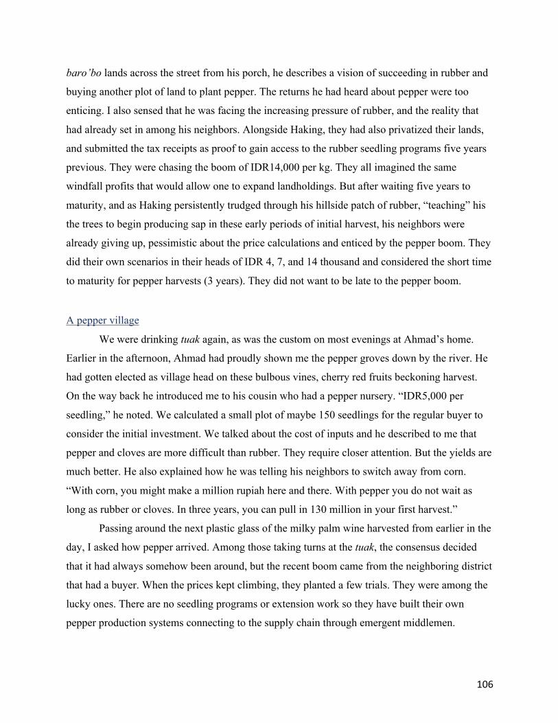
106
baro’bo lands across the street from his porch, he describes a vision of succeeding in rubber and
buying another plot of land to plant pepper. The returns he had heard about pepper were too
enticing. I also sensed that he was facing the increasing pressure of rubber, and the reality that
had already set in among his neighbors. Alongside Haking, they had also privatized their lands,
and submitted the tax receipts as proof to gain access to the rubber seedling programs five years
previous. They were chasing the boom of IDR14,000 per kg. They all imagined the same
windfall profits that would allow one to expand landholdings. But after waiting five years to
maturity, and as Haking persistently trudged through his hillside patch of rubber, “teaching” his
the trees to begin producing sap in these early periods of initial harvest, his neighbors were
already giving up, pessimistic about the price calculations and enticed by the pepper boom. They
did their own scenarios in their heads of IDR 4, 7, and 14 thousand and considered the short time
to maturity for pepper harvests (3 years). They did not want to be late to the pepper boom.
A pepper village
We were drinking tuak again, as was the custom on most evenings at Ahmad’s home.
Earlier in the afternoon, Ahmad had proudly shown me the pepper groves down by the river. He
had gotten elected as village head on these bulbous vines, cherry red fruits beckoning harvest.
On the way back he introduced me to his cousin who had a pepper nursery. “IDR5,000 per
seedling,” he noted. We calculated a small plot of maybe 150 seedlings for the regular buyer to
consider the initial investment. We talked about the cost of inputs and he described to me that
pepper and cloves are more difficult than rubber. They require closer attention. But the yields are
much better. He also explained how he was telling his neighbors to switch away from corn.
“With corn, you might make a million rupiah here and there. With pepper you do not wait as
long as rubber or cloves. In three years, you can pull in 130 million in your first harvest.”
Passing around the next plastic glass of the milky palm wine harvested from earlier in the
day, I asked how pepper arrived. Among those taking turns at the tuak, the consensus decided
that it had always somehow been around, but the recent boom came from the neighboring district
that had a buyer. When the prices kept climbing, they planted a few trials. They were among the
lucky ones. There are no seedling programs or extension work so they have built their own
pepper production systems connecting to the supply chain through emergent middlemen.

107
Ahmad is convinced that pepper is the way to solve low incomes for the people in his village. He
aggressively encourages people to switch over, and the results are profound. Pepper has quickly
spread across the landscape, evident from the drone imagery I have collected as well as the
polygons in Map 4. Figure 1 also shows the extent that pepper has found a place, crowding out
an ancestral gravestone to find any excess land.
Figure 1. A gravesite in Kajang surrounded with stakes from gliricida with pepper vines
I wanted to find someone just beginning to plant pepper in Ahmad’s village to better
understand the considerations among those following the pepper boom. That’s how I met Uppa.
Uppa’s family had just hosted a major Kalomba party (a ceremony and a blessing for a child),
which came with all the requisite invitations compelling gifts from family members. The cash
allowed Uppa to purchase a 60 are plot of land. When we arrived to dig the holes that morning,
the field looked crisp, as it had gotten the double dosage of herbicides and a torching to clear the
vegetation. Straggly burnt corn stalks remained, which I am told represented a final harvest for
food as the previous landowner tried to make use of his land prior to making the transaction. I
saw remnants of the previous owner hedging his bets. He had kept his rubber and tried to grow

108
pepper on the same plot of land, diminishing returns on both that clearly never materialized in
the way he had imagined. The rubber stands still remained, hacked away at a height of five feet
to allow light to enter for the final corn harvest. He failed and decided to sell, and Uppa’s
kalomba ceremony was strategically timed to generate enough capital to purchase the land and
make a go at pepper. We spent two full days digging 120 holes between us, joined by two
nephews that had come to help. I know they would get paid in reciprocated labor, as Uppa also
promised me the same reward. We had fun considering what form that might take, as I have no
land. Maybe it would be a family ceremony someday he suggested. As we resumed digging these
holes of potential reward, I was surprised anything could grow on such a rocky surface.
Some weeks later, playing dominoes with Haking and his cousins, we discuss the pepper-
rubber consideration. A cousin of Haking’s, holding out a card he wants to play offers an
explanation. “We plant black pepper and now the prices are starting to fall. What’s next? Are we
going to wait until it’s time to harvest and lose all the years of waiting again, and then fool
ourselves into planting rubber again? I’m lucky because I didn’t follow along, or maybe I’ve just
been lazy,” he says as he slaps down another card.
V. Calculating accumulation and exclusion After collecting all the maps of household land production at the village level and
collating them to a regional scale for the total area of the Kajang Adat Region as presented in
Maps 2, 3, and 4, I began to calculate the overall availability of land. Without naming a specific
village I put together a rough estimate to understand the ratio of land per household. In village A,
let’s call it Tanah Beru, there is a total of 600 hectares. Approximately 5% is for settlement
areas, whereas about half of the land (300 hectares) are covered by tree crops.48 The remainder
are agricultural lands, corn and sawah. There are 500 hundred households in the village, meaning
that divided evenly between all households each can access roughly 3/5ths of a hectare.
However, by no means are tree crop lands divided evenly, and it is not uncommon to find people
with more than 5 hectares.
Indeed, I often engaged with the village secretary in Tanah Beru this very question. How
much land do you think it would take to make it [sejahtera]? He responded, “maybe 3/4 hectare
48 Some of this is mixed groves, especially for timber crops, which I have not covered as a land use category. This often falls into the category of agroforest because they are generally planted as hedges / boundaries for tree crop areas.

109
of tree crop land, and 1/4 hectare sawah.” He stopped to re-calculate in his mind briefly. “If it’s
rubber, 70 ara is not enough.” Trying to get a sense of how many people could gain access to
land for such a scenario I then asked how many households have more than five hectares. He had
been reluctant to share his data on individual tax receipts with me, though we often went through
the data together. I understood this was sensitive data and so I asked for general responses. He
responded with a surprisingly specific answer: 37. In other words, a large percentage of these
lands with commodity crops are controlled by a handful of people. It is also important to
acknowledge that household-land ratios are imperfect given that people who live in a village can
own lands outside of that village, and vice versa. That said, there is a clear trend in land
consolidation among a group of emergent elite, indicative of those succeeding during crop
booms. In this chapter I have also shown the precarity of these crop booms, and the potential for
people like Haking and Bungko to fall into a cycle where land sale is the only option.
This analysis must also be contextualized amidst the fact that tree crops are not the only
way to make a living. There are a rare few among the local elite that have jobs as civil servants,
though they tend to also be the landed elite. There are also a limited number of collectors
[pengumpul, or middlemen], and many also protect their livelihoods through livestock. New
industries, such as working as local electricians, also come alongside new developments.
On agricultural land, quantifying how land relations accumulate and dispossess are more
difficult. White corn is still the easiest way to grow food, and rice is a critical part of being
Kajang. However, I have shown that the ways gillirang is contested and the entry of capital into
the costs of production (agricultural inputs) alongside the increasing demands on accessing yield
(for ceremonial purposes), while also restructuring labor relations through more individual
ventures onset by other factors like mechanization, showcase the surprising ways that capitalist
relations find a way into Kajang.
These terms of exclusion through capitalist relations are certainly a modern phenomenon,
made possible by changes in governing systems and the expanded opportunity to engage in
markets. In the past land management practices were premised on household production systems
based on networks of reciprocity to prepare and harvest fields. Administrators acted coercively to
deliver development and the aristocracy benefited handsomely in these positions. Though this
legacy remains in part, more contemporary changes have had a redistributive effect on power
relations away from the historical landed elite and aristocracy. However, when viewed from

110
perspective of capitalist relations, as I have shown herein, an emergent landed elite are also
engaged in new forms of exclusion.
Capitalist relations and development authority join together to shape powerful outcomes
in village offices. Positions of village heads are increasingly defined by those securing windfall
profits from clove, pepper, or rubber harvests that help to finance their election campaigns.
Indeed, this trend extends beyond Kajang, as recent political analysis in Indonesia have called
this phenomenon as “democracy for sale” (Aspinall and Berenschot, 2019), which in Kajang is
called in the vernacular “Money Politik.” Those that succeed in occupying these positions of
power also extend their influence through these positions to guide development decisions that in
the case of the pepper village also reinforce the accumulation of capital among a particular
network. The new village authority also uses their positions to seek new opportunities for capital,
or as Sallasa explains to me as follows: “The infrastructure projects fill the pockets of those in
positions of village power. This is how they do it. There are three ways. First, they set up their
own contracting companies and then pay themselves to do the work. Every single village has a
construction company to pay itself. Maybe they don’t register under their own name, but they
will do it through a cousin or something. I don’t know one village that does not do this. Second,
they use it to justify the same projects under various budgets. In the past it was PNPM and
village funds. It was easy to structure the disbursement to collect a lot of the money for the same
projects. Third, they skim on all the standard material unit prices [sand, gravel, etc.] and pocket
the rest.”
In sum, this chapter has built upon the terms of development and authority and shown the
way capitalist relations take place in different ways, as well as the concomitant effects imprinted
on the landscape. Chapter 3 highlighted the way that different historical political-economic
relations shaped authority, and how that authority shapes contemporary elected leadership
positions and expectations. In part 2, I showed how the increasing layers of gillirang are creating
new mechanisms of exclusions among the farmer networks that negotiate and prioritize claims
through the local cultural and normative systems of authority. These agricultural systems also
highlight how capitalist relations are not contingent on private land and tree crops alone, but that
commoditization arrangements creep up through surprising means of cultural reward and
reciprocity, namely through increasing financial value equated with the ceremonial role of rice.

111
Finally, in part 3 I highlighted the more unsurprising avenue compelling capitalist relations
amidst the volatility of crop booms at the margin.
The broader research question however looks at any changes in the tenurial rules and
property institutions in Kajang as a result of recognition. In short, did recognition make a
difference in a particular way to these existing land and tenure relations or would the changes
described herein would have occurred irrespective of recognition? The current discussion points
to the limited impacts that recognition has had on much of the capitalist relations that are taking
place. However, the formalization of adat as negotiated by village heads and their alliances with
indigenous rights activists show that recognition has only further reinforced authority among the
historical and emergent landed elite thus supporting outcomes that accelerate capitalist relations.
Nevertheless, recognition is still new and in order to shift my frame of analysis to the future, I
engage youth on the notion of landscapes of potential. Therefore, in the next chapter I continue
the analysis at the nexus of development authority, tree crops, and agriculture, but do so by
situation how the next generation of emergent leadership see themselves inheriting these
landscapes.

112
Chapter 5 – Landscapes of potential: Youth, changing land relations, and connections to recognition
In the past during the time of the harvest people would all get together and sing [kelong] in the fields. These were big events that no longer take place. Those were also times of the greatest feasts as well. This generation no longer knows how to sing.
– Bahri
I. Studying future land relations While land claims are made based on an ability to define the past, change is made by
articulating visions of the future. As previous chapters have noted, successful land claims are
inherently a process of historical articulation supported by networks of power and legitimation
(Tsing, 1999; Li, 2000; Hirtz, 2003). Future possibilities however, are also shaped by these land
relations that refract through the visions of emergent local leadership that come to fill roles of
authority. As youth grow into these positions by inheriting, claiming, and articulating new
visions amidst existing political economic conditions, they express potentially new terms of land
relations to shape material outcomes on the landscape. Therefore, exploring some of the early
imaginaries among youth as they see themselves move into, or see their peers take on positions
of authority and leadership, presents a window into understanding what I call landscapes of
potential.
This chapter extends the analysis from chapter 3 and 4 on village development planning
and land and agricultural tenure relations. In this chapter I revisit these land management
categories through youth perspectives. The framing of the chapter thus follows a research
tradition from studies on agrarian change that overlap with youth studies (White, 2012; Bernstein
et al., 2018). Although such research still has a lot of unanswered questions given the complexity
and variability of youth and rural spaces,49 I focus on a “generationing” approach (Ansell, 2016;
Huijsmans, 2016; Park and White, 2017) by examining the processes that youth transition into
their foreseeable roles of authority. I therefore seek to describe how Kajang youth imagine
49 These unanswered questions was the topic of the keynote delivered by Ben White at the 25th Agrofoods conference hosted by Institut Teknologi Bandung in December 2017

113
someday filling their roles in land management and Kajang leadership posts, as well as their
desires for future change.
The chapter proceeds as follows. I first begin with a brief engagement of the intersection
of youth studies and agrarian change, focusing on a generationing approach. Second, I provide a
broad categorization of future possibilities as expressed from the viewpoints of Kajang youth.
This section reflects on what youth aspire to be, the opportunities available to them, the
constraints that guide their potential trajectories, the strategies they plan to pursue, as well as
their parent’s notions of desirable and acceptable pathways.
Third, I shift my attention to two young people, both men, who are well respected in one
cluster of villages. These individuals are poised to command a central role in shaping future land
relations in Kajang. Following on the analysis from the previous chapter, I separate the two
leadership roles by tenure category. These two categories are private collectives based on kinship
groups [gillirang, explained in detail in chapter 4] and private land ownership. I select one crop
among each category, rice as indicative of gillirang tenure relations, and rubber as representative
of private land ownership. In each land category I situate the two young men, both successful,
well-respected, and admired among their respective peers.
One is Aco, a young man 21 years of age, who has come to command a central role in
coordinating rice cultivation in Kajang. He never went to school and has worked in the rice fields
since he was nine years old. He knows the different roles that are available for work and is
increasingly entrusted to coordinate work parties in two important valleys across a cluster of
villages. He recently married into an alliance of families that have long controlled rice
cultivation in the region, securing future rice land claims through kinship alliances. The
contrasting ideal type is in the context of the private land category, indicative from the expansion
of rubber as a smallholder crop. The corollary example, 20-year-old Baso, is the son of a former
elected official. Baso’s father found much success from timely tree crop harvests, accumulating
land and capital, and thereafter consolidated authority by occupying government posts that could
direct subsidy programs. This success ensured that Baso would attend university in the provincial
capital of Makassar. Upon completion of his political science degree, Baso plans to return to
inherit his father’s land and take over control in rubber production, which he says will prepare
him to someday run for local elected office.

114
Fourth, I draw out the notion of landscapes of potential, situating visions of future
possibility from each viewpoint. I describe how the national politics of indigenous rights
recognition unfolds amidst these two positions of emergent leadership anticipated to have an
outsized influence on the landscape. As such, I connect the mobilization of indigenous rights and
land recognition schemes to the stories of Aco and Baso.50 I show how the values of indigeneity
recognized by formal bureaucratic and governing processes, and the lands that are titled as a
result, invariably get redirected through the interpretations of people like Baso, the landed elite.
These are the families that have been successful in expanding their landholdings through well-
timed tree crops booms, accumulating land and capital, and securing posts in formal government
positions. More broadly, young people who are likely [and would like] to stay in Kajang that
have the means to do so, will look to Aco and Baso as models of success, thus shaping the
discursive and material imprints on the landscape of potential.
II. Placing youth in the agrarian question Research on land grabbing has more recently incorporated considerations of gender and
generationing (Park and White, 2018). Their volume shows that although land grabbing may
benefit a handful of people in the short term through buyouts and cash payments, more drastic
differentiation takes place over periods of generational change. In such conditions, as youth
come of age at sites of enclosure, and customs of inheritance no longer apply, or only apply to a
limited area of existing cultivation, expectations of obtaining the same opportunities as past
generations are no longer possible.
Generational dynamics and future opportunities to land are just beginning to emerge as a
concerted analytical focus, although Bernstein et al. (2018) point to longstanding interest in the
household that included elements of age and generation in studies of peasant political economy
and agrarian change that reach back to the 1960s. The more recent iterations of the agrarian
question, Bernstein notes, revolves around issues of [re]defining peasants, smallholders, and
family farms; situating them within state-centric systems and capitalist relations; evaluating the
opportunities for peasant organizing; as well as the broader possibilities from processes of
production and reproduction. The generational succession sits centrally amidst these theory and
50 As with elsewhere in this dissertation Aco and Baso are not their real names. Aco and Baso actually are slightly different versions of the same name, given to a first-born male. Aco is a more localized version whereas Baso connects more with the Bugis-Makassarese version of the same name.

115
praxis considerations. How will such political, economic, and cultural convergences play out
amidst the current dynamics of globalization, land grabbing, and initiatives at titling and
recognition?
White’s keynote at the 25th Agrifood’s Conference on “Food, Youth, and the Future of
Farming” argued for the continuing primacy of smallholder agriculture and bases his viewpoint
on the inherent productivity advantages among smallholders in comparison with large scale
agriculture. He also shows how 98% of the world’s farm units remain smallholders, located on
over half of the world’s land, and at least 80% of which are on plots less than two hectares. Li
(2018) further highlights the dramatic generational effects that result with the arrival of the
plantation. Using a case of plantation expropriation in Kalimantan, she shows the limited
opportunity youth have to fill the role and authority of previous generations, relegated as cheap
labor or displaced by migrant workers. The only remaining option for the great many is
migration, forced into unequal conditions in precarious new locales of uncertainty.
Meanwhile, in many places around the world, particularly in the global south and those
graduating into status as middle-income countries, farmers are aging, and young people are both
waiting longer to transition into similar roles or drawn to the possibilities of seeking opportunity
elsewhere. There is also a growing trend and perception that the current generation of aging
farmers also encourage their children to escape the life of hardship as a farmer to pursue
opportunities in other industries. Young people also develop their own perspectives by these
mixed messages of staying and migrating, reacting to the forces that allow them to stay or
compel them to leave. These include narratives that farming is dirty work, low-wage, and
undignified. Such ideas are also reinforced by societal norms and echoed on billboards and
through TV screens, as well as reinforced in formal institutions and in schools. On the contrary,
there are also instances where smallholders are experiencing a resurgence, part of alternative
capitalist futures, interests in reinvigorating localized markets, and a desire to develop more
sustainable agro-ecological food systems (Mostafanezhad and Suryanata, 2018).
White thus provides us with a broad categorization for future farmers. The first are the
replacement farmers: those that grow up on the farm and take over the farm. The second are the
U-turn farmers: those that grow up farming, go away, then return to farming. A third category
consist of the potential new entrants to farming, those that are actively drawn to the idea of
farming or in some unusual cases, like government programming for rural Japan, actively seek to

116
support training to support entrants into farming. What then, will become of the next generation
of smallholders that not only makes up a large portion of the world’s workforce, produces much
of its food, and defines the way of life for many people in the world? In this context, a
generationing approach provides explanatory and research potential.
III. The generationing approach and intersectionality The question of intergenerational land and rights transfer, as well as opportunities for
youth to define the future are challenging and the generationing approach provides pathways for
engaging with the idea of youth as a socially constructed process, and one that requires
collaboration between those that consider themselves or each other as youth (Ansell 2016;
Huijsmans 2016). First, defining youth is a contested and confusing concept. Overall, youth is
relational, but also occupies very real categorizations. On the one hand youth exists because one
defines oneself as such, but on the other, that it also orders populations on census forms, shapes
development projects in particular ways, and compels certain roles in society. The very
experience and definitions of youth are also changing as people are living longer, marrying later,
spending longer time in educational institutions, and waiting longer to enter the labor market. A
focus on youth as a social construct and as a lens for analysis has emerged as part of the growing
analytical commitment that arose with gender studies, and particularly intersectionality.
Collins and Bilge (2016) provides a broad engagement with intersectionality, as both a
theoretical and practical tool for thinking. The link that brings the many strands of usages and
applications of intersectionality convenes around its ability to uncover the various layers of
inequality which other frames might not be able to accommodate. They show that advocacy
mobilizations in the 1960s and 70s were not able to incorporate the many layers of inequality
experienced in, for example, first being black, second being a woman, and meanwhile being a
worker also demanding rights. Youth studies therefore fits through the broader lens of
intersectionality, providing another way to extend our understanding of inequality and refocusing
attention around the potential forces of empowerment. A generationing approach does not
therefore overshadow the other foundational elements of the agrarian question but rather
complements them. In the research presented herein, youth that grew up as descendants of slave
classes structuring their economic opportunities, are not just judged through the lens of their
Kajang and more broadly Bugis-Makassar identity, but also through their experience of being a
woman, facing stricter interpretations of Islamic law, and citizens of the Indonesian state.

117
Conversely, a male descendent of Karaengs with large landholdings and opportunities to attend
college, enlisting as leadership in increasing powerful local Islamic organizations situates a very
different experience of being young in Kajang.
IV. Engaging youth: Arriving at visions of the future in Kajang My research in Kajang took place between 2014-2017. In this timeframe, I spent one full
year living in Kajang villages and spent an additional year in jurisdictional capitals and at
comparative sites of land rights recognition and agrarian change. The research began with
participatory mapping to determine land cover as a proxy for engaging on discussions of land use
change. I then followed up with collaborations by engaging with regional and local institutions,
as well as informal groups (See chapter 1 for a more detailed description of methods). This led
me to form various policy drafting partnerships with district level agencies and village
governments. Farmers however, were my main interlocutors, as my approach sought to contrast
the benefits of land recognition with other land use considerations.
Engaging local farmers on land relations required persistent and direct engagement, and
due to the long contentious history in Kajang, many were initially suspicious of my presence. In
my early times in Kajang, I came to learn that one local resident thought I was looking to
purchase land for a future development project. Another individual thought I was a rubber
plantation representative in disguise seeking to survey lands for plantation expansion. And one
cryptic story circulated by an individual noted that I fit the description of a Dutch descendent
fulfilling a prophecy from colonial times, in which a balanda [meaning Dutchmen but locally
used for a foreigner] would arrive to steal the most sacred and secret artefacts.
In part to counter these suspicions, I elected to embed myself in the community by
making myself useful. Meanwhile, aligning this bottom up engagement with my research
interests, I participated in every aspect of the crop management cycle, by helping out along all
phases of production from seed/seedling collection to crop maintenance to harvest and also
joined in efforts to deliver harvests to markets. I focused on the main seasonal crops of rice and
corn, and three longer-term tree crops rubber, black pepper, and cloves. I also inquired into other
agroforestry management systems when relevant (e.g. ginger, langsat, bananas, rambutan,
coconut), following along the production and supply chain for each crop. Most of the time
making myself useful meant participating as a day laborer, helping to hoe irrigated rice dikes,
plant seed and seedlings, dig holes, cut chutes for pepper vines, spray herbicide, spread fertilizer,

118
and other menial labor activities with the objective of experiencing all aspects of farm and
household production.
Throughout this process of engagement however, I realized it was not always easy to
engage with older generations on agrarian change. A lot of this also had to do with the gap in our
communication abilities. Although my Indonesia language fluency allowed me to communicate
freely in most contexts, my mediocre Konjo speaking and comprehension presented some
communication challenges, particularly with older generations. In these situations I often felt it
difficult to fully express themselves. Older farmers also often saw me interacting with formal
authorities and interviewing them, which lent to the initial unease about my presence,
particularly as my interests pursued questions about land and land uses. Responses often gave
way to common essentializations of the Kajang, described through a common set of generalities
among respondents. Over time I tempered these suspicions by putting away notepads and
recording devices, engaging on questions of family responsibility and inheritance, seeking to
understand how younger generations moved into similar positions in the community. Farming in
the fields also helped to build a sense of trust, inverting the power dynamic and relegating me to
the most inexperienced and incompetent. Many found it amusing as I agreed to take on menial
tasks commonly assigned alongside young children.
Although everyone in Kajang says that farming is easy [it’s finding money that’s
difficult, they say], I often felt like I had two left feet in the field. On one occasion, invited to
spray herbicides to clear a row of weeds growing up through the rice fields I had been too heavy
on the handle using up an entire pump-pack in just a few passes. The owner of the fields was
clearly upset by my incompetence, having to spend time dealing with me and also for the loss of
pricey chemical inputs, which I offered to reimburse. His son intervened, helping translate both
the language and the intent. On another occasion, I hoed [abingkung] rice pathways for a week
and got a full hand of 23 blisters. People in the village found this hilarious and went out of their
way to ask me to see my hands. My early incompetence may have seemed a burden for those
with time constraints and responsibility to meet targets of getting seed in the ground or
coordinating a full harvest, but the younger generations were at least amused by the opportunity
of telling an outsider, a foreigner [bulek/balanda], and a researcher nonetheless, what to do as a
farm laborer while working together on rice plots, fertilizing clove trees, or digging holes to

119
prepare pepper plantings. Over time as I became just another member working in the fields, this
level of engagement allowed for meaningful exchanges on lives and livelihoods.
It is in this context that young people gravitated to me and I very much benefited from
their insights and support. They had a better command of the Indonesian language and would
often step into the role of interpreters when I interviewed their parents. I also began to make
friends with several groups of young people in the village. At various stages during my stay, four
different college age students would accompany me to interviews, for example making
introductions, interpreting, and listening in to talk story with former village heads, guerilla
fighters and Dompe from the 1960s, as well as other Kajang leadership in various settings. I also
had seven students that sought me out to study English, regularly visiting me throughout the
week. They were all eager to learn about where I was from, hear about the outside world, what I
was doing there, or talk about global happenings in the news like international soccer matches,
particularly during the height of the 2016 European Championship. Hearing of my interests in
soccer a group of youth that had formed the village soccer team also sought me out to join their
practices and kickarounds at the local schoolyard on afternoons when the rains did not make the
fields too muddy. Through these interactions, local youth began to invite me to attend their
planning meetings and events, teaching me how to be competent at dominoes, and teaching me
speak and act more appropriately.
None of the direct respondents herein are below the age of 18, and if youth of those ages
are discussed, it is in the context of general encounters about positions on the landscape, or as
other generalized descriptions among parents about potential futures. Overall, those I have
identified as emerging leaders among youth were indicative of youth that were either taking on,
or likely to inherit notable land management responsibility. It is these positions that I explore
through the stories of Aco and Baso to further examine the implications of indigenous land and
rights recognition relative to landscapes of possibility. I next turn to the process of becoming an
adult embodied by the marriage ceremony, followed by categorizing youth perceptions of
possibility and desire, followed by placing Aco and Baso in the landscape.

120
V. Ideal types of possibility among Kajang youth
Becoming an adult: Of weddings, gift-giving, and inheritance
As a young person matures into the responsibility of taking care of their own household,
the wedding51 ceremony serves as an initial safety net for newlyweds to begin a new life.
Therefore, the ceremony functions to generate initial capital through gifts from other families in
their community in a system of social debt and reciprocity. For a wedding, invited guests must
bring a certain quota of gifts. Gifts are provided in the form of cash and rice. The men bring
cash, and the women bring a certain quota of rice.
Determining gift-giving obligations to a pesta [party/ceremony] is based on reciprocity
and inflation. For example, in 2016, a guest will present a gift of 50,000 rupiah (US$ 3) in cash
provided by the man, while the woman provides a gift of 30-50 liters (up to 35 kg equivalent) of
rice. The gift comes with future reciprocity. When the one providing the gift has a ceremony in
their family, the receiver will return an amount equivalent to or greater than the amount
provided. This custom extends beyond family weddings. Close family have a greater
responsibility and the numerous gift-giving responsibilities are a common point of conversation
in the community. Stories about gifts between certain immediate family members also gain
notable attention for the heavy burden of family gift giving responsibilities. The most commonly
shared story was of one family presenting over a ton (1,000 kg) of rice to their immediate
sibling. This example, often discussed in Kajang, at once instills a strong sense of family bonds
and mutual responsibility, but also highlights the overwhelming cases of social and material debt
that families incur and must someday repay. Indeed, the pesta is viewed as one of the largest
burdens in the community, and people often quip that the numerous pestas in the community will
bankrupt them.
With the initial stockpiling of wealth from the wedding ceremony in the form of cash and
rice, the newlyweds compile a comfortable safety net for beginning their new life. The cash is
imagined as a way to cover major costs like purchasing land or constructing a home, while the
rice provides food security before future opportunities at accumulating harvests. As noted in
chapter 4, rice not only provides the main staple food but also holds a price in the local market
51 Weddings are a much more complex affair only addressed for the extent to which it relates to youth and land relations. Otherwise, there is also another dimension of weddings requiring dowries, a transfer of wealth in the form of cash and buffaloes, and a long list of negotiations that are not discussed here. For more on this topic see Maarif (2012)

121
used to buy fish to put food on the table. In the past, land-short families could move into the
frontier by staking out forest areas to access lands. However, as the frontier in Kajang ended in
the 1990s, cash and inheritance have become an extremely important factor determining access
to land and a home. The ideal scenario, therefore, is to access enough land to build a home, gain
regular access to gillirang land for rice cultivation, and plant an area with a plot of tree crops to
generate enough cash.
Imagined trajectories
Table 2. Categorizing Youth Options in Kajang
1. Compelled, or wish to stay in the village
a. Due to household responsibility – at the behest of parents or for other reasons of necessity b. Wish to stay, perhaps have been to regional cities and migrated, but openly state their dislike of such possibilities. One described the city as inhumane [kurang manusiawi] and that you pay for everything in the city, even to breathe, even to use the restroom.
2. Opportunity to attend university, and plan to return
a. Women i. Plan (and have opportunities) to return to Kajang, seek opportunity in government jobs, especially as nurses and teachers
b. Men i. Security jobs in the police and military are attractive because of past perceptions of authority and continued influence of such positions ii. Village administration appointments that require a certain level of bureaucratic credentials iii. Limited appointments in bureaucratic agencies in the district capital (~50 kilometers away) that allow for commuting
3. Migration a. Seasonal: follow planting and harvest cycles in nearby regions or find construction work in city centers. Usually work during labor intensive periods of planting/harvest (paid in yield or cash), an option especially when families need to save up for a household ceremony b. Working on plantations (or trade with plantation workers) in Malaysia, a migration network established decades ago c. Following networks of migration to neighboring province (Southeast Sulawesi) where land from the forest estate has been made available for small plots d. Other longer-term migration to regional urban centers. Some plan to make enough to move back and reclaim family plots when older generations pass and inheritance can be claimed.
Kajang land inheritance systems are for the most part equally divided by gender, and to
some extent by order of birth. One exception is that the youngest daughter will inherit their
parent’s home, explained as a household strategy for elderly care. For the most part however,

122
field labor is conducted by men, and the perception of land cultivation are associated with men.52
This is why I have chosen two well-respected young men as my case studies. Prior to examining
these two individual cases, however, I want to first foreground the broader imaginaries and
possibilities on coming into adulthood and individual ideas about a productive life.
Table 2 is indicative of ethnographic material and does not reflect quantitative
distribution. The categories situate different pathways of possibility as described to me among
youth and their parents. The categories are by no means comprehensive, and rather, reflect local
perceptions on desires, capabilities, possibilities, and constraints.
VI. Emergent leadership on the land
Aco: On becoming an influential rice farmer
Aco’s53 family is known as one of the hardest working families in the village. While
trying to keep up with him in the rice fields one morning, he pointed at a 12-year-old boy
herding cattle towards a new patch of grass amidst a rubber grove. Aco explained to me that his
nephew was missing school to work in the fields. The reference was not about the boy but rather
Aco’s way of explaining his own upbringing. Although his nephew attends school several times
a week, Aco never went to school. Most young boys are introduced into agricultural work at an
early age. The apprenticeship begins by herding cattle, Aco explains, and keeping them healthy
enough to be ready for the plowing seasons twice a year. It instills a sense of personal
responsibility. Aco ends by explaining that the boy was still reeling from losing one of the cows,
killed by a venomous snake bite.
For as long as he can remember, Aco practically lived among the paddies [sawah],
sleeping in the field houses [bolla-bolla] and making himself useful in every part of cultivation.
Like his nephew, he tended cattle, helped with weeding, repaired the embankment dikes. During
the planting season, the busiest season of the year, he perfected his technique. The approach
52 This does not mean women do not play an important role in land management. In other sections of this dissertation I provide more complex interactions of gendered land relations. This includes specific parts of planting and harvest. For corn women plant the seed. For rice, women for the most part conduct the harvest, especially among traditional rice varieties with a hand cutting tool in a process called masangki. For the traditional black dye so important to the Kajang, women also gain access to land plots to cultivate indigo, usually around among home gardens. 53 Both the names Aco and Baso selected for this paper are pseudonyms. They are also variations of the same name, usually given to first born sons. The latter, Baso, is an aristocratic name throughout South Sulawesi and Aco is the local pronunciation.

123
involves taking a clump of seedlings, carefully separating three or four seedlings so as not to tear
the roots, and swiftly pecking them into the softened mud. The depth and angle must be
accurately positioned to ensure seedlings will thrive, not too deep to drown the plant, and not too
shallow that it lodges. Planting also involves a dance, spacing between neighbors, calculating
distances as far as your arms can reach, retreating as each row is planted, staking out lines
relative to nearby planters and distances to dike plots. Your speed and quality determines your
utility as a worker.
Although merely 21 years old, Aco commands authority in these sawah. He maintains the
sawah with herbicide spray, pulling weeds where necessary, fixing eroding footpaths, and
allocating water through the irrigation system. He is entrusted by various land claimants making
arrangements of responsibility and reward across family alliances. He knows many of the
intricacies of these plots, as he has helped reshaped smaller irrigation divisions and redirected
numerous embankment plots and pathways. He knows that without constant supervision, a rice
plot can be repositioned out of existence through redirecting new embankments. In one village I
mapped, the village boundaries effectively disintegrated amidst the sawah embankments,
identifiable through those making payments in the tax code, and thus leaving much up for
administrator interpretations. In this system, Aco plays an important role coordinating labor roles
during times of field preparation and harvest. During peak labor periods, the village always
seems busier, part of seasonal migration of family members returning both as an excuse to visit
family and support fieldwork, re-establishing future claims so as not to be forgotten.
Last year, Aco married the daughter of an influential rice farmer, a village elder well-
versed in local interpretations of local indigenous law [pasang], particularly as they related to
sawah inheritance claims. Aco’s father-in-law was the son of a village administrator that had
constructed several sawah plots through irrigation construction projects in the 1970s. As a result,
Aco’s father in law also inherited numerous cultivation rights, which overtime were split through
annual rotational [gillirang] claims amongst kin groups. Aco tells me that his father-in-law
knows all the family lineages, inheritance rights, as well as all the lands formerly set aside for
ritual cultivation. Knowing rights to claim makes him one of the more powerful presences in
these rice valleys. He knows how plots were inherited, divided, and fought over among various
sibling groups, and how others were put up for sale. Conversely, he knows how to make new
claims or exclude others from making one.

124
Making a claim to a plot of sawah involves an ever-changing institution of rules,
interpreted through a mixture of ancestry and sweat. Absence in the fields through migration, or
inadequate alliances could render a claim forgotten or ignored, as new interpretations renegotiate
legitimating claims. Aco’s father-in-law is always involved in farmer groups, gaining access to
government subsidies such as fertilizer, seedling, and even getting allocation to hand tractors. He
also actively pushes the boundaries of gillirang land claims and is part of a group that some in
the village describe as the rice mafia, due to their powerful control and expanding authority over
sawah.
Alongside his father-in-law, Aco clearly commands authority over a vast area of these
sawah during peak times. While his father-in-law is outspoken, Aco commands a quiet but firm
authority, as they coordinate preparation of sawah fields by plowing and irrigating, in his quiet
but firm authority. Together they direct planters into prepared plot areas. He taught himself how
to use the intricacies of the recently introduced hand-tractors, which his father-in-law was able to
access through the farmer groups, and Aco is among the few that get to operate it. Meanwhile his
father-in-law works the remaining areas plowing with cattle. He is more comfortable plowing
behind the cows, and together they can operate a larger area in a shorted amount of time. His
father-in-law plows by singing to the cattle, in what he describes as a language [a’doyong] to
guide them to shift direction, go faster, and turn around. Laaiiiaaaaaa Loooooooooo Hala hala
hala hala. Hai! [name of the cow] Eh! Eh! Eh! Kiri, kiri, kiri! Oh! Hala hala hala.
Yappaadoiiiii. Ha Haaaaa Hala hala! Wooo! When I ask Aco if he knows how to a’doyong like
his father-in-law, he scoffs, replying that he prefers the mechanized, trustworthy feel of the hand
tractor.
Shortly after completing the planting season, I went looking for Aco but was told that he
was away for a few weeks. Rice harvest in South Sulawesi does not occur at the same time.
Therefore, instead of watching the rice grow, Aco later explained to me, groups of families will
get together to seek out opportunities as laborers elsewhere. The nearby Bone region to the North
has vast rice valleys that can always accommodate additional labor during harvest periods. Aco’s
family were preparing for an upcoming wedding and therefore took the opportunity in Bone to
be paid in yield to support putting on the ceremony. In Kajang, the primacy of rice as an
increasingly important staple replacing corn, combined with the required varieties to host or
attend family ceremonies, will continue to carve out a central place on the landscape. Aco has

125
found an influential place in the opportunities to shape and claim land, as well as structure labor
relations associated, which will likely remain unchanged as long as rice plays an important role
in these landscapes of potential.
Baso: Private rubber groves
Attending a ceremonial event at Baso’s house, we began discussing his involvement in a
local youth organization. Their mission, he tells me, is to support Kajang indigenous rights and
the environment. He also explains their approach to creating the organizational structure,
modelled after an influential Islamic youth group he joined at his university in Makassar, where
he is currently studying political science. During school holidays, he and other friends make the
trip home to Kajang and like to get together to plan the local youth organization, discussing
organizational structure, membership, and responsibility. Shaping this local youth organization,
joining a well-known Islamic chapter, and his choice of field of study are all part of his strategy
to someday run for local office. Affable and gregarious, and knowing my interests in land, he
invites me to join early the next morning to see his father’s rubber groves. Although rubber has
been in Kajang as a plantation for more than a century, access among smallholders was a much
more recent phenomenon, one in which his father had an important role in facilitating.
During the New Order era (1966-1998), the military and police acted as extortionist
intermediaries for government projects, and in Kajang, facilitated the expropriation of land
through the promise of development and the threat of violence (see chapter 3). The police were
also embedded into local leadership structures occupying administrative posts. These positions
were aligned with the Karaeng aristocracy of an earlier colonial era, layered on to the polities of
the spheres of influence by the Gowa kingdoms. Acting as a colonial administrator, and
subsequently as part of the Suharto apparatus helped to facilitate the expansion of plantation
concessions, gaining personal wealth through land consolidation and financial gain. Embedded
patron-client relations emergent from historical positions amongst the aristocracy, followed by
the New Order layering of military personnel that occupied civil-administrative positions to this
day make it difficult to disentangle the land grabbers from the grabbed. It is indeed difficult to
point to some outside culprit, as plantation interests were legitimated through state offices along
the vertical hierarchy all the way to the village level, ordered by the local elite that coordinated
labor to make development projects possible. Even in the unique cases that successfully

126
mobilized against the plantation supported by national NGO’s contesting Lonsum heavy-handed
rubber plantation expansion were thereafter undermined in the process of re-administering the
land. In other words, when land was successfully wrested from the plantation, the local
administrators re-grabbed land claims for a select few (Personal communication, interview, and
addressed in much more detail in Muur, 2019).
In 2003, Baso was just six years old when the largest demonstrations took place in the
Lonsum rubber plantations. State security forces mobilized at the behest of the plantation
resulted in the killing of three Kajang protesters. Dressed in their iconic black traditional clothing
they were shot and killed in the plantation zone of Bonto Biraeng village, less than ten
kilometers from Baso’s home. The timing of the demonstration was in part due to land
contestations taking place all over Indonesia as part of a weakened state after the fall of Suharto.
The other reason was due to the high price of rubber, which led to increased theft among the
plantations, and community organizing to demand greater access to land occupied by Lonsum.
Although nucleus-plasma relations between the plantation and smallholder did exist among some
community members, the high rubber prices made smallholders feel as though they were missing
out on potential earnings. As a result of the plantation conflict, high prices of labor, and
emboldened smallholders, an entirely parallel supply chain for rubber began to emerge. One
rubber collector described this juncture as the beginning of his career as a local businessman, and
since he says, large-scale buyers have come from Japan and China to survey potential rubber
production capacity.
Baso’s father, although having the family lineage of local aristocratic families did not
attain a leadership post as part of the military apparatus of the New Order era. He successfully
ran for an election during the unraveling of that period and consolidated power through a set of
political alliances. His success was facilitated by widespread smallholder entry into tree crops as
part of the new parallel market for rubber. Successful in both clove and rubber harvests,
occupying an elected leadership post also helped Baso’s father benefit in additional ways by
accessing government subsidy programs. In addition, he also helped to register numerous land
certificates [or the more common land tax receipts to prove land ownership] to qualify
households for government programs to access seedlings and fertilizer. He supported extended
family networks and those that followed the schemes early benefitted handsomely from the
rubber boom, taking the opportunity to expand landholdings. Rubber prices did especially well

127
during 2008 – 2012. Seeing their neighbors succeed during peak prices of 14,000 IDR/kg
resulting in windfall profits, neighbors also sought to join in. By the time I was in Kajang in
2014, rubber prices hovered around 4,000 IDR/kg and I watched families painfully cut down pre-
maturing rubber stands to plant black pepper and catch the wave of that boom. This is a crippling
investment, given that land is effectively taken out of production waiting 5-7 years to begin
tapping. Those late to the game, waiting to harvest, experiencing a set back and needing cash,
seeing rubber prices bottom out, and without safety nets were forced to sell lands to families like
Baso’s that could afford the setback or still had enough landholdings to make a profit from
rubber. As a result, households like Baso’s began to accumulate considerable landholdings. The
high price of rubber as Baso entered high school ensured that he and his siblings would have the
opportunity to attend university.
Home from a school holiday, Baso told me to come by early in the morning to visit one
of their plots. We sat and chatted for a while, drank coffee, and I wondered why we were wasting
the day as I knew that tapping has to be completed in the early morning prior to collecting the
cups later on that day. When we arrived at Baso’s father’s groves I immediately understood the
reason. Baso and his father do not tap, but rather this was a supervision visit to oversee the
contract tapper at work and to collect the dried rubber stock for measuring and taking to the
market. The family contract worker had been tapping for the last two hours, making his final
rounds on this plot. The contractor learned to tap during his time working at Lonsum, but
resigned due to family issues and inflexibility of worker hours and the competitiveness of the
plantation quota system. Baso’s father hired him on a steady salary as a favor to a distant relative
and saw an opportunity to receive professional quality rubber collection. As we walked through
the mono-cropped rows, talking with the contractor, we discussed all the technical and economic
aspects of rubber. Like his father, Baso had the same entrepreneurial air facilitating the
conversation with the contractor and myself, detailing all the elements of production. His father,
at first busy at their weighing station, would jump in to complete Baso’s sentences, describing
production volumes relative to potential yield and income. “With this plot here,” Baso’s father
joked, exaggerating the effects of the stubbornly low rubber prices, “it gives us enough to eat.”
We walked over to the drying vats collected from earlier in the week and I heard the common
phrase about drying rubber, this time from Baso: “it sure smells bad, but money from rubber can
really taste sweet.” Baso is first in line among his siblings to claim a sizable portion of these

128
groves, and unlike the gillirang rice fields, these plots will undergo a direct transfer when Baso
inherits the deed, which he foresees will take place when he plans to marry.
VII. Landscapes of potential
Preserving tradition while cultivating science and technology
Home from another college break, Baso and his friends from the youth organization had
planned an event at the village office, supported by a small amount from the village development
budget. They became accustomed to convening in these types of forums to discuss plans for their
organization. Formal village staff and other local officials attended and opened the event.
Speeches began in the formal Indonesian way, and customarily across South Sulawesi, layered
with various Islamic greetings. The village head provided introductory words supporting the
initiative, followed by a local police officer in attendance to deliver a public service
announcement. The officer noted that helmet enforcement will begin taking place on the main
roads as a response to the high number of fatalities among youth. Furthermore, the level of drug
use [sabu] and abuse had also reached alarming rates, and the policeman implored youth to stay
away.
Finally, the speeches began among the youth leadership and other invited speakers from
the community. They highlighted three main themes, beginning with the grand history of the
Kajang and the importance of maintaining their name, followed by fulfilling development
programs of the Indonesian state and acting as good Muslims, and concluding with high hopes of
a future made possible by cultivating science and technology.
The idea of being Kajang as described in this setting is different from those promoted by
indigenous rights recognition. They draw from a very different set of pasang than those
commonly selected by indigenous rights activists that seek to highlight local environmental
stewardship. On the contrary, the speeches at this youth organization event describe the distant
envoys that proved historical and cultural influence of the Kajang. From Kaili in Central
Sulawesi, to East Nusa Tenggara and the Malukus, crossing into modern day Philippine territory,
as I am told in various renditions, the Kajang once travelled and claimed some form of authority
amidst these distant sultanates. In one speech, citing a historical colonial text about the Kajang,
the speaker passionately rendered the passages as follows, invoking colonial texts in Dutch
libraries: “during Dutch colonial times, in 1824 our ancestors lost in a battle, which resulted in

129
our colonization by the Dutch. We were not colonized by the Dutch for 350 years like we often
learn about Indonesian history. It was only 120 years here [of colonial rule]. The Dutch came
here and brought their systems of government only in 1824. These books are available in [the
Dutch archives] in Leiden. There are 149 different books just about Kajang, far more than
anything written about Bulukumba. This shows how great our ancestors were.” The overall
intent of this message is that Kajang ancestors had a large influence across the archipelago, and
even the Dutch struggled to exert their influence on such a powerful people. The line of
argument follows that the district government in Bulukumba, which administers Kajang as a
subdistrict did not receive nearly as much attention or significance in the past, thus suggesting
the need to re-establish Kajang authority for the future.
The message thereafter pivots from the greatness of Kajang’s intrinsic identity to the
opportunities that young people have to redefine the future. The prescription is presented as
holding on to one’s Kajang identity while becoming exemplary Indonesians and Muslims. For a
community like the Kajang however, which are best known for their traditional identity and
ideology that explicitly shuns modern forms of technology in favor of a modest agrarian
lifestyle, watching this group of educated youth re-articulate this identity was an interesting
discursive switch. To re-establish the greatness of the Kajang name requires doing it through
modern means the argument proceeds, through technology, education, and cultivating local
business opportunities.
After the formal speeches concluded and the smaller groups began to break up into more
relaxed conversations over coffee and packaged snacks procured for the event, I joined in and
inquired further about what they had meant by science and technology. How would that look like
in a place like this? The first response was a simple and practical one. One of the biggest barriers
at the moment, one earnest college student described to me, is the limited telecommunications
services. He noted their collective interest in inviting cellular tower construction into the area.
Once they have reliable signal, I am told, they would like to build a small coffeeshop with WiFi
service whereby customers could access the internet. He continued by explaining that it could be
a potentially attractive site for tourists as well, especially if the café were located with a nice
view of Lompobattang mountain in the distance. I knew the site they mentioned, where gillirang
corn fields dominate the hillside, horses regularly graze, and on the plots recently privatized, are
quickly being filled in with pepper vines.

130
I inquired further about how their plans could support the main economies here, namely
how could these initiatives help existing livelihoods here for the future of everyone in Kajang?
The answer from the chorus, of course, lay in the promise of technology. They noted that they
wanted to invite surveyors from agriculture and agribusiness departments to test the soil and
identify which crops were best fit for cultivation. They described the droughts that killed
immature clove trees, the rubber trees experiencing low prices. Technology could help farmers
find the right balance of soil fertility, crop varietal, inputs, and harvest. They also described rice
planting and harvest machinery that they had heard about in the engineering departments at one
of their universities. This technological fix was not merely a utopia among youth, but also a
message I heard from numerous village heads, to which they all described would help them to
overcome poverty.
Finally, a grander plan emerges from the discussion, one indicative of their desires to
think of even more systemic change. One of the college students mentions a plan by a local
legislator to construct a vocational college. Responding to my disbelief he assures me that plans
were already underway. I ask: where will the college be located and who would attend? Another
jumps in to the conversation to help me understand. He explains there is a large plot of land
along the main road into Kajang, on the buffer zones of and partially within the boundaries of the
sacred forest. They speculated of the different ways that enough land could be consolidated to
make way for construction, and further considered who might attend. For others that did not have
the opportunity to go to college in Makassar, another added, they could enroll here.
Plans for constructing a local university I later learned had indeed been proposed, but
realization of such a project was still far from being approved. What this discussion highlighted
however, was their knowledge of how land control management decisions worked, particularly
the ways in which local administrative forces can create the opportunities to realize landscapes of
potential. For example, in other discussions with members of these youth organizations they also
began to coalesce on a large plot of land to build a soccer field in the formerly state-administered
sacred forests. They had attended the village development planning meetings to propose
potential budgets for allocating the field and coordinated with village administrators sympathetic
to these plans to try to find ways to incorporate its construction as part of the village budgeting
process. They cleverly coordinated closely with the new village administration’s plans to
construct a village hall to make the procurement simpler. Even if these plans do not succeed

131
now, they push the boundaries of possibility, hardwire the administrative means for developing
proposals, and someday may guide its realization.
Landscapes of potential among these youth who have made it to regional universities
from successful family harvests in cash crops mean several things. First, as they experience time
in cafés in the provincial capital, they interact with the state and development in particular ways.
The way informational technology is transforming space presents attractive opportunities and
inspires utopian ideals about what may be possible in its application when they return to their
communities. They are certainly inspired by visions of grandeur that connect to notions about
what their unique identity of the past can be for the future. As national attention has also put the
spotlight on their community for indigenous rights recognition, they seek to define what this may
mean on their own terms. Indeed, cellphone towers will have already been installed by the time
this chapter goes to publication, as numerous plans to do so indicated construction was
imminent. The longer term implications however, are shaped by the engagement of these youth
in formal administrative processes and institutional building that help them learn the language of
bureaucracy and determine how their ideas of the future can become real.
Meanwhile, the terms of land access for young people that come into leadership roles as
anticipated of individuals like Baso are still rooted in the broader political ecology of tree crops,
which I have shown previously to be accumulating among families of these landed elite. If Baso
one day does end up running for office, the rubber groves he will inherit provide the capital to
fundraise for an election, as well as the capital to expand his landholdings. Perhaps then, soccer
fields and local colleges may in fact become reality.
The private land and gillirang squeeze: Risky opportunities and increasing claimants
Aco, having never attended school and busy with fieldwork responsibilities, has no time
for, or interest in participating in youth organizations, especially those that demand sitting in
long meetings drafting up charters for organizational articles of responsibility; and not that he
would be welcomed – or know what to do – at these gatherings anyway. His father-in-law and
brother-in-law had gone in together to buy a small lot (70 ara), formerly planted with cornfields
and converted to rubber five years ago. The landowner missed the rubber boom, cut down and
burned the five-year rubber stands, and planted with one final corn rotation to harvest and
stockpile food. The cost calculations for rubber made sense during high rubber prices, but after
132
five long years of waiting – even though the rubber was nearing maturity for tapping – an
upcoming family ceremony reordered the cost calculations in favor of selling the land, which
Aco’s father-in-law gathered enough funds to purchase. Aco’s father-in-law wanted to make a go
at the pepper boom on this lot, hoping the prices would remain high in three years, when
peppercorns mature enough for harvest. It was a shorter wait than rubber or cloves, and pepper
prices were impressively high in 2016.
With Aco’s rice responsibilities all taken care of that morning, helping prepare the pepper
plantings made the most sense to him. He also knew that his labor would be reciprocated through
labor commitments in the rice fields, or as cash from the harvests. He also knew that this might
be part of his wife’s inheritance and could in part become his someday. We dug holes together a
foot and a half deep and of the same width, a grueling task on the rocky terrain of this plot of
land. Aco’s father-in-law knew that the increasing number of claimants to gillirang rice meant
that another strategy was imminent, and a successful cash crop harvest might present
opportunities to increase cash income and eventually expand landholdings. Seeing if they could
strike their luck on a potentially lucrative cash crop like pepper could be a game changer for their
families. Otherwise, as they already know too well, the only other option is migration. They all
had numerous family members working in Malaysia on the oil palm plantations, or in the
neighboring province of Southeast Sulawesi chasing frontier lands in national forests that might
provide income in the short term, and maybe get privatized for their ownership in the long term.
Aco’s father-in-law also knew that a successful harvest and expanding landholdings could bring
some of his children that had migrated, home.
Even with the high incidence of migration in Kajang, not only are the private lands to
plant tree crops difficult to access without excess capital, the gillirang rice lands are also
increasingly contested. Aco at only 21 years of age already views the councils that determine
conflict over rice fields with cynicism. He uses the common phrase of “makelar kasus” [using
the Dutch word for broker to indicate their role as middlemen able to fix outcomes] to describe
the hearings that have the authority to resolve conflicts over ancestral claims that determine
gillirang rights. These hearings once functioned as a forum for determining rituals and civil
conflicts, but in the past generation are increasingly a site of resolving land conflicts to gillirang.
Invariably those that are found to be in the wrong end up paying a fine, and the spoils are
distributed among those in attendance. He equates both the formal and indigenous leadership as

133
buttressing a corrupt system, saying that they are only in it for the money. Although he has such
a negative view of these forums and processes, and eschews involvement in them, he also knows
how much he depends on them. The village and formal institutions uphold the private property
claims through the material evidence of the tax receipts that prove formal land administration.
Meanwhile, the indigenous councils determine ancestral claims and determine which years you
have the rights to claim sawah. His father-in-law is especially expert at making such claims and
Aco is pulled into a network of families that quickly take up claims to rice land every year,
ensuring that they always get access. Aco knows that this legitimates his position as a person of
authority in the everyday production of rice.
When I raised the point to Aco and his father-in-law about the recent policy of Kajang
indigenous recognition and land titling to the sacred forest he reacted indifferently. Aco
explained one unusual perspective explaining that legislating around the forest was a strategy to
keep Kajang from developing. I was unclear what was meant by development in this context, but
I pressed further, saying that now the forestry agency no longer has the authority to the forest,
allowing local Kajang to maintain rightful protection of that land. Aco was surprised by my
description and indeed from his perspective this explanation makes little sense. Aco responded
that if it is a devolution of power, local elites will probably begin taking pieces of it for
themselves as they have done in the past. He and his father-in-law both described how certain
people enclosed lands as part of their involvement in government projects to convert forest lands.
Devolving local authority would not protect the forest, they explain, but only serve to accelerate
those that are already enclosing areas along its boundaries. He further describes the subtler
practicing taking place in and around the sacred forest to try to seek claims. I ask why they could
not make the same type of claims, to which they smile. They explain that you can only get away
with it when the village and indigenous leadership cannot stop you.
VIII. Limiting visions Realizing landscapes of potential, as I have shown, are contingent on family background
and networks. They structure available opportunities to access land for livelihoods. In rice, this is
contingent on making historical claims, a contentious process controlled by indigenous councils
but structured by a network of rice farmers to determine access and production, one which is
experiencing an increasing number of claimants every year. On the other hand, the Baso’s that
put land into longer periods of production for singular household benefits, present the

134
opportunity to reap larger rewards under the right conditions of crop booms. Successful harvest
allows for expanded landholdings and also to finance coveted positions in administrative offices.
The effect however is that it structures a much smaller number of people that can benefit from
land, one no longer with a frontier to expand access into unless they migrate to seek out
opportunity elsewhere. In conclusion, the irony of course is that although the indigenous rights
movement discursively supports the ideals of harmony and communal lands, Aco and Baso’s
stories highlight how the alliances for recognition schemes end up supporting the very actors that
embody capitalist relations and the very forces accelerating privatization, accumulation, and
exclusion. Meanwhile the notion of gillirang as an institution of harmonious communal land
relations, is a tenure category increasingly fraught with conflict and coercion.

135
Chapter 6 – Assessing the new social forestry project in Indonesia: Recognition, livelihood and conservation?54
I. Introduction
Indonesia is undergoing major policy changes to expand social forestry designations of
national forests. Expanding designations is at once a landmark reform and a call for caution,
raising questions about policy intentions, and practical concerns about legal, technical, and
implementation mechanisms. Social forestry literature highlights three key tenets, namely efforts
that: confer rights to local communities, support livelihoods, and achieve conservation outcomes.
This chapter shifts to a comparative approach, to examine social forestry implementation from a
cross-section of sites in South Sulawesi by reflecting on sustained action research between 2012–
2016. The approach critically juxtaposes social forestry policy intent with implementation at
three different sites. Findings indicate social forestry implementation suffers from historically
problematic state enclosures and flawed land administration processes, entrenched political
economic interests among local actors, and lack of institutional engagement beyond the
permitting process. Shortcuts to addressing entrenched conflict will only heighten tensions or
further marginalize the most vulnerable, without guarantees to conservation outcomes.
According to FAO’s 40-year review of global Community Based Forestry (CBF)
published in 2016, Indonesia only has 0.84 million hectares of social forests (Gilmour 2016).
Official government data as of November 2017 places this figure at just under 1.1 million
hectares (see Table 1) accounting for a rapid increase in social forestry permits since 2014.
Nevertheless, less than 1% of formally recognized forests are under social forestry management.
This comparatively low number falls well behind FAO’s analysis of the Asia-Pacific region,
which averages 34% of forests under CBF arrangements. From this perspective, Indonesia has an
enormous potential to expand social forestry programs, which the current administration
acknowledges and is actively pursuing. President Joko Widodo and his administration’s national
development plans now support mechanisms to achieve goals of designating a sharp increase to
12.7 million hectares, essentially setting aside an area equivalent in size to the island of Java.
54 A version of this chapter was published in the International Forestry Review in 2017.

136
Almost two thirds of Indonesia’s land area are managed under the Forestry Ministry (now
the Ministry of Environment and Forestry, henceforth MOEF), a legacy of historical natural
resource enclosures that began during colonial administration rule and lasted through the end of
centralized governance practices of the late 1990s (Peluso and Vandergeest, 2001; Vandergeest
and Peluso, 2006). The legacy of this history remains, in that the national forests amounts to an
area of 126 million hectares (MOEF, 2014; Siscawati et al., 2017). Although instituting
democratic decentralization reforms in 1998 promised a new development trajectory, forest
management practices in Indonesia are still shaped heavily by land-intensive primary sector
extraction and cultivation (Lucas and Warren, 2003; Resosudarmo, 2004; Barr et al., 2006). As a
result, rapid land use changes continue to take a heavy toll in the forms of deforestation and land
degradation, resulting in rural land dispossession and violent conflict. These trends were most
evident from the fires that burned 2.6 million hectares in 2015, resulting in a public health
disaster, amounting to US$16 billion in losses, and high levels of carbon emissions (World Bank,
2015).
Social Forestry’s discursive power: Land for people
Social forestry as a policy priority emerged in the context of past enclosures about who
has rights to land. Government and advocacy groups have found common ground in social
forestry because of the various goals it represents. Multiple stakeholders now promote social
forestry as an attractive win-win-win solution, stating that the policy can recognize communal
rights, improve rural livelihood opportunities, support conservation, and overall, solve
Indonesia’s complex land conflicts (Maryudi et al., 2012). Current policy objectives aim to
achieve over 10% (i.e. 12.7 million of 126 million hectares) of social forestry designations
within the total national forest area. As these policies seek to meet designation targets however,
there has been less emphasis on more critical questions about social forestry for whom
(Moeliono et al., 2017).
Proponents support social forestry policy for three main considerations. First, advocates
note that social forestry discursively acknowledges the increasing number of people without land
access and the growing number of land conflicts in Indonesia. For example, McCarthy and
Robinson (2016) indicate 48 million people in 41,000 villages live within or bordering national
forest lands. Social forestry allows for one approach to compromise, maintaining management

137
authority while negotiating terms to already occupied land. Meanwhile, deregulatory priorities of
neoliberal policies favor corporate concessionaires, indicative of 70% of Indonesia’s total land
area under commoditization arrangements, albeit some of them ‘virtual,’ or yet undeveloped
(McCarthy et al., 2012; McCarthy and Robinson, 2016). Although Siscawati et al. (2017) present
a much lesser formal figure of 35 million hectares under corporate control, nevertheless, such
enclosures indicate decreasing land available to support rural community livelihoods (Li, 2014).
Social forestry thus provides common ground between state interests and communities
interacting with national forest boundaries, whereby access to land rights are provided amidst a
reluctance to devolve full management authority. The second attractive notion of social forestry
in Indonesia is the idea that formalizing terms of access could incentivize community
empowerment programs and provide economic development opportunities. Social forestry
programs could therefore support rural livelihood initiatives and economic growth. Third,
proponents believe that given certain conditions, communities can act as more effective
managers of forest resources, and incentivize better conservation practices (Larson, 2004;
Shrestha and McManus, 2007; Maryudi et al., 2012; Porter-Bolland et al., 2012).
Table 3. Social Forestry Mechanisms, Total Area, and Change Since Jokowi No Schemes Before Jokowi Era (2007 –
Oct 2014) Since Jokowi Administration Nov 2014 – Nov 2017
Total (Ha)
1 Village Forests (HD) 78,072 416,528 494,600 2 Community Forests 153,725 102,621 256,346 3 Community Forest
Plantations (HTR) 198,594 38,312 236,906
4 Partnership /Kemitraan 18,712 66,764 85,476 5 Adat Forests (HA) 11,291 11,291 6 Permits for social forestry
concession (IPHPS) 7,035 7,035
Total 449,104 642,554 1,091,658
Chapter outline
This chapter explores these three policy priorities of rights, livelihood, and conservation,
by examining a cross section of case studies from long term engagement in South Sulawesi. At
these sites, we ask: Does social forestry, in its current form in Indonesia, provide for greater
acknowledgement of rights to people in the national forest? Or conversely, does social forestry
indicate that communities acknowledge the rights of the state to designate forest areas?
Similarly, does social forestry also help to reduce the incidence of land conflict? If so, in what
ways? How does social forestry, as it is formulated today, help empower communities to access

138
new economic opportunities? And finally, in what ways has social forestry supported
conservation goals? Overall, in the complex history of land use policies in Indonesia, this chapter
asks to what extent does social forestry fulfil the goals of its proponents: does it indeed present
opportunities to defend and restore the commons, landscapes, lives, and livelihoods? Or, on the
other hand, does social forestry designation, in its current manifestation simply indicate a
reformulation of past policies in defense of business-as-usual?
The chapter is divided into sections that also underpin the methods employed. First, the
approach examines the global literature on social forestry, contextualizing a broad range of
studies with social forestry origins in Indonesia. Next, the chapter highlights several case studies
on the emergence and implementation experience of social forestry programs at each case study
site in South Sulawesi. Data collection took place over four years through sustained action
research initiatives at each site, which reflects direct participation in facilitating interests among
various stakeholders to undertake social forestry policy implementation. The analytical approach
in this chapter takes action-research one step further by more critically analyzing the stated goals
of current social forestry policy efforts in Indonesia and contrasting them with the overall
implementation experience at the case study sites.
The chapter concludes that in its current form, although social forestry has discursively
raised the profile and interests of community rights to land, none of the three core goals of social
forestry have yet become a priority in policy implementation for reasons described herein. The
chapter also concludes by suggesting some key principles which could set a different course for
more meaningful policy engagement among relevant stakeholders.
II. Social forestry – A broad concept The FAO forty-year review offers a broad definition of the family of social forestry55
schemes as “initiatives, sciences, policies, institutions, and processes that are intended to increase
the role of local people in governing and managing forest resources” (from RECOFTC,56 cited in
Gilmour, 2016: 2). The definition goes on to highlight the milieu of social forestry forms,
55 FAO (Gilmour 2016) uses the definition community-based forestry. We view the umbrella term as broadly interchangeable, whether it is community based natural resource management, community-based forest management, community forestry, social forestry, adaptive collaborative management and others. We understand that the term is contested among its proponents and variants. In this paper, we select the term “social forestry” because it follows the Indonesia policy context (perhutanan sosial). 56 The Center for People and Forests (RECOFTC) is an international organization working on community forest management across the Asia-Pacific region.

139
ranging from indigenous, to government led practices and policies, as well as different
partnership schemes that involve public and private enterprises, and cases of sacred protection.
Social forestry emerged in the 1970s and 1980s, when state-centric schemes for scientific
management were criticized for the absence of distributive economic effects and the lack of
capacity to protect forest resources. The notion of rights gained policy attention through the
compelling work of Elinor Ostrom (1990), critiquing the “tragedy of the commons” narrative and
convincingly arguing that providing sufficient tenure arrangements to communities could set up
the rules to sustainably manage common pool resources. Social forestry has also become
attractive for other reasons, however. For example, neoliberal policies of deregulation and
privatization that intensified in the 1980s viewed social forestry as an opportunity to reduce the
role of the state, conferring land management responsibility without providing the corresponding
resources to local communities (Lake, 2002). In the global south, land degradation and fuelwood
crises provided the impetus for social forestry and suggested very different origins to
community-based involvement (Gilmour, 2016: 7). In other policy circumstances, Indonesia
included, Indigenous rights have merged with social forestry ideals by challenging the processes
of dispossession initiated by the colonial state or wrought by settler colonies.
Across the rich social forestry literature, core definitions support a commitment towards
devolution to local actors (McDermott and Schreckenberg, 2009; Gilmour, 2016). Three central
tenets are rights, livelihoods, and conservation (Charnley and Poe, 2007; Maryudi et al., 2012).
Critiques however, challenge some of the premises and experiences of social forestry in practice.
Agrawal and Gibson (1999) state that notions of social forestry contain too simplistic a view of
‘community,’ while Li (2002) describes the overall policy approach as a ‘strategic
simplification’ that necessarily overlooks local socio-economic concerns among diverse
communities. Furthermore, a critical examination of success stories has suggested the
provocative notion whether social forestry is created, or whether pre-existing conditions are
found. Glasmeier and Farrigan (2005: 62) describe this as the chicken versus the egg in social
forestry, asking: “was community forestry the source of change itself, or did the adoption of
community forestry as a practice require that those changes first be made?”
As the popularity of social forestry ideas moved into policy applications, research also
helped to identify gaps between rhetoric and implementation. Research in Malawi

140
found the effects of social forestry as doing “more harm than good,” undermining existing
institutional arrangements and substituting them with ‘hollow’ administrative processes
(Kamoto et al., 2013). The study also highlighted the importance, or rather the negligence, of
incorporating flexible mechanisms based on locally trusted institutions. Behera and
Engel (2006) in another case uncovered that disingenuous attempts to transfer property rights
undermined social forestry programs in India. In a systematic review, McDermott and
Schreckenberg (2009) also found that although social forestry programs tended to fulfil
commitments to devolve decision-making powers, many failed to meaningfully support the most
vulnerable populations. Indeed, in numerous cases, the poorest were unexpectedly worse-off
because of social forestry. The review also highlighted some pre-requisites to effective
implementation, namely initiating capacity building from the outset for facilitators and
government intermediaries.
Finally, Sikor’s volume (2006) more critically examines the experience of social forestry
in terms of local, political, and agrarian perspectives, which are constituted dialectically
between communities, states, and markets. Findings highlight that social forestry policies are
shaped by the nodes of power that implement them, which in turn interact with broader
political or economic forces. For example, one case in Maluku highlights how debt bondage for
clove harvests determined outcomes for agroforestry sites beyond social forestry policy
(Salampessy et al., 2017). States and markets shape the rules about property and access to the
forest, determining who has rights, what resources are valued, and form resultant social forestry
initiatives (Sikor, 2006: 346). In the next section, the paper turns to the social forestry experience
in Indonesia, juxtaposing with the global experience to gauge existing conditions and foreground
the cases studies.
Social Forestry in Indonesia
Although social forestry is a small percentage area of Indonesia’s national forest,
programs have been around for a long time. The origins of social forestry ideologies and logic
behind implementation are significant. The historical evolution in Indonesia took place in several
key stages (Lindayati, 2002). The pre-social forestry phase of the 1960s–80s highlighted an era
in which the central government enacted sovereignty by appropriating as much land into the
national forest as possible. This took place through the systematic expansion of the “political

141
forest” in which land surveys unscrupulously identified the most valuable species (for extraction
and protection) as a rationale for enclosure under the responsibility of state forest management
(Peluso and Vandergeest, 2001). During this early period, social forestry schemes were awarded
in locations that had high levels of conflict, forcing government actors to make concessions on
community demands. A discursive shift also occurred after the 8th World Forestry Congress,
which was hosted in Jakarta, Indonesia. The Congress, entitled “Forests for People,” brought
centre-stage the role of forests for rural livelihoods.
In the 1990s the broader rhetoric of community-based resource management became a
global ideal and compelled governments worldwide to begin implementing social forestry
schemes (Edmunds and Wollenberg, 2003). Formal village and community forestry offices and
provisions were developed by the forestry ministry with objectives of providing economic
benefits to local communities. A nationwide network of NGOs also emerged during this time,
albeit carefully because any challenge to tenure within the state system was not possible until the
fall of President Suharto in 1998. Once the centralized state unraveled and repurposed itself
under a democratically decentralized governance regime, new opportunities for social forestry
emerged.
The 2000s set in motion a new era of forest management under a revised Basic Forestry
Law (from 5/1967 to 41/1999). The emergence of human rights organizations, especially calling
for the recognition of indigenous people and the title of their forests (coalescing in the network
called AMAN) presented a coordinated voice to promote discourses for contesting land in the
national forest. Little changed in the Forestry law however, beyond acknowledgement of
stewardship rights to indigenous forests that did not materialize in legal mechanisms. A social
forestry network (FKKM) also emerged and had a growing influence on the Forestry Law. At
that time however, there was still little willingness by formal authorities nor the mechanisms to
hand over forestland to communities, although numerous groups across the country were forcibly
staking their claims (Lucas and Warren, 2003). Legal forestry policy negotiations did however
ensure that social forestry became the most acceptable means for negotiating access to the vast
national forests. The current legal definition of social forestry under MOEF ministerial decree
83/2016 is as follows:
“social forestry is a sustainable management system implemented in state forests or forest rights concessions/indigenous forests, undertaken by local communities or legal indigenous communities as the main stakeholders, in order to increase their prosperity,

142
ensure environmental balance and social cultural dynamics, in the form of Village Forests, Community Managed Forests, Community Plantation Forests, Community Forests, Indigenous Forests, and Forestry Partnerships.”
As of 2016, the procedures for obtaining social forestry permits were complicated and
expensive and follow similar procedures as large concessions. Permits for village and
community managed forests typically had to pass 29 desks in at least 4 offices taking 180 days.
To adjust to a more rights-oriented approach and simplify the regulatory process, MOEF passed
a new decree, further streamlining the process (83/2016) – see figure 2 for permit licensing
process. Although permit proposal processes are simplified by the decree, preparing permits is
still onerous for local communities, requiring intervention by external actors to prepare necessary
documentation.
Between 2011–2016, policy commitments amounted to 2.5 million hectares for social
forestry. Since president Joko Widodo was elected in 2014, the targets have grown more
ambitious, suggesting even greater commitment. In response, MOEF facilitated the creation of
an indicative map for social forestry (PIAPS), allowing for local governments to propose
potential sites that would amount to a total of 12.7 million hectares.57 The PIAPS map was
developed with formal institutions and coordinated with NGOs that have made headway in the
participatory mapping movement. The PIAPS maps are available online, and are revised every
six months.58 One main challenge for social forestry implementation are processes of re-
centralization taking place from Law 23/2014, in which the institutional structure shifted from
the district to the provincial level with the creation of Forest Management Units (FMU) (Sahide
et al. 2016, Fisher et al. 2017), realigning bureaucratic networks, and raising broader questions
about social forestry policy trends across Southeast Asia (Fisher et al., 2017a). Key staff-
members at MOEF have yet to be migrated to their new positions at the provincial level creating
bottlenecks to the already complex permitting process.
57 MOEF is increasingly aware of the difficulty in meeting targets of 12.7 million hectares of social forestry area. They have hence lowered the target of 12.7 million hectares to 4.3 million hectares, making up for additional land areas through a qualifying partnership scheme. Examining these political dynamics are beyond the scope of this paper. 58 PIAPS are a combination of centralized approaches that indicate community management areas and bottom up proposals by NGOs submitted through the Working Group for Social Forestry. These are facilitated by the Directorate General for Social Forestry and Environmental Partnerships. The indicative map is published at the MOEF website and is available at: http://webgis.dephut.go.id:8080/kemenhut/index.php/id/peta/petapiaps

143
As of November 2017, the Directorate General on Social Forestry and Environmental
Partnerships at MOEF presented their progress on achieving social forestry targets (See Table 3
above). Village forests (HD) achieved the greatest expansion and consists of the single largest
category at 494,600 hectares. Other notable categories include the new scheme of indigenous
forests (HA), which although remain limited in total area, highlight a major political victory for
activists in Indonesia (Fisher et al., 2017b). In sum, the total area of social forestry at the close of
2017 amounts to almost 1.1 million hectares, close to 1% of total national forest area. Adding an
additional 11.6 million hectares to achieve targets by 2019 indicate a significant policy and
implementation undertaking.
This paper picks up on program implementation between 2012–2018, examining existing
examples that can highlight the challenges of the rapid expansion of targets in social forestry
policy. The questions to be explored are, to what extent are social forestry efforts fulfilling the
core definition of social forestry, namely a devolution of power to local communities? What are
the mechanisms of social forestry implementation and what can be learned from existing social
forestry programs? Does social forestry expand livelihood opportunity? What does this mean for
local forest health? This paper analyses experiences at three multi-year action research programs
from Sulawesi, including: Community Forest in Borong Rappoa, Bulukumba; Village Forest in
Patteneteang, Bantaeng; and, Indigenous Forest designation in Kajang, Bulukumba.
Figure 2. Social Forestry permitting process

144
III. Methods Researching the impacts of social forestry requires an understanding of complex socio-
ecological dynamics, particularly the formal and informal institutional arrangements that govern
land management practices. This research took place as part of a series of ongoing action
research programs in three provinces on the island of Sulawesi.59 Action research allowed for a
deliberate process of developing partnerships with key stakeholders and responding to local good
governance initiatives as they emerged (Evans et al., 2006; Adnan et al., 2008; Colfer et al.,
2011; Fisher et al., 2017b). This helped the research team to critically analyze national social
forestry efforts and contextualize findings from site-level perspectives.
In 2012 the project began supporting programs in South Sulawesi, Southeast Sulawesi,
and Gorontalo provinces. These programs sought to improve livelihoods through agroforestry
initiatives, address tenurial considerations of rural communities, and support good governance
efforts by improving participation in natural resource management. Research teams therefore
collected baseline materials on land cover, mapped land uses and tenure relations, and sought to
support local policy initiatives that responded to multi-stakeholder concerns. As social forestry
became a policy priority for these sites, and received national attention for their initiatives, the
research team was well placed to contextualize social forestry implications. The case studies
herein are purposively selected from action research engagement in South Sulawesi. Three sites
were selected to provide comparative cases between social forestry designation types, and
comparisons across district jurisdictions.
Sustained data collection
As an action research program, research teams worked at each of the project sites to build
trust and improve participation in natural resource management by engaging in a landscape scale
adaptive collaborative management approach (Colfer et al. 2011). This included stakeholder
mapping, cataloguing interest groups, convening regular forums, and conducting targeted
baseline information. Stakeholders were identified as farmers, community groups (both formal
59 The first project took place between 2011–2016 under Contribution Arrangement No. 7056890, Department of Foreign Affairs, Trade and Development (DFATD), Government of Canada. Action research in these communities were followed up by a consecutive program to work with local partners in Sulawesi under a United States Agency for International Development (USAID) grant by the Partnership for Enhanced Engagement in Research (PEER) program.

145
and informal), NGOs, government agencies, and vulnerable communities. Baselines were
conducted on livelihoods (such as detailed data collection on local productive systems), on the
regulatory environment (such as development programs, forestry policies, water policies, and the
village law), and overall historical political economy dynamics (elements that shaped the
landscape and precursors influencing local power relations). Interviews with key stakeholders
were conducted regularly at sites, as well as focus group discussions, policy research, field data,
and other intensive engagement as deemed necessary by the participatory forums. The NGOs
Balang Institute and OASE conducted regular site visits to all sites and reported quarterly, while
the lead author spent one full year at the Kajang site over a period of 4 years. This reflexive
approach responding to site-specific land and resource governance considerations sustained over
several years provided a deep appreciation of local concerns.
Action research for sustainable landscape governance
To initiate action research, stakeholder analysis was first conducted. Key stakeholders
were thereafter convened to engage in discussions about level of participation in landscape scale
governance. These regularly held “learning forums” (Mulyana et al. 2008), and follow-up
interviews with stakeholders, focused on issues concerning access to land and natural resources,
and environmental services across upstream-downstream relations. Key priorities and decision-
making powers were raised, followed by trainings on facilitation and environmental conflict
resolution (Fisher and Sablan, 2018). Learning forums were also conducted between sites,
whereby multi-stakeholder groups were convened to share issues and challenges from elsewhere.
Action research principles were instituted through the identification of key issues and
discussions about priority fact-finding interests. For example, jurisdictional boundaries quickly
became a major question among stakeholders at each site, which led to the consolidation of
official district and national forest boundary maps, and complemented by field data collection
initiatives through participatory mapping (see for example, Maps 5, 6, and 7). Overall, these
learning forums emerged in different ways at each of the sites depending on local priorities. Each
were convened around the principles of increasing livelihoods and improving landscape scale
conservation initiatives, identifying technical support opportunities and policy gaps.
As social forestry became a more concerted national policy effort, each of these sites
presented ideal comparative empirical cases to understand the broader implementation

146
considerations at three different types of social forestry schemes, across different geographies,
with unique histories and land management interests. Detailed, local perspectives provided in the
case studies herein thus present sustained data collection to address the broader research
questions described above. In particular, this research was able to discern from local cases the
extent to which social forestry policy fulfilled implementation expectations.
In each of the sections below, this paper examines background for three site-specific
designation schemes. Each case study is explored by providing a brief overview of the social
forestry scheme, followed by historical political economy considerations of the landscape, and
the designation process. Next, the paper transitions to institutional mechanisms – both formal
and informal – that negotiate management within the designated social forestry area. Third, this
paper evaluates the three tenets of social forestry devolution, which include rights recognition,
livelihood and empowerment programs, and conservation efforts (as illustrated by Maryudi et al.
2012). It is important to note that the action research efforts reflected in this paper include sites
that already obtained social forestry designation and may be ahead of the curve of current policy
reforms. It is also important to critically examine the role of external actors in promoting policy
schemes, in which this action research team also certainly had a role in facilitating developments.
Recent but unsubstantiated social forestry research is also beginning to show that policy
imperatives to achieve social forestry designation targets across Indonesia are being rushed,
another area that should be considered in evaluating other cases. Therefore, future examinations
of social forestry policy implementation should evaluate the extent to which distinct practices are
taking place at each site. That said, the principles that emerge from the examination of this
chapter are likely to apply across other sites in Indonesia.
Case 1: Community Forestry (HKM) in Bulukumba (Borong Rappoa)
Background on Community Forests (HKM)
Community Forests (Hutan Kemasyarakatan, HKM), are primarily targeted for
community empowerment objectives, especially to provide new livelihoods opportunities.60
Permit proposals are possible on production or protected forest, in special zones defined by the
forest management unit (FMU), and on State Forest Management Corporation (Perum
60 MOEF Decree 83 / 2016

147
Perhutani) lands.61 A ministerial decree provides the permit, but the 2016 decree now allows for
provincial governments (the Governor) to accelerate designation by including sites in their
development plans. A permit is first proposed by a community group, farmer group, or
cooperative, which must include institutional structure. MOEF Decree 83/2016 Article 19
describes further requirements on accurate mapping and descriptive management plans. The
FMU must also include the permit as part of their long-term forest planning.
Designating Community Forests in Borong Rappoa
During the Colonial period, the Dutch government demarcated boundaries that local
communities still describe as the BoschWezen boundaries. From early on the steeper upstream
slopes of Bulukumba were set aside as conservation forest. Forestry ministry efforts in the 1980s
conducted renewed demarcation efforts (TGHK) formally designating 1,900 hectares along the
slopes of Bawakaraeng mountain under conservation schemes, followed by a national land and
reforestation program (GNRHL) in the 2000s. Such boundaries are still visible from the sparse
pine forests that were part of the reforestation programs implemented along the slopes. In 2001,
community groups sought to establish the first community forestry permits with support from
Hasanuddin University (UNHAS) and a development project that helped to pass provisory
permits. Community forestry efforts waned through the mid 2000s but by 2011 a decree was
finally issued (MOF 363 / 2011)62, designating 2,265 hectares of forest under the then HKM
designation (AgFor final report).
According to local residents, land surveys in the early 2000s expanded the reach of the
national forest to include community cultivation lands. Settlement areas of Borong Rappoa
village were then included in the expansion areas of the conservation forest zone. The
communities firmly state that they never agreed to this more recent demarcation and when
community forestry arrangements began to emerge within these expansion areas, community
members were surprised. There are two hamlets in Borong Rappoa – which are Borong Rappoa
(same name as the village) and Bonto Manai. There are also historically distinguished settlement
areas called kampung Na’na and Asayya that border the national forest located in the Bonto
61 Specific for Perum Perhutani lands, there are two new schemes: i) IUPHPS-Permits on social forestry management; and ii) forestry partnership recognition and protection. Both of these schemes are developed from pre-existing Forestry Partnership schemes with distinct ministerial decrees. 62 Surat Keputusan Menteri Kehutanan nomor 363/Menhut-II/2011

148
Manai Hamlet, which are often referred to in land claims. The community continues to plant
cloves, passion fruit, and coffee, and some live in the expansion area of the conservation forest.
The local forestry agency supported the formation of a farmer group in the early 2000s.
The group was created to undertake replanting efforts.63 Plans to formalize HKM began in 2007.
The communities claim they were never informed about HKM expectations. They were under
the impression that regular meetings were like any other government seedling disbursement
mechanism. They formed their community group like other agrarian subsidy projects and began
planting agroforestry plots with cash crops expecting to one day harvest. The farmer group listed
118 people over an area of 450.81 hectares under HKM management, from several sections,
called: Asayya, Na’na, Kayu Birangang, Katimbang, Senggang, and Bontoa. The forestry agency
facilitated the formation of the farmer group in coordination with the member listed as the head
of the group. Tensions arose between the group leader and its members however, especially over
the uneven distribution of program benefits. Support programs did however distribute seedlings
for patchouli and timber crops, but forestry officials told farmer group members they would
never be able to harvest timber products. As a result, the farmer group stopped agreeing to plant
any trees. Farmer group members planted under the assumption of ancestral, private, and
usufruct rights, and in many cases, were also supported by the existence of formal documents
such as land tax documents (SPPT) and the highly regarded C(P1) historical evidence.64
Local historical perspectives also noted the mobility of settlements in the area. During the
1950s intimidation tactics by the DI/TII rebellion forced people to resettle in Balang Didi hamlet,
but over time they returned to reclaim lands. A company, PT Sulawesi, also moved in and
established clove plantation operations in 1975. Local community members also planted around
the site, hoping to benefit from the presence of the company, but thereafter resettled further
downstream because of the steep terrain.
During the TGHK re-designation of 1984, the community participated in setting
boundary markers. The stakes were placed in areas that enclosed their earlier planting efforts,
stakes which community members acknowledge later removing. As a result, there are two sets of
63 It is also important to note that groups were formed for national reforestation and degradation programs (GNRHL) that were then later repurposed for HKM. Group members were often not informed of their involvement in such groups. 64 SPPT are proof of tax payments on a piece of property and formally sanctioned by the village head and approved by the land agency (BPN)

149
claims to the land now designated as HKM. The communities contend that it is ancestral land,
and that the additional 450.81 now designated as HKM, should not be within the boundaries of
the national forest. Meanwhile, the forestry agency maps were updated with geographic
coordinates from boundary making operations that officially included these areas. Statements
among officials also indicate that local leaders were complicit in implementing projects for
demarcation, receiving salaries to designate these lands and thus formalizing them as national
forest. Furthermore, now that the site has received HKM designation, the forestry agency has
continued to develop extension and outreach, implementing programs, assigning budgets, and
other means of disbursing funds for community support further justifying claims of national
forest designation.
Map 5. Borong Rappoa and the various versions of jurisdictional boundaries
Conflict began when community members began to harvest their suren (Toona sureni)
wood plots, invoking land and labor as justification to their claim. The forest police, in turn, were
required to respond to such ‘vandalism’ and enforce regulations. Community members do not
dispute areas beyond the BoschWezen boundary. In fact, the community supported sanctions of

150
two people that tried to claim land in those areas by planting coffee, which the forest police cut
down.
The areas within HKM designation are noted to include three sections: Senggang,
Katimbang, and Bontoa. Bontoa is dominated by cloves, while Katimbang and Senggang mostly
cultivate coffee. The community is preparing to harvest all remaining Suren wood located at
those sites further increasing tension with forest police. Some of the land in the HKM area also
have SPPT land claims that further complicate negotiations. Such complexity and lack of
accountability is also illustrative in Map 5, in which the jurisdictional maps present inaccuracies.
Not only do the administrative boundaries of the national forest (the BoschWezen, TGHK, and
social forestry designations) highlight inconsistencies, the village and district boundaries also
present alternative jurisdictional authority. Such administrative inaccuracies also lead to
competing claims and increase tensions.
During the research period, discussing forest status continued to cause problems due to
the conflict between the community and forest police. Discussion in the learning forums, shifted
to protecting the critical watershed functions in upstream areas, complemented by riverbed
restoration efforts, and potential non-invasive cultivation possibilities. Participation in these
ways led to common ground around the construction of a micro-hydro power plant, which
received enthusiastic support by local communities for the potential electricity generation in the
area. Anytime the discussion returned to the issue of HKM status however, community members
refused to be involved. Under such program justification, community members declined to plant
tree crops, and in instances that replanting was conducted, community members would sabotage
seedlings. Any discussion around HKM therefore, would stall efforts at collaboration, but micro-
hydro allowed for sidestepping the contentious issue over rights on forest protection,
empowerment and livelihood support. The local NGO facilitator at the site noted that:
I don’t think that HKM is a strategy that should be implemented to address natural resource challenges. They have difficulty accessing electricity there, and that was a great way to build partnership and common ground. They are absolutely willing to work together on conservation efforts if it is based on genuine mutual needs. But we see social forestry systems that exist today as too rigid to address any sort of flexible adaptive management system responsive to the community.

151
Case 2: The Village Forest in Bantaeng (Patteneteang)
Background on Village Forests (HD)
Village forests (Hak Pengelolaan Hutan Desa, shortened to HD) are management rights
to protected or production forests (without existing permits) that are given over to authority
overseen by a village organization.65 Similar to HKM sites, HD are included in the indicative
maps (PIAPS), designated in provincial level development plans, and receive final approval by
ministerial decree. Village forests are proposed by a village organization, either a cooperative or
a village owned enterprise (BUMDes). In general, the location cannot exceed the area of village
authority but there are certain stipulations whereby villages may partner with neighboring
jurisdictions for broader ecosystem landscape planning efforts. Permit proposals are prepared
with the following documentation: i) village regulation or decision letter by the village head; ii)
descriptive planning information for the HD; and iii) a map at 1:50,000 scale. Once the village
fulfils these requirements, there are options for administration verification through the provincial
government and MOEF in a series of steps (Article 11–15).
Designating Village Forests in Patteneteang
Village forest permits began in earnest in 2009, supported by the NGO RECOFTC and
UNHAS. These organizations worked with the Bantaeng district forest agency and began
preparing necessary documentation. Local communities were only loosely involved in the
planning process at that time, mostly by setting up institutional documentation of the BUMDes
and passing the necessary village decrees. The zoning areas (PAK) were finalized in 2010.
Throughout the planning process, the main concern was mapping potential activities at the site.
The site was divided into two different sub-sections (blok): Tasa’la and Daulu. The Daulu
section experienced problems similar to the HKM case described in Borong Rappoa above,
whereby existing land tax receipts (SPPT) indicating land claims overlapped within areas also
designated as national forest jurisdiction. Like the HKM case, mapping inconsistencies have
caused differing perceptions of institutional role and authority, also causing conflict. Based on
the PAK data from MOEF, the official area of the village forest in Patteneteang is 339 hectares,
and the management organization includes 101 village members.
65 Also articulated in Ministerial regulation 83/2016

152
In 1993, boundary areas were designated throughout the district of Bantaeng, including
the village of Patteneteang. At that time, the village administration was a small settlement area
called Bonto Tallu. In contrast to the HKM case described above, local communities were more
successful in contesting formal jurisdictional authority over their claims to land. Community
members protested boundary demarcation and succeeded in influencing local parliament in
Bantaeng to mediate disagreements. The community brought evidence of land rights, such as
their SPPTs, and clearly outlined evidence of land claims dating back to the 1950s (i.e. C(P)1
forms).
The mediation resulted in the head of the local parliament visiting the site and evaluating
conditions. Community members described the boundary of the BoschWezen, which helped with
the negotiation. With this intervention, claims by community members were recognized and
parties agreed to conduct a joint boundary setting process. Significant political changes were
underway at the national level in 1997–8, which also influenced uncertainty about the political
authority for making claims. Measurements proceeded jointly by various stakeholder
representatives, overseen by: Subdistrict head (camat) of Tompobulu, military representatives
based in Bantaeng (KODIM), district (kabupaten) office staff, and the village government. The
process took place over three months and measurements were jointly conducted between local
community members and the land agency office (BPN) in Bantaeng. The mapping process is
what provided formal provision of SPPT lands in 2000/1 that are still in use today.
When HD efforts began, one group in Patteneteang took the lead in demarcating areas
within the national forest administrative area. On the one hand this privileged those that had
access to decision making authority. More generally however, as re-mapping efforts for HD
proposal got underway, new concerns emerged about overlapping SPPT land claims designated
as national forest in MOEF databases. Therefore, getting the boundaries designated as HD meant
that SPPT land claims among certain residents would also be rendered moot. Several villagers
implicated were not informed, creating new tensions when they learned that their claims were no
longer valid. Like in Borong Rappoa, the current jurisdictional maps highlight these
inconsistencies (see figure 3), namely the differences between MOEF data, participatory
mapping data, and village boundary maps. The paper further details these implications in the
discussion section.

153
Map 6. Village Forest in Patteneteang based on considerations of Jurisdictional Authority, settlement areas, and access points
Much of what emerges from Patteneteang are the institutional challenges for creating,
administering, and managing HD as they are currently being set up. Patteneteang village actors
followed the common approaches to prove management responsibility by creating a BUMDes.
However, BUMDes as an institutional structure to administer HD presented challenges.66 First,
BUMDes are envisioned as revenue generating enterprises that are to be productive in the near
term. Secondly, the BUMDes neither understood their position about HD management plans, nor
their management responsibility in executing the objectives drawn up in the permit plans
facilitated by RECOFTC and UNHAS.
The sub-zones intended for various management functions also did not match field
conditions. For example, areas indicated for range protection of the Anoa, the largest endemic
mammal to Sulawesi, was already being managed as coffee development areas. The Tasa’la
zone, neighboring the Borong Rappoa HKM site, places the management area as overlapping
66 Similar findings were also true in nearby village forests (Campaga and Labbo) that are not discussed in detail herein.

154
with areas also claimed by Bulukumba district. These missteps occurred due to unclear
verification standards by the ministerial and district teams that mistakenly administered these
competing territorial overlaps.
Case 3: Indigenous Forest in Bulukumba (Kajang)
Background on Indigenous Forests as Social Forestry
From a national perspective, Indigenous Forest, or Hutan Adat (HA), has received much
more controversy and contentious legal interpretation over the designation process (see chapter 1
and 2). This is because policy interests of rights recognition suggests that designation equates to
removal from the national forest. A series of legal decisions and policy efforts, particularly
constitutional court decision MK35/2012, and subsequent recognition of nine indigenous
communities (Kajang included), as well as concerted efforts among activists to challenge adat
community land rights involves a more complex political contestation embodied by recent social
movements in Indonesia. It is not the intention of this research to discuss various aspects of
policy interpretations, save for the approaches and implications from designation (for a more
complete legal and policy discussion, see e.g. Davidson and Henley, 2007; Butt, 2014; Rachman
and Siscawati, 2016; Myers et al., 2017).
In this light, the Kajang case is significant for its precedent-setting status, as it was the
first to successfully assign a full local regulation to designate HA out of the national forest. The
designation process received widespread attention in a ceremonious event convened by
Indonesian President Widodo, which acknowledged central government support of recognizing
indigenous authority (Gaol and Dahlia, 2017). Social movement advocacy groups contend this
could legitimize indigenous land claims across millions of hectares in Indonesia (McCarthy and
Robinson, 2016). Early guidance on the administrative mechanisms to return rights to indigenous
communities shifts the burden of proof on local (district) governments to both demonstrate the
extant of indigenous territorial claim and continued customary practices on those lands
(UNORCID, 2013; Mancayo and Firmansyah, 2014). National government actors suggest that
HA is one of the strategies to achieve the social forestry goal of 12.7 million hectares, and
therefore including a complementary site in this analysis provides further comparative potential
on the various implications of social forestry schemes.

155
Designating Indigenous Forests in Kajang
The Kajang are indeed a unique community, known for continuing to practice strict
definitions of local customs (Rössler, 1991; Tyson, 2009; Maarif, 2012; van der Muur and
Bedner, 2016; Fisher et al., 2017b). Kajang cosmology is also closely linked to their sacred
forest, which in 1997 was designated as limited production forest (HPT).67 Although Kajang
forests in the past had multiple uses and different access zones (Mahbub 2013), the forest now
represents a protected area, in which harvest, collection, or planting is prohibited without explicit
permission by the Ammatoa, the Kajang cultural leader. Kajang leadership and the local forestry
agency have developed a mutual support system in which both partner to enforce management
responsibilities (Workman et al., 2015; chapter 2).
The district regulation recognizing the Ammatoa Kajang made it the precedent-setting
HA case. The district regulation was drafted by a multi-stakeholder Taskforce68 led by the
district tourism agency and convened by the district forestry agency. Representation also
included the legal bureau and other agencies, and uniquely extended representation to local NGO
partners, including AMAN-South Sulawesi, Balang Institute, and OASE. To determine the
extent of territorial claims to the national forest, a participatory mapping exercise and joint
questionnaires were conducted across villages throughout the Kajang area of influence. This
helped to expand the scope of the district regulation beyond the boundaries of the sacred forest,
including a broader definition of customary sites into the district regulation (Fisher et al., 2017b).
After numerous public consultations and community input, district regulation 9/2015 was signed
into law. One account described the policymaking effort as “the most participatory regulation”
for its emphasis on multi-stakeholder collaboration in the Taskforce (Kemitraan, 2015). In
December 2016, President Widodo invited the Kajang and eight other indigenous communities
for the official handing over of the decision letter69 that effectively acknowledged their
indigenous lands independent from the national forest.
Although acknowledgement of rights for indigenous communities to national forests
represents a tremendous political victory and symbolic achievement among national level actors
and international activists, the designation process proves a more nuanced experience. First, the
67 Forestry Minister Decision 504/KPTS/-II/1997 designating 331.17 hectares as HPT 68 The Taskforce was created under Bupati Decree 760/2013 69 SK.6746/MENLHK-PSKL/KUM.1/12/2016

156
acknowledgement of land to the national forest only confers de jure land rights of a system that
had in fact already had a strong co-management partnership between state and Kajang
indigenous leadership institutions (Workman et al., 2015). Indeed, conferring rights out of the
national forest suggests that the forestry agency no longer has the authority to conduct
enforcement patrols to support the Kajang community, a fact that local Kajang leadership
laments. This key aspect about continued forest management mechanisms was overlooked by the
singular policy objective of achieving the goals of designation. The more day-to-day
management aspects are currently under discussion in a Taskforce re-established after the
passage of the district regulation.
Map 7. Jurisdictional and management of Kajang indigenous forests and areas of strict adherence of the pasang code
Secondly, the triumph over rights also raises questions about the two other legs of the
social forestry stool, namely conservation and livelihoods. Since this forest is a sacred grove, in
what ways does this social forestry victory for indigenous rights also support local livelihood
concerns? Rights recognition is indeed an extremely meaningful outcome especially in the

157
context of historical land dispossession in Indonesia. However, the Kajang case, as seen from the
lens of social forestry implementation does not address the core interests of local community
members, which revolve around livelihood opportunity. In one sense, the fact that the tourism
agency spearheaded the Taskforce indicate a broader effort at developing economic opportunity.
But developing tourism also comes along with the corresponding question about the benefits for
whom. The policy promise of social forestry seeks to address smallholder access to land, an
element that HA in Kajang does not address. If viewed from past tourism initiatives in Kajang,
efforts have tended to be piecemeal, without much attention on integrating new economic
opportunities for the community more broadly. New efforts from the re-established Taskforce
could prove otherwise, as discussions are coordinating a tourism master plan with mechanisms
for forest management authority in Kajang.
IV. Discussion This chapter is not intended to undermine the overall discursive and symbolic progress
made by social forestry in Indonesia, but rather to examine existing social forestry experiences in
light of key questions around rights, livelihood, and conservation. Indeed, the emergence of
social forestry as a way to engage with local communities would not have otherwise been
possible in the past. At each site however, findings uncovered a gulf between policy imagination
and implementation experience. In response to the research questions of this chapter, the
discussion below focuses on two major barriers to achieving the three-part policy imperative.
From each site, the research identified that accountability mechanisms, particularly spatial
(boundaries and mapping), continues to be a major stumbling block on implementation.
Delineating boundaries suffers from poor data management and integration, which leads to a
violation of rights and rules in the field, and results in conflict that undermines collaboration
efforts. Second, land management considerations are not attentive to capacity building of local
institutions, but rather, currently privilege bureaucratic mechanisms that focus on administrative
procedure, undermining agreements on co-management roles. After exploring these two issues in
more detail from each site, I conclude the chapter by highlighting how social forestry
mechanisms as they are currently administered act as barriers to achieving broader interests in
rights recognition, livelihood empowerment, and conservation outcomes.

158
Rethinking boundaries
At each of the sites described in this paper, fundamental problems emerged from
inconsistent boundaries. This is a legacy of past approaches to boundary designation, lack of
participation in administering boundaries, poor data accessibility and accuracy, and overall
accountability uncertainty. Implications of poor spatial data management today cripple social
forestry intentions, because as sites get slated for designation they invariably run up against
competing claims by individuals, communities, or other agencies; a dilemma common in most
land conflict across Indonesia. At all three sites described herein, inaccurate mapping
information and differing perceptions of boundaries created misunderstanding and resulted in
some of the most difficult elements of policy negotiation. In Borong Rappoa local viewpoints of
unjustified state enclosures and prohibiting timber harvest amidst social forestry designation
broke down any potential for building trust in mutual management responsibility. In
Patteneteang, improper placement of boundaries on community lands and incorrect zoning of
coffee plantations undermined land management authority and further eroded mutual trust. In
Kajang, after years of joint collaboration on joint forest boundary protections, agreement on
boundaries were mostly secured, but recognition thereafter undermined the joint management
arrangements between the forest agency and local indigenous leadership.
At a national level, PIAPS consolidation efforts acknowledge these challenges, and
efforts now seek to integrate national mapping database reforms under the One Map Policy. The
forestry agency seeks to achieve a clean and clear policy on maps and jurisdictional authority. In
this light, the way remapping efforts are undertaken could provide a first step in transparency and
accessibility over administering social forestry sites. Indeed, numerous opportunities to develop
joint agreements on spatial authority emerged in these cases but were undermined by regulatory
and protocol concerns. At the very least, synchronizing the dizzying lines on the maps as
portrayed in this paper could reduce confusion over the jurisdictional frames of reference among
key institutions.
Beyond jurisdictional agreement however, synchronizing maps will still face the
challenge of addressing historical claims. Reassigning an overlay of social forestry on a map
with clean boundaries does not overcome the central complaint at these sites. As yet, social
forestry mechanisms have been reluctant to explicitly acknowledge competing claims, although
new mechanisms (e.g. Tanah Objek Reforma Agraria, or TORA) are being proposed for sites of

159
competing claims in Indonesia. In both Borong Rappoa and Patteneteang however, community
members are vehemently opposed to any policy that takes away rights they once assumed,
especially sites where labor, or labor of previous generations, go along with the expectations of
future harvest. Furthermore, claims of having paid taxes on these lands proved through SPPT
receipts and other documentation only embitters community perceptions of social forestry.
The role of institutions
Literature from Malawi proves an ominous warning, in that social forestry efforts
requiring new administrative institutions could supersede and weaken existing social relations
and informal institutions (Kamoto et al., 2013). The current social forestry conditions in
Indonesia are at risk of similar outcomes. Each of the three cases herein showed that new
institutional forms compelled by social forestry policies either created new organizations to
prove implementation, pitted community groups against each other (Borong Rappoa and
Patteneteang), or actually undermined existing institutional arrangements (Kajang). On the one
hand, a lack of capacity, flexibility, and commitment among administrators to support local
(often informal) institutions are the culprit, particularly at sites which could differ dramatically
from one location to the next. On the other hand, like most development and subsidy programs in
rural Indonesia, projects are geared towards formal bureaucratic justification and disbursement
interventions rather than influencing any meaningful changes in land management functions (cf.
Li, 2016 on the “project system”).
The example from Borong Rappoa proves salient. Opportunities for collaboration
emerged there out of plans to build micro-hydro electricity generation. The community already
had a conservation ethic, articulating important environmental services that come from upstream
forests. The micro-hydro initiative provided opportunities to build common ground and discuss
conservation outcomes with community members. However, any discussion of social forestry
designation in relation to local land claims and cultivation rights had become too contentious.
Therefore, formal government interests to pursue social forestry policy may not match
community interests, but evidence from Borong Rappoa indicates that mutual outcomes for joint
land management arrangements could have succeeded nonetheless.
The three cases presented herein show that outside facilitation was essential for drafting
designation plans because of the challenging permitting hurdles. The plans were indeed

160
comprehensive but there was minimal attention to support local institutions with the knowledge
or authority to implement them. In Patteneteang in particular, support by external actors (an
NGO and local university) helped to make the case for HD designation. However, a learning
forum in 2017 reviewing approved plans indicated that none of the management outcomes were
achieved, nor was there much awareness among villagers or the BUMDes about their role in
fulfilling such commitments. Intermediary NGOs played a major role in mapping, designating,
and drafting plans for social forestry permits; but without meaningfully incorporating local
management practices into the plans unfortunately undermines the intent of social forestry. The
Patteneteang experience also highlights a lack of attentiveness on empowering local institutions
with the support and authority to monitor and manage conservation areas. Lastly, in Patteneteang
the BUMDes were designed as revenue generating institutions, expected to make annual returns
on investment from its inception. The income imperative meanwhile, puts undue pressure on the
BUMDes to generate income, income most likely generated from natural resources, and thus run
counter to the intended conservation goals of social forestry.
Overall, the stated objective of social forestry, at its most basic level, is to confer greater
authority to local communities. None of the cases presented herein showcase increased capacity
in this light, and rather the evidence points to the creation of bureaucratic hurdles that privilege
new institutional mechanisms and undermine existing local management systems. McDermott
and Schreckenberg (2009) also warned of such means, noting that social forestry could prove
detrimental and exclusionary to the poorest local communities, a consideration that needs to be
taken seriously in future research as new interventions are administered.
V. Conclusion So how does the implementation of social forestry projects fare, considering the
experiences across three different designations across two districts in South Sulawesi? And
furthermore, to what extent does social forestry present opportunities for recognizing rights,
empowering livelihoods, and forest conservation? First, and most plainly, the experience
highlights the continued legacy of problems over historical boundary setting processes.
Jurisdictional maps, such as village maps, national forest maps, and differing perceptions over
the meaning of boundaries vary greatly among stakeholders. Across Indonesia, in the worst
instances, such differences cause violent conflict and further entrench mistrust within
communities, particularly in their relations with formal authorities. These cases showed that

161
boundary setting and expansion of claims by authorities, combined with poor mapping databases
across agencies continue to serve as a major barrier. Social forestry does not magically solve
these disagreements, and furthermore, using social forestry to reinforce these claims can only
result in further erosion of trust. This was the case in Borong Rappoa, in which collaboration was
made possible by micro-hydro and conservation discussions, but ultimately broke down when
the forestry agency tried to re-stake boundary claims and enforce new rules through social
forestry programs. No matter the name of the program, such fundamental differences will prove
difficult to overcome without the explicit acknowledgement and authority to come up with
mutually agreeable solutions. Although formal actors may believe they are fulfilling their
mandate, from local perspectives, livelihoods and decision-making rights are being challenged or
stripped away. Boundary disputes are extremely destructive for initiating any sort of
collaborative partnership.
Second, the current efforts at social forestry implementation are heavily skewed in favor
of meeting administrative fulfilments, often creating new institutions and undermining local
authority that have the natural resource management memory, knowledge, and experience.
Administering agencies rarely conduct meaningful visits that carefully assess local
considerations, and risk reinforcing obvious contentious issues like the boundary disputes
highlighted above. In chasing national bureaucratic targets to meet social forestry designation
and expansion, authority is taken away from local management practices. Social forestry policy
implementation thus reflects another iteration of what Tania Li (2016) has called the ‘project’
system, built around administering procurement processes. As a result, based on the sites
examined herein, the hope of social forestry to recognize local authority, support livelihood
development, and assist conservation initiatives in their current form have missed opportunities
at building mutual capacity for collaborative management arrangements. Implementation thus
highlights a neglect in the devolution principle of social forestry, forgetting to honor the local
practices that can help yield conservation outcomes. This was even true in Kajang, a case
celebrated for its recognition of local authority, which resulted in the unintended consequence of
formalizing rights that actually undermined the longstanding co-management authority
protecting sacred forests.
Finally, the livelihoods programs designed for social forestry are also reflective of other
agrarian subsidy programs that create alliances with certain stakeholders in communities, at

162
times creating new divisions among them. Seedling distribution programs highlight the power
relationships among those in formal posts that divide livelihood empowerment programs among
networks of local elites. Economic empowerment programs for local institutions are also poorly
designed with unrealistic targets. The BUMDes experience in Patteneteang shows requirements
for return on investment that would be difficult to meet in any scenario, highlighting another
missed opportunity to create more equitable and realistic economic ventures.
Are social forestry policies addressing local land management concerns, providing
opportunities to local institutions and individuals based on need, and supporting co-management
arrangements in support of forest conservation? This important question should rise to the
forefront of any assessment of social forestry implementation and set the agenda for meeting
policy targets. Unfortunately, although each of these cases showed promise in affirming this
central question, ultimately implementation reinforced hollow policies that erode trust between
institutional and local authority. At the moment the cases herein show that administrative
objectives do not differentiate social forestry outcomes from other government initiatives,
whereby the shell of administrative requirements are created to mobilize a project, not to
contribute to the broader longer-term land management goals and capacity building interests for
supporting devolution of authority. Following this course of events, social forestry risks
becoming just another project with lofty development and societal goals, reinforcing the
institutional arrangements it purports to challenge.

163
Chapter 7 – Conclusion: Beyond recognition
Beyond recognition seeks to take the overwhelming focus on the act of gaining
recognition and extend our understanding to the implications of what happens as a result. As I
have shown in the precedent setting case of Kajang, alongside comparative sites elsewhere, there
are some uncomfortable realities of how recognition is articulated, applied, translated, and
redefined. Therefore, although indigenous rights recognition has gained global attention for its
power to temper the dispossessory effects of land grabbing, there are also exclusionary outcomes
that occur as a result of recognition. Indeed, as I have shown throughout, land and rights
recognition on the basis of indigeneity are not immune to cooptation by local elites. Recognition,
therefore, certainly does not automatically provide access to whom external proponents imagine
to be the beneficiaries: the landless, vulnerable, and rural poor.
In Indonesia, the recent history of rapid land conversion in the form of aggressive logging
in its forests, followed by the expansion of large-scale plantation agriculture, created conditions
of dramatic environmental change and land conflict. The Forestry Ministry has overseen and
been responsible for administering this legacy of change, evident from the fact that today they
maintain authority to almost 2/3rds of Indonesia’s land area. Decision MK35/2012 has redirected
the Ministry’s mandate, and by stating that enclosure of indigenous lands is unconstitutional, has
resulted in initiatives to devolve land authority on the basis of local cultural authority. Activists
and governments have forged unique partnerships that seek to operationalize this mandate, and
Kajang provides an instructional first case that provides immense analytical potential. From a
detailed examination of the Kajang case, this dissertation presents four main takeaways to bring
greater clarity to initiatives of land rights and recognition.
The first is that recognition is not an act that universally empower indigenous people.
Across Indonesia local cultural systems are shaped by a colonial legacy that was further
interpreted by many of the coercive practices of the Suharto era. The positions of cultural
authority in the past are often represented by the sanctioned intermediaries responsible for
delivering a coercive development agenda. The notion of indigenous land rights recognition, at
least discursively, has sought to challenge the inequitable outcomes of that past. Therefore, given
this context, it is unsurprising that in Kajang, the very terms of formalizing recognition, as
undertaken by the old and new landed elite (Karaeng and village heads), sought to do so by

164
asserting their indigenous cultural authority alongside their formal state-sanctioned positions to
interpret recognition. In other words, the assumed relationship between recognition and
redistributing access to land in Kajang was certainly never the case. As a result, some perplexing
outcomes emerged.
In particular, the average Kajang, never viewed recognition as an act of empowerment.
On the contrary, recognition was locally understood as a government initiative only accessible to
the elites that could benefit from its interpretation. They did this by elevating recognition
initiatives and establishing networks with government agencies and NGOs that offered support
through procurement projects justified as development. Local Kajang saw limited benefits from
such acts of recognition and certainly saw little opportunity to access land as a result. On the
other hand, Kajang cultural authority interested in protecting the sacred forest lamented the fact
that indigenous rights recognition actually undermined partnerships with the forestry agency.
The forest rangers had long served an important role in policing the boundaries of the sacred
forest, formally stopping encroachers that are no longer afraid of cultural sanctions. The highest
spiritual authority in Kajang, the Ammatoa, expressed concern when forest rangers explained to
him that upon recognition, they no longer had jurisdiction to help protect infractions within its
borders. Recognition had been interpreted in such a way that the forestry agency was no longer
required, nor allowed to support land management functions in areas recognized as having
indigenous land title.
In this regard, the politics of land rights recognition in Indonesia are still contested over
who gets to maintain authority and how that authority is legitimated. For example, at one
governing scale suggested by the provincial level forestry agency, indigenous forests could be
repossessed if the land uses were changed. This interpretation points to recognition conferring
the burdens of land management in a particular way defined by outsiders, sequestering a static
interpretation of forest and land management even under indigenous authority. In opposition,
land rights activists have proposed that recognition confers even broader rights to the area of
Kajang influence and thus increases their rights to decide land management outcomes. This
perspective speaks to demands to reclaim land enclosed from the large Lonsum rubber
plantation. However, at the current political juncture, challenging the plantation are quickly
silenced on the basis that land rights were already recognized for the sacred forest, suggesting

165
that significant goodwill had already been given to the Kajang. Meanwhile, regional elites have
already indicated that the land concession to the plantation have already been extended.
In sum, although recognition is framed as a tool for empowerment, and indeed presents a
powerful tool of legitimation, it should not be presumed that such outcomes are in any ways
automatic. In the current context of Indonesia’s political moment, the focus is on formally
establishing as much recognition as possible, securing formal recognition, and quickly moving
on to the next site.
The second main takeaway that emerges from this dissertation, is that any form of rights
recognition must be contextualized in the longstanding political economic factors that shape and
reproduce the landscape. In this way I have sought to contextualize how recognition is situated
alongside land relations in Kajang. Does recognition somehow affect the existing land
contestation that are taking place, and if yes, in what ways? To answer this question, I described
the two main features of land tenure in Kajang. The first is gillirang, a system of individual
ownership of annual rotational tenure on the basis of kin and ancestry. Gillirang tenure is
associated with the two main seasonal crops grown in Kajang, rice and corn, which get two
rotations per year. In the past, the main staple food was corn; and, the first priority was to plant a
traditional variety locally called white corm. In recent years however, the increasing emphasis on
cash crops has made way to prioritizing the production of yellow corn. Rice, on the other hand, is
the other main crop grown on gillirang land. Rice has become the main staple food in the past
two decades, which has resulted in increasing contestations to accessing gillirang claims for rice
production. Meanwhile, less and less people have access to sawah for two reasons: the
mechanization of agriculture; and, the increased dependence on agricultural inputs that reduce
labor for production and in turn decreases the distribution of yield. Rice has also become
“capitalized” beyond its uses for producing food. The increasing importance of the ceremonial
value of rice, as well as rice as a gift and means of social exchange, has heightened demands for
access and thus increased its value. Every ceremony demands an increasing quota of rice, and
without being able to access sawah, households have to spend more to purchase it. The terms of
access for gillirang are also being negotiated by increasingly coercive practices among a
shrinking cadre of gatekeepers that are described as the “mafia gillirang.” This group claims
authority of interpreting ancestral claims and uses such knowledge to provide access or exclude
land rights.

166
But the most dramatic impacts related to land are taking place on what used to be the
frontier. The frontier once provided a safety valve for new households to access land. This
frontier was also the site of shifting cultivation that included more diverse species and uses. This
frontier has now been enclosed however, identified as individual private lands that are the sites
tree crop cultivation for cash crops. These tree crops create a longer permanence on these lands,
and the labor required to manage a rubber, clove, or black pepper grove are increasingly limited.
Although at first cash crops first challenged the old landed elite, more recently, the rapid
expansion of tree crops transitioned to processes of land accumulation among a new emergent
landed elite. Success from these crop booms help local influential decision makers to run for
local village offices. Becoming a village head thereafter translates into the opportunity to access
formal decision-making powers of the state and the opportunity to negotiate development
projects. The alliance between the old landed elite, namely the longstanding aristocracy of the
Karaeng, with the new landed elite representative among these village heads, are the very actors
that have actively taken up the cause of indigenous rights recognition. It is also clear that the
projects that have emerged from recognition serve to support the notions of development among
these influential actors.
The third key takeaway is the approach to generationing agrarian change. In what I call
landscapes of potential, I position two influential youth within the key land tenure categories of
the landscape. Youth that imagine a future in gillirang, are increasingly distressed about their
ability to fulfill a role on the landscape. Even the exemplary cases of youth successful in
participating in the means of production on the gillirang landscape, are concerned about their
future prospects, seeking out prospects to acquire private lands. They also coordinate groups to
migrate to nearby areas undergoing rice planting and harvest seasons, willing to be paid in yield.
They are also increasingly distrustful of formal institutions, pessimistic about the benefits of
recognition, which they sense only benefit the local elite. Meanwhile, those that have been
successful in accumulating private lands as part of crop booms have welcomed recognition,
creating local organizations that serve to implement future programming. They are fortunate to
have the opportunity to go to college in the regional capital of Makassar, and describe a future
Kajang that has cell towers, cafes with wifi, and a place with “smart” agriculture. They propose
the development of a local college and a soccer field, a new village hall, and want to attract
initiatives for soil testing that can help them identify the best commodity to plant in the region.

167
They plan these futures with a sense of pride about what it means to be Kajang. In all, an
intersectional examination of youth and their place on the landscape, as well as exploring their
visions and possibilities on that landscape, provides unique analytical potential. Connecting the
most prominent voices among the local landed elite with a broader transnational movement that
discursively evokes land access to the poor and dispossessed farmer, also poses some awkward
contradictions on the outcomes of recognition.
And the fourth, and final key takeaway relates to the methodological approach of a
landscape political ecology. The participatory approaches to doing research at various scales,
mixing land cover analysis contextualized by participating in the production of the landscape
presents powerful analytical possibility in examining issues related to land dilemmas and
landscape change. Methodologically my landscape political ecology approach combined remote
sensing and GIS with land classifications of a set period in time. This land cover information was
used to engage existing land relations and also to better understand the dynamics associated with
change. My static approach to land cover analysis provided a facilitation tool to explore change.
Complemented with the archival and historical research, I identified the broader genealogies of
land relations and authority in Kajang, as well as how access to state systems are still being
redefined by local indigenous leadership authority that claims to negotiate formal policy as
Kajang representatives. The scale of my analysis reflexively engaged on household land holdings
across various land categories and spatial representation of crop production, but further
incorporated village planning initiatives and regional scale analysis across subdistricts,
presenting a picture that maintains relevance when seen from a national lens of what might be
possible from recognition policies.
In conclusion, the findings of this dissertation are not limited to indigenous rights
recognition, nor are they limited to Indonesia. But it is to say, that as evident from other cases of
agrarian change, that recognition is unevenly distributed. Social movements in Indonesia
advocating for conflict resolution through acts such as land rights, gained much momentum and
legitimacy by invoking indigenous land rights. However, due to the unevenly distributed benefits
that are unfolding in the ways I have described herein, the anticipation that decolonization, and
environmental and social justice will follow, are not automatic. I have shown that various actors
involved in governing landscapes have very different ideas about recognition, what it represents,
and what it is intended to achieve. Maintaining focus on Kajang as I have done throughout this

168
dissertation highlights what is lost when social movements make the case for recognition and
quickly turn away. Although advocacy to defend the local has historically been on the basis of
defending against large scale plantation enclosures, the ability must consider that its outcomes
can also reproduce and reinforce the same outcomes. Thinking about land rights must be able to
get beyond the assumed benefits of regulatory initiatives, and highlighting this key blind spot can
perhaps open up the possibilities for what different strategies can achieve.
Simply put, in this dissertation I have sought to explain what happens when land is given
back to local indigenous authority, or at least how land is imagined to be returned to
communities through a formal regulatory process. The recognition process of the Kajang, and
titling of Kajang sacred forests, was indeed a significant event given that it represented a material
and legitimate challenge to Indonesia’s vast national forests, and for some, symbolized the
opportunity to contest historical enclosures and increasingly aggressive land grabbing behaviors.
I thus sought to explain the broader phenomenon encompassed by first understanding the
processes of recognition and titling itself, and second, the way that recognition and title are
experienced locally. In this way I have shown what happens when land is given back, and more
specifically what the effects are more broadly for the movement contesting such rights, as well as
what the expectations of such recognition looks like locally.
When I raise these awkward outcomes among the most vociferous supporters of
contesting national forests based on indigeneity, activists tend to respond by saying that
indigeneity is the strongest, most effective, and indeed among the few remaining options for
contesting land against powerful global land grabbing practices transforming landscapes across
Indonesia and beyond. Nevertheless, I have shown that the imagined outcomes of empowering
land scarce communities to gain access to land for their livelihoods did not occur in Kajang. This
does not preclude that the symbolism of Kajang victory has not helped to contest land elsewhere,
as activists suggest. In parts of chapter 2 and in chapter 6 I take on this notion of defending local
land rights by examining available examples from sites elsewhere across Indonesia. I compared
with other sites of land recognition available in the literature and conducted field research at sites
that suggest a transfer of authority to local community control. Even in the best-case scenarios,
the approaches to administering redistributive policies for land access in national forests seems
necessarily half-hearted in their transfer of authority, burdened by bureaucratic systems that
require adding new layers of administrative requirements to make claims. The outcomes lead to

169
similar ones as I have described in Kajang, reinforcing local elites in formal posts, and
unsurprisingly exacerbating longstanding land conflicts.
The applications of this research not only points to these methodological elements of
entering the landscape but also highlights the practical and strategic implications for those that
promote policy through the imaginary of what such victories set out to, and can, achieve. As
social movement actors work with the state to formalize indigeneity it might be timely to
reconsider the strategies that to better capture the viewpoints and strategic direction that might be
advocated by communities from below. Without considering such a vision, the movement in
Indonesia, one that considers itself the largest and most diverse network of indigenous
communities in the world, might undermine its many strides by forcing regulatory successes that
quickly look away upon achieving recognition. Hence, rather than focusing a great deal of its
efforts on pursuing such formal outcomes, a more strategic approach might be to build a bottom
up coalition that connects the mutual concerns of rural Indonesians – ones that look beyond
recognition to supporting those in need of land access.
-------
I thus conclude with two issues, one that looks upwards to the movement and its global
alliances, and second, one that re-examines the land relations unfolding in Kajang. The first is in
relation to an encounter with a well-known scholar-activist that traveled to Kajang to further
highlight the Kajang as a model for replication and regulatory success. The researcher, a part of
AMAN’s policy team building a case for a formal law on recognizing indigenous people and
their land rights, sought to highlight the economic values of an indigenous community. This
researcher approached me because he had heard of my spatial analysis and land cover categories
of each commodity. I shared all the raw data and also presented a table of the numbers that
categorized hectares by land cover category. I requested further updates about the utilization of
this data. I found out later that the land cover data was monetized with a financial value to make
the case that there is great wealth in Kajang. In short, the strategies being employed by the social
movement advocating for indigeneity continue to highlight simplifications and
misrepresentations to create a narrative that uncritically reinforces power relations among local
elite in these communities.

170
Secondly, some of the emerging developments relative to local land and capitalist
relations in Kajang examine the mobility of Kajang beyond its ancestral area of territorial
influence. As the frontier was fully enclosed decades ago, Kajang have developed a large
network of migration in search of new frontiers. Indeed, people from Kajang have developed
powerful networks to access and control land in a nearby national forest. These forests have a
completely different set of meaning from the sacred forests that are protected by local custom.
These forests are categorized as new frontiers that one might have moved into in the past had
they had the capacity to open up new land. Such a frontier in a neighboring province, one that
requires several hours of travel over land and sea, points to a changing spatial representation of
place among the Kajang. Rates of land conversion unfolding in the forests of Southeast Sulawesi
province have also cause alarm among administrators. Therefore, the narrative of Kajang as
forest protectors is also giving way to a narrative of Kajang forest destroyers when seen from a
perspective beyond the local. Furthermore, it is not uncommon to hear about a Kajang family
owning tens of hectares of land in this emergent frontier of Southeast Sulawesi. When I ask them
what they are growing, they describe this new opportunity through opportunities of a clove rush
unfolding there. These migrants are not the land poor of Kajang however, although they may
assign landless family members to protect their claims in Southeast Sulawesi while they are able
to continue living in Kajang. Therefore, although a new frontier has been discovered, it is
certainly with the intent of protecting the forest, nor is it perceived as an opportunity to
redistributed access to those that have the greatest need for land.

171
References
Adnan, Hasantoha, Djuhendi Tadjudin, Yuliani, E Linda, Heru Komarudin, Dicky Lopulalan, Yuliana L Siagian, and Dani Wahyu Munggoro. 2008. Belajar Dari Bungo Mengelola Sumberdaya Alam Di Era Desentralisasi. Bogor, Indonesia: Center for International Forestry Research.
Afiff, Suraya A. 2016. “REDD, Land Management and the Politics of Forest and Land Tenure
Reform with Special Reference to the Case of Central Kalimantan Province.” Land and Development in Indonesia: Searching for the People’s Sovereignty (Eds. McCarthy, JF and Robinson, K.), 113–40.
Agrawal, Arun. 2005. Environmentality: Technologies of Government and the Making of
Subjects. Duke University Press Durham, NC. Agrawal, Arun, and Clark Gibson. 1999. “Enchantment and Disenchantment: The Role of
Community in Natural Resources Conservation.” World Development: 27. AMAN. n.d. “Profile Kami - Aliansi Masyarakat Adat Nusantara.” Accessed October 22, 2017.
http://www.aman.or.id/profile-kami/. Anderson, Benedict. 2006. Imagined Communities: Reflections on the Origin and Spread of
Nationalism. verso. Anderson, Benedict RO’G. 1983. “Old State, New Society: Indonesia’s New Order in
Comparative Historical Perspective.” The Journal of Asian Studies 42 (3): 477–96. Ansell, Nicola. 2016. “Age and Generation in the Service of Development?” In Generationing
Development, 315–30. Springer. Appadurai, Arjun. 1996. Modernity At Large: Cultural Dimensions of Globalization. Vol. 1. U
of Minnesota Press. Aspinall, Edward. 2005. Opposing Suharto: Compromise, Resistance, and Regime Change in
Indonesia. Stanford University Press. Aspinall, Edward, and Ward Berenschot. 2019. Democracy for Sale: Elections, Clientelism, and
the State in Indonesia. Cornell University Press. Astuti, Rini, and Andrew McGregor. 2016. “Indigenous Land Claims or Green Grabs? Inclusions
and Exclusions within Forest Carbon Politics in Indonesia.” The Journal of Peasant Studies, 1–22.
Barr, Christopher M, Ida Aju Pradnja Resosudarmo, Ahmad Dermawan, John McCarthy, Moira
Moeliono, and Bambang Setiono. 2006. Decentralization of Forest Administration in

172
Indonesia: Implications for Forest Sustainability, Economic Development, and Community Livelihoods. CIFOR.
Bedner, Adriaan. 2016. “Indonesian Land Law: Integration at Last? And for Whom.” In Land
and Development in Indonesia: Searching for the People’s Sovereignty, 63–88. Behera, Bhagirath, and Stefanie Engel. 2006. “Institutional Analysis of Evolution of Joint Forest
Management in India: A New Institutional Economics Approach.” Forest Policy and Economics 8, no. 4: 350–62.
Bennett, Tony. 2016. “The Stuart Hall Conjuncture.” Cultural Studies Review 22 (1): 282–86. Berkes, Fikret. 1999. Sacred Ecology: Traditional Ecological Knowledge and Resource
Management. Taylor & Francis. Bernstein, Henry, Harriet Friedmann, Jan Douwe van der Ploeg, Teodor Shanin, and Ben White.
2018. “Fifty Years of Debate on Peasantries, 1966–2016.” The Journal of Peasant Studies 45, no. 4: 689–714.
Bettinger, Keith, Micah Fisher, and Wendy Miles. 2014. “The Art of Contestation and Legitimacy: Environment, Customary Communities, and Activism in Indonesia.” In Occupy the Earth: Global Environmental Movements, 195–224. Emerald Group Publishing Limited.
Bigalke, Terance William. 2005. Tana Toraja: A Social History of an Indonesian People.
Singapore University Press Singapore. Blaikie, Piers. 1985. The Political Economy of Soil Erosion in Developing Countries. Longman. Booth, Anne. 1998. The Indonesian Economy in the Nineteenth and Twentieth Centuries: A
History of Missed Opportunities. Springer. Borras Jr, Saturnino M, and Jennifer C Franco. 2013. “Global Land Grabbing and Political
Reactions ‘from Below.’” Third World Quarterly 34 (9): 1723–47. Brosius, J.P., A.L. Tsing, and C. Zerner. 1998. “Representing Communities: Histories and
Politics of Community‐based Natural Resource Management.” Buehler, Michael. 2008. “The Rise of Shari’a by-Laws in Indonesian Districts: An Indication for
Changing Patterns of Power Accumulation and Political Corruption.” South East Asia Research, 255–85.
Burns, Peter. 1989. “The Myth of Adat.” The Journal of Legal Pluralism and Unofficial Law 21
(28): 1–127.

173
Cense, A.A. 1931. “De Patoentoengs in Het Bergland van Kadjang.” Unpublished Manuscript. Leiden: Koninklijk Instituut voor Taal-, Land- en Volkenkunde.
Charnley, Susan, and Melissa R Poe. 2007. “Community Forestry in Theory and Practice: Where
Are We Now?” Annual Review of Anthropology. 36: 301–36. Collins, Patricia Hill, and Sirma Bilge. 2016. Intersectionality. John Wiley & Sons. Colfer, Carol J Pierce. 2010. Which Way Forward:" People, Forests, and Policymaking in
Indonesia". Routledge. Colfer, Carol J Pierce, Etienne Andriamampandry, Stella Asaha, Emmanuel Lyimo, Endri
Martini, Jean Laurent Pfund, and John Watts. 2011. “Participatory Action Research for Catalyzing Adaptive Management: Analysis of a" Fits and Starts" Process.” Journal of Environmental Science and Engineering 5 (1): 28–43.
Cook, Ian. 2004. “Follow the Thing: Papaya.” Antipode 36 (4): 642–64. Cummings, William. 2003. “Rethinking the Imbrication of Orality and Literacy: Historical
Discourse in Early Modern Makassar.” The Journal of Asian Studies 62 (2): 531–51. Davidson, Jamie, and David Henley. 2007. The Revival of Tradition in Indonesian Politics: The
Deployment of Adat from Colonialism to Indigenism. Routledge. Dhiaulhaq, Ahmad, and John F McCarthy. (Forthcoming). “Indigenous Rights and Agrarian
Justice Framings in Forest Land Conflicts in Indonesia.” The Asia Pacific Journal of Anthropology Special Issue on Adat and Land Politics in Indonesia.
Djalins, Upik. 2015. “Becoming Indonesian Citizens: Subjects, Citizens, and Land Ownership in
the Netherlands Indies, 1930–37.” Journal of Southeast Asian Studies 46 (02): 227–45. Donselaar, WM. 1855. “Beknopte Beschrijving van Bonthain En Boelecomba Op Zuid Celebes.”
Bijdragen Tot de Taal-, Land-En Volkenkunde 3 (1): 163. Dove, Michael R. 1995. “The Theory of Social Forestry Intervention: The State of the Art in
Asia.” Agroforestry Systems 30(3): 315–40. Dove, Michael R. 2006. “Indigenous People and Environmental Politics.” Annual Review of
Anthropology. 35: 191–208. Edmunds, David, and Eva Wollenberg. 2003. “Whose Devolution Is It Anyway? Divergent
Constructs, Interests and Capacities between the Poorest Forest Users and States.” In Local Forest Management: The Impacts of Devolution Policies. Earthscan Publications, London.
Ellen, Roy F. 1986. “What Black Elk Left Unsaid: On the Illusory Images of Green

174
Primitivism.” Anthropology Today 2 (6): 8–12. Erb, Maribeth. 2007. “Adat Revivalism in Western Flores.” In The Revival of Tradition in
Indonesian Politics: The Deployment of Adat from Colonialism to Indigenism. Routledge. Fairhead, James, and Melissa Leach. 1996. Misreading the African Landscape: Society and
Ecology in a Forest-Savanna Mosaic. Vol. 90. Cambridge University Press. Fairhead, James, Melissa Leach, and Ian Scoones. 2012. “Green Grabbing: A New
Appropriation of Nature?” Journal of Peasant Studies 39 (2): 237–61. Fisher, Larry A. 1999. “Beyond the Berugaq: Conflict, Policy, and Decision-Making in Forest
and Conservation Management in Nusa Tenggara, Indonesia.” Cornell University. Fisher, Larry A, Yeon-Su Kim, Sitti Latifah, and Madani Mukarom. 2017. “Managing Forest
Conflicts: Perspectives of Indonesia’s Forest Management Unit Directors.” Forest and Society 1, no. 1: 8–26.
Fisher, Micah, Ahmad Maryudi, and Muhammad Alif K Sahide. 2017. “Forest and Society:
Initiating a Southeast Asia Journal for Theoretical, Empirical, and Regional Scholarship.” Forest and Society 1(1): 1–7.
Fisher, Micah R, and Tina Sablan. 2018. “Evaluating Environmental Conflict Resolution:
Practitioners, Projects, and the Movement.” Conflict Resolution Quarterly. Fisher, Micah R, Timothy Workman, Agus Mulyana, Institute Balang, Moira Moeliono, E Linda
Yuliani, and Carol J Pierce Colfer. 2017. “Striving for PAR Excellence in Land Use Planning: Multi-Stakeholder Collaboration on Customary Forest Recognition in Bulukumba, South Sulawesi.” Land Use Policy.
Fisher, Micah R, Moira Moeliono, Agus Mulyana, E Linda Yuliani, Andi Adriadi, Junaid Judda,
and M Aalif K Sahide. 2018. “Assessing the New Social Forestry Project in Indonesia: Recognition, Livelihood and Conservation?” International Forestry Review 20 (3): 346– 61.
Friberg, Timothy. 1995. “Konjo: Introduction and Wordlist.” Comparative Austronesian
Dictionary: An Introduction to Austronesian Studies 1: 563–71. Gaol, Amy Lumban, and Lia Dahlia. “Indonesian President Hands over Management of Forests
to Indigenous People,” February 15, 2017. http://blog.worldagroforestry.org/index.php/2017/02/15/indonesian-president-hands-management-forests-indigenous-people/#.WKVL0AVg670.facebook.
Gibson, Thomas. 2000. “Islam and the Spirit Cults in New Order Indonesia: Global Flows vs.
Local Knowledge.” Indonesia, 41–70.

175
Gibson, Thomas, T Widlok, and WG Tadesse. 2005. “From Humility to Lordship in Island Southeast Asia.” Property and Equality: Encapsulation, Commercialisation, Discrimination 2: 231.
Gilmour, Don. 2016. Forty Years of Community-Based Forestry A Review of Its Extent and
Effectiveness. Rome: Food and Agriculture Organization of the United Nations. Glasmeier, Amy K, and Tracey Farrigan. 2005. “Understanding Community Forestry: A
Qualitative Meta‐study of the Concept, the Process, and Its Potential for Poverty Alleviation in the United States Case.” The Geographical Journal 171, no. 1: 56–69.
Gupta, Akhil. 1998. Postcolonial Developments: Agriculture in the Making of Modern India.
Duke University Press. Hale, Charles R. 2002. “Does Multiculturalism Menace? Governance, Cultural Rights and the
Politics of Identity in Guatemala.” Journal of Latin American Studies 34 (3): 485–524. Hale, Charles R. 2008. Engaging Contradictions: Theory, Politics, and Methods of Activist
Scholarship. Univ of California Press. Hall, Derek, Philip Hirsch, and Tania Murray Li. 2011. Powers of Exclusion: Land Dilemmas in
Southeast Asia. Honolulu: University of Hawai’i Press. Hall, Ruth, Marc Edelman, Saturnino M Borras Jr, Ian Scoones, Ben White, and Wendy
Wolford. 2015. “Resistance, Acquiescence or Incorporation? An Introduction to Land Grabbing and Political Reactions ‘from Below.’” Journal of Peasant Studies 42 (3–4): 467–88.
Hansen, MC, PV Potapov, R Moore, M Hancher, SA Turubanova, A Tyukavina, D Thau, SV
Stehman, SJ Goetz, and TR Loveland. 2013. “High-Resolution Global Maps of 21st- Century Forest Cover Change.” Science 342 (6160): 850–53.
Hauser-Schäublin, Brigitta. 2013. Adat and Indigeneity in Indonesia: Culture and Entitlements
between Heteronomy and Self-Ascription. Universitätsverlag Göttingen. Hirtz, Frank. 2003. “It Takes Modern Means to Be Traditional: On Recognizing Indigenous
Cultural Communities in the Philippines.” Development and Change 34 (5): 887–914. Huijsmans, Roy. 2016. Generationing Development: A Relational Approach to Children, Youth
and Development. Springer. Hutterer, Karl L. 1977. Economic Exchange and Social Interaction in Southeast Asia:
Perspectives from Prehistory, History and Ethnography. Vol. 13. University of Michigan Center.

176
Kamoto, Judith, Graham Clarkson, Peter Dorward, and Derek Shepherd. 2013. “Doing More Harm than Good? Community Based Natural Resource Management and the Neglect of Local Institutions in Policy Development.” Land Use Policy 35: 293–301.
Keck, Margaret E, and Kathryn Sikkink. 1998. Activists beyond Borders: Advocacy Networks in
International Politics. Vol. 35. Cambridge University Press. Kemitraan, Partnership. 2015. Hutan Untuk Kesejahteraan: Cerita Dari Lapangan. Jakarta:
Kemitraan Partnership dan The Royal Norwegian Embassy. Kimura, Ehito. 2012. Political Change and Territoriality in Indonesia: Provincial Proliferation.
Vol. 46. Routledge. Konsorsium Pembaharuan Agraria (KPA). 2014. “Data Konflik Agraria Indonesia Tahun 2013.”
Accessed October 30, 2014. http://www.kpa.or.id/news/blog/ini-data-konflik-agraria-di-tanah-air-sepanjang-tahun-2013/.
Larson, Anne. 2004. “Formal Decentralisation and the Imperative of Decentralisation ‘from
below’: A Case Study of Natural Resource Management in Nicaragua.” The European Journal of Development Research 16, no. 1: 55–70.
Larson, Anne M. 2011. “Forest Tenure Reform in the Age of Climate Change: Lessons for
REDD+.” Global Environmental Change 21, no. 2: 540–49. Li, Tania. 1999. Transforming the Indonesian Uplands: Marginality, Power and Production.
Vol. 4. Taylor & Francis. Li, Tania Murray. 2000. “Articulating Indigenous Identity in Indonesia: Resource Politics and
the Tribal Slot.” Comparative Studies in Society and History 42 (01): 149–79. Li, Tanya Murray. 2001. “Masyarakat Adat, Difference, and the Limits of Recognition in
Indonesia’s Forest Zone.” Modern Asian Studies 35 (03): 645–76. Li, Tania Murray. 2002. “Engaging Simplifications: Community-Based Resource Management,
Market Processes and State Agendas in Upland Southeast Asia.” World Development 30 (2): 265–83.
Li, Tania Murray. 2011. “Centering Labor in the Land Grab Debate.” The Journal of Peasant
Studies 38 (2): 281–98. Li, Tania Murray. 2014. Land’s End: Capitalist Relations on an Indigenous Frontier. Duke
University Press. Li, Tania Murray. 2016. “Governing Rural Indonesia: Convergence on the Project System.”
Critical Policy Studies 10(1): 79–94.

177
Li, Tania Murray. 2017 “Intergenerational Displacement in Indonesia’s Oil Palm Plantation Zone.” The Journal of Peasant Studies 44 (6): 1158–76.
Lindayati, R. “Ideas and Institutions in Social Forestry Policy. Chapter 2 in Colfer, Carol J.
Pierce, and Ida Ayu Resosudarmo (Eds.). 2002.” Which Way Forward? People, Forests, and Policymaking in Indonesia, 2002.
Lieberman, Victor. 1830. “Strange Parallels.” Southeast Asia in Global Context, c. 800 1: 225. Lucas, Anton, and Carol Warren. 2013. Land for the People: The State and Agrarian Conflict in
Indonesia. Ohio University Press/Swallow Press. Maarif, Samsul. 2012. “Dimensions of Religious Practice: The Ammatoans of Sulawesi,
Indonesia.” Dissertation, Arizona State University. Mahbub, M. Asar Daid. “Dialektika Pengetahuan Lokal Dan Non Lokal (Studi Kasus Pasang Ri
Kajang Dalam Pengelolaan Hutan Adat Kajang.” 2013. Dissertation, Program Pasca Sarjana Universitas Hasanuddin.
Mancayo, Andiko Sutan, and Nurul Firmansyah. 2014. Mengenal Pilihan-Pilihan Hukum
Daerah Untuk Pengakuan Masyarakat Adat: Kiat-Kiat Praktis Bagi Pendamping Hukum Rakyat (PHR), Masyarakat Sipil (Pelaku Advokasi) Dan Pemimpin Masyarakat Adat. Perkumpulan HuMa Indonesia, Canting Press.
Maryudi, Ahmad, Rosan R Devkota, Carsten Schusser, Cornelius Yufanyi, Manjola Salla,
Helene Aurenhammer, Ratchananth Rotchanaphatharawit, and Max Krott. 2012. “Back to Basics: Considerations in Evaluating the Outcomes of Community Forestry.” Forest Policy and Economics 14 (1): 1–5.
McCarthy, John F, and Kathryn May Robinson. 2016. Land and Development in Indonesia:
Searching for the People’s Sovereignty. Singapore: ISEAS – Yusof Ishak Institute. McCarthy, John F, Jacqueline AC Vel, and Suraya Afiff. 2012. “Trajectories of Land
Acquisition and Enclosure: Development Schemes, Virtual Land Grabs, and Green Acquisitions in Indonesia’s Outer Islands.” Journal of Peasant Studies 39(2): 521–49.
McCarthy, John F, and Robert A Cramb. 2009. “Policy Narratives, Landholder Engagement, and
Oil Palm Expansion on the Malaysian and Indonesian Frontiers.” The Geographical Journal 175 (2): 112–23.
McDermott, MH, and Kate Schreckenberg. 2009. “Equity in Community Forestry: Insights from
North and South.” International Forestry Review 11, no. 2: 157–70. Miles, Wendy. 2015. “Revaluing Rainforests: The Political Ecology of Market Based
Conservation.” University of Hawaii at Manoa.

178
MOEF, Ministry of Environment and Forestry Republic of Indonesia. 2018. “The State of Indonesia’s Forests 2018.”
MOEF Data and Information Centre. 2014. “Statistik Kementerian Lingkungan Hidup Dan
Kehutanan 2014 / Ministry of Environment and Forestry Statistics 2014.” Ministry of Environment and Forestry.
Moeliono, Moira, Pham Thu Thuy, Indah Waty Bong, Grace Yee Wong, and Maria Brockhaus.
2017. “Social Forestry-Why and for Whom? A Comparison of Policies in Vietnam and Indonesia.” Forest and Society 1: 1–20.
Moniaga, S. 2007. “From Bumiputera to Masyarakat Adat: A Long and Confusing Journey’in
Jamie Davidson and David Henley (Eds.) The Revival of Tradition in Indonesian Politics: The Deployment of Adat from Colonialism to Indigenism.”
Mostafanezhad, Mary, and Krisnawati Suryanata. 2018. “Is Farming Sexy? Agro-Food
Initiatives and the Contested Value of Agriculture in Post-Plantation Hawai ‘I.” Geoforum 91: 227–34.
Mulyana, Agus, Hasantoha Adnan, Yayan Indriatmoko, Agus Priyono, and Moira Moeliono.
2008. Belajar Sambil Mengajar: Menghadapi Perubahan Sosial Untuk Pengelolaan Sumberdaya Alam. CIFOR.
Muur, Willem van der. 2018. “Forest Conflicts and the Informal Nature of Realizing Indigenous
Land Rights in Indonesia.” Citizenship Studies 22 (2): 160–74. Muur, Willem van der. 2019. “Land Rights and the Forces of Adat in Democratizing Indonesia:
Continuous Conflict between Plantations, Farmers, and Forests in South Sulawesi.” Leiden University.
Myers, Rodd, Dian Intarini, Martua Thomas Sirait, and Ahmad Maryudi. 2017. “Claiming the
Forest: Inclusions and Exclusions under Indonesia’s ‘New’Forest Policies on Customary Forests.” Land Use Policy 66: 205–13.
Nasution, Adnan Buyung. 1992. The Aspiration for Constitutional Government in Indonesia: A
Socio-Legal Study of the Indonesian Konstituante, 1956-1959. Pustaka Sinar Harapan. Nevins, Joseph, and Nancy Lee Peluso. 2008. Taking Southeast Asia to Market: Commodities,
Nature, and People in the Neoliberal Age. Cornell University Press. Niezen, Ronald. 2003. The Origins of Indigenism: Human Rights and the Politics of Identity.
Univ of California Press. Ostrom, Elinor. 1990. Governing the Commons: The Evolution of Institutions for Collective
Action. Cambridge University Press.

179
Park, Clara Mi Young, and Ben White. 2017. “Gender and Generation in Southeast Asian Agro- Commodity Booms.” The Journal of Peasant Studies 44 (6): 1103–10.
Peluso, Nancy Lee. 1995. “Whose Woods Are These? Counter‐mapping Forest Territories in
Kalimantan, Indonesia.” Antipode 27 (4): 383–406. Peluso, Nancy Lee, and Peter Vandergeest. 2001. “Genealogies of the Political Forest and
Customary Rights in Indonesia, Malaysia, and Thailand.” The Journal of Asian Studies 60 (03): 761–812.
Perkasa, Vidhyandika, and Nukila Evanty. 2014. “The World Conference on Indigenous
Peoples: A View From Indonesia - Council of Councils.” September 22, 2014. http://www.cfr.org/councilofcouncils/global_memos/p33476.
Poffenberger, Mark. 1990. Keepers of the Forest: Land Management Alternatives in Southeast
Asia. Kumarian Press, Inc. Poffenberger, Mark. 2006. “People in the Forest: Community Forestry Experiences from
Southeast Asia.” International Journal of Environment and Sustainable Development 5(1): 57–69.
Rachman, Noer Fauzi, and Mia Siscawati. 2016. “Forestry Law, Masyarakat Adat and Struggles
for Inclusive Citizenship in Indonesia.” In Routledge Handbook of Asian Law, 224. Reid, Anthony. 1988. Southeast Asia in the Age of Commerce, 1450-1680: Expansion and Crisis.
Vol. 2. Yale University Press. Ribot, Jesse C, and Nancy Lee Peluso. 2003. “A Theory of Access*.” Rural Sociology 68 (2):
153–81. Ricklefs, Merle Calvin. 2008. A History of Modern Indonesia since c. 1200. Macmillan
International Higher Education. Rössler, Martin. 1990. “Striving for Modesty: Fundamentals of the Religion and Social
Organization of the Makassarese Patuntung.” Bijdragen Tot de Taal-, Land-En Volkenkunde, 289–324.
Sahide, Muhammad Alif K, Micah R Fisher, Ahmad Maryudi, Ahmad Dhiaulhaq, Christine
Wulandari, Yeon-Su Kim, and Lukas Giessen. 2018. “Deadlock Opportunism in Contesting Conservation Areas in Indonesia.” Land Use Policy 77: 412–24.
Sahide, MAK, S Supratman, A Maryudi, Y-S Kim, and L Giessen. 2016. “Decentralisation
Policy as Recentralisation Strategy: Forest Management Units and Community Forestry in Indonesia.” International Forestry Review 18 (1): 78–95.

180
Saito-Jensen, Moeko, Thomas Sikor, Y Kurniawan, Michael Eilenberg, EP Setyawan, and SJ Kustini. 2015. “Policy Options for Effective REDD+ Implementation in Indonesia: The Significance of Forest Tenure Reform.” International Forestry Review 17(1): 86–97.
Salampessy, Messalina Lovenia, Indra Gumay Febryano, and Dini Zulfiani. 2017. “Bound by
Debt: Nutmeg Trees and Changing Relations between Farmers and Agents in a Moluccan Agroforestry Systems.” Forest and Society 1(2): 60–66.
Scheltema, Anne Marie Peter August. 1931. “Deelbouw in Nederlandsch-Indië.” Schlager, Edella, and Elinor Ostrom. 1992. “Property-Rights Regimes and Natural Resources: A
Conceptual Analysis.” Land Economics, 249–62. Schoenberger, Laura, Derek Hall, and Peter Vandergeest. 2017. “What Happened When the
Land Grab Came to Southeast Asia?” The Journal of Peasant Studies 44 (4): 697–725. Scoones, Ian, Ruth Hall, Saturnino M Borras Jr, Ben White, and Wendy Wolford. 2013. “The
Politics of Evidence: Methodologies for Understanding the Global Land Rush.” Journal of Peasant Studies 40 (3): 469–83.
Scott, James C. 1998. Seeing like a State: How Certain Schemes to Improve the Human
Condition Have Failed. Yale University Press. Scott, James C. 2009. The Art of Not Being Governed: An Anarchist History of Upland Southeast
Asia. Yale University Press. Shrestha, Krishna K, and Phil McManus. “The Embeddedness of Collective Action in Nepalese
Community Forestry.” Small-Scale Forestry 6, no. 3 (2007): 273–90. Sikor, Thomas. 2006. “Analyzing Community-Based Forestry: Local, Political and Agrarian
Perspectives.” Forest Policy and Economics 8(4): 339–49. SNUB (Solidaritas Nasional Untuk Bulukumba). 2003. “Kronologis: Kasus Penembakan Petani
Dan Masyarakat Adat Kajang Bulukumba Propinsi Sulawesi Selatan Oleh Aparat POLDA Sulawesi Selatan Dan Polres Bulukumba 21 Juli 2003.”
Supratman. 2016. Kemitraan Pengelolaan Hutan Rakyat: Pembelajaran Dari Bulukumba,
Sulawesi Selatan. Bogor: FORDA Press. Sylvain, Renee. 2014. “Essentialism and the Indigenous Politics of Recognition in Southern
Africa.” American Anthropologist 116 (2): 251–64. Tilly, Charles. 1990. Coercion, Capital, and European States, AD 990-1992. Cambridge: Basil
Blackwell. Tsing, Anna Lowenhaupt. 1999. “Becoming a Tribal Elder, and Other Green Development

181
Fantasies.” Transforming the Indonesian Uplands: Marginality, Power and Production, 159–202.
Tsing, Anna Lowenhaupt. 2005. Friction: An Ethnography of Global Connection. Princeton
University Press. Tyson, Adam D. 2010. Decentralization and Adat Revivalism in Indonesia: The Politics of
Becoming Indigenous. Vol. 9. Taylor & Francis. UNORCID. 2013. “National Workshop on the Forestry Law: Constitutional Court Ruling
No.35/PUU-X/2012.” Usop, K.M.A.M. 1978. “Pasang Ri Kajang. Kajian Sistem Nilai Di ‘Benteng Hitam’ Amma
Toa.” Ujung Pandang: Pusat Latihan Penelitian Ilmu-Ilmu Sosial. Van Vollenhoven, Cornelis, JF Holleman, and HWJ Sonius. 2013. Van Vollenhoven on
Indonesian Adat Law. Springer. Vel, Jacqueline AC, and Adriaan W Bedner. 2015. “Decentralisation and Village Governance in
Indonesia: The Return to the Nagari and the 2014 Village Law.” The Journal of Legal Pluralism and Unofficial Law 47 (3): 493–507.
Welker, Marina. 2014. Enacting the Corporation: An American Mining Firm in Post-
Authoritarian Indonesia. Univ of California Press. White, Ben. 2012. “Agriculture and the Generation Problem: Rural Youth, Employment and the
Future of Farming.” IDS Bulletin 43 (6): 9–19. White, Ben, Saturnino M Borras Jr, Ruth Hall, Ian Scoones, and Wendy Wolford. 2012. “The
New Enclosures: Critical Perspectives on Corporate Land Deals.” Journal of Peasant Studies 39 (3–4): 619–47.
Winichakul, Thongchai. 1994. Siam Mapped: A History of the Geo-Body of a Nation. University
of Hawaii Press. Wolf, Eric R. 2010. Europe and the People without History. Univ of California Press. Wolford, Wendy, Saturnino M Borras, Ruth Hall, Ian Scoones, and Ben White. 2013.
“Governing Global Land Deals: The Role of the State in the Rush for Land.” Development and Change 44 (2): 189–210.
Workman, Timothy, Micah R Fisher, Agus Mulyana, Moira Moeliono, E Linda Yuliani, and
Balang. 2015. “Out of the Lion’s Den, Into the Crocodile’s Jaws?: Lessons from Policy Developments on Customary Forest in Bulukumba.” World Agroforestry Centre (ICRAF) Southeast Asia Regional Program., Brief no 56, , no. Bogor, Indonesia: 8.

182
World Bank. 2015. “Indonesia’s Fire and Haze Crisis.” November 25, 2015. http://www.worldbank.org/en/news/feature/2015/12/01/indonesias-fire-and-haze-crisis.
WRI. n.d. “CAIT Climate Data Explorer | World Resources Institute.” Accessed October 31,
2015. http://www.wri.org/our-work/project/cait-climate-data-explorer. Yeh, Emily T., and Joe Bryan. 2015. “Indigeneity.” In The Routledge Handbook of Political
Ecology Edited by Thomas Perreault, Gavin Bridge, and James McCarthy. Routledge. Zerner, Charles. 1994. “Through a Green Lens: The Construction of Customary Environmental
Law and Community in Indonesia’s Maluku Islands.” Law and Society Review, 1079–1122.