Arthur Kill Ecologically Sensitive Maritime and Industrial Area ...
13
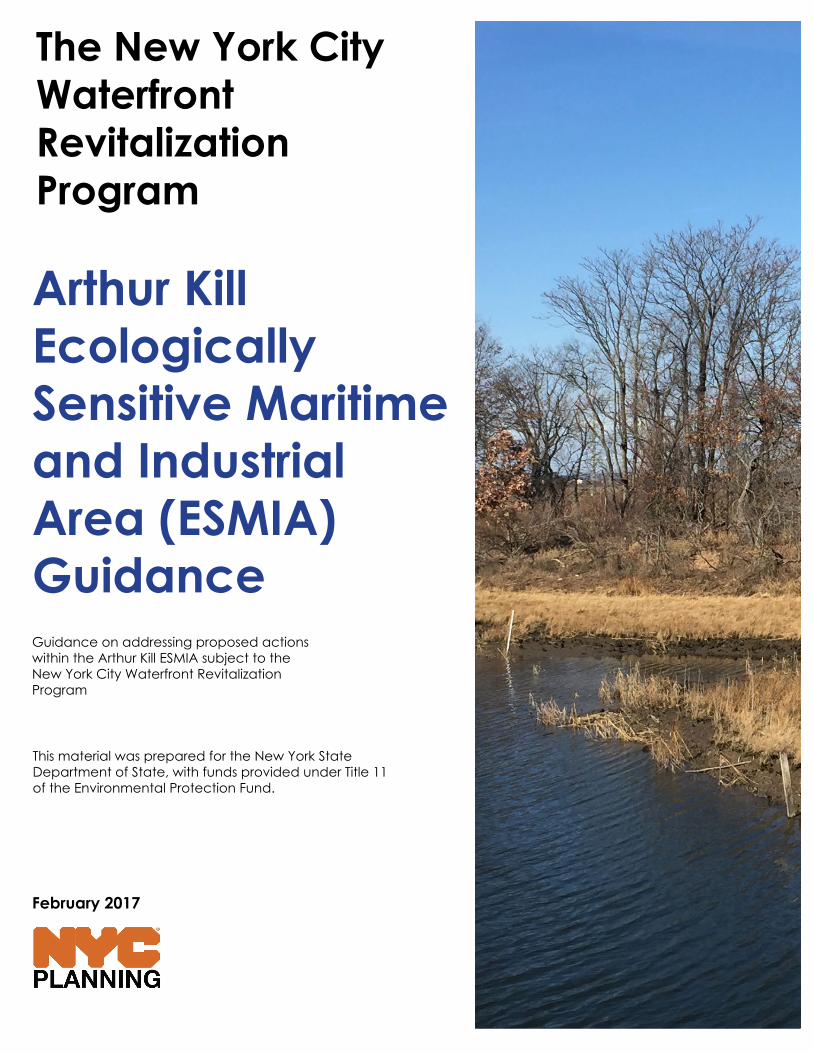
The New York City Waterfront Revitalization Program February 2017 Arthur Kill Ecologically Sensitive Maritime and Industrial Area (ESMIA) Guidance Guidance on addressing proposed actions within the Arthur Kill ESMIA subject to the New York City Waterfront Revitalization Program This material was prepared for the New York State Department of State, with funds provided under Title 11 of the Environmental Protection Fund.
-
Upload
khangminh22 -
Category
Documents
-
view
6 -
download
0
Transcript of Arthur Kill Ecologically Sensitive Maritime and Industrial Area ...
The New York City Waterfront Revitalization Program
February 2017
Arthur Kill Ecologically Sensitive Maritime and Industrial Area (ESMIA)GuidanceGuidance on addressing proposed actions within the Arthur Kill ESMIA subject to the New York City Waterfront Revitalization Program
This material was prepared for the New York State Department of State, with funds provided under Title 11 of the Environmental Protection Fund.

2 WRP ESMIA GUIDANCE
ABOUT
The New York City Waterfront Revitalization Program (WRP) is the City’s principal Coastal Zone Management tool. It establishes the City’s policies for development and use of the waterfront and coastal areas. In October 2013, the City Council approved a revised version of the WRP. The intent of these revisions was to update the policies based on new information and to reflect the City’s objectives for waterfront revitalization, as embodied in Vision 2020, the NYC Comprehensive Waterfront Plan, released in 2011. In 2016, the revised version was approved by New York State Secretary of State and concurred with by the U.S. Secretary of Commerce.
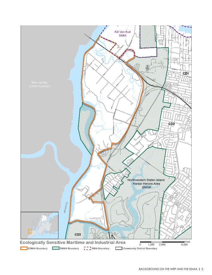
Revisions to the WRP included the designation of the Arthur Kill Ecologically Sensitive Maritime and Industrial Area (ESMIA) on the West Shore of Staten Island and established new policy objectives addressing the unique ecological qualities of the area. In addition to assessing overall consistency with the WRP, projects subject to WRP review within the defined ESMIA must also address the development objectives outlined in policies 2.2 and 4.2. This document provides guidance to applicants and coastal consistency reviewers on how to assess if a proposed project or action advances or hinders the achievement of these policies.
WHEN TO USE THIS GUIDE
Use this guide to assist in completing a WRP Consistency Assessment Form (CAF) for discretionary actions within the Arthur Kill Ecologically Sensitive Maritime and Industrial Area (ESMIA), including:
• A local discretionary action, such as a City Planning Commission action or a Citycapital project, subject to City Environmental Quality Review.
• State agency actions and programs subject to State Environmental Quality Review.
• Federal agency permits/authorizations, funding or direct actions.
This guide is not necessary if:• The discretionary action only includes maintenance activities or the in-kind, in-place
replacement of existing structure or facilities.
• The discretionary action is not located within the Arthur Kill Ecologically SensitiveMaritime and Industrial Area (ESMIA)
A full description of the Arthur Kill ESMIA, the applicable WRP policies, and all application materials and instructions are available at www.nyc.gov/wrp.
The New York City Waterfront Revitalization Program Arthur Kill Ecologically Sensitive Maritime and Industrial Area Guidance document was developed by the NYC Department of City Planning. This is a guidance document only and is not intended to serve as a substitute for the actual regulations referenced herein. The City disclaims any liability for errors that may be contained herein and shall not be responsible for any damages, consequential or actual, arising out of or in connection with the use of this information. The City reserves the right to update or correct information in this guidance document at any time and without notice.
3TABLE OF CONTENTS
About
Background on the WRP and ESMIA
Map of the Arthur Kill ESMIA
Relevant Policies and Guiding Principles
Areas of Potential Conflict
Policy Guidance Questionnaire
Edge Design
Upland Site Design
Building Design
Submitting a WRP Application
Resources & Information
TABLE OF CONTENTS
Page 2
Page 4
Page 5
Page 6
Page 7
Page 8
Page 8
Page 10
Page 12
Page 13
Page 13
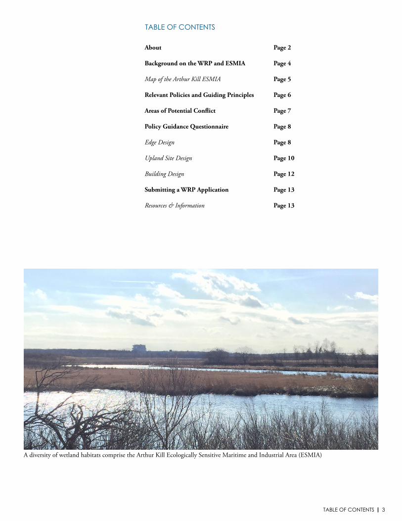
A diversity of wetland habitats comprise the Arthur Kill Ecologically Sensitive Maritime and Industrial Area (ESMIA)
4 WRP ESMIA GUIDANCE
BACKGROUND ON THE WRP AND ESMIAThis document provides guidance to applicants and coastal consistency reviewers to assess if a proposed project or action advances, hinders, or is neutral to the achievement of the New York City Waterfront Revitalization Program (WRP) policies regarding the Arthur Kill Ecologically Sensitive Maritime and Industrial Area (ESMIA). The WRP establishes the City’s policies for development and use of the waterfront and is the City’s principal coastal zone management tool.
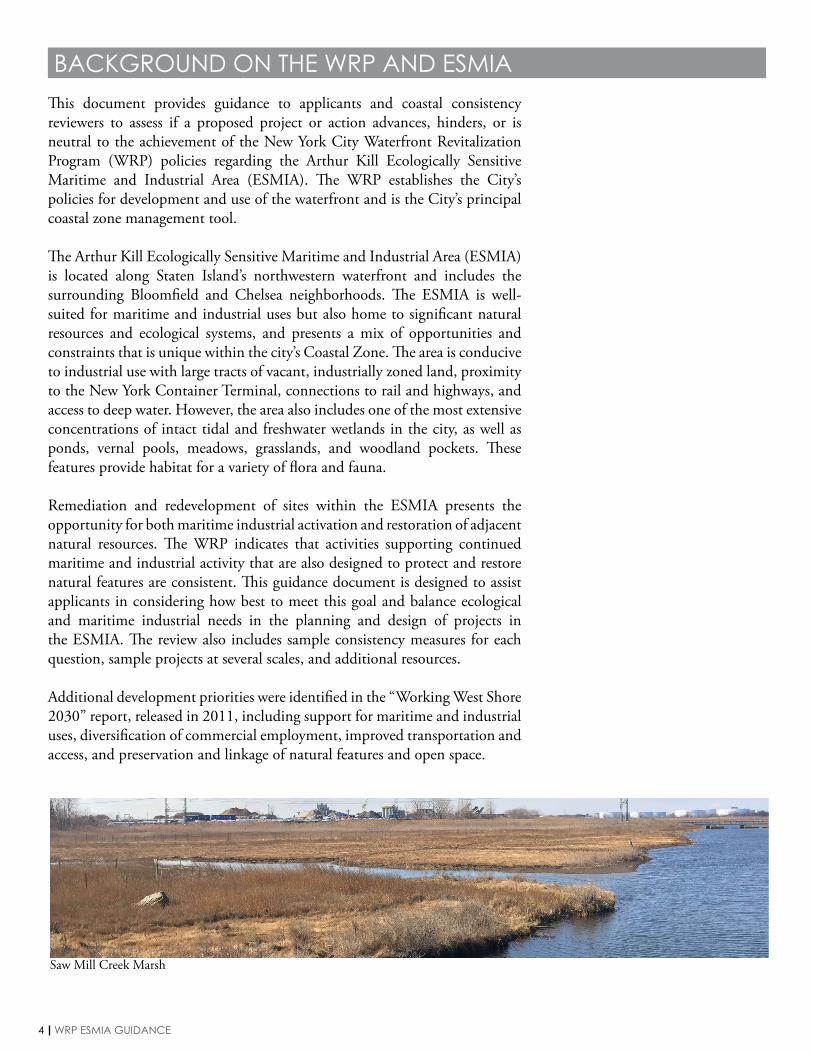
The Arthur Kill Ecologically Sensitive Maritime and Industrial Area (ESMIA) is located along Staten Island’s northwestern waterfront and includes the surrounding Bloomfield and Chelsea neighborhoods. The ESMIA is well-suited for maritime and industrial uses but also home to significant natural resources and ecological systems, and presents a mix of opportunities and constraints that is unique within the city’s Coastal Zone. The area is conducive to industrial use with large tracts of vacant, industrially zoned land, proximity to the New York Container Terminal, connections to rail and highways, and access to deep water. However, the area also includes one of the most extensive concentrations of intact tidal and freshwater wetlands in the city, as well as ponds, vernal pools, meadows, grasslands, and woodland pockets. These features provide habitat for a variety of flora and fauna.
Remediation and redevelopment of sites within the ESMIA presents the opportunity for both maritime industrial activation and restoration of adjacent natural resources. The WRP indicates that activities supporting continued maritime and industrial activity that are also designed to protect and restore natural features are consistent. This guidance document is designed to assist applicants in considering how best to meet this goal and balance ecological and maritime industrial needs in the planning and design of projects in the ESMIA. The review also includes sample consistency measures for each question, sample projects at several scales, and additional resources.
Additional development priorities were identified in the “Working West Shore 2030” report, released in 2011, including support for maritime and industrial uses, diversification of commercial employment, improved transportation and access, and preservation and linkage of natural features and open space.
Saw Mill Creek Marsh
5BACKGROUND ON THE WRP AND THE ESMIA
6 WRP ESMIA GUIDANCE
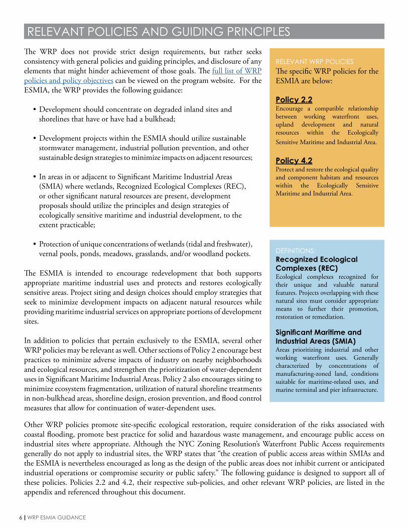
RELEVANT POLICIES AND GUIDING PRINCIPLESThe WRP does not provide strict design requirements, but rather seeks consistency with general policies and guiding principles, and disclosure of any elements that might hinder achievement of those goals. The full list of WRP policies and policy objectives can be viewed on the program website. For the ESMIA, the WRP provides the following guidance:
• Development should concentrate on degraded inland sites and shorelines that have or have had a bulkhead;
• Development projects within the ESMIA should utilize sustainable stormwater management, industrial pollution prevention, and other sustainable design strategies to minimize impacts on adjacent resources;
• In areas in or adjacent to Significant Maritime Industrial Areas (SMIA) where wetlands, Recognized Ecological Complexes (REC), or other significant natural resources are present, development proposals should utilize the principles and design strategies of ecologically sensitive maritime and industrial development, to the extent practicable;
• Protection of unique concentrations of wetlands (tidal and freshwater), vernal pools, ponds, meadows, grasslands, and/or woodland pockets.
RELEVANT WRP POLICIESThe specific WRP policies for the ESMIA are below:
Policy 2.2Encourage a compatible relationship between working waterfront uses, upland development and natural resources within the Ecologically Sensitive Maritime and Industrial Area.
Policy 4.2Protect and restore the ecological quality and component habitats and resources within the Ecologically Sensitive Maritime and Industrial Area.
The ESMIA is intended to encourage redevelopment that both supports appropriate maritime industrial uses and protects and restores ecologically sensitive areas. Project siting and design choices should employ strategies that seek to minimize development impacts on adjacent natural resources while providing maritime industrial services on appropriate portions of development sites.
In addition to policies that pertain exclusively to the ESMIA, several other WRP policies may be relevant as well. Other sections of Policy 2 encourage best practices to minimize adverse impacts of industry on nearby neighborhoods and ecological resources, and strengthen the prioritization of water-dependent uses in Significant Maritime Industrial Areas. Policy 2 also encourages siting to minimize ecosystem fragmentation, utilization of natural shoreline treatments in non-bulkhead areas, shoreline design, erosion prevention, and flood control measures that allow for continuation of water-dependent uses.
DEFINITIONS:Recognized Ecological Complexes (REC)Ecological complexes recognized for their unique and valuable natural features. Projects overlapping with these natural sites must consider appropriate means to further their promotion, restoration or remediation.
Significant Maritime and Industrial Areas (SMIA)Areas prioritizing industrial and other working waterfront uses. Generally characterized by concentrations of manufacturing-zoned land, conditions suitable for maritime-related uses, and marine terminal and pier infrastructure.
Other WRP policies promote site-specific ecological restoration, require consideration of the risks associated with coastal flooding, promote best practice for solid and hazardous waste management, and encourage public access on industrial sites where appropriate. Although the NYC Zoning Resolution’s Waterfront Public Access requirements generally do not apply to industrial sites, the WRP states that “the creation of public access areas within SMIAs and the ESMIA is nevertheless encouraged as long as the design of the public areas does not inhibit current or anticipated industrial operations or compromise security or public safety.” The following guidance is designed to support all of these policies. Policies 2.2 and 4.2, their respective sub-policies, and other relevant WRP policies, are listed in the appendix and referenced throughout this document.
7AREAS OF POTENTIAL CONFLICT
AREAS OF POTENTIAL CONFLICTTogether, these policies encourage siting and design decisions that balance the industrial opportunities and ecological needs of the area, by distinguishing areas of sites appropriate for maritime industrial activation from areas that are more appropriate for ecosystem protection and restoration. However, such bright line distinctions may be difficult to draw in practice. Examples of the challenges that may emerge in planning for development on the ESMIA include:
EDGE DESIGNShoreline design best practices widely recommend utilizing soft, sloping edges for both ecosystem protection and resiliency reasons where practicable, particularly outside of non-Priority Marine Activity Zone (PMAZ) areas. However, maritime industrial uses will often require hard and/or bulkhead edges for practical reasons. Edge design will need to balance these competing concerns.
PERMEABLE VS. IMPERMEABLE SURFACESIn general, best practices recommend maximizing green infrastructure and permeable surfaces for stormwater management needs, and the WRP calls for minimizing impervious surfaces as a general guideline. However, such practices may be inappropriate for industrial uses, where paving and grading is often recommended for safe management and to avoid contamination by industrial water and waste.
EXPANDING INFRASTRUCTURE VS. ECOLOGICAL PROTECTIONRedevelopment in the ESMIA will likely require infrastructure build-out, as much of the area lacks a sufficient roadway network for the movement of both goods and people. The WRP also recommends construction of rail freight and intermodal freight transportation solutions. However, infrastructure could lead to wetlands fragmentation or exacerbate other ecological concerns.
PUBLIC ACCESS VS. ADEQUATE PROTECTIONSWRP Policy 8 encourages public access and view corridors, even for industrial uses, where such access does not endanger public health and safety. While there may be opportunities to encourage waterfront connections on ESMIA sites, this must be balanced with the adequate wall and fencing requirements of industrial sites, and other measures that must be taken to protect health and safety.
The following guidance is intended to help applicants navigate these conflicts and arrive at project proposals that balance the industrial and ecological needs within the ESMIA.
DEFINITIONS:Priority Marine Activity Zones (PMAZ)Areas with a concentration of water-dependent activity or sites that are key nodes in waterborne transportation networks, and which have the infrastructure to support these uses. Projects within these zones should prioritize designs that accommodate water-dependent uses.
8 WRP ESMIA GUIDANCE
EDGE DESIGNRELEVANT POLICIES: 2.2.A, 2.2.B, 2.2.C, 2.2.D, 2.2.K, 2.2.M;4.2.A, 4.2.B, 4.2.C, 4.2.G
With the policy goals of the WRP in mind, the applicant should consider the impacts of redevelopment on the ESMIA at three distinct, though interrelated, scales: the edge, the upland site, and any proposed buildings or other structures. The applicant should complete all questions in each of the three sections below. Consistent with the intent of the WRP, the questions are designed to indicate consistency with general policies and principles, and not to dictate specific design requirements.
Completion of this questionnaire should be used to complete a policy consistency assessment for Policies 2.2 and 4.2. It can also be used to complete a consistency assessment at other industrial sites where ecological resources are present.
POLICY GUIDANCE QUESTIONNAIRE
1
2
3
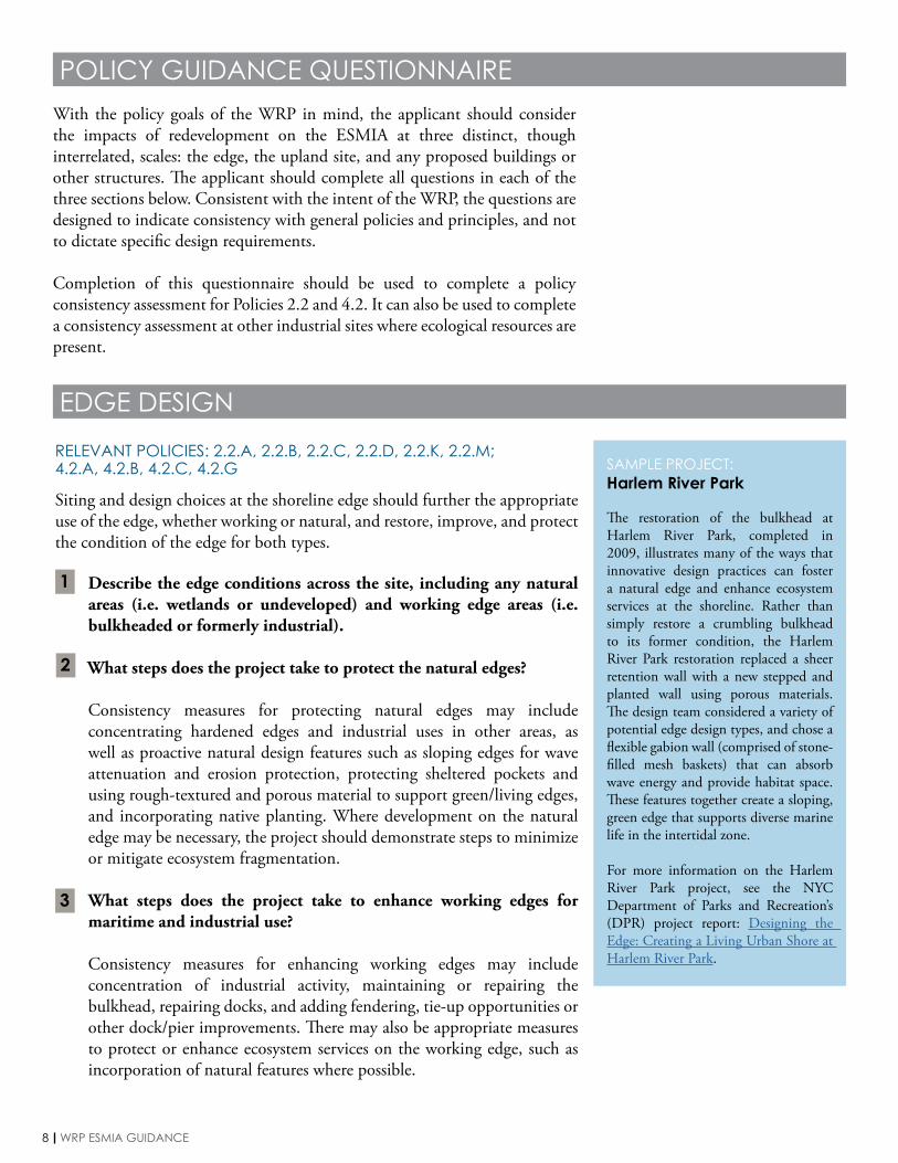
SAMPLE PROJECT:Harlem River Park
The restoration of the bulkhead at Harlem River Park, completed in 2009, illustrates many of the ways that innovative design practices can foster a natural edge and enhance ecosystem services at the shoreline. Rather than simply restore a crumbling bulkhead to its former condition, the Harlem River Park restoration replaced a sheer retention wall with a new stepped and planted wall using porous materials. The design team considered a variety of potential edge design types, and chose a flexible gabion wall (comprised of stone-filled mesh baskets) that can absorb wave energy and provide habitat space. These features together create a sloping, green edge that supports diverse marine life in the intertidal zone.
For more information on the Harlem River Park project, see the NYC Department of Parks and Recreation’s (DPR) project report: Designing the Edge: Creating a Living Urban Shore at Harlem River Park.
Siting and design choices at the shoreline edge should further the appropriate use of the edge, whether working or natural, and restore, improve, and protect the condition of the edge for both types.
Describe the edge conditions across the site, including any natural areas (i.e. wetlands or undeveloped) and working edge areas (i.e. bulkheaded or formerly industrial).
What steps does the project take to protect the natural edges?
Consistency measures for protecting natural edges may include concentrating hardened edges and industrial uses in other areas, as well as proactive natural design features such as sloping edges for wave attenuation and erosion protection, protecting sheltered pockets and using rough-textured and porous material to support green/living edges, and incorporating native planting. Where development on the natural edge may be necessary, the project should demonstrate steps to minimize or mitigate ecosystem fragmentation.
What steps does the project take to enhance working edges for maritime and industrial use?
Consistency measures for enhancing working edges may include concentration of industrial activity, maintaining or repairing the bulkhead, repairing docks, and adding fendering, tie-up opportunities or other dock/pier improvements. There may also be appropriate measures to protect or enhance ecosystem services on the working edge, such as incorporation of natural features where possible.

9POLICY GUIDANCE QUESTIONNAIRE // EDGE DESIGN
SAMPLE PROJECT:Sims Municipal Recycling Sunset Park Material Recovery Facility
The Sims Municipal Recycling Sunset Park Material Recovery Facility, opened in December 2013, is an 11-acre recycling center on Brooklyn’s industrial Sunset Park waterfront. In addition to incorporating features that make the building and supporting structures more resilient to future flooding and storms, the development partnered with landscape architects and marine biologists on a number of measures to support new ecosystems that complement the adjoining active shoreline and piers.
Subtidal communities of blue mussels, eelgrass, and other species help revitalize marine ecosystems and monitor water quality without impeding local industrial activity, even incorporating local recycled materials as substrate to attract species and diversify and strengthen coastal green infrastructure and marine ecology.
For more information on the Sunset Park Material Recovery Facility, visit the Sims Municipal Recycling website.
5
6
7
4 What steps does the project take to protect or restore tidal wetlands?
Consistency measures for wetlands protection or restoration may include reconstruction of lost physical conditions to maximize wetlands values, adjustment of altered chemical characteristics, reintroduction of indigenous flora to emulate natural conditions, and enhancement of adjacent areas to provide natural buffers to wetlands.
Does the project maintain ecosystem services by preventing the net loss of wetlands?
Consistency measures to prevent net wetlands loss may include avoiding draining or filling wetlands, minimizing adverse impacts of unavoidable draining or filling through siting and materials decisions, or contributing to a wetland mitigation banking program. Per Policy 4.5, avoidance is preferred to on-site mitigation, which is preferred to off-site mitigation (including mitigation banking).
Does the project require dredging? If so, describe the conditions of the shoreline or waterway where dredging is required.
Consistency measures for appropriate dredging may include use of an approved method at an approved site, as well as use of dredging materials for wetland creation, water quality improvements, beach nourishment, port redevelopment, or other beneficial uses.
Does the project plan take steps to minimize air and water pollution at the edge?
Consistency measures to minimize pollution might include policies to minimize idling during goods delivery or transfer, or infrastructure to reduce or eliminate runoff or discharge into the water.
Old Place Creek Tidal Wetland Area
10 WRP ESMIA GUIDANCE
UPLAND SITE DESIGN
Upland site design should mitigate impacts on both local ecology and the surrounding community, while promoting continued or new industrial uses.
Does the project identify areas of the site for natural resource protection that are critical to maintaining habitat and ecosystem continuity?
Consistency measures may include conducting a natural resources assessment of the site, following the methodology in Chapter 11, Section 300 of the CEQR Technical Manual, or an alternative recognized assessment methodology.
Does the project take steps to protect upland/freshwater wetlands?
Consistency measures for wetlands protection may include avoiding siting industrial uses on wetlands and ensuring an adequate buffer zone between industrial and wetlands areas, avoiding fragmentation of wetlands and habitats in siting decisions, and avoiding draining or fill.
Does the project take steps to restore local ecology?
Consistency measures to restore local ecology may include brownfields remediation, removal of invasive species, and avoiding the use of non-indigenous plants except those required to provide ecosystem services, such as may be needed for phytoremediation, erosion control or filtration when native species cannot provide the same services.
Does the project take steps to mitigate stormwater impacts on the site?
Consistency measures to mitigate stormwater management challenges may include planted trees, porous pavement or paving/grading with drainage, gravel wetlands, green streets, drainage and conveyance systems, treatment and filtration equipment, gray water capture and reuse, berms, detention ponds, vegetative buffers, trenches, and swales. Consistency demonstration should include an explanation of whether green or gray measures are more appropriate at specific portions of the site, based on specific site uses and characteristics.
What site-wide measures are being taken to mitigate air pollution, dust, and odor?
Consistency measures to mitigate air pollution may include covering all open material piles (except when active operations are underway), sprinkling and irrigation to moisten surface and suppress dust and odor, vegetative cover to stabilize soil, proper paving to reduce dust from tires, and locating polluting uses away from ecological areas.
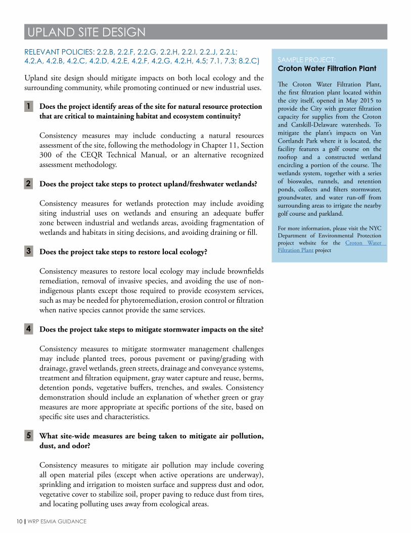
SAMPLE PROJECT:Croton Water Filtration Plant
The Croton Water Filtration Plant, the first filtration plant located within the city itself, opened in May 2015 to provide the City with greater filtration capacity for supplies from the Croton and Catskill-Delaware watersheds. To mitigate the plant’s impacts on Van Cortlandt Park where it is located, the facility features a golf course on the rooftop and a constructed wetland encircling a portion of the course. The wetlands system, together with a series of bioswales, runnels, and retention ponds, collects and filters stormwater, groundwater, and water run-off from surrounding areas to irrigate the nearby golf course and parkland.
For more information, please visit the NYC Department of Environmental Protection project website for the Croton Water Filtration Plant project
RELEVANT POLICIES: 2.2.B, 2.2.F, 2.2.G, 2.2.H, 2.2.I, 2.2.J, 2.2.L;4.2.A, 4.2.B, 4.2.C, 4.2.D, 4.2.E, 4.2.F, 4.2.G, 4.2.H, 4.5; 7.1, 7.3; 8.2.C)
1
2
3
4
5
11POLICY GUIDANCE QUESTIONNAIRE // UPLAND SITE DESIGN
What site-wide measures are being taken to mitigate water pollution?
Consistency measures to mitigate water pollution may include minimizing exposure of manufacturing materials and areas to rain, snow, melt, and runoff through either siting or equipment, and locating polluting uses away from ecological areas. It should be indicated whether a Storm Water Management Plan has been or will be completed.
Are there plans in place to manage solid and hazardous waste to minimize ecosystem and coastal resource impacts?
Consistency measures to minimize waste impacts may include limiting waste production, preventing pollution runoff, and a waste transportation plan that minimizes interaction with ecosystem resources.
Does the site border any residential communities or community use facilities? If yes, is there a buffer zone between development areas and adjoining communities?
Consistency measures to demonstrate a buffer with adjoining communities may include locating equipment and other sources of air and noise pollution away from residential areas, installing proper ventilation to direct pollution away from residential areas, or isolating these sources through gray measures such as enclosure or green measures such as vegetated buffers.
Will physical or visual public access be provided at safe locations throughout the site?
Consistency measures to provide appropriate public access may include interpretive signage and recreation opportunities, boardwalks, cat walks, nature trails, overlooks or platforms, and other access opportunities designed to minimize ecological impacts. Per Policy 8.2, natural resource protection may be prioritized over public access where both uses are not compatible. In such cases, providing visual access to coastal resources may be considered a consistency measure.
What steps does the project plan take to encourage continued industrial uses in the area?
Consistency measures to encourage industrial uses may include investing in roadway or other infrastructure upgrades, dredging to support port redevelopment, or otherwise contributing to the development of a maritime hub.
6
7
8
9
10
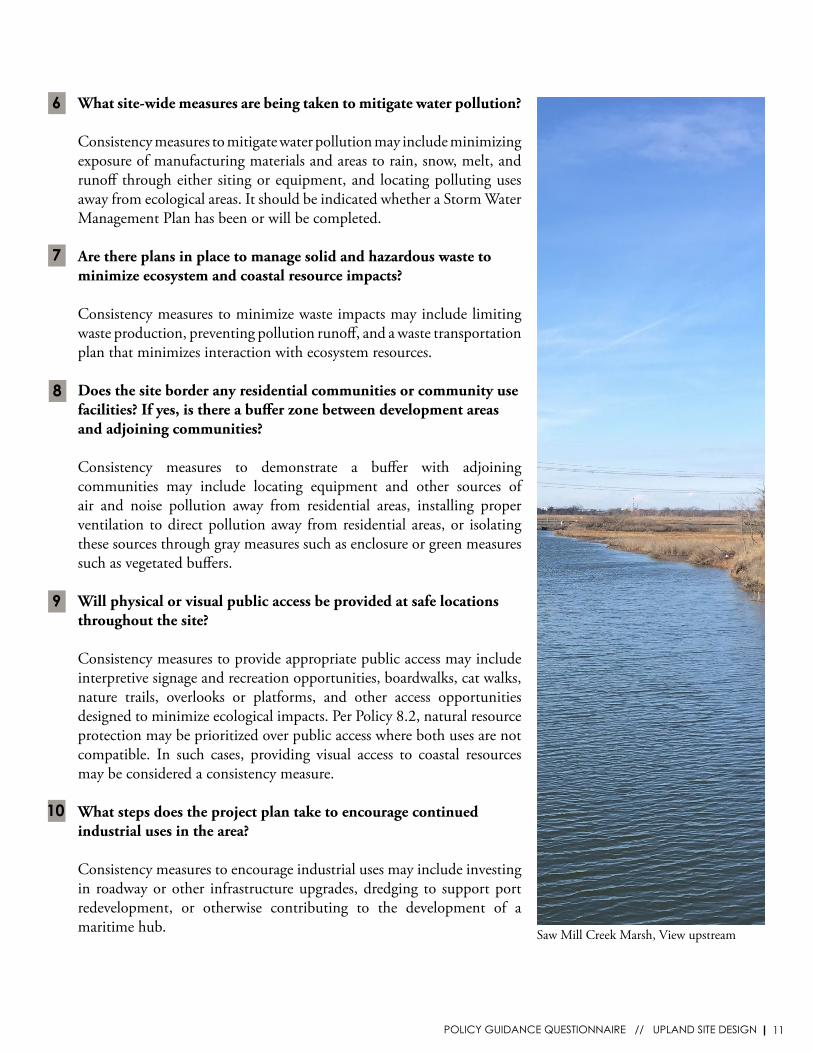
Saw Mill Creek Marsh, View upstream
12 WRP ESMIA GUIDANCE
BUILDING DESIGN
Siting and design choices at the building scale should minimize the range of pollution and ecosystem impacts of operational activities, mitigate stormwater impacts, and support continued industrial uses.
Does the project take steps to minimize water pollution at the building scale?
Consistency measures to minimize water pollution may include containment walls around hazardous materials, and limiting non-storm water discharge from process water, A/C condensate, cooling water, and vehicle wash water.
Does the project take steps to mitigate stormwater impacts at the building scale?
Consistency measures to mitigate building stormwater impacts may include identifying and mapping potential discharge points, inventorying and protecting significant materials (fuels, solvents, detergents, plastic pellets, metallic products, raw materials for food processing or production, hazardous substances under CERCLA, fertilizers, pesticides, waste products), installation of backflow preventers, water retention through rain barrels and cisterns, green or blue roofing, or other measures to minimize impervious cover on the site.
Does the project take steps to minimize air pollution from equipment and building systems?
Consistency measures to minimize air pollution may include diesel particulate filters for equipment, ventilation systems to direct air pollution away from ecologically sensitive areas, and physical barriers to restrict dispersal of airborne particulates.
Does the project take steps to mitigate noise impacts?
Consistency measures to mitigate noise impacts may include strategically locating, isolating, or enclosing noise-producing equipment.
Do the building uses support water-dependent or maritime industrial use?
Consistency measures to support industrial uses may include demonstrating that current or future building tenants are directly engaged in water-dependent or other maritime industrial businesses, including information on jobs and economic revenue generated through industrial uses in the building.
SAMPLE PROJECT:Remsen Yard DEP Maintenance Facility
When the Department of Environmental Protection’s Remsen Yard facility in Brooklyn was redesigned in 2009, on-site water management was a primary goal. The industrial facility uses a variety of strategies to detain, retain, and reuse stormwater, including bioswales, and a system for rainwater collection and reuse. Remsen Yards demonstrates how large industrial facilities can be designed to mitigate water impacts.
For more information on the Remsen Yard project, see the Sustainable New York Design and Construction Excellence report.
RELEVANT POLICIES: 2.2.I, 4.2.A, 4.2.D
1
2
3
4
5
13SUBMITTING A WRP APPLICATION
Discretionary projects subject to local WRP review require submission of a WRP Consistency Assessment Form (CAF) and any required supporting materials.
Application materials can be emailed to [email protected] or sent to:
Waterfront and Open Space Division New York Department of City Planning 120 Broadway, 31st Floor New York, NY 10271 A full description of the New York City Waterfront Revitalization Program and accompanying documents are available at www.nyc.gov/wrp
NYC Department of City Planning
• The New York City Waterfront Revitalization Program (WRP)
• Vision2020 NYC Comprehensive Waterfront
• Open Industrial Uses Study
• Urban Waterfront Adaptive Strategies
Other Local Agency Resources
• PlaNYC Sustainable Stormwater Management plan (Updated 2012)NYC Mayor’s Office of Recovery & Resiliency
• NYC Green Infrastructure ProgramNYC Department of Environmental Protection
• Sustainable Urban Site Design ManualNYC Department of Design & Construction
NYS Department of Environmental Conservation (DEC) Resources
• New York State Stormwater Management Design Manual
• New York State Open Space Conservation Plan
Federal Environmental Protection Agency (EPA) Resources
• Developing Your Stormwater Pollution Prevention Plan: A Guide for Industrial Operators
• Green Infrastructure Design and Implementation Tools
Other Resources
• Waterfront Edge Design Guidelines (WEDG)Waterfront Alliance
• Hudson-Raritan Estuary Comprehensive Restoration PlanNew York-New Jersey Harbor & Estuary Program
RESOURCES & INFORMATION
SUBMITTING A WRP APPLICATION
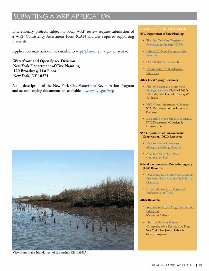
View from Prall’s Island, west of the Arthur Kill ESMIA