A Geographer's World - Rahway Public Schools
36
Explore ONLINE! 2 Document-Based Investigations Graphic Organizers Interactive Games Animation: How Satellites Gather Map Data Channel One News Video: Making Art with GPS Animation: Map Projections Animation: How to Read a Map What You Will Learn Lesson 1: Studying Geography 5 The Big Idea The study of geography helps us view the world in new ways. Lesson 2: The Branches of Geography 10 The Big Idea Geography is divided into two main branches—physical geography and human geography. Lesson 3: Themes of Geography 16 The Big Idea Geographers have created two different but related systems for organizing geographic studies. Lesson 4: The Geographer’s Tools 20 The Big Idea Geographers use many tools to study the world. Lesson 5: Geography Handbook 24 The Big Idea Geographers study the world by understanding maps and geographic features of Earth. In this module, you will learn that geography is the study of the world. You will find out how geographic studies are organized and what tools are used. Essential Question How does the use of geographic tools help us view the world in new ways? A Geographer’s World Module 1 About the Photo: This village is in the country of Nepal. It rests high in the Himalayas, the highest mountains in the world. Module 1
-
Upload
khangminh22 -
Category
Documents
-
view
8 -
download
0
Transcript of A Geographer's World - Rahway Public Schools

Explore ONLINE!
2
Document-Based Investigations
Graphic Organizers
Interactive Games
Animation: How Satellites Gather Map Data
Channel One News Video: Making Art with GPS
Animation: Map Projections
Animation: How to Read a Map
What You Will LearnLesson 1: Studying Geography . . . . . . . . . . . . . . . . . . . . . . . . 5The Big Idea The study of geography helps us view the world in new ways.Lesson 2: The Branches of Geography . . . . . . . . . . . . . . . . . . . 10The Big Idea Geography is divided into two main branches—physical geography and human geography.Lesson 3: Themes of Geography . . . . . . . . . . . . . . . . . . . . . . 16The Big Idea Geographers have created two different but related systems for organizing geographic studies.Lesson 4: The Geographer’s Tools . . . . . . . . . . . . . . . . . . . . . . 20The Big Idea Geographers use many tools to study the world.Lesson 5: Geography Handbook . . . . . . . . . . . . . . . . . . . . . . 24The Big Idea Geographers study the world by understanding maps and geographic features of Earth.
In this module, you will learn that geography is the study of the world. You will find out how geographic studies are organized and what tools are used.
Essential QuestionHow does the use of geographic tools help us view the world in new ways?
A Geographer’s WorldModule 1
About the Photo: This village is in the country of Nepal. It rests high in the Himalayas, the highest mountains in the world.
Module 1
DO NOT EDIT--Changes must be made through “File info” CorrectionKey=NL-B

Human Geography Geography is also the study of people. It asks where people live, what they eat, what they wear, and even what kinds of animals they keep.
Physical Geography Geography is the study of the world’s land features, such as this windswept rock formation in Arizona.
Studying the World Exploring the world takes people to exciting and interesting places.
A Geographer’s World 3
DO NOT EDIT--Changes must be made through “File info” CorrectionKey=NL-B

Reading Social Studies
Much of the information gathered by these satellites is in the form of images. Geographers can study these images of Earth to see what an area looks like from far above. Satellites also collect information that we can-not see from the planet’s surface. The information gathered by satel-lites helps geographers make accurate maps.
YOU TRY IT!
Create a chart like the Computer Mapping one above, but change the title to “Satellite Images.” Fill in some prior knowledge in the left column. Then take turns reading aloud the passage below with a partner. Once you each have read the passage, add what you learned about satellite images to the right column.
In the past, cartographers always drew maps by hand. Many of those maps were not very accurate. Today, though, most maps are made using computers and satellite images. Through advances in mapmaking, we can make accurate maps on almost any scale, from the whole world to a single neighborhood, and keep them up to date.
Use Prior KnowledgeREADING FOCUS
When you put together a puzzle, you search for pieces that are missing to complete the picture. As you read, you do the same thing when you use prior knowledge. You take what you already know about a subject and then add the information you are reading to create a full picture. The example below shows how using prior knowledge about computer mapping helped one reader fill in the pieces about how geographers use computer mapping.
Computer Mapping
What I know before reading What else I learned
My dad uses the computer to get maps for trips.
Maps have not always been very accurate.
I can find maps of states and countries on the Internet.
Computers help make new kinds of maps that are more than just cities and roads.
These computer maps are an important part of geography.
As you read this module, use your prior knowledge to help add to your understanding of the text.
Module 14
DO NOT EDIT--Changes must be made through “File info” CorrectionKey=NL-A

Lesson 1
Studying Geography
The Big IdeaThe study of geography helps us view the world in new ways.
Main Ideas■■ Geography is the study of the world, its people, and the land-scapes they create.
■■ Geographers look at the world in many different ways.
Key Terms and Places geographylandscapesocial scienceregions
If YOU lived there . . .You have just moved to Miami, Florida, from your old home in Pennsylvania. Everything seems very differ-ent—from the weather and the trees to the way people dress and talk. Even the streets and buildings look differ-ent. One day you get an email from a friend at your old school. “What’s it like living there?” your friend asks.
How will you describe your new home?
What Is Geography?Think about the place where you live. What does the land look like? Are there tall mountains nearby, or is the land so flat that you can see for miles? Is the ground covered with bright green grass and trees, or is the area part of a sandy desert?
Now think about the weather in your area. What is it like? Does it get really hot in the summer? Do you see snow every winter? How much does it rain? Do tornadoes ever strike?
Finally, think about the people who live in your town or city. Do they live mostly in apartments or houses? Do most people own cars or do they get around town on buses or trains? What kinds of jobs do adults in your town have? Were most of the people you know born in your town or did they move there?
The things that you have been thinking about are part of your area’s geography. Geography is the study of the world, its people, and the landscapes they create. To a geographer, a place’s landscape is all the human and physical features that make it unique. When they study the world’s landscapes, geographers ask questions much like the ones you just asked yourself.
Geography as a Science Many of the questions that geogra-phers ask deal with how the world works. They want to know what causes mountains to form and what creates tornadoes. To answer questions like these, geographers have to think and act like scientists.
As scientists, geographers do field work to gather data, or information, about places. Gathering data can sometimes lead geographers to fascinating places. They might have to crawl
5 A Geographer’s World
DO NOT EDIT--Changes must be made through “File info” CorrectionKey=NL-A

Reading Check Compare In what ways is geography
both a science and a social science?
deep into caves or climb tall mountains to make observations and take measurements. At other times, geographers study sets of images collected by satellites orbiting high above Earth. These scientists make observations about the places they study. Then they record those observations.
However geographers make observations and gather data, they have to study it carefully. Like other scientists, geographers must examine their findings in great detail before they can learn what all the information means. These scientists interpret and summarize the data gathered. Then they make their conclusions.
Geography as a Social Science Not everything that geographers study can be measured in numbers, however. Some geographers study people and their lives. For example, they may ask why countries change their gov-ernments or why people in a place speak a certain language. This kind of information cannot be measured.
Because it deals with people and how they live, geography is sometimes called a social science. A social science is a field that studies people and the relationships among them.
The geographers who study people do not dig in caves or climb moun-tains. Instead, they visit places and talk to the people who live there. That is the field work they do to gather information about people’s lives and communities. These geographers may design and conduct surveys to gather information. They also might record oral histories from what people tell them about their communities.
Analyze VisualsWhat is the landscape of this part of Algeria like?
Geography is the study of the world, its people, and the landscapes they create. To study a place’s geography, we look at its physical and human features.
Many Algerians live in small villages like this one. The village is one of Algeria’s human features.
Together, Algeria’s physical and human features create the country’s landscape.
The physical features of Algeria include huge deserts full of tall sand dunes.
What Is Geography?
Module 16
DO NOT EDIT--Changes must be made through “File info” CorrectionKey=NL-A
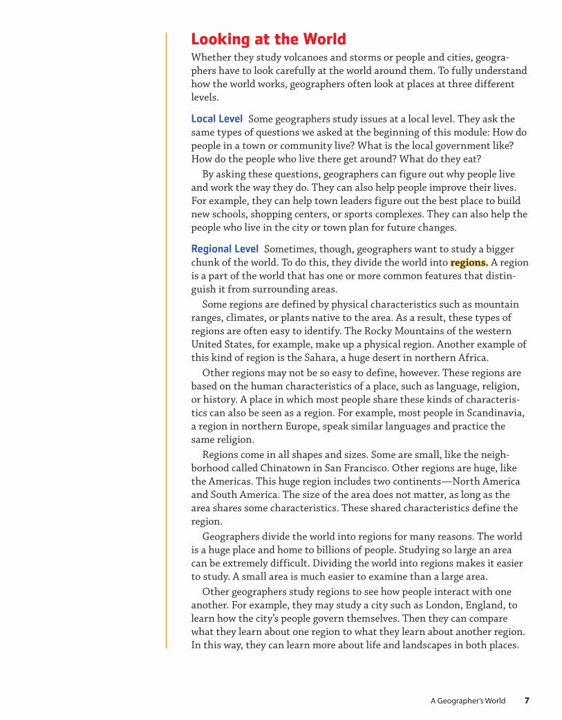
Looking at the WorldWhether they study volcanoes and storms or people and cities, geogra-phers have to look carefully at the world around them. To fully understand how the world works, geographers often look at places at three different levels.
Local Level Some geographers study issues at a local level. They ask the same types of questions we asked at the beginning of this module: How do people in a town or community live? What is the local government like? How do the people who live there get around? What do they eat?
By asking these questions, geographers can figure out why people live and work the way they do. They can also help people improve their lives. For example, they can help town leaders figure out the best place to build new schools, shopping centers, or sports complexes. They can also help the people who live in the city or town plan for future changes.
Regional Level Sometimes, though, geographers want to study a bigger chunk of the world. To do this, they divide the world into regions. A region is a part of the world that has one or more common features that distin-guish it from surrounding areas.
Some regions are defined by physical characteristics such as mountain ranges, climates, or plants native to the area. As a result, these types of regions are often easy to identify. The Rocky Mountains of the western United States, for example, make up a physical region. Another example of this kind of region is the Sahara, a huge desert in northern Africa.
Other regions may not be so easy to define, however. These regions are based on the human characteristics of a place, such as language, religion, or history. A place in which most people share these kinds of characteris-tics can also be seen as a region. For example, most people in Scandinavia, a region in northern Europe, speak similar languages and practice the same religion.
Regions come in all shapes and sizes. Some are small, like the neigh-borhood called Chinatown in San Francisco. Other regions are huge, like the Americas. This huge region includes two continents—North America and South America. The size of the area does not matter, as long as the area shares some characteristics. These shared characteristics define the region.
Geographers divide the world into regions for many reasons. The world is a huge place and home to billions of people. Studying so large an area can be extremely difficult. Dividing the world into regions makes it easier to study. A small area is much easier to examine than a large area.
Other geographers study regions to see how people interact with one another. For example, they may study a city such as London, England, to learn how the city’s people govern themselves. Then they can compare what they learn about one region to what they learn about another region. In this way, they can learn more about life and landscapes in both places.
7 A Geographer’s World
DO NOT EDIT--Changes must be made through “File info” CorrectionKey=NL-A

Global Level Sometimes, geographers do not want to study the world just at a regional level. Instead, they want to learn how people interact globally, or around the world. To do so, geographers ask how events and ideas from one region of the world affect people in other regions. In other words, they study the world on a global level.
Geographers who study the world on a global level try to find relation-ships among people who live far apart. They may, for example, examine the products that a country exports to see how those products are used in other countries.
Global LevelLondon is one of the world’s main financial centers. Here, a geographer might study how London’s economy affects the world.
Looking at the World
Geographers look at the world at many levels. At each level, they ask different questions and discover different types of information. By putting information gathered at different levels together, geographers can better understand a place and its role in the world.
Local LevelThis busy neighborhood in London, England, is a local area. A geographer here might study local foods, housing, or clothing.
Regional LevelAs a major city, London is also a region. At this level, a geographer might study the city’s population or transportation systems.
Analyze VisualsBased on these photos, what are some questions a geographer might ask about London?
Module 18
DO NOT EDIT--Changes must be made through “File info” CorrectionKey=NL-A

In recent decades, worldwide trade and communication have increased. As a result, we need to understand how our actions affect people around the world. Through their studies, geographers provide us with information that helps us figure out how to live in a rapidly changing world.
Summary and Preview Geography is the study of the world, its people, and its landscapes. In the next lesson, you will explore the branches into which the field is divided.
Reading Check Find Main Ideas
At what levels do geographers study the
world?
Review Ideas, Terms, and Places
1. a. Define What is geography? b. Explain Why is geography considered a science?
2. a. Identify What is a region? Give two examples.b. Elaborate What global issues do geographers study?
Critical Thinking
3. Summarize Draw two ovals like the ones shown here. Use your notes to fill the ovals with information about geography and geographers.
Lesson 1 Assessment
What Geography Is
What Geographers
Study
9 A Geographer’s World
DO NOT EDIT--Changes must be made through “File info” CorrectionKey=NL-A

The Branches of Geography
The Big IdeaGeography is divided into two main branches—physical geog-raphy and human geography.
Main Ideas■■ Physical geography is the study of landforms, water bod-ies, and other physical features.
■■ Human geography focuses on people, their cultures, and the landscapes they create.
■■ Other branches of geography examine specific aspects of the physical or human world.
Key Terms and Placesphysical geographyhuman geographycartographymeteorology
If YOU lived there . . . You are talking to two friends about the vacations their families will take this summer. One friend says that his family is going to the Grand Canyon. He is very excited about seeing the spectacular landscapes in and around the canyon. Your other friend’s family is going to visit Nashville, Tennessee. She is looking forward to trying new foods at the city’s restaurants and touring its museums.
Which vacation sounds more interesting? Why?
Physical GeographyThink about a jigsaw puzzle. Seen as a whole, the puzzle shows a pretty or interesting picture. To see that picture, though, you have to put all the puzzle pieces together. Before you assemble them, the pieces do not give you a clear idea of what the puzzle will look like when it is assembled. After all, each piece con-tains only a tiny portion of the overall image.
In many ways, geography is like a huge puzzle. It is made up of many branches, or divisions. Each of these branches focuses on a single part of the world. Viewed separately, none of these branches shows us the whole world. Together, however, the many branches of geography improve our understanding of our planet and its people.
Geography’s two main branches are physical geography and human geography. Geographers identify and locate major physical and human geographic features of various places and regions in the world. The first branch, physical geography, is the study of the world’s physical geographic features—its land-forms, bodies of water, climates, soils, and plants.
The Physical World What does it mean to say that physical geography is the study of physical geographic features? Phys-ical geographers want to know all about the different features found on our planet. They want to know where mountain ranges are, how rivers flow across the landscape, and why dif-ferent amounts of rain fall from place to place.
Lesson 2
Module 110
DO NOT EDIT--Changes must be made through “File info” CorrectionKey=NL-A

Reading Check Identify Points of View
What are some features in your area that a
physical geographer might study?
More importantly, however, physical geographers want to know what causes the different shapes on Earth. They want to know why mountain ranges rise up where they do and what causes rivers to flow in certain directions. They also want to know why various parts of the world have very different weather and climate patterns.
To answer these questions, physical geographers take detailed mea-surements. They study the heights of mountains and the temperatures of places. To track any changes that occur over time, physical geographers keep careful records of all the information they collect.
Uses of Physical Geography Earth is made up of hundreds of types of physical geographic features. Without a complete understanding of what these features are and the effect they have on the world’s people and landscapes, we cannot fully understand our world. This is the major reason that geographers study the physical world—to learn how it works.
There are also other, more specific reasons for studying physical geogra-phy, though. Studying the changes that take place on our planet can help us prepare to live with those changes. For example, knowing what causes volcanoes to erupt can help us predict eruptions. Knowing what causes ter-rible storms can help us prepare for them. In this way, the work of physical geographers helps us adjust to the dangers and changes of our world.
Human GeographyThe physical world is only one part of the puzzle of geography. People are also part of the world. Human geography is the study of the world’s human geographic features—people, communities, and landscapes. It is the second major branch of geography.
The Human World Put simply, human geographers study the world’s people, past and present. They look at where people live and why. They ask why some parts of the world have more people than others, and why some places have almost no people at all.
Eratosthenes (c. 276–c. 194 BC)
Did you know that geography is over two thousand years old? Actually, the study of the world is even older than that, but the first person ever to use the word geography lived then. His name was Eratosthenes (er-uh-TAHS-thuh-neez), and he was a Greek scientist and librarian. With no modern instruments of any kind, Eratosthenes figured out how large Earth is. He also drew a map that showed all of the lands that the Greeks knew about. Because of his many contributions to the field, Eratosthenes has been called the Father of Geography.
Generalize Why is Eratosthenes called the Father of Geography?
BIOGRAPHY
11A Geographer’s World
DO NOT EDIT--Changes must be made through “File info” CorrectionKey=NL-A

Reading Check Summarize
What do human geographers study?
Human geographers also study what people do. What jobs do people have? What crops do they grow? What makes them move from place to place? These are the types of questions that geographers ask about people around the world.
Because people’s lives are so different in different places, no one can study every aspect of human geography. As a result, human geographers often specialize in a smaller area of study. Some may choose to study only the people and landscapes in a certain region. For example, a geographer may study only the lives of people who live in West Africa.
Other geographers choose not to limit their studies to one place. Instead, they may choose to examine only one aspect of people’s lives. For example, a geographer could study only economics, politics, or city life. However, that geographer may compare economic patterns in various parts of the world to see how they differ.
Uses of Human Geography Although every culture is different, people around the world have some common needs. All people need food and water. All people need shelter. All people need to deal with other people in order to survive.
Human geographers study how people in various places address their needs. They look at the foods people eat and the types of governments they form. The knowledge they gather can help us better understand people in other cultures. Sometimes, this type of understanding can help people improve their landscapes and situations.
On a smaller scale, human geographers can help people design their cities and towns. By understanding where people go and what they need, geographers can help city planners place roads, shopping malls, and schools. Geographers also study the effect people have on the world. As a result, they often work with private groups and government agencies that want to protect the environment.
Partnering with Archaeology and History Human geography can also help other types of social scientists, such as archaeologists. Archaeolo-gists engage in digs and study artifacts and features in a particular loca-tion. They gather evidence about groups of people and how those groups lived at particular times in history. The human geography of a place is part of archaeologists’ gathered evidence.
Human geography also contributes to the work of historians. Historians use archaeological, geographical, and other types of evidence to investi-gate patterns in history. They identify turning points. A turning point can be an event, era, or development in history that brought about social, cultural, ecological, political, or economic change. The geography of places can affect historic turning points.
Other Fields of GeographyPhysical geography and human geography are the two largest branches of the subject, but they are not the only ones. Many other fields of geography exist, each one devoted to studying one aspect of the world.
12 Module 1
DO NOT EDIT--Changes must be made through “File info” CorrectionKey=NL-A

Most of these fields are smaller, more specialized areas of either physical or human geography. For example, economic geography—the study of how people make and spend money—is a branch of human geography. Another specialized branch of human geography is urban geography, the study of cities and how people live in them. Physical geography also includes many fields, such as the study of climates. Other fields of physical geography are the studies of soils and plants.
Cartography One key field of geography is cartography, the science of making maps. Without maps, geographers would not be able to study where things are in the world. In addition to locations, maps can display other information about people, places, and environments. Cartogra-phers decide which information to include on a given map and how it is displayed.
In the past, cartographers always drew maps by hand. Many of those maps were not very accurate. Today, though, most maps are made using computers and satellite images. Through advances in mapmaking, we can make accurate maps on almost any scale, from the whole world to a single
Human GeographyThe study of Earth’s people, including their ways of life, homes, cities, beliefs, and customs, like those of these children in Malawi, a country in Central Africa
Geography is the study of Earth’s physical and human geographic features.
Geography
Physical GeographyThe study of Earth’s physical geographic features, including rivers, mountains, oceans, weather, and other features, such as Victoria Falls in southern Africa
13A Geographer’s World
DO NOT EDIT--Changes must be made through “File info” CorrectionKey=NL-A

neighborhood, and keep them up to date. These maps are not only used by geographers. For example, road maps are used by people who are planning long trips.
Hydrology Another important branch of geography is hydrology, the study of water on Earth. Geographers in this field study the world’s river systems and rainfall patterns. They study what causes droughts and floods and how people in cities can get safe drinking water. They also work to measure and protect the world’s supply of water.
Meteorology Have you ever seen the weather report on television? If so, you have seen the results of another branch of geography. This branch is called meteorology, the study of weather and what causes it. Meteorolo-gists use computers to follow and predict weather.
Meteorologists study weather patterns in a particular area. Then they use the information to predict what the weather will be like in the coming
Computer MappingIn the past, maps were drawn by hand. Making a map was a slow process. Even the simplest map took a long time to make. Today, however, cartographers have access to tools people in the past—even people who lived just 50 years ago—never imagined. The most important of these tools are computers.
Computers allow us to make maps quickly and easily. In addition, they let us make new types of maps that people could not make in the past.
The map shown here, for example, was drawn on a computer. It shows the number of computer users in the United States who were connected to the Internet on a particular day. Each of the lines that rises off of the map represents a city in which people were using the Internet. The color of the line indicates the number of computer users in that city. As you can see, this data resulted in a very complex map.
Making such a map required cartographers to sort through huge amounts of complex data. Such sorting would not have been possible without computers.
ContrastHow are today’s maps different from those created in the past?
Connect to Technology
Module 114
DO NOT EDIT--Changes must be made through “File info” CorrectionKey=NL-A

Reading Check Find Main Ideas
What are some major branches of
geography?
Review Ideas, Terms, and Places
1. a. Define What is physical geography?b. Explain Why do we study physical geography?
2. a. Identify What are some things that people study as part of human geography?b. Summarize What are some ways in which the study of human geography can influence our lives?c. Evaluate Which do you think would be more interesting to study: physical geography or human geography? Why?
3. a. Identify What are two specialized fields of geography? b. Analyze How do cartographers contribute to the work of other geographers?
Critical Thinking
4. Compare and Contrast Draw a diagram like the one shown here. In the left circle, list three features of physical geography from your notes. In the right circle, list three features of human geography. Where the circles overlap, list one feature they share.
Lesson 2 Assessment
Physical Human
days. Their work helps people plan what to wear and what to do on any given day. At the same time, their work can save lives by predicting the arrival of terrible storms. These predictions are among the most visible ways in which the work of geographers affects our lives every day.
Summary and Preview In this lesson you learned about two main branches of geography—physical and human. Next, you will learn about two systems geographers use to organize their studies.
15A Geographer’s World
DO NOT EDIT--Changes must be made through “File info” CorrectionKey=NL-A

Lesson 3
Themes of Geography
The Big IdeaGeographers have created two different but related systems for organizing geographic studies.
Main Ideas■■ The five themes of geography help us organize our studies of the world.
■■ The six essential elements of geography highlight some of the subject’s most important ideas.
Key Terms and Placesabsolute locationrelative locationenvironment
If YOU lived there . . . Your older sister has offered to drive you to a friend’s house across town, but she doesn’t know how to get there. You know your friend’s street address and what the apartment building looks like. You know it’s near the public library. You also would recognize some landmarks in the neighborhood, such as the gas station and the supermarket.
What might help your sister find the house?
The Five Themes of GeographyGeographers use themes, or ideas, in their work. These geog-raphy themes can be applied to nearly everything that geogra-phers study. The five major themes of geography are Location, Place, Human-Environment Interaction, Movement, and Regions.
Location Every point on Earth has a location, a description of where it is. This location can be expressed in many ways. Some-times a site’s location is expressed in specific, or absolute, terms, such as an address. For example, the White House is located at 1600 Pennsylvania Avenue in the city of Washington, DC. A specific description like this one is called an absolute location. Other times, the site’s location is expressed in general terms. For example, Canada is north of the United States. This general description of where a place lies is called its relative location.
Place Another theme, Place, is closely related to Location. How-ever, Place does not refer simply to where an area is. It refers to the area’s landscape, the features that define the area and make it different from other places. Such features could include land, climate, and people. Together, they give a place its own character.
Human-Environment Interaction In addition to looking at the features of places, geographers examine how those features interact. In particular, they want to understand how people interact with their environment—how people and their physi-cal environment affect each other. An area’s environment includes its land, water, climate, plants, and animals.
Module 116
DO NOT EDIT--Changes must be made through “File info” CorrectionKey=NL-A

555
UNITED STATES
HMH — MS World Geography — 2017MS_SNLESE668737_001M
Mojave Desert Locate-It1st pass 3/8/17
Approved 3/31/17
The Five Themes of Geography
MovementThis theme looks at how and why people and things move. Airports like this one in Dallas, Texas, help people move around the world.
Human-Environment InteractionPeople interact with their environments in many ways. Some, like this man in Florida, use the land to grow crops.
LocationThe theme of location describes where something is. The mountain shown above, Mount Rainier, is in west-central Washington.
PlacePlace describes the features that make a site unique. For example, Washington, DC, is our nation’s capital and has many great monuments.
Analyze VisualsWhich of the five themes deals with the relationships between people and their surroundings?
RegionsRegions are areas that share common characteristics. The Mojave Desert, shown here, is defined by its distinctive climate and plant life.
Geographers use five major themes to organize and guide their studies: Location, Place, Human-Environment Interaction, Movement, and Regions.
5
5
4
4
3
2
2
1
1
3
17A Geographer’s World
DO NOT EDIT--Changes must be made through “File info” CorrectionKey=NL-A

Geography’s Themes, Essential Elements, and Standards
Themes of Geography Essential Elements Geography Standards
Location The theme of Location describes where something is.
The World in Spatial Terms
1. How to use maps and other geographic representations, tools, and technologies to acquire, process, and report information from a spatial perspective
2. How to use mental maps to organize information about people, places, and environments in a spatial context
3. How to analyze the spatial organization of people, places, and environments on Earth’s surface
Place Place describes the features that make a site unique.
Regions Regions are areas that share common characteristics.
Places and Regions 4. The physical and human characteristics of places
5. How people create regions to interpret Earth’s complexity
6. How culture and experience influence people’s perceptions of places and regions
Movement This theme looks at how and why people and things move.
Human-Environment Interaction People interact with their environment in many ways.
Physical Systems 7. The physical processes that shape the patterns of Earth’s surface
8. The characteristics and spatial distribution of ecosystems on Earth’s surface
Human Systems 9. The characteristics, distribution, and migration of human populations on Earth’s surface
10. The characteristics, distribution, and complexity of Earth’s cultural mosaics
11. The patterns and networks of economic interdependence on Earth’s surface
12. The processes, patterns, and functions of human settlement
13. How the forces of cooperation and conflict among people influence the division and control of Earth’s surface
Environment and Society
14. How human actions modify the physical environment
15. How physical systems affect human systems
16. Changes that occur in the meaning, use, distribution, and importance of resources
The Uses of Geography
17. How to apply geography to interpret the past
18. How to apply geography to interpret the present and plan for the future
People interact with their environment every day in all sorts of ways. They clear forests to plant crops, level fields to build cities, and dam rivers to prevent floods. At the same time, physical environments affect how people live. People in cold areas, for example, build houses with thick walls and wear heavy clothing to keep warm. People who live near oceans look for ways to protect themselves from storms.
Movement People are constantly moving. They move within cities, between cities, and between countries. Geographers want to know why and how people move. For example, they ask if people are moving to find work or to live in a more pleasant area. Geographers also study the roads and routes that make movement so common.
Regions You have already learned how geographers divide the world into many regions to help the study of geography. Creating regions also makes it easier to compare places. Comparisons help geographers learn why each place has developed the way it has.
Reading Check Find Main Ideas What are the five
themes of geography?
Module 118
DO NOT EDIT--Changes must be made through “File info” CorrectionKey=NL-A
Review Ideas, Terms, and Places
1. a. Contrast How are the themes of Location and Place different? b. Elaborate How does using the five themes help geographers understand the places they study?
2. a. Identify Which of the five themes of geography is associated with airports, highways, and the migration of people from one place to another?b. Explain How are the geography standards and the six essential elements related?c. Compare How are the six essential elements similar to the five themes of geography?d. Recall To which essential element does the theme of Location relate?
Critical Thinking
3. Categorize Draw a chart like the one below. Use your notes to list the five themes of geography, explain each of the themes, and list one feature of your city or town that relates to each.
Lesson 3 Assessment
Academic Vocabulary element part
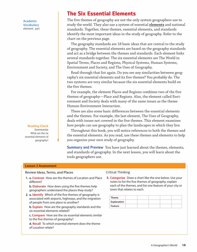
The Six Essential ElementsThe five themes of geography are not the only system geographers use to study the world. They also use a system of essential elements and national standards. Together, these themes, essential elements, and standards identify the most important ideas in the study of geography. Refer to the chart on the previous page.
The geography standards are 18 basic ideas that are central to the study of geography. The essential elements are based on the geography standards and act as a bridge between the themes and standards. Each element links several standards together. The six essential elements are The World in Spatial Terms, Places and Regions, Physical Systems, Human Systems, Environment and Society, and The Uses of Geography.
Read through that list again. Do you see any similarities between geog-raphy’s six essential elements and its five themes? You probably do. The two systems are very similar because the six essential elements build on the five themes.
For example, the element Places and Regions combines two of the five themes of geography—Place and Regions. Also, the element called Envi-ronment and Society deals with many of the same issues as the theme Human-Environment Interaction.
There are also some basic differences between the essential elements and the themes. For example, the last element, The Uses of Geography, deals with issues not covered in the five themes. This element examines how people can use geography to plan the landscapes in which they live.
Throughout this book, you will notice references to both the themes and the essential elements. As you read, use these themes and elements to help you organize your own study of geography.
Summary and Preview You have just learned about the themes, elements, and standards of geography. In the next lesson, you will learn about the tools geographers use.
Reading Check Summarize
What are the six essential elements of
geography?
Theme
Explanation
Feature
19A Geographer’s World
DO NOT EDIT--Changes must be made through “File info” CorrectionKey=NL-A

Lesson 4
The Geographer’s Tools
The Big IdeaGeographers use many tools to study the world.
Main Ideas■■ Maps and globes are the most commonly used tools of geographers.
■■ Many geographers study infor-mation gathered by satellites.
■■ Geographers use many other tools, including graphs, charts, databases, and models, in their work.
Key Terms and PlacesmapglobeGlobal Positioning System (GPS)Geographic Information System
(GIS)
If YOU lived there . . .Your family’s apartment has a leaking pipe under the kitchen sink. The landlord has sent a plumber to your apartment to fix the leak. The plumber arrives carrying a tool chest. You know that plumbers need specific tools to do their jobs correctly.Can you think of a tool the plumber might use for
this job?
Maps and GlobesLike all people with jobs to do, geographers need tools to study the world. The tools that geographers use most often in their work are maps and globes. A map is a flat drawing that shows all or part of Earth’s surface. A globe is a spherical, or ball-shaped, model of the entire planet.
Both maps and globes show what the world looks like. They can show where mountains, deserts, and oceans are. They can also identify and describe the world’s countries and major cities.
There are, however, major differences between maps and globes. Because a globe is spherical like Earth, it can show the world as it really is. A map, though, is flat. It is not possible to show a spherical area perfectly on a flat surface. To understand what this means, think about an orange. If you took the peel off of an orange, could you make it lie completely flat? No, you could not, unless you stretched or tore the peel first.
The same principle is true with maps. To draw Earth on a flat surface, people have to distort, or alter, some details. For example, places on a map might look to be farther apart than they really are, or their shapes or sizes might be changed slightly.
Still, maps have many advantages over globes. Flat maps are easier to work with than globes. Also, it is easier to show small areas like cities on maps than on globes. In addition, maps usually show more information than globes. Because globes are more expensive to make, they do not usually show anything more than where places are and what features they have.
Module 120
DO NOT EDIT--Changes must be made through “File info” CorrectionKey=NL-A

Percentage of Students on HighSchool Soccer Teams by Region
Perc
enta
ge
Region
10
8
6
4
2
0North South Midwest West
ME
NY
PA
VA
NCTN
KY
OHIN
MIWIMN
NDMT
WA
OR
NV
CA
ID
UT
AZ
WY
CO
NM
SD
NE
KS
OK
TX
IA
MO
AR
LA
IL
SC
GAALMS
FL
WV
MA
NJDE
DC MD
RICT
NHVT
N
S
WE
HMH — MSWG — 2017MS_SNLESE668737_003M
U.S. Soccer Participation1st pass 3/8/17
Approved 3/31/17
High School Soccer Participation
More than 9%5–9%3–5%Fewer than 3%
Data not available
Participation inHigh School Soccer
HRW-MS World Geographyms_snlese668737_003m_kU.S. Soccer ParticipationLegend
Color AltsFirst proof: 06/05/17Final: 06/08/17
Maps, on the other hand, can show all sorts of information. Besides showing land use and cities, maps can include a great deal of information about a place. A map might show what languages people speak or where their ancestors came from. Maps like the one below can even show how many students in an area play soccer.
Reading Check Summarize
What are the tools geographers most
often use?
The Geographer’s Tools
Geographers use many tools to study the world. Each tool provides part of the information a geographer needs to learn what a place is like.
A geographer can use a globe to see where a place, such as the United States, is located.
Maps usually give geographers more information about a place than globes do. This map, for example, shows rates of soccer participation in the United States.
Charts and graphs are also tools geographers can use to study information. They are often used when geographers want to compare numbers, such as the number of students who play soccer in each region of the country.
Analyze VisualsWhat information could you learn from each of these tools?
21 A Geographer’s World
DO NOT EDIT--Changes must be made through “File info” CorrectionKey=NL-A

Reading Check Summarize
What satellite technology transmits
data to people with receivers?
SatellitesMaps and globes are not the only tools that geographers use in their work. As you have already read, many geographers study information gathered by satellites.
Much of the information gathered by these satellites is in the form of images. Geographers can study these images of Earth to see what an area looks like from far above. Satellites also collect information that we cannot see from the planet’s surface. The information gathered by satellites helps geographers make accurate maps.
Satellites also collect and transmit information for a technology called Global Positioning System (GPS). The system uses 24 satellites to trans-mit information to Earth. This GPS information gives the exact location of a given object on our planet. The information is displayed on a small receiver. Vehicle drivers are some of the people who use GPS to find out how to get from where they are to other locations. There are many other uses of GPS. These include locating people in need of rescue on boats or in the wilderness. Scientists also use GPS to track and study wildlife.
Satellite image of Italy
Other Geographic ToolsGeographers also use many other tools. To depict aspects of various coun-tries and world regions, geographers create graphs, charts, databases, and models. They also use these tools to gather data and compare various world regions.
There is a geography tool that is made up of a group of databases. It is called Geographic Information System (GIS). GIS combines and pro-vides information from many different sources. People use GIS by posing
Module 122
DO NOT EDIT--Changes must be made through “File info” CorrectionKey=NL-A
Reading Check Summarize
Of what does Geographic
Information System (GIS) consist?
The Geographer’s Tools
Review Ideas, Terms, and Places
1. a. Compare and Contrast How are maps and globes similar? How are they different? b. Identify What are the advantages maps have over globes?
2. a. Describe How do geographers use satellite images? b. Recall What are some uses of GPS?
3. a. Describe What is GIS?b. Recall What is the purpose of GIS for geographers?
Critical Thinking
4. Summarize Make a chart like the one below that lists some of the geographer’s tools.
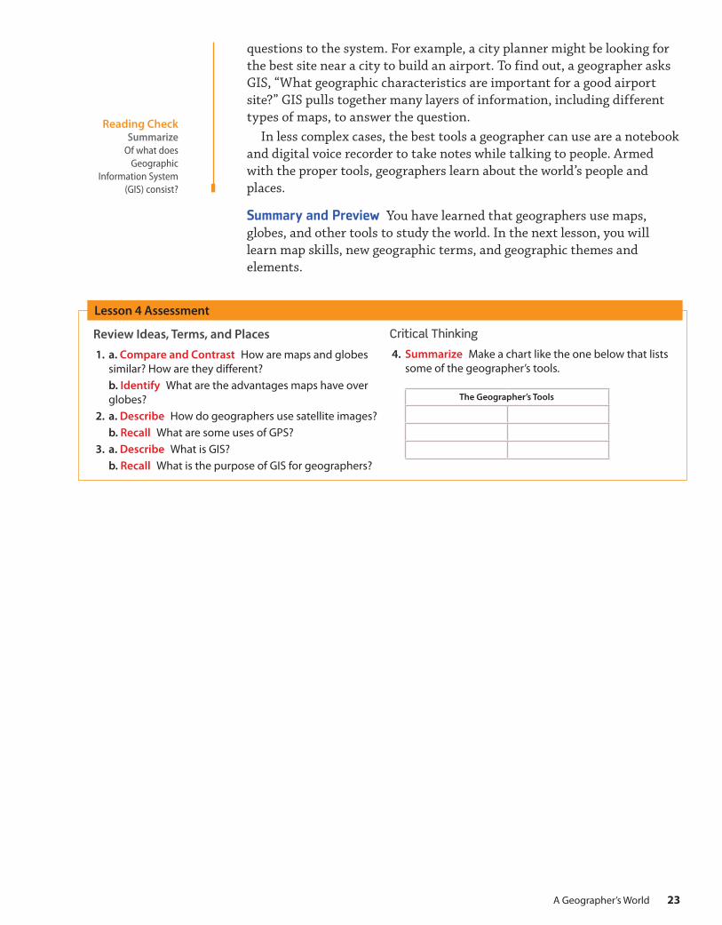
questions to the system. For example, a city planner might be looking for the best site near a city to build an airport. To find out, a geographer asks GIS, “What geographic characteristics are important for a good airport site?” GIS pulls together many layers of information, including different types of maps, to answer the question.
In less complex cases, the best tools a geographer can use are a notebook and digital voice recorder to take notes while talking to people. Armed with the proper tools, geographers learn about the world’s people and places.
Summary and Preview You have learned that geographers use maps, globes, and other tools to study the world. In the next lesson, you will learn map skills, new geographic terms, and geographic themes and elements.
Lesson 4 Assessment
23 A Geographer’s World
DO NOT EDIT--Changes must be made through “File info” CorrectionKey=NL-A

30°S
7 0 ° N
20°N
10°S20°S30°S
80°N
40°
Equator
7 0 ° N
60°N
50°N
40°N
30°N
20°N
10°N
0°
North Pole
HMH — MSWG — 2017MS_SNLESE668737_005M
2nd pass 3/23/173rd pass 3/29/17
Approved 3/31/17
60°E
60°
180°
150°E
30°E
120°W150°W
0°
60°W
30
°W
90°E
120°E
North Pole
PrimeMeridian
90°W
HMH — MSWG — 2017MS_SNLESE668737_005M
2nd pass 3/23/173rd pass 3/29/17
Approved 3/31/17
Latitude and LongitudeAs you learned in Lesson 4, a globe is a spherical model of Earth. It is useful for showing the entire Earth or studying large areas of Earth’s surface.
To study the world, geographers use a pattern of imaginary lines that circle the globe in east–west and north–south direc-tions. It is called a grid. The intersection of these imaginary lines helps us find places on Earth.
The east–west lines in the grid are lines of latitude. These lines are called parallels because they are always the same distance apart. Lines of latitude measure distance north and south of the equator. The equator is an imaginary line that circles the globe halfway between the North and South Poles. It divides the globe into north and south halves. Parallels measure distance from the equator in degrees. The symbol for degrees is °. Degrees are fur-ther divided into minutes. The symbol for minutes is .́ There are 60 minutes in a degree. Parallels north of the equator are labeled with an N. Those south of the equator are labeled with an S.
The north–south imaginary lines are lines of longitude. Lines of longitude are called meridians. These imaginary lines pass through the poles. They measure distance east and west of the prime meridian. The prime meridian is an imaginary line that divides the globe into east and west halves. It runs through Greenwich, England, and represents 0° longitude.
The Big IdeaGeographers study the world by understanding maps and geo-graphic features of Earth.
Main Ideas■■ When creating maps, cartogra-phers use a pattern of latitude and longitude lines that circle Earth.
■■ Cartographers have created map projections to show the round surface of Earth on a flat piece of paper.
■■ Cartographers provide features to help users read maps.
■■ There are different kinds of maps for different uses.
■■ There are many kinds of land-forms and other features on Earth.
Key Terms and Placesgridlatitudeparallelsequatordegreesminuteslongitudemeridiansprime meridianhemispherescontinentsmap projections
Lesson 5
Lines of Latitude Lines of Longitude
Geography Handbook
Module 124
DO NOT EDIT--Changes must be made through “File info” CorrectionKey=NL-A

ASIA
EUROPE
NORTHAMERICA
AFRICA
Equator
NorthPole
INDIANOCEAN
PACIFICOCEAN
ATLANTICOCEAN
ARCTIC OCEAN
INDIANOCEAN
NORTHERN HEMISPHERE
HMH — MSWG — 2017MS_SNLESE668737_006M
Northern Hemisphere2nd pass 3/23/173rd pass 3/29/17
Approved 3/31/17
Eq
uator
AUSTRALIA
AFRI
CA
ANTARCTICA
SOUTHAMERICA
SouthPole
INDIANOCEAN
SOUTHERNOCEAN
PACIFICOCEAN
ATLANTICOCEAN
SOUTHERN HEMISPHERE
HMH — MSWG — 2017MS_SNLESE668737_007M
Sourthern Hemisphere2nd pass 3/23/17
Approved 3/31/17
PACIFICOCEAN
ATLANTICOCEAN
NORTHAMERICA
SOUTHAMERICA
ANTARCTICA
Equator
180°
North Pole
South Pole
WESTERN HEMISPHERE
HMH — MSWG — 2017MS_SNLESE668737_008M
Western Hemisphere2nd pass 3/23/17
Approved 3/31/17
Equator
PrimeMeridian
ANTARCTICA
AFRICA
EUROPEASIA
AUSTRALIA
North Pole
South Pole
INDIANOCEAN
ATLANTICOCEAN
EASTERN HEMISPHERE
HMH — MSWG — 2017MS_SNLESE668737_009M
2nd pass 3/23/17Approved 3/31/17
Lines of latitude range from 0°, for locations on the equator, to 90°N or 90°S, for locations at the poles. Lines of longitude range from 0° on the prime meridian to 180° on a meridian in the mid–Pacific Ocean. Meridians west of the prime meridian to 180° are labeled with a W. Those east of the prime meridian to 180° are labeled with an E. Using latitude and longitude, geographers can identify the exact location of any place on Earth.
The equator divides the globe into two halves, called hemispheres. The half north of the equator is the Northern Hemisphere. The southern half is the Southern Hemisphere. The prime meridian and the 180° meridian divide the world into the Eastern and Western Hemispheres.
Earth’s land surface is divided into seven large landmasses that are called continents. Landmasses smaller than continents and completely surrounded by water are called islands.
Geographers organize Earth’s water surface into major regions, too. The largest is the world ocean. Geographers divide the world ocean into the Pacific Ocean, the Atlantic Ocean, the Indian Ocean, the Arctic Ocean, and the Southern Ocean.
Northern Hemisphere Southern Hemisphere
Western Hemisphere Eastern Hemisphere
Reading Check Summarize
How do geographers use a grid of
imaginary lines to study the world?
25A Geographer’s World
DO NOT EDIT--Changes must be made through “File info” CorrectionKey=NL-A

HMH — MSWG — 2017MS_SNLESE668737_010M
1st pass 3/15/17Approved 3/31/17
HMH — MSWG — 2017MS_SNLESE668737_011M
2nd pass 3/23/17Approved 3/31/17
Map ProjectionsA map is a flat diagram of all or part of Earth’s surface. Mapmakers have created different ways of showing our round planet on flat maps. These different ways are called map projections. Because Earth is round, there is no way to show it accurately on a flat map. All flat maps are distorted in some way. Mapmakers must choose the type of map projection that is best for their purposes. Many map projections are one of three kinds: cylindri-cal, conic, or flat-plane.
Cylindrical Projections These projections are based on a cylinder wrapped around the globe. See the “Paper cylinder” illustration below. The cylinder touches the globe only at the equator. The meridians are pulled apart and are parallel to each other instead of meeting at the poles. This causes land-masses near the poles to appear larger than they really are.
A Mercator projection is one type of cylindrical projection. The Mercator projection is useful for navigators because it shows true direction and shape. However, it distorts the size of land areas near the poles.
Paper cylinder
Mercator projection
Module 126
DO NOT EDIT--Changes must be made through “File info” CorrectionKey=NL-A

HMH — MSWG — 2017MS_SNLESE668737_012M
2nd pass 3/23/17Approved 3/31/17
HMH — MSWG — 2017MS_SNLESE668737_014M
2nd pass 3/23/17Approved 3/31/17
HMH — MSWG — 2017MS_SNLESE668737_015M
2nd pass 3/23/17Approved 3/31/17
HMH — MSWG — 2017MS_SNLESE668737_013M
2nd pass 3/23/17Approved 3/29/17
Reading Check Identify Problems
Why is it impossible to accurately show large parts of the world on
flat maps?
Conic Projections These projections are based on a cone placed over the globe. See the “Paper cone” illustration below. A conic projection is most accurate along the lines of latitude where it touches the globe. It retains almost true shape and size. Conic projections are most useful for showing areas that have long east–west dimensions, such as the United States.
Flat-plane Projections These projections are based on a plane touching the globe at one point, such as at the North Pole or South Pole. See the “Flat plane” illustration below. A flat-plane projection can show true direc-tion to airplane pilots and ship navigators. It also shows true area. How-ever, it distorts the true shapes of landmasses.
Paper cone
Flat-plane projectionFlat plane
Conic projection
27A Geographer’s World
DO NOT EDIT--Changes must be made through “File info” CorrectionKey=NL-A

Trieste
SELJUKTURKS
ENGLAND
HOLYROMANEMPIRE
FRANCE
HOLYLAND
BYZANTINEEMPIRE
Mediterranean Sea
Black Sea
North Sea
ATLANTICOCEAN
Rome
Lyon
Genoa
Trieste
Zadar
ViennaRegensburg
Constantinople
Edessa
Antioch
Tripoli
Acre
Jerusalem
Sicily
Crete
Corsica
Sardinia
50°N
10°W 0°
40°N
10°E
20°E
30°E
N
S
W
E
HMH — MSWG — 2017MS_SNLESE668737_016M
The First Crusade, 10961st pass 3/3/17
Approved 3/31/17
Christian lands, 1095
Muslim lands, 1095
First Crusade, 1096–1099
Projection: Azimuthal Equal Area
HMH-MS World Geography-2018ms_snlese668737_016m_sThe First Crusade, 1096Legend
Color AltsFirst proof: 06/05/17Final: 06/08/17
0 100 200 Miles
0 100 200 Kilometers
HMH-MS World Geography-2018ms_snlese668737_016m_lThe First Crusade, 1096Locator
Color AltsFirst proof: 06/05/17Final: 06/08/17
Map FeaturesMaps are like messages sent out in code. To help us translate the code, mapmakers provide certain features. These features help us understand the message they are presenting about a particular part of the world. Of these features, almost all maps have a title, a compass rose, a scale, and a legend. The map below has these four features plus a fifth—a locator map.
1 Title A map’s title shows what the subject of the map is. The map title is usually the first thing you should look at when studying a map, because it tells you what the map is trying to show.
The First Crusade, 10961
2
3
4
5
Module 128
DO NOT EDIT--Changes must be made through “File info” CorrectionKey=NL-A

Christian lands, 1095
Muslim lands, 1095
First Crusade, 1096–1099
Projection: Azimuthal Equal Area
0 100 200 Miles
0 100 200 Kilometers
HMH — MSWG — 2017MS_SNLESE668737_018M_K
The First Crusade, 1096 - Legend1st pass 3/15/17
Approved 3/31/17
Christian lands, 1095
Muslim lands, 1095
First Crusade, 1096–1099
Projection: Azimuthal Equal Area
0 100 200 Miles
0 100 200 Kilometers
HMH — MSWG — 2017MS_SNLESE668737_018M_K
The First Crusade, 1096 - Legend1st pass 3/15/17
Approved 3/31/17
HMH — MSWG — 2017MS_SNLESE668737_017M_L
The First Crusade, 1096 - Locator1st pass 3/15/17
Approved 3/31/17
NNENW
SSESW
W E
Reading Check Summarize What
four features do most maps have?
2 Compass Rose A directional indicator shows which way north, south, east, and west lie on the map. Some mapmakers use a “north arrow,” which points toward the North Pole. Remember, “north” is not always at the top of a map. The way a map is drawn and the location of directions on that map depend on the perspective of the mapmaker. Most maps indicate direction with a compass rose. A compass rose has arrows that point to all four principal directions, also called cardinal points. The principal directions are north (N), east (E), south (S), and west (W). Some compass roses also show the intermediate directions. These are northeast (NE), southeast (SE), southwest (SW), and northwest (NW).
3 Scale Mapmakers use scales to represent the distances between points on a map. Scales may appear on maps in several different forms. Some maps provide a bar scale. Scales give distances in miles and kilometers.
To find the distance between two points on the map, place a piece of paper so that the edge connects the two points. Mark the location of each point on the paper with a line or dot. Then compare the distance between the two dots with the map’s bar scale. The number on the top of the scale gives the distance in miles. The number on the bottom gives the distance in kilometers. Because the distances are given in large inter-vals, you may have to approximate the actual distance on the scale.
4 Legend The legend, or key, explains what the symbols on the map represent. Point symbols are used to specify the location of things, such as cities, that do not take up much space on the map. Some legends show colors that represent certain features like empires or other regions. Other maps might have legends with symbols or colors that rep-resent features such as roads. Legends can also show economic resources, land use, population density, and climate. Some legends include the map scale as well.
5 Locator Map A locator map shows where in the world the area on the map is located. In this example, the area shown on the main map is shown in red on the locator map. The locator map also shows surrounding areas so the reader can see how the information on the map relates to neigh-boring lands.
29A Geographer’s World
DO NOT EDIT--Changes must be made through “File info” CorrectionKey=NL-A

Nile River
LakeNasser
30°N
Tropic of Cancer
20°N
20°N
10°W
10°E
20°E
0°
M A U R I T A N I A
N I G E R C H A DS U D A N
M A L I
E U R O P E
SOUTHWEST ASIA
20°W
30°N
Tropic of Cancer
30°N
20°N
20°N
10°W
10°W
10°E
20°E
30°E
0°
0°
Nile River
LakeNasser
Mediterranean Sea
Red Sea
Strait of Gibraltar
ATLANTICOCEAN
Canary Islands(SPAIN)
WesternSahara
(Claimed byMOROCCO)
Rabat
Algiers Tunis
Tripoli
Alexandria
Cairo
Casablanca
E G Y P T
A L G E R I A
L I B Y A
M O R O C C O
TUNISIA
M A U R I T A N I A
N I G E R C H A DS U D A N
M A L I
E U R O P E
SOUTHWEST ASIA
N
S
W
E
HMH — MSWG — 2017MS_SNLESE668737_096M
North Africa PoliticalChapter Opener
1st pass 3/17/17Approved 3/31/17
Projection: Azimuthal Equal-Area
National capital
Other cities
0 150 300 Miles
0 150 300 Kilometers
HMH — MSWG — 2017MS_SNLESE668737_096M_K
North Africa PoliticalLegend
1st pass 3/17/17Approved 3/31/17
HMH-MS World Geography-2018ms_snlese668737_096m_lNorth Africa PoliticalLegend
Color AltsFirst proof: 06/05/17Final: 06/08/17
Different Kinds of MapsAs you study the world’s regions and countries, you will use a variety of maps. Political maps and physical maps are two of the most common types of maps you will study. In addition, you will use thematic maps. These maps might show climate, population, resources, ancient empires, or other topics. By working with these maps, you will see what the physical geog-raphy of places is like, where people live, and how the world has changed over time.
Political Maps Political maps show the major political features of a region. These features include country borders, capital cities, and other places. Political maps use different colors to represent countries, and capital cities are often shown with a special star symbol.
North Africa: Political
Module 130
DO NOT EDIT--Changes must be made through “File info” CorrectionKey=NL-A

10°N
10°S
0° Equator
20°N
10°W 0°
ATLANTIC OCEAN
Gulf ofGuinea
Niger River
BURKINAFASO
GHANA
CÔTED’IVOIRE
LIBERIA
BENIN
TOGO
GUINEA
SENEGAL
SIERRALEONE
GUINEA-BISSAU
GAMBIA
NIGER
NIGERIA
MALIMAURITANIA
CHAD
N
S
W E
HMH — MSWG — 2017MS_SNLESE668737_020M
West Africa: Climate1st pass 3/8/17
Approved 3/31/172nd pass 6/5/17
Final: 6/8/17
CHINAAFGHANISTANIRANMountEverest29,035 ft(8,850 m)
K228,251 ft(8,611 m)
60°E
70°E
80°E
30°N
20°N
10°N
Tropic of Cancer
90°E
INDIAN OCEAN
Arabian Sea
Gulf ofKhambhat
Gulf ofMannar
Bay ofBengal
In
dus
Ch
enab
River
Sutlej R.
Ganges River
Ch
amba
l R.
Narmada River
Godavari River
Krishna River
Brahmaputra R
iver
Riv
er
Yam
una
R
.
H
I MA L A Y A S
Hindu Kush
IndusRiverValley
TharDesert
Ganges
Delta
D e c c a nP l a t e a u
Karakoram Range
Gangetic PlainTarai
We
stern
Gh
ats E
ast
ern
Ghats
Malabar C
oast
Co
rom
and
elC
oas
t
I N D I A
PAKISTANNEPAL BHUTAN
BANGLADESH
SRI LANKA
MALDIVES
CHINA
MYANMAR
AFGHANISTANIRAN
N
S
WE
HMH — MSWG — 2017MS_SNLESE668737_019M
South Asia: Physical2nd pass 3/23/173rd pass 3/29/17
Approved 3/31/17
4,0002,0005002000 (Sea level)Belowsea level
13,1206,5601,640
656(Sea level) 0
Belowsea level
Feet MetersELEVATION
Projection: Albers Equal-Area
HMH-MS World Geography-2018MS_SNLESE668737_019M_kSouth Asia: PhysicalLegend
Color AltsFirst proof: 06/05/17Final: 06/08/17
0 250 500 Miles
0 250 500 Kilometers
HMH-MS World Geography-2018ms_snlese668737_020m_kWest Africa: Climatelegend
Color AltsFirst proof: 06/05/17Final: 06/08/17
Projection: Azimuthal Equal-Area
Humid tropical
Tropical savanna
Desert
Steppe
Climate Types
0 400 800 Miles
0 400 800 Kilometers
HMH-MS World Geography-2018MS_SNLESE668737_019M_lSouth Asia: PhysicalLocator
Color AltsFirst proof: 06/05/17Final: 06/08/17
HMH-MS World Geography-2018MS_SNLESE668737_020M_lWest Africa: ClimateLocator
Color AltsFirst proof: 06/05/17Final: 06/08/17
Reading Check Summarize
What are two of the most common kinds
of maps used in geography?
Physical Maps Physical maps show the major physical features of a region. See the map above. These features may include mountain ranges, rivers, oceans, islands, deserts, and plains. Often, these maps use different colors to represent different elevations of land. The reader can easily see which areas are high elevations, such as mountains, and which areas are lower.
Thematic Maps Thematic maps focus on one special topic, such as cli-mate, resources, or population. See the map below. These maps present information on the topic that is particularly important in the region. Depending on the type of thematic map, the information may be shown with different colors, arrows, dots, or other symbols.
The Indian Subcontinent: Physical
West Africa: Climate
31A Geographer’s World
DO NOT EDIT--Changes must be made through “File info” CorrectionKey=NL-A

Reading Check Summarize What is
a landform?
Earth’s Surface FeaturesA landform is a naturally formed feature on Earth’s surface. There are many kinds of landforms and water features on Earth. Many of these fea-tures are shown in this illustration.
1
2
3
4
5
6
7
8
9
10
11
12
13
14
15
16
17
18
19
21 22
20
23
24
2526
27
28
30
36
31
29
33
34
42
38
39
37
32
35
40
41
46
45
44
43
Module 132
DO NOT EDIT--Changes must be made through “File info” CorrectionKey=NL-A

Feature Descriptions1 ocean large body of water
2 cape point of land that extends into water
3 coastal plain area of flat land along a sea or ocean
4 coast area of land near the ocean
5 glacier large area of slow-moving ice
6 lake inland body of water
7 plain nearly flat area
8 inlet area of water extending into the land from a larger body of water
9 floodplain flat land next to a river formed by silt deposited by floods
10 timberline line on a mountain above which it is too cold for trees to grow
11 river natural flow of water that runs through the land
12 source of river place where a river begins
13 foothill hilly area at the base of a mountain
14 riverbank land along a river
15 mouth of river place where a river empties into another body of water
16 hill rounded, elevated area of land smaller than a mountain
17 mountain area of rugged land that generally rises higher than 2,000 feet
18 island area of land surrounded entirely by water
19 basin bowl-shaped area of land surrounded by higher land
20 mountain range row of mountains
21 plateau large, flat, elevated area of land
22 bluff high, steep face of rock or earth
23 isthmus narrow piece of land connecting two larger land areas
24 valley area of low land between hills or mountains
25 marsh lowland with moist soil and tall grasses
26 lagoon body of shallow water
27 strait narrow body of water connecting two larger bodies of water
28 canyon deep, narrow valley with steep walls
29 peninsula area of land that sticks out into a lake or ocean
30 volcano opening in Earth’s crust where lava, ash, and gases erupt
31 waterfall steep drop from a high place to a lower place in a stream or river
32 delta area where a river deposits soil into the ocean
33 cliff high, steep face of rock or earth
34 reef ocean ridge made up of coral, rock, or sand
35 gulf large part of the ocean that extends into land
36 peak top of a mountain
37 swamp area of low, wet land with trees
38 bay part of a large body of water that is smaller than a gulf
39 dune hill of sand shaped by wind
40 tributary stream or river that flows into a larger stream or river
41 mountain pass gap between mountains
42 sea body of salt water smaller than an ocean
43 desert extremely dry area with little water and few plants
44 oasis area in the desert with a water source
45 mesa flat-topped mountain with steep sides
46 savanna area of grassland and scattered trees
33A Geographer’s World
DO NOT EDIT--Changes must be made through “File info” CorrectionKey=NL-A

Summary As you study geography, one of the main tools you will use is the map—the primary tool of geographers. In this lesson, you learned about some of the basic features of maps. You discovered how maps are made, how to read them, and how they can show the round surface of Earth on a flat piece of paper. You learned about latitude and longitude and map projections. You read about map features, such as titles, com-pass roses, scales, legends, and locator maps, and different kinds of maps designed for different uses. You’ve discovered names and descriptions of some of Earth’s features. Now use your new knowledge to explore the world from a geographer’s perspective.
Review Ideas, Terms, and Places
1. a. Define What is the equator?b. Identify How is the prime meridian used?
2. a. Define What is a map projection?b. Explain Why are cylindrical and flat-plane projections useful for airplane pilots and ship navigators?
3. a. Describe Describe a compass rose and the information it contains.b. Identify and Explain What is a bar scale? How is it used?
4. a. Analyze Which kind of map would you use if you wanted to know which part of the mapped area was highest? Why?b. Identify What characteristic makes a map a thematic map?
5. a. Define What is a delta?b. Define What is a glacier?
Critical Thinking
6. Compare and Contrast Create a chart like the one shown that compares and contrasts kinds of map projections.
Lesson 5 Assessment
Map Projections
Cylindrical Conic Flat-plane
Based on
Accurately shows
Distorts
Module 134
DO NOT EDIT--Changes must be made through “File info” CorrectionKey=NL-A

Social Studies Skills
Define the SkillIn addition to maps and globes, satellite images are among the geographer’s most valuable tools. Geographers use two basic types of these images. The first type is called true color. These images are like photographs taken from high above Earth’s surface. The colors in these images are similar to what you would see from the ground. Vegetation, for example, appears green.
The other type of satellite image is called an infrared image. Infrared images are taken using a special type of light. These images are based on heat patterns, and so the colors on them are not what we might expect. Bodies of water appear black, for example, since they give off little heat.
Learn the SkillUse the satellite images on this page to answer the following questions.
1. On which image is vegetation red?
2. Which image do you think probably looks more like Italy from the ground?
Practice the SkillSearch the Internet to find a satellite image of your state or region. Determine whether the image is true color or infrared. Then write three statements that describe what you see on the image.
Analyze Satellite Images
True-color satellite image of Italy
Infrared satellite image of Italy
35A Geographer’s World
DO NOT EDIT--Changes must be made through “File info” CorrectionKey=NL-A

a. a part of the world that has one or more common features that make it different from surrounding areas
b. a flat drawing of part of Earth’s surfacec. a partd. a spherical model of the planete. the study of the world’s physical featuresf. the study of weather and what causes itg. the study of the world, its people, and the landscapes they
createh. the science of making mapsi. the physical and human features that define an area and
make it different from other placesj. the study of people and communities
1. geography
2. physical geography
3. human geography
4. element
5. meteorology
6. region
7. cartography
8. map
9. landscape
10. globe
Module 1 Assessment
Review Vocabulary, Terms, and PlacesMatch the words in the columns with the correct definitions listed below.
Comprehension and Critical ThinkingLesson 1 11. a. Explain In what ways do geographers
become scientists when working to answer questions?
b. Recall What are three levels at which a geographer might study the world?
c. Identify Which of these levels covers the largest area?
Lesson 212. a. Locate Choose a country to locate on
the political map of the world in this book’s atlas. Use latitude and longitude to determine the absolute location of the country.
b. Explain Why did geographers create the five themes and the six essential elements?
c. Predict How might the five themes and six essential elements help you in your study of geography?
Lesson 313. a. Identify What are the two main
branches of geography? What does each include?
b. Summarize How can physical geogra-phy help people adjust to the dangers of the world?
c. Elaborate Why do geographers study both physical and human geographic features of places?
Lesson 414. a. Elaborate How might satellite images
and computers help geographers improve their knowledge of the world?
b. Define What is GPS? c. Explain How might a geographer use a
notebook and a digital voice recorder to gather data?
Lesson 5 15. a. Define What is a hemisphere of a globe? b. Explain What features are shown in a
political map? c. Identify What is a peninsula?
Module 136
DO NOT EDIT--Changes must be made through “File info” CorrectionKey=NL-A

Module 1 Assessment, continued
Reading Skills16. Use Prior Knowledge Use the Reading
Social Studies activity in this module to help you create a chart. With a partner, create a three-column chart titled A Geog-rapher’s World. In the first column, list what you each knew about geography before you read the module. In the sec-ond column, list what you each learned about geography. In the third column, list questions that you each still have about geography.
Social Studies SkillsAnalyze Satellite Images Use the images from the Social Studies Skills activity in this module to answer the questions below.
17. On which image do forests appear more clearly: the true color or the infrared image?
18. What color do you think represents mountains on the infrared satellite image?
19. Why might geographers use satellite images like these while making maps of Italy?
Map Activity20. Sketch Map Look for and read environ-
mental print to help you sketch a map of your school. Environmental print can be found all around you in the form of signs, labels, symbols, words, and numbers that provide information. Your map should include environmental print found in and around classrooms and buildings. Use the basic sketch map shown here as an example.
Focus on Writing21. Write a Job Description Review your notes
on the different jobs geographers do. Then write a job description of a geographer that could be included in a career planning guide. You should begin your description by explaining why the job is important. Then identify the job’s tasks and respon-sibilities. Finally, tell what kind of person might do well as a geographer.
37A Geographer’s World
DO NOT EDIT--Changes must be made through “File info” CorrectionKey=NL-A