2008 Texas Bays and Estuaries Meeting Marine Science Institute ...
29
2008 Texas Bays and Estuaries Meeting Marine Science Institute The University of Texas at Austin Port Aransas, Texas April 16-17, 2008
-
Upload
khangminh22 -
Category
Documents
-
view
3 -
download
0
Transcript of 2008 Texas Bays and Estuaries Meeting Marine Science Institute ...

2008
Texas Bays and Estuaries Meeting
Marine Science Institute
The University of Texas at Austin
Port Aransas, Texas
April 16-17, 2008

2
Welcome to the 2008 Texas Bays and Estuaries Meeting!
This marks the 4thrd year of this revived meeting and the future looks bright. This year
we are hosting a short-notice session on the Dinophysis event that closed many of the
oyster beds along the Texas coast. As in past years, a notice board will be set up next to
the Visitor Center’s office, and a payphone is located near the restrooms. During the
meeting, please refrain from smoking in the buildings. Restrooms are located in the
Visitor’s Center next to the library. Lunch will be served under the laboratory overhang
next to the parking lot. Dinner will be served either outside or in the Visitor’s Center
lobby, depending on the weather. Beer and wine are available at dinner for one ticket
(one ticket = $2.00). You must use the tickets, as the bartender will not accept cash. You
may wander freely with your drinks, but please do not leave the campus with them.
Please make time to examine the posters in the lobby of the Visitor’s Center. Authors
will be at their posters from 5 to 5:45 or whenever the BBQ pulls them away.
We hope you enjoy the meeting and look forward to seeing you again in the future!
Marine Science Institute The University of Texas at Austin
3
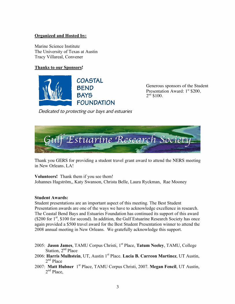
Organized and Hosted by: Marine Science Institute The University of Texas at Austin Tracy Villareal, Convener Thanks to our Sponsors!
Thank you GERS for providing a student travel grant award to attend the NERS meeting in New Orleans, LA! Volunteers! Thank them if you see them! Johannes Hagström,, Katy Swanson, Christa Belle, Laura Ryckman, Rae Mooney Student Awards: Student presentations are an important aspect of this meeting. The Best Student Presentation awards are one of the ways we have to acknowledge excellence in research. The Coastal Bend Bays and Estuaries Foundation has continued its support of this award ($200 for 1st, $100 for second). In addition, the Gulf Estuarine Research Society has once again provided a $500 travel award for the Best Student Presentation winner to attend the 2008 annual meeting in New Orleans. We gratefully acknowledge this support. 2005: Jason James, TAMU Corpus Christi, 1st Place, Tatum Neeley, TAMU, College
Station, 2nd Place 2006: Harris Mulhstein, UT, Austin 1st Place. Lucia B. Carreon Martinez, UT Austin,
2nd Place 2007: Matt Hubner 1st Place, TAMU Corpus Christi, 2007. Megan Fencil, UT Austin,
2nd Place,
Generous sponsors of the Student Presentation Award: 1st $200, 2nd $100.
4
Texas Bays and Estuaries Meeting Program Wednesday, April 16, 2008 0730 - Registration, Visitor’s Center Lobby, UTMSI, Port Aransas, TX 0830 - Welcome and Opening Remarks Plenary talk 0845 – Innovative Tools for Fisheries Management. Richie Ahuja, Environmental Defense, Austin, Texas 0945 - Has water temperature shaped the evolutionary history of southern flounder? Joel Anderson, Bill Karel, Britt Bumguardner, Dusty McDonald and Mark Fisher, Texas Parks and Wildlife, Coastal Fisheries. 1000 - Patterns in fish and macro-invertebrate distributions in the Upper Laguna Madre: seine catches from 1985 to 2004. Amy Larimer, Texas Parks and Wildlife Department; Frances Gelwick and William Neill, Texas A&M University, College Station, TX. 1015_ Do body traits affect aggressiveness in young red drum? Shinnosuke Nakayama, Alfredo F. Ojanguren and Lee A. Fuiman, The University of Texas at Austin, Marine Science Institute 1030– BREAK 1100 - Biological response to changes in climate patterns: Gray snapper (Lutjanus griseus L.) population explosion in Texas bays and estuaries. James Tolan and Mark Fisher, TPWD-Coastal Fisheries Division. 1115 - An assessment of sea turtle assemblages in Texas estuaries. Tasha L. Metz and André M. Landry, Jr., Texas A&M University-Galveston 1130 - Subtidal oyster reef as nekton habitat in Matagorda Bay, Texas. Megan Reese and Gregory W. Stunz, Harte Research Institute for Gulf of Mexico Studies, Texas A&M University-Corpus Christi; James Simons, Texas Parks and Wildlife Department. 1145 – Recolonization dynamics in the recently re-flooded Bahia Grande. Reuben Trevino*, Erika Cornejo, Troy McWhorter, Anthony Reisinger, Noemi Matos, Oscar Sosa, David Hicks
5
1200- Sargassum Symposium, 12-14 May, 2008, Holiday Inn, North Padre Island, Texas. John S. Adams. Center for Progressive Studies and the Beach Access Coalition, Corpus Christi, Texas. 1215 – LUNCH Robert Bustamante of UTMSI Cafeteria 1330 - Geochemical characterization of barren zones in the Lower Laguna Madre. Hugo Salazar, Jesse A. Cantu, Roberto Gamez , Hudson DeYoe, and Thomas Whelan III; University of Texas-Pan American 1345 – The effect of boat propeller scarring on genetic variation in a subtropical seagrass species. Patrick D. Larkin, Krista L. Heideman, Dana D. Burfeind and Gregory W. Stunz, Texas A&M University - Corpus Christi. 1400 - Superoxide dismutase activity in Thalassia testudinum. Thomas Whelan, Michael Persans, Hudson DeYoe, Jacqueline Bruce University of Texas-Pan American; Brigit van Tussenbroek Unidad Académica Puerto Morelos, ICML, Universidad Nacional Autónoma de México 1415 - Evaluation of Regulatory Protection of Seagrasses in the Redfish Bay State Scientific Area. Faye Grubbs, Perry Trial, Dennis Pridgen, and Mark Fisher, Texas Parks and Wildlife Department 1430 - Imaging seagrass epiphytes for quantification Kirk Cammarata, TX A&M University-Corpus Christi, Corpus Christi, TX 78412 1445 - Comparative study of the trace metal distribution in Spartina alterniflora and Thalassia testudinum in the Lower Laguna Madre. Roberto Gamez, Hugo Salazar, Jesus A. Cantu and Thomas Whelan III; Chemistry Department University of Texas Pan American.
1500 – BREAK
1530 – Morphologic Examination of the Stability of Pass Cavallo, Matagorda Bay, Texas. Nicholas C. Kraus, U.S. Army Corps of Engineers; Brian K. Batten, Dewberry and Davis.

6
1545 - Monitoring Seasonal Morphology Change at Packery Channel, Corpus Christi, Texas. Deidre D. Williams, Division of Nearshore Research, TAMU-CC; Nicholas C. Kraus, U. S. Army Engineer Research and Development Center, Coastal and Hydraulics Laboratory. 1600 – Houston-Galveston Ship Channels Sedimentation Model Validation. Jennifer N. Tate and Charlie Berger, US Army Engineer Research and Development Center – Coastal and Hydraulics Laboratory, Vicksburg, Mississippi. 1615 - Evidence suggesting hyperpycnal flow within a low gradient river delta and implications for both sand and mud transport onto the shelf: Brazos River Timothy M. Dellapenna, Dept. of Marine Sciences, TAMUG, Christian Noll, Oceanography Dept., TAMU, Bryan Fielder, Oceanography Department, TAMU, Robert Webster, Marine Systems Sciences, TAMU-CC 1630 - A Quantitative Investigation of the Role Sargassum Accumulation Plays in Inhibiting Sand Erosion on Galveston Island’s West-end Beaches. Robert Webster, Timothy Dellepenna,, April Taylor, Chris Robert, Texas A&M at Galveston Coastal Geology Laboratory, Galveston, Texas 1645 - Matagorda Island Adaptive Management Plan Cameron Perry and Robert Thomas, HDR | Shiner Moseley and Associates, Inc., 555, N. Carancahua, Suite 1650, Corpus Christi, TX 78478 1700 - Improving coastal land-use planning through the application of decision support tools in the Mission-Aransas National Estuarine Research Reserve. Kiersten Madden and Sally Morehead, Mission-Aransas NERR; Ken Dunton, UT Marine Science Institute; Patrick Crist, NatureServe; Doug Walker, Placeways; Dave Eslinger, NOAA Coastal Services Center 1730 - Poster Session and cash bar at the UTMSI Visitor Center.
1830- BBQ Dinner and cash bar: Steve Lew’s BBQ, Rockport, TX
1930 - Bar closes

7
Thursday April, 17, 2008
0815 - Geochemical results for the 2007 sampling of the Bahia Grande Basin Restoration Project. Jesus A. Cantu, Hugo Salazar, Roberto Gamez, Hudson DeYoe, and Thomas Whelan III. The University of Texas-Pan American 0830 - The effect of hypoxia on habitat selection of juvenile estuarine fishes. John Froeschke and Gregory W. Stunz, Harte Research Institute, Texas A&M University-Corpus Christi. 0845 - Hypoxia effects on harpacticoid copepod community structure in the northern Gulf of Mexico. Laura Ryckman, and Edward Buskey, University of Texas Marine Science Institute; Paul Montagna, Texas A&M University, Corpus Christi. 0900 - Does thermal experience affect seasonal variability in escape responses of red drum larvae? Alfredo F. Ojanguren and Lee A. Fuiman, University of Texas at Austin Marine Science Institute. 0915- Sub-Adult Tarpon Distribution in Texas Estuaries 1975 – 2007. Artussee D. Morris and Fernando Martinez-Andrade, Texas Parks and Wildlife Department 0930- Clay removal of the Golden Alga Prymnesium parvum Johannes A. Hagström and Tracy A. Villareal, University of Texas at Austin, Marine Science Institute, Port Aransas, Texas.
0945 - Break
1015 - Photoreactivity of dissolved organic matter in the Lavaca-Matagorda Bay system: Potential importance to bacterial respiration. G. Christopher Shank, University of Texas at Austin Marine Science Institute; Kevin Nelson and Paul Montagna, Texas A&M Corpus Christi. 1030 - Nitrogen dynamics during and after storm events in the Mission-Aransas NERR. Rae Mooney and James W. McClelland, The University of Texas at Austin, Marine Science Institute. 1045 - Nutrient Limitation of Phytoplankton in the Lower Laguna Madre, Texas. Natasha Pardo and Hudson DeYoe, Center for Subtropical Studies & Biology Dept, University of Texas – Pan American, Edinburg, TX.

8
Plenary talk
1100- 'From beautiful to nasty: Dinophysis spp. in coastal waters'
Dr. Lucie Maranda, Graduate School of Oceanography, University of Rhode Island
1200 –Lunch (not provided)
1330 - First recorded toxic D. acuminata bloom in Texas, Meridith Byrd, TPWD
1350–Dinophysis Bloom and Oyster toxicity, K. Wiles (or proxy), Texas Dept. of State Health Services.
1410 Imaging FlowCytobot provides early warning of the first diarrhetic shellfish poison (DSP)-producing algal bloom in the Gulf of Mexico. L. Campbell, R. J. Olson, H. M. Sosik, A. Abraham, J. Deeds, K. White, H. Granade, C. Hyatt, E.J. Buskey
1450 - Dinophysis distribution and toxicity in the coastal bend. Katie Swanson and T. A. Villareal, UTMSI
1510: NOAA Phytoplankton Monitoring Network, TX volunteers Dinophysis overview, Jeff Paternoster, NOAA
1540 – Meeting ends
Special Session: The 2008 Dinophysis event in Texas waters

9
ABSTRACTS – Oral presentations Sargassum Symposium, 12-14 May, 2008, Holiday Inn, North Padre Island, Texas. John S. Adams. Center for Progressive Studies and the Beach Access Coalition, Corpus Christi, Texas. The objective of this symposium is to bring together as many people as possible who have a stake in Sargassum. The focus will be to have speakers address the scientific, economic, educational, and administrative issues of dealing with Sargassum on Texas beaches. Representatives from the tourism related industries will be presenting their perspective on why sargassum needs to be removed from the beach, as well as why is may be of interest to leave it in some places. Representatives of coastal communities that are tasked with the removal and disposal of Sargassum will be asked to relate their problems and successes. Several speakers will address the environmental issues as pertains to Sargassum removal, disposal, etc., including studies on beach erosion and barrier island dune vegetation. Others are exploring innovative and alternative uses of Sargassum in such varying applications as fertilizers, food additives, and biofuels. Demonstrations and discussions of various methods of Sargassum removal will be an important aspect of the Symposium, as some estimates are that as much as 70% of the material removed from the beach during a Sargassum removal is sand. As a result of the interaction among the participants perhaps a better understanding of practical approaches to Sargassum can be reached. Has water temperature shaped the evolutionary history of southern flounder? Joel Anderson, Bill Karel, Britt Bumguardner, Dusty McDonald and Mark Fisher Texas Parks and Wildlife, Coastal Fisheries. Texas Parks and Wildlife fishery-dependent and fishery-independent data indicate a decline in the southern flounder (Paralichthys lethostigma) population. One interesting aspect of flounder life history is that at extreme temperatures, juvenile flounder in nursery areas may experience irreversible temperature-dependent sex determination (TDSD). However, little research has been conducted that demonstrates the potential effects of TDSD over short or extended periods of abnormal temperature. Here, we examine the molecular genetics of southern flounder in the Gulf and Atlantic, and present a circumstantial case that would suggest that extreme water temperatures have had a dramatic effect on the evolutionary history of southern flounders, on at least two occasions. Historically, evidence from mitochondrial DNA suggests that flounder populations began post-glacial expansion in the Atlantic prior to expansion in the Gulf, possibly as a result of warm Atlantic water provided by the Gulf stream current. More recently, genetic patterns suggest that contemporary inter-basin gene flow is dominated by males, and TDSD is invoked as a possible mechanism for male-mediated dispersal of genotypes. The implications for management and conservation of the southern flounder are discussed.
10
Imaging seagrass epiphytes for quantification Kirk Cammarata, TX A&M University-Corpus Christi, Corpus Christi, TX 78412 Seagrasses are critical components of estuarine systems, but are in decline in some areas. Proliferation of epiphytes has been implicated where there are anthropogenic nutrient impacts, presumably reducing seagrass photosynthetic productivity due to attenuation of light. However, biofilms present complex microenvironments with spatiotemporal variation. A more detailed understanding of the biotic and abiotic conditions at the epiphyte-leaf interface will provide insight into how epiphytes impact observed seagrass declines and inform our understanding of anthropogenic nutrient impacts. Quantification of seagrass epiphytes typically involves labor intensive scraping and weighing. We developed a fluorescence-based digital imaging protocol which facilitates quantification of epiphytes, image archiving, and comparison of samples. Differences in epiphyte loading were observed in samples from different sites, younger vs older blades, and along the age gradient of individual blades. Image resolution to 10 µm is possible. This method of epiphyte quantification makes a micro-landscape analysis more accessible compared to scrape-based assays. We are working on pattern- and color-based image analysis to obtain organism-specific quantification. This methodology may be useful for routine monitoring and could inform modeling studies Geochemical results for the 2007 sampling of the Bahia Grande Basin Restoration Project. Jesus A. Cantu, Hugo Salazar, Roberto Gamez, Hudson DeYoe, and Thomas Whelan III. The University of Texas-Pan American Since the 1930’s, following the dredging of the Brownsville Ship Channel, the Bahía Grande Basin (6500 acres) became a barren geological bowl of dust. Dredging a pilot channel from the Brownsville Ship Channel to the dry Bahía in 2005 provided a source of seawater which has subsequently flooded the Basin. For our geochemical study, the estuary was divided into three primary sectors (North East, North West, and South). We analyzed major elements (Ca, Mg, Na, and K), trace elements (Zn, Cu, Fe, Mn, As, Pb, and Cr). In addition to the elements described above, we measured organic carbon concentration and carbonate content in surface sediments and, in some cores, depth profiles. We examined geographical and seasonal variability for each geochemical parameter. Photographic evidence shows geochemical stratification in texture and color. Bioturbation was absent. In general, seasonal variations in geochemical data over the 2007 sampling period was not observed, although some trace metals contained some seasonal characteristics. The South sector, for instance, showed Mn had a seasonal variability during May compared to March and in August. Geographic trends were observed in our geochemical analysis. Higher concentrations for Arsenic (As), for instance, were statically observed in the North West sector of the Basin.
11
Evidence suggesting hyperpycnal flow within a low gradient river delta and implications for both sand and mud transport onto the shelf: Brazos River Timothy M. Dellapenna, Dept. of Marine Sciences, TAMUG, Christian Noll, Oceanography Dept., TAMU, Bryan Fielder, Oceanography Department, TAMU, Robert Webster, Marine Systems Sciences, TAMU-CC Sediment transport from river mouths via hyperpycnal flow is a well documented process for high gradient rivers worldwide. However, many important hydrocarbon bearing deltaic systems were derived from lower gradient systems where hyperpycnal flow is not normally attributed. The Brazos River may provide a modern example of such a low gradient river. We had the unique opportunity to sample the mouth and proximal shelf of the Brazos River during the flooding of July 2007. Using a CTD equipped with a turbidity sensor, water column profiles were taken on both along and across shelf transects from the river mouth across and along the river plume. In addition, bottom water samples and shallow gravity cores were collected to determine the thickness of the flood deposit, suspended sediment concentration, porewater salinity and grain size distribution. We found both a high turbidly hypopycnal plume as well as a high turbidity bottom nephaloid layer, with low turbidity in the middle of the water column. Brazos River mud is characteristically red, while marine sediment is olive-grey. Preliminary result reveal a distinctively red, high-water content storm layer, composed of up to 30% sand that extended 5 km from the river mouth. The presence of sand within the storm layer and the high turbidity bottom layer suggests hyperpycnal flow existed during the flood. If this is the case, hyperpycnal flow may be a regular occurrence on the Brazos River and may be more common within low gradient river systems than previously believed, providing an additional mechanism for transporting both sand and mud across the inner shelf. The effect of hypoxia on habitat selection of juvenile estuarine fishes. John Froeschke and Gregory W. Stunz, Harte Research Institute, TAMU, Corpus Christi. Hypoxic events where dissolved oxygen concentrations fall below 2 mg/l are becoming a wide-ranging phenomenon. However, there has been little research on the impact of hypoxia on habitat selection of juvenile fishes. We designed a series of mesocosm experiments to assess the relative influence of hypoxia and seagrass on habitat selection for three common estuarine species, Atlantic croaker (Micropogonias undulatus), pinfish (Lagodon rhomboides), and red drum (Sciaenops ocellatus). Experiments were conducted using a large mesocosm where a dissolved oxygen gradient was established. Artificial seagrass units (ASU’s) and sand were used as habitat treatments. All three species could detect and respond to both the oxygen concentration and habitat treatments. The response between the habitat and oxygen concentration was hierarchical and interactive. In conditions where oxygen concentrations were <2 mg/l, fishes chose the region with the greatest oxygen concentration. However, at moderate levels of hypoxia (4 mg/l), habitat selection was primarily influenced by availability of the preferred habitat. Results indicate that hypoxic events may strongly affect habitat selection of juvenile fishes, and this may alter subsequent distribution patterns and biological interactions within estuarine communities.

12
Comparative study of the trace metal distribution in Spartina alterniflora and Thalassia testudinum in the Lower Laguna Madre. Roberto Gamez, Hugo Salazar, Jesus A. Cantu and Thomas Whelan III; Chemistry Department University of Texas Pan American. This study focuses on the distribution of essential trace metal micronutrients (Zn, Mn, Fe and Cu) in Spartina alterniflora and Thalassia testudinum, and their associated sediments along a barrier island sequence in the eastern Lower Laguna Madre. Both plants grow in submerged sediments. However, the marsh grass Spartina must obtain its nutrients from the sediments. Thalassia, however, may utilize the water column and/or sediments for its nutrient requirements. Clear differences existed between these species growing in the same sediments. Most notable was the difference between Mn in Thalassia and Spartina. Thalassia contained an average of 200 ug Mn/g tissue whereas Spartina had 85 ug Mn/g tissue. Sediments where both plants were growing had 100 ug Mn/g and 1200 ug Fe/g. Iron was more erratic but showed highest values in the roots and rhizomes from Spartina relative to the above ground leaf. Thalassia demonstrated just the opposite trend. The results of this study indicate that Thalasia acquires most of its Mn requirement from the water column. Iron may also uptake some Fe from the water. The other metals show some trends but are less obvious. Evaluation of Regulatory Protection of Seagrasses in the Redfish Bay State Scientific Area. Faye Grubbs, Perry Trial, Dennis Pridgen, and Mark Fisher, Texas Parks and Wildlife Department In the 1990s, it was recognized that propeller scars left by boaters were causing significant damage to seagrass beds in the Redfish Bay State Scientific Area (RBSSA) located in Aransas and Corpus Christi Bays. Initial efforts to address the problem through education, outreach, and the establishment of voluntary no-prop zones, were largely unsuccessful. In May 2006, a regulation went into effect which prohibits the uprooting of seagrasses by submerged propellers within the RBSSA. As part of an effort to evaluate the efficacy of the new regulation, baseline data were collected along 35 randomly-selected 100 m transects in the RBSSA from August-September in 2005. In 2006, sampling criteria were refined, resulting in 15 of the original transects being dropped from the sampling frame while 15 new transects were added. These 35 transects were sampled from August-October in 2006 and 2007. The total number of propeller scars on each transect was recorded, and qualitative as well as quantitative information was collected on each scar. In 2007, the locations along transects of scars detected in 2006 were re-examined to evaluate scar recovery. Following enactment of the regulation, significantly fewer scars were observed (p<0.0001). Both the total number of scars, and the mean number of scars per transect were reduced by 69%. In addition, prop scars in the area appear to recover at a much more rapid rate than what has been reported in the literature. Of 97 scars observed in 2006, 91 were considered recovered by 2007.

13
Clay removal of the Golden Alga Prymnesium parvum Johannes A. Hagström and Tracy A. Villareal, University of Texas at Austin, Marine Science Institute, Port Aransas, Texas.
Blooms of the fish killing alga Prymnesium parvum Carter first occurred in Texas waters with certainty in 1985, and have been a re-occurring problem ever since. Several methods have been proposed to control/mitigate these blooms since they have a significant impact on both ecosystem and economy in affected areas. One of the most promising control methods to date is to spray the bloom with a clay-flocculent combination since this method is believed to be most cost effective and to have the least impact on the ecosystem. Studies so far have been short-term, hours to day(s), particularly with regards to conditions found in Texas during a bloom.
Experiments are underway in which the fate of a P. parvum strain isolated from Texas waters growing at different conductivities and nitrogen:phosphorus ratios (N:P) is studied during two weeks after clay addition. Removal efficiency (RE) of a 2,500 μS cm-1 and N:P 20:1 culture was found to be 81 – 100 % in all treatments (i.e. combinations of 16h light:8h dark or 24h dark and daily mixing or no mixing) during the first 4 days. RE then dropped significantly in the light treatments but remained >90% in dark treatments. Since the alga will sink to the bottom where light is reduced our results suggest that that clay flocculation could be an effective control method against P. parvum. Cellular toxicity during the clay treatment will also be discussed. Morphologic Examination of the Stability of Pass Cavallo, Matagorda Bay, Texas. Nicholas C. Kraus, U.S. Army Corps of Engineers; Brian K. Batten, Dewberry and Davis. This study conducted for the Galveston District of the U.S. Army Corps of Engineers concerns the cross-sectional area stability of Pass Cavallo, a natural coastal inlet located in the southwest corner of Matagorda Bay. The width of Pass Cavallo has decreased since opening of the Matagorda Ship Channel (MSC) entrance to Matagorda Bay in 1966. The process of narrowing began after separation of Matagorda Bay into East Matagorda Bay and the present Matagorda Bay by formation of the Colorado River delta during 1929-1935. The deep-draft MSC enters the bay 5.6 km to the north of Pass Cavallo and is a more efficient tidal channel by joining with a deeper and more central portion of the bay. Tidal inlets are maintained in a dynamic equilibrium through balance of coastal and inlet processes. Conceptually, longshore transport of sediment by the wave-induced current tends to fill an inlet, whereas the ebb-tidal and flood-tidal currents scour the channel. Collapse of a portion of the ebb-tidal shoal at Pass Cavallo after construction of the MSC entrance is posited as being responsible for much of the reduction in cross-sectional channel area of Pass Cavallo because of reduction in tidal prism. Since the mid-1990s, the width of Pass Cavallo has been stable, suggesting the sediment load to the inlet from collapse of its ebb shoal has declined. It is concluded that Pass Cavallo will remain open at its present cross-sectional channel area or undergo a moderate increase in channel area.

14
Patterns in fish and macro-invertebrate distributions in the Upper Laguna Madre: seine catches from 1985 to 2004. Amy Larimer, Texas Parks and Wildlife Department; Frances Gelwick and William Neill, Texas A&M University, College Station, TX. Despite harsh conditions, the upper Laguna Madre (ULM) is a highly productive ecosystem and a popular sport fishing area, especially for spotted seatrout and red drum. The goal of the present study was to improve understanding of spatio-temporal trends in relative abundance of selected fish and macro-invertebrate species in the upper Laguna Madre. TPWD’s bag-seine and water-quality data from 1985-2004 were used to examine variation in species’ relative abundances and relationships to several environmental factors. We hypothesized that one or more of these variables, alone or in combination, are related to spatial and temporal trends in community composition. Canonical correspondence analysis (CCA) indicated a significant relationship between abundances of the most common species and tested environmental variables, accounting for about 14% of the total variation. Temporal variables (season, daylength, and year) accounted for 5.7% of the total variation, followed by the spatial component with 4.2%. Environmental variables (temperature, salinity, dissolved oxygen and turbidity) accounted for the least amount of variation with 1%. ] The effect of boat propeller scarring on genetic variation in a subtropical seagrass species. Patrick D. Larkin, Krista L. Heideman, Dana D. Burfeind and Gregory W. Stunz, Texas A&M University - Corpus Christi. Habitat disturbance poses a significant threat to the stability of ecosystems throughout the world. Persistent disturbance can lead to fragmentation and loss of habitat, which can lead to diminished population sizes, reduced gene flow, and increased inbreeding. This study was undertaken to examine the effect of one form of disturbance, boat propeller scarring, on genetic variation in the subtropical seagrass Halodule wrightii. We used an Amplified restriction Fragment Length Polymorphism (AFLP) assay to measure genetic variation within and among six replicate sites. Each site possessed plots representing four levels of scarring intensity: reference (0%), low (1-5%), moderate (5-15%), and high (>15%). Although we found highly scarred plots to have the lowest estimates for genetic diversity (He, P), scarring intensity was not significant for explaining mean differences or genetic differentiation. A significant proportion of the differentiation (17%), however, was attributed to differences among sites, an indication of genetic structuring on a relatively small scale (~ 30 km2).

15
Improving coastal land-use planning through the application of decision support tools in the Mission-Aransas National Estuarine Research Reserve. Kiersten Madden and Sally Morehead, Mission-Aransas NERR; Ken Dunton, UT Marine Science Institute; Patrick Crist, NatureServe; Doug Walker, Placeways; Dave Eslinger, NOAA Coastal Services Center Understanding the linkages between land use strategies and their effect on coastal-marine ecosystems is critical to the development of sound policies that can maintain social, economic, and ecological values of coastal communities. Decision support tools integrate land use objectives, socioeconomic indicators, ecological values, and physical characteristics to define outcomes resulting from different land use scenarios and enable decision makers to make better land-use decisions. The Nonpoint Source Pollution and Erosion Comparison Tool (N-SPECT) developed by NOAA Coastal Services Center helps coastal managers predict the impacts of land cover changes on water quality and coastal environments by applying the USDA Natural Resources Conservation Service’s curve number technique and solving the Universal Soil Loss Equation over a given geographic region. Users can run different land cover change scenarios to get information about potential changes in surface water runoff, nutrients, and sediment delivered to rivers and streams. Land use scenarios and their potential effect on adjacent bay systems are being developed using N-SPECT for a watershed of the Mission-Aransas National Estuarine Research Reserve. An assessment of sea turtle assemblages in Texas estuaries. Tasha L. Metz and André M. Landry, Jr., Texas A&M University-Galveston Sea turtle use of five Texas estuaries - Sabine Lake, Galveston Bay, Lavaca/Matagorda Bay (LMB), Aransas Bay Complex, and lower Laguna Madre (LLM) - was characterized during 2006-07 via in-water assessment techniques. Entanglement netting generated catch-per-unit-effort data, while satellite telemetry assessed movement and habitat use patterns. These data were combined with counterparts from historical sampling in the LLM (1991-94; 2002-03) and LMB (1996; 2001-02) to assess population trends over time. The 73 turtles taken during 2006-07 were comprised of juvenile and/or subadult greens (Chelonia mydas), Kemp’s ridleys (Lepidochelys kempii), and loggerheads (Caretta caretta) whose capture was restricted to mid- and lower-coast estuaries. Green turtles were most abundant in seagrass beds of lower coast estuaries (97% of catch), while Kemp’s ridleys dominated catches at mud-laden, mid-coast sites (80 % of catch). Examination of CPUE from all sampling years revealed ongoing population growth of green turtles in the LLM and Kemp’s ridleys in LMB. Satellite tracks indicate green turtles exhibit loyalty to seagrass beds in which they were captured, while conspecifics in the LLM move into Mexican waters in response to cooler water temperatures. In contrast to the other two species, loggerheads tend to utilize slightly deeper waters, with movements spanning the entire Texas coast. Overall, these data suggest that Texas’nearshore and inshore waters serve as important developmental foraging habitat for these threatened and endangered species.
16
Nitrogen dynamics during and after storm events in the Mission-Aransas NERR. Rae Mooney and James W. McClelland, The University of Texas at Austin, Marine Science Institute.
Nitrogen loading is important to coastal systems because primary production is often limited by nitrogen availability in estuarine/marine waters. During storm events, rivers deliver disproportionate amounts of water and nitrogen to estuaries. In South Texas, where precipitation is highly variable within and between years, a few major storm events each year account for a high percentage of annual river export. Nitrogen concentrations were determined in water samples collected at sites along the Mission and Aransas Rivers and in Copano Bay during and following two major storm events in early July, 2007. After these events salinity in Copano Bay dropped from 12 to 2 psu within 5 days and did not reach pre-storm salinity conditions again until December. Nitrate and ammonium concentrations in the bay increased substantially immediately after each storm event, but showed different patterns of subsequent recovery. Nitrate decreased rapidly while ammonium was more variable and decreased more slowly. Dissolved organic nitrogen decreased immediately after the first storm event and then increased to concentrations greater than pre-storm values within a week. Subsequent recovery to pre-storm values occurred gradually over the summer. This study of storm related nutrient effects is part of a two year study designed to improve our understanding of land-sea coupling in South Texas.
Sub-Adult Tarpon Distribution in Texas Estuaries 1975 – 2007. Artussee D. Morris and Fernando Martinez-Andrade, Texas Parks and Wildlife Department Tarpon (Megalops atlanticus) were collected by the Texas Parks and Wildlife Department along the coast of Texas from 1975 to 2007 using four different sampling gears. Data analysis indicates some marked temporal and spatial trends as well as some other distinctive trends related to environmental parameters at time of capture. A total of 260 tarpon were caught almost exclusively with gill nets over this time period. The majority (89%) were caught from September to November. Most catches were along the lower coast of Texas with the lower Laguna Madre having the most (71), followed by Aransas Bay (41), the upper Laguna Madre (38), and Corpus Christi Bay (37). Tarpon ranged in length from 527 to 1,082 mm with 90% ranging from 500 to 1,000 mm. A Length-Weight relationship was also developed through linear regression on 88 individuals (sexes combined) and resulted in a good fit (r2=0.79. Water temperature at time of capture ranged from 13 to 33º C, although a majority of captures occurred when water temperatures were 20 – 30 ºC indicating a preference for warm temperatures. Tarpon were captured in salinities ranging from 0 to 62 ppt with a marked decline in captures in hypersaline conditions. Most individuals were caught at dissolved oxygen levels between 7 – 9 mg/l, but were captured in levels ranging from 0.1 to 21 mg/l.

17
Do body traits affect aggressiveness in young red drum? Shinnosuke Nakayama, Alfredo F. Ojanguren and Lee A. Fuiman, The University of Texas at Austin, Marine Science Institute Batch spawning strategy of red drum results in co-occurrence of various sizes of young red drum in nursery habitats, and thus, behavioral interactions between conspecifics of different sizes are expected. It is not clear, however, how developmental state, physiological state and differences in these traits affect social behavior in young fish that share nursery habitats with conspecifics. The aim of this work was to untangle the effects of these traits on the intensities of aggressive and grouping behaviors in young red drum. Also, we examined whether these social behaviors would affect vertical segregation in habitat choice. Two fish were placed in a 15-liter tank and their social interactions were observed. We found that the duration of grouping behavior in red drum increased as body size (i.e. developmental state) increased, and aggressive behavior was more frequent as body condition (i.e. physiological state) decreased. Differences in body size between two individuals also explained social behaviors. A fish tended to move to the lower part of the water column as the number of aggressive behaviors it displayed increased. Our results show that body size and condition are important determinants in deciding whether or not to fight with conspecifics. Does thermal experience affect seasonal variability in escape responses of red drum larvae? Alfredo F. Ojanguren and Lee A. Fuiman, University of Texas at Austin Marine Science Institute. The spawning season of red drum (Scienops ocellatus) in the Gulf of Mexico takes place between late August and mid-November so that larvae arrive at seagrass beds in successive cohorts for up to three months. Our previous research suggested temporal variability in escape responses of hatchery-produced red drum larvae. In order to assess the relevance of this variability for wild populations, we collected 340 larvae in seagrass beds near Port Aransas throughout three spawning seasons (2005-2007). Fish were transferred to the laboratory at the University of Texas Marine Science Institute and tested for escape responses when exposed to a looming visual stimulus. Considering all three years, larvae collected at the end of the season were less responsive and initiated their responses when the approaching stimulus was closer. A significant proportion of this seasonal variability was explained by the average temperature over the 20-d before capture, which suggests a physiological basis for the observed trend. To differentiate between the effects of temperature and other ecological factors which change as the season progresses, we kept larvae under controlled thermal conditions until settlement size, and then tested them for escape responses. The results of this experiment show that (1) red drum larvae perform better at 29 ºC than at 24 ºC regardless of thermal experience, and (2) thermal experience had a marginal effect on escape performance.

18
Nutrient Limitation of Phytoplankton in the Lower Laguna Madre, Texas. Natasha Pardo and Hudson DeYoe, Center for Subtropical Studies & Biology Dept, University of Texas – Pan American, Edinburg, TX. The Lower Laguna Madre (LLM) is a subtropical lagoon in south Texas whose water quality is strongly influenced by the eutrophic Arroyo Colorado. From a management perspective, it is important to establish if there are spatial and temporal differences in phytoplankton nutrient limitation. The goal of this year-long project is to determine which nutrient, nitrogen (N) or phosphorus (P), or both limit phytoplankton growth at three LLM sites that differ in nutrient level: high (GI), medium (BW) and low (AB). Field assays were conducted in June and August 2007. At each site, four nutrient treatments (control, N, P, and N+ P) were applied to 20-liter carboys of screened lagoon water. After one day of incubation, photosynthetic production (light/dark bottle method) was measured while biomass accrual (chlorophyll a) was measured after one day and 3 or 4 days of incubation. In June, a stimulatory effect of nutrient addition on net primary productivity was seen at BW (P) and GI (N or N+P)(p<.001, both) while in August, a stimulatory nutrient effect on net primary productivity was seen at AB (N) and GI (N) (p<.05, both). At AB and BW, N+P resulted in generally higher chlorophyll levels (p<.05). At GI, there was a stimulatory effect of N in June (p<.01) but not August. There were clearly spatial as well as temporal differences in nutrient limitation in the LLM.
Matagorda Island Adaptive Management Plan Cameron Perry and Robert Thomas, HDR | Shiner Moseley and Associates, Inc., 555, N. Carancahua, Suite 1650, Corpus Christi, TX 78478 The Matagorda Island Adaptive Management Plan (AMP) was developed to assist U.S. Fish and Wildlife Service (USFWS) and Coastal Bend Bays & Estuary Program (CBBEP) in their efforts to enhance the roughly 15,000 acre complex at the eastern end of Matagorda Island, Texas. Many uncertainties exist regarding site restoration because of the scale and complexity of the project area, which consists of wind tidal flats, salt marsh, uplands, sand flats, tidal channels, brackish wetlands, and miscellaneous open water features. A system of levees and roads, constructed historically to drain the site and promote livestock grazing, remains largely intact, resulting in muted tidal exchange with the surrounding bay system, altered circulation patterns, restricted flows, and impaired water quality in remote reaches. USFWS would like to improve water circulation within the refuge by opening sections of levee and adding culverts to other areas. However, minimal data is currently available to provide management recommendations. Therefore and adaptive management plan was recommended. Adaptive management is intended to guide restoration efforts by providing a scientific framework for monitoring and learning from actions taken so that priorities can be re-assessed and more informed management decisions made in the future. This AMP is a working document and should be modified as needed to reflect improved understanding of the system function and refined restoration priorities.

19
Subtidal oyster reef as nekton habitat in Matagorda Bay, Texas. Megan Reese and Gregory W. Stunz, Harte Research Institute for Gulf of Mexico Studies, Texas A&M University-Corpus Christi; James Simons, Texas Parks and Wildlife Department.
Much research has been directed toward understanding nekton habitat use in estuaries. However, few studies have quantitatively assessed the use of oyster reefs by nekton, particularly for subtidal reefs. The lack of habitat use data is primarily been due to inefficiency of conventional gear to adequately sample these areas. The objective of this study was to characterize nekton use of subtidal oyster reefs in Matagorda Bay, TX using a novel sampling device. We simultaneously sampled seagrass (Halodule wrightii), marsh-edge (Spartina alterniflora), subtidal oyster reef (Crassostrea virginica), and non-vegetated bottom seasonally during July 2006 through April 2007. We adapted a mesh trawl net fitted to an oyster dredge to sample subtidal oyster reefs and deep non-vegetated bottom habitats. We conducted gear efficiency studies and found this gear to have similar density estimates to conventional methods. Marsh-edge and seagrass habitats had the highest density of nekton over all seasons, with non-vegetated bottom and oyster reef having significantly lower densities. However, several ecologically important fishery species were found on oyster reef habitat, such as penaeid shrimp and Atlantic croaker (Micropogonias undulatus). Our results suggest that even with lower overall densities of nekton on subtidal oyster reefs, these areas represent an important estuarine habitat type. Hypoxia effects on harpacticoid copepod community structure in the northern Gulf of Mexico. Laura Ryckman, and Edward Buskey, University of Texas Marine Science Institute; Paul Montagna, Texas A&M University, Corpus Christi. Hypoxia in the northern Gulf of Mexico has documented lethal effects on benthic organisms. Less studied are its sub-lethal effects on benthic community structure. We studied the effects of low dissolved oxygen (DO) on reproductive characteristics of the harpacticoid copepod community in the northern Gulf of Mexico. Harpacticoid copepods were studied because they brood their eggs and are known to be sensitive to low levels of DO. Cores were taken along 3 transects during cruises in August and September 2007, from which we measured biomass, abundance, and the abundance of gravid females. August cores showed significant higher abundance at normoxic sites versus hypoxic or transition sites. However, in the fall there was evidence of recovery at some of the transition sites. Instantaneous measurements of bottom water DO were a good predictor of measured characteristics during the summer, but less of a predictor in fall samples.

20
Geochemical characterization of barren zones in the Lower Laguna Madre. Hugo Salazar, Jesse A. Cantu, Roberto Gamez , Hudson DeYoe, and Thomas Whelan III; University of Texas-Pan American The objective of the study was to investigate patches of bare sediment, or barren zones, found within seagrass beds. These are dominant features of seagrass beds in the Laguna Madre, but little is known concerning their origin or history. In order to characterize these features, pore water samples were analyzed for ammonium, hydrogen sulfide, and phosphate concentrations. Bulk sediments were analyzed for carbonate, organic carbon, and grain size. Analyses were made on samples taken from within the barren zones and their adjacent seagrass meadows. Common trends included 1) elevated concentrations of hydrogen sulfide in seagrass/transition zones, 2) depressed ammonium in the seagrass compared to the barren zone, and 3) low and similar phosphate concentrations throughout. Sediment carbonate levels from core samples varied, remained about ten percent. Future studies will involve transplantation of seagrass into barren zones and following their biological and geochemical development. Photoreactivity of dissolved organic matter in the Lavaca-Matagorda Bay system: Potential importance to bacterial respiration. G. Christopher Shank, University of Texas at Austin Marine Science Institute; Kevin Nelson and Paul Montagna, Texas A&M Corpus Christi. We examined freshwater discharge of dissolved organic matter (DOM) to the Lavaca-Matagorda (LM) Bay estuarine system and investigated whether photochemical reactions involving chromophoric dissolved organic matter (CDOM), the light absorbing fraction of the larger DOM pool, could stimulate bacterial respiration within estuarine waters. When CDOM absorbs solar radiation, its complex structure degrades and a suite of biologically labile photoproducts (BLP’s) can form. Photochemical production of bioavailable organic compounds can be an important stimulus of bacterial respiration in estuaries with long residence times. During our study (April and July 2007), the LM system was experiencing very high freshwater inputs due to flood conditions along the Lavaca and Colorado Rivers. Dissolved organic carbon (DOC) concentrations ranged from 3-10 mg C l-1 while CDOM levels (reported as a305) ranged from 8-77 m-1. Net ecosystem metabolism (NEM) calculations indicated that most of the LM system was net heterotrophic during our study. Our experiments also showed that bacterial respiration could be stimulated by exposing Matagorda Bay samples to solar radiation, likely due to BLP formation. We estimate that BLP production could support approximately 30-100% of the daily heterotrophic C demand during late spring and summer.

21
Houston-Galveston Ship Channels Sedimentation Model Validation. Jennifer N. Tate and Charlie Berger, US Army Engineer Research and Development Center – Coastal and Hydraulics Laboratory, Vicksburg, Mississippi.
The Houston-Galveston Ship Channel began to experience higher than anticipated rates of shoaling after it’s enlargement in the late 1990’s from a 40 ft depth by 400 ft width to a 45 ft depth by 530 ft width. This increased deposition, primarily along Atkinson Island, may simply be a single event that will fade once the new channel reaches equilibrium or it may be a permanent feature that will continue to require increased dredging in order to maintain a navigable waterway. The US Army Engineer District, Galveston, tasked the US Army Engineer Research and Development Center (ERDC), Coastal and Hydraulics Laboratory to develop a validated sediment model of the region to be used as a tool to determine why this increased shoaling has occurred and what can be done to prevent it. The study included the collection and analysis of field data, analysis of hydrodynamic currents and historical dredging records, determination of the effects of vessel induced shear, and sediment model simulations. The focus of this presentation is the sediment model validation including the effects of vessel traffic and the analysis of possible plan alternatives. Due to the results of the model validation, the impact of navigation on the shoaling along the channel was determined to be a significant factor in the sedimentation. Biological response to changes in climate patterns: Gray snapper (Lutjanus griseus L.) population explosion in Texas bays and estuaries. James Tolan and Mark Fisher, TPWD-Coastal Fisheries Division. The exponential increase in the abundance of gray snapper (Lutjanus griseus) populations in Texas bays and estuaries over the past 30 years can be related to increased wintertime surface water temperatures resulting from changing climate patterns. Trends in their relative abundance are evaluated using monthly fishery-independent monitoring data from each of the seven major estuaries along the Texas coast from 1982 to 2006. Environmental conditions demonstrate rising annual sea surface temperatures, although this increase is not uniform, with the largest proportion attributed to rising winter temperatures minimums since 1993. Positive phases of the North Atlantic Oscillation, resulting in wetter, warmer winters all along the eastern United States, has occurred nearly uninterrupted since the late 1970s. Increases in gray snapper abundance during this same time are linked to favorable overwintering conditions for the newly settled juveniles, resulting in increased recruitment success. In the absence of cold winters, this species has established semi-permanent populations in nearly every estuary on the Texas coast. A back-shift to negative phases of the North Atlantic Oscillation will likely result in returns to colder wintertime temperature minimums and this could topple these recent population gains.

22
Recolonization dynamics in the recently re-flooded Bahia Grande. Reuben Trevino, Erika Cornejo, Troy McWhorter, Anthony Reisinger, Noemi Matos, Oscar Sosa, David Hicks In July 2005, the 6,500 acre, Bahia Grande was reconnected to the lower Laguna Madre by way of a 4.5 m wide pilot channel extending from the Brownsville Ship Channel. This event marked the first permanent flooding of the Bahia Grande in over 70 years. A quarterly sampling program was initiated immediately following the reflooding of the basin to monitor community dynamics in both water column and benthic habitats. Community dynamics has been similar to those of wind-tidal flats and coastal evaporative salt ponds as a result of a widely-fluctuating salinity regime. During periods of moderate hypersalinity (45-55 ppt) species recruitment to both water column and benthic habitats is near exponential. However, intervals of moderate hypersalinity are generally short-lived (< 5 months) and diversity eventually crashes as salinity rises to brine conditions (>80 ppt) during periods of reduced precipitation. Under brine conditions, the benthic community becomes dominated by salt tolerant insect larvae and adults; and fish diversity approaches near zero as sheepshead minnow (Cyprinodon variegatus) dominate the system. These findings support the need for future manipulations and enhancement actions for increasing circulation throughout the system. A Quantitative Investigation of the Role Sargassum Accumulation Plays in Inhibiting Sand Erosion on Galveston Island’s West-end Beaches. Robert Webster, Timothy Dellepenna,, April Taylor, Chris Robert, Texas A&M at Galveston Coastal Geology Laboratory, Galveston, Texas The impact of sargassum beach cast material on erosion and accretion was measured along the beaches of the west end of Galveston Island, Texas between February 2006 and January 2007. Five monthly cross sectional profiles were obtained from the toe of the dune or other limiting structure using theodolite and transit systems coupled with survey grade global positioning systems that measured latitude, longitude, and elevation from the toe of the dune or other limiting structure to the wetline. During the 12-month study period, the average elevation change for all study sites was -10 cm, and ranged from an independent non-raked site change of +4 cm to an independent raked site of - 26 cm. These monthly observations resulted in a time series of both profile and volume changes, thus enabling an analysis of the elevation measurements on the beach face. Monthly monitoring at the five beach sites revealed that accumulation of beach cast was markedly seasonal with largest amounts observed during the months of June and July. At this point in our study, the analysis of the temporal dataset profiles does not support a direct connection between sargassum beach cast and long-term (annual) beach influences (accretion or erosion) on beach geomorphology. The accretion of sand during the height of sargassum casting was short-term (seasonal) and beach elevation returned to previous levels in subsequent months after the sargassum disappeared from the beach.
23
Superoxide dismutase activity in Thalassia testudinum. Thomas Whelan, Michael Persans, Hudson DeYoe, Jacqueline Bruce University of Texas-Pan American; Brigit van Tussenbroek Unidad Académica Puerto Morelos, ICML, Universidad Nacional Autónoma de México Oxygen requirements for the seagrass Thalassia testudinum are well documented. Increased oxygen demand in seagrass results from the need to oxidize anaerobic, sulfide rich sediments where seagrasses are growing. Accompanied with this increased photosynthetic oxygen requirement (relative to land plants), it is anticipated that an increased superoxide dismutase (SOD) activity follows. SOD is the primary enzyme responsible for the removal of the highly reactive superoxide anion produced during photosynthesis. We measured the SOD activity, in vitro, from total protein extracts in Thalassia leaf from 2 locations in Lower Laguna Madre and from 3 locations in the back reef lagoon in the Mexican Caribbean. Thalassia in the Lower Laguna Madre, showed SOD activity from 100 + 0.7% (50 cm water) to 90.8 + 5.6% (80 cm water). Thalassia from the Mexican Caribbean however, ranged from 43.7 + 8.6 %, 79.7 + 5.9 %, and 63.7 + 5.7. The shallowest water produced the lowest SOD activity (43.7+ 8.6 %). These data suggest that Thalassia growing in sulfide rich sediments of the Lower Laguna Madre generate more superoxide than Thalassia growing in sulfide lean sediments of the Mexican Caribbean. Monitoring Seasonal Morphology Change at Packery Channel, Corpus Christi, Texas. Deidre D. Williams, Division of Nearshore Research, TAMU-CC; Nicholas C. Kraus, U. S. Army Engineer Research and Development Center, Coastal and Hydraulics Laboratory. Monitoring of changes in shoreline position and nearshore and channel morphology has revealed seasonal trends in sediment transport within the shared system of Packery Channel and the Gulf of Mexico. The monitoring program began in August 2003, prior to inlet construction, and has continued to present. The most significant shoreline change takes place adjacent to the inlet and is limited to within 3 km north and south. Shoreline advance adjacent to the inlet exhibits a nearly symmetric response, indicative of nearly balanced longshore sand transport. Shoreline position is stable or advancing from the mid-point of the seawall northward to Newport Pass. A localized region of shoreline recession exists at the south end of the seawall, an area of documented historic erosion. In the channel, sediment moves in response to reversals in current velocity by tide and wind. Current velocity in the entrance channel and eastern section of the inland waterway follows the tidal signal measured at Bob Hall Pier with enhanced ebb flow occurring during the passage of N-NW frontal systems. Changes in channel morphology and bottom features as well as the alternating presence of longshore bars to the north and south of the inlet in the Gulf of Mexico indicate that the net direction of sediment transport at Packery Channel fluctuates seasonally. An ebb-tidal delta had not formed as of December 2007.
24
ABSTRACTS- Poster Presentations Assessment of picoeukaryote diversity along an estuarine gradient. Christian G. Andresen, University of Texas at El Paso; Deana L. Erdner, University of Texas Marine Science Institute. Estuaries are known for being highly biological productive and for supporting tremendous marine biodiversity. Some of the most abundant organisms in these ecosystems are picoeukaryotes, which can be responsible for a significant fraction of the primary production in both marine and freshwater ecosystems. Their small size (0.5 - 3 micrometers) and cryptic morphology have led to the use of DNA-based analytical methods. We used Restriction Fragment Length Polymorphism (RFLP) fingerprinting of a fragment of the 18S ribosomal RNA gene to assess the diversity of picoeukaryote communities along the salinity gradient in the Mission-Aransas National Estuarine Research Reserve (MANERR). Picoeukaryotes collected in the MANERR were all remarkably diverse, which is consistent with results from other aquatic environments. The great diversity suggests that particular picoeukaryotes may adapt to particular conditions along the estuarine gradient. This study provides essential baseline information for further studies of picoeukaryote communities in estuarine environments and necessary data for subsequent sequence analyses of the clone libraries, generating further insight and resolution into the genetic structure of these communities. Land Use vs. Gulf Coast Nitrate Levels Joel and Jason Farrington, Genesis Science, Inc., Magnolia TX Our purpose was to discover if land use has a significant effect on nitrate levels in an estuary. Nitrate samples were gathered from five stations in East Matagorda Bay (EMB), one in Caney Creek (CC), and six in the Brazos Plume. We chose to study a non-point source of fertilizer, dividing each watershed into crop land, rangeland, and other. We compared the watersheds of each estuary using ESRI ArcGIS Desktop Edition 9.2. The total fertilizer was divided by the total acres of crop land to see if there was any significant difference in application of fertilizer per acre for each watershed. 0.09 ppm was the average nitrate level for EMB, and 0.11 ppm was the average nitrate level for the Brazos Plume. Also the Brazos plume behaves like an estuary in that the salinity levels are less then 35 ppt. The Brazos Plume salinity average is 24.23 and the salinity average for the EMB is 17.84. Based on our average nitrate levels, we concluded that land use does not have a significant effect on the nitrate levels. This is because the nitrate levels are within the average nitrate levels for an estuary. Also a T-Test was performed to see if there was any significant difference in the average nitrate levels of the two different estuaries, there was none. Further more, nitrate may not be the sole cause of the phenomenon of hypoxia we experienced in the Brazos Plume. Even though our investigation did not prove that land use causes a major change in the nitrate levels of an estuary, further research is needed to monitor the land use as it becomes more urbanized. Fertilizers from lawns may have more of an effect on nitrogen runoff than farmland.

25
The Regulation of East Matagorda Bay Salinity. Joshua D. Habegger The goal of this project was to create an equation that can be used to regulate the salinity of East Matagorda Bay by control of its inflow. Understanding the necessity of the saltwater/freshwater balance of an estuary is a great component in keeping this brackish ecosystem productive; upset the balance, and the fish will leave or die. Scientists have found that up to 97% of variability in estuarine salinity can be attributed to gauged inflow into Texas estuaries (Shormann, 1992). However, nothing is known regarding the extent to which East Matagorda Bay’s health relies on local rivers for freshwater input (Cifuentes and Kaldy, 2006). Making five trips to East Matagorda Bay throughout 2007 and 2008, I appraised its water for salt content and graphed these results with the flow rates of three of its freshwater inflow sources. Polynomial regressions were derived from these results, and the equations with the highest R squared chosen. The equation with the highest R squared of 0.99 is: Y = 520.06X^2 -26760X + 388241. According to this equation, inserting the desired level of salinity into the X variables will give the amount of freshwater inflow required to allow into East Matagorda Bay from the San Bernard River for 90 days to achieve this salinity. Oyster Reef and Seabed Mapping of Copano Bay, Texas. Erin Weaver, Marie Herbort and Timothy M. Dellapenna, Texas A&M University- Galveston; James Simons, Texas Parks and Wildlife Department. The primary goal of this project was to map the distribution of substrate types within Copano Bay, including oyster reefs, in order to provide a dataset available both for marine resource management as well as further research projects. Copano Bay is a shallow (< 2-3 m), microtidal estuary in south central Texas and is part of the Mission-Aransas National Estuarine Research Reserve System (NERRS). At ~180 km2, it is a secondary bay of the Aransas Bay system. Copano Bay was surveyed using sidescan sonar, CHIRP sub-bottom profiler and single beam bathymetry in June and July of 2007. Over 200 survey lines with a spacing interval of 150 m provided maximum coverage of the seafloor. Side scan sonar data were groundtruthed using 45 surface sediment grab samples and vibra-cores collected from various locations across the Bay and were analyzed to obtain grain size distribution and shallow stratigraphy. Thematic ArcGIS layers of the sidescan sonar mosaic, surface sediment grain size distribution along with CHIRP profiles are being used to delineate substrate types, including oyster reefs. CHIRP data reveal that in many cases, there appear to be antecedent geological controls or influences on the position of the oyster reefs. This will be further investigated during the 2008 field season with collection of deeper vibra-cores and stratigraphic investigations.

26
Impact of Urbanization on the Amount and Sources of CO2 Evaded from Subtropical Rivers. Fanwei Zeng and Caroline A. Masiello, Department of Earth Science, Rice University, Houston, TX Abstract:
Rivers are generally supersaturated with CO2, and studies using carbon isotopic data suggest that most of this CO2 originates from terrestrial organic matter. This implies that rivers are an important pathway by which terrestrial carbon is returned to the atmosphere. Knowledge of river CO2 emission fluxes and sources of evaded CO2 is, therefore, essential for understanding regional carbon budgets. In this study, we directly measured partial pressure of dissolved CO2 (pCO2) and carbon isotopic signatures (Δ14C and δ13C) of dissolved inorganic carbon (DIC) in two rivers, one almost entirely urbanized and the other relatively undeveloped. Our goal is to evaluate the role of subtropical rivers as a CO2 source to the atmosphere and the impact of urbanization on the amount and sources of evaded CO2, both of which are poorly known. Preliminary results show that both rivers are highly supersaturated with CO2 at all times. No significant difference in pCO2 values has been found between the two rivers. However, DIC in the urbanized river is always more depleted in Δ14C than DIC in the undeveloped river, implying that urbanization can likely cause more old carbon released to the atmosphere.

27
NOTES

28

29
The Marine Science Institute is dedicated to the three primary
functions of a major university (education, research, and service) as they apply to the Texas coastal zone. It is an organized research unit of the University of Texas at Austin and emphasizes both basic and applied research aimed at understanding the biological, chemical, and physical processes governing the coastal zone ecosystem.