Implementasi Batas Wilayah dan Kepulauan Terluar Indonesia ... · PETA WILAYAH RI 17 AGUSTUS 1945...
38
IMPLEMENTASI BATAS WILAYAH dan KEPULAUAN TERLUAR INDONESIA terhadap KEDAULATAN NKRI Dr. Sri Handoyo dan Ir. Tri Patmasari, M.Si Pusat Pemetaan Batas Wilayah BAKOSURTANAL Disampaikan pada “Dialog Publik Perbatasan dalam Membangun Jati Diri Bangsa (Nation and Character Building)” tanggal 12-13 April 2006 di Batam. Diselenggarakan oleh Direktorat KKPD, Ditjen. SKDI, DEPKOMINFO
-
Upload
dangkhuong -
Category
Documents
-
view
225 -
download
0
Transcript of Implementasi Batas Wilayah dan Kepulauan Terluar Indonesia ... · PETA WILAYAH RI 17 AGUSTUS 1945...

IMPLEMENTASI BATAS WILAYAH dan KEPULAUAN TERLUAR INDONESIA
terhadap KEDAULATAN NKRI
Dr. Sri Handoyo dan Ir. Tri Patmasari, M.SiPusat Pemetaan Batas Wilayah
BAKOSURTANAL
Disampaikan pada “Dialog Publik Perbatasan dalam Membangun Jati Diri Bangsa (Nation and Character
Building)” tanggal 12-13 April 2006 di Batam. Diselenggarakan oleh Direktorat KKPD, Ditjen. SKDI, DEPKOMINFO

Bagian SATU
Batas Wilayah NKRI(sejarah, darat, dan laut)
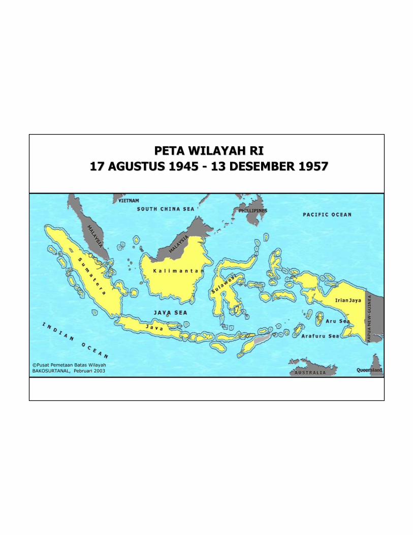
PETA WILAYAH RI PETA WILAYAH RI
17 AGUSTUS 1945 17 AGUSTUS 1945 -- 13 DESEMBER 195713 DESEMBER 1957
©Pusat Pemetaan Batas Wilayah
BAKOSURTANAL, Pebruari 2003

PETA WILAYAH RIPETA WILAYAH RI
13 DESEMBER 1957 13 DESEMBER 1957 -- 17 FEBRUARI 196917 FEBRUARI 1969
Deklarasi Djuanda 1957
UU No. 4/PRP/tahun 1960
©Pusat Pemetaan Batas Wilayah
BAKOSURTANAL, Pebruari 2003
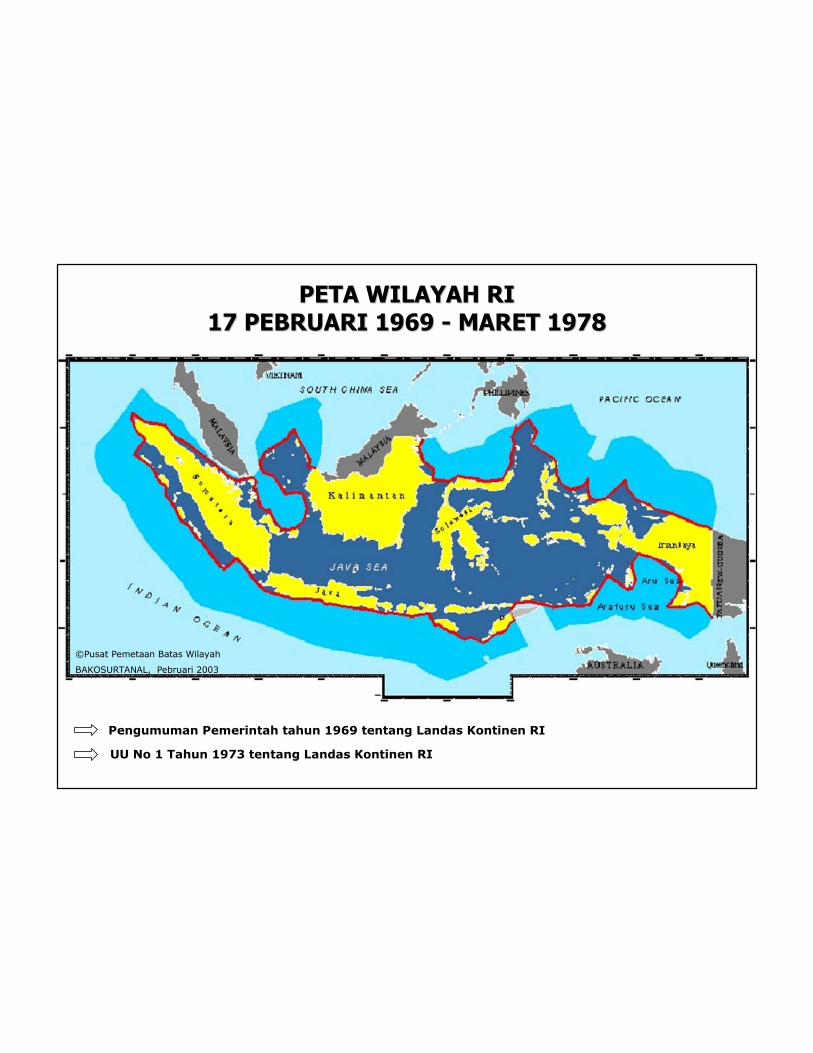
PETA WILAYAH RIPETA WILAYAH RI
17 PEBRUARI 1969 17 PEBRUARI 1969 -- MARET 1978MARET 1978
Pengumuman Pemerintah tahun 1969 tentang Landas Kontinen RI
UU No 1 Tahun 1973 tentang Landas Kontinen RI
©Pusat Pemetaan Batas Wilayah
BAKOSURTANAL, Pebruari 2003
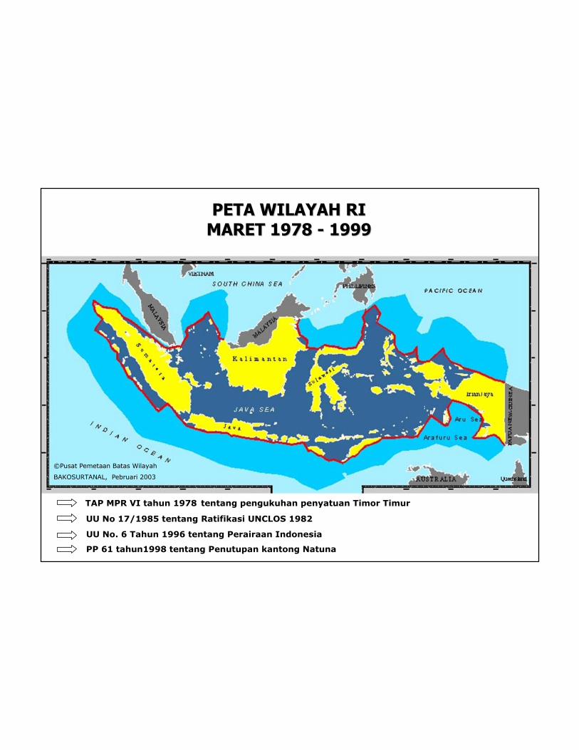
PETA WILAYAH RI PETA WILAYAH RI
MARET 1978 MARET 1978 -- 19991999
TAP MPR VI tahun 1978 tentang pengukuhan penyatuan Timor Timur
UU No 17/1985 tentang Ratifikasi UNCLOS 1982
PP 61 tahun1998 tentang Penutupan kantong Natuna
UU No. 6 Tahun 1996 tentang Perairaan Indonesia
©Pusat Pemetaan Batas Wilayah
BAKOSURTANAL, Pebruari 2003
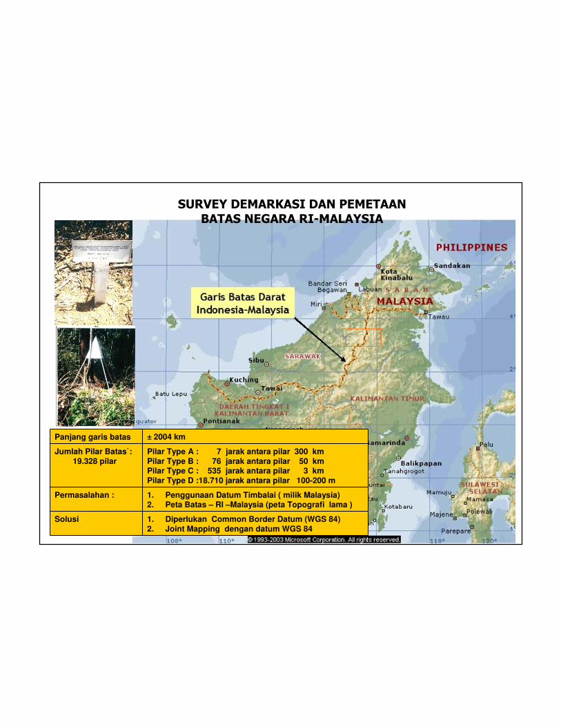
SURVEY DEMARKASI DAN PEMETAAN
BATAS NEGARA RI-MALAYSIA
Panjang garis batas ± 2004 km
Jumlah Pilar Batas`: 19.328 pilar
Pilar Type A : 7 jarak antara pilar 300 kmPilar Type B : 76 jarak antara pilar 50 kmPilar Type C : 535 jarak antara pilar 3 kmPilar Type D :18.710 jarak antara pilar 100-200 m
Permasalahan : 1. Penggunaan Datum Timbalai ( milik Malaysia)2. Peta Batas – RI –Malaysia (peta Topografi lama )
Solusi 1. Diperlukan Common Border Datum (WGS 84)2. Joint Mapping dengan datum WGS 84
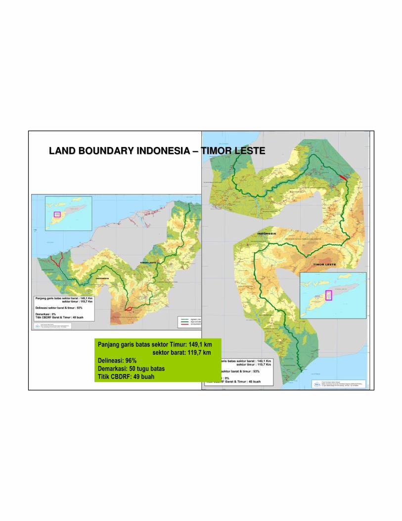
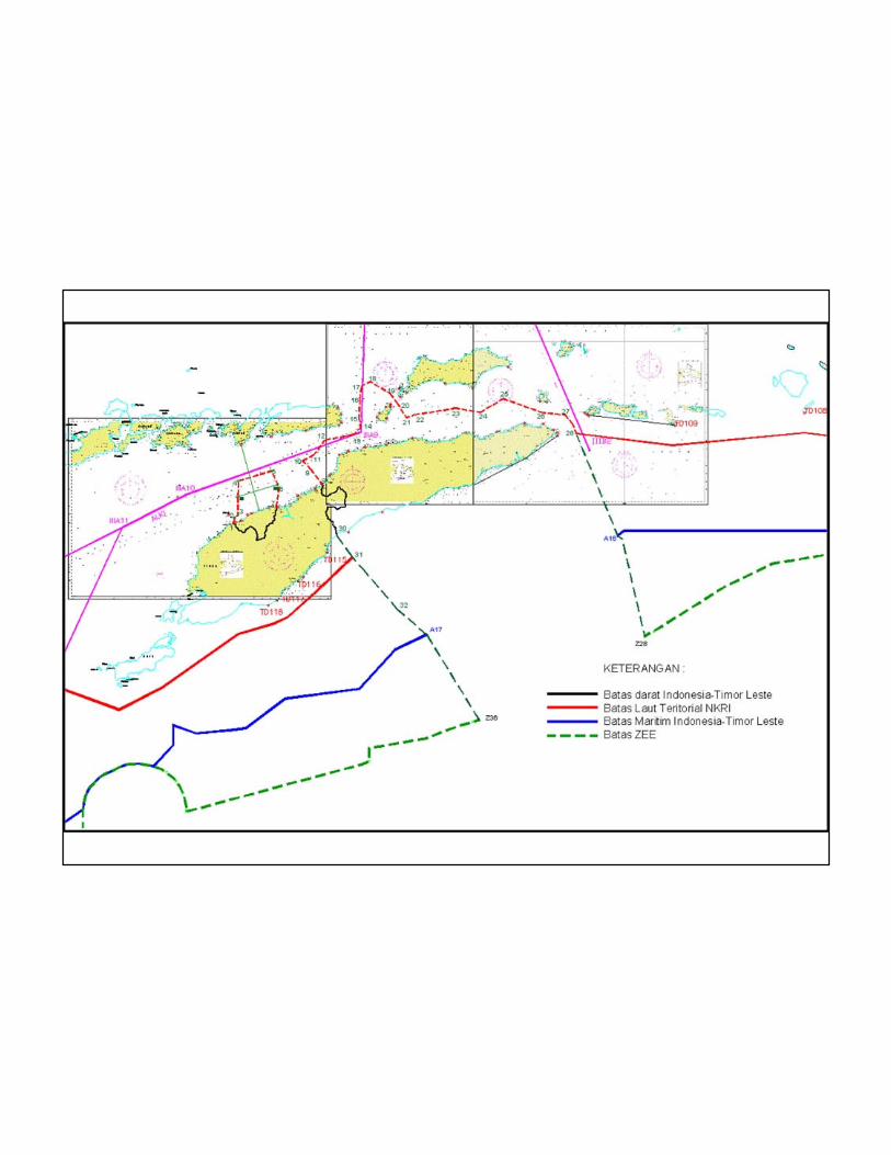
LAND BOUNDARY INDONESIA – TIMOR LESTELAND BOUNDARY INDONESIA – TIMOR LESTE
Panjang garis batas sektor Timur: 149,1 km
sektor barat: 119,7 km
Delineasi: 96%
Demarkasi: 50 tugu batas
Titik CBDRF: 49 buah
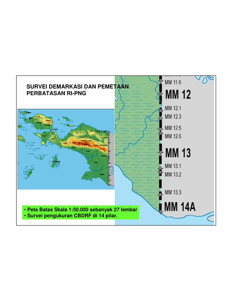
SURVEI DEMARKASI DAN PEMETAAN PERBATASAN RI-PNG
• Peta Batas Skala 1:50.000 sebanyak 27 lembar• Survei pengukuran CBDRF di 14 pilar.

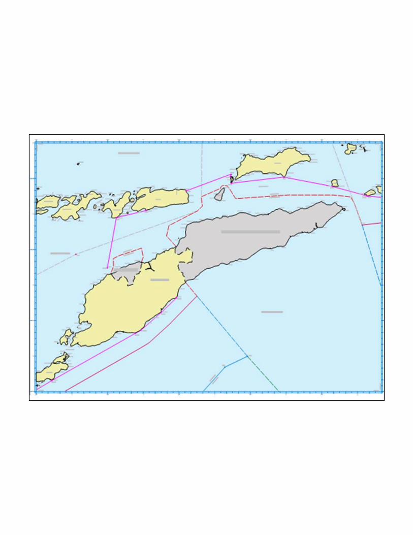
BATAS INDONESIA - THAILAND
© BAKOSURTANAL; Pusat Pemetaan Batas Wilayah, 2003

BATAS INDONESIA - SINGAPURA
© BAKOSURTANAL; Pusat Pemetaan Batas Wilayah, 2003
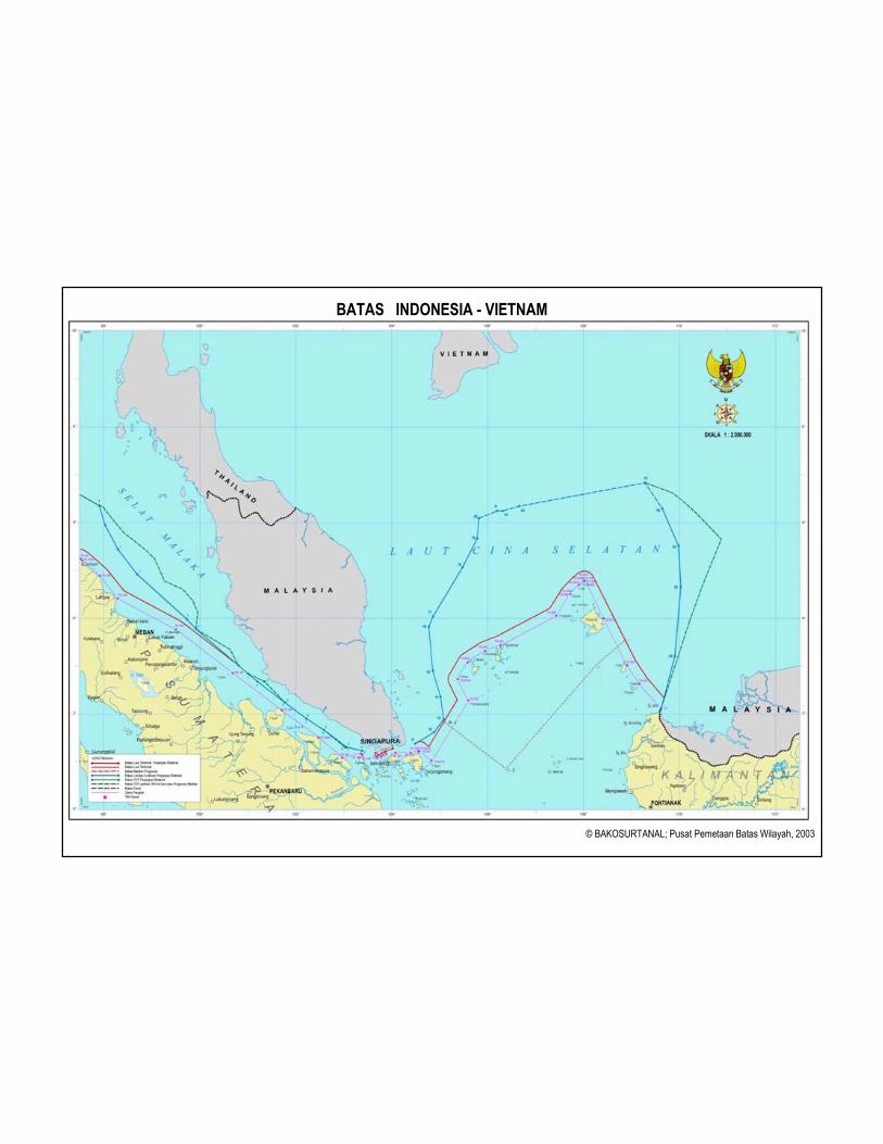
BATAS INDONESIA - VIETNAM
© BAKOSURTANAL; Pusat Pemetaan Batas Wilayah, 2003
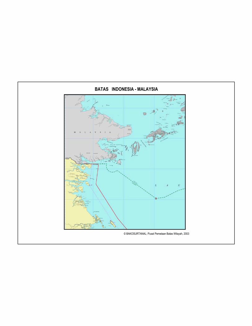
BATAS INDONESIA - MALAYSIA
© BAKOSURTANAL; Pusat Pemetaan Batas Wilayah, 2003
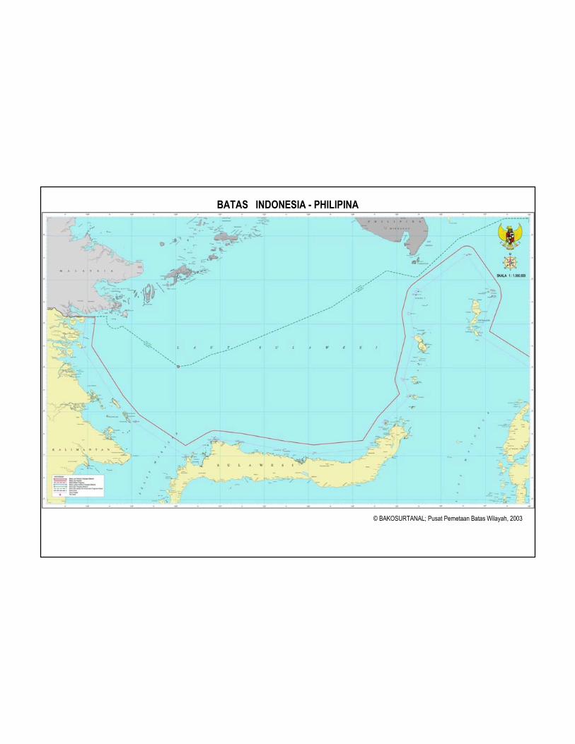
BATAS INDONESIA - PHILIPINA
© BAKOSURTANAL; Pusat Pemetaan Batas Wilayah, 2003

BATAS INDONESIA - AUSTRALIA
© BAKOSURTANAL; Pusat Pemetaan Batas Wilayah, 2003

Date (dd-mm-yr) Border Country
Type of Boundary Signing Ratification
Singapore Territorial Sea 25-05-73 29-08-74
Territorial Sea 17-03-70 08-10-71
Continental Shelf (3) 27-10-69 07-11-69
Continental Shelf (+ Thailand) 21-12-71 16-07-73 Malaysia
EEZ (Economic Exclusive Zone) not yet not yet
Continental Shelf 26-06-03 not yet Vietnam
EEZ (Economic Exclusive Zone) not yet not yet
Continental Shelf not yet not yet Philippines
EEZ (Economic Exclusive Zone) not yet not yet
Territorial Sea (2) 12-02-73 26-11-74
Continental Shelf 13-12-80 10-07-82 Papua New Guinea
EEZ (Economic Exclusive Zone) not yet not yet
Continental Shelf (Seabed) (2) 18-05-71 09-10-72
08-11-73
Fishing Zone 29-10-81 01-02-82
Continental Shelf (Zone of Cooperation)
11-12-89 09-02-91
Australia
EEZ (Economic Exclusive Zone) 14-03-97 not yet
The Status of Maritime Boundaries Agreements
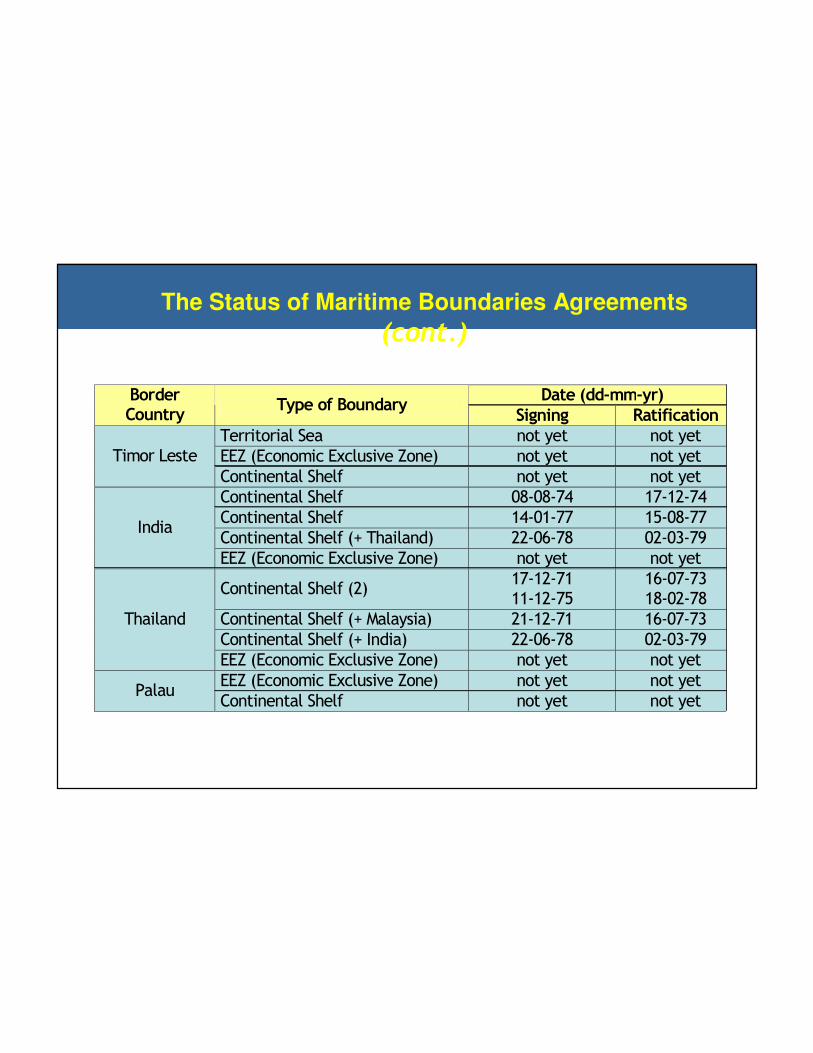
Date (dd-mm-yr) Border Country
Type of Boundary Signing Ratification
Territorial Sea not yet not yet
EEZ (Economic Exclusive Zone) not yet not yet Timor Leste
Continental Shelf not yet not yet
Continental Shelf 08-08-74 17-12-74
Continental Shelf 14-01-77 15-08-77
Continental Shelf (+ Thailand) 22-06-78 02-03-79 India
EEZ (Economic Exclusive Zone) not yet not yet
Continental Shelf (2) 17-12-71 11-12-75
16-07-73 18-02-78
Continental Shelf (+ Malaysia) 21-12-71 16-07-73
Continental Shelf (+ India) 22-06-78 02-03-79
Thailand
EEZ (Economic Exclusive Zone) not yet not yet
EEZ (Economic Exclusive Zone) not yet not yet Palau
Continental Shelf not yet not yet
The Status of Maritime Boundaries Agreements
(cont.)

Indi
aIn
done
sia
Longitude90 92 94 96 98
- 2
0
2
4
6
Baseline
350
nm
Gardiner line
(line of 1% sediment thickness)
100
nm
Covered area
2,172 km2
Covered area
2,172 km2
60 n
m
India
n O
cean
Latitu
de
200 nm
Cut-off line
Foot of Continental Slope
2500 meter Isobath
Distance Formula
Kajian Landas Kontinen Indonesia di luar 200 nm di Barat NADKajian Landas Kontinen Indonesia di luar 200 nm di Barat NAD
Diindikasikan 3 lokasi batas
LK di luar 200 nm :
• sebelah barat NAD
• selatan NTT
• utara Papua
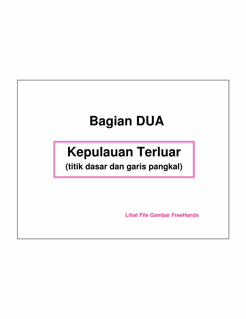
Bagian DUA
Kepulauan Terluar(titik dasar dan garis pangkal)
Lihat File Gambar FreeHands
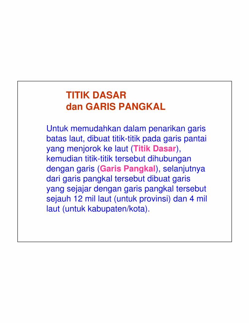
Untuk memudahkan dalam penarikan garis
batas laut, dibuat titik-titik pada garis pantai
yang menjorok ke laut (Titik Dasar), kemudian titik-titik tersebut dihubungan
dengan garis (Garis Pangkal), selanjutnya dari garis pangkal tersebut dibuat garis
yang sejajar dengan garis pangkal tersebut
sejauh 12 mil laut (untuk provinsi) dan 4 mil
laut (untuk kabupaten/kota).
TITIK DASAR dan GARIS PANGKAL


Stasiun Pasut
TR = Titik Referensi
Garis Pantai Hidrografi
Garis Pantai Geodetic
Garis Pantai padaKetinggian Kondisi Kering(Titik Dasar = Basepoint)
Daerah Pantai
Muka Air Laut Tertinggi
Muka Air Laut Rata-Rata
Datum Vertikal Untuk Peta Rupa Bumi
Muka Air Laut Terendah
Datum Vertikal Untuk Chart
12 nM
Laut Territorial
24 nM
Zona Tambahan
200 nM
Zona Ekonomi Eksklusif

© Pusat Pemetaan Batas Wilayah
BAKOSURTANAL 2003
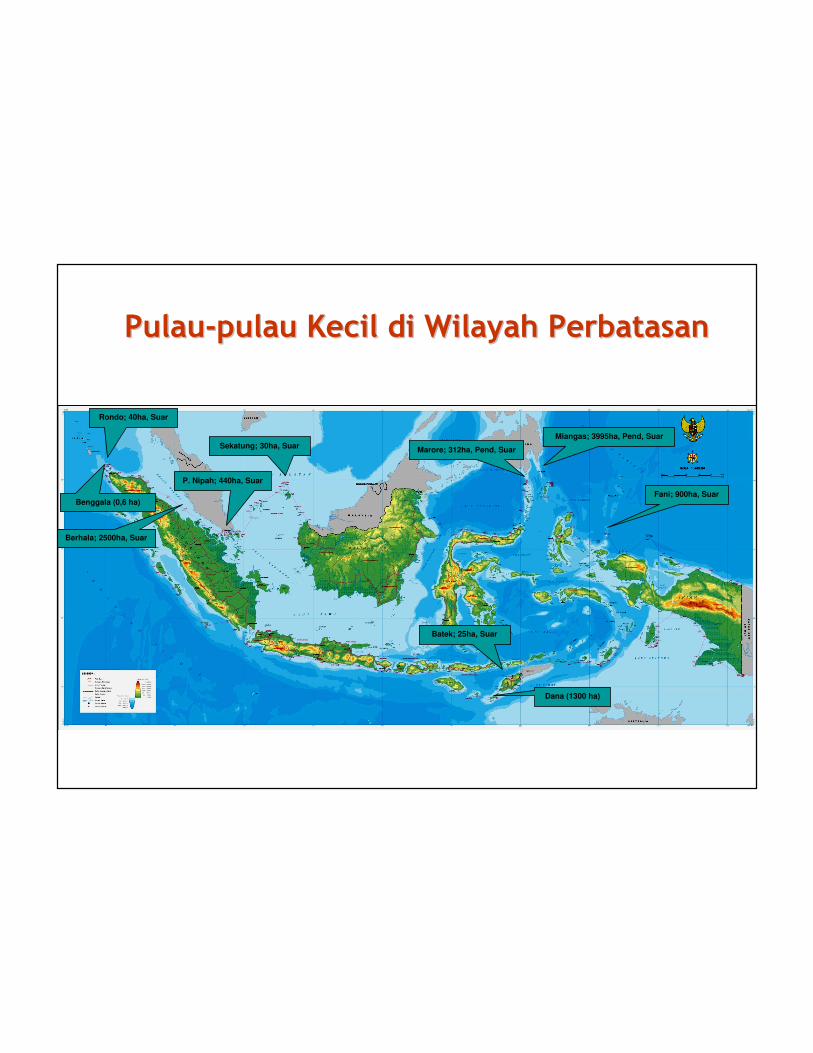
Pulau-pulau Kecil di Wilayah Perbatasan PulauPulau--pulau Kecil di Wilayah Perbatasan pulau Kecil di Wilayah Perbatasan
Sekatung; 30ha, Suar
P. Nipah; 440ha, Suar
Marore; 312ha, Pend, Suar
Batek; 25ha, Suar
Berhala; 2500ha, Suar
Miangas; 3995ha, Pend, Suar
Rondo; 40ha, Suar
Benggala (0,6 ha)
Dana (1300 ha)
Fani; 900ha, Suar
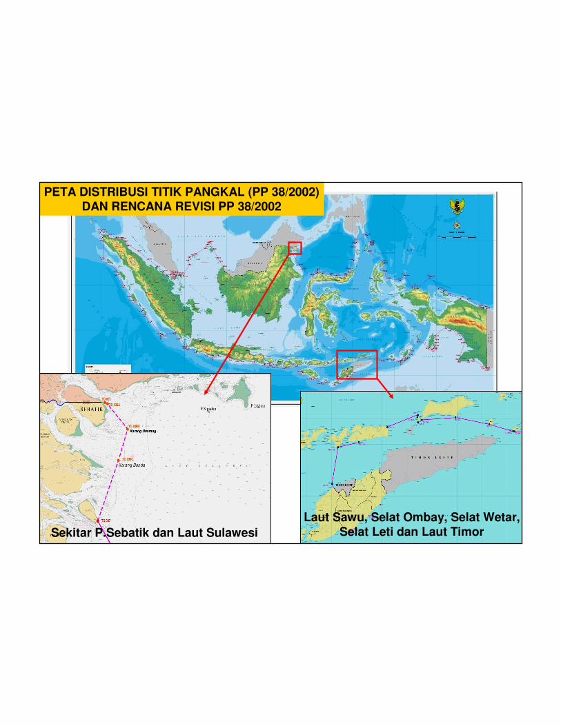
PETA DISTRIBUSI TITIK PANGKAL (PP 38/2002)DAN RENCANA REVISI PP 38/2002
Sekitar P.Sebatik dan Laut Sulawesi
Laut Sawu, Selat Ombay, Selat Wetar,Selat Leti dan Laut Timor
Bagian TIGA
Kasus Batas
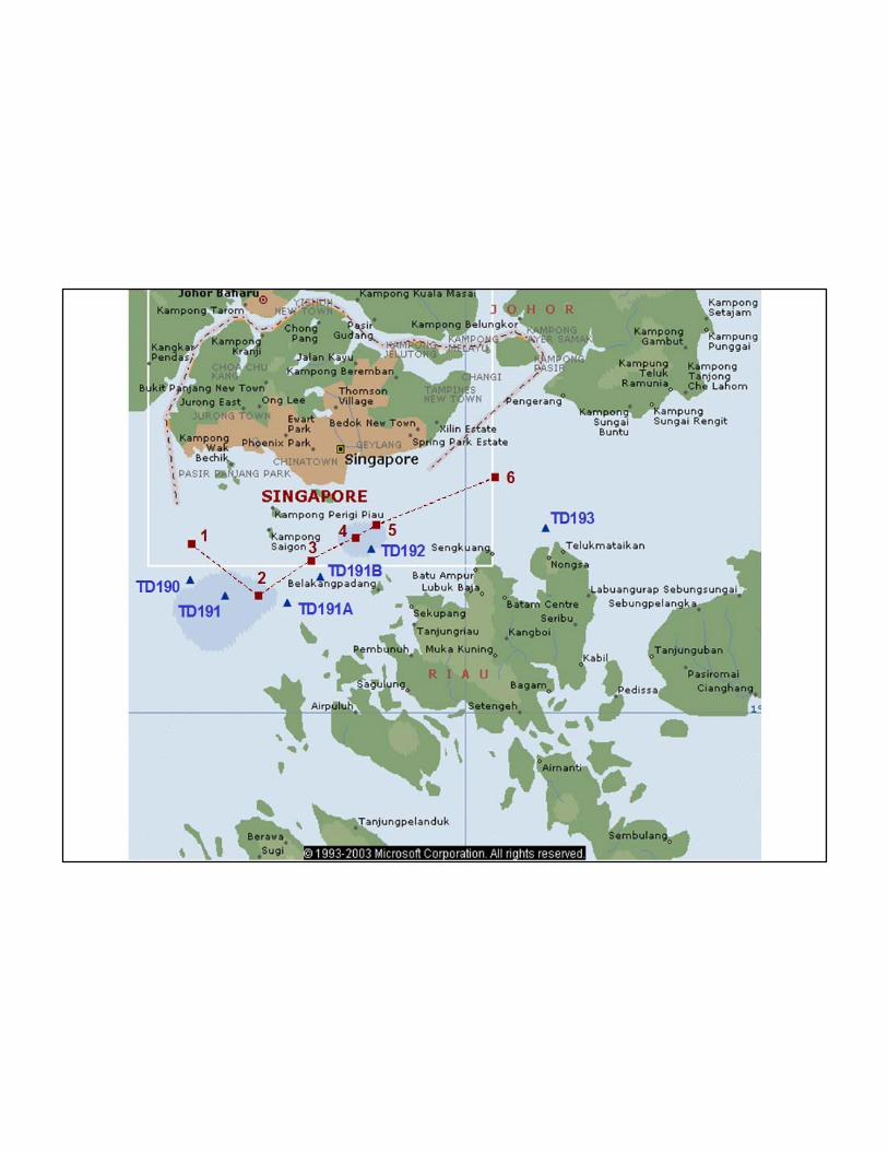
RI-Singapura
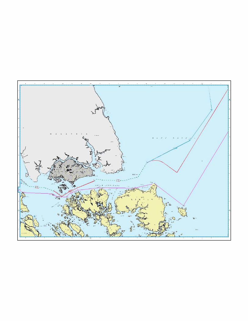

MAP OF THE TREATY BETWEEN INDONESIA - SINGAPORE RELATING TO
DELIMITATION OF THE TERRITORIAL SEAS IN THE STRAIT OF SINGAPORE25 May 1973
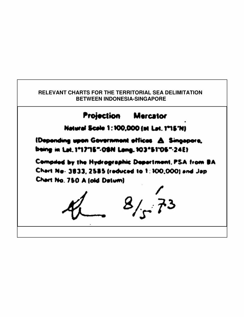
RELEVANT CHARTS FOR THE TERRITORIAL SEA DELIMITATIONBETWEEN INDONESIA-SINGAPORE
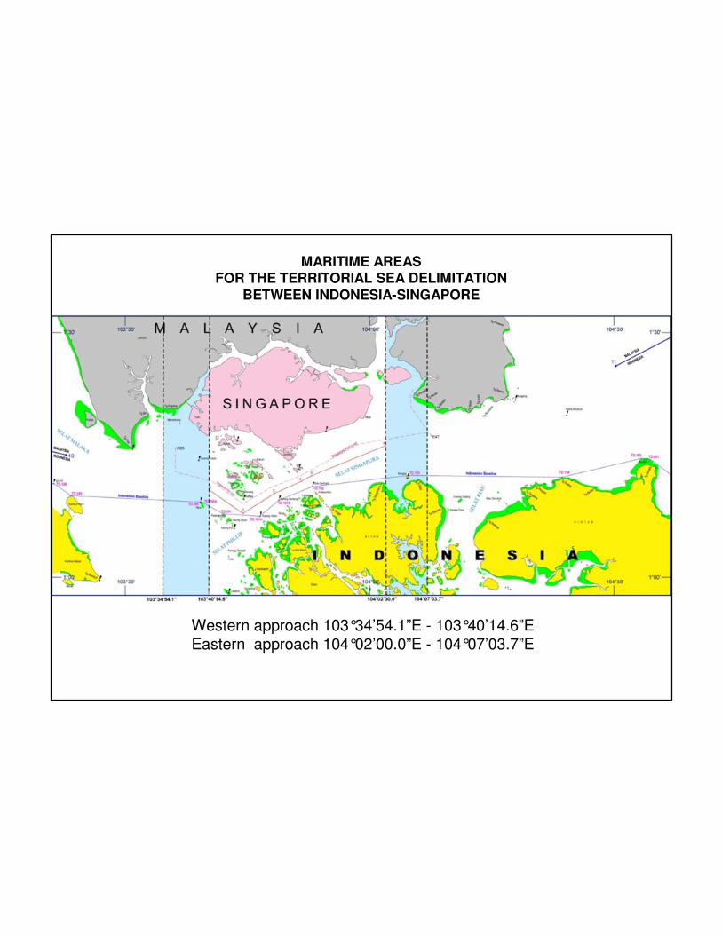
MARITIME AREASFOR THE TERRITORIAL SEA DELIMITATION
BETWEEN INDONESIA-SINGAPORE
Western approach 103°34’54.1”E - 103°40’14.6”E
Eastern approach 104°02’00.0”E - 104°07’03.7”E
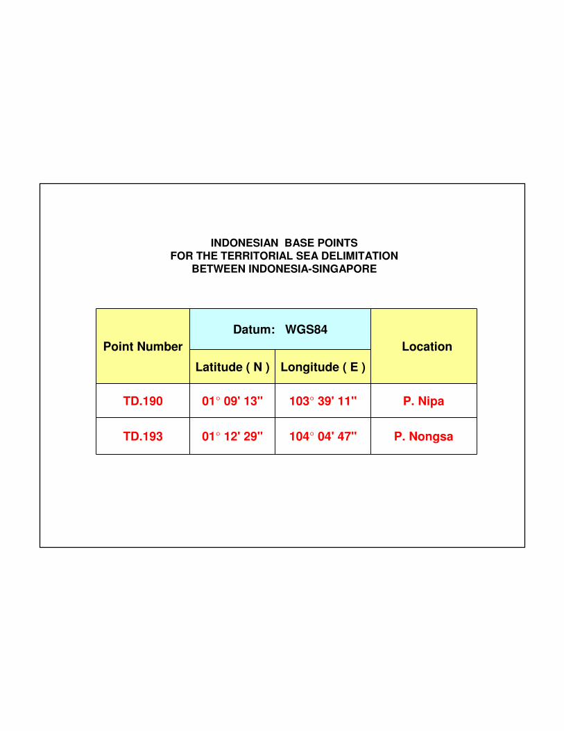
Point Number
Datum: WGS84
Location
Latitude ( N ) Longitude ( E )
TD.190 01° 09' 13" 103° 39' 11" P. Nipa
TD.193 01° 12' 29" 104° 04' 47" P. Nongsa
INDONESIAN BASE POINTSFOR THE TERRITORIAL SEA DELIMITATION
BETWEEN INDONESIA-SINGAPORE
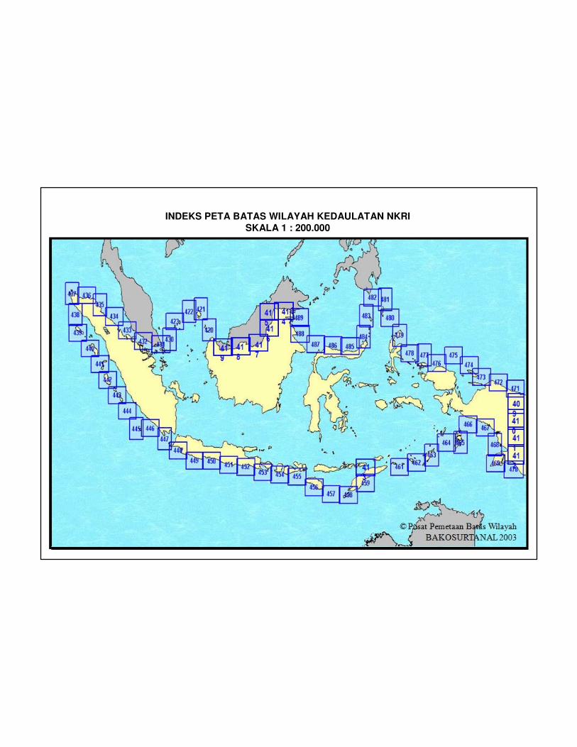
INDEKS PETA BATAS WILAYAH KEDAULATAN NKRISKALA 1 : 200.000
© Pusat Pemetaan Batas Wilayah
BAKOSURTANAL 2003
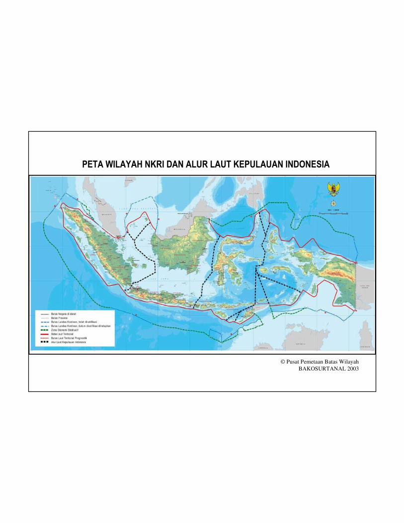
PETA WILAYAH NKRI DAN ALUR LAUT KEPULAUAN INDONESIA