-c7 >r - USGS · 9,1287: c? 10-j 11 !" li i,3 j 14 ii 15 i 16 {17 i i 13 19 20-21 22 23 24 25--c7...
165
9,1287 : c? 10- j 11 ! L " i i ,3 j i 14 i 15 i 16 { 17 i i 13 19 20- 21 22 23 24 25- -c7 >r DNITED STATES DEPARTMENT OF THE INTERIOR -GEOLOGICAL SURVEY GEOLOGY OF THE MACKAY 30-MINUTE QUADRANGLE, IDAHO* By Wtllis H. Nelson and Clyde P. Ross Open-file report 1969 This report is preliminary and has not been edited or reviewed for conformity with Geological Survey standards U S. OO'(K»iN'V i.NT OFFICZ : 1*5» O - 51'.
Transcript of -c7 >r - USGS · 9,1287: c? 10-j 11 !" li i,3 j 14 ii 15 i 16 {17 i i 13 19 20-21 22 23 24 25--c7...

9,1287
: c?
10- j
11 !L" i i
,3 ji14 i
15 i
16 {
17 ii
13
19
20-
21
22
23
24
25-
-c7 >r
DNITED STATES DEPARTMENT OF THE INTERIOR
-GEOLOGICAL SURVEY
GEOLOGY OF THE MACKAY 30-MINUTE QUADRANGLE, IDAHO*
By
Wtllis H. Nelson and Clyde P. Ross
Open-file report
1969
This report is preliminary and has not been edited or reviewed
for conformity with Geological Survey standards
U S. OO'(K»iN'V i.NT OFFICZ : 1*5» O - 51'.

9.126?
1
2
3 ,
4 ;
v-1
6 \
_ 7
8
9
10-
11
12
13*.
14
15--
16
17
18 ]
19
20~-
21
22
2.1
24
25 -
cContents
Carboniferous and Permian rocks -
Age and paleontology -- - .
% White Knob Limestone -----
Age and paleontology .
Regional relations - - - -
Marble and associated isochemically metamorphosed
Page ;t
i ; 3
6 ,
U !
- 11i
14
---*- 14
32 **
39
42
42
. 66
91
O9
92
----- y* |
100
105
... -IriC I
107
110

1~2
3
.4
5-
6
7
8
9
10-
11
12
n*"
14
I5~
16
17
18
19
20-
21
22
23
24
Quaternary deposits ............ ..
Snake River Group -- - ... .-
Terrace alluvium - ...
Flood-plain alluvium . ...
Faults
Geologic history - .-. .... .. ..
Alder Creek mining district - - --
Copper Basin mining district ---
Little Wood River mining district -
References cited ----------- ........'....
I
»..
Page
i
i *%/\
. 130
i
I/O I- . .. .. ... 143 ,
ii

9.1267
5-
Tables
Table 1. Chemical analyses of White Knob Limestone
from near Mackay -- . .. .... .
2. Chemical and normative analyses of Challis
Volcanics -- - - -- - .
3. Chemical and normative analyses of intrusive
rocks of the Mackay quadrangle
io-:
n
12
13
14
15-
16
17
18
19
20
21
22
23
24
25
45
In back
In back!
PRINTING OFFICE: !«} O-511171
iii

9.1267
The geology of the Mackay thirty-minute
quadrangle, Idaho
By Willis H. Nelson and Clyde P. Ross
7 Abstract
8 The Jefferson Dolomite, Grand View Dolomite, and Three Forks
5 (Limestone, all of Devonian age, are the oldest rocks exposed in the
10-jquadrangle. Rocks that range from Mississippian to Permian in age are .
I |11 .widespread; they are represented by the White Knob Limestone in the! i
12 |eastern part of the quadrangle and the Copper Basin Formation in the [
13 ; western part. The Copper Basin Formation, which is composed of non- ii ' i14 |carbonate detrital rocks, is interlayered with the White Knob Limestone;
i i 15~|near the middle of the quadrangle. This interlayering is herein !
i ' Ii . i16 I interpreted to be the result of depositional interbedding, but it could:
I i17 !be in part due to juxtaposition by faulting. The Challis Volcanics, of,
i j18 Tertiary age, cover much of the quadrangle, and except for a conspic
uous basal conglomerate, lack distinctive subdivisions similar to those19
20-
21
22
23
24
in neighboring areas. Alluvial deposits which may be in part as old as
Pliocene are scattered through the quadrangle. Glaciation affected allI I
the higher parts of the quadrangle, and locally glacial deposits of at i
least three ages can be distinguished. The latest two of these are
probably of late Wisconsin Bull Lake and Pinedale ages. Basalt flows
o^_p_rpb_able._RecenjC:_jige_extend_into_the_^Q_uthernmQSt.-.part- of_the____

9.1267
quadrangle and originate in part from vents there.
Intrusive rocks, including plutons and related dikes of Tertiary
age, are scattered throughout the quadrangle. They range from granite
to quartz diorite in composition. The intrusive rocks seem to be
related to the Challis Volcanics.
The rocks of the quadrangle were strongly deformed and eroded
prior to the deposition of the Challis Volcanics. No thrust faults
have been recognized although such faults are plentiful in the adjacent,
region. Deformation has continued until recent times. *.*-
10- All or parts of five mining districts are included in the
11 quadrangle and the total production probably exceeded $10,000,000.
12
13
Mining has been quiet since World War II but activity has been renewed ,|
at times in the past and possibilities for the discovery of substantial;
14 new deposits seem promising. The mineral deposits formed largely byi
15~!replacement, partly in areas of contact metamorphism. The metals
16 present are varied but copper has been the main product. All of the
deposits are believed to be related to the intrusions of Tertiary age.17
ia
19
20-
21
22
23
24
IT. 3. GOVER.WEST i'RtNTJNC OF7;CS : ?? > O - 511171

3.1267
1 Introduction
2 The Mackay quadrangle lies mainly in the drainage basin of the
Big Lost River in south-central Idaho. It is largely in Ouster County
but parts of Blaine and Butte Counties are included. The Mackay
s- quadrangle contains all or large parts of the Copper Basin, Alder
1 Creek, Little Wood River, and Lava Creek mining districts (Ross, 1941).
7 The eastern border of the Alto district is included.
The locations of most of the features described and discussed in
9 ;this report, as well as the fossil localities cited, are shown on the
id-igeologic map of the Mackay quadrangle (Nelson and Ross, 1969). Thei
11 iwork on which the geologic map of the quadrangle and this report is
i i12 based, was part of a series of studies undertaken by Ross in central
13
14
Idaho, j Field mapping was done at a scale of 1:96,000 during the|
'summers of 1956, 1957, and 1958, with brief visits in 1959, 1960, and
i5-1961. Ross did the largest part of the field mapping with Nelsoni -
16 participating in the field during 1958. Nelson took over completion|
17 of the report and developed many of the ideas presented here afteri i
18 Ross' death early in 1965. Emphasis of this study was mainly on majori
ia jfeatures of the Paleozoic stratigraphy, but other aspects of the general
-"-geology received attention. The scale of the available base map and| '
21 the time devoted to the fieldwork prohibited detailed study of the
22 quadrangle as a whole, but stratigraphic details were obtained in
23 'selected areas, mainly by B.A.L. (Betty) Skipp and Willis Nelson. A
24 nap of the part of the Alder Creek mining district that centers around
mine was made by Nelson. 1°L the__cpurse_of.. this_wo.r_kJhe_I'. 5. GOVSHN . L'N'T HKi.VfLNC, OFFICE : 1959 O -

S. i 257
gathered significant data on metamorphism and on the character and age ;
of the intrusive activity in relation to ore genesis; summaries of the
3 .work are included in this report. In the summer of 1961, Thor
Kiilsgaard studied the mines close to Mackay, using Nelson's detailed
5-jareal map as a guide, and some of his ideas on the ore deposits are
included.
11
12
14
1
16
' 17
13
19
i
21
15-
20- |
23 !
24
25 i
:. 3. GOVERNMENT PRINTING OFFICE: t«59 O-511171M7-T30

9.1267
10-
11
12
13
14
1
16
17
18
15
Everyone encountered during the course of the field-
work was cordial and cooperative, contributing greatly to
the pleasure and speed with which the work was done. In
the summer of 1956, Ronald Kistler acted as field assistant
During the following summer, Betty Skipp spent about two
weeks in an intensive study of Carboniferous strata in the
southeastern part of T. 7 N., R. 22 £. (Skipp,
1961a, 1961b), and in other incidental work in the quad
rangle. Much of the areal mapping in 1958 was done .-by
Robert Lester and Betty Skipp, who have contributed
also in the subsequent office work. Verl Potts owned and
managed the pack train used in 1957 and 195S. The skill
and energy displayed by himself and his horses were
indispensable in providing access to the more remote parts
of the quadrangle. Valuable aid in the office was rendered
| by George E. Ulrich, mainly in connection with the pet.ro-
graphic work.
20-
21
22
23
24
25
U. 3. GOVERNMENT P3INTING OFFICE : t«9 O Mil 71 (7-100

9.1257
5-
10-
11
12
13
14
I
16
17
18
19
15-
20
21
22
23
ta.
24
25-
Devonian rocks
Rocks of Devonian age are recognized only in the Lost
River Range in the northeast corner of the quadrangle.
They constitute an extension southeastward of the three
Devonian formations mapped in the adjacent Borah Peak quad
rangle (Ross, 1947, p. 1107-1112). In ascending order,
the units are the Jefferson Dolomite, Grand View Domoraite,
and Three Forks Limestone. The extensive exposures in the
Borah Peak quadrangle have yielded more data on all three
than could be obtained in the Mackay quadrangle.
- A few hundred feet of Jefferson Dolomite are poorlyi
exposed in a small area on the lower slopes of the Losti
River Range, where it consists of dark-bluish-gray dolomitei '
nearly black in most outcrops. Evidence of the former
presence of organisms is discernible but few identifiable
fossils remain. One (collection 4474-SD, map location 1)
was determined by Jean M. Berdan (written communication,
November 27, 1957) as "FavoSites" cf. "F." limitaris
Rominger, of Middle or Late Devonian age.
U. S. GOVERNMENT PRINTING OFFICE: 1959 O-5IJ171( 7-100

9.1267
5-
10-
11
12
13
14
15
16
17
18
19
20-
21
22
23
24
25-
The Grand View Dolomite extends southeastward from
the northern border of the Mackay quadrangle past the gorge
of Lower Cedar Creek. Detailed measurements on the timbered»
slopes are impracticable but the thickness is roughly 2,000
feet. The dolomite is similar to that in the Jefferson
Dolomite below, but it is somewhat thinner bedded and
weathered surfaces tend to be more rusty colored. In
places near the top, thin limestone beds may represent
gradation into the overlying Three Forks Limestone. Two
scanty collections (MI 3 and MI 4, map locations 2 and 3)
from the Grand View Dolomite in unsurveyed sec. 29,I
T. 8 N«, R. 24 E.j in the Lost River Range, were examinedii
by R. S. Boardman (written communication, February 4,
1957). The first (MI 3) contains a species of the ramose
stromatoporoid genus Amphipora of Middle or Late Devonian
age. The other, from a short distance down slope, contains
a species of a ramose stromatoporoid closely related to
Amphipora but probably belonging to the poorly understood
genus Dendrostrana. It is presently known in this country
only in the Middle Devonian of Michigan.
U. S. GOVERNMENT PRINTING" OFFICE : 1759 O-5) 1171 7-ICo
7.
9.12S7 .
5-
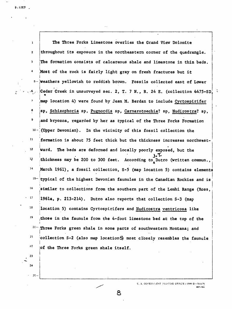
The Three Forks Limestone overlies the Grand View Dolomite
throughout its exposure in the northeastern corner of the quadrangle.
JThe formation consists of calcareous shale and limestone in thin beds.
.Most of the rock is fairly light gray on fresh fractures but itIjweathers yellowish to reddish brown. Fossils collected east of Loweri|Cedar Creek in unsurveyed sec. 2, T. 7 N. , R. 24 E. (collection 4475-SD
10-
11
12
14
15~
15
17
13
19
C~
21
23
24
location 4) were found by Jean M. Berdan to include Cyrtospirifer
sp, Schizophoria sp, Pugnordis sp, Carnarotoechia? sp, Nudirostra? sp,
jand bryozoa, regarded by her as typical of the Three Forks Formationi Ij(Upper Devonian). In the vicinity of this fossil collection theiformation is about 75 feet thick but the thickness increases northwest
ward. The beds are deformed and locally poorly exposed, but the
; thickness may be 200 to 300 feet. According to Dutro (written commun.,' A
(March 1961), a fossil collection, S-5 (map location 5) contains elements! l
typical of the highest Devonian faunules in the Canadian Rockies and isi^similar to collections from the southern part of the Lemhi Range (Ross,
|1961a, p. 213-214). Dutro also reports that collection S-3 (map
location 5) contains Cyrtospirifers and Nudirostra ventricosa like
I those in the faunule from the 4-foot limestone bed at the top of thei^ree Forks green shale in some parts of southwestern Montana; andIcollection S-2 (also map location^ most closely resembles the faunulei jof the Three Forks green shale itself.
U. 3. GOVEK.V.iENT HUNTING OFrlCS : 19S9 O- 511171S87-IOC
8

9.1267
10-
11
12
13
14
1
16
17
18
19
15-
20
21
22
23
24
25-
S-5. About 210 feet above base of Three Forks Limestone
near the Milligen . . contact:
echinoderm debris, indet.
Schizophoria aff. £. striatula Schlotheim
Camarotoechia cf. C_. nordeggi Kindle
Pugnoides cf. £. minutus (Warren)
Nudirostra sp.
Cyrtospirifer aff. £. animasensis Girty
Cyrtospirifer aff. £. whitneyi (Hall)
"Cleiothyradina" cf. "£." devonica (Raymond)
-~ Athyris aff. A^. angelica Hall
S-3. Same map location as S-5; about 160 feet above base
of Three Forks Limestone:
echinoderm debris, indet.
massive bryozoan, undet.
ramose bryozoans, undet.
Schuchertella sp.
Produc tella aff. P_. coloradoensis Kindle
Canarotoechia sp.
Nudiros tra ventricosa (Haynes)
Cyrtospirifer aff. £. monticola (Haynes)
Cyrtospirifer sp.
"Spirifer" cf. "£." notabilis Kindle
Crurithyris? sp.pectinoid pelecypod, indet.
______________nautiloid cephalopod. indet.________________U. S. GOVER*SMEMT PRINTS ^ fFICE : 1959 O - S1I17I
e«7-too

9-t2«7
S-2
10-
11
12
13
14
15-
16
17
18
19
20
21
22
23
24
25
Same map location as S-5; about 60 feet above base of
Three Forks Limestone: s
echinoderm debris, indet.
ramose bryozoans, undet./
Schuchertella sp .
Schizophoria cf. £. striatula Schlotheim
Productella aff . £. coloradoensis Kindle
a" sp.
Canaro toechia sp.
Nudiros tra sp .
Cyrtospirifer cf. £. whitneyi (Hall)
Cyrtospirifer sp.
"Spirifer" cf. ' £. " notabilis Kindle
"Cleiothyradina" cf. "£. " devonica (Raymond)
orthoceratid cephalopod, indet.
U. S. GOVBH«MENT PRINTING OFFICE : 1959 O - S1U718«7-tOO
10

2
3
Carboniferous and Permian rocks
Milligen Formation
The stratigraphic unit herein designated the Milligen Formation
* sccurs in and extends north and east of the northeastern part of the
5-:iackay quadrangle. It is separated from the rocks at the type locality
e jf the Milligen Formation, in the Hailey quadrangle to the west, byI ,
7 wide areas underlain by other rocks, including the Copper Basin Formation
3 The lower part of the Copper Basin Formation locally includes dark-gray
9 argillaceous rock, which may be the same age as the Milligen Formation,
ic-but none of the argillaceous rocks in the Copper Basin Formation can be
11 traced into either the Milligen Formation of the Lost River Range ori
12 the rocks at the type area of the Milligen Formation in the Haileyi
13 quadrangle.
14 !
I
15-'
18
19
20-
21
22
23
24
25 i
' :. S. GO 'EKNVHTNT PKDTTTNG CFFiCS
II

9.1267
1 An additional reason for questioning the correlation of the rocks
2 mapped as Milligen Formation of the Lost River Range with the Milligen
3 jFormation in the type locality in the Hailey quadrangle is the
4 suggestion by Roberts and Thomasson (1964) that the Milligen Formation
5--fin the type locality may have been deposited in a basin that wasi 6 jseparate from the basin in which the Copper Basin Formation was being
*7 deposited. See the section on the regional relationships of the Copper
a Basin Formation below for further discussion of this problem.
All of the rocks mapped as Milligen Formation in the quadrangle are
10- dominated by dark, nearly black argillite. Some beds are calcareous ,
i i11 shale. The formation yields few exposures and in steep slopes it isi"~~" !12 commonly covered by abundant talus from the overlying White Knob j
13 Limestone. The formation is everywhere so poorly exposed that detailed ;i
14 sections could not be measured in it. Within the quadrangle, thej -
15~ phickness is probably less than 500 feet, although farther northwesti
16 in the same range the thickness has been estimated as about 1,000 feet
17 ;(Ross, 1947, p. 1113).
13
19
20-
21
22
23
24
25-
OFFICE : 19S9 O - ?U17i
1Z

9.1267
1 In the Mackay quadrangle, the Milligen Formation grades downward
2 through a narrow zone into the Three Forks Limestone (Upper Devonian)
3 and is overlain by White Knob Limestone of which at least the lower
4 part is of Late Mississippian age, as shown below. In this quadrangle,i
|5- therefore, the Milligen Formation is clearly of Mississippian age, as '
i e It is in the Borah Peak quadrangle to the north (Ross, 1947, p. 1113). |
^ i7 1/e have found no diagnostic fossils in the formation in this quadrangle,
ia ilthough a few plant fragments have been noted. Sandberg, Mapel, and \
9 iuddle (1967) report on a conodont fauna, which indicates an Earlyi
io-Mississippian (Kinderhook) age, for rocks 13 feet above the base of the
11 Milligen Formation, near the mouth of Cedar Creek Canyon, 4 miles
12 northeast of Mackay.
14
1
16
17
13
19
15-
20-
21
22
23
24
25
r. s. CCYER.V.YIH::. OFFICE: i«9 G--uU'l

9.1267
5-
10-
11
12
13
14
15-
16
17
18
19
Copper Basin Formation
Name and description' _ j
The name Copper Basin Formation was introduced by
Ross (1962) for the thick assemblage of dominantly non-
carbonate clastic rocks that underlies much of the western
part of the Mackay quadrangle; the name is taken from the
major topographic depression in the western part of the
quadrangle.
The Copper Basin Formation consists of quartzite,
sandstone, siltstone, arglllite, muds tone, conglomerate,
and limestone in proportions that vary from place to place.
These rocks range from light gray to nearly Black on fresh
surfaces, and weather various shades of brown. These
various rock types are interbedded on a scale that ranges
from individual beds to sequences many hundreds of feet
in thickness that are dominated by a single rock type.
Where aggregates of argillite or limestone within the
formation are large enough, they have been mapped as sub
divisions of the formation.
20-
21
22
23
24
25-
U. S. GOVERNMENT PRINTING OFFICE : J9S9 O- 51U71 r l«7.100
9.1267
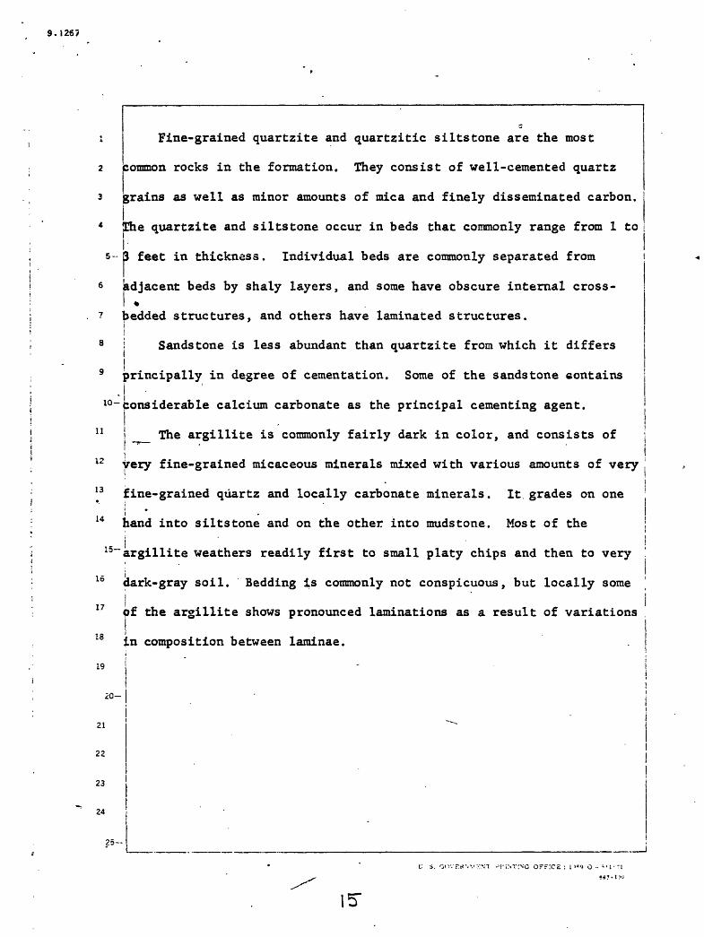
Fine-grained quartzite and quartzitic siltstone are the most
common rocks in the formation. They consist of well-cemented quartz
grains as well as minor amounts of mica and finely disseminated carbon.
4 The quartzite and siltstone occur in beds that commonly range from 1 toI-
5-3 feet in thickness. Individual beds are commonly separated from-r6 adjacent beds by shaly layers, and some have obscure internal cross-
7 bedded structures, and others have laminated structures.
8 i Sandstone is less abundant than quartzite from which it differs
9 principally in degree of cementation. Some of the sandstone contains.|
l°-Considerable calcium carbonate as the principal cementing agent.
11 ! _ The argillite is commonly fairly dark in color, and consists of!
12 very fine-grained micaceous minerals mixed with various amounts of very
13 fine-grained quartz and locally carbonate minerals. It grades on onei
14 hand into siltstone and on the other into muds tone. Most of the
15~ argillite weathers readily first to small platy chips and then to very. _ i
dark-gray soil. Bedding is commonly not conspicuous, but locally some
f the argillite shows pronounced laminations as a result of variations17
18
19
in composition between laminae.
20-
21
22
23
24
-M'iNrrvc OFFICE : i '=<? o - *-i-?i

1267
The conglomerate consists of well-rounded pebbles and cobbles in a
2 groundmass similar to the associated quartzite and sandstone. The
3 pebbles and cobbles are predominantly quartzose rocks that commonly
4 range from granules to pebbles one inch across; at the head of the Right:
s- Fork of Iron Bog Creek, some of the conglomerate contains cobbles
6 5 inches across.i
The limestone in the Copper Basin Formation is similar to, but it
8 is commonly thinner bedded and contains more noncarbonate detritus
9 than the White Knob Limestone. Except for the masses of limestone
10 ~ shown as members of the formation on the geologic map of the quadrangle
11 (Nelson and Ross, 1969), limestone is very sparsely distributed in thei
12 Copper Basin Formation.
13 Some of the sandstone, siltstone, argillite, and the matrices ofI
14 some of the conglomerate contain a significant amount of carbonate;
I5~these rocks are commonly more susceptible to weathering than similar
16 rocks with less carbonate in them and they commonly weather to a more
brownish color.i18 (
19
JO-
21
22
23
24
25-
U. i. GOVERNMENT PKi.STIMJ OFFICE. : l"»s-J O - M1I71

9.1267
5-
10-
The lower 650 feet of rock exposed at Timbered Dome is dolomite
(see p. 31), which differs so much from other rocks of Carboniferous
age in the quadrangle that the possibility that it belongs to some
older unit naturally arises. However, these rocks are exposed over a
limited area, and within that area no evidence for an older age
assignment has been discovered. In the absence of any evidence for a different assignment, the dolomite is included in the Copper Basin
Formation.
The stratigraphic section on Timbered Dome described below and
located on the geologic map of the quadrangle, was measured by Betty
11 j Skipp and Robert Lester and is shown diagrammatically by Skipp (1961a).
12 This section includes rocks that are assigned to both the Copper Basin
13
14
Formation and the White Knob Limestone.
15-
16
17
18
19
20-
21
23
24
25-
t-'. S. GOV3R>MENT ^KCNTI^G OFFICt' : t'jr 1? O - -Mi.'I
36?-Ui
7

. 9-1267
5-
Section of Carboniferous rocks at Timbered Dome
(Thicknesses marked by asterisks calculated
by means of Kelsh plotter)
(Fossils listed were determined tentatively by Betty Skipp)
(Color designations are from "Rock-color Chart,"
10-
11
12
13
14
I
16
17
18
19
15
20-
21
22
23
t
24
25-
Goddard and others, 1948}* At top
Sequence interruptedly small fault which is
overlain by Challis Volcanics
Limestone and sandstone, interbedded; lime
stone, dark-gray and grayish-red
_ (10R 4/2), fine- to coarse-grained,
abundantly fossiliferous (reefoid)
in'places, medium- to thick-bedded,
resistant, weathers .light-brown and
medium-gray; sandstone, very pale
orange (10YR 8/2) and grayish-orange
(10YR 7/4), fine-grained, quartzose,
calcareous, cherty, unfossiliferous,
medium-bedded. Bryozoa, productid
brachiopods and corals----- --
Gradational contact
Thickness feet
100*
U. S. GOVERNMENT PRLNTING"O?FICE : 1959 O - 5U171 «7'tOO
8

9.1267
5-
10-
11
12
13\
14
1
16
,17
18
19
15-
20-
21
22
23
*-
24
25-
Section of Carboniferous rocks at Timbered
Dome--Continued
Limestone and siltstone, interbedded; lime
stone, dark-gray, very fine grained,
sparsely fossiliferous, thin- to
medium-bedded, nonresistant, weathers
grayish-orange; siltstone, grayish-
orange, fine-grained, thin- to medium-
bedded. Unidentifiable brachiopods.
No microfossils-----------------------
~^_ Jasperoid, dark-gray to medium-dark-gray,
very fine grained, fossiliferous near
base, massively bedded, resistant,
weathers light-olive-gray (5Y 6/1) and
.light-brownish-gray (SYR 6/1); inter-
bedded with secondarily silicified
sandstones. Gastropods and brachiopods
poorly preserved---------------------
Contact masked by silicification
Thickness feet
220*
1,080*
U. S. GOVERNMENT PRINTING OFFICE : 1959 O - 5U171. e«T> too

9.1267
7
8
9
10-
11
12
13
14
I
16
17
13
19
20-
15-
21
22
23
24
25
Section of Carboniferous rocks at Timbered
Dome Continued
Sandstone, light-gray to medium-light-gray,\ -
very fine to fine grained, quartzose,
very clean, well compacted, breaks across
grain, mostly medium-bedded, some thick-
bedded, top 10 feet fossiliferous,
resistant, lower 2CO feet secondarily
silicified, weathers grayish-orange
(10YR 7/4) to light-brown (SYR 5/6);
__ interbedded in upper 10 feet with lime-
; stone, medium-gray, fine-grained, impure,
I thi'n to very thin bedded, weathers i
yellowish-gray (5Y 8/1)
Abrupt contact
Thickness feet
430*
V. S. GOVERNMENT PRINTING' OFFICE ; J9*9 O - 511171

S.1267
5-
8
9
10-
11
12
13
14
. 15
16
17
18
19
20-
21
22
23
"24
25
Section of Carboniferous rocks at Timbered
Dome Continued
Limestone, medium-gray to dark-gray,
medium- to coarse-grained, largely
calcsrenite, fossiLiferous, middle
portion thin-bedded and very cherty,%
upper beds medium-bedded with some
grayish-black and light-olive-gray
nodular chert, some graded bedding
and banding. Brachiopods--Spirifer
pellaensis We Her, Productus ,
several species, Girtyella sp.
Corals--several genera including
Triplophyllites sp. Fenestellate
bryozoa. Plectogyra sp.------------
Gradational contact
Thickness feet
645
U. S. GOVERNMENT PRINTING OFFICE : 19*9 O - $11171
847-IOO

9.1267
5-
10-
11
12
13
14
15-
16
17
18
19
20-
21
22
23
24
25-.-
Section of Carboniferous rocks at Timbered,
Dome--Continued/
Limestone, grayish-black to medium-gray,
fine- to medium-grained, fossil iferous,
massive- to thick-bedded, weathers
medium-gray, in places weathered sur-»
face has meringuelike peaks. Corals--
Syringopora sucularia (Girty),
Amplexus sp., Caninia torquia (Owen).
Foraminifera--Plectogyra sp»,
^~ Paraiaillerella circuli (Thompson).
Ammodiscus sp. Brachiopods noted in>
field but not collected--spirifers,
Die1a s ma sp., Composita sp.----------
Gradational contact
Thickness feet
80
U. S. GOVERNMENT PRINT2SG OFFiCE : 1959 O - SUJ71
««?-TOO
Z2.
9.1267
5-
10-
11
12
13 .
14
Section of Carboniferous rocks at Timbered
Dome--Con tinuedThickness
feet
15-
16
17
is
19
20
21
22
23
24
25-
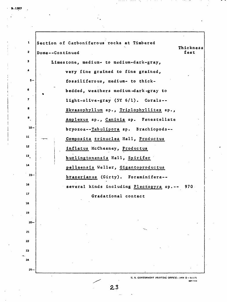
Limestone, medium- to medium-dark-gray,
very fine grained to fine grained,
fossiliferous, medium- to thick-
bedded, weathers medium-dark-gray to
light-olive-gray (5Y 6/1). Corals--
Ekvasophyllum sp., Triplophyllites sp.,
Amplexus sp., Caninia sp. Fenestellate
bryozoa--Tabulipora sp. Brachiopods--
Composita trinuclea Hall, Produc tusi
j inflatus McChesney, ProductusiI burlingtonensis Hall. Spirifer, gi - * *
pellaensis Weller, Gigantoproductus
brazerianus (Girty). Foraminifera-
several kinds including Plectogyra sp.-- 970
Gradational contact
U. 3. GOVE3NMENT PRINTING OFFICE: 1959 O- Sit 171S47-IOO
2.3

9.126?
10-
11
12
13
14
15-
16
17
13
19
20-
21
22
23
24
25
Section of Carboniferous rocks at Timbered
Dome--Continuedf
Limestone, olive-gray to medium-dark-gray,
some pale-grayish red (10R 5/2),
fine- to coarse-grained, dolomitic(?)
near base, fossiliferous, medium to« .
massively bedded, weathers gray and
pale yellowish-brown (10YR 7/2),
resistant near base where coarse
grained limestone is dominant; inter-
___ calated with a few beds of sandstone,
very fine grained, quartzose, pale-
light-brownish-gray (SYR 7/1).
Bryczoa, crinoid fragments, brachio-
pods--Cliothyridina sublamellosa
(Hall), Composita laevis Weller,
Girtyella sp.; corals--Triplophyllites
sp. Paramillerella tortula (D. Zeller),
Plectogyra sp.--------- --------------
Variable contact
Thickness feet
55
. S. GOVEHKMENT PRINTING OFFICE : 1959 O - $111':MT.tCO
9-t267
10-
11
12
13
14
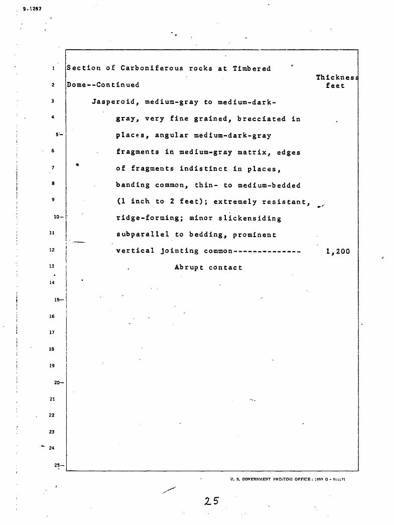
Section of Carboniferous rocks at Timbered r
Dome--Continued
Jasperoid, medium-gray to medium-dark-
gray, very fine grained, brecciated in
places, angular medium-dark-gray
fragments in medium-gray matrix, edges
of fragments indistinct in places,
banding common, thin- to medium-bedded
(1 inch to 2 feet); extremely resistant,
ridge-forming; minor slickensiding
subparallel to bedding, prominent
vertical jointing common----------- -
Abrupt contact
Thickness feet
15
16
17
ia
19
2
21
22
23
24
20-
25-
1,200
U. S. GOVERNMENT PRINTING OFFICE : 1959 O -
Z5

9.12«7
10-
11
12
13
14
15
16
17
18
19
20
21
22
23
24
25
Section of Carboniferous rocks at Timbered
Dome--Continued
Siltstone and limestone, interbedded.
Percentage of siltstone decreases
up section. Siltstone, pale-red
(5R 6/2) and very pale-yellowish-
brown (10YR 6/2), quartzose,
calcareous, thin- to medium-bedded,
slope-forming. Limestone, dark-
gray to grayish-black, very fine to
medium grained; very fine grained i I limestone is dominant and is
characterized by dark color,
stylolitic structures, and a very
pale-yellowish-brown (10YR 7/2)
weathered crust composed of silty
material; medium-grained limestone
is oolitic, has sparry calcite cement,
microfossiliferous, Plectogyra sp.;
forms steep slope below jasperoid.
contact------------------------------
Gradational contact
Thickness feet
780
U. 3. GOVERNMENT PRINTINQ OFFICE : 1959 O - JI11T1M7-ICO
9.128?
5-
10-
11
12
13
14
15-
16
17
18
19
20-
21
22
23
24
25
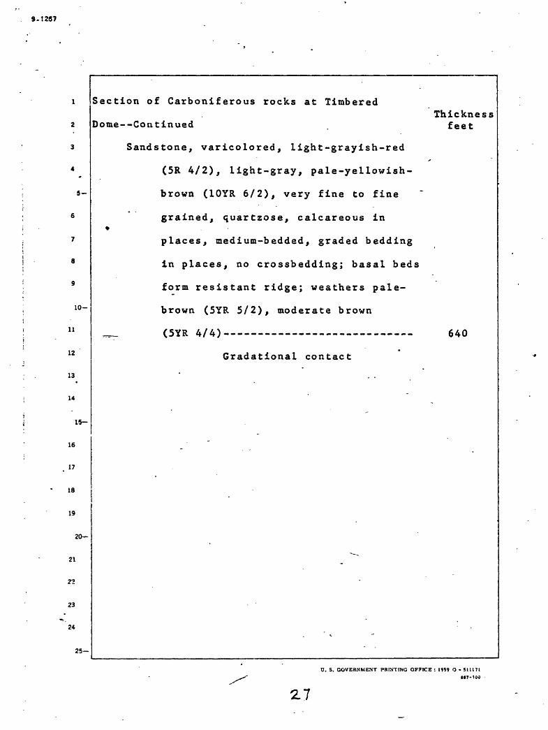
Section of Carboniferous rocks at Timbered
Dome--Continued
Sandstone, varicolored, light-grayish-red
(5R 4/2), light-gray, pale-yellowish-
brown (10YR 6/2), very fine to fine
grained, quartzose, calcareous in%
places, medium-bedded, graded bedding
in places, no crossbedding; basal beds
form resistant ridge; weathers pale-
brown (SYR 5/2), moderate brown
___ (SYR 4/4)
Gradational contact
Thickness feet
640
O. S. GOVERNMENT PRINTING OFFICE : 19S9 O - SI 1171 7-100
2.7

9.1267
5-
10-
11
12
13
14
1
16
17
12
19
15-
20-
21
22
23
25-
Section of Carboniferous rocks at Timbered
Dome--Continued
Siltstone, varicolored, light-pale-brown
(SYR 6/2), light-olive-gray (5Y 6/1),
medium-light-gray, and light-grayish-
red-purple (5RP 5/2), quartzose,
fossil iferous, thin-bedded, slope
forming; thin zone of intraformational
conglomerate occurs in talus through
upper 30 feet--fragments are silt*
-«-~ stone, medium-gray, angular, maximum
size approximately 30 mm, siliceous
cement, outlines of fragments are
indistinct in places. Pelecypod,
Del topee ten sp. Brachiopod,
L^eiorhyncus carboniferum var. polypleurum
Girty---- .-- - .-- ............ -
Gradational contact
Thickness feet
520
U. S. GOVERNMENT PRINTING OFFICE : 1959 O - 5J1171M7-IOO
2.8
9.1287
5-
10-
11
12
13
14
1
16
17
18
19
20-
21
22'
23
=-
2*
25
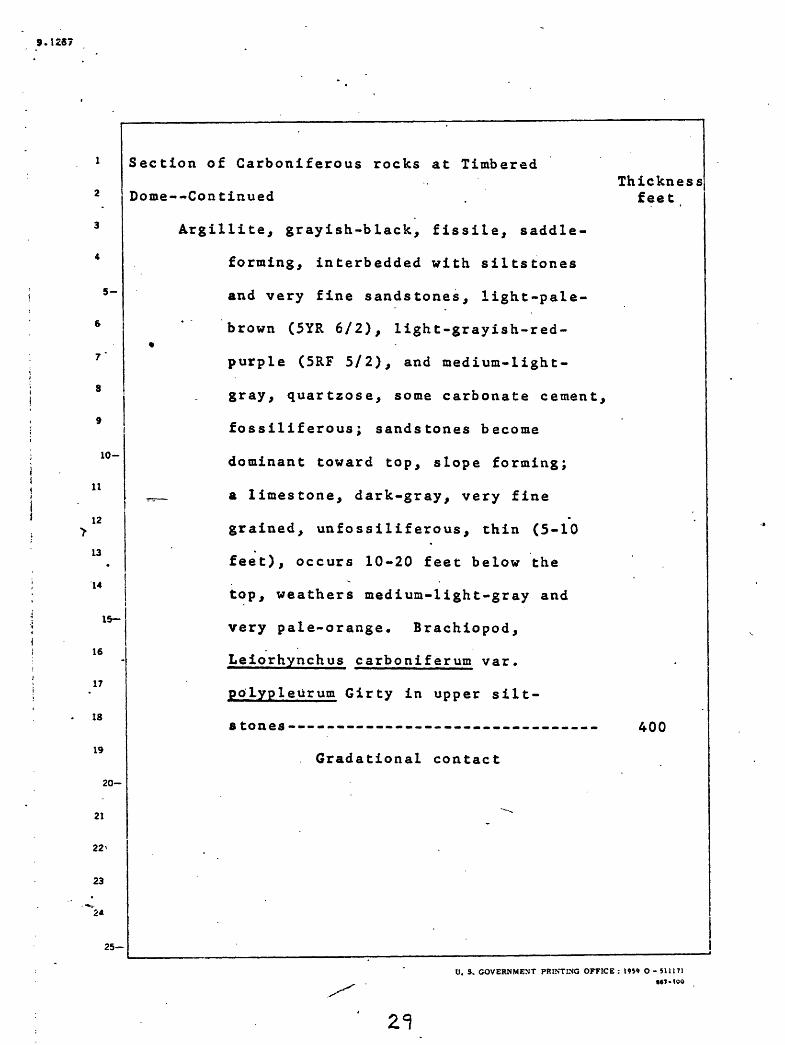
Section of Carboniferous rocks at Timbered
Dome--Continued
Argillite, grayish-black, fissile, saddle-
forming, interbedded with siltstones
and very fine sandstones, light-pale-
brown (SYR 6/2), light-grayish-red- %
purple (5RF 5/2), and medium-light-
gray, quartzose, some carbonate cement,
fossiliferous; sandstones become
dominant toward top, slope forming;
^_ a limestone, dark-gray, very fine
grained, unfossiliferous, thin (5-10
feet), occurs 10-20 feet below the
top, weathers mediuia-light-gray and
very pale-orange. Brachiopod,
Leiorhynchus carboniferum var.
polypleurum Girty in upper silt-
stones --------------------------------
Gradational contact
Thickness feet
400
U. S. GOVERNMENT PRINTING OFFICE : 1959 O - 51U 7]6*7*100
2=}
9.1267 .
5-
10-
11
12
13
14
15-
16
17
18
19
20
21
22
23
25-
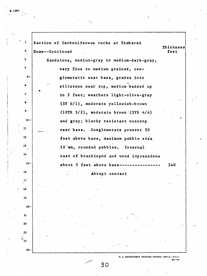
Section of Carboniferous rocks at Timbered
Dome--Continued
Sandstone, medium-gray to medium-dark-gray,
very fine to medium grained, con
glomeratic near base, grades into
siltstone near top, medium bedded up
to 2 feet; weathers light-olive-gray
(5Y 6/1), moderate yellowish-brown
(10YR 5/2), moderate brown '(5YR 4/4)
and gray; blocky resistant outcrop
_^ near base. Conglomerate present 50
feet above base, maximum pebble size
10'mm, rounded pebbles. Internal
cast of brachiopod and wood impressions
about 5 feet above base----------------
Abrupt contact
Thickness feet
340
C. S. COVgPSMENT PRINTING OFFICE: 1959 O - 5J1171 7-100
30

9.1287
5-
10-
11
12
13
14
1
16
.17
18
19
15-
20-
21
22
23
V-
24
25-
Section of Carboniferous rocks at TimberedThickness
Dome Continued . feet
Dolomite, light-olive-gray (5Y 6/2) and
medium-gray, very fine grained, un-
fossiliferous, banded in places, float
ing sand grains and sandy streaks common
(sand averages 1/4 mm, subround), thick
(10 feet) to massively bedded, resistant,
characteristic rough-weathered surface
with prominent chert veins standing in
^__ relief, weathers very pale-yellowish-brown
(10YR 7/2); interbedded with quartzite,
light-gray, medium-grained, thin- to
medium-bedded, and sandstone (found only
near top of interval), medium-dark-gray,
medium-grained, quartzose, CaCO. and
MgCO~ cement, graded bedding present on
small scale, weathers dark-gray. A
sample of the dolomite of this unit con tains 35.75 percent calcium carbonate and 13.3 percent magnesium carbonate, accord ing to an analysis by James A. Thomas of the Geological Survey, made Feb. 19, 1959-- 650
Base not exposed. Total -- 8,110 feet
The beds assigned to the Copper
Basin Formation aggregate 3,300
feet in thickness. _____________V. S. GOVERNMENT PRINTING OFFICE: 1959 O-*lUTi
«T-IOO

S.1237
5-
10-
11
Age and paleontology
All of the diagnostic fossils so far obtained from
the Copper Basin Formation are of Late Mississippian age.
However, some collections contain forms that may be as
young as Middle Pennsylvanian and some contain forms that
may be as old as Early Mississippian. Also near Cabin
Cr*eek a thick section of the Copper Basin Formation under
lies limestone of Early Mississippian (Osage) age. Ross
(1962, p. 386 and 387) reasoned that the uppermost part of
the Copper Basin Formation was likely to be of Permian age
because the Copper Basin Formation interfingers with the
12 White Knob Limestone and the uppermost part of the White
13
14
15
16
17
18
19
I
Knob Llimestone is of Permian age. However, there is noi .
evidence that any of the Copper Basin Formation is as
young as the Permian part of the White Knob Limestone.
20-
21
22
23
24
25-
U. S. GOVERNMENT ?HD,TING OFFICE : 19*» O - SI 1171

9.1267
The most intensively studied section of the rocks of the Copper
Basin Formation is on Timbered Dome. There the rocks that can be
assigned to the Copper Basin Formation, without hesitation, are
overlain by a thick sequence of limestone that contains a layer of
sandstone several hundred feet in thickness, see pages 18 to 31. The '' j
limestone is all assigned to the White Knob Limestone and the included!«sequence of sandstone is interpreted to be an eastward- extending
wedge or lense of the Copper Basin Formation. Dutro and others
!9 ! (written commun., March 20, 1961) believe that the fossil in collection
10- 18137-PC (map location 6) from the sandstone layer in the limestone
11 ! definitely indicates an Upper Mississippian Chester age whereas, Skipp,
12 i on the basis of endothyrids, would place the Mississippian-i
Pennsylvania!! boundary in the limestone below the sandstone (see the\ \
discussion on p. 76 and Skipp, 1961a) . The Sulcatopinna cf. S. ;i i
15 : inexpectans Walcott in collection 18137-PC was originally described by!
3 '
13
14
16
17
i Walcott from beds near Eureka now thought by Mackenzie Gordon to be
18
approximately equivalent to the Goniatites granosus zone (early i I Chester) . A similar species of Sulcatopinna also occurs in the
19 | Batesville Sandstone in Arkansas.i
20- j
j21
22
23
24
25-
>KDT- -NG OFF!
33

9-t2«7
5-
10-
Fossils indicate that the main part of the Copper
Basin Formation, below the lower jasperoid, is of Upper
Mississippian Meramec age. Betfe^ Skipp (1961a) reached
this conclusion on the basis of enuothyrids, and Dutro and
others (written communication, March 20, 1961) noted the
presence of Leiorhynchus aff. L^ carboniferum Girty in the
Copper Basin Formation below the lower jasperoid.
H
12
13
14
I
16
17
18
19
15-j
20
21
22
23
24
25
U. S/GOVERNMENT PRINTING'OFFICE : 1959 O-51H71M7-I04

9.1257
5-
10-
11
12
13
14
15-
16
17
18
19
Collection 18454-PC, from the south flank of Timbered
Dome .(maP location 7), was studied by Dutro (written
communication, March 14, 1961). It came from beds that
probably correspond to those below the lowest jasperoid
unit in the measured section. Their age significance is in
some doubt. The most probable inference is that they are
of Meramec age. Dutro, however, remarks that similar
fossils were reported by Sando, Dutro, and Gere (1959)
from rocks in Laketown Canyon, northeast Utah, thought to
be of late Osage age. On the other hand, he points out
that a flattened ammonite in connection 18454-PC is tenta
tively i identified by Gordon as Cravenoceratoides?, a genus
found in rocks of late Chester age. The fossils found in
the collection are listed below.
18454-PC: Chonetes aff. £. choctawensis Girty
Leiorhynchus cf. J^. carboniferum
polypleurum Girty
Crurithyris? sp.
Cravenoceratoides? sp.
20-
21
22
23
!&
24
25-
V. S. GOVERNMENT PRINTING OFFICE : 1959 O - SlliTl»tr-too
35-

9-1287
5
6
7
8
9
1
11! 1
12 !
10-
Anderson's lot 4 (1929b, p. 11) came from the south
west slope of Timbered Dome in sec. 11, T. 3 N., R. 24 £.
(map location 8). Lot 4 was regarded by Girty as of Late
Mississippian age and reported by him to contain
Orbiculoidea sp.
Productella hirsutiformis
Leiorhynchus carboniferum var. polypleurum
Spirifer martiniformis?
Del topee ten caneyanns
Del topee ten sp.
Bembexia sp.
Anderson (1929b, p. 12) collected fossil-s from the
13
14
15-
16
17
black shale (his lot no. 7, map location 9) of the Copper
Basin Formation west of Dry Fork Creek, which seem to
underlie the White Knob Limestone. Girty reported thatv
this collection contained Leiorhynchus carboniferum var.
polypleurum. This fossil is regarded as indicative ofI
18 Mis sissippian age.
19
20-
21
22
23
24
25-
U. S. COVETUfMENT PRINTING OFFICE: 1959 O-511171

9.1267
5-
10-
Collection 18147-PC, along the Right Fork of Iron Bog
Creek (map location 10), contains, . according to Dutro,
Yochelson, Duncan, and Sando (written communication,
March 20, 1961), Quadratia? sp., Spirifer sp. aff. £.
ankansanus (Girty) and Dimegelasma? sp. and is of probable
Mississippian age.
Collection 18451-PC from near Dry Fork Creek (map
location 11) contains (Dutro, written communication,
March 14, 1961) Leiorhynchus cf. L^. carboniferum Girty
and is of probable Late Mississippian age.
11
12
13
14
15-
16
.17
18
19
20-
21
22
23
**
24
25-
O. S. GOVERNMENT. PRrNTING OFFICE : 1959 O - 51U71 7-100
37

S.12S7
5-
Collection CPR 865 (map location 12) came from sec.
25, T. 8 N., R. 21 E., immediately north of the quadrangle
from rocks that were previously mapped as belonging to theT.J. W.J.
lo
11
12
13
14
15
16
17
18
19
20-
21
22
23
"24
25
Wood River Formation (Ross, 1947, pi. 1). ADutro and ASando
(written communication, March 15, 1961) note that collectio
CPR 865 contains brachiopods that are of generalized types
ranging from Chester through Middle Pennsylvanian at least.
The Pentremi tes by itself would suggest a Chester age
although similar forms are known from the Morrow. The
corals are most like Early Pennsylvanian forms and are com
pared to species described under Hapsiphy1lum by Moore and
Jeffords from the Lower Pennsylvanian of Texas. Thus, the
rock is regarded as probably of Early Pennsylvanian age,
possibly a Morrow equivalent.
CPR 865:
horn, corals, indet.
echinoderm debris, indet.
Pentremites sp.
rhynchonelloid brachiopod, indet.
Wellerella? sp.
leiorhynchoid brachiopod, indet. ^
Spirifer aff. £. rockymountainus Marcou
Composita cf. £. sulcata Weller
Cleiothyradina sp.
Crurithyris sp.___________________________________C. S. GOVERNMENT POINTING OFFICE : 1959 O - 51U71
W7 100
38

9.1257
11
12
Dielasma? sp.
enomphalacean gastropod, indet.
small high-spired gastropods, indet.
Thomasson (1959, p. 39-40) found ostracods in limestone in or near
s- sec. 20, T. 4 N., R. 22 E. These include Glyptopleura sp. Polytylites
sp. and Kirkbyella sp., very close to Kirkbyella quitkei Creneis and* Bristol. Thomasson regards this fauna as indicative of Early to Middle
Pennsylvanian age. The ostracods were determined for him by Kesling
and Sohn.
1C ~!Regional relation
The Copper Basin Formation is flanked on the west by rocks that
|have been mapped as Milligen and Wood River Formations in the Haileyi
J 'quadrangle, and on the east it is in part overlain by, and in part
14 !interlayered with, White Knob Limestone. Some of the aspects of the
15~I relationship of the Copper Basin Formation to these formations on
10 'either side-of it will be discussed in the following paragraphs.
17
18
19
20-
21
22
23
24
25-
('. o. GGVrih.VVE.v: HKLNTLNU CFFICE : 195' O - 5iU71

8.1287
5
10-
11
12
13
15
16
17
IS
19
20-
The rocks that characterize most of the Copper Basin
Formation are similar to and adjoin rocks that have been
mapped as Wood River Formation in the eastern part of the
Hailey quadrangle, and argillaceous parts of the Copper
Basin Formation are similar to and adjoin rocks that have
.been mapped as Milligen Formation in the eastern part of
the Hailey quadrangle (Umpleby, Westgate, and Ross, 1930).
A zone of reversed faults intervenes between the rocks
along the western edge of the Mackay quadrangle and the
type localities of the Milligen and Wood River Formations
in the Hailey quadrangle to the west*(Umpleby, Westgate,
j and Ross, 1930, pi. 1). West of this zone of faults the
distinction between the Milligen and Wood River Formations
is based on differences in lithology and especially on the
presence of conglomerate above the Milligen Formation at
or near the base of the Wood River Formation. East of
this zone of faults, in the Mackay quadrangle and the
eastern part of the Hailey quadrangle, the distribution
of lithologies, including conglomerate, is too erratic for
the rocks to be consistently subdivided.
21
22
25
0. S. GOVERNMENT PRINTING OFFICE : 1959 O - S1117I 7-100

5-
6 -r ' \
8
9
10-
11
12
13
14
15-
16
17
18
19
20
21
22
23
25-
Roberts and Thomasson (1964), based in part on analogies they
have drawn between the geology of northern Nevada and that of central
Idaho, have suggested that the rocks on either side of the zone of
reversed faults in the Hailey quadrangle may have been deposited in
separate basins and that the rocks that were deposited in these
separate basins were subsequently brought together by faulting. If - ]
this supposition is true, then the use of the names Milligen and Wood
River Formations is not justified east of the zone of reversed faults.
The Copper Basin Formation locally contains lenticular masses of
limestone and near the middle of the quadrangle rocks of the formation i | are interlayered with rocks of the White Knob Limestone. Some of thisiI interlayering of rock types may be the result of low*angle faulting,i| but we have chosen to interpret it to be intertonguing of different
:facies. The mixing of sandstone and siIt stone with limestone at
Timbered Dome (see p. 18 to 31, and Skipp, 1961a) is believed to be
j due to such inter finger ing. The limestone within the Copper Basin
Formation between Copper Creek and Muldoon Canyon is considered to be
a lens of limestone that is related to but not connected with, thei
main part of the White Knob Limestone to the east. Alternately, this
i limestone may be part of a wedge that extends westward from the main
mass of the White Knob Limestone. The limestone between Fish and Dry
Fork Creeks is interpreted to be part of a westward-extending wedge ofi
White. Knob Limestone. The sandstone, siltstone, and conglomerate, - ,
which are interlayered in the White Knob Limestone near Cabin Creek,i
are considered-to be-parts- af-wedges-and lenses- that-extend- eastward ';C%VER.N\:I:NT r
9.1267
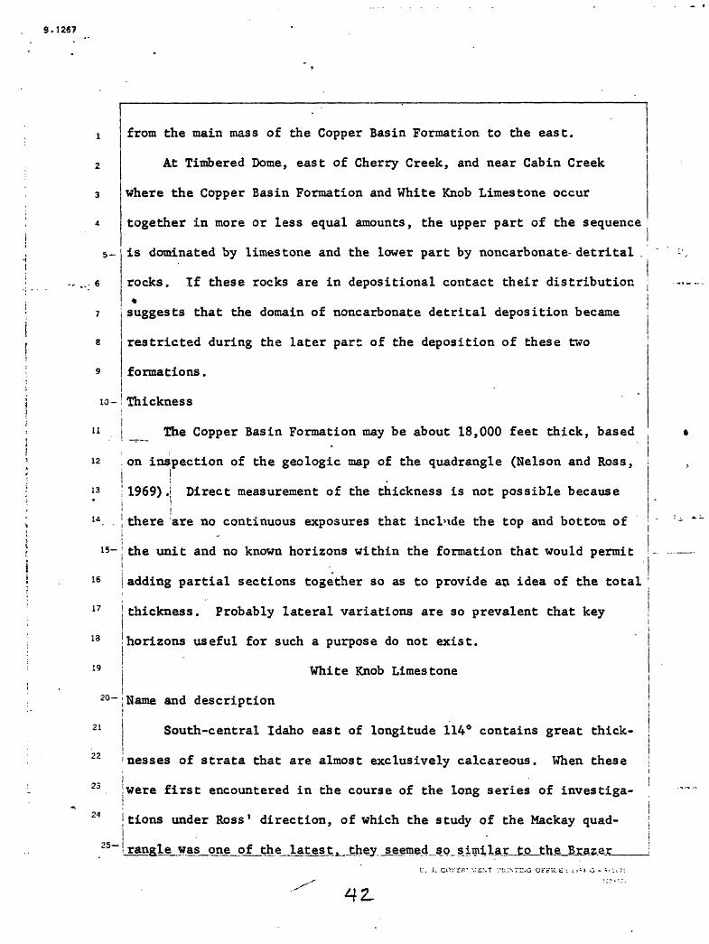
1 from the main mass of the Copper Basin Formation to the east.
2 At Timbered Dome, east of Cherry Creek, and near Cabin Creek
where the Copper Basin Formation and White Knob Limestone occur
together in more or less equal amounts, the upper part of the sequence
5- is dominated by limestone and the lower part by noncarbonate detrital .
rocks. If these rocks are in depositional contact their distribution
7 j suggests that the domain of noncarbonate detrital deposition became
s restricted during the later part of the deposition of these two
formations.
10- ' Thickness
11 j _ The Copper Basin Formation may be about 18,000 feet thick, based
12 .on inspection of the geologic map of the quadrangle (Nelson and Ross,| !
13 !1969)J Direct measurement of the thickness is not possible because
1 I u . . I there are no continuous exposures that include the top and bottom of
i 15- i: the unit and no known horizons within the formation that would permit
j16 j adding partial sections together so as to provide an idea of the total
17 |thickness. Probably lateral variations are so prevalent that key
13 (horizons useful for such a purpose do not exist.
19 i White Knob Limestonei
2°-;Name and description
21 South-central Idaho east of longitude 114° contains great thick-
22 nesses of strata that are almost exclusively calcareous. When these iZJ were first encountered in the course of the long series of investiga-
24 | tions under Ross 1 direction, of which the study of the Mackay quad-|
25~Srangle was one of the latest > they seemed so similar to the Braze)

9.1257
Limestone of northern Utah and southeastern Idaho, commonly considered
to be of Late Mississippian age, that this name was applied to them
(Ross, 1934a, p. 977-985). Recent studies (Scholten, 1957a and b;
Blackstone, 1954; Ross, 1961a, p. 222-228) show that limestone of this
5- character in south-central Idaho.ranges in age from Mississippian into
Permian. The Brazer Limestone in the type locality has been found, when restudied (Sando, Dutro, and Gere, 1959), to be dolomite instead
of limestone, 850 feet thick, and of Early to Late Mississippian age.i
9 It seems desirable, therefore, to restrict the name Brazer to the
10 -; dolomite of Mississippian age in the Crawford Mountains, Utah, whereii
11 iBrazer Canyon is situated, and Ross (1962) has introduced the name! i
12 jWhite Knob Limestone for the assemblage of rocks heretofore called
" ! ! '\3 ] Brazerj in the vicinity of the Mackay quadrangle. This assemblage is
; j
14 ,'vell exposed in the White Knob Mountains in the northern part of the
15~~ Mackay quadrangle. The name is especially appropriate because the
16
17
19
most detailed petrologic and stratigraphic study yet made of any part
of the assemblage was done in these mountains (Skipp, 1961a and b).
20-
21
22
23
24
25
U. S. GOv=r>>.V!:r.T rMiNTSNC OFFICE: l'< : 3 O -

9.12S7
5-
1
2
3
4
6
7
8
9
10-
11
12
13
14
15
16
17
18
19
20-
21
22
23
'24
Most of the White Knob Limestone is very pure lime
stone with chert nodules and laminae in many of the beds.
Table \ presents chemical analyses of specimens from the
formation. Most of the limestone is medium to thick
bedded, although thin-bedded limestone is locally common,
especially near the base of the formation. In the Lost
River Range the lower 300 to 500 feet of the formation is
thin bedded. Conspicuously thin-bedded limestone is also
present near Black Daisy Canyon and near Lupine Creek.
25-
V. S. GOVERNMENT PRINTING OFFICE : 19S9 O - SU171M7-IOO

1
2
3
4
5-
6
7
8
9
lO-
ll
12
13
14
15-
16
*17
18
19
20-
21
22
23
"2*
25
Table
Si °2
A1 2°3
Fe 2 0 3
FeO
MgO
CaO
Na2°
K2 0
H2 0+
H 20-
Ti0 2
P 2°5
MnO
co 2
Cl
F
,
Chemical1. --analyses of White Knob Limestone
No. 59N 1From 2,750 ft. N.
49° E. of theGrand Prize Mine
4.77
.17
.03
.06
.48
52.58
.01
.03
.05
.04
.01
.04
.02 "
41.53
.00
.01"
99.83
from near Mackay
No. 59N 2From 750 ft. S. 56° E. of the
Blue Bird Mine
5.47
.12
- .09
.03
.39
52.34
.02
.02
.11
.02
.01
.03
.01
41.31
.00
.07
99.98
-
0. S. GOVERNMENT PRINTING OFFICE: 1959 O - S1U71M7-100

S. 1267
Locally sandstone, quartzite, siltstone, mudstone, argillite, and
conglomerate similar to those in the Copper Basin Formation are
interlayered in the White Knob Limestone as isolated beds and as
4 sequences that range from a few feet to several hundreds of feet in
5- thickness. These sequences of noncarbonate clastic rocks in the
limestone are most common in a zone that extends northward through the
middle of the quadrangle. These layers of noncarbonate clastic rocks
may be either layers whose deposition alternated with the deposition
jof the limestone, or layers that were brought into juxtaposition withi
10-Jthe limestone by low-angle faulting. We interpret them to be inter- i
11 jbedded wedges and lenses of rocks akin to the Copper Basin Formationi
12 that extends eastward into the White Knob Limestone. The presence ofj
13 jlimestone layers in the Copper Basin Formation to the west, described _ |
14 I above, are interpreted to be further manifestations of this inter-i
15~ifingering.
16 j ' . -
i17
18
19
20-
21
22
23
25-
f. i. GOvEHJ.v.iLNT PS:::»;SG OFF:CE : iv>? o -

Four stratigraphic sequences that contain rocks of the White Knob ;
Limestone were studied in detail. The location of these sequences are
shown on the geologic map of the quadrangle (Nelson and Ross, 1969);
two of these are close together north and east of the junction of
Antelope and Cherry Creeks; one is near Cabin Creek, east of Copperi
Basin; and the fourth is at Timbered Dome. The sequences at Timbered ;t
Dome are described in the section of this report on the Copper Basin i
8 j Formation, and the other three will be described in the order that they
are listed above. The details of these sections are also shown
10-igraphically by Skipp (1961a). The sections near the junction of ;i
11 Antelope and Cherry Creeks are dominantly limestone; the one near Cabin
Creek contains a little sandstone, siltstone, and conglomerate similar12
13
14
A
16
17
IS
19
to rocks in the Copper Basin Formation; and the section at Timberedi
Dome contains much rock that is assigned to the Copper Basin Formation.'
15
20-
21
22
23
24
9.1267
5-
7
8
9
10-
11
12
13
14
15
16 j
17
18
19
20
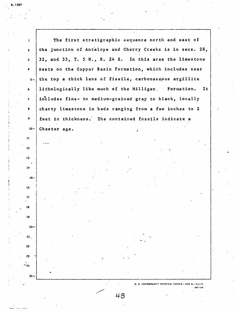
The first stratigraphic sequence north and east of
the junction of Antelope and Cherry Creeks is in sees. 28,
32, and 33, T. 5 N., R. 24 E. In this area the limestone
rests on the Copper Basin Formation, which includes near
the top a thick lens of fissile, carbonaceous argillite
lithologically like much of the Milligen . Formation. It
includes fine- to medium-grained gray to black, locally
cherty limestone in beds ranging from a few inches to 2
feet in thickness. The contained fossils indicate, a
Chester age. ,
22
23
'24
25
0. S. GOVERNMENT PRnVTING OFFICE: 19*9 O - 5UI71

9.1267
2
3
4.
Stratigraphic section in sees. 28, 32, and 33, T. 5 N.,
R. 24 E.
10-
11
12
13
14
IS
17
18
19
20-
21
22
23
24
Jasperoid(silicified limestone below
the Challis Volcanics)
White Knob Limestone
Limestone, pink, coarse-grained, somewhat\
metamorphosed-------------------------
Limestone, dark-gray, fine-grained, medium-
bedded; ebonites, brachiopods
Echinoconchs, Paramillerella cf. £.
cooper (D. Zeller) 1953, Plectogyra
sp.--------- _ ..-.-.._ .._.-_.-..
Limestone, medium-grained and medium-bedded,
with much black chert. Fossil hash,
corals, bryozoa, Endo thyra cf. £.
Symmetrica (E. Zeller) 1957-----------
Limestone, mostly medium-gray, massive, with
a layer of chert nodules and a few
thin shale layers. Fossil hash,
crinbid stems, corals, Plec togyra sp.-
Limestone, medium-gray, fine-grained, thick-
bedded, with some chert. Corals,
brachiopods, Plectogyra sp.-----------
Thickness feet
25-
100
1,050
100
450
150
U. S. GOVERN.Mfc'NT PRINTING OFFICE: 1959 O- SI 11 7'

5-
10-
11
12
13
14
1
16
17
13
19
Stratigraphic section in sees. 28, 32, and 33, T. 5 N.,
R. 24 S.--Continued
Limestone, medium-gray, fine-grained,
in part laminated, cherty, with
corals-------------------------------
Limestone, d^rk-gray, fine-grained, with
crinoid s terns----------- -----------
Limestone, medium-dirk-gray, fine-grained,
*non-fossil iferous--------------------
15-
20-
21
22
23
25-
Copper Basin Formation
__ Siltstone and quartzite with interbedded
argillite. Quartzite is light-gray
and weathers dark-yellow-brown. A
lens of conglomerate 200 feet from the
top has quartzite and chert pebbles up
to 1.5 inches in diameter. The pro
portion of argillite decreases upward.
Probable worm tracks 100 feet above
base of unit. Leiorhynchus
carboniferum var. polypleurum
Girty- ----------- ......_ ...
Argillite, fissile, dark-gray to black
with sandy layers- ------ - ------
Thickness feet
200
250
20
750
60
U. S. GOVERNMENT PRINTING 'OFFICE : 1959 O - 511171M7-ICC

5-
10-
11
12
13
14
15
16
17
18
19
20
21
22
23
'24
25
Thickness feet
Stratigraphic section in sees. 28, 32, and 33, T. 5 N.,
R. 24 E. Continued
Sandstone, medium-gray, medium-bedded,
weathering dark-yellow-brown---------- 150
Argillite, fissile, with sandy layers, dark-
gray to black------ ---- >- -- .--- 20
Total ------- 3,300
Of this 2,320 feet belong to the White
Knob Limestone.
0. S. GOVERNMENT PRINTING .OFFICE : O- 511171 MT-100

9.1267
10-
11
12
13
14
15
16
17
18
19
20
21
22
23
25-
The second stratigr&phic sequence north and east of
the junction of Antelope and Cherry Creeks is in sees. 2,
3, and 4, T. 4 N., R. 24 £. The sequence contains fossils
at intervals but most of these appear not to be diagnostic.
Numerous crinoid stems and cup corals and some gastropods,
corals, and brachiopods are present. The contact with the« Seews to be
Copper Basin Formation^^s- gradational. The limestone is
mostly dark-gray on fresh fracture and in beds a few
inches to 5 feet thick. The thickness of the beds tends
to increase upward in the section. Some of the limestone
in_jthe lower part of the section weathers to thin sheets.
At fairly close intervals throughout the section chert," i
in part rusty, is plentiful in nodules and layers. Somei
limestone beds include abundant closely spaced, thin chert
laminae. A few beds are sandy. In several places the
limestone is silicified and brecciated in the manner common
beneath the Challis Volcanics but the volcanic rocks have
been removed by erosion.
U. 3. GOVERNMENT PPCTTIN'G-OFFICE : !«9 O-S!ll?ta«7-too
52.

9.1267
5-
7
8
.9
H
11
12
13
14
Stratigraphic section in sees. 2, 3, and 4, T. 4 N.,
15
16
17
18
19
20-
21
22
23
*-,--
24
25
R. 24 E.
Top of formation not reached.
Limestone, massive, in beds 1 to 6 feet
thick. -In most beds chert is incon
spicuous but some are ribboned with *
it. Fossils are rare and poorly pre
served------- ------------------------
Limestone, massive, with some beds over 10
feet thick. Many beds have closely
_ spaced chert laminae and nodules.(i Some beds are soft where weathered---I
Limestone, mostly thick-bedded but some isi ' j
fissile. Chert in nodules and laminae.
Silicified brachiopods and corals----
Limestone, mostly in beds less than a foot
thick. Chert laminae plentiful------
Limestone, massive, dark, in beds up to 5
feet thick. Chert not abundant------
Limestone, poorly exposed, in beds up to
3 feet thick. There are some chert
layers and some chert nodules up to^
3 feet long-------- i----------------
Thickness feet
340
245
470
380
460
200
V. S. GOVERNMENT PRINTING OFFICE : 1959 O - SUtTi

9.t2 7
5-
10-
11
12
13
14
15
Stratigraphic section in sees. 2, 3, and 4, T. 4 N.,
R. 24 £. Continued
Largely covered limestone in beds up to
16
17
18
19
20-
21
22
23
24
25
Thickness feet
5 feet thick, with some chert---- ---- 190
In part covered. Limestone in beds 1 to 5
feet thick. Scanty and irregular chert
nodules. Poorly preserved gastropods-- 350
The rock in this interval is poorly exposed
and in part covered by limestone breccia
interpreted to be of Tertiary age.
i Mostly thin-bedded limestone, with some
I chert layers. Float indicates some beds
are sandy-'-- -------------.--.-.--.--. 370
Mostly covered. Limestone with chert laminae
and nodules---------------------------- 235
Limestone, in part brecciated. Chert laminae
up to 6 inches thick------------------- 120
Limestone, thin-bedded, with closely spaced
chert laminae locally. One exposure
has about 5 chert layers, an inch thick,
per foot of limestone. Crinoid stems
are plentiful. Poorly preserved non-
diagnostic corals---------------------- 69
U. S. GOVERNMENT PHINTII.G OFFICE : I9S9 O - SUI71M7-100
9.1267
5-
10-
11
12
13
14
1
16
17
ia
19
15-
20-
21
22
23
k»
24
25
Thickness feet
60
180
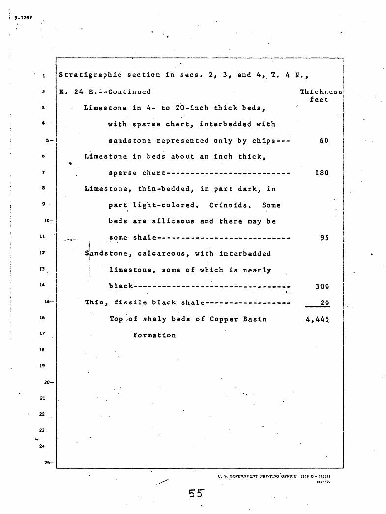
Stratigraphic section in sees. 2, 3, and 4, T. 4 N.,
R. 24 E.--Continued
Limestone in 4- to 20-inch thick beds,
with sparse chert, interbedded with
sandstone represented only by chips---
Limestone in beds about an inch thick,«
sparse chert--------------------------
Limestone, thin-bedded, in part dark, in
part light-colored. Crinoids. Some
beds are siliceous and there may be
_._ some shale----------------------------
iSandstone, calcareous, with interbedded
i
| limestone, some of which is nearlyI
black ......... _ . .
Thin, fissile black shale ---------------- ____
Top -of shaly beds of Copper Basin 4,445
Formation
95
300
20
U. S. GOVERNMENT PRINTING OFFICE : 1959 O - 511171M7-tOO

. 9.1267
5-
7
8
9.
10-
11
12
13
14 -
15-
16
.17
18
19
20-
The stratigraphic sequence near Cabin Creek is in and
near unsurveyed sec. 14, T. 6 N., R. 22 £. Here the lime
stone of the basal part of the formation contains thin
argillaceous and cherty beds similar to some in the under
lying Copper Basin Formation. The limestone in the lower/
2,500 feet is fine grained and contains clay and silt,
mainly in thin laminae. At higher horizons the limestone
is more nearly pure calcium carbonate, and is more richly
fossiliferous. It is composed mainly of clastic calcium
carbonate particles cemented by lime mud. Bryozoan bio-
stromes are present. The upper part of the formation in
this area contains beds of conglomerate and sandstone
intercalated in the limestone. The limestone throughout
I is essentially free from magnesium. Additional details
of the rocks of this section have been published elsewhere
by Bet-t^ Skipp (1961a and b).
21
22
23
24
25-
U. S. GOVERNMENT PRINTING OFFICE : 1959 O - 5H17IM7-tCO

9.1267
5-
10-
Stratigraphic section in and near unsurveyed sec. 14,
11
12
13
14
1
16
17
18
19
15-
20-
21
22
23 V-
24
25
T. 6 N., R. 22 E.
Challis Volcanics
Limestone, dark-gray ~to medium-gray, fine-
to medium-grained, fossiliferous, thin-
to thick-bedded, upper beds cliff
forming; weathers medium-gray to light-
gray with a smooth surface; contains a
iens of sandstone, olive-gray, con
glomeratic, grains largely chert,
,- weathers to resistant ledge;
Parasaillerella designata (D. Zeller)
1953, corals and brachiopods----------
Conglomerate, medium-light-gray to light-
brownish-gray, chert and quartzite
groundmass, resistant, lenticular;
lichens give dark-gray appearance; some
sandstone and siltstone interbeds,
quartzose, thin-bedded----------------
Thickness feet
495
220
U. S. GOVERKMJSNT PRINTING OFFICE : t?S9 O - MM7tS«7-100
57

9.1267
Stratigraphic section in and near unsurveyed sec. 14,
T. 6 N., R. 22 E. Continued
5-
10-
ii
12
13-
14
15-
16
17
IS
19
20-
21
22
23': -
24
25
Limestone, olive-gray, mottled dark-gray
and orange near base, medium to very
coarse grained, fossiliferous,
limonitic, weathers grayish-orange:
brachiopods, corals, crinoids, ostra-
codes, Foraminifera, fish plates-----
Sandstone, greenish-gray to pale brown,
quartzose; graded bedding; slope
I forming------------------------------
! Conglomerate, medium-gray to grayish-red,
chert and quartzite groundmass,
weathers grayish-red and pale brown,
resistant; sandstone interbeds, light-
gray, coarse-grained, chert .grains,
crossbedding--------------------- --
Thickness feet
75
55
10
U. S. GOVEHJIMENT PRLNTtNG OFFICE : S959 O - 5HI71K7-IGO
58
9.1267
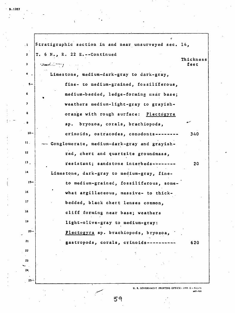
. 1 Stratigraphic section in and near unsurveyed sec. 14,
T. 6 N., R. 22 E.--Continued
12
13
14
1
16
17
18
19
15-
20-
21
22
23
2*
25
Thickness feet
Limestone, medium-dark-gray to dark-gray,
fine- to medium-grained, fcssiliferous,
medium-bedded, ledge-forming naar base;^
weathers medium-light-gray to grayish-
orange with rough surface: Plectdgyra
sp. bryozoa, corals, brachiopods,
crinoids, ostracodes, conodonts--------
^ Conglomerate, medium-dark-gray and grayish-
red, chert and quartzite groundmass,
resistant; sandstone interbeds--------
Liiaestone, dark-gray to medium-gray, fine-
to medium-grained, fossiliferous, some-«
what argillaceous, massive- to thick-
bedded, black chert lenses common,
cliff forming near base; weathers
light-olive-gray to medium-gray:
Plectogyra sp. brachiopods, bryozoa, "
gastropods, corals, crinoids--------
340
20
620
O. S. GOVERNMENT PRINTING OFFiCE : I'S* O - 511171 «7-tOO

9.1267
10-
11
12
13
14
15
16
17
18
19
20
21
22
23
24
25-
Stratigraphic section in and near unsurveyed sec. 14,
T. 6 N., R. 22 E. ContinuedThickness
feet
Sandstone, medium-dark-gray to grayish-
red, quartzose, very coarse grained,
crosshedded; limestone interbeds,
medium-gray, oolitic, very coarse
grained - ------- .-----.---.-..---- 50
Conglomerate, dark-grayish-red to moderate
yellowish-brown, chert and quartzite
: groundmass, lenticular, resistant,
foreset bedding, weathers dark-reddish-
brown; sandstone interbeds, medium-dark- j
gray, medium- to coarse-grained,
quartzose ---------- ------- --.-. 190 "Sandstone, medium-gray, quartzose, medium-
to coarse-grained, siliceous and
calcareous; limestone interbeds,
medium-gray, sandy, fossiliferous, some
coquinoid, some calcarenitic; con
glomerate, poorly sorted, quartzose,
at base and in lenses: brachiopods-- 140
U. S. GOVERNMENT J-RtNTINC OFFICE ; 1959 O - 5111714*7-100

9.1267
Stratigraphic section in and near unsurveyed sec. 14,
T. 6 N., R. 22 E.--Continued
10-
11
12
13
14
IB-
16
17
IS
19
20-
21
22
23
24
25-
Th ickness feet
Limestone, dark-gray to grayish-black,
fine- to medium-grained, fossilifer-
ous, some organic matter; conglomerate
lenses, poorly sorted: brachiopods,
gastropods, bryozoa, ostracodes,
Foraminifera------------------------ 75
Conglomerate, light-olive-gray to medium-
light-gray, poorly sorted, chert and
quartz groundmass, non-resistant,
weathers medium-gray and light-
yellow-orange----------------------- 20
Limestone, dark-gray to medium-gray,«
medium-grained, fossiliferous,
argillaceous in places, thick-bedded,
microcoquina common, sandy and coarse
grained near top, lower beds resistant,
weathers light-gray, light-brownish-
gray and yellowish-gray: Plectogyra
sp. brachiopods, crinoids, bryozoa,
corals, Foraminifera, conodonts----- 590
V. S. GOVERNMENT PHiNTING OFFICE : 1959 O - SIU7J8*7-'00

9.126?
5-
7
8
9
10-
11
12
13 .
14
15-
16
17
18
19
20-
21
22
23"S-
24
25-
Stratigraphic section in and near unsurveyed sec. 14,
T. 6 N., R. 22 E.--Continued
Conglomerate, light-olive-gray to pale
brown, chert and quartzite groundmass,
weathers moderate yellowish-b-rown;
sandstone interbeds, locally con
glomeratic; limestone interbeds,
grayish-black to medium-light-gray,
largely coarse-grained, sandy, silty,
-^ fossiliferous, some microcoquina:
brachiopods, crinoids, echinoids,
conodonts, bryozoa-------------------
Limestone, dark-gray to light-olive-gray,
medium- to coarse-grained, fossilifer- «
ous, microcoquina and sandy streaks
common, some oolitic beds, argillaceous
in places, thin- to medium-bedded;
conglomerate, quartzose at top:
Plectogyra sp. Granuliferella? sp.
crinoids, brachiopods, bryozoa,
trilobites, gastropods---------------
Thickness feet
'145
190
C. S. GOVERNMENT PRINTING OFFICE : 1959 O - SUJ71««7-!00
62.

9 -1267
5-
10-
11
12
13
14
S tratigraphic section in and near unsurveyed sec.
T. 6 N., R. 22 E. Continued
15-
16
17
18
19
20-
21
22
23
24
25
Thickness feet
Limestone, medium-light to medium-dark-
gray, medium-grained, fossilif ercus,
silty, .oolitic , weathers medium-dark-
gray: corals, echinoids, bryozoa------ 50
Siltstone, light-yellow-brown to light-
yellow-gray, quartzose, resistant; lime
stone, light to medium gray, coarse-
. grained, cher ty------------------------ 45
Limestone, dark-gray to medium-gray, medium-
grained, fossil if erous , medium-bedded,
reefoid bed at 3,200 feet; lower beds
resistant, medium-gray chert nodules
common, weathers medium-gray:
P^lectogyra sp., Granulif erella sp.,
brachiopods, corals, crinoids,
Forarainif era-------------------------- 1,040
Siltstone, quartzose----- ---------------- 150
Limestone, medium-dark-gray, medium-grained,
f ossilif erous , silty, some microcoquinas ,
non-resistant, weathers medium-light-gray;
bryozoa, Foraminif era----------------- 75
C. S. GOVERNMENT PRINTING OFFICE: 1959 O

$.1267
7
8
9
lO-
ll
12
13 _
14
15-
16 .
17
18
1.9
20-
21
22
23
24
Stratigraphic section in and near unsurveyed sec. 14,
T. 6 N., R. 22 E.--Continued
25-
Limestone, medium-gray to grayish-black,
fine- to medium-grained, coarser
grained in upper beds, fossiliferous
in places, reefoid bed at 2,200 feet,
clay, silt and black chert abundant
in upper beds, bedding irregular,t
massive at base, banded in places,
weathers medium-gray to light-olive-ij gray; siltstone interbeds, calcareous:
Granuliferella sp. Plectogyra sp.,
bryozoa, corals, ostracodes, crinoids,
. echinoids, Foraminifera --------- .
Thickness feet
1,880
U. S. GOVERNMENT PRINTING OFFICE : 1959 O - 5U171M7-IOO

9.1267 .
5-
10-
11
12
13
14
1
16
.17
IS
19
Stratigraphic section in and near unsurveyed sec. 14,
15
20-
21
22
23
24
25-
Thickness feet
T. 6 N., R. 22 E.--Continued
Limestone, dark-gray to grayish-black,
finely crystalline, clayey, silty in
places, unfossiliferous, thin-bedded,
laminated, weathers medium-gray to
light-olive-gray with a crust; silt-
stone interbeds, dark-gray and light-
grayish-orange, quartzose, calcareous;
mudstone interbeds, gr-ayish-black,»
some siliceous, some carbonaceous----- ____
Measured thickness of White Knob lime
stone above Copper Basin Formation 7,365
740
«J. S. GOVERNMENT PRINTING OFFICE : 1959 O - tlllfla«7>too

9.1287 ,
10-
11
12
13
14
1
16
17
18
19
15-
20-
21
22
23
24
25-
Age and paleotology
Fossils have been collected from numerous areas in'
the quadrangle underlain by the White Knob Limestone.
These fossils indicate that the formation ranges in age
from the lower Mississippian Osage through the Mississip-
pian and Pennsylvania!! into the Permian at least as high *
as the Leonard and probably into the Word. The areas from
which diagnostic fossils have come, and their indicated
ages, are listed below in the order that they arfel ?'.
treated in more detail in the following paragraphs. The
order of presentation is in general that of decreasing age.
Briefly rocks just north of Cabin Creek have yielded
fossils that indicate an age range of from Osage into
Chester, those from in and near the bight of Dry Creek a
range from Meramec into Chester, those from on and near9
Timbered Dome a range from Meramec into Late Pennsylvanian,
and those from near Antelope Creek east of Cherry Creek a
range from Chester into Leonard and probably Word.
Fossil collections from the Lava Creek and the
Leadbelt Creek-Dry Canyon area, are also listed and dis
cussed below.
V. S. GOVERSYFNT PRINTING OFFICE : 1959 O - 51117Ta«7>too

9.1287
5-
10-
12
13
14
17
18
19
2Q-
Fossils from the vicinity of Cabin Creek were collected from the
measured stratigraphic section that is presented on pages 5*1 to 65.
Betty Skipp studied endothyrids from this section (Skipp, 1961a) and
has concluded that the rocks there range in age from Osage, through !
T. J. W- J. 'Meramec into Chester. Dutro and Sando (written commun., March 20,-- :A j
1961) have studied megafossils from this section and their conclusions '
concerning the age of the rock are in accord with those of Skipp. They
comment that comparisons between this section and the one on Timbered !
i'Dome are difficult, apparently because of different facies involved ini
!the two areas. Under the stratigraphic scheme adopted in the present j
jireport, based primarily on lithologic map units, the section near Cabini { |Creek belongs to the White Knob Limestone and much of that at Timbered j' ' l! . ! . II Dome belongs to the Copper Basin Formation, which is in accord with 'i | i1 i !jthe idea of facies differences advanced by Dutro and Sando. They ----- -!i ' j:suggest that the top of the section at Cabin Creek correlates
;approximately with the Cop o'f the Copper Basin Formation at Timberedi *
Dome, which there appears to interfinger with the basal part of theiiWhite Knob Limestone. They regard collections 18129-PC and 18130-PC
(map locations 13 and 14) near the top of the Cabin Creek sequence as
of probable Chester age.
21
22
23
24
25-

9-t2«7
As noted below, beds high in the White Knob Limestone
at Timbered Dome are definitely of Pennsylvaniari age.
Dutro and Sando say that collections 18122-PC, 18123-PC,
18124-PC, and 18126--PC (map locations 15, 16, 17, and 18)
s_ at Cabin Creek are of Meramec or at the youngest early
Chester in age. The presence of Inflatia in these and
higher collections suggests that all these beds may bei --
3 Chester equivalents. However, they note that the occur
rence of the small coral Rotiphyllum? in 18121-PC (map
io- j location 19) suggests a fauna that has been noted else-
11 i where just below the Fab erophy Hum beds in Utah (Sando,
12 | Dutro, and Gere, 1959, p. 2761). This statement seems to
13 imply a possible Osage age. The bryozoan-rich rocks in i
14 the lower part, of the sequence at Cabin Creek could be ofi
is-1 Meramec or possibly older Mississippian age. Taking theI
!6 various bits of evidence into account. Dutro and Sandoi
17 iwould tentatively place the Chester-Meraraec boundary some
what less than 1,200 feet below the top of the section
of White Knob Limestone measured near Cabin Creek.19
20-
21
22
23
24
25
U. 5. GOVERNMENT PRrNTrNG'OFFiCE : 1959 O - 5ll!'l
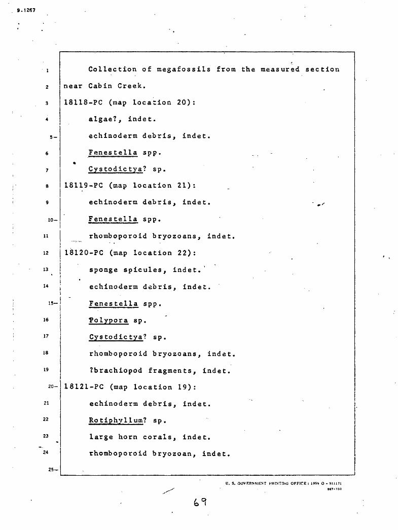
9.1267
5-
10-
11
12
13
14
1
16
17
18
19
2
21
22
23
24
15-
20-
Collection of megafossils from the measured section
near Cabin Creek.
18118-PC (map location 20):
algae?, indet.
echinoderm debris, indet.
Fenes tella spp.*
Cystodic tya? s p.
18119-PC (map location 21):
echinoderm debris, indet. - , x
Fenestella spp.
rhomboporoid bryozoans, indet.
18120-PC (map location 22):
sponge spicules, indet.'
echinoderm debris, indet.
Fenes tella spp.
Tolypora sp.
Cystodictya? sp.
rhomboporoid bryozoans, indet.
?brachiopod fragments, indet.
18121-PC (map location 19):
echinoderm debris, indet.
Ro tiphylluin? s p .
large horn corals, indet.
rhomboporoid bryozoan, indet.
25-
0. S. OOVEHNMENT HRtNTU.G OFFICE : 195* O - SU1718«?-!00

9-1267
5-
10-
II
12.
13
14
1
16
17
IS
19
15
20-
21
22
23
24
25-
18122-PC (map location 15):
echinoderm debris, indet.
Fenes tella sp .
Cystodic tya? sp.
rhomboporoid bryozoan?, indet.
Chonetes sp. (small)%
Inflatia cf. JU inflatus (McChesney)
"Avonia"sp, (cf. "£. " moorefieldanus Girty)
Flexaria? sp.
Spirifer aff. S_. pellaensis Weller
-= -. Torynif er? s p .
punctate spiriferoid, indet.
Ettmetria sp.!
cf. Rhineoderma sp.
phillipsid trilobite, indet.
18123-PC (map location 16):
echinoderm debris, indet.
Fenes tella spp.
rhomboporoid bryozoans, undet.
Chonetes sp. (as in 18122)
Quadratia cf. ^. hirsutiformis (Walcott)
Inf lata cf. _£. inf latus (McChesney)
Spirif er aff. S_. pellaensis teller
Torynifer sp.
0. S. GOVERNMENT PRINTrXG OFFICE : i959 O - SI 1171 47-ICo

9.1267
5-
10-
11
12
13
14
15-
16
17
18
19
20-
21
22
23
24
25
18124-PC (map location 17):
Michelinia sp.
echinoderm debris, indet.
Fenestella spp.
Cystodictya sp.
lamellar fistuliperoid, undet.
ramose trepos tome, undet.
Spirifer cf. S_. haydenianus Girty
13126-PC (map location 18):
sponge spicules, indet.
- - horn coral, indet.
echinoderm debris, indet.
Fenestella spp.
rhomboporoid bryozoans, indet.
Cystodictya sp.*
bryozoan fragments, indet.
Echinoconchus aff. E_. genevienvensis Weller
Spirifer cf. S_. bifurcatus Hall
Composita sp.
Cleiothyradina cf. £. sublamellosa (Hall)
Reticulariina? s p.
Girtyella? s p.
U. 5. GOVERNMENT PKUNTfNG OFFICE : 19S9 O - 511171M7-1CO
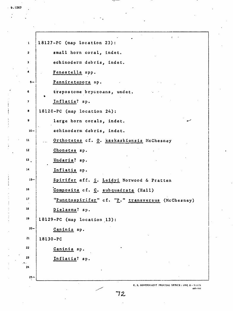
9.1257
5-
10-
11
12
13
14
1
16
17
18
19
15
20-
21
22
23
24
18127-PC (map location 23):
small horn coral, indet.
echinoderm debris, indet.
Fenes tella spp.
Penniretepora s p.
trepostotae bryozoans, undet.
Inflatia? s p.
18128-PC (map location 24):
large horn corals, indet. »'
echinoderm debris, indet.
Orthotetes cf. £. kaskaskiensis McChesney
Chonetes sp.
Undaria? s p.
Inflatia sp.
Spirifer aff. £. Leidyi Norwood & Pratten
Compos!ta cf. £. subquadrata (Hall)
"Punctospirifer" cf. "P.." transversus (McChesney)
Dielasma? sp.
18129-PC (map location 13):
Caninia sp.
18130-PC
Caninia sp.
Inflatia? sp.
25
V. S. GOVERNMENT PRINTING OFFICE : 1M9 O SIU71
9.1267
5-
10-
11
12
13
U
1
16
17
18
19
15
20-
21
22
23
24
25-
Several fossil collections were obtained from the
White Knob Limestone in and near the bight of Dry Fork
Creek. Collections 18152-PC through 18155 (map locations
25 to 28), listed below, were examined by Dutro and Sando
(written communication, March 20, 1961). They note that
collection 18152-PC represented the Faberophyllum-<k
Striatifera fauna referred to above and is of probable
Meramec age while collection 18155-PC contains Caninia
and brachiopods like those above that fauna 1 zone at"'
Timbered Dome. This collection could be of early ChesterV
age.
18152-PC (map location 25):
Carruthersalia? sp.
Faberophyllum s p.*
springoporoid coral, cf. Kueichowpora
'small horn corals, indet.
Antiquatonia? sp.
Striatifera cf. £. brazeriana (Girty)
Composita sp.
18153-PC (map location 26):
ramose bryozoans, undet.
Cystodictya? s p.
18154-PC (map location 27):
Rhopalolasma? s p.
V. S. GOVERT.MENT PRINTING OFFICE: 1959 O - 5111718«7-tOO
73

S.I267
10-
11
12
13
14
18155-PC (map location 28):
Caninia sp.
crinoid columnals, indet.
ramose bryozoans, undet.
Cystodictya sp.
Inflatia? sp.
15-
16
17
18
19
20-
21
22
23
24
25
Spiri f er aff. j>_. pellaensis We Her
Clelothyradina sp.
Eumetria sp.
«. 5. GOVERNMENT PRiMTING OFFICE: l<»59 O - 5111 71
7H-

9.1267
5-
lo-
12
14
is
19
21
22
The fossils from Timbered Dome listed below came from limestone!jthat is interbedded with sandstone, siltstone, and mudstone. As
described on pages 18 to 31 and shown diagrammatically by Skipp (1961a),
the section there consists of an intermediate limestone mass that
i overlies sandstone, siltstone, and mudstone, and that is separated from
an upper limestone mass by an intervening mass of sandstone. This ';
i sequence of rocks is interpreted to result from two westward-extending
iwedges of White Knob Limestone interfingering with two eastward-i!extending wedges of the Copper Basin Formation. As thus interpreted,i
iboth the intermediate and upper masses of limestone are considered to
:be parts of the White Knob Limestone. The megafossils in collections
J18131-PC through 18136-PC and 18138-PC (map locations 29 through 35)
ihave been examined by Dutro and Sando (written commun., March 20, 1961)
/with the results listed below. They regard the lower part of the
'limestone above the lower jasperoid as of probable Meramec age. High
in this limestone assemblage they recognize the Faberophy1lum-
!Striatifera fauna that is quite widespread in the northeastern Utah-
southeastern Idaho region. Beds containing that fauna are thought to
be of late Meramec age and are generally found in the lower part of the
;Great Blue equivalents south of the Snake River Plain. The relation of
these equivalents to other upper Paleozoic units is summarized by Carr
'and Trimble (1961).
23 I
25-

3.1267
5-
10-
11
12
13
14
1
16
17
13
19
2
21
'22
23
24
15
20-
Dutro and Sando remark that collections 18132-PC through 18134-PC~|
are characterized by a large Caninia and brachiopods suggestive of an
early Chester age. These three collections correspond to an assemblage
like that of the faunal zone above the Faberophyllum-Striatifera zone
south of the Snake River Plain. Dutro and Sando think the Meramec-ii
(Chester boundary at Timbered Dome would be at or below the middle of !i
the limestone between the two jasperoid bodies in the measured section/
Collection 18137-PC (map number 6) from beds of the Copper Basin
iFormation below the upper jasperoid mass is, as noted on page 33,
idefinitely indicative of a Chester age.j ;
! The upper part of the limestone in the measured section is ! i . j ;regarded by £etty Skipp (1961a), on the basis of the endothyrid content,
i ilas of Pennsylvanian age. Dutfo and Sando, on the contrary, say that,i" |
I because the brachiopods in the highest collection in the measured Ii ' Ij section (18138-PC) (map location 35) are like those from lower beds-,i:there is no apparent reason for considering that rocks younger thanI « -
iChester occur in the section. Collection 19667-PC (map location 36)ijwas obtained by Ross from the White Knob Limestone fairly near but
iprobably stratigraphically above collection 18138-PC. Dutro and
Yochelson (written comrnun., March 14, 1961) regard this collection as
[definitely of Pennsylvanian age and probably Late Pennsylvanian.
Collection CPP 700 (map location 37) listed below was described by
Dutro (written commun., March 23, 1961).
25

9.1267
5-
10-
11
12
13
14
1
16
17
ia
19
15
20-
21
22
23
*
24
25-
List of fossils in White Knob Limestone at Timbered Dot 3
18131-PC (map location 29):
large horn coral, indet.
fenestrata bryozoans, indet.
ramose bryozoans, undet.
Cystodictya sp.
Avonia? sp.
Echinoconchus aff. £_. genevievensis WeHer
Spirifer aff. £. pellaensis Weller
Compos it& sp.
Cleiothyradina aff. £. sublamellosa (Hall)i
Reticulariina? sp.i .
Eumetria? s p. - . .i
pelecypod, indet.
Loxonema sp.
18132-PC (map location 30):
Caninia sp.
echinoderm debris, indet.
ramose bryozoans, undet. (small)
Ovatia sp.
gigantoproductid brachiopod, indet.
Composita sp.
pleurotomariacean gastropod, undet.
U. S. GOVERNMENT PRINTING'OFFICE : 1«9 O -
77
9.1267
5-
10-
11
12
13
14
1
16
17
IS
19
18133-PC (map location 31):
^Caninia sp .
Ova t la sp .
Flexaria? s p .'r f
Spirif er cf . S_. pellaensis We Her
Compost ta sp.«
18134-PC (map location 32):
Caninia sp.
Pseudodorlodotia? sp »
Hayasakaia? sp.
sp.
15-
18135-PC (map location 33):
small horn coral, indet.
echinoderm debris, indet.
ramose bryozoans, undet.
Echinoconchus sp .
Inf latia? sp.
Spirif er af f . S[. haydenianus Girty
Compos! ta sp .
20-
21
22
23
24
25
U. S. GOVERNMENT PHINTING OFFICE : 1»59 O - 5U171a«7-!00
"78

S.1267
5-
10-
11 !12
13
U
15-
16
17
18
19
20-
21
22
23
24
18136-PC (map location 34):
fenestrate bryozoans, undet.
ramose bryozoans, undet.
Inflatia sp.
Spirifer? sp.
Reticulariina? sp.*
brachiopod fragments, undet.
18138-PC (map location 35):
fenestrate bryozoans, undet.
ramose bryozoans, undet.
Inflatia sp.
Flexaria? sp.i i
productoid fragments, indet.i
Reticulariina? s p.
19667-PC (map location 36):
Linoproductus sp. (large)
Cancrinella sp.
Juresania aff. J_. nebrascensis (Owen)
productoid brachiopod, indet.
"Nuculana obesa" White
Nuculoid pelecypod, indet.
Glabrocingulum (Ananias) cf. G. (A.) welleri
(Newell)v
25-
0. S. GOVERNMENT PHtNTBiO OFFICE : 1959 O - 511171
Q i
9.1267
5-
10-
11
12
13
14
1
16
17
18
19
CPR 700 (map location 37): r
horn coral fragment, indet.
echiaoderm debris, indet.
echinochonchid brachiopod, indet.
Spirifer aff. £. leidyi Norwood and Pratten
Composita sp.
15-
20
21
22
23
24
25
M. 3. GOVERNMENT :>PINTIMG OFFICE : 195? O - 51U71
80

9.1267
5-
10-
Fossils from the White Knob Limestone were collected
from several localities north and east of the junction of
Antelope and Cherry Creeks. On the bases of the study of
endothyrids, BCttij Skipp (1961a) has concluded that the
rocks from the measured section described on pages to
5] are Meramec and Chester in age. Collection 18148-PC*
(map location 38) is from the eastern or stratigraphicallyowe of -
high end of the*emeasured sectiorf. Collections 18150-PCA A A .
and 18151-PC (map locations 39 and 40) are from east of
and stratigraphically above the measured section.
Collection 18151-PC, according to Yochelson's analysis of
. the mollusca (Dutro, Yochelson, Duncan, and Sando, writ-teni
communication, March 20, 1961), is definitely Permian, it
11
12
.13
14 \ is certainly pos t-Wolf camp and could be either Leonard or
;;Word equivalent, with a slight preference for the latter.I- - . According to the report just cited, collection 18150-PC is
of Middle Pennsylvanian age or younger. Collection CPR-486
(map location 41) is from between the two measured sections
north and east of the- junction of»Antelope and Cherry
[Greeks, and according to Dutro (written communication,
March 23", 1961) is of Mississippian age. Collection
SK5-8125 (map location 42) is from south of Antelope Creek,
16
17
18
19
20-
21
22
23
.24
25-
and is regarded as of Middle Pennsylvanian age, probably from the early part of the Middle Pennsylvanian (Douglas, written communication, October 23, 1958, and Yochelson, written communication, November 4, 1958). The fossils froirthe five Collections commented on in fhi« paragraph
listed below 0. S. GOVERNMENT PHINTING OFFICE : 1«59 O - 51U71947-IOO
81

9.1267
5-
10-
11
12
13
14
1
16
17
18
19
15
20
21
22
23
*
24
25-
18148-PC (map location 38):
small horn corals, indet.
echinoderm debris, indet.
Fenestella sp.
ramose bryozoans, indet.
worm tubes, indet.
Schizophoria sp.
Derbyia sp.
Lissochonetes sp.
Antiguatonia? sp.
"Marginifera" sp.
Linoproductus sp. (large)
productoid fragments, indet.»
Spirifer cf. £. occidentalis Girty
Spirifer aff. S^. rockymontanus Marcou
Compos ita sp.
Reticulariina? sp.
Hustedia sp.
dielasmid brachiopod, undet.
V. 3. GOVERNMENT PRINTING OFFICE: 1959 O - S1H71M7-190
82.
9.1267
* ML
10-
18150-PC (map location 39):
Fenes tella sp.
rhomboporoid bryozoans, indet
Chonetes sp.
Antiquatoni a? sp.
"Marginifera'1 sp.
productoid fragments, indet.
Cleio thyradina sp.
Hustedia sp.
punctate spiriferoid, undet.
11
12
13
14
1
16
17
18
19
15
20-
23*-,
24
25-
C. S. GOVERNMENT PRINTING OFFICE: 1959 O - 5UI7I T*!00

S.t267
2
3
4-
B _
6
7
8
9
10-
11
12
13 ..
14
15-
16
17
18
19
20-
21
22
23k~
24
25-
18151-PC (roap location 40):
small horn coral, indet.
Tabullpora sp.
Rhombo trypella sp.
rhomboporoid bryozoans, indet,
, stenoporoid bryozoan, indet.
Antiquatonia? sp.
Linoporductus sp.
Juresania? sp.
echinoconchid brachiopod, indet.
^~~ "Marginifera" sp.I
punctate spiriferoid, indet.
Nucula sp.
Promytilus? sp.
Astartella sp.
astartellid pelecypod (?), undet.
Aviculopecten sp.
Permophorus aff. ^. albequus (Beebe)
parallelodontid pelecypod, undet.
Schizodus sp.
Euphemites cf. E^. batteni Yochelson
Knightites (Retispira) cf. ,K. (R^.) fragilus
Yochelson
Bellerophon sp.
_____Colpites? sp.________(_____________:____U. S. GOVERNMENT PRINTING OFFICE , 1959 O - SUIT!
S47-IOO

9.1267
5-
10-
11
12
13
14
1
16
17
18
19
15
20-
21
22
23
24
25-
18151-PC (map location 40)--Continued
aff. Baylea sp.
Callitomaria? s p.
Platyworthenia? s p.
Glabrocingulum sp.
Apachella? sp. "
cf. Peruvispira sp.
pleurotomariacean gastropod A, undet.
pleurotomariacean gastropod B, undet.
Straparol1 us (Euomphalus?) s p.
-- Piano tectus sp.
Anomphalus sp.
Platyceras (Strophos tylus?) s p.
Naticopsis spp.
Taosia sp.
Girtyspira? s p.
aff. Auriptygma sp.
Meekospira? sp.
"Strobeus" sp.f
cf« Orthonema sp.
subulitacean gastropod A, undet.
subulitacean gastropod 3, undet.
loxonematid gastropod, undet.
Pseudozygopleura sp. Donaldina? sp.orm tuboj of* S^irorb^.9 sp
0. S. GOVERNMENT PRINTING OFFICE : 1959 O SIU71I47>«00
85-

9.1287
5-
10-
11
12
13
14
15
16
17
18
19
20-
21
22
23
24
SK 58125 (map location 42):
Fusulinella sp. or "Profusulinella" sp.
The silicification has destroyed the detailed
structure of these small fusulines making it
impossible to make a positive identification.
In addition to fusulinids, this sample contains «
the cross section of a bellerophontiform gastro-
pod > possibly Bellerophon, and several external
impressions of crinoid stems which closely mimic
high-spired gastropods.
CPR 486 (map location 41):
fenestrate bryozoans, indet.
ramose bryozoans, indet.! i
Derbyia aff. D. cymbula Hall and Clarke
Linoproductus cf. L^. platyumbonus Dunbar and Condra
Spirifer cf. £. occidentalis Girty
Composita cf. £. subtilita Hall
Reticulariina? sp.V ~ '
pectinoid peiecypod, undet.
pelecypod fragments, indet.
gastropod borings, indet.
proetid trilobite, undet.
spindle-shaped borings, indet.
25
U. S. GOVERNMENT PHINTINC "OFFICE : 1959 O - 511171MT-tCO

9.1267
5-
10-
11
12
13
14
15-
16
-17
18
19
20-
21
22
23
24
25-
Fossils from the vicinity of Lava Creek are contained
in collections 18142-PC, 18144-PC and CPR 699 (map
locations 43, 44, and 45). ^Dutro," Yochelson,^Duncan, and
^Sando (written communication, March 20, 1961) consider
collection 18142-PC to be of probable Meramec age; the
other collections, although not closely diagnostic, are* s
probably of Late Mississippian age.
18142-PC (map location 43):
Cystodictya sp.
Moorefieldelia cf. M. eurekensis (Walcott)
18144-PC (map location 44):
ramose bryozoans, indet.
shell fragments, indet. (perhaps brachiopods)
CPR 699 (map location 45):
small horn corals, indet.
echinoderm debris, indet.
encrusting bryozoan, indet.
Composita sp.
pectenoid pelecypod, indet.
shell fragments, indet.
U. S. GOVERNMENT PRINTING OFFICE : 1*59 O - 511171M7-100
87

S.126?
5-
10-
11
12
13
14
Fossils obtained from the mass of White Knob Limestone
that extends from Leadbelt Creek to Dry Canyon are listedr.J.
below. Dutro (written communication, March 23, 1961) con-*
sidered the fossils in collection CPR 6S1 (map location 46)
from Leadbelt Creek to be of Middle(?) Pennsylvanian age.
Collection CPR 662 (map location 47,) from Dry Canyon indi
cates a Mississippian age, according to Dutro (written
communication, March 23, 1961). The fossils listed below
from collections 18140-PC and 18141-PC (map location 48)T.J. E.U.
15-
16
17
18
19
20-
21
22
23
24
from Dry Canyon were determined by Dutro, Yochelson,Helen w.J-Duncan, and Sando (written communication, March 20, 1961).^ A
The fossils in lot 6 (map location 49) collected byi
Andersen (1929b, p. 12) were determined by Girty.
CPR 681 (map location 46):
Syringopora sp.
small amplexoid horn coral, indet.
echinoderm debris, indet.
fenestrate bryozoans, indet.
Polypora sp.
ramose and encrusting bryozoans, indet.
Spirifer cf. £. occidentalis Girty
Composita sp.
moderately high-spired gastropod, indet.
gastropod(?) fragment, indet.
25
V. S. GOVEIiMiENT PHuiTni.G OFFICE : 19*9 O - 51H71
88
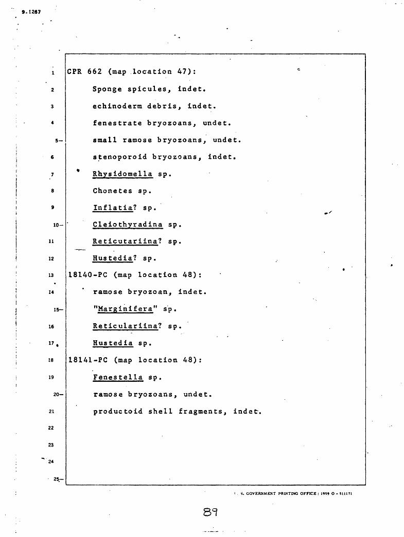
9.1267
5-
10-
11
12
13*
14
1
16
17
18
19
15-
20
21
22
23
24
25-
CPR 662 (map location 47):
Sponge spicules, indet.
echinoderm debris, indet.
fenestrate bryozoans, undet.
small ramose bryozoans, undet.
stenoporoid bryozoans, indet.
Rhysidomella sp.
Chonetes sp.
Inflatia? sp.
Cleiothyradina sp.
Reticutariina? sp.
Hustedia? sp.
18140-PC (map location 48):
ramose bryozoan, indet.
"Marginifera" sp.
Reticulariina? sp.
Hustedia sp.
18141-PC (map location 48):
Fenestella sp.
ramose bryozoans, undet.
productoid shell fragments, indet.
i . ». GOVERNMENT PRINTING OFFICE : 1959 O - 5U1T1
8=?

9.1257
5-
10-
12
13
14
Lot 6 (map location 49):
Wewokella? sp.
Triplophyllum sp.
Chaetetes radians
Productus ovatus
Diaphragmus elegans?
* Spiriferina spinosa?
Sulcalipinna sp.
Aviculipec ten sp.
Levidentalum sp.
Bellerophon sp.
Pleurotomaria sp.
Griffithides sp.
15
16
17
13
20-
21
22
23
.24
25

S.1287
Regional relations
Wherever the base of the White Knob Limestone can be observed in
the quadrangle, the limestone of the formation lies with apparent
conformity on rocks of the various types that make up the Copper Basin
5 _ Formation. In the Lost River Range, in the northeastern corner of the
quadrangle, the rocks of the White Knob Formation grade downward into
very dark-gray argillaceous rocks that are similar to but cannot be
correlated with any specific part of the Copper Basin Formation. These
dark argillaceous rocks have been considered to be part of the Milligen
10- Formation; here this assignment is questioned as explained in the
section of this report entitled Milligen Formation. Elsewhere in the
12 1 quadrangle all the rocks that are exposed beneath the formation cani
13 j reasonably be assigned to the Copper Basin Formation.
u
15-
16
17
18
19
20-j
21
22 |
23 |
24 ;
25-
(.'. i. GOVERNMENT s'KiJSTIM', OFFICE : 1'' S 9 O - M 11 V
387-Uo

9.1267
Rocks that are assigned to the White Knob Limestone are locally
interlayered with rocks that are assigned to the Copper Basin
Formation. The pertinent discussion of the relationships between the
rocks of these two formations has been presented in the section of
this paper on the Copper Basin Formation. - ' -~
At most places in the quadrangle the White Knob Limestone is
unconformably overlain by Challis Volcanics. East of Fish Creek,
however, the rocks that are assigned to the formation are conformably i
9 overlain by rocks of the Copper Basin Formation.
10- I Thickness
n ; The 7,365 feet thickness of White Knob Limestone measured near
12 i Cabin Creek and described on pages 57 to 65 is the thickest section of
13 ! the formation that has been recognized in the area of the Mackayi II j
UL [quadrangle. In the Lost River Range north of the quadrangle, Ross
is-i (1947, p. 1116) estimated the formation to be probably more than
is j 6,000 feet in thickness.
17 Early Tertiary rocks
18 Challis Volcanics
19 i The Challis Volcanics comprise a thick and widespread assemblage
2°-|of volcanic rocks, with some intercalated sedimentary rocks, that oncei
21 covered much of south-central Idaho. According to a recent revision ofi
22 |the originally broad definition (Ross, 1961b), the formation consists
23 iof dominantly volcanic strata of early Tertiary age within the part of
24 jcentral Idaho north of the Snake River Plain and south of the westward-
25- flowing segment of the^ Salmon River (near latitude 45°3Q1). That region

9-12S7
5-
. 6
10-
11
12
13
14
15-
also contains younger volcanic rocks now excluded from the Challis
Volcanics.
The Challis Volcanics cover nearly half of the Mackay quadrangle.
They are a heterogeneous assemblage of lava flows, volcanic breccia,
sandstone, siltstone, and conglomerate. These rocks are various shades'i
of reddish gray, brownish gray, and greenish gray. They range in j-* ! composition from andesite to rhyolite. Analyses of typical specimens
i are given in table 2. Most of the assemblage corresponds with the
latite-andesite member of the formation in the Bayhorse region (Ross,
1937, p. 50-53). It differs from that member in that fragmental rocks
of various kinds are more abundant than in the Bayhorse region. No
basalt has been found in the Challis Volcanics in the Mackay quadrangle,i
although it is reported in the Wood River region (Umpleby and others,
1930, p. 53-57).
Lava flows seem to be the most abundant material in the formation! ' l16 I in the Mackay quadrangle, and andesite is the most common flow rock.
i17 jThe typical andesite of the flows contains phenocrysts of pyroxene,
hornblende, and biotite either singly or in various combinations. Most18
19
20-
21
22
23
24
25
I
of the andesite also has plagioclase phenocrysts that range from calcic
j oligoclase to calcic andesine. Some of the flows contain a little J
potassium feldspar (commonly sanidine) and some contain quartz; in
these flows the plagioclase is commonly more sodic than that in the
typical andesite flows. In most of the flow rocks the phenocrysts are '
less than 2 mm long and most of the groundmass is partly devitrified
glass^_______________________________________________^ENT :'R!\T}\3 OFFICS :

9.1267
Breccias composed of volcanic detritus are about as abundant as
lava flows and are of the same range of composition as the lava flows,
Most of these breccias occur as massive lenticular or tongue-shaped
masses that seem to be mudflow deposits, although stream-deposited
.5- breccias, air-laid breccias, and auto-brecciated parts of lava flows
are undoubtedly also present.
Volcanic sandstone and siltstone are widely distributed but nowhere
in large enough aggregates to map at the scale of the present study.
The recognizable constituents include plagioclase (commonly oligoclase
10-|to andesine), and locally sanidine and quartz, but most of the detritus
^ is glassy volcanic rocks, commonly somewhat devitrified. These rocks
12 |are sufficiently altered to hinder identification of their components.I i
1 3 >Much of the material in these rocks is pyroclastic material; some has
14
1
16
17
18
19
2
21
22
23
24
15
been aerial deposited with little or no subsequent sorting or trans-~
portation, and some is clearly water-laid.
Conglomerate, confined mostly to the base of the formation, is
I locally several hundred feet thick. It consists of rounded fragments
that range from a fraction of an inch to as much as one foot in size,
and include volcanic rocks, quartzite, siltstone, .and chert, as well as
sparse limestone and Challis Volcanics.
25-
l . =>. C«JVSK.V\ i.NT PBI.NTKiO OFFICE : l-<* O - *i
CJlf.

S.12S7
One noteworthy exposure 3,700 feet N. 11° W. of the junction of
2 Sawmill Canyon and the North Fork of Alder Creek consists largely of
3 rounded pebbles, cobbles, and boulders of igneous rock. Farwell and
Full (1944, p. 9) interpreted these fragments to be granite and from
a.--.] this concluded that the granite, to be described below, was already in
place and exposed to erosion before the volcanic rocks were being
deposited. The rounded rock fragments are composed of phenocrysts ofI
plagioclase and biotite, and locally a little quartz and sanidine.
Most of the quartz and feldspar phenocrysts are rather intensely
10- broken, and some of the quartz is rounded and resorbed. The ground-
11 mass of these rocks is glassy and some includes laminated glass
12 | fragments that look like pumice. Some of these fragments may bei
13 [ xenoliths of plutonic rocks which have had their groundmasses melted
14 - -| and locally inflated, or, as seems more likely, they may all be -i
15~ | fragments of volcanic rocks. If any are xenoliths of plutonic rock,
16 then their presence shows that the plutonic rocks from which they were
17 derived had crystallized, probably below the surface, before thei
18 j enclosing volcanic rocks were extruded.i
Some of the Challis Volcanics near Lake. Creek, south of Copper
! 1-° Basin, are altered to the extent that they resemble the Gasto Volcanics
as described by Ross in the Casto quadrangle to the north (1934b,i i
p. 28-35, 45-54). The granitic mass in the vicinity of Lake Creek |I
intrudes and seems to be the cause of this alteration, which diminishes
away from the granitic mass. The alteration produced chlorite, epidote,
25 actinolite, carbonate, jericite, and some quartz. The original mafic
I. S. GO/SfC.'.'.it.Nr HHINTir-iG UrfiCE : !<»* » O -

9.1267
2 ' I
5-
7
8
9
1
11
12
13
14
1
16
17
18
19
2
21
22
23
10-
15-
minerals, perhaps largely pyroxene, have been more extensively altered
than the feldspar. Apparently at a late stage the rocks were
kaolinlzed.
20-
25-
L'. S. OOVBI.'.MSNT PS!.\T.7;G OFFICE: !9r> O- 5i
9.1267
10-
11
12
13
*
14
1
16
17
18
19
15-
The maximum thickness of the Challis Volcanics that is
indicated by comparing the surface topography with contours«
drawn on the base of the Challis Volcanics is in sec. 18,
T. 3 N., R. 23 E., and is a little more than 1,700 feet.
In many areas underlain by the formation, there is no
evidence as to the elevation of the base of the formation,
and in these places the thickness is indeterminable but may
exceed 1,700 feet. In the Mackay quadrangle, the upper
limit of the Challis Volcanics is everywhere an erosion»
surface so that the maximum thickness of the remaining
parts of the formation at any place is less than the origin*.1
thickness of the formation at that place.
20
21
22
23
24
25
U. S. GOVERNMENT PRINTING OFFICE : 1959 O - 1171
9.1287
5-
10-
11
12
13
14
1
16
17
18
19
Direct stratigraphic correlation between the part of the Challis
Volcanics in the Mackay quadrangle and the parts of the formation in
adjacent areas is impossible. However, the rocks in the Mackay
quadrangle resemble the latite-andesite member which makes up the
,lower,..part of the formation in the Bayhorse area to the north- (Ross,
1937, p. 50). The implication that only the lower part of the
formation is present in the Mackay quadrangle is strengthened by thei! fact that no correlative of the Germer Tuffaceous Member, which
overlies the latite-andesite member in the area to the north, has been
recognized in the Mackay quadrangle.
The Challis Volcanics within the Mackay quadrangle have not
yielded diagnostic fossils. Fragments of fossilized coniferous woodi
are widespread but too poorly preserved to be of value in establishingK.A. ~ I.
, and Doner, /\ , written
15-
20-
22
23
24
25-
[_the .age of the formation (Scott,r - Ajcommun., October 17, 1958).
| Ross (1961b, p. C179) presented evidence which shows that thei ,!Challis Volcanics range in age from Eocene into, at youngest, early :
Miocene, and probably is. mostly Oligocene in age. Fossils from the i i I - ' |Germer Tuffaceous Member southwest of Challis, northwest of the Mackay
i quadrangle, were examined by J. A. Wolfe (written report, October 7,
1960), who concluded that all the species in these collections arei ii known from middle Eocene floras of the Rocky Mountains Region. As
jnoted above, the part of the Challis Volcanics in the Mackay quadrangleiseems to be older than the Germer Tuffaceous Member and is therefore
tpxdbab LyJEocene in_age^

9.12S7
5-
The volcanic rocks are, as noted below, intruded by granitic
bodies and dikes that are 40 to 50 million years old. As the
intrusions are presumed to belong to the same general period of
magmatic activity as the eruptions, the volcanics within the quadrangle
are older but probably not greatly older than the intrusions. On
this basis, much of the Challis Volcanics in the Mackay quadrangle is probably of Eocene age.
10-
it
12
15-
16 I
i17 j
!8
19
20-
21
22
23
24
i.. s. ^ov>;K>vEsr ^HOTING OS-VICE : i^i u - MIITIJ»7- !CV
9.1267
5-
10-
11
tf
13
14
1
16
17
18
19
15-
20
21
22
23
24
25
Intrusive rocks -
Intrusive rocks, probably all products of a single
>eriod of igneous activity, are conspicuous features of the
Hackay quadrangle. They include several plutons and
numerous dikes. The compositions, distribution, and
relationships of the intrusive rocks and ore deposits in the
-central part of the quadrangle are presented in aX
separate paper (Nelson and Ross, 19fe8), and only a summary
of this information is included here. *.'
The rocks of the plutons range in composition from
granite to quartz diorite; table 3 gives the chemical and
normative compositions of some of these rocks. The rocks
are holocrystalline, commonly porphyritic, and range from
finie to medium grained; they are composed of quartz,
potassium feldspar, plagioclase that ranges from An« Q to
-_ in composition, hornblende, biotite, locally pyroxene,
and various accessory minerals.
All of the plutons within the Mackay quadrangle seem
to be intrusive; their contacts are sharp, and locally cross
cutting, the country rock is commonly metamorphosed for a
short distance beyond the contacts, the grain size of the
plutonic rocks near the contacts diminished toward the con
tacts, and locally dikes extend out from the plutons into
the country rock.
0. S. GOVERXYiEXT PRINTING OFFICE : 1959 O - SUJ7J
00
9.1267
10-
11
12
13
14
15-
16
17
18
19
20-
21
22
23
24
25
A. short The pluton that lies west of Mackay is called the
^
Mackay Granite, and the outermost part of it on the north
east is composed of light-colored granite rock that we
termed leucogranite porphyry in our paper on the Alder
Creek mining district (Nelson and Eloss, 1968). The leuco
granite porphyry is so consistently different from the rest«
of the Mackay Granite that we believe that it is the product
of a separate intrusive surge. The leucogranite porphyry
is of special interest because the most valuable ore
deposits that have been found in the quadrangle are asso
ciated with skarn that borders and lies within it. The
relationship of the leucogranite porphyry to skarn and of
skarn jto concentrations of ore 'minerals is discussed in
more detail in the section of this paper on ore deposits.
C. S. GOVERNMENT PRINTING OFFICE : 1959 O - 51 tl 71

9.1267
10-
11
12
13
16
17
18
19
20
21
22
23
.- 24
Lead-alpha age determinations made by T. W. Stern from
zircon from two samples of the Mackay Granite both gave an
age of 40 ^f 10 million years. One sample came from near
the Champion mine. Its chemical composition is shown .by
the fourth analysis in table 3 . The other sample is
from the SW cor. sec. 13, T. 6 N., R. 23 E. A sample of
th»e leucogranite porphyry from the NW% sec. 1, T. 6 N.,
R. 23 E., was determined by the lead-alpha method to be
50 ± 10 million years old (Stern, 1959, written communica
tion). An age determination by the same method, from the
pluton along Lake Creek, gave an age of 50 ^f 10 million
years.
The pluton that lies west-of Copper Basin underlies
jabo'ut 4 square miles of the Mackay quadrangle, and is part
of a larger complex of granitic rock that underlies about
50 square miles of the area west of the quadrangle. Within
the quadrangle these rocks are somewhat variable in
appearance and composition, but they all have granitoid
textures and seem to be intrusive. In the area west of
the quadrangle this complex includes gneissose rocks that
Cook (1956, p. 13) concluded were metamorphosed sedimentary
rocks.
25-
U. S. GOVERNMENT PRINTINC OFFICE : Hi? O - 511171
02,

9.1267
10-
11
12
13
14
1
16
17
18
19
15
20-
21
22
23
24
25-
The pluton that extends southward across the southern
boundary of the quadrangle at Iron Mountain is presumablyA
the northern end of a much larger mass described by
Anderson (1929b, p. 22-23), who speaks of Iron Mountain as
Boyle Mountain.
Dikes cut all the rocks of the quadrangle older than
th*e Snake River Basalt. They are most numerous in a zone
that trends northeastward through the center of the
northern half of the quadrangle. A second less dense con
centration of dikes forms another zone that passes through
the headwaters of Iron Bog Creek. Not many dikes have been
recognized in the Challis Volcanics. This is in part due
to the difficulty of distinguishing the dike rocks from the
similar appearing volcanic rocks. It may, however, be that
fewer dikes cut the Challis Volcanics than cut the older
rocks, because the Challis Volcanics and dike rocks
probably were emplaced during about the same interval of
time.
U. S. GOVERNMENT PRINTING OFFICE: m» O- 5U171
103

9.1257
10-
11
12
13
14
15
16
17
18
19
20-
21
22
23
24
25-
The rocks that make up the dikes range from fine to
coarse grained, most are porphyritic, but a few are not.
They are compo-sed of quartz, potassium feldspar, plagioclase
mostly oligoclase, hornblende, biotite, locally pyroxene,
and various accessory minerals.
The most common dikes are composed of light-colored,
f i^ie-grained rhyolite that contains dipyramid phenocrysts
of quartz, in part smoky, as well as phenocrysts of oligo-
clase and(or) orthoclase. The phenocrysts in these dikes >'
seldom exceed one-fourth inch in size. Specimen (£
table 3 , is a typical appearing rhyolite.
Rhyolite porphyry with abundant large phenocrysts is
the second most abundant type of rock that occurs in dikes
in .the quadrangle. The phenocrysts in these dikes include
oligoclase, orthoclase, and quartz. The oligoclase and
orthoclase phenocrysts are commonly larger than the quartz
phenocrysts, and locally they attain lengths of one inch.
Specimens '7 and \B , table 3 , are typical rhyolite
porphyry.
U. S. GOVERNMENT PRINTING OFFICE : 1959 O - 511171

5 -»i-
Metamorphic rocks
The metamorphic rocks include marble and associated rocks, skarn,
and jasperoid, which will be described in order below. Of these rocks,
only the jasperoid is sufficiently widespread to be shown on the
-geologic map of the quadrangle (Nelson and Ross, 1969). More 4
detailed descriptions and discussions of the metamorphic rocks will be J
found in Nelson and Ross, 1968, Farwell and Full, 1944, and Umpleby,
1917.
- Marble and associated isochemically metamorphosed rocks
10- Marble occurs at the contact between limestone and the variousi
u 1 intrusive rocks, notably the granitic pluton west of Mackay known asj -r
12 ! the Mackay Granite. The most conspicuous development is in White Knob
13 !a gleaming white mass of marble that constitutes a landmark in sec. 3, i
14 JT. 6 N., R. 23 E. Somewhat less conspicuous zones of marble are
15- plentiful. They vary in width and in places extend hundreds of feet
16 I into the limestone from the contact with igneous rock. Locally theI
17 !marble includes layers and masses of scapolite, diopside, tremolite,
18 ;wollastonite, and garnet (largely grossularite). These are inter-
19 ipreted to be the results of recrystallization of pre-existing rock
2Q-
21
22
23
25
components without addition of material from other sources; some seem
to have originally been beds of argillaceous and siliceous limestone
and beds and nodules of chert.
Where the granitic rocks intrude sandy and silty beds of the
Copper Basin Formation, isochemical metamorphism has resulted in
.recry s t all.i.z a t.i.Qn_o.f_quar_tz_litt Q_mo s alcj5-_thatLJ:gnd,-tQL_conceaL- o rigin a 1 !I. 5. GOVERNMENT r-l'iNT^.'G OFFICE : l^o O - -ill'l
05"

9.1287
5-
sedimentary textures, and also the formation of muscovite, biotite,
and diopside. All these changes may have been brought about without
addition of outside material.
10-
11
12
13*
14
IS
19
2
21
22
23
20-
25-
u. s. CO/FR:.MENT

9.1267
10-
11
12
13
14
15-
16
17
18
19
20-
21
22
23
24
25-
Skarn
Skarn is of outstanding interest because all the largei
ore bodies are within skarn. Skarn occurs locally along
all the contacts between granitic rocks and limestone. At
most places the skarn is discontinuous and no more than a
few feet thick. Adjacent to the leucogranite porphyry
al*ong the northeast edge of the pluton west of Mackay,
however, skarn is extensively developed and locally attains
a thickness of several hundreds of feet.
U. S. GOVERNMENT PRINTING OFFICE : 1959 O - SI 1171
107
5.T267
-.,. 5-..
Some patches of skarn, in part associated with limestone', are
surrounded by leucogranite porphyry. These patches of skarn are
believed to be parts of roof pendants and engulfed blocks of limestone
that have been altered to skarn. The skarn consists of garnet and
-di op side with subordinate amounts of epidote, actinolite, scapolite*, '
10-
11
wollastonite, and fluorite. Garnet makes up about three-quarters of* the skarn; most is brown and is about midway in composition between
andradite and grossularite. A small amount of it is yellow and is
dominantly grossularite. According to analyses presented by Umpleby
(1917, p. 64), the diopside contains considerable magnesium and a
little iron. In some places the skarn consists almost entirely of
12 jmagnetite and hematite, and skarn of this character about 1,000 feett
13 [northwest of the Grand Prize mine is in large enough bodies to be of
economic interest. In addition to the minerals just listed, Umplebyii
15~'(1917, p. 49-55) mentions eight that are thought to be components ofr~j the skarn: apatite, augite, custerite, hedenbergite, plagioclase, and
14
18
vesuvianite. Ilvaite in rather large masses was found in contact
metamorphosed limestone near Navarro Creek. The skarn seems to have I
19 |been formed by fluids from the granitic magmas reacting with pre-
20- I
i existing rocks--mostly by metasomatism of limestone or marble.
21
22
23
24
C. a. GG/EK.NVESr "HINTING OFFICE: 19S1
08
9.126?
5-
little of it seems to have formed from granitic rocks, an<
locally veins of skarn extend as much as 100 feet into
granitic rock. Sulfide minerals and their alteration
products are associated with the skarn, and concentrations
of these within skarn constitute the most important ore
bodies in the area. These minerals and their relationship
to« the skarn are described in greater detail under the
description of the Empire mine in the ore deposits section
of this paper.
10-
11
12
13
14
15-
16
17
18
19
20-
21
22
23
24
25-
U. S. GOVERNMENT PRINTING OFFICE : 19S9 O - 511171
9.5 267
s-
10-
11
12
14
15-
16
17
18
19
20-
21
22
23
24
Jasperoid
The jasperoid consists of fine-grained, somewhat ferruginous
silica that commonly has been in part brecciated and recemented by
fine-grained quartz. All the jasperoid in the quadrangle is associatec
with limy rocks, principally limestone, and much of it occurs at" and
near'depositional contacts of the Challis Volcanics on limy rocks.
Where jasperoid caps hills of limy rock, the geologic setting indicates
jthat these hills were once capped by volcanic rocks that have been
removed by erosion. Although this relation strongly suggests that much,
i of the jasperoid developed by replacement of limy rocks by fluids
|derived from the Challis Volcanics, it is less clear whether or notijsome of the plutons were sources of fluids that also*caused jasperoidi-
!zation. Jasperoid also occurs along faults that seem to have been
[.avenues for the movement of silica-bearing fluids that caused
jasperoidization.
Quaternary deposits
Snake River Group
Relatively unmodified basalt flows, which are some of the youngest
parts of the Snake River Group, occur in the southernmost part of the
Mackay quadrangle. These include lava flows that are slightly older
than the flows of the Crater of the Moon and virtually non-weathered
flows, that are probably correlative with those at Craters of the Moon
National Monument. These flows will be described below; the older
first and the younger second.
25
f. S. OOVEKNVENT PHi>'r !NG OFFICE : J9*'J O - 511171
8S7-VW

5-
10-
11
12
13
14*
1
16
17
18
19
15-
20-
21
22
23
24
25-
Basalt flows which are older than the flows of thes/r//
Craters of the Moon, butAyoung enough to be little modified
by erosion, occur in both the southeastern and southwestern
parts of the quadrangle. Those that crop out along
Friedman Creek are believed to be the upper of two sets
of flows that extend from the Snake River Plain, up the
va41ey of the Little Wood River, into the lower reaches
of Copper Creek, and into the valley of Friedman Creek.
South of the quadrangle these two sets of flows are
separated by old alluvium and at the southern edge of the
quadrangle they are obscured by an extensive cover of young
alluvium. The basalt flowed in the channel of Friedman! '
Creek where it locally overlies old alluvium and is locally
overlain by young alluvium. Chilled lava laps a short dis
tance up the sides of the valley of Friedman Creek.
O. S. GOVERNMENT PRINTING OFFICE .- 1959 O - 5U171

9-1267
5-
10-
11
12
13
14
1
16
17
18
19
15-
20
21
22
23
24
25-
The basalt flows in T. 3 N., R. 25 E., are not so -.
clearly related to present topography as those just des
cribed. All that can be stated positively as to their age
is that they are more weathered and eroded and therefore
probably older than the lava in the valley of South Lava
Creek, which is related to lava in the Craters of the Moon.
Tlrey are, however, fresh in comparison with most of the
basalt of the Snake River Plain farther south and they
preserve many lava tunnels and other fragile features.
They end abruptly a few miles east of the quadrangle, where
they overlie lava of more ancient appearance, which is
probably rather high in the thick sequence of flows that
underlies the northern part of the Snake River Plain.
Young basaltic rock regarded as akin to that in and
near the Craters of the Moon National Monument (Stearns,
1928; Stearns, Crandall, and Stewart, 1938, p. 93-100) is
present in the southeastern corner of the quadrangle. It
emerged from orifices in sees. 5 and 8, T. 2 N., R. 24 E.,
and occupied parts of the valleys of Dry Fork Creek and
Lava Creek.
U. S. GOVER.VVENT PRINTING OFFICE : 1959 O - 5U171

9.1267
10-
11
12
13
14
15
16
17
18
19
20
21
22
23
24
25-
These young rocks comprise lava flows and cinder masses
which are so much fresher in appearance than the older flows
of the Snake River Group previously described that they can
be distinguished on the most casual observation. They are
mostly black but locally they are colored brown or red by
.iron oxides. The flows generally have irregular upper sur-
fates that consist of broken, vesicular, and spiny blocks
of basalt, consolidated while the lava beneath was still in
motion. Exceptionally, they have ropy, pahoehoe type sur
faces. They stand higher at their borders than in their
median portions probably because the central parts of the
flows partly drained away after the edges had chilledi
against the valley sides. The lava is sparsely covered byi
grass and brush, although little soil is visible except in
holes where it has been carried in by water and, perhaps,
by wind.
U. S. GOVERNMENT PRINTING OFFICE : 19S» O - 511171
113

9.1267
10-
11
12
13
v,
u
1
16
17
18
19
15-
20-
21
22
23
24
25-
The recent lava in the Lava Creek drainage includes
two or more separate flows and issued from at least two
closely spaced vents, one of which retains a visible crater
At both vents the material is fragmental ejectamenta, in
part cinders and blocks, less commonly rounded bombs.
Anderson (1929a, p. 16-17) reports that the lava is ophitic
arid contains labradorite, augite, and glass. Magnetite is
conspicuous but olivine is absent* A flow from Lava Creek
entered the valley of Dry Fork where it covered detrital
material, largely alluvium. It dammed the valley of Dry
Fork Creek and forced the water to escape underground
through sink holes in the limestone of the valley floor.
Springs north of the mouth of Cold Spring Canyon probably
are fed by water from above the lava dam, although some
water now escapes around the toe of the flow.
U. S. GOVERNMENT PRINTING OFFICE : 1959 O - 511171
9.1267
10-
11
12
13
.
14
IS
IS
17
18
19
20
21
22
23
24
25
The entire assemblage of dominantly basaltic flows and
associated rocks that underlies the Snake River Plain was
formerly termed the Snake River Basalt (Russell, 1902,
p. 58) and originally regarded as Miocene to Recent in age.
In current studies, Malde arvd Powers (1962) restrict the
.term Snake River Group to rocks of late Pleistocene and
Recent age, the upper part of the Snake River Basalt of
previous usage. Stearns (1928, p. 98-100) concluded that
the last volcanic eruption in the Craters of the Moon
National Monument probably occurred more than 250 years ago
but perhaps not more than 1,000 years ago and that the
earliest flows may be Pleistocene in age. Most are surely
Recent. Anderson (1929a) thought that the lava within the
Mackay quadrangle belonged to the earliest of the successio
of eruptions related to the great rift in the area of the
Craters of the Moon, but evidence on this point is scanty.
The young flows in the Mackay quadrangle, particularly
those in the Dry Fork Creek drainage, seem to be younger
than Wisconsin glaciation and, therefore, Recent.
IT. S. GOVERNMENT PRINTING OFFICE: 1959 O - 511171

.9-1287 .
5
10-
Glacial deposits
Glacial erosion has been widespread and U-shaped
valleys and cirques are common in all of the higher parts
of the Mackay quadrangle. Glacial deposits are scattered
over much of the quadrangle, but are most abundant in the
northern part where the higher altitudes were favorable
for the development of glaciers. Water-sorted glacial out-
wash merges with alluvium, mainly the old alluvium, and the
boundaries between different kinds of surficial deposits
cannot be drawn with precision.
11
12
13
14
1
16
17
18
19
15-
20-
21
22
23
24
25-
0. 3. GOVERNMENT PRINTING OFFICE: 1959 O-5U171««?-fon

S.1267
5-
10-
11
12
13
14
1
16
17
13
19
2
21
22
23
24
15-
20-
25-
The glacial deposits in the Mackay quadrangle are divisible into
a group of older deposits that occur well above the present streams,
and a group of younger deposits that occur in and near the present
stream valleys. The older high-level deposits are inferred to be
either.,early- or pre-Wisconsin in age, and although none of them are
shown on the geologic map of the quadrangle (Nelson and Ross, 1969), * some of them will be described below. In Copper Basin the younger
deposits, which are in harmony with the present drainage, can be
further subdivided locally into older deposits, which are inferred to ,
ibe of Bull Lake age, and younger deposits, which are inferred to beI ' Ii . !; Pinedale in age. In the following paragraphs, the older deposits and .!
i
i the two subdivisions of younger deposits will be described in order
| from oldest to youngest.
L High-level deposits, consisting of masses of glacial boulders and,
| more commonly, sparsely distributed erratics, are fairly plentiful in
the higher parts of the quadrangle but none of these deposits are
shown on the geologic map of the quadrangle (Nelson and Ross, 1969).
Places where such material has been noted include slopes along the
North Fork of Alder Creek below the mouth of Stewart Canyon, the ridgei
i crest south of Cliff Creek in the SE% sec. 6, T. 6 N., R. 24 E., (i
slopes between Corral Creek and the West Fork of Navarro Creek at ii
altitudes near 8,000 feet, ridges near Bear Creek up to about 8,900i i
feet in altitude, the ridge that rises over 8,500 feet above sea leveli
jbetween the Right Fork of Iron Bog Creek and Smiley Creek, ridges above
LCherry Creek_above-an_ aItltude_of-a^50D-feet_and-almos-t to the divide_;i:. 5. GO >s !<: < . £:.~ ^Ki.vr:.\j uri-:c£ : ivi u - inn
9.126?
10-
11
12
14.
16
17
18
19
20-
21
22
23
24
with Copper Basin, saddles above Wood Canyon mostly below 7,500 feet,
ridges along the East Fork of the Big Lost River near the western
border of the quadrangle, and additional localities in which widely
scattered boulders remain.
-At some of these places the high-level glacial deposits include
granitic fragments, althou^^ the drainage basins they are in do not
contain granitic bedrock. None of the glaciation in the region is
believed to have produced glaciers large enough to have crossed major
drainage divides. Therefore, the presence of granitic erratic in
drainage basins that do not contain granitic bedrocks is considered
! clear evidence for substantial changes in the drainage pattern subse
quent to the deposition of these high-level glacial deposits. The
i fact that most of these deposits are now well above the present valleyI i
!_bottonis also indicates that there has been considerable downcutting-
! since the glaciation that produced them.ij It is clear that the presently recognizable high-level deposits
are only remnants of once more extensive deposits, which were probably
concentrated along old stream valleys where they were vulnerable to
modification or removal by subsequent stream and glacial erosion. Most
of the remaining high-level deposits probably owe their continued
existence to fortuitous locations away from the sites of active stream
and glacial erosion.
25-
u - ^11171
80 7 too
8
9.12S7
" t
10-
The relation of the high-level deposits to present topography is
reminiscent of that in the Bayhorse region where widespread glacial
.drift occurs some 1,000 feet above the present streams (Ross, 1929,
1937, p. 93-96). In the Bayhorse region the well-displayed early
glaciation -was tentatively assigned a Nebraskan age. While this '
remains possible,. the evidence at hand for all such features in centra Idaho indicates merely that the early glaciation was either early- or
pre-Wisconsin in age.
11
By far the greater part of the deposits of glacial origin in the
quadrangle is relatively young material that is related to the present
drainage; it consists of slightly weathered irregular blankets ofi "^12 i bouldery material on the floors and lower slopes of mountain valleys '
j i13 land canyons up to a height of several hundred feet above. the streams.
I i14 In most of the quadrangle these young glacial deposits cannot be .'
i is- j separated into material of different ages. In Copper Basin, however,
; ' i is the deposits of two glacial maxima can be locally distinguished, and
| i17 where possible these have been shown separately on the geologic map ofi '
!
13 | the quadrangle (Nelson and Ross, 1969). Differentiation of these
i is J young deposits was done with advice by Gerald M. Richmond. '
! i 20-! The oldest of the young glacial deposits that are related to the !
21
23
24
present topography occupy an area of more than 4 square miles southwest
of benchmark 7705, at the mouth of Cabin Creek. These deposits are
somewhat weathered in comparison to the younger deposits to be
described, and because of this, as well as their spatial relation to
25~|other glacial deposits, they are inferred to be of Bull Lake age.____

9.1267
10-
11
12
14
1
16
17
18
19
2
21
22
23
is
2°-
The younger part of the young moraine in Copper Basin lies to the j
west of, in part adjacent to, and presumably in part upon the deposits
just described. On the east side of Star Hope Creek, this younger
moraine underlies an area named the Potholes, from the kettle topography
that-occurs on it._On the west side of Star Hope Creek, the younger" -
moraine makes up parts of ridge spurs, and the moraine attains-a * thickness of about 1,500 feet in the end of the ridge north of Broad
Canyon. This younger moraine is inferred to be of Pinedale age on the
| basis of its freshness and its relationship to the other glacial
i deposits in the area.
! _ Throughout the quadrangle the cirques do not contain mappableI j| quantities of moraine and their surfaces tend to be bare rock. Talus
i piles land thin alluvium in hollows in the cirque floors were not
! mapped.
No remnants of glacial ice or of drift young enough to be
I attributed to the "little ice age" (Matthes, 1942) have been noted in"
I the Mackay quadrangle, but it is plausible to suppose that glaciationi ijoccurred in'the highest parts of the quadrangle at that time. This
1 suggestion is based on the presence in the rugged parts of the Lost
I River Range to the east of snow banks with blue ice in their interiors
(Ross, 1947, p. 1149). None of this ice can be considered a modern
glacier, but it might be remnants of glaciers of the little ice age.
25-
l. S. GO- ttj;..', KNT Prt'NTiNu O-FICE : 1959 O - M.STl
S-J7-ICO
20
9.1267
Old alluvium
The streams throughout the quadrangle are bordered by unconso11datedI
or, at most, poorly cemented alluvial material. The larger masses of
alluvium probably record a long complex history of erosion and
5- deposition, but for mapping and descriptive purposes, they are divided-
only into old alluvium, terrace alluvium, and flood-plain alluvium.
Only the larger masses of alluvium are shown on the geologic map of the
a .quadrangle (Nelson and Ross, 1969).
9 i The old alluvium corresponds essentially to the "older alluvium"
io-|in the Bayhorse region (Ross, 1937, p. 70-72) except that it is not
11 jbelieved to include glacial deposits, other than glacio-fluvial outwashli
12 Corresponding deposits are plentiful in the Borah Peak quadranglei
\3 I (Ross, 1947, p. 1125) 9 but the alluvium there was not subdivided in
14 ^mapping. No alluvial deposits old enough to be correlated with the
is-:Donkey Fanglomerate of Pliocene(?) age in the Borah Peak quadrangle
16 i(Ross, 1947, p. 1122-1124) were recognized in the Mackay quadrangle, I
17 but it is conceivable that some exist.
18 The old alluvium is above modern flood plains and even above
19 {terrace deposits that border the flood plains. It lies on low'ridge! |
20~ crests and high terraces and fans formed well before the present erosion
cycle and it generally shows some cementation.
The largest masses of old alluvium occur as fans that occupy much
21
23
24
of the Big Lost River valley and that are now incised by the river and
its tributaries. These fans are composed mainly of fairly coarse gravel|
jand sand, derived from the mountains under conditions differ en t._from__;I 1 , a. GOVcSV-hJ.NT J'HrsTS.V; GeFiCZ: W7
12.1

9-1257
5-
10-
8
9
1
11
12
13
14
1
16
17
18
19
15-
20-
21
22 I
23
24
those of the present. The material of the fans is rather poorly
cemented, in large part by calcium carbonate. It is firm enough to
maintain low, steep bluffs, but it crumbles readily under a pick. The
lower ends of the fans are truncated along fairly continuous bluffs
where the old alluvium is incised by the Big Lost-River. ~~" ' -""
The old alluvium in the valley of the Big Lost River near Mackay
is very thick; the alluvium of the modern flood plain and adjacent
terraces is relatively thin. Gravity traverses were conducted in the
valley of the Big Lost River by J. Jacobson and D. Hill. Accprding to
D. P. Hill (written commun., October 15, 1959), and David Strait
(written commun., December 6, 1960), who interpreted the data, a
traverse across the valley along the southern boundary of the northern
tiers of sections in T. 5 N., R. 25 E., indicates that the alluviumI ' ji I.there attains a maximum thickness of about 3,000 feet. Another travers'e! *along the eastern boundaries of sec. 31, T. 7 N., R. 25 E., and sec. 6,
T. 6 N., R. 25 E., a mile west of the eastern border of the quadrangle,
|jives an inferred depth of 6,000 feet. A traverse north from near the
lam at the Mackay reservoir suggests that a shallowly-buried ridge ofidense rock extends east from the dam, and that the alluvial fill northi
of the dam is thicker than that over the buried ridge. Scattered
outcrops of White Knob Limestone indicate that the buried ridge may be
composed of this rock. The data are not sufficient to indicate whetherithis buried ridge is continuous across the valley; presumably the
ancestral Big Lost River passed through it.
25-
-. s. CCVER.\-.:^\T ?;;;..T:N^ OFFICE: i?*9 o- MU-»-: - K

0.1267
,.5-.
6 .
lo-!
In Copper Basin the smooth surface that extends westward from j
Copper Basin Ranger Station for a distance of about 4 miles is underlain
by gravel, sand, and silt, somewhat doubtfully included in the old
alluvium. The material here may be somewhat younger than most of the
pld:-all,uvium. It is sufficiently well sorted and rounded to indicate""
deposition by water rather than ice. The small glaciers that once
filled-the neighboring mountain valleys, or their ancestors, must have
yielded detritus to the lowland as they melted and the material here
described may include products of this run-off.
Patches of loose gravel, which are not shown on the geologic map
11 jof the quadrangle (Nelson and Ross, 1969), occur on ridge crests along ;
12 |the lower reaches of Dry Fork Creek at altitudes up to 400 feet above
13 {present creek level. These represent terrace gravel laid down by the*- i
14 JDry Fork Creek or its tributaries early in its history. The amount of
15~.erosion that has occurred since this gravel was deposited suggests that
16 jit may have been deposited during the Pleistocene epoch.
Terrace alluvium17
18 i The terrace alluvium is in general intermediate in age between the
19 jold alluvium and the flood-plain alluvium. Most of it is probably
jfairly young; some of it may be as young as some of the flood-plain
21
22
23
24
25-
alluvium; and a little of it may be as old as some of the old alluvium.
Two sets of alluvium mantled terraces are present along the valley
of the East Fork of the Big Lost River beyond where it emerges from
Copper Basin. The lower set is fairly continuous but the upper set is
Idiscpntinuous^_Two_s.ets__of_graveL.mantled t errac e_als.o_Qc_c_ur_.along__

9.1257
Copper Creek in the southwestern corner of the quadrangle; these two
sets are about 20 feet and 100 feet above the flood plain of Copper
Creek. The valley of Fish Creek is also terraced but the terrace
deposits were not delineated on the geologic map of the quadrangle
(Nelson and Ross, 1969).
Flood-plain alluvium
lO-
The flood-plain alluvium of the present report corresponds to the
"younger alluvium" and "flood-plain alluvium" of the Bayhorse region
(Ross, 1937, p. 72-73) and to the younger part of the alluvium mapped
in the Borah Peak quadrangle (Ross, 1947, p. 1125). Alluvium is
present on the flood plains of most streams in the Mackay quadrangle
but, as in the Bayhorse region, it was mapped only in large valleys.
13
14
1
16
17
18
19
15-
20-
21
22
23-
24
25-
t'. 5. GoVEH.N \iE.\T HrtUNTIMi OFFICE : i } > ' O - ;.! 11 7!
8*7-Ho

.9.1267 .
5-
10-
11
12
13
14
1
16
17
.18
19
15
20-
21
22
23
24
25-
Thin beds of nearly white, pulverulent volcanic ash
occur in at least four places in the quadrangle. All are
in unconsolidated material allied to the young alluvium.
One is in a bench cut in the flood plain of the Big Lost
River at the border of Mackay Reservoir. One is in
unmapped gray- 1 -along the West Fork of Navarro Creek, down
stream from and probably younger than the large glacial
deposit farther south. Another ash bed is in torrential
fill in a gully in sec. 32, T. 2 N., R. 21 E. This fill
has been dissected by recent erosion to expose the ash
beds. Another is in the fill of a minor gully tributaryi
to Antelope Creek in sec. 11, T. 4 N., R. 24 £. Probably
all the fill that contains ash is rather old flood-plaini
alluvium. Ash deposits in broadly similar environments
have been reported from numerous places in (he Northwest
(Horberg and Robie, 1955; Riggs and Could, 1957) and most
appear to be from a single eruption 6,700 years ago. The
ash in the Mackay quadrangle seems identical to those
listed in the two reports cited (Powers, H. A., 1961,
oral communication).
(25"U. 5. GOVERNMENT PRtNTING OFFICE : 1959 O - 511171
T>IOO

9.1237
1 Landslide deposits
2 Landslides and landslips are plentiful but few have been.mapped.
One conspicuous mass of landslide debris, in and near sec. 19, T. 7 N.,
R. 25 E., is shown on the geologic map of the quadrangle (Nelson and
5- Ross, 1969).
Structurek
Faults
Although no low-angle faults have been recognized in the Mackay
quadrangle, the prevalence of such faults in the area to the west
10- suggest that low-angle faults may be present here also. The reader I
11 <wi_ll realize that much of the~inter?ayering of the various rock types! ~ i
12 jof the. Copper Basin Formation and the White Knob Limestone, which isi !
13 >hereinjattributed to depositional interbedding, could equally well bei j
14 ithe result of juxtaposition by faulting. Recognition of t low-angle
is- ifaulting is hindered by the scarcity of useful marker horizons withini
16 jthe Copper Basin Formation and White Knob Limestone, as well as by the
17 widespread cover of volcanic rocks.
18
19
20
21
22
23
24
.25
U. S. Par\-T!?;O CFFIC2 : i?59

9.1267
5 "
6.
7
8
9
10-
11
12
13 ,
14
1
16
17
18
19
15
20-
Many steep faults have been recognized in the Mackay quadrangle,
and doubtless many more are present but unrecognized, especially in
areas underlain by the Challis Volcanics. Many of the faults shown on
the geologic map of the quadrangle (Nelson and Ross, 1969) are
inferred from.the presence of steep straight scarps either ih^ the ' ' |'~ *'-
p.resent topography or in the surface at the base of the Challis Volcanics. ''' * iPart of the surface at the base of the volcanics is shown by contours
on the geologic map (Nelson and Ross, 1969); it is a composite of the
topography before the eruption of the volcanics and the modifications
of that surface by later deformation. Commonly steep straight slopesII in the surface beneath the Challis Volcanics coincide with modern1 """" 1
escarpments. At most places there is insufficient evidence to deter-! I
mine whether these are fault-line scarps that existed as steep hill-i jsides prior to the deposition of the volcanic rocks, or whether they
are fault scarps that formed after the volcanics had been laid down,
probably some are one, some the other, and some a combination of both.
At least some of the volcanic rocks along the fault that crosses
the heads of Navarro Creek seem to have been deposited subsequent to
the movement on that fault, because the volcanic rocks extend across
the fault and into canyons cut in the scarp.
21
22
23
24
25
12.7

9.1267
5
10-
11
12
13
14
1
16
17
13
19
21
22
23
24
15-
25-
On the other hand, the movement on the fault that extends south- ,
southwestward from the vicinity of Mackay-seems to have occurred after
at least part of the volcanic rocks had been deposited. Here Jasperoid;,
in part brecciated and recemented by jasperoid, occurs in the Challis
Volcanics along.,the fault. The straightness of this contact and the
fact that the volcanic rocks are in contact with Paleozoic rocks along \*
it also suggests that it is a fault that was active after at least
some of the volcanism. At the northern end of this fault, old alluvium
has been deposited against the fault scarp. There is no evidence thati any movement has occurred on this fault during or after the time that
jthe old alluvium was deposited.
ii The straightness of the fault contact between volcanic rocks andj'Paleozoic rocks, which extends northward from Copper Creek, suggestsi that this fault was active during and perhaps after, the deposition of
the Challis Volcanics.iIi Within the Paleozoic rocks there are few recognizable stratigraphic
|markers that can be used for determining structures. In the southwest
i
part of the quadrangle in the vicinity of Argosy Creek, however,iilimestone beds in the Copper Basin Formation are truncated by a fault.
| The steep southwest-facing front of the Lost River Range, along
With the abrupt change in stratigraphic level between the mountains and
the isolated outcrop at the SW cor. sec. 4, T. 7 N., R. 24 E., indicate
that a major structure, probably a fault, exists at this mountain front.
Many of the centers of eruption in the Craters of the Moon National
Monument.area^-South-of-ihe-Mackay-quadrangle, are along-a fracture-zone
12.8

9-1267
5-
10-
12
13
_
14
I
16
17
13
IV
15-
20-
21
22
23
24
25-
that trends about N. 40° W. and has been named the Great Rift zone
(Stearns, 1928, p. 7-9). As Anderson has noted (1929a, p. 18-19;
1929b, p. 26-27), a northwestward projection of the rift zone lines up
with the eruptive centers of young basalt near Lava Creek.
Folds ---
Throughout the quadrangle the Paleozoic rocks are folded, and the
major folds that carr be delineated trend between about due north to
about N. 45° W. Major folds that have been recognized include those in
the Lost River Range in the northeastern corner of the quadrangle, the
janticline that extends with possible interruptions from Corral CreekIIsoutheast past Cherry Creek and probably to Timbered Dome, the anti-! ~"~
dine that extends south between Star Hope and Copper Creeks, and thei Ii ijanticline that lies west of Dry Fork Creek.; I! Superimposed on the major folds are many minor folds which were! . - "not delineated at the scale of the mapping for this report. In thei ilimestone many of the minor foI3s are intricate, nonsymmetrical, and of;*
'a type that seems to be common in limestone. Some of the deformationi Iin the limestone seems to be associated with the emplacement of the
| |masses of intrusive rocks in the quadrangle. Many of the attitudes of 1 !I !the beds near the intrusive rocks west and southwest of Mackay are
i
based on work of summer students of the University of Idaho, School of !i ' Mines, and were furnished through the courtesy of Professor George 'I i! IWilliams. I
The Challis Volcanics have been folded but less intensely, and
apparent Ly_less_ayatematijcally^_than_the-older_ rocks.___________I . > .-.iu. KH--"r. OFf.CS : l*'-1 O MI1T1
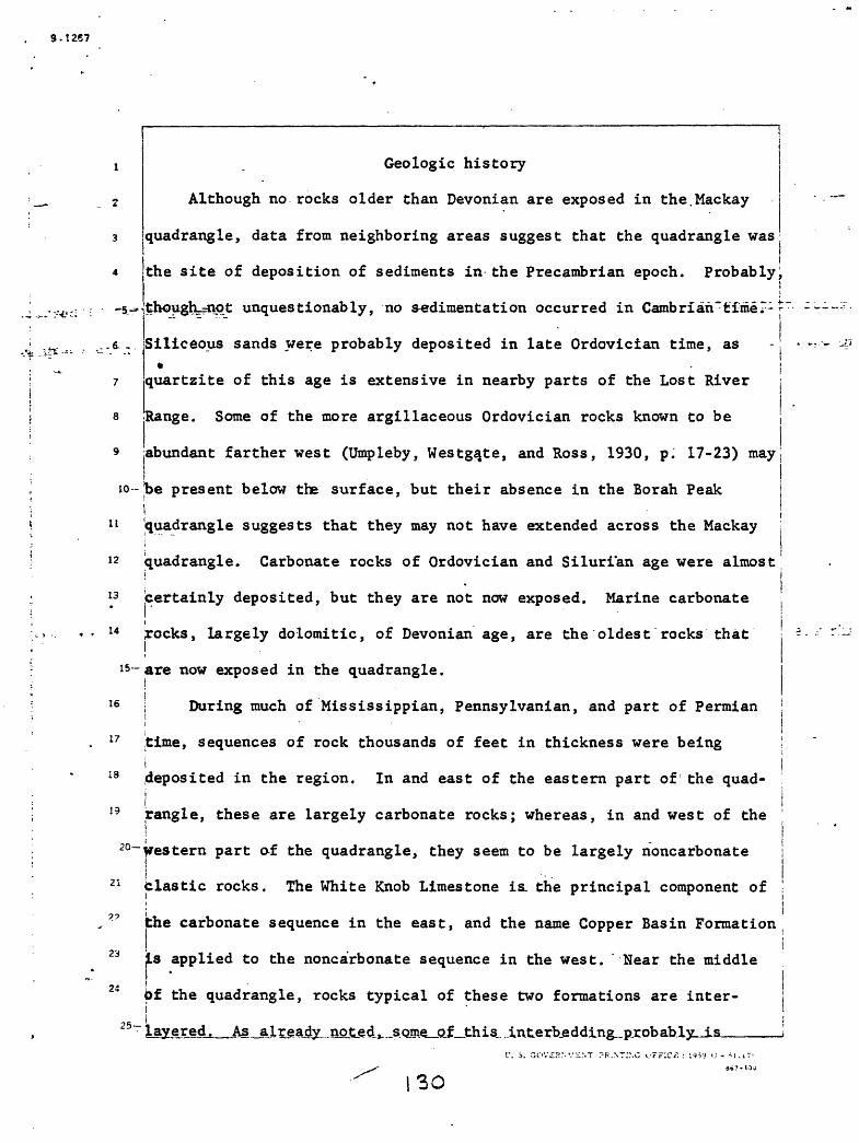
9.1257
11
12
13
14
i
16
17
13
19
is-
20-
21
24
25-
Geologic history
Although no rocks older than Devonian are exposed in the.Mackay
quadrangle, data from neighboring areas suggest that the quadrangle wasI
the site of deposition of sediments in the Precambrian epoch. Probably^i
though_rnpt unquestionably, no sedimentation occurred in Cambrian'feimer1
Siliceous sands were probably deposited in late Ordovician time, as
jquartzite of this age is extensive in nearby parts of the Lost River
Range. Some of the more argillaceous Ordovician rocks known to be
abundant farther west (Umpleby, Westga.te, and Ross, 1930, p. 17-23) may
be present below the surface, but their absence in the Borah Peaki'quadrangle suggests that they may not have extended across the Mackay ,
quadrangle. Carbonate rocks of Ordovician and Silurian age were almostI i
certainly deposited, but they are not now exposed. Marine carbonate j! Irocks, largely doloraitic, of Devonian age, are the oldest rocks that
are now exposed in the quadrangle.
! During much of Mississippian, Pennsylvanian, and part of Permian
time, sequences of rock thousands of feet in thickness were beingideposited in the region. In and east of the eastern part of the quad-i Irangle, these are largely carbonate rocks; whereas, in and west of theiiwestern part of the quadrangle, they seem to be largely noncarbonatei ii - I Clastic rocks. The White Knob Limestone is. the principal component of '.i \ the carbonate sequence in the east, and the name Copper Basin Formation
i is applied to the noncarbonate sequence in the west. Near the middle!
6f the quadrangle, rocks typical of these two formations are inter-ilayered. As already noted, some of this interbeddlng.,pjcob.ab.ly-jis_____
30
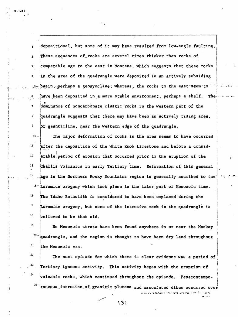
S-T267
i°-
11
12
13
14
1
16
17
18
19
2
21
22
23
24
15
20-
depositional, but some of it may have resulted from low-angle faulting.
These sequences of., rocks are several times thicker than rocks of
comparable age to the east in Montana, which suggests that these rocks
in the area of the quadrangle were deposited in an actively subsiding
basin,-^perhaps a geosyncline; whereas, the rocks to the east"seem to
have been deposited in a more stable environment, perhaps a shelf. The-
dominance of noncarbonate clastic rocks in the western part of the
quadrangle suggests that there may have been an actively rising area,
or geanticline, near the western edge of the quadrangle.
The major deformation of rocks in the area seems to have occurred
'after the deposition of the White Knob Limestone and before a consid
erable .period of erosion that occurred prior to the eruption of the
Challis Volcanics in early Tertiary time. Deformation of this general
Jage in the Northern Rocky Mountains region is generally ascribed to the
Laramide orogeny which took place in the later part of Mesozoic time.
The Idaho Batholith is considered to have been emplaced during thejLaramide orogeny, but none of the intrusive rock in the quadrangle is
believed to be that old.
No Mesozoic strata have been found anywhere in or near the Mackay
quadrangle, and the region is. thought to have been dry land throughout
the Mesozoic era.i I The next episode for which there is clear evidence was a period of
tertiary igneous activity. This activity began with the eruption ofL
volcanic rocks, which continued throughout the episode. Penecontempo- \j
:raneojus_intr.usion..ofL grani.tic-.plutons_and- associated dikes- occurred -over
\3

9.1267
. i- _*-,:- .jSafc «C.*
10-
8
9
1
11
12
13
14
i
16
17
18
19
15-
20-
21
23
a span of time, which, however, seems to have begun after the volcanism
was well under way. By the time this igpeous activity had ceased, the
entire area of the quadrangle was probably buried beneath lava flows
and associated pyroclastic rocks of the Challis Volcanics. Locally
some crumpling.and faulting of the older rocks seems to have
accompanied the emplacement of the intrusive rocks.*
Since the eruption of the Challis Volcanics, erosion has been
dominant, but the presence of alluvium of several ages indicates that
down-cutting by streams hesitated, at least locally, several times*.
jThe alluviation may have been due in part to climatic fluctuation, and
in part to local interference of drainage by structural sagging or
faulting. The regional seismicity, and large local differences ini'altitude in the area, attest to continuing deformation in the region.
I _ During Pleistocene time, glaciers sculptured the higher parts ofithe quadrangle, and at least three glacial maxima are recorded in
jdeposits in the quadrangle.i
During late Pleistocene and Recent time, basalt flows, which are
'among the youngest parts of the Snake River Group, flowed into several
of the valleys in the southernmost part of the quadrangle.
Mineral deposits
The Mackay quadrangle contains the Alder Creek and Copper Basin
joining districts, large parts of the Little Wood River and Lava Creek|mining districts, and the easternmost edge of the Alto district (Ross,
1941, pi. 1). All of these have been productive and all continue to bejisporadically active, although on a reduced scale compared to past activity.
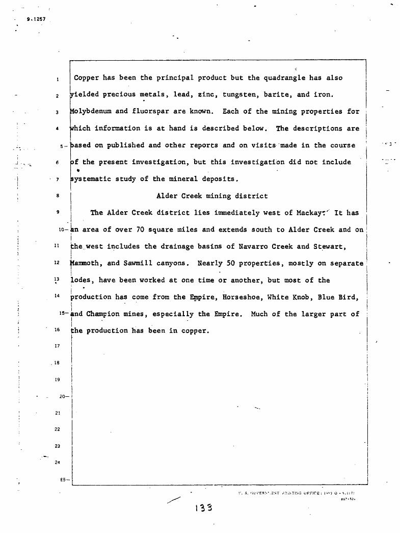
9.1257
Copper has been the principal product but the quadrangle has also
yielded precious metals, lead, zinc, tungsten, barite, and iron.
Molybdenum and fluorspar are known. Each of the mining properties for
rfiich information is at hand is described below. The descriptions are
i>ased on published and other reports and on visits made in the course
' the present investigation, but this investigation did not include »
systematic study of the mineral deposits.
Alder Creek mining district
The Alder Creek district lies immediately west of MackayT' It has
iG-an area of over 70 square miles and extends south to Alder Creek and on
11 the west includes the drainage basins of Navarro Creek and Stewart,
12 Mammoth, and Sawmill canyons. Nearly 50 properties, mostly on separatei
\3 lodes, have been worked at one time or another, but most of the
14 production has come from the Empire, Horseshoe, White Knob, Blue Bird,
15~and Champion mines, especially the Empire. Much of the larger part ofI .
16 the production has been in copper.i
17
18
19
20-
21
22
23
24
25-
^ATING OFFICE : l-f'7 O - 5.1IT:

9.1267
5-
10-
11
12
13
14
15-
16
17
18
19
20
21
22
23
24
25-
The Empire mine, in sec. 36, T. 7 N., R. 23 E., pro
duced continuously from 1902 through 1930, and sporadically
since then, first under the White Knob Copper Company, and
later under the Empire Copper Company, the Idaho Metals
Company, the Mackay Metals Company, the Mackay Exploration
Company, and, finally, the Lost River Mines Incorporated.
Umfcleby (1917, p. -94) estimated the production through 1913
at $2,500,000, mainly in copper, and Ross (1930, p. 8-9)
presented production figures from the beginning of 1914
through April 1929 that total over $6,000,000 in large part
from leasing operations. Farwell and Full (1944, p. 5)
show the production of metals by weight from 1902 through
1942. ; In 1956 a sulfide ore body was discovered in an adit
that was driven more than 1,500 feet from the surface at
approximately the 1,100-foot level of the mine. Exploration
has continued since then.and in 1960 ore was shipped from
this adit. In 1961 a mill was constructed at the portal.
Some iron oxide from open cuts above the principle old
workings was shipped in 1958.
U. S. GOVERNMENT PRINTING OFFICE : 1959 O - 511171

9 -i 267
5-
10-
11
12
13
14
Most of the ore that has been shipped from the Empire mine has
been oxidized material not susceptible to concentration by methods
available at the time the mining was done. This ore is reported to
have contained 4 to 5 percent copper. Concentrates of sulphide ore
averaging about half this much-copper were shipped (Ross, 1930, p. 15),I"
and some shipped in.the early days contained as much as 6 percent
(Umpleby, 1917, p. 49). At least one carload of tungsten ore containing
2.08 percent WO^, was mined below the 1,000-foot level, and was shipped
in 1942 (Farwell.and Full, 1944, p. 1, 11). During the most active
part of the history of the property, only fairly rich copper ore or
material easily concentrated by gravity methods could be handled.
Presumably much copper-bearing material that could be profitably
(produced using modern techniques remains in the mine and some may be! i j Iin the dumps.
15
16
17
18
19
20-
21
22
23
24
25
i. a. tiovgHr.. £. ,r r'rti.Nr;:.-.; OFFICE : ;o*9 o-
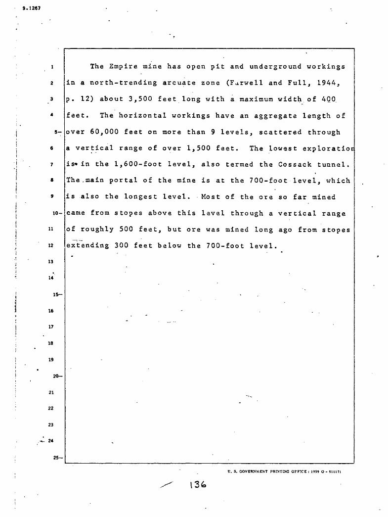
5.1267
5-
10-
11
12
13
14
1
16
17
18
19
15-
20-
21
22
23
24
25-
The Empire mine has open pit and underground workings
in a north-trending arcuate zone (Farwell and Full, 1944,
p. 12) about 3,500 feet long with a maximum width, of 400.
feet. The horizontal workings have an aggregate length of
over 60,000 feet on more than 9 levels, scattered through
a vertical range of over 1,500 feet. The lowest exploratior
is*in the 1,600-foot level, also termed the Cossack tunnel.
The,main portal of the mine is at the 700-foot level, which
is also the longest level. Most of the ore so far mined
came from stopes above this level through a vertical range
of roughly 500 feet, but ore was mined long ago from stopes
extending 300 feet below the 700-foot level.
U. S. GOVERNMENT PRINTING OFFICE: 1959 O- 51U71

9.1267
11
The concentrations of ore minerals in the Empire mine and some of
the neighboring mines are intimately associated with skarn, which is
described in the section of this paper on metamorphic rocks. The skarn
occurs along the contact between limestone and the leucogranite
porphyry. Various ideas as to the nomenclature, relationships, and age
of the intrusive rocks and the skarn have been expressed by previous
Investigators (Kemp and Gunther, 1908; Umpleby, 1917; Farwell.and Full,
L944; Leland, 1957). In the present discussion nomenclature and
concepts concerning the rocks are based on the work of Nelson,-(Nelson
10- and Ross, 1968), done in connection with the present investigation, andt i
on that of Thor Kiilsgaard (in U.S. Geol. Survey, 1962), who visited the
12 mine in 1961. Most of the ore shoots are in skarn adjacent to marble;
13
14
some are entirely within skarn; and some are at the contact between
skarn and leucogranite porphyr. Umpleby (1917, p. 45) stated that most
15~pf the ore shipped came from ore shoots within the granite porphyry, 100
16 jto 800 and in one case 1,200 feet from the contact. Probably most of
17 these shoots were in skarn that had formed by replacement of roof
18 pendants aid engulfed blocks of limestone, but in places intrusive rocks
19 contain skarn minerals, some of which seem to be replacements of thei i
20~intrusive rocks and some to fill fissures.
The mineralized shoots in the Empire mine are irregular pipelike
>odies (Farwell and Full, 1944, p. 10) that commonly are elliptical in
]>lan, with their long axes at various different attitudes but usually
steeply pitching. In horizontal cross section the long axes range in
25t
-length from 15 to 200 feet and the short axes from 5 to 55 feet. One

9.1267
shoot has been mined almost continuously through a vertical distance of
600 feet but most are less persistent. Some ore bodies strike north-
Iwest; others northeast. Most pipes pitch northeast, east, or southeast;
in directions nearly at right angles to their strikes. Some pipes
branch upward; a few branch downward. A few ore bodies, mostly under
marble hanging walls, are flat. Stope maps show more irregularities
.7 in" trend than systematic arrangement. There is a tendency for s topes
to be radial with respect to the main mass of the leucogranite porphyry!
but some of the larger s topes nearly parallel the boundary of that body.
10- Dikes of various shapes and trends traverse the skarn, addingi
11 complexities to the form and distribution of ore bodies. The mine
contains various fractures and shear zones and some o.f these have
proved to be useful guides in the search for ore (Ross, 1930, p. 15).
14 |The fractures and shear zones are not sufficiently well shown on
is- available maps to permit generalizations on their distribution and i i
is ;origin. Umpleby (1917, p. 45) has called attention to one gouge-lined
fracture with a strike of N. 20°-30° E., and a dip of 50°-60° SE. He
regarded this as a product of minor post-mineral movement along a pre- i
19 mineral fault. Farwell and Full (1944, maps and sections) show
18
20-numerous faults whose trends average near N. 45° E., and whose dips areli
21 southeast. Their structure sections show these faults traversing dikes
22
23
24
25
and skarn bodies without displacement. The limestone is tightly and
irregularly folded but details on the structure of limestone near the
are bodies are not available.
I . v G' V5HNV-CNT
38

9.126?
5-
10-
11
12
13
,
14
15
16
17
18
19
20-
21
22
23
24
25-
Kiilsgaard (U.S. Geological Survey, 1962, p. A3-A4) -
found that in the lower levels of the Empire mine steeply
plunging irregular pipe-like bodies of primary ore have
formed where northeast-trending premineralization faults
cut the skarn. He reasons that the jointed and fractured
skarn was more permeable to mineralizating solutions
ascending along the faults than were the limestone and
granitic rocks. His conclusions support, in part, the
earlier conclusions of Umpleby (1917, p. 44-49).
The hypogene minerals in the ore bodies in the Empire
mine (Umpleby, 1917, p. 49-55) include chalcopyrite, pyrite,
pyrrhotite, magnetite, scheelite, molybdenite, sphalerite,
specularite, galena, tetrahedrite, bornite, calcite, quartz,j
fluorite, in one place siderite, and the minerals of the
enclosing skarn. The sulphide body in the tunnel started ir
1956 contains pyrrhotite, pyrite, arsenopyrite, sphalerite,
chalcopyrite, galena, covellite, malachite, and possibly
scorodite. Much of the ore is oxidized and this contains
such minerals as azurite, brochantite, calamine, chalcanthite
chrysocolla, native copper, copper pitch, covellite, cuprite
gypsum, hematite, limonite, kaolinite, malachite, opal,
pyrolusite, smithsonite, and tenorite. Chalcocite has been
noted but is nowhere abundant. There is no evidence that
secondary enrichment of economic significance has occurred
anywhere in the mine. ______________________________U. S. GOVERNMENT PRINTING OFFICE : 1959 O - 511171

9.1267
10-
11
12
13
14
15
16
17
18
19
20
21
22
23
24
25
The distribution of supergene and hypogene ore mineral
in the Empire mine has not been studied in any detail.
Unoxidized sulphide remains within 50 feet of the surface
in a few places but oxidized metallic minerals are
encountered in ore shoots hundreds of feet underground. It
seems that surface water was able to penetrate readily
into fractured ground throughout the mountain in which the
workings are situated. Wherever this water reached,
sulphides were oxidized but no stable zone was established '
at which secondary enrichment could take place.
The mines and prospects in the area surrounding the
Empire copper mine have yielded mainly lead and zinc ore,
although copper is also present. They include the White
Knab, Grand Prize, Blue Bird, Champion, Horseshoe, and
smaller properties. The deposits in these properties
differ from those of the Empire mine in that skarn is less
abundant or absent in them, and the mineralized bodies are
irregular veins rather than pipes. The properties named
above have all been productive at one time or another but
available records of production are incomplete.
U. S. GOVERNMENT PRINTING OFFICE : 1959 O - 511171
H-0

9.1267
5-
10-
12
13
is-
17
is
20-
21
22
23
24
From 1916 through 1928, the Horseshoe mine yielded 8,869 tons of
crude ore, 90 tons of concentrates, 63.57 ounces of gold, 94,901 ounces
of silver, 20,334 pounds of copper, 2,488,503 pounds of lead, and
39,571 pounds of zinc (Ross, 1930, p. 9). At the Horseshoe mine, the
principal fracture zone trends about N. 30° W., and is in marble. The
production from this mine has been mainly lead carbonate ore containing
s<3me gold and silver, although bodies of sulphide containing pyrite,
sphalerite, chalcopyrite, and galena occur in the mine. The sphalerite
contains so much iron that it has been unmarketable. The workings_
extend to 350 feet below the surface and oxidized material to more than
200 feet.
| The Champion mine has been known since early in .the history of thej. .district but little mining was done there until after 1931. J. L.
Ausich (1961, written commun.) reports that 5,947,132 pounds of crudeIore has been produced since then. The overall average of this ore is
J12.45 percent lead, 2.86 percent copper, 26.16 percent iron, and 3.18
ounces silver. This mine is mostly in White Knob limestone but the
jworkings extend into granitic rock. Some skarn is reported (Umpleby,i1917, p. 101). Available data on the Grand Prize, White Knob, Blue
Bird, and other small mines in the vicinity of the Empire mine are too
scanty to warrant inclusion here.
25-
r. s. cx».-;»vv£NT F
9.1257
10-
7
3
9
1
11
12
13
14
1
16
17
18
19
2
21
22
23
24
15-
The Copper Queen workings on the East Fork of Navarro Creek are
held by L. D. and H. H. Lindburg and E. G. Pence. They consist of
short tunnels and shallow cuts. No production is on record. The
bedrock is White Knob Limestone, cut by dikes of several kinds. The 'i
limestone is- somewhat marmorized and contains small masses of skarn'-f
composed of garnet, ilvaite, and magnetite. The mineralized material
is in fracture zones, in part on dike boundaries. The metallic
minerals seen were oxidized. Scheelite is reported to occur in skarn
in these workings (Cook, E. F., 1956, p. 29).
| Mine workings have been noted near the head of Mammoth Canyon,ialong Stewart and Sawmill Canyons, Cliff Creek, and near Sheep Canyon
i|(T. 6 N., R. 25 E.). All are small and most have had" little work done
on them for some time. Several of the lodes in this part of thej'district contain tungsten (Cook, E, F., 1956, p. 27-29). These includeijthe Phoenix property near the head of Mammoth Canyon in which powellitei!and scheelite occur in skarn, the Vaught property close to Cliff Creekiin which powellite and scheelite have been found, the Hanni mine near
the head of Cliff Creek from which 11 tons of ore assaying 1.60 percenti | WOo were shipped in November 1953. i
20
25
t » T
9.1267
Copper Basin mining district
The Copper Basin district embraces the mountains surrounding Copper
3 Jasin. It contains the Copper Basin, Cornhusker, Star Hope, and smaller
4 properties. The Copper Basin mine, which has also been called the Reed
5- md Davids on-mine,, is in unsurveyed^see. 35, T. 6 N., R. 22" Er 'Adirs, *
shafts, and cuts are scattered over a rather large area of hillside
7 through a vertical range between 7,800 and 8,600 feet in altitude. Some
8 of the workings are still open but in our inspection no stopes were
9 reached that might have given some measure of past production. A shaft
10~265 feet deep, with workings off of it, is reported (Umpleby, 1917,I - i
i! p. 102-105) to have been sunk on a ridge at an altitude of about 9,500 ;
12 feet. This was not seen during the present investigation. The deposits!" ! . i
13 were first located in 1888 and much of the activity was in the followingi i
14- -few years, although there have been revivals since then, notably in; i
15~1918 to 1920. A smelter was set up in 1900, but does not appear to
i16 tave been successful. The total output has been estimated at $230,000
I17 (Ross, 1930, p. 10), mostly in copper, although some lead has been
18 obtained. From 1912 through 1919, the mine produced 88.56 ounces ofi
19 $old, 16,227 ounces of silver, 696,060 pounds of copper, ^tnd 2,662i
20~pounds of lead with an aggregate value of $185,404. The mine workings
71 !are in argillaceous, calcareous, and quartzitic rocks, near the contact
22 Ibetween the White Knob Limestone and the Copper Basin Formation, and are'2, I . I ".. Cut by various dikes. There are zones of silicified breccia. The |
24 icalcareous beds in the mine contain lime silicate minerals like those '
»-\ lin_the_.Empire mine._So .far _as_J^ Jcnown^-all-the ore-mined-jwas oxidized Ore seen in these workings by Ross in 1929 is in tabular^replacements along the bedding in quartzite. .^.,OJ

9.1267
5-
10-
11
12
13
14
15-
17
18
19
20-
21
22
23
24
25-
The Cornhusker property is high on the northeastern
slope of Muldoon Canyon. It is owned by Harvey Beverland
and was discovered about 18SO by the owner's grandfather.
It has been worked intermittently since then but all the
workings are shallow and widely spaced. Some lead carbonate
*e was shipped in 1957 and some shipments may have been
made in the early days. The bedrock is Copper Basin Forma
tion including some intercalated limestone. The mineraliza
tion is in long fractures, mostly in calcareous rock, but
.the bodies are both small and widely scattered so far as
can be judged from observations made by Ross in 1957. An
adit was started that year in a prominent limestone ledge
but the result of this exploration is not known.
V. S. GOVERNMENT PRINTING OFFICE : 1959 O - Slll'l

9.1267
5-
10-
11
12
13
14
1
16
17
18
19
15-
20-
21
22
23
24
25-
The Star Hope mine, which has been known also as the
Starr Hope and Star of Hope mine, is on Star Hope Creek. It
was discovered about 1880 and worked actively for some 10
years with some revivals of interest since then. The work
ings are close to a small tributary on the northeast slope
of the valley of Star Hope Creek and were reached by a
sWltchback road that ascends from an altitude of about
8,400 feet to one of over 9,400 feet, passing several
portals on the way. This road was only a few years oldw''
but it was impassable to vehicles in 1956. The dumps
indicate that they result from somewhat less than 3,000
feet of workings in all, but the adits were not safely
accessible in 1956. Umpleby (1917, p. 105) found a total
of '1,500 feet of workings at the time of his examination
in 1912. He spoke of a production of $50,000 from rich
lead-silver ore. The bedrock belongs to the Copper Basin
Formation which here is carbonaceous and contains inter
calated limestone. The rock is intricately contorted. The
dumps show that the vein matter was vuggy quartz containing
pyrite and galena. There are numerous dikes and one of
these is sheeted and altered by mineralization.
C. S. GOVERNMENT PRINTING OFFICE : 1959 O - 511171

9.1257
10-
11
12
13
14
15-
16
17
18
19
20-
21
22
23
24
25-
At the southwestern border of the alluvium of Star
Rope Creek some workings of recent appearance were noted in
1956* These consist of short adits and a small stope,
holed through to the surface. The vein matter here is
te, galena, and calcite in granular vein quartz. -
Boundaries with the quartzitic wall rock are irregular.
Mineralization resulted from replacement of the rock and
only subordinately from fissure filling.
There are several prospects west of Copper Basin. The* f
principal one noted during the present investigation is the
Red Rock prospect in the mountains south of Ramey Creek.
It is owned, according to a claim notice on the ground, by
B. A. Miller and V. A. Johnson: The principal adit,
pro'bably a few hundred feet long, was caved at the time of
a visit by Ross in 1957, but a hole about 25 feet above it
showed recent work. This excavation is on a poorly defined
zone of fracture in chloritized and silicified rock mostly
originally granitoid. Some of the altered rock contains
pyrite and galena.
IT. 3. GOVERNMENT PRINTING OFFICE ; 1959 O - 51II71
9.1261
5-
10-
11
12
13
14
1
16
17
18
19
15-
20
21
22
23
- 24
25
Little Wood River mining district
The Little Wood River district is an irregular area
that is about half in the Mackay quadrangle and about half
in the Hailey quadrangle. The district derives its name
from the principal stream that traverses it, whose head
waters are in the Hailey quadrangle. The principal mining
activity in the district has been in the Mackay quadrangle
in and close to the eastern part of T. 3 and 4 N.,
R. 21 E., and the western part of T. 3 and 4 N., R. 22 E.
This part of the district, sometimes called the Muldoon
district, is drained by Copper Creek, a tributary of the
Little, Wood River. Copper Creek was formerly called* iMuldoon Creek, and a town called Muldoon and two smelters
i!
were once situated at the confluence of Copper Creek and
the tributary now called Muldoon Creek, formerly the East
Fork of Muldoon Creek (Umpleby, 1917, fig. 14). Almost no
trace of the old town andAsmelter remain and most of the
mine workings have long been caved. Ore was discovered in
the district in 1881 and major activity continued until
about 1910 (Finch, E. H., in Umpleby, 1917, p. 106-110). Bj
1913, when Finch visited the area, many of the workingst
were already inaccessible. There have been only minor
intermittent revivals since then.
U. S. GOVERNMENT PRINTING OFFICE : 1959 O - 51U71

9.1267
5-
10-
11
12
13
14
15-
16
17
18
19
20-
21
22
23
24
25-
The Muldoon mine, which is the principal mine in the
district, is reported to have produced about $200,000 from
silver-lead ore. The mine had about 4,000 feet of drifts
and crosscuts (Finch in Umpleby, 1917, p. 109-110) plus
several stopes. The .vertical range of the main workings-
was fully 400 feet and exploration has been carried through
a vertical distance of about 1,200 feet (Anderson and
Wagner, 1946, p. 21). The deposit is reported by Anderson
to be a replacement along the bedding of quartzitic^and
slaty rocks, with an igneous rock on the hanging wall in
places. The latter is probably one of the many dikes in
tjie area. The beds strike northward and dip northeast,
with numerous variations in attitude. Ore was found in
diverse rocks, including the dike rock. The ore minerals
included argentiferous galena, pyrite, sphalerite, and
chalcopyrite, with some quartz.
U. S. GOVERNMENT ^HUNTING OFFICE : 1?S9 O - 5U171
14-8
3.1267
5-
6
The Idaho Muldoon mine, not to be confused with the Muldoon mine,
has almost surely been productive although records of production are
unknown. The principal working of the mine is an adit in limestone,
which, with its branches L has a length of over 400 feet. There is a
shaft or winze 160 feet from the portal. This is 40 feet deep .and has
a 40-foot drift at its bottom. (Anderson and Wagner, 1946, p. 20-21,
7 jflg. 4.) The principal vein follows a fault of variable attitude.
This fault strikes northeast and in most places dips 65°-70° NW., but
near the shaft dips 80° SE. When seen by Anderson, calcite.stringers
lo-jand scattered grains of galena were visible along the fault in the
11 Ipart of the workings near the portal. Farther in he noted an ore shoot
12 !that dips steeply southeast with a northeasterly plurjge. The shoot isi
13 iabout 40 feet long and up to at least 3 feet wide. It contains galena,*- . *
14 Ipyrite, chalcopyrite, and sphalerite, with oxidation products in1
is-jsurface exposures. The fracturing throughout the workings is complex.i
is jOne persistent fracture zone is followed southward by a drift nearly!
17 100 feet long. The trend is somewhat west of north and the dip is
I is 'about 67° E. The rock is altered on this fracture, but no sulphides
19 were seen by Anderson and Wagner. In addition to the deposits just
2°- [described, the mine has a replacement deposit on the bedding of lime-
21 stone that strikes N. 20° W. and dips 35° NE. This is exposed in cuts ,'
22 {for a distance of about 100 feet. It contains the sulphides already
23
-. 24
25-
noted plus much arsenopyrite. Oxidation products are present. The
sulphides are sporadically distributed, mostly in a layer less than
10 inches thick. ____________..'. I h>Ki.-.'T!NG OFFICE :
9.. 1267
7
8
9
1
11
12
13
14
1
16
17
18
19
10-
15-
__.2̂ r Ma
21
22
23
24
The dumps of old workings are plentiful along both sides of
Muldoon Creek but, apart from the two mines described above, essentially
no information is available in regard to them.
During the late 1950's the Muldoon Barium Co. prospected for barite
alo^g Copper and Muldoon Creeks and has mined in sec. 12, T. 3"IT. ,r Tl. ~~~1~
21 E," Some shipments have been made but work was halted in 1960, The
workings here consist of an adit with branches, totalling about 600
feet with an open cut above, and various prospect openings. The bedrock
belongs to the Copper Basin Formation, which here includes limestone
lenses in somewhat calcareous quartzitic beds. The mine is close to
|one of the major faults of the region, and the rocks are intricately! ~
icontorted. They have been bent into overturned folds" and displaced by ;
minor overthrusts. Tertiary dikes cut the beds. The principal barite
Jbody has been followed underground for over 200 feet. It is roughly "i'accordant with the contorted bedding and has been broken by slumpingijand perhaps also by recent faulting. Much of it has been crushed. Some
I !;of the transverse fractures are lined with quartz containing galena and! . ii ! jsphalerite. The summary above is based on maps and descriptions J
{furnished by the company (Z. A. Franciskovic, written communications, !
rch, October, and December 1960) for use in this report, supplemented;
y observations on the property.
Exploration by the Muldoon Barium Co. has revealed barite in
several places along Muldoon Creek, mostly near the old Idaho Muldoon
nine. The presence of some barite on old dumps is reported by the
->/- .-% -c
25 company, but the amount found in mining for silver and_lead_ mus±_hav-e_ !been small as the mineral is not mentioned in : published^ reports,,_,,.,.-.
^- u--i~-
ISO-

9-1267
5-
10-
11
12
13
14
15-
16
17
18
19
20-
21
22
23
24
25-
The Eagle Bird mine near the head of Garfield is re-
rorted to have yielded 3,380 tons of ore with a net value
of $62,775 between 1948 and 1953 (McGowan, V. L., October
written communication). Various other workings are
scattered over the 21 claims of the property but these were
not examined in the present investigation. Probably little
wo*rk has been done in them for some years r~ The Eagle Bird
adit, with its branches, is about 800 feet long and has
stopes that reach the surface. It is entirely in limestone^^
and explores a mineralized fracture zone that trends about
N. 20° W. and dips 40° and less to the northeast. The zone
is 'controlled by irregular, in part poorly defined,
fractures but conforms approximately to the bedding of the
limestone. The various other workings scattered widely*
over the property were driven to explore other mineralized
zones, presumably like those of the Eagle Bird. The ore at
the latter contains galena, pyrite, pyrrhotite, sphalerite,
arsenopyrite. According to Cook (1956, p. 12), it also
contains scheelite. Samples were found to carry 0.02 to
0.69 percent WO-. The limestone is silicified and dolo-
mitized and contains sparsely disseminated sulphide grains.
Smelter returns furnished by the lessees show that the ore
shipped contained 4.6 to 16.2 percent lead, 1.7 to 10.1
percent zinc and 7.6 to 17.9 ounces of silver to the ton.
U. S. GOVERNMENT PRINTING OFFICE: 1»59 O-5IH7I
(51

9.1267
10-
11
12
13
14
1
16
17
18
19
15-
20-
21
22
23
.-* 24
25-
The Silver Spar property is on Black Spar Creek, and
was formerly known as the Black Spar mine. It includes 20
patented claims, some of which were patented in 1891, as
well as some unpatented claims. Except for part of a
drainage adit, the workings were inaccessible at the time
of the present study. They are in the Challis Volcanics.
Mo"st of the data summarized here was furnished by Dr. Dwight
Lenzi, President of the Silver Spar Mining Co. (written
communications, with maps, November 1959, February 1960). .'
A map prepared in 1923 shows an adit with its portal close
to Copper Creek that extended a total of about 1,100 feet
to'tap workings from a shaft on Black Spar Creek. The
shaft is reported by Dr. Lenzi to be 200 feet deep with a
drift at the bottom and another at the 100-foot level,
probably connected with the adit. There are various other
adits on the property. In 1957 an attempt was made by
prospectors to enter the adit but was promptly abandoned
because of the large volume of water encountered. Ore
specimens at the shaft contain tetrahedrite, galena,
sphalerite, and pyrite, in a quartz, carbonate, and barite
gangue. The carbonate is probably ankerite but the amount
collected is too small for precise identification.
U. S. GOVERNMENT PRINTING OFFICE : 1959 O - 5UI71
52,

9.128?
5-
10-
The old workings along Little Copper Creek are reported
(Finch in Umpleby, 1917, p. 109) to include those on- the
Drummond claim near the head of the creek. Unlike most
deposits in the district, this was valued mainly for copper.
Finch noted that the _ or^_w^as__Jn^ ̂ calcarepus^ .rock^conj^aljiing
wollastonite, diopside, garnet, and epidote, under a hanging
wall composed, of-a granitic porphyry dike. The ore minerals
included galena, anglesite, and small crystals of oxidized
copper sulphides. The ore mined was reported to contain
6 percent copper and $5 to $6 a ton in gold.
11
12
13
»t
14
15
16
17
18
19
20-
21
22
23
24
25-
C. S. GOVERNMENT PRINTING OFFICE : 19*9 O - 5IU7I

5.1257
10-
11
12
13
*
14
15-
16
17
18
19
20-
21
22
23
24
25-
. Lava Creek mining district
The Lava Creek district is an irregular area mostly in
T. 2 and 3 N., R. 24 £. Most of.it is within the Mackay
quadrangle but part is south of the quadrangle boundary.
XhejExa district of Umpleby (1917, -p. 14 and 120) is the '
northern part of the Lava Creek district, as the term is«
used here. The town of Era, founded on Champagne Creek
during the 1880's, has long been abandoned. Mining began
in the district in 1883 but was halted in 1887 after known
bodies of rich oxidized silver ore were exhausted. During
the eighties a mill at the Hornsilver mine is estimated to
have yielded $300,000 from several mines. Of this $250,000i
came from the Hornsilver mine (Anderson, 1929b, p. 30).i
Umpleby (1917, pi. 1) shows the Hornsilver mine to be in
the SW%, sec. 11, T. 3 N., R. 24 E. The Hub mine, in the
southwestern -corner of sec. 9, T. 2 N., R. 24 E., is
supposed to have yielded $90,000, most of it during the
eighties and early nineties of the past century. The north
western part of the district, known as the Lead Belt, was
found during the early prospecting but active development
did not begin until 1905 and was never very productive.
Umpleby (1917, p. 14) credits the mines in the Lead Belt
with a yield of $25,000. During the 1920's the district ha
a revival of activity in an attempt to utilize sulphides.
The production during this revival has not been recorded inU. 3. GOVERNMENT PRrNTING OFFICE: 1959 O - 51U71
5f
9.1267
10-
11
12
13
14
15-
16
17
18
19
20
21
22
23
24
25-
detail but general statements by Anderson (1929b, p. 31)
suggest that it was less than $100,000. Interest was
renewed in 1943 and continued for a few years. At that
time the Last Chance mine (Anderson, 1947, p. 453), which
is at the western edge of sec. 14, T. 3 N., R. 24 E*,
yielded 1,174,506 pounds of lead, 2,007,769 pounds of zinc,
an*d about 31,000 ounces of silver. The annual volumes of
the Minerals Yearbook of the U.S. Bureau of Mines show that
the district was active in 1937 into 1946 and yielded about
17,000 tons of ore during that period. Their statistics
as to metal content are not directly comparable to thosei given by Anderson. They show that the major production was
that of the Era Mining and Development Co. from the Horn-
sil'ver mine between 1943 and March, 1946. Presumably that
production is the same as that credited by Anderson to the
adjacent Last Chance mine of the same company.
V. 3. COVERX.VS.NT PRINTING OFFICE: 19S9 O-S1U71

9.1287
10-
11
12
13
14
1
16
17
18
19
15-
20-
21
22
23
2*
25
Most of the mineral deposits of the Lava Creek district
are in the Challis Volcanics, which are cut by several in
trusive masses, themselves locally mineralized. The deposits
are in fissures and breccia zones and formed in part by
filling of open spaces, in part by replacement. Anderson
(1929b, 1947) described over 20 deposits of which two are ir
the Lead Belt. Deposition seems to have taken place in
several pulses, with successive changes in the composition
of the solutions and perhaps with progressive lowering of
the temperatures of deposition. About 20 primary metallic^^
minerals and 11 gangue minerals are reported. In addition
to the common sulphides, according to Anderson, the deposits
contain ruby silver, tetrahedrite, wurtzite, aikinite,j j
hubnerite, pyrrhotite, and arsenopyrite. The more signifi
cant gangue minerals include calcite, dolomite, rhodochrosit
alunite, barite, clay minerals, sericite, chlorite, and
epidote. The secondary products are those to be expected
from the primary assemblage. They include 23 minerals,
comprising sulphides, oxides, and carbonates. Cook reports
(1956, p.. 11) the Sam and Tom property in the south-central
part of sec. 12, T. 2 N., R. 23 E., contains powellite
disseminated in contact-metamorphosed limestone.
.'. S. GOVERNMENT PRtXTLNG OFFICE : 1959 O - 5U17I
15

9.126?
References cited
Anderson, A. L., 1929a, Lava Creek vents, Butte County, Idaho:
Northwest Sci., v. 3, p. 13-19.
___, 1929b, Geology and ore deposits of the Lava Creek district,
5- Idaho: Idaho Bur. Mines and Geology, Pamph. 32. * j
__, 1947, Epithermal mineralization at the Last Chance and Hornsilverk '*. !
Imines, Lava Creek District, Butte County, Idaho: Geol. Soc. America
Bull., v. 58, no. 5.
9 'Anderson, A. L., and Wagner, W. R., 1946, A geological reconnaissance
10-
11
in the Little Wood River (Muldoon) district, Blaine County, Idaho:;
[.._.._. Idaho Bur. Mines and Geology, Pamph. 75.
12 iBlackstone, D. L., Jr., 1954, Permian rocks in the Lemhi Range, Idaho: ;
13 i Am. Assoc. Petroleum Geologists Bull., v. 38, no. 5, p. 923-935.
14 ;Carr, W. J., and Trimble, D. E., 1961, Upper Paleozoic rocks in the
15~ j Deep Creek Mountains, Idaho: U.S. Geol. Survey Prof. Paper 424-C,
p. C181-C184.
17 Cook, E. F., 1956, Tungsten deposits of south-central Idaho: Idaho
Bur. Mines and Geology, Pamph. 108.
16
18
19
2!
22
Harwell, F. W., and Full, B. P., 1944, Geology of the Empire copperi
mine near Mackay, Idaho: U.S. Geol. Survey open-file report.
JGoddard, E. N., chm., and others, 1948, Rock-color chart, Washington:
National Research Council (repub. by Geol. Soc. America, 1951).i
23 Horberg, Leland, and Robie, R. A., 1955, Postglacial volcanic ash in
24
25-;'
the Rocky Mountain piedmont, Montana and Alberta; Geol. Soc.
America Bull., v. 66, no. 8, p. 949-955.

9.1 Z<&7
10-
11
12
13
14
1
16
17
IS
19
15-
20-
21
22
23
24
Kemp, J. F., and Gunther, C. G., 1908, The White Knob copper deposits,
Mackay, Idahoj Am. I M Eng., Transmountain 38, p. 269-296.
Leland, G. R., 1957, General geology and mineralization of the Mackay
stock area: Master's thesis, University of Idaho.
,. H.-E.-, and.Powers, H. A-.-J- 1962, Upper Cenozoic stratigraphy of
^western Snake River Plains: Bull., Geol. Soc. of America, v. 73,
p. 1197-1230.
Matthes, F. E., 1942, Glaciers, Chapter 5 in Hydrology. Physics of the
earth, v. 9, McGraw-Hill Book Co., p. 149-219.
jNelson, W. H., and Ross, C. P., 1968, Geology of part of the Alder
i Creek mining district, Custer County, Idaho: U.S. Geol. Survey
| Bull. 1252A.i1 , 1969, Geologic map of the Mackay quadrangle, south-central Idaho!
j U.S. Geol. Survey Misc. Geol. Inv. Map 1-580, scale 1:125,000.
jRigg, G. B., and Could, H. R., 1957, Age of Glacier Peak eruption and
I chronology of post-glacial peat deposits in Washington andi fj surrounding areas: Am. Jour. Sci., v. 255, p. 341-363.i'Roberts, R. J., and Thomasson, M. R., 1964, Comparison of late Paleozoici - ii depositional history of northern Nevada and Central Idaho: U.S.
i Geol. Survey Prof. Paper 475-D, p. D1-D6.i i;Ross, C. P., 1929, Early Pleistocene glaciation in Idaho: U.S. Geol.
; Survey Prof. Paper 158, p. 123-128.
|___, 1930.(reprinted 1956), The Alder Creek Mining district, Custer
County, Idaho; Idaho Bur. Mines and Geology, Pamph. 33, p. 7-18.
25
158

9.1267
s-
8
9
1
11
12
13
14
1
16
17
18
19
2
21
is--
20.
Ross, C. P., 1934a, Correlation and interpretation of Paleozoic j
stratigraphy in south-central Idaho; Geol. Soc. America Bull., j
v. 45, p. 937-1000.
___, 1934b, Geology and ore deposits of the Casto quadrangle, Idaho;
U.S. Geol. Survey Bull. 854.
___, 1937, Geology and ore deposits of the Bayhorse region, Custer
County, Idaho; U.S. Geol. Survey Bull. 877.
___, 1941, The metal and coal mining districts of Idaho, with notes
on the nonmetallic resources of the State; Pt. 2 (and Carr, Martha
E.S.), Bibliography and Table of Contents; Idaho Bur. Mines and
Geology, Pamph. 57.
___, 1947, Geology of the Borah Peak quadrangle, Idaho; Geol. Soc.
America Bull., v. 58, no. 12, pt. 1.
___, 1961a, Geology of the southern part of the Lemhi Range, Idaho;
U.S. Geol. Survey Bull. 1081F.
___, 1961b, A redefinition and restriction of the term Challis
volcanics; U.S. Geol. Survey Prof. Paper 424-C, p. C177-C180.
___, 1962, Upper Paleozoic rocks in central Idaho; Bull. Am. Assoc.
Petroleum Geologists, v. 46, no. 3, pt. 1, p. 384-387.
Russell, I. C., 1902a, Geology and water resources of the Snake River
plains of Idaho; U.S. Geol. Survey, Bull. 199, 192 p.
Sandberg, C. A., Mapel, W. J., and Huddle, J. W., 1967, Age and regional
significance of basal part of Milligen Formation, Lost River Range.
Idaho; U.S. Geol. Survey Prof. Paper 575-C, p. C127-C131.
25

S-1263
lO-
11
12
13 .
K
1
16
17
19
^
21
23
24
15-
25-
;3ando, W. J., Dutro, J. T., Jr., and Gere, W. C., 1959, Brazer Dolomite
(Mississippian), Randolph quadrangle, northeast Utah: Am. Assoc.
Petroleum Geologists Bull., v. 43, no. 12, p. 2741-2769.
licholten, Robert, 1957a,. Paleozoic evolution of the geosynclinal margin
north" of the Snake River Plain, Idaho-Montana: Geol. Soc. America
Bull., v. 68, p. 151-170.
_, 1957b, Preliminary interpretation of Permo-Carboniferous strati
graphy in east-central Idaho; Geol. Soc. America Bull., v. 68,
no. 12, pt. 2, p. 1794.i
Skipp, Betty, 1961a, Stratigraphic distribution of Endothyrid
I Foraminifera in Carboniferous rocks of the Mackay quadrangle,: j !| Idaho: U.S. Geol. Survey Prof. Paper 424-C, Art. 236, p. C239-C243 i. i j j___, !l961b, Interpretation of sedimentary features in Brazer Limestone;
t j Ji (Mississippian) near Mackay, Custer County, Idaho; Bull. Am. Assoq
Petroleum Geologists, v. 45, no. 3, p. 376-389.ii ..Stearns, H. T., 1928, Craters of the Moon National Monument, Idaho:
i
j Idaho Bur. Mines and Geology, Bull, 13.IStearns, H. T., Crandall, Lynn, and Steward, W. G., 1938, Geology and
i
| groundwater resources of the Snake River Plain in southeastern i
"j Idaho: U.S. Geol. Survey Water-Supply Paper 774.i ' '- Thomasson, M. R., 1959, Late Paleozoic stratigraphy and paleotectonics
iof central and eastern Idaho: Ann Arbor, Michigan, University
Microfilms, Inc., Misc. 59-2238 (Wisconsin Univ., Ph.D. thesis),
tfenpleby, J. B., 1917, Geology and ore deposits of the Mackay region:
_U.S. Geol. Survey Prof. Paper.S>7_.___________________________OFflCS : ; >">
9.1267
Umpleby, J. B., Westgate, L. G., and Ross, C. P., 1930, Geology and ore
deposits of the Wood River region, Idaho; U.S. Geol. Survey
Bull. 814.
U.S. Geological Survey, 1962, Copper ore in Idaho, in Geological Survey
Research 1962: U.S. Geol. Survey Prof. Paper 450-A, p. A3-A4.
10-
11
12
13
14
1
16
17
IS
19
15
20-
21
23
25-