Toponomy of Ancient Kabaw (Adrar n Infusen)
27
Toponomy of Ancient Kabaw Adrar n Infusen region Mazigh Buzakhar & Madghis Buzakhar TIRA for Researches & Studies, Libya [email protected] , [email protected] 8. Bayreuth-Frankfurt-Leidener Kolloquium zur Berberologie Université de Bayreuth – Allemagne 9-11 octobre 2014, Iwalewa-Haus
-
Upload
independent -
Category
Documents
-
view
5 -
download
0
Transcript of Toponomy of Ancient Kabaw (Adrar n Infusen)
Toponomy of Ancient Kabaw Adrar n Infusen region
Mazigh Buzakhar & Madghis Buzakhar TIRA for Researches & Studies, Libya [email protected] , [email protected]
8. Bayreuth-Frankfurt-Leidener Kolloquium zur Berberologie Université de Bayreuth – Allemagne 9-11 octobre 2014, Iwalewa-Haus
%%%%%%%%%%%%%%%%
8. Bayreuth-Frankfurt-Leidener Kolloquium zur Berberologie Université de Bayreuth – Allemagne 9-11 octobre 2014, Iwalewa-Haus
%%%%%%%%%%%%%%%%
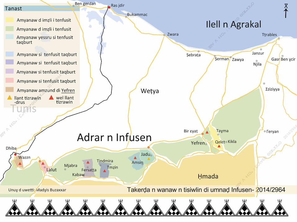
Overview The study of toponomy in the region of Adrar n Infusen region shows vital the important of preserving the place-names.
Researches and analysis are essentially required on the region topographic and geo-names of Adrar n Infusen region.
The paper mainly highlights the concept of listing recorded place names from town of Kabaw 2006.
Classification of all recorded place names with basic etymology analysis.
%%%%%%%%%%%%%%%%
Introduction
Place-names are an important aspect of culture and identity as they provide a location where history, events, landscapes, relationships and people are remembered, celebrated and reinforced [K. J. Belshaw: Decolonising the land naming & reclaiming places, 2005, P7]. by understanding native toponomy of any region can enrich the knowledge of language, history and the environment [K. Heikkila: Teaching through toponomy 2007, P18].
%%%%%%%%%%%%%%%%
Location & Geography
Kabaw town is located in the top of mountain range adrar n Infusen, in south- east of Tripoli, and it’s at 640 meters above sea level; the town covers an area of approximately 10,000 square kilometers on geographical landscape semi Saharan climate and has a population slightly over 9,100 people.
The village populations are Amazigh speakers and origin occupies the town of Kabaw during proto-historical times.
Most of village activities were found as agricultural, proto- trade with close inhabited regions around the mountain area. With region occupation, its economic and social development leads the establishment of Γasru.
%%%%%%%%%%%%%%%%
%%%%%%%%%%%%%%%%
%%%%%%%%%%%%%%%%
%%%%%%%%%%%%%%%%
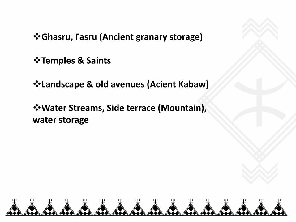
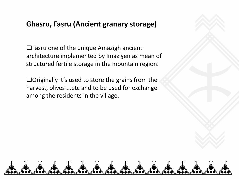
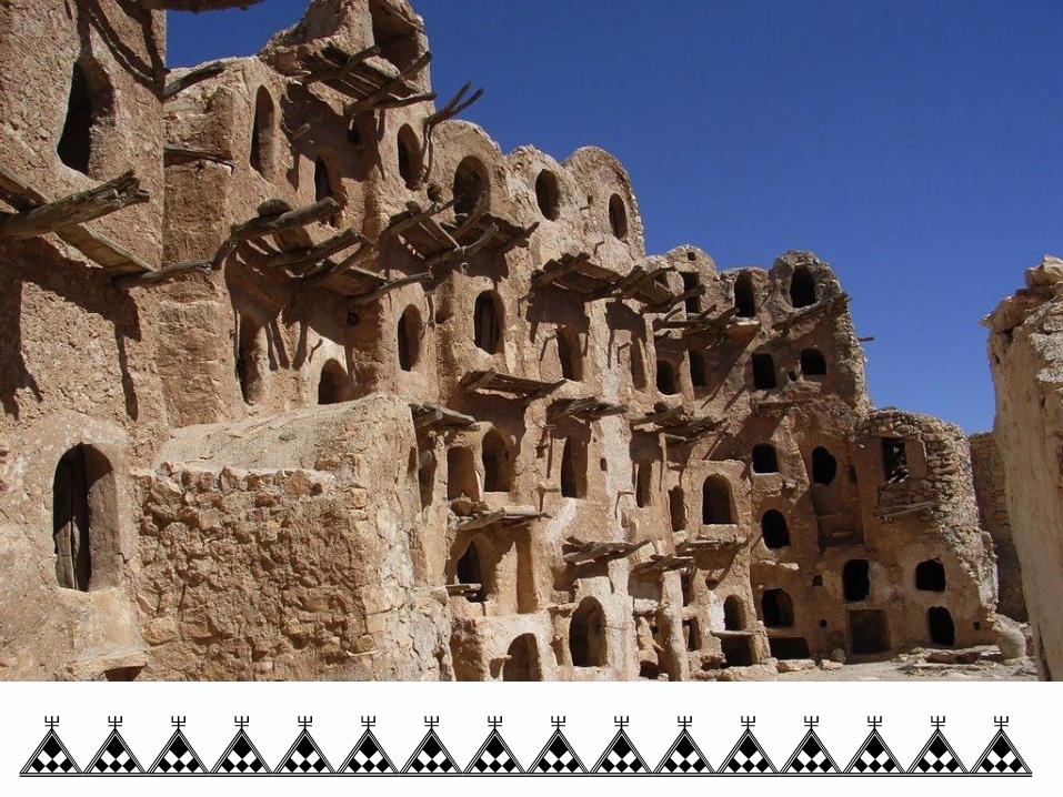
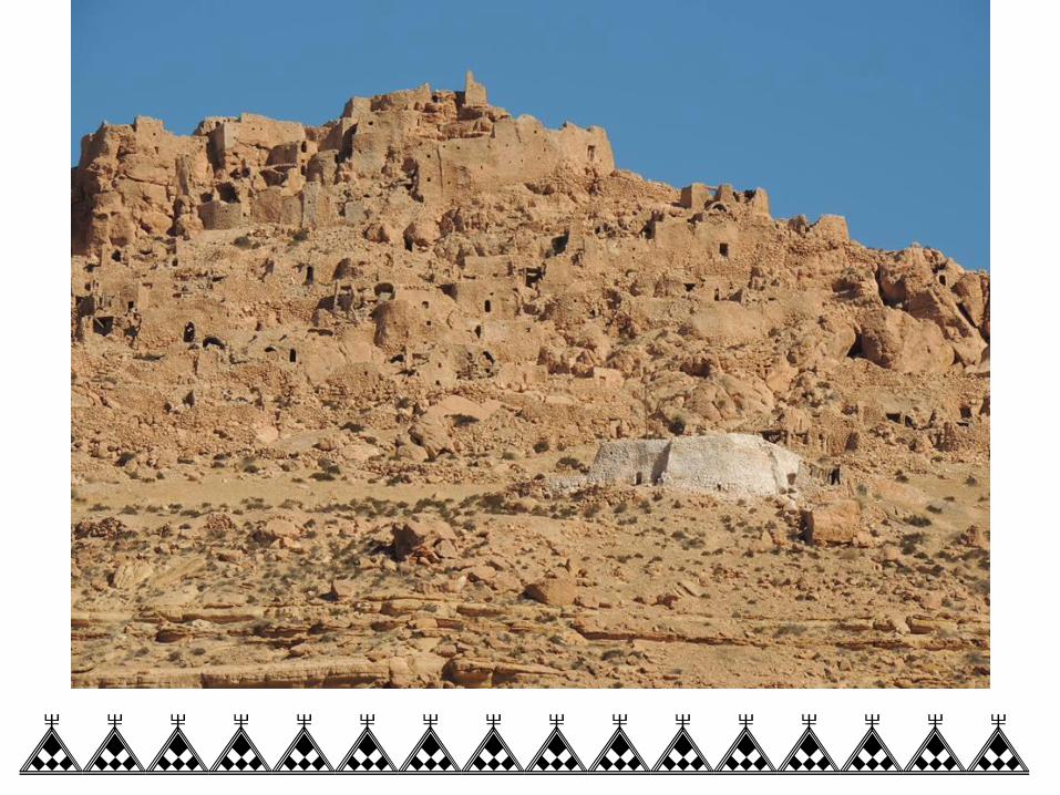
Ghasru, Γasru (Ancient granary storage)
Temples & Saints
Landscape & old avenues (Acient Kabaw)
Water Streams, Side terrace (Mountain), water storage
%%%%%%%%%%%%%%%%
Ghasru, Γasru (Ancient granary storage)
Γasru one of the unique Amazigh ancient architecture implemented by Imaziɣen as mean of structured fertile storage in the mountain region.
Originally it’s used to store the grains from the harvest, olives ...etc and to be used for exchange among the residents in the village.
%%%%%%%%%%%%%%%%
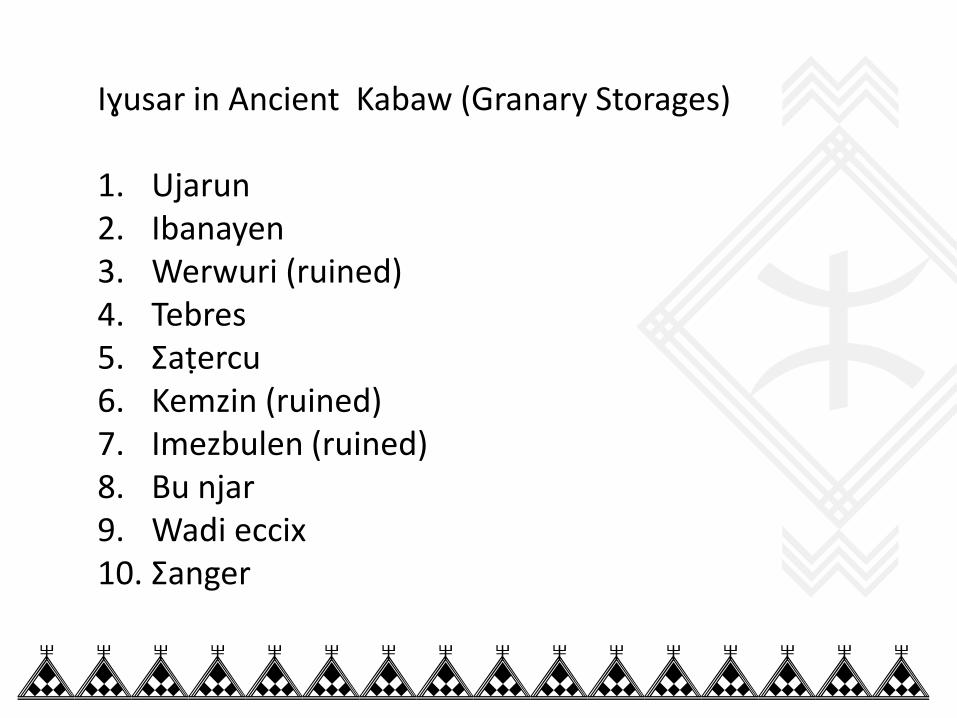
Iɣusar in Ancient Kabaw (Granary Storages) 1. Ujarun 2. Ibanayen 3. Werwuri (ruined) 4. Tebres 5. Σaṭercu 6. Kemzin (ruined) 7. Imezbulen (ruined) 8. Bu njar 9. Wadi eccix 10. Σanger
%%%%%%%%%%%%%%%%
%%%%%%%%%%%%%%%%
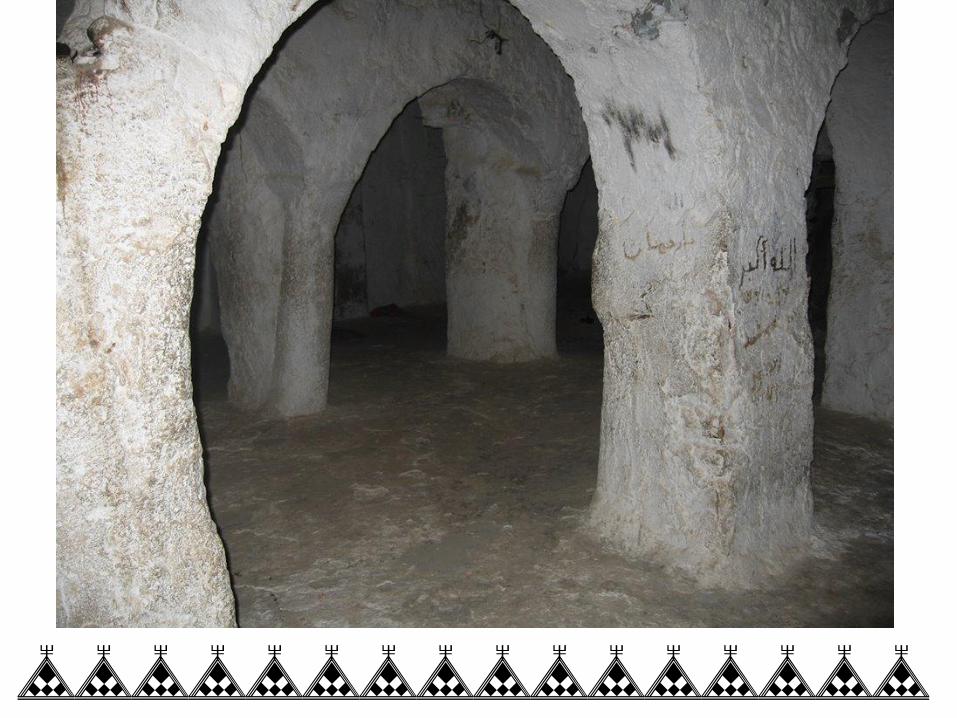
Temples & Saints Through the name places that are found in Kabaw, there are evidences of religious influence throughout the mountain range of Infusen as been described in the early works on African churches by scholars.
These temples whether it’s at the time of Judaism, or Christianity can be found in the region as in forms of temples like Elmaεbed, Tnumat. Or even to ancient pagan religious practice.
%%%%%%%%%%%%%%%%
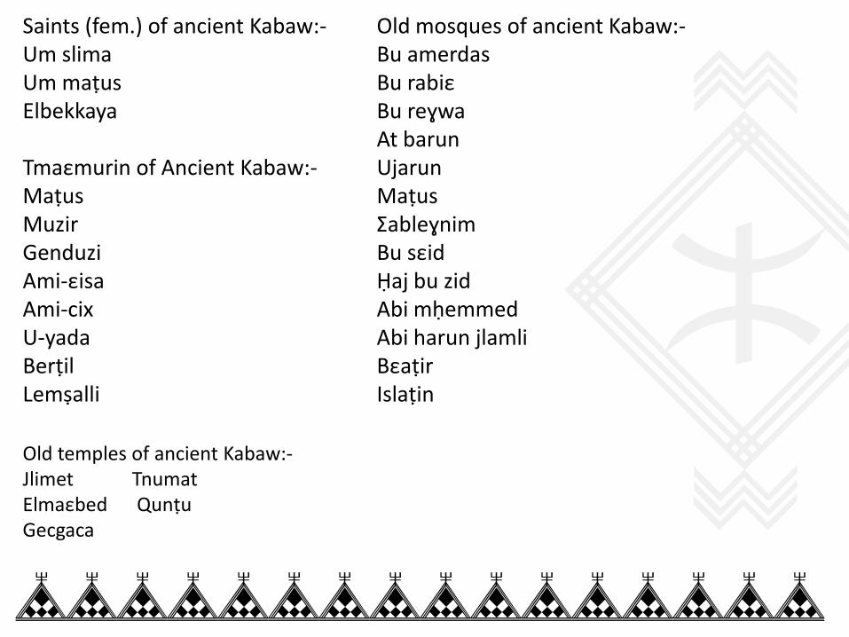
Saints (fem.) of ancient Kabaw:- Um slima Um maṭus Elbekkaya Tmaεmurin of Ancient Kabaw:- Maṭus Muzir Genduzi Ami-εisa Ami-cix U-yada Berṭil Lemṣalli
Old mosques of ancient Kabaw:- Bu amerdas Bu rabiε Bu reɣwa At barun Ujarun Maṭus Σableɣnim Bu sεid Ḥaj bu zid Abi mḥemmed Abi harun jlamli Bεaṭir Islaṭin
Old temples of ancient Kabaw:- Jlimet Tnumat Elmaεbed Qunṭu Gecgaca
%%%%%%%%%%%%%%%%
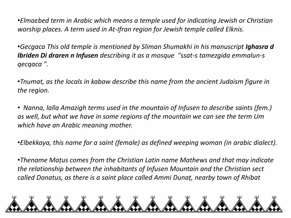
•Elmaεbed term in Arabic which means a temple used for indicating Jewish or Christian worship places. A term used in At-Ifran region for Jewish temple called Elknis. •Gecgaca This old temple is mentioned by Sliman Shumakhi in his manuscript Ighasra d Ibriden Di draren n Infusen describing it as a mosque "ssat-s tamezgida emmalun-s qecqaca ". •Tnumat, as the locals in kabaw describe this name from the ancient Judaism figure in the region. • Nanna, lalla Amazigh terms used in the mountain of Infusen to describe saints (fem.) as well, but what we have in some regions of the mountain we can see the term Um which have an Arabic meaning mother. •Elbekkaya, this name for a saint (female) as defined weeping woman (in arabic dialect). •Thename Maṭus comes from the Christian Latin name Mathews and that may indicate the relationship between the inhabitants of Infusen Mountain and the Christian sect called Donatus, as there is a saint place called Ammi Dunaṭ, nearby town of Rhibat
%%%%%%%%%%%%%%%%
%%%%%%%%%%%%%%%%
Landscape & old avenues (Ancient Kabaw)
On naming landscape the employment of the words are somewhat important aspect which very remarkable on shaping socio-geographic area of mountain region of Infusen.
With the help of etymology background of these place names can bring us a clear definition on how the people on the mountain defined their places whether geographic landscape or community settlements.
%%%%%%%%%%%%%%%%
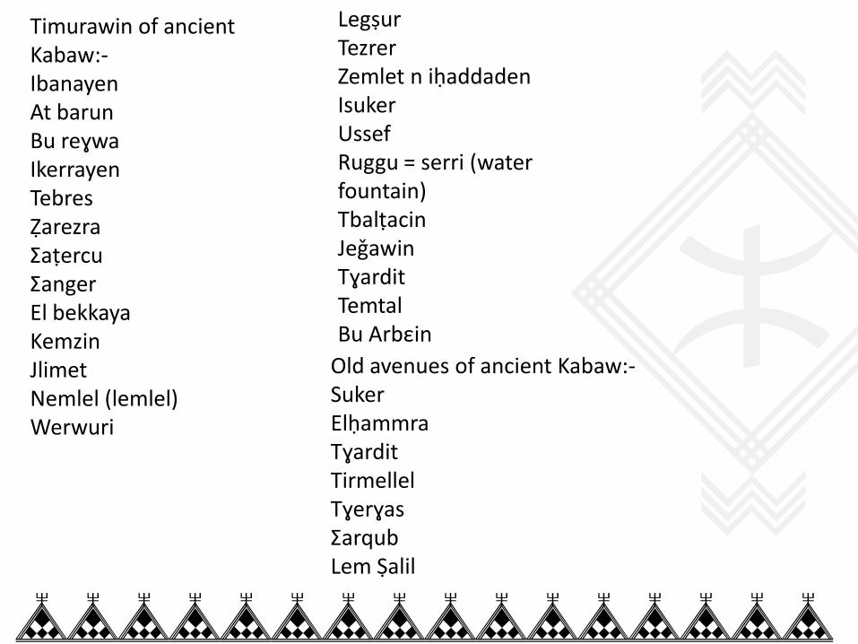
Timurawin of ancient Kabaw:- Ibanayen At barun Bu reɣwa Ikerrayen Tebres Ẓarezra Σaṭercu Σanger El bekkaya Kemzin Jlimet Nemlel (lemlel) Werwuri
Legṣur Tezrer Zemlet n iḥaddaden Isuker Ussef Ruggu = serri (water fountain) Tbalṭacin Jeǧawin Tɣardit Temtal Bu Arbεin Old avenues of ancient Kabaw:-
Suker Elḥammra Tɣardit Tirmellel Tɣerɣas Σarqub Lem Ṣalil
%%%%%%%%%%%%%%%%
• Tamurt (sing) Timurawin (pl.) town or land with group of communities’ settlements used in adrar n infusen & at yefren. •Tɣardit ------------ > Piece of land for agriculture (Tantala Tanfusit). •Zemlet n iḥaddaden ------- > Zemlet means back of the mountain. •Ussef --------- > Ussef = suf means valley, wadi. •Σarqub ------------ > a branch from a wadi. • Temtal, Arabic term for sculpture could be ancient monument (it could be for worshiped god or goddess). We can find this name place also in Ghedamis. •Arbεin (pl.), Arbic term for number forty-40, the name place Bu Arbεin might describe one of the social structure found in Nefusa Mountain during the Ibadhi time or maybe more, the so called The forty committee members.
%%%%%%%%%%%%%%%%
%%%%%%%%%%%%%%%%
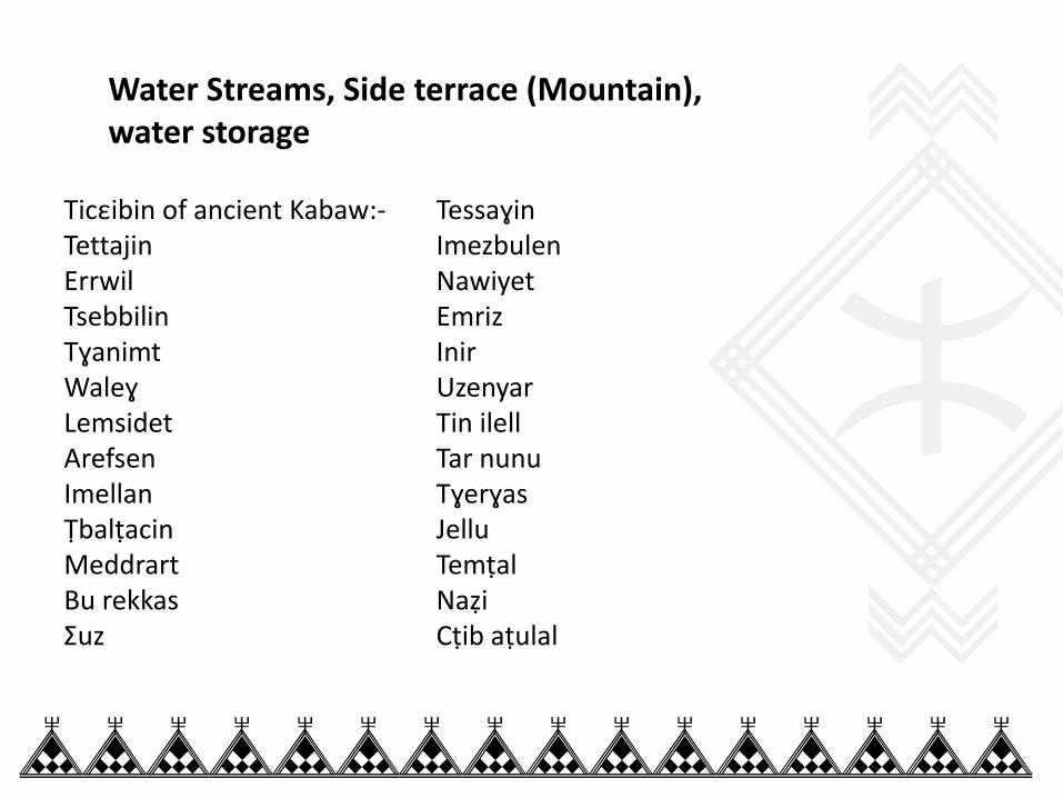
Ticεibin of ancient Kabaw:- Tettajin Errwil Tsebbilin Tɣanimt Waleɣ Lemsidet Arefsen Imellan Ṭbalṭacin Meddrart Bu rekkas Σuz
Tessaɣin Imezbulen Nawiyet Emriz Inir Uzenyar Tin ilell Tar nunu Tɣerɣas Jellu Temṭal Naẓi Cṭib aṭulal
Water Streams, Side terrace (Mountain), water storage
%%%%%%%%%%%%%%%%
•Tacεabt (sing.) Ticεibin (pl.) defined as water stream in Kabaw region, where in At-Ifran another term is used which is Tlat (sing.) Tilattin (pl.). •Tessaɣin --------- > Tassaɣt (minor of Assaɣ which means a water well). •Naẓi ---------- > Naẓ means water flow, verb ittnuẓẓu. •Cṭiba aṭulal ------- > Acṭib means a wide open land, aṭulal arabic term for long. •Tɣanimt (sing.-fem.) Aɣanim (sing.-masc.) name for a reed plant which also grows in the mountain. • Tin term used to indicate the outskirt of a place, geographic location or even person’s belonging. Therefore Tin ilell describes a place where indicates towards the sea (as direction) •Ikerrayen (pl.) wild cows, though the name is giving to place where once a group of herds much from wild bulls were found, as still in Jebel Akhder (Green Mountain) in Cyrenaica we find wild cows with reddish color. • Legṣur (pl.), Arabic term means Castle (sing. from Latin castellum) it describes the Amazigh term for food granary Γasru (sing.).

%%%%%%%%%%%%%%%%
Ḥzamat of Ancient Kabaw:- Ḥzamat n tlalatin Ḥzamat n ḥarẓellah Ḥzamat n ɣalya Ḥzamat n u-yadder Siḥ of Ancient Kabaw:- Siḥ elberber Siḥ laεrab Siḥ laε-lawna
Tfula of Ancient Kabaw:- Tfula n iziṭen Tfula n ẓaẓ Tfula n addawed Ijerban of ancient Kabaw:- Ujreb n iεic Ujreb n Maεbed Ujreb n Tanut Ujreb n Uccan Ujreb n Ayyub Ujreb n Ameqqran
%%%%%%%%%%%%%%%%
•Ijerban (pl.) Ujerb (sing.), the etymology root of this term is JRBGRBGRM which means water pool made by heavy rain. •Ḥazamat, the term etymologically comes from Arabic term ELḤIZAM which means a belt. Basically the term used as geographic description of mountain side terrace. •Ḥzamat n ḥarẓellah ------ > ḥarẓ allah = ḥafeḍ allah •Siḥ elberber ------- > Siḥ = ḍaher, an open wide land •Tameεmurt from verb εemmer means in Tantala Tayefrnit to guard. There is a place in Yefren called Aεemmar. •Genduzi -------- > Agenduz means calf. •Lemṣalil --------- > could be related to the word ṣlat in ancient hebrew means place of worship •Tfula, etymology of this term can be closely traced in Ayt Baεmran region (Morocco) which is Tiflit (sing) as it can be used to describe the use of water storage through artificial stream to irrigate a land. •Tmaεmurin (pl.) Tmaεmurt (sing.) ancient sacred place can be found near a scared tree called Tijeɣt. •Ami (sing.-masc.) name given to elder wise man used lately in Ibadhi time 17th century.
%%%%%%%%%%%%%%%%
Conclusion It’s essential for us to raise the awareness of toponomy studies and its impact on the shaping the historical resources of landscape.
It is important to acknowledge that there are verities systems of place names distinguished along the region of Adrar n Infusen and we are in need to continue understand the region that we inhabited and lived. Which will help also linguistic studies.
its vital to continue surveying all adrar n infusen region place names by recording and listing them as data documentation, to be later considered for more analysis and studies.
%%%%%%%%%%%%%%%%
Tanemmirt
%%%%%%%%%%%%%%%%