The Unobtrusive Mississippian Village: Rethinking Late Prehistoric Settlement Patterns in Western...
34
The Unobtrusive Mississippian Village: Rethinking Late Prehistoric Settlement Patterns in Western Tennessee Andrew M. Mickelson Department of Earth Sciences University of Memphis 75 th Society for American Archaeology Meetings, St. Louis, MO April 18, 2010
Transcript of The Unobtrusive Mississippian Village: Rethinking Late Prehistoric Settlement Patterns in Western...

The Unobtrusive Mississippian Village:
Rethinking LatePrehistoric Settlement Patterns in Western
TennesseeAndrew M. MickelsonDepartment of Earth Sciences
University of Memphis75th Society for American
Archaeology Meetings, St. Louis, MO
April 18, 2010
From Dancey (1981)
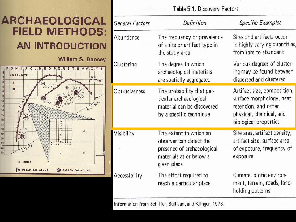
The Study Area and Problems of Archaeological
Discovery• Study area is located between the Mississippi River to the West and the Tennessee River to the East
• Near the intersection of the Loess Plains and Northern Hilly Gulf Coastal Plains
• Early Mississippian (1000 -1250 AD) mound complexes in extreme headwaters/interflueve locations away from major drainages

Atmospheric data from Reimer et al (2004);OxCal v3.10 Bronk Ramsey (2005); cub r:5 sd:12 prob usp[chron]
500AD1000AD
1500ADCalibrated date
Obion 6 970±250BPObion 6 960±150BPObion 6 910±110BPAmes B middle 840±40BPAmes B top 930±70BPAmes B bottom 1270±40BPAmes D 930±70BP
Owl Creek 820±100BPOwl Creek 850±50BPOwl Creek 860±70BPOwl Creek 880±60BPOwl Creek 900±80BPOwl Creek 1180±120BP
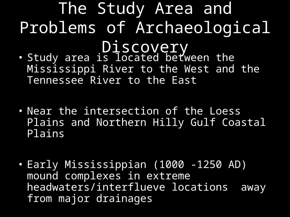
Ames Mound ComplexFocus of this Presentation

PRE- 1962 (Obtrusive Mounds A, B C -- no settlement)
1962 (Obtrusive Mounds A, B, C and now D -- no settlement)
Previous Research at Ames Mounds ca 1960 -1979

1972 Research at Ames“ The recent tests by the University of Tennessee produced virtually nothing, and what little was recovered was sent to the owners of the plantation.”
- A Guthe
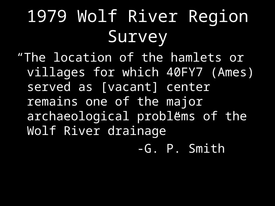
1979 Wolf River Region Survey
“The location of the hamlets or villages for which 40FY7 (Ames) served as [vacant] center remains one of the major archaeological problems of the Wolf River drainage”
-G. P. Smith

1979 Wolf River Region Survey
“The large and apparently empty ceremonial center, 40FY7 (Ames), up the North Fork still needs some people to explain its location”
-D. Peterson

2007 Ames Research“Research tentatively indicates that Ames represents a vacant center with stable residential households dispersed across the surrounding landscape”
- A. Mickelson
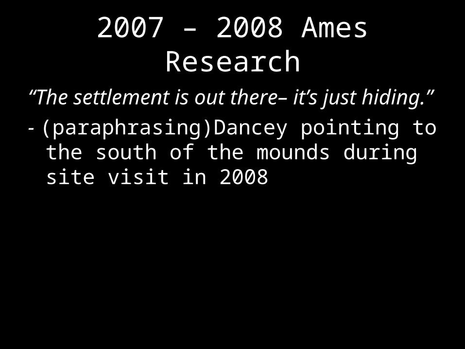
2007 – 2008 Ames Research
“The settlement is out there– it’s just hiding.”- (paraphrasing)Dancey pointing to the south of the mounds during site visit in 2008

Problems of Archaeological Discovery
No major chert or other tool stone sources in the region– only occasional chert pebbles in stream beds and alluvial fans
– Not much rock to find to begin with– low probability of finding what you are looking for
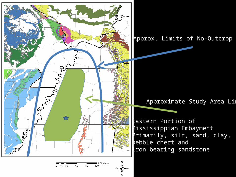
Approximate Study Area Limits
Eastern Portion of Mississippian EmbaymentPrimarily, silt, sand, clay, pebble chert and iron bearing sandstone
Approx. Limits of No-Outcrop Zone

The Study Area and Problems of Archaeological
Discovery• Loess and Eolian dust - silt-sized material deposited and reworked by surface winds.
• Problem with traditional surface surveys – reduced visibility- not necessarily the best discovery technique
• RESULT = unobtrusive surface scatters – what surface material does exist gets covered by dust

The Mound Complex Portion of Ames
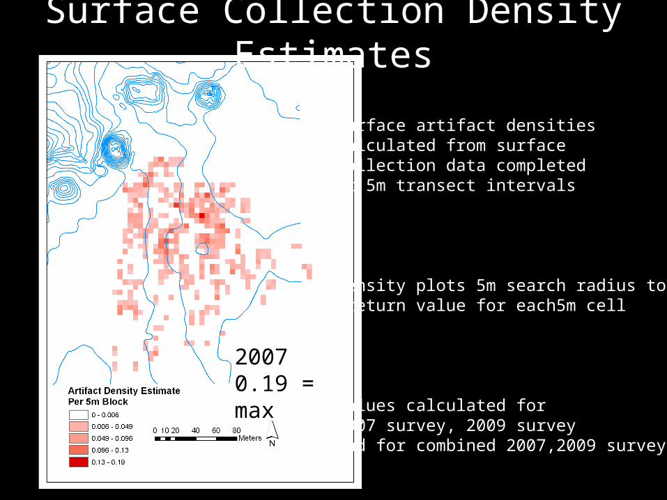
Surface Collection Density Estimates
20070.19 = max
Surface artifact densitiescalculated from surface collection data completedAt 5m transect intervals
Density plots 5m search radius to return value for each5m cell
Values calculated for2007 survey, 2009 surveyAnd for combined 2007,2009 survey data
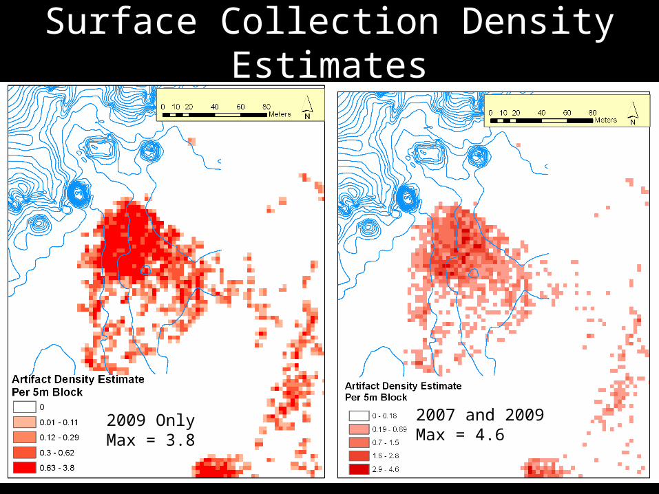
Surface Collection Density Estimates
2007 and 2009Max = 4.6
2009 OnlyMax = 3.8

What about plowzone testing?

Interpretation of Shovel Test Density Estimates
• 14137.155 cc per shovel test (1 artifact per shovel test)
• 14 artifacts per m sq by 20 cm deep plow zone(plow zone in 1 1 x 1 m unit
• (70 artifacts per cubic meter)
• 2,240 artifacts/40 m by 40 m within plow zone
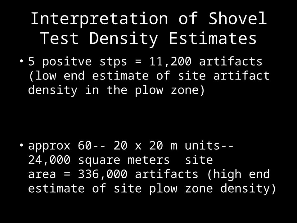
Interpretation of Shovel Test Density Estimates
• 5 positve stps = 11,200 artifacts (low end estimate of site artifact density in the plow zone)
• approx 60-- 20 x 20 m units-- 24,000 square meters site area = 336,000 artifacts (high end estimate of site plow zone density)

The Clincher
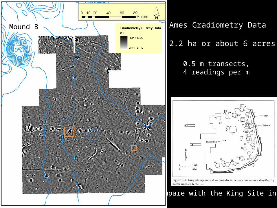
Ames Gradiometry Data
2.2 ha or about 6 acres
Mound B
0.5 m transects, 4 readings per m
Compare with the King Site in GA
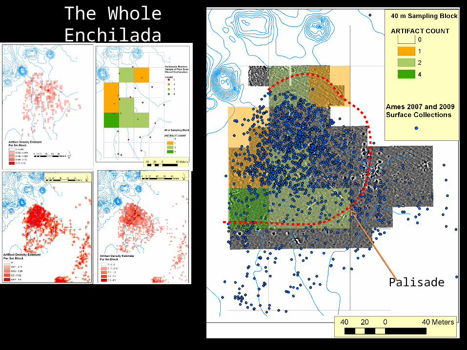
The Whole Enchilada
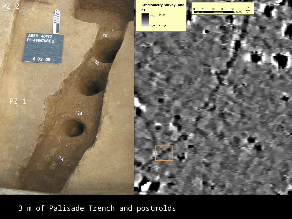
Palisade
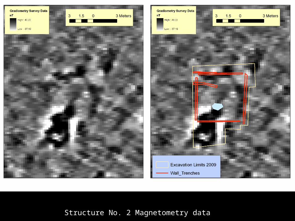
Structure No. 2 Magnetometry data
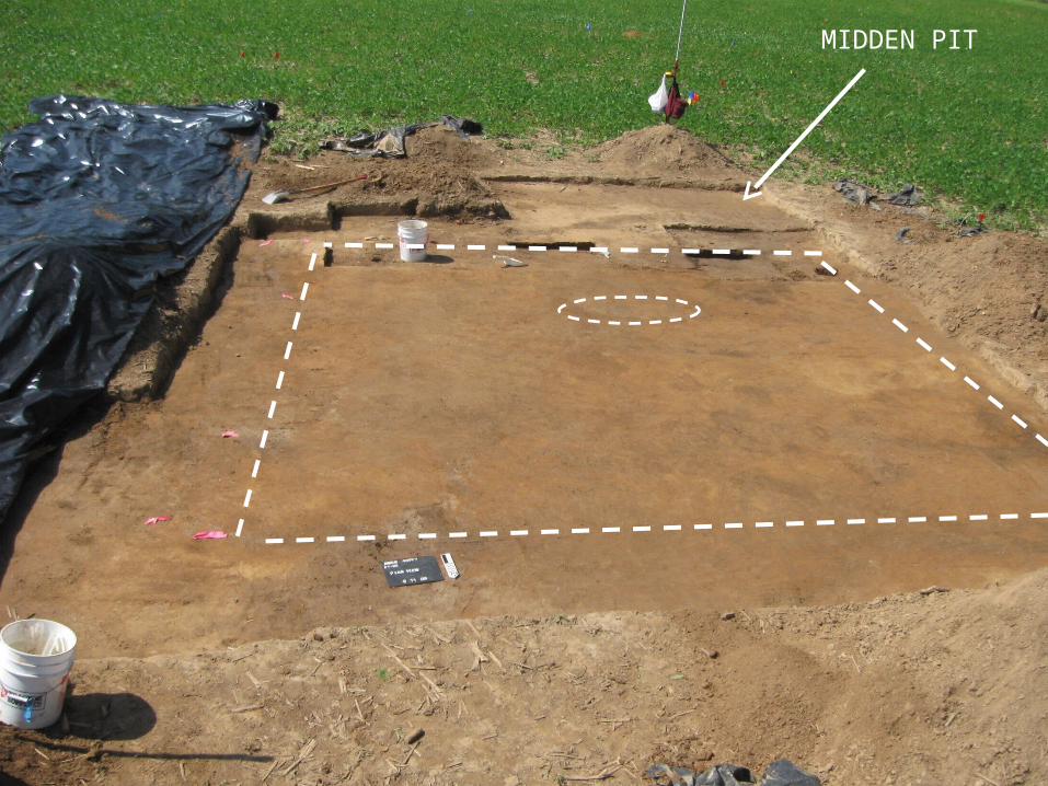
MIDDEN PIT
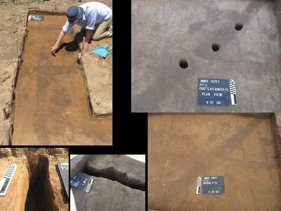
PZ 1
PZ 2
3 m of Palisade Trench and postmolds

Reevaluation of the Regional Scene
• Owl Creek – “A Vacant Mississippian Mound Center” – Shovel testing and surface collection (Rafferty 1995) revealed about 200 artifacts total. (compare with Ames)
• Denmark – Magnetometry data point to layout similar to that at Ames.
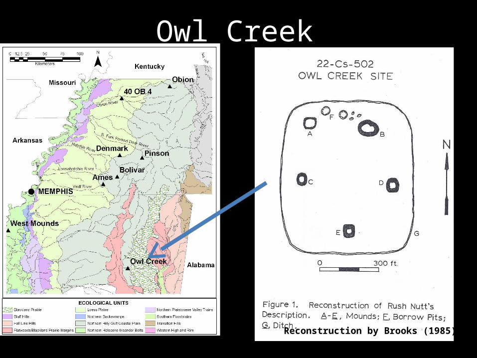
Owl Creek
Reconstruction by Brooks (1985)

Owl Creek
Shovel testing schematic for Owl Creek (Rafferty 1995)
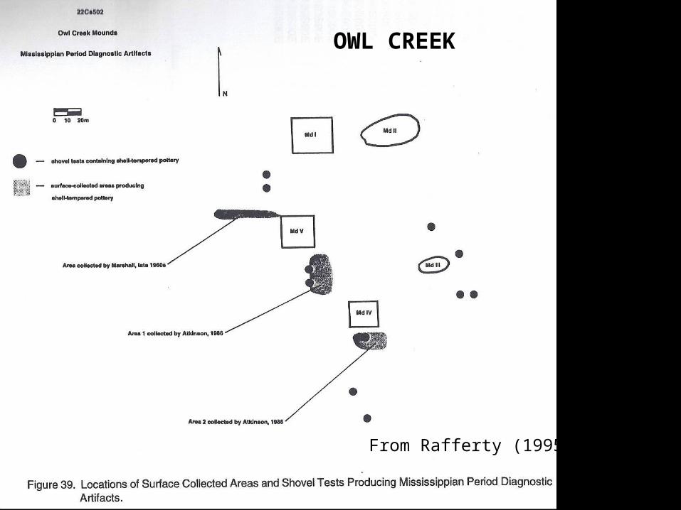
From Rafferty (1995)
OWL CREEK
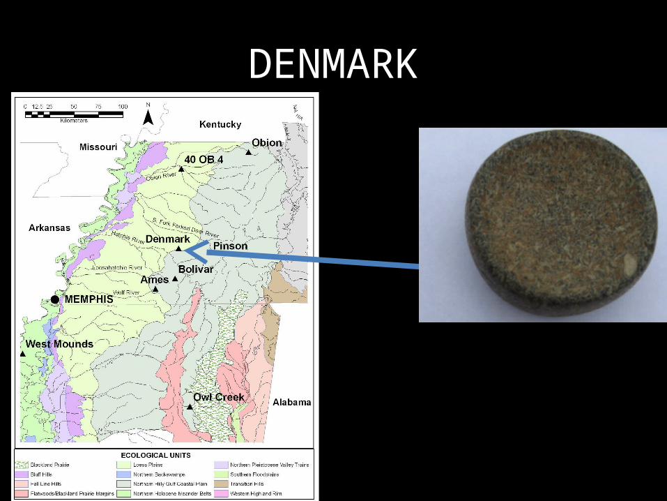
DENMARK
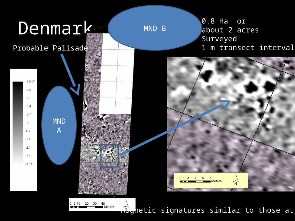
Denmark
MND A
MND B
Probable Palisade
Magnetic signatures similar to those at Ames
0.8 Ha or about 2 acresSurveyed1 m transect interval
Summary• Discovery factors (visibility and obtrusiveness) play a factor in understanding the archaeological record in the region
• The Vacant Center Model appears untenable for this place and time
• Sites represent “classic” Early Mississippian Communities in hinterland region away from typical large floodplain settings