The Sustainability Imperative
25
Community Research Connections Discussion Paper Series, Number 2 1 The Sustainability Imperative A preliminary investigation into sustainable communities in Canada This paper explores sustainable communities in Canada. Firstly, the question of what is a sustainable community is addressed through a review of the current literature. Then a set of principles are developed that characterise a community on the path to sus- tainable development. A broad survey identifies ten Canadian communities, ranging from a small Gulf Island to a major city, that are operating or aim to be operating in line with these principles. Social, ecological and economic characteristics of each jurisdic- tion are described and finally each community is placed, in relation to the other communities, on a sustainable development spectrum. 1. CONTEXT What is a sustainable community? The difficulty with arriving at an un- ambiguous definition lies behind the word in the society in which the concept originates. In developing the idea of sustainability, society as a col- lective seeks to reconcile the modern character of both human to nature and human-to-human relationships in order to address the moral and social implications of its ecological impacts and inequities within and between communities. Sustainability is radical (from the roots) firstly, in that its definition of community encompasses everything from the maple to the mosquito to the mayor. Secondly, it is purposeful in that it directs a community in a cer- tain direction by imposing constraints. While some parts of the direction are informed by science, other parts are defined by community values and this unwieldy mixture results in a concept that is highly vulnerable to interpreta- tion, which can swing from pole to pole depending on whether it is regarded as a threat or an opportunity. At the heart of the debate surrounding sustainability is the issue of substitu- tion, whether or not human capital can be substituted for natural capi- tal. Whether or not there are limits to growth. Many ecologists and a few economists argue that natural capital is not infinitely substitutable- this is sometimes termed strong sustainability. Weak sustainability, on the other hand, is achieved if the aggregate stock of natural and human capital is not decreasing and one is substitutable for the other. One of the most commonly cited defini- tions of sustainable development is the result of extensive deliberations by the United Nations Commission on Environment and Development, widely known as the Bruntland Commission,” to ensure that it meets the needs of the present without compromising the abil- ity of future generations to meet their own needs” (WCED, 1987). Notably, this definition does not address the issue of natural capital and its substitut- ability. Yuill Herbert Board Member Canada Research Chair in Sustainable Community Development Waldegrave Farm Tatamagouche, NS B0K 1V0 Tel: 902. 657-2543 [email protected] February 2005
-
Upload
independent -
Category
Documents
-
view
0 -
download
0
Transcript of The Sustainability Imperative

Community Research ConnectionsDiscussion Paper Series, Number 2
1
The Sustainability Imperative A preliminary investigation into sustainable communities in CanadaThis paper explores sustainable communities in Canada. Firstly, the question of what is a sustainable community is addressed through a review of the current literature. Then a set of principles are developed that characterise a community on the path to sus-tainable development. A broad survey identifies ten Canadian communities, ranging from a small Gulf Island to a major city, that are operating or aim to be operating in line with these principles. Social, ecological and economic characteristics of each jurisdic-tion are described and finally each community is placed, in relation to the other communities, on a sustainable development spectrum.
1. CONTEXT
What is a sustainable community? The difficulty with arriving at an un-ambiguous definition lies behind the word in the society in which the concept originates. In developing the idea of sustainability, society as a col-lective seeks to reconcile the modern character of both human to nature and human-to-human relationships in order to address the moral and social implications of its ecological impacts and inequities within and between communities.
Sustainability is radical (from the roots) firstly, in that its definition of community encompasses everything from the maple to the mosquito to the mayor. Secondly, it is purposeful in that it directs a community in a cer-tain direction by imposing constraints. While some parts of the direction are informed by science, other parts are defined by community values and this unwieldy mixture results in a concept that is highly vulnerable to interpreta-tion, which can swing from pole to pole depending on whether it is regarded as a threat or an opportunity.
At the heart of the debate surrounding sustainability is the issue of substitu-tion, whether or not human capital can be substituted for natural capi-tal. Whether or not there are limits to growth. Many ecologists and a few economists argue that natural capital is not infinitely substitutable- this is sometimes termed strong sustainability. Weak sustainability, on the other hand, is achieved if the aggregate stock of natural and human capital is not decreasing and one is substitutable for the other.
One of the most commonly cited defini-tions of sustainable development is the result of extensive deliberations by the United Nations Commission on Environment and Development, widely known as the Bruntland Commission,” to ensure that it meets the needs of the present without compromising the abil-ity of future generations to meet their own needs” (WCED, 1987). Notably, this definition does not address the issue of natural capital and its substitut-ability.
Yuill HerbertBoard MemberCanada Research Chair in Sustainable Community Development
Waldegrave FarmTatamagouche, NS B0K 1V0Tel: 902. [email protected]
February 2005

2 www.crcresearch.org
“What will you leave me, Grandfather?”“All of my territory with everything you find on it.
All kinds of animals, fish, trees, all the rivers,that is the heritage I leave you.Down through the generations
that is what you will need for survival.”“Don’t ever forget what I am going to tell you.
During your lifetime do as I do—respect all the animals,
don’t ever make them suffer before you kill them,don’t ever waste anything by killing more than
you need, anddon’t ever try to keep an animal in captivity
because the animals are necessary for the survival of future generations.”
A dying Innu man to his grandson, Qu as-tu fait de mon pays? by Antane Kapesh
(from Blanchet-Cohen, 1996)
Table of Contents 1. Context .......................................................................... 12. Hornby Island ............................................................... 53. Harrop-Procter ............................................................... 74. Banff .............................................................................. 85. Walpole Island ............................................................... 96. Hamilton ....................................................................... 107. Ward’s Island ................................................................ 118. Whistler ......................................................................... 119. Clayoquot Sound .......................................................... 1310. East Clayton ............................................................... 1411. Vancouver ................................................................... 1412. Analysis ...................................................................... 1513. Great Bear Rainforest ................................................ 1714. Initial Steps ................................................................. 1815. Bibliography ............................................................... 19 Appendices 1: Hornby Island Vision Statement Summary ................... 212: Harrop-Procter Community Forest Vision ..................... 213: Town of Banff Mission ................................................... 214: Hamilton: Direction to Guide Development ................... 22 5: Hamilton’s Definition of a Sustainable Community ....... 226: Whistler 2020 Values .................................................... 227: Clayoquot Sound UNESCO Biosphere ......................... 238: East Clayton: Principles of Development ...................... 239: GVRD’s Sustainable Region Initiative ........................... 2310: Guiding Principles of Ecosystem-Based Management 2411: Southeast False Creek Vision Statement .................... 2512: Okotoks Sustainability Vision ...................................... 2513: Cooperation for Cortes Self-Sufficiency ...................... 25
www.crcresearch.org 3
Rees and Wackernagel, arguing on behalf of the limits side of the debate, concede that technology and hu-man ingenuity have had successes, pointing to, for example, how micro-wave transmission and optical fibres have reduced the demand for copper. However, they argue that in many cases natural capital provides the raw material for manufactured capital and that there will be no substitut-able option for complex ecological systems such as forests or soil in the foreseeable future. Their definition of living sustainably is “to ensure that we use the essential products and processes of nature no more quickly than they can be renewed, and that we discharge wastes no more quickly than they can be absorbed” (Rees and Wackernagel, 1996). David Boyd sum-marises this idea in the David Suzuki Foundation Report Sustainability within a Generation; sustainability is simply “living within the Earth’s limits” (Boyd, 2004).
However, the concept of ecologi-cal limits in itself is not sufficient for as Dale points out, without a social component to sustainability we will “face the consequences of living in an increasingly inequitable world made up of winners and losers and the chaos that will result “(Dale, 2001). In this vein, Herman Daly writes that sustainability is “a level of resource use that is both sufficient for a good life for its population and within the carrying capacity of environment if generalised to the whole world” (Daly, 1996). While Daly describes the state of sustainability, Dale points to a pro-cess initiated now with the destination of sustainability; a process of reconcil-ing three imperatives: (1) the ecologi-cal imperatives to live within global biophysical carrying capacity and maintain biodiversity; (2) the social imperative to ensure the development of democratic systems of governance in order to effectively propagate and sustain the values by which people wish to live; and (3) the economic imperative to ensure that the basic needs are met worldwide. And equi-table access to resources - ecological, economic and social - is fundamental to its implementation (Dale, 2001).
1.1 Sustainability as a Holarchy
As is clear from the definitions con-sidered above, this particular analysis accepts the idea of absolute biophysi-cal limits. Further, human systems cannot recreate the ecological systems that are required to sustain human life. They are fundamentally dependent upon them for all their resources, and natural capital is non-substitutable, regardless of man’s ingenuity. Thus, if the concept of sustainability is divided into its three components or impera-tives, the community sustainability can be described as embedded in what Ar-thur Koestler called a holarchy (1976), a series of circles or nests, with each senior level transcending but embrac-ing its juniours. In this description, the economy is embedded within a soci-ety or cultural sphere, which in turn, is embedded within the ecological or ecosystem sphere, the ultimate limiting factor for all human activities. The eco-system is the all-encompassing sphere, of which human society is but a subset. In its turn, the economy is a subset of society, a sub-subset, as it were, of the ecosystem. This holonic order then sets the stage for the decision-mak-ing processes and governance for a sustainable society.
Although the system described above is a type of hierarchy, it is not a hierar-chy that is based on the accumulation of power nor the use of power, rather it is a hierarchy based on successive levels of interdependence and inclusiv-ity. It clearly illustrates, for example, that actions in the economic sphere have implications, firstly for the social sphere and secondly for the ecologi-cal sphere, as the economic sphere is a subset of both. Further, recognition of limits is intrinsic to the model; the economy is limited by the size of soci-ety and society in turn is limited by the size of the ecosystem. The footprint of society determines the capacity of the ecosystem to support other species; similarly the footprint of the economy determines the capacity of society to support ‘un-economic’ forms of activity. This model provides a compelling argu-ment for integrated decision-making that considers ramifications in all three holons.
Clearly, the challenges that society faces, such as the ecological impera-tive, are a consequence of the abuse of this holarchy, so that, not only is the logical order overturned, but the hier-archy has become characterised by a destructive domination as opposed to inclusivity. This is the case, for exam-ple, when policy decisions are taken based on economic consequences without consideration of the other two imperatives, similarly, when decisions are made for social reasons and do not include economic considerations.
1.2 Challenges
This analysis focuses on the process of sustainable development, rather than on the state of sustainability. This is a necessary qualification due to the perceived impossibility of describing sustainability in terms of a particular human settlement or society. This im-possibility is based on a combination of knowledge limitations and qualita-tive questions that have no absolute answers, as is illustrated below with the problem of calculating sustain-able consumption with respect to the biological carrying capacity of an ecosystem.
The most comprehensive tool that currently exists for measuring hu-man impact on the ecosystem is the ecological footprint, a measure of the demands that humans place on na-ture. The ecological footprint converts consumption of food, energy, and other materials to the equivalent area of biologically productive land required to produce that consumption. Although the methodology is an approximation because of data limitations (incorpo-rating all the elements of consumption for a population is similar to measur-ing the length of a coastline; it varies according to the unit of measurement, which in turn is dependent on the data set), Mathis Wackernagel proposes that the ecological footprint analysis tends to understate the degree of impact simply because it does not include all the components of human consumption.
The Federation of Canadian Mu-nicipalities commissioned Anielski

4 www.crcresearch.org
Management Inc. to calculate the ecological footprints of Canada’s twenty largest municipalities (Aniel-ski et al, 2004). The results ranged from 6.87 hectares per person in Greater Sudbury to 10.33 hect-ares per person in York Regional Municipality. The question, then, is whether the people of these regions are living within the carrying ca-pacity of the particular ecosystem upon which they are dependent for all resources. And the response, it turns out, depends on which carrying capacity is considered. Clearly these populations are dramatically exceed-ing the global carrying capacity, which is calculated by dividing the total amount of biologically produc-tive land by the population to be 1.9 hectares per person. In this sense, Canadians certainly do not have a sustainable lifestyle, for if everyone in the world lived as Canadians do, humans would use 382% of the earth’s biocapacity.
Then, when the total ecological foot-print of the population of a municipal-ity is compared with the municipal area, the results range from Greater Sudbury’s demand for 300 percent more land to support its population to 6646 percent more land for Peel Regional Municipality. However, at a national level Canada can support this level of consumption, as there are 14.24 hectares of biologically productive land available for each Canadian in Canada; this results in a per capita surplus of 7 hectares. The question we have to ask ourselves is how prudent is it to live close to these limits, or is it wiser to live well below?
The resulting conundrum is that at a global level the residents of Canada’s twenty largest cities are not living within the earth’s carrying capacity while at a national level they are and at a municipal level they are not. The ecological footprint analysis does not have the internal capacity to determine the validity of one particular comparison. Rather, it is dependent on the ethical frame-work in which the analysis is placed;
indeed each of the three options has a different range of social conse-quences.
A further ethical dilemma, presented as a consequence of the ecologi-cal footprint analysis, relates to the value that society places on other species. While there are 1.9 hect-ares of biologically productive land available per person globally, there are also between 5 and 100 million other species that require a share of that biologically productive land to be able to survive. Although a very small portion can share habitat with humans, the majority require natural systems that have not been modi-fied by humans. How much of the biologically productive land should be set aside for other species? It is a haunting ethical question with no easy answers. The Bruntland Com-mission chose 12 percent, but most scientists will dispute this figure and its scientific basis.
1.3 Methodology
The example of the ecological footprint analysis illustrates the dif-ficulty with describing sustainability in absolutes, even with the ecologi-cal holon, which is measured using scientific methodologies that are primarily objective and rational. The problem is further complicated at the social and economic levels, as these are realms characterised by a high degree of subjectivity. Moreover, in dynamically interconnected living systems such as natural and social systems, measuring a complex con-cept such as sustainability becomes even more problematic.
Rather than making arbitrary deci-sions relating to what is and what is not sustainability in the many categories and sub-categories that the concept encompasses, for the purposes of this paper, I chose a diverse number of communities in order to try and determine a wider range of sustainability initiatives for further study. Following a broad sur-vey of existing initiatives, I then com-pared them using a spectrum mov-ing from dark to light. Further, since
sustainability is not an end state, as it involves dynamically interact-ing human and natural systems, it is never ultimately achievable. Thus for these reasons a spectrum was chosen to represent various community efforts for implementing sustainability. I then applied a num-ber of filters and indicators to classify communities along this spectrum, which are described below.
To gain a position on the sustainability spectrum, a community had to meet a single requirement; its stated mission, purpose or goal had to mirror, at least in part, the theo-retical descriptions of sustainable development or sustainability written above.
In practical terms this means that a community must have components that fall into the three holons or im-peratives of sustainability.
The context of each community is different. For example, while the Greater Vancouver Regional Dis-trict is home to almost two million, Hornby Island has a population of just 900. This difference of scale is reflected in every aspect of sustainability, the size of economy, ecological impact and social com-plexity. And it is not only scale; it is location and history; Ward’s Island has the major economic resources of Toronto but very limited access to natural capital, while Hamilton has a legacy of ecological destruction at its foundation and is struggling econom-ically. Nevertheless, these apples and oranges are inevitably hanging from the same branch and must consequently be measured with the same rule stick.
1.4 Framing the Indicators
In an e-Dialogue on sustainable community development, Tony Boy-dell writes of a community of sus-tainable practices: “A place where human activities enhance rather than degrade the natural environment, where the quality of the built environ-ment approaches that of the natural setting, where the diversity of origins

www.crcresearch.org 5
and religions is a source of social strength rather than strife, where people control the destiny of their community, and where the basics of food, clothing, shelter, security and useful activity are accessible to all” (Dale, ed. 2002).
David Suzuki Foundation’s Sustainability within a Generation re-port lists nine ‘critical challenges’ that constitute the range that community initiatives need to take to achieve sustainability. 1. generating genuine wealth: supplementing the narrow goal of economic growth with the objective of genuine wealth.2. improving efficiency: increasing the efficiency of energy and resource use by a factor of four to ten times.3. shifting to clean energy: replacing fossil fuels with clean, low-impact renewable sources of energy.4. reducing waste and pollution: moving from a linear “throw-away” economy to a cyclical “reduce, re-use and recycle” economy.5. protecting and conserving water: recognizing and respecting the value of water in our laws, policies and actions6. producing healthy food: ensuring Canadian food is healthy and pro-duced in ways that do not compro-mise our land, water or biodiversity.7. conserving, protecting and restor-ing Canadian nature: taking effective steps to stop the decline of biodiver-sity and revive the health of ecosys-tems.8. building sustainable cities: avoid-ing urban sprawl in order to protect agricultural land and wild places, and improve our quality of life.
9. promoting global sustainability: increasing Canada’s contribution to sustainable development in poor countries. (Boyd, 2002)
The Community Sustainability Assessment (Joseph, undated) was developed for ecovillages and includes ecological, social and spiritual sections. The social section is divided into a range of categories: openness, trust & safety, communal space, communication, network-ing outreach & services, social sustainability (diversity & tolerance; decision-making; conflict resolu-tion), education, health care and sustainable economics. The spiritual component is a unique consideration with its inclusion of categories such as community glue and community resilience.
It would be difficult to claim that any community has met all of the criteria in the three definitions above, but many communities, in particular, the ones listed below are making progress in various facets of sustainability, despite consider-able impediments. What follows is a description of the selected com-munities, providing a snapshot of their ecological, social and economic capitals.
2. HORNBY ISLAND, BC
Located in Georgia Strait ap-proximately 100 kilometres north of Nanaimo, Hornby Island has a year-round population of 900 that increases in the summer to 5000. To arrive at Hornby, one must take a ferry from Vancouver Island to Den-man Island and a second ferry from Denman; these two ferries create a sense of isolation from mainstream
society and island communities in and of themselves are different because of their well-defined bound-aries.
For more than a thousand years, the Coast Salish peoples used Hornby as a summer hunting and fishing ground (Fletcher, 2001). In the late nineteenth century, white settlers created three farms on the island, maintaining a population of approxi-mately one hundred and fifty people. The 1960s and 1970s saw an influx of ‘back-to-the-landers’ and coun-terculture. Three small subdivisions were created and the number of cot-tages increased dramatically around this period. The Islands Trust as-sumed planning control in 1974 with a mandate of preserving and protect-ing the islands of Howe Sound and restricted further development on Hornby to 10 acres.
2.1 Oak Groves and Six-Gill Sharks
Hornby Island is home to three distinct land based ecosystems; dry Douglas Fir, Cedar Hemlock and the particularly rare Garry Oak grass-lands. One of the original settlers donated a peninsula on the island as a provincial park that contains another rare ecosystem, an old-growth stand of dry coastal Douglas Fir. Another park encompasses a popular sand beach and remnant old growth Douglas Fir. The centre of the Island, a mountain that provides much of the freshwater for the island has recently been designated Mount Geoffrey Regional Park. The most significant oak grove stand, located in a development project, is protect-ed by a covenant. And a marine pro-tected area was created to preserve underwater habitat bordering Helli-well Park, preserving habitat for rare six-gill sharks. A recent partnership with the Land Conservancy of BC aims to purchase one of the largest properties on the island. According to the Islands Trust’s Sustainability Indicators report, by the end of 2001, 15% of Hornby Island had protected status and the percentage of sensi-
Table 1: Holons and PointersHolon IndicatorEcological major community initiatives to address ecological impacts;Economic an economy focussed on moving towards ‘living within the
earth’s limits’ while providing a good quality of lifeSocial a range of projects or initiatives to improve quality of life in the
community
6 www.crcresearch.org
tive ecosystems in the Hornby Island protected increased from 32.6% to 33.9% from 1996 to 2001. This data does not include the major addition of Mount Geoffrey Regional Park on the Land Conservancy’s pro-posal. When surveyed in 2000, 75 percent of the island was forested. The volunteer organisations Con-servancy Hornby Island and Hornby Island Forestry Society are active in ensuring protection of the local ecosystems. The Islands Trust has regulations that protect the ocean shore; docks and other permanent modifications are not permitted.
Because the Island is relatively dry and has suffered period of drought, the availability of freshwater has been a problem. As a result local residents created the Hornby Water Stewardship Project designed to fos-ter personal responsibility for water conservation and protection. This project has completed a compre-hensive study of the water recharge systems on Hornby, initiated a groundwater demonstration project in one of the concentrated residential areas, continues to complete water quality testing for the public and to sell water collection barrels. There is one salmon-bearing stream on the island, Beulah Stream, and an enhancement project has resulted in increases in the number of returns.
Hornby Island Recycling Depot is known internationally for its innova-tive methods of reducing the Islands’ waste, recycling and reusing more than 70 percent. The Depot is also home to a free store where every-thing from clothes to books to tennis rackets to kitchen stoves can be had. Tribune Bay Constructed Wet-land is a pilot project to treat waste-water from a single-family residence at the Tribune Bay Education centre using a subsurface flow system. Vol-unteers are also active in construct-ing trails in the forest along much of the 56 km. of roads for cycling and walking.
There are 17 farms on Hornby Island, accounting for 427 acres in
2001. Four of these farms are certi-fied organic. A wide range of veg-etables and fruits are available in the Co-op and at farm stands.
2.2 Artists, vegetables and archi-tecture
The economy of Hornby is highly diversified. Like the Trust Area as a whole, the Hornby Island is less de-pendent on primary industry such as forestry and fishing, than most of the province, making it less vulnerable to cyclical changes in those industries. In 1996, Hornby Island had one of the more diversified economies (by income source) in BC with a diversity index of 80 compared to, for ex-ample, an index of 82 in the nearby Comox Strathcona Regional Dis-trict. According to the Islands Trust, income levels on Hornby Island in 2000 were $21,667 compared to the provincial average of $29,613.
In response to a recognition that many of the young people were leav-ing the island, the community formed a Community Economic Enhance-ment Committee (CEEC). The first undertaking of the CEEC was a vi-sioning project that took more than a year to complete. Over 500 commu-nity members participated, providing input through workshops and written questionnaires. This input was syn-thesized by an Advisory Committee of about 35 people over 3 months. The summary vision statement is as follows:
Hornby Islander’s have envisioned a future based on our community strengths and our desire to remain a diverse, sustainable and viable com-munity. Central to this vision are the values that we share as a community - creating a balance with the natural world, working together co-opera-tively and peacefully, taking personal and collective responsibility for the well-being of the community, and cel-ebrating the special spirit and energy of this unique island and its people.
The more detailed vision is attached in Appendix 1, but throughout is a commitment to sustainability.
Hornby can be characterized as a hybrid economy, with a heavy reli-ance on co-operatives. One of the largest enterprises on the island is Hornby Island Co-operative, the main grocery, hardware, liquor and gasoline retail outlet. The Co-op supports local business as much as possible; local artwork hangs on the walls and local vegetables are a mainstay on the shelves. There are significant amounts of organic and fair-trade products. The Co-op is the central hub of Hornby life and has supported the develop of a market centre next to the store that includes, two small restaurants, a book store, pottery, jewellery and clothing stores, a bike repair and rentals store and a pottery store. In addition, there is a co-operative campsite, Heron Rocks, situated in an oak grove with strict ecological regulations and that has a multi-year waiting list for member-ship. There is also a local bakery that makes local and organic breads.
The Fords Cove Marina is a further centre of activity, with a small store and a campground. Other enter-prises include Hornby Island Diving, which was instrumental in creat-ing the marine park, Hornby Island Kayak Tours and two medium-sized resorts. It is said Hornby has the highest per capita concentration of artists and craftspeople of any com-munity in Canada. Island Potters represents more than twenty potters on the island in its store.
With respect to intellectual capi-tal, there are two architects and a number of builders. One of the companies, Blue Sky Design, has been featured in many architec-tural magazines and won a number of awards; its designs on Hornby are thought to be some of the best examples of west coast architecture because they blend with the natural surroundings. Natural building has been a major focus for islanders with a range of examples of straw bale, cob and cordwood construction.
Although the Islands Trust report puts the unemployment rate for 2001 at 8.7%, it is not clear whether this

www.crcresearch.org 7
includes the informal economy, which is a major source of work on the island.
2.3 Beehive of volunteers
Hornby Island falls under the juris-diction of the Courtney Strathcona Regional District, with the exception of planning and land use, which are governed by the Islands Trust. The Islands Trust has two representatives from each island and develops island specific policies. The Hornby Island Residents and Ratepayer’s Asso-ciation was created to fulfill various services provided by the Regional District with completely local gover-nance. Its stated aim is to contribute to the ongoing evolution of a vibrant, self-governing community that sup-ports and nurtures the well being of all islanders and of the island itself. HIRRA administers the Recycling De-pot, Mount Geoffrey Regional Park, First Responders/Fire Protection and the Privy Council (which constructs and maintains outhouses at strategic locations around the island).
Hornby Island is a thriving commu-nity. There is a volunteer organisation focussed on every area of human activity. The centre of community activity is the Hornby Island Commu-nity Hall, a beautiful building that was constructed in a community effort. Its entrance door is carved through a giant stump that was found on the beach. The Hall hosts art shows, weekly movies, concerts, dances and speakers. It has a kitchen, a theatre, a central hall and an outdoor stage. Another centre is the Joe King (joking) Baseball Park that houses a base ball field for inter-island tourna-ments, tennis courts, another dance hall/meeting hall and a community laundromat. A further concentration of activity is the Pub, which hosts concerts, jamming nights and din-ners.
The elementary school has been designated a Community School under provincial legislation with a mission of furthering education and community development on Hornby Island by developing, providing, or
facilitating programs, services and activities in support of this Mission and by advocating, encouraging, co-ordinating and partnering in support of this Mission. The programs that it supports include Toddler Drop In, a variety of art, sports & music after school activities, a swim program, a semester program for secondary students, a teen drop-in on weekend evenings, a young driver training, a community computer access site, Hornby Island Job Shop, Certificate Courses and an Adult Community Education Program.
The Tribune Bay Outdoor Educa-tion Centre, is located on 6 hectares (14 acres) in Tribune Bay Provincial Park. The Centre has a Park Use Permit with the Province of BC, and is a partnership of two school districts: School District 71 (Comox Valley) and School District 69 (Qua-licum).
The Hornby Island Blues Workshop is one of the premier instructional blues camps in Canada offering some of Canada’s finest blues artists as instructors. In the summer, the Hornby Festival Society hosts 12-16 concerts of some of artists such as Gratien Gellnas, Jane Coop, Loree-na McKennitt, Maureen Forrester, Peggy Baker, Richard Margison, the St.. Lawrence String Quartet, Andra Lapiante and Rick Mercer. Hornby Community Radio Society received a CRTC licence in 2004.
There is a community health centre and the dentist visits in his mobile dentist studio converted from an old school bus. It is difficult to determine whether or not Hornby’s commit-ment to sustainability is a function of its small scale and its diversity of population, as well as its atypical geography. Further research needs to be conducted on the types of capitals—social and economic, most particularly its informal economy, to determine whether or not their successes can be replicated in other communities.
3. HARROP-PROCTOR, BC
Harrop-Procter is a small town on the shore of Kootney Lake, acces-sible only by ferry. Its population fluctuates from 650-800 people in the winter months to 1150 in the summer time. Harrop-Procter was the scene of major protests and ar-rests as community members tried to prevent logging in the Harrop-Procter watershed. The creation of a community forest has helped to unite the loggers and conservation-ists in the community and resulted in the development of an economic base that functions within ecological limits. The choice of a non-profit co-operative to run the forest reflects a commitment to greater community control over local resources.
3.1 Crystal clear waters
The Harrop-Procter Community For-est hired Silva Forest Foundation (SFF), one of the most respected forestry consultants in the world, to complete an ecosystem-based management plan. SFF mapped out ecologically sensitive areas, wet-lands, watersheds, wildlife corridors and human use. The plan identifies 13 percent of the total land area that can be logged (SFF, 1999). This plan preserves the watershed, old growth forests, wildlife habitat and recreation areas.
3.2 Wood with a conscience
Residents of Harrop-Procter had been struggling to protect their watersheds against clearcutting for twenty-five years. In 1999, the Har-rop-Procter Watershed Protection Society received a forestry licence to 10,600 hectares of forestland on the west arm of Kootney Lake. Their goals are as follows (SFF, 1999): » to achieve ecosystem-based forest management in the Harrop-Procter area which will benefit the community in perpetuity;» to ensure that forest use ac-tivities, particularly timber manage-ment, protect water quality, quantity, and timing of flow in both the short and long terms;

» to promote a sustainable, commu-nity-based economy through ecosys-tem-based forestry planning, ecologi-cally responsible timber management activities, the enhancement of local processing facilities, and the develop-ment of value-added wood manufac-turing;» to develop appropriate non-timber forest uses of the Harrop-Procter watersheds. Non-timber forest uses under consideration include, but are not limited to: wildcrafting, nature in-terpretation, wildlife viewing, tourism, and existing trap lines; and,» to establish a water monitoring program in the Harrop-Procter water-sheds in order to evaluate the results of ecosystem-based forestry, and to ensure that timber management does not degrade water supplies.
The Harrop-Procter Community Coop-erative was formed to run the forestry and community development side of the operation. The Co-operative has two subsidiary companies employing seventeen people. Harrop-Procter Forest Products sells Forest Steward-ship Council-certified lumber and Sun-shine Bay Botanicals markets dried herbs, teas and tinctures. Private enterprises associated with the com-munity forest include Mandala Cus-tom Homes and Traditional Timber Framing Co. Mill Creek Enterprises mills the wood and the Canadian Eco-lumber Cooperative markets Harrop-Procter’s wood.
Other small businesses in Harrop-Procter’s one street town include a bakeshop, an eco-friendly gift shop, a massage studio and hair salon. Harrop-Procter Business and Artisan’s Association has over forty members, mainly artists and builders.
The business development strategy of the town is to use the attention that community forest has generated with the storytelling festival to create a larger identity. To this end, the town has created soapboxes made of certi-fied local wood that they distributed to politicians and others. They have also created a Harrop-Procter label that is attached to locally made products.
3.3 Telling stories
The town hosts a two-day story-telling festival in the summer. The Procter Hall hosts community events ranging from harvest festivals to musicians. Part of the mandate of the Cooperative includes commu-nity outreach. They have developed a series of hiking trails and host speakers and artists for the com-munity.
4. BANFF
The town of Banff is Canada’s first incorporated municipality within a national park, transferring mu-nicipal government powers from the federal government to an elected town council. The town is a service centre for the park and is home to 7,125 people. Because the town is inside Banff National Park there is no freehold land available and thus the town must lease the land within its municipal boundaries. This has the consequence of limiting the size of the town with no option for ex-pansion. Its residents must dem-onstrate a need to reside, which is usually employment with or by the park. The amount of construction is limited to 1.5% per annum; the most aggressive growth manage-ment scheme in Canada. The town has implemented a population cap of 10,000 permanent members that will likely be reached in 2006. Many of these initiatives, however, were put in place as a result of increasing development pressures and much of the existing wildlife in the park has been heavily impacted by the sheer volume of people visiting the park.
4.1 A National Park
Because Banff is located in a Na-tional Park, it falls under the Minister of Canadian Heritage program of no net negative environmental impact; with the implication that develop-ments will result in the ecosystem in the future being better off or no worse than it is today. This manage-ment regime is based on shared responsibility between a variety of sectors, the application of the precautionary principle, collection of
baseline knowledge, ongoing moni-toring and evaluation. A variety of policy and regulatory tools are used to this end, including leadership in environmental stewardship, the Canadian Environmental Assess-ment Act, standards for appropriate development and standards for ap-propriate business activity.
Banff has a state of our environ-ment/community indicators reporting program, an environmental steward-ship policy, a municipal environmen-tal management system, a public involvement and education strategy and a local action plan for address-ing energy management and green-house gas emissions.
Banff National Park is the world’s third largest national park. At 6,641 square kilometres it encompasses valleys, mountains, glaciers, forests, meadows and rivers as well as a wide range of wildlife. There are 1,600 km. of hiking trails and a wide range of other recreational activities.
4.2 Arts Centre
The Banff Centre is Canada’s only multidisciplinary arts centre dedicat-ed to lifelong learning and profes-sional development. Program areas include music and sound, theatre arts, writing and publishing, aborigi-nal arts, media and visual arts, and creative electronic environment. There is a parallel section focussed on leadership development in all areas of society. Major projects include the Banff Mountain Film and Book Festivals and World Tour, Banff Mountain Photography Competition, Banff Mountain Summit, Mountain Communities Conferences, Banff Mountain Archives, and a mountain grants program.
4.3 Bear, Thunderbird and Buffalo
The Community Cairns Projects began in 1999 as part of the millen-nium celebrations of the town. The proposal called for outdoor artworks that would reflect the Banff area and guide people through the ‘cultural landscape’. Cairns were chosen because of the practical and sym-
8 www.crcresearch.org

www.crcresearch.org 9
bolic links of cairns with mountain route-finding, self-discovery and with reaching an objective (the summit). A community-based selection process selected a proposal by artist Stewart Steinhauer. The sculptures include a Sleeping Buffalo to reflect Banff’s status as one of the oldest sites of continuous human inhabitation in the Americas; a Bear that is the spiritual guardian of the land and of all life on the land; and finally the Thunderbird and the Eagle who help fragile hu-mans remember their spiritual identity while they exist in a physical form.
5. WALPOLE ISLAND, ON
Walpole Island, referred to in Ojibwe as “Bkjewanong” (Where the waters divide) forms a large river delta of 24,000 hectares on Lake St. Clair in Ontario. The community is home to approximately 2200 Chippewa, Pot-tawatomie and Ottawa who live under a single Chief and Council.
5.1 Cattail Marsh
Walpole Island is home to the only wetland prairie system in Ontario, and possibly in Canada. The island is primarily cattail marsh with a series of upland oak-hickory forested ridges interspersed amongst it, known for its biodiversity values. Twelve percent of Canada’s species at risk, or 45 species, are found on the islands, in-cluding a number of species that are found nowhere else. “This is due to the fact that their habitats and associ-ated species remain intact, which is a direct result of our traditional lifestyles and values (Bkejwanong Nature)”.
Ancestors of Ojibway, Pottawatomi and Ottawa natives have lived sea-sonally on Walpole Island for nearly 8,000 years, demonstrating that tra-ditional farming, hunting and fishing activities can be carried out in a way that does not harm the ecosystem. Walpole Island’s mission reflects this experience:
To preserve, enhance and maintain a mutual respect and to continue our beneficial dependency upon the en-vironment we shall endeavour to co-exist with Mother Nature and protect
this relationship. We, the Anishnabeg of the Walpole Island First Nation, pledge to use these resources to the mutual benefit of all people. We shall therefore ensure proper re-spect for all resources. As our elders have done, we shall maintain laws that preserve our wildlife, lands and resources.
Upstream from the Walpole Island is Canada’s ‘chemical valley’ and between 1974 and 1986 there were 32 major oil spills and hundreds of smaller ones. Since 1986, the Ministry of Environment has been recording over 100 spills each year (Barrow, 1995).
The Walpole Island First Nation has initiated a major conservation pro-gram with a wide range of projects from research with the Royal Ontario Museum to species recovery plans, habitat restoration, fish and wildlife management and air quality and pesticides monitoring. All consul-tants who are hired by the nation are required to transfer their skills to the local people and in this way, the na-tion has developed its own expertise. They have preserved 84 acres in reserves and have conducted stud-ies on the impact of toxins on ducks and muskrats in the area.
In cooperation with the University of Michigan, Walpole First Nation developed an educational program titled GREEN that teaches students how to monitor water quality. In addi-tion, Walpole Island has worked with industries in Sarnia and in the US to improve corporate practices and thus improve the quality of Lake St. Clair; they convinced Dow Chemical to install a river separation system so that spills can no longer go into the river.
They developed an environmental audit tool to analyse the impact of all activities on the island; this tool has been ‘exported’ to other first nations communities. The community then created a Sustainable Development Strategy and Implementation Plan (Blanchet-Cohen, 1996).
5.2 Tahgahoning Enterprises
Tahgahoning Farm is owned by the Walpole Island First Nation Coun-cil. Main crops on the farm’s 4700 acres are soybeans, grain corn, canning peas, chickory, sugar beets and seed corn. The farm makes significant investments in regener-ating and protecting the land and year-end profits are re-invested in the community. The farm employ-ees five people full time and eight seasonally.
A 22-acre wildlife sanctuary has been established in the cornfields, which the elders use as their teach-ing centre. Care is taken to prevent run-off from reaching local marshes. The farm is experimenting with no-till and low-tillage techniques to reduce the usage of chemicals and fuel and minimise the impact on the soil.
5.3 Nin.Da.Waab.Jig Heritage Centre
Nin.Da.Waab.Jig means those who seek to find. The Heritage Centre was founded in 1989 as the re-search arm of Walpole First Nation dealing with land claims, environ-mental protection and heritage conservation. Its aim is to record the past to better understand the pres-ent. In 1988, the Centre published a history book titled Walpole Island: Soul of Indian Territory. They have developed research techniques that integrate the community into deci-sion-making and research process-es. The centre serves as a reposi-tory for oral traditional knowledge on the history of the native peoples in the region and is spearheading land claims efforts for Walpole First Nation
Bkejwanong Children’s Centre was the first day care centre in a first na-tion community in Canada, employ-ing 25 people including a cultural enrichment officer. The centre pro-vides childcare services that reflect community cultural values, beliefs and traditions.

10 www.crcresearch.org
6. HAMILTON, ON
The City of Hamilton, with a popu-lation of 468,000, is located in the largest naturally protected harbour on Lake Ontario. Its watershed is approximately 500 square kilometres and includes three major creeks, the Grindstone, Red Hill and Spencer. In 1975, Hamilton was the premier industrial city in Canada and home to the two largest steel manufactur-ing plants in the country. By the late 1990s, employment in the industrial waterfront had fallen below half of earlier levels to 24,000 jobs. By 1991, 16 percent of the workforce was commuting to Greater Toronto Area (Korol, 2001).
The City of Hamilton has identified four goals for its sustainability plan, called Vision 2020 (City of Hamilton, 2003).
» fulfilment of human needs for peace, clean air and water, safe food, adequate shelter, education, arts, culture, and satisfying employ-ment;
» maintenance of ecological integrity through careful stewardship, reha-bilitation, reduction in wastes and protection of diverse and important natural species and systems;
» provision for self-determination through public involvement in the definition and development of local solutions to social, environmental, and economic concerns; and,
» achievement of equity with the fairest possible sharing of limited resources among neighbourhoods, regions and beyond, and between our generation and that of our de-scendants.
6.1 Expressways and waterkeep-ers
Conserver Society of Hamilton & District has worked to prevent urban expansion into the Niagara escarp-ment, develop composting programs, create cycling trails and implement environmental education. Earth Day
Hamilton hosts a major festival for 30,000 students each year. The Ham-ilton Conservation Authority owns, leases or manages 4,000 hectares of environmentally significant land to protect rare and endangered species with a major focus on protecting clean water from the regional watershed. Environment Hamilton acts as a pollu-tion watchdog and successfully sued the city for $480,000 for allowing toxic substances including PCBs to be dis-charged into a creek. Transportation for Liveable Communities organises car free days, critical masses and works to improve public transport in the city.
A survey of the ten largest urban cen-tres in Canada found that Hamilton has the second largest per capita lev-el of expressways and arterial roads, behind Ottawa. While Hamilton has 7.1 metres of expressways or arte-rial lanes per person, Toronto has 3 metres. Hamilton’s fuel consumption is the second largest as well at 1,242 litres per person (Shannon, 2004).
Friends of Red Hill Valley is an 800 member group opposing the develop-ment of an expressway in a publicly-owned chunk of land 700 hectares in size. The valley, half of which is in the Niagara Escarpment World Biosphere Reserve, is a green space that fol-lows a creek through the city to a bay in Lake Ontario. The Municipality of Hamilton recently announced a lawsuit against 60 federal bureaucrats and 4 cabinet ministers charging that the federal government illegally used the Canadian Environmental Assess-ment Act to stop or delay the express-way.
6.2 Farming
The identification of economic enter-prise that one can define as sustain-able is difficult in the context of a large city. One cannot say that the city of Hamilton has a sustainable economy- historically it was primar-ily based on a polluting manufactur-ing sector. Recently, this sector has significantly diminished in importance and the economy has diversified.
Agriculture is, however, unusually significant. The City of Hamilton has 1026 farms in its boundaries with a total 42,076 hectares, an $813 mil-lion dollar industry. Between 2001 and 2002, 532 hectares of agricul-tural land were lost due expansions of the official community plan (Vision 2020, 2003). There is no informa-tion available relating to the degree that the agriculture sector in the Hamilton area has taken up organic production.
A city like Hamilton with a ma-jor industrial past has significant restoration challenges as well as stranded capital invested in ecologi-cally destructive technologies. In the 1980s Hamilton Harbour was identified as an area of concern by the federal and provincial govern-ments due to severe ecosystem damage from industrial activity. Some 46 percent of Hamilton’s 45-kilometre waterfront on Lake Ontario is used for industrial purposes, while 10 percent is residential and the remainder is private, institutional or public open space. The Hamil-ton Harbour Remedial Action Plan was created in 1992 to clean-up, monitor and prevent pollution. The steering committee is a coalition of citizens, non-profits, corporate and governmental representatives. The 2002 report card indicated some areas of progress including decline in obvious abnormalities in fish and wildlife, the creation of 340 hectares of new wildlife habitat, reduction of usage of pesticides by municipali-ties and public, implementing water metering and conservation plans in Hamilton, and the restoration of 170 hectares of aquatic vegetation. Major challenges remain including bacterial contamination of beaches, chemical concentrations in birds and fish and highly contaminated sedi-ments (BARC, 2002).
6.3 A Social Strategy
The legacy of the industrial past left difficult social challenges: a high level of poverty because of a transitioning economy, deep cuts

www.crcresearch.org 11
to provincial social assistance, lack of settlement support for immigrants and a high level of child poverty (Heisler et al 2002).There are plans to address these challenges on several fronts, expressed through the New City of Hamilton Statement of Mission and Goals, the Economic Development Plan and the Vision 2020 sustainable development framework.
The City commissioned the Caledon Institute of Social Policy (2002) to help design a Social Policy for the City with the vision of becoming a ‘vibrant community’, defined as a community that “ensures that basic needs are met. There is no individual or family without a roof over its head. No child goes to school hungry. No person suffers from abuse or vio-lence without having a safe place to go” (ibid). The report also identifies social assets in the city, including visionary leaders in key sectors, high quality educational institutions, inter-nationally recognised practitioners in the field of healthy child develop-ment, a substantial network of non-profits, key community consultations and a culturally diverse population amongst others (ibid).
7. WARD’S ISLAND, TORONTO
Ward’s Island began as a fishing community in the 1830s and is one of the oldest neighbourhoods in Toronto. Further settlement occurred after WWII when returning veterans were encouraged to lease lots and build houses. Descendants of some of those original Islanders still live on the Island. At its peak in the late 1940s to early 1950s, the summer population reached 8,000 and the year-round community over 2,000. Today there is a population of over 600 in 262 homes. The 1996 census indicates that 200 are children, 18 percent are seniors; 10 percent of the households are low income and 17 percent of the households make over $80,000. The average, $50,448, is below that of Toronto as a whole, $60,110 (Toronto Island web page). Ward Island has no explicit commit-ment to sustainability.
7.1 Car-free
Ward Island has no cars. Narrow paths between the houses are for cycling and walking and are safe for children, who are consequently given more freedom. Bike trailers have been built for moving larger items.
The Island Natural Science School works with Toronto grade five and six students to develop a respect for living things and the environment, an awareness of the effects of human impacts upon the natural environ-ment, an awareness of environmen-tal issues and possible solutions, as well as more general skills.
7.2 Political Theatre
While many islanders are dependent on the nearby City of Toronto for employment, either as commuters or as independent contractors, oth-ers have created local employment particularly in the areas of arts and theatre, a major focus on the island. The non-profit organisation, Toronto Artscape, recently constructed the Gibraltar Point Centre for the Arts providing low cost work and live/work space for thirteen artists. There are two theatre companies: Swizzlestick and Shadowland. The latter is in-spired by the Vermont-based Bread and PuppetTheatre and creates performances that focus on envi-ronmental concerns and community animation.
7.3 Land Trust
Houses on the Toronto Islands are governed by the Toronto Island Residential Stewardship Act, which is administered by the Toronto Island Land Trust. Islanders paid between $36,000 and $46,000 for leases that run until 2092 and they own their homes. The Land Trust regulates the sale of the leases and houses so that they cannot be sold for speculation but leaseholders can bequeath their lease to their children or spouse. Further, Islanders are required to occupy their house 220 days per year and their house must be their primary residence (Toronto Island Land Trust web page).
The Waterfront Montessori Chil-dren’s Centre (WMCC) is a non-profit cooperative childcare centre that was founded in 1974 with an enrolment of 32 for children from 2 to 5 years old. The education focuses on movement, language, music, art, science, math, seasonal exploration, grace and courtesy, self-care and care of the classroom.
The Shaw House was originally a large lakeshore house that is owned by the Trust and has sat vacant for more than 20 years. The Islanders created a plan to turn it into hous-ing for elders in order to be able to keep them in their own community and they hired a green architect to undertake this project in a manner that would set an example of envi-ronmental construction.
As much of the building as possible was recycled; straw bale insulation was added, it was reoriented for passive solar heating, a green roof was installed, and additional materi-als were either recyclable or reus-able. The building is designed for common cooking and living areas and with extensive gardens. Many of the islanders helped with con-struction.
8. WHISTLER
The area around Whistler was first inhabited by the Coast Salish First Nations who supported themselves for thousands of years by hunting and gathering. In 1877 a trail was built and shortly thereafter, the Rain-bow Lodge, a popular honeymoon spot, was constructed on Alta Lake. In the 1960s, a group of business-men launched a bid to host the 1968 Olympic winter games and although the bid failed, one businessman built a ski life on Whistler mountain.
Between 1980 and 1990, the num-ber of beds in Whistler increased from 28,000 to more than 46,000, with a full time population of 9800 (Melamed, 2002). As a result, the community initiated a visioning process, Whistler 2002: Charting

12 www.crcresearch.org
a Course for the Future, in order to identify the common values of the community. The resulting five priority areas were: » building a Stronger Resort Community;» enhancing the Whistler Experience;» moving Toward Environmental Sustainability;» achieving Financial Sustainability; and» contributing to the Success of the Region.
In 2004, the municipality created a 2020 comprehensive sustainability plan (CSP) with the goal of achieving sustainability by 2060. A sustainable community, according to the CSP is where social and ecological systems are sustainable and supported by a health economy, today and in the future (RMOW vol. 1, 2004).
Whistler 2020 involves a variety of community organisations including the Resort Municipality of Whistler, Tourism Whistler, Whistler Black-comb, Chamber of Commerce, local businesses, the Whistler Hous-ing Authority, Whistler Community Services Society, Vancouver Coastal Health and other health agencies, School District #48 and other educa-tion partners, One Whistler, Whistler Arts Council, Whistler Museum and Archives, Maurice Young Millennium Place, Whistler Public Library, Asso-ciation of Whistler Area Residents for the Environment (AWARE), Whistler Naturalists, Whistler Fisheries Stew-ardship Group, among others.
The CSP uses the Natural Step Framework to create strategies around community life, the resort experience, the environment and the economy.
8.1 Hydrogen Highway
The community has identified three shared environmental values: lo-cal stewardship, global and regional stewardship and the rights of future generations.
The Transportation Advisory Group created a Comprehensive Transport Strategy. The municipality has pur-chased six electric bikes and hybrid electric vehicles for staff usage, and is experimenting with biodiesel and propane in its fleet. Whistler recently joined the Canadian Hydrogen High-way, a federal government initiative to link Vancouver to Whistler with a network of seven hydrogen-fuelling stations (RMO, 2004). The municipal-ity succeeded in increasing public transit ridership from five buses and 325,000 riders in 1991 to a fleet of 24 buses and 2,270,000 riders in 2000 (Melamed, 2002).
A number of conservation initiatives were initiated under the 2002 plan in-cluding Emerald Forest Conservation, the preservation of 139 hectares of private land in the Whistler Village core area, acquiring tenure of the Westside Nature Reserve, integrating protection of the natural environment into rural developments, creating a pedestrian-oriented village development and im-plementing a watershed management plan for the River of Golden Dreams to increase the Kokanee population.
Pesticides have not been used on Whistler’s parks and public areas since the early 1990s; instead native and near-native plants that are more pest resistant are planted, natural pesti-cides such as steam, cider vinegar, bacteria, glycerine soap and others are used and manual weeding replaces chemical weed killers.
The municipality has developed green homebuilding standards, ‘Whistler Green’ and is currently piloting their use with a development of 14 houses. The standard includes an assess-ment of site and landscape, water, energy, indoor environment, materi-als, waste and owner education. The Spring Creek fire hall is expected to achieve LEED Silver, while Whistler’s conference centre is expected to achieve LEED Gold. The municipality is purchasing energy from BC Hydro’s Green Power program. As well, in 2004, Whistler released an Integrated Energy, Air Quality and Greenhouse Gas Management Plan. Community
greenhouses are planned to provide free access to locally grown food for Whistler residents.
8.2 Snow
Whistler’s economy is based on tourism, primarily derived from the resort of Whistler Blackcomb. The municipality identifies the environ-mental impacts of providing tourism, citing the use of 2.9 million GJ of energy usage (2000), an aver-age per capita water consumption of 542 litres per day (2002), and 17,700 tonnes of waste in the landfill (2003). The transport and commer-cial sectors emitted 78 percent of Whistler’s greenhouse gas emis-sions (RMOW Vol. 2, 2004).
The CSP aims to broaden the scope of Whistler’s economy by diversify-ing tourism with a focus on health and wellness, developing the arts and culture side of the community, promoting Whistler as an educa-tional centre with a focus on lifelong learning and enhancing ecotourism and summer camps.
8.3 A skier’s chapel
In Whistler’s early days, a group of skiers constructed an interfaith chapel. This was recently replaced with the Maurice Young Millennium Place (MY Place), a chapel as well as a community centre that provides facilities for concerts, festivals, plays, religious retreats, meetings and conventions with the aim of nur-turing Whistler’s community spirit. It is home to a daycare centre, a meditation room, a recording studio, a teen centre, a performance hall, the interfaith chapel and communal space.
Faced with chronic affordable hous-ing problems, the municipality cre-ated the Whistler Housing Authority (WHA) to develop and maintain resi-dent restricted housing, and current-ly has 3,984 bed units (1,969 rental and 2,015 owned beds). These are offered at a cost not exceeding $155/ft2 for ownership and $1.25/ft2 per month for rentals, with annual increases built in for inflation.

www.crcresearch.org 13
9. CLAYOQUOT SOUND, BC
Clayoquot Sound is a region of 350,000 hectares, of which ninety-three percent is forested. This area is simultaneously the tribal lands of the Nuu-chuh-nulth peoples and crown land of the Provincial government. Out of ten major valleys, nine remain as predominantly old growth west coast temperate rainforest (Bunton, 2001) meaning that Clayoquot Sound has global significance as a pristine and rare ecosystem.
Clayoquot Sound is in the midst of major change including economic structural adjustment, institutional innovation and social transforma-tion, an evolving understanding of humanity’s relationships with uncer-tain and complex natural systems. This is reflected by the development of a complex array of institutions and processes that seek to reconcile decision-making by governments and corporations with the needs of First Nations, the ecosystem and the wider community (Bunton, 2001). The total resident population is 5000 concentrated in Tofino, Ucluelet, Ahousaht, Toquaht and a number of smaller communities; approximately have of the population belong to the First Nations.
Starting in the 1980s and culminating with the 1993 arrests of 900 people
in a non-violent protest, Clayoquot Sound was in the midst of political turmoil and periodic open conflict revolving around forestry practices. Following these protests, the gov-ernment announced the Clayoquot Compromise, protecting thirty three percent of the region as parks. Environmentalists were outraged and their efforts resulted in a govern-ment initiative the Scientific Panel for Sustainable Forest Practices in Clayoquot Sound. Pressure from the Nuu-chuh-nulth Tribal Council led to the signing of an Interim Measures Agreement in 1994 with the provin-cial government that shares natural resource management between the Tribal Council and the BC govern-ment until the resolution of the treaty process
Since then, a number of consensus-based processes have sought to reunite the community, efforts that were rewarded with the designation of the Clayoquot Biosphere Reserve in 1999.
9.1 Thinking like a Cedar
The Scientific Panel for Sustain-able Forest Practices in Clayoquot Sound was adopted by the BC government in 1995 recommending the use of adaptive management, ecosystem-based forestry and plan-ning, area-based plans, watershed reserve level networks of protected areas, the use of a variable reten-tion silviculture system in old growth ecosystem, reduction of road sizes and construction, the incorporation of human values in forest practices and the retention of a minimum of forty percent old growth in each water-shed.
The Hesquiaht management plan aims to create wealth, improve quality of life and protect biodiver-sity for the next eighty generations. The timeline of eighty generations was selected, as this is the life span of the longest living species in the region, the cedar tree. The initial component of the management plan
is the restoration of watersheds that have been degraded as the result of clearcut logging. The plan integrates scientific knowledge with traditional knowledge, not necessarily because scientific knowledge increases the quality of the plan but because as Chief Steve Charleson says “we find that with science we are listened to” (Blanchet-Cohen, 1996). The knowledge of elders is being incor-porated into Geographic Information Systems.
9.2 Iisaak Forest Products
Clayoquot Sound attracts almost one million visitors annually (Bun-ton, 2001) and the tourist economy has developed accommodation catering to a wide range of incomes, a variety of eco-tourism services such as kayaking, nature interpreta-tion, wilderness tours, and whale watching.
Iisaak Forest Products, the Nuu-chuh-nuulth word for ‘respect’ is a joint venture between the Nuu-chuh-nuulth Nation (51%) and Weyer-hauser (49%). Iisaak practices conservation forestry, incorporating the protection of cultural values, the implementation of the Clayoquot Sound Scientific Panel Recommen-dations, the maintenance of a con-tinuous reserve network, non-timber opportunities in pristine areas, the application of variable retention har-vesting techniques, adaptive man-agement and Forest Stewardship Council certification into its opera-tions (Iisaak, 2001). Iisaak describes its approach as ‘quadruple bottom line’ as it melds social, ecological, economic and cultural sustainability (Wilson, 2002).
Existing parks and protected areas within the core area conserve a wide range of habitats and landscapes, covering approximately 90,412 hect-ares in the terrestrial component (34% of terrestrial area of 265,705 hectares) and 19,869 hectares in the marine component (24% of ma-rine area of 84,242 hectares).
Millions of Dollars (2000)Accommodation 233Food and beverage 278Recreation and entertainment
141
Retail 125Grocery 62Spending outside Whistler
114
Transportation 60Construction 64
Table 2: Breakdown of Whistler’s Economy
Source RMOW Vol. 2 (2004)

14 www.crcresearch.org
9.3 Youth and Elders
Clayoquot Biosphere Trust is an organisation that supports the region’s participation in UNESCO’s Biosphere reserve program, which combines support for conservation, sustainable development and research and edu-cation. The Trust’s founding principles incorporate the rights, interests and stewardship responsibilities of First Nations and other local communities, the need for diversified communities, the need to better understand natural and economic processes, the need to provide a high level of education and to involve youth and elders in design-ing the future. The Trust received a twelve million dollar fund from the Government of Canada to support its activities.
The Clayoquot Alliance has a three-part mission including firstly, com-munity-based research in areas such as aquaculture, community health and marine resources, secondly, an institutional research project focus-sing on governance in the region and thirdly, academic research on a range of subjects. They support a Nuu-chuh-nulth language project to facilitate the development of language and traditional knowledge projects and are developing precedents and processes for university to community research.
Nuu-chah-nulth Tribal Council repre-sents fourteen nations on Vancouver Island on the basis of a vision of self-determination and self-sufficiency. The Nuu-chah-nulth are linked inex-tricably to the marine and terrestrial worlds of Clayoquot Sound, a relation-ship framed by the important concept hishuk ish ts’awalk, or “everything is one” (Bunton, 2001). The Tribal Council works on a number of fronts; on one hand they are undertaking a landmark court case regarding fisher-ies and their right to earn a living from the ocean, publishes the Ha-shilth-sa newspaper, runs nursing services and family services that are mandated to strengthen and support the extended family, and local schools.
10. EAST CLAYTON
Surrey’s first ‘sustainable community’, East Clayton is a residential develop-ment on 250 hectares that aims to protect the watershed and provide a higher quality of living for its residents, a projected population of 13,000. The result of a partnership between the City of Surrey and the James Taylor Chairin Landscape and Liveable En-vironments at UBC, East Clayton rep-resents the first time that sustainability principles have been used as the basis for an urban development; more specifically, East Clayton is designed to promote social cohesion, local eco-nomic opportunities and environmental stewardship while providing equitable access to housing and jobs and reduc-ing dependence on the automobile (James Taylor Chair, 2003). To date, the first stage of the project has been completed.
10.1 Infiltration
All residential units were designed to be within a four hundred metre walk-able radius of commercial and transit services in order to reduce auto use and achieve a projected twenty-five percent reduction in air pollution. Streams were protected through the maintenance of native aquatic habi-tats and by ensuring that fifty percent of the parkland, riparian areas and greenways protect areas of significant habitat value. A total of ten hectares of parks and school sites provide forest cover, habitat and a naturalised wet-land. Roads and yards are designed to allow the infiltration stormwater as opposed to redirection and convey-ance.
Building design incorporated passive solar orientation and narrow streets are shaded by rows of trees.
10.2 Working Downstairs
A section of East Clayton Village is designed to support mixed-use build-ings with residential units above com-mercial or workspace on the street level. This is designed to support the development of small business, cre-ate a pedestrian-oriented community, increase the affordability for low-in-
come residents, increase quality of living, decrease or eliminate com-muting, creating a lively neighbour-hood, stimulating the economy, acting as a transition between the residential and business park and reducing car usage. Density will be fifteen to twenty-five units per acre (John Taylor Chair, 2000). The 29 acre techno-business park aims to integrate industry and business with other land use plans in the area and to create a major employment centre within a short distance of the residential area while applying envi-ronmental ‘character’ criteria (ibid).
10.3 Front Porches
Social interaction is encouraged by placing car garages at the rear of houses while incorporating a porch onto the front of the house. In addition, the houses are placed close to the front of the lot in order to be focussed on the neighbour-hood. Twenty percent of the rental housing is aimed at the affordable category, distributed throughout the neighbourhood to create diversity. Density, as well, varies from lot to lot so that apartments are intermixed with single-family homes. Services, such as parks, schools and transit are designed to be within a five to six minute walk, thus encouraging pedestrian activity and community interaction.
11. VANCOUVER, BC
In 2001, the Greater Vancouver Re-gional District (GVRD) had a popu-lation of fewer than two million in its municipality at a density of 690 per square kilometre (Anielski, 2004). The Federation of Canadian Munici-palities’ ecological footprint study calculated Vancouver’s footprint to be 7.7 hectares, slightly larger than Canada’s national average of 7.25 and in the middle of the pack when compared to Canada’s other large municipalities (ibid). In 2003, the GVRD tied with Geneva and Vienna as the city with the second best overall quality of life according to Mercer Human Resources Consult-ing, behind top-rated Zurich (GVRD, 2004).

www.crcresearch.org 15
11.1 One hundred year planning
Of the 2,800 square kilometres in the GVRD, roughly 2,000 are protected as watersheds, agricultural and en-vironmental lands, areas for recre-ation, mountainous terrain and other natural areas. Land available for residential, commercial or industrial development amounts to 600 square kilometres (GVRD, 2004). The GVRD uses a triple bottom line template to evaluate all projects.
South East False Creek is an area of 36 hectares on the False Creek Inlet in the City of Vancouver. Since the 1800s the area has seen a wide range of industrial uses including sawmills, foundries, shipbuilding, metalworking, warehousing, salt dis-tribution and the city’s public works yard (City of Vancouver, 1999). The purpose of the development, as described by Vancouver’s planning department is as follows: “SEFC, as a sustainable urban neighbourhood, will integrate into its urban context while protecting and enhancing the social and economic health of its community, as well as the health of local and global ecosystems” (ibid). Urban agriculture, green building, and public transportation are major considerations for the design. Build-ing is anticipated to begin in 2006.
The GVRD passed a motion making the Leadership in Energy and Envi-ronmental Design (LEED) standard its framework for all new building de-sign. Two projects to date have been designed to this standard: the Surrey Waste Transfer Station and the Sey-mour-Capilano Water Filtration Plant. The Waste to Energy Facility (WTEF) in Burnaby generates 15 MW of energy, enough power for 15,000 homes with little or no environmental impact (GVRD, 2004).
In June 2003, the grand prize of the International Urban Systems Design Competition was awarded to the GVRD for its cities planning for long term urban sustainability (cities plus) one hundred year plan involving its 21 municipalities, a collaborative
effort amongst more than 500 experts and participants from more than 30 cities.
11.2 Growing Organic
There are 60,800 hectares in Agri-cultural Land Reserve (ALR) in the GVRD, the most favourable climate and soils for agriculture in Canada. Consequently the lower mainland (GVRD and Fraser Valley Regional District combined) is the location of a major concentration of farms, twenty nine percent of the total number in British Columbia on just 3.7 percent of the province’s total farmland (Artemis, 2001). The average farm size is one-eighth of the provincial average and those farms generate six times the per hectare income of other farms in Brit-ish Columbia (ibid). In their founda-tion paper for the Citiesplus program, Barbolet et al (Draft 2002), indicate that the following are ‘hot’ in the Van-couver region (hot meaning growing):
» organic home delivery services;
» leading-edge food purveyors (e.g. ‘Food Fair’, ‘Capers’, ‘Choices’);
» cottage industries producing sublime food products for local markets (e.g. cheese, wine, beer);
» celebratory events such as ‘Feast of Fields’; and
» Granville Island Market, farmers’ markets.
There are no statistics available for the extent of organic farming in the lower mainland region, however the opening of the first organic superstore, Whole Foods in West Vancouver, indi-cates that the market is rapidly grow-ing. In BC as a whole, in 2003, there were 420 certified organic farms that generate $20 million, 60 processors and 297 mainstream grocery stores (Macey, 2004).
11.3 Safe Injections
The Greater Vancouver Housing Corporation (GVGC), a wholly owned subsidiary of the GVRD owns 3,566 units, space for over 10,000 people. A unique project, Inlet Centre in Port Moody, combines supportive and
affordable housing with a hospice. Inlet Centre is owned by the City of Port Moody but leased at favourable rates to the GVHC and contains 22 affordable housing units, 41 sup-portive care units for elders, 23 units for single elder women and a 10 bed hospice.
In November, 2003, the Vancouver Coastal Health opened two safe injection sites and has supervised an average of 450 injections per day, of which statistically one quarter would have resulted in death without inter-vention of medical professionals (City of Vancouver, 2003). The sites also refer patients to primary health care and detox centres.
12. ANALYSIS
My first step was to create a spectrum to illustrate community sustainability; in this case it is black and white with shades of grey (this is not intended to be symbolic, merely illustrative). Black represents a com-munity that has come a long way on its journey towards sustainability. It respects natural limits, there is a diverse economy, community involve-ment levels are high in addressing community needs and the level of cultural activity is significant in every component of the population.
At the other end of the spectrum, coloured in the innocence or naivety of white, a community is beginning to come to grips with the idea of sustainability. It is making first steps to implement some method of mea-suring its performance with social, ecological and economic indicators and its policy decisions are beginning to reflect ecological limits and social priorities. Further research will have to determine evidence of integrated decision-making, specific network formation, social capital indicators and community agency.
To be able to place communities on this spectrum, I used the ten Bella-gio Principles for Gauging Progress Towards Sustainable Development as a sort of scorecard. A summary of them follows.

16 www.crcresearch.org
1. Activities should be guided by a clear vision of sustainable devel-opment and goals that define that vision.
2. Sustainability should be viewed in a holistic sense, including economic, social, and ecological components.
3. Notions of equity should be in-cluded in any perspective of sustain-able development. This includes access to resources as well as human rights and other ‘non market’ activities that contribute to human and social well-being.
4. Time horizon should span ‘both human and ecosystem time scales’, and the spatial scale should include ‘not only local but also long distance impacts on people and ecosystems’.
5. Progress towards sustainable development should be based on the measurement of a ‘limited number’ of indicators based on ‘standardized measurement’.
6. Methods and data employed for assessment of progress should be open and accessible to all.
7. Progress should be effectively communicated to all.
8. Broad participation is required.
9. Allowance should be made for repeated measurement in order to determine trends an incorporate the results of experience.
10. Institutional capacity in order to monitor progress towards sustainable development needs to be assured.
Source: Adopted from Hardi and Zdan (1997).
Based on the above criteria, I placed communities as follows in Table 3 on the sustainability spectrum. This arrangement is, to a degree, subjec-tive. However, while one may argue that one particularly community should actually be higher than an-other, it is likely that the general flow is faithful to the above criteria.
In the communities of Hornby Island, Clayoquot Sound, Banff, Walpole Island and Harrop-Procter, there is a clear understanding of ecologi-cal limits and the communities are actively framing their policies and activities in this context. On Hornby Island, it is the production of organic food and the preservation of a high percentage of the island; in Clayo-quot Sound it is the adoption of an extensive network of protected areas and the use of ecosystem-based management.
Banff has had ecological limits imposed on it from above and is successfully integrating these into its day-to-day business. The com-munity of Walpole Island preserved elements of its ecosystem and is actively engaging the wider commu-nity to reduce pesticide and chemi-cal usage and Harrop-Procter has imposed strict limits on its ability to log its community forest. All four of these communities have econo-mies that respect natural limits and provide a good quality of life to their residents. Hornby’s economy is more diversified and hence contains more opportunities and a higher degree of independence and its community is highly active both culturally and from a social justice perspective.
Clayoquot Sound has created new governance structures and process-es that are only possible because of the powerful influence of the First Nations communities and the unique perspective that they bring to human management. Banff has a strong cultural movement, fuelled by the inspiration of its stunning location and Walpole Island is proactively preserving its cultural history.
Ward Island has attracted a unique community of people due to its prox-imity to Toronto, the nature of the land trust that restricts living costs on the island and the fact that it is an island. The latter eliminated the necessity of automobiles, making it the first (and only) car-free com-munity in Canada with consequent reductions in their environmental impacts. The community is highly active with a range of volunteer undertakings including the ecologi-cal ‘Shaw House’ to enable elders to stay on the island and social justice-oriented theatre.
Whistler is a ski resort that is em-bracing the concept of sustainability. Initial steps have been made to reduce its ecological impact on the transport and parks areas. The Greater Vancouver Regional District similarly has embraced the concept
Hornby Island Clayoquot Sound Banff Walpole Island Harrop-Procter Ward’s Island Whistler Vancouver East Clayton
Hamilton
Sustainable
Unsustainable
Table 3: Sustainability Spectrum

www.crcresearch.org 17
and is implementing throughout its operations, but is faced with re-fo-cussing a major population. Intrinsic within the design of East Clayton are a number of ecological and social factors, but it is far from embracing the idea of ecological limits.
And finally Hamilton has begun to measure sustainability as the key-stone of its Vision 2020 process but considerable work needs to be done to ensure that the vision reflects the action. There are a number of striking characteristics of the com-munities that have climbed high on the sustainability spectrum. The top seven are small; this means that they are less burdened by bureaucracy and are quicker on their feet in the face of new challenges in compari-son with larger scale communities such as Hamilton and Vancouver. As well, their governance structure is correspondingly less complex as a function of scale.
One might argue, however, that a small change in a big city is in fact a big change. This example applies equally to a large area such as the Great Bear Rainforest, described in section 13. Another interesting char-acteristic is that Hornby, Walpole and Ward are islands, and Harrop-Procter and much of Clayoquot Sound is reached by boat. That this creates a separation or even isolation from the rest of society generates a higher level of inter-community dependence, which can be described as a higher level of social capital that in turn, can give the community increased resil-ience (Dobell, 2001).
Of all the communities listed, six are from British Columbia, four are from Ontario and one is from Alberta. There are no medium-sized commu-nities who have embraced the idea of sustainability to be placed on the spectrum. In all of the communities, with the possible exception of Hamil-ton, Hornby and Ward Island, it is the destruction of the ecological impera-tive that has driven the adoption of the sustainability approach.
On Hornby, the ecological and social imperatives have advanced hand in hand and on Ward Island, it is the social imperative, followed by eco-logical issues that is driving change. Further research will be conducted under Royal Roads’ Canada Re-search Chair program on these and other case study communities.
13. IN THE WINGS: the Great Bear Rainforest
The Great Bear Rainforest is an area the size of Switzerland, covering seven million hectares and encom-passing 500 kilometres of Canada’s west coast. The area is of global ecological significance as it encom-passes twenty-five percent of the world’s remaining temperate rainfor-est. The population is just 31,000, of which 15,000 live in the city of Prince Rupert and half of the population is First Nations, half of whom live in eleven isolated villages of between 200 and 1,500 people. The Haida Nation’s traditional territory covers all of Haida Gwaii and nine other First Nations have territories entirely or primarily within the Great Bear Rainforest; Gitga’at, Haisla, Heiltsuk, Gitxaala (formerly Kitkatla), Kitasoo/Xai’xais Lax Kw’Alaams, Metlakatla, Nuxalk andWuikinuxv (formerly Oweekeno).
13.1 Leading-edge Science
The Coast Information Team (CIT) was created in 2001 by an unusual partnership, the BC government, the Coast Forest Conservation Initiative (a coalition of forestry companies) and the Rainforest Solutions Project (a coalition of environmental groups). The mandate of the CIT was to sup-port Ecosystem-Based Management (EBM) and the land use planning tables in the north and central coast, including the Haida Gwaii/Queen Charlotte Islands using the best traditional, scientific and local knowl-edge.
The work of the CIT involved re-nowned scientists in a multi-disciplin-ary and collaborative approach, with
a peer review stage. Ecosystem-based management is “an adaptive approach to managing human activi-ties that seeks to ensure the coex-istence of healthy, fully functioning ecosystems and human communi-ties” and the “intent is to maintain those spatial and temporal charac-teristics of ecosystems such that component species and ecological processes can be sustained, and human well-being supported and im-proved” (CIT, 2004). The CIT’s well-being assessment concluded that the region is far from a high level of well-being and is characterised by a number of negative factors including excessive population change, inad-equate employment income, high proportions of low-income house-holds, weak economic foundations (poor access to resources and limited business diversity), mediocre knowledge and education, and lack of power over decisions that affect local livelihoods (cited in Pacific Analytics et al, 2004).
13.2 The Sustainability Scenario
Pacific Analytics and Ecotech Consulting completed an economic analysis titled Revitalising British Columbia’s Coastal Economy (2004), analysing the economic implications of the land-use plans that are in the process of being finalised; they describe the anticipated outcome as the sustainability scenario.
Fully protected areas or biodiversity areas total 32.4% of the land base on the Central Coast, 35.4% of the North Coast and 45% of Haida Gwaii. In areas where logging and economic activities will be permitted, an Ecosystem-Based Management (EBM) approach will be used; focus-ing on achieving human well-being and ecosystem integrity simultane-ously. First Nations that secure a significant proportion of their land-base as protected areas become eligible to benefit from a fund worth up to $120 million for Conservation Financing (CF) under the Conser-vation Investments and Incentives Initiative (CIII). The funds would be allocated in two parts, the first to an

18 www.crcresearch.org
endowment to support conservation-related jobs, and the second to invest in economic development in First Nation communities. As a result of setting aside protected areas, So-cially Responsible Investment (SRI) opportunities could attract up to $80 million in venture capital and loan funds to support new businesses and economic sectors whose activities are consistent with EBM throughout the region and in adjacent coastal com-munities.
The conclusion of the report is “taken together, whether or not one consid-ers the actual ecological benefits of the Sustainability Scenario, there is an economic case for the Sustainability Scenario” (Pacific Analytics at al, 2004).
Conservation Investments and Incen-tives Initiative (CIII)
The CIII investment pool will invest $96 million for economic develop-ment and conservation initiatives with a further $24 million for program support and technical assistance. A further $80 million of Socially Respon-sible Investments (SRI) in the form of venture capital and loan funds will be leveraged for high growth, envi-ronmentally sustainable companies. This funding is contingent on a high level of conservation by participating First Nations, as well as an objective assessment of market potential and security of supply, management ca-pability, careful tracking of implemen-tation and other due diligence mea-sures. Independent analysis indicates that some 1,400 direct jobs could be generated on the coast in areas such as tourism, shellfish aquaculture and non-timber forest products (Pacific Analytics et al, 2004).
14. INITIAL STEPS: on the verge
The following communities are in the initial stages of adopting the sustainability lens:
WOLFVILLE - Wolfville has a population of 3658 which doubles to 7000 when Acadia University, the ma-jor employer is in session. The Centre for Rural Sustainability is spearheading the development of a town plan based on Natural Step principles, called the Wolfville Sustainability Initiative. Acadia University drives Wolfville’s economy. www.ruralsustainability.org/projects%20wsi.htm
PETERBOROUGH - Peterborough is small city of 130,000 in the greater area. Trent University has a wide range of innovative programs both in social and ecological fields. Peterborough Green-up works to encourage citizens to take up environmentally-sustainable lifestyles, focussing on issues such as waste reduction, water conservation, energy conservation, landscape enhancement, air quality improvement, ac-tive and alternative transport and climate change awareness. A major website called peterboroughmoves.com gives people a wide range of tools to get out of their cars. Peterborough Reuses includes a directory of green products and services, classifieds and a reuse and recycle guide. www.greenup.on.ca/
PERTH - Perth has a population of 6,000 but supports a larger community of three times that in the sur-rounding area. A project of the Town, EcoPerth, has been focussing on social and environmental change in the community. A wide range of projects include encouraging people to buy groceries locally, energy conservation in municipal buildings, bicycle recycling from the dump, supporting local business, creating a local food box, encouraging people to purchase compact fluorescent light bulbs, educational programs in schools and installing domestic hot water systems. www.ecoperth.on.ca/
QUESNEL - A cooperative venture involving the Fraser Basin Council, the community of Quesnel and the Ministry of Community, Aboriginal and Women’s Services developed twenty-one indicators to measure the sustainability of the community (Quesnel Community Indicators, 2002). Quesnel has a population of 11,000 and is the location of six sawmills and two pulp mills. Its innovative town plan focuses on reducing car usage by increasing down town density and providing effective public transport. www.city.quesnel.bc.ca/
BOWEN ISLAND - In 2001, two graduates of the UBC’s School of Community and Regional Planning published the State of Bowen Island, a 280-page sustainability analysis of Bowen Island. The Municipality then established a Bowen Island Sustainable Community Task Force, which is working on a community energy plan, sustainable transportation, a solid waste plan, the Bowen Island GeoLibrary and the Com-munity Learning Resources Centre. Bowen Island has a high percentage of green space; forty percent of the island is crown land, which will become a community forest and protected areas include a 397-hectare ecological reserve and a 240-hectare regional park, as well as a number of smaller parks (Bailey and Julian, 2001). Of the employed labour force, 44% travel off island to Vancouver for work (ibid). There are a wide range of volunteer activities and organisations. www.bowenisland.info
CORTES ISLAND - Cortes Island has 950 year round residents on 13,000 hectares. Cortes Ecoforestry Society is seeking tenure over the 5500 hectares of crown land (40% of the island) to practice ecosys-tem-based management forestry. Hollyhock is an international learning centre for the cultivation of human consciousness, well-being and social impact; it offers almost a hundred courses each year out its centre on Cortes and in other locations. Linnea Farm is a 315-acre land trust that offers an 8-month ecological gardening program and also is the home of Linnea School, which has sixty students, offering a holistic approach to education. www.cortesisland.com/tideline/index.html
OKOTOKS - In 1998, Okotoks’ Town Council passed a resolution that indicated it would pursue a ‘Sustain-able Okotoks’ vision to community development. This included ensuring that the population was limited to the carrying capacity of water supply from the Sheep River watershed, estimated at 25,000 to 30,000 resi-dents, managing growth to but not beyond our urban boundaries, reducing reliance on vehicles by planning for mixed land uses, the creation of higher density housing options, expansion of an integrated pedestrian system, expansion of our open space system, higher landscaping requirements and pursuit of activities as diverse but integrated as eco-efficiency, recycling, water conservation, and architectural regulations (Town of Okotoks, 1998). The Town installed three active solar systems for an arena, a pool and the recycling cen-tre. Okotoks has recently installed an Integrated Wastewater Treatment System that turns thirty percent of its sewage into high quality compost and its discharge meets upstream water quality standards to maintain the quality of the sheep river. www.okotoks.ca
Table 4: Communities on the Verge
www.crcresearch.org 19
Anielski, Mark and Wilson, Jeffrey (2004). Ecological Footprint Analysis of Canadian Municipalities and Regions. Federation of Canadian Municipalities. www.fcm.ca.
Artemis Agri-Strategy Group (2001). An Economic Profile of Agriculture in the Lower Mainland. Agriculture and Agri-Food Canada and the Greater Vancouver Regional District.
Bailey, Jim and Julian, Maggie (2001). The State of Bowen Is-land. Bowen Island Sustainability Project. Bowen Island Munici-pality
Barbolet. H et al (2002). Citiesplus Foundation Paper Series: Agricultural Systems. Sheltair Group and Greater Vancouver Regional District
Barrow, Nita and Johnson, Pierre Marc- Chairs (1995). We the Peoples: 50 Communities: Walpole Island First Nation. www.iisd.org/50comm/commdb/desc/d09.htm
Bay Area Restoration Council (2002). Hamilton Harbour and its Watershed. Towards Safe Harbours 2002 Report Card. www.hamiltonharbour.ca/pdf/reports/TSH_report_2002.pdf
Bkejwanong Natural Heritage Centre. Species At Risk. www.bkejwanong.com/NatHeritage/Frameset1.html
Blanchet-Cohen, Natasha (1996). Strategies for a Living Earth: Examples from Canadian Aboriginal Communities. Biodiversity Convention. Environment Canada. www.nativemaps.org/ab-stracts/strategies.pdf
Boyd, David (2004). Sustainability within a Generation: A New Vision for Canada. David Suzuki Foundation. Vancouver, Canada.
Bunton, Martin and Dobell, Rob (2001). Sound Governance: the emergence of collaborative networks and new institutions in the Clayoquot Sound Region. Background Paper for the Clayo-quot Sound Regional Workshop. www.clayoquotalliance.uvic.ca/PDFs/SOUND_GOV_2.pdf
City of Hamilton (2003). Grids Study Design. www.vision2020.hamilton.ca
City of Hamilton (2003). Hamilton’s Vision 2020 website. www.vision2020.hamilton.ca/about/vision.asp
City of Vancouver (1999). Southeast False Creek Policy State-ment. City of Vancouver Planning Department.
City of Vancouver (2003). Four Pillars Drug Strategy. Supervised Injection Sites Frequently Asked Questions. www.city.vancou-ver.bc.ca/fourpillars/pdf/SIS_FAQs.pdf
Coast Information Team (2004). Ecosystem-based Management Planning Handbook. www.citbc.org
Dale, Ann (2001). At the Edge: Sustainable Development in the 21st Century. UBC Press. Vancouver, BC
Dale, Ann, Moderator (2002) Sustainable Communities in Canada. Does one exist? www.e-dialogues.ca.
Daly, Herman (1996). Beyond Growth: the Economics of Sus-tainable Development. Beacon Press. Boston, MA.
Dobell, Ron (2001). Social Learning, Social Capital and Adap-tive Management in the Clayoquot Sound UNESCO Biosphere Reserve. 4th Annual Policy Research Conference. Ottawa, ON. Published by the Clayoquot Alliance. Victoria, BC
Fletcher, Olivia (2001). Hammerstone: A Biography of Hornby Island. NeWest Press. Edmonton, Alberta.
Gelinas, Johanne (2003). The Commissioner’s Perspective. 2003 Report of the Commissioner of the Environment and Sustainable Development. Office of the Attorney General of Canada. Ottawa, Canada.
Greater Vancouver Regional District (2002) Sustainable Region Initiative Phase 2 Backgrounder. www.gvrd.bc.ca/sustainability/moreinfo.htm
Greater Vancouver Regional District (2004). 2003 Sustainability Report. www.gvrd.bc.ca
Hardi, Peter and Zdan, Terrence (1997). Principles in Practice: Assessing Sustainable Development. International Institute for Sustainable Development.
Heisler, Paul et al. (2002). A Social Vision for the New City of Hamilton. Caldeon Institute of Social Policy. Ottawa, ON
Holland Barrs Planning Group (2002). Southeast False Creek Urban Agriculture Strategy. City of Vancouver.
Iisaak Forest Resources Ltd. (2001). Annual Report 2001. Iisaak Forest Resources Ltd.
Islands Trust (2003). Sustaining the Island: Measuring Our Prog-ress 2003 Hornby Island Local Trust Area www.islandstrust.bc.ca
James Taylor Chair in Landscape and Liveable Environments (2000) East Clayton Neighbourhood Concept Plan. In collabora-tion with the City of Surrey, Pacific Resources Centre, Ramsay Warden Architects and Reid Cowther & Partners. www.sustain-able-communities.agsci.ubc.ca/projects/Headwaters.html
15. BIBLIOGRAPHY

20 www.crcresearch.org
James Taylor Chair in Landscape and Livable Environments (2003). The Headwaters Project: A Sustainable Community De-velopment in Surrey, BC. www.actprogram.org
Joseph, Linda (un-dated). Community Sustainability Assessment. Ecovillage Network of the Americas. www.ecovillage.org
Koeslter, A. (1976). The Ghost in the Machine. Random House. New York, NY.
Korol, Robert and Mclean, Don (1991). Comparing the Sustainability of Hamilton Neighbourhoods. Citizens for A Sus-tainable Community. www.actlocally.info/study.pdf
Macey, Anne (2004). “Certified Organic” The Status of the Cana-dian Organic Market in 2003. Agriculture and Agri-Food Canada.
Melamed, Ken (2002). Sustainability and the Resort Community of Whistler. Presentation at Federation of Canadian Municipali-ties Conference. www.fcm.ca
New Economics Foundation (1998). Communities Count: a step by step guide to community sustainability indicators. www.neweconomics.org
Pacific Analytics Inc and Harrison, Don (2004). Revitalising British Columbia’s Coastal Economy: A New Economic Vision for the North and Central Coast and Haida Gwaii. Rainforest Solutions Project.
Quesnel Community Indicators Project Team (2002). State of Our Community: Moving Sustainability Forward. Fraser Basin Council and Ministry of Community, Aboriginal and Women’s Services. www.fraserbasin.bc.ca
Rees, William and Wackernagel, Mathis (1996). Our Ecological Footprint. New Society Publishers. Gabriola Island, BC.
Resort Municipality of Whistler (RMOW)(2004). News Re-lease: The Northernmost Stop on the Hydrogen Highway. Resort Municipality of Whistler. www.whistler.ca/News_Releases/news12300401.php
Resort Municipality of Whistler (RMOW) (2004). Whistler 2020: Moving Towards A Sustainable Future. Comprehensive Sustainability Plan. Volumes 1-3.
Shannon, Eileen (2004). The City of Hamilton’s Vision 2020- Smogs, Logs and Financial Bogs. Hamilton’s Ecological Foot-print www.sustainablehamilton.org/reportcard.htm
Silva Forest Foundation (1999). Ecosystem-based Forest Use Plan for the Harrop-Procter Watersheds. www.silvafor.org
Toronto Island Web Page. see: http://torontoisland.org/
Toronto Island Land Trust Web Page. see: http://torontoisland.org/tirct/index.htm
Town of Okotoks (1998). Okotoks Municipal Development Plan: The Legacy Plan. Town of Okotoks Community Development.
Town of Okotoks (2002). Business Plan 2002-2004. Town of Okotoks
Vision 2020 (2003). Agriculture and the Rural Economy. An-nual Sustainability indicators Report. www.vision2020.hamilton.ca/NewVision2020pdf/Indicators2003/Agricultural-theme.pdf
Wilson, Gypsy (2002). The Iisaak Sustainable Forestry Project. Clayoquot Alliance for Research, Education and Training. www.clayoquotalliance.uvic.ca/PDFs/GypsyCoopSummer02.pdf
World Commission on Environment and Development (1987). Our Common Future, ‘The Bruntland Report’. Oxford University Press. Oxford, UK.
World Wide Fund for Nature (2004). Living Planet Report. Gland, Switzerland.

www.crcresearch.org 21
The Sustainability Imperative - Appendices
APPENDIX 1: Hornby Island Vision Statement Summary Hornby Islanders have envisioned a fu-ture based on our community strengths and our desire to remain a diverse, sustainable and viable community. Central to this vision are the values that we share as a community - creat-ing a balance with the natural world, working together co-operatively and peacefully, taking personal and collec-tive responsibility for the well-being of the community, and celebrating the special spirit and energy of this unique island and its people.
Living SustainablyHornby Islanders understand that liv-ing in balance with nature is essential. We will improve our transportation systems, incorporate renewable energy sources, utilize more sustainable build-ing practices, recycle our resources and respect the limits of our water supply.
Strengthening CommunityWe will build a healthy and diverse community by pooling our resources, sharing our skills and working co-op-eratively. A community where every-one is respected, well-nourished and adequately housed, where our educa-tion systems thrive and healthcare is available for everyone.
Building A Thriving EconomyHornby Island will diversify its economy by building on the strengths within the community such as our vibrant arts scene, sustainable agricul-tural practices, diverse healing arts and our capacity to live in harmony with nature. Tourism is a valued part of our economy, and to be more sustainable it will become more integrated into the values and lifestyles that Islanders cherish.
Creating Local ControlHornby Islanders intimately under-stand this island’s natural cycles, its community and its needs. We will continue to find ways to bring as much
APPENDIX 2: Harrop-Procter Community ForestThe Harrop-Procter Watershed Protec-tion Society (HPWPS)’s mission is:
» The preservation and protection of all watersheds in the community and the assurance of a consistent quantity and quality of water.
» The development of public forests in the Harrop-Procter area according to site-sensitive ecologically based forestry practices; modeled on Silva Forest Foundation planning, approved by the HPWPS.
» To promote and encourage locally based employment available through the development of public forest lands.Dedicated to ecosystem research, public education and sustainable rural com-munities.
The Harrop-Procter Community Co-op-erative (HPCC):
» Will develop public forests in the Harrop-Procter area using ecologically based forestry practices which are mod-eled on Silva Forest Foundation plan-ning and are approved by HPWPS.
» Will stimulate locally based employ-ment from these forestlands that is ecologically sustainable, and socially and economically equitable.
Source: www.hpcommunityforest.org
APPENDIX 3: Town of Banff VisionThe town of Banff is famous for its spec-tacular setting, but it is more than just a pretty place. As Canada’s first incor-porated municipality in a national park, Banff is a very special community:
» It is an environmentally conscious community. Through a host of programs and special projects, the town actively strives to foster visitor and resident appreciation and respect for nature, and to meet its responsibilities as a national park community.
» It is also a balanced community. Although the town’s population is only 7,135, great value is placed on the qual-ity of life. Consequently, Banff has a complement of services, facilities and opportunities rarely found outside larger centres.
» It is a community with rich character and culture. Architectural and heritage guidelines ensure the town retains its mountain culture and charm. Banff also has three historic sites, numer-ous heritage buildings, one of the best performing art schools in the country, top-notch art galleries and a world-re-nown museum specializing in the art and history of the Canadian Rockies.
» It is a friendly and open community. Although Banff hosts roughly 4 million visitors every year, it still has the sense of intimacy and relaxation distinctive to small towns.
Source: www.townofbanff.com
decision-making power as possible into the hands of the community. In co-operation with off-island agencies, we will establish our own mechanisms for dealing with conflict, protecting the environment, providing essential ser-vices, creating peace and security and meeting the needs of all our citizens.
Source: Hornby Island Community Economic Enhancement Committee website.
1. Hornby Island, cont’d.

22 www.crcresearch.org
The Sustainability Imperative - Appendices, cont’d.
APPENDIX 4: Hamilton: Directions to Guide DevelopmentThe “Building a Strong Foundation” consultation process identified nine Directions to guide development deci-sions. The Directions were adopted by City Council on September 24, 2003. These will inform the requirements for the background studies and will be used as the basis for creating development options in the GRIDS process.
Direction #1: Encourage a compatible mix of uses in neighbourhoods that provide opportunities to live, work and play.
Direction #2: Concentrate new develop-ment within existing built-up areas and within a firm urban boundary.
Direction #3: Protect rural areas for a viable rural economy, agricultural resources, environmentally sensitive recreation and enjoyment of the rural landscape.
Direction #4: Design neighbourhoods to improve access to community life.
Direction #5: Retain and attract jobs in Hamilton’s strength areas and in targeted new sectors.
Direction #6: Expand transportation op-tions that encourage travel by foot, bike and transit and enhance efficient inter-regional transportation connections.
Direction #7: Maximize the use of exist-ing buildings, infrastructure and vacant or abandoned land.
Direction #8: Protect ecological systems and improve air, land and water quality.
Direction #9: Maintain and create at-tractive public and private spaces and respect the unique character of existing buildings, neighbourhoods and settle-ments.
Source: Grids Study Design (2003)
APPENDIX 5: Hamilton’s Definition of Sustainable CommunityIn our sustainable community change supports the ecosystems and human systems on which we depend. We have a coordinated and collaborative approach to planning, policy-making, and action, which includes public participation.
We know that our success depends upon widespread understanding of the critical relationship between people and their environment. Our principles of sustainability encompass the following:
» Fulfillment of human needs for peace, clean air and water, food, shelter, educa-tion, and useful and satisfying employ-ment;
» Maintenance of ecological integrity through careful stewardship, rehabilita-tion, reduction in wastes and protection of diverse and important natural species and systems;
» Provision for self-determination through public involvement in the defi-nition and development of local solu-tions to environmental and development problems; and,
» Achievement of equity with the fair-est possible sharing of limited resources among contemporaries and between our generation and that of our descendants.
Source: www.vision2020.hamilton.ca/about/what-is.asp
APPENDIX 6: Whistler 2020 ValuesA sustainable community: where social and ecological systems are sustainable and supported by a healthy economy, today and in the future.
A strong, healthy community: where the needs of residents are met, where community life and individual well-being are fostered, where the diversity of people is celebrated, and where social interaction, recreation, culture, health services and life-long learning are accessible.
A well-planned community: where growth and development are managed and controlled.
Our natural environment: and our role as responsible stewards of it, respect-ing and protecting the health of natural systems today and for generations to come.
A strong tourism economy: where a healthy, diversified tourism economy is sustainable through thoughtful, long-range planning, strategic market-ing and business partnerships.
A safe community: where diverse residents and guests are comfortable and secure. The people who live, work and play here – our families, children, neighbours, colleagues and friends.
Our guests: and our desire to provide exceptional service in all we do.
Our partners – and the positive, co-operative relationships that recognize the values of all the communities in the corridor.
Source: RMOW (2004)
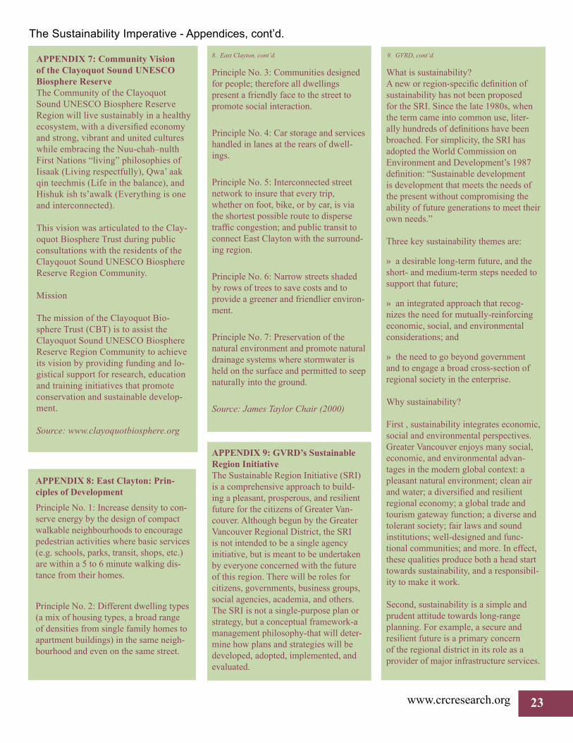
www.crcresearch.org 23
APPENDIX 7: Community Vision of the Clayoquot Sound UNESCO Biosphere ReserveThe Community of the Clayoquot Sound UNESCO Biosphere Reserve Region will live sustainably in a healthy ecosystem, with a diversified economy and strong, vibrant and united cultures while embracing the Nuu-chah–nulth First Nations “living” philosophies of Iisaak (Living respectfully), Qwa’ aak qin teechmis (Life in the balance), and Hishuk ish ts’awalk (Everything is one and interconnected).
This vision was articulated to the Clay-oquot Biosphere Trust during public consultations with the residents of the Clayqouot Sound UNESCO Biosphere Reserve Region Community.
Mission
The mission of the Clayoquot Bio-sphere Trust (CBT) is to assist the Clayoquot Sound UNESCO Biosphere Reserve Region Community to achieve its vision by providing funding and lo-gistical support for research, education and training initiatives that promote conservation and sustainable develop-ment.
Source: www.clayoquotbiosphere.org
Principle No. 3: Communities designed for people; therefore all dwellings present a friendly face to the street to promote social interaction.
Principle No. 4: Car storage and services handled in lanes at the rears of dwell-ings.
Principle No. 5: Interconnected street network to insure that every trip, whether on foot, bike, or by car, is via the shortest possible route to disperse traffic congestion; and public transit to connect East Clayton with the surround-ing region.
Principle No. 6: Narrow streets shaded by rows of trees to save costs and to provide a greener and friendlier environ-ment.
Principle No. 7: Preservation of the natural environment and promote natural drainage systems where stormwater is held on the surface and permitted to seep naturally into the ground.
Source: James Taylor Chair (2000)
What is sustainability?A new or region-specific definition of sustainability has not been proposed for the SRI. Since the late 1980s, when the term came into common use, liter-ally hundreds of definitions have been broached. For simplicity, the SRI has adopted the World Commission on Environment and Development’s 1987 definition: “Sustainable development is development that meets the needs of the present without compromising the ability of future generations to meet their own needs.”
Three key sustainability themes are:
» a desirable long-term future, and the short- and medium-term steps needed to support that future;
» an integrated approach that recog-nizes the need for mutually-reinforcing economic, social, and environmental considerations; and
» the need to go beyond government and to engage a broad cross-section of regional society in the enterprise.
Why sustainability?
First , sustainability integrates economic, social and environmental perspectives. Greater Vancouver enjoys many social, economic, and environmental advan-tages in the modern global context: a pleasant natural environment; clean air and water; a diversified and resilient regional economy; a global trade and tourism gateway function; a diverse and tolerant society; fair laws and sound institutions; well-designed and func-tional communities; and more. In effect, these qualities produce both a head start towards sustainability, and a responsibil-ity to make it work.
Second, sustainability is a simple and prudent attitude towards long-range planning. For example, a secure and resilient future is a primary concern of the regional district in its role as a provider of major infrastructure services.
8. East Clayton, cont’d.
The Sustainability Imperative - Appendices, cont’d.
APPENDIX 8: East Clayton: Prin-ciples of DevelopmentPrinciple No. 1: Increase density to con-serve energy by the design of compact walkable neighbourhoods to encourage pedestrian activities where basic services (e.g. schools, parks, transit, shops, etc.) are within a 5 to 6 minute walking dis-tance from their homes.
Principle No. 2: Different dwelling types (a mix of housing types, a broad range of densities from single family homes to apartment buildings) in the same neigh-bourhood and even on the same street.
APPENDIX 9: GVRD’s Sustainable Region InitiativeThe Sustainable Region Initiative (SRI) is a comprehensive approach to build-ing a pleasant, prosperous, and resilient future for the citizens of Greater Van-couver. Although begun by the Greater Vancouver Regional District, the SRI is not intended to be a single agency initiative, but is meant to be undertaken by everyone concerned with the future of this region. There will be roles for citizens, governments, business groups, social agencies, academia, and others. The SRI is not a single-purpose plan or strategy, but a conceptual framework-a management philosophy-that will deter-mine how plans and strategies will be developed, adopted, implemented, and evaluated.
9. GVRD, cont’d.
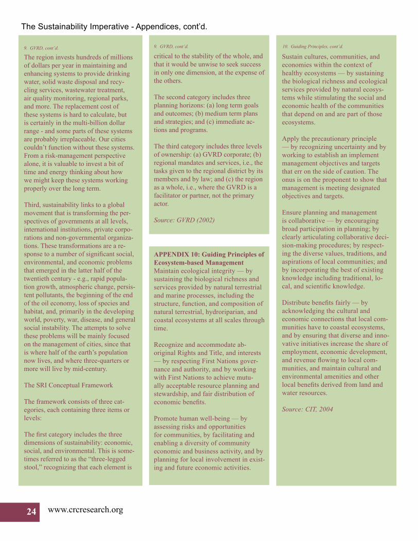
24 www.crcresearch.org
The Sustainability Imperative - Appendices, cont’d.
The region invests hundreds of millions of dollars per year in maintaining and enhancing systems to provide drinking water, solid waste disposal and recy-cling services, wastewater treatment, air quality monitoring, regional parks, and more. The replacement cost of these systems is hard to calculate, but is certainly in the multi-billion dollar range - and some parts of these systems are probably irreplaceable. Our cities couldn’t function without these systems. From a risk-management perspective alone, it is valuable to invest a bit of time and energy thinking about how we might keep these systems working properly over the long term.
Third, sustainability links to a global movement that is transforming the per-spectives of governments at all levels, international institutions, private corpo-rations and non-governmental organiza-tions. These transformations are a re-sponse to a number of significant social, environmental, and economic problems that emerged in the latter half of the twentieth century - e.g., rapid popula-tion growth, atmospheric change, persis-tent pollutants, the beginning of the end of the oil economy, loss of species and habitat, and, primarily in the developing world, poverty, war, disease, and general social instability. The attempts to solve these problems will be mainly focused on the management of cities, since that is where half of the earth’s population now lives, and where three-quarters or more will live by mid-century.
The SRI Conceptual Framework
The framework consists of three cat-egories, each containing three items or levels:
The first category includes the three dimensions of sustainability: economic, social, and environmental. This is some-times referred to as the “three-legged stool,” recognizing that each element is
critical to the stability of the whole, and that it would be unwise to seek success in only one dimension, at the expense of the others.
The second category includes three planning horizons: (a) long term goals and outcomes; (b) medium term plans and strategies; and (c) immediate ac-tions and programs.
The third category includes three levels of ownership: (a) GVRD corporate; (b) regional mandates and services, i.e., the tasks given to the regional district by its members and by law; and (c) the region as a whole, i.e., where the GVRD is a facilitator or partner, not the primary actor.
Source: GVRD (2002)
Sustain cultures, communities, and economies within the context of healthy ecosystems — by sustaining the biological richness and ecological services provided by natural ecosys-tems while stimulating the social and economic health of the communities that depend on and are part of those ecosystems.
Apply the precautionary principle — by recognizing uncertainty and by working to establish an implement management objectives and targets that err on the side of caution. The onus is on the proponent to show that management is meeting designated objectives and targets.
Ensure planning and management is collaborative — by encouraging broad participation in planning; by clearly articulating collaborative deci-sion-making procedures; by respect-ing the diverse values, traditions, and aspirations of local communities; and by incorporating the best of existing knowledge including traditional, lo-cal, and scientific knowledge.
Distribute benefits fairly — by acknowledging the cultural and economic connections that local com-munities have to coastal ecosystems, and by ensuring that diverse and inno-vative initiatives increase the share of employment, economic development, and revenue flowing to local com-munities, and maintain cultural and environmental amenities and other local benefits derived from land and water resources.
Source: CIT, 2004
APPENDIX 10: Guiding Principles of Ecosystem-based Management Maintain ecological integrity — by sustaining the biological richness and services provided by natural terrestrial and marine processes, including the structure, function, and composition of natural terrestrial, hydroriparian, and coastal ecosystems at all scales through time.
Recognize and accommodate ab-original Rights and Title, and interests — by respecting First Nations gover-nance and authority, and by working with First Nations to achieve mutu-ally acceptable resource planning and stewardship, and fair distribution of economic benefits.
Promote human well-being — by assessing risks and opportunities for communities, by facilitating and enabling a diversity of community economic and business activity, and by planning for local involvement in exist-ing and future economic activities.
9. GVRD, cont’d. 9. GVRD, cont’d. 10. Guiding Principles, cont’d.

The Sustainability Imperative - Appendices, cont’d.
APPENDIX 11: Southeast False Creek Vision Statement1) Implementing SustainabilitySEFC should promote the implementa-tion of sustainable development prin-ciples in an urban setting, and thereby contribute to improving the mainstream practices of urban development through-out Vancouver and the region.
2) Stewardship of Ecosystem HealthThe development of SEFC should improve the ecological health of the False Creek Basin. It should recognize the need for conservation, restoration and management of local, regional and global ecosystems. Therefore, resource conservation and waste reduction mea-sures should be implemented to a level that will meet the needs of present and future generations.
3) Economic Viability and VitalityDevelopment in SEFC should ensure economic viability without subsidy so the knowledge gained will be relevant to other development projects.
4) Social and Community HealthThe development in SEFC should seek ways to strengthen social networks and enhance the quality of life for all in the neighbourhood. This can be achieved by creating a liveable, complete commu-nity which: enhances cultural vitality and diversity; provides a wide range of accessible housing and employment choices; and encourages participation of residents and visitors in stewardship of the neighbourhood.
Source: City of Vancouver (1999).
APPENDIX 12: Okotoks Sustainability Vision“In the year 2010, the City of Okotoks, in the pristine Sheep River valley, will be an environmentally sensitive and re-sponsible community of people who en-joy a quality of life and a shared vision of prosperity and harmony. Through participative local government the City will demonstrate regional leadership in sustainable development, economic partnerships and a holistic approach to community well-being. Okotoks will be synonymous with vision and accom-plishment.”
Council established four goals to direct their own actions and those of Admin-istration in the context of the vision statement:
» Okotoks will provide to its commu-nity the right services in a superior way at a reasonable cost
» Okotoks will achieve a dynamic and diverse economic base
» Okotoks will demonstrate leader-ship as an environmentally conscious community
» Okotoks will achieve excellence in public governance
Source: www.okotoks.ca
APPENDIX 13: Cooperation for Cortes Self-Sufficiency The Aim: To obtain our basic needs, as far as possible, from local, sustainable sources.
What is involved?
» The study of our genuine needs: healthy food, clean air and water, shel-ter, clothing, heating, power, transport, close community relations, art and entertainment.
» That we become aware of the basic skills required to produce these needs locally.
» The pinpointing of local craftspeople possessing these skills and making this information available to all concerned.
» The training of Cortes Islanders in these skills and in the concept of natu-ral sustainability.
» The setting up of a local trading/gift economy to reduce the need for high wage employment and its resulting stress.
» Local processing of raw materials and keeping value-added at home.
» Major reduction in motor vehicle traffic and the use of fossil fuels. Im-provement in public transport.
» Reducing imports of materials from off Island and abroad.
» Getting other communities in BC involved in local self-sufficiency, and studying their ideas.
Source: www.dwayneedwardrourke.com/Pages/SELFSUFF/brochure.html#anchor787560
Principal ResearcherAnn Dale, Trudeau Fellow (2004)Professor, School of Environment and SustainabilityFaculty of Social and Applied SciencesCanada Research Chair on Sustainable Community DevelopmentRoyal Roads University2005 Sooke Road, Victoria, BC, V9B 5Y2Tel: 250. 391-2600, x 4117, Fax: 250. 391-2587E-mail: [email protected]
We gratefully acknowledge the support and funding from the Canada Research Chairs Program.