Search for Sarasvati based on mistranslations and misrepresentations to buttress Marxist ideology to...
19
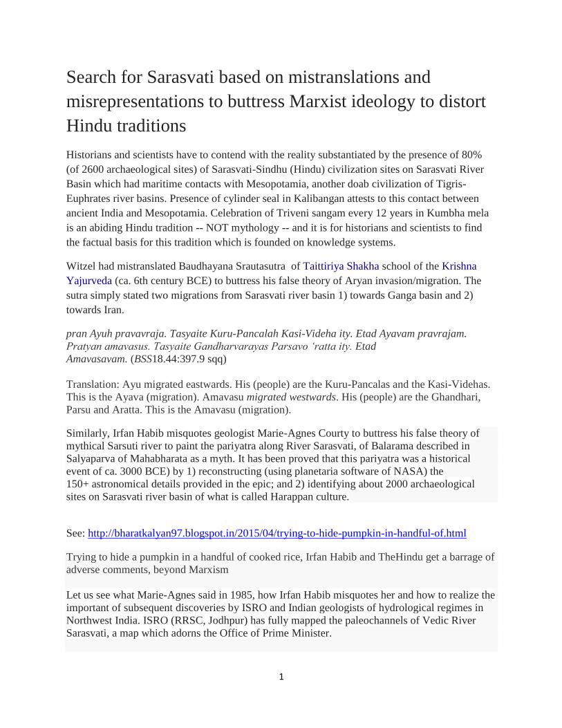
1 Search for Sarasvati based on mistranslations and misrepresentations to buttress Marxist ideology to distort Hindu traditions Historians and scientists have to contend with the reality substantiated by the presence of 80% (of 2600 archaeological sites) of Sarasvati-Sindhu (Hindu) civilization sites on Sarasvati River Basin which had maritime contacts with Mesopotamia, another doab civilization of Tigris- Euphrates river basins. Presence of cylinder seal in Kalibangan attests to this contact between ancient India and Mesopotamia. Celebration of Triveni sangam every 12 years in Kumbha mela is an abiding Hindu tradition -- NOT mythology -- and it is for historians and scientists to find the factual basis for this tradition which is founded on knowledge systems. Witzel had mistranslated Baudhayana Srautasutra of Taittiriya Shakha school of the Krishna Yajurveda (ca. 6th century BCE) to buttress his false theory of Aryan invasion/migration. The sutra simply stated two migrations from Sarasvati river basin 1) towards Ganga basin and 2) towards Iran. pran Ayuh pravavraja. Tasyaite Kuru-Pancalah Kasi-Videha ity. Etad Ayavam pravrajam. Pratyan amavasus. Tasyaite Gandharvarayas Parsavo ‘ratta ity. Etad Amavasavam. (BSS18.44:397.9 sqq) Translation: Ayu migrated eastwards. His (people) are the Kuru-Pancalas and the Kasi-Videhas. This is the Ayava (migration). Amavasu migrated westwards. His (people) are the Ghandhari, Parsu and Aratta. This is the Amavasu (migration). Similarly, Irfan Habib misquotes geologist Marie-Agnes Courty to buttress his false theory of mythical Sarsuti river to paint the pariyatra along River Sarasvati, of Balarama described in Salyaparva of Mahabharata as a myth. It has been proved that this pariyatra was a historical event of ca. 3000 BCE) by 1) reconstructing (using planetaria software of NASA) the 150+ astronomical details provided in the epic; and 2) identifying about 2000 archaeological sites on Sarasvati river basin of what is called Harappan culture. See: http://bharatkalyan97.blogspot.in/2015/04/trying-to-hide-pumpkin-in-handful-of.html Trying to hide a pumpkin in a handful of cooked rice, Irfan Habib and TheHindu get a barrage of adverse comments, beyond Marxism Let us see what Marie-Agnes said in 1985, how Irfan Habib misquotes her and how to realize the important of subsequent discoveries by ISRO and Indian geologists of hydrological regimes in Northwest India. ISRO (RRSC, Jodhpur) has fully mapped the paleochannels of Vedic River Sarasvati, a map which adorns the Office of Prime Minister.
-
Upload
independent -
Category
Documents
-
view
0 -
download
0
Transcript of Search for Sarasvati based on mistranslations and misrepresentations to buttress Marxist ideology to...
1
Search for Sarasvati based on mistranslations and
misrepresentations to buttress Marxist ideology to distort
Hindu traditions
Historians and scientists have to contend with the reality substantiated by the presence of 80%
(of 2600 archaeological sites) of Sarasvati-Sindhu (Hindu) civilization sites on Sarasvati River
Basin which had maritime contacts with Mesopotamia, another doab civilization of Tigris-
Euphrates river basins. Presence of cylinder seal in Kalibangan attests to this contact between
ancient India and Mesopotamia. Celebration of Triveni sangam every 12 years in Kumbha mela
is an abiding Hindu tradition -- NOT mythology -- and it is for historians and scientists to find
the factual basis for this tradition which is founded on knowledge systems.
Witzel had mistranslated Baudhayana Srautasutra of Taittiriya Shakha school of the Krishna
Yajurveda (ca. 6th century BCE) to buttress his false theory of Aryan invasion/migration. The
sutra simply stated two migrations from Sarasvati river basin 1) towards Ganga basin and 2)
towards Iran.
pran Ayuh pravavraja. Tasyaite Kuru-Pancalah Kasi-Videha ity. Etad Ayavam pravrajam.
Pratyan amavasus. Tasyaite Gandharvarayas Parsavo ‘ratta ity. Etad
Amavasavam. (BSS18.44:397.9 sqq)
Translation: Ayu migrated eastwards. His (people) are the Kuru-Pancalas and the Kasi-Videhas.
This is the Ayava (migration). Amavasu migrated westwards. His (people) are the Ghandhari,
Parsu and Aratta. This is the Amavasu (migration).
Similarly, Irfan Habib misquotes geologist Marie-Agnes Courty to buttress his false theory of
mythical Sarsuti river to paint the pariyatra along River Sarasvati, of Balarama described in
Salyaparva of Mahabharata as a myth. It has been proved that this pariyatra was a historical
event of ca. 3000 BCE) by 1) reconstructing (using planetaria software of NASA) the
150+ astronomical details provided in the epic; and 2) identifying about 2000 archaeological
sites on Sarasvati river basin of what is called Harappan culture.
See: http://bharatkalyan97.blogspot.in/2015/04/trying-to-hide-pumpkin-in-handful-of.html
Trying to hide a pumpkin in a handful of cooked rice, Irfan Habib and TheHindu get a barrage of
adverse comments, beyond Marxism
Let us see what Marie-Agnes said in 1985, how Irfan Habib misquotes her and how to realize the
important of subsequent discoveries by ISRO and Indian geologists of hydrological regimes in
Northwest India. ISRO (RRSC, Jodhpur) has fully mapped the paleochannels of Vedic River
Sarasvati, a map which adorns the Office of Prime Minister.
2
French geologist Marie-Agnes Courty, based on a microscopic study of sediments in Ghaggar-
Chautang region, found 'true grey sands at a depth of over 8 m, identical to those of the Yamuna
and Sulej...mighty rivers with their sources in the Himalayas flowed at the end of the last ice age
in the Ghaggar's present basin...Yamuna-like rivers...stopped flowing in the study area well
before the Protohistoric period...' The proto-historic periods she is referring to are periods well
before 2600 to 1900 BCE of Sarasvati-Sindhu civilization. The 7 or 8 m of alluvium covering the
grey sands were layers of loamy sand and silty clay and could have originated from streams
flowing from the Shivaliks, and not from the inner Himalayas. Puri and Verma have
demonstrated the presence of metamorphic and quartzite rocks in the ancient river-bed (Somb
nadi) area of Ad Badri, at the foothills of Shivaliks and established that the paleochannel could
have flowed from the inner Himalayas, making Ad Badri the Hardwar of Vedic River Sarasvati.
(Puri, VMK & BC Verma, Glaciological and geological source of Vedic Saraswati in the
Himalayas, Itihas Darpan, vol. 4, 1998, no. 2, pp. 16, 7-36). Puri and Verma identify three
glaciers in the Bandarpunch massif which fed Tons (Tamasa river), the tributary of Yamuna river
before Yamuna reached the plains and suggest that Tamasa and Yamuna once flowed westward
into the wide Bata valley and onto the Markanda river. They thus concluded that Tamasa river
was the Vedic River Sarasvati in the upper Himalayan reaches. This finding of a Himalayan river
flowing into the Ghaggar-Chautang basin is reinforced by the findings of KS Valdiya based on
the dynamics of Himalayan ranges continuously under tectonic regimes caused by plate-
continents of the northward drift of Indian plate jutting into the Eurasian plate. Valdiya explains
this vividly in the context of the Yamuna tear near Paonta Saheb demonstrating the eastward
migration of Yamuna River, a migration principally caused by plate-tectonics and Himalayan
dynamics. (Valdiya, KS, 2002, Saraswati, the river that disappeared, ISRO and Universities
Press, Hyderabad, p. 27).
Courty, Marie-Agnes, 'Le milieu physique et utilisation du sol', in Henri-Paul Francfort,
ed., Prospections archeologiques au nord-ouest de L'inde: rapport preliminair 1983-1984,
memoire 62, Editions Recherches sur les Civilisations, Paris, 1985, p. 30
Courty, Marie-Agnes, 'Integrfation of Sediment and Soil information in the reconstruction of
protohistoric and historic landscapes of the Ghaggar plain (North-west India)', in Frifelt, Karen
& Per Sorensen, eds., South Asian Archaeology 1985, Scandinavian Institute of Asian Studies,
Occasional papers No. 4, Curzon Press, London, 1989, p. 259
The controversy among geologists about the Himalayan source for Vedic River Sarasvati was
renewed by an article of Liviu Giosan of Woods Hole Oceanographic Institution, MA, USA in a
paper published in Proceedings of the National Academy of Sciences
(https://www.whoi.edu/oceanus/viewArticle.do?id=147629)
In this paper, Giosan acknowledges the presence of a large river system in NW India and refers
to Ghaggar river as a river fed by seasonal monsoon rains and NOT sourced from Himalayas.
This view was countered by KS Valdiya in Current Science wherein the phenomena of aandhi
(sand storms) and Himalayan dynamics were reinforced to underscore that climate or monsoon
3
was only a partial explanation and that larger forces were at work in the region leading to river
migrations. A westward migration of Sutlej river abandoning Ghaggar and joining the Sindhu in
Bahawalpur province has also been noted by Valdiya and Rafique Mughal who did excavations
identifying over 200 ‘indusrial sites’ on Cholistan desert sites of Sarasvati-Sindhu civilization.
[http://bharatkalyan97.blogspot.in/2013/11/evidence-for-sutlej-sarasvati-as.html#! K.S. Valdiya.
2013. "The River Saraswati was a Himalayan-born river". Current Science 104 (01)]
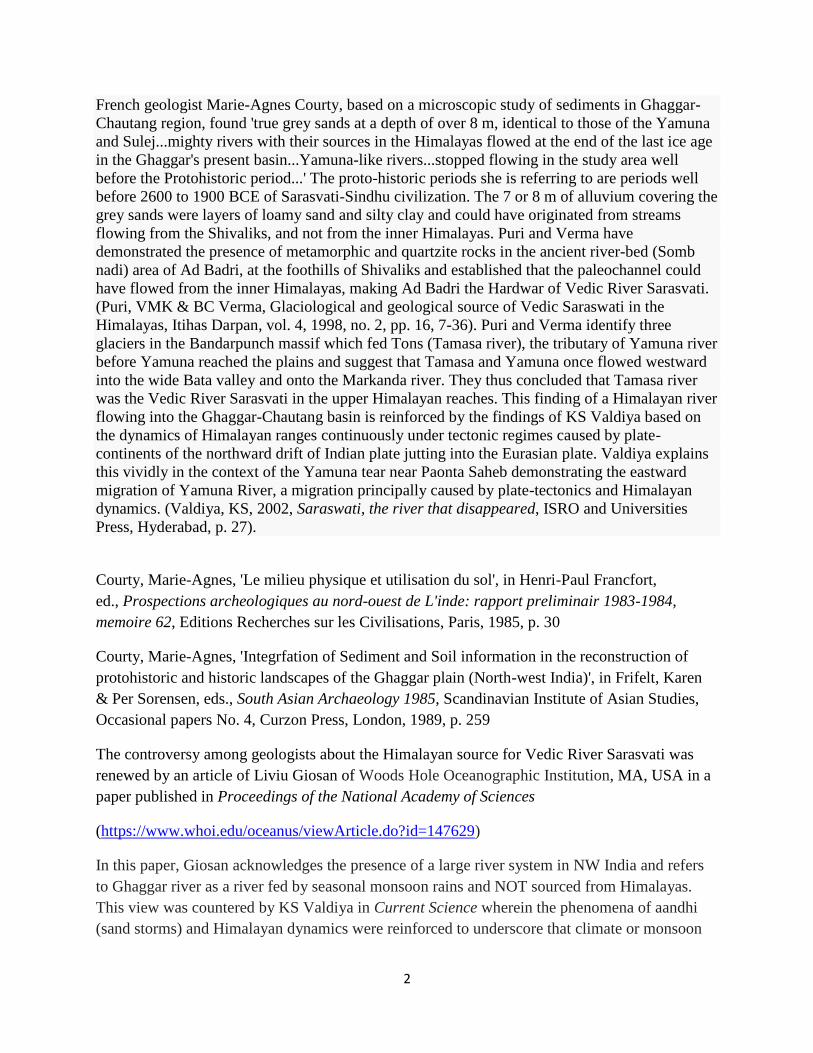
If the westward diversion of the Sutlej river occurred recently (about 4000 years ago), it may
have been responsible for the Ghaggar-Hakra (Saraswati) drying up, causing desertification
of Cholistan and the eastern part of the modern state of Sindh, and the abandonment of Harappan
settlements along the Ghaggar. However, the Sutlej may have already been captured by the Indus
thousands of years earlier, leaving hundreds of streams (naiwal) continuing to flowin southwards
into Ghaggar, as evidenced in satellite images analysed by RRSC, Jodhpur of ISRO.
Geologists have to explain this 90-degree westward tun of River Sutlej which occurred in
historic times, from ca. 2500 BCE.
Saraswati underground
Author(s): Richard Mahapatra
Nov 15, 2002 |
Experts attempt to map the mythical river's palaeo-channels and put them to good use
4
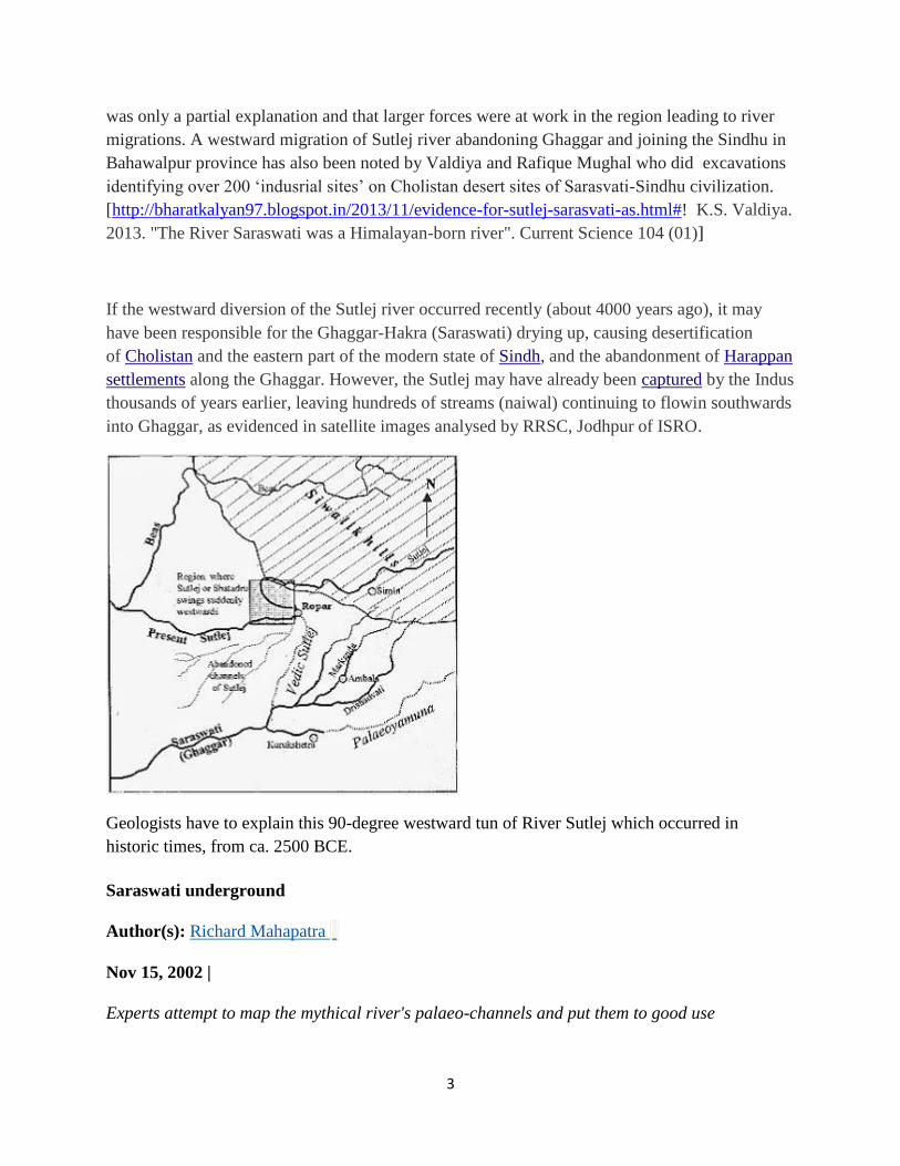
Photo: Bandeep Singh / India Today Legend has it that the
beautiful goddess Saraswati sprung from the forehead of her
father Brahma, the god of creation. It is said that as soon as
Brahma looked at her beauty, he was filled with desire for her.
Unhappy with the amorous attentions he bestowed upon her, she
tried to dodge and hide. This is why the river Saraswati flows
underground. And the brief appearance she made aboveground is
the moment, legends assert, that she stopped to rest from her
tiring run.
Whatever the merits of this legend, on June 15, 2002, Union
Minister for Culture Jagmohan announced excavations to trace
the course of the river Saraswati.
He has named a team of four experts -- Baldeo Sahai of the
Indian Space Research Organisation (ISRO), Ahmedabad, archaeologist S Kalyan Raman,
glaciologist Y K Puri and water consultant Madhav Chitle -- for this task. They will carry out the
first phase of excavations, from Adi Badri to Bhagwanpura in Haryana, followed by a second
phase from Bhagwanpura to Kalibangan on the Rajasthan border.
These experts will also look into deepening Kapalmochan and Ranmochan, two wells fed by
Saraswati. It is believed that the Pandavas had taken a bath in these wells. If efforts to yield
Saraswati water in these wells fail, experts have been told to tap tubewells. There will also be an
attempt to trace the Saraswati at Thaneshwar -- once the capital of Harshvardhan -- a few
kilometres (kms) from Kurukshetra.
Novel as this project is, it is an extension of the work done by the Rajasthan Groundwater
Department (RGWD). The RGWD had, as early as 1996, embarked on an ambitious project --
albeit confined to the state of Rajasthan -- to retrace an ancient network of water channels.
These channels, buried 60 metres below the ground, were believed to be the route traced by the
river Saraswati. The RGWD was clear about what it set out to do. Once these channels were
retraced, and the sequence of the river flow established, it would go a long way in solving the
water problem in arid Rajasthan. The theory was that these channels could transport surplus
water from Punjab and Haryana during the monsoons, and store it for future use.
RGWD's research, design and development division in Jodhpur is monitoring the project with a
Rs 4.7 million grant from the Rajiv Gandhi National Mission for Drinking Water (RGNMDW).
The RGWD is assisted by the Central Ground Water Board (CGWB), ISRO, Bhabha Atomic
Research Centre (BARC) and the National Physical Laboratory. WhileRGWD is investigating
sites of palaeo-channels, CGWB is carrying out drilling activities for water and soil
samples. BARC, meanwhile, is estimating the age of water and soil samples by carbon-14 dating.
5
This experiment is novel in that Rajasthan would be the first to ever use palaeo-channels for
transporting water and storing it underground.
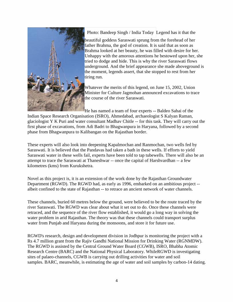
Satellite images, supported by a four-year drilling exercise, which was guided by ancient
literature, have established that the river Saraswati is not a myth. It was a huge river that died a
premature death about 5,000 years ago, and is now buried 60 metres below the ground. A map of
all the channels discovered so far leads one to conclude that it was probably 1,500 km long, three
to fifteen kms wide, and about five metres deep. The river probably crisscrossed the present-day
states of Himachal Pradesh, Haryana, Punjab and Rajasthan. S C Sharma, regional
director, CGWB, says it continues to flow to the sea at a rate of 20 metres a year.
The prospect of rediscovering the Saraswati was triggered off by digital photographs sent by the
American satellite Landsat. To the surprise of many scientists, the photographs showed the
presence of underground water in a definitive pattern in the Jaisalmer area. It was during this
time that scientists started speaking of a large palaeo-channel in Rajasthan that could well belong
to a big river.
Remote sensing images of the ISRO and the Geological Survey of India (GSI) also found the
existence of palaeo-channels of a mighty river in seven to eight places, all lying on the west of
the Aravalli ranges. The images pointed to the possibility that the river started at the foothills of
the Aravallis and shifted westward in stages. The river seems to enter Rajasthan in Ganganagar
district, with its tail ends in Bikaner and Jaisalmer districts, a few kilometres from the Rann of
Kutchh.
Further, a geophysical survey undertaken by the RGWD in the Tanot and Longewala areas
indicated the existence of coarse sediments in the depth range of 30 to 60 metres pointing to the
possibility of the existence of a river in the region.
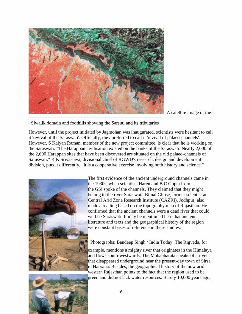
6
A satellite image of the
Siwalik domain and foothills showing the Sarsuti and its tributaries
However, until the project initiated by Jagmohan was inaugurated, scientists were hesitant to call
it 'revival of the Saraswati'. Officially, they preferred to call it 'revival of palaeo-channels'.
However, S Kalyan Raman, member of the new project committee, is clear that he is working on
the Saraswati. "The Harappan civilisation existed on the banks of the Saraswati. Nearly 2,000 of
the 2,600 Harappan sites that have been discovered are situated on the old palaeo-channels of
Saraswati." K K Srivastava, divisional chief of RGWD's research, design and development
division, puts it differently, "It is a cooperative exercise involving both history and science."
The first evidence of the ancient underground channels came in
the 1930s, when scientists Haren and B C Gupta from
the GSI spoke of the channels. They claimed that they might
belong to the river Saraswati. Bimal Ghose, former scientist at
Central Arid Zone Research Institute (CAZRI), Jodhpur, also
made a reading based on the topography map of Rajasthan. He
confirmed that the ancient channels were a dead river that could
well be Saraswati. It may be mentioned here that ancient
literature and texts and the geographical history of the region
were constant bases of reference in these studies.
Photographs: Bandeep Singh / India Today The Rigveda, for
example, mentions a mighty river that originates in the Himalaya
and flows south-westwards. The Mahabharata speaks of a river
that disappeared underground near the present-day town of Sirsa
in Haryana. Besides, the geographical history of the now arid
western Rajasthan points to the fact that the region used to be
green and did not lack water resources. Barely 10,000 years ago,

7
the whole region was host to a big river system, which attracted civilisations like the
Mohenjodaro and Harappa.
Archaeological findings also indicate that a major river originating primarily from the same
source as the present Sutlej flowed through northern Rajasthan, Bahawalpur and Sindh. The
course of the river was southeast of the Sutlej's present course. Some scholars working on
ancient literature also suggest that the Saraswati flowed along the present course of Luni river in
Rajasthan, and shifted westwards progressively. Baldeo Sahai, one of the members of the new
research project says, "Latest research indicates that the Saraswati was a perennial river
connected to the Bander Poonch glacier in the Himalayas."
RGWD scientists say that the desertification of western Rajasthan started only 5,000-6,000 years
ago. After the Ice Age, it is believed that the area had some massive glaciers, which flushed it
with fresh water for thousands of years. Due to marine tectonic activity, the area from the Rann
of Kutchh to Bikaner was submerged by seawater. This was the beginning of the desertification
process.
The tectonic activity is also said to be the reason behind Saraswati's delinking from its source of
water. Consequently, it is believed, the river dried up and was buried under desertification sands
and alluvium.
In the early 1980s, RGWD scientists were amazed by the fact that fresh water was available in
many places of Jaisalmer district, and some wells never dried up. This aroused considerable
interest, for Jaisalmer's water is known to be saline. Investigations revealed that about 100
metres away from the site of the fresh water, the groundwater was saline. Some ofCGWB 's
observation stations for monitoring groundwater have fresh water in the depth range of 30-40
metres. "These stations are located in a linear pattern in the northeast-southeast direction, and
never go dry," saysS C Sharma. "During drilling operations, alluvial sediments were found at a
depth of 78-100 metres, pointing to the existence of a flow channel. It also points towards the
existence of a fresh water source along the inferred palaeo-channel," says K K Srivastava.
Extensive surveys showed that there was a big water channel 60-70 metres underground, and the
water was moving very slowly towards the sea. Drilling work to trace these channels were
started in Jaisalmer. The second stage of the operations is in the Bikaner-Kolait region, upward
of Jaisalmer. There are palaeo-channels in all 10 districts of western Rajasthan, and these have
been mapped to prepare the river's ancient course.
The course of the river is yet to be traced completely, though. Besides, it is believed that, like
any other major river, the Saraswati also changed its course frequently. This would explain the
very large number of channels buried underground.
Once the fact that the channels do exist was established, RGWDcommissioned the Physical
Research Laboratory, Ahmedabad and BARC,Bombay to determine the age of the water and the
soil. A team of scientists led by S M Rao of BARC's isotope division studied the samples
collected from different depths. BARC's dating suggests that the samples are as old as 20,000-

8
40,000 years. The youngest sample dates back to 2,500 years. These findings place the samples
in the 'marine transgression' age, when the desertification of Rajasthan started. The groundwater
today contains more tritium, a radioactive material, due to atmospheric nuclear tests conducted in
the 1960s and 1970s by the USand the erstwhile USSR.
RGWD, in a proposal to the RGNMDW, outlined the utility of the project. This report suggests
that once the channels are demarcated, and their course traced, they could contribute
substantially towards solving the water crisis in arid western Rajasthan. "Transporting water
through palaeo-channels would reduce the cost of water transportation drastically, because we do
not need to build a canal. It would also reduce wastage due to evaporation," says S C Sharma.
The channels could also double up as storage facility for surplus monsoon water.
Officials say that the defence ministry has also shown an interest in the project, as it could mean
adequate water supply to its soldiers stationed on the India-Pakistan border. Whether the large
amount of data available with the army is utilised or not, the findings of the two projects on
Saraswati are worth waiting for.
http://www.downtoearth.org.in/content/saraswati-underground
Evidence for Sutlej-Sarasvati as a Himalayan river system. Visit Ropar. A suggestion to Liviu
Giosan et al.
From tectonically to erosionally controlled development of the Himalayan orogen
Thiede et al. Geology 2005 33 (8), p. 689
Rasmus C. Thiede, J Ramon Arrowsmith, Bodo Bookhagen, Michael O McWilliams, Edward R.
Sobel and Manfred R. Strecker Geology 2005; 33; 689-692, The Geological Society of America
Abstract
Whether variations in the spatial distribution of erosion influence the location, style, and
magnitude of deformation within the Himalayan orogen is a matter of debate…The locus of
pronounced exhumation defined by the apatite fission-track (AFT) data correlates with a region
of high precipitation, discharge, and sediment flux rates during the Holocene. This correlation
suggests that although tectonic processes exerted the dominant control on the denudation pattern
before and until the middle Miocene; erosion may have been the most important factor since the
Pliocene…
9
Geological setting of the Northwestern Himalaya
Sustained Eurasian-Indian convergence since the continental collision ca. 50 Ma has caused
persistent lateral and vertical growth of the Himalaya, which has been accommodated by
progressive motion along a series of major crustal fault systems: the Southern Tibetan
detachment, the Main Central thrust, the Main Boundary thrust, and the Main frontal thrust.
These orogen-parallel fault systems bound the main Himalayan tectonostratigraphic domains,
which are underthurst by the Indian plate along the basal Main Himalayan thrust.
…Although the southern Himalayan front is affected by heterogeneous erosion at the million
year time scale, the topography forms a nearly perfect arc. Focused erosion is thus compensated
by self-organized thrust activation resulting in heterogeneous distribution of rock uplift and
exhumation. Rapid rock uplift in tur may keep the longitudinal river profiles steep, forcing the
rivers to further incise. For example, the removal of the 10-15-km thick High Himalayan
Crystalline nappe, which today is replaced by Lesser Himalayan Crystalline rocks forming the
Larji-Kulu-Rampur window, indicates pronounced removal of crystalline rocks along the Sutlej
River network…
The development, however, toward synchronous exhumation of both crystalline nappe systems
may suggest that when a critical mass removal threshold is exceeded, the orographic barrier may
play a fundamental role in intercepting moisture and focusing discharge, erosion, and sediment
transport along an orogenic front. To compensate the erosional loss, the orogen is forced to
internally reorganize, and therefore erosion may control the distribution of exhumation and rock
uplift. For the past 10 m.y., the Himalayan deformation front has migrated only 20-50 km.
southward. Therefore internal rock uplift and focused exhumation concentrated orogenic
deformation in this internal sector, rather than propagating the deformation front southward.
Read the full text pdf document
here:https://drive.google.com/file/d/0B4BAzCi4O_l4bXFJREpFSjR6VU0/edit?usp=sharing
10
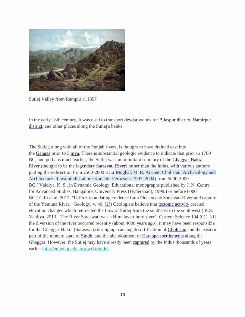
Sutlej Valley from Rampur c. 1857
In the early 18th century, it was used to transport devdar woods for Bilaspur district, Hamirpur
district, and other places along the Sutlej's banks.
The Sutlej, along with all of the Punjab rivers, is thought to have drained east into
the Ganges prior to 5 mya. There is substantial geologic evidence to indicate that prior to 1700
BC, and perhaps much earlier, the Sutlej was an important tributary of the Ghaggar-Hakra
River (thought to be the legendary Sarasvati River) rather than the Indus, with various authors
putting the redirection from 2500-2000 BC,( Mughal, M. R. Ancient Cholistan. Archaeology and
Architecture. Rawalpindi-Lahore-Karachi: Ferozsons 1997, 2004) from 5000-3000
BC,( Valdiya, K. S., in Dynamic Geology, Educational monographs published by J. N. Centre
for Advanced Studies, Bangalore, University Press (Hyderabad), 1998.) or before 8000
BC.( Clift et al. 2012. "U-Pb zircon dating evidence for a Pleistocene Sarasvati River and capture
of the Yamuna River." Geology, v. 40. [2]) Geologists believe that tectonic activity created
elevation changes which redirected the flow of Sutlej from the southeast to the southwest.( K.S.
Valdiya. 2013. "The River Saraswati was a Himalayan-born river". Current Science 104 (01). ) If
the diversion of the river occurred recently (about 4000 years ago), it may have been responsible
for the Ghaggar-Hakra (Saraswati) drying up, causing desertification of Cholistan and the eastern
part of the modern state of Sindh, and the abandonment of Harappan settlements along the
Ghaggar. However, the Sutlej may have already been captured by the Indus thousands of years
earlier.http://en.wikipedia.org/wiki/Sutlej
11
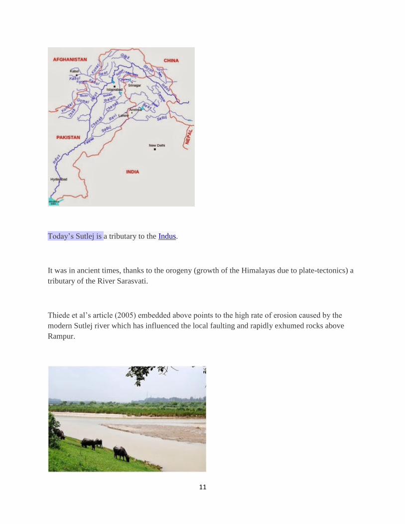
Today’s Sutlej is a tributary to the Indus.
It was in ancient times, thanks to the orogeny (growth of the Himalayas due to plate-tectonics) a
tributary of the River Sarasvati.
Thiede et al’s article (2005) embedded above points to the high rate of erosion caused by the
modern Sutlej river which has influenced the local faulting and rapidly exhumed rocks above
Rampur.
12
Cattle grazing on the banks of the river inRupnagar, Punjab, India
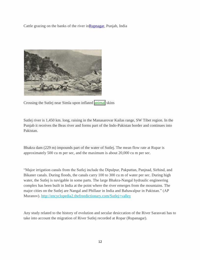
Crossing the Sutlej near Simla upon inflated animal skins
Sutlej river is 1,450 km. long, raising in the Manasarovar Kailas range, SW Tibet region. In the
Punjab it receives the Beas river and forms part of the Indo-Pakistan border and continues into
Pakistan.
Bhakra dam (229 m) impounds part of the water of Sutlej. The mean flow rate at Rupar is
approximately 500 cu m per sec, and the maximum is about 20,000 cu m per sec.
“Major irrigation canals from the Sutlej include the Dipalpur, Pakpattan, Panjnad, Sirhind, and
Bikaner canals. During floods, the canals carry 100 to 300 cu m of water per sec. During high
water, the Sutlej is navigable in some parts. The large Bhakra-Nangal hydraulic engineering
complex has been built in India at the point where the river emerges from the mountains. The
major cities on the Sutlej are Nangal and Phillaur in India and Bahawalpur in Pakistan.” (AP
Muranov). http://encyclopedia2.thefreedictionary.com/Sutlej+valley
Any study related to the history of evolution and secular desiccation of the River Sarasvati has to
take into account the migration of River Sutlej recorded at Ropar (Rupanagar).
13
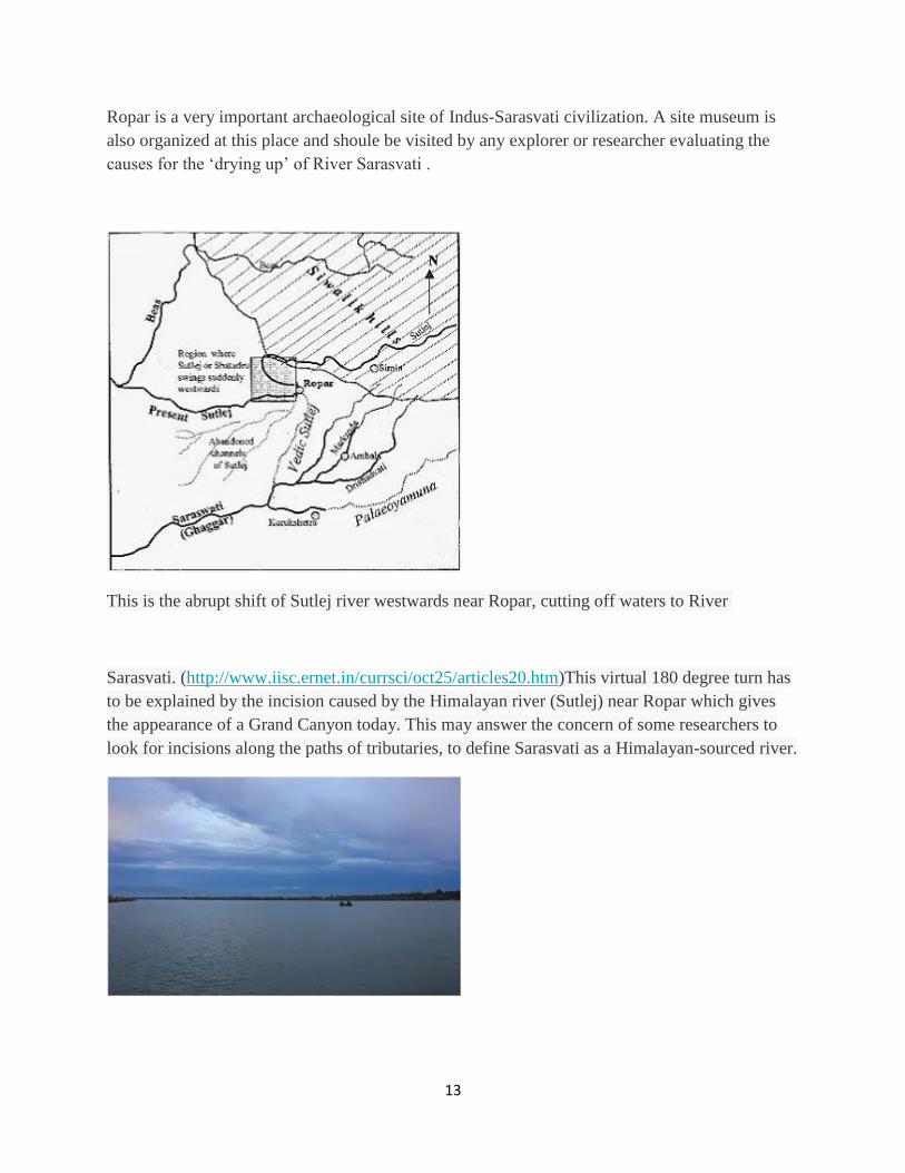
Ropar is a very important archaeological site of Indus-Sarasvati civilization. A site museum is
also organized at this place and shoule be visited by any explorer or researcher evaluating the
causes for the ‘drying up’ of River Sarasvati .
This is the abrupt shift of Sutlej river westwards near Ropar, cutting off waters to River
Sarasvati. (http://www.iisc.ernet.in/currsci/oct25/articles20.htm)This virtual 180 degree turn has
to be explained by the incision caused by the Himalayan river (Sutlej) near Ropar which gives
the appearance of a Grand Canyon today. This may answer the concern of some researchers to
look for incisions along the paths of tributaries, to define Sarasvati as a Himalayan-sourced river.
14
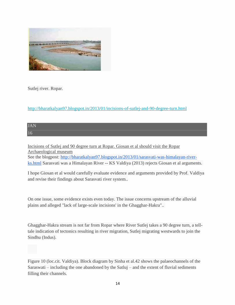
Sutlej river. Ropar.
http://bharatkalyan97.blogspot.in/2013/01/incisions-of-sutlej-and-90-degree-turn.html
JAN
16
Incisions of Sutlej and 90 degree turn at Ropar. Giosan et al should visit the Ropar
Archaeological museum
See the blogpost: http://bharatkalyan97.blogspot.in/2013/01/sarasvati-was-himalayan-river-
ks.html Sarasvati was a Himalayan River -- KS Valdiya (2013) rejects Giosan et al arguments.
I hope Giosan et al would carefully evaluate evidence and arguments provided by Prof. Valdiya
and revise their findings about Sarasvati river system..
On one issue, some evidence exists even today. The issue concerns upstream of the alluvial
plains and alleged "lack of large-scale incisions' in the Ghagghar-Hakra"..
Ghagghar-Hakra stream is not far from Ropar where River Sutlej takes a 90 degree turn, a tell-
tale indication of tectonics resulting in river migration, Sutlej migrating westwards to join the
Sindhu (Indus).
Figure 10 (loc.cit. Valdiya). Block diagram by Sinha et al.42 shows the palaeochannels of the
Saraswati – including the one abandoned by the Satluj – and the extent of fluvial sediments
filling their channels.
15
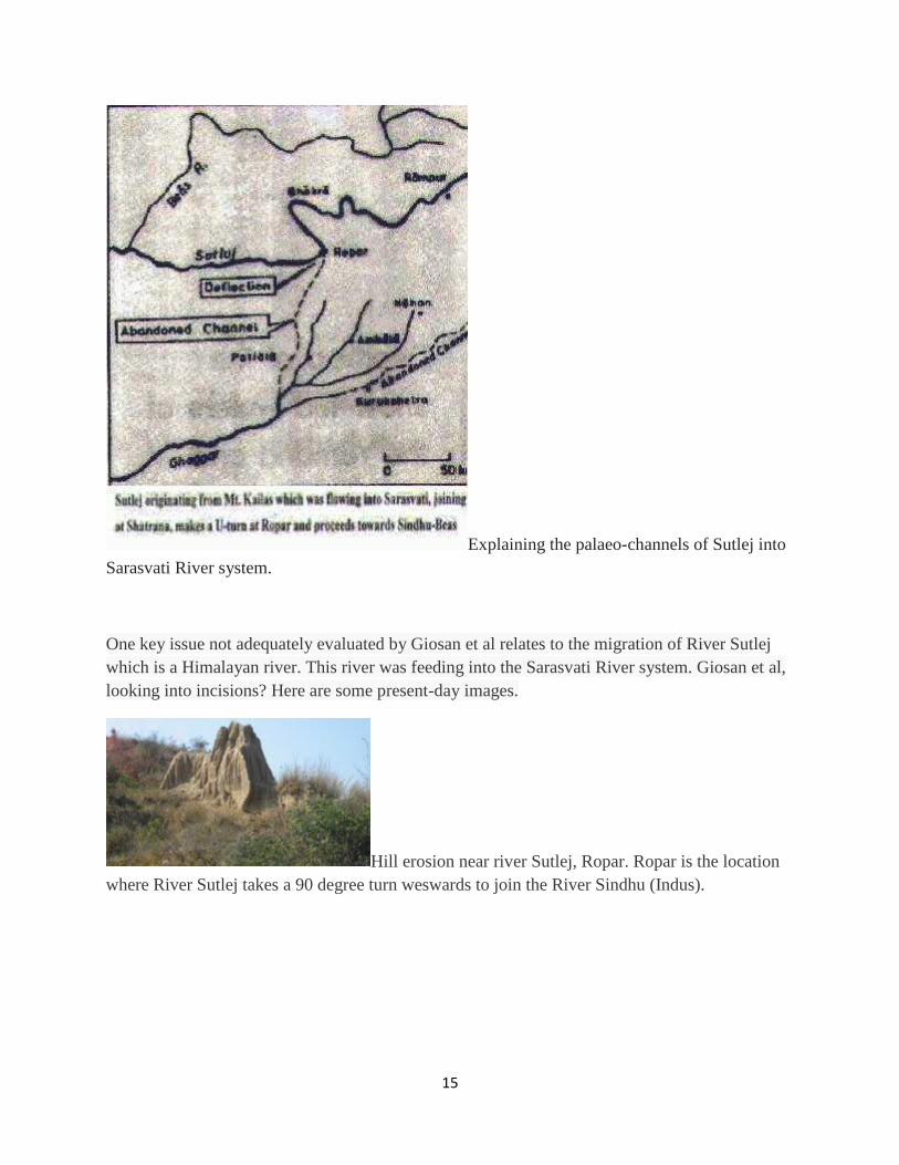
Explaining the palaeo-channels of Sutlej into
Sarasvati River system.
One key issue not adequately evaluated by Giosan et al relates to the migration of River Sutlej
which is a Himalayan river. This river was feeding into the Sarasvati River system. Giosan et al,
looking into incisions? Here are some present-day images.
Hill erosion near river Sutlej, Ropar. Ropar is the location
where River Sutlej takes a 90 degree turn weswards to join the River Sindhu (Indus).
16
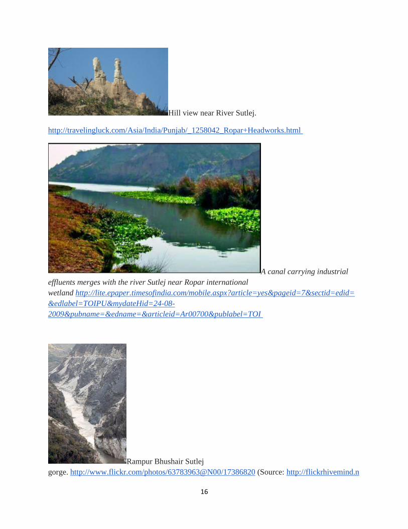
Hill view near River Sutlej.
http://travelingluck.com/Asia/India/Punjab/_1258042_Ropar+Headworks.html
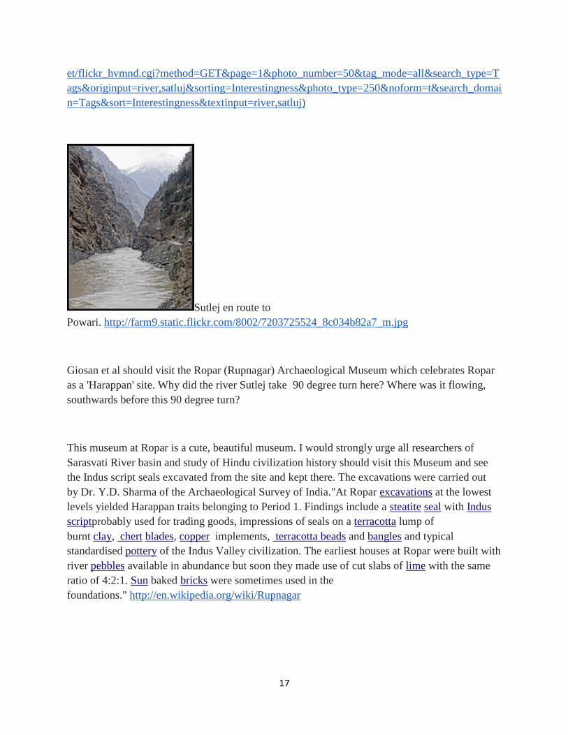
A canal carrying industrial
effluents merges with the river Sutlej near Ropar international
wetland http://lite.epaper.timesofindia.com/mobile.aspx?article=yes&pageid=7§id=edid=
&edlabel=TOIPU&mydateHid=24-08-
2009&pubname=&edname=&articleid=Ar00700&publabel=TOI
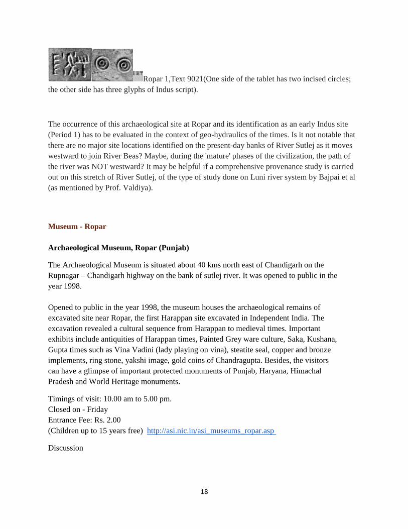
Rampur Bhushair Sutlej
gorge. http://www.flickr.com/photos/63783963@N00/17386820 (Source: http://flickrhivemind.n
17
et/flickr_hvmnd.cgi?method=GET&page=1&photo_number=50&tag_mode=all&search_type=T
ags&originput=river,satluj&sorting=Interestingness&photo_type=250&noform=t&search_domai
n=Tags&sort=Interestingness&textinput=river,satluj)
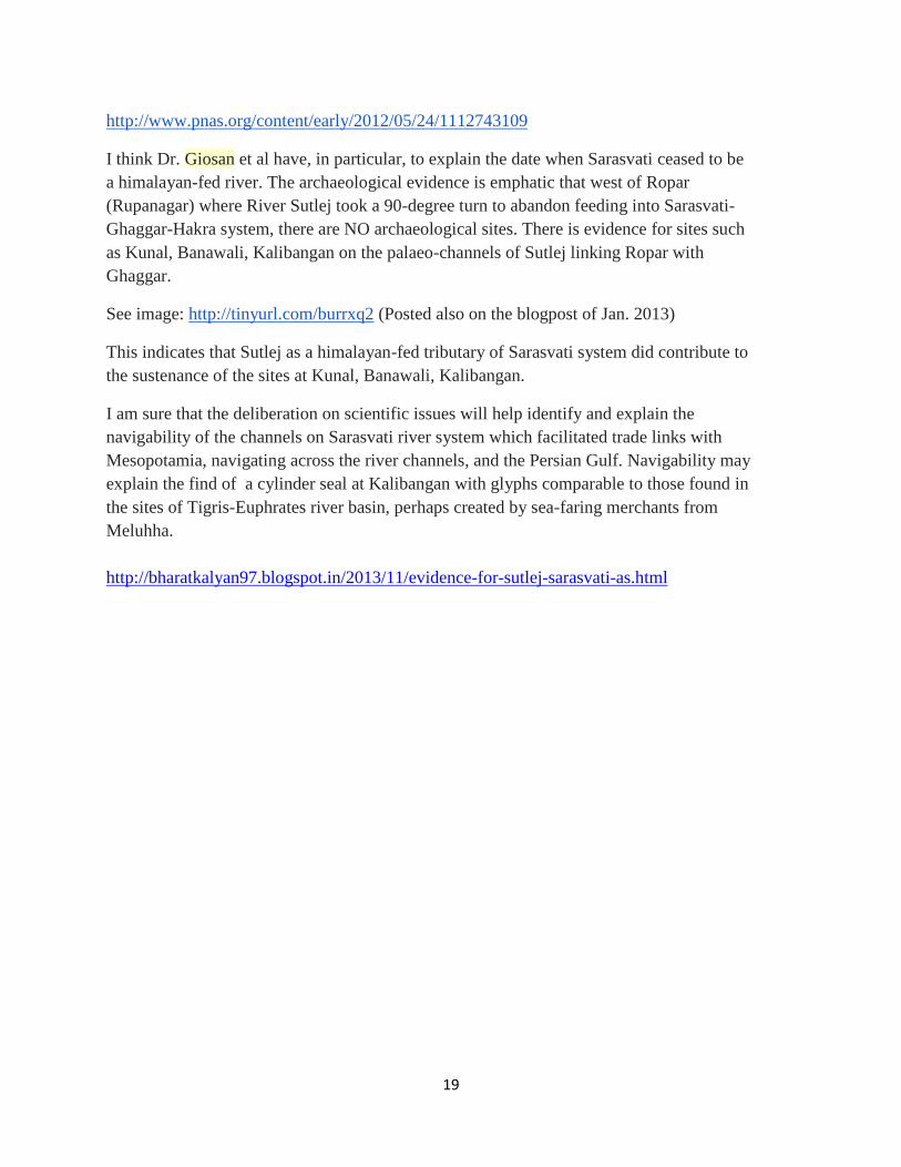
Sutlej en route to
Powari. http://farm9.static.flickr.com/8002/7203725524_8c034b82a7_m.jpg
Giosan et al should visit the Ropar (Rupnagar) Archaeological Museum which celebrates Ropar
as a 'Harappan' site. Why did the river Sutlej take 90 degree turn here? Where was it flowing,
southwards before this 90 degree turn?
This museum at Ropar is a cute, beautiful museum. I would strongly urge all researchers of
Sarasvati River basin and study of Hindu civilization history should visit this Museum and see
the Indus script seals excavated from the site and kept there. The excavations were carried out
by Dr. Y.D. Sharma of the Archaeological Survey of India."At Ropar excavations at the lowest
levels yielded Harappan traits belonging to Period 1. Findings include a steatite seal with Indus
scriptprobably used for trading goods, impressions of seals on a terracotta lump of
burnt clay, chert blades, copper implements, terracotta beads and bangles and typical
standardised pottery of the Indus Valley civilization. The earliest houses at Ropar were built with
river pebbles available in abundance but soon they made use of cut slabs of lime with the same
ratio of 4:2:1. Sun baked bricks were sometimes used in the
foundations." http://en.wikipedia.org/wiki/Rupnagar
18
Ropar 1,Text 9021(One side of the tablet has two incised circles;
the other side has three glyphs of Indus script).
The occurrence of this archaeological site at Ropar and its identification as an early Indus site
(Period 1) has to be evaluated in the context of geo-hydraulics of the times. Is it not notable that
there are no major site locations identified on the present-day banks of River Sutlej as it moves
westward to join River Beas? Maybe, during the 'mature' phases of the civilization, the path of
the river was NOT westward? It may be helpful if a comprehensive provenance study is carried
out on this stretch of River Sutlej, of the type of study done on Luni river system by Bajpai et al
(as mentioned by Prof. Valdiya).
Museum - Ropar
Archaeological Museum, Ropar (Punjab)
The Archaeological Museum is situated about 40 kms north east of Chandigarh on the
Rupnagar – Chandigarh highway on the bank of sutlej river. It was opened to public in the
year 1998.
Opened to public in the year 1998, the museum houses the archaeological remains of
excavated site near Ropar, the first Harappan site excavated in Independent India. The
excavation revealed a cultural sequence from Harappan to medieval times. Important
exhibits include antiquities of Harappan times, Painted Grey ware culture, Saka, Kushana,
Gupta times such as Vina Vadini (lady playing on vina), steatite seal, copper and bronze
implements, ring stone, yakshi image, gold coins of Chandragupta. Besides, the visitors
can have a glimpse of important protected monuments of Punjab, Haryana, Himachal
Pradesh and World Heritage monuments.
Timings of visit: 10.00 am to 5.00 pm.
Closed on - Friday
Entrance Fee: Rs. 2.00
(Children up to 15 years free) http://asi.nic.in/asi_museums_ropar.asp
Discussion
19
http://www.pnas.org/content/early/2012/05/24/1112743109
I think Dr. Giosan et al have, in particular, to explain the date when Sarasvati ceased to be
a himalayan-fed river. The archaeological evidence is emphatic that west of Ropar
(Rupanagar) where River Sutlej took a 90-degree turn to abandon feeding into Sarasvati-
Ghaggar-Hakra system, there are NO archaeological sites. There is evidence for sites such
as Kunal, Banawali, Kalibangan on the palaeo-channels of Sutlej linking Ropar with
Ghaggar.
See image: http://tinyurl.com/burrxq2 (Posted also on the blogpost of Jan. 2013)
This indicates that Sutlej as a himalayan-fed tributary of Sarasvati system did contribute to
the sustenance of the sites at Kunal, Banawali, Kalibangan.
I am sure that the deliberation on scientific issues will help identify and explain the
navigability of the channels on Sarasvati river system which facilitated trade links with
Mesopotamia, navigating across the river channels, and the Persian Gulf. Navigability may
explain the find of a cylinder seal at Kalibangan with glyphs comparable to those found in
the sites of Tigris-Euphrates river basin, perhaps created by sea-faring merchants from
Meluhha.
http://bharatkalyan97.blogspot.in/2013/11/evidence-for-sutlej-sarasvati-as.html