Notice of Panel Meeting - City of West Torrens
486
Notice of Panel Meeting NOTICE IS HEREBY GIVEN in accordance with Section 56A(19) of the Development Act 1993, that a meeting of the DEVELOPMENT ASSESSMENT PANEL of the CITY OF WEST TORRENS will be held in the George Robertson Room, Civic Centre 165 Sir Donald Bradman Drive, Hilton on TUESDAY, 9 AUGUST 2016 at 5.00 PM Terry Buss Chief Executive Officer City of West Torrens Disclaimer Development Assessment Panel Please note that the contents of this Development Assessment Panel Agenda have yet to be considered and deliberated by the Development Assessment Panel and officer recommendations may be adjusted or changed by the Development Assessment Panel in the process of making the formal Development Assessment Panel decision. Note: The plans contained in this agenda are subject to copyright and should not be copied without authorisation.
-
Upload
khangminh22 -
Category
Documents
-
view
3 -
download
0
Transcript of Notice of Panel Meeting - City of West Torrens

Notice of Panel Meeting
NOTICE IS HEREBY GIVEN in accordance with Section 56A(19) of the Development Act 1993, that a meeting of the
DEVELOPMENT ASSESSMENT PANEL
of the
CITY OF WEST TORRENS
will be held in the George Robertson Room, Civic Centre 165 Sir Donald Bradman Drive, Hilton
on
TUESDAY, 9 AUGUST 2016 at 5.00 PM
Terry Buss Chief Executive Officer City of West Torrens Disclaimer Development Assessment Panel Please note that the contents of this Development Assessment Panel Agenda have yet to be considered and deliberated by the Development Assessment Panel and officer recommendations may be adjusted or changed by the Development Assessment Panel in the process of making the formal Development Assessment Panel decision. Note: The plans contained in this agenda are subject to copyright and should not be copied without authorisation.

DEVELOPMENT ASSESSMENT PANEL 9 August 2016
I N D E X
1. MEETING OPENED ............................................................................................. 1
1.1 Evacuation Procedure .............................................................................. 1
2. PRESENT ............................................................................................................ 1
3. APOLOGIES ........................................................................................................ 1
4. CONFIRMATION OF MINUTES .......................................................................... 1
5. DISCLOSURE STATEMENTS ............................................................................. 1
6. REPORTS OF THE CHIEF EXECUTIVE OFFICER ............................................. 2
6.1 6 Surrey Road, KESWICK ......................................................................... 2
6.2 50 Davenport Tce, RICHMOND ............................................................... 33
6.3 22 Lindsay Street, CAMDEN PARK ...................................................... 126
6.4 26A Taylors Lane, MILE END ............................................................... 150
6.5 12 Netherby Avenue, PLYMPTON ........................................................ 167
6.6 39 Gladstone Road, MILE END ............................................................. 187
6.7 4 Arcoona Avenue, LOCKLEYS ........................................................... 230
6.8 20 Fulham Park Drive, LOCKLEYS ...................................................... 245
6.9 28 Selby Street, KURRALTA PARK ...................................................... 265
6.10 365A Marion Road, PLYMPTON ........................................................... 294
6.11 588-592 Henley Beach Road, FULHAM ................................................ 347
6.12 5 Lowry Street, FULHAM ...................................................................... 369
6.13 25 Kingswood Crescent, LOCKLEYS .................................................. 396
6.14 7 Ramsey Street, NETLEY .................................................................... 414
6.15 69 Gray Street, PLYMPTON .................................................................. 437
6.16 3 Hill Place, RICHMOND........................................................................ 449
6.17 5 & 7 Louise Avenue, FULHAM ............................................................ 471
7. CONFIDENTIAL REPORTS OF THE CHIEF EXECUTIVE OFFICER ............. 483
8. SUMMARY OF COURT APPEALS ................................................................. 483
8.1 Summary of Court Appeals .................................................................. 483
9. MEETING CLOSE ........................................................................................... 484

DEVELOPMENT ASSESSMENT PANEL 9 August 2016 Page 1 1. MEETING OPENED
1.1 Evacuation Procedure 2. PRESENT
3. APOLOGIES
4. CONFIRMATION OF MINUTES
RECOMMENDATION That the Minutes of the meeting of the Panel held on 12 July 2016 be confirmed as a true and correct record. 5. DISCLOSURE STATEMENTS
The following information should be considered by Development Assessment Panel Members prior to a meeting: Action to be taken prior to consideration of a matter Sections 2(4)(5) of the Minister's Code of Conduct - Section 21A of the Development Act 1993 requires that:
"If you consider that you have, or might reasonably be perceived to have an interest in the matter before the panel, you must clearly state the nature of that interest in writing to the presiding member before the matter is considered.
If you consider that you have a personal interest which may be in conflict with your public duty to act impartially and in accordance with the principles of the Act, you must declare a conflict of interest as above."
Action to be taken after making a declaration of interest: Section 2(6) of the Minister's Code of Conduct - Section 21A of the Development Act 1993 requires that:
"If you have an interest in a matter, you must not partake in any of the assessment processes involving the matter. You must leave the room at any time in which the matter is discussed by the panel including during the hearing of any representations or during any vote on the matter. You must not vote on the matter and you must not move or second any motion or participate in any discussion through the consensus process."
If an interest has been declared by any member of the panel, the presiding member must record the nature of the interest in the minutes of meeting.
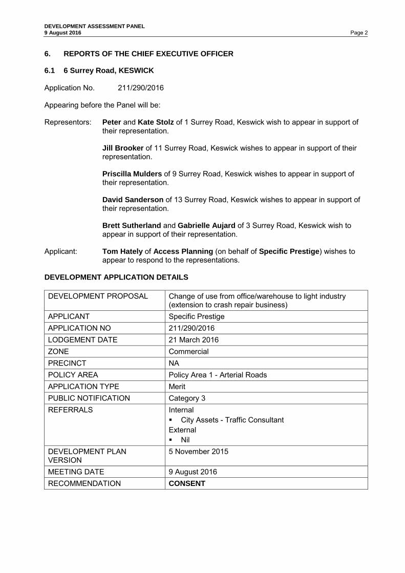
DEVELOPMENT ASSESSMENT PANEL 9 August 2016 Page 2 6. REPORTS OF THE CHIEF EXECUTIVE OFFICER
6.1 6 Surrey Road, KESWICK Application No. 211/290/2016 Appearing before the Panel will be: Representors: Peter and Kate Stolz of 1 Surrey Road, Keswick wish to appear in support of
their representation.
Jill Brooker of 11 Surrey Road, Keswick wishes to appear in support of their representation. Priscilla Mulders of 9 Surrey Road, Keswick wishes to appear in support of their representation. David Sanderson of 13 Surrey Road, Keswick wishes to appear in support of their representation. Brett Sutherland and Gabrielle Aujard of 3 Surrey Road, Keswick wish to appear in support of their representation.
Applicant: Tom Hately of Access Planning (on behalf of Specific Prestige) wishes to
appear to respond to the representations. DEVELOPMENT APPLICATION DETAILS DEVELOPMENT PROPOSAL Change of use from office/warehouse to light industry
(extension to crash repair business) APPLICANT Specific Prestige APPLICATION NO 211/290/2016 LODGEMENT DATE 21 March 2016 ZONE Commercial PRECINCT NA POLICY AREA Policy Area 1 - Arterial Roads APPLICATION TYPE Merit PUBLIC NOTIFICATION Category 3 REFERRALS Internal
City Assets - Traffic Consultant External Nil
DEVELOPMENT PLAN VERSION
5 November 2015
MEETING DATE 9 August 2016 RECOMMENDATION CONSENT

DEVELOPMENT ASSESSMENT PANEL 9 August 2016 Page 3 BACKGROUND
The development proposal is presented to the Development Assessment Panel (DAP) for the following reason/s:
• All Category 2 or 3 applications where a representor has requested to be heard shall be assessed and determined by the DAP.
RELATED APPLICATIONS
DA 211/979/2010 (110-112 Richmond Road, Keswick) Construct two openings between two buildings under different occupation; install four (4) complete refinishing system units (spray booths) with ancillary flues and provide new opening for vehicle access from Surrey Road for the carrying out of an Industry use (motor vehicle crash repairs). Development Approval granted 3 February 2011. DA 211/847/2015 (4 Surrey Road, Keswick) Construction of a workshop addition, alterations to existing workshop building, associated car parking area and demolition of existing outbuilding. Planning Consent granted 30 September 2015. SITE AND LOCALITY
The subject land is an allotment formally described as Allotment 19 filed plan 8229 in the area named Keswick, Hundred of Adelaide as contained in Certificate of Title Volume 5443 Folio 776. The land is more commonly known as 6 Surrey Road, Keswick. The subject land is a rectangular parcel of land, 696.77sqm in area with a frontage to the street of 15.24 metres. The land is relatively flat. The subject land contains a large building which has a total floor area of 549 square metres. The building has existing use rights as a warehouse and ancillary offices. Vehicle access exists from Surrey Road via a single crossover. The land has car parking in front of the building. A small area of landscaping is located at the front of the site. The locality has a mix of commercial, residential and educational uses (Richmond Primary School), with a strong commercial emphasis on the southern side of Richmond Road extending to the intersection with South Road (warehousing, offices, shops, motor repair stations, and a petrol station). To the eastern side of the subject land (and generally to the eastern side of Surrey Road) are low density residential land uses in the form of single storey dwellings. The locality and location of the subject land are shown on the following diagrams.

DEVELOPMENT ASSESSMENT PANEL 9 August 2016 Page 4

DEVELOPMENT ASSESSMENT PANEL 9 August 2016 Page 5

DEVELOPMENT ASSESSMENT PANEL 9 August 2016 Page 6 PROPOSAL
The proposal is for a change in use of the land formerly used as an office and warehouse to light industry (motor vehicle crash repairs). See Attachment 1 for a copy of the proposed plans and supporting documentation. The proposal is to use the existing building for additional working space for the business, and specifically for the storage, fitting and removal of aluminium motor vehicle panels. PUBLIC NOTIFICATION
The application is a Category 3 form of development pursuant to Section 38 and Schedule 9 of the Development Act and Regulations 1993 and the Procedural matters of the Commercial Zone. Properties notified: Twelve properties were notified during the public notification
process. Representations: Five representations were received. Persons wishing to be heard:
The following representors identified that they wish to address the Panel:
• Peter and Kate Stolz • Jill Brooker • Priscilla Mulders • David Sanderson • Brett Sutherland and Gabrielle Aujard
Summary of Representations:
Concerns were raised regarding the following matters; • Land use • Noise and air pollution • Traffic
The Applicant has provided a response to the representations, summarised as follows: • Commercial Zone - Principle of Development Control 1 nominates 'light industry' and motor-
related business (other than a wrecking yard) as envisaged uses in the zone. • No alterations to the existing building are proposed. • The chief purpose is for the storage of cars and aluminium parts. Repair work will be limited
to the fitting and removal of panels. • The applicant will restrict hours of operation to 8:00am to 5:30pm Monday to Friday. There
will be no after-hours or weekend work. • The existing roller door will be closed when work is occurring inside. • No spray painting will be undertaken on this site. • The proposal does not seek to increase the intensity of the current business, but rather to
assist in providing a more efficient workflow. An additional three (3) parking spaces (likely for staff) will be provided through use of this site.
• Deliveries to this site are not anticipated. They will continue to occur at 110-112 Richmond Road.
A copy of the representors' concerns and the applicant’s response is contained in Attachment 2.

DEVELOPMENT ASSESSMENT PANEL 9 August 2016 Page 7 REFERRALS
Internal City Assets - Traffic Consultant The application was referred to Council's Traffic Consultant to review and comment on traffic related matters associated with the proposed development. The consultant was initially concerned with car parking numbers and traffic movements; however these concerns may be overcome with certain conditions being placed on any approval granted. See Attachment 3 for a copy of both original and additional advice. ASSESSMENT
The subject land is located within the Commercial Zone, and more particularly Arterial Roads Policy Area 1 as described in the West Torrens Council Development Plan. The main provisions of the Development Plan which relate to the proposed development are as follows: General Section
Advertisements Objectives 1, 2 & 3
Principles of Development Control 1, 2, 3, 4, 5, 6, 7, 10, 11, 12, 14, 15 &16
Crime Prevention Objectives 1 Principles of Development Control 1, 2, 3, 4, 5, 6, 8 & 10
Design and Appearance Objectives 1
Principles of Development Control 1, 2, 3, 4, 5, 6, 7, 8, 9, 10, 11, 12 & 13
Interface between Land Uses Objectives 1 & 2 Principles of Development Control 1, 2, 4, 6, 7 & 8
Landscaping, Fences and Walls
Objectives 1 & 2 Principles of Development Control 1, 2, 3, 4, 5 & 6
Orderly and Sustainable Development
Objectives 1, 2, 3, 4 & 5 Principles of Development Control 1, 3, 5, 6, 7 & 8
Transportation and Access
Objectives 1, 2, 3, 4 & 5 Principles of Development Control 1, 8, 10, 11, 12, 13, 18, 20,
23, 24, 25, 26, 27, 28, 29, 30, 31, 33, 34, 35, 36, 37, 38, 39, 40 & 41
Zone: Commercial Objectives 1 & 2 Principles of Development Control 1 & 2 Policy Area: Arterial Road (Policy Area 1) Desired Character Statement: This policy area will accommodate a wide range of commercial and light industrial uses. It is envisaged that the appearance of commercial development within the policy area will be improved through the redevelopment and upgrading of existing development sites. Development site refers to the land which incorporates a development and all the features and facilities associated with that development, such as outbuildings, driveways, parking areas, landscaped areas, service yards and fences. Where a number of buildings or dwellings have shared use of such features and facilities, the development site incorporates all such buildings or dwellings and their shared features and facilities. Objectives 1 Principles of Development Control 1, 2

DEVELOPMENT ASSESSMENT PANEL 9 August 2016 Page 8 ASSESSMENT
In assessing the merits or otherwise of the application, the proposed development satisfies the relevant Development Plan provisions with the exception of the following, as discussed under the following sub headings: Interface between Land Uses The subject land is located on the edge of a Commercial Zone, with a Residential Zone on the opposite site of the road. An Industry Zone is located south, with the zone boundary intersecting a portion of the existing school grounds. It is evident that the locality contains a mix of land uses, including educational, commercial, light industrial, and residential. General Section - Interface between Land Uses talks about, inter alia, non-residential and residential uses and minimising negative impacts and potential conflict between land uses. The activities as described by the applicant's agent are considered not likely to detrimentally affect the amenity of the locality or cause unreasonable interference through noise, odour, vibration and the like. Vehicular Access Following advice from Council's traffic consultant, the Administration is satisfied that traffic impacts will be minimised through imposing conditions of consent such as preventing service vehicles from accessing the site, and that all vehicles should access and leave the site in a forwards direction, should the DAP approve the proposal. SUMMARY The Administration is satisfied that the proposal satisfies the majority of relevant Development Plan provisions particularly those contained in the Commercial Zone, and will not unreasonably impact the adjoining residential uses, notwithstanding some concerns of Council's traffic consultant. Having considered all the relevant Objectives and Principles of the Development Plan, the proposal is considered to be not seriously at variance with the Development Plan. On balance the proposed development sufficiently accords with the relevant provisions contained within the West Torrens Council Development Plan Consolidated 5 November 2015 and warrants Development Plan Consent. RECOMMENDATION
The Development Assessment Panel, having considered all aspects of the report, the application for consent to carry out development of land and pursuant to the provisions of the Development Act 1993 resolves to GRANT Development Plan Consent for Application No. 211/290/2015 by SPECIFIC PRESTIGE to undertake Change of use from office/warehouse to light industry (extension to crash repair business) at 6 Surrey Road, Keswick (CT 5443/776) subject to the following conditions of consent: Council Conditions 1. That the development shall be completed and operated in accordance with the plans and
information detailed in this application except where varied by any conditions listed below. 2. That the hours of operation of the subject land shall be between 8:00am to 5:30pm Monday
to Friday inclusively. 3. That service or delivery vehicles shall not directly access the site. 4. That vehicles shall enter and exit the site in a forward direction.

DEVELOPMENT ASSESSMENT PANEL 9 August 2016 Page 9
ATTACHMENT 1

DEVELOPMENT ASSESSMENT PANEL 9 August 2016 Page 10

DEVELOPMENT ASSESSMENT PANEL 9 August 2016 Page 11

DEVELOPMENT ASSESSMENT PANEL 9 August 2016 Page 12

DEVELOPMENT ASSESSMENT PANEL 9 August 2016 Page 13

DEVELOPMENT ASSESSMENT PANEL 9 August 2016 Page 14

DEVELOPMENT ASSESSMENT PANEL 9 August 2016 Page 15
ATTACHMENT 2

DEVELOPMENT ASSESSMENT PANEL 9 August 2016 Page 16

DEVELOPMENT ASSESSMENT PANEL 9 August 2016 Page 17

DEVELOPMENT ASSESSMENT PANEL 9 August 2016 Page 18

DEVELOPMENT ASSESSMENT PANEL 9 August 2016 Page 19

DEVELOPMENT ASSESSMENT PANEL 9 August 2016 Page 20
DEVELOPMENT ASSESSMENT PANEL 9 August 2016 Page 21

DEVELOPMENT ASSESSMENT PANEL 9 August 2016 Page 22

DEVELOPMENT ASSESSMENT PANEL 9 August 2016 Page 23

DEVELOPMENT ASSESSMENT PANEL 9 August 2016 Page 24

DEVELOPMENT ASSESSMENT PANEL 9 August 2016 Page 25

DEVELOPMENT ASSESSMENT PANEL 9 August 2016 Page 26

DEVELOPMENT ASSESSMENT PANEL 9 August 2016 Page 27

DEVELOPMENT ASSESSMENT PANEL 9 August 2016 Page 28

DEVELOPMENT ASSESSMENT PANEL 9 August 2016 Page 29
DEVELOPMENT ASSESSMENT PANEL 9 August 2016 Page 30
ATTACHMENT 3

DEVELOPMENT ASSESSMENT PANEL 9 August 2016 Page 31

DEVELOPMENT ASSESSMENT PANEL 9 August 2016 Page 32

DEVELOPMENT ASSESSMENT PANEL 9 August 2016 Page 33 6.2 50 Davenport Tce, RICHMOND Application No. 211/356/2016 Appearing before the Panel will be: Representors: Mr & Mrs Martin wish to appear in support of the representation. Applicant: A representative of Adelaide Workers Homes Inc. wishes to appear to
respond to the representation. DEVELOPMENT APPLICATION DETAILS DEVELOPMENT PROPOSAL Combined application for Land Division Creating Fifteen
(15) Community Titled Allotments; Demolition of existing buildings; and Construction of seven (7) two to four storey residential flat buildings comprising 240 dwellings and ancillary office, carparking, communal facilities, outbuildings, landscaping and access ways as a staged development over a period of 10 years
APPLICANT Adelaide Workers Homes Inc. APPLICATION NO 211/356/2016 LODGEMENT DATE 20 April 2016 ZONE Residential POLICY AREA 19 - Residential Medium Density APPLICATION TYPE Merit PUBLIC NOTIFICATION Cat 3 REFERRALS Internal
Civil External Nil
DEVELOPMENT PLAN VERSION
5 November 2015
MEETING DATE 9 August 2016 RECOMMENDATION CONSENT
BACKGROUND
The development proposal is presented to the Development Assessment Panel (DAP) for the following reason/s:
• All Category 2 or 3 applications where a representor has requested to be heard shall be
assessed and determined by the DAP. PREVIOUS or RELATED APPLICATION(S)
Nil

DEVELOPMENT ASSESSMENT PANEL 9 August 2016 Page 34 SITE AND LOCALITY
The land is regular in shape and made up of 8 allotments. It is bounded on three sides by public roads, Davenport Terrace to the north, Ellen Street to the west and Milner Road to the east. The land as a whole has a frontage to Davenport Terrace of approximately 175m and a depth of 110m giving an overall area of approximately 19,145m². There are currently 26 residential flat buildings on the site containing 70 dwellings, all of which are single storey in height. They share a common architecture with minor colour variations between buildings. These buildings have been positioned around the internal road network that has a spoked wheel design. Vehicular access to the land is gained by way of an existing double width crossover on Davenport Terrace. The allotment is flat and formally landscaped with grass and small shrubs and trees. There are no fences around or within the subject land providing for open and uninterrupted views. No easements are registered on the Certificates of Title, nor are there Regulated Trees situated on or about the land. The locality is primarily residential with exceptions being a café and hairdresser that can be found directly west of the subject site on the corner of Davenport Tce and Ellen Street and a warehouse south of the subject site on Ellen Street. Residential development is of varying densities, forms and heights. This variety is expected when residential land is zoned to accommodate infill development and gentrification happens over a period of time. Whilst residential development is primarily single storey in nature, several newer properties have been developed with two storey dwellings. In addition to the subject land being within Medium Density Policy Area 19, it is also within 400m of a Centre Zone. Keswick Creek is south of the site and takes the form of a man made flow path rather than a natural creek. The subject land and locality are situated within a flood zone shown to be inundated by 0.25 - 0.5m during a 1 in 100 year flood event. Overall, it is considered that the prevailing character of the locality provides a high level of amenity for its residents.

DEVELOPMENT ASSESSMENT PANEL 9 August 2016 Page 35

DEVELOPMENT ASSESSMENT PANEL 9 August 2016 Page 36
DEVELOPMENT ASSESSMENT PANEL 9 August 2016 Page 37 PROPOSAL
It is considered that the proposal is best described as follows: "Combined application for Land Division Creating Fifteen (15) Community Titled Allotments; Demolition of existing buildings; and Construction of seven (7) two to four storey residential flat buildings comprising 240 dwellings and ancillary office, carparking, communal facilities, outbuildings, landscaping and access ways as a staged development over a period of 10 years." The 240 new dwellings will be made up of:
- 27 studio apartments; - 73 one bedroom apartments; - 120 two bedroom apartments; - 5 three bedroom apartments; and - 15 three bedroom townhouses.
The land and buildings are owned and operated by Adelaide Worker's Homes Inc. a corporation that provides workmen and workwomen with dwellings at reasonable rental rates. In order to construct the new buildings, the existing buildings will need to be demolished. To minimise the impact on the current residents, this will be undertaken in stages. The first stage will include the removal of 35 existing dwellings and the construction of two (2) three storey residential flat buildings in their place. These two residential flat buildings include 72 new dwellings. This will provide enough accommodation for the existing residents whilst construction proceeds. There are seven (7) residential flat buildings proposed with the highest (Group C - 4 storeys) being located centrally within the land. The next tallest buildings (Group A, B, D and E - 3 storeys) will be located north of the four (4) storey building towards Davenport Terrace. The buildings in closest proximity to the adjoining dwellings south of the subject site will be two storeys in height. The three and four storey buildings will be serviced by lifts and stairs, whilst the two storey buildings will only have stairs. Dwellings on the ground floor will have areas of Private Open Space (POS) enclosed with a 1.8m high fence, whilst dwellings above ground level will have balconies that face into the subject land. This is in addition to the considerable amount of communal open space that includes BBQ areas, gardens and playgrounds. The development includes 263 carparks, 12 of which are for people with disabilities. In addition to this there will also be 27 motorbike parking spaces and bicycle storage in numerous locations around the property. All carparks are stated to comply with AS 2890.1. Each of the buildings will be serviced by a screened waste storage area in close proximity to the building that it serves. The buildings have been designed with a mixture of colours and materials including concrete, brick, glass, Colorbond and aluminium. As previously described the development is proposed to be staged. At this stage the Applicant has suggested a 10 year time frame, however this will be subject to the uptake of the new dwellings. Refer Attachment 1 & accompanying report at Attachment 4.

DEVELOPMENT ASSESSMENT PANEL 9 August 2016 Page 38 PUBLIC NOTIFICATION
The application is a Category 3 form of development pursuant to Section 38 and Schedule 9 of the Development Act and Regulations. Properties notified: 73 properties were notified during the public notification
process. Representations: One representation was received. Persons wishing to be heard:
One representor identified that they wish to address the Panel.
• Mr Martin
Summary of Representations:
Concerns were raised regarding the following matters; • Impact on on-street car parking; • Bulk and scale of the buildings; • Traffic generation; • Flooding issues; • Energy efficiency.
The Applicant has provided a response to the representation(s), as summarised below: • There is an oversupply of on-site parking and the minimal amount of crossovers (3),
maximises the availability of on-street parking; • The tallest buildings are set well back from property boundaries. • Car ownership amongst tenants is less than 50%. • Flooding issues have been mitigated through detailed stormwater design; and • The proposed dwellings will achieve the required 6 star energy rating. A copy of the representor's concern and the applicant’s response is contained in Attachments 2 & 3. REFERRALS
Internal City Assets Concerns were raised regarding the following matters: • Flooding potential of the under croft parking area; • Lack of detailed design of the stormwater management system; and • Lack of detailed design around the traffic and carpark layout. No concerns remain outstanding due to the inclusion of a reserved matter and conditions in the staff recommendation.

DEVELOPMENT ASSESSMENT PANEL 9 August 2016 Page 39 ASSESSMENT
The subject land is located within the Residential Zone, and more specifically Medium Density Policy Area 19 as described in the West Torrens Council Development Plan. The main provisions of the Development Plan which relate to the proposed development are as follows: General Section
Crime Prevention Objectives 1 Principles of Development Control 1, 2, 3, 4, 5, 6, 7, 8 & 10
Design and Appearance Objectives 2
Principles of Development Control 1, 2, 4, 5, 9, 10, 11, 12, 13, 14, 15, 17, 20, 21, 22 & 23
Energy Efficiency Objectives 1 & 2 Principles of Development Control 1, 2, 3 & 4
Hazards Objectives 1, 2, 4 & 7 Principles of Development Control 1, 2, 3, 4, 5, 6 & 7
Infrastructure Objectives 1, 2 & 3
Principles of Development Control 1, 2, 3, 4, 5, 6, 8, 9, 10, 11 & 12
Landscaping, Fences and Walls
Objectives 1 Principles of Development Control 1, 2, 3 & 4
Orderly and Sustainable Development
Objectives 1, 2, 3, 4 & 5 Principles of Development Control 1, 2, 3, 6 & 7
Residential Development
Objectives 1, 2, 3, 4 & 5 Principles of Development Control 1, 4, 5, 6, 7, 8, 9, 10, 11,
12, 18, 19, 20, 21, 22, 23, 24, 25, 26, 27, 28, 29, 30 & 31
Transportation and Access
Objectives 1, 2, 3, 4 & 5 Principles of Development Control 1, 2, 3, 4, 5, 6, 7, 8, 9, 10,
11, 12, 13, 14, 15, 16, 17, 18, 21, 22, 23, 24, 44, 45, 46 & 47
Zone: Residential Zone Desired Character Statement: This zone will contain predominantly residential development. There may also be some small-scale non-residential activities such as offices, shops, consulting rooms and educational establishments in certain locations. Non-residential activities will be complementary to surrounding dwellings. Allotments will be at very low, low and medium densities to provide a diversity of housing options in different parts of the zone. The range of allotment sizes will support the desired dwelling types anticipated in each policy area, and the minimum allotment sizes shall be treated as such in order to achieve the Desired Character for each policy area and, in turn, reinforce distinction between policy areas. Row dwellings and residential flat buildings will be common near centres and in policy areas where the desired density is higher, in contrast to the predominance of detached dwellings in policy areas where the distinct established character is identified for protection and enhancement. There will also be potential for semi-detached dwellings and group dwellings in other policy areas. Residential development in the form of a multiple dwelling, residential flat building or group dwelling will not be undertaken in a Historic Conservation Area.

DEVELOPMENT ASSESSMENT PANEL 9 August 2016 Page 40 Landscaping will be provided throughout the zone to enhance the appearance of buildings from the street as viewed by pedestrians, provide an appropriate transition between the public and private realm and reduce heat loads in summer. Objectives 1, 2, 3 & 4 Principles of Development Control 1, 3, 5, 7, 9, 10, 11, Policy Area: Medium Density Policy Area 19 Desired Character Statement: Allotments in this policy area will be at medium density, accommodating a range of dwelling types including semi-detached, row and group dwellings, as well as some residential flat buildings and some detached dwellings on small allotments. There will be a denser allotment pattern close to centre zones where it is desirable for more residents to live and take advantage of the variety of facilities focused on centre zones. New buildings will contribute to a highly varied streetscape. Buildings will be up to 2 storeys, except for allotments fronting Brooker Terrace, Marion Road and Henley Beach Road, and overlooking the Westside Bikeway, where buildings will be up to 3 storeys in height and provide a strong presence to streets. Garages and carports will be located behind the front facade of buildings. Development will be interspersed with landscaping, particularly behind the main road frontage, to enhance the appearance of buildings from the street as viewed by pedestrians, provide an appropriate transition between the public and private realm and reduce heat loads in summer. Objectives 1 Principles of Development Control 1, 2, 3 & 5 QUANTITATIVE ASSESSMENT
The proposal is assessed for consistency with the prescriptive requirements of the Development Plan as outlined in the table below. Due to the size of the proposal, I have only mentioned the related minimum or maximum where it is relevant. For example, where there is a variety of rear setbacks I have only listed the minimum in this table.
DEVELOPMENT PLAN
PROVISIONS
STANDARD ASSESSMENT
SITE AREA Medium Density Policy Area 19 PDC 4 or PDC 5 (within 400m of centre)
Within 400m of centre zone
Residential Flat Building
150m²(avg.) (19,145m² / 240)
80m² (avg.)
Does Not Satisfy
by 53%
SITE FRONTAGE Medium Density Policy Area 19 PDC 4 or PDC 5 (within 400m of centre)
Residential Flat Building 15m
(complete building)
390m
Satisfies

DEVELOPMENT ASSESSMENT PANEL 9 August 2016 Page 41 SITE COVERAGE Medium Density Policy Area 19 PDC 3
60% (max.)
28%
Satisfies
PRIMARY STREET SETBACK Medium Density Policy Area 19 PDC 3
3m (min.)
5m
Satisfies
SECONDARY STREET SETBACK Medium Density Policy Area 19 PDC 3
2m (min.)
7m
Satisfies
SIDE/REAR SETBACKS Residential Zone PDC 11
N/A
See secondary street setback
Medium Density Policy Area 19 PDC 3
Rear
6m (min.)
4m
Does Not Satisfy
BUILDING HEIGHT Medium Density Policy Area 19 PDC 3
2 storeys or 8.5m (all other locations)
4 storeys or 15m
Does Not Satisfy
INTERNAL FLOOR AREA Residential Development PDC 9
- Studio (where there is no separate bedroom), 37m²
(min.) 1 Bedroom, 50m² (min.) 2 Bedroom, 75m² (min.)
- 3+ Bedroom, 100m² (min.)
Studio = 45m² (Avg) 1 bed = 45m² (Avg) 2 bed = 65m² (Avg) 3bed = 80m² (Avg)
Does Not Satisfy
PRIVATE OPEN SPACE Residential Development PDC 19
<300m²
- 24m² (min.), of which 8m² may comprise balconies, roof patios and the like, provided
they have a minimum dimension of 2m.
-Minimum dimension 3m (excl. balconies).
- 16m² (min.) at the rear of side of dwelling, directly
accessible from a habitable room.
Dwellings located above
ground level Studio (where there is no separate bedroom), 0m² 1 Bedroom, 8m² (min.) 2Bedroom, 11m² (min.)
3+ Bedroom, 16m² (min.)
14m² (total) Minimum 3m (min. dimension) 14m² (accessed from
habitable room)
Does Not Satisfy
7m² (total) minimum 2m (min. dimension)
7m² (accessed from habitable room)
Does Not Satisfy

DEVELOPMENT ASSESSMENT PANEL 9 August 2016 Page 42 CARPARKING SPACES Transportation and Access PDC 34
Group dwellings and
Residential Flat Buildings - 2 car-parking spaces required, 1 of which is
covered + an additional 0.25 spaces
per dwelling
263 spaces provided
Satisfies
QUALITATIVE ASSESSMENT
In assessing the merits or otherwise of the application, the proposed development satisfies the relevant Development Plan provisions with the exception of the following, as discussed under the following sub headings: Site Area The site area calculation described in the Quantitative Table above has been worked out by dividing the area of the subject land by the amount of dwellings proposed. Whilst this has provided an average site area figure per dwelling, it does not take into account the different types of dwellings that can be included within a residential flat building. Studio's and single bedroom dwellings do not require the same amount of land as a three bedroom dwelling would. It should be noted that a three bedroom dwelling has the ability to accommodate the same number of occupants as three one bedroom dwellings, but would only need a site area of 150m² rather than 450m². As previously mentioned the 240 new dwellings will be made up of: - 27 studio apartments (one bedroom, but not separated from the living area); - 73 one bedroom apartments; - 120 two bedroom apartments; - 5 three bedroom apartments; and - 15 three bedroom townhouses. The vast majority of proposed dwellings fit into the one and two bedroom dwelling categories, with only 20 out 240 dwellings having three bedrooms. The 53% deficiency in site area sounds like a considerable amount, but considering the intended occupants and proposed shared facilities, it is not considered to be fatal to the application. Due to the proposal involving consolidated multistorey development rather than spread out single storey development, site coverage has been kept to a minimum. Setbacks The rear setback is the only setback that does not comply with what is prescribed in the Development Plan for this Zone and Policy Area. A minimum 6m setback requirement is described in Principle of Development Control (PDC) 3 of the Policy Area. The proposal seeks to have the dwellings closest to the rear (southern) boundary be set back a minimum 4m. This dimension has been taken from the verandah to the boundary. It should be noted that the wall of the dwelling will be setback 5.7m from the rear boundary. Had the verandah not been part of this application and applied for at a later date, there is no rear setback requirement for the verandah and could therefore potentially be built on the rear boundary. There are seven (7) properties south of the subject site on Ellen Street which back onto the development. One of these properties is the warehouse development which has been built to three of its boundaries, including the boundary of the subject site. For this reason there will be no impact to this property.

DEVELOPMENT ASSESSMENT PANEL 9 August 2016 Page 43 The remaining six (6) properties are used for residential purposes and all contain a detached dwelling and associated outbuildings. These dwellings have all been positioned well away from the rear boundary with many containing mature screening vegetation along the shared boundary. For the above reasons and as the residential flat buildings proposed closest to this shared boundary are only two storeys in height, the reduced setback is not considered fatal to the application. Height, Bulk and Scale PDC 3 of the Medium Density Policy Area 19 states that the maximum building height from natural ground level should not exceed two (2) storeys or 8.5m in height. The proposal seeks to have four (4) three storey buildings and one (1) four storey building. Whilst considerably higher than what is stated in the Development Plan, they will also be setback a minimum of 30m from the closest adjoining dwelling. An area of land the size of the subject property is unusual within a residential area, as the majority of allotments are considerably smaller and accommodate only one dwelling. It would not be possible to write a Development Plan with provisions that cover all circumstances. Generally speaking, a four storey dwelling on a standard residential allotment would cause a considerable impact on adjoining allotments through visual amenity as well as overshadowing. Given the proposed setbacks of the three and four storey buildings from adjoining properties, these factors are considered negligible or non-existent. The proposed height of the buildings proposed is one of the concerns raised by the representor. They feel that as the majority of Dwellings along Ellen St are single storey, then so too should the proposed buildings. Proposals for multiple story dwellings are often met with concerns about privacy and overlooking. The dwellings located closest to the southern boundary will all have obscured glazing to the sides and rear of the dwellings. Any balconies proposed will face towards the centre of the subject site or onto a public road to ensure that overlooking to adjoining properties is minimised or eliminated. Private Open Space (POS) There is a wide range of POS provided to each dwelling within this proposal. As would be expected, the dwellings on the ground floor are provided with the largest proportion of POS. This is accommodated within fenced yards with direct access from a habitable room. The upper level dwellings are provided with balconies with access from a habitable room. The smallest of these balconies has an area of 7m², which is 1m² below the minimum stated in the Development Plan for one bedroom dwellings. PDC 24 in the Residential Development Section of the Development Plan States:
Private open space may be substituted for the equivalent area of communal open space where: (a) at least 50 per cent of the communal open space is visually screened from public areas of the development (b) ground floor communal space is overlooked by habitable rooms to facilitate passive surveillance (c) it contains landscaping and facilities that are functional, attractive and encourage recreational use.
The proposal does contain a number of areas of communal open space such as:
- Private garden plots (734m²) and - Playgrounds and recreation space (721m²)

DEVELOPMENT ASSESSMENT PANEL 9 August 2016 Page 44 This is a considerable amount of communal space and averages out to an additional 6m² per dwelling. By adding this to the existing (minimum) 7m² provided to each dwelling it is considered that on balance the proposal meets the minimum requirements for POS. Internal Floor Area The Residential Section of the Development Plan states that buildings have minimum floor areas respective to the amount of bedrooms they contain. The table below lists the Development Plan requirement and what is proposed:
Number of bedrooms DP requirement Proposed 1 (no separate bedroom) 37m² 42m² 1 50m² 45m² 2 75m² 65m² 3+ 100m² 85m²
Apart from the studio dwellings, the proposal falls short on the minimum floor areas for dwellings above the ground floor. Despite this quantitative deficiency each of the proposed dwellings are self-contained and provide all of the normal facilities found in a dwelling such as laundries, bathrooms, storage, bedrooms, dining and living rooms. The rationale around minimum floor area figures provided in the Development Plan is unclear. So is commentary on how, by achieving these minimums, it will provide a high quality living environment. It is considered that a living environment is impacted by a number of factors such as facilities provided, access to natural light and air, POS and personal living choices. Housing choice is an important factor and is recognised in the Development Plan. The Desired Character of the policy area states that in close proximity to centre zones that it is desirable for more residents to live and take advantage of the variety of facilities focused on centre zones. The proposal seeks to increase the density near a centre zone that is located 250m away. On Balance, the deficiency of floor area for the proposed dwellings is not considered fatal to the application due to the reasons discussed above. Staging The Development Act 1993 allows for the staging of developments and also for the granting of extra time to complete developments. Due to the scale of this proposal the applicant has advised that they seek consent for staging of the development and extended time frames. At this time only the first stage has been defined:
It will involve the demolition of thirty five existing single storey dwellings and the erection in their stead of two x three storey residential flat buildings comprising 9 studio dwellings, 27 one bedroom dwellings, 33 two bedroom dwellings and 3 three bedroom dwellings for a total of 72 new dwellings. These dwellings are identified on the proposal plans as being within the Group D and E buildings, which are located at the western end of the subject land.
A reserved matter has been listed requiring full detail of staging and timelines prior to the granting of Development Approval for Stage 1. SUMMARY It is accepted that the proposal has a number of quantitative deficiencies to some of the relevant provisions of the Development Plan. However none of these deficiencies, individually or in combination, are considered to be fatal to the application. This is a unique site within a residential area and provides an opportunity for a unique development and considerable investment into the City of West Torrens.

DEVELOPMENT ASSESSMENT PANEL 9 August 2016 Page 45 Where there are deficiencies, it is considered that there are mitigating circumstances that overcome the perceived issue that the provision was written for. For example the maximum two storey building height would be unsuitable on a standard sized residential allotment, however on the subject site, the considerable setbacks from adjoining properties significantly reduces its visual impact, overlooking and overshadowing potential. Having considered all the relevant Objectives and Principles of the Development Plan, the proposal is considered to be not seriously at variance with the Development Plan. On balance the proposed development sufficiently accords with the relevant provisions contained within the West Torrens Council Development Plan Consolidated 5 November 2015 and warrants Development Plan Consent. RECOMMENDATION
The Development Assessment Panel, having considered all aspects of the report, the application for consent to carry out development of land and pursuant to the provisions of the Development Act 1993 resolves to GRANT Development Plan Consent for Application No. 211/356/2016 by Adelaide Workers homes INC to undertake the demolition of existing buildings and construction of seven (7) two to four storey residential flat buildings comprising 240 dwellings and ancillary office, car parking, communal facilities, outbuildings, landscaping and access ways as a staged development over a period of 10 years at 50 Davenport Tce, Richmond subject to the following reserved matters and conditions of consent; Reserved Matters The following information shall be submitted for further assessment and approval by the City of West Torrens as reserved matters under Section 33(3) of the Development Act 1993: 1. A detailed design, refined calculations and stormwater management provisions as based on
the Wallbridge and Gilbert report WAD120880Rep001 rev B. 2. A site plan demonstrating the ability for a MRV sized vehicle, having either through
movement and/or the ability to undertake a three point turn within the site, to service the nominated waste collection points.
3. Detailed staging plan and time line. Council Conditions 1. That the development shall be undertaken and completed in accordance with the plans and
information detailed in this application except where varied by any condition(s) listed below. 2. That the finished floor level shall be a minimum of 350mm above the highest point of the
watertable adjacent to the subject site. Reason: to prevent inundation during a flood event
3. All waste from the site shall be collected and disposed of by private contractors at the
property owner's expense. 4. The under croft access ramp shall comply with the relevant Australian Standard/s.

DEVELOPMENT ASSESSMENT PANEL 9 August 2016 Page 46 5. That all stormwater design and construction shall be in accordance with Australian
Standards and recognised engineering best practices to ensure that stormwater does not adversely affect any adjoining property or public road and for this purpose stormwater drainage shall not at any time:- a) Result in the entry of water into a building; or b) Affect the stability of a building; or c) Create unhealthy or dangerous conditions on the site or within the building; or d) Flow or discharge onto the land of an adjoining owner; and not flow across footpaths or
public ways. 6. That all driveways, parking and manoeuvring areas shall be formed (surfaced with
concrete, bitumen or paving) and properly drained, and shall be maintained in a reasonable condition at all times.
7. That all carparking spaces shall be linemarked, in accordance with the approved plans and
in accordance with Australian Standard 2890.1, 2004 Parking Facilities, Part 1, Off Street Carparking, prior to the occupation of the proposed development. Linemarking and directional arrows shall be clearly visible at all times.
8. That any driveways, parking and manoeuvring areas and footpaths shall be lit in
accordance with the Australian Standard 1158 during the hours of darkness that they are in use. Such lights shall be directed and screened so that overspill of light into nearby premises is avoided and minimal impact on passing motorists occurs.
9. That all landscaping shall be planted in accordance with the approved plans prior to the
occupancy of the development. Any person(s) who have the benefit of this approval shall cultivate, tend and nurture the landscaping, and shall replace any landscaping which may become diseased or die.
10. That the upper level windows of the dwellings immediately adjacent the southern property
boundary, shall be provided with fixed obscure glass to a minimum height of 1.7 metres above the upper floor level to minimise the potential for overlooking of adjoining properties, prior to occupation of the building. The glazing in these windows shall be maintained in a reasonable condition at all times.

DEVELOPMENT ASSESSMENT PANEL 9 August 2016 Page 47
ATTACHMENT 1

DEVELOPMENT ASSESSMENT PANEL 9 August 2016 Page 48

DEVELOPMENT ASSESSMENT PANEL 9 August 2016 Page 49

DEVELOPMENT ASSESSMENT PANEL 9 August 2016 Page 50

DEVELOPMENT ASSESSMENT PANEL 9 August 2016 Page 51

DEVELOPMENT ASSESSMENT PANEL 9 August 2016 Page 52

DEVELOPMENT ASSESSMENT PANEL 9 August 2016 Page 53

DEVELOPMENT ASSESSMENT PANEL 9 August 2016 Page 54

DEVELOPMENT ASSESSMENT PANEL 9 August 2016 Page 55

DEVELOPMENT ASSESSMENT PANEL 9 August 2016 Page 56
DEVELOPMENT ASSESSMENT PANEL 9 August 2016 Page 57

DEVELOPMENT ASSESSMENT PANEL 9 August 2016 Page 58

DEVELOPMENT ASSESSMENT PANEL 9 August 2016 Page 59

DEVELOPMENT ASSESSMENT PANEL 9 August 2016 Page 60

DEVELOPMENT ASSESSMENT PANEL 9 August 2016 Page 61

DEVELOPMENT ASSESSMENT PANEL 9 August 2016 Page 62

DEVELOPMENT ASSESSMENT PANEL 9 August 2016 Page 63

DEVELOPMENT ASSESSMENT PANEL 9 August 2016 Page 64

DEVELOPMENT ASSESSMENT PANEL 9 August 2016 Page 65

DEVELOPMENT ASSESSMENT PANEL 9 August 2016 Page 66

DEVELOPMENT ASSESSMENT PANEL 9 August 2016 Page 67

DEVELOPMENT ASSESSMENT PANEL 9 August 2016 Page 68

DEVELOPMENT ASSESSMENT PANEL 9 August 2016 Page 69

DEVELOPMENT ASSESSMENT PANEL 9 August 2016 Page 70

DEVELOPMENT ASSESSMENT PANEL 9 August 2016 Page 71

DEVELOPMENT ASSESSMENT PANEL 9 August 2016 Page 72

DEVELOPMENT ASSESSMENT PANEL 9 August 2016 Page 73

DEVELOPMENT ASSESSMENT PANEL 9 August 2016 Page 74

DEVELOPMENT ASSESSMENT PANEL 9 August 2016 Page 75

DEVELOPMENT ASSESSMENT PANEL 9 August 2016 Page 76

DEVELOPMENT ASSESSMENT PANEL 9 August 2016 Page 77

DEVELOPMENT ASSESSMENT PANEL 9 August 2016 Page 78

DEVELOPMENT ASSESSMENT PANEL 9 August 2016 Page 79

DEVELOPMENT ASSESSMENT PANEL 9 August 2016 Page 80
ATTACHMENT 2

DEVELOPMENT ASSESSMENT PANEL 9 August 2016 Page 81

DEVELOPMENT ASSESSMENT PANEL 9 August 2016 Page 82

DEVELOPMENT ASSESSMENT PANEL 9 August 2016 Page 83

DEVELOPMENT ASSESSMENT PANEL 9 August 2016 Page 84

DEVELOPMENT ASSESSMENT PANEL 9 August 2016 Page 85

DEVELOPMENT ASSESSMENT PANEL 9 August 2016 Page 86

DEVELOPMENT ASSESSMENT PANEL 9 August 2016 Page 87
ATTACHMENT 3

DEVELOPMENT ASSESSMENT PANEL 9 August 2016 Page 88

DEVELOPMENT ASSESSMENT PANEL 9 August 2016 Page 89

DEVELOPMENT ASSESSMENT PANEL 9 August 2016 Page 90

DEVELOPMENT ASSESSMENT PANEL 9 August 2016 Page 91

DEVELOPMENT ASSESSMENT PANEL 9 August 2016 Page 92
ATTACHMENT 4

DEVELOPMENT ASSESSMENT PANEL 9 August 2016 Page 93

DEVELOPMENT ASSESSMENT PANEL 9 August 2016 Page 94

DEVELOPMENT ASSESSMENT PANEL 9 August 2016 Page 95

DEVELOPMENT ASSESSMENT PANEL 9 August 2016 Page 96

DEVELOPMENT ASSESSMENT PANEL 9 August 2016 Page 97

DEVELOPMENT ASSESSMENT PANEL 9 August 2016 Page 98

DEVELOPMENT ASSESSMENT PANEL 9 August 2016 Page 99

DEVELOPMENT ASSESSMENT PANEL 9 August 2016 Page 100

DEVELOPMENT ASSESSMENT PANEL 9 August 2016 Page 101

DEVELOPMENT ASSESSMENT PANEL 9 August 2016 Page 102

DEVELOPMENT ASSESSMENT PANEL 9 August 2016 Page 103

DEVELOPMENT ASSESSMENT PANEL 9 August 2016 Page 104

DEVELOPMENT ASSESSMENT PANEL 9 August 2016 Page 105

DEVELOPMENT ASSESSMENT PANEL 9 August 2016 Page 106

DEVELOPMENT ASSESSMENT PANEL 9 August 2016 Page 107

DEVELOPMENT ASSESSMENT PANEL 9 August 2016 Page 108

DEVELOPMENT ASSESSMENT PANEL 9 August 2016 Page 109

DEVELOPMENT ASSESSMENT PANEL 9 August 2016 Page 110

DEVELOPMENT ASSESSMENT PANEL 9 August 2016 Page 111

DEVELOPMENT ASSESSMENT PANEL 9 August 2016 Page 112

DEVELOPMENT ASSESSMENT PANEL 9 August 2016 Page 113

DEVELOPMENT ASSESSMENT PANEL 9 August 2016 Page 114

DEVELOPMENT ASSESSMENT PANEL 9 August 2016 Page 115

DEVELOPMENT ASSESSMENT PANEL 9 August 2016 Page 116

DEVELOPMENT ASSESSMENT PANEL 9 August 2016 Page 117

DEVELOPMENT ASSESSMENT PANEL 9 August 2016 Page 118

DEVELOPMENT ASSESSMENT PANEL 9 August 2016 Page 119

DEVELOPMENT ASSESSMENT PANEL 9 August 2016 Page 120

DEVELOPMENT ASSESSMENT PANEL 9 August 2016 Page 121

DEVELOPMENT ASSESSMENT PANEL 9 August 2016 Page 122

DEVELOPMENT ASSESSMENT PANEL 9 August 2016 Page 123

DEVELOPMENT ASSESSMENT PANEL 9 August 2016 Page 124

DEVELOPMENT ASSESSMENT PANEL 9 August 2016 Page 125

DEVELOPMENT ASSESSMENT PANEL 9 August 2016 Page 126 6.3 22 Lindsay Street, CAMDEN PARK Application No. 211/351/2016 Appearing before the Panel will be: Representors: Mrs June Phillips wishes to appear in support of the representation. Mrs
Phillips will also be representing Suzanne Parslow. Applicant Mr George Majda wishes to appear to respond to representations. DEVELOPMENT APPLICATION DETAILS DEVELOPMENT PROPOSAL Combined Application Land division (DAC No.
211/C101/16 Unique ID 54820) to create two (2) additional allotments and construction of three (3) dwellings within a Residential Flat Building
APPLICANT State Surveys & George Majda & Associates APPLICATION NO 211/796/2016 (Combined Land Use & Land Division)
211/351/2016 (Original Land Use) LODGEMENT DATE 23 June 2016
211/796/2016 (Combined Land Use & Land Division) ZONE Residential POLICY AREA Medium Density Policy Area 18 APPLICATION TYPE Merit PUBLIC NOTIFICATION Category 2 REFERRALS Internal
City Assets
External Nil
DEVELOPMENT PLAN VERSION
05 May 2016
MEETING DATE 09 August 2016 RECOMMENDATION CONSENT
BACKGROUND
The development proposal is presented to the Development Assessment Panel (DAP) for the following reasons:
All Category 2 or 3 applications where a representor has requested to be heard shall be assessed and determined by the DAP.
PREVIOUS or RELATED APPLICATION(S)
Nil

DEVELOPMENT ASSESSMENT PANEL 9 August 2016 Page 127 SITE AND LOCALITY
The subject site fronts Lindsay Street, Camden Park and backs onto the Adelaide to Glenelg Tramline. The site measures 15.95 metres by 50.98 metres with a site area of approximately 807m². A 1.52 m width infrastructure easement exists in the south east corner of the land. The site contains an existing dwelling and outbuildings that will require demolition should the proposed development proceed. The site also contains a Regulated Tree that has been assessed as suitable for removal. The subject site is shown in Figure 1.
Figure 1 Subject Site
The immediate locality contains predominately single storey dwellings however it is noted that the Medium Density provisions that relate to the locality provide for a changed built form to emerge over time. The wider locality contains Cross Road, Anzac Highway and open space areas with the built form being predominately residential. Other notable land uses in the locality include a tram stop on the Glenelg to Adelaide tramline. The site and locality are shown in the following maps.

DEVELOPMENT ASSESSMENT PANEL 9 August 2016 Page 128

DEVELOPMENT ASSESSMENT PANEL 9 August 2016 Page 129

DEVELOPMENT ASSESSMENT PANEL 9 August 2016 Page 130 PROPOSAL
The proposed development involves a land division to create two (2) additional allotments and the construction of three (3) two storey dwellings within a Residential Flat Building. The dwellings will contain three bedrooms and a study on the upper level with kitchen, family living and car parking located on the lower level. The dwellings are internally oriented on the subject site with bedrooms overlooking the common driveway. Dwelling 1 will provide 188m² of living area, Dwelling 2 will provide 167m² of living area and Dwelling 3 will provide 196m² of living area. All dwellings will be provided with garage and alfresco areas. The land division will create allotments of: Allotment 701: 207m² Allotment 702: 156m² Allotment 703: 264m² Common Property (driveway): 180m² PUBLIC NOTIFICATION
The application is a Category 2 form of development pursuant to Section 38 and Schedule 9 of the Development Act and Regulations and Residential Zone, Procedural Matters. Properties notified: 5 properties were notified during the public notification process. Representations: Three (3) representations were received. Persons wishing to be heard:
2 representors identified that they wish to address or be represented at the Panel.
• Mrs June Philips • Suzanne Parslow (to be represented by Mrs Phillips)
Summary of Representations:
Concerns were raised regarding the following matters; • Out of character with existing development • Overshadowing • Overlooking • Tree Removal
The Applicant provided a written response to the representation which is outlined below: In response to the representations received, we are pleased to advise the following; Representor – Mrs June Philips – 2/20 Lindsay Street Camden Park 1. Council’s Development Policy promotes diversity in housing stock and as a result of infill
development ultimately the character of the streetscape will change. 2. Boundary fence – A proposed new 1800mm high Colorbond fence will replace the garage
wall / structures. Every endeavour will be undertaken to maintain security and privacy for the adjoining residents during the demolition process.
3. With the removal of the existing built structures along the western boundary and the proposed increased setback of the proposed new dwellings the status of the morning sunlight will be basically maintained.

DEVELOPMENT ASSESSMENT PANEL 9 August 2016 Page 131 4. Consideration has been given to the design of the proposed dwellings with the orientation of
the allotment on a North East / South West axis together with the generous setback from the Western boundary.
5. The design does not include any Balconies. Representor – Suzanne Parslow – 1/20 Lindsay Street Camden Park 1. Council’s Development Policy promotes diversity in housing stock and as a result of infill
development ultimately the character of the streetscape will change. 2. Every endevour of safety precautions will be undertaken during Demolition and Construction,
including temporary fencing to ensure privacy for the property owner. 3. Consideration has been given to the design of the proposed dwellings with the orientation of
the allotment on a North East / South West axis together with the generous setback from the Western boundary.
4. The Privacy Screens will act to maintain privacy and actually assist the reduction of heat gain, together with the double glazing proposed in order to achieve an Industry Standard minimum of 6 Stars.
5. The design does not include any balconies. The rear unit incorporates a flat roofed section over the single storey area below. No impact on privacy.
6. All trees located on the allotment have reached maturity and do not add any benefit to both the owner and adjacent neighbours - but will simply eliminate the amount of debris currently disposed into their properties.
Representor – Nicholas Myriti – 24 Lindsay Street Camden Park 1. Council’s Development Policy promotes diversity in housing stock and as a result of infill
development ultimately the character of the streetscape will change. 2. The design will only reduce the late afternoon sunlight from the South West direction. 3. The North East elevation of the units ( Elevation 2) shows the Upper level windows at a sill
height of 1700mm – a complying form of attained privacy in accordance with Council Policy A copy of the representor's concerns is contained in Attachment 2. REFERRALS
Internal City Assets Department Concerns were raised regarding the following matters: General Finished Floor Level (FFL) Consideration Council seeks to ensure that the FFL of all new development is protected from inundation when considering a 350mm stormwater flow depth in the adjacent street watertable. This is typically achieved through establishing the FFL of new development a minimum of 350mm above the highest adjacent street water table. In association with the above proposed development, no site or road verge level information has been provided and as such it is impossible to determine if the proposal will satisfy the above consideration.

DEVELOPMENT ASSESSMENT PANEL 9 August 2016 Page 132 Simply conditioning that a development satisfy this consideration can have its complications with regards to the ultimately required level of the development in relation to neighbouring properties and the related planning considerations this brings about. It may also bring about the necessity for alterations to the design of the development which are outside of the expectations of the applicant (for example; requiring step(s) up from existing buildings to additions). It is recommended that appropriate site and adjacent road verge survey information be provided to correctly assess the required minimum FFL for this proposal. Verge Interaction (with street tree)
In association with new development, driveways and stormwater connections through the road verge need to be located and shaped such that they appropriately interact with and accommodate existing verge features in front of the subject and adjacent properties. New driveways and stormwater connections are required to be located a minimum 1.0 metre offset from other existing or proposed driveways, stormwater connections, stobie poles, street lights, side entry pits and pram ramps, etc. (as measured at the front property boundary). These new features are also desired to be located a minimum of 2.0 metres from existing street trees, although a lesser offset may be acceptable in some circumstances. If an offset less than the desired 2.0 metres is proposed or if it is requested for the street tree to be removed, then assessment for the suitability of such will be necessary from Council’s Technical Officer (Arboriculture). It is recommended that revised plans indicating satisfaction to the above requirements should be provided to Council. It should also be nominated for the stormwater connection through the road verge area to be constructed of shape and material to satisfy Council’s standard requirements • 100 x 50 x 2mm RHS Galvanised Steel or • 125 x 75 x 2mm RHS Galvanised Steel or • Multiples of the above. Traffic Comments Traffic manoeuvrability has been assessed as acceptable for vehicles from all garages in accordance with the site layout shown in ‘Site Plan’ (George Majda Dwg D-524 received 08/04/16). However, vehicle manoeuvrability for visitor vehicles appear to be unsatisfactory in consideration of the requirements of the relevant Australian Standard (AS/NZS 2890.1:2004). This visitor parking space either should be deleted or the applicant should clearly demonstrate the compliance of manoeuvrability for critical parking spaces and movements using suitable techniques as outlined within AS/NZS 2890.1:2004. The plans currently before the DAP have been amended to satisfy the above requirements or alternatively conditions of consent are recommended. Arboriculture Assessment The subject tree appears free from major pests and diseases, however, a substantial amount of deadwood was noted within the canopy and foliage density is sparse- indicating tree health is not optimum. It is considered fully-grown in its current growing conditions and I believe it has reached the end of its useful life expectancy. Visible delamination of the two main stems is evident as large cracks extend longitudinally to ground level on both sides of the mains stem. Upon closer inspection it was determined that aggressive fungal decay has entered the heartwood and root plate of the subject tree, which has most likely jeopardized the structural integrity of the whole tree.

DEVELOPMENT ASSESSMENT PANEL 9 August 2016 Page 133 The visible separation of the two main stems represents a significant structural defect. It is considered likely that the failure of the two stems will ultimately occur as a result, causing significant property/ structural damage to the proposed dwellings. Large internal branches within the canopy are rubbing/ crossing several limbs. This has the potential to lead to decay and create further potential failure points within the crown. To remediate the obvious and visible defects identified throughout the tree would involve removing approximately 50% of live foliage. This will have a detrimental affect on tree health, damage its visual amenity and would not comply with Australian Standards for ‘Pruning of Amenity Trees (AS 4373-2007)’. Therefore, these defects cannot be remediated via approved arboricultural methods or techniques. Having given consideration to the plans provided, and issues associated with this tree I believe the applicant has provided supporting information that can be considered as satisfying the criteria required. I concluded that the tree represents an unacceptable risk to site users. There is no alternative but to remove the Allocasaurina cunninghamiana as soon as is practicably possible. External Nil ASSESSMENT
The subject land is located within the Residential Zone and more particularly Medium Density Policy Area 18, as described in the West Torrens Council Development Plan. The main provisions of the Development Plan which relate to the proposed development are as follows: General Section
Crime Prevention Objectives 1
Principles of Development Control 1, 2, 3, 4, 5, 6, 7, 8, 9 & 10
Design and Appearance
Objectives 2
Principles of Development Control 1, 2, 3, 4, 5, 6, 7, 8, 9, 10, 11, 12, 13, 14, 15, 16, 17, 18, 19 & 20
Energy Efficiency Objectives 1 & 2 Principles of Development Control 1, 2, 3 & 4
Hazards Objectives 1, 2, 3, 4, 5, 6, 7, 8, 9 &
10
Principles of Development Control 1, 2, 3, 4, 5, 6, 7, 8, 9, 10, 11, 12, 13, 14 & 15
Infrastructure Objectives 1, 2, 3, 4 & 5
Principles of Development Control 1, 2, 3, 4, 5, 6, 7, 8, 9, 10, 11 & 12

DEVELOPMENT ASSESSMENT PANEL 9 August 2016 Page 134
Land Division
Objectives 1, 2, 3 & 4
Principles of Development Control 1, 2, 3, 4, 5, 6, 7, 8, 9, 10, 11, 12, 13, 14, 15, 16, 17, 18, 19, 20 & 21
Landscaping, Fences and Walls
Objectives 1 & 2 Principles of Development Control 1, 2, 3, 4, 5 & 6
Orderly and Sustainable Development
Objectives 1, 2, 3, 4 & 5 Principles of Development Control 1, 2, 3, 4, 5, 6, 7 & 8
Regulated Trees Objectives 1 & 2 Principles of Development Control 1, 2 & 3
Residential Development
Objectives 1, 2, 3, 4 & 5 Principles of Development Control 1, 2, 3, 4, 5, 6, 7, 8, 9, 10,
11, 12, 13, 14, 15, 16, 17, 18, 19, 20, 21, 22, 23, 24, 25, 26, 27, 28, 29, 30, 31, 32, 33, 34, 35, 36, 37, 38, 39, 40, 41, 42, 43, 44, 45, 46, 47, 48, 49, 50, 51, 52, 53, 54, 55 & 56
Siting and Visibility Objectives 1 Principles of Development Control 1, 2, 3, 4, 5, 6, 7 & 8
Transportation and Access
Objectives 1, 2, 3, 4 & 5 Principles of Development Control 1, 2, 3, 4, 5, 6, 7, 8, 9, 10,
11, 12, 13, 14, 15, 16, 17, 18, 19, 20, 21, 22, 23, 24, 25, 26, 27, 28, 29, 30, 31, 32, 33, 34, 35, 36, 37, 38, 39, 40 & 41
Zone: Residential Zone Desired Character Statement (extract); This zone will contain predominantly residential development. There may also be some small-scale non-residential activities such as offices, shops, consulting rooms and educational establishments in certain locations. Non-residential activities will be complementary to surrounding dwellings. Allotments will be at very low, low and medium densities to provide a diversity of housing options in different parts of the zone. The range of allotment sizes will support the desired dwelling types anticipated in each policy area, and the minimum allotment sizes shall be treated as such in order to achieve the Desired Character for each policy area and, in turn, reinforce distinction between policy areas. Row dwellings and residential flat buildings will be common near centres and in policy areas where the desired density is higher, in contrast to the predominance of detached dwellings in policy areas where the distinct established character is identified for protection and enhancement. There will also be potential for semi-detached dwellings and group dwellings in other policy areas. Landscaping will be provided throughout the zone to enhance the appearance of buildings from the street as viewed by pedestrians, provide an appropriate transition between the public and private realm and reduce heat loads in summer.

DEVELOPMENT ASSESSMENT PANEL 9 August 2016 Page 135 Objectives 1 A residential zone comprising a range of dwelling
types, including a minimum of 15 per cent affordable housing. 2 Dwellings of various types at very low, low and medium densities. 3 Increased dwelling densities in close proximity to centres, public transport routes and public open spaces. 4 Development that contributes to the desired character of the zone.
Principles of Development Control 1 The following forms of development are envisaged in the zone: ▪ affordable housing ▪ domestic outbuilding in association with a dwelling ▪ dwelling ▪ dwelling addition ▪ small scale non-residential use that serves the local community, for example: - child care facility - health and welfare service - open space - primary and secondary school - recreation area - shop measuring 250 square metres or less in gross leasable floor area ▪ supported accommodation. 5 Development should not be undertaken unless it is consistent with the desired character for the zone and policy area. 7 Dwellings should be set back from allotment or site boundaries to: (a) contribute to the desired character of the relevant policy area (b) provide adequate visual privacy by separating habitable rooms from pedestrian and vehicle movement. 10 Dwelling setbacks from side and rear boundaries should be progressively increased as the height of the building, (with the total wall height of the building being measured from the existing ground level at the boundary of the adjacent property as shown by Figure 1), increases to: (a) minimise the visual impact of buildings from adjoining properties (b) minimise the overshadowing of adjoining properties.

DEVELOPMENT ASSESSMENT PANEL 9 August 2016 Page 136
12 Side boundary walls in residential areas should be limited in length and height to: (a) minimise their visual impact on adjoining properties (b) minimise the overshadowing of adjoining properties. 13 Except where otherwise specified by a policy area, side boundary walls comply with the following: (a) side boundary walls should be located immediately abutting the wall of an existing or simultaneously constructed building on the adjoining site and constructed to the same or to a lesser length and height (b) side boundary walls: (i) should have a maximum vertical wall height of 3 metres (ii) should have a maximum length of 8 metres (iii) should be constructed along one side of the allotment only and no further than 14 metres from the front boundary (c) where there is an existing adjacent boundary wall which is setback greater than 1 metre from the front setback standard established for the rest of the street, side boundary walls should be located not more than 1 metre closer to the primary street frontage.
Policy Area: Medium Density 18 DESIRED CHARACTER (extract) Allotments in this policy area will be at medium density, accommodating a range of dwelling types including semi-detached, row and group dwellings, as well as some residential flat buildings and some detached dwellings on small allotments. There will be a denser allotment pattern close to centre zones where it is desirable for more residents to live and take advantage of the variety of facilities focused on centre zones. Objectives 1 The following forms of development are
envisaged in the policy area: ▪ affordable housing ▪ detached dwelling ▪ domestic outbuilding in association with a dwelling ▪ domestic structure ▪ dwelling addition ▪ group dwelling ▪ residential flat building ▪ row dwelling ▪ semi-detached dwelling ▪ small scale non-residential use that serves the local community, for example: - child care facility - open space - recreation area - shop, office or consulting room ▪ supported accommodation.

DEVELOPMENT ASSESSMENT PANEL 9 August 2016 Page 137 Principles of Development Control 1 Development should not be undertaken unless it
is consistent with the desired character for the policy area. 4 Medium density development that achieves gross densities of between 23 and 45 dwellings per hectare (which translates to net densities of between 40 and 67 dwellings per hectare, where net density can be calculated by dividing 10000 by the site area and multiplying that number by the number of proposed dwellings for the site) should be in the form of 2 to 4 storey buildings.
QUANTITATIVE ASSESSMENT The proposal is assessed for consistency with the prescriptive requirements of the Development Plan as outlined in the table below. DEVELOPMENT PLAN PROVISIONS
STANDARD ASSESSMENT
SITE AREA PDC 6 Medium Density Policy Area
150m² Allotment 701: 207m² Allotment 702: 156m² Allotment 703: 264m² Common Property: 180m² Satisfies
SITE FRONTAGE PDC 6 Medium Density Policy Area
15 m 15.93m (existing) Satisfies
SITE COVERAGE PDC 5 Medium Density Policy Area
70% Satisfies
STREET SETBACK PDC 5 Medium Density Policy Area
3 metres 3m Satisfies
SIDE/REAR SETBACKS PDC 11 Residential Zone PDC 5 Medium Density Policy Area
Side 1.0 m ground level (up to 3m wall height) 2.0m upper level (up to 6m wall height)
Dwelling 1 1.0m (northern ground level boundary) 5.3m (southern ground level boundary) 1.0m (northern upper level boundary) 4.5m (southern upper level boundary) Partly Satisfies

DEVELOPMENT ASSESSMENT PANEL 9 August 2016 Page 138 DEVELOPMENT PLAN PROVISIONS
STANDARD ASSESSMENT
Dwelling 2 1.0m (northern ground level boundary) 5.0m (southern ground level boundary) 1.0m (northern upper level boundary) 4.4m (southern upper level boundary) Partly Satisfies Dwelling 3 0.0m (northern ground level boundary) 5.3m (southern ground level boundary) 2.0m (northern upper level boundary) 2.9m (southern upper level boundary) Partly Satisfies
Rear 4m
1.0m (at closest point) Not Satisfied
PRIVATE OPEN SPACE Council Wide PDC 19 Council Wide PDC 20
24 m² Minimum dimension of 3 metres
Satisfies
CARPARKING SPACES Council Wide PDC 34 (Transportation & Access) Table WeTo/2
2 car-parking spaces required per dwelling (1 covered) and 0.25 additional spaces per dwelling 7 spaces
7 spaces Satisfies
BUILDING HEIGHT PDC 5 Medium Density Policy Area
Three storey or 12.5 maximum
Satisfies

DEVELOPMENT ASSESSMENT PANEL 9 August 2016 Page 139 QUALITATIVE ASSESSMENT In assessing the merits or otherwise of the application, the proposed development generally satisfies the relevant Development Plan provisions with the following comments provided: Siting The proposed development is generally consistent with front and rear setbacks identified in the Development Plan; however it does include boundary development on the northern allotment boundary that is inconsistent with the Development Plan. This garage boundary wall is located towards the rear of the site away from the dwelling on the adjacent land and has a length of 8.6m at the ground level which is marginally above what the Development Plan considers. The rear setback also does not meet the Development Plan requirements however given this boundary is adjacent the Tramline this departure is not likely to result in negative impacts. Bulk and Scale While the dwellings are oriented internally to the site, the primary façade to Lindsay Street has attempted to address the primary street frontage. The building design has attempted to break up wall areas fronting Lindsay Street through the use of different materials, finishes and articulation. It is noted that the subject site could have been developed for a three storey building up to a height of 12.5 metres. The height of the proposed development is lower than the Development Plan allows and overall it is considered that the bulk and scale of the proposed building is reasonable. Overlooking and Overshadowing The proposed development includes window sill heights of 1.7 metres on the upper level northern elevation. The southern elevation windows which overlook the common driveway are proposed to have an aluminium privacy screen to a height of 1.5 metres. It is considered that the screens should be installed to a height if 1.7 metre to be consistent with the Development Plan provisions and a recommended condition of consent has been included to deal with this issue. The subject site comprises an allotment that is oriented broadly north/south and the upper storey is setback 4.5 metres (southern boundary) and 2.0 metres (northern boundary). On this basis it is expected that adjoining land owners will maintain access to sunlight consistent with the provisions in the Development Plan that call for north-facing windows to habitable rooms of existing dwelling(s) on adjacent allotments, to receive at least three (3) hours of direct sunlight over a portion of their surface between 9.00 am and 5.00 pm on the 21 June. Visual Impact on Neighbouring Developments & Streetscape The proposed development is oriented towards the common driveway and not its primary frontage of Lindsay Street. As outlined above the building design has attempted to break up wall areas fronting Lindsay Street through the use of different materials, finishes and articulation. Landscaping is proposed on the Lindsay Street frontage as is a 1.8 metre colorbond fence for a portion of the Lindsay Street frontage. It is considered that the development would have a stronger relationship to the street if the landscaping on this frontage was increased and the length of colorbond fence was reduced in the order of 1.5 metres to be located to end in line with the adjacent wall. A condition of consent has been included to address this issue. Regulated & Significant Trees The proposed development should it proceed will require the removal of an existing regulated tree. The tree has been inspected by Council's independent arborist and has been recommended for removal as it presents an unacceptable risk.

DEVELOPMENT ASSESSMENT PANEL 9 August 2016 Page 140 Landscape Assessment An indicative landscaping schedule has been provided as part of the development application and the areas of landscaping have been included in the site plan. Landscaping will be contained within the front setback area, adjacent the common driveway and adjacent the proposed visitor space. Each dwelling will also have its own private open space that can be landscaped. Land Division Council Wide provisions that relate to Land Division include:
Objective 2 Land division that creates allotments appropriate for the intended use. Objective 5 Land division should result in allotments of a size suitable for their intended use.
The proposed allotments will meet the recommended site area and are considered suitable for their intended use for residential development. SUMMARY The proposed development involving a land division to create two (2) additional allotments and the construction of three (3) two storey dwellings within a Residential Flat Building within the Residential Zone and Policy Area 18 is considered an appropriate land use. In particular given the proximity to public transport, medium density development on this site is considered desirable. The application underwent Category 2 notification with three representations being received. Issues raised were that the development was out of character with existing development in this locality, potential for overshadowing and overlooking and requirement of tree removal. While it is acknowledged that the development is somewhat out of character with the existing built form (single storey dwellings) in this locality it is noted that the medium density policies in the Development Plan seek to change that character over time and the proposed development is consistent with the desired character. Minimum levels of sunlight to adjoining land will be provided and the potential for overlooking is dealt with by the provision of privacy screens on the proposed development and a condition of consent to require the screens to a minimum height of 1.7 metres. Having considered all the relevant Objectives and Principles of the Development Plan, the proposal is considered to be not seriously at variance with the Development Plan. On balance the proposed development sufficiently accords with the relevant provisions contained within the West Torrens (City) Development Plan Consolidated 05 May 2016 and warrants the granting of Development Plan Consent & Land Division Consent. RECOMMENDATION
The Development Assessment Panel, having considered all aspects of the report, the application for consent to carry out development and division of land and pursuant to the provisions of the Development Act 1993 resolves to GRANT Development Plan Consent & Land Division Consent for Application No. 211/114/2016 by State Surveys to undertake a Community Title land division (DAC No. 211/C101/16 Unique ID 54820); creating two (2) additional allotments and construction of three (3) two storey dwellings within a Residential Flat Building at 22 Lindsay Street Camden Park (CT 5113/207) subject to the following conditions:

DEVELOPMENT ASSESSMENT PANEL 9 August 2016 Page 141 Council Conditions DEVELOPMENT PLAN CONSENT 1. The development must be undertaken and completed in accordance with the plans and
information detailed in this application except where varied by any condition(s) listed below. 2. The construction of a drainage system and the position and manner of discharge of a
stormwater drain must not at any time:- a) Result in the entry of water into a building; or b) Affect the stability of a building; or c) Create unhealthy or dangerous conditions on the site or within the building; or d) Flow or discharge onto the land of an adjoining owner; and not flow across footpaths or
public ways. 3. All driveways, parking and manoeuvring areas must be formed, surfaced with concrete,
bitumen or paving, and be properly drained. They must be maintained to the reasonable satisfaction of Council thereafter.
4. All planting and landscaping must be completed within 3 months of the commencement of
the use of this development and must be maintained to the reasonable satisfaction of Council. Any plants that become diseased or die must be replaced with suitable species.
5. The upper level windows of the dwelling must be provided with privacy screens to a
minimum height of 1.7 metres above the upper floor level to minimise the potential for overlooking of adjoining properties, prior to occupation of the building. The privacy screens are to be maintained at all times to the reasonable satisfaction of Council.
6. The finished floor level must be a minimum of 350mm above the highest point of the
watertable adjacent to the property 7. The length of colorbond fence on the Lindsay Street boundary to be reduced in length by 1.5
metres to be located in line with the adjacent dwelling wall. LAND DIVISION CONSENT 1. The development must be undertaken and completed in accordance with the plans and
information detailed in this application except where varied by any condition(s) listed below. 2. Prior to the issue of clearance to this division approved herein, the existing outbuilding(s)
from proposed lots must be removed. Agency Conditions 1. Payment of $12,976.00 into the Planning and Development Fund (2 allotment(s) @
$6,488.00/allotment). Payment may be made by credit card via the internet at www.edala.sa.gov.au or by phone (71097018), by cheque payable to the Development Assessment Commission marked “NOT NEGOTIABLE” and sent to GPO Box 1815, Adelaide, 5001 or in person, at Ground Floor, 101 Grenfell Street, Adelaide.
2. A final plan complying with the requirements for plans as set out in the Manual of Survey
Practice Volume 1 (Plan Presentation and Guidelines) issued by the Registrar General to be lodged with the Development Assessment Commission for Land Division Certificate purposes.

DEVELOPMENT ASSESSMENT PANEL 9 August 2016 Page 142
ATTACHMENT 1

DEVELOPMENT ASSESSMENT PANEL 9 August 2016 Page 143

DEVELOPMENT ASSESSMENT PANEL 9 August 2016 Page 144

DEVELOPMENT ASSESSMENT PANEL 9 August 2016 Page 145

DEVELOPMENT ASSESSMENT PANEL 9 August 2016 Page 146
ATTACHMENT 2

DEVELOPMENT ASSESSMENT PANEL 9 August 2016 Page 147

DEVELOPMENT ASSESSMENT PANEL 9 August 2016 Page 148
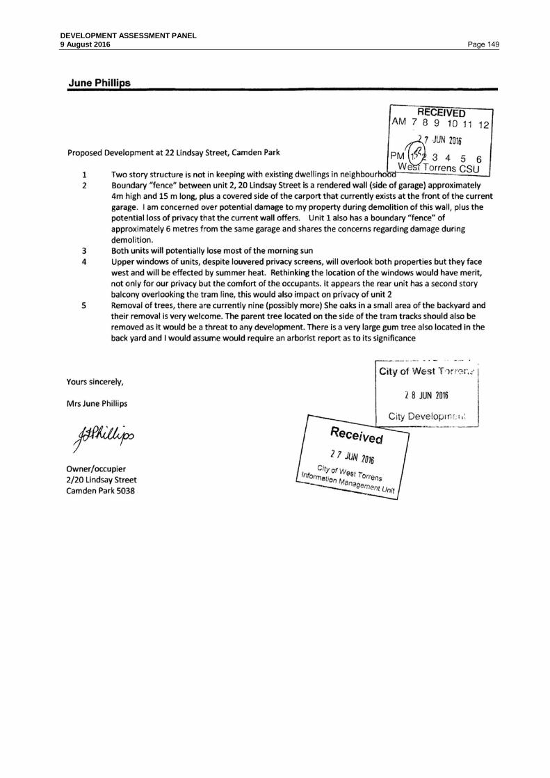
DEVELOPMENT ASSESSMENT PANEL 9 August 2016 Page 149

DEVELOPMENT ASSESSMENT PANEL 9 August 2016 Page 150 6.4 26A Taylors Lane, MILE END Application No. 211/177/2016 Appearing before the Panel will be: Representors: R M Sbrogio wishes to appear in support of the representation. Applicant/s: Phil Squeo of Stannard Family Homes wishes to appear to respond to the
representations. DEVELOPMENT APPLICATION DETAILS DEVELOPMENT PROPOSAL Construction of a two-storey dwelling with garage under
main roof APPLICANT Stannard Family Homes APPLICATION NO 211/177/2015 LODGEMENT DATE 24 February 2016 ZONE Residential POLICY AREA Thebarton Character Policy Area 27 APPLICATION TYPE Merit PUBLIC NOTIFICATION Category 2 REFERRALS Internal
City Assets External Nil
DEVELOPMENT PLAN VERSION
05 November 2015
MEETING DATE 09 August 2016 RECOMMENDATION CONSENT
BACKGROUND
The development proposal is presented to the Development Assessment Panel (DAP) for the following reason:
• All Category 2 or 3 applications where a representor has requested to be heard shall be assessed and determined by the DAP.
PREVIOUS or RELATED APPLICATION(S)
211/304/2009 (211/D021/2009) Torrens Title Land Division - approved

DEVELOPMENT ASSESSMENT PANEL 9 August 2016 Page 151 SITE AND LOCALITY
The subject land is located on the northern side of Taylors Lane, Thebarton. The subject site has a frontage of 9.19m to Taylors Lane and a depth of 28.52m with a total site area of approximately 260m². The land is currently vacant following a division of the land. Taylors Lane is located between Rose Street and Henley Beach Road and fronts the rear of commercial development fronting Henley Beach Road (Urban Corridor Zone). The land uses fronting Henley Beach Road are commercial and generally have their car parking adjacent or accessed from Taylors Lane. Taylors Lane currently contains a mix of residential and commercial activities and the locality is heavily influenced by the car parking areas associated with commercial development of the rear fencing/storage of these commercial activities. The subject site is located directly opposite a car park entrance/exit. Taylors Lane is a low speed traffic environment that is significantly narrower than surrounding public streets. The site and locality are shown on the following photos and maps.
Figure 1: Subject site, Commercial Land Use to the south and existing outbuilding on neighbouring land to the west

DEVELOPMENT ASSESSMENT PANEL 9 August 2016 Page 152
Figure 2: Locality map

DEVELOPMENT ASSESSMENT PANEL 9 August 2016 Page 153
Figure 3: Subject Site
PROPOSAL
The proposed development consists of the construction of a two-storey dwelling with garage under main roof and associated site works including landscaping. Refer Attachment 1. PUBLIC NOTIFICATION
The application is a Category 2 form of development pursuant to Section 38 and Schedule 9 of the Development Act and Regulations and the Residential Zone and Thebarton Character Policy Area, Procedural Matters Section of the West Torrens Council Development Plan. Properties notified: 6 properties were notified during the public notification
process. Representations: 1 representation was received. Persons wishing to be heard:
R M Sbrogio identified a wish to address the Panel.
Summary of Representations:
Concerns were raised regarding the following matters; • Visual privacy • Overshadowing • Future development opportunities • Tree damage • Materials

DEVELOPMENT ASSESSMENT PANEL 9 August 2016 Page 154 While the Applicant did not respond directly to the representor's issues the proposed plans have been amended to address some of the issues raised. Amendments to the proposed plans have included increased setbacks for part of the upper storey, modifications to the dwelling frontage, provision of additional landscaping and changes to some of the materials of construction. The applicant has provided information on the tree contained within the adjacent allotment following a request from Council as to whether it constituted a Regulated Tree. The applicant has provided a photo of a measurement of the tree with its circumference at 1.9 metres. Council staff contacted the adjoining site owner (Mr Sbrogio) who confirmed that this measurement occurred when he was present. The application is proceeding on the basis that the tree on the adjacent allotment is not a regulated tree. Issues of overlooking, overshadowing and materials are addressed as part of the assessment of the application. A copy of the representor's concerns is contained in Attachment 2. REFERRALS
Internal City Assets Concerns were raised regarding the following matters: General Finished Floor Level (FFL) Consideration • Based on the survey information provided on the ‘Site Plan’, (Standard Family Homes
drawing no. 26ATayL-PA received on 23/012/16), a minimum FFL of 100.30 would be required. It is recommended that revised plans indicating the required minimum FFL be provided to Council.
Garage Dimensions and Setback • The internal garage length is currently proposed as 5.40m. Although not specified in the
relevant Australian Standards (AS/NZS 2890.1:2004), traffic engineering best practice recommends that the minimum internal length of an enclosed garage or enclosed carport space should be a minimum of 5.8m. It is recommended that revised plans be submitted, showing a garage with an internal length of 5.8m.
Verge Interaction
• It should be noted that easements were established as part of the subdivision works for
drainage to discharge into Rose Street. However in this instance, it is recommended that the new storm water connection can be established in Taylor's Lane.
Plans before the DAP have been amended to satisfy the above requirements..
Local Heritage Advisor While the development site does not contain a local heritage item and it is not located in a Heritage Zone or Policy Area, it is located in the Character Policy Area and given a key element of the proposed development was its two storey nature and representation to the street, the Council Heritage Advisor was requested to review the design of the dwelling and its impact on local character.

DEVELOPMENT ASSESSMENT PANEL 9 August 2016 Page 155 Mr Alexander indicted that: The Desired Character of Thebarton Character Policy Area 27 anticipates a predominant single storey character, with some two storey buildings designed in a manner that is complementary to the single storey character of nearby buildings. New development is expected to contribute to the Desired Character (Objective 1, PDC 1 and also objective 4 and PDC 5 of the Residential Zone). New development is foreseen as being complementary to the key character elements of Victorian era villas, cottages, and bungalow-style dwellings in the policy area, rather than dominating or detracting from them, particularly when viewed from the street, describing pitched roofs, verandahs and masonry. Importantly the Desired Character discourages garages forward of the main dwelling and encourages side setbacks. PDC 6 invites two storey dwellings with a maximum wall height of six metres and PDC 7 encourages setbacks from side boundaries. PDC 10 encourages side and rear se backs to be progressively increased and PDC 11 anticipates a Ground Floor side set back of 1000 and a first floor side setback of two metres. PDC 11 also anticipates rear setbacks of three metres at Ground level and eight metres for the upper level. PDC 13 suggests a maximum wall height of three metres on the boundary, with a maximum length of eight metres, no further than 14 metres from the front boundary. PDC 17 provides guidance on the incorporation or integration of upper floors within roof spaces. PDC 18 discusses fencing and limiting the number of crossovers. PDC 20 provides guidance with respect to relating new buildings in height, scale and proportions and materials that complement and reinforce the character and design elements of existing buildings. PDC 21 limits the width of a street facing garage to being 3.66m. While the development incorporates pitched roof forms of 25 degrees pitch, the proposed development falls short on several fronts: • The garage and driveway is too wide and dominant; • The upper storey is not sufficiently incorporated into the overall single storey built form; • The side and rear setbacks of the upper storey are less than anticipated. While the upper storey is set back from the lane frontage, it is only set back by virtue of the single storey double garage. The only hint that there might be a dwelling on the allotment is provided by a small porch. While the proposal occurs in a laneway where the existing character is more diverse than in the main streets of the area, the proposal still fails to adequately address some of the basic design principles sought. Amended plans were prepared by the applicant which addressed the dominance of the garage presented to Taylors Lane, the side setbacks on part of the upper storey, entrance to the dwelling and representation to Taylors Lane, landscaping on site and design of the upper storey and these plans are presented to the DAP. ASSESSMENT
The main provisions of the Development Plan which relate to the proposed development are as follows:

DEVELOPMENT ASSESSMENT PANEL 9 August 2016 Page 156 General Section
Design and Appearance Objectives 1
Principles of Development Control 1, 2, 3, 9, 10, 11, 12, 13, 14, 15, 21, 22
Energy Efficiency Objectives 1 Principles of Development Control 1, 2,
Infrastructure Objectives 1, 3 Principles of Development Control 1
Interface between Land Uses Objectives 1 & 2 Principles of Development Control 1, 2
Landscaping, Fences and Walls
Objectives 1 & 2 Principles of Development Control 1, 2, 3, 4 & 6
Orderly and Sustainable Development
Objectives 1, 2, 3, 4 & 5 Principles of Development Control 1, 7
Regulated Trees Objectives 1 & 2 Principles of Development Control 1, 2 & 3
Residential Development
Objectives 1, 2, 3, 4 & 5 Principles of Development Control 1, 4, 5, 6, 7, 8, 10, 11, 12,
13, 14, 16, 18, 19, 20, 21, 27, 30, 31
Zone: Residential Desired Character Statement(extract) This zone will contain predominantly residential development. Allotments will be at very low, low and medium densities to provide a diversity of housing options in different parts of the zone. The range of allotment sizes will support the desired dwelling types anticipated in each policy area, and the minimum allotment sizes shall be treated as such in order to achieve the Desired Character for each policy area and, in turn, reinforce distinction between policy areas. Row dwellings and residential flat buildings will be common near centres and in policy areas where the desired density is higher, in contrast to the predominance of detached dwellings in policy areas where the distinct established character is identified for protection and enhancement. There will also be potential for semi-detached dwellings and group dwellings in other policy areas. Landscaping will be provided throughout the zone to enhance the appearance of buildings from the street as viewed by pedestrians, provide an appropriate transition between the public and private realm and reduce heat loads in summer. Objectives 1 A residential zone comprising a range of dwelling
types, including a minimum of 15 per cent affordable housing. 2 Dwellings of various types at very low, low and medium densities. 3 Increased dwelling densities in close proximity to centres, public transport routes and public open spaces. 4 Development that contributes to the desired character of the zone.

DEVELOPMENT ASSESSMENT PANEL 9 August 2016 Page 157 Principles of Development Control 1 The following forms of development are
envisaged in the zone: ▪ affordable housing ▪ domestic outbuilding in association with a dwelling ▪ dwelling ▪ dwelling addition ▪ small scale non-residential use that serves the local community, for example: - child care facility - health and welfare service - open space - primary and secondary school - recreation area - shop measuring 250 square metres or less in gross leasable floor area ▪ supported accommodation. 2 Development listed as non-complying is generally inappropriate. 5 Development should not be undertaken unless it is consistent with the desired character for the zone and policy area. 7 Dwellings should be set back from allotment or site boundaries to: (a) contribute to the desired character of the relevant policy area (b) provide adequate visual privacy by separating habitable rooms from pedestrian and vehicle movement. 10 Dwelling setbacks from side and rear boundaries should be progressively increased as the height of the building, (with the total wall height of the building being measured from the existing ground level at the boundary of the adjacent property as shown by Figure 1), increases to: (a) minimise the visual impact of buildings from adjoining properties (b) minimise the overshadowing of adjoining properties. 18 Development should preserve and enhance streetscapes by: (a) the incorporation of fences and gates in keeping with the height, scale and type of fences in the locality (b) limiting the number of driveway crossovers. 20 Where a new dwelling is constructed alongside or within a group of older style residential buildings, the new dwelling should be of a similar height, scale and proportions and be constructed of materials that complement and reinforce the character and design elements of existing buildings.

DEVELOPMENT ASSESSMENT PANEL 9 August 2016 Page 158 Policy Area: Thebarton Character Policy Area 27 Desired Character Statement: The policy area will contain detached, semi-detached and row dwellings. Allotments will vary in size considerably from medium to very low density. Some allotments have rear access vehicle parking via service laneways, reducing the number of garages and carports visible in the main streets. Due to the variance in allotment sizes, subdivision will reinforce the existing allotment pattern in the immediate locality. New development will be complementary to the key character elements of Victorian-era villas, cottages, and bungalow-style dwellings in the policy area, rather than dominating or detracting from them, particularly when viewed from the street. Key elements of this character include pitched roofs, verandas / porticos and masonry building materials. There will be predominantly one storey buildings, with some two storey buildings designed in a manner that is complementary to the single storey character of nearby buildings. Setbacks will be complementary to the setbacks of adjacent properties. There will be no garages / carports forward of the main facade of buildings. Fencing forward of dwellings will be low to provide views of built-form that define the character of the policy area. Any driveway crossovers will be carefully designed and located to ensure the preservation of street trees which have an important positive impact on the streetscape. Objectives 1 Development that contributes to the desired
character of the policy area.
Principles of Development Control 1 The following forms of development are envisaged specifically in the policy area: ▪ domestic outbuilding in association with a dwelling ▪ domestic structure, such as a veranda, porch ▪ detached dwelling ▪ dwelling addition ▪ row dwelling ▪ semi-detached dwelling ▪ small scale non-residential use that serves the local community, for example: - child care facility - health and welfare service - open space - primary and secondary school - recreation area - shop measuring 250 square metres or less in gross leasable floor area ▪ supported accommodation. 2 Development should not be undertaken unless it is consistent with the desired character for the policy area.

DEVELOPMENT ASSESSMENT PANEL 9 August 2016 Page 159 QUANTITATIVE ASSESSMENT
The proposal is assessed for consistency with the prescriptive requirements of the Development Plan as outlined in the table below: DEVELOPMENT PLAN PROVISIONS
STANDARD ASSESSMENT
STREET SETBACK Residential Zone PDC 8
Average setback of adjacent
buildings
Adjacent allotment to east is vacant and allotment to the
west contains an outbuilding on the property boundary
4.88m to portico & 5.5m to
front wall of dwelling
Satisfies
SIDE/ REAR SETBACKS Residential Zone PDC 11
Side
(wall less than 3m) 1 metre
(wall less than 6m) 2 metres
Rear Single Storey - 3 metres Upper Storey - 8 metres
Side:
Eastern boundary lower level 1.02m
Western boundary lower level 0.98m
Eastern boundary upper level 2m and 1.2 metres
Western boundary upper level0.98m and 1.8m (approx.)
Partly Satisfied
Rear: Single Storey - 1.91m Upper Storey - 1.91m
Does Not Satisfy
PRIVATE OPEN SPACE Residential Development PDC 19
24m² with minimum
dimension of 3m
44.87m² (at rear of dwelling)
with min dimension of 3m
Satisfies
LANDSCAPING Landscaping, Fences & Walls PDC 4
10%
Satisfies
CARPARKING SPACES Council Wide Transportation and Access PDC 33
2 car-parking spaces one
covered
3 car-parking spaces
Satisfies

DEVELOPMENT ASSESSMENT PANEL 9 August 2016 Page 160 QUALITATIVE ASSESSMENT
In assessing the merits or otherwise of the application, the proposed development generally satisfies the relevant Development Plan provisions with the following comments provided: Land Use and Zoning The provisions of the Residential Zone outlines that a mix of dwelling types and styles will be developed in residential areas while development in the Thebarton Policy Area should consist of detached, semi-detached and row dwellings and predominately single storey new development to complement the existing character. While the subject site is located in the Thebarton Character Policy Area 27, the existing character of its immediate locality is heavily influenced by its location on a laneway, the adjacent commercial development and car parking and the rear of portion of dwellings and allotments that front Rose Street to the north. On that basis it is considered that the proposed development of a two storey dwelling in this locality and zone is an appropriate land use. Surrounding Uses The proposed development of a two storey detached dwelling is consistent with the surrounding land uses which consist of a mix of dwelling forms and styles, commercial development and car parking for commercial development. Bulk and Scale The proposed two storey detached dwelling is consistent with the specific character of this section of Taylors Lane and the broader existing built form. Overlooking and Overshadowing The proposed second storey will contain windows with a sill height of 1.7 or marginally below this height. A condition of consent has been included requiring that second storey windows have a minimum sill height of 1.7 metres or obscure glass. The subject site comprises an allotment that is oriented north/south. On that basis it is expected that adjoining land (allotment to the east is currently vacant and allotment to the west has its dwelling fronting Rose Street with rear yard adjacent the proposed dwelling) will maintain access to sunlight consistent with the provisions in the Development Plan. Colours and Materials The proposed development includes a range of materials and finishes including stone portico and parapet, render to the garage, weatherboard, brickwork and colorbond roofing. Visual Impact on Streetscape While the proposed development will present a two storey building to the street, the design of the dwelling has sought to present different forms and finishes to Taylors Lane and set the second storey back approximately 11 metres from Taylors Lane. Given the varied built form in this locality including significant commercial buildings located in the Urban Corridor Zone a two storey dwelling is considered appropriate for this locality. Regulated Trees Based on the information provided by the applicant, regarding the tree contained within the adjacent allotment, the application has proceeded on the basis that the tree is not a regulated tree. The issue of damage to the tree located on the adjacent land (but overhanging the subject site) was raised by the Category 2 representor. While Council has limited ability to control the pruning of trees that are not classified as regulated or significant, the applicant has indicated a willingness to work with the adjacent land owner to prune the tree in a reasonable manner and a note addressing this issue is proposed to be included on any consent granted.

DEVELOPMENT ASSESSMENT PANEL 9 August 2016 Page 161 SUMMARY The proposed development of a two storey detached dwelling is considered an appropriate land use in this locality and within the Residential Zone. While the provisions of the Thebarton Policy Area call for new development to be predominantly single storey buildings, with some two storey buildings designed in a manner that is complementary to the single storey character of nearby buildings, this immediate locality has a differing character to the remainder of the policy area which is heavily influenced by the adjacent Urban Corridor Zone, commercial buildings both within the Residential Zone and within the Urban Corridor Zone and large areas of at grade car parking. The proposed dwelling has addressed some of the key design and character elements outlined in the Development Plan including pitched roofs and a variety of building materials. The proposed development fails to meet the minimum rear setback in the Development Plan and part of the upper storey wall height also doesn't meet the minimum side setback requirements. This is in part due to the small allotment size (260m²) and the development seeking to maximise the dwelling floor area in this near city location. The proposed development will introduce a two storey building element to the rear of the site, however it is noted that the applicant has sought to preserve the front setback to the front wall of the dwelling at 5.5 metres to present a less dominant built form to Taylors Lane (other dwellings and buildings in Taylors Lane have significantly lesser setbacks). The two storey component of the dwelling is set back approximately 11 metres from Taylors Lane. Having considered all the relevant Objectives and Principles of the Development Plan, the proposal is considered to be not seriously at variance with the Development Plan. On balance the proposed development sufficiently accords with the relevant provisions contained within the West Torrens Council Development Plan Consolidated 05 November 2015 and warrants Development Plan Consent. RECOMMENDATION
The Development Assessment Panel, having considered all aspects of the report, the application for consent to carry out development of land and pursuant to the provisions of the Development Act 1993 resolves to GRANT Development Plan Consent for Application No. 211/177/2016 by Stannard Family Homes to construct a two-storey dwelling with garage under main roof at 26A Taylors Lane, Thebarton (CT 6156/903) subject to the following conditions: Conditions 1. The development must be undertaken and completed in accordance with the plans and
information detailed in this application except where varied by any condition(s) listed below. 2. The construction of a drainage system and the position and manner of discharge of a
stormwater drain must not at any time:- a) Result in the entry of water into a building; or b) Affect the stability of a building; or c) Create unhealthy or dangerous conditions on the site or within the building; or d) Flow or discharge onto the land of an adjoining owner; and not flow across footpaths or
public ways. 3. All driveways, parking and manoeuvring areas must be formed, surfaced with concrete,
bitumen or paving, and be properly drained. They must be maintained to the reasonable satisfaction of Council thereafter.

DEVELOPMENT ASSESSMENT PANEL 9 August 2016 Page 162 4. All planting and landscaping must be completed within 3 months of the commencement of
the use of this development and must be maintained to the reasonable satisfaction of Council. Any plants that become diseased or die must be replaced with suitable species.
5. The upper level windows of the dwelling must have a sill height of a minimum of 1.7 metres
above the upper floor level or be provided with obscure glass/glazing to a minimum height of 1.7 metres above the upper floor level to minimise the potential for overlooking of adjoining properties, prior to occupation of the building. The glass or glazing in these windows is to be maintained at all times to the reasonable satisfaction of Council.
6. The finished floor level must be a minimum of 350mm above the highest point of the
watertable adjacent to the property Notes a) Pruning of the existing tree located on the adjacent site and nominated on Site Plan
26ATayL dated 21/07/2016 should be undertaken in accordance with the Australian Standards for Pruning of Amenity Trees AS4373-2007 to minimise damage to the tree.

DEVELOPMENT ASSESSMENT PANEL 9 August 2016 Page 163
ATTACHMENT 1

DEVELOPMENT ASSESSMENT PANEL 9 August 2016 Page 164

DEVELOPMENT ASSESSMENT PANEL 9 August 2016 Page 165

DEVELOPMENT ASSESSMENT PANEL 9 August 2016 Page 166
ATTACHMENT 2

DEVELOPMENT ASSESSMENT PANEL 9 August 2016 Page 167 6.5 12 Netherby Avenue, PLYMPTON Application No. 211/1529/2015 Appearing before the Panel will be: Representors: Dr PJ O’Connor and N O’Connor owners of 1D Urrbrae Terrace,
Plympton wish to appear in support of the representation. Applicant/s: Alberto D'Andrea of D'Aandrea & Associates wishes to appear to respond
to representations. DEVELOPMENT APPLICATION DETAILS DEVELOPMENT PROPOSAL Construction of a two storey residential flat building
comprising four dwellings APPLICANT D'ANDREA & ASSOCIATES APPLICATION NO 211/1529/2015 LODGEMENT DATE 24 December 2015 ZONE Residential POLICY AREA Policy Area 18 APPLICATION TYPE Merit PUBLIC NOTIFICATION Category 2 REFERRALS Internal
City Assets External Nil
DEVELOPMENT PLAN VERSION
5 November 2015
MEETING DATE 9 August 2016 RECOMMENDATION CONSENT
BACKGROUND
The development proposal is presented to the Development Assessment Panel (DAP) for the following reason/s:
All Category 2 or 3 applications where a representor has requested to be heard shall be assessed and determined by the DAP.
PREVIOUS or RELATED APPLICATION(S)
Nil

DEVELOPMENT ASSESSMENT PANEL 9 August 2016 Page 168 SITE AND LOCALITY
The subject land is described as Allotment 99 Deposited Plan 3290 in the area named Plympton in the Hundred of Adelaide, as contained in Certificate of Title Volume 5715 Folio 323. The land is more commonly known as 12 Netherby Avenue, Plympton. There is a right-of way shown on the Title to Urrbrae Terrace. The subject land is a rectangular shaped allotment of approximately 704 square metres, located on the north-west corner of Netherby Avenue and Urrbrae Terrace. The land has a frontage of 37.34 metres to Urrbrae Terrace and 14.48 metres to Netherby Avenue, and includes a 3 metre by 3 metre corner cut-off at the intersection of these two roads. The land contains a single storey detached dwelling and pergola. Topographically the land is relatively flat. Four established street trees are located directly in front of the site on the Urrbrae Terrace verge, one of which will be impacted as a result of the proposed development. One established street tree, located on the Netherby Avenue verge directly in front of the site, will be unaffected. Vehicle access to the site is currently provided via an existing single width crossover located adjacent to the intersection of Netherby Avenue and Urrbrae Terrace. The subject land is located with the Residential Zone, Medium Density Policy Area 18 within the Affordable Housing Designated Area. The land is located approximately 90 metres west of Gray Street (a Secondary Road), 320 metres north-west of Anzac Highway (a Primary Arterial Road) and 90 metres east of the Community Zone (Weigall Oval Reserve). The land is located within 200 metres of the Local Centre Zone, District Centre Zone and Urban Corridor Zone. The existing neighbourhood consists primarily of single storey detached dwellings (circa 1950’s) constructed of brick, stone or render with pitched and skillion roofs and some newer single storey infill development on Urrbrae Terrace. All surrounding land uses are residential in nature, located on allotments generally rectangular in shape. The site and locality are shown on the following maps.

DEVELOPMENT ASSESSMENT PANEL 9 August 2016 Page 169

DEVELOPMENT ASSESSMENT PANEL 9 August 2016 Page 170

DEVELOPMENT ASSESSMENT PANEL 9 August 2016 Page 171 PROPOSAL
The applicant seeks consent for a residential flat building comprising four (4) two-storey dwellings on the land, with associated garages. Amended plans were submitted by the applicant in response to the representations, and are described below. Each dwelling comprises an open plan kitchen/dining/living area, laundry and WC at ground floor level, and three bedrooms, activity area and amenities at first floor level. Each dwelling is provided with two (2) car parking spaces located within double garages under the main roof. Vehicle access to the garages is proposed via three 3.6 metre wide crossovers from Urrbrae Terrace (requiring removal of one street tree) and one 4.5 metre wide crossover from Netherby Avenue. The dwellings are proposed to be constructed of ‘off-white’ rendered external walls, with a mix of brown or dark grey coloured face brickwork; shale grey Colorbond custom orb roof decking at 15 degrees; anodic powder coated aluminium window and door joinery; white render, stone coloured scyon matrix cladding or dark grey render finish to feature spandrels; and either timber batten or aluminium-framed acrylic infill garage doors. Landscaping plans submitted indicate that landscaping will be provided within the front setback area and the rear private open space areas of each dwelling. The proposed development application details are included in Attachment 1. PUBLIC NOTIFICATION
The application is a Category 2 form of development pursuant to Section 38 and Schedule 9 of the Development Act and Regulations and Residential Zone, Procedural Matters. Properties notified: Seventeen (17) properties were notified during the public
notification process. Representations: 4 representations were received. Persons wishing to be heard:
One representor identified that they wish to address the Panel.
• Dr PJ and N O’Connor (represented by Garry J Smith First National Real Estate)
Summary of Representations:
Concerns were raised regarding the following matters: • Overdevelopment • Inconsistent with the local character • Out of scale • Loss of visual amenity • Does not meet the Development Plan provisions for open
space, storage, car parking, minimum setback to the rear boundary
• Additional vehicular traffic exacerbating existing congestion.

DEVELOPMENT ASSESSMENT PANEL 9 August 2016 Page 172 The Applicant did not provide a written response to the representations, but has provided amended plans (Refer Attachment 1). A copy of the representors concerns is contained in Attachment 2. REFERRALS
Internal City Assets Department The amended plans were referred to Council’s City Assets Department, who provided the following comments: • In accordance with the provided ‘Site/Ground Floor Plan’ (D'Andrea & Associates drawing
received on 27/06/16), the FFL of the proposed dwelling 1 to dwelling 3 (16.90) has been assessed as satisfying minimum requirements (16.90) in consideration of street and/or flood level information.
• Based on the survey information provided on ‘Site/Ground Floor Plan’ (D'Andrea & Associates drawing received on 27/06/16), a minimum FFL of 16.95 would be required for dwelling 4.
The applicant provided amended plans to meet this requirement. ASSESSMENT
The subject land is located within the Residential Zone and, more particularly, Medium Density Policy Area 18 as described in the West Torrens Council Development Plan (consolidated 5 November 2015). The main provisions of the Development Plan which relate to the proposed development are as follows: General Section
Crime Prevention Objectives 1 Principles of Development Control
1, 2, 3, 6, 7, 8
Design and Appearance Objectives 2 Principles of Development Control
1, 2, 3, 5, 9, 10, 12, 13, 14, 15, 16, 21, 22, 23
Energy Efficiency Objectives 1 & 2 Principles of Development Control
1, 2, 3
Landscaping, Fences and Walls
Objectives 1 & 2 Principles of Development Control
1, 2, 3, 4, 6
Orderly and Sustainable Development
Objectives 1, 2, 3, 4 & 5 Principles of Development Control
1, 3
Residential Development
Objectives 1, 2, 3, 4 & 5 Principles of Development Control
1, 4, 5, 7, 8, 9, 10, 11, 12, 13, 14, 16, 18, 19, 20, 21, 22, 28, 30, 31, 32, 33
Transportation and Access Objectives 2 Principles of Development Control
1, 2, 8, 9, 11, 23, 24, 30, 34, 35, 36, 37, 44

DEVELOPMENT ASSESSMENT PANEL 9 August 2016 Page 173 Zone: Residential Zone Desired Character Statement: “This zone will contain predominantly residential development. There may also be some small-scale non-residential activities such as offices, shops, consulting rooms and educational establishments in certain locations. Non-residential activities will be complementary to surrounding dwellings. Allotments will be at very low, low and medium densities to provide a diversity of housing options in different parts of the zone. The range of allotment sizes will support the desired dwelling types anticipated in each policy area, and the minimum allotment sizes shall be treated as such in order to achieve the Desired Character for each policy area and, in turn, reinforce distinction between policy areas. Row dwellings and residential flat buildings will be common near centres and in policy areas where the desired density is higher, in contrast to the predominance of detached dwellings in policy areas where the distinct established character is identified for protection and enhancement. There will also be potential for semi-detached dwellings and group dwellings in other policy areas. Residential development in the form of a multiple dwelling, residential flat building or group dwelling will not be undertaken in a Historic Conservation Area. Landscaping will be provided throughout the zone to enhance the appearance of buildings from the street as viewed by pedestrians, provide an appropriate transition between the public and private realm and reduce heat loads in summer.” Objectives 1, 2, 3 & 4 Principles of Development Control 1, 5, 6, 7, 10, 11, 12, 13, 14 Policy Area: Medium Density Policy Area 18 Desired Character Statement: “Allotments in this policy area will be at medium density, accommodating a range of dwelling types including residential flat buildings, row dwellings, group dwellings, semi-detached dwellings and some detached dwellings on small allotments. Allotment amalgamation to create larger development sites will occur to maximise the density of development while also achieving integrated design outcomes, particularly within a comfortable walking distance of centre zones. Vehicle access will occur from side streets and new rear public and private laneways wherever possible, also supporting the retention of existing street trees. New buildings will contribute to a highly varied streetscape. Buildings will be up to 3 storeys and provide a strong presence to streets, other than in the part of the policy area in Underdale, Ashford (other than allotments adjacent to Residential Character Ashford Policy Area 22) and allotments bounded by Anzac Highway, Morphett Road and Cromer Street in Camden Park where buildings will be up to 4 storeys. Parking areas and garages will be located behind the front facade of buildings. Buildings on the edge of the policy area which adjoin residential policy areas at lower densities will pay particular attention to managing the interface with adjoining dwellings, especially in terms of the appearance of building height and bulk, and overshadowing. Development will be interspersed with landscaping, particularly behind the main road frontage, to enhance the appearance of buildings from the street as viewed by pedestrians, provide an appropriate transition between the public and private realm and reduce heat loads in summer.” Objectives 1 Principles of Development Control 1, 4, 5, 6

DEVELOPMENT ASSESSMENT PANEL 9 August 2016 Page 174 QUANTITATIVE ASSESSMENT
DEVELOPMENT PLAN
PROVISIONS
STANDARD ASSESSMENT
SITE AREA Medium Density Policy Area 18 PDC 6
Residential Flat Building 150m² (average)
176m² (average) Satisfies
SITE FRONTAGE Medium Density Policy Area 18 PDC 6
15m (for complete building)
37.34m to Urrbrae Terrace Satisfies
SITE COVERAGE Medium Density Policy Area 18 PDC 5
70% (maximum)
52% approximately Satisfies
PRIMARY STREET SETBACK Medium Density Policy Area 18 PDC 5
3m (minimum)
2.959m to Urrbrae Terrace Almost satisfies
SECONDARY STREET SETBACK Medium Density Policy Area 18 PDC 5
1m (minimum)
1.7m to Netherby Avenue Satisfies
SIDE/REAR SETBACKS Residential Zone PDC 11
Side 0/1m (Ground Floor) 2m (Upper Floor)
0m setback (Dwelling 1 and Dwelling 4 garages) 2m (Dwelling 1) Satisfies
Medium Density Policy Area 18 PDC 5
Rear 4m (minimum)
3.207m setback Does Not Satisfy
BUILDING HEIGHT Medium Density Policy Area 18 PDC 5
3 storeys or 12.5m
2 storeys (7.32m) Satisfies
INTERNAL FLOOR AREA Module: Residential Development PDC 9
3 bedroom - 100m² (minimum)
128m² (Dwelling 1) 147m² (Dwelling 2 & 3) 147.3 m² (Dwelling 4) (main living and upper floor) Satisfies

DEVELOPMENT ASSESSMENT PANEL 9 August 2016 Page 175
DEVELOPMENT PLAN
PROVISIONS
STANDARD ASSESSMENT
PRIVATE OPEN SPACE Medium Density Policy Area 18 PDC 7
24m² with a minimum dimension of 3m
Dwellings 1 – 3 34.65m² Dwelling 4 34.3m² (comprising two separate areas in front of the dwelling behind a 2m high rendered wall) Satisfies
LANDSCAPING Module: Landscaping, Fences & Walls PDC: 4
A minimum of 10 per cent of a development site
10% Satisfies
CARPARKING SPACES Module: Transportation and Access PDC 34
2 car parking spaces per dwelling, one of which is covered plus an additional 0.25 car parking spaces per dwelling.
2 car parking spaces per dwelling provided (double garages) plus visitor parking spaces provided to Dwelling 1 - 3 Satisfies
QUALITATIVE ASSESSMENT In assessing the merits or otherwise of the application, the proposed development satisfies the relevant Development Plan provisions with the exception of the following, as discussed under the following sub headings: Setbacks The proposed dwellings will result in a minimum setback of 2.959m from the primary road frontage (Urrbrae Terrace); a minor shortfall of 0.041m from that sought by the Development Plan. Impacts on the existing streetscape character are considered to be suitably minimised by the fact that each dwelling has a staggered façade. A portion of proposed Dwellings 1-3 will result in a minimum setback to the rear boundary of 3.207m; a shortfall of 0.793m from that sought by the Development Plan. Impacts on the adjoining property are considered suitably minimised by the staggered arrangement of the rear façade stepping back to 4.007m on the ground floor, and proposed landscaping to the rear boundary. The upper floor of Dwellings 1–3 are setback 4.007m. Streetscape Representors expressed concerns in respect of the proposed development being inconsistent with the local character and out of scale, as well as the loss of visual amenity. It is noted that the proposed two storey dwellings would be the first example of two storey development in the immediate locality.

DEVELOPMENT ASSESSMENT PANEL 9 August 2016 Page 176 The Desired Character Statement for Medium Density Policy Area 18 supports new buildings up to three storeys, contributing to a highly varied streetscape, and providing a strong presence to streets. It is considered that the proposed development is consistent with the desired character, with its visual impact minimised by staggered and varied façades; the subject land having a primary frontage to a section of Urrbrae Terrace between Netherby Avenue and James Street which comprises only two allotments, and faces a medium density development (albeit single storey) on the southern side of Urrbrae Terrace. The Desired Character Statement further supports maximising density within walking distance of centre zones, vehicle access occurring from side streets, and garages being located behind the front façade of buildings; all of which are satisfied by the proposed development. Private open space – Dwelling 4 It is noted that the private open space to Dwelling 4 comprises two separate areas in front of the dwelling behind a 2m high rendered wall; one area facing Netherby Avenue (east), the other Urrbrae Terrace (south). The design of Dwelling 4 is constrained by having two street frontages. While the configuration of the private open space is not ideal, it does satisfy the majority of Residential Zone PDC 18 provisions in that it can be accessed directly from the internal living areas of the dwelling, is screened for privacy, minimises overlooking from adjacent buildings, achieves separation from bedroom windows on adjoining sites, and has sufficient area and shape to be functional. SUMMARY
The proposed development does present some inconsistencies with the Development Plan, most of which are marginal. Representors' concerns regarding setback to the rear boundary, scale, visual amenity and local character are addressed above. The representors' concerns raised in respect of overdevelopment, open space, storage and car parking were based on an assessment of the plans originally lodged with the application, not the amended plans lodged post-notification. An assessment of the amended plans against the Development Plan provisions as detailed in the Quantitative Assessment section of this report, demonstrates the proposals compliance with the relevant provisions. In respect of the representors' concern regarding additional vehicular traffic exacerbating existing congestion, it is noted that the amended plans were referred to Council’s City Assets Department who raised no traffic issues associated with the proposed development. Overall the development is considered an orderly and functional development that satisfies the Desired Character for the Medium Density Policy Area 18. Having considered all the relevant Objectives and Principles of the Development Plan, the proposal is considered to be not seriously at variance with the Development Plan. On balance the proposed development sufficiently accords with the relevant provisions contained within the West Torrens Council Development Plan Consolidated 5 November 2015 and warrants Development Plan Consent. RECOMMENDATION
The Development Assessment Panel, having considered all aspects of the report, the application for consent to carry out development of land and pursuant to the provisions of the Development Act 1993 resolves to GRANT Development Plan Consent for Application No. 211/1529/2015 by D’Andrea and Associates (SA) Pty Ltd to undertake the construction of four two-storey dwellings each with garage under the main roof at 12 Netherby Avenue, Plympton (CT 5715/323) subject to the following conditions:

DEVELOPMENT ASSESSMENT PANEL 9 August 2016 Page 177 Council Conditions 1. That the development shall be undertaken and completed in accordance with the plans
received 27 June 2016 as detailed in this application except where varied by any condition(s) listed below.
2. That the finished floor level shall be 16.90 for Dwellings 1-3 & 16.95 for Dwelling 4 in
reference to the ‘Site/Ground Floor Plan’ provided by D'Andrea and Associates (Drawing received on 27 June 2016).
3. That all stormwater design and construction will be in accordance with Australian
Standards and recognised engineering best practices to ensure that stormwater does not adversely affect any adjoining property or public road and for this purpose stormwater drainage will not at any time:- a) Result in the entry of water into a building; or b) Affect the stability of a building; or c) Create unhealthy or dangerous conditions on the site or within the building; or d) Flow or discharge onto the land of an adjoining owner; and not flow across footpaths or
public ways.
4. That any retaining walls will be designed to accepted engineering standards, and not of timber construction if retaining a difference in ground level exceeding 200mm.
5. That all driveways, parking and manoeuvring areas will be formed, surfaced with concrete,
bitumen or paving, and be properly drained, and shall be maintained in reasonable condition at all times.
6. That all landscaping will be planted in accordance with the approved plans prior to the
occupancy of the development. Any person(s) who have the benefit of this approval will cultivate, tend and nurture the landscaping, and shall replace any landscaping which may become diseased or die.
7. That the upper level windows of the dwellings will be provided with fixed obscure glass to a
minimum height of 1.7 metres above the upper floor level to minimise the potential for overlooking of adjoining properties, prior to occupation of the building. The glazing in these windows will be maintained in reasonable condition at all times.
8. Council requires one business day’s notice of the following stages of building work:
• Commencement of building work on site • Commencement of placement of any structural concrete • Completion of wall and roof framing prior to the installation of linings • Completion of building work.

DEVELOPMENT ASSESSMENT PANEL 9 August 2016 Page 178
ATTACHMENT 1

DEVELOPMENT ASSESSMENT PANEL 9 August 2016 Page 179

DEVELOPMENT ASSESSMENT PANEL 9 August 2016 Page 180

DEVELOPMENT ASSESSMENT PANEL 9 August 2016 Page 181
ATTACHMENT 2

DEVELOPMENT ASSESSMENT PANEL 9 August 2016 Page 182

DEVELOPMENT ASSESSMENT PANEL 9 August 2016 Page 183

DEVELOPMENT ASSESSMENT PANEL 9 August 2016 Page 184

DEVELOPMENT ASSESSMENT PANEL 9 August 2016 Page 185

DEVELOPMENT ASSESSMENT PANEL 9 August 2016 Page 186

DEVELOPMENT ASSESSMENT PANEL 9 August 2016 Page 187 6.6 39 Gladstone Road, MILE END Application No. 211/483/2016 DEVELOPMENT APPLICATION DETAILS DEVELOPMENT PROPOSAL Alteration of an existing restaurant (new doorway),
extension of operating hours and additional seating (additional 20 seats, resulting in 40 seats in total) in association with an existing restaurant - Non-Complying
APPLICANT Martin Childs APPLICATION NO 211/483/2016 LODGEMENT DATE 5/5/2016 ZONE Residential POLICY AREA 30 - Mile End Conservation Policy Area APPLICATION TYPE Non-Complying PUBLIC NOTIFICATION Cat 3 REFERRALS Internal
City Assets Heritage
External Nil
DEVELOPMENT PLAN VERSION
5 May 2016
MEETING DATE 9 August 2016 RECOMMENDATION CONSENT subject to the concurrence of DAC
BACKGROUND
The development proposal is presented to the Development Assessment Panel (DAP) for the following reason/s:
• All applications for non-complying forms of development shall be assessed and determined by the DAP.
PREVIOUS or RELATED APPLICATION(S)
• 176/1977 - Shop alteration (internal) (Historic Application issued 5/02/1977) • 13/1977 - Screen fence (Historic Application issued 29/06/1977) • 29/1978 - Shop extension & verandah replacement (Historic Application
issued16/08/1978) • 64/1980 - Extensions to shop (Historic Application issued 3/10/1980) • 136/1981 - Verandah & laundry (Historic Application issued 3/02/1981) • 210/1981 - Extension (Historic Application issued 22/06/1981) • 133/1982 - Steel screen fence (Historic Application issued 15/02/1982) • 211/844/2000 - Dwelling (Development Approval issued 17/10/2000. • 211/917/2001 - Land Division (Torrens Title) (Torrens Title Approval issued 26/11/2001. • 211/783/2005 - Rear pergola attached to dwelling (Development Approval issued
12/08/2005) • 211/1427/2008 - Replace existing verandah lining with similar. Replace box gutters and
roof iron and wall cladding (Development Approval issued 15/04/2009) • 211/848/2013 - Change of use from shop to restaurant (Café) - (Development Approval
issued 7/5/2014)

DEVELOPMENT ASSESSMENT PANEL 9 August 2016 Page 188 SITE AND LOCALITY
The land is regular in shape located on the south-western corner of Gladstone Road and Victoria Street, Mile End. With a primary frontage to Gladstone Road of 15.13 metres and a secondary frontage to Victoria Street of 36.62 metres, it results in an overall site area of approximately 554m2. The subject site has been improved with a single storey dwelling and restaurant. Vehicular access to the site is currently provided by a single width crossover located along the site’s Victoria Street frontage. This access point provides access to a hardstand area which is used for informal car parking, loading area and bin storage. No on-site car parking is currently provided for patrons of the restaurant. The subject site is devoid of vegetation with the exception of a palm tree and small shrubs in the north eastern corner of the site; the area in front of the dwelling portion of the building where the additional outdoor seating is proposed. No easements are registered on the Certificate of Title, nor are there any Regulated Trees situated on or about the land. The locality contains low density residential development with dwellings constructed in the early 20th century. The majority of dwellings in the locality are contributory items. Typically, the buildings accommodate a generous setback from the road and side boundaries. Fencing is common along both Gladstone Road and Victoria Street, albeit with different design heights and colours. Street trees are mature in size and are evenly distributed long the road reserve, which in addition to the prevailing character of the locality provides a high level of amenity for its residents. The site and locality are shown on the following maps.

DEVELOPMENT ASSESSMENT PANEL 9 August 2016 Page 189

DEVELOPMENT ASSESSMENT PANEL 9 August 2016 Page 190

DEVELOPMENT ASSESSMENT PANEL 9 August 2016 Page 191 PROPOSAL
It is considered that the proposal is best described as follows: "Alteration of an existing restaurant (new doorway), extension of operating hours and additional seating (additional 20 seats, resulting in 40 seats in total) in association with an existing restaurant"
The proposed new doorway will lead from the internal dining area through to the paved area located in the north eastern corner of the allotment in front of the dwelling portion of the building. There is an existing palm tree which is to remain and provide coverage for the patrons sitting in this location. The operating hours will be extending from:
Wednesday to Monday - 7:30am - 4pm To:
Monday to Friday - 7am to 5pm Saturday and Sunday - 7:30am to 5pm
The seating is also proposed to increase from a maximum of 20 to a maximum of 40. These seats will be distributed inside and outside. Refer Attachment 1, and traffic report Attachment 3. NON-COMPLYING
The application is a Non-Complying form of development, due to it involving the alteration to a restaurant which is listed in the Procedural Matters section of the Zone as a Non-Complying form of development. The applicant has provided a Statement of Effect pursuant to Regulation 17 of the Development Regulations 2008, refer Attachment 2. Should the Panel resolve to approve the application, the concurrence of the Development Assessment Commission is required. Alternatively, should the Panel refuse the application, no appeal rights are afforded to the Applicant. The Administration resolved, under delegation to proceed with an assessment of the proposal. The application is now presented for a decision. PUBLIC NOTIFICATION
The application is a Category 3 form of development pursuant to Section 38 and Schedule 9 of the Development Regulations Properties notified: 24 properties were notified during the public notification
process. Representations: 9 representations were received. - 1 against
- 8 in support Persons wishing to be heard:
No representors identified that they wish to address the Panel.
Summary of Representations:
Concerns were raised regarding the following matters; • Noise from setting up outdoor tables at 6am. • The lack of on-site parking and the impact it has to on-
street parking

DEVELOPMENT ASSESSMENT PANEL 9 August 2016 Page 192 The Applicant has provided a response to the representation, as summarised below: • They are willing to delay setting up tables and chairs outside until 7am; • There is sufficient on-street parking given that the majority of their patrons walk or ride to the
café. A copy of the representor's concerns and the applicant’s response is contained in Attachment 4. REFERRALS
City Assets (internal) Concerns were raised regarding the following matters; • During the previous application (211/848/2013), it was determined that up to 20 seats could
be supportive by Council from a parking impact perspective; • Based on the parking rate of 1 space per 3 seats required, the proposal is deficient of 13 off-
street carparks. • This additional pressure on the on-street parking in a Residential Zone would have adverse
impacts on adjacent residential premises and as such cannot be supported by City Assets. The following concerns remain outstanding; • Lack of off-street parking. A full copy of the relevant report is attached, refer Attachment 5. Flightpath - Heritage Consultant City Assets (internal) • No concerns were raised from this proposal. ASSESSMENT
The subject land is located within the Residential Zone, and more specifically the Mile End Conservation Policy Area 30 as described in the West Torrens Council Development Plan. The main provisions of the Development Plan which relate to the proposed development are as follows: General Section
Historic Conservation Area Objectives 1, 2, 3 & 4 Principles of Development Control 1, 2 & 3
Interface between Land Uses Objectives 1,2 & 3 Principles of Development Control 1, 2, 4, 5, 6, 8 & 10
Orderly and Sustainable Development
Objectives 1, 3, 4 & 6 Principles of Development Control 1 & 6
Transportation and Access Objectives 2 Principles of Development Control 34, 35 & 36
Zone: Residential Zone Desired Character Statement: This zone will contain predominantly residential development. There may also be some small-scale non-residential activities such as offices, shops, consulting rooms and educational establishments in certain locations. Non-residential activities will be complementary to surrounding dwellings.

DEVELOPMENT ASSESSMENT PANEL 9 August 2016 Page 193 Allotments will be at very low, low and medium densities to provide a diversity of housing options in different parts of the zone. The range of allotment sizes will support the desired dwelling types anticipated in each policy area, and the minimum allotment sizes shall be treated as such in order to achieve the Desired Character for each policy area and, in turn, reinforce distinction between policy areas. Row dwellings and residential flat buildings will be common near centres and in policy areas where the desired density is higher, in contrast to the predominance of detached dwellings in policy areas where the distinct established character is identified for protection and enhancement. There will also be potential for semi-detached dwellings and group dwellings in other policy areas. Residential development in the form of a multiple dwelling, residential flat building or group dwelling will not be undertaken in a Historic Conservation Area. Landscaping will be provided throughout the zone to enhance the appearance of buildings from the street as viewed by pedestrians, provide an appropriate transition between the public and private realm and reduce heat loads in summer. Objectives 4 Principles of Development Control 1, 2, 3 & 5 Policy Area: Mile End Conservation Policy Area 30 Desired Character Statement: The provisions of the Historic Conservation Area apply to this policy area. The policy area will contain detached and semi-detached dwellings. Allotments are at low to very low density and are generally deep, with narrow frontages to wide main streets. In many cases, there is also rear access to service laneways. Subdivision will reinforce the existing allotment pattern which is a significant positive feature of the policy area. It is envisaged that the long and wide streets running east-west within the policy area will continue to provide pedestrian access to the main frontages of dwellings, and the laneways will be used for rear vehicular access. Streetscape character elements including continuous front fencing, landscaping space in front yards, regular street trees and on-street visitor car parking will be supported by having vehicle cross-overs in laneways. There will be a unity of built-form, where all new development is complementary to historic buildings rather than dominating or detracting from them. There will be predominantly one storey buildings, with some two storey buildings where the upper level is contained within the roof space in a manner that is complementary to the single storey character of nearby buildings. New dwellings will incorporate building elements common to older structures such as pitched roofs, verandas and simple detailing, as well as building materials such as stone, bricks, limited rendered masonry and corrugated iron/steel. Alterations and additions will be primarily located at the rear of existing dwellings so that they have minimal impact on the streetscape. Setbacks will be complementary to the boundary setbacks of existing buildings in the policy area. Historic front fencing, such as post and rail with woven wire and timber picket fences will be preserved, and new front fencing will be complementary in form and materials, facilitating views into front yards and of building facades. Objectives 1 Principles of Development Control 1 & 2

DEVELOPMENT ASSESSMENT PANEL 9 August 2016 Page 194 QUANTITATIVE ASSESSMENT
The proposal is assessed for consistency with the prescriptive requirements of the Development Plan as outlined in the table below:
DEVELOPMENT PLAN
PROVISIONS
STANDARD ASSESSMENT
CARPARKING SPACES Transportation and Access PDC 34 WeTo/2
Detached dwellings
2 car-parking spaces required, 1 of which is
covered
Restaurant - 1 car park per 3 seats
(15 required total)
4 spaces provided (uncovered)
Does Not Satisfy
QUALITATIVE ASSESSMENT
In assessing the merits or otherwise of the application, the proposed development satisfies the relevant Development Plan provisions with the exception of the following, as discussed under the following sub headings: Land Use and Zoning A restaurant land use is listed as a Non-Complying land use within the Policy Area. Although existing, the proposal seeks to double its seating capacity, extend its hours of operation and extend the outdoor seating area. PDC 2 of the Residential Zone States:
"PDC 2 Development listed as non-complying is generally inappropriate." However, PDC 1 of the Zone states that a shop with a floor area less than 250m² is an envisaged land use. A shop is defined in Schedule 1 of the Development Regulations 2008 as being:
shop means— (a) premises used primarily for the sale by retail, rental or display of goods, foodstuffs, merchandise or materials; or (b) a restaurant; or (c) a bulky goods outlet or a retail showroom; or (d) a personal service establishment,
As the floor area of the restaurant remains unchanged at 190m², this is considered to fit within the envisaged use of PDC 1, notwithstanding that it is also a Non-Complying. This is an unfortunate quirk of the Development Plan where provisions within the same Policy Area are within direct conflict of one another. It is the Administration's position that, as the floor area is below the 250m² limit, the envisaged land use provision is most relevant when assessing this application.

DEVELOPMENT ASSESSMENT PANEL 9 August 2016 Page 195 Car parking Provisions Council's traffic engineer has provided comments stating that any increase in demand on on-street parking will have adverse impacts on the adjacent residential properties. This view has been shared by one adjoining property owner, however there are also eight (8) other property owners that do not share this concern and have submitted representations in support of the proposed development. The applicant has also provided a traffic report from Phil Weaver (Consultant Traffic Engineer) that supports the proposal as there will be a minimal change in parking demand from the additional seating. This conclusion was drawn from; • Traffic surveys being taken at various trading periods in order to determine the parking
demand within the roads surrounding the subject site; • These surveys determined that there was capacity to accommodate 106 cars within the
survey area; • The peak parking demand was at 1-1:15pm on Friday where 63 cars were parked within the
survey area, leaving 43 parks unused. This is a finely balanced issue as it has the potential to cause considerable impact, however the numerous representations in support from adjoining neighbours as well as the composition of the clientele seem to mitigate the issue. SUMMARY This is a successful business with a loyal customer base derived mainly from local residents. Many of these locals have provided support for the proposal during the public notification process. Despite this, it should be recognised that the proposal is lacking any off street parking for patrons of the restaurant. Council's traffic engineer disagrees with the opinion of the Applicant's traffic engineer and believes that there is only sufficient on-street parking for 20 patrons as is currently approved. Based on the information provided by the Applicant, the majority of its clients walk or ride to the site thereby eliminating their need to park a car. Although the proposal is Non-Complying, it is also considered to be an envisaged use within the Residential Zone. Having considered all the relevant Objectives and Principles of the Development Plan, the proposal is considered to be not seriously at variance with the Development Plan. On balance the proposed development sufficiently accords with the relevant provisions contained within the West Torrens Council Development Plan Consolidated 5 May 2016 and warrants Development Plan Consent. RECOMMENDATION
The Development Assessment Panel, having considered all aspects of the report, the application for consent to carry out development of land and pursuant to the provisions of the Development Act 1993 resolves to GRANT Development Plan Consent for Application No. 211/483/2016 by Rashed Kabir and Samima Akther to undertake the alteration of an existing restaurant (new doorway), extension of operating hours and additional seating (additional 20 seats, resulting in 40 seats in total) in association with an existing restaurant - Non-Complying at 39 Gladstone Rd, Mile End subject to the following conditions of consent:

DEVELOPMENT ASSESSMENT PANEL 9 August 2016 Page 196 Council Conditions 1. That the development shall be undertaken and completed in accordance with the plans and
information detailed in this application except where varied by any condition(s) listed below. 2. That all original planning conditions of Development Approval 211/848/2013, other than
those altered by this application, shall remain applicable.
3. The hours of operation herein approved are as follows: Monday to Friday 7am - 5pm Saturday and Sunday 7:30am - 5pm Any variation to these hours of operation will require a further consent. Reason: To minimise the impact on adjoining properties.
4. The restaurant approved herein shall not provide more than a maximum of forty (40) seats.

DEVELOPMENT ASSESSMENT PANEL 9 August 2016 Page 197
ATTACHMENT 1

DEVELOPMENT ASSESSMENT PANEL 9 August 2016 Page 198

DEVELOPMENT ASSESSMENT PANEL 9 August 2016 Page 199
ATTACHMENT 2

DEVELOPMENT ASSESSMENT PANEL 9 August 2016 Page 200

DEVELOPMENT ASSESSMENT PANEL 9 August 2016 Page 201

DEVELOPMENT ASSESSMENT PANEL 9 August 2016 Page 202

DEVELOPMENT ASSESSMENT PANEL 9 August 2016 Page 203

DEVELOPMENT ASSESSMENT PANEL 9 August 2016 Page 204

DEVELOPMENT ASSESSMENT PANEL 9 August 2016 Page 205

DEVELOPMENT ASSESSMENT PANEL 9 August 2016 Page 206

DEVELOPMENT ASSESSMENT PANEL 9 August 2016 Page 207

DEVELOPMENT ASSESSMENT PANEL 9 August 2016 Page 208

DEVELOPMENT ASSESSMENT PANEL 9 August 2016 Page 209

DEVELOPMENT ASSESSMENT PANEL 9 August 2016 Page 210

DEVELOPMENT ASSESSMENT PANEL 9 August 2016 Page 211

DEVELOPMENT ASSESSMENT PANEL 9 August 2016 Page 212

DEVELOPMENT ASSESSMENT PANEL 9 August 2016 Page 213

DEVELOPMENT ASSESSMENT PANEL 9 August 2016 Page 214
ATTACHMENT 3

DEVELOPMENT ASSESSMENT PANEL 9 August 2016 Page 215

DEVELOPMENT ASSESSMENT PANEL 9 August 2016 Page 216

DEVELOPMENT ASSESSMENT PANEL 9 August 2016 Page 217

DEVELOPMENT ASSESSMENT PANEL 9 August 2016 Page 218

DEVELOPMENT ASSESSMENT PANEL 9 August 2016 Page 219

DEVELOPMENT ASSESSMENT PANEL 9 August 2016 Page 220
ATTACHMENT 4

DEVELOPMENT ASSESSMENT PANEL 9 August 2016 Page 221

DEVELOPMENT ASSESSMENT PANEL 9 August 2016 Page 222

DEVELOPMENT ASSESSMENT PANEL 9 August 2016 Page 223

DEVELOPMENT ASSESSMENT PANEL 9 August 2016 Page 224

DEVELOPMENT ASSESSMENT PANEL 9 August 2016 Page 225

DEVELOPMENT ASSESSMENT PANEL 9 August 2016 Page 226

DEVELOPMENT ASSESSMENT PANEL 9 August 2016 Page 227

DEVELOPMENT ASSESSMENT PANEL 9 August 2016 Page 228

DEVELOPMENT ASSESSMENT PANEL 9 August 2016 Page 229
ATTACHMENT 5

DEVELOPMENT ASSESSMENT PANEL 9 August 2016 Page 230 6.7 4 Arcoona Avenue, LOCKLEYS Application No. 211/993/2014/A DEVELOPMENT APPLICATION DETAILS DEVELOPMENT PROPOSAL Construction of a two storey semi-detached dwelling
(Variation to Development Application 211/993/2014A), associated garage and verandah (alfresco)
APPLICANT Format Homes Pty Ltd APPLICATION NO 211/993/2014A LODGEMENT DATE 17 February 2016 ZONE Category 1 POLICY AREA Internal
Nil External Nil
APPLICATION TYPE Residential Zone PUBLIC NOTIFICATION Residential Policy Area 21 REFERRALS Merit DEVELOPMENT PLAN VERSION
05 November 2015
MEETING DATE 09 August 2016 RECOMMENDATION CONSENT
BACKGROUND
The development proposal is presented to the Development Assessment Panel (DAP) for the following reason:
• With regard to sites where the Development Assessment Panel has previously refused an application within the last five years, all similar applications on the site shall be assessed and determined by the Development Assessment Panel
The proposed development involves a variation to the consent granted for Development Application 211/993/2014 in the form of the inclusion of an upper storey addition to one of the single storey semi-detached dwellings. The consent was granted by the ERD Court following the refusal of the development application by DAP. PREVIOUS or RELATED APPLICATION(S)
• DA 211/1098/2013 - Torrens Title land division (2 allotments) - Refused by the DAP 11 February, 2014
• DA 211/1339/2013 - The construction of two (2) single-storey, semi-detached dwellings including garages and alfrescos under the main roof - Refused by the DAP 11 February, 2014
• DA 211/993/2014 Land Division - Torrens title DAC No- 211/D118/14 - Create One (1) additional allotment, demolition of existing buildings, and the construction of two (2) single storey dwellings, associated garages and verandahs (alfrescos) - Refused by DAP 11 November 2014 - Approved by ERD Court 21 October 2015.

DEVELOPMENT ASSESSMENT PANEL 9 August 2016 Page 231 SITE AND LOCALITY
The subject site is rectangular in shape and is located on the southern side of Arcoona Avenue Lockleys. It has a frontage width of 20.27 metres to Arcoona Avenue and a maximum depth of 40.34 metres with a site area of approximately 818m2. The site is currently occupied by a single storey detached dwelling, ancillary outbuildings and established vegetation. Vehicle access to the site is currently provided by way of a single width crossover located at the western end of the site's Arcoona Avenue frontage. The subject site is located approximately 370 metres from the nearest Centre Zone with the River Torrens Linear Park and Reserve to the west. The existing immediate locality predominantly comprises single and two-storey detached dwellings with pitched roofs which are generally constructed of brick and/or render and provided with wide, open frontages. Recent development and approvals in the immediate locality include the division of 3 Arcoona Avenue and construction of two (2) semi-detached dwellings and the division adjacent land at 20 Fulham Park Drive (Corner of Arcoona Avenue) The site and locality are shown on the following maps and site photos.

DEVELOPMENT ASSESSMENT PANEL 9 August 2016 Page 232
Figure 1: Subject Site & locality

DEVELOPMENT ASSESSMENT PANEL 9 August 2016 Page 233
Figure 2: Locality map
Figure 3 Subject Site

DEVELOPMENT ASSESSMENT PANEL 9 August 2016 Page 234 PROPOSAL
It is proposed to amend the approved development (DA 211/993/2014 - construct two, single-storey attached dwellings) by adding a second storey to Dwelling A. Dwelling A previously contained two bedrooms and a separate lounge which could be used as a third bedroom, open plan kitchen / family / meals area and associated amenities. The amended plans include two bedrooms, home theatre room, open plan kitchen/meals/family area and laundry on the ground level and two bedrooms, living area and bathroom facilities on the upper level. Dwelling A will retain a tandem garage accommodating two vehicles within the dwelling's roofline and dwelling facade. The garage is set back a sufficient distance to allow for an additional vehicle parking space within the front setback area. The dwelling is still of complementary building styles, and generally constructed of rendered blueboard and brickwork, with colorbond pitched roofs and incorporating other architectural features such as lacework, quoining and gable infill features. Only the proposed variation is being assessed by Council with the reminder of the development having been granted consent by the ERD Court. The proposed land division will not be altered as part of this variation application. The proposed development is detailed in Attachment 1. PUBLIC NOTIFICATION
The application is a Category 1 form of development pursuant to Section 38 and Schedule 9 Part 1 of the Development Act and Regulations and the Residential Zone, Procedural Matters Section of the West Torrens Council Development Plan. REFERRALS
Internal Nil, the original application was referred to the City Assets Department for comment (DA 211/993/2014). However as access and egress has not been amended the variation application has not been referred. External Nil ASSESSMENT
The subject land is located within the Residential Zone and more specifically within the Low Density Policy Area 21 as described in the West Torrens Council Development Plan. The primary provisions of the Development Plan which relate to the proposed development are outlined below:

DEVELOPMENT ASSESSMENT PANEL 9 August 2016 Page 235 General Section
Design and Appearance Objectives 1
Principles of Development Control 1, 2, 3, 4, 9, 10, 11, 12 13, 14, 15
Orderly and Sustainable Development
Objectives 1, 2, 3, 4 & 5 Principles of Development Control 1, 3, 5 & 6
Residential Development Objectives 1, 2, 3 & 4 Principles of Development Control 1, 3, 4 5,6,7,8, 9, 10,
11,12,13, 27 Zone: Residential Zone Desired Character Statement (extract) This zone will contain predominantly residential development. Allotments will be at very low, low and medium densities to provide a diversity of housing options in different parts of the zone. The range of allotment sizes will support the desired dwelling types anticipated in each policy area, and the minimum allotment sizes shall be treated as such in order to achieve the Desired Character for each policy area and, in turn, reinforce distinction between policy areas. Row dwellings and residential flat buildings will be common near centres and in policy areas where the desired density is higher, in contrast to the predominance of detached dwellings in policy areas where the distinct established character is identified for protection and enhancement. There will also be potential for semi-detached dwellings and group dwellings in other policy areas. Objectives 1 A residential zone comprising a range of dwelling
types, including a minimum of 15 per cent affordable housing. 2 Dwellings of various types at very low, low and medium densities. 3 Increased dwelling densities in close proximity to centres, public transport routes and public open spaces. 4 Development that contributes to the desired character of the zone.
Principles of Development Control 1 The following forms of development are envisaged in the zone: ▪ affordable housing ▪ domestic outbuilding in association with a dwelling ▪ dwelling ▪ dwelling addition ▪ small scale non-residential use that serves the local community, for example: - child care facility - health and welfare service - open space - primary and secondary school - recreation area - shop measuring 250 square metres or less in gross leasable floor area ▪ supported accommodation.

DEVELOPMENT ASSESSMENT PANEL 9 August 2016 Page 236
2 Development listed as non-complying is generally inappropriate. 5 Development should not be undertaken unless it is consistent with the desired character for the zone and policy area. 7 Dwellings should be set back from allotment or site boundaries to: (a) contribute to the desired character of the relevant policy area (b) provide adequate visual privacy by separating habitable rooms from pedestrian and vehicle movement. 10 Dwelling setbacks from side and rear boundaries should be progressively increased as the height of the building, (with the total wall height of the building being measured from the existing ground level at the boundary of the adjacent property as shown by Figure 1), increases to: (a) minimise the visual impact of buildings from adjoining properties (b) minimise the overshadowing of adjoining properties. 18 Development should preserve and enhance streetscapes by: (a) the incorporation of fences and gates in keeping with the height, scale and type of fences in the locality (b) limiting the number of driveway crossovers. 20 Where a new dwelling is constructed alongside or within a group of older style residential buildings, the new dwelling should be of a similar height, scale and proportions and be constructed of materials that complement and reinforce the character and design elements of existing buildings.
Policy Area: Low Density Policy Area 21 Desired Character Statement (extract) This policy area will have a low density character. In order to preserve this, development will predominantly involve the replacement of detached dwellings with the same (or buildings in the form of detached dwellings). There will be a denser allotment pattern and some alternative dwelling types, such as semi-detached and row dwellings, close to centre zones where it is desirable for more residents to live and take advantage of the variety of facilities focused on centre zones. Buildings will be up to 2 storeys in height.

DEVELOPMENT ASSESSMENT PANEL 9 August 2016 Page 237 Garages and carports will be located behind the front façade of buildings. Buildings in the area bounded by Henley Beach Road, Torrens Avenue and the Linear Park will be complementary to existing dwellings through the incorporation of design features such as pitched roofs, eaves and variation in the texture of building materials. Development will be interspersed with landscaping, particularly behind the main road frontage, to enhance the appearance of buildings from the street as viewed by pedestrians, provide an appropriate transition between the public and private realm and reduce heat loads in summer. Low and open-style front fencing will contribute to a sense of space between buildings. Objectives 1 Development that contributes to the desired
character of the policy area.
Principles of Development Control 1 The following forms of development are envisaged specifically in the policy area: ▪ affordable housing ▪ domestic outbuilding in association with a dwelling ▪ domestic structure, such as a veranda, porch ▪ detached dwelling ▪ dwelling addition ▪ row dwelling within 400 metres of an existing centre zone ▪ semi detached dwelling within 400 metres of an existing centre zone ▪ small scale non-residential use that serves the local community, for example: - child care facility - health and welfare service - open space - primary and secondary school - recreation area - shop measuring 250 square metres or less in gross leasable floor area ▪ supported accommodation. 2 Development should not be undertaken unless it is consistent with the desired character for the policy area.
QUANTITATIVE ASSESSMENT
The proposal is assessed for consistency with the prescriptive requirements of the Development Plan as outlined in the table below. Note only the proposed variation consisting of the addition of a second level to one of the semi-detached dwellings is assessed. All other elements were previously considered by DAP and the ERD Court:

DEVELOPMENT ASSESSMENT PANEL 9 August 2016 Page 238 DEVELOPMENT PLAN PROVISIONS
STANDARD ASSESSMENT
SIDE/ REAR SETBACKS Residential Zone PDC 11
Side 2m wall height up to 6m from ground level Rear 8m for two storey component of dwelling
Upper Level 2.0m (eastern Boundary) Upper Level 1.5m (western Boundary) Partly Satisfied Upper Storey - 8.9m Satisfied
QUALITATIVE ASSESSMENT In assessing the merits or otherwise of the application, the proposed development satisfies the relevant Development Plan provisions with the following comments provided: Land Use and Zoning The desired character for the Low Density Policy Area 21 outlines that development will be at low density focused around predominantly replacement of detached dwellings with the same (or buildings in the form of detached dwellings) with denser development in proximity to centres. Buildings will be up to 2 storey in height. The proposed development is for the addition of a second storey to one of the two (2) semi-detached dwellings which is consistent the provisions of Development Plan. Surrounding Uses The Arcoona Avenue locality has a mix of dwelling styles including 2 storey detached dwellings, 2 storey semi-detached and single storey detached dwellings. The proposed development of a two storey semi-detached dwelling is consistent with the surrounding land uses. Bulk and Scale The proposed second storey addition to one of the semi-detached dwellings is consistent with the changing character of this locality with recent approvals and construction including two storey dwellings. Overlooking The proposed second storey addition will contain windows with a sill height of 1.6 or 1.65 metres which is marginally below the requirements of the Development Plan (Residential Development PDC 27) of 1.7 metres. A condition of consent has been included requiring that second storey windows have a minimum sill height of 1.7 metres or obscure glass. Visual Impact on Streetscape While the proposed development will present a somewhat lopsided building (second storey on only one of the semi-detached dwellings) to the street the design of the dwellings has sought to present different forms and finishes to Arcoona Avenue. Given the changing nature of this section of Arcoona Avenue with more two storey development the proposed variation is considered appropriate.

DEVELOPMENT ASSESSMENT PANEL 9 August 2016 Page 239 SUMMARY The proposed addition of a second storey to one of the approved semi-detached dwellings is considered an appropriate development in this location and zone. The development of two storey dwellings is envisaged in both the Residential Zone and Policy Area 21 Low Density. The existing two storey dwellings in this locality reflect this policy. The setbacks for the upper storey are mostly consistent with the provisions of the Development Plan. As noted only the proposed variation has been assessed as part of this variation application. Having considered all the relevant Objectives and Principles of the Development Plan, the proposal is considered to be not seriously at variance with the Development Plan. On balance the proposed variation sufficiently accords with the relevant provisions contained within the West Torrens Council Development Plan Consolidated 05 November 2015 and warrants the granting of Development Plan Consent. RECOMMENDATION
The Development Assessment Panel, having considered all aspects of the report, the application for consent to carry out development of land and pursuant to the provisions of the Development Act 1993 resolves to GRANT CONSENT to Development Application No. 211/993/2014A by Format Homes Pty Ltd consisting of the addition of a second storey to one of the semi-detached dwellings (Dwelling A) approved in Development Application No. 211/993/2014 subject to conditions Conditions 1. The development must be undertaken and completed in accordance with the plans and
information detailed in this application except where varied by any condition(s) listed below. 2. The upper level windows of the dwelling must have a sill height of a minimum of 1.7 metres
above the upper floor level or be provided with fixed obscure glass/glazing to a minimum height of 1.7 metres above the upper floor level to minimise the potential for overlooking of adjoining properties, prior to occupation of the building. The glass or glazing in these windows is to be maintained at all times to the reasonable satisfaction of Council.
3. That all original planning conditions of Development Plan Consent 211/993/2014 dated 21
October 2015, where relevant, shall remain applicable.

DEVELOPMENT ASSESSMENT PANEL 9 August 2016 Page 240
ATTACHMENT 1

DEVELOPMENT ASSESSMENT PANEL 9 August 2016 Page 241

DEVELOPMENT ASSESSMENT PANEL 9 August 2016 Page 242

DEVELOPMENT ASSESSMENT PANEL 9 August 2016 Page 243

DEVELOPMENT ASSESSMENT PANEL 9 August 2016 Page 244

DEVELOPMENT ASSESSMENT PANEL 9 August 2016 Page 245 6.8 20 Fulham Park Drive, LOCKLEYS Application No. 211/643/2016 DEVELOPMENT APPLICATION DETAILS DEVELOPMENT PROPOSAL Construction of a two-storey dwelling with garage and
alfresco under the main roof APPLICANT F & L Aloi APPLICATION NO 211/643/2016 LODGEMENT DATE 7 June 2016 ZONE Residential POLICY AREA Residential Policy Area 21 APPLICATION TYPE Merit PUBLIC NOTIFICATION Category 1 REFERRALS Internal
Amenity Officer External Nil
DEVELOPMENT PLAN VERSION
5 May 2016
MEETING DATE 9 August 2016 RECOMMENDATION CONSENT
BACKGROUND
The development proposal is presented to the Development Assessment Panel (DAP) for the following reason:
• With regard to sites where the Development Assessment Panel has previously refused an application within the last five years, all similar applications on the site shall be assessed and determined by the Development Assessment Panel
PREVIOUS or RELATED APPLICATIONS
211/1358/2014, Land division - torrens title, DAC No- 211/D169/14, Create one (1) additional allotment Approved
211/1388/2014, Construction of two (2), two-storey dwellings with garages and terrace under the main roof, and boundary fencing; construction of an in-ground swimming pool associated with Dwelling 1; and demolition of existing dwelling and associated structures
Refused
211/954/2015, Construction of a two storey detached dwelling with garage & terrace under main roof & construction of a swimming pool
Withdrawn
211/1399/2015, Demolition of existing dwelling and associated structures plus the construction of two x two-storey dwellings
On Hold
211/1358/2014/A, Land division - torrens title, DAC No- 211/D169/14, Create one (1) additional allotment - Boundary Re-alignment
Refused

DEVELOPMENT ASSESSMENT PANEL 9 August 2016 Page 246 SITE AND LOCALITY
The subject site is described as Allotment 163 Deposited Plan 4749 in the area named Lockleys as contained in Certificate of Title Volume 5854 Folio 939. The land is more commonly known as 20 Fulham Park Drive, Lockleys. The subject site is half of a corner allotment with a frontage of 19.66 metres to Arcoona Avenue and an area of 396sqm. The entire allotment currently accommodates a 1960's conventional yellow brick, hipped roof dwelling. The subject site is located within the Residential Zone and more particularly Residential Policy Area 21. It is located approximately 40m east of the Linear Park which is within the Open Space Zone. The locality is predominately characterised by detached dwellings constructed in the 1950s on relatively large, rectilinear allotments with wide frontages.

DEVELOPMENT ASSESSMENT PANEL 9 August 2016 Page 247

DEVELOPMENT ASSESSMENT PANEL 9 August 2016 Page 248

DEVELOPMENT ASSESSMENT PANEL 9 August 2016 Page 249 PROPOSAL The development application seeks consent for the construction of a two-storey detached dwelling with a double garage and alfresco built under the main roof. The application also includes landscaping and a front fence to be associated with the dwelling. The site will utilise and modify an existing crossover to provide vehicle access. A copy of the documentation provided with the application is contained in Attachment 1. PUBLIC NOTIFICATION The application is not listed in the Procedural Matters Table of the Residential Zone of the West Torrens Development Plan (Consolidated 5 November 2015) as being either a Category 1 or Category 2 development. Pursuant to Section 38 of the Development Act 1993 and Schedule 9 (2) (f) of the Development Regulations 2008 the proposed development is a Category 1 development. REFERRALS
Internal Amenity Officer Concerns were raised regarding the following matters; • The site plan indicates that paving will be carried out within the TPZ's of both trees and a
new driveway will be constructed to the west of the Cinnamomum camphora which will traverse the TPZ and SRZ. Therefore, alternative construction methods must be implemented to ensure minimal adverse effects on tree health. The proposed paving area should be constructed with pervious pavers laid on a profile specifically designed for use around trees. This profile allows the movement of air and moisture into the organic soil beneath assisting in the preservation of the root environment.
The applicant has provided additional information to address this concern. ASSESSMENT The subject land is located within Policy Area 21 of the Residential Zone as described in the West Torrens Council Development Plan. The main provisions of the Development Plan which relate to the proposed development are as follows: General Section
Crime Prevention Objectives 1 Principles of Development Control 1, 2, 3, 4, 5, 6, 7, 8, 9 & 10
Design and Appearance
Objectives 2
Principles of Development Control 1, 2, 3, 4, 5, 6, 7, 8, 9, 10, 11, 12, 13, 14, 15, 16, 17, 18, 19 & 20
Energy Efficiency Objectives 1 & 2 Principles of Development Control 1, 2, 3 & 4
Landscaping, Fences and Walls
Objectives 1 & 2 Principles of Development Control 1, 2, 3, 4, 5 & 6
Residential Development
Objectives 1, 2, 3, 4 & 5 Principles of Development Control 1, 2, 3, 4, 5, 6, 7, 8, 9, 10,
11, 12, 13, 14, 15, 16, 17, 18, 19, 20, 21, 22, 23, 24, 25, 26, 27, 28, 29, 30, 31, 32, 33, 34, 35, 36, 37, 38, 39, 40, 41, 42, 43, 44, 45, 46, 47, 48, 49, 50, 51, 52, 53, 54, 55 & 56

DEVELOPMENT ASSESSMENT PANEL 9 August 2016 Page 250 Zone: Residential Zone Desired Character Statement: This zone will contain predominantly residential development. There may also be some small-scale non-residential activities such as offices, shops, consulting rooms and educational establishments in certain locations. Non-residential activities will be complementary to surrounding dwellings. Allotments will be at very low, low and medium densities to provide a diversity of housing options in different parts of the zone. The range of allotment sizes will support the desired dwelling types anticipated in each policy area, and the minimum allotment sizes shall be treated as such in order to achieve the Desired Character for each policy area and, in turn, reinforce distinction between policy areas. Row dwellings and residential flat buildings will be common near centres and in policy areas where the desired density is higher, in contrast to the predominance of detached dwellings in policy areas where the distinct established character is identified for protection and enhancement. There will also be potential for semi-detached dwellings and group dwellings in other policy areas. Residential development in the form of a multiple dwelling, residential flat building or group dwelling will not be undertaken in a Historic Conservation Area. Landscaping will be provided throughout the zone to enhance the appearance of buildings from the street as viewed by pedestrians, provide an appropriate transition between the public and private realm and reduce heat loads in summer. Objectives 1, 2, 3, 4 Principles of Development Control 1, 5, 6, 7, 8, 10, 11, 12, 13, 14 Policy Area: Low Density Policy Area 21 Desired Character Statement: This policy area will have a low density character. In order to preserve this, development will predominantly involve the replacement of detached dwellings with the same (or buildings in the form of detached dwellings). There will be a denser allotment pattern and some alternative dwelling types, such as semi-detached and row dwellings, close to centre zones where it is desirable for more residents to live and take advantage of the variety of facilities focused on centre zones. Battleaxe subdivision will not occur in the policy area to preserve a pattern of rectangular allotments developed with buildings that have a direct street frontage. In the area bounded by Henley Beach Road, Torrens Avenue and the Linear Park, where the consistent allotment pattern is a significant positive feature of the locality, subdivision will reinforce the existing allotment pattern. Buildings will be up to 2 storeys in height. Garages and carports will be located behind the front façade of buildings. Buildings in the area bounded by Henley Beach Road, Torrens Avenue and the Linear Park will be complementary to existing dwellings through the incorporation of design features such as pitched roofs, eaves and variation in the texture of building materials. Development will be interspersed with landscaping, particularly behind the main road frontage, to enhance the appearance of buildings from the street as viewed by pedestrians, provide an appropriate transition between the public and private realm and reduce heat loads in summer. Low and open-style front fencing will contribute to a sense of space between buildings. Objectives 1 Principles of Development Control 1, 2

DEVELOPMENT ASSESSMENT PANEL 9 August 2016 Page 251 QUANTITATIVE ASSESSMENT
The proposal is assessed for consistency with the prescriptive requirements of the Development Plan as outlined in the table below:
DEVELOPMENT PLAN
PROVISIONS
STANDARD ASSESSMENT
SITE AREA Residential Policy Area 21 PDC 2
420m²
397m² Existing (Approved by DAP)
SITE FRONTAGE Residential Policy Area 20 PDC 2
12m
19.66m Existing - Satisfies
STREET SETBACK Residential Zone PDC 8
At least the average setback of the adjacent buildings. 4.0m
4m Satisfies
SIDE/REAR SETBACKS Residential Zone PDC 11
Side Setback Lower level 1m and if sited on the boundary side boundary walls: (i) should have a maximum vertical wall height of 3 metres (ii) should have a maximum length of 8 metres (iii) should be constructed along one side of the allotment only and within 14 metres of the front boundary
1.0m - East Satisfies On boundary (6.6m long and 3m high) - West Satisfies
Upper level 2m Rear Setback
3.0m - East Satisfies 2.2m - West Satisfies

DEVELOPMENT ASSESSMENT PANEL 9 August 2016 Page 252
Lower level 3m Upper level 8m
4m Satisfies 8m Satisfies
PRIVATE OPEN SPACE Residential Development PDC 19
16m2
93m2 Satisfies
LANDSCAPING Landscaping, Fences & Walls PDC 4
10%
20% approximately Satisfies
CARPARKING SPACES Transport and Access PDC 33
2 car-parking spaces, 1 of which is covered
4 provided (2 covered) Satisfies
QUALITATIVE ASSESSMENT
In assessing the merits or otherwise of the application, the proposed development satisfies the relevant Development Plan provisions: Bulk and Scale The proposed style of two-storey dwelling is not one that already occurs in Arcoona Avenue. The existing two-storey dwellings have the second storey component set back further from the street than the first storey. Whilst this dwelling will be visually quite different in this street, it does meet the Desired Character Statement for the Policy Area, therefore the appearance is supportable. SUMMARY The proposal meets the majority of relevant Objectives and Principles of the Development Plan, the proposal is considered to be not seriously at variance with the West Torrens Council Development Plan Consolidated 5 May 2016 and warrants Development Plan Consent. RECOMMENDATION
The Development Assessment Panel, having considered all aspects of the report, the application for consent to carry out development of land and pursuant to the provisions of the Development Act 1993 resolves to GRANT Development Plan Consent for Application No. 211/643/2016 by F & L Aloi to construct a two-storey dwelling with garage and alfresco under the main roof at 20 Fulham Park Drive, Lockleys (CT 5854/939) subject to the following conditions of consent:

DEVELOPMENT ASSESSMENT PANEL 9 August 2016 Page 253 Council Conditions 1. That the development shall be undertaken and completed in accordance with the plans and
information detailed in this application except where varied by any condition(s) listed below.
2. That the finished floor level shall be 6.60 in reference to the plan provided by Abela Design & Drafting (Job Number 1324-04-16 dated 28 July 2016).
3. That all stormwater design and construction will be in accordance with Australian Standards and recognised engineering best practices to ensure that stormwater does not adversely affect any adjoining property or public road and for this purpose stormwater drainage will not at any time:-
a) Result in the entry of water into a building; or b) Affect the stability of a building; or c) Create unhealthy or dangerous conditions on the site or within the building; or d) Flow or discharge onto the land of an adjoining owner; and not flow across footpaths or
public ways. 4. That any retaining walls will be designed to accepted engineering standards, and not of
timber construction if retaining a difference in ground level exceeding 200mm.
5. That all driveways, parking and manoeuvring areas will be formed, surfaced with concrete, bitumen or paving, and be properly drained, and shall be maintained in reasonable condition at all times.
6. That all planting and landscaping will be completed within three (3) months of the commencement of the use of this development and be maintained in reasonable condition at all times. Any plants that become diseased or die will be replaced with a suitable species.
7. When excavations are carried out in the vicinity of the Street Tree: a) The Contractor shall use hand excavation to locate any tree roots; and b) Small roots of 50mm in diameter or less may be pruned, but pruning shall occur using
a sharp pruning tool such as secateurs or a hand saw. The use of an axe to cut roots is not permitted. Roots which need to be removed shall be removed before commencing machine excavation; and
c) Larger roots shall be inspected by Council to determine their contribution to the trees stability and any potential nutrient storage values; and
d) Any damage to the upper portion of the trees through heat exposure, high pressure tool exposure or drift from caustic or corrosive chemicals (eg. cement/mortar dust) shall be avoided.
8. That the permeable pavers shall be in accordance with Australian Standard 4970-2009,
“Protection of Trees on Development Sites” and the manufacturer’s recommendations with consideration to the following: a) Paver based material selection and placement requirements; b) Assessment for requirement of geofabric placement below base material and
associated selection and installation of such material; c) Assessment for requirement of base material drainage and installation of such; and d) Engineering design assessment is required to ensure that infiltration to permeable
pavers will not have shrinkage or expansion effects on materials (soils) located on adjacent allotments or located within directly adjacent dwellings within this development.

DEVELOPMENT ASSESSMENT PANEL 9 August 2016 Page 254
9. That the upper level east, west and south facing windows of the dwelling will be provided
with fixed obscure glass to a minimum height of 1.7 metres above the upper floor level to minimise the potential for overlooking of adjoining properties, prior to occupation of the building. The glazing in these windows will be maintained in reasonable condition at all times.
10. Council requires one business day’s notice of the following stages of building work: • Commencement of building work on site • Commencement of placement of any structural concrete • Completion of wall and roof framing prior to the installation of linings • Completion of building work

DEVELOPMENT ASSESSMENT PANEL 9 August 2016 Page 255
ATTACHMENT 1

DEVELOPMENT ASSESSMENT PANEL 9 August 2016 Page 256

DEVELOPMENT ASSESSMENT PANEL 9 August 2016 Page 257

DEVELOPMENT ASSESSMENT PANEL 9 August 2016 Page 258

DEVELOPMENT ASSESSMENT PANEL 9 August 2016 Page 259

DEVELOPMENT ASSESSMENT PANEL 9 August 2016 Page 260

DEVELOPMENT ASSESSMENT PANEL 9 August 2016 Page 261

DEVELOPMENT ASSESSMENT PANEL 9 August 2016 Page 262

DEVELOPMENT ASSESSMENT PANEL 9 August 2016 Page 263

DEVELOPMENT ASSESSMENT PANEL 9 August 2016 Page 264

DEVELOPMENT ASSESSMENT PANEL 9 August 2016 Page 265 6.9 28 Selby Street, KURRALTA PARK Application No. 211/1512/2015 DEVELOPMENT APPLICATION DETAILS DEVELOPMENT PROPOSAL Construction of a two storey residential flat building
comprising four (4) dwellings and associated driveway, fencing and landscaping
APPLICANT InProperty Design LODGEMENT DATE 21 December 2015 ZONE Residential Zone POLICY AREA Policy Area 18 APPLICATION TYPE Merit PUBLIC NOTIFICATION Category 2 REFERRALS Internal
City Assets External Nil
ASSESSING OFFICER Adam Williams DEVELOPMENT PLAN VERSION
5 November 2015
MEETING DATE 9 August 2016 RECOMMENDATION CONSENT
BACKGROUND
The development proposal is presented to the Development Assessment Panel (DAP) for the following reason:
• With regard to residential development and land division applications, where all proposed allotments and or sites fail to meet, nor are within 5% of, the minimum frontage widths and site areas designated in respective zones and policy areas within the West Torrens Council Development Plan,
PREVIOUS or RELATED APPLICATIONS
Nil

DEVELOPMENT ASSESSMENT PANEL 9 August 2016 Page 266 SITE AND LOCALITY
The subject land is described as Allotment 43 Filed Plan 7199 in the area named Kurralta Park Hundred of Adelaide as contained in Certificate of Title Volume 57788, Folio 205. The land is more commonly known as 28 Selby Street, Kurralta Park. The subject land is rectangular in shape, 802 square metres in size and has a frontage to Selby Street of 18.31 metres and a depth of 43.85 metres. The land is relatively flat but does have a slight fall towards the rear of the allotment. Development of the land includes a double fronted, brick construction, single storey detached dwelling. The dwelling was built in the 1950's and has a carport attached to its southern wall, front and rear verandahs and a free-standing ancillary outbuilding in the south-west corner of the property. The site has a modest coverage of vegetation including medium sized trees around the perimeter of the site and grassed front and back yards. No regulated trees are located on the site or adjoining the site and vehicle access to the land is available via a single width crossover to Selby Street. The locality contains primarily single storey, detached dwellings constructed during the 1950's and 1960's however it is apparent the original housing stock of the locality is being replaced by a newer and more diverse range of dwelling types. Most buildings are single storey but two storey buildings are interspersed across the locality. There is also greater proliferation of 2-4 storey residential flat buildings to the south of the subject land with 13 Selby Street in particular containing two, two storey residential flat buildings. Allotments within the street are primarily rectangular in shape and range from 306 square metres to 800 square metres. Frontage widths range from 8 to 20 metres. The Selby Street road verge has a number of street trees that line its edge. The trees are of various ages and size with one (1) street tree located directly in front of the site. Other notable features of the locality include Brownhill Creek, approximately 100 metres to the north of the subject land, Kurralta Park shopping centre, approximately 400 metres to the south-west of the subject land and the Gallipoli underpass, approximately 350 metres to the south-east. The site and locality are shown on the following maps

DEVELOPMENT ASSESSMENT PANEL 9 August 2016 Page 267

DEVELOPMENT ASSESSMENT PANEL 9 August 2016 Page 268

DEVELOPMENT ASSESSMENT PANEL 9 August 2016 Page 269 PROPOSAL
The Applicant seeks development plan consent for the construction of a two storey residential flat building. The building will contain four (4) dwellings side by side with the front dwelling facing Selby Street. The other dwellings will face the southern boundary of the subject land and the common driveway. The dwellings contain: Ground floor • Open plan living, kitchen and meals area; • Laundry and water closet; • Alfresco area; • Double carport for residences 1 and 4 and single carport for residences 2 & 3; and • Storage sheds; bin storage areas and rainwater tanks. Upper floor • Three (3) bedrooms; • Ensuites (for bedroom 1 only); • Retreat area; • Bathroom; and • Balcony (accessible from the retreat area). Each dwelling is provided with exclusive private open spaces. The spaces are provided in two sections; ground floor space is primarily between the building and the northern property boundary while upper floor space is provided by balconies. Residence 1 will have a section of private open space in front of the building line but obscured from public views by a 1.8 metre high fence. All balconies will be provided with screening to a height of 1.7 metres above the upper finished floor level. Each dwelling is provided with exclusive car park spaces; Residence 1 and 4 will have four spaces each (two under carports, two in front of their respective carports) while Residences 2 and 3 will have two spaces each (one under a carport and another in front of their respective carports). An additional "shared" on-site visitor car park space and bicycle rack (four bike capacity) will be sited adjacent the eastern property boundary. The dwellings will be serviced by a common driveway that runs between the residential flat building and the southern property boundary. The driveway will be 4.1 metres wide at the narrowest point and six (6) metres at the widest points. A 300mm landscape strip will separate the driveway from the southern property boundary while strips of landscaping will be located between the driveway and the southern walls of Residences 1-4. A 2.1 metre high fence will be erected around the southern, western and northern property boundaries. A copy of the drawings submitted for the proposed development is contained in Attachment 1. PUBLIC NOTIFICATION
The land use application involves a building of two (2) storeys comprising dwellings on a single site. The development is not listed as either a Category 1 or Category 2 form of development in the Procedural Matters Section of the Residential Zone of the West Torrens Council Development Plan (as consolidated 5 November 2015). The proposed development was processed as a Category 2 form of development in accordance with Section 38 of the Development Act 1993 and Schedule 9 (18) (a) of the Development Regulations 2008.

DEVELOPMENT ASSESSMENT PANEL 9 August 2016 Page 270 Properties notified: A total of six (6) notification letters were sent to owners and/or
occupiers of adjoining properties during the public notification process.
Representations: One response was received with privacy being raised as the
concern. The applicant made amendments to the proposed development and the representor has informed Council that the concern has been adequately addressed.
A copy of the representation, the response from the Applicant's planning consultant and the confirmation email from the representor that his concerns had been resolved are contained in Attachment 2. REFERRALS
Internal City Assets The application was referred to Council’s City Assets Department for advice on finished floor level, stormwater management, driveway access design, verge interaction, and traffic manoeuvrability within the development. Traffic manoeuvrability and driveway design is considered acceptable. Stormwater connection should be located 1.0 metres from existing or proposed driveways, other stormwater connections and stobie poles. The stormwater connection and driveway crossovers should also be located no less than two (2) metres from street trees. The Applicant provided no finished floor level information. A condition of consent can require the appropriate information be provided to Council for consideration prior to full development approval being issued. ASSESSMENT
The subject land is located within the Residential Zone and more particularly Medium Density Policy Area 18 as described in the West Torrens Council Development Plan. The main provisions of the Development Plan which relate to the proposed development are as follows: General Section
Crime Prevention Objectives 1 Principles of Development Control 1, 2, 3, 7 & 8
Design and Appearance Objectives 1 & 2
Principles of Development Control 1, 2, 3, 9, 10, 12, 13, 14, 15, 21 & 22
Energy Efficiency Objectives 1 & 2 Principles of Development Control 1, 2 & 3
Land Division Objectives 1, 2, 3 & 4 Principles of Development Control 1, 2, 4, 5, 6, 8, 12, 16
Landscaping, Fences and Walls
Objectives 1 & 2 Principles of Development Control 1, 2, 3, 4 & 6
Orderly and Sustainable Development
Objectives 1, 2, 3, 4 & 5 Principles of Development Control 1 & 3

DEVELOPMENT ASSESSMENT PANEL 9 August 2016 Page 271
Residential Development
Objectives 1, 2, 3, 4 & 5 Principles of Development Control 1, 3, 4, 5, 6, 7, 8, 9, 10, 11,
12, 13, 14, 18, 19, 20, 21, 27, 28, 29, 30, 31, 32, 33
Transportation and Access Objectives 2 Principles of Development Control 1, 2, 8, 9, 10, 11, 23, 24,
30, 34, 35, 36, 37 & 44 Zone: Residential Zone Desired Character Statement: “This zone will contain predominantly residential development. There may also be some small scale non-residential activities such as offices, shops, consulting rooms and educational establishments in certain locations. Non-residential activities will be complementary to surrounding dwellings. Allotments will be at very low, low and medium densities to provide a diversity of housing options in different parts of the zone. The range of allotment sizes will support the desired dwelling types anticipated in each policy area, and the minimum allotment sizes shall be treated as such in order to achieve the Desired Character for each policy area and, in turn, reinforce distinction between policy areas. Row dwellings and residential flat buildings will be common near centres and in policy areas where the desired density is higher in contrast to the predominance of detached dwellings in policy areas where the distinct established character is identified for protection and enhancement. There will also be potential for semi-detached dwellings and group dwellings in other policy areas. Residential development in the form of a multiple dwelling, residential flat building or group dwelling will not be undertaken in a Historic Conservation Area. Landscaping will be provided throughout the zone to enhance the appearance of buildings from the street as viewed by pedestrians, provide an appropriate transition between the public and private realm and reduce heat loads in summer”. Objectives 1, 2, 3 & 4 Principles of Development Control 1, 5, 6, 7, 10, 11, 12 & 13
Policy Area: Medium Density Policy Area 18 Desired Character Statement: 'Allotments in this policy area will be at medium density, accommodating a range of dwelling types including residential flat buildings, row dwellings, group dwellings, semi-detached dwellings and some detached dwellings on small allotments. Allotment amalgamation to create larger development sites will occur to maximise the density of development while also achieving integrated design outcomes, particularly within a comfortable walking distance of centre zones. Vehicle access will occur from side streets and new rear public and private laneways wherever possible, also supporting the retention of existing street trees. New buildings will contribute to a highly varied streetscape. Buildings will be up to 3 storeys and provide a strong presence to streets, other than in the part of the policy area in Underdale, Ashford (other than allotments adjacent to Residential Character Ashford Policy Area 22) and allotments bounded by Anzac Highway, Morphett Road and Cromer Street in Camden Park where buildings will be up to 4 storeys. Parking areas and garages will be located behind the front facade of buildings. Buildings on the edge of the policy area which adjoin residential policy areas at lower densities will pay particular attention to managing the interface with adjoining dwellings, especially in terms of the appearance of building height and bulk, and overshadowing.

DEVELOPMENT ASSESSMENT PANEL 9 August 2016 Page 272 Development will be interspersed with landscaping, particularly behind the main road frontage, to enhance the appearance of buildings from the street as viewed by pedestrians, provide an appropriate transition between the public and private realm and reduce heat loads in summer.' Objectives 1 Principles of Development Control 1, 4, 5, 7, 8 QUANTITATIVE ASSESSMENT The proposal is assessed for consistency with the quantitative guidelines of the Development Plan as outlined in the table below:
DEVELOPMENT PLAN
PROVISIONS GUIDELINES PROPOSED
SITE AREA Medium Density Policy Area 18 PDC 6
Residential Flat Building
150m2 (average)
135m2 average
Not Satisfied by 10%
SITE FRONTAGE Medium Density Policy Area 18 PDC 6
Residential Flat Building
15 m (for complete building)
18.23 m
Satisfies
SITE COVERAGE Medium Density Policy Area 18 PDC 5
70% (max.)
Approx. 66%
Satisfies
PRIMARY STREET SETBACK Medium Density Policy Area 18 PDC 5
3m (min.)
2.4m to part of upper front wall,
3m to ground floor front wall
Not Satisfied
SIDE/REAR SETBACKS Residential Zone PDC 11
Side
0/1m (Ground Floor) 2m (Upper Floor)
Side
3.46m at the closest point for both ground and upper floor
(applicable to Residence 4 only)
Satisfies
Medium Density Policy Area 18 PDC 5
Rear 4m (min.)
Rear
2.4m
Not Satisfied
BUILDING HEIGHT Medium Density Policy Area 18 PDC 5
3 storeys or 12.5m
2 storeys
Satisfies

DEVELOPMENT ASSESSMENT PANEL 9 August 2016 Page 273 INTERNAL FLOOR AREA Residential Development PDC 9
3 Bedroom - 100m² (min.)
All dwellings no less than 100m2
Satisfies
LANDSCAPING Module: Landscaping, Fences & Walls PDC: 4
10%
12%
Satisfies
PRIVATE OPEN SPACE Medium Density Policy Area 18 PDC 7
- 24m² (min.), of which 8m²
may comprise balconies, roof patios and the like, provided
they have a minimum dimension of 2m.
-Minimum dimension 3m (excl. balconies).
Dwelling 1 - Ground floor: 16m²
Balcony: 8m² Dwelling 2 - Ground floor 17m²
Balcony:8 m² Dwelling 3 - Ground floor 17m²
Balcony: 8m² Dwelling 4 - Ground floor 42m²
Balcony: 8m²
Satisfies
Minimum dimension of 2.5 metres at ground level
Balcony minimum dimensions: 2m
Not Satisfied
CARPARKING SPACES Transportation and Access PDC 34
2 spaces per dwelling (1
covered) plus
0.25 independent visitor space
per dwelling residential flat building
Dwellings 1 and 4 have 4 car
parking spaces Dwellings 2 & 3 have 2 car
parking spaces
Satisfies
1 shared visitor car parking space provided
Satisfies
QUALITATIVE ASSESSMENT
The proposed development has been assessed against the relevant qualitative guidelines of the Development Plan, as discussed under the following sub headings: Design and Appearance The proposed development will sit primarily amongst single storey detached dwellings with open front gardens and direct frontages to public streets. There are also a number of two storey residential flat buildings to the south of the immediate locality. The locality has a diverse range of dwelling stock in the form of single and two storey buildings.

DEVELOPMENT ASSESSMENT PANEL 9 August 2016 Page 274 The main façade of the building will face the Selby Street frontage. The façade features a variety of materials and avoids extensive areas of uninterrupted walling. The front yard will support low and medium scale plantings to soften the building’s presence. The shallow primary setback is not a product of over development but a reflection on recent changes to setback policies within this locality. The façade incorporates windows to both the ground and upper floors that facilitate passive surveillance of the adjacent public space. The dwelling entry points are perceptible and accessible from public street frontages and vehicle parking areas. The southern and northern elevations of the building have an element of repetitiveness however this will not be overly apparent from the street. The walls are also recessed at certain points to break up the building's mass and proportions. The proposed building incorporates a contemporary design that is compatible with existing buildings particularly: • building height; • roof form and pitch; • façade articulation and detailing; and • presentation of windows and front door to Selby Street. In terms of dwelling design, the internal living rooms have external outlooks to private space, ample access to sunlight supply and internal floor areas that provide quality living environments. The staggered and varied building lines will also ensure the building has minimal impact on adjoining dwellings, particularly in terms of overshadowing and visual presence. The design and appearance of the proposed development satisfies a number of design and appearance guidelines within Council's Development Plan. Private Open Space The appropriateness of each dwelling’s private open spaces is not determined by their overall area and dimensions alone. The value of the spaces has also been considered against the following provision of the Residential Development Module: PDC 18 Private open space (available for exclusive use by residents of each dwelling) should be provided for each dwelling and should be sited and designed: (a) to be accessed directly from the internal living areas of the dwelling (b) to be generally at ground level (other than for residential flat buildings) and to the side or rear of a dwelling and screened for privacy (c) to take advantage of, but not adversely affect, natural features of the site (d) to minimise overlooking from adjacent buildings (e) to achieve separation from bedroom windows on adjoining sites (f) to have a northerly aspect to provide for comfortable year round use (g) not to be significantly shaded during winter by the associated dwelling or adjacent development (h) to be partly shaded in summer (i) to minimise noise or air quality impacts that may arise from traffic, industry or other business activities within the locality (j) to have sufficient area and shape to be functional, taking into consideration the location of the dwelling, and the dimension and gradient of the site. PDC 20 Private open space should not include driveways, effluent drainage areas, rubbish bin storage areas, sites for rainwater tanks and other utility areas, sites for outbuildings, and common areas such as parking areas and communal open space.

DEVELOPMENT ASSESSMENT PANEL 9 August 2016 Page 275 PDC 21 Private open space at ground level should be designed to provide a consolidated area of deep soil (an area of natural ground which excludes areas where there is a structure underneath, pools and non-permeable paved areas) to: (a) assist with ease of drainage (b) allow for effective deep planting (c) reduce urban heat loading and improve micro-climatic conditions around sites and buildings. All ground level private open space has a northern orientation and is directly accessible from the main living areas of each dwelling. The spaces have dimensions of at least three (3) metres but separation between the northern property boundary and northern most ground floor wall is 2.5 metres. Nevertheless the spaces include plantings along the northern boundary to provide shade in summer, lawn, alfrescos and small outbuildings (the floor areas of the outbuildings were not included in the open space area calculations listed in the quantitative assessment table). Direct sunlight will be available to the spaces from mid-morning through to mid-afternoon periods during winter. Residence 4 is provided with the largest area of private space while Residence 1 intends to utilise space located forward of the proposed building (and screened by 1.8 metre-high fencing). The spaces for Residences 2 & 3 are rather limited in comparison to Residences 1 & 4. Balconies will also be provided at the upper level of each dwelling. The balconies are directly accessible from the retreat areas on the upper floor and have dimensions of at least 2.7 metres. The balconies offer additional external amenity for occupants of the dwellings and have screens to a height of 1.7 metres above the upper floor level for privacy. The private open spaces are considered to have sufficient area, orientation and shape to provide functionality that satisfies the private open space guidelines of the Development Plan. Dwelling density and local character “Allotments in this policy area will be at medium density, accommodating a range of dwelling types including residential flat buildings” – Desired Character Statement, Policy Area 18 “Row dwellings and residential flat buildings will be common near centres and in policy areas where the desired density is higher, in contrast to the predominance of detached dwellings in policy areas where the distinct established character is identified for protection and enhancement”. – Desired Character Statement, Residential Zone “Allotment amalgamation to create larger development sites will occur to maximise the density of development while also achieving integrated design outcomes, particularly within a comfortable walking distance of centre zones”. – Desired Character Statement, Policy Area 18 “the minimum allotment sizes shall be treated as such in order to achieve the Desired Character for each policy area” – Desired Character Statement, Residential Zone The Desired Character Statement (DCS) for the Residential Zone envisages residential flat buildings being common near centres and in policy areas where the desired density is higher. The proposed development has an average dwelling site area of 135 square metres; falling just shy of the minimum site area provision for a residential flat building in Policy Area 18. The subject land is also approximately 400 metres from the Kurralta Park District Centre Zone which places it within a locality identified in the Development Plan as being appropriate for medium density development involving residential flat buildings. The shortfall in average site area is not considered detrimental to the building's relationship to adjoining properties, on-site parking and vehicle manoeuvrability or enjoyment of the land.

DEVELOPMENT ASSESSMENT PANEL 9 August 2016 Page 276 Car parking and safety “Development should provide safe and convenient access for all anticipated modes of transport.” – Principle of Development Control 8, Transportation and Access “Driveway crossovers should be separated and the number minimised to optimise the provision of on-street visitor parking (where on-street parking is appropriate).” – Principle of Development Control 11, Transportation and Access “Development should be provided with safe and convenient access which: (a) avoids unreasonable interference with the flow of traffic on adjoining roads (b) provides appropriate separation distances from existing roads or level crossings (c) accommodates the type and volume of traffic likely to be generated by the development or land use and minimises induced traffic through over-provision (d) is sited and designed to minimise any adverse impacts on the occupants of and visitors to neighbouring properties” – Principle of Development Control 24, Transportation and Access “Driveways, access tracks and parking areas should be designed and constructed to: (a) follow the natural contours of the land (b) minimise excavation and/or fill (c) minimise the potential for erosion from runoff (d) avoid the removal of existing vegetation (e) be consistent with Australian Standard AS 2890 Parking facilities” – Principle of Development Control 30, Transportation and Access “On-site vehicle parking should be provided having regard to: (a) the number, nature and size of proposed dwellings (b) proximity to centre facilities, public and community transport within walking distance of the dwellings (c) the anticipated mobility and transport requirements of the likely occupants, particularly groups such as aged persons” – Principle of Development Control 44, Transportation and Access “Vehicle parking areas servicing more than one dwelling should be of a size and location to: (a) serve users, including pedestrians, cyclists and motorists, efficiently, conveniently and safely (b) provide adequate space for vehicles, including emergency service vehicles, to manoeuvre between the street and the parking area (c) reinforce or contribute to attractive streetscapes” – Principle of Development Control 45, Transportation and Access The common driveway will facilitate all vehicle access to and from Selby Street and will ensure all vehicles can enter and exit the subject land in a forward direction. The common driveway can also provide accessibility in the event emergency service vehicles need to enter the land. A common service box abuts the common driveway at the front of the subject land however its location is unlikely to prevent sightlines being hindered while low plantings on the northern side enable vehicles to have unobstructed views to the Selby Street footpath. Landscaping will be provided to either side of the driveway and there is scope within the common property to increase vegetation coverage through the inclusion of landscaped “pinch points". This additional design work has the potential to slow down vehicle movements within the site and provide greater safety for pedestrians and is recommended as a condition of consent. The driveway design is consistent with the Australian/New Zealand Standard AS/NZ 2890.1 2004- Parking facilities and therefore believed to be an efficient design to provide a balance between function, safety and aesthetics.

DEVELOPMENT ASSESSMENT PANEL 9 August 2016 Page 277 Overshadowing “Development should ensure that sunlight to solar panels of existing buildings is maintained for a minimum of 2 consecutive hours between 9.00am and 3.00pm on 22 June” – Principle of Development Control 14, Residential Zone “The design and location of buildings should ensure that direct winter sunlight is available to adjacent dwellings, with particular consideration given to: (a) windows of habitable rooms, particularly living areas (b) ground -level private open space (c) upper - level private balconies that provide the primary open space area for any dwelling (d) access to solar energy.” – Principle of Development Control 10, Residential Development “Development should ensure that ground-level open space of existing buildings receives direct sunlight for a minimum of two hours between 9.00 am and 3.00 pm on 21 June to at least the smaller of the following: (a) half of the existing ground-level open space (b) 35 square metres of the existing ground-level open space (with at least one of the area’s dimensions measuring 2.5 metres).” – Principle of Development Control 12, Residential Development The adjoining property at 26a Selby Street will experience some shadow from the proposed development. Shadow analysis conducted by Council staff determined that shadow cast over the adjoining property will have minimal impact to the overall amenity of the adjoining land. The movement of the shadow over the adjoining property will ensure that no particular part of the dwelling or its surrounding curtilage is covered by shadow for unreasonable lengths of time. The impact and extent of shadow satisfies the specific overshadowing guidelines of the Development Plan. Privacy “Except for buildings of 3 or more storeys, upper level windows, balconies, terraces and decks that overlook habitable room windows or private open space of dwellings should maximise visual privacy through the use of measures such as sill heights of not less than 1.7metres or permanent screens having a height of 1.7 metres above finished floor level.” - Principle of Development Control 27, Residential Development The proposed development has upper level windows to all four of its elevations. The windows have sill heights at varying levels ranging from sills that are in line with the upper floor to 1.7 metres above the upper floor. Some will have fixed glazing, others with openings (either slide or wind out). Further design measures will need to be applied to the windows to ensure the visual privacy of adjoining properties is maintained and a condition requiring a re-design of the windows is included in the recommendations. The balconies are located on the southern side of the building and accessible from sliding glass doors. The balconies include fixed aluminium slat screening and a solid hebel balustrade with a stainless steel handrail. These features will combine to create a screen to a height of 1.7 metres above the upper floor level and is considered adequate to satisfy privacy guidelines within the Development Plan. Storage “Site facilities for group dwellings, multiple dwellings and residential flat buildings should include: (a) mail box facilities sited close to the major pedestrian entrance to the site (b) bicycle parking for residents and visitors (for developments containing more than 6 dwellings) (c) household waste and recyclable material storage areas away from dwellings.” - Principle of Development Control 30, Residential Development

DEVELOPMENT ASSESSMENT PANEL 9 August 2016 Page 278 “A dwelling should incorporate a minimum storage area of 8 cubic metres for goods and chattels, other than food and clothing, within at least one of the following: (a) a non-habitable room of the dwelling (b) a garage, carport or outbuilding (c) an on-site communal facility” - Principle of Development Control 31, Residential Development Each dwelling is provided with a dedicated external storage shed of approximately three (3) cubic metres and internal under-stair storage of two (2) cubic metres. There is scope for larger outbuildings to be provided but to do so will result in a reduction of private open space. Additional storage could be provided within the carports of Residences 1 and 4 however the same opportunity would not be available to Residence 2 and 3. The proposal could accommodate another small communal shed next to the proposed bicycle racks. This potential outbuilding could offset any storage shortfalls experienced by the occupants of Residences 2 and 3 if necessary. A communal mailbox will be located at the front of the subject land and each dwelling has capacity to accommodate household waste and recyclable materials next to their respective water tanks. SUMMARY The proposed development exhibits some minor inconsistencies with some general guidelines of the Development Plan but on balance the proposal meets the overall objectives of the Residential Zone and Medium Density Policy Area 18. The proposed development is considered appropriate for the site as: • The design and siting of the proposed development is considered to be compatible with the
relevant policies for the locality; • The proposal is unlikely to have a detrimental impact on surrounding properties and should
provide for a reasonable level of amenity for future residents; and • The proposal generally satisfies the qualitative and quantitative provisions of the West
Torrens Council Development Plan. Having considered all the relevant Objectives and Principles of the Development Plan, the proposal is considered to be not seriously at variance with the Development Plan. Having considered all the relevant Objectives and Principles of the Development Plan, the proposal is considered to be not seriously at variance with the Development Plan. Subject to the inclusion of suitable conditions, it is considered that the proposed development generally accords with the relevant provisions contained within the West Torrens Council Development Plan Consolidated 5 November 2015 and warrants Development Plan Consent and Land Division Consent. RECOMMENDATION
The Development Assessment Panel, having considered all aspects of the report, the application for consent to carry out development of land and pursuant to the provisions of the Development Act 1993 resolves to GRANT Development Plan Consent for Application No. 211/1512/2015 by InProperty Design to undertake the construction of a two storey residential flat building comprising four (4) dwellings and associated driveway, fencing and landscaping at 28 Selby Street, Kurralta Park (CT 5788/205) subject to the following conditions of consent:

DEVELOPMENT ASSESSMENT PANEL 9 August 2016 Page 279 1. That the development shall be undertaken and maintained in accordance with the plans
and information detailed in this application except where varied by any conditions listed below.
2. A site works and drainage plan shall be submitted to Council, and endorsed by Council's City Development staff prior to Development Approval being issued. The plan shall include finished floor levels that are no less than 350mm above the adjacent Selby Street stormwater table.
3. That all stormwater design and construction must be in accordance with Australian Standards and recognised engineering best practices to ensure that stormwater does not adversely affect any adjoining property or public road and for this purpose stormwater drainage must not at any time:- a) Result in the entry of water into a building; or b) Affect the stability of a building; or c) Create unhealthy or dangerous conditions on the site or within the building; or d) Flow or discharge onto the land of an adjoining owner; and not flow across footpaths or
public ways.
4. That any retaining walls must be designed to accepted engineering standards, and not of timber construction if retaining a difference in ground level exceeding 200mm.
5. That all driveways, parking and manoeuvring areas must be formed, surfaced with concrete, bitumen or paving prior to occupation of the dwelling, and be properly drained, and maintained in a reasonable condition at all times.
6. Prior to occupation of the dwellings, all planting and landscaping must be completed and be maintained in reasonable condition at all times. Any plants that become diseased or die must be replaced with a suitable species.
7. The ground floor stair windows and all upper level windows of the dwellings, with the exception of those on the front elevation, shall have a sill height of a minimum of 1.7 metres above the upper floor level or be provided with fixed obscure glass/glazing to a minimum height of 1.7 metres above the upper floor level to minimise the potential for overlooking of adjoining properties, prior to occupation of the building. The glass or glazing in these windows is to be maintained at all times to the reasonable satisfaction of Council
8. The gaps between the balustrade, handrails and each aluminum slats of all south facing
balconies shall be no more than 10 millimeters.
9. Landscaped protrubances shall be added to the landscaping strip abutting the southern boundary to create "pinch points of no less than three metres wide" within the common driveway. The protrubances should be sited in a manner that does not compromise reversing movements of vehicles parked on the subject land.
10. The shared visitor car park shall be marked as such by a small sign post in the adjacent landscaped verge.
11. The height of the colorbond fence along the southern property boundary shall be no more than 1.8 metres high (when measured from the lowest point) unless the owners of 26a Selby Street agree for the fence to go higher to 2.1 metres.
12. Only low plantings to a maximum growth height of one (1) metre shall be established along the northern side of the common driveway's first 3 metres.

DEVELOPMENT ASSESSMENT PANEL 9 August 2016 Page 280
ATTACHMENT 1

DEVELOPMENT ASSESSMENT PANEL 9 August 2016 Page 281

DEVELOPMENT ASSESSMENT PANEL 9 August 2016 Page 282

DEVELOPMENT ASSESSMENT PANEL 9 August 2016 Page 283

DEVELOPMENT ASSESSMENT PANEL 9 August 2016 Page 284

DEVELOPMENT ASSESSMENT PANEL 9 August 2016 Page 285

DEVELOPMENT ASSESSMENT PANEL 9 August 2016 Page 286

DEVELOPMENT ASSESSMENT PANEL 9 August 2016 Page 287

DEVELOPMENT ASSESSMENT PANEL 9 August 2016 Page 288

DEVELOPMENT ASSESSMENT PANEL 9 August 2016 Page 289
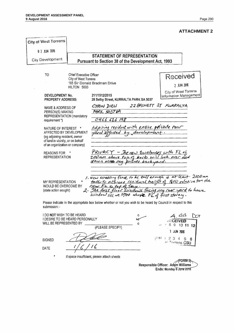
DEVELOPMENT ASSESSMENT PANEL 9 August 2016 Page 290
ATTACHMENT 2

DEVELOPMENT ASSESSMENT PANEL 9 August 2016 Page 291

DEVELOPMENT ASSESSMENT PANEL 9 August 2016 Page 292

DEVELOPMENT ASSESSMENT PANEL 9 August 2016 Page 293

DEVELOPMENT ASSESSMENT PANEL 9 August 2016 Page 294 6.10 365A Marion Road, PLYMPTON Application No. 211/1430/2015 DEVELOPMENT APPLICATION DETAILS DEVELOPMENT PROPOSAL Construction of a two Storey Residential Flat Building
comprising ten (10) dwellings and detached carport (25.1m x 5.6m x 3.3m max height) and associated landscaping
APPLICANT Rivergum Homes APPLICATION NO 211/1430/2015 LODGEMENT DATE 1 December 2015 ZONE Residential Zone POLICY AREA Medium Density Policy Area 18 APPLICATION TYPE Merit PUBLIC NOTIFICATION Category 2 REFERRALS Internal
City Assets – stormwater and traffic External Commissioner of Highways
DEVELOPMENT PLAN VERSION
5 November 2015
MEETING DATE 9 August 2016 RECOMMENDATION CONSENT
BACKGROUND
The development proposal is presented to the Development Assessment Panel (DAP) for the following reason:
• With regard to residential development and land division applications, where all proposed allotments and or sites fail to meet, nor are within 5% of, the minimum frontage widths and site areas designated in respective zones and policy areas within the West Torrens Council Development Plan,
The minimum site area and road frontage for Residential Flat Buildings within the Residential Zone is 100m2 and 15m respectively. The proposal is presented with an (average) site area per dwelling of 95.2m2 (battle axe handle excluded as per General Section, Land Division Module PDC 7(a)) and is presented with a frontage of 5.96 metres to Marion Road. Whilst the site area represents a minor departure from the 5% threshold when using a simplistic calculation of site area, road frontage (by virtue of being an existing battle axe allotment) achieves only 40% of the desired frontage. It is deemed appropriate that the Development Assessment Panel determine the application.

DEVELOPMENT ASSESSMENT PANEL 9 August 2016 Page 295 PREVIOUS or RELATED APPLICATION(S)
DA 211/905/2004 - Division of Land, create two (2) Torrens Title Allotments from one (1) existing allotment. - Development Approval Granted 21 February 2005. SITE AND LOCALITY
The subject land is identified as Allotment 2 in Deposited Plan 79933 and is held in Certificate of Title Volume: 6029; Folio: 37. The land is known as 365A Marion Road, Plympton. The land forms a battle axe allotment of 1,121m2. Excluding the battle axe handle, the land is a regular shaped allotment of 952m2 in area. The land is identified on map series WeTo/12. A small portion of the handle is subject to an easement (marked ‘A’) in favour of the land to the north, accounting for overhanging gutters of an existing outbuilding. The land does not contain any regulated or significant trees, and is not identified within the Development Plan as being subjected to flood hazard. The land is not heritage listed. The land is sited within the ‘Affordable Housing’ designated area. The land is situated on the eastern side of Marion Road, between Long Street to the north and Keily Street to the south. Sited adjacent the Plympton Primary School oval, the land is approximately 360 metres north of the Anzac Highway / Marion Road intersection. The locality is dominated by a secondary arterial road, Marion Road, and a mix of residential and commercial development. To the east of Marion Road, single and two-storey residential development is prevalent. There is a variety of group, detached and semi-detached dwellings that vary in age and architectural style. Dwellings are generally well maintained, with front fencing and well established landscaping. The land adjoins the oval of the Plympton Primary School, with other school buildings located on Owen Street. On the western side of Marion Road, to the north of Anzac Highway, a large site within the Urban Corridor Zone contains a mix of retail and commercial development. Numerous residential flat buildings, up to three storeys in height, are contained within the locality. The subject land and locality are identified on the following maps:

DEVELOPMENT ASSESSMENT PANEL 9 August 2016 Page 296
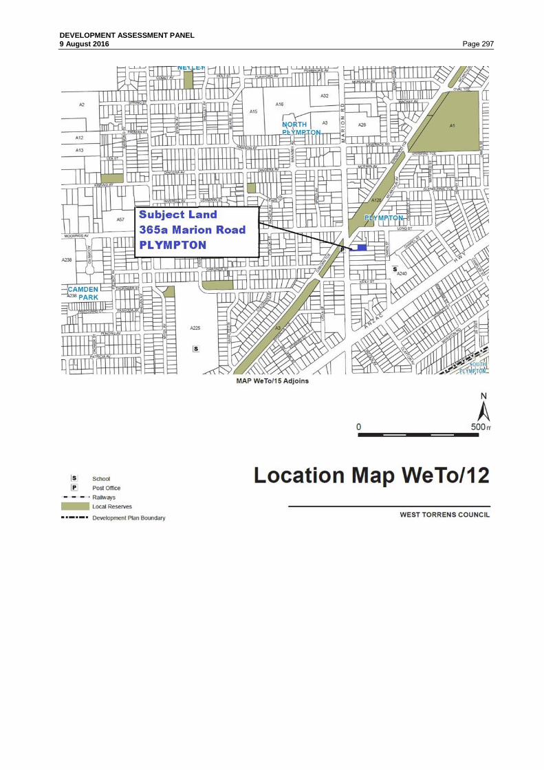
DEVELOPMENT ASSESSMENT PANEL 9 August 2016 Page 297

DEVELOPMENT ASSESSMENT PANEL 9 August 2016 Page 298 PROPOSAL
The proposal is seeking Development Plan Consent for the construction of a two storey Residential Flat Building comprising ten (10) two bedroom dwellings. A detached 10 bay carport of 140m2 is located on the southern boundary of the land, adjoining a public school oval. The total combined area of built form proposed will occupy 518m2 of the land. The proposed buildings will occupy 54% of the site (handle excluded), or 46% of the whole of the land. The proposal has been submitted by Rivergum Homes as an ‘Affordable Housing’ proposal, and has written support from Renewal SA. As part of the proposal, the Applicant has agreed to enter into an affordable housing agreement with Renewal SA. This will constitute a legal obligation for the developer to commit to the provision of affordable housing as defined by the South Australian Housing Trust Regulations 2010. The average site area per dwelling (excluding the battle-axe handle) is 95.2m2. Dwellings are provided with a floor area of 59m2 and 72m2 respectively. Upper level dwellings are provided with a (front) balcony of 12.3m2. Private open space provision to ground floor dwellings varies between 15m2 – 39.7m2. Two water storage tanks (10,000m2) will be located within the waste refuse (common) area, and clothes drying facilities will be wall mounted at the rear of ground floor dwellings. Landscaping will be provided to common areas and the rear yards of ground floor dwellings. The proposed dwellings will utilise a 3.3 metre wide common driveway, which is splayed at the entrance to facilitate two way vehicle movements, minimising conflict and avoiding queuing or reversing onto Marion Road. Letterboxes will be wall mounted on the northern side of the driveway. A common refuse area is provided at the eastern end of the proposed building, with a private contractor (max truck length 7.4m) to collect waste weekly. Two visitor carparks may be provided at the end of the carport, but use will be restricted on waste collection days. Each dwelling will come equipped with a wall mounted device that will allow for one bicycle to be stored in a secure and convenient manner. Refer Attachment 1. PUBLIC NOTIFICATION
The application is a Category 2 form of development pursuant to Section 38 and Schedule 9(18)(a) of the Development Act and Regulations, and the Procedural Matters section of the Residential Zone of the West Torrens Council Development Plan. Properties notified: 13 notification letters were sent to owners or occupants of
adjacent properties during the public notification period. Representations: One (1) representation was received from the adjoining property
owner: • Qing Xu of 365 Marion Road, Plympton The Representor does not wish to be heard
Summary of Representations:
Concerns were raised regarding the following matters; • Visual impact arising from construction of two storey
building; • Overshadowing impact to dwelling and rear yard; • Overlooking and impacts on privacy in rear year; • Increased density resulting in concerns for personal
safety.

DEVELOPMENT ASSESSMENT PANEL 9 August 2016 Page 299 The Applicant has provided a response to the representations, as summarised below:
• Building Height - Policy Area 18 (PDC 5) contemplates buildings of up to three (3) storeys, or 12.5 metres, in height. The proposal is two storeys, with a maximum height of 7.4 metres;
• Overlooking – the western façade of the proposed building has no windows. All upper level windows on northern side will include obscure glazing to 1.7m above floor level. Much of the rear yard of the representor is covered by structures. Southern balconies on the proposed building sit forward of the uncovered portion of the representor’s land.
• Overshadowing – overshadowing diagrams have been prepared (see Attachment 1). The representor’s open space will continue to receive access to at least three (3) hours of sunlight between 12 noon and 3pm on the winter solstice.
• Personal safety – dwelling density is acceptable within the Policy Area. Further, the orientation, design and vertical profile will provide increased opportunities for passive surveillance over the battle axe handle of the land, school oval and Marion Road.
A copy of the representation is contained in Attachment 2 and the applicant’s response is contained in Attachment 3. REFERRALS
Internal
City Assets Department Concerns were raised regarding the following matters: • Traffic manoeuvrability and carparking • Finished Floor Level requirements • Verge interaction • Refuse collection • Letterbox location • Stormwater management All matters have been addressed to the satisfaction of the City Assets department.
External
Pursuant to Section 37(4)(b) and Schedule 8 of the Development Act and Regulations, the application was referred to Safety and Service Division of the Department of Planning, Transport and Infrastructure (DPTI).
DPTI Concerns were raised regarding the following matters: • The provision of a suitable area of land at the entrance (desired minimum dimension 6.0m
x 5.5m); • Need to relocate all obstructions from within the first 6 metres of the driveway (incl
letterboxes, service infrastructure (meters) and carparking); • Vehicle manoeuvrability and carparking; and • Waste collection and potential impact on the arterial road. The Applicant has amended the proposal sufficiently to address all of the concerns raised by DPTI.

DEVELOPMENT ASSESSMENT PANEL 9 August 2016 Page 300 DPTI has advised that, in principle, no objection is raised to the proposed development subject to the imposition of a number of conditions of consent relating to waste collection arrangements, the construction and maintenance of the access onto Marion Road, replacement of a portion of fencing with an open mesh style material to ensure adequate sight distances, maintenance of landscaping and stormwater management. A copy of the report is attached, refer Attachment 4. ASSESSMENT
The subject land is located within the Residential Zone and more particularly Medium Density Policy Area 18 as described in the West Torrens Council Development Plan, consolidated 5 November 2015. The main provisions of the Development Plan which relate to the proposed development are as follows: General Section
Design and Appearance Objectives 1 Principles of Development Control
1, 2, 3, 5, 9, 10, 13, 14, & 15
Energy Efficiency Objectives 1 Principles of Development Control
2 & 3
Infrastructure Objectives 3 Principles of Development Control
1, 3, 4, 5, 6, & 8
Landscaping, Fences and Walls
Objectives 1 & 2 Principles of Development Control
1, 4 & 6
Natural Resources Objectives 1, 2, 6 & 7 Principles of Development Control
5, 7, 8, 9, 10, 11 & 13
Orderly and Sustainable Development
Objectives 4 & 5 Principles of Development Control
1 & 3
Residential Development
Objectives 1, 2, 3, 4 & 5 Principles of Development Control
2, 4, 5, 6, 7, 8, 9, 10, 11, 12, 14, 15, 16, 18, 20, 23, 27, 30, 31, 32, & 33
Transportation and Access Objectives 2 Principles of Development Control
23, 24, 27, 28, 34, 35, 44 & 45
Waste Objectives 2 Principles of Development Control
2 & 5
Overlay – Affordable Housing Objectives 1 & 2

DEVELOPMENT ASSESSMENT PANEL 9 August 2016 Page 301 Zone: Residential Zone Desired Character Statement: This zone will contain predominantly residential development. There may also be some small-scale non-residential activities such as offices, shops, consulting rooms and educational establishments in certain locations. Non-residential activities will be complementary to surrounding dwellings. Allotments will be at very low, low and medium densities to provide a diversity of housing options in different parts of the zone. The range of allotment sizes will support the desired dwelling types anticipated in each policy area, and the minimum allotment sizes shall be treated as such in order to achieve the Desired Character for each policy area and, in turn, reinforce distinction between policy areas. Row dwellings and residential flat buildings will be common near centres and in policy areas where the desired density is higher, in contrast to the predominance of detached dwellings in policy areas where the distinct established character is identified for protection and enhancement. There will also be potential for semi-detached dwellings and group dwellings in other policy areas. Residential development in the form of a multiple dwelling, residential flat building or group dwelling will not be undertaken in a Historic Conservation Area. Landscaping will be provided throughout the zone to enhance the appearance of buildings from the street as viewed by pedestrians, provide an appropriate transition between the public and private realm and reduce heat loads in summer. Objectives 1, 2, 3 and 4 Principles of Development Control 1, 2, 4, 5, 6, 7, 11, 12, 13, 15, and 16 Policy Area: Medium Density Policy Area 18 Desired Character Statement: Allotments in this policy area will be at medium density, accommodating a range of dwelling types including residential flat buildings, row dwellings, group dwellings, semi-detached dwellings and some detached dwellings on small allotments. Allotment amalgamation to create larger development sites will occur to maximise the density of development while also achieving integrated design outcomes, particularly within a comfortable walking distance of centre zones. Vehicle access will occur from side streets and new rear public and private laneways wherever possible, also supporting the retention of existing street trees. New buildings will contribute to a highly varied streetscape. Buildings will be up to 3 storeys and provide a strong presence to streets, other than in the part of the policy area in Underdale, Ashford (other than allotments adjacent to Residential Character Ashford Policy Area 22) and allotments bounded by Anzac Highway, Morphett Road and Cromer Street in Camden Park where buildings will be up to 4 storeys. Parking areas and garages will be located behind the front facade of buildings. Buildings on the edge of the policy area which adjoin residential policy areas at lower densities will pay particular attention to managing the interface with adjoining dwellings, especially in terms of the appearance of building height and bulk, and overshadowing. Development will be interspersed with landscaping, particularly behind the main road frontage, to enhance the appearance of buildings from the street as viewed by pedestrians, provide an appropriate transition between the public and private realm and reduce heat loads in summer. Objectives 1 Principles of Development Control 1, 1 (duplicate numbering), 5 & 7

DEVELOPMENT ASSESSMENT PANEL 9 August 2016 Page 302 QUANTITATIVE ASSESSMENT The proposal is assessed for consistency with the prescriptive requirements of the Development Plan as outlined in the table below:
DEVELOPMENT PLAN PROVISIONS
STANDARD ASSESSMENT
SITE AREA Medium Density Policy Area 18 PDC 7 (Average site area per dwelling)
100m² (average site area per dwelling – affordable housing)
95.2m² (average) This calculation is based on a site area of 952m2 (excluding handle) divided by ten dwellings to result in an average site area per dwelling. The proposal exhibits a minor departure (shortfall of 5.2%) from the required 'average' site area per dwelling for row dwellings within an affordable housing residential flat building development. Does not Satisfy by 5.2%
ALLOTMENT AREA
Existing
1,121m² (whole) 952m² (excl handle)
SITE FRONTAGE Medium Density Policy Area 18 PDC 6
15m for complete building
5.96m (existing)
SITE DEPTH
Existing
73.48m (whole) 36.8m (excl handle)
SITE COVERAGE Medium Density Policy Area 18 PDC 5
70%
54% (whole) 46% (excl handle) Satisfies
STREET SETBACK Medium Density Policy Area 18 PDC 5
3m
37.5m Satisfies

DEVELOPMENT ASSESSMENT PANEL 9 August 2016 Page 303 REAR SETBACKS Medium Density Policy Area 18 PDC 5
Rear: 4m
North (side): 2 – 2.9m South (side): 0m (open carports – adjoining public open space) East (rear): 4.042m Satisfies
BUILDING HEIGHT Medium Density Policy Area 18 PDC 5
3 storeys or 12.5m
Two storeys 7.4m Satisfies
PRIVATE OPEN SPACE Medium Density Policy Area 18 PDC 7
Row Dwellings in affordable housing development: Ground level: 24m2 with minimum dimension of 3m Above ground level balcony: 8m2 with minimum dimension of 2m
Ground Level Dwelling 1: 39.72m2 Dwelling 5: 36.33m2 Satisfies Dwelling 2: 15.0m2 Dwelling 3: 15.0m2 Dwelling 4: 15.0m2 Does Not Satisfy Upper Level Dwelling 6: 12.3m2 Dwelling 7: 12.3m2 Dwelling 8: 12.3m2 Dwelling 9: 12.3m2 Dwelling 10: 12.3m2 Satisfies
LANDSCAPING Module: Landscaping, Fences & Walls PDC: 4
10%
6.3% (common areas) 12.7% in total (approx.) Satisfies
DWELLING FLOOR AREA Module: Residential Development PDC 9
One bedroom: 50m2 Two bedroom: 75m2
Ground Floor Dwellings: 59.35m2 Upper Floor Dwellings: 72.03m2
Does Not Satisfy
CARPARKING SPACES Medium Density Policy Area 18 PDC 5
1 car-parking space / dwelling required
1 space per dwelling provided, plus two visitor spaces Satisfies

DEVELOPMENT ASSESSMENT PANEL 9 August 2016 Page 304 QUALITATIVE ASSESSMENT In assessing the merits or otherwise of the application, the proposed development satisfies the relevant Development Plan provisions with the exception of the following, as discussed under the following sub headings: Dwelling Density and Average Site Area per Dwelling Principle of Development Control 7 of Medium Density Policy Area 18 considers the quantitative parameters that apply to developments that are to be considered as ‘affordable housing’ in relation to site area, amongst other things.
The subject land is presented as an existing battle axe allotment of some 1,121m2. In determining the calculation of average site area per dwelling, it is appropriate to exclude the area of land contained within the battle-axe handle (as per General Section, Land Division Module PDC 7(a)). While it is acknowledged that the handle provides exclusive access to and from the site, it forms common property and cannot be considered available for individual dwellings. The calculation of site area per dwelling has undertaken to exclude the handle, notwithstanding a submission by the Applicant that the common driveway should be included. The resultant average site area per dwelling proposed is 95.2m2. This represents a departure (5.2%) from the 100m2 per dwelling average envisaged by PDC 7, above. However, the 5% variation to the criteria is not considered highly detrimental to the proposal given there is sufficient land area to enable the proposed dwellings to conform with the desired character of the Zone and Policy Area in relation to building height, setbacks, vehicle manoeuvring and parking, and bulk and scale criteria. The shortfall in site area will have no impact on streetscape character. Site Frontage PDC 6 of the Medium Density Policy Area 18 requires a minimum frontage of 15 metres (for complete building) for a Residential Flat Building. The subject land is an existing battle axe allotment with an existing frontage of 5.96 metres. The frontage requirements cannot be met. The site would not able to meet the frontage requirements for detached, semi-detached or group dwellings either. The shape of the allotment makes it difficult for the land to be developed for the purpose intended by the Zone, in a manner that would comply with the provision.

DEVELOPMENT ASSESSMENT PANEL 9 August 2016 Page 305 A report has been received from DPTI which provides an assessment of the access in relation to ensuring safe and convenient movements of traffic to and from, and within, the site. Numerous reports have also been received from GTA Consultants (traffic specialists) via the Applicant. DPTI is satisfied that sufficient manoeuvring area is provided to ensure that vehicles can enter and exit the site in a forward direction. A minor alteration to the southern boundary fence will be made to ensure adequate driver sightlines. It is considered that traffic considerations in regard to site frontage have been sufficiently addressed. In regard to streetscape considerations, it must be noted that the allotment is existing. Development undertaken at the rear of the site will be sited some 37.5 metres from the front property boundary. Development undertaken at the rear of the site will not be readily visible from the front property boundary. Given the dimensions of the land cannot be altered, and the ability for the proposal to satisfy vehicle access requirements, it is not considered that the failure to meet site frontage requirements is detrimental to the proposal. Private Open Space The most significant consideration of the proposal is its failure to provide sufficient private open space to three (3) of the ground floor dwellings, as prescribed by PDC 7 of the Medium Density 18 Policy Area. Dwellings 1 and 5 are provided with 39.72m2 and 36.33m2 respectively, while upper level dwellings (Dwellings 6 – 10) are allocated 12.3m2 via a balcony that is directly accessible from the living area. Dwellings 2 – 5, on the ground floor, are provided with a north facing rear yard of 15.0m2. This represents a shortfall of 9m2, or 37.5%. The departure is significant.

DEVELOPMENT ASSESSMENT PANEL 9 August 2016 Page 306 When considering the provision of private open space, PDCs 18, 20 and 23 of the Residential Development Module are relevant considerations.
In this regard, all private open space is directly accessible from habitable rooms within the dwellings, being the main living room in each case. Ground floor dwellings are provided with private open space that is regular shaped, provides a minimum dimension of not less than three (3) metres, and is north facing. An expanse of the rear yards will be lawn and incorporate plantings. At the ground floor, rear yards are free from obstructions and include perimeter landscaping, providing opportunities for shade during summer months and access to sunlight during winter. Dwellings 1 is provided with a larger than required allocation by virtue of a ‘side’ yard, whilst Dwelling 5 has the benefit of a paved area to the rear of the bin storage area at the eastern end of the building. While the shortfall of private open space to Dwellings 2 – 5 is noted, it is considered that the shape, orientation and accessibility of the space provides sufficient compensation for the shortfall. In addition, the availability of a large area of public open space adjoining the land to the south, and the close proximity of an open reserve corridor to the north (accessible from Long Street) provides additional scope for residents to access open space and recreation opportunities. The amount of private open space provided is therefore considered sufficient in the context of the overall development and its location. Minimum Dwelling Floor Area Dwellings will have a floor area of 59.35m2 (ground floor) and 72.03m2 (upper floor) respectively. All dwellings are provided with two bedrooms, an open plan kitchen and living room and associated wet areas, including an internal laundry. The dwellings are modest in size and layout.

DEVELOPMENT ASSESSMENT PANEL 9 August 2016 Page 307 PDC 9 of the Residential Module provides guidance in relation to the desired size of dwellings forming part of a residential flat building.
The proposal fails to provide a minimum of 75m2 of floor space required for a two bedroom dwelling. Notwithstanding, there are a number of other relevant considerations, and positive aspects of the development that outweigh the shortfall in floor area. • The development responds to the State Government mandate expressed via the 30 Year
Plan for Greater Adelaide to increase the availability of affordable housing within the metropolitan area.
• Upper floor dwellings represent a short fall of only 3m2 per dwelling. This is insignificant. • Ground floor dwellings are provided with private north facing rear yards, which will effectively
form an extension to the living space of dwellings; and • The site is adjacent to a large public school oval and other public reserves. It is understood that the affordable housing ‘apartment’ market attracts predominantly young couples or single persons. In this case, it is likely, though not enforceable, that one of the bedrooms would be used as a study or hobby room. A one bedroom dwelling would be required to provide 50m2 of floor area. In considering the proposal as an ‘affordable housing’ development, it is not unreasonable to give weight to the economic considerations of delivering an appropriately priced product. If the Council is committed to facilitating the delivery of affordable housing, the site presents an excellent opportunity to do so, given the location of the site adjoining large areas of public open space, the availability of public transport on both Marion Road and Anzac Highway and the close proximity to a retail/commercial centre including a supermarket, newsagent, pharmacy, bank and food outlets. The Applicant has submitted that if the proposed dwellings were to be increased in size, thus reducing the overall yield, construction costs would escalate, meaning that the development would no longer meet the affordable housing criteria. Having considered the proposal in the context of an affordable housing development, and the opportunity to directly access private open space at the ground level, and a balcony at the upper level, from living rooms, it is considered that the shortfall in floor area is acceptable. Landscape Assessment Principle of Development Control 4 of the Landscape, Fences and Walls Modules stipulates that 10% of a development site should be landscaped.

DEVELOPMENT ASSESSMENT PANEL 9 August 2016 Page 308 Landscaping is provided to each dwelling occupying the ground floor and within common areas. Landscaping provided within the common areas accounts for 6.3% of the site. An additional 54m2 is provided within the private yards of dwellings 1 – 5. If included within the provision, landscaping would account for 12.7% (approx.) of the site. Whilst it is understood that a more detailed landscape plan may be provided if requested, a shortfall in landscaping within and around the driveway and common areas in preference to the provision of private open space is considered more acceptable. While landscaping within the common areas is slightly less than PDC 4 anticipates, it is considered acceptable given the need to ensure that traffic manoeuvring areas must be kept free of obstructions and driver sight lines must be maintained. On balance, it is considered that the appearance of the site, including the placement of landscaping along the common driveway, within the common areas, at the front of ground floor dwellings and within private yards, will be enhanced significantly. This will ensure an increased level of amenity for the occupants of the development. SUMMARY The proposed development seeks consent to construct a two storey residential flat building comprising ten (10) two bedroom dwellings. The proposal will include a ten bay carport to be used by residents, and provides opportunity for the provision of an additional two visitor carparks. The proposed residential flat building will be constructed on an existing battle axe allotment within the Residential Zone, in a Policy Area that anticipates medium density development of up to three (3) storeys in height. The land is located within the Affordable Housing designated area, with good access to public transport on both Marion Road and Anzac Highway. It is within 360 metres of a shopping centre providing a range of retail and commercial services. The development has been presented as an Affordable Housing proposal and has the benefit of the support from Renewal SA, with the developer indicating willingness to enter into an affordable housing agreement with the State Government. The proposal is finely balanced and represents a minor departure from satisfying the full extent of quantitative requirements in relation to site area, dwelling size and private open space in relation to a small number of dwellings. While these matters are an indicator of dwelling density and, in some cases, can assist in determining the level of amenity enjoyed by the occupants and/or adjoining property owners, they are not considered to be detrimental to this proposal. There are numerous positive attributes of the proposal that, on balance, outweigh the shortfalls identified. The resultant development is an acceptable form of development within the Zone, and will contribute to the provision of medium density residential accommodation. It is considered that the construction of the proposed residential flat building will satisfy the general intent of the Residential Zone, and more particularly the Medium Density 18 Policy Area for the following reasons. In particular, the proposal; • Provides a residential land use within a type built form that is anticipated within the Zone and
Policy Area;
• Is a land use that is consistent with the established character of the locality;
• Significantly improves the appearance of the land through high quality and contemporary architectural design;

DEVELOPMENT ASSESSMENT PANEL 9 August 2016 Page 309 • Increases landscaping and overall presentation of the site;
• Does not unduly impact upon the level of amenity enjoyed by occupants of adjoining
properties to the west, north or east;
• Will not result in an unreasonable degree of overshadowing or overlooking, therefore ensuring adjoining properties have adequate access to winter sunlight and privacy;
• Provide increased opportunities for passive surveillance of the adjoining public school oval, potentially increasing security within the area;
• Complies with the setbacks, building heights, and site coverage requirements;
• Provides for a density of development that is acceptable within the locality;
• Ensures that each dwelling is provided with access to private open space that is directly accessible from living areas within the dwelling. Upper level balconies are provided with obscure glazing to maximise the level of privacy enjoyed by residents, whilst minimising views into the dwelling from the common areas within the development, and the adjoining public school oval. Where there is a shortfall of private open space to three (3) ground floor dwellings, this is off-set by the north facing orientation and unobstructed regular shaped nature of the space, increasing the desirability and useability of the open space provided;
• Demonstrates only a minor (5%) departure from the desired average site area per dwelling when a calculation is undertaken excluding the battle axe handle of the site which will be utilised as a sole access to the site;
• Adequately addresses stormwater management;
• Provides a sufficient level of carparking for residents within a detached carport, with an opportunity to provide an additional two visitor carparks;
• Ensures that waste (refuse) will be managed effectively through provision of a common bin storage area and the provision of a weekly on-site collection by a private contractor;
• Ensures that vehicles can enter and exit the site in a forward direction, ensuring the free flow of traffic on the adjoining arterial road;
• Provides an open plan floor layout that will enable flexibility by the user, whilst endeavouring to deliver a low cost product that responds to the ‘affordable housing’ criteria established by the State Government; and
• Provides an opportunity to increase the supply of affordable housing within the City of West Torrens, as contemplated by the Development Plan, the South Australian Strategic Plan and the 30 Year Plan for Greater Adelaide.
Having considered all the relevant Objectives and Principles of the Development Plan, the proposal is considered to be not seriously at variance with the Development Plan. On balance the proposed development sufficiently accords with the relevant provisions contained within the West Torrens Council Development Plan Consolidated 5 November 2016 and warrants Development Plan Consent.

DEVELOPMENT ASSESSMENT PANEL 9 August 2016 Page 310 RECOMMENDATION
The Development Assessment Panel, having considered all aspects of the report, the application for consent to carry out development of land and pursuant to the provisions of the Development Act 1993 resolves to GRANT Development Plan Consent for Application No. 211/1430/2015 by Rivergum Homes to undertake the construction of a Two Storey Residential Flat Building comprising ten (10) dwellings and detached carport (25.1m x 5.6m x 3.3m max height) and associated landscaping at 365A Marion Road, Plympton (CT 6029/37) subject to the following conditions/for the following reasons (and any subsequent or amended condition that may be required as a result of the consideration of reserved matters under Section 33(3) of the Development Act): Reserved Matters: A. The Applicant, Rivergum Homes, shall enter into an Affordable Housing Land Management
Agreement with Renewal SA to ensure that the criteria established within the Gazette Notice issued under the South Australian Housing Trust Regulations 2010 in relation to ‘affordable housing’ is met. The Affordable Housing Land Management Agreement must be prepared and executed, with a copy provided to the Council, prior to the issue of Development Approval.
Council Conditions 1. Except where minor amendments may be required by other relevant acts, or by conditions
imposed by this application, the development is to be established in strict accordance with the endorsed stamped details and plans submitted in Development Application 211/1430/2015. All works shall be completed to the reasonable satisfaction of Council prior to the occupation and/or use of the development.
2. That the carport approved herein shall not be enclosed and shall be kept as an open
structure at all times. For this purpose, any works to enclose the sides, rear or front (including a roller/panel-lift door) shall require a separate application to Council.
3. That all stormwater design and construction shall be in accordance with Australian
Standards and recognised engineering best practices to ensure that stormwater does not adversely affect any adjoining property or public road and for this purpose stormwater drainage shall not at any time:- a) Result in the entry of water into a building; or b) Affect the stability of a building; or c) Create unhealthy or dangerous conditions on the site or within the building; or d) Flow or discharge onto the land of an adjoining owner; and not flow across footpaths or
public ways. Stormwater detention, re-use and/or water quality measures shall be implemented in accordance with engineering calculations and design drawing(s) provided by Intrax Consulting Engineers Pty Ltd (Job Number 73829 dated 9 November 2015).
4. That all driveways, parking and manoeuvring areas shall be formed (surfaced with concrete, bitumen or paving) and properly drained, and shall be maintained in a reasonable condition at all times.
5. Vehicle access ways and carparking spaces shall be kept free of obstructions at all times.
6. That directional signs not exceeding 0.2 square metres shall be erected at the eastern end of the herein approved carport to indicate the location of visitor parking. The sign shall advise that parking is prohibited on (nominated) waste collection days.

DEVELOPMENT ASSESSMENT PANEL 9 August 2016 Page 311 7. That driveways, carparking spaces, manoeuvring areas and landscaping areas shall not be
used for storage or display of materials or goods including waste products and refuse.
8. A 2.5m (min) length of the existing corrugated iron fence located at the western end of the southern boundary shall be removed and replaced with open chain mesh fencing. Works undertaken shall be consistent with the recommendations contained within the GTA Consultants report dated 16 May 2016 (ref: GTA 15A1291000).
9. All waste collection shall be undertaken completely on private property by a private
contractor. Refuse collection vehicles shall not exceed a length of 7.4 metres. 10. That the approved waste disposal facilities and waste enclosure shall be installed and be
made operative prior to occupation of the development. 11. That all landscaping shall be planted in accordance with the approved plans prior to the
occupancy of the development. Any person(s) who have the benefit of this approval shall cultivate, tend and nurture the landscaping, and shall replace any landscaping which may become diseased or die.
12. That the upper level windows of the dwellings will be provided with fixed obscure glass to a minimum height of 1.7 metres above the upper floor level to minimise the potential for overlooking of adjoining properties, prior to occupation of the building. The glazing in these windows will be maintained in reasonable condition at all times.
Commissioner of Highways Conditions The following conditions are imposed at the request of the Commissioner of Highways (ref: 2016/00229/01, dated 22/04/2016) 1. Access to Marion Road shall be constructed in accordance with Rivergum Homes,
Preliminary Concept Plan, Sheet 1, Issue 5, dated 31/7/15.
2. The access point shall be suitably flared to Marion Road to allow convenient ingress and egress movements in order to minimise disruption to the free flow of traffic.
3. All waste collection shall be undertaken completely on private property. Sufficient area shall be provided to ensure commercial vehicles can achieve forward entry and exit movements.
4. Pedestrian sightlines at the access shall be in accordance with AS/NZS2890.1:2004.
5. All landscaping located along the shared driveway shall be low growing and shall be trimmed on an as needs basis so as not to restrict driver sightlines along the driveway to/from the access point.
6. The shared access and internal manoeuvring areas shall be clear of all obstructions including meters, letterboxes, landscaping and visitor parking.
7. All vehicles shall enter and exit the site in a forward direction.
8. All stormwater generated by the development shall be appropriately collected and disposed of without entering or jeopardising the safety of the adjacent arterial road network

DEVELOPMENT ASSESSMENT PANEL 9 August 2016 Page 312
ATTACHMENT 1

DEVELOPMENT ASSESSMENT PANEL 9 August 2016 Page 313

DEVELOPMENT ASSESSMENT PANEL 9 August 2016 Page 314

DEVELOPMENT ASSESSMENT PANEL 9 August 2016 Page 315

DEVELOPMENT ASSESSMENT PANEL 9 August 2016 Page 316

DEVELOPMENT ASSESSMENT PANEL 9 August 2016 Page 317

DEVELOPMENT ASSESSMENT PANEL 9 August 2016 Page 318

DEVELOPMENT ASSESSMENT PANEL 9 August 2016 Page 319

DEVELOPMENT ASSESSMENT PANEL 9 August 2016 Page 320

DEVELOPMENT ASSESSMENT PANEL 9 August 2016 Page 321
DEVELOPMENT ASSESSMENT PANEL 9 August 2016 Page 322

DEVELOPMENT ASSESSMENT PANEL 9 August 2016 Page 323

DEVELOPMENT ASSESSMENT PANEL 9 August 2016 Page 324

DEVELOPMENT ASSESSMENT PANEL 9 August 2016 Page 325

DEVELOPMENT ASSESSMENT PANEL 9 August 2016 Page 326

DEVELOPMENT ASSESSMENT PANEL 9 August 2016 Page 327

DEVELOPMENT ASSESSMENT PANEL 9 August 2016 Page 328

DEVELOPMENT ASSESSMENT PANEL 9 August 2016 Page 329

DEVELOPMENT ASSESSMENT PANEL 9 August 2016 Page 330

DEVELOPMENT ASSESSMENT PANEL 9 August 2016 Page 331

DEVELOPMENT ASSESSMENT PANEL 9 August 2016 Page 332

DEVELOPMENT ASSESSMENT PANEL 9 August 2016 Page 333

DEVELOPMENT ASSESSMENT PANEL 9 August 2016 Page 334

DEVELOPMENT ASSESSMENT PANEL 9 August 2016 Page 335

DEVELOPMENT ASSESSMENT PANEL 9 August 2016 Page 336

DEVELOPMENT ASSESSMENT PANEL 9 August 2016 Page 337

DEVELOPMENT ASSESSMENT PANEL 9 August 2016 Page 338

DEVELOPMENT ASSESSMENT PANEL 9 August 2016 Page 339
ATTACHMENT 2

DEVELOPMENT ASSESSMENT PANEL 9 August 2016 Page 340

DEVELOPMENT ASSESSMENT PANEL 9 August 2016 Page 341
ATTACHMENT 3

DEVELOPMENT ASSESSMENT PANEL 9 August 2016 Page 342

DEVELOPMENT ASSESSMENT PANEL 9 August 2016 Page 343

DEVELOPMENT ASSESSMENT PANEL 9 August 2016 Page 344
ATTACHMENT 4

DEVELOPMENT ASSESSMENT PANEL 9 August 2016 Page 345

DEVELOPMENT ASSESSMENT PANEL 9 August 2016 Page 346

DEVELOPMENT ASSESSMENT PANEL 9 August 2016 Page 347 6.11 588-592 Henley Beach Road, FULHAM Application No. 211/527/2016 DEVELOPMENT APPLICATION DETAILS DEVELOPMENT PROPOSAL Division of land to create four (4) Torrens Title allotments
from one (1) existing Torrens Title allotment APPLICANT Grantley Leith LODGEMENT DATE 13 May 2016 ZONE Residential POLICY AREA Policy Area 21 APPLICATION TYPE Merit PUBLIC NOTIFICATION Category 1 REFERRALS Internal
Nil External Development Assessment Commission SA Water Commissioner of Highways Environment Protection Authority
DEVELOPMENT PLAN VERSION
5 May 2016
MEETING DATE 9 August 2016 RECOMMENDATION CONSENT
BACKGROUND
The development proposal is presented to the Development Assessment Panel (DAP) for the following reasons:
• With regard to residential development and land division applications, where all proposed allotments and or sites fail to meet, nor are within 5% of, the minimum frontage widths and site areas designated in respective zones and policy areas within the West Torrens Council Development Plan,
The application was previously before the Council's Development Assessment Panel (DAP) in November 2011. On that occasion the DAP determined to support the recommendation that Development Plan Consent be issued to the proposed development. The Development Plan Consent has lapsed since that decision and a new application has been submitted. The proposed plan of division is very similar to the previous approved proposal, the difference being all four allotments are now of equal size and dimensions whereas with the previous approval the outside allotments were larger than the two inside allotments. The Development Plan has also changed since the previous application.

DEVELOPMENT ASSESSMENT PANEL 9 August 2016 Page 348 PREVIOUS or RELATED APPLICATIONS
211/504/1997 - Change of use to motor repair station - Granted Development Approval 19 March 1998. 211/160/1999 - Change of use to nursery - Granted Development Plan Consent 14 July 1999. 211/569/2010 - Change of use from nursery to store and placement of two shipping containers on site for storage purposes - Granted Development Plan Consent by the Development Assessment Panel 11 October 2011. 211/771/2011 - Construction of four (4) two storey dwellings - Granted Development Plan Consent by the Development Assessment Panel 11 October 2011. 211/882/2011 - Division of Land to create four allotments from one existing allotment - Granted Development Approval by the Development Assessment Panel 8 November 2011. SITE AND LOCALITY
The subject land is described as Allotment 36 Filed Plan 119254 in the area named Fulham Hundred of Adelaide as contained in Certificate of Title Volume 5584 Folio 849. The land is more commonly known as 588-592 Henley Beach Road, Fulham. The subject site is a rectangular allotment located on the northern side of Henley Beach Road between Ayton Avenue and Huntington Avenue. The site has a width of 41.14 metres and depth of 30.40 metres resulting in an overall site area of 1,573.7 square metres. The subject site was previously occupied by a number of uses: a Motor Repair Station, a nursery and a store. The buildings on the land have been demolished and the site has remained vacant. Site rehabilitation works have been conducted on the site to ensure the land is fit for residential purposes. Abutting the subject site's east side boundary is a two storey building that consists of shops on the lower level and dwellings on the upper level. To the west and south of the subject site, the locality is characterised primarily by single storey detached dwellings. The site and locality are shown on the following maps.

DEVELOPMENT ASSESSMENT PANEL 9 August 2016 Page 349

DEVELOPMENT ASSESSMENT PANEL 9 August 2016 Page 350

DEVELOPMENT ASSESSMENT PANEL 9 August 2016 Page 351 PROPOSAL
The Applicant is seeking development approval for the division of land to create four (4) Torrens Title allotments from one (1) existing Torrens Title allotment. The four allotments will all be rectangular in shape and have frontages to Henley Beach Road of 10.29 metres and depths of 38.41 metres. An eight (8) metre deep Right of Way will run across the front of all four allotments to facilitate one way traffic flow across the subject land. The proposed Plan of Division is contained in Attachment 1 while a copy of the DAP report for the previous approval is contained in Attachment 2. PUBLIC NOTIFICATION
The application is not listed in the Procedural Matters Table of the Residential Zone of the West Torrens Development Plan (Consolidated 5 May 2016) as being either a Category 1 or Category 2 development. Pursuant to Section 38 of the Development Act 1993 and Schedule 9 (2) (f) of the Development Regulations 2008 the proposed development is a Category 1 development. REFERRALS
External Development Assessment Commission (DAC) and SA Water Pursuant to Section 33 and Schedule 29(1) of the Development Act and Regulations, the application was referred to SA Water by the Development Assessment Commission. Neither DAC nor SA Water had any objections to the proposal subject to several conditions being added to any consent notice. Commissioner of Highways The Commissioner of Highways does not object in-principle to the proposal and has advised to attach several conditions to any approval granted. Environment Protection Authority (EPA) The subject land has previously been the subject of a Site Contamination Audit Report. The auditor found the site is suitable for unrestricted uses with no conditions on the use of land and water. The EPA considers the proposed development to be acceptable with regard to potential site contamination and no further investigations are required. The EPA has advised that a note be attached to any approval granted. Full copies of the relevant reports are contained in Attachment 3. ASSESSMENT
The subject land is located within the Residential Zone and more particularly Low Density Policy Area 21 as described in the West Torrens Council Development Plan (Consolidated 5 May 2016). The main provisions of the Development Plan which relate to the proposed development are as follows:

DEVELOPMENT ASSESSMENT PANEL 9 August 2016 Page 352 General Section
Energy Efficiency Objectives 1 & 2 Principles of Development Control 1
Infrastructure Objectives 1, 2 & 3 Principles of Development Control 1, 2, 4, 5, 6, 8, 9 & 16
Land Division Objectives 1, 2, 3 & 4 Principles of Development Control 1, 2, 5, 6, 7, 8 and 12,
Orderly and Sustainable Development
Objectives 1, 2, 3 4 & 5 Principles of Development Control 1, 3, 5 & 7
Residential Development Objectives 1, 2, 3 & 5 Principles of Development Control 1, 2, 3, 10, 11, 12, 13, 18,
19, 20, 21, 22, 23 & 24,
Transportation and Access
Objectives 2 Principles of Development Control 2, 8, 10, 11, 18, 23, 24,
30, 32, 34, 35, 36, 37, 40, 41, 43, 44 & 45
Zone: Residential Desired Character Statement: This zone will contain predominantly residential development. There may also be some small-scale non-residential activities such as offices, shops, consulting rooms and educational establishments in certain locations. Non-residential activities will be complementary to surrounding dwellings. Allotments will be at very low, low and medium densities to provide a diversity of housing options in different parts of the zone. The range of allotment sizes will support the desired dwelling types anticipated in each policy area, and the minimum allotment sizes shall be treated as such in order to achieve the Desired Character for each policy area and, in turn, reinforce distinction between policy areas. Row dwellings and residential flat buildings will be common near centres and in policy areas where the desired density is higher, in contrast to the predominance of detached dwellings in policy areas where the distinct established character is identified for protection and enhancement. There will also be potential for semi-detached dwellings and group dwellings in other policy areas. Residential development in the form of a multiple dwelling, residential flat building or group dwelling will not be undertaken in a Historic Conservation Area. Landscaping will be provided throughout the zone to enhance the appearance of buildings from the street as viewed by pedestrians, provide an appropriate transition between the public and private realm and reduce heat loads in summer. Objectives 1, 2, 3 & 4 Principles of Development Control 1, 2, 5 &1 7

DEVELOPMENT ASSESSMENT PANEL 9 August 2016 Page 353 Policy Area: Policy Area 21 Desired Character Statement: This policy area will have a low density character. In order to preserve this, development will predominantly involve the replacement of detached dwellings with the same (or buildings in the form of detached dwellings). There will be a denser allotment pattern and some alternative dwelling types, such as semi-detached and row dwellings, close to centre zones where it is desirable for more residents to live and take advantage of the variety of facilities focused on centre zones. Battleaxe subdivision will not occur in the policy area to preserve a pattern of rectangular allotments developed with buildings that have a direct street frontage. In the area bounded by Henley Beach Road, Torrens Avenue and the Linear Park, where the consistent allotment pattern is a significant positive feature of the locality, subdivision will reinforce the existing allotment pattern. Buildings will be up to 2 storeys in height. Garages and carports will be located behind the front façade of buildings. Buildings in the area bounded by Henley Beach Road, Torrens Avenue and the Linear Park will be complementary to existing dwellings through the incorporation of design features such as pitched roofs, eaves and variation in the texture of building materials. Development will be interspersed with landscaping, particularly behind the main road frontage, to enhance the appearance of buildings from the street as viewed by pedestrians, provide an appropriate transition between the public and private realm and reduce heat loads in summer. Low and open-style front fencing will contribute to a sense of space between buildings. Objectives 1 Principles of Development Control 1, 2, 4 & 6 QUANTITATIVE ASSESSMENT The proposal is assessed for consistency with the prescriptive requirements of the Development Plan as outlined in the table below:
DEVELOPMENT PLAN PROVISIONS Guidelines Proposal
AREA and FRONTAGE Low Density Policy Area 21 PDC 6
Area: 420sqm Frontage: 12 metres
Site Area
All allotments: 395sqm
Not Satisfied by 6%
Frontage
All allotments 10.29m
Not Satisfied by 14%
SITE AREA FOR DWELLING Low Density Policy Area 21 PDC 4
350m²(min.)
All allotments: 395sqm
Satisfies

DEVELOPMENT ASSESSMENT PANEL 9 August 2016 Page 354 SITE FRONTAGE FOR DWELLING Low Density Policy Area 21 PDC 4
9m (min.)
All allotments 10.29m
Satisfies
QUALITATIVE ASSESSMENT The proposed development has been assessed against the relevant Development Plan provisions, as discussed under the following sub headings: Density and Character The subject land is located within 400 metres of an existing centre zone and within a policy area where detached or semi-detached dwellings should have minimum allotment areas of 350 square metres and minimum street frontages of 9 metres. The proposed development is for a division of land only but had the matter involved a combined application, i.e. both a division of land and construction of dwellings together in one application the proposed development would satisfy the minimum site areas and frontages. The desired character statement for Policy Area 21 seeks to preserve a pattern of rectangular allotments developed with detached and semi-detached buildings that have a direct street frontage. The proposed division will maintain the desired allotment pattern albeit with smaller allotments and accommodate either detached or semi-dwellings with direct street frontages. Given the subject land’s proximity to a centre zone the proposed allotments are consistent with the desired character and allotment dimensions for the policy area. Vehicle Access and Movement The Development Plan includes guidelines that seek vehicle movement between arterial roads and abutting land to occur in a forward direction and by way of minimal access and egress points. The proposed division of land includes a Right of Way that will facilitate both these outcomes. Sufficient on-site area is available for vehicles to manoeuvre in an acceptable manner. SUMMARY The proposed division of the land into four allotments satisfies the relevant policies of the Development Plan. Having considered all the relevant Objectives and Principles of the Development Plan, the proposal is considered to be not seriously at variance with the Development Plan. On balance the proposed development sufficiently accords with the relevant provisions contained within the West Torrens Council Development Plan Consolidated 5 May 2016 and warrants Development Plan Consent. RECOMMENDATION
The Development Assessment Panel, having considered all aspects of the report, the application for consent to carry out development of land and pursuant to the provisions of the Development Act 1993 resolves to GRANT Development Plan Consent for Application No. 211/527/2016 by Grantley Leith to undertake division of land to create four (4) Torrens Title allotments from one (1) existing Torrens Title allotment at 588-592 Henley Beach Road, Fulham (CT 5584/849) subject to the following conditions of consent:

DEVELOPMENT ASSESSMENT PANEL 9 August 2016 Page 355 COUNCIL CONDITIONS: 1. Development is to take place in accordance with the plans prepared by Estate Services
(SA) relating to Development Application No. 211/527/2016 (DAC 211/D051/16). DEVELOPMENT ASSESSMENT COMMISSION CONDITIONS: Nil LAND DIVISION CONSENT COUNCIL CONDITIONS: Nil DEVELOPMENT ASSESSMENT COMMISSION CONDITIONS: 1. The financial requirements of SA Water shall be met for the provision of water supply and
sewerage services (SA Water H0045629). SA Water advises on receipt of the developer details and site specifications an investigation will be carried out to determine if the connections/s to the development will be costed as standard or non standard On approval of the application, all internal water piping that crosses the allotment boundaries must be severed or redirected at the developers/owners cost to ensure that the pipework relating to each allotment is contained within its boundaries.
2. Payment of $19,464.00 into the Planning and Development Fund (3 allotment(s) @
$6,488.00/allotment). Payment may be made by credit card via the internet at www.edala.sa.gov.au or by phone (8303 0724), by cheque payable to the Development Assessment Commission marked "Not Negotiable" and sent to GPO Box 1815, Adelaide 5001 or in person, at Level 5, 136 North Terrace, Adelaide.
3. A final plan complying with the requirements for plans as set out in the Manual of Survey
Practice Volume 1 (Plan Presentation and Guidelines) issued by the Registrar General to be lodged with the Development Assessment Commission for Land Division Certificate Purposes.
COMMISSIONER OF HIGHWAY CONDITIONS: 4. The Henley Beach Road access points shall be a maximum of 4.5 metres in width at the
property boundary and angled at 70 degrees to the road. Directional signage/line marking shall be provided to reinforce the desired one-way operation
5. All obsolete crossovers, or parts thereof, on Henley Beach Road shall be reinstated to
Council standard kerb and gutter at the applicant's cost prior to operation of the development
6. The shared access and vehicle manoeuvring areas shall be clear of all obstructions
including meters, letterboxes, vegetation and visitor car parking. 7. All vehicles shall enter and exit the site in a forward direction 8. Stormwater run-off shall be collected on-site and discharged without jeopardising the
integrity and safety of Henley Beach Road. Any alterations to the road drainage infrastructure required to facilitate this shall be at the applicant's cost.

DEVELOPMENT ASSESSMENT PANEL 9 August 2016 Page 356
ATTACHMENT 1

DEVELOPMENT ASSESSMENT PANEL 9 August 2016 Page 357
ATTACHMENT 2

DEVELOPMENT ASSESSMENT PANEL 9 August 2016 Page 358

DEVELOPMENT ASSESSMENT PANEL 9 August 2016 Page 359

DEVELOPMENT ASSESSMENT PANEL 9 August 2016 Page 360

DEVELOPMENT ASSESSMENT PANEL 9 August 2016 Page 361

DEVELOPMENT ASSESSMENT PANEL 9 August 2016 Page 362

DEVELOPMENT ASSESSMENT PANEL 9 August 2016 Page 363

DEVELOPMENT ASSESSMENT PANEL 9 August 2016 Page 364

DEVELOPMENT ASSESSMENT PANEL 9 August 2016 Page 365

DEVELOPMENT ASSESSMENT PANEL 9 August 2016 Page 366

DEVELOPMENT ASSESSMENT PANEL 9 August 2016 Page 367

DEVELOPMENT ASSESSMENT PANEL 9 August 2016 Page 368

DEVELOPMENT ASSESSMENT PANEL 9 August 2016 Page 369 6.12 5 Lowry Street, FULHAM Application No. 211/576/2016 DEVELOPMENT APPLICATION DETAILS DEVELOPMENT PROPOSAL Division of land to create two (2) Torrens Title allotments
from one existing Torrens Title allotment APPLICANT Nando Disotto and Romi Dimasi LODGEMENT DATE 3 May 2016 ZONE Residential POLICY AREA Low Density Policy Area 21 APPLICATION TYPE Merit PUBLIC NOTIFICATION Category 1 REFERRALS Internal
Nil External Development Assessment Commission and SA Water
DEVELOPMENT PLAN VERSION
5 November 2015
MEETING DATE 9 August 2016 RECOMMENDATION CONSENT
BACKGROUND
The development proposal is presented to the Development Assessment Panel (DAP) for the following reasons:
• With regard to residential development and land division applications, where all proposed allotments and or sites fail to meet, nor are within 5% of, the minimum frontage widths and site areas designated in respective zones and policy areas within the West Torrens Council Development Plan, the application shall be assessed and determined by the DAP.
PREVIOUS or RELATED APPLICATIONS
Nil

DEVELOPMENT ASSESSMENT PANEL 9 August 2016 Page 370 SITE AND LOCALITY
The subject land is described as Allotment 471 Deposited Plan 6148 in the area named Fulham Hundred of Adelaide as contained in Certificate of Title Volume 5656 Folio 203. The land is more commonly known as 5 Lowry Street, Fulham. The subject land is a rectangular shaped allotment of approximately 714.7 square metres with a frontage of 17.37 metres to Lowry Street and a site depth of 41.15 metres. The site is relatively flat and contains a single storey, detached dwelling constructed circa 1950. Ancillary structures include three (3) free standing rear outbuildings, a pergola, and a carport and verandah which are attached to the dwelling. Vegetation of various sizes is scattered mostly around the rear of the property and a brush fence runs across the front of the site. A single street tree is centrally located on the road verge immediately in front of the subject land and a stobie pole is just north of the subject land’s northern property boundary. The locality consists mostly of low density, single storey detached dwelling development constructed between the 1950's and 70's. There are also some examples of new residential developments that has recently replaced the original dwellings previously on the land. There are few examples of subdivision within the locality. A Local Centre Zone containing a group of shops is approximately 390 metres north of the subject land and located on the corner of Henley Beach Road and Huntington Avenue while Coast Watchers Park, an area of public open space wedged between Ashburn Avenue and Coral Sea Drive is approximately 200 metres to the north. The site and locality are shown on the following maps.

DEVELOPMENT ASSESSMENT PANEL 9 August 2016 Page 371

DEVELOPMENT ASSESSMENT PANEL 9 August 2016 Page 372

DEVELOPMENT ASSESSMENT PANEL 9 August 2016 Page 373 PROPOSAL
The applicant is seeking Development Approval for a Torrens Title land division to create two (2) allotments from one (1) existing Torrens Title allotment. Allotment 1 will be 8.68 metres wide and Allotment 2 will be 8.69 metres wide. Both allotments will be 41.15 metres deep. Allotment 1 will have an area of 357 square metres and Allotment 2 will have an area of 358 square metres. An easement for sewerage purposes will run along the rear of the allotments. The Applicant has provided indicative dwelling floor plans and a planning report in support of the proposal. The indicative floor plans do not form part of this assessment and must be the subject of a separate application. The proposed Plan of Division and supporting documents are contained in Attachment 1. PUBLIC NOTIFICATION
The application is not listed in the Procedural Matters Table of the Residential Zone of the West Torrens Development Plan (Consolidated 5 November 2015) as being either a Category 1 or Category 2 development. Pursuant to Section 38 of the Development Act 1993 and Schedule 9 (2) (f) of the Development Regulations 2008 the proposed development is a Category 1 development. REFERRALS
External Development Assessment Commission (DAC) and SA Water Pursuant to Section 33 and Schedule 29(1) of the Development Act and Regulations, the application was referred to SA Water by the Development Assessment Commission. Neither DAC nor SA Water had any objections to the proposal subject to several conditions being added to any consent notice. Full copies of the relevant reports are contained in Attachment 2. ASSESSMENT
The subject land is located within the Residential Zone and more particularly Low Density Policy Area 21 as described in the West Torrens Council Development Plan (Consolidated 5 Nov 2015). The main provisions of the Development Plan which relate to the proposed development are as follows:

DEVELOPMENT ASSESSMENT PANEL 9 August 2016 Page 374 General Section
Energy Efficiency Objectives 1 & 2 Principles of Development Control 1
Infrastructure Objectives 1, 2 & 3 Principles of Development Control 1, 2, 4, 5, 6, 8, 9 & 16
Land Division Objectives 1, 2, 3 & 4 Principles of Development Control 1, 2, 5, 6, 7, 8 and 12,
Orderly and Sustainable Development
Objectives 1, 2, 3 4 & 5 Principles of Development Control 1, 3, 5 & 7
Residential Development Objectives 1, 2, 3 & 5 Principles of Development Control 1, 2, 3, 10, 11, 12, 13, 18,
19, 20, 21, 22, 23 & 24,
Transportation and Access
Objectives 2 Principles of Development Control 2, 8, 10, 11, 18, 23, 24,
30, 32, 34, 35, 36, 37, 40, 41, 43, 44 & 45
Zone: Residential Desired Character Statement: This zone will contain predominantly residential development. There may also be some small-scale non-residential activities such as offices, shops, consulting rooms and educational establishments in certain locations. Non-residential activities will be complementary to surrounding dwellings. Allotments will be at very low, low and medium densities to provide a diversity of housing options in different parts of the zone. The range of allotment sizes will support the desired dwelling types anticipated in each policy area, and the minimum allotment sizes shall be treated as such in order to achieve the Desired Character for each policy area and, in turn, reinforce distinction between policy areas. Row dwellings and residential flat buildings will be common near centres and in policy areas where the desired density is higher, in contrast to the predominance of detached dwellings in policy areas where the distinct established character is identified for protection and enhancement. There will also be potential for semi-detached dwellings and group dwellings in other policy areas. Residential development in the form of a multiple dwelling, residential flat building or group dwelling will not be undertaken in a Historic Conservation Area. Landscaping will be provided throughout the zone to enhance the appearance of buildings from the street as viewed by pedestrians, provide an appropriate transition between the public and private realm and reduce heat loads in summer. Objectives 1, 2, 3 & 4 Principles of Development Control 1, 2, 5 &1 7

DEVELOPMENT ASSESSMENT PANEL 9 August 2016 Page 375 Policy Area: Policy Area 21 Desired Character Statement: This policy area will have a low density character. In order to preserve this, development will predominantly involve the replacement of detached dwellings with the same (or buildings in the form of detached dwellings). There will be a denser allotment pattern and some alternative dwelling types, such as semi-detached and row dwellings, close to centre zones where it is desirable for more residents to live and take advantage of the variety of facilities focused on centre zones. Battleaxe subdivision will not occur in the policy area to preserve a pattern of rectangular allotments developed with buildings that have a direct street frontage. In the area bounded by Henley Beach Road, Torrens Avenue and the Linear Park, where the consistent allotment pattern is a significant positive feature of the locality, subdivision will reinforce the existing allotment pattern. Buildings will be up to 2 storeys in height. Garages and carports will be located behind the front façade of buildings. Buildings in the area bounded by Henley Beach Road, Torrens Avenue and the Linear Park will be complementary to existing dwellings through the incorporation of design features such as pitched roofs, eaves and variation in the texture of building materials. Development will be interspersed with landscaping, particularly behind the main road frontage, to enhance the appearance of buildings from the street as viewed by pedestrians, provide an appropriate transition between the public and private realm and reduce heat loads in summer. Low and open-style front fencing will contribute to a sense of space between buildings. Objectives 1 Principles of Development Control 1, 2, 4 & 6 QUANTITATIVE ASSESSMENT The proposal is assessed for consistency with the prescriptive requirements of the Development Plan as outlined in the table below:
DEVELOPMENT PLAN
PROVISIONS
Guidelines
Proposal
Lot 1 Lot 2
AREA and FRONTAGE Low Density Policy Area 21 PDC 6
Area: 420 sqm Frontage: 12 metres
Area: 357 sqm
Not Satisfied by
15%
Frontage: 8.68 m
Not Satisfied by 28%
Area: 358 sqm
Not Satisfied by
15%
Frontage: 8.69 m
Not Satisfied by 28%
SITE AREA FOR DWELLING Low Density Policy Area 21 PDC 4
350m²(min.)
373m²
Satisfies
373m²
Satisfies

DEVELOPMENT ASSESSMENT PANEL 9 August 2016 Page 376 SITE FRONTAGE FOR DWELLING Low Density Policy Area 21 PDC 4
9m (min.)
8.68m
Does Not Satisfied
by 4%
8.69m
Not Satisfied
by 4%
QUALITATIVE ASSESSMENT The proposed development has been assessed against the relevant Development Plan provisions, as discussed under the following sub headings: Density and Character The subject land is located within 400 metres of an existing centre zone and within a policy area where detached or semi-detached dwellings should have minimum allotment areas of 350 square metres and minimum street frontages of 9 metres. The proposed development is for a division of land only but had the matter involved a combined application, i.e. both a division of land and construction of dwellings together in one application, only the frontages would fall below the guidelines. The proposed frontages are no less than 8.68 metres, a shortfall considered relatively moderate and will not be readily discernible to the person on the street once dwellings are constructed. The desired character statement for Policy Area 21 seeks to preserve a pattern of rectangular allotments developed with detached and semi-detached buildings that have a direct street frontage. The proposed division will maintain the desired allotment pattern albeit with smaller allotments and accommodate either detached or semi-dwellings with direct street frontages. Given the subject land’s proximity to a centre zone the proposed allotments are consistent with the desired character for the policy area. SUMMARY The proposed allotments are situated in a locality with a relatively consistent allotment pattern and although comprising frontage widths below the prescribed guidelines the development will nevertheless provide allotments that satisfy the envisaged densities and the desired character of the Policy Area. Having considered all the relevant Objectives and Principles of the Development Plan, the proposal is considered to be not seriously at variance with the Development Plan. On balance the proposed development sufficiently accords with the relevant provisions contained within the West Torrens Council Development Plan Consolidated 5 November 2015 and warrants Development Plan Consent. RECOMMENDATION
The Development Assessment Panel, having considered all aspects of the report, the application for consent to carry out development of land and pursuant to the provisions of the Development Act 1993 resolves to GRANT Development Plan Consent for Application No. 211/576/2016 by Mr. Nando Disotto and Mrs. Romi Dimasi to undertake Division of land to create two (2) Torrens Title allotments from one existing Torrens Title allotment at 5 Lowry Street, Fulham (CT 5656/203) subject to the following conditions of consent (and any subsequent or amended condition that may be required as a result of the consideration of reserved matters under Section 33(3) of the Development Act):

DEVELOPMENT ASSESSMENT PANEL 9 August 2016 Page 377 DEVELOPMENT PLAN CONSENT COUNCIL CONDITIONS: 1. Development is to take place in accordance with the plans prepared by Cavallo Forrest &
Associates relating to Development Application No. 211/576/2016 (DAC 211/D063/16). DEVELOPMENT ASSESSMENT COMMISSION CONDITIONS: Nil LAND DIVISION CONSENT COUNCIL CONDITIONS: 1. That prior to the issue of section 51 clearance to this division approved herein, the existing
dwelling and all ancillary structures shall be removed from proposed allotment(s) 1 and 2. For this purpose a separate development application to Council is required.
DEVELOPMENT ASSESSMENT COMMISSION CONDITIONS: 2. The financial requirements of SA Water shall be met for the provision of water supply and
sewerage services. The alteration of internal drains to the satisfaction of SA Water is required. Subject to a new process, on receipt of the developer details and site specifications an investigation will be carried out to determine if the connections to the development will be standard or non standard fees. On approval of the application, all internal water piping that crosses the allotment boundaries must be severed or redirected at the developers/owners cost to ensure that the pipework relating to each allotment is contained within its boundaries.
3. Payment of $6,488.00 into the Planning and Development Fund (1 allotment(s) @
$6,488.00/allotment). Payment may be made by credit card via the internet at www.edala.sa.gov.au or by phone (8303 0724), by cheque payable to the Development Assessment Commission marked "Not Negotiable" and sent to GPO Box 1815, Adelaide 5001 or in person, at Level 5, 136 North Terrace, Adelaide.
4. A final plan complying with the requirements for plans as set out in the Manual of Survey
Practice Volume 1 (Plan Presentation and Guidelines) issued by the Registrar General to be lodged with the Development Assessment Commission for Land Division Certificate Purposes.

DEVELOPMENT ASSESSMENT PANEL 9 August 2016 Page 378
ATTACHMENT 1

DEVELOPMENT ASSESSMENT PANEL 9 August 2016 Page 379

DEVELOPMENT ASSESSMENT PANEL 9 August 2016 Page 380

DEVELOPMENT ASSESSMENT PANEL 9 August 2016 Page 381

DEVELOPMENT ASSESSMENT PANEL 9 August 2016 Page 382

DEVELOPMENT ASSESSMENT PANEL 9 August 2016 Page 383

DEVELOPMENT ASSESSMENT PANEL 9 August 2016 Page 384

DEVELOPMENT ASSESSMENT PANEL 9 August 2016 Page 385

DEVELOPMENT ASSESSMENT PANEL 9 August 2016 Page 386

DEVELOPMENT ASSESSMENT PANEL 9 August 2016 Page 387

DEVELOPMENT ASSESSMENT PANEL 9 August 2016 Page 388

DEVELOPMENT ASSESSMENT PANEL 9 August 2016 Page 389

DEVELOPMENT ASSESSMENT PANEL 9 August 2016 Page 390

DEVELOPMENT ASSESSMENT PANEL 9 August 2016 Page 391

DEVELOPMENT ASSESSMENT PANEL 9 August 2016 Page 392

DEVELOPMENT ASSESSMENT PANEL 9 August 2016 Page 393

DEVELOPMENT ASSESSMENT PANEL 9 August 2016 Page 394

DEVELOPMENT ASSESSMENT PANEL 9 August 2016 Page 395
ATTACHMENT 2

DEVELOPMENT ASSESSMENT PANEL 9 August 2016 Page 396 6.13 25 Kingswood Crescent, LOCKLEYS Application No. 211/510/2016 DEVELOPMENT APPLICATION DETAILS DEVELOPMENT PROPOSAL Combined application for Land Division and Land use-
Torrens Title; DAC NO. 211/D088/16 (Unique ID 54613); Create one (1) additional Torrens Title Allotment and the construction of a detached two-storey dwelling with garage and alfresco under the main roof
APPLICANT Katnich Building Design & R L Bell APPLICATION NO 211/510/2016 LODGEMENT DATE 2 June 2016 ZONE Residential Zone POLICY AREA Low Density Policy Area 21 APPLICATION TYPE Merit PUBLIC NOTIFICATION Category 1 REFERRALS Internal
City Works (Amenity Officer) City Assets (Civil Engineer) External Development Assessment Commission (DAC) SA Water
DEVELOPMENT PLAN VERSION
5 November 2015
MEETING DATE 9 August 2016 RECOMMENDATION CONSENT
BACKGROUND
The development proposal is presented to the Development Assessment Panel (DAP) for the following reason/s:
• With regard to residential development and land division applications, where all proposed allotments and or sites fail to meet, nor are within 5% of, the minimum frontage widths and site areas designated in respective zones and policy areas within the West Torrens Council Development Plan.
PREVIOUS or RELATED APPLICATION(S)
Nil

DEVELOPMENT ASSESSMENT PANEL 9 August 2016 Page 397 SITE AND LOCALITY
The subject land is described as Allotment 31 Deposited Plan 7594 in the area named Lockleys Hundred of Adelaide as contained in Certificate of Title Volume 5196 Folio 972. The land is more commonly known as 25 Kingswood Crescent, Lockleys. The subject land is located on the northern side of Kingswood Crescent. The site is a square shaped allotment but is oriented to follow the angle of the road, and is approximately 877.7 square metres with a frontage of 26.2 metres to Kingwood Crescent and a site depth of 33.5 metres. The site currently contains a single storey 1966 colonial style house, with a verandah to the rear. The rear boundary of the subject land abuts the Open Space Zone containing Linear Park. The subject land is located approximately 160 metres south-east of the Lockleys Oval and 137 metres west of Tapleys Hill Road. Whilst the locality is predominately characterised by dwellings constructed in the 1960s there are several examples of land divisions, and associated new dwellings, undertaken post 2000. The site and locality are shown on the following maps.

DEVELOPMENT ASSESSMENT PANEL 9 August 2016 Page 398

DEVELOPMENT ASSESSMENT PANEL 9 August 2016 Page 399

DEVELOPMENT ASSESSMENT PANEL 9 August 2016 Page 400 PROPOSAL
The proposal includes both land division and the construction of double storey dwelling on proposed Allotment 1. The Applicant seeks approval for a Torrens Title Land Division creating one additional allotment. Proposed Allotment 1 will have a frontage to the public road measuring 14.81 metres, a depth of 33.53 metres and a total area of 497 square metres. Proposed Allotment 2 will have a frontage of 11.40 metres to the public road, a depth of 33.53 metres and total area of 382 square metres. The allotment boundaries are consistent with those shown in the land use plans and drawings. The Applicant also seeks approval for a double storey dwelling with garage and alfresco under the main roof. The proposed land division and land use plans and supporting information are included in Attachment 1. PUBLIC NOTIFICATION
The application is a Category 1 form of development pursuant to Section 38 and Schedule 9 of the Development Act and Regulations and Residential Zone, Procedural Matters. REFERRALS
City Works (Amenity Officer) Division of the land will result in one (1) additional driveway and crossover to be established to enable vehicle access for a future dwelling on Lot 2. A crossover can be established without requiring the removal of any street trees and City Works will support the proposal in this instance. The orientation and floor layout of any future dwelling applications on Lot 2 should take the location of the street trees into consideration and maintain the minimum offsets. City Assets (Civil Engineer) Council's Civil Engineer, part of the City Assets Department, has no objections to the proposal with regard to finished floor level, stormwater disposal, driveway and crossovers and verge interaction. External The land division component was referred to SA Water by the Development Assessment Commission (DAC) who advised of no objection subject to specified standard conditions being included on any consent to be issued. A copy of the relevant referral responses are included in Attachment 2. ASSESSMENT
The subject land is located within the Residential Zone and more particularly within Low Density Policy Area 21 as described in the West Torrens Council Development Plan. The main provisions of the Development Plan which relate to the proposed development are as follows:

DEVELOPMENT ASSESSMENT PANEL 9 August 2016 Page 401 General Section
Crime Prevention Objectives 1 Principles of Development Control 1, 2, 3, 7 & 8
Design and Appearance
Objectives 1
Principles of Development Control 1, 2, 3, 4, 5, 9, 10, 11, 12, 13, 14, 15, 20, 21, 22, 23, 25 & 26
Energy Efficiency Objectives 1 & 2 Principles of Development Control 1, 2 & 3
Land Division Objectives 1, 2, 3 & 4
Principles of Development Control 1, 2, 4, 5, 6, 8, 10, 11, 12 & 16
Landscaping, Fences and Walls
Objectives 1 Principles of Development Control 1, 2, 3 & 4
Orderly and Sustainable Development
Objectives 1, 2, 3, 4 & 5 Principles of Development Control 1, 3, 4 & 8
Residential Development
Objectives 1, 2, 3 & 4 Principles of Development Control 1, 3, 4, 5, 6, 7, 8, 9, 10, 11,
12, 13, 14, 15, 16, 18, 19, 20, 21 & 27
Transportation and Access Objectives 2 Principles of Development Control 1, 2, 10, 11, 23, 24, 30, 34,
35 & 44 Zone: Residential Zone Desired Character Statement: "This zone will contain predominantly residential development. There may also be some small-scale non-residential activities such as offices, shops, consulting rooms and educational establishments in certain locations. Non-residential activities will be complementary to surrounding dwellings.
Allotments will be at very low, low and medium densities to provide a diversity of housing options in different parts of the zone. The range of allotment sizes will support the desired dwelling types anticipated in each policy area, and the minimum allotment sizes shall be treated as such in order to achieve the Desired Character for each policy area and, in turn, reinforce distinction between policy areas. Row dwellings and residential flat buildings will be common near centres and in policy areas where the desired density is higher, in contrast to the predominance of detached dwellings in policy areas where the distinct established character is identified for protection and enhancement. There will also be potential for semi-detached dwellings and group dwellings in other policy areas. Residential development in the form of a multiple dwelling, residential flat building or group dwelling will not be undertaken in an Historic Conservation Area. Landscaping will be provided throughout the zone to enhance the appearance of buildings from the street as viewed by pedestrians, provide an appropriate transition between the public and private realm and reduce heat loads in summer". Objectives 1, 2, 3 & 4 Principles of Development Control 1, 5, 6, 7, 8, 10, 11, 12 & 13

DEVELOPMENT ASSESSMENT PANEL 9 August 2016 Page 402 Policy Area: Low Density Policy Area 21 Desired Character Statement: "This policy area will have a low density character. In order to preserve this, development will predominantly involve the replacement of detached dwellings with the same (or buildings in the form of detached dwellings). There will be a denser allotment pattern and some alternative dwelling types, such as semi-detached and row dwellings, close to centre zones where it is desirable for more residents to live and take advantage of the variety of facilities focused on centre zones. Battleaxe subdivision will not occur in the policy area to preserve a pattern of rectangular allotments developed with buildings that have a direct street frontage. In the area bounded by Henley Beach Road, Torrens Avenue and the Linear Park, where the consistent allotment pattern is a significant positive feature of the locality, subdivision will reinforce the existing allotment pattern. Buildings will be up to 2 storeys in height. Garages and carports will be located behind the front façade of buildings. Buildings in the area bounded by Henley Beach Road, Torrens Avenue and the Linear Park will be complementary to existing dwellings through the incorporation of design features such as pitched roofs, eaves and variation in the texture of building materials. Development will be interspersed with landscaping, particularly behind the main road frontage, to enhance the appearance of buildings from the street as viewed by pedestrians, provide an appropriate transition between the public and private realm and reduce heat loads in summer. Low and open-style front fencing will contribute to a sense of space between buildings". Objectives 1 Principles of Development Control 1, 2, 4 & 6 QUANTITATIVE ASSESSMENT
The proposal is assessed for consistency with the prescriptive requirements of the Development Plan as outlined in the table below:
DEVELOPMENT PLAN
PROVISIONS
STANDARD ASSESSMENT
Lot 1 Lot 2 SITE AREA Low Density Policy Area 21 PDC 4 (within 400m of centre)
Detached Dwelling
350m²(min.) Semi-detached Dwelling
350m²(min.) Row Dwelling 350m²(avg.)
497m²
Satisfies
382m²
Satisfies
SITE FRONTAGE Low Density Policy Area 21 PDC 4 (within 400m of centre)
Detached Dwelling 9m Semi-detached Dwelling
9m Row Dwelling 9m
14.81m
Satisfies
11.40m
Satisfies
SITE AREA Low Density Policy Area 21 PDC 6
420m²
497m²
Satisfies
382m²
Does not satisfy
by 9.047%

DEVELOPMENT ASSESSMENT PANEL 9 August 2016 Page 403 SITE FRONTAGE Low Density Policy Area 21 PDC 6
12m
14.81m Satisfies
11.4m
Does not satisfy by 5%
Dwelling on Lot 1 PRIMARY STREET SETBACK Residential Zone PDC 8
Avg. of adjoining buildings
(Min 4.75m)
4.7m
Does Not Satisfy by 0.05m or 1%
SIDE/REAR SETBACKS Residential Zone PDC 11
Side
0/1m (min.)(lower floor) 2m (min.)(upper floor)
North East - 1.66m (lower) 1.66m (upper)
Upper level does Not Satisfy by
0.34m or 17%
South West - on boundary (lower) 3.8m (upper)
Satisfies Rear
3m (min.)(lower floor) 8m (min.)(upper floor)
9.45m (lower)
12.405m (upper)
Satisfies
BUILDING HEIGHT Residential Zone PDC 6
2 storeys or 6m
2 storeys
Satisfies
INTERNAL FLOOR AREA Residential Development PDC 9
3+ Bedroom, 100m² (min.)
274m²
Satisfies
PRIVATE OPEN SPACE Residential Development PDC 19
300-500m²
- 60m² (min.), of which 10m² may comprise
balconies, roof patios and the like, provided they
have a minimum dimension of 2m.
-Minimum dimension 4m. - 16m² (min.) at the rear of side of dwelling, directly
accessible from a habitable room.
198.425m² (total)
9.45m at ground and 2.795m balcony (min. dimension)
198.425m² (accessed from habitable room)
Satisfies
CARPARKING SPACES Transportation and Access PDC 34
- 2 car-parking spaces required, 1 of which is
covered
3 spaces provided (1 covered)
Satisfies

DEVELOPMENT ASSESSMENT PANEL 9 August 2016 Page 404 QUALITATIVE ASSESSMENT
In assessing the merits or otherwise of the application, the proposed development satisfies the relevant Development Plan provisions with the exception of the following, as discussed under the following sub headings: Site Area and Frontage Within the Low Density Policy Area 21 there is a certain tension with the policy regarding minimum site areas and frontage widths. Low Density Policy Area 21, Land Division Principle of Development Control (PDC) 6 is as follows, Land division should create allotments with an area of greater than 420 square metres and a minimum frontage width of 12 metres, other than where the land division is combined with an application for dwellings or follows an approval for dwellings on the site. Low Density Policy Area 21, Form and Character PDC 4 is as follows, When a dwelling is located within 400 metres of a centre zone, it should have a minimum site area (and in the case of residential flat buildings, an average site area per dwelling) and a frontage to a public road not less than that shown in the following table:
The Development Plan allows for a lesser site area and frontage width than specified in Low Density Policy Area 21, PDC 6, where the land is located within 400 metres of a centre zone. A land use has been proposed for Allotment 1 but given that each envisaged dwelling type requires the same site area and frontage width, and the subject land is located within 400 metres of a centre zone, the proposed site area and frontage width of Allotment 2 are considered to be adequate for the following reasons: • The proposed development results in an allotment size that is not greater than 10% deficient
of the site area specification; • The frontage width is only 5% deficient of the minimum specification; • The site area and frontage width deficiency are not considered to be a major departure from
the Development Plan policy as the reduced site area will not be readily discernible when viewing the allotments from the street and the deficiency;
• A denser allotment pattern is encouraged closer to centre zone facilities; and • The proposed allotment is of a size that could sufficiently accommodate any envisaged
dwelling type.

DEVELOPMENT ASSESSMENT PANEL 9 August 2016 Page 405 Setbacks Front Setback The proposed dwelling is set back 4.7 metres from the front boundary, which is 0.05 metres less than the average setback of the building on the adjoining allotments. This is considered to be a minor variation from the development plan policy and the proposed setback is considered to be adequate as: • The building has a staggered façade and only a small portion of the façade is setback at
4.7m, with the remainder having a larger setback than the minimum; • The building is not situated further forward than the building with the lesser front setback; • The deficiency will not be readily discernible when viewing the dwelling from the street. Side Setback The setback of the upper floor level from the north-eastern boundary is less than the minimum distance as specified within Residential Zone PDC 11. Due to the orientation of the land the reduced side setback to the upper level will not result in any unreasonable overshadowing of 27 Kingswood Crescent. Side boundary Walls When determining the appropriateness of side boundary walls the Development Plan describes that; Side boundary walls in residential areas should be limited in length and height to: (a) minimise their visual impact on adjoining properties (b) minimise the overshadowing of adjoining properties. (General Section, Residential Zone PDC 12) The garage and laundry wall of the proposed dwelling is located on the south-western boundary of the subject land. The visual impact of the proposed dwelling will be amplified from the perspective of 23 Kingswood Crescent as currently the dwelling maintains a 1.8 metre setback from the side boundary. The proposal will result in a different outlook from 23 Kinsgwood Crescent but it is not considered to be unreasonable for the following reasons: • The wall is not adjacent to a space considered to be highly useable by the occupants, for
example, it is adjacent to the side walkway only and not the boundary adjacent the private open space;
• This side boundary wall is the only structure located along a boundary on this site and a clear passage from the front to the rear of the site is still adequately maintained along other side boundary;
• The wall will not disrupt any scenic views of adjoining properties to Linear Park; • The wall amount to 28% of the length of the boundary, which is not considered to be
excessive; and • The wall will not result in any unreasonable overshadowing (explanation preceding) With regards to overshadowing, it is noted that currently the existing dwelling maintains a 1.8 metre setback from this boundary, and therefore the proposed wall of 2.7m in height, extending for 9.5 metres, will have a different impact on the adjoining property 23 Kingswood Crescent. Given that a wall is now located on the boundary the amount of time the north facing window is overshadowed is increased, for example currently the window will be in shadow until approximately 11:30am but now the window will be in shadow until approximately 2pm. Although the amount of sunlight to the north facing window will be reduced the proposed development is not considered to result in any unreasonable overshadowing as it will still allow for three (3) hours of direct sunlight over a portion of its surface, from 2pm to 5pm (General Section, Residential Development PDC 11).

DEVELOPMENT ASSESSMENT PANEL 9 August 2016 Page 406 SUMMARY The proposed development results in marginal deficiencies with regard to the site area and frontage of one of the two proposed allotments. Overall, the proposed development contributes to the achievement of the desired character and will result in a built form that conforms with the majority of the relevant provisions that relate to residential development. Having considered all the relevant Objectives and Principles of the Development Plan, the proposal is considered to be not seriously at variance with the Development Plan. On balance the proposed development sufficiently accords with the relevant provisions contained within the West Torrens Council Development Plan Consolidated 5 November 2015 and warrants Development Plan Consent. RECOMMENDATION
The Development Assessment Panel, having considered all aspects of the report, the application for consent to carry out development of land and pursuant to the provisions of the Development Act 1993 resolves to GRANT Development Plan Consent for Application No. 211/510/2016 by Katnich Building Design & R L Bell to create one (1) additional Torrens Title Allotment and the construction of a detached two-storey dwelling with garage and alfresco under the main roof at 25 Kingswood Crescent Lockleys (CT 5196/972) subject to the following conditions of consent (and any subsequent or amended condition that may be required as a result of the consideration of reserved matters under Section 33(3) of the Development Act): DEVELOPMENT PLAN CONSENT COUNCIL CONDITIONS: 1. That the development shall be undertaken and completed in accordance with the plans and
information stamped with Development Plan Consent on 09 August 2016 as detailed in this application except where varied by any condition(s) listed below.
2. That all stormwater design and construction will be in accordance with Australian
Standards and recognised engineering best practices to ensure that stormwater does not adversely affect any adjoining property or public road and for this purpose stormwater drainage will not at any time: a) Result in the entry of water into a building; or b) Affect the stability of a building; or c) Create unhealthy or dangerous conditions on the site or within the building; or d) Flow or discharge onto the land of an adjoining owner; and not flow across footpaths or
public ways.
3. That any retaining walls will be designed to accepted engineering standards, and not of timber construction if retaining a difference in ground level exceeding 200mm.
4. That all driveways, parking and manoeuvring areas will be formed, surfaced with concrete, bitumen or paving, and be properly drained, and shall be maintained in reasonable condition at all times.
5. That all planting and landscaping will be completed within three (3) months of the commencement of the use of this development and be maintained in reasonable condition at all times. Any plants that become diseased or die will be replaced with a suitable species.

DEVELOPMENT ASSESSMENT PANEL 9 August 2016 Page 407 6. Council requires one business day’s notice of the following stages of building work:
Commencement of building work on site Commencement of placement of any structural concrete Completion of wall and roof framing prior to the installation of linings Completion of building work
Note: When a building-owner gives notice for the commencement of building work, they shall advise Council of the relevant person, (name, address and telephone number) who will provide the Statement of Compliance required under regulation 83AB. The relevant person must be: The licensed building contractor who performed the work, or A registered building work supervisor, private certifier or registered architect.
LAND DIVISION CONSENT COUNCIL CONDITIONS: 1. Development is to take place in accordance with the plans prepared by Cavallo Forest &
Associates, relating to Development Application No. 211/510/2016 (211/D088/16). 2. Prior to the issue of Section 51 Clearance to this division approved herein:
• all existing buildings must be removed (note that the removal shall be subject to a separate development approval).
DEVELOPMENT ASSESSMENT COMMISSION CONDITIONS: 3. The financial requirements of SA Water shall be met for the provision of water supply and
sewerage services.
The alteration of internal drains to the satisfaction of SA Water is required. Sewer Extension Required. Subject to our new process, on receipt of the developer details and site specifications an investigation will be carried out to determine if the connections to your development will be standard or non -standard fees. On approval of the application, all internal water piping that crosses the allotment boundaries must be severed or redirected at the developers/owners cost to ensure that the pipework relating to each allotment is contained within its boundaries.
4. Payment of $6,488 into the Planning and Development Fund (1 allotments @
$6,488/allotment). Payment may be made by credit card via the internet at www.edala.sa.govau or by phone (8303 0724), by cheque payable to the Development Assessment Commission marked "Not Negotiable" and sent to GPO Box 1815, Adelaide 5001 or in person, at Level 5, 136 North Terrace, Adelaide.
5. A final plan complying with the requirements for plans as set out in the Manual of Survey
Practice Volume 1 (Plan Presentation and Guidelines) issued by the Registrar General to be lodged with the Development Assessment Commission for Land Division Certificate Purposes.

DEVELOPMENT ASSESSMENT PANEL 9 August 2016 Page 408
ATTACHMENT 1

DEVELOPMENT ASSESSMENT PANEL 9 August 2016 Page 409

DEVELOPMENT ASSESSMENT PANEL 9 August 2016 Page 410

DEVELOPMENT ASSESSMENT PANEL 9 August 2016 Page 411

DEVELOPMENT ASSESSMENT PANEL 9 August 2016 Page 412
ATTACHMENT 2

DEVELOPMENT ASSESSMENT PANEL 9 August 2016 Page 413

DEVELOPMENT ASSESSMENT PANEL 9 August 2016 Page 414 6.14 7 Ramsey Street, NETLEY Application No. 211/491/2016 DEVELOPMENT APPLICATION DETAILS DEVELOPMENT PROPOSAL Removal of one regulated tree - Eucalyptus leucoxylon x
sideroxylon (hybrid SA Blue gum, Red Ironbark cross) APPLICANT Build Tec Group APPLICATION NO 211/491/2016 LODGEMENT DATE 6 May 2016 ZONE Residential POLICY AREA Policy Area 20 APPLICATION TYPE Merit PUBLIC NOTIFICATION Category 1 REFERRALS External
Consultant Arborist DEVELOPMENT PLAN VERSION
5 May 2016
MEETING DATE 9 August 2016 RECOMMENDATION REFUSAL
BACKGROUND
The development proposal is presented to the Development Assessment Panel (DAP) for the following reason:
• All applications where the assessing officer recommends refusal, shall be assessed and determined by the DAP.
PREVIOUS or RELATED APPLICATION(S)
211/355/2008 - Demolition of Existing detached dwelling and Construction of one (1) single-storey semi-detached dwelling and one (1) two-storey semi-detached dwelling, included retention of the tree - Consent granted, subsequently lapsed. 211/990/2013 - Construction of two (2) single storey semi-detached dwellings each with single garage under main roof, included retention of the tree - Consent granted, subsequently lapsed.

DEVELOPMENT ASSESSMENT PANEL 9 August 2016 Page 415 SITE AND LOCALITY
The subject land is located on the northern side of Ramsey Street between Pam Street and Lilac Place, has a frontage of 7.84m metres to Ramsey Street, a depth of 38.1 metres, and an area of 349 square metres. With the exception of the regulated tree, the site is vacant. The locality is characterised by single storey dwellings on medium allotments with some occurrences of infill development. The subject site is located in the Residential Zone, Policy Area 20. The site and locality are shown on the following maps:

DEVELOPMENT ASSESSMENT PANEL 9 August 2016 Page 416

DEVELOPMENT ASSESSMENT PANEL 9 August 2016 Page 417 PROPOSAL
Proposed is removal of a regulated tree, Eucalyptus leucoxylon x sideroxylon (hybrid SA Blue gum, Red Ironbark cross), on a vacant allotment. Refer Attachment 1.
PUBLIC NOTIFICATION
The application is a Category 1 form of development pursuant to Section 38 and Schedule 9 of the Development Act and Regulations. REFERRALS
Internal Council's Consultant Arborist Calypso Tree Co: The tree is sound, healthy and not preventing development - recommended retention. A full copy of the relevant report is attached, refer Attachment 2. ASSESSMENT
The subject land is located within the Residential Zone and more particular Policy Area 20 as described in the West Torrens Council Development Plan. The main provisions of the Development Plan which relate to the proposed development are as follows: General; Section - Regulated Trees Objectives 1, 2 Principles of Development Control 1, 2, 3 In assessing the merits or otherwise of the application, the proposed development satisfies all relevant Development Plan provisions with the exception of the following, as discussed under the following sub headings:

DEVELOPMENT ASSESSMENT PANEL 9 August 2016 Page 418 Regulated Trees General Section, Regulated Trees, Objectives state:
1 The conservation of regulated trees that provide important aesthetic and/or environmental benefit.
2 Development in balance with preserving regulated trees that demonstrate one or more of the following attributes: (a) significantly contributes to the character or visual amenity of the locality (b) indigenous to the locality (c) a rare or endangered species (d) an important habitat for native fauna.
The tree significantly contributes to the visual character and amenity of the area, as whilst there are few backyard trees in the area, the low rise nature of the local built form means that trees like this one are readily seen from a considerable distance and add significantly to the leafy character of the locality. The tree is not indigenous, nor is it a rare or endangered species. There is no evidence of the tree being used by birds for nesting therefore whilst providing habitat for native fauna, it may be deduced that it is not providing "important" habitat for native fauna. General Section, Regulated Trees, Principle of Development Control 2 states:
2 A regulated tree should not be removed or damaged other than where it can be demonstrated that one or more of the following apply: (a) the tree is diseased and its life expectancy is short (b) the tree represents a material risk to public or private safety (c) the tree is causing damage to a building (d) development that is reasonable and expected would not otherwise be possible (e) the work is required for the removal of dead wood, treatment of disease, or is
in the general interests of the health of the tree. Consultant Calypso Calyptra Is the tree diseased and its life expectancy is short? Yes/No Yes/No
Does the tree represent a material risk of safety? Yes/No Yes/No
Is the tree causing damage to a building? Yes/No Yes/No
Would development that is reasonable and expected not otherwise be possible? Yes/No Yes/No
The primary point of contention between the two arborists consulted regarding this tree is the matter of the scaring at the primary trunk bifurcation. Calypso -
Due to the thick build-up of deeply furrowed bark, the central union and the south face of the main stem (opposite to the location of the 'callused split') was completely obscured from ground level. Therefore, accurate assumptions or recommendations regarding the structural integrity of this primary bifurcation was not possible without first conducting an aerial assessment. The 'callused crack' mentioned in the tree assessment provided does not indicate partial structural failure in the past, or represent a major structural defect. This shallow cambial split is often caused by rapid incremental growth of sapwood which can cause longitudinal cracks in the outer layer. It is an indication that the tree is still growing, and is extremely common in various Eucalyptus species. During an aerial assessment undertaken at the time of inspection, removal of some loose bark revealed minor cambial dieback within the main union. It is considered likely that this dieback is a result from a fungal pathogen which took advantage of the open wound caused by Cockatoos at the time. Visible formation of wound wood is occurring around the margins of this decay and the tree appears to be responding well, with no visible indication of the decayed patches expanding. The remaining sections of this union were completely sound, therefore, it was demonstrated that the site identified is not at an increased risk of failure, and does not represent an unacceptable level of risk to property or site users.

DEVELOPMENT ASSESSMENT PANEL 9 August 2016 Page 419 Calyptra -
Primary trunk bifurcation has been subject to partial structural failure sometime in the past, with a callused crack extending from the crotch downwards for about two metres on the north side of the tree. This primary bifurcation represents a major structural defect in the tree, and the complete structure failure of the tree at this point is considered very high, and increasing over time.
Due to the potential impacts of this differing opinion, further research was undertaken and questions asked:
• Calypso undertook an aerial assessment of the area of concern • Calyptra undertook a ground level assessment • An applicant's arborist report on the tree undertaken in 2008 noted the bifurcation and
advised that it appeared sound The balance of information leans towards the Calypso opinion, over the Calyptra opinion. SUMMARY
Given the current circumstances (vacant site with no valid dwelling approvals) there is insufficient evidence to warrant the removal of the tree at this time. A future development application may include the removal of the tree and may be more supportable than the current proposal. Having considered all the relevant Objectives and Principles of the Development Plan, the proposal is considered to be not seriously at variance with the Development Plan. On balance the proposed development does not sufficiently accord with the relevant provisions contained within the West Torrens Council Development Plan Consolidated 5 May 2016 and does not warrant Development Plan Consent. RECOMMENDATION
The Development Assessment Panel, having considered all aspects of the report, the application for consent to carry out development of land and pursuant to the provisions of the Development Act 1993 resolves to REFUSE Development Plan Consent for Application No. 211/491/2016 by Build Tec Group to undertake Removal of one regulated tree - Eucalyptus leucoxylon x sideroxylon (hybrid SA Blue gum, Red Ironbark cross) at 7 Ramsey Street, Netley (CT 6041/37) for the following reasons: 1. The proposed development is contrary to
General Section, Regulated Trees, Objectives: 1 The conservation of regulated trees that provide important aesthetic and/or
environmental benefit. 2 Development in balance with preserving regulated trees that demonstrate one or
more of the following attributes: (a) significantly contributes to the character or visual amenity of the locality
General Section, Regulated Trees, Principle of Development Control:
2 A regulated tree should not be removed or damaged other than where it can be demonstrated that one or more of the following apply: (a) the tree is diseased and its life expectancy is short (b) the tree represents a material risk to public or private safety (c) the tree is causing damage to a building (d) development that is reasonable and expected would not otherwise be
possible (e) the work is required for the removal of dead wood, treatment of disease, or
is in the general interests of the health of the tree.

DEVELOPMENT ASSESSMENT PANEL 9 August 2016 Page 420
ATTACHMENT 1

DEVELOPMENT ASSESSMENT PANEL 9 August 2016 Page 421

DEVELOPMENT ASSESSMENT PANEL 9 August 2016 Page 422

DEVELOPMENT ASSESSMENT PANEL 9 August 2016 Page 423

DEVELOPMENT ASSESSMENT PANEL 9 August 2016 Page 424

DEVELOPMENT ASSESSMENT PANEL 9 August 2016 Page 425

DEVELOPMENT ASSESSMENT PANEL 9 August 2016 Page 426

DEVELOPMENT ASSESSMENT PANEL 9 August 2016 Page 427

DEVELOPMENT ASSESSMENT PANEL 9 August 2016 Page 428

DEVELOPMENT ASSESSMENT PANEL 9 August 2016 Page 429

DEVELOPMENT ASSESSMENT PANEL 9 August 2016 Page 430

DEVELOPMENT ASSESSMENT PANEL 9 August 2016 Page 431

DEVELOPMENT ASSESSMENT PANEL 9 August 2016 Page 432

DEVELOPMENT ASSESSMENT PANEL 9 August 2016 Page 433
ATTACHMENT 2

DEVELOPMENT ASSESSMENT PANEL 9 August 2016 Page 434

DEVELOPMENT ASSESSMENT PANEL 9 August 2016 Page 435

DEVELOPMENT ASSESSMENT PANEL 9 August 2016 Page 436

DEVELOPMENT ASSESSMENT PANEL 9 August 2016 Page 437 6.15 69 Gray Street, PLYMPTON Application No. 211/581/2016 DEVELOPMENT APPLICATION DETAILS DEVELOPMENT PROPOSAL Land Division - Community Title; DAC No. 211/C071/16
(Unique ID 54314); Create one (1) additional allotment APPLICANT Ms Amanda Ford APPLICATION NO 211/581/2016 - DAC 211/C071/16 LODGEMENT DATE 27 May 2016 ZONE Residential POLICY AREA 19 - Residential Medium Density APPLICATION TYPE Merit PUBLIC NOTIFICATION Cat 1 REFERRALS Internal
City Assets External DAC SA Water
DEVELOPMENT PLAN VERSION
5 May 2016
MEETING DATE 9 August 2016 RECOMMENDATION CONSENT
BACKGROUND
The development proposal is presented to the Development Assessment Panel (DAP) for the following reason/s:
• With regard to residential development and land division applications, where all proposed allotments and or sites fail to meet, nor are within 5% of, the minimum frontage widths and site areas designated in respective zones and policy areas within the West Torrens Council Development Plan,
PREVIOUS or RELATED APPLICATION(S)
• 211/375/2016, Construction of a carport and verandah - Approved. • 211/394/2016, Construction of a single storey dwelling with garage under the main roof -
undergoing assessment. • 211/432/2016, Demolition of a garage, shed and carport - Approved.

DEVELOPMENT ASSESSMENT PANEL 9 August 2016 Page 438 SITE AND LOCALITY
The land is regular in shape and located on the eastern side of Gray St in the suburb of Plympton. With a frontage of 16.15m, a depth of 60.96m the overall land size is 982m². There is currently a single storey detached dwelling on the land, exhibiting a conventional design. In addition to the dwelling there are a number of ancillary structures such as carports, verandahs and garages. These ancillary structures have been approved for demolition, which will leave only the main dwelling structure. A carport and verandah have been approved under a separate application to provide undercover parking facilities for the existing dwelling. The allotment is predominantly flat, informally landscaped and backs onto Brownhill Creek. This creek harbours many large mature trees. No easements are registered on the Certificate of Title, but a fence line has been constructed approximately 5m from the rear boundary separating the creek from the subject land. The local area contains low density residential development with several examples of battle-axed shaped allotments. Typically, the dwellings are setback at least 6m from the front boundary providing large front gardens. Providing an example of a typical residential street, all properties within the locality have been improved with ancillary forms of development such as outbuildings and verandahs. In most cases these have been sited to the side or rear of the dwelling, although there are a couple of examples of verandahs being constructed across the façade of the dwelling. Overall, it is considered that the prevailing character of the locality provides a high level of amenity for its residents.

DEVELOPMENT ASSESSMENT PANEL 9 August 2016 Page 439
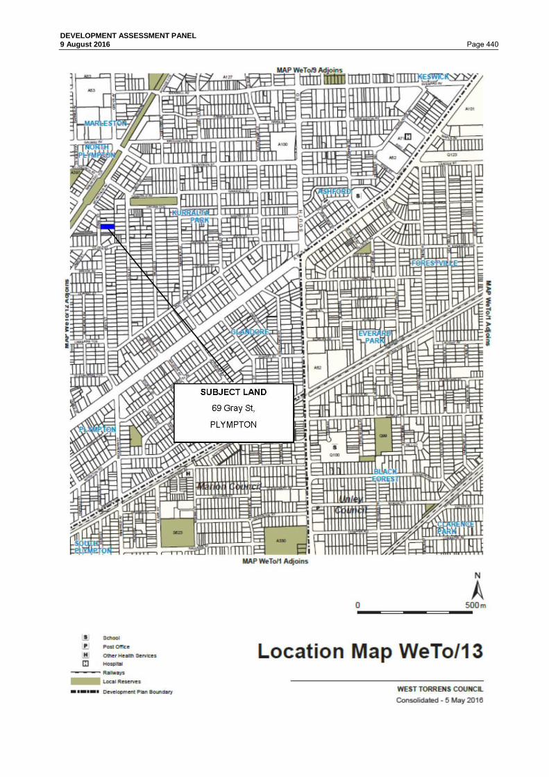
DEVELOPMENT ASSESSMENT PANEL 9 August 2016 Page 440

DEVELOPMENT ASSESSMENT PANEL 9 August 2016 Page 441 PROPOSAL
It is considered that the proposal is best described as follows:
"Land Division - Community Title; DAC No. 211/C071/16 (Unique ID 54314); Create one (1) additional allotment"
The land division will create a new allotment behind the existing dwelling in the form of a battle-axe. This allotment will have an area of 626m² (including the driveway). Community land can be found in the south western corner of the allotment and will be used for letterboxes and water meters. The allotment created for the existing dwelling will have an area of 356m². The southern wall of the dwelling will make up the boundary line and border the driveway to the rear allotment. Refer Attachment 1. PUBLIC NOTIFICATION
The application is a Category 1 form of development pursuant to Section 38 and Schedule 9 Part 1 of the Development Act and Regulations and the Residential Zone, Procedural Matters Section of the West Torrens Council Development Plan. REFERRALS
Internal referral to the City Assets Department and Councils Amenity officer were not required as they made their assessment during 211/375/2016 & 211/394/2016. External Pursuant to Section 33 and Regulation 29 of the Development Act and Regulations, the application was referred to: DAC No concerns were raised and only the standard conditions requested.
SA Water No concerns were raised Refer Attachment 2.

DEVELOPMENT ASSESSMENT PANEL 9 August 2016 Page 442 ASSESSMENT
The subject land is located within the Residential Zone, and more specifically Medium Density Policy Area 19 as described in the West Torrens Council Development Plan. The main provisions of the Development Plan which relate to the proposed development are as follows: General Section
Land Division Objectives 1, 2, 3 & 4 Principles of Development Control 1, 2, 5, 6, 7, 8, 9, 10 & 12
Orderly and Sustainable Development
Objectives 1, 2, 3, 4 & 5 Principles of Development Control 1, 3, 5 & 7
Residential Development Objectives 1 & 4 Principles of Development Control 1, 3, 18 19, 20 & 21
Transportation and Access Objectives 2 Principles of Development Control 23, 24, 29, 30, 31, 34, 35,
44 & 45 Zone: Residential Zone Desired Character Statement: This zone will contain predominantly residential development. There may also be some small-scale non-residential activities such as offices, shops, consulting rooms and educational establishments in certain locations. Non-residential activities will be complementary to surrounding dwellings. Allotments will be at very low, low and medium densities to provide a diversity of housing options in different parts of the zone. The range of allotment sizes will support the desired dwelling types anticipated in each policy area, and the minimum allotment sizes shall be treated as such in order to achieve the Desired Character for each policy area and, in turn, reinforce distinction between policy areas. Row dwellings and residential flat buildings will be common near centres and in policy areas where the desired density is higher, in contrast to the predominance of detached dwellings in policy areas where the distinct established character is identified for protection and enhancement. There will also be potential for semi-detached dwellings and group dwellings in other policy areas. Residential development in the form of a multiple dwelling, residential flat building or group dwelling will not be undertaken in a Historic Conservation Area. Landscaping will be provided throughout the zone to enhance the appearance of buildings from the street as viewed by pedestrians, provide an appropriate transition between the public and private realm and reduce heat loads in summer. Objectives 3 & 4 Principles of Development Control 1, 2, 5 & 22 Policy Area: Medium Density Policy Area 19 Desired Character Statement: Allotments in this policy area will be at medium density, accommodating a range of dwelling types including semi-detached, row and group dwellings, as well as some residential flat buildings and some detached dwellings on small allotments. There will be a denser allotment pattern close to centre zones where it is desirable for more residents to live and take advantage of the variety of facilities focused on centre zones.

DEVELOPMENT ASSESSMENT PANEL 9 August 2016 Page 443 New buildings will contribute to a highly varied streetscape. Buildings will be up to 2 storeys, except for allotments fronting Brooker Terrace, Marion Road and Henley Beach Road, and overlooking the Westside Bikeway, where buildings will be up to 3 storeys in height and provide a strong presence to streets. Garages and carports will be located behind the front facade of buildings. Development will be interspersed with landscaping, particularly behind the main road frontage, to enhance the appearance of buildings from the street as viewed by pedestrians, provide an appropriate transition between the public and private realm and reduce heat loads in summer. Objectives 1 Principles of Development Control 1, 2, 3, 5 & 7 QUANTITATIVE ASSESSMENT
The proposal is assessed for consistency with the prescriptive requirements of the Development Plan as outlined in the table below:
DEVELOPMENT PLAN
PROVISIONS
STANDARD ASSESSMENT
SITE AREA Medium Density Policy Area 19 PDC 4 or PDC 5 (within 400m of centre)
Detached Dwelling 270m²(min.)
356m² (Lot 61) 626m² (Lot 62)
Satisfies
SITE FRONTAGE Medium Density Policy Area 19 PDC 4 or PDC 5 (within 400m of centre)
Detached Dwelling 9m
10.10m (Lot 61) 5.05m (Lot 62)
Lot 62 Does Not Satisfy
by 56% SITE COVERAGE Medium Density Policy Area 19 PDC 3
60% (max.)
49% (Lot 61)
Satisfies
PRIMARY STREET SETBACK Medium Density Policy Area 19 PDC 3
No change
SIDE/REAR SETBACKS Residential Zone PDC 11
Side 0/1m
0m
Satisfies
Medium Density Policy Area 19 PDC 3
Rear 6m (min.)
8m (4m to verandah)
Satisfies

DEVELOPMENT ASSESSMENT PANEL 9 August 2016 Page 444 PRIVATE OPEN SPACE Residential Development PDC 19
300-500m²
- 60m² (min.), of which 10m² may comprise balconies, roof patios and the like, provided
they have a minimum dimension of 2m.
-Minimum dimension 4m. - 16m² (min.) at the rear of side of dwelling, directly
accessible from a habitable room.
78m² (total)
4.5m (min. dimension) 78m² (accessed from
habitable room)
Satisfies
CARPARKING SPACES Transportation and Access PDC 34
Detached, semi-detached, row and multiple dwellings
- 2 car-parking spaces required, 1 of which is
covered
4 spaces provided (2
undercover)
Satisfies
QUALITATIVE ASSESSMENT
In assessing the merits or otherwise of the application, the proposed development satisfies the relevant Development Plan provisions with the exception of the following, as discussed under the following sub headings: Site Area and Frontage The proposed battle-axe allotment does not comply with the minimum frontage requirement for a detached dwelling. This is common for battle-axe shaped allotments as it is only the driveway portion of the allotment that has street frontage. This frontage deficiency is not considered fatal to the application as battle-axe allotments are allowed in the medium density areas and it would not be practical for them to have 9m wide frontages to a public road. There are several other examples of battle-axe shaped allotments within the locality such as: • 65a Gray Street; • 65b Gray Street; and • 73a Gray Street. SUMMARY This is a reasonable development within the Medium Density Policy Area 19. There isn't a prevailing allotment pattern due to there being a mixture of standard and battle-axed shaped allotments. This proposal will not be detrimental to the existing or desired character of the locality. Having considered all the relevant Objectives and Principles of the Development Plan, the proposal is considered to be not seriously at variance with the Development Plan. On balance the proposed development sufficiently accords with the relevant provisions contained within the West Torrens Council Development Plan Consolidated 05 May 2016 and warrants Development Plan Consent.

DEVELOPMENT ASSESSMENT PANEL 9 August 2016 Page 445 RECOMMENDATION
The Development Assessment Panel, having considered all aspects of the report, the application for consent to carry out development of land and pursuant to the provisions of the Development Act 1993 resolves to GRANT Development Plan Consent for Application No. 211/581/2016 by Ms Amanda Ford to undertake Land Division - Community Title; DAC No. 211/C071/16 (Unique ID 54314); Create one (1) additional allotment at 69 Gray Street (CT 5670/725) subject to the following conditions of consent; Development Plan Consent Conditions 1. That the development shall be undertaken and completed in accordance with the plans and
information detailed in this application except where varied by any condition(s) listed below. Land Division Consent Conditions: 2. The financial requirements of SA Water shall be met for the provision of water supply and
sewerage services. Subject to our new process, on receipt of the developer details and site specifications an investigation will be carried out to determine if the connections to your development will be standard or non-standard fees.
3. The developer must inform potential purchasers of the community lots of the servicing
arrangements and seek written agreement prior to settlement, as future alterations would be at full cost to the owner/applicant
4. Payment of $6,488 into the Planning and Development Fund (1 allotment(s) @
$6,488/allotment). Payment may be made by credit card via the internet at www.edala.sa.gov.au or by phone (7109 7018), by cheque payable to the Development Assessment Commission marked "Not Negotiable" and sent to GPO Box 1815, Adelaide 5001 or in person, at Ground Floor, 101 Grenfell Street, Adelaide.
5. A final plan complying with the requirements for plans as set out in the Manual of Survey
Practice Volume 1 (Plan Presentation and Guidelines) issued by the Registrar General to be lodged with the Development Assessment Commission for Land Division Certificate purposes.

DEVELOPMENT ASSESSMENT PANEL 9 August 2016 Page 446
ATTACHMENT 1

DEVELOPMENT ASSESSMENT PANEL 9 August 2016 Page 447
ATTACHMENT 2

DEVELOPMENT ASSESSMENT PANEL 9 August 2016 Page 448

DEVELOPMENT ASSESSMENT PANEL 9 August 2016 Page 449 6.16 3 Hill Place, RICHMOND Application No. 211/1408/2016/D DEVELOPMENT APPLICATION DETAILS DEVELOPMENT PROPOSAL (Combined Application)
Land division - Torrens title DAC No- 211/D163/15 Create One (1) additional allotment and the construction of a residential flat building containing two (2) x two-storey dwellings and associated garages to the front of an existing group dwelling
APPLICANT Mr Hafez Zamani APPLICATION NO 211/1408/2015D (DAC 211/D163/15) LODGEMENT DATE 11 November 2015 ZONE Residential Zone POLICY AREA 19 - Residential Medium Density APPLICATION TYPE Merit PUBLIC NOTIFICATION Cat 2 REFERRALS Internal
City Assets External DAC SA Water
DEVELOPMENT PLAN VERSION
5 November 2015
MEETING DATE 9 August 2016 RECOMMENDATION CONSENT
BACKGROUND
The development proposal is presented to the Development Assessment Panel (DAP) for the following reason:
• With regard to residential development and land division applications, where all proposed
allotments and or sites fail to meet, nor are within 5% of, the minimum frontage widths and site areas designated in respective zones and policy areas within the West Torrens Council Development Plan,
PREVIOUS or RELATED APPLICATION(S)
DA 211/1046/2010 - Land division (211/D098/10) - Approved DA 211/839/2015 - Demolition of existing dwelling - Approved DA 211/1300/2015 - Construction of a residential flat building containing two (2) two storey
dwellings and associated garages to the front of an existing group dwelling - Withdrawn

DEVELOPMENT ASSESSMENT PANEL 9 August 2016 Page 450 SITE AND LOCALITY
The subject site is irregular in shape and located at the end of Hill Place. There is an existing two storey dwelling built in the south eastern corner of the allotment. This is a recently constructed building featuring a conventional and contemporary design. The remainder of the site has been cleared of structures in preparation for development. The allotment is flat and no easements are registered on the Certificate of Title. The locality is residential in nature comprised of a variety of dwelling types such as detached dwellings, group dwellings and residential flat buildings. This reflects the beginning of infill development due to the zoning being changed to encourage medium density developments. The southern end of Hill Place is dominated by single storey detached dwellings on large allotments. Frontage widths vary due to the allotment pattern at the end of cul-de-sacs. Dwellings are generally set back from all boundaries with ancillary development such as carports being built to one side boundary. There are a variety of fencing styles, but the majority are low enough not to screen views of the dwellings. The locality is located within a flood prone area of 0.25-0.5m, but outside of the airport noise area. It is also within the 400m Centre Zone Buffer Area, allowing smaller allotment sizes and frontage widths. Overall, it is considered that the prevailing character of the locality provides a high level of amenity for its residents.

DEVELOPMENT ASSESSMENT PANEL 9 August 2016 Page 451

DEVELOPMENT ASSESSMENT PANEL 9 August 2016 Page 452

DEVELOPMENT ASSESSMENT PANEL 9 August 2016 Page 453 PROPOSAL
It is considered that the proposal is best described as follows:
"A combined application, involving a Land division - Torrens title DAC No- 211/D163/15 Creating one (1) additional allotment and the construction of a residential flat building containing two (2) x two-storey dwellings and associated garages to the front of an existing group dwelling"
All three dwellings will share an existing crossover with unrestricted rights of way placed over the shared driveway to facilitate vehicular movements. There will also be reciprocal party wall rights over allotments 100 & 101 for a party wall. Lot 100 and 101 will have site areas of 200m² and 227m² respectively. Lot 100 will be the only dwelling to have a frontage to Hill Place. The residential flat building proposed is to be two storeys in height and each dwelling will have a total floor area (ground and upper floor) of 151.2m². Refer Attachments 1 & 2. PUBLIC NOTIFICATION
The application is a Category 2 form of development pursuant to Section 38 and Schedule 9 of the Development Act and Regulations. Properties notified: 11 properties were notified during the public notification
process. Representations: 0 representations were received.
REFERRALS
Internal City Assets - Amended plans were submitted that resolved the concerns. Amenity Officer - No concerns were raised as the proposal seeks to utilise the existing crossover. External Pursuant to Section 33(1)(c) and Regulation 29 of the Development Act and Regulations, the application was referred to: Development Assessment Commission (DAC) No concerns were raised and the standard conditions provided. SA Water No concerns were raised.

DEVELOPMENT ASSESSMENT PANEL 9 August 2016 Page 454 ASSESSMENT
The subject land is located within the Residential Zone, and more specifically the Medium Density Policy Area 19 as described in the West Torrens Council Development Plan. The main provisions of the Development Plan which relate to the proposed development are as follows: General Section
Design and Appearance Objectives 1
Principles of Development Control 1, 2, 3, 5, 9, 10, 11, 13, 15, 21, 22 & 23
Hazards Objectives 1, 2 & 4
Principles of Development Control 1, 2, 4, 5, 6, 8, 9, 10, 11, 12, 13, 14 & 15
Land Division Objectives 1, 2, 3 & 4 Principles of Development Control 1, 2, 3, 4, 5, 6, 8, 11 & 16
Orderly and Sustainable Development
Objectives 1, 2, 3, 4 & 5 Principles of Development Control 1, 3 & 7
Residential Development
Objectives 1, 2, 3 & 4 Principles of Development Control 1, 3, 4, 5, 6, 7, 8, 9, 10, 11,
12, 13, 18, 19, 20, 21, 27, 30 & 31
Transportation and Access Objectives 2 Principles of Development Control 10, 11, 23, 24, 30, 34, 35,
36, 40 & 44 Zone: Residential Zone Desired Character Statement: This zone will contain predominantly residential development. There may also be some small-scale non-residential activities such as offices, shops, consulting rooms and educational establishments in certain locations. Non-residential activities will be complementary to surrounding dwellings. Allotments will be at very low, low and medium densities to provide a diversity of housing options in different parts of the zone. The range of allotment sizes will support the desired dwelling types anticipated in each policy area, and the minimum allotment sizes shall be treated as such in order to achieve the Desired Character for each policy area and, in turn, reinforce distinction between policy areas. Row dwellings and residential flat buildings will be common near centres and in policy areas where the desired density is higher, in contrast to the predominance of detached dwellings in policy areas where the distinct established character is identified for protection and enhancement. There will also be potential for semi-detached dwellings and group dwellings in other policy areas. Residential development in the form of a multiple dwelling, residential flat building or group dwelling will not be undertaken in a Historic Conservation Area. Landscaping will be provided throughout the zone to enhance the appearance of buildings from the street as viewed by pedestrians, provide an appropriate transition between the public and private realm and reduce heat loads in summer. Objectives 1, 2, 3 & 4 Principles of Development Control 1, 5, 6, 7, 10, 11, 12 & 14

DEVELOPMENT ASSESSMENT PANEL 9 August 2016 Page 455 Policy Area: Medium Density Policy Area 19 Desired Character Statement: Allotments in this policy area will be at medium density, accommodating a range of dwelling types including semi-detached, row and group dwellings, as well as some residential flat buildings and some detached dwellings on small allotments. There will be a denser allotment pattern close to centre zones where it is desirable for more residents to live and take advantage of the variety of facilities focused on centre zones. New buildings will contribute to a highly varied streetscape. Buildings will be up to 2 storeys, except for allotments fronting Brooker Terrace, Marion Road and Henley Beach Road, and overlooking the Westside Bikeway, where buildings will be up to 3 storeys in height and provide a strong presence to streets. Garages and carports will be located behind the front facade of buildings. Development will be interspersed with landscaping, particularly behind the main road frontage, to enhance the appearance of buildings from the street as viewed by pedestrians, provide an appropriate transition between the public and private realm and reduce heat loads in summer. Objectives 1 Principles of Development Control 1, 2, 3 & 5 QUANTITATIVE ASSESSMENT
The proposal is assessed for consistency with the prescriptive requirements of the Development Plan as outlined in the table below:
DEVELOPMENT PLAN
PROVISIONS
STANDARD ASSESSMENT
SITE AREA Medium Density Policy Area 19 PDC 5 (within 400m of centre)
Within 400m of centre zone
Detached Dwelling 250m²(min.)
Semi-detached Dwelling 200m²(min.)
Group Dwelling 170m²(min.) Residential Flat Building
150m²(avg.) Row Dwelling 150m²(min.)
200m² (Lot 100) 227m² (Lot 101)
Satisfies
SITE FRONTAGE Medium Density Policy Area 19 PDC 5 (within 400m of centre)
Residential Flat Building 15m
(complete building)
13.11m
Does Not Satisfy
by 13%
SITE COVERAGE Medium Density Policy Area 19 PDC 3
60% (max.)
41%
Satisfies
PRIMARY STREET SETBACK Medium Density Policy Area 19 PDC 3
3m (min.)
4.7m
Satisfies

DEVELOPMENT ASSESSMENT PANEL 9 August 2016 Page 456 SIDE/REAR SETBACKS Residential Zone PDC 11
Side 0/1m
1m
Satisfies
Medium Density Policy Area 19 PDC 3
Rear 6m (min.)
3.1m (Lot 100) 6m (Lot 100)
3.9m (Lot 101) 6m (Lot 101)
Does Not Satisfy
BUILDING HEIGHT Medium Density Policy Area 19 PDC 3
2 storeys or 8.5m
2 storeys Satisfies
INTERNAL FLOOR AREA Residential Development PDC 9
- 3+ Bedroom, 100m² (min.)
125m² each
Satisfies
PRIVATE OPEN SPACE Residential Development PDC 19
<300m²
- 24m² (min.), of which 8m² may comprise balconies, roof patios and the like, provided
they have a minimum dimension of 2m.
-Minimum dimension 3m (excl. balconies).
- 16m² (min.) at the rear of side of dwelling, directly
accessible from a habitable room.
29.1m² (total)
3m (min. dimension) 29.1m² (accessed from
habitable room)
28.7m² (total)
3.1m (min. dimension) 28.7m² (accessed from
habitable room)
Satisfies
CARPARKING SPACES Transportation and Access PDC 34
Group dwellings and
Residential Flat Buildings - 2 car-parking spaces required, 1 of which is
covered + an additional 0.25 spaces
per dwelling
2 spaces provided (one
covered (Each))
Satisfies

DEVELOPMENT ASSESSMENT PANEL 9 August 2016 Page 457 QUALITATIVE ASSESSMENT
In assessing the merits or otherwise of the application, the proposed development satisfies the relevant Development Plan provisions with the exception of the following, as discussed under the following sub headings: Setbacks The Development Plan States that dwellings within Medium Density Policy Area 19 should have a minimum rear setback of 6m. Whilst the upper level of the proposed dwellings meets this provision, the ground floor doesn't. This isn't considered fatal to the application, as many of the surrounding dwellings also have rear setbacks well under the 6m minimum. As there is an existing character of lesser rear setbacks, it is not considered that this development will have a detrimental impact on it or the dwellings immediately adjoining the rear boundary. Frontage The minimum frontage requirement for a residential flat building within the Policy Area is 15m. The subject land only has a frontage of 13.11m. This 1.89m deficiency is not considered fatal to the application as the land widens to 27m within 8m of the front boundary. The shape of the allotment also necessitates that the dwellings not directly face the public road but rather be on an angle. This allows deeper views into the property from the public realm and also allows both front doors, of the proposed residential flat building, to be viewed form the road. This improves visual amenity as most residential flat building designs mean that you can only see the front dwelling from the road. SUMMARY This is a reasonable development within the Medium Density Policy Area 19. It is acknowledged that there are deficiencies in frontage width and ground floor rear setbacks, but due to the site characteristics and adjoining development, it is not considered fatal to the application. Residential flat buildings are envisaged development within this zone and Policy Area. Having considered all the relevant Objectives and Principles of the Development Plan, the proposal is considered to be not seriously at variance with the Development Plan. On balance the proposed development sufficiently accords with the relevant provisions contained within the West Torrens Council Development Plan Consolidated 5 November 2016 and warrants Development Plan Consent. RECOMMENDATION
The Development Assessment Panel, having considered all aspects of the report, the application for consent to carry out development of land and pursuant to the provisions of the Development Act 1993 resolves to GRANT Development Plan Consent for Application No. 211/1408/2015D by Hafez Zamani to undertake Land division - Torrens title DAC No- 211/D163/15 Create One (1) additional allotment and the construction of a residential flat building containing two (2) x two-storey dwellings and associated garages to the front of an existing group dwelling at 3 Hill Place, Richmond (CT 5321/190) subject to the following conditions of consent Development Plan Consent Conditions: 1. Development is to take place in accordance with the plans relating to Development
Application No. 211/1408/15D (DAC 211/D163/15).

DEVELOPMENT ASSESSMENT PANEL 9 August 2016 Page 458 2. That the upper level windows of the dwellings shall be provided with fixed obscure glass to
a minimum height of 1.7 metres above the upper floor level to minimise the potential for overlooking of adjoining properties, prior to the occupation of the building. The glazing in these windows will be maintained in a reasonable condition at all times.
3. That all stormwater design and construction shall be in accordance with Australian
Standards and recognised engineering best practices to ensure that stormwater does not adversely affect any adjoining property or public road and for this purpose stormwater drainage shall not at any time:- a) Result in the entry of water into a building; or b) Affect the stability of a building; or c) Create unhealthy or dangerous conditions on the site or within the building; or d) Flow or discharge onto the land of an adjoining owner; and not flow across footpaths or
public ways. 4. That all driveways, parking and manoeuvring areas shall be formed, surfaced with
concrete, bitumen or paving, and be properly drained, and shall be maintained in reasonable condition at all times.
Land division Consent Conditions: 5. The financial requirements of the SA Water Corporation shall be met for the provision of
water and sewerage services (SA Water H0039862).
The internal drains shall be altered to the satisfaction of the SA Water Corporation. 6. Payment of $6,488 into the Planning and Development fund (1 allotment @
$6,488/allotment). Payment may be made by credit card via the internet at www.edala.sa.gov.au or by phone (7109 7018), by cheque payable to the Development Assessment Commission marked “Not Negotiable” and sent to GPO Box 1815, Adelaide 5001 or in person, at Ground Floor, 101 Grenfell Street, Adelaide.
7. A final plan complying with the requirements for plans as set out in the Manual of Survey
Practice Volume 1 (Plan Presentation and Guidelines) issued by the Registrar General to be lodged with the Development Assessment Commission for Land Division Certificate purposes.
On approval of the application, all internal water piping that crosses the allotment boundaries must be severed or redirected at the developers/owners cost to ensure that the pipework relating to each allotment is contained within its boundaries.

DEVELOPMENT ASSESSMENT PANEL 9 August 2016 Page 459
ATTACHMENT 1

DEVELOPMENT ASSESSMENT PANEL 9 August 2016 Page 460

DEVELOPMENT ASSESSMENT PANEL 9 August 2016 Page 461

DEVELOPMENT ASSESSMENT PANEL 9 August 2016 Page 462

DEVELOPMENT ASSESSMENT PANEL 9 August 2016 Page 463

DEVELOPMENT ASSESSMENT PANEL 9 August 2016 Page 464

DEVELOPMENT ASSESSMENT PANEL 9 August 2016 Page 465

DEVELOPMENT ASSESSMENT PANEL 9 August 2016 Page 466

DEVELOPMENT ASSESSMENT PANEL 9 August 2016 Page 467

DEVELOPMENT ASSESSMENT PANEL 9 August 2016 Page 468

DEVELOPMENT ASSESSMENT PANEL 9 August 2016 Page 469

DEVELOPMENT ASSESSMENT PANEL 9 August 2016 Page 470
ATTACHMENT 2

DEVELOPMENT ASSESSMENT PANEL 9 August 2016 Page 471 6.17 5 & 7 Louise Avenue, FULHAM Application No. 211/507/2016 DEVELOPMENT APPLICATION DETAILS DEVELOPMENT PROPOSAL Land Division - Torrens Title; DAC No. 211/D047/16
(Unique ID 54016); Create two (2) additional allotments Stage 1 - Create Lots 1 & 2 Stage 2 - Create Lots 3 & 4
APPLICANT Michael Gregory Roe APPLICATION NO 211/507/2016 LODGEMENT DATE 7 April 2016 ZONE Residential POLICY AREA Low Density Policy Area 21 APPLICATION TYPE Merit PUBLIC NOTIFICATION Category 1 REFERRALS Internal
City Works - Street tree removal External Development Assessment Commission (DAC) SA Water
DEVELOPMENT PLAN VERSION
5 November 2015
MEETING DATE 9 August 2016 RECOMMENDATION CONSENT
BACKGROUND
The development proposal is presented to the Development Assessment Panel (DAP) for the following reason/s:
• With regard to residential development and land division applications, where all proposed allotments and or sites fail to meet, nor are within 5% of, the minimum frontage widths and site areas designated in respective zones and policy areas within the West Torrens Council Development Plan,
PREVIOUS or RELATED APPLICATION(S)
Nil

DEVELOPMENT ASSESSMENT PANEL 9 August 2016 Page 472 SITE AND LOCALITY
The subject land is comprised of two parcels namely, Allotment 40 Deposited Plan 7593 in the area named Fulham Hundred of Adelaide, Certificate of Title Volume 5592 Folio 587, and Allotment 41 Deposited Plan 7593 in the area named Fulham Hundred of Adelaide, Certificate of Title Volume 5592 Folio 976. The lands are more commonly known as 5 & 7 Louise Avenue, Fulham. The subject land is an irregular shape, due to the back boundary being angled inwards toward the shared boundary of 5 and 7 Louise Avenue. The total site area of the subject land is approximately 1,371 square metres and the total frontage width to Louise Avenue is 36.576 metres. Currently contained on 5 Louise Avenue is a 1968 conventional hipped roof dwelling, a small verandah and an outbuilding and on 7 Louise Avenue is a 1967 conventional hipped roof dwelling, a large verandah, outbuilding and in-ground swimming pool. The subject land is located on the northern side of Louise Avenue within the Residential Zone and more particularly Low Density Policy Area 21. The rear boundary of the subject land abuts four (4) residential properties located within the City of Charles Sturt. The locality consists of low to medium density residential development up to two storeys in height that was mainly constructed circa 1950's, 60's and 70's. The subject land is located within 400 metres of the Local Centre Zone located at the intersection of Henley Beach Road and Tapleys Hill Road. The site and locality are shown on the following maps.

DEVELOPMENT ASSESSMENT PANEL 9 August 2016 Page 473

DEVELOPMENT ASSESSMENT PANEL 9 August 2016 Page 474

DEVELOPMENT ASSESSMENT PANEL 9 August 2016 Page 475 PROPOSAL
The proposed land division is for a Torrens Title Land Division creating two additional allotments. The proposal is for a side by side land division which will result in all allotments having a direct frontage to a public street. Proposed Allotment 1 and 2 will each have a 9.145 metre frontage width, and a maximum depth of 37.12 metres. The total area of Allotment 1 is 338.92 square metres and the total area of Allotment 2 is 339.97 square metres. Proposed Allotment 3 and 4 will each have a 9.165 metre frontage width. The total area of Allotment 3 is 343.33 square metres and the total area of Allotment 4 is 349 square metres. The Plan of Division is contained within Attachment 1. PUBLIC NOTIFICATION
The application is a Category 1 form of development pursuant to Section 38 and Schedule 9 of the Development Act and Regulations and Residential Zone, Procedural Matters. REFERRALS
Internal The application was referred to Council's City Works Department for comment on the potential of street tree removal for the location of future crossovers. The Amenity Officer advised that the street tree in front of 7 Louise Avenue should not be removed, but with that said, there is adequate room to accommodate a single width crossover in front Lot 2 whilst maintaining the minimum offset requirements and there is already an existing crossover in front of Lot 1. To accommodate crossovers to allow vehicle access to proposed Allotment 3 and 4, City Works will support the removal of the street tree situated adjacent to 5 Louise Avenue. External The application was referred to SA Water by the Development Assessment Commission (DAC) who advised of no objection subject to specified standard conditions being included on any consent to be issued. A copy of the relevant referral responses are included in Attachment 2. ASSESSMENT
The subject land is located within the Residential Zone and more particularly within the Low Density Policy Area 21 as described in the West Torrens Council Development Plan. The main provisions of the Development Plan which relate to the proposed development are as follows: General Section
Infrastructure Objectives 3 Principles of Development Control 1, 6, 8 & 16
Land Division Objectives 1, 2, 3 & 4 Principles of Development Control 1, 2, 5, 6 & 8
Orderly and Sustainable Development
Objectives 1, 2, 3, 4 & 5 Principles of Development Control 1, 3 & 8
Residential Development Objectives 1, 2, 3 & 4 Principles of Development Control 1 & 2
Transportation and Access Objectives 2 Principles of Development Control 1, 2, 23, 24 & 25

DEVELOPMENT ASSESSMENT PANEL 9 August 2016 Page 476 Zone: Residential Zone Desired Character Statement: "This zone will contain predominantly residential development. There may also be some small-scale non-residential activities such as offices, shops, consulting rooms and educational establishments in certain locations. Non-residential activities will be complementary to surrounding dwellings. Allotments will be at very low, low and medium densities to provide a diversity of housing options in different parts of the zone. The range of allotment sizes will support the desired dwelling types anticipated in each policy area, and the minimum allotment sizes shall be treated as such in order to achieve the Desired Character for each policy area and, in turn, reinforce distinction between policy areas. Row dwellings and residential flat buildings will be common near centres and in policy areas where the desired density is higher, in contrast to the predominance of detached dwellings in policy areas where the distinct established character is identified for protection and enhancement. There will also be potential for semi-detached dwellings and group dwellings in other policy areas. Residential development in the form of a multiple dwelling, residential flat building or group dwelling will not be undertaken in a Historic Conservation Area. Landscaping will be provided throughout the zone to enhance the appearance of buildings from the street as viewed by pedestrians, provide an appropriate transition between the public and private realm and reduce heat loads in summer." Objectives 1-4 Principles of Development Control 1 & 5 Policy Area: Low Density Policy Area 21 Desired Character Statement: "This policy area will have a low density character. In order to preserve this, development will predominantly involve the replacement of detached dwellings with the same (or buildings in the form of detached dwellings). There will be a denser allotment pattern and some alternative dwelling types, such as semi-detached and row dwellings, close to centre zones where it is desirable for more residents to live and take advantage of the variety of facilities focused on centre zones. Battleaxe subdivision will not occur in the policy area to preserve a pattern of rectangular allotments developed with buildings that have a direct street frontage. In the area bounded by Henley Beach Road, Torrens Avenue and the Linear Park, where the consistent allotment pattern is a significant positive feature of the locality, subdivision will reinforce the existing allotment pattern. Buildings will be up to 2 storeys in height. Garages and carports will be located behind the front façade of buildings. Buildings in the area bounded by Henley Beach Road, Torrens Avenue and the Linear Park will be complementary to existing dwellings through the incorporation of design features such as pitched roofs, eaves and variation in the texture of building materials. Development will be interspersed with landscaping, particularly behind the main road frontage, to enhance the appearance of buildings from the street as viewed by pedestrians, provide an appropriate transition between the public and private realm and reduce heat loads in summer. Low and open-style front fencing will contribute to a sense of space between buildings". Objectives 1 Principles of Development Control 1, 2, 4 & 6

DEVELOPMENT ASSESSMENT PANEL 9 August 2016 Page 477 QUANTITATIVE ASSESSMENT
The proposal is assessed for consistency with the prescriptive requirements of the Development Plan as outlined in the table below:
DEVELOPMENT PLAN
PROVISIONS
STANDARD ASSESSMENT
Allotment 1
Allotment 2
Allotment 3
Allotment 4
SITE AREA Low Density Policy Area 21 PDC 4
350m²
(For either
detached, semi-detached or row
dwellings)
339m²
Does not satisfy by
3.14%
340m²
Does not satisfy by
2.8%
343m²
Does not satisfy by
2%
349m²
Does not satisfy by
0.28%
ALLOTMENT AREA Low Density Policy Area 21 PDC 6
420m²
(This allotment
area is only required if the
application is not combined with a
land use proposal)
339m²
Does not satisfy by
19.2%
340m²
Does not satisfy by
19%
343m²
Does not satisfy by
18.3%
349m²
Does not satisfy by
16.9%
SITE FRONTAGE Low Density Policy Area 21 PDC 4
9m
(For either detached, semi-detached or row
dwellings)
9.144m
Satisfies
9.144m
Satisfies
9.144m
Satisfies
9.144m
Satisfies
ALLOTMENT FRONTAGE Low Density Policy Area 21 PDC 6
12m
(This allotment frontage width is
only required if the application is not combined with a
land use proposal)
9.144m
Does not satisfy by
23.8%
9.144m
Does not satisfy by
23.8%
9.144m
Does not satisfy by
23.8%
9.144m
Does not satisfy by
23.8%
QUALITATIVE ASSESSMENT
In assessing the merits or otherwise of the application, the proposed development satisfies the relevant Development Plan provisions with the exception of the following, as discussed under the following sub headings: Allotment Frontage and Area Within the Low Density Policy Area 21 there is a certain tension with the policy regarding minimum site areas and frontage widths.

DEVELOPMENT ASSESSMENT PANEL 9 August 2016 Page 478 Low Density Policy Area 21, Land Division Principle of Development Control (PDC) 6 is as follows, Land division should create allotments with an area of greater than 420 square metres and a minimum frontage width of 12 metres, other than where the land division is combined with an application for dwellings or follows an approval for dwellings on the site. Low Density Policy Area 21, Form and Character PDC 4 is as follows, When a dwelling is located within 400 metres of a centre zone, it should have a minimum site area (and in the case of residential flat buildings, an average site area per dwelling) and a frontage to a public road not less than that shown in the following table:
The Development Plan allows for a lesser site area and frontage width than specified in Low Density Policy Area 21, PDC 6, where the land is located within 400 metres of a centre zone. Although the proposed division is not combined with an application for dwellings, given that each envisaged dwelling type requires the same site area and frontage width and the subject lands are located within 400 metres of a centre zone the proposed site areas and frontage widths are considered to be adequate for the following reasons: • The proposed development results in allotments that are no greater than 3.15% deficient of
the site area specification; • The site area deficiency is not considered to be a major departure from the Development
Plan policy as the reduced site area will not be readily discernible when viewing the allotments from the street and the deficiency;
• The frontage width of each allotment is greater than 9 metres; • A denser allotment pattern is encouraged closer to centre zone facilities; and • The proposed allotments are of a size that could sufficiently accommodate any envisaged
dwelling type. SUMMARY The proposal will result in allotments with frontages that do not satisfy the minimum for land division, however, regardless of the dwelling type (given that the requirement is the same for all envisaged dwelling types within Low Density Policy Area 21) the proposed allotments will have a site area marginally smaller than 350 square metres and a satisfactory frontage width for residential development that is located within 400 metres of a Centre Zone. Having considered all the relevant Objectives and Principles of the Development Plan, the proposal is considered to be not seriously at variance with the Development Plan. On balance the proposed development sufficiently accords with the relevant provisions contained within the West Torrens Council Development Plan Consolidated 5 November 2015 and warrants Development Plan Consent.

DEVELOPMENT ASSESSMENT PANEL 9 August 2016 Page 479 RECOMMENDATION
The Development Assessment Panel, having considered all aspects of the report, the application for consent to carry out development of land and pursuant to the provisions of the Development Act 1993 resolves to GRANT Development Plan Consent for Application No. 211/507/2016 by Michael Gregory Roe to undertake Land Division - Torrens Title; DAC No. 211/D047/16 (Unique ID 54016); Create two (2) additional allotments at Draft Development Assessment Panel Agenda 9 August 2016 (CT 5592/976 CT 5592/987) subject to the following conditions of consent (and any subsequent or amended condition that may be required as a result of the consideration of reserved matters under Section 33(3) of the Development Act): DEVELOPMENT PLAN CONSENT COUNCIL CONDITIONS: 1. Development is to take place in accordance with the plan titled Proposed Land Division
(Site Plan), relating to Development Application No. 211/507/2016 (DAC 211/D047/16). LAND DIVISION CONSENT COUNCIL CONDITIONS: 1. Prior to the issue of Section 51 Clearance to this division approved herein:
• all existing buildings must be removed (note that the removal shall be subject to a separate development approval).
DEVELOPMENT ASSESSMENT COMMISSION CONDITIONS: 2. The financial requirements of SA Water shall be met for the provision of water supply and
sewerage services.
The alteration of internal drains to the satisfaction of SA Water is required.
An investigation will be carried out to determine if the connection/s to your development will be costed as standard or non-standard. On approval of the application, all internal water piping that crosses the allotment boundaries must be severed or redirected at the developers/owners cost to ensure that the pipework relating to each allotment is contained within its boundaries.
3. Payment of $12,976 into the Planning and Development Fund (2 allotments @
$6,488/allotment). Payment may be made by credit card via the internet at www.edala.sa.govau or by phone (8303 0724), by cheque payable to the Development Assessment Commission marked "Not Negotiable" and sent to GPO Box 1815, Adelaide 5001 or in person, at Level 5, 136 North Terrace, Adelaide.
4. A final plan complying with the requirements for plans as set out in the Manual of Survey
Practice Volume 1 (Plan Presentation and Guidelines) issued by the Registrar General to be lodged with the Development Assessment Commission for Land Division Certificate Purposes.

DEVELOPMENT ASSESSMENT PANEL 9 August 2016 Page 480
ATTACHMENT 1

DEVELOPMENT ASSESSMENT PANEL 9 August 2016 Page 481
ATTACHMENT 2

DEVELOPMENT ASSESSMENT PANEL 9 August 2016 Page 482

DEVELOPMENT ASSESSMENT PANEL 9 August 2016 Page 483 7. CONFIDENTIAL REPORTS OF THE CHIEF EXECUTIVE OFFICER
Nil 8. SUMMARY OF COURT APPEALS
8.1 Summary of Court Appeals BACKGROUND Monthly statistics are provided for the information of the Panel in relation to: 1. any matters being referred to the Development Assessment Commission (DAC); and 2. any planning appeals before the Environment, Resources and Development Court (ERDC)
and their status. The current status is listed as follows: Matters pending determination by DAC Reason for referral DA number Address Description of development
Section 49 211/722/2016 Lot 2 West Beach
Road, WEST BEACH
Change of use to function room
Concurrence 211/262/2016 437 Henley Beach Road, BROOKLYN PARK
Alterations and additions to existing restaurant
Schedule 10 211/136/2015 134-136 Anzac Highway, GLANDORE
On The Run redevelopment
Section 49 211/1155/2012/A Lot 2 West Beach Road, WEST BEACH
Amendment to condition regarding lighting
Development Application appeals before the ERDC DA Number Address Reason for
Appeal Description of Development
Status
211/173/2016 6 Darebin Street, MILE END
Applicant appealed condition
Two-storey dwelling addition
Preliminary Conference 8 August 2016
211/1311/2015 & 211/1427/2015
51 Watson Avenue, NETLEY
Applicant appealed Nature & DAP refusal
construction of two dwellings & create one additional allotment
Pending outcome of Hearing regarding nature of development & Conciliation Conference for land division

DEVELOPMENT ASSESSMENT PANEL 9 August 2016 Page 484 211/864/2015 247-247A South
Road, MILE END
Applicant appealed DAP refusal
Change of use Preliminary Conference 8 August 2016
211/875/2015 23 Wood Street, KURRALTA PARK
Appeal by third party against decision
Construct a residential flat building containing five dwellings
Directions Hearing 16 August 2016
211/391/2016 3 Castlebar Road, LOCKLEYS
Applicant appealed DAP refusal
Carport forward of dwelling
Preliminary Conference 23 August 2016
SUMMARY
The information requested by the Panel has been provided for information purposes. RECOMMENDATION The Development Assessment Panel receive and note the information. 9. MEETING CLOSE