methods and tools for water-related adaptation to climate ...
44
-
Upload
khangminh22 -
Category
Documents
-
view
0 -
download
0
Transcript of methods and tools for water-related adaptation to climate ...
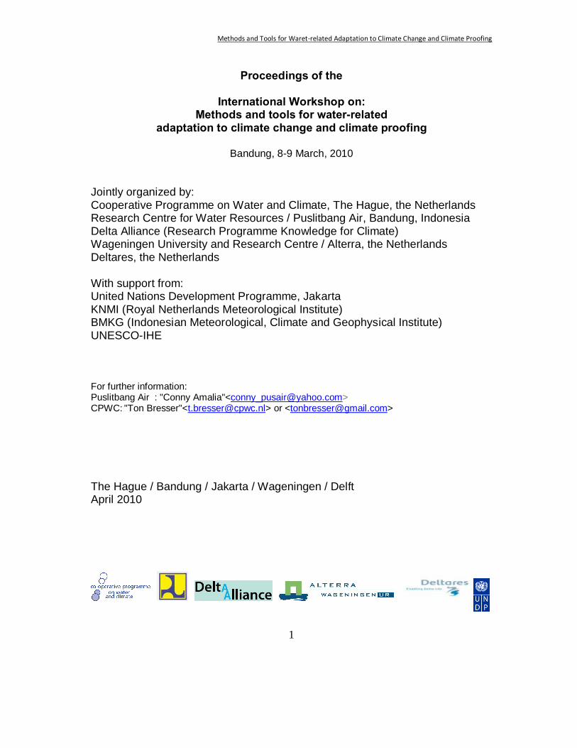
Methods and Tools for Waret-related Adaptation to Climate Change and Climate Proofing
1
Proceedings of the
International Workshop on: Methods and tools for water-related
adaptation to climate change and climate proofing
Bandung, 8-9 March, 2010 Jointly organized by: Cooperative Programme on Water and Climate, The Hague, the Netherlands Research Centre for Water Resources / Puslitbang Air, Bandung, Indonesia Delta Alliance (Research Programme Knowledge for Climate) Wageningen University and Research Centre / Alterra, the Netherlands Deltares, the Netherlands With support from: United Nations Development Programme, Jakarta KNMI (Royal Netherlands Meteorological Institute) BMKG (Indonesian Meteorological, Climate and Geophysical Institute) UNESCO-IHE For further information: Puslitbang Air : "Conny Amalia"<[email protected]> CPWC: "Ton Bresser"<[email protected]> or <[email protected]>
The Hague / Bandung / Jakarta / Wageningen / Delft April 2010
Methods and Tools for Waret-related Adaptation to Climate Change and Climate Proofing
2
Table of Contents
Table of contents ....................................................................................
Foreword ................................................................................................
Summary ................................................................................................
Introduction ............................................................................................
Objectives ..............................................................................................
Target group(s) ......................................................................................
The programme......................................................................................
8 March...............................................................................................
9 March ..............................................................................................
Affiliations ...............................................................................................
List of Participants .................................................................................
Short summaries of presentations .........................................................
Part I: Introductory speeches .................................................................
Part II: State of the Art: overviews .........................................................
Part III: Case studies from Indonesia and abroad .................................
Part IV: Parallel sessions with practical applications ............................
Part V: Plenary wrap-up .........................................................................
Closure speech with main Conclusions about the way forward .............
2
3
5
7
8
9
10
10
11
14
16
20
20
22
24
29
34
42
Methods and Tools for Waret-related Adaptation to Climate Change and Climate Proofing
3
Foreword
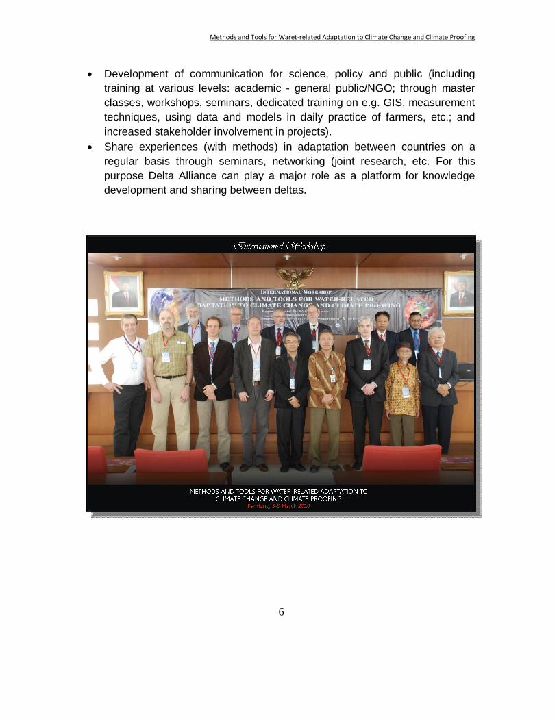
The International Workshop on Methods and Tools for Water-related Adaptation to Climate Change and Climate Proofing held from 8 to 9 March, 2010 in the Pusat Penelitian and Pengembangan Sumber Daya Air (PUSAIR) offices Bandung, Indonesia was jointly organized by the Cooperative Programme on Water and Climate, the Hague, the netherlands, Puslitbang Air, Bandung, Indonesia, Delta Alliance (Research Programme Knowledge for Climate), Wageningen University and Research Centre/Alterra, the Netherlands and Detares, the Netherlands with the support from the United Nations Development Programme, Jakarta, UNESCO-IHE, KNMI (Royal Netherlands Meteorological Institute), BMKG (Indonesian Meteorological, Climate and Geophysical Institute) and LIPI (Indonesian Institute of Sciences) as a follow-up of the co-operation between Indonesia and the Netherlands in the field of climate adaptation. The workshop fits in the National Water Plan of the Netherlands’ government of which the international chapter includes the strengthening of cooperation with other delta countries, including Indonesia, Vietnam and Bangladesh and is part of the work plan of the Cooperative Programme on Water and Climate, a Netherlands’ sponsored programme with the objective to improve knowledge and capacity on the relation between water and climate change especially in developing countries and countries in transition. The objectives of the workshop are:
- To provide insight in the disciplinary elements of importance under climate change
- To introduce tools and methods for climate change outlooks (meteorological, hydrological) as well as for operational use by water managers for planning and operations to plan and implement adaptation to climate change in deltas and other low lying areas
- To show added value and limitations of applying those tools and methods in the context of development planning, spatial planning, water resources management, agriculture, nature conservation, etc
- To present and discuss case studies where the various tools and methods are or have been applied
- To start training the trainers of policy advisers and practitioners in the use of those tools and methods
- To start the development of a toolbox on adaptation for use in Indonesia and other countries
Methods and Tools for Waret-related Adaptation to Climate Change and Climate Proofing
4
- To come up with recommendations for follow-up activities in this area that may include similar workshops and master classes for regional and local experts
- To formulate recommendations for cooperation on these issues across deltas and across delta countries
The workshop started and was officially opened with an introductory speech by Dr. Arie Setiadi Moerwanto, director of Puslitbang Air, and was then followed by three sessions on day 1 and a plenary session on day 2 which was divided into three groups each discussing different topics - Group A: Methods to prepare for adaptation in the physical system, Group B: Drought Management, Group C: Methods to use in forestry, agriculture and land management, and GIS and Remote Sensing. It is envisioned that recommendations resulted from the parallel session will be followed-up in the future. The workshop was closed by Dr Arie Setiadi Moerwanto. The workshop which target included experts and government advisors, government officials at central and provincial level and practitioners who deal with water and/or climate related issues in development, and academics in the field of water and climate change was attended by 120 participants. At last, the Organizing Committee would like to thank and extend their great appreciation to all parties for their support and contribution, and gratefully acknowledge the authors for preparing the papers.
Organizing Committee
Methods and Tools for Waret-related Adaptation to Climate Change and Climate Proofing
5
Summary The Co-operative Programme on Water and Climate (CPWC), the Research Centre for Water Resources (RCWR/Pusair) and the Delta Alliance organized an international workshop on “Methods and Tools for Water-related Adaptation to Climate Change and Climate Proofing” in Bandung, Indonesia on 8 and 9 March 2010. Around 110 participants from Indonesia, the Netherlands, Vietnam and Bangladesh attended the 2 days workshop. They came from government (national and regional), environmental and water management, research and education, NGO’s and the private sector. After introductions about the Indonesian and Netherlands co-operation and the Indonesian strategy towards climate change adaptation, overviews of the state of the art in research and management in this field were presented by experts from Indonesia, the Netherlands and Vietnam. Some case studies from Indonesia, Vietnam, and Bangladesh provided insight in the methods and tools used to adapt in those countries. The focus was on lowlands and especially delta areas. The presentations showed a variety of approaches but also striking similarities in issues and ways to tackle them. The objective of the Delta Alliance of co-operating between countries with low-lying deltas is supported by these similarities and certainly by the participants. It was felt that much could be learned from experiences in other countries with more or less similar conditions. During the second day discussions took place in break-out sessions on (i) methods to prepare for adaptation in the physical system; (ii) drought management and (iii) methods to use in forestry, agriculture and land management. The results of the break-out sessions were presented and completed during a plenary panel session. One of the objectives of the discussions was to come up with recommendations on necessary follow-up. The workshop chairman summarized the recommendations and indicated that there is a clear need for: • Advanced modeling capacity of the climate-hydrology system (includes data
analysis; concentrates on extreme events; includes scenario and down scaling; with attention for the boundary condition: (joint?) computing facilities).
• Monitoring and assessment (including combinations of remote sensing and field observations; from rainfall to impacts of climate change in the water sector: drought management, morphology etc.).
• Development of tools for management of water and land (including carbon stocks and fluxes; including interactions between nature and social-economic development for each livelihood).
Methods and Tools for Waret-related Adaptation to Climate Change and Climate Proofing
6
• Development of communication for science, policy and public (including training at various levels: academic - general public/NGO; through master classes, workshops, seminars, dedicated training on e.g. GIS, measurement techniques, using data and models in daily practice of farmers, etc.; and increased stakeholder involvement in projects).
• Share experiences (with methods) in adaptation between countries on a regular basis through seminars, networking (joint research, etc. For this purpose Delta Alliance can play a major role as a platform for knowledge development and sharing between deltas.
Methods and Tools for Waret-related Adaptation to Climate Change and Climate Proofing
7
Introduction
Indonesia is preparing itself to adapt to upcoming climate change and its impacts. Adaptation will be necessary in the near future, especially water related adaptation. The National Action Plan for Climate Change (RANPI) and various other government documents ask for further development of knowledge and capacity to deal with climate change impacts. At the recent Climate Change Conference in Copenhagen support for developing countries and countries in transition for adaptation has been part of the agenda. Indonesia has been one of the more active countries in the Copenhagen debates and is now preparing for the next phase in climate change mitigation and adaptation. International cooperation is part of the agenda.
Indonesia and the Netherlands have a Memorandum of Understanding between the respective ministries responsible for water and environment (4-party MoU). This workshop was a follow up of the ongoing co-operation between Indonesia and the Netherlands thus far, in the field of climate adaptation. Various projects in the area of adaptation to climate change are being carried out already in co-operation between Indonesia and the Netherlands or are planned for the near future.
The workshop fitted in the focus and timing of the Netherlands’ ‘Nationaal Waterplan’ (National Water Plan of the Netherlands’ government) that was approved by the government in December 2009. The international chapter of this National Water Plan includes the strengthening of the co-operation with other delta countries, including Indonesia, Vietnam and Bangladesh. This is realized in close co-operation with the Netherlands’ Water Partnership and through the financing mechanism of Partners for Water.
The workshop is part of the 2009/2010-work plan of the Co-operative Programme on Water and Climate, a Netherlands’ sponsored programme with the objective to improve knowledge and capacity on the relation between water and climate change, especially in developing countries and countries in transition.
The initiative is also part of the implementation of the international Delta Alliance, a new platform that has as objectives to increase the exchange of knowledge across deltas, to improve research and project collaboration and to reduce the overlap in fundamental research. The Delta Alliance is supported by a number of research programmes like Knowledge for Climate (Kennis voor Klimaat) and Climate Changes Spatial Planning (Klimaat voor Ruimte), CPWC and the knowledge institutions Wageningen UR and Deltares. The first phase of the Delta Alliance is implemented in co-operation between Indonesia, Vietnam, the State of California, Bangladesh and the Netherlands.
Methods and Tools for Waret-related Adaptation to Climate Change and Climate Proofing
8
Objectives The objectives of the workshop were:
1. to provide insight in the disciplinary elements relevant for climate change 2. to introduce tools and methods for climate change outlooks
(meteorological, hydrological) as well as for operational use by water managers for planning and operations to plan and implement adaptation to climate change in deltas and other (economically important) low lying areas; primarily Indonesia is the target country but the workshop will not be limited to that and might have follow-ups elsewhere;
3. to show the potential added value and limitations (when dealing with uncertainty) of applying those tools (physically based, legal, institutional and financial) and methods in the context of development planning, spatial planning, IWRM, agriculture, nature conservation, etc.;
4. to present and discuss case studies (also from other countries) where the various tools and methods are or have been applied;
5. to start training the trainers of policy advisers and practitioners in the use of those tools and methods;
6. to start the development of a toolbox on adaptation for use in Indonesia and other countries;
7. to come up with recommendations for follow-up activities in this area; 8. to formulate recommendations for co-operation on these issues across
deltas and across delta countries.
Most of the objectives have been met in the workshop; some only briefly others more in-depth. Objective 5 needed more time than available. This will be dealt with in a follow-up to the workshop. Objective 6 is part of a project carried out at Wageningen University and Research Centre as a contract of CPWC. The outcomes of this workshop will be input into this project. The results of that project will be communicated to the partners involved in this workshop.
Methods and Tools for Waret-related Adaptation to Climate Change and Climate Proofing
9
Target Group(s) The workshop targeted experts and government advisors, government officials at central and provincial level, and practitioners who deal with water and/or climate related issues in development. Also academics in the (broad) field of water and climate change participated. The general level of education was at least higher education or academic. The workshop was held in English mainly; the working knowledge of almost all participants was more than enough to follow the presentations and to take part in the discussions. To stimulate the cooperation across delta countries (an objective of the Delta Alliance) a few experts from Vietnam and Bangladesh participated in the workshop. They highlighted the state of knowledge on water-related climate change adaptation in their country. This proved to be a good start for follow-up activities involving different deltas.
Methods and Tools for Waret-related Adaptation to Climate Change and Climate Proofing
10
The Programme The programme that has been realized was slightly different from the original set-up, mainly in the official part I. Some of the officials had last minute changes in their schedule and had to send replacements. This did not influence the contents of the presentations. The originally planned 4 break-out sessions on the second day were concentrated in 3 sessions. The 4th session would have shown too much overlap with the other 3 and would have made it difficult for participants to choose. Participants received the book “Climate Change Adaptation in the Water Sector” and a CD with background material (including also some useful models and information on the coordinating organisations). The final programme is shown below. The main contents of the presentations follow this overview. The complete set of presentations is on the CD which is attached to these proceedings. The affiliation of chairmen and presenters is given in a separate list.
8 March Part I: Introductory speeches Chair: Dr. Arie Setiadi Moerwanto, co-chair: Ir. Wim van Driel
- Dr. Arie Setiadi Moerwanto : Welcome and opening of the workshop - Dr. Armi Susandi : National Adaptation Strategy for Climate
Change - Dr. Piet de Wildt : Perspectives for (future) cooperation - Mr. M. Irfan Shaleh : National Adaptation Program for Climate
Change - Mr. Sugianto : National adaptation programme for public
works - Dr. Heru Santoso : Sustaining the Environment and Human
Security - Ir. Ton Bresser : The Co-operative Programme on Water and
Climate
Methods and Tools for Waret-related Adaptation to Climate Change and Climate Proofing
11
Part II: State of the Art: overviews Chair: Dr. Edvin Aldrian, co-chair: Ir. Ton Bresser
- Prof. Eelco van Beek : Methods and measures in the water and land development planning in relation to climate change; vulnerability assessments to climate change and their relevance
- Dr. Aart Schrevel : Presenting Delta Alliance - Prof. Wahyoe Hantoro : Global climatic change and (relative) high
stand sea level in Indonesia - Prof. Dr. Le Quang Minh : State of affairs on adaptation in the Mekong
area Part III: Case studies from Indonesia and abroad Chair: Mr. Sugianto, co-chair Ir Wim van Driel
- Dr. Le Duc Trung : Mekong River, Vietnam - Dr. Emmadudin Ahmad : Bangladesh deltas - Drs. JanJaap Brinkman : Jakarta Floods, Sea Defence Jakarta - Dr. Peter van der Meer : Lowland development - Ms. Verania Andria : Adaptation in dairy farming East Java - Dr. Arien Heryansyah : Aceh climate proofing - Dr.A. Faqih : South Sumatra project: vulnerability
assessment and adaptation methods - Dr. Wanny Adidarma : Impact of Climate Change on Hydrological
Aspects in Indonesia - Dr. Edvin Aldrian : Climate Change Adaptation Policy and
Experience in BMKG Explanation of parallel sessions: Ir. Ton Bresser
9 March Part IV: Parallel sessions with practical applications General set-up of the sessions In each session a theoretical part was presented with the important knowledge elements for climate adaptation; this introductory lecture (or lectures) was followed by demonstrations of one or more examples of tools and methods. The focus was on deltaic areas. Questions to be answered by the participants (not limited):
Methods and Tools for Waret-related Adaptation to Climate Change and Climate Proofing
12
o What are the knowledge, training and capacity development needs in Indonesia?
o How to create a knowledge development and exchange network on climate change and water-related adaptation within Indonesia?
o How to reach convergence between the research and development agenda and the capacity building needs?
o How to exchange knowledge and experience in Indonesia and between countries with similar situations?
Each group had one or more facilitators. Each group appointed a person to present the main findings in the plenary part V of the programme. Sessions: A1 Methods to prepare for adaptation in the physical system
Presenters and facilitators: Dr. Edvin Aldrian, Dr. Piet de Wildt Weather and climate forecasts (decadal scale)
Seasonal to annual scale forecasting Use and limitations of scenarios
Deterministic and Stochastic Modelling and its use as well as limitations (uncertainties in stochastic models) for climate, water and its relations (rain, run off, groundwater, evapo (transpi)ration.
A2 Presenters and facilitators: Prof. Eelco van Beek, Mr. Waluyo Hatmoko Hydrological, meteorological tools to explore the extent of climate change impacts in tropical regions; urban and rural areas in low lying regions (deltas) El Niño forecasting Planning tools for water management and spatial planning Use of scenarios
B Drought Management
Presenters and facilitators: Dr. Aart Schrevel, Dr. Aljosja Hooier Droughts, water scarcity, aridity, and water shortages: the terminology The drought cycle: from crises management to drought planning Methods to deal with prolonged droughts Drought Management Plans Levels of intervention Early warning systems and indicators Institutions and their respective tasks Public participation
C Methods to use in forestry, agriculture and land management,
including Remote Sensing and GIS;
Methods and Tools for Waret-related Adaptation to Climate Change and Climate Proofing
13
Presenters and facilitators: Dr. Peter van der Meer, Ir. Claire Jacobs The application of remote sensing data in climate studies Carbon stocks, assessment and monitoring; REDD as a tool between mitigation and adaptation Water for food and ecosystems: competition or opportunity? (Landscape) Ecological modelling
Part V: Plenary wrap-up Chair: Ir. Wim van Driel Brief feed-back from the parallel sessions concentrating on recommendations (5 minutes each) Recommandation about possible Master Classes: Dr. Rien Dam (Deltares) Panel discussion around the recommendations from the groups; what did we miss? Panel members: Wim van Driel (chair), Dr. Emmadudin Ahmad (IWM/Bangladesh), Ir. William M. Putuhena, PhD (RCWR/Pusair) and Dr. Heru Santoso (LIPI) Closure speech with main conclusions about the way forward Dr. Arie Setiadi Moerwanto.
Methods and Tools for Waret-related Adaptation to Climate Change and Climate Proofing
14
Affiliations
Dr. Arie Setiadi Moerwanto Research Centre for Water Resources / Pusair Ir. Wim van Driel Wageningen UR / Alterra / Delta Alliance Dr. Armi Susandi National Council on Climate Change (DNPI),
Working Group on Adaptation / Department of Meteorology, Institute of Technology, Bandung
Dr. Piet de Wildt Representative of Ministry of Transport, Public Works and Water Management (Verkeer en Waterstaat) / Royal Netherlands Meteorological Institute (KNMI)
M. Irfan Shaleh Ministry of National Development Planning (Bappenas), Directorate of Water and Irrigation
Mr. Sugianto Ministry of Public Works (PU), Directorate General of Water Resources
Dr. Heru Santoso Indonesian Institute of Sciences (LIPI), International Centre for Interdisciplinary and Advanced Research (ICIAR)
Ir. Ton Bresser Co-operative Programme on Water and Climate / UNESCO-IHE
Dr. Edvin Aldrian Meteorological, Climatological and Geophysical Agency (BMKG), Centre for Climate Change and Air Quality
Prof. Eelco van Beek Deltares / University of Twente Dr. Aart Schrevel Wageningen UR / Alterra Prof. Wahyoe Hantoro Indonesian Institute of Sciences (LIPI) Prof. Dr. Le Quang Minh Vietnam National University Ho Chi Minh City /
Delta Alliance, Vietnam Dr. Le Duc Trung National Mekong Committee: Mekong River,
Vietnam Dr. Emmadudin Ahmad Institute of Water Modeling / Delta Alliance
Bangladesh Drs. JanJaap Brinkman Deltares Dr. Peter van der Meer Wageningen UR / Alterra Ms. Verania Andria United Nations Development Programme
(UNDP), Jakarta Dr. Arien Heryansyah Centre for Climate Risk and Opportunity
Management (CCROM), Agriculture University Bogor (IPB)
Methods and Tools for Waret-related Adaptation to Climate Change and Climate Proofing
15
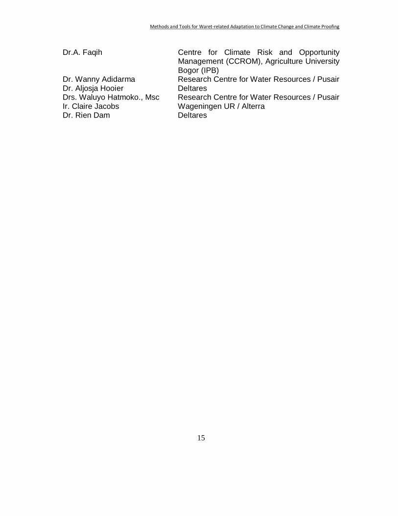
Dr.A. Faqih Centre for Climate Risk and Opportunity Management (CCROM), Agriculture University Bogor (IPB)
Dr. Wanny Adidarma Research Centre for Water Resources / Pusair Dr. Aljosja Hooier Deltares Drs. Waluyo Hatmoko., Msc Research Centre for Water Resources / Pusair Ir. Claire Jacobs Wageningen UR / Alterra Dr. Rien Dam Deltares
Methods and Tools for Waret-related Adaptation to Climate Change and Climate Proofing
16
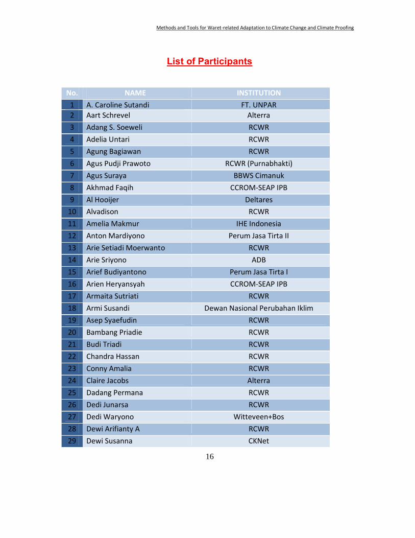
List of Participants No. NAME INSTITUTION
1 A. Caroline Sutandi FT. UNPAR 2 Aart Schrevel Alterra 3 Adang S. Soeweli RCWR 4 Adelia Untari RCWR 5 Agung Bagiawan RCWR 6 Agus Pudji Prawoto RCWR (Purnabhakti) 7 Agus Suraya BBWS Cimanuk 8 Akhmad Faqih CCROM-SEAP IPB 9 Al Hooijer Deltares
10 Alvadison RCWR 11 Amelia Makmur IHE Indonesia 12 Anton Mardiyono Perum Jasa Tirta II 13 Arie Setiadi Moerwanto RCWR 14 Arie Sriyono ADB 15 Arief Budiyantono Perum Jasa Tirta I 16 Arien Heryansyah CCROM-SEAP IPB 17 Armaita Sutriati RCWR 18 Armi Susandi Dewan Nasional Perubahan Iklim 19 Asep Syaefudin RCWR 20 Bambang Priadie RCWR 21 Budi Triadi RCWR 22 Chandra Hassan RCWR 23 Conny Amalia RCWR 24 Claire Jacobs Alterra 25 Dadang Permana RCWR 26 Dedi Junarsa RCWR 27 Dedi Waryono Witteveen+Bos 28 Dewi Arifianty A RCWR 29 Dewi Susanna CKNet
Methods and Tools for Waret-related Adaptation to Climate Change and Climate Proofing
17
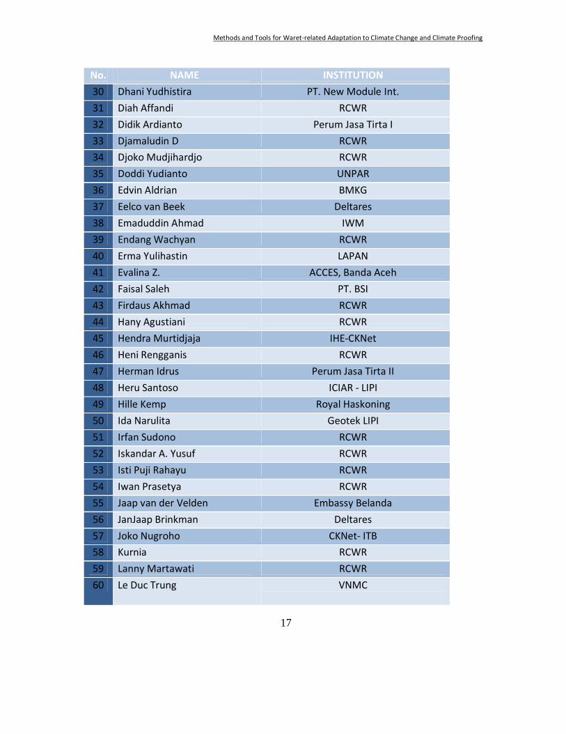
No. NAME INSTITUTION 30 Dhani Yudhistira PT. New Module Int. 31 Diah Affandi RCWR 32 Didik Ardianto Perum Jasa Tirta I 33 Djamaludin D RCWR 34 Djoko Mudjihardjo RCWR 35 Doddi Yudianto UNPAR 36 Edvin Aldrian BMKG 37 Eelco van Beek Deltares 38 Emaduddin Ahmad IWM 39 Endang Wachyan RCWR 40 Erma Yulihastin LAPAN 41 Evalina Z. ACCES, Banda Aceh 42 Faisal Saleh PT. BSI 43 Firdaus Akhmad RCWR 44 Hany Agustiani RCWR 45 Hendra Murtidjaja IHE-CKNet 46 Heni Rengganis RCWR 47 Herman Idrus Perum Jasa Tirta II 48 Heru Santoso ICIAR - LIPI 49 Hille Kemp Royal Haskoning 50 Ida Narulita Geotek LIPI 51 Irfan Sudono RCWR 52 Iskandar A. Yusuf RCWR 53 Isti Puji Rahayu RCWR 54 Iwan Prasetya RCWR 55 Jaap van der Velden Embassy Belanda 56 JanJaap Brinkman Deltares 57 Joko Nugroho CKNet- ITB 58 Kurnia RCWR 59 Lanny Martawati RCWR 60 Le Duc Trung VNMC
Methods and Tools for Waret-related Adaptation to Climate Change and Climate Proofing
18
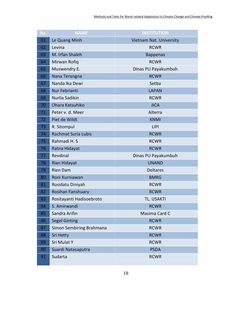
No. NAME INSTITUTION 61 Le Quang Minh Vietnam Nat. University 62 Levina RCWR 63 M. Irfan Shaleh Bappenas 64 Mirwan Rofiq RCWR 65 Muswendry E. Dinas PU Payakumbuh 66 Nana Terangna RCWR 67 Nanda Ika Dewi Setba 68 Nur Febrianti LAPAN 69 Nurlia Sadikin RCWR 70 Ohara Katsuhiko JICA 71 Peter v. d. Meer Alterra 72 Piet de Wildt KNMI 73 R. Sitompul LIPI 74 Rachmat Suria Lubis RCWR 75 Rahmadi H. S RCWR 76 Ratna Hidayat RCWR 77 Revdinal Dinas PU Payakumbuh 78 Rian Hidayat UNAND 79 Rien Dam Deltares 80 Roni Kurniawan BMKG 81 Rosidatu Diniyah RCWR 82 Rosihan Fanshuary RCWR 83 Rositayanti Hadisoebroto TL. USAKTI 84 S. Amirwandi RCWR 85 Sandra Arifin Masima Card C 86 Segel Ginting RCWR 87 Simon Sembiring Brahmana RCWR 88 Sri Hetty RCWR 89 Sri Mulat Y RCWR 90 Suardi Natasaputra PSDA 91 Sudarta RCWR
Methods and Tools for Waret-related Adaptation to Climate Change and Climate Proofing
19
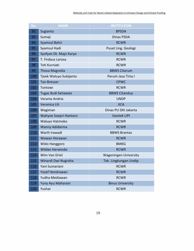
No. NAME INSTITUTION 92 Sugianto BPSDA 93 Sumaji Dinas PSDA 94 Syamsul Bahri RCWR 95 Syamsul Hadi Pusat Ling. Geologi 96 Syofyan Dt. Majo Karyo RCWR 97 T. Firdaus Larosa RCWR 98 Teti Kurniati RCWR 99 Thova Magnolia BBWS Citarum
100 Tjoek Waluyo Subijanto Perum Jasa Tirta I 101 Ton Bresser CPWC 102 Tontowi RCWR 103 Tugas Budi Setiawan BBWS Citanduy 104 Verania Andria UNDP 105 Veronica Lili JICA 106 Wagiman Dinas PU DKI Jakarta 107 Wahyoe Soepri Hantoro Geotek LIPI 108 Waluyo Hatmoko RCWR 109 Wanny Adidarma RCWR 110 Warih Irawadi BBWS Brantas 111 Wawan Herawan RCWR 112 Wido Hanggoro BMKG 113 Wildan Herwindo RCWR 114 Wim Van Driel Wageningen University 115 Winardi Dwi Nugraha Tek. Lingkungan Undip 116 Yani Sumariani RCWR 117 Yosef Hendrawan RCWR 118 Yudha Mediawan RCWR 119 Yuny Ayu Maharani Binus University 120 Yushar RCWR
Methods and Tools for Waret-related Adaptation to Climate Change and Climate Proofing
20
Short Summaries of Presentations
Part I: Introductory Speeches Dr. Arie Setiadi Moerwanto : Welcome and opening of the workshop In his opening remarks on behalf of Dr. Ir. Mochammad Amron, MSc, Director General for Research and Development of the Ministry of PU, Dr. Moerwanto put Indonesia and especially Java in a global perspective with respect to water availability. Water scarcity adds to a number of hazards the island is prone to and the pressure of an increasing population. Droughts are associated with the El Niño-events. It looks as if these events are increasing in frequency. But also floods seem to increase. Indonesia is working towards a flood early warning system. Dr. Armi Susandi : National Adaptation Strategy for Climate Change:
Perspective from COP 15, Copenhagen Mr Susandi started by stressing the relationship between climate change and sustainable development: climate change considerations have to be taken into account in development planning. At the international level attention for adaptation is increasing. The estimates for the necessary budgets for developing countries to adapt vary between 4 and 37 billion US$ per annum. Financing mechanisms are still under preparation. Funds have to come from national and international sources. He outlined the structure of an Adaptation Plan Framework (APF). The National Council (DNPI) plays an important role in defining the adaptation work plan for Indonesia. Vulnerability assessments play an important role in determining where to act first. Data and methods need an urgent update. Droughts and floods pose increasing threats especially in Java. Jakarta is extremely vulnerable to floods. Many protection options are under study. The main challenges for adaptation are: (i) adaptation is not only long term strategy but also short term action; (ii) integrated climate change action on national and local development is important for sustainable development; (iii) adaptation activities is continues action; (iv) spatial and temporal assessments are important tools for climate change adaptation action. Dr. Piet de Wildt : Perspectives for (future) cooperation On behalf of the Ministry for Transport, Public Works and Water Management, Dr. de Wildt gave a brief overview of the co-operation between Indonesia and the Netherlands in the last couple of years. He then outlined the recent Netherlands’ Water Plan and especially the part on global co-operation. The Netherlands will focus on delta areas in 5 countries: Indonesia, Vietnam,
Methods and Tools for Waret-related Adaptation to Climate Change and Climate Proofing
21
Bangladesh, Mozambique and Egypt when looking for adaptation strategies in the light of climate change. Specifically for Indonesia the coming years much attention will be paid to exchange of experience and information through network activities; projects on urban development and flood protection, lowland development and capacity development; starting with designing a long term co-operation strategy. Mr. M. Irfan Shaleh : National Adaptation Program for Climate Change Mr. Shaleh started by pointing out that climate change and adaptation in particular have to be part of the development agenda. Indonesia is prone to many risks. A substantial part of these are water related and have a climate component (floods, droughts, landslides). Planning to deal with these has to be done in a coherent way: climate change will be mainstreamed in development planning. The ICCTF (Indonesian Climate Change Task Force) has the task to make this connection. As a first step road maps are developed for mitigation (forestry, peat land, waste, energy, transportation, agriculture, industry) and adaptation (water resources, agriculture, marine, coastal and fisheries, infrastructure, health, forestry and biodiversity, research and development and for some cross sectoral issues). Mr. Shaleh gave some important issues for each of these sectors. He stressed that there are large challenges ahead. The complexity of the issues, of the policy and planning system and the many actors which have to be involved are just some of these challenges. The plan he presented is just the beginning of a process. The next stages have be done together, with novel approaches, actions and behaviour and with a combination of social engineering and technology. Mr. Sugianto : National adaptation programme for public works After an introduction with an overview of Indonesia’s contribution to green house gas emissions, reduction targets, the development in general and in Jakarta area in particular, an overview was presented of critical issues with respect to water and the additional contribution of climate change and variability. Mr. Sugianto explained how climate change is incorporated in PU’s policy and strategy. Both mitigation and adaptation are addressed in these: in national and regional (spatial) plans; in water resources infrastructure planning; in urban and rural infrastructure; and in road infrastructure. Mr. Sugianto presented the main contributions of PU to the action plan for climate change mitigation.
Methods and Tools for Waret-related Adaptation to Climate Change and Climate Proofing
22
Dr. Heru Santoso : Sustaining the Environment and Human Security Dr. Santoso had chosen sustainable development as the starting point with the threat that the MDGs may not be reached by many of the developing countries. All efforts, including coping with climate change, have to be combined to meet the challenges. He outlined the role of ICIAR in this area. Some recent projects were presented briefly including research on the combination of spatial planning and water resources planning in the Bandung basin; the water balance of Java; a drought index for Kalimantan to predict the risks on forest fires; and calculating the extreme rainfall over Bogor-area as an important risk factor for landslides. Ir. Ton Bresser : The Co-operative Programme on Water and Climate As the last speaker in this part of the workshop, Ir. Bresser briefly explained the role of the Co-operative Programme on Water and Climate in general, in de last few years in Indonesia and in the organization of this workshop in particular.
Part II: State of the Art: overviews Prof. Eelco van Beek : Methods and measures in the water and land
development planning in relation to climate change; vulnerability assessments to climate change and their relevance
The focus of the contribution by Prof. van Beek was on IWRM: Integrated Water Resources Management. This concept deals with water in all its aspects and problems: too much, too little, too dirty, by looking at present and potential future situations. One of the main messages is, that really solving present problems with climate variability will cover the majority of the future problems as well. Climate change is not something new. He warned that many of the phenomena we now tend to attribute to climate change in fact mostly fall under normal climate variability, but that other conditions have changed (e.g. land use, buffer capacity of lakes). He provided examples from China and the Netherlands to prove the point. Surely climate change is there, but most of our present problems are due to other causes. A complicating issue is that scientists and politicians / policy makers often lack clear communication. Dealing with climate change requires dealing with uncertainties. This is not new in water management. It only requires adding an additional uncertain element in the design. He distinguishes two main lines of action: build resilience or build resistance. These lines can be combined in two strategies: a robust strategy, that can cope even with unexpected changes in climate or a flexible strategy that does not rely on irreversible measures or structures, but leaves room for
Methods and Tools for Waret-related Adaptation to Climate Change and Climate Proofing
23
adaptation along the way as climate changes gradually. The main conclusion is that IWRM is a suitable approach even under climate change. Dr. Aart Schrevel : Presenting Delta Alliance As a representative of the Delta Alliance, Dr. Schrevel focussed on the deltas in the world. Deltas are both very valuable and very vulnerable. To profit from their value mankind will have to deal with the vulnerabilities. Yet, pressures on the deltas are increasing rapidly because of population and economic growth (and additional concentrations of people in the deltas), and also by climate change in more recent years. By joining efforts and exchanging experiences and knowledge solutions can be reached more easily. It is because of these reasons that the Delta Alliance has been called into being. At the moment the Delta Alliance has partners in Indonesia, the Rhine and Mekong deltas and from San Francisco Bay. The aim is to connect 10-20 deltas around the world. It will be a platform to develop and implement knowledge; to exchange knowledge and experience (incl. methods and tools); and to give deltas a voice in the international arena and at the funding agencies. The alliance will provide a forum / platform; it will initiate research and co-ordinate events. In Indonesia the focus is on e.g. the Ciliwung and on lowland deltas; suggestions from the participants are welcome. The Bandung workshop will be followed by a scoping workshop in April/May. The establishment of a Lowland University Alliance is foreseen for the near future. The official launch of the Delta Alliance will be end of September / early October this year, at Rotterdam, the Netherlands. Dr. Schrevel encourages all participants to join Delta Alliance, Prof. Wahyoe Hantoro : Global climatic change and (relative) high stand
sea level in Indonesia The geological history of the region determines the present risks. The many low lying reefs and islands are very vulnerable for a rising sea level, but also for other non-climatic changes (tectonic) and anthropological influences. On a geological time scale the sea level is not extremely high, but it is rising. Other climate related risks include changes in precipitation and in the onset of the wet season. It is not sure whether the tropical typhoon pathways are changing but parts of Indonesia are at the border of those ways. For risks of sea level rise a scenario approach is proposed with the variables: sea level rise, tide, ENSO, storm surges and tsunami. The additional level ranges from 1.3 to 7.3 meters in 2030 and from 1.9 to 7.9 in 2100. With these scenarios maps of inundation of the various islands have been drawn. With a vulnerability approach the main impacts on coastal plains and small islands have been assessed. An overview of infrastructure under threat is presented and a list of necessary actions. Prof Hantoro stressed that the natural protection of intact mangroves and other coastal vegetation zones can be substantial.
Methods and Tools for Waret-related Adaptation to Climate Change and Climate Proofing
24
Prof. Dr. Le Quang Minh: State of affairs on adaptation in the Mekong area Prof. Minh pointed to the combination of key issues: water, land use and social developments as the main source of concern in the Mekong delta area and the cities including sometimes conflicting issues between the urban and rural area. He then moved to agriculture. The Mekong delta provides 50-70% of the national production (rice, fruit, and fish). To achieve this land use in the delta has changed drastically in the past decades. With respect to water issues, it must be noted that more than 50% of the Mekong delta is less than ½ meter above mean sea level leaving it prone to floods. But floods have both positive (sediments / fertility, fish, cleaning) and negative impacts (loss of lives and property, damage to infrastructure). Salt water intrusion can occur in as much as 1/3 of the delta. Here again both positive (shrimp farming, mangroves) and negative impacts (rice) can be noted leading to conflicts of interest in measures to take. The main problems nowadays are: water shortages in the dry season and floods in the wet season; pollution of surface waters (and in the future also groundwater); too much pesticide; soil acidification; very vulnerable wetlands and deforestation. On top of this, upstream activities like dam construction and deforestation can have major impacts in de the delta: prolonged droughts, more severe floods etc. Climate change is just one of the factors added to these developments, aggravating the impacts of developments both upstream and within the delta. Impacts are not always negative: for some aspects there are positive developments. This makes decision making complicated. Lessons from other regions (like the Netherlands) might help in finding optimal solutions.
Part III: Case studies from Indonesia and abroad Dr. Le Duc Trung: Mekong River, Vietnam Dr. Trung described the Mekong river (ca. 800,000 km2, 4800 km long, from Tibet to the South China Sea, 60 M people in lower basin). Since 1995 4 countries (Lao, Thailand, Cambodia, and Vietnam) work together in the Mekong River Commission, developing a Basin Development Plan. Climate change is on the agenda but data are not always available. Expected changes are (among others): substantial increase of extreme rainfall in some areas; decrease in other areas with prolonged droughts; increase in salt water intrusion in the delta. A decision support framework is under development; the scope is the entire basin but with emphasis on the impacts in the lower Mekong. Data sets (both spatial and temporal) are being collected. The framework will be used to draft the MRC Climate Change Adaptation Initiative with (i) planning, implementation and demonstration; (ii) improving capacity, methods and tools
Methods and Tools for Waret-related Adaptation to Climate Change and Climate Proofing
25
for adaptation; (iii) strategies and plans with monitoring and regular reporting; (iv) regional co-operation, exchange and learning in 3.5-year phases with a longer term sustainability strategy. Dr. Trung highlighted some developments in water and climate in the Vietnam part of the delta. Structural measures are needed like flood control and mitigation (dams, canals, reservoirs); embankment for prioritized areas; elevated residential areas; salinity control structures (e.g. sluices); dredging. Concrete actions will be part of the National Target Programme. Next to the measures mentioned this will include an impact assessment; a S&T-programme; strengthening of organizations and institutions; and awareness raising and human resources development. Dr. Emmadudin Ahmad : Bangladesh deltas Bangladesh is the other region of interest when looking for similarities and learning point for Indonesia. Dr. Ahmad first described the region and the setting with tropical cyclones as a major threat. A suit of basin models has already been developed to describe the upstream situation and to facilitate climate change impact studies. The impacts include flooding, saline intrusions, storm surges, sedimentation and water logging. For different scenarios the bank over topping can be calculated and the necessary height of embankments. For cyclone protection the construction of shelters with a certain height of the floor levels is one of the measures. With high sea levels the river water can not be discharged resulting in water logging. Tidal river management and temporal reservoir areas are measures to deal with this. Salt water intrusion leads to threats for drinking water supply intake points and groundwater resources. In many areas the required knowledge still has to be increased like for coastal zones (hydrology, sedimentology, biology, ICZM); but also at basin level. Monitoring and downscaling of scenarios are also to be developed next to risk assessment, non-structural management options and education. Drs. JanJaap Brinkman : Jakarta Floods, Sea Defence Jakarta Making Jakarta flood resilient in 2030 is the objective of the Jakarta Flood Project. Mr. Brinkman explained that it first was important to have a consistent experts view on the situation. Communication is of the utmost importance. To support this, a complete modeling framework was developed including all 13 rivers entering the Jakarta area and all major draining canals. With this the situation can be calculated when various measures are considered under different scenarios. Some conclusions could be drawn swiftly: (i) bring the system back to the original design situation by dredging and dike improvements; this would have spared about 1 M people from flooding in 2007; (ii) finish the East Banjir Canal; this would lead to a large improvement in the eastern part of Jakarta. Based on these assessments national and provincial government took swift actions: the Jakarta Urgent Flood Mitigation Project. But
Methods and Tools for Waret-related Adaptation to Climate Change and Climate Proofing
26
also threats from the sea are important for Jakarta. The combination of a semi-annual cycle and an 18.6 year cycle (astronomical tide) leads to sometimes extreme sea levels; in the media the flood of Nov. 2007 was attributed to climate change! But proper analysis showed that land subsidence is the major cause of flooding (up to 26 cm/a). Prediction for Dec. 2007 and 2008 floods proved to be accurate. This time precautionary measures had been taken, limiting the damage. Also more structural measures were set in motion (toll road to airport, coastal defence). A strategic plan for coastal defence is under development with 3 main directions: do nothing (evacuate northern Jakarta); find on-land solutions (large infrastructures, large social impacts); find off-land solutions (large impact on coast). The combination of flood management (including solid waste management to keep the system intact), subsidence management, spatial planning, integrated water management (including water demand and supply) leads to the need for a “delta approach’, much like the Dutch approach: a road map for at least the coming 20 years. And climate change impacts are probably the least of the problems compared to those related to land subsidence, water management and spatial planning. Dr. Peter van der Meer : Lowland development The case of Kalimantan served as the basis for the contribution of Dr. van der Meer on lowland development. The challenge is to give room for economic development while minimizing the impacts on nature and natural resources (sustainable development). The concept of ecosystems’ goods and services can be very helpful in determining the most efficient mix of land-use. In Central Kalimantan a Master Plan was prepared for the Ex-Mega Rice Project Area. This is a huge area (1.5 Mha) with mostly degraded peat lands. Deforestation and drainage of peat lands has lead to very large emissions of carbon from the area. The outcome of the study includes a zoning of the area with different land-use types: cultivation, protection, limited use, coastal protected area. Water management will be the result of choices for development. Community empowerment is considered to be the most important tool in achieving sustainable development in the region: finding the balance between people, profit and planet. A general challenge in lowland development is not to think about “competing claims” but instead in terms of “combining claims”. Spatial planning can be a powerful tool to optimise the ecosystem services from an area. In addition, plans for lowland development should provide multiple options (scenarios) for policy makers and other stakeholders, including climate proofing (adaptation, mitigation).
Methods and Tools for Waret-related Adaptation to Climate Change and Climate Proofing
27
Ms. Verania Andria : Adaptation in dairy farming East Java Ms. Andria presented the case of East Java Dairy Farming were a model approach is used to prepare community based action plans for climate change adaptation. Dairy farming is growing fast in the region leading to an increase in environmental impacts. In this study the methane emissions are subject. Both the impacts on the climate and the impacts of climate change are studied as well as the influence of increased dairy farming on the water system; a systems dynamics approach was taken linking the farming system with the climate and water system, with the regional and ecologic system and with the economic system (including welfare). Next to that an agent-based model is under development to assess the resilience of the growing agricultural system to climate change. Dr. Arien Heryansyah : Aceh climate proofing For Banda Aceh a modeling approach is taken to assess the impacts of climate change on the design of the flood protection system. Banda Aceh lies in the delta of the Krueng Aceh. The city’s drainage system is designed for a 5 years return period of water logging and flooding. The objective of the study was to determine what the performance of the system would be under climate change conditions (climate proofing). Dr. Heryansyah explained the meteorological / climate data, hydrological modeling, spatial analysis, and sea level analysis have been used. Climate change scenarios were downscaled to the region. A multi-layer (sub) catchment model was constructed. Land use data were translated into infiltration and evapotranspiration. The resulting run-off was calibrated with available data. Future developments (next to the CC-scenarios) were also dependent on land use scenarios. The main conclusions were that for the river floods land use was the major factor of importance. Climate change will add to that in the further future. The present design of flood protection can handle the impacts of land use change or climate change. When combined additional protection will be necessary. Dr.A. Faqih : South Sumatra project, vulnerability assessment and
adaptation methods Dr. Faqih presented the use of climate modeling in risk management studies. Risks are composed of a probability of occurrence an event and the consequences of a realised event. Climate change might influence the probability. Vulnerability combines the level of risk with the capacity to cope with the consequences. In assessments it is always necessary to try to calculate the risks, starting with the development of climate itself: mainly rainfall as the determining factor: historical rainfall and scenarios. This has to be done area specific and for periods within a year (dry and wet). Especially extremes are important. For a large number of villages on Java the levels of risk to droughts

Methods and Tools for Waret-related Adaptation to Climate Change and Climate Proofing
28
and floods have been calculated both for present and for future situations. This leads to an overview of vulnerability of those villages and their capacity to deal with climate change. Dr. Wanny Adidarma : Impact of Climate Change on Hydrological Aspects
in Indonesia Dr. Adidarma went into more detail in the hydrology in her presentation. In an overview of natural disasters in Indonesia, floods and droughts are much more prominent than other events. And IPCC sees a likely increase in both. Especially Java is becoming dryer according to observations. The length of the wet season is also decreasing. The occurrence of droughts and the severity are increasing. For the Solo River however there is an increase in extreme rainfall events leading to more floods. In Indonesia extremes in rainfall are often associated with El Niño and Indian Ocean Dipole events. This is mirrored in agricultural production. To prevent loss of crops information on the occurrence of events like El Niño and other operational data is essential. There is still room for improvement on this in Indonesia. More planned adaptation then can take over from spontaneous adaptation. Dr. Edvin Aldrian : Climate Change Adaptation Policy and Experience in
BMKG In his presentation Dr. Aldrian started with outlining the relations between national and international institutions with respect to climate change. At the international level mainly UNFCCC-related institutions are important. At the national level BMKG and some partners are responsible for detecting climate developments. Adaptation and mitigation are tasks of sectoral ministries and Bappenas. Three main issues can be noted in Indonesia in the area of climate change: the gap between political will and scientific capacity; the gap between national and local/regional government; and the human resources available for these processes. The main sectors for action on adaptation (9) and mitigation (7) are distinguished (see earlier presentation by Mr. Irfan Shaleh). BMKG is supporting these sectors by providing e.g. climate maps, rainfall, temperature and moisture forecasts, early warning on extreme weather and by modeling outputs like scenarios, wave strength, tidal and storm surges etc. Many projects are underway to support sectors with better information e.g. for the energy and water resources sectors. This includes a combined approach with monitoring and modeling in some river basins; a project to assess the carbon fluxes of the Brantas catchment; an assessment of carbon, nutrients and water fluxes from the rivers of Java; the water and carbon cycles of the Musi River basin; an assessment of vulnerable lakes in Indonesia due to changes in rainfall; and the construction of climate change scenarios for Indonesia. Dr. Aldrian ended with
Methods and Tools for Waret-related Adaptation to Climate Change and Climate Proofing
29
the conclusion that trends must be reversed and that we have to work towards a low carbon emission future.
Part IV: Parallel sessions with practical applications Each session started with brief presentation(s) highlighting the available methods and tools. In each group a number of questions have been discussed leading to recommendations. A. Methods to prepare for adaptation in the physical system Dr. Edvin Aldrain: Climate models, long range forecasting and climate
predictability Models are the only way to experiment with the complex system earth. The present understanding of the system and the available computing power lead to more or less acceptable model results. With this statement Dr. Aldrian started his overview of (the characteristics of) climate models. For adaptation downscaling of model results to the regional level is important; this is done with empirical or statistical means. Regional climate should be understood as the result of interplay of global climate and regional physiographic detail. Regional modeling is thus nested in a global scale model. For Indonesia the ECHAM(4) physics are used to downscale: 0.5° for the entire country (101x55 grid cells) and e.g. 1/6° for Sulawesi (73x61 grid cells). This allows for detailed research on the 5 major islands. The time resolution generally is a month. Inter-annual variability can be studied quite well. The model suite allows for predictions of the weather (some days to a max. of 2 weeks in advance); for ENSO prediction; and for prediction of the statistics of the climate system, 50 years in advance. Additional research is done on land-sea, land-sea-atmosphere, land-sea and land-atmosphere interactions. Especially the consequences of large scale land use and land cover changes on the regional climate and the hydrosphere are studied. It could e.g. be concluded that: (i) deforestation over Kalimantan will increase surface temperature and local evaporation; (ii) it will lead to the increase of sea breeze which brings water vapour to the coast; (iii) it will then lead to an increase in precipitation over the coastal area, while in the middle of Kalimantan the deforestation will cause a decrease of precipitation; (iv) consequently, over small islands in the tropics such as Kalimantan, the deforested area shall recover itself due to the increase of precipitation over the coast. Recovery over the middle of the island will take a longer time. In an overview of climate variability phenomena Dr. Aldrian indicated the different time scales, the main factors causing them and the impacts on the weather/climate. His main conclusions about the available tools are:
Methods and Tools for Waret-related Adaptation to Climate Change and Climate Proofing
30
• Climate modeling provides comprehensive tools for studying ocean –land – atmosphere interactions and uplifts the hidden phenomena lying within.
• The climatological implications of the interactions are quite diverse • Climate modeling provides tools to experiment with nature without
damaging nature itself. • Satellite images and data can be used to study local land-sea
interactions. Further investigation is needed with longer time series. Dr. Piet de Wildt : Climate Scenario’s as Tool for Adaptation Future climate will probably show changes in both mean and distribution when presented stochastically. Climate scenarios are consistent pictures of possible futures. They indicate the magnitude of changes in e.g. temperature, precipitation, evaporation, wind and sea level. Global scenarios generally are the result of multi-model calculations. They have a poor representation of spatial detail. Over time this has improved. But still the representation of spatial detail and of small scale phenomena (e.g. rainfall extremes, land-atmosphere interactions) is rather poor. Based on global models, regional models and observations KNMI developed 4 scenarios for the Netherlands: with more or less temperature increase and with or without changes in air circulation patterns. Together they depict the range of plausible changes compared to the present situation. The present situation is depicted in the Climate Atlas, providing the reference climate (1971-2000) with regional differences. KNMI tried to find the real questions the different sectors have about climate in order to provide custom-made answers. These questions differ in spatial and time resolution, have a different time horizon, concern different issues (wind speed, rainfall extremes, sea level rise etc.). Dr. de Wildt provided examples from urban water management, railway companies, health organizations, and gas providers. In case of e.g. Jakarta the same type of questions have to be asked: what are pivotal parameters and which policy-related questions have to be answered? This will point the way to the tools to develop in the near future. Prof. Eelco van Beek : Methods and tools to prepare for adaptation in the
physical system Methods are the conceptual approaches to deal with the inherent uncertainties associated with climate change. The tools are computer models or similar systems to support he analysis of the hydrological system in alternative states. IWRM is used as the framework for these assessments. It includes some important principles of how to plan and manage systems. The framework is a logical sequence of analysis steps, leading to a preferred strategy, based on the
Methods and Tools for Waret-related Adaptation to Climate Change and Climate Proofing
31
systems analysis principles. Uncertainty assessment and communication is often included in the framework. IWRM is a process which promotes the co-ordinated development and management of water, land and related resources, in order to maximise the resultant economic and social welfare in an equitable manner without compromising the sustainability of vital ecosystems (GWP, 2000). It includes structured policy analysis; inception, development and selection phases; and throughout the process a strong interaction with stakeholders. Models are used in this framework for many purposes (analysis, prediction, communication, learning, and as supporting tools). The type of model to use depends on the problem setting (e.g. 2D, 3D, quantity, quality). An example for the Khulna study in Bangladesh was presented. B. Drought Management Dr. Aart Schrevel and Dr. Aljosja Hooier The session focused on two main issues: an Early Drought Warning System (DEWS), explained by Dr. Aljosja Hooier, and droughts and how to deal with them, explained by Dr. Aart Schrevel. The Early Drought Warning System was presented using a power point presentation. It has been tested in lowland areas that are susceptible for bush fires. The system allows its operators and policy makers to predict with a high degree of accuracy when and where bush fires might erupt. The practical use of the system is obvious: policy makers can take pre-emptive measures and in this way avoid (further) damage. The system could also be used in other areas in Indonesia, for example in Java, where drought conditions occur more frequently and call for actions to be taken by water managers, other civil servants and members of the general public (including farmers). During the discussion it was concluded that the instrument warrants follow-up at field level in order to make its potential come true. The participants of the session were invited to explain their own situation, thus to explain their experiences with droughts in their day-to-day work – most participants came from Java. Droughts appeared to be occurring frequently and more frequently than in the recent past. Droughts occurred because of changes in rain fall patterns, but also important were changes in land uses and in demands for water. From these general observations, conditions were discussed in more detail. Subsequently the question how to deal with these drought conditions were addressed. It was concluded that Drought Management Plans should be developed at river basin level. The Drought Management Plans should follow a standard format. Dr. Schrevel presented an
Methods and Tools for Waret-related Adaptation to Climate Change and Climate Proofing
32
example of a standard Drought Management Plan, which was discussed to understand its usefulness for conditions in Indonesia. The discussion could not be completed and one of the recommendations of the participants was to adapt the standard Drought Management Plan format to Indonesian conditions. The participants also concluded that:
- the Early Drought Warning System requires to be made operational at field level, or a system needs to be set up that makes the results of the systems available for immediate practical use at field level;
- the standard Drought Management Plan needs to be adapted to conditions prevailing in Indonesia
- Drought Management Plans should not be documents drawn up and presented to potential users at one point in time, not to be used again subsequently; rather it should be a document of which the contents is developed together with stakeholders – a kind of contract on the measures to be taken and responsibilities of all stakeholders in case of a drought event.
C. Methods to use in forestry, agriculture and land management; Ir. Claire Jacobs : Remote sensing and GIS; A short introduction on its
applications An overview of applications of remote sensing and GIS was shown. The difference between optical and radar remote sensing was explained. Radar sees through cloud and rain, and is thus suitable for humid regions such as parts of Indonesia. Example were given of remote sensing applications for agriculture (land use, biomass, crop production; crop water stress), and examples for forestry were demonstrated (monitoring deforestation and forest degradation, estimation of biomass, carbon storage in support of REDD). Ir. Claire Jacobs : The use of Remote Sensing for evapotranspiration
mapping using MODIS Water consumption in river basins cannot be measured directly but can be quantified with remote sensing. An example was given on how remote sensing can be used to monitor evapotranspiration. using MODIS images, based on a case study in Morocco. MODIS images (free of cost) were used to derive constant time series of ET to assess water use in agricultural areas. Spatial and temporal analysis of ETa – ETpot helped to detect crop water stress in the area.
Methods and Tools for Waret-related Adaptation to Climate Change and Climate Proofing
33
Ir. Claire Jacobs : Monitoring of deforestation (presentation from Dirk Hoekman and others)
An example is demonstrated for Kalimantan. In Kalimantan it is necessary to use radar techniques because of clouds which make optical remote sensing almost impossible. Examples are given for ERS and ENVISAT ASAR applications on deforestation mapping; location of new logging roads; degree of change in canopy cover; settlement and agricultural expansion. ENVISAT ASAR APP is a fast and reliable tool for operational deforestation monitoring. Routine monitoring is done of large / inaccessible forests in Kalimantan at 25 x 25 m resolution with systematic updates every 35 days. For validation, visual inspection was done with an ultra light aircraft with GPS and camera. Some conclusions:
o For decision making it is important to have a fast, timely overview of the status of forest.
o Up-to-date information is vital for effective management of forests and control carbon emissions.
o Forest changes can easily be detected by higher resolution sensors, e.g. space borne radar (ASAR, PALSAR) and traditional sensors (LANDSAT, ASTER, SPOT).
o Radar with all-weather acquisition capabilities can map peat swamp forest characteristics and contribute to improved carbon stock estimations.
o Systematic monitoring of tropical forests over wide areas so far is mainly done at low resolution (see e.g. deforestation movie of Sumatra at Google Earth).
o ALOS PALSAR will enable monitoring peat swamp forest areas during the next 5-6 years.
Dr. Peter van der Meer : Introduction : carbon stocks & land-use planning Spatial planning can be a powerful tool to optimise the ecosystem services from an area. In addition, plans for lowland development should provide multiple options (scenarios) for policy makers and other stakeholders, including climate proofing (adaptation, mitigation). Carbon sequestration through forestry and in other watershed areas with either natural or planted vegetation can help mitigate global warming, as well generate funds for sustainable development. For instance tools like REDD (Reduced Emissions from Deforestation and Forest Degradation) and CDM (Clean Development Mechanism) can be tools in watershed management to increase vegetation cover, and reduce runn off problems and increase funding.
Methods and Tools for Waret-related Adaptation to Climate Change and Climate Proofing
34
It was explained how carbons stocks in forest vegetation can be calculated using models (CO2Fix). In addition some of the key-issues in setting up carbon offset program were addressed, including baseline studies and additionality, monitoring, verification, and penalties, and setting the payment. It was also stressed that depending on local circumstances it might be important to include local communities and participative processes. It was stressed that local people often have a potential (e.g. in monitoring, verification, safeguarding etc.) and are not a problem. Community-based planning for climate adaptation is important and should be made were possible part of the planning process. It was concluded that more knowledge is needed on the exact needs and issues of local communities in relation to climate change adaptation and mitigation.
Part V: Plenary wrap-up Recommendations from Group A Methods to prepare for adaptation in the physical system (cited): 1. What are the knowledge, training and capacity development needs in
Indonesia? a. Climate modeling on river basin scale b. Measuring and analyzing of hydrological data c. Regional climate model, quantitative modeling and forecasting d. Very high speed/capacity computing facility e. Access to the data on boundary condition of climate model such as
from ECMWF f. Capacity building in climate modeling g. Methods for ensemble to make sure the climate change quantity h. Water quality methods and tools, inter laboratory cooperation i. Research on monitoring and prediction of extreme weather, water
cycle, disasters contingency j. Integrated social natural science research k. Observation monitoring system, understanding of extreme conditions l. Impact of climate change on possible disaster and disaster reduction m. Raising public awareness on the impact of the climate change n. Water management method and tools for climate change adaptation,
in the whole project cycle (planning, design, construction and operation)
Methods and Tools for Waret-related Adaptation to Climate Change and Climate Proofing
35
o. Bridging the gap between the climate change data and information to the water management
p. Tailoring climate change information for specific sector q. Knowledge and skill on statistical downscaling techniques
2. How to create a knowledge development and exchange network on
climate change and water-related adaptation within Indonesia? a. Regular workshop and seminar b. Joint proposal to provide a high speed and capacity computing
facility that can be accessed by relevant institution c. Joint research and development on climate change adaptation d. Empowerment of Regional Hydro-meteorological Training Center in
Indonesia e. Use the existing professional associations such as Indonesian
Hydrological Society(MHI) and Indonesian Hydraulic Association (HATHI), CK-Net
f. Link to the National Council on Climate Change g. Develop a grand research proposal (incl. Vietnam and Bangladesh
and more European Countries) submitted to European Union Framework 7 Funding on climate change issues and delta / river basin management
3. How to reach convergence between the research and development
agenda and the capacity building needs? a. Develop concept on mechanism for adaptation strategy in water
resources management (RCWR, BMKG, LAPAN, LIPI, River Basin Organizations)
b. Socialization and dissemination on climate change impact on water resources
4. How to exchange knowledge and experiences and between countries
with similar situations? a. Lecture, training, on the job training b. Sharing experience c. Exchange of PhD student d. Programs for Double PhD and double supervisor : (Indonesia and
NL)
Methods and Tools for Waret-related Adaptation to Climate Change and Climate Proofing
36
Recommendations from Group B Drought Management: 1. What are the knowledge, training and capacity development needs in
Indonesia?
- Application of the Dews model at field and river basin level - Training of farmers (agricultural sector) on alternative livelihoods during
drought season - Establishment of a Climate Field School (could be done by BMKG and
partners) - Further development of the DEWS model - Training in operation of the DEWS model - Training in contents, preparation and embedding in institutional system of
Drought Management Plans - Implementation of Drought Management Plans at basin level - Training at first level : national ( BMK); second level (Kabupaten); and
third level (Village, P3A (Petani Pemakai Air)
2. How to create a knowledge development and exchange network on climate change and water-related adaptation within Indonesia?
- set up joint research: e.g. gather information from community and water
managers with regard to how they responded to the last big drought events in 1997, 2002 and 2006
- organise similar workshops – as the one presented in these proceedings – at basin level in other parts of Indonesia
- set up joint projects at river basin level on the application of DEWS model
- set up joint projects at river basin level on formulation and implementation of Drought Management Plans
Methods and Tools for Waret-related Adaptation to Climate Change and Climate Proofing
37
3. How to reach convergence between the research and development agenda and the capacity building needs?
- organise workshops in which researchers and policy makers participate;
pay special attention to dialogues between researchers and policy makers
4. How to exchange knowledge and experiences and between countries with
similar situations?
- join Delta Alliance and make use of Delta Alliance opportunities
Methods and Tools for Waret-related Adaptation to Climate Change and Climate Proofing
38
Recommendations from Group C Methods to use in forestry, agriculture and land management (cited):
1) Knowledge, training, and capacity development needs The most urgent environmental problems were identified and discussed within the group, being: Pollution control, deforestation, and peat fire control. The participants agreed that techniques are needed to monitor forests (carbon stocks and emissions) and water management (pollution, sediments), and that no easy-to-use tools are available for them at the moment. The knowledge and training needs can be listed as: o Remote sensing is a useful tool for water management but not much is
known yet on techniques and applications o River water quality and sediments: how to use RS to monitor sediment
and water quality, pollution control? o Carbon: Techniques needed to monitor/measure carbon stocks and
emissions, CDM and REDD, peat fire control, negotiation techniques o Waste management, sanitation, spread of diseases: problem of funding
and awareness, not of technology/expertise o Lowland planning tool for water management strategies, macro to micro, o There was a clear need for improved peatland management, considering
the huge pressure and large carbon pools in these lowland systems. . o Monitoring and assessment of morphology changes in rivers and land
use dynamics o Stakeholder involvement, how to link research and practical
implementation o Database needed on CSR activities Indonesia o Software training (e.g. ArcGIS)
2-3) How to create a knowledge development and exchange network?
o More exchange of information between disciplines o Workshops o There is a need for an interdisciplinary approach in which various
stakeholder groups are needed to identify which knowledge is most needed, and also to insure that this knowledge is embedded in the overall framework of sustainable development/management
4) How to exchange knowledge and experience between countries with similar conditions?
o Comparative study (pilot study) between countries Due to time constraints the discussion was not finished for this topic
Methods and Tools for Waret-related Adaptation to Climate Change and Climate Proofing
39
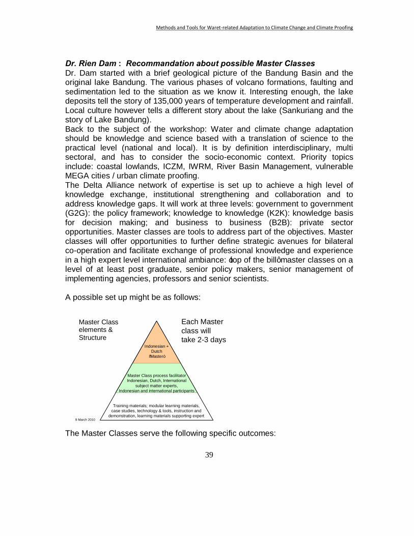
Dr. Rien Dam : Recommandation about possible Master Classes Dr. Dam started with a brief geological picture of the Bandung Basin and the original lake Bandung. The various phases of volcano formations, faulting and sedimentation led to the situation as we know it. Interesting enough, the lake deposits tell the story of 135,000 years of temperature development and rainfall. Local culture however tells a different story about the lake (Sankuriang and the story of Lake Bandung). Back to the subject of the workshop: Water and climate change adaptation should be knowledge and science based with a translation of science to the practical level (national and local). It is by definition interdisciplinary, multi sectoral, and has to consider the socio-economic context. Priority topics include: coastal lowlands, ICZM, IWRM, River Basin Management, vulnerable MEGA cities / urban climate proofing. The Delta Alliance network of expertise is set up to achieve a high level of knowledge exchange, institutional strengthening and collaboration and to address knowledge gaps. It will work at three levels: government to government (G2G): the policy framework; knowledge to knowledge (K2K): knowledge basis for decision making; and business to business (B2B): private sector opportunities. Master classes are tools to address part of the objectives. Master classes will offer opportunities to further define strategic avenues for bilateral co-operation and facilitate exchange of professional knowledge and experience in a high expert level international ambiance: ‘top of the bill’ master classes on a level of at least post graduate, senior policy makers, senior management of implementing agencies, professors and senior scientists. A possible set up might be as follows:
9 March 2010
Master Class elements &structure Indonesian +
Dutch “Master”
Master Class process facilitatorIndonesian, Dutch, International
subject matter experts, Indonesian and international participants
Training materials; modular learning materials, case studies, technology & tools, instruction and
demonstration, learning materials supporting expert
Each Master class will take 2-3 days
The Master Classes serve the following specific outcomes:
Master Class elements & Structure
Methods and Tools for Waret-related Adaptation to Climate Change and Climate Proofing
40
o The concept includes the sharing of an integrated vision on delta issues and water management (safety, spatial planning) and climate adaptation, within a framework of sustainable socio-economic development.
o Jointly, key issues and priorities will be defined for a bilateral Indonesian - Netherlands cooperation agenda.
o Facilitating the interaction between high level policy makers and experts enables practice-oriented knowledge transfer and capacity building.
o Discussion sessions will include introduction and elaboration of innovative knowledge based tools
o They aim to integrate contributions from national and regional level policy and decision-makers, knowledge institutes, climate change adaptation experts for various sectors (water management, agriculture and ecosystems, spatial planning, urban development, etc.) and expertise from the private sector and industry.
o Indonesian participation will constitute a select group of Indonesian experts, policy- and decision-makers.
o they will include knowledge transfer/exchange through key presentations, active workshop sessions on specialist topics and discussions.
o The development and production of learning materials for dedicated research and training institutes is included.
Possible themes for master classes might be: Water, Climate Change and Governance (the Dutch “Veerman Approach”); Climate Change Scenario’s; Climate Change and Disaster Mitigation; Water, Food and Ecosystems (Green Adaptation); Water Supply and Sanitation; Environmental services; Urban Climate Resilience; Spatial planning; Tools, methodologies and instruments. Panel discussion around the recommendations from the groups; what did we miss? In the panel discussion various points from the reports of the parallel sessions came up again. It was stressed that we are dealing with complex problems, with many uncertainties and many stakeholders with conflicting interests. The gaps in knowledge and experience between the various stakeholders at the different levels is probably the most important issue:. scientists, (water)managers policy makers , politicians (and their short span of attention) and the general public. It is not really clear what the best way forward is in the Indonesian situation. How can we make the step from analysis and strategy to actual implementation of adaptation measures? There is still a lot of uncertainty about the future climate predictions and their impact . The Global Climate Models have to be downscaled, impacts to be
Methods and Tools for Waret-related Adaptation to Climate Change and Climate Proofing
41
analysed for different scenarios, adaptation strategies to be developed and monitoring to be organized. This can be done in a parallel process between BMKG (leading scenarios), universities and LIPI (impact) and Public Works (adaptation). Governance is in this respect a central issue. To be decided who should take the leadership. It was suggested that operations should be organised at the level of river basin catchments. Pusair will be become responsible for the River Basin Organisations (RBO). It is the intention to install dissemination units inside the RBO, which should operate as a ‘home doctor’. Suggestions on how these dissemination units should be organised are most welcome. The payment for catchment services could finance the implementation of adaptation measures. Tools and processes for the communities should be included; how to influence the behaviour. In Bangladesh they have examples how to reach out to the rural people: they understand that there are feasible solutions. It is a matter of connecting the separate worlds of scientists, policy makers, managers and general public. Specific capacity building is needed for this purpose. It was stressed that climate change could not be blamed for all existing (water-related) problems. Many of them are caused by (other) anthropogenic changes. Therefore it was suggested that the impact of climate change should always be compared to the impact of other changes. It was also advised to assess the impact of current changes on the current infrastructure and design criteria. The concept of master classes was discussed. It turned out that the name caused some misunderstanding. It was connected with the MSc-level which is not the intention (see presentation by Mr. Rien Dam). The notion, that capacity development also at the highest level is necessary, was widely supported. A series of master classes could probably count on wide support in Indonesia. It can however best be part of a more comprehensive training and capacity development programme at all levels (national-local, academic-general public, and various sectors). It was suggested to contact the Council (DNPI) and the relevant ministries (Bappenas, PU, KLH, Forestry, Agriculture, ..) to see how such a programme could best be developed. Capacity development is not just educating people. The institutions need to be in place and functioning, including enforcement of regulation that is already approved. There is also a need for equipment for monitoring and facilities for advanced computing. Maintenance at the moment is a serious problem. Keeping important infrastructure and equipment sound and running is certainly
Methods and Tools for Waret-related Adaptation to Climate Change and Climate Proofing
42
one of the challenges in Indonesia. These challenges cold not be fully addressed in this workshop, but they certainly deserve attention. Building towards a network, both within Indonesia and internationally, to bundle knowledge and make it widely available is a much supported way of action. Experiences in Bangladesh with high level (water and climate ) modelling could be used in Indonesia. The Delta Alliance could play an important role in this respect at the international level. Within Indonesia CKNet, a network of universities around water issues might play a role, provided it will be continued and will be an open network. The present MoU between the Netherlands and Indonesia and the MoU between the 4 research institutes Pusair, BMKG, Deltares and KNMI are also valuable institutions in this respect.
Closure speech with main conclusions about the way forward In his closing remarks Dr. Arie Setiadi Moerwanto summarized the main findings and recommendations from the workshop as follows. In support of climate change adaptation, there is a need for: • Advanced modeling capacity of the climate-hydrology system.
- Includes data analysis - Concentrates on extreme events - Includes scenario and down scaling - Boundary condition: computing facilities (joint?)
• Monitoring and assessment - Includes combinations of remote sensing and field observations. - From rainfall to impacts of climate change in the water sector (drought,
morphology etc.). • Development of tools for management of water and land.
- Includes carbon stocks and flows. - Includes interaction natural-social science.
• Development of communication for science, policy and public. - Includes training at various levels (academic - general public/NGO). - Through master classes, workshops, seminars, dedicated training (GIS,
measurement techniques, using data and models in daily practice of farmers, etc.)
- Increased stakeholder involvement in projects.
Methods and Tools for Waret-related Adaptation to Climate Change and Climate Proofing
43
• Share experiences (with methods) in adaptation between countries on a regular basis through seminars, networking joint research, etc. For this purpose Delta Alliance can play a major role as a platform for knowledge development and sharing between deltas
Further contact with the Council (DNPI) and the relevant ministries (Bappenas, PU, KLH, Forestry, Agriculture, other stakeholder) will be necessary to see how a programme of capacity development and international co-operation on adaptation could best be developed. Dr. Moerwanto thanked the people who organized the workshop for their valuable input. He hoped that the spirit of this workshop would continue and that the co-operation with the Netherlands (and in the future with countries like Vietnam and Bangladesh) would prove to be in the benefit of all parties. Pusair would be more than willing to continue in this way. He invited participants to join in the colloquium that would take place at Pusair, the days after this workshop. Communications All the information on and produced by the workshop will be made available on a CD and through the internet sites of CPWC (www.waterandclimate.org) and Delta Alliance (www.delta-alliance.org). These proceedings will also be published as a hard copy.