How Academics and the Public Experienced Immersive Virtual ...
22
Citation: Bonali, F.L.; Russo, E.; Vitello, F.; Antoniou, V.; Marchese, F.; Fallati, L.; Bracchi, V.; Corti, N.; Savini, A.; Whitworth, M.; et al. How Academics and the Public Experienced Immersive Virtual Reality for Geo-Education. Geosciences 2022, 12, 9. https:// doi.org/10.3390/geosciences 12010009 Academic Editors: Hara Drinia, Panagiotis Voudouris, Assimina Antonarakou and Jesus Martinez-Frias Received: 26 November 2021 Accepted: 21 December 2021 Published: 24 December 2021 Publisher’s Note: MDPI stays neutral with regard to jurisdictional claims in published maps and institutional affil- iations. Copyright: © 2021 by the authors. Licensee MDPI, Basel, Switzerland. This article is an open access article distributed under the terms and conditions of the Creative Commons Attribution (CC BY) license (https:// creativecommons.org/licenses/by/ 4.0/). geosciences Article How Academics and the Public Experienced Immersive Virtual Reality for Geo-Education Fabio L. Bonali 1,2, * , Elena Russo 1 , Fabio Vitello 3 , Varvara Antoniou 4 , Fabio Marchese 1,† , Luca Fallati 1 , Valentina Bracchi 1 , Noemi Corti 1 , Alessandra Savini 1 , Malcolm Whitworth 5 , Kyriaki Drymoni 1 , Federico Pasquaré Mariotto 6 , Paraskevi Nomikou 4 , Eva Sciacca 7 , Sofia Bressan 1 , Susanna Falsaperla 8 , Danilo Reitano 8 , Benjamin van Wyk de Vries 9 , Mel Krokos 10 , Giuliana Panieri 11 , Mathew Alexander Stiller-Reeve 12,13 , Giuseppe Vizzari 14 , Ugo Becciani 7 and Alessandro Tibaldi 1,2 1 Department of Earth and Environmental Sciences, University of Milan Bicocca, Piazza della Scienza 1-4, 20126 Milan, Italy; [email protected] (E.R.); [email protected] (F.M.); [email protected] (L.F.); [email protected] (V.B.); [email protected] (N.C.); [email protected] (A.S.); [email protected] (K.D.); [email protected] (S.B.); [email protected] (A.T.) 2 CRUST-Interuniversity Center for 3D Seismotectonics with Territorial Applications, 66100 Chieti, Italy 3 INAF-Istituto di Radioastronomia, via Gobetti 101, 40129 Bologna, Italy; [email protected] 4 Department of Geology and Geoenvironment, National and Kapodistrian University of Athens, 15784 Athens, Greece; [email protected] (V.A.); [email protected] (P.N.) 5 School of the Environment, Geography and Geosciences, University of Portsmouth, Portsmouth PL01 3QL, UK; [email protected] 6 Department of Human and Innovation Sciences, Insubria University, Via S. Abbondio 12, 22100 Como, Italy; [email protected] 7 INAF-Osservatorio Astrofisico di Catania, Via Santa Sofia 78, 95123 Catania, Italy; [email protected] (E.S.); [email protected] (U.B.) 8 Istituto Nazionale di Geofisica e Vulcanologia-Osservatorio Etneo, Piazza Roma 2, 95125 Catania, Italy; [email protected] (S.F.); [email protected] (D.R.) 9 Laboratoire Magmas et Volcans, Observatoire du Physique du Globed e Clermont, IRD, UMR6524-CNRS, Université Clermont Auvergne, 63170 Aubiere, France; [email protected] 10 School of Creative Technologies, University of Portsmouth, Portsmouth PO1 2DJ, UK; [email protected] 11 CAGE, Center for Arctic Gas Hydrate, Environment and Climate, The Arctic University of Tromsø, 9019 Tromso, Norway; [email protected] 12 Department of Informatics, Systems and Communication, University of Milan Bicocca, Viale Sarca 336/14, 20126 Milan, Italy; [email protected] 13 Konsulent Stiller-Reeve, 5281 Valestrandsfossen, Norway 14 Center for Climate and Energy Transformation, University of Bergen, 5020 Bergen, Norway; [email protected] * Correspondence: [email protected]; Tel.: +39-0264482015 † Now at Red Sea Research Center, King Abdullah University of Science and Technology, Thuwal 23955-6900, Saudi Arabia. Abstract: Immersive virtual reality can potentially open up interesting geological sites to students, academics and others who may not have had the opportunity to visit such sites previously. We study how users perceive the usefulness of an immersive virtual reality approach applied to Earth Sciences teaching and communication. During nine immersive virtual reality-based events held in 2018 and 2019 in various locations (Vienna in Austria, Milan and Catania in Italy, Santorini in Greece), a large number of visitors had the opportunity to navigate, in immersive mode, across geological landscapes reconstructed by cutting-edge, unmanned aerial system-based photogrammetry techniques. The reconstructed virtual geological environments are specifically chosen virtual geosites, from Santorini (Greece), the North Volcanic Zone (Iceland), and Mt. Etna (Italy). Following the user experiences, we collected 459 questionnaires, with a large spread in participant age and cultural background. We find that the majority of respondents would be willing to repeat the immersive virtual reality experience, and importantly, most of the students and Earth Science academics who took part in the navigation confirmed the usefulness of this approach for geo-education purposes. Geosciences 2022, 12, 9. https://doi.org/10.3390/geosciences12010009 https://www.mdpi.com/journal/geosciences
-
Upload
khangminh22 -
Category
Documents
-
view
0 -
download
0
Transcript of How Academics and the Public Experienced Immersive Virtual ...

�����������������
Citation: Bonali, F.L.; Russo, E.;
Vitello, F.; Antoniou, V.; Marchese, F.;
Fallati, L.; Bracchi, V.; Corti, N.;
Savini, A.; Whitworth, M.; et al. How
Academics and the Public
Experienced Immersive Virtual
Reality for Geo-Education.
Geosciences 2022, 12, 9. https://
doi.org/10.3390/geosciences
12010009
Academic Editors: Hara Drinia,
Panagiotis Voudouris,
Assimina Antonarakou and
Jesus Martinez-Frias
Received: 26 November 2021
Accepted: 21 December 2021
Published: 24 December 2021
Publisher’s Note: MDPI stays neutral
with regard to jurisdictional claims in
published maps and institutional affil-
iations.
Copyright: © 2021 by the authors.
Licensee MDPI, Basel, Switzerland.
This article is an open access article
distributed under the terms and
conditions of the Creative Commons
Attribution (CC BY) license (https://
creativecommons.org/licenses/by/
4.0/).
geosciences
Article
How Academics and the Public Experienced Immersive VirtualReality for Geo-Education
Fabio L. Bonali 1,2,* , Elena Russo 1, Fabio Vitello 3 , Varvara Antoniou 4 , Fabio Marchese 1,†, Luca Fallati 1 ,Valentina Bracchi 1 , Noemi Corti 1 , Alessandra Savini 1 , Malcolm Whitworth 5 , Kyriaki Drymoni 1 ,Federico Pasquaré Mariotto 6 , Paraskevi Nomikou 4 , Eva Sciacca 7 , Sofia Bressan 1, Susanna Falsaperla 8 ,Danilo Reitano 8 , Benjamin van Wyk de Vries 9, Mel Krokos 10, Giuliana Panieri 11 , MathewAlexander Stiller-Reeve 12,13, Giuseppe Vizzari 14 , Ugo Becciani 7 and Alessandro Tibaldi 1,2
1 Department of Earth and Environmental Sciences, University of Milan Bicocca, Piazza della Scienza 1-4,20126 Milan, Italy; [email protected] (E.R.); [email protected] (F.M.); [email protected] (L.F.);[email protected] (V.B.); [email protected] (N.C.); [email protected] (A.S.);[email protected] (K.D.); [email protected] (S.B.); [email protected] (A.T.)
2 CRUST-Interuniversity Center for 3D Seismotectonics with Territorial Applications, 66100 Chieti, Italy3 INAF-Istituto di Radioastronomia, via Gobetti 101, 40129 Bologna, Italy; [email protected] Department of Geology and Geoenvironment, National and Kapodistrian University of Athens, 15784 Athens,
Greece; [email protected] (V.A.); [email protected] (P.N.)5 School of the Environment, Geography and Geosciences, University of Portsmouth, Portsmouth PL01 3QL, UK;
[email protected] Department of Human and Innovation Sciences, Insubria University, Via S. Abbondio 12, 22100 Como, Italy;
[email protected] INAF-Osservatorio Astrofisico di Catania, Via Santa Sofia 78, 95123 Catania, Italy; [email protected] (E.S.);
[email protected] (U.B.)8 Istituto Nazionale di Geofisica e Vulcanologia-Osservatorio Etneo, Piazza Roma 2, 95125 Catania, Italy;
[email protected] (S.F.); [email protected] (D.R.)9 Laboratoire Magmas et Volcans, Observatoire du Physique du Globed e Clermont, IRD, UMR6524-CNRS,
Université Clermont Auvergne, 63170 Aubiere, France; [email protected] School of Creative Technologies, University of Portsmouth, Portsmouth PO1 2DJ, UK; [email protected] CAGE, Center for Arctic Gas Hydrate, Environment and Climate, The Arctic University of Tromsø,
9019 Tromso, Norway; [email protected] Department of Informatics, Systems and Communication, University of Milan Bicocca, Viale Sarca 336/14,
20126 Milan, Italy; [email protected] Konsulent Stiller-Reeve, 5281 Valestrandsfossen, Norway14 Center for Climate and Energy Transformation, University of Bergen, 5020 Bergen, Norway;
[email protected]* Correspondence: [email protected]; Tel.: +39-0264482015† Now at Red Sea Research Center, King Abdullah University of Science and Technology, Thuwal 23955-6900,
Saudi Arabia.
Abstract: Immersive virtual reality can potentially open up interesting geological sites to students,academics and others who may not have had the opportunity to visit such sites previously. We studyhow users perceive the usefulness of an immersive virtual reality approach applied to Earth Sciencesteaching and communication. During nine immersive virtual reality-based events held in 2018 and2019 in various locations (Vienna in Austria, Milan and Catania in Italy, Santorini in Greece), a largenumber of visitors had the opportunity to navigate, in immersive mode, across geological landscapesreconstructed by cutting-edge, unmanned aerial system-based photogrammetry techniques. Thereconstructed virtual geological environments are specifically chosen virtual geosites, from Santorini(Greece), the North Volcanic Zone (Iceland), and Mt. Etna (Italy). Following the user experiences, wecollected 459 questionnaires, with a large spread in participant age and cultural background. We findthat the majority of respondents would be willing to repeat the immersive virtual reality experience,and importantly, most of the students and Earth Science academics who took part in the navigationconfirmed the usefulness of this approach for geo-education purposes.
Geosciences 2022, 12, 9. https://doi.org/10.3390/geosciences12010009 https://www.mdpi.com/journal/geosciences

Geosciences 2022, 12, 9 2 of 22
Keywords: immersive virtual reality; geology; photogrammetry; education; Iceland; Santorini; Etna
1. Introduction
Virtual reality (VR) is considered as a modern approach that provides 3D visualizationin geological sciences, geoinformation for data collection and dissemination [1–3], as wellas an immersive user experience [4,5]. Nowadays, VR landscapes can also rely on open orad hoc-created geospatial datasets (e.g., [2]), including digital terrain and photogrammetry-derived 3D models [6], as well as bathymetric data [4]. The latter are also provided inthe form of virtual outcrops and virtual geosites, and are considered as a key strategyto overcome common difficulties among students, such as visualizing three-dimensionalconcepts on a two-dimensional medium (for instance, a book), or on an image-based virtualtour [7–9].
A first attempt to apply VR techniques to studying geomorphological processes wasmade by Hilde et al. [10] and Anderson [11], who applied 3D visualization techniquesto picturing ocean bottom topography by reconstructing a 3D scenario and a 3D tour.Subsequently, Anderson [12] refined the first approximation approach of Hilde et al. [10]to produce three-dimensional models of Mars using Viking Orbiter images, to studyan extended period of glaciation in the Elysium Region. Other VR approaches focusedon organising the so-called virtual tours of key outcrops, geolocated in a GIS platform,navigated by students by visualizing and studying 2-D images [7–9] or 3D digital outcropmodels [13]. This approach has been introduced to support teaching activity in EarthSciences, to reduce teaching costs, and to improve student learning efficiency and increaselearning interest [9].
In addition, virtual tours have been useful at different stages: as a digital reviewbefore field campaigns, as a tutorial review, and as a digital asset substitute for fieldsite inspection [8]. A mixed approach proposed a number of 3D models to be exploredsimilarly to a virtual tour, using a PC, a tablet or a Smartphone; for example, McCaffreyet al. [14] applied this approach to petroleum geoscience, whereas Pasquaré Mariottoet al. [3] combined the use of virtual geosites with a WebGIS Platform (https://arcg.is/1e4erK0 (accessed on 26 November 2021)) to improve geoheritage communication.
VR applications have been increasingly used in recent years for geoscience education,scientific research, geoheritage communication and geotourism purposes; in fact, due to thisapproach, geological sites are made more accessible and available, including those that aredangerous or expensive to travel to, or have limited access. According to previous researchefforts [3,15], this can be largely attributed to the possibility of making 3D models availableas a free web resource, providing users with a number of virtual geological landscapes.These are the so-called virtual outcrops or virtual geosites, which are available to the publicvia web resources and represent, in 3D, geomorphological features and structures withphotorealistic textures, based on photogrammetry techniques [3,6]. As such, virtual geositescan be an innovative tool for popularizing geoheritage in a broader audience by explainingongoing, active geological and environmental processes [3,15,16]. Virtual geosites can alsoengage younger generations, who are particularly interested in highly interactive forms ofcommunication and teaching [15]. An important advancement in the exploration of virtualoutcrops and virtual geosites is the immersive virtual reality approach tailored by Tibaldiet al. [5], which has been developed in the framework of two research and innovationprojects: namely the Italian Argo3D (https://argo3d.unimib.it/ (accessed on 26 November2021)) and the EU Erasmus + 3DTeLC (http://3dtelc.lmv.uca.fr/ (accessed on 26 November2021)) Projects.
In these projects, users can explore virtual geosites in the first person, thus experiencingthe feeling of an immersive environment as if they were directly in the field. Furthermore,they can either walk or fly in photorealistic and photogrammetry-based landscapes (virtualscenarios) [6]. This possibility allows them to explore remote or inaccessible areas that

Geosciences 2022, 12, 9 3 of 22
would not be accessible otherwise, e.g., when vertical cliffs are present or when exploringrecent volcanically and tectonically active areas.
With the final aim of raising awareness about the above-cited projects, we organizednine educational events, with the total participation of 459 attendees, belonging to differentage groups and cultural backgrounds, ranging from the lay public to highly-specialisedscientific community members, and involving both students and researchers in EarthSciences.
The participants firstly experienced immersive virtual reality and afterwards providedtheir feedback on the experience via anonymous questionnaires, the results of which arepresented in this paper. Participants were categorised in the following five groups, four ofwhich are subgroups:
(i) All Participants;(ii) Academics/Researchers in Earth Sciences (Academics) that include PhD students and
postdocs;(iii) MSc Students in Earth Sciences (MSc);(iv) Middle and High School Students (Schools students);(v) Lay Public (i.e., participants that do not belong to the other groups).
For the dissemination events, we selected four Virtual Geosites which are consideredas stunning volcano–tectonic environments due to their cultural, historical and scientificvalue. These are: the Metaxa Mine located in the Santorini volcanic complex in Greece [17];a rift-transform triple-junction [18]; the 1984 Krafla eruption area [19], both located alongthe North Volcanic Zone (NVZ) of Iceland; and the Mt Pizzillo area, situated in the NE riftof Mt Etna, Italy [20].
In this paper, we explore the impact of immersive virtual reality as applied to geologi-cal exploration aimed at geo-education, geological exploration and, potentially, geotourismin volcanic areas.
2. Materials and Methods2.1. Immersive Virtual Reality Approach
As detailed in Choi et al. [21], VR applications can be classified as non-immersive and,more importantly, fully immersive experiences. Non-immersive VR is typically referred toas 3D visualization and displays 3D models on a computer screen and/or mobile devicewithout using any head-mounted displays. Fully immersive VR was applied duringour dissemination activities and provided users with virtual ways to explore classicalgeological sites, being able to fly above virtual landscapes, using a suitable VR headsetand thumbsticks. Users were provided with a holistic view of a virtual geosite, whichallowed them to explore specific geomorphological and volcanotectonic features at a rangeof different aerial scales. This approach has been fully developed for Earth Sciences byTibaldi et al. [5], with contributions from Gerloni et al. [22] and Krokos et al. [6]. Theformer has introduced a navigation mechanism dedicated to explore outcrops in a fullyimmersive way by replicating real-world field exploration. This approach is based on anoffline-based visual discovery framework developed with the Unity game engine (https://unity.com (accessed on 26 November 2021)). The application employs an Oculus Rift(https://www.oculus.com (accessed on 26 November 2021)) as a head-mounted VR deviceand allows earth scientists to navigate in their own immersive VR scenarios, based onphoto-realistic photogrammetry outputs [6].
In our immersive virtual reality application, the landscape was built upon unmannedaerial system (UAS)-based photogrammetry techniques and is thus able to provide centimet-ric pixel size resolution for the resulting virtual landscape in the form of a 3D model. Thishas been successfully applied to models of different aerial extents and resolutions, rangingfrom about 50 to 1000 m (among the longest) and from 0.8 to 4 cm/pixel, respectively.
We used Agisoft Metashape (https://www.agisoft.com/ (accessed on 26 Novem-ber 2021)) to process the 3D-model and generate a Wavefront OBJ Tiled model, whichwas designed and tested as the landscape input for our approach by Krokos et al. [6],

Geosciences 2022, 12, 9 4 of 22
Tibaldi et al. [6] and Antoniou et al. [17]. The use of 3D tiled models enabled us to obtainreliable representations of geometrical features especially when the objects are oblique tothe studied outcrop.
When the user starts their virtual exploration, they walk around on a “solid groundsurface” (Figure 1a–c), moving with the thumbsticks on the controllers. Our immersivevirtual reality system allows them to choose between three different modes to navigate thescenery, named “walk mode”, “drone mode” and “flight mode”(Figure 1b). In the default“walk mode”, the user can navigate the virtual geosite slowly at a virtual height of around2 m. (Figure 1c). In the “drone mode”, the user can experience the site as a radio-controlleddrone, flying above the virtual landscape. In the “flight mode” (Figure 1e), the user movesto a higher elevation and looks down over the terrain. This mode allows the user to moveacross the site at the fastest speed.
Geosciences 2022, 12, x FOR PEER REVIEW 4 of 22
model. This has been successfully applied to models of different aerial extents and resolutions, ranging from about 50 to 1000 m (among the longest) and from 0.8 to 4 cm/pixel, respectively.
We used Agisoft Metashape (https://www.agisoft.com/ (accessed on 26 November 2021)) to process the 3D-model and generate a Wavefront OBJ Tiled model, which was designed and tested as the landscape input for our approach by Krokos et al. [6], Tibaldi et al. [6] and Antoniou et al. [17]. The use of 3D tiled models enabled us to obtain reliable representations of geometrical features especially when the objects are oblique to the studied outcrop.
When the user starts their virtual exploration, they walk around on a “solid ground surface” (Figure 1a–c), moving with the thumbsticks on the controllers. Our immersive virtual reality system allows them to choose between three different modes to navigate the scenery, named “walk mode”, “drone mode” and “flight mode”(Figure 1b). In the default “walk mode”, the user can navigate the virtual geosite slowly at a virtual height of around 2 m. (Figure 1c). In the “drone mode”, the user can experience the site as a radio-controlled drone, flying above the virtual landscape. In the “flight mode” (Figure 1e), the user moves to a higher elevation and looks down over the terrain. This mode allows the user to move across the site at the fastest speed.
Figure 1. (a) User experiencing geological exploration. The VR headset and the input peripherals belong to the Oculus Rift. (b) The three exploration modes available in our application; (c) walk; (d) drone; and (e) Flight modes; road for scale.
2.2. Dissemination Events The dissemination events described below were held between 2018 and 2019 in Italy,
Greece, and Austria. Each participant was offered the possibility to explore two virtual geosites of their personal choice, each for five minutes, for a total of 10 min for each participant, during which they tried all three navigation modes.
During the virtual exploration, each user was supported by a trained staff member, who was knowledgeable about the virtual geosites and the use of the immersive tools. The aim was to offer a navigation tutorial to the user, so that they could quickly grasp the main geological and geomorphological features of the selected site. The dissemination events were as follows: 1. Title: Field exploration using immersive virtual reality in the framework of the “B.Inclusion
days” (https://www.unimib.it/eventi/binclusion-days-2018), held at the University of Milan-Bicocca, Italy. This event was supported by the EGU 2018 Public Engagement Grant (https://www.egu.eu/news/400/egu-2018-public-engagement-grants-
Figure 1. (a) User experiencing geological exploration. The VR headset and the input peripheralsbelong to the Oculus Rift. (b) The three exploration modes available in our application; (c) walk;(d) drone; and (e) Flight modes; road for scale.
2.2. Dissemination Events
The dissemination events described below were held between 2018 and 2019 in Italy,Greece, and Austria. Each participant was offered the possibility to explore two virtualgeosites of their personal choice, each for five minutes, for a total of 10 min for eachparticipant, during which they tried all three navigation modes.
During the virtual exploration, each user was supported by a trained staff member,who was knowledgeable about the virtual geosites and the use of the immersive tools. Theaim was to offer a navigation tutorial to the user, so that they could quickly grasp the maingeological and geomorphological features of the selected site. The dissemination eventswere as follows:
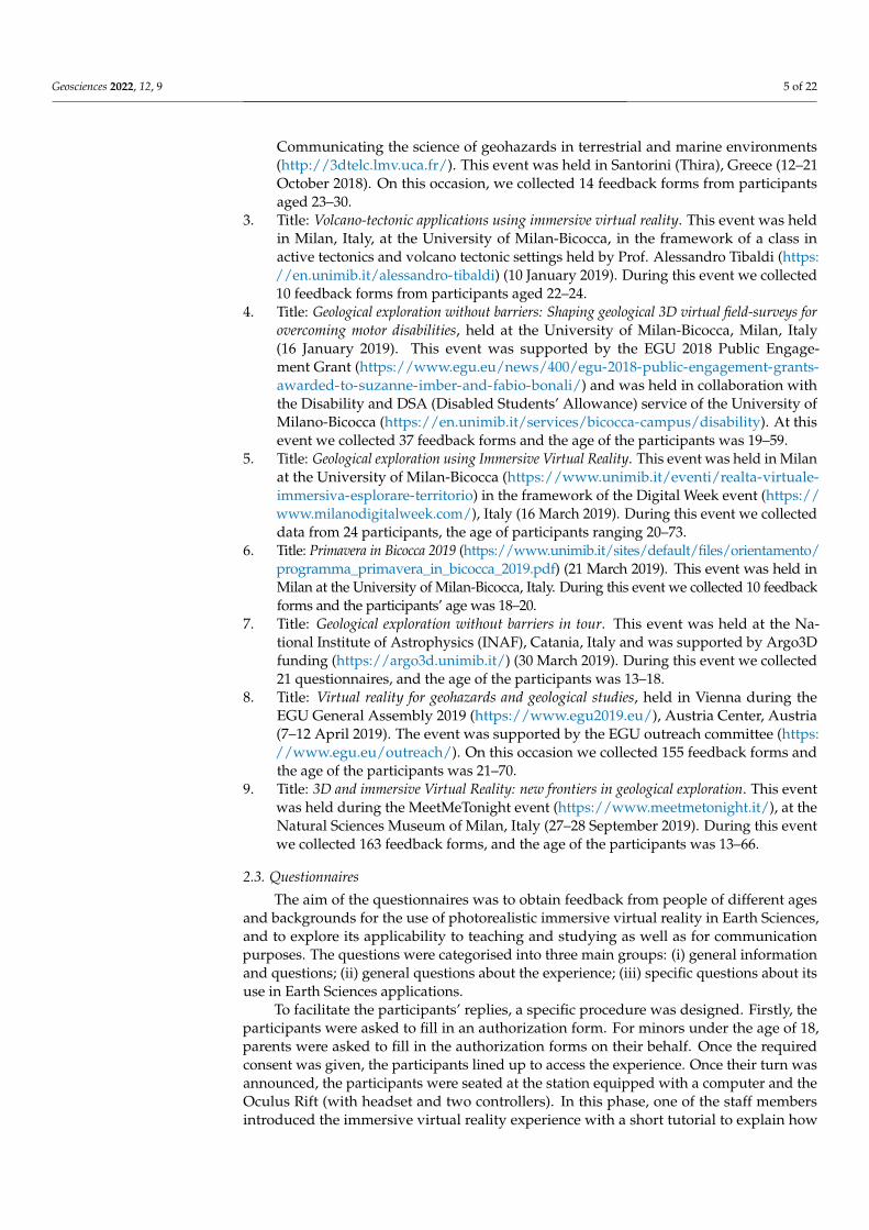
1. Title: Field exploration using immersive virtual reality in the framework of the “B.Inclusiondays” (https://www.unimib.it/eventi/binclusion-days-2018), held at the Universityof Milan-Bicocca, Italy. This event was supported by the EGU 2018 Public Engage-ment Grant (https://www.egu.eu/news/400/egu-2018-public-engagement-grants-awarded-to-suzanne-imber-and-fabio-bonali/) and was held in collaboration withthe Disability and DSA (Disabled Students’ Allowance) service of the University ofMilan-Bicocca (https://en.unimib.it/services/bicocca-campus/disability) (10 Octo-ber 2018). During this event we collected feeback from 25 participants aged 20–56.
2. Title: Santorini Summer School, in the framework of the EU Erasmus + Project—Bringing the 3D-world into the classroom: a new approach to Teaching, Learning and
Geosciences 2022, 12, 9 5 of 22
Communicating the science of geohazards in terrestrial and marine environments(http://3dtelc.lmv.uca.fr/). This event was held in Santorini (Thira), Greece (12–21October 2018). On this occasion, we collected 14 feedback forms from participantsaged 23–30.
3. Title: Volcano-tectonic applications using immersive virtual reality. This event was heldin Milan, Italy, at the University of Milan-Bicocca, in the framework of a class inactive tectonics and volcano tectonic settings held by Prof. Alessandro Tibaldi (https://en.unimib.it/alessandro-tibaldi) (10 January 2019). During this event we collected10 feedback forms from participants aged 22–24.
4. Title: Geological exploration without barriers: Shaping geological 3D virtual field-surveys forovercoming motor disabilities, held at the University of Milan-Bicocca, Milan, Italy(16 January 2019). This event was supported by the EGU 2018 Public Engage-ment Grant (https://www.egu.eu/news/400/egu-2018-public-engagement-grants-awarded-to-suzanne-imber-and-fabio-bonali/) and was held in collaboration withthe Disability and DSA (Disabled Students’ Allowance) service of the University ofMilano-Bicocca (https://en.unimib.it/services/bicocca-campus/disability). At thisevent we collected 37 feedback forms and the age of the participants was 19–59.
5. Title: Geological exploration using Immersive Virtual Reality. This event was held in Milanat the University of Milan-Bicocca (https://www.unimib.it/eventi/realta-virtuale-immersiva-esplorare-territorio) in the framework of the Digital Week event (https://www.milanodigitalweek.com/), Italy (16 March 2019). During this event we collecteddata from 24 participants, the age of participants ranging 20–73.
6. Title: Primavera in Bicocca 2019 (https://www.unimib.it/sites/default/files/orientamento/programma_primavera_in_bicocca_2019.pdf) (21 March 2019). This event was held inMilan at the University of Milan-Bicocca, Italy. During this event we collected 10 feedbackforms and the participants’ age was 18–20.
7. Title: Geological exploration without barriers in tour. This event was held at the Na-tional Institute of Astrophysics (INAF), Catania, Italy and was supported by Argo3Dfunding (https://argo3d.unimib.it/) (30 March 2019). During this event we collected21 questionnaires, and the age of the participants was 13–18.
8. Title: Virtual reality for geohazards and geological studies, held in Vienna during theEGU General Assembly 2019 (https://www.egu2019.eu/), Austria Center, Austria(7–12 April 2019). The event was supported by the EGU outreach committee (https://www.egu.eu/outreach/). On this occasion we collected 155 feedback forms andthe age of the participants was 21–70.
9. Title: 3D and immersive Virtual Reality: new frontiers in geological exploration. This eventwas held during the MeetMeTonight event (https://www.meetmetonight.it/), at theNatural Sciences Museum of Milan, Italy (27–28 September 2019). During this eventwe collected 163 feedback forms, and the age of the participants was 13–66.
2.3. Questionnaires
The aim of the questionnaires was to obtain feedback from people of different agesand backgrounds for the use of photorealistic immersive virtual reality in Earth Sciences,and to explore its applicability to teaching and studying as well as for communicationpurposes. The questions were categorised into three main groups: (i) general informationand questions; (ii) general questions about the experience; (iii) specific questions about itsuse in Earth Sciences applications.
To facilitate the participants’ replies, a specific procedure was designed. Firstly, theparticipants were asked to fill in an authorization form. For minors under the age of 18,parents were asked to fill in the authorization forms on their behalf. Once the requiredconsent was given, the participants lined up to access the experience. Once their turn wasannounced, the participants were seated at the station equipped with a computer and theOculus Rift (with headset and two controllers). In this phase, one of the staff membersintroduced the immersive virtual reality experience with a short tutorial to explain how

Geosciences 2022, 12, 9 6 of 22
to explore the VR environment, as well as providing some basic geological notions aboutthe environment in which they would soon be immersed. During each event, after theexperience, the participants were invited to fill in a Google Form questionnaire that wasthe same for each dissemination event. The latter was divided into three macro categories:
(1) General information aimed at collecting anonymous data such as age and job title,and then general questions. Questions: (i) Have you ever used a VR headset before?(reply, YES/NO); (ii) Do you usually go hiking/trekking? (reply, YES/NO);
(2) General questions on the experience aimed at evaluating the experience with thevirtual reality just tested: (iii) Which is your favourite navigation mode? (reply: Walk,Drone or Flight mode); (iv) How satisfied are you with the portrayal of the virtuallandscape? (five-level Linkert item—1 Unsatisfied, 2 Slightly satisfied, 3 Neutral,4 Moderately satisfied, 5 Very satisfied); (v) How would you rank your experiencewith virtual exploration? (five-level Linkert item—1 Unsatisfied, 2 Slightly satisfied,3 Neutral, 4 Moderately satisfied, 5 Very satisfied); (vi) Would you like to repeat theexperience? (reply, YES/NO); (vii) Did you experience any form of sickness duringthe navigation? (reply, YES/NO), If so, which one? (Open reply)
(3) Specific questions on the potential use of Immersive Virtual Reality in Earth Sci-ences, aimed at assessing the perception of the users on the possible adoption ofthis technology in the geo-education context: (viii) How useful do you think it isas a studying/learning tool in Earth Sciences? (five-level Linkert item—1 Useless,2 Slightly useful, 3 Neutral, 4 Moderately useful, 5 Very useful); (ix) How useful doyou think it is as a teaching tool in Earth Sciences? (five-level Linkert item—1 Useless,2 Slightly useful, 3 Neutral, 4 Moderately useful, 5 Very useful).
As a final point regarding the questionnaires, it was decided to propose a limitednumber of questions to the participants, focusing on acquiring a large number of replies,following a trade-off approach. In fact, we planned to reach a reasonable balance betweenthe possibility to acquire useful feedback about the use of immersive virtual reality forgeo-education and the practical plausibility of administering the form within the events.We especially focused on getting feedback on the quality, usability, and usefulness of thedeveloped system.
We did not carry out a specific analysis of perceived usability of the developed immer-sive VR environment and system, because it would have required the participants to fill ina very long and time-consuming questionnaire [23].
3. The Virtual Geosites3.1. The Metaxa Mine, Santorini (Greece)
The Metaxa Mine is in the SE part of the Santorini volcanic complex, which is partof the active South Aegean Volcanic Arc. The volcanic centres extend from Sousaki andMethana (close to Central Greece) to the Nisyros-Kos islands (at the Eastern border withTurkey), with Santorini volcano being its southernmost expression. The latter is locatedon the Aegean microplate and is associated with recent volcano tectonic activity in theregion [24]. The activity of the volcanic arc is related to the subduction of the Africanplate beneath the Eurasian plate [25], but locally around Santorini Island the stress field isextensional due to the slab rollback [26] and the associated regional tectonics.
The Metaxa Mine is an iconic geosite where visitors have a chance to view and explorethe Late Bronze Age Minoan era deposits. Moreover, it is an industrial heritage site as theextraction of pumice during the previous century gave considerable income opportunitiesto the local population. Locally, the landscape presents an asymmetrical morphology [17],surrounded by almost vertical and overhanging cliffs and covered by debris flow depositsand remnants of anthropogenic activities. Its heterogeneous floor is scattered with smallhills made of covered excavation materials. Along the vertical slopes of the mine, andespecially at the entrance, an excellent outcrop showing Late Bronze Age deposits [5] canbe observed. The virtual geosite for this site (Figure 2) has an extent of about 520 × 400 mand a texture resolution of 0.9 cm/pix. Further details are in Antoniou et al. [17] while

Geosciences 2022, 12, 9 7 of 22
3D details with annotations can be found at https://geovires.unimib.it/ (accessed on 26November 2021), within the geosites section, and at https://arcg.is/1e4erK0 (accessed on26 November 2021).
Geosciences 2022, 12, x FOR PEER REVIEW 7 of 22
site as the extraction of pumice during the previous century gave considerable income opportunities to the local population. Locally, the landscape presents an asymmetrical morphology [17], surrounded by almost vertical and overhanging cliffs and covered by debris flow deposits and remnants of anthropogenic activities. Its heterogeneous floor is scattered with small hills made of covered excavation materials. Along the vertical slopes of the mine, and especially at the entrance, an excellent outcrop showing Late Bronze Age deposits [5] can be observed. The virtual geosite for this site (Figure 2) has an extent of about 520 × 400 m and a texture resolution of 0.9 cm/pix. Further details are in Antoniou et al. [17] while 3D details with annotations can be found at https://geovires.unimib.it/ (accessed on 26 November 2021), within the geosites section, and at https://arcg.is/1e4erK0 (accessed on 26 November 2021).
Figure 2. 3D eastern view of the Virtual Geosite of the Metaxa Mine. See the white church on the right hand side for scale.
3.2. 1984 Krafla Eruption Site, Northern Volcanic Zone (Iceland) The virtual geosite is located within the Krafla fissure swarm in the Northern
Volcanic Zone of Iceland, along the emerging part of the Mid Atlantic ridge. This unique volcano tectonic terrain is composed of active rift zones, extension fractures, faults, eruptive fissures, and basaltic volcanoes. The area is occupied by a number of volcanic craters with a N-S alignment (Figure 3), lava flows, as well as a series of extension fractures and normal faults associated with the 1984 Krafla eruption [27]. The larger cone in the foreground (350 m × 150 m) was formed in 1984, at the end of the “Krafla Fires” eruptive cycle [28]. In its central part, one can observe the pyroclastic cone flank [19] as well as two normal faults which cross the post-Latest Glacial Maximum lava flows (older than 7 ka BP; 27). In the model, a cluster of recent monogenetic volcanoes (scoria cones) is also present, as well as an older scoria cone filled by the 1984 lava flow. The virtual geosite for this site (Figure 4) has an extent of about 1010 × 680 m and a texture resolution of 2.6 cm/pix. Additional details are made available in 3D with annotations at: https://geovires.unimib.it/ (accessed on 26 November 2021), within the volcano tectonics section.
Figure 2. 3D eastern view of the Virtual Geosite of the Metaxa Mine. See the white church on theright hand side for scale.
3.2. 1984 Krafla Eruption Site, Northern Volcanic Zone (Iceland)
The virtual geosite is located within the Krafla fissure swarm in the Northern VolcanicZone of Iceland, along the emerging part of the Mid Atlantic ridge. This unique volcanotectonic terrain is composed of active rift zones, extension fractures, faults, eruptive fissures,and basaltic volcanoes. The area is occupied by a number of volcanic craters with a N-Salignment (Figure 3), lava flows, as well as a series of extension fractures and normalfaults associated with the 1984 Krafla eruption [27]. The larger cone in the foreground(350 m × 150 m) was formed in 1984, at the end of the “Krafla Fires” eruptive cycle [28]. Inits central part, one can observe the pyroclastic cone flank [19] as well as two normal faultswhich cross the post-Latest Glacial Maximum lava flows (older than 7 ka BP; 27). In themodel, a cluster of recent monogenetic volcanoes (scoria cones) is also present, as well asan older scoria cone filled by the 1984 lava flow. The virtual geosite for this site (Figure 4)has an extent of about 1010 × 680 m and a texture resolution of 2.6 cm/pix. Additionaldetails are made available in 3D with annotations at: https://geovires.unimib.it/ (accessedon 26 November 2021), within the volcano tectonics section.

Geosciences 2022, 12, 9 8 of 22Geosciences 2022, 12, x FOR PEER REVIEW 8 of 22
Figure 3. 3D view of the virtual geosite of the Krafla eruption site; the scale is highlighted in the figure.
Figure 4. 3D view of the rift-transform triple junction virtual geosite; the scale is highlighted in the figure.
3.3. The Rift-Transform Triple Junction, Northern Volcanic Zone (Iceland) To the east of Husavik, in Northern Iceland, a remarkable subaerial triple-junction
intersection is preserved between the Husavik-Flatey Fault dextral transform fault and rifting in the Northern Volcanic Zone (Figure 4). The geomorphological and structural landforms are visible due to the presence of a sheet of pahoehoe lavas that record numerous structural features that are displayed in fantastic detail. These features include transform and extensional fault structures, riedel fault complexes, transpressional faulting and compressional strike-slip relay ramps, as well as second-order R, R’ and P shears [18], providing a unique opportunity to investigate this dynamic structural environment using a virtual reality model created from drone imagery acquired over the triple junction region for the first time. Two interacting fault systems are clearly visible in the drone data
Figure 3. 3D view of the virtual geosite of the Krafla eruption site; the scale is highlighted in the figure.
Geosciences 2022, 12, x FOR PEER REVIEW 8 of 22
Figure 3. 3D view of the virtual geosite of the Krafla eruption site; the scale is highlighted in the figure.
Figure 4. 3D view of the rift-transform triple junction virtual geosite; the scale is highlighted in the figure.
3.3. The Rift-Transform Triple Junction, Northern Volcanic Zone (Iceland) To the east of Husavik, in Northern Iceland, a remarkable subaerial triple-junction
intersection is preserved between the Husavik-Flatey Fault dextral transform fault and rifting in the Northern Volcanic Zone (Figure 4). The geomorphological and structural landforms are visible due to the presence of a sheet of pahoehoe lavas that record numerous structural features that are displayed in fantastic detail. These features include transform and extensional fault structures, riedel fault complexes, transpressional faulting and compressional strike-slip relay ramps, as well as second-order R, R’ and P shears [18], providing a unique opportunity to investigate this dynamic structural environment using a virtual reality model created from drone imagery acquired over the triple junction region for the first time. Two interacting fault systems are clearly visible in the drone data
Figure 4. 3D view of the rift-transform triple junction virtual geosite; the scale is highlighted inthe figure.
3.3. The Rift-Transform Triple Junction, Northern Volcanic Zone (Iceland)
To the east of Husavik, in Northern Iceland, a remarkable subaerial triple-junctionintersection is preserved between the Husavik-Flatey Fault dextral transform fault andrifting in the Northern Volcanic Zone (Figure 4). The geomorphological and structurallandforms are visible due to the presence of a sheet of pahoehoe lavas that record numerousstructural features that are displayed in fantastic detail. These features include transformand extensional fault structures, riedel fault complexes, transpressional faulting and com-pressional strike-slip relay ramps, as well as second-order R, R’ and P shears [18], providinga unique opportunity to investigate this dynamic structural environment using a virtualreality model created from drone imagery acquired over the triple junction region for thefirst time. Two interacting fault systems are clearly visible in the drone data and using theVR (the drone flight mode is particularly good for viewing these structures), comprising a

Geosciences 2022, 12, 9 9 of 22
NW-SE transform-affinity faults of the Husavik-Flatey Fault and the roughly N-S normalfaults of the Theistareykir rifting in the volcanic zone. The site is dominated by the verticalfault scarp face that extends north-south and the Husavik-Flatey Fault that extends awayfrom this cliff face, as well as a series of small fault scarps with evidence of opening andright lateral movement.
3.4. Mt Pizzillo Area, NE Rift of Mt. Etna (Italy)
Mt. Etna is located along the eastern coast of Sicily, Italy, and since 2013 it has beeninscribed on the UNESCO World Heritage list. Its long eruptive history, starting from600,000 years ago [29] and its continuous gas and vapor emissions along with its sporadicStrombolian activity, has produced several spectacular lava fountains and lava flows whichmake this volcano an important reference for volcanological studies. Etna is, therefore, anideal site to test immersive virtual reality and design a virtual survey of geological andstructural features, such as its dense network of eruptive fissures forming the so-calledNE, S and W Rifts. In particular, the area of investigation is located in the northern sectorof the volcano: it belongs to the NE Rift, a group of eruptive fissures that mark a zone offrequent, shallow volcanic intrusions. The rough terrain is affected by active deformation(approximately 2 cm/yr [30]) and is covered by cinder cones and historical lava flows. Thevirtual geosite (Figure 5), which has an aerial extent of about 230 × 200 m and a textureresolution of 2 cm/pix, is an area located within Mt Etna’s NE rift, on the northern flankof the volcano. Here, the users can observe a swarm of NE-SW extension fractures withcentimetric dilation (up to about 70 cm) and several piercing points, which can be clearlyobserved along the fracture walls. The two widest main fractures gradually transit tonormal faults, dipping towards each other. The faults can be clearly recognized on the flankof the pyroclastic cone of historical age [29]. The primary fracture located on the right isnext to a short normal fault dipping to the left. By following the trace of the fault where itreaches the highest point on the flank, it is possible to see its partitioning into two faultsthat dip towards each other and form a graben structure. Further details are made availablein 3D with annotations at: www.geovires.unimib.it, within the volcano tectonics section.
Geosciences 2022, 12, x FOR PEER REVIEW 9 of 22
and using the VR (the drone flight mode is particularly good for viewing these structures), comprising a NW-SE transform-affinity faults of the Husavik-Flatey Fault and the roughly N-S normal faults of the Theistareykir rifting in the volcanic zone. The site is dominated by the vertical fault scarp face that extends north-south and the Husavik-Flatey Fault that extends away from this cliff face, as well as a series of small fault scarps with evidence of opening and right lateral movement.
3.4. Mt Pizzillo Area, NE Rift of Mt. Etna (Italy) Mt. Etna is located along the eastern coast of Sicily, Italy, and since 2013 it has been
inscribed on the UNESCO World Heritage list. Its long eruptive history, starting from 600,000 years ago [29] and its continuous gas and vapor emissions along with its sporadic Strombolian activity, has produced several spectacular lava fountains and lava flows which make this volcano an important reference for volcanological studies. Etna is, therefore, an ideal site to test immersive virtual reality and design a virtual survey of geological and structural features, such as its dense network of eruptive fissures forming the so-called NE, S and W Rifts. In particular, the area of investigation is located in the northern sector of the volcano: it belongs to the NE Rift, a group of eruptive fissures that mark a zone of frequent, shallow volcanic intrusions. The rough terrain is affected by active deformation (approximately 2 cm/yr [30]) and is covered by cinder cones and historical lava flows. The virtual geosite (Figure 5), which has an aerial extent of about 230 × 200 m and a texture resolution of 2 cm/pix, is an area located within Mt Etna’s NE rift, on the northern flank of the volcano. Here, the users can observe a swarm of NE-SW extension fractures with centimetric dilation (up to about 70 cm) and several piercing points, which can be clearly observed along the fracture walls. The two widest main fractures gradually transit to normal faults, dipping towards each other. The faults can be clearly recognized on the flank of the pyroclastic cone of historical age [29]. The primary fracture located on the right is next to a short normal fault dipping to the left. By following the trace of the fault where it reaches the highest point on the flank, it is possible to see its partitioning into two faults that dip towards each other and form a graben structure. Further details are made available in 3D with annotations at: www.geovires.unimib.it, within the volcano tectonics section.
Figure 5. 3D view of the virtual geosite of Mt Pizzillo, along the NE Rift, Mt Etna.
4. Feedback from the Users In this section we show the results acquired from 459 questionnaires from
participants, aged 13–73. We focus both on the entire dataset of participants and on the following categories:
Figure 5. 3D view of the virtual geosite of Mt Pizzillo, along the NE Rift, Mt Etna.
4. Feedback from the Users
In this section we show the results acquired from 459 questionnaires from participants,aged 13–73. We focus both on the entire dataset of participants and on the followingcategories:
(i) Academics/researchers in Earth Sciences (A/RES) (n = 144, age 25 ÷ 70);(ii) MSc students in Earth Sciences (MScSES) (n = 35, age 21 ÷ 30);

Geosciences 2022, 12, 9 10 of 22
(iii) middle and high school students (MHSS) (n = 104, age 13 ÷ 20);(iv) Lay public (LP) (not related to the previous categories, n = 176, age 19 ÷ 73) (Figure 6).
It is worth noting that 10 out of 459 users are affected by a physical disability thatwould hinder the hiking or trekking needed to visit these geosites in real life.
Geosciences 2022, 12, x FOR PEER REVIEW 10 of 22
(i) Academics/researchers in Earth Sciences (A/RES) (n = 144, age 25 ÷ 70); (ii) MSc students in Earth Sciences (MScSES) (n = 35, age 21 ÷ 30); (iii) middle and high school students (MHSS) (n = 104, age 13 ÷ 20); (iv) Lay public (LP) (not related to the previous categories, n = 176, age 19 ÷ 73) (Figure
6). It is worth noting that 10 out of 459 users are affected by a physical disability that would hinder the hiking or trekking needed to visit these geosites in real life.
Figure 6. Graphs showing the results related to the General questions provided to the participants after their experience. To the left, relative frequency histogram displaying the age of the participants, grouped each 6 years, and, to the right, Pie chart showing the frequency of each category.
4.1. General Questions The preliminary questions allowed us to identify the most frequent age groups that
participated in the experience during our events. The histogram in Figure 6 shows that the users mainly belonged to two main groups: 13–31 years old, followed by the range between 31 and 49 years old, while older ages were less represented. For their backgrounds, the graph in Figure 6 shows that most of the users belonged to the lay public (38%), followed by academics (31%), school students (23%) and finally MSc class (age 21–30) (8%).
4.1.1. Have You Ever Used a VR Headset Before? As part of their feedback, all participants were asked about their familiarity with the
VR equipment before the event. The results are displayed in Figure 7 and show that the majority of the users (54%) had not used similar equipment before. This observation, however, changes if we consider each category singularly. In particular, most students (52%) ranging from 13 to 20 years old (school students) had already used a VR headset before. On the other hand, lay public and academics show similar percentages: most (55% in the former case and 56% in the latter) had not used a VR headset before the dissemination event.
Figure 6. Graphs showing the results related to the General questions provided to the participantsafter their experience. To the left, relative frequency histogram displaying the age of the participants,grouped each 6 years, and, to the right, Pie chart showing the frequency of each category.
4.1. General Questions
The preliminary questions allowed us to identify the most frequent age groups thatparticipated in the experience during our events. The histogram in Figure 6 shows that theusers mainly belonged to two main groups: 13–31 years old, followed by the range between31 and 49 years old, while older ages were less represented. For their backgrounds, thegraph in Figure 6 shows that most of the users belonged to the lay public (38%), followedby academics (31%), school students (23%) and finally MSc class (age 21–30) (8%).
4.1.1. Have You Ever Used a VR Headset Before?
As part of their feedback, all participants were asked about their familiarity with the VRequipment before the event. The results are displayed in Figure 7 and show that the majorityof the users (54%) had not used similar equipment before. This observation, however, changesif we consider each category singularly. In particular, most students (52%) ranging from 13 to20 years old (school students) had already used a VR headset before. On the other hand, laypublic and academics show similar percentages: most (55% in the former case and 56% in thelatter) had not used a VR headset before the dissemination event.

Geosciences 2022, 12, 9 11 of 22Geosciences 2022, 12, x FOR PEER REVIEW 11 of 22
Figure 7. Bar charts showing the users’ familiarity with VR equipment before the dissemination events. The results represent both the total number of participants and the background of each group, respectively.
4.1.2. Do You Usually Go Hiking/Trekking? Figure 8 shows the habits of the participants with respect to hiking/trekking: most
users (72% of all participants) enjoyed the direct contact with nature and thus were used to going hiking or trekking. This percentage increased when considering both academics and MSc (84% in the first case and 83% in the latter). Finally, school students (59%) and lay public (68%) also reached quite high percentages. This was a fundamental question to compare replies from two different datasets of participants that were, or were not, addicted to field excursions, thus with different levels of expertise in landscape exploration.
Figure 8. Bar charts showing the habits of the participants with regard to hiking/trekking. The results represent both the total number of participants and the background of each group respectively.
Figure 7. Bar charts showing the users’ familiarity with VR equipment before the disseminationevents. The results represent both the total number of participants and the background of each group,respectively.
4.1.2. Do You Usually Go Hiking/Trekking?
Figure 8 shows the habits of the participants with respect to hiking/trekking: mostusers (72% of all participants) enjoyed the direct contact with nature and thus were usedto going hiking or trekking. This percentage increased when considering both academicsand MSc (84% in the first case and 83% in the latter). Finally, school students (59%) andlay public (68%) also reached quite high percentages. This was a fundamental question tocompare replies from two different datasets of participants that were, or were not, addictedto field excursions, thus with different levels of expertise in landscape exploration.
Geosciences 2022, 12, x FOR PEER REVIEW 11 of 22
Figure 7. Bar charts showing the users’ familiarity with VR equipment before the dissemination events. The results represent both the total number of participants and the background of each group, respectively.
4.1.2. Do You Usually Go Hiking/Trekking? Figure 8 shows the habits of the participants with respect to hiking/trekking: most
users (72% of all participants) enjoyed the direct contact with nature and thus were used to going hiking or trekking. This percentage increased when considering both academics and MSc (84% in the first case and 83% in the latter). Finally, school students (59%) and lay public (68%) also reached quite high percentages. This was a fundamental question to compare replies from two different datasets of participants that were, or were not, addicted to field excursions, thus with different levels of expertise in landscape exploration.
Figure 8. Bar charts showing the habits of the participants with regard to hiking/trekking. The results represent both the total number of participants and the background of each group respectively.
Figure 8. Bar charts showing the habits of the participants with regard to hiking/trekking. The resultsrepresent both the total number of participants and the background of each group respectively.

Geosciences 2022, 12, 9 12 of 22
4.2. General Questions on Immersive Virtual Reality4.2.1. Which Is Your Favourite Navigation Mode?
For most participants, as displayed in Figure 9, the most popular navigation modeduring immersive virtual reality exploration was the drone. This was clearly shown bothby considering all participants (69%) and the single categories (for which the percentageranged from 67% to 71%). Between the other two modes, the walk and flight ones, usersmostly chose the walk mode (20–21%). A discrepancy, however, was found in the resultsprovided by the MSc group, who showed a slight preference for the flight mode (17%) overthe walk mode (14%).
Geosciences 2022, 12, x FOR PEER REVIEW 12 of 22
4.2. General Questions on Immersive Virtual Reality 4.2.1. Which Is Your Favourite Navigation Mode?
For most participants, as displayed in Figure 9, the most popular navigation mode during immersive virtual reality exploration was the drone. This was clearly shown both by considering all participants (69%) and the single categories (for which the percentage ranged from 67% to 71%). Between the other two modes, the walk and flight ones, users mostly chose the walk mode (20–21%). A discrepancy, however, was found in the results provided by the MSc group, who showed a slight preference for the flight mode (17%) over the walk mode (14%).
Figure 9. Bar charts showing the preferred navigation mode. The results represent both the total number of participants and the background of each group respectively.
4.2.2. How Satisfied Are You with the Portrayal of the Virtual Landscape? The users’ satisfaction on the portrayal of the immersive VR environments showed
that most declared themselves to be moderately (49%) to very satisfied (38%) (Figure 10), with the academics as the most satisfied (47%), followed by the lay public and MSc. The data for school students showed the lowest satisfaction rate for rank 5, even though the majority responded 4 and 5.
Figure 9. Bar charts showing the preferred navigation mode. The results represent both the totalnumber of participants and the background of each group respectively.
4.2.2. How Satisfied Are You with the Portrayal of the Virtual Landscape?
The users’ satisfaction on the portrayal of the immersive VR environments showedthat most declared themselves to be moderately (49%) to very satisfied (38%) (Figure 10),with the academics as the most satisfied (47%), followed by the lay public and MSc. Thedata for school students showed the lowest satisfaction rate for rank 5, even though themajority responded 4 and 5.

Geosciences 2022, 12, 9 13 of 22Geosciences 2022, 12, x FOR PEER REVIEW 13 of 22
Figure 10. Bar charts showing the portrayal feedback of the Immersive Virtual Reality exploration. The results represent both the total number of participants and the background of each group respectively.
4.2.3. How Would You Rank Your Experience with Virtual Exploration? More feedback was collected about the general satisfaction of the participants with
the immersive virtual reality exploration. Most users were moderately to very satisfied with their experience (Figure 11). The highest percentages were shown by academics and the lay public. Based on our statistical analysis, school students were a little bit less satisfied when compared with the other categories. In fact, 18% declared themselves to be basically neutral.
Figure 10. Bar charts showing the portrayal feedback of the Immersive Virtual Reality exploration.The results represent both the total number of participants and the background of each grouprespectively.
4.2.3. How Would You Rank Your Experience with Virtual Exploration?
More feedback was collected about the general satisfaction of the participants with theimmersive virtual reality exploration. Most users were moderately to very satisfied withtheir experience (Figure 11). The highest percentages were shown by academics and thelay public. Based on our statistical analysis, school students were a little bit less satisfiedwhen compared with the other categories. In fact, 18% declared themselves to be basicallyneutral.

Geosciences 2022, 12, 9 14 of 22Geosciences 2022, 12, x FOR PEER REVIEW 14 of 22
Figure 11. Bar charts showing the experience of the participants during their immersive virtual reality exploration. The results represent both the total number of participants and the background of each group respectively.
4.2.4. Would You like to Repeat the Experience? Based on our results, a high percentage of the users wanted to repeat the experience
(Figure 12). In fact, an average of 97% of all participants definitely wanted to repeat the experience; The school students category scored 100%.
Figure 12. Bar charts showing the participants’ wish to repeat the immersive virtual reality exploration experience. The results represent both the total number of participants and the background of each group respectively.
Figure 11. Bar charts showing the experience of the participants during their immersive virtual realityexploration. The results represent both the total number of participants and the background of eachgroup respectively.
4.2.4. Would You like to Repeat the Experience?
Based on our results, a high percentage of the users wanted to repeat the experience(Figure 12). In fact, an average of 97% of all participants definitely wanted to repeat theexperience; The school students category scored 100%.
Geosciences 2022, 12, x FOR PEER REVIEW 14 of 22
Figure 11. Bar charts showing the experience of the participants during their immersive virtual reality exploration. The results represent both the total number of participants and the background of each group respectively.
4.2.4. Would You like to Repeat the Experience? Based on our results, a high percentage of the users wanted to repeat the experience
(Figure 12). In fact, an average of 97% of all participants definitely wanted to repeat the experience; The school students category scored 100%.
Figure 12. Bar charts showing the participants’ wish to repeat the immersive virtual reality exploration experience. The results represent both the total number of participants and the background of each group respectively.
Figure 12. Bar charts showing the participants’ wish to repeat the immersive virtual reality explo-ration experience. The results represent both the total number of participants and the background ofeach group respectively.

Geosciences 2022, 12, 9 15 of 22
4.2.5. Did You Experience Any Form of Physical Sickness during the Navigation? If so,Which One?
Short-term sickness was mentioned by 26% of the participants (Figure 13). This variedacross the different groups, with academics being the most impacted, and MSc and schoolstudents being the least impacted. The overall 119 sickness effects reported consistedof: slight dizziness (65%), slight headache (22%), slight nausea (10%) and disorientation(3%). None resulted in an interruption of the experience, suggesting that these effects areminor in most cases. Regarding this point, we are aware that there are more thorough,systematic, and validated ways of evaluating the feeling of sickness due to the usage ofVR technologies (in particular the Simulator Sickness Questionnaire—SSQ—introduced byKennedy et al. [31]), but we only wanted to have an at-a-glance indication about the factthat some adverse effects were perceived by the users, and also to evaluate the real need ofperforming additional experiments on this point.
Geosciences 2022, 12, x FOR PEER REVIEW 15 of 22
4.2.5. Did You Experience Any Form of Physical Sickness during the Navigation? If so, Which One?
Short-term sickness was mentioned by 26% of the participants (Figure 13). This varied across the different groups, with academics being the most impacted, and MSc and school students being the least impacted. The overall 119 sickness effects reported consisted of: slight dizziness (65%), slight headache (22%), slight nausea (10%) and disorientation (3%). None resulted in an interruption of the experience, suggesting that these effects are minor in most cases. Regarding this point, we are aware that there are more thorough, systematic, and validated ways of evaluating the feeling of sickness due to the usage of VR technologies (in particular the Simulator Sickness Questionnaire—SSQ—introduced by Kennedy et al. [31]), but we only wanted to have an at-a-glance indication about the fact that some adverse effects were perceived by the users, and also to evaluate the real need of performing additional experiments on this point.
Figure 13. Bar charts showing possible side effects associated with the immersive virtual reality experience. The results represent both the total number of participants and the background of each group respectively.
4.3. Teaching 4.3.1. How Useful Do You Think Immersive Virtual Reality Is as a Studying/Learning Tool in Earth Sciences?
Figure 14 shows the effectiveness of immersive virtual reality as a learning tool. All participants believed that it could be very useful (59%) followed by moderately useful (30%). When considering each category, the perception of the users remained very similar. In particular, the lay public was found to be the most enthusiastic, as 67% found it ‘very useful’. The other categories recognized the potential of this technology as a learning instrument. In particular, 56% of the school students and 57% of the MSc agreed with this scenario. Academics were less fond of it: 52% provided a very positive opinion, but 13% remained neutral.
Figure 13. Bar charts showing possible side effects associated with the immersive virtual realityexperience. The results represent both the total number of participants and the background of eachgroup respectively.
4.3. Teaching4.3.1. How Useful Do You Think Immersive Virtual Reality Is as a Studying/Learning Toolin Earth Sciences?
Figure 14 shows the effectiveness of immersive virtual reality as a learning tool. Allparticipants believed that it could be very useful (59%) followed by moderately useful(30%). When considering each category, the perception of the users remained very similar.In particular, the lay public was found to be the most enthusiastic, as 67% found it ‘veryuseful’. The other categories recognized the potential of this technology as a learninginstrument. In particular, 56% of the school students and 57% of the MSc agreed with thisscenario. Academics were less fond of it: 52% provided a very positive opinion, but 13%remained neutral.

Geosciences 2022, 12, 9 16 of 22Geosciences 2022, 12, x FOR PEER REVIEW 16 of 22
Figure 14. Bar charts showing the possible efficiency of immersive virtual reality as a learning tool in Earth Sciences. The results represent both the total number of participants and the background of each group respectively.
4.3.2. How Useful Do You Think Immersive Virtual Reality Is as a Teaching Tool in Earth Sciences?
The great majority of the users (68%) declared that immersive virtual reality can be effectively used as a geo-education tool (Figure 15). In detail, academics and MSc showed similar results (70% and 69%, respectively) and found this possibility very promising. In contrast, school students only believed that it was ‘very useful’ at 52%, offering a general positive opinion when the ‘moderately useful’ replies, totalling 95%, were considered.
Figure 14. Bar charts showing the possible efficiency of immersive virtual reality as a learning tool inEarth Sciences. The results represent both the total number of participants and the background ofeach group respectively.
4.3.2. How Useful Do You Think Immersive Virtual Reality Is as a Teaching Tool inEarth Sciences?
The great majority of the users (68%) declared that immersive virtual reality can beeffectively used as a geo-education tool (Figure 15). In detail, academics and MSc showedsimilar results (70% and 69%, respectively) and found this possibility very promising. Incontrast, school students only believed that it was ‘very useful’ at 52%, offering a generalpositive opinion when the ‘moderately useful’ replies, totalling 95%, were considered.

Geosciences 2022, 12, 9 17 of 22Geosciences 2022, 12, x FOR PEER REVIEW 17 of 22
Figure 15. Chart bars showing the possible efficiency of immersive virtual reality as a geo-education tool. The results represent both the total number of participants and the background of each group respectively.
5. Discussion Overall, the results of our initiative of using immersive virtual reality as a tool to
carry out dissemination events on geo-education has been very positive. We held nine events, in three different countries, both in Italian and English languages, engaging a total of 459 international participants from various backgrounds. All dissemination events were carried out with the same format, virtual geosites and holistic view, aimed at understanding the impact of VR experiences on geosciences. Such events also involved people affected by temporal, or permanent, motor disabilities, who could explore “in person” inaccessible sites, proving how this technology could provide equality when dealing with geological field work and exploration. Thanks to the feedback given by all participants collected during these events, we provided a quantitative assessment of the immersive virtual reality experience, to evaluate its applicability as a tool for virtual geological exploration, with a particular focus on geo-education and communication. This represents an additional value, since previous attempts to evaluate VR techniques applied to Earth Sciences were mainly qualitative.
Generally speaking, there is a general agreement in the literature, mainly by practice and qualitative evaluations, that VR techniques are useful for teaching, as well as for learning in Earth Sciences (e.g., [7–9]). Over the last decade, several low-cost solutions have been made available to enable a quick and easy immersive virtual reality experience, both in terms of hardware and software solutions [32–34], providing teachers, students, and researchers with innovative tools to be applied in Earth Sciences. So far, in 2002, Kaiser et al. [32] applied immersive VR technology to improve mine planning, thanks to a collaboration among scientists with different areas of expertise. Recently, Kinsland and Borst [35] successfully used such technology to visualize geological data as 3D objects to be managed by scientists. As regards geo-education and research activity, McNamee and
Figure 15. Chart bars showing the possible efficiency of immersive virtual reality as a geo-educationtool. The results represent both the total number of participants and the background of each grouprespectively.
5. Discussion
Overall, the results of our initiative of using immersive virtual reality as a tool tocarry out dissemination events on geo-education has been very positive. We held nineevents, in three different countries, both in Italian and English languages, engaging a totalof 459 international participants from various backgrounds. All dissemination events werecarried out with the same format, virtual geosites and holistic view, aimed at understandingthe impact of VR experiences on geosciences. Such events also involved people affectedby temporal, or permanent, motor disabilities, who could explore “in person” inaccessiblesites, proving how this technology could provide equality when dealing with geologicalfield work and exploration. Thanks to the feedback given by all participants collectedduring these events, we provided a quantitative assessment of the immersive virtual realityexperience, to evaluate its applicability as a tool for virtual geological exploration, with aparticular focus on geo-education and communication. This represents an additional value,since previous attempts to evaluate VR techniques applied to Earth Sciences were mainlyqualitative.
Generally speaking, there is a general agreement in the literature, mainly by practiceand qualitative evaluations, that VR techniques are useful for teaching, as well as forlearning in Earth Sciences (e.g., [7–9]). Over the last decade, several low-cost solutionshave been made available to enable a quick and easy immersive virtual reality experience,both in terms of hardware and software solutions [32–34], providing teachers, students,and researchers with innovative tools to be applied in Earth Sciences. So far, in 2002,Kaiser et al. [32] applied immersive VR technology to improve mine planning, thanks toa collaboration among scientists with different areas of expertise. Recently, Kinsland andBorst [35] successfully used such technology to visualize geological data as 3D objectsto be managed by scientists. As regards geo-education and research activity, McNamee

Geosciences 2022, 12, 9 18 of 22
and Bogert [36] started using immersive virtual reality through a commercial applicationthat allows users to fly and walk in a virtual scenario, in order to address two of themain problems in teaching geological processes in an introduction-level physical geologycourse: describing dimensions and scale. A slightly different approach has been used byVisneskie et al. [37], where the immersive experience was conducted with a set of 360-VR-Videos organized as a virtual tour to be used with mobile headsets. At a more advancedlevel, Tibaldi et al. [5], Antoniou et al. [17] and Caravaca et al. [38] designed a systemwhere the user is capable of moving within a georeferenced and scaled 3D scene that canbe explored simulating a real field trip.
Following this general view that VR tools are useful for geo-education and researchactivities in Earth Sciences, we aim to contribute to the discussion with a new relevant quan-titative evaluation on the immersive virtual reality system developed by Tibaldi et al. [5]and many of the authors of the present paper, and successively applied for use in researchactivity by Antoniou et al. [17].
In evaluating the replies to the questionnaires, the first important output was thatmost participants would be glad to repeat the experience. This held for at least 97% ofthe respondents (all participants), with 100% positive replies provided by school students(Figure 12). More in detail, 96% of the participants, who had never used a VR headsetbefore, would be willing to repeat the experience, whereas for those who had already trieda VR headset, the percentage rose to 98%.
For the exploration mode, most participants preferred to fly in “drone mode”, aroundand above the main geological objects within the virtual geosites (Figure 9), by a percentagealways greater than 67%, with the highest being reached by the lay public (71%), and agreater appreciation from participants that had already used VR (75%), when comparedto those who had experienced it for the first time (64%). In addition, when considering ifusers were used to hiking or not, the drone mode reached a percentage of 68% and 71%,respectively, confirming that this was the best choice for navigation.
Another important aspect pertains to the type of virtual scenario we have proposed:again, in this case, the majority of participants ranked with high marks (4–5) the portrayal ofthe virtual landscape (87%), which is based on drone-captured pictures. This appreciationrate came especially from the lay public (86%), academics (89%), and school students (92%);on the other hand, the percentage of MSc was 71% (Figure 10).
The above results confirm the general appreciation for a photogrammetry-basedvirtual scenario. The results acquired from school students are the most interesting. Indeed,they show the lowest satisfaction for rank 5, even though the majority responded 4 and 5.We think that this could be due to the fact that school students are far more used to gamingand hyper real visualisations than other categories: as a consequence, their expectationsmight probably be higher. An improvement that can be made to the virtual landscape, fora better application to geo-education, is the possibility of adding everyday scaled objects tothe scene, to help the user better perceive dimensions and distances. This approach couldhelp overcome distance underestimation problems in VR compared to reality [39,40].
For the overall evaluation of the exploration of volcanic areas through the system,with the support of a geo-expert, the majority of the participants ranked with high value(4–5) the experience (87%), reaching a percentage of 93% among the lay public, 92% amongacademics, 88% among MSc, whereas the percentage plummeted to 72% for school students(Figure 11).
For the use of immersive virtual reality as a tool for studying and teaching EarthSciences, it is worth noting that these questions have a different importance for academicsthan for both the student categories (MSc and school students). For the former group,both teaching and studying dimensions are relevant: in terms of studying activities, it isinterpreted as an application to study landscapes, and thus as an application for researchpurposes as they are allowed to make direct observations. For MSc and school students, itis the studying/learning question that has a greater importance, since it would be appliedas a tool for advanced learning activity. Regarding the results of these questions, as shown

Geosciences 2022, 12, 9 19 of 22
in Figures 14 and 15, there is a general appreciation from all groups, with percentages inthe range 85–96%: particularly, immersive virtual reality is considered as a great studyinstrument by 85–93% of the sample; the geo-education potential of it is highly regardedby 89–96% of the sample; in this latter case, the highest value (5) dominates the replies(Figure 15).
Some participants suffered from sickness effects, but none stopped the experience, andamong those affected by sickness effects, only 8% of this subset would not like to repeatthe experience, corresponding to about 2% of the total, suggesting that educational VRapplications still need to be slightly improved. The latter point could be further exploredthrough more detailed analyses on perceived adverse effects and system usability, followingVizzari [41]’s approach. It is noted that in order to achieve this, it is necessary to focuson a smaller number of participants, in ad hoc events lasting longer, with specific tasksbeing carried out, and that this is out of the scope of the present work. From a technicalpoint of view, the use of VR headsets capable of working with a frame per second valuehigher than 90 can help reduce sickness effects [42]. In addition to that, it can be suggestedthat the user repeat the experience a few minutes after the first test. In fact, based on ourpersonal experience, the more frequently immersive virtual reality systems are used, themore comfortable users become with the VR experience.
Overall, our results demonstrate and confirm the great potential of immersive virtualreality for geo-education and as a tool for geoscience communication to citizens, withpossible applications for geotourism. Students, academics, and non-academics can explorevirtual geosites in person, acquiring geological knowledge without temporal or spatiallimitations, potentially reducing travel costs and carbon emissions [43], and decreasingunnecessary energy consumption.
The most important and innovative benefits we consider regarding the use of Immer-sive VR can be summed up as follows:
(i) It has a great potential to help users learn geology in a more interactive way, enhancinginterest and improving learning efficiency, even if geological field trips are still crucialfor a better understanding of Earth Science processes;
(ii) It can open up the possibility of studying virtual geosites in person for people affectedby motor disabilities; it is worth noting that all participants belonging to this categoryranked all questions with values greater than 4 and wished to repeat the experiencein the future;
(iii) It implies a relevant cost cutting, especially for students, since geological outcrops canbe brought into the lab;
(iv) It can be considered as an approach to reduce carbon emissions, due to the decreasein travelling needs for many people;
(v) It allows researchers to virtually travel to key geological spots and do science even inabnormal times, such as the COVID-19 pandemic.
Furthermore, immersive virtual reality can be also used by students to examine thegeology field route beforehand, so as to make the trip easier and more efficient. It allowsusers to carry out tasks that could be difficult in the real world due to constraints andrestrictions, such as cost, scheduling, or location. Immersive virtual reality can be analternative plan for field trip teaching in case the actual field trip cannot be conducted, orbefore scheduling a field trip to better plan the survey of the area.
We wish to highlight that both VR and immersive VR tools are especially crucial nowa-days to overcome limitations due to travel restrictions and lockdown periods aimed atcontaining the COVID-19 pandemic, which have especially affected Earth Science teachingand research activities. In fact, teaching usually entails field activities with the involve-ment of large student groups and research activities often need field surveying in foreigncountries. For both, the use of VR can also reduce the carbon imprint of education andresearch.

Geosciences 2022, 12, 9 20 of 22
6. Conclusions
Our work has been focused on the quantitative evaluation of the participation of dif-ferent types of people in immersive virtual reality experiences dedicated to Earth Sciences,especially volcanic areas. Our quantitative survey has involved a total of 459 questionnaires,filled in by participants at nine events between 2018 and 2019. The geological sites selectedfor the experience are located in Greece (Santorini), North Iceland and Italy (Mt. Etna).
The analysis of the questionnaires, based on nine questions, has enabled us to shedlight on how useful this approach is for geo-education purposes. The majority of therespondents have shown a high degree of interest in the immersive experience. Theyparticularly appreciated the opportunity to fly like a drone over the displayed geologicalobjects. Another key outcome of the survey is the respondents’ major satisfaction withthe portrayal of the environment, made possible by cutting-edge, unmanned aerial system(UAS)-based photogrammetry techniques.
Importantly, 97% of the participants wished to repeat the experience.With regard to the geo-education potential of this technique, most participants ranked
with high value (4–5) the experience (94%), reaching a percentage of 96% among academicsin Earth Sciences. Therefore, this study confirms that both students and academics see VRas a useful tool for geo-education.
Furthermore, our data shows the important role that immersive VR might have as atool for:
(i) popularizing Earth Sciences teaching and research by making geological key areasavailable to the public in terms of 3D models and scientific explanations of geologicalprocesses;
(ii) including people affected by motor disabilities who would not have access to danger-ous/remote areas (e.g., tectonically or volcanically active) otherwise.
Based on the above considerations, immersive VR can be also regarded as a ground-breaking tool to improve democratic ways to access information and experience, as wellas to promote inclusivity and accessibility in geo-education while reducing travel, savingtime, and carbon footprints.
Author Contributions: F.L.B. has tailored and managed all the events as well as organized andwritten the manuscript. E.R., F.V., V.A., F.M., L.F., V.B., N.C., A.S., M.W., K.D., F.P.M., P.N., E.S., S.B.,S.F., D.R., B.v.W.d.V., M.K., G.P., M.A.S.-R., G.V., U.B. and A.T. have participated in the events andcontributed to writing the manuscript. All authors have read and agreed to the published version ofthe manuscript.
Funding: This research received no external funding devoted to this specific research.
Informed Consent Statement: Not applicable.
Data Availability Statement: The dataset with the replies from the participants is available online athttps://doi.org/10.5281/zenodo.5792209 (accessed on 26 November 2021).
Acknowledgments: This research has been provided in the framework of the following projects:(i) the MIUR project ACPR15T4_00098–Argo3D (http://argo3d.unimib.it/ (accessed on 26 November2021)); (ii) 3DTeLC Erasmus + Project 2017-1-UK01-KA203-036719 (http://www.3dtelc.com (accessedon 26 November 2021)); (iii) EGU 2018 Public Engagement Grant (https://www.egu.eu/outreach/peg/ (accessed on 26 November 2021)). Agisoft Metashape is acknowledged for photogrammetricdata processing. This article is also an outcome of Project MIUR–Dipartimenti di Eccellenza 2018–2022. Finally, this paper is an outcome of the Virtual Reality lab for Earth Sciences—GeoVires lab(https://geovires.unimib.it/ (accessed on 26 November 2021)). The work supports UNESCO IGCP692 ‘Geoheritage for Resilience’.
Conflicts of Interest: The authors declare no conflict of interest.

Geosciences 2022, 12, 9 21 of 22
References1. Trinks, I.; Clegg, P.; McCaffrey, K.; Jones, R.; Hobbs, R.; Holdsworth, B.; Holliman, N.; Imber, J.; Waggott, S.; Wilson, R. Mapping
and analysing virtual outcrops. Visual Geosci. 2005, 10, 13–19. [CrossRef]2. Edler, D.; Keil, J.; Wiedenlübbert, T.; Sossna, M.; Kühne, O.; Dickmann, F. Immersive VR Experience of Redeveloped Post-
Industrial Sites: The Example of “Zeche Holland” in Bochum-Wattenscheid. J. Cartogr. Geogr. Inf. 2019, 69, 267–284. [CrossRef]3. Pasquaré Mariotto, F.; Bonali, F.L. Virtual Geosites as Innovative Tools for Geoheritage Popularization: A Case Study from Eastern
Iceland. Geosciences 2021, 11, 149. [CrossRef]4. Lütjens, M.; Kersten, T.; Dorschel, B.; Tschirschwitz, F. Virtual Reality in Cartography: Immersive 3D Visualization of the Arctic
Clyde Inlet (Canada) Using Digital Elevation Models and Bathymetric Data. MTI 2019, 3, 9. [CrossRef]5. Tibaldi, A.; Bonali, F.L.; Vitello, F.; Delage, E.; Nomikou, P.; Antoniou, V.; Becciani, U.; Van Wyk de Vries, B.; Krokos, M.;
Whitworth, M. Real world–based immersive Virtual Reality for research, teaching and communication in volcanology. Bull.Volcanol. 2020, 82, 38. [CrossRef]
6. Krokos, M.; Bonali, F.L.; Vitello, F.; Varvara, A.; Becciani, U.; Russo, E.; Marchese, F.; Fallati, L.; Nomikou, P.; Kearl, M.; et al.Workflows for virtual reality visualisation and navigation scenarios in earth sciences. In Proceedings of the 5th InternationalConference on Geographical Information Systems Theory, Applications and Management, Heraklion, Crete, Greece, 3–5 May2019; SciTePress: Setùbal, Portugal, 2019; pp. 297–304.
7. Hurst, S.D. Use of “virtual” field trips in teaching introductory geology. Comput. Geosci. 1998, 24, 653–658. [CrossRef]8. Warne, M.; Owies, D.; McNolty, G. Exploration of a first year university multimedia module on field geology. In Proceedings of
the Beyond the Comfort Zone: Proceedings of the 21st ASCILITE Conference, Perth, Australia, 5–8 December 2004; ASCILITE:Tugun, Australia, 2004; pp. 924–933.
9. Deng, C.; Zhou, Z.; Li, W.; Hou, B. A panoramic geology field trip system using image-based rendering. In Proceedings of the2016 IEEE 40th Annual Computer Software and Applications Conference (COMPSAC), Atlanta, GA, USA, 10–14 June 2016; IEEE:Piscataway, NJ, USA; Volume 2, pp. 264–268.
10. Hilde, T.W.C.; Carlson, R.L.; Devall, P.; Moore, J.; Alleman, P.; Sonnier, C.J.; Lee, M.C.; Herrick, C.N.; Kue, C.W. [TAMU]2-TexasA&M University and topography and acoustic mapping undersea system. In Proceedings of the Oceans 91, New York, NY, USA,1–3 October 1991; Volume 1, pp. 750–755.
11. Anderson, D.M. Seafloor mapping, imaging and characterization from [TAMU]2 side-scan sonar data sets: Database management.In Proceedings of the International Symposium on Spectral Sensing Research, Maui, HI, USA, 15–20 November 1992; Volume 2,pp. 737–742.
12. Anderson, D.M. Glacial features observed in the Elysium Region of Mars. In Proceedings of the Tenth Thematic Conference onGeologic Remote Sensing, San Antonio, TX, USA, 9–12 May 1994; pp. I-263–I-273.
13. Martínez-Graña, A.M.; Goy, J.L.; Cimarra, C.A. A virtual tour of geological heritage: Valourising geodiversity using Google Earthand QR code. Comput. Geosci. 2013, 61, 83–93. [CrossRef]
14. McCaffrey, K.J.W.; Hodgetts, D.; Howell, J.; Hunt, D.; Imber, J.; Jones, R.R.; Tomasso, M.; Thurmond, J.; Viseur, S. Virtual fieldtripsfor petroleum geoscientists. In Geological Society, London, Petroleum Geology Conference Series; Geological Society of London:London, UK; Volume 7, pp. 19–26.
15. Mariotto, F.P.; Antoniou, V.; Drymoni, K.; Bonali, F.; Nomikou, P.; Fallati, L.; Karatzaferis, O.; Vlasopoulos, O. Virtual GeositeCommunication through a WebGIS Platform: A Case Study from Santorini Island (Greece). Appl. Sci. 2021, 11, 5466. [CrossRef]
16. Chang, S.C.; Hsu, T.C.; Jong, M.S.Y. Integration of the peer assessment approach with a virtual reality design system for learningearth science. Comput. Educ. 2020, 146, 103758. [CrossRef]
17. Antoniou, V.; Bonali, F.L.; Nomikou, P.; Tibaldi, A.; Melissinos, P.; Mariotto, F.P.; Vitello, F.R.; Krokos, M.; Whitworth, M.Integrating Virtual Reality and GIS Tools for Geological Mapping, Data Collection and Analysis: An Example from the MetaxaMine, Santorini (Greece). Appl. Sci. 2020, 10, 8317. [CrossRef]
18. Rust, D.; Whitworth, M. A unique ~12 ka subaerial record of rift-transform triple-junction tectonics, NE Iceland. Sci. Rep. 2019, 9,9669. [CrossRef]
19. Pasquaré Mariotto, F.; Bonali, F.L.; Venturini, C. Iceland, an open-air museum for geoheritage and Earth science communicationpurposes. Resources 2020, 9, 14. [CrossRef]
20. Tibaldi, A.; Corti, N.; De Beni, E.; Bonali, F.L.; Falsaperla, S.; Langer, H.; Neri, M.; Cantarero, M.; Reitano, D.; Fallati, L. Mappingand evaluating kinematics and the stress and strain field at active faults and fissures: A comparison between field and drone dataat the NE rift, Mt Etna (Italy). Solid Earth 2021, 12, 801–816. [CrossRef]
21. Choi, D.H.; Dailey-Hebert, A.; Estes, J.S. Emerging Tools and Applications of Virtual Reality in Education; Choi, D.H., Dailey-Hebert,A., Estes, J.S., Eds.; Information Science Reference: Hershey, PA, USA, 2016.
22. Gerloni, I.G.; Carchiolo, V.; Vitello, F.R.; Sciacca, E.; Becciani, U.; Costa, A.; Riggi, S.; Bonali, F.L.; Russo, E.; Fallati, L.; et al.Immersive virtual reality for earth sciences. In Proceedings of the 2018 Federated Conference on Computer Science andIn-formation Systems (FedCSIS), Poznan, Poland, 9–12 September 2018; IEEE: Piscataway, NJ, USA; pp. 527–534.
23. Kalawsky, R.S. VRUSE—A computerised diagnostic tool: For usability evaluation of virtual/synthetic environment systems.Appl. Ergon. 1999, 30, 11–25. [CrossRef]
24. Browning, J.; Drymoni, K.; Gudmundsson, A. Forecasting magma-chamber rupture at Santorini volcano, Greece. Sci. Rep. 2015, 5,15785. [CrossRef] [PubMed]

Geosciences 2022, 12, 9 22 of 22
25. Le Pichon, X.; Angelier, J. The Hellenic arc and trench system: A key to the neotectonic evolution of the eastern Mediter-raneanarea. Tectonophysics 1979, 60, 1–42. [CrossRef]
26. Brun, J.P.; Faccenna, C.; Gueydan, F.; Sokoutis, D.; Philippon, M.; Kydonakis, K.; Gorini, C. Effects of slab rollback acceleration onAegean extension. Bull. Geol. Soc. 2017, 50, 5–23. [CrossRef]
27. Saemundsson, K.; Hjartarson, A.; Kaldal, I.; Sigurgeirsson, M.A.; Kristinsson, S.G.; Víkingsson, S. Geological Map of the NorthernVolcanic Zone, Iceland. Northern Part 1: 100.000; Iceland GeoSurvey and Landsvirkjun: Reykjavik, Iceland, 2012.
28. Thordarson, T.; Larsen, G. Volcanism in Iceland in historical time: Volcano types, eruption styles and eruptive history. J. Geodyn.2007, 43, 118–152. [CrossRef]
29. Branca, S.; Coltelli, M.; Groppelli, G.; Lentini, F. Geological map of Etna volcano, 1:50,000 scale. Italy J. Geosci. 2011, 130, 265–291.[CrossRef]
30. Tibaldi, A.; Groppelli, G. Volcano-tectonic activity along structures of the unstable NE flank of Mt. Etna (Italy) and their possibleorigin. J. Volcanol. Geoth. Res. 2002, 115, 277–302. [CrossRef]
31. Kennedy, R.S.; Lane, N.E.; Berbaum, K.; Lilienthal, M.G. Simulator Sickness Questionnaire: An Enhanced Method for QuantifyingSimulator Sickness. Int. J. Aviat. Psychol. 1993, 3, 203–220. [CrossRef]
32. Mat, R.C.; Shariff, A.R.M.; Zulkifli, A.N.; Rahim, M.S.M.; Mahayudin, M.H. Using game engine for 3D terrain visualization of GISdata: A review. In IOP Conference Series: Earth and Environmental Science; IOP Publishing: Bristol, UK, 2014; Volume 20, p. 012037.
33. Murray, J.W. Building Virtual Reality with Unity and Steam VR; AK Peters/CRC Press: Boca Raton, FL, USA, 2017. [CrossRef]34. Kaiser, P.K.; Henning, J.G.; Cotesta, L.; Dasys, A. Innovations in mine planning and design utilizing collaborative immersive
virtual reality (CIRV). In Proceedings of the 104th CIM Annual General Meeting, Vancouver, BC, Canada, 28 April–1 May 2002;pp. 1–7.
35. Kinsland, G.L.; Borst, C.W. Visualization and interpretation of geologic data in 3D virtual reality. Interpretation 2015, 3, SX13–SX20.[CrossRef]
36. McNamee, B.D.; Bogert, K. Gaining perspective with google earth virtual reality in an introduction-level physical geology course.In Proceedings of the GSA Annual Meeting, Indianapolis, IN, USA, 4–7 November 2018.
37. Visneskie, H.; Parks, J.; Johnston, J. Learning about Ontario’s Paleozoic Geology with Virtual Reality Google Expedition Tours.Available online: https://uwspace.uwaterloo.ca/bitstream/handle/10012/15693/learning_about_ontarios_paleozoic_geology.pdf?sequence=1&isAllowed=y (accessed on 26 November 2021).
38. Caravaca, G.; Le Mouélic, S.; Mangold, N.; L’Haridon, J.; Le Deit, L.; Massé, M. 3D digital outcrop model reconstruction of theKimberley outcrop (Gale crater, Mars) and its integration into Virtual Reality for simulated geological analysis. Planet. Space Sci.2020, 182, 104808. [CrossRef]
39. Murgia, A.; Sharkey, P.M. Estimation of Distances in Virtual Environments Using Size Constancy. Int. J. Virtual Real. 2009, 8,67–74. [CrossRef]
40. Keil, J.; Edler, D.; O’Meara, D.; Korte, A.; Dickmann, F. Effects of Virtual Reality Locomotion Techniques on Distance Estimations.ISPRS Int. J. Geo-Inf. 2021, 10, 150. [CrossRef]
41. Vizzari, G. Virtual Reality to Study Pedestrian Wayfinding: Motivations and an Experiment on Usability. In Proceedings ofthe 2020 IEEE International Conference on Artificial Intelligence and Virtual Reality (AIVR), Utrecht, The Netherlands, 14–18December 2020; IEEE: Piscataway, NJ, USA; pp. 205–208. [CrossRef]
42. Kersten, T.; Drenkhan, D.; Deggim, S. Virtual Reality Application of the Fortress Al Zubarah in Qatar Including PerformanceAnalysis of Real-Time Visualisation. J. Cartogr. Geogr. Inf. 2021, 71, 241–251. [CrossRef]
43. Dolf, M.; Teehan, P. Reducing the carbon footprint of spectator and team travel at the University of British Columbia’s varsitysports events. Sport Manag. Rev. 2015, 18, 244–255. [CrossRef]