Hazardous Materials/ Unexploded Ordnance (UXO) Review
104
Mission Trails Regional Park Master Plan Update Hazardous Materials/ Unexploded Ordnance (UXO) Review GHD Inc. May 2016
-
Upload
khangminh22 -
Category
Documents
-
view
4 -
download
0
Transcript of Hazardous Materials/ Unexploded Ordnance (UXO) Review
Mission Trails Regional Park Master Plan Update Hazardous Materials/
Unexploded Ordnance (UXO) Review
GHD Inc.
May 2016

Mission Trails Regional Park - Hazardous Materials/Unexploded Ordnance Review

Contents
1. Purpose .................................................................................................................. 1
2. Project Location ...................................................................................................... 1
3. MTRP Setting ......................................................................................................... 2
3.1 Environmental Setting .............................................................................................................. 2 3.2 Hazards and Hazardous Materials ........................................................................................... 2 3.3 UXO Materials .......................................................................................................................... 4 3.4 Public Safety ............................................................................................................................. 6 3.5 Phase I Environmental Site Assessment (ESA) Practices ....................................................... 6
4. Applicable Laws and Regulations ........................................................................... 7
4.1 Federal Regulations ................................................................................................................. 7 4.2 State Regulations ..................................................................................................................... 8 4.3 Local Regulations ................................................................................................................... 10
5. Key Environmental Issues .................................................................................... 12
5.1 Issue 1 .................................................................................................................................... 12 5.2 Issue 2 .................................................................................................................................... 13 5.3 Issue 3 .................................................................................................................................... 14
6. List of Preparers ................................................................................................... 15
7. References ........................................................................................................... 16
Table Index
Table 2.1 – Existing Hazards/UXOs Identified Within Project Location ........................... 1
Table 3.1 – Summary of Process/Actions for Safe Removal of UXOs ............................ 5
Appendices A Leaking Underground Storage Tanks (LUST) Cleanup Sites B Oil and Gas Site C Hazardous Waste Cleanup Site D Munitions and Explosives Detections (MEDs)

Mission Trails Regional Park - Hazardous Materials/Unexploded Ordnance Review
This page intentionally left blank

Page 1 Mission Trails Regional Park – Hazardous Materials/Unexploded Ordnance Review
1. Purpose
The purpose of this Hazardous Materials/Unexploded Ordnance Review (Review) is to evaluate the Mission Trails Regional Park (MTRP) Master Plan Update (MPU) as a whole, to identify potential hazards and hazardous materials, disclose and address the safe removal, disposal, and/or remediation of potentially existing unexploded ordnance (UXO) materials, and discuss human health/public safety as it relates to fire hazards. This Review also presents the current regulatory framework addressing hazardous materials and UXO issues, as well as recommendations for addressing potential impacts generated from implementing elements of the updated MTRP Master Plan.
2. Project Location
The Project is located in San Diego County, within the MPU boundary as identified in the approved 1985 MTRP Development Master Plan and includes approximately 7,600 acres of existing parkland, approximately 2,259 acres of the East Elliot Community Planning Area and approximately 1,450 acres known as West Sycamore, as part of the Rancho Encantada Precise Plan area. In total, six areas within MTRP contained existing potential hazardous materials, UXO materials, and/or other public safety concerns related to issues such as fire hazards (see Table 2.1). For purposes of this report, these areas comprise the Master Plan Study Area.
Table 2.1 – Existing Hazards/UXOs Identified Within Project Location
Hazardous Materials UXO Materials
Public Safety (Fire Hazards)
West Sycamore
East Elliott
Fortuna Mountain
Mission Gorge Area
Cowles Mountain Area
Lake Murray Area

Page 2 Mission Trails Regional Park – Hazardous Materials/Unexploded Ordnance Review
3. MTRP Setting
3.1 Environmental Setting With a property size of nearly 7,600 acres, MTRP consists of open space and recreational uses, including mountains, valleys, two lakes, a major river and scenic gorge, historical landmarks, wildlife habitats, and cultural resources. Surrounded by residential development, the close proximity and diversity of the park services a broad cross-section of the population who may have difficulty reaching the remote locations of other recreational facilities.
3.2 Hazards and Hazardous Materials Chemicals are used in daily activities, including landfill disposal, fuel pumping, and water filtration that can be hazardous to humans and the environment. All businesses that handle or generate hazardous materials within the Master Plan Study Area are monitored by the United States Environmental Protection Agency (EPA). The California Environmental Protection Agency (Cal/EPA) is required through Section 65962.5 of the California Government Code to update a list of hazardous materials sites. Known as the Cortese List, these sites include hazardous and waste substance sites, leaking underground storage tank (LUST) sites, solid waste disposal sites with waste constituents above hazardous waste levels outside the waste management unit, “active” Cease and Desist Orders (CDO) and Cleanup and Abatement Orders (CAO), and hazardous waste facilities subject to corrective action are identified (CalEPA 2012).
Cal/EPA Geotracker and the California Department of Toxic Substances Control (DTSC) EnviroStar database searches identified six active cleanup sites within the Master Plan Study Area as described in Sections 3.2.1 and 3.3. (The Master Plan Study Area is defined above in Section 2.) A review of the record search maps did not identify any active Federal Superfund, State Response, School Cleanup, School Investigation, Corrective Action, Hazardous Waste Permit, or Evaluation sites within the Master Plan Study Area. However, two active Military Evaluation sites were discovered within the Master Plan Study Area.
3.2.1 Leaking Underground Storage Tanks (LUST)
The Division of Water Quality Underground Storage Tank (UST) program through the State Water Resources Control Board (SWCRB) protects public health and safety and the environment from releases of hazardous substances from tanks through monitoring and conducting inventory of reporting information for soil and groundwater of UST cases and non-UST cleanup programs. Electronic Submittal Information (ESI) from the UST program is available via the SWRCB Geotracker database. A review of the Geotracker database for LUST cleanup sites identified three open sites within MTRP as indicated below (details provided in Appendix A):
• Marine Corps Air Station (MCAS) Miramar, Camp Elliott – East, San Diego, CA 92103 [RB Case #: 400690 -- 5]
• MCAS Miramar, Camp Elliott – Mission Trails Area, San Diego, CA 92103 [RB Case #: 400690 -- 2]
• Alvarado Water Treatment (Filtration) Plant, 5530 Kiowa Drive, La Mesa, CA 91942 [RB Case #: 9 000239N96]
Located in the East Elliott Area is the Sycamore Canyon Landfill, which is owned and operated by Allied Waste Systems as an active LUST cleanup site. Sycamore Canyon Landfill is classified as a Class III, non-hazardous landfill that accepts non-hazardous, non-friable asbestos-containing materials.

Page 3 Mission Trails Regional Park – Hazardous Materials/Unexploded Ordnance Review
Additionally, Geotracker listed four closed sites within Master Plan Study Area as indicated below:
• Goodan Ranch, 16450 Sycamore Canyon Road, Santee, CA 92040 [Closed as of 2/21/1992]
• Caltrans, 13940 Father Junipero SE, Santee, CA 92071 [Closed as of 6/20/1991]
• Mission Trails Golf Course, 7380 Golfcrest Place, San Diego, CA 92119 [Closed as of 4/31/2013]
• SDCTY-Alvarado Operations, 5540 Kiowa Drive, La Mesa, CA 91942 [Closed as of 9/3/2004]
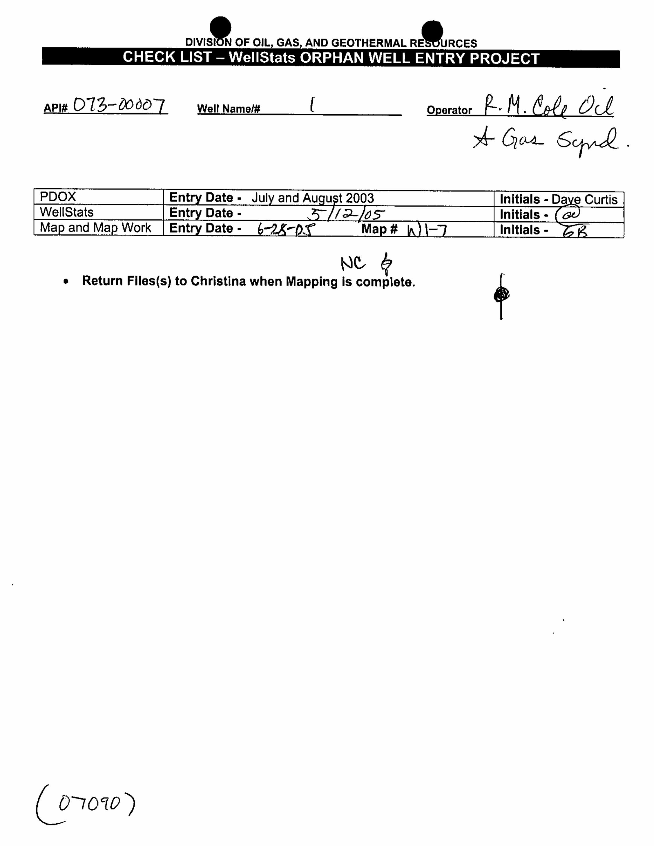
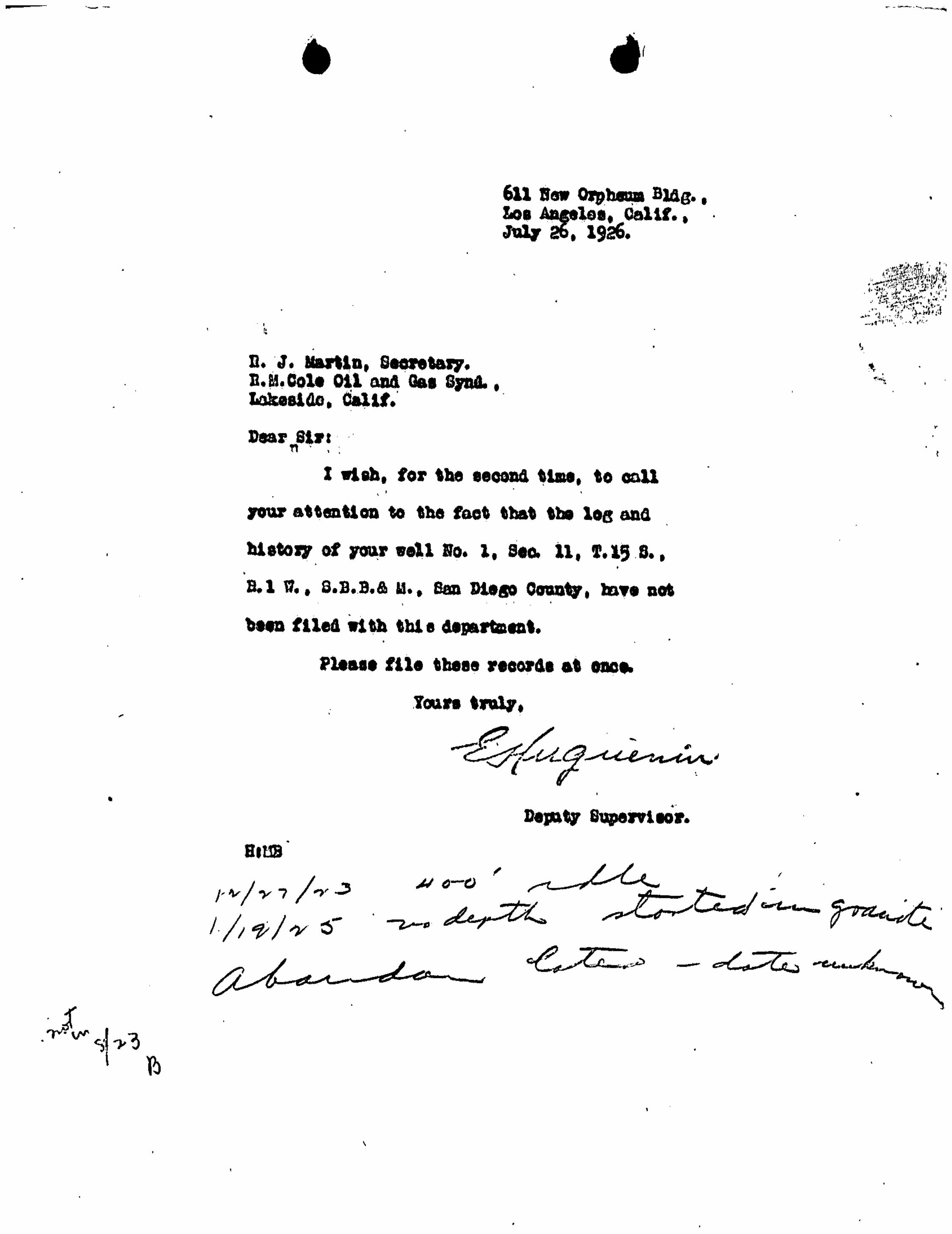
3.2.2 Oil and Gas Wells
The Division of Oil, Gas, and Geothermal Resources (DOGGR) through the California Department of Conservation indicates that there are no active oil, gas, or geothermal production fields within the Master Plan Study Area. However, one “idle” oil and gas well has been identified in proximity to the West Sycamore Area: Well #1, R.M. Cole Oil & Gas Syndicate [Closing Record dated 5/12/1927] - (details provided in Appendix B).
3.2.3 Hazardous Waste Handlers
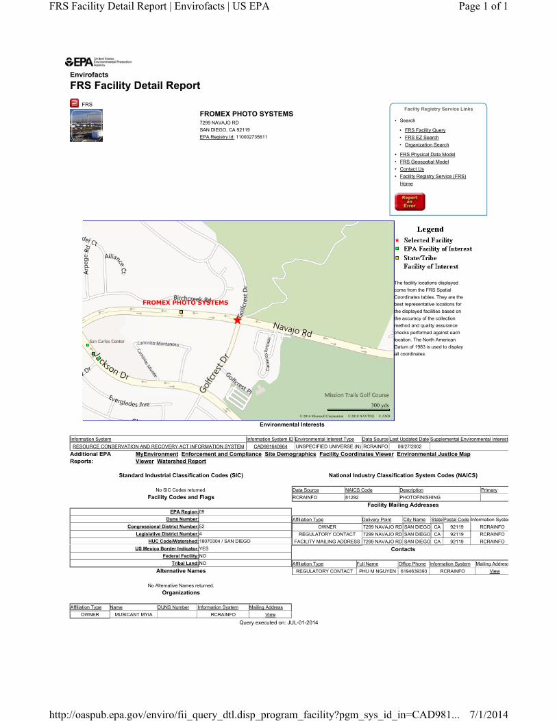
The Resource Conservation and Recovery Information (RCRAInfo) through the EPA is a national program management and inventory system listing hazardous waste handlers, requiring information to be provided about their activities to state environmental agencies. This regulation is governed by the Resources Conservation and Recovery Act (RCRA), as amended by the Hazardous and Solid Waste Amendments of 1984 (EPA 2014b). A review of the RCRAInfo database for hazardous waste cleanup sites identified one open site within the Master Plan Study Area: Fromex Photo Systems, 7299 Navajo Road, San Diego, CA 92119 [EPA ID 110002735611] - (details provided in Appendix C).
3.2.4 Additional Agency Listings
In addition to the databases indicated above, other databases maintained by federal, state, and local regulatory agencies provide valuable, site-specific information that can be used to evaluate if the conditions in the Master Plan Study Area would pose a threat to human health or the environment. Regulatory agency databases through the DTSC listed below are applicable to the Master Plan Study Area:
• National Priorities List (NPL) maintained by the EPA
• Comprehensive Environmental Response Compensation and Liability Information System (CERCLA) maintained by the EPA
• Solid Waste Information System (SWIS) maintained by the California Integrated Waste Management Board (CIWMB)
3.2.5 Transportation of Hazardous Materials
Transport of hazardous materials occurs throughout the City of San Diego (City) through surface streets, rails, and freeways. Freeways, including I-8 and SR-52, surround the Master Plan Study Area. Additionally, there are numerous other transportation routes, such as Mission Gorge Road, Navajo Road, and Jackson Drive, are located throughout the Master Plan Study Area.
The transport of hazardous materials by truck and rail is regulated by the U.S. Department of Transportation (DOT) as the City does not have direct authority for this action. Criteria and procedures are established through DOT regulations for the safe handling and transport of hazardous materials on public roadways. Federal safety standards are also included in the California Administrative Code. The California Department of Health Services (DHS) regulates the haulers of hazardous waste.

Page 4 Mission Trails Regional Park – Hazardous Materials/Unexploded Ordnance Review
3.3 UXO Materials Use of military munitions in live-fire training and testing assisted in the ability to maintain a well-trained military force, which resulted in UXO in areas currently or formerly used for training. Per the United States Department of Defense (DoD), the term unexploded ordnance (UXO) refers to explosive, propellant or chemical-containing munitions that were armed, fired and remain unexploded (DoD 2003). The United States Army Corps of Engineers (USACE) has established programs to address the full range of UXO issues with public safety as a primary concern. The program is most readily achieved through education and outreach to inform military personnel and the public about the potential hazards associated with UXO. A review of the DTSC EnviroStor database for FUDS cleanup sites identified one site within the Master Plan Study Area: MCAS Miramar - Camp Elliott, Tierrasanta, CA [Case 80000794] - (details provided in Appendix D).
The USACE monitors an inventory of reporting information for UXO materials within the Mission Trails Formerly Used Defense Sites (FUDS) project areas. The purpose of the long-term monitoring program is to protect public health and safety and the environment from UXO materials through the Public Involvement Plan (PIP) and Five-Year Recurring Reviews. The 2009 Former MCAS Miramar - Camp Elliott Five-Year Recurring Review displays 23 detected ordnance locations in the northern ends of the Fortuna Mountain and East Elliott Areas, where most of the UXOs have been uncovered (see Appendix D).
3.3.1 Process for Safe Removal of UXOs
Identifying UXOs may be difficult as they can come in a variety of shapes and sizes and can look like a pointed pipe, soda can, baseball, or muffler. Their physical nature can look new or old, be complete or in parts, be found alone or in groups, be exposed by erosion or fires, and/or be visible on the surface or buried (DENIX 2002). These suspicious items can be encountered while installing underground pools, posts for decking and fencing projects, digging foundations, and excavating and installing utilities (i.e., cables, piping, etc.).
When a UXO is located, the DoD may initiate one of three responses: an Emergency Response for immediate, unacceptable hazards (i.e., possibility of acute physical injury, death, destruction of property), a Time-Critical Removal Action (TCRA) if the circumstances allow a response within a few months, or a Non-Time-Critical Removal Action (NTCRA) if the process is much longer and involves the public and regulatory communities early and continually throughout the process. Following the response initiation, the phases are conducted in the order listed in Table 3.1 as summarized from the Base Realignment and Closure (BRAC) Environmental Fact Sheet: Unexploded Ordnance (UXO).

Page 5 Mission Trails Regional Park – Hazardous Materials/Unexploded Ordnance Review
Table 3.1 – Summary of Process/Actions for Safe Removal of UXOs
Phase Actions
Removal Preliminary Assessment (PA)
• Existence of the site in question is recognized
• Determination of whether UXO is present and if further action is needed
Removal Site Investigation (SI)
Combination of preliminary risk assessment with the Archives Search Report (ASR), which includes:
• Historical records search,
• Interviews with knowledgeable personnel, and
• Interpretation of aerial photos and maps to gain a better understanding of the types of amount of UXO hazards potentially present
Engineering Evaluation/Cost Analysis (EE/CA)
• Geophysical survey performed utilizing a geostatistically based sampling program to characterize areas suspected of containing UXO
• Evaluation of site-specific response actions conducted according to National Contingency Plan criteria
• Solicitation of public comment for the potential response and anticipated future land use
• Response finalized in an Action Memorandum after installation responds to public comments
Removal Design (RD) • Preparation of objectives outlined in the Action Memorandum
• Plan exhibits contract specifications, response plans, safety and personnel qualifications, and anticipated depth of clearance
• An explosives safety submission is prepared for the DoD Explosives Safety Board (DDESB) for review and approval before the removal
Removal Action (RA) • Selected resolution is implemented according to RD plan
• Can potentially detonate UXO in place or at off-site demolition grounds if approved by the DDESB
Post-Removal Action (Post-RA)
• Public education
• Periodic UXO sweeps
• Long-term monitoring
• Land use restrictions
• Additional UXO actions if land use changes
3.3.2 Safety Guidelines
Field safety warnings (e.g., trail signs, park handouts, and kiosks) and emergency communications related to UXO have continued to be available and effective through establishing points of contacts for Tierrasanta,
Page 6 Mission Trails Regional Park – Hazardous Materials/Unexploded Ordnance Review
MTRP, and USACE, monitoring, mapping and maintaining Munitions and Explosives of Concern (MEC) warning signs, and circulating documents and processed as mandated by FUDS guidelines. The Five-Year Recurring Reviews facilitate and promote two-way communication between residents surrounding the Master Plan Study Area and encourage community awareness and educational involvement in site-related activities.
3.4 Public Safety
3.4.1 Fire Hazards
The County of San Diego (County) has an ongoing concern with wild-land fire, especially in the grass- and brush-covered hillsides on the borders of the metropolitan areas. These hazards exist in varying degrees, caused by climate, vegetation and physical conditions. The County encounters ‘Santa Ana’ winds generally during the late summer and fall, which bring hot, dry desert air into the area and fuel the rapid spread of fire.
Potential losses from wildfire include: human life, structures and other improvements, natural and cultural resources, the quality and quantity of the water supply, and other assets such as crop land, recreational opportunities, and economic losses. Smoke and air pollution from wildfires can be a severe health hazard. In addition, catastrophic wildfire can lead to secondary impacts or losses such as future flooding, landslides, and erosion during the rainy season.
According to CAL FIRE’s Fire Hazard Severity Zones in Local Responsibility Area (LRA) map, the majority of the Master Plan Study Area is designated as a Very High Fire Hazard Severity Zone (VHFHSZ) and is considered to be in a fire hazard zone. However, sections of the Master Plan Study Area are within the LRA (Non-VHFHSZ) designation, mostly in the southern segment of the Lake Murray area.
Brush Management Zones
The City has established requirements to protect property and structures from wildfires by proactive brush management practices. In general, these management practices are divided into Zones 1 and 2. Brush Management Zone 1 is a level area around a home or other structures used for planting ornamental species. This area would be watered and free of dead material. Brush Management Zone 2 covers more native vegetated areas. In this zone, selective vegetation would not be irrigated, pruned, or thinned. Specific City regulations associated with fire prevention can be found in the Municipal Code, as detailed in the “Applicable Laws and Regulations” section below.
3.5 Phase I Environmental Site Assessment (ESA) Practices
3.5.1 Significance and Use
Per the American Society of Testing and Materials (ASTM) Standard E1527-13, the purpose of conducting Phase I ESAs is to define good commercial and customary practice in the United States for conducting an environmental site assessment of commercial real estate with respect to the range of contaminants within the scope of the Comprehensive Environmental Response, Compensation and Liability Act (CERCLA). As part of the subsequent review under the California Environmental Quality Act (CEQA), any future projects would be recommended to have Phase I ESAs conducted on the property to assess its environmental condition, taking into account commonly known and reasonable ascertainable information. Although not required, this practice is intended primarily as an approach to conducting an inquiry designed to identify recognized environmental conditions in connection with a property.

Page 7 Mission Trails Regional Park – Hazardous Materials/Unexploded Ordnance Review
4. Applicable Laws and Regulations
The following is a discussion of the federal, state, and local laws, regulations, and other applicable guidance addressing hazards, hazardous materials, and UXO. The inclusion of these legal provisions herein should not indicate that implementation of any of the MTRP MPU element would be subject all of these provisions, but only those as applicable.
4.1 Federal Regulations
4.1.1 Chemical Accident Prevention Provisions
The Chemical Accident Prevention Provisions were adopted in the Code of Federal Regulations (CFR) to address chemical accident prevention at facilities using extremely hazardous substances. The provisions require all facilities that use or handle certain flammable and toxic materials to prepare a Risk Management Plan (RMP) that describes the materials used over the previous five years, a worst-case accident scenario and alternatives, a prevention program, and an emergency response program. New RMPs are required every five years.
4.1.2 Comprehensive Environmental Response, Compensation, and Liability Act
CERCLA, commonly known as the Superfund, was enacted by Congress on December 11, 1980. This law provided broad federal authority to respond directly to releases or threatened releases of hazardous substances that may endanger public health or the environment. CERCLA established requirements concerning closed and abandoned hazardous waste sites, provided for liability of persons responsible for releases of hazardous waste at these sites, and established a trust fund to provide for cleanup when no responsible party could be identified. CERCLA also enabled revision of the National Contingency Plan (NCP). The NCP provides the guidelines and procedures needed to respond to releases and threatened releases of hazardous substances, pollutants, or contaminants; and established the NPL.
4.1.3 Hazardous Materials Transportation Act
DOT regulates the interstate transport of hazardous materials and wastes through implementation of the Hazardous Materials Transportation Act (HMTA). The provisions of the HMTA contain requirements for hazardous materials shipments and packaging, and guidelines for marking, manifesting, labeling, packaging, placarding, and spill reporting. Specific regulations dealing with hazardous materials are covered under:
• 49 CFR 105.600 - Registration of Persons Who Offer to Transport Hazardous Materials,
• 49 CFR 173.56 - Hazardous Material Regulations, Shippers – General Requirements for Shipping and Packaging, and
• 49 CFR 397 - Transportation of Hazardous Materials; Driving and Parking Rules.
4.1.4 Resource Conservation and Recovery Act
The RCRA of 1976 (U.S. Government Code [USC], Title 42, Sections 6901–6987) was established to protect human health and the environment, reduce waste, conserve energy and natural resources, and eliminate the generation of hazardous waste. The Hazardous and Solid Waste Act (HSWA) of 1984 significantly expanded the scope of RCRA by adding new corrective action requirements, land disposal restrictions, and technical

Page 8 Mission Trails Regional Park – Hazardous Materials/Unexploded Ordnance Review
requirements. In addition, the HSWA affirmed and extended the “cradle to grave” system of regulating hazardous wastes and specifically prohibited the use of certain techniques for the disposal of some hazardous wastes. The corresponding regulations in 40 CFR 260–299 provide the general framework for managing hazardous waste, including requirements for entities that generate, store, transport, treat, and dispose of hazardous waste.
4.1.5 Toxic Substances Control Act
The federal Toxic Substances Control Act of 1976 provides EPA with authority to require reporting, record-keeping and testing requirements, and restrictions relating to chemical substances and/or mixtures. The act addresses the production, importation, use, and disposal of specific chemicals including polychlorinated biphenyls (PCBs), asbestos, radon, and lead-based paint.
4.2 State Regulations
4.2.1 Hazardous Waste Control Law
The Hazardous Waste Control Law (HWCL), Chapter 6.5 of Division 20 of the Health and Safety Code and its implementing regulations in California Code of Regulations (CCR), Title 22, Division 4.5, consist of statutes and regulations intended to prevent ultimate mismanagement of hazardous waste with the primary focus being preventing disposal at unauthorized locations. Such disposal can directly affect humans and the environment by direct contact with the wastes or it can pollute ground or surface waters. While the HWCL is generally more stringent than the RCRA, until EPA approves the California program, both state and federal laws apply in California. The HWCL lists 791 chemicals and about 300 common materials that may be hazardous; establishes criteria for identifying, packaging, and labeling hazardous wastes; prescribes management controls; establishes permit requirements for treatment, storage, disposal, and transportation of hazardous wastes; and identifies wastes that cannot be disposed of in landfills.
4.2.2 Hazardous Material Release Response Plans and Inventory Laws
California’s Right-To-Know law from the California Emergency Management Agency (EMA) requires businesses to develop a Hazardous Material Management Plan or a business plan for hazardous materials emergencies if they handle more than 500 pounds, 55 gallons, or 200 cubic feet of hazardous materials. In addition, the business plan would include an inventory of all hazardous materials stored or handled at the facility above these thresholds. This law is designed to reduce the occurrence and severity of hazardous materials releases. The Hazardous Materials Management Plan or business plan must be submitted to the Certified Unified Program Agency (CUPA), which, in this case, is the County Department of Environmental Health’s (DEH) Hazardous Materials Division (HMD). The HMD inspects businesses or facilities that handle or store hazardous materials, generate hazardous waste, generate medical waste, and own or operate USTs. The HMD also administers the California Accidental Release Prevention (CalARP) Program and the Aboveground Petroleum Storage Act Program, and provides specialized instruction to small businesses through its Pollution Prevention Specialist. The state has integrated the federal Emergency Planning & Community Right-to-Know Act (EPCRA) reporting requirements into this law; once a facility is in compliance with the local administering agency requirements, submittals to other agencies are not required.
4.2.3 California Labor Code
The California Labor Code includes the regulation of the workplace to assure appropriate training is given on the use and handling of hazardous materials; as well as the operation of equipment and machines that use,

Page 9 Mission Trails Regional Park – Hazardous Materials/Unexploded Ordnance Review
store, transport, or dispose of hazardous materials. The following Parts of Division 5 specifically apply to this site:
• Division 5, Part 1, Chapter 2.5 ensures that employees in charge of handling hazardous materials are appropriately trained and are knowledgeable about the materials they handle.
• Division 5, Part 6 governs the operation and care of hazardous material storage tanks and boilers.
• Division 5, Part 7 ensures that employees who work with volatile flammable liquids are outfitted in appropriate safety gear and clothing.
• Division 5, Part 7.5, otherwise referred to as the California Refinery and Chemical Plant Worker Safety Act of 1990, was enacted to prevent or minimize the consequences of catastrophic releases of toxic, flammable, or explosive chemicals.
4.2.4 California Code of Regulations, Title 8 – Industrial Relations
Occupational safety standards exist in federal and state laws to minimize worker safety risks from both physical and chemical hazards in the workplace. The California Division of Occupational Safety and Health (Cal/OSHA) and the federal OSHA are the agencies responsible for assuring worker safety in the workplace. Cal/OSHA assumes primary responsibility for developing and enforcing standards for safe workplaces and work practices. These standards would be applicable during both construction and operation of a project. Regulations enforced through Cal/OSHA pertaining to asbestos-containing material, liquefied petroleum gas, storage tanks, and boilers are listed in 8 CCR 3.2.
4.2.5 California Code of Regulations, Title 23
23 CCR 2620 states that the purpose of the regulation is:
“…intended to protect waters of the state from discharges of hazardous substances from underground storage tanks. These regulations establish construction requirements for new underground storage tanks;
establish separate monitoring requirements for new and existing underground storage tanks; establish uniform requirements for unauthorized release reporting, and for repair, upgrade, and closure of
underground storage tanks; and specify variance request procedures.”
4.2.6 Other State Requirements
The State regulates air particulates during construction, demolition, and operation through the San Diego Air Pollution Control District rules. These regulations are contained in Safety Code Section 25100 et seq., 22 CCR 4.5 (“Environmental Health Standards for the Management of Hazardous Wastes”), and 26 CCR (“Toxics”).
The DTSC and the Regional Water Quality Control Boards (RWQCBs) have jurisdiction over the cleanup of any released hazardous materials. If hazardous materials were encountered in association with redevelopment or development of a piece of property, site characterization, cleanup plans, and removal and disposal of materials would require approval by and completed in compliance with DTSC or RWQCB requirements and laws prior to the issuance of any demolition, grading, or building permits.

Page 10 Mission Trails Regional Park – Hazardous Materials/Unexploded Ordnance Review
4.3 Local Regulations
4.3.1 San Diego County Operational Area Emergency Plan
The San Diego County DEH, HMD established the San Diego County Operational Area Emergency Plan (Area Plan) for emergency response to a release or threatened release of a hazardous material within the County.
4.3.2 San Diego County Multi-Jurisdictional Plan
The Multi-Jurisdictional Hazard Mitigation Plan was developed with the participation of all jurisdictions in the County, including every incorporated City and the unincorporated County. The plan includes an overview of the risk assessment process, and identifies hazards present in the jurisdiction, hazard profiles, and vulnerability assessments. The plan also identifies goals, objectives, and actions for each jurisdiction in the County.
In the event of a hazardous materials emergency within the City, the first response would be from the San Diego Fire-Rescue Department and the County of San Diego Hazardous Incident Response Team (HIRT), located within the City.
4.3.3 City of San Diego Municipal Code
The City’s hazardous material regulations are included in:
• Municipal Code, Section 42.0801 (Hazardous Waste Establishments)
• Section 42.0901 (Disclosure of Hazardous Materials)
• Section 54.0701 (Investigation and Cleanup of Contaminated Property)
• Regulations for use of explosive materials within the City are included in Section 55.3301 (Explosives and Fireworks).
The City’s Local Enforcement Agency (LEA) is responsible for enforcing federal and state laws and regulations for the safe and proper handling of solid waste. Solid waste disposal addressed by the LEA includes household trash and garbage, construction debris, commercial refuse, sludge, ash, discarded appliances and vehicles, manure, landscape clippings, and other discarded wastes. The LEA also investigates complaints of illegal disposal of solid waste and evaluates historic waste disposal sites (including old trash/ burn dumps). However, enforcement of state and most other hazardous regulation within the City is through the County’s Certified Unified Program Agency (CUPA).
The City has established requirements to protect property and structures from wildfires by proactive brush management practices. In general, these management practices are divided into Zone 1 and 2 areas. Brush Management Zone 1 is a level area around a home or other structures used for planting ornamental species. This area would be watered and free of dead material. Brush Management Zone 2 covers more native vegetated areas. In this zone, selective vegetation would not be irrigated, pruned, or thinned. Specific city regulations associated with fire prevention are provided in Section 55.0101 (Adoption of the California Fire Code); Section 55.0901 (Fire Department Access and Water Supply; and Section 55.1001 (Fire Protection Systems and Equipment). Municipal Code Sections 142.0402, 142.0403, and 142.0412 regulate brush management and create two Brush Management Zones with different requirements. The Code was amended in October 2005 to make these zones total 100 feet of defensible space from a habitable structure.

Page 11 Mission Trails Regional Park – Hazardous Materials/Unexploded Ordnance Review
4.3.4 City of San Diego Significance Determination Thresholds
The MTRP MPU constitutes a “project”, as defined by CEQA. In 2011, the City of San Diego established Significance Determination Thresholds for use in the evaluation of a project’s potential environmental impact pursuant to CEQA. Following are the City Thresholds that would apply to the analysis of the MPU project, with the application of each to the three ‘Key Environmental Issues’ discussed in Section 5 as noted:
• Be located within two miles of a public airport or public use airport, resulting in a safety hazard for people residing or working in the Master Plan Study Area (Issue 1);
• Be located within the vicinity of a private airstrip, resulting in a safety hazard for people residing or working in the era (Issue 1);
• Impair implementation of an emergency response plan (Issue 1);
• Expose people or structures to significant risk involving wildland fires (Issue 1);
• Create a significant hazard through the routine transport, use, or disposal of hazardous materials (Issue 2);
• Create a significant hazard involving the release of hazardous materials into the environment (Issue 2);
• Emit hazardous emissions or handle hazardous or acutely hazardous materials, substances, or waste within one-quarter mile of an existing or proposed school (Issue 2); and
• Be located on a site which is included on a list of hazardous materials sites compiled pursuant to Government Code Section 65962.5 and, as a result, would create a significant hazard to the public or environment (Issue 3).
Page 12 Mission Trails Regional Park – Hazardous Materials/Unexploded Ordnance Review
5. Key Environmental Issues
This section describes the key environmental issues relating to human health, public safety, and hazardous materials for the Master Plan. It recommends the methods used to determine the potential effects of Master Plan implementation. Recommendations to avoid, minimize, rectify, reduce, eliminate, or compensate for potentially significant effects accompany the discussion of each key issue.
5.1 Issue 1: Would the proposed Master Plan Update and Natural Resource Management Plan expose people or property to health hazards, including fire?
Airport Hazards
No aeronautical structures are located within the vicinity of the Master Plan Study Area. No known/regularly scheduled flights departing from or arriving at the San Diego International Airport (SDIA) pass over the Mission Trails Study Area. However, Montgomery-Gibbs Executive Airport (Montgomery Field) and Marine Corps Air Station (MCAS) Miramar are both located approximately 5.0 miles west of the study area. Neither facility has regularly scheduled flights. However, MCAS Miramar is home the 3rd Marine Aircraft Wing, which deploys and conducts aircraft training flights from this base. Montgomery Field is a general aviation facility from which private, corporate, charter, air ambulance, law enforcement fire rescues, and cargo flights operate. Given the vast area of the proposed park, the potential for aircraft-human conflict would be very low. Therefore, the potential impact is not considered significant.
Health Hazards
The majority of the land in the Master Plan Study Area is located within a VHFHSZ. Development permitted within the Master Plan Study Area would be limited to non-habitable structures including pedestrian/bicycle trails, pedestrian/bicycle bridges, boardwalks, scenic overlook platforms as recommended by the Mission Trails Design District Ordinance and Design Manual. Implementation of the Mission Trails Design District Ordinance and Design Manual which would also be subject to the Brush Management Regulations from the City of San Diego Municipal Code Section 142.0412, which requires that all structures must have at least a 100-foot buffer between a proposed structure and native or naturalized vegetation. However, although there are no specific development proposals within the Master Plan Study Area, it is possible that hazards from wild-land fires will increase with the expansion of MTRP.
No greater risk would occur in the Master Plan Study Area with continued use of its current location. However, if construction of the facilities covered by the MPU were to occur, it would involve ground disturbance and grading, and would occur within areas identified as susceptible to wild-land fire risk. As such, future projects implemented in accordance with the MPU would be required to comply with state and City regulations for Brush Management by siting structures in a manner that minimizes potential wild-land fire damage.
The Brush Management Regulations will support a reduced impact that wild-land fires may have on potential damage to the structures listed above by ensuring appropriate precautions are publicized and implemented. Continued posting of signage on information boards as specified by the MPU indicating seasonal fire warnings is recommended around the Master Plan Study Area. There would be a lessened likelihood of problematic consequences from wild-land fire occurrence by expanding public awareness. With these regulations, the potential impact from wild-land fires is not considered significant.

Page 13 Mission Trails Regional Park – Hazardous Materials/Unexploded Ordnance Review
Emergency Response
It is unknown from the MPU and its associated Community Plans how many emergency response plans exist within the Master Plan Study Area. However, because future physical actions within the Master Plan Study Area would be limited to pathways, bridges, and overlooks, these types of facilities would not impede travel of vehicles on roads or movement of people. Therefore, it is not expected that implementation would hinder the emergency response plan.
Community Plan Amendments
The MPU proposes to amend the Mission Valley, Tierrasanta, East Elliot, and Navajo Community Plans to adopt the MPU as the policy document for the Master Plan Study Area. Currently the Community Plans do not list any specific guidelines or policies regarding safety hazards. The amendments, as proposed by the MPU, would not include specific guidelines or policies regarding safety hazards; therefore, no policy conflicts would occur with implementation of the MPU. However, because portions of the Master Plan Study Area within the Community Plans are within the VHFHSZ, implementation of the Community Plan Amendments in terms of exposure of people or structures to safety hazards could generate physical effects to the environment associated with safety hazards. Addition of safety hazard guidelines to the Community Plans would be imperative to avoid having a significant detrimental impact on the communities.
5.2 Issue 2: Would the proposed Master Plan Update and Natural Resource Management Plan create future risk of an explosion or the release of hazardous substance (including, but not limited to gas, oil, pesticides, chemicals, or radiation)? Would the proposed Master Plan expose people or the environment to a significant hazard through the routine transport, use, or disposal of hazardous materials?
Construction of non-habitable structures such as pedestrian/bicycle trails, pedestrian/bicycle bridges, boardwalks, or scenic overlook platforms within the Master Plan Study Area as recommended by the Mission Trails Design District Ordinance and Design Manual would not result in the release of hazardous materials into the environment. As discussed in Section 3.2 (Hazards and Hazardous Materials), four active LUST sites and one idle gas well were discovered within the Master Plan Study Area. Although the MPU does not include proposals to develop any habitable structures, future projects would involve ground disturbance and grading activities and would potentially encounter and disrupt hazardous substances below ground. However, all future development allowed under the MPU would be required to comply with all applicable federal, state, and local regulations related to the accidental release of hazardous materials. Compliance with such regulations would minimize the potential for a release and provide planning mechanisms for such prompt and effective cleanup in the event of an accidental release. In addition, all future projects implemented in accordance with the MPU would be subject to further CEQA review. However, no developments are proposed as part of the MPU. As such, this would not result in a significant hazard through the use, transport, or disposal of hazardous materials and impacts.
No addition of the storage of explosive or hazardous substances is anticipated for the MPU unless development is planned within the boundaries of former MCAS Miramar Camp Elliott. The USACE has established the PIP and Five-Year Recurring Reviews to monitor an inventory of reporting information for UXO materials within the FUDS project areas at former MCAS Miramar Camp Elliott. This long-term monitoring program addresses UXO issues and provides public outreach and education to inform personnel about the potential hazards associated with UXOs. Field safety warnings, emergency communications, instituting MEC warning signs, and circulating documents have continued to be effective points of resources

Page 14 Mission Trails Regional Park – Hazardous Materials/Unexploded Ordnance Review
and information. This regulation and long-term monitoring program has and will continue to minimize health hazards to the public.
Community Plan Amendments
The MPU proposes to amend the Mission Valley, Tierrasanta, East Elliot, and Navajo Community Plans to adopt the MPU as the policy document for the Master Plan Study Area. Currently the Community Plans do not list any specific guidelines or policies regarding safety hazards. The amendments, as proposed by the MPU, would not include specific guidelines or policies regarding hazardous materials, and no policy conflicts would occur with implementation of the MPU. Potential physical impacts associated with the routine transport, use, or disposal of hazardous materials and hazardous releases into the environment could be avoided through compliance with existing federal, state, and local regulation, lessening the physical effects to the environment.
5.3 Issue 3: Would the proposed Master Plan's uses be located on a site which is included on a list of hazardous materials sites compiled pursuant to Government Code Section 6596.25 and, as a result, create a significant hazard to the public or environment? As stated above for Issue 2 and in Section 3.2 (Hazards and Hazardous Materials), four active LUST sites and one idle oil and gas well have been discovered within the Master Plan Study Area.
Although the MPU does not include proposals to construct any new structures, future projects within the Master Plan Study Area would involve ground disturbance and grading activities and would potentially encounter and disrupt hazardous substances below ground. However, all future implemented in accordance with the MPU including Mission Trails Design District Ordinance and Design would be required to comply with applicable federal, state, and local regulations related to the accidental release of hazardous materials. Compliance with such regulations would minimize the potential for a release and provide planning mechanisms for prompt and effective cleanup in the event of an accidental release. Required compliance with existing regulations would reduce MPU impacts related to an accidental hazardous materials release to below a level of significance.
Community Plan Amendments
The Mission Valley, Tierrasanta, East Elliott, and Navajo Community Plans do not currently list any specific guidelines or policies regarding hazardous materials sites. The amendment, as proposed by the MPU, would not include specific guidelines or policies regarding hazardous materials sites and therefore, would not conflict with implementation of the Community Plan Amendment.
Page 15 Mission Trails Regional Park – Hazardous Materials/Unexploded Ordnance Review
6. List of Preparers
Consultant
GHD Inc.
3750 Convoy Street, Suite 220
San Diego, CA 92111
• Kristie Casarez, P.E., Project Director
• David D. Davis, AICP, Project Manager/Technical Reviewer
• Teresa Nhean, Planner/Primary Author
Page 16 Mission Trails Regional Park – Hazardous Materials/Unexploded Ordnance Review
7. References
American Society for Testing and Materials (ASTM). (2005). ASTM1527-05 Standard Practice for Environmental Site Assessments: Phase I Environmental Site Assessment Process.
California Department of Conservation. (2014). Division of Oil, Gas & Geothermal Resources Well Finder. Retrieved from http://maps.conservation.ca.gov/doggr/index.html#close.
California Department of Forestry and Fire Protection, Fire and Resource Assessment Program (FRPA). (2009). San Diego County, Very High Fire Hazard Severity Zones in LRA as Recommended by CAL FIRE.
California Department of Toxic Substances Control. (2014). EnviroStor. Retrieved from http://www.envirostor.dtsc.ca.gov/public/.
California Emergency Management Agency (CalEMA). (2012). Community Right-To-Know Laws: A Guide for Consumers.
California Environmental Protection Agency (CalEPA). (2012). Cortese List Data Resources. Retrieved from http://www.calepa.ca.gov/sitecleanup/corteselist/.
California Office of Administrative Law (OAL). (2014). Title 23. Waters. Retrieved from https://govt.westlaw.com/calregs/Browse/Home/California/CaliforniaCodeofRegulations?guid=I010C6BF0D45A11DEA95CA4428EC25FA0&originationContext=documenttoc&transitionType=Default&contextData=(sc.Default)&bhcp=1.
California State Board of Equalization (BOE). (2014). Hazardous Waste Fee Health and Safety Code. Retrieved from http://www.boe.ca.gov/lawguides/business/current/btlg/vol4/hwf/hwf-ch6-5-all.html.
CalRecycle. (2014). SWIS Facility/Site Search. Retrieved from http://www.calrecycle.ca.gov/SWFacilities/Directory/Search.aspx.
City of San Diego. (2012). Section 5.6 Human Health, Public Safety, and Hazardous Materials. San Diego River Park Master Plan Project, Draft PEIR.
City of San Diego, Development Services Department. (2014). Solid Waste Local Enforcement Agency (LEA). Retrieved from http://www.sandiego.gov/development-services/industry/lea/index.shtml.
City of San Diego, Office of the City Clerk. (2014). Municipal Code. Retrieved from http://www.sandiego.gov/city-clerk/officialdocs/legisdocs/muni.shtml.
City of San Diego, Park and Recreation Department (PRD). (2013). Mission Trails Regional Park, Master Plan Update.
City of San Diego, Park and Recreation Department (PRD). (2014). San Diego Municipal Code: Chapter 14: General Regulations.
City of San Diego, Planning Department. (2013). Mission Trails Design District Ordinance and Design Manual.
Converse Consultants. (2011). Phase I Environmental Site Assessment Report, Castlerock, San Diego, California.
County of San Diego. (2010a). Multi-jurisdictional Hazard Mitigation Plan. Retrieved from http://www.co.san-diego.ca.us/oes/emergency_management/oes_jl_mitplan.html.

Page 17 Mission Trails Regional Park – Hazardous Materials/Unexploded Ordnance Review
County of San Diego. (2010b). San Diego County Emergency Operations Plan. Retrieved from http://sdcounty.ca.gov/oes/emergency_management/protected/oes_jl_oparea.html.
RECON. (2013). Natural Resources Management Plan for Mission Trails Regional Park, San Diego, California.
State of California. (2012). California Labor Code. Retrieved from http://www.leginfo.ca.gov/cgi-bin/calawquery?codesection=lab.
State of California, Department of Industrial Relations. (2014). Cal/OSHA – Title 8 regulations - Index. Retrieved from http://www.dir.ca.gov/title8/index/T8index.asp.
State Water Resources Control Board (SWRCB). (2014). GeoTracker. Retrieved from http://www.calepa.ca.gov/sitecleanup/corteselist/.
United States Army Corps of Engineers, Los Angeles District (USACE). (2009a). Draft Five-Year Recurring Review, Munitions and Explosives Response Action, Former Camp Elliott, San Diego, California.
United States Army Corps of Engineers, Los Angeles District (USACE). (2009b). Draft Public Involvement Plan for the Tierrasanta and Mission Trails Project Areas, Former Camp Elliott, San Diego, California.
United States Department of Defense (DoD). (1999). BRAC Environmental Fact Sheet: Unexploded Ordnance (UXO).
United States Department of Defense (DoD). (2003). Report of the Defense Science Board Task Force on Unexploded Ordnance.
United States Department of Defense (DoD), Environment, Safety and Occupational Health Network and Information Exchange (DENIX). (2002). 3Rs Explosives Safety Education Program. Retrieved from https://www.denix.osd.mil/uxo/.
United States Department of Transportation, Pipeline and Hazardous Materials Safety Administration (PHMSA). (2014). Regulations. Retrieved from http://www.phmsa.dot.gov/regulations.
United States Environmental Protection Agency (EPA). (2011). CERCLA Overview. Retrieved from http://www.epa.gov/superfund/policy/cercla.htm.
United States Environmental Protection Agency (EPA). (2013). National Priorities List (NPL). Retrieved from http://www.epa.gov/superfund/sites/npl/index.htm.
United States Environmental Protection Agency (EPA). (2014a). Hazardous Materials Transportation Act. Retrieved fro http://www.epa.gov/oem/lawsregs.htm#hmta.
United States Environmental Protection Agency (EPA). (2014b). Resource Conservation and Recovery Act Information (RCRAInfo). Retrieved from http://www.epa.gov/enviro/facts/rcrainfo/search.html.
United States Environmental Protection Agency (EPA). (2014c). Summary of the Toxic Substances Control Act. Retrieved from http://www2.epa.gov/laws-regulations/summary-toxic-substances-control-act.
United States Government Printing Office (GPO). (1997). Code of Federal Regulations, Title 40 – Protection of Environment. Retrieved from http://www.gpo.gov/fdsys/pkg/CFR-2010-title40-vol15/xml/CFR-2010-title40-vol15-part68.xml.

Mission Trails Regional Park – Hazardous Materials/Unexploded Ordnance Review
Appendix A
Leaking Underground Storage Tanks (LUST) Cleanup Sites


CASE SUMMARY
REPORT DATE HAZARDOUS MATERIAL INCIDENT REPORT FILED WITH OES?
I. REPORTED BY - UNKNOWN
CREATED BYUNKNOWN
II. RESPONSIBLE PARTY - UNKNOWN
III. SITE LOCATIONFACILITY NAME ALVARADO FILTRATION PLANT
FACILITY ID
FACILITY ADDRESS 5530 KIOWA DRIVELA MESA, CA 91942SAN DIEGO COUNTY
ORIENTATION OF SITE TO STREET
CROSS STREET
V. SUBSTANCES RELEASED / CONTAMINANT(S) OF CONCERN
VI. DISCOVERY/ABATEMENTDATE DISCHARGE BEGAN
DATE DISCOVERED HOW DISCOVERED DESCRIPTION
DATE STOPPED STOP METHOD DESCRIPTION
VII. SOURCE/CAUSESOURCE OF DISCHARGE CAUSE OF DISCHARGE
DISCHARGE DESCRIPTION
VIII. CASE TYPECASE TYPE
IX. REMEDIAL ACTIONNO REMEDIAL ACTIONS ENTERED
X. GENERAL COMMENTS
XI. CERTIFICATIONI HEREBY CERTIFY THAT THE INFORMATION REPORTED HEREIN
IS TRUE AND ACCURATE TO THE BEST OF MY KNOWLEDGE.
XII. REGULATORY USE ONLYLOCAL AGENCY CASE NUMBER REGIONAL BOARD CASE NUMBER
9 000239N96
LOCAL AGENCY
UNKNOWN
REGIONAL BOARD
Page 1 of 2GeoTracker
7/1/2014http://geotracker.waterboards.ca.gov/case_summary.asp?global_id=L10002065679

Copyright © 2014 State of California
CONTACT NAME Roger Mitchell
INITIALS RNM
ORGANIZATION_NAMESAN DIEGO RWQCB (REGION 9)
EMAIL ADDRESS [email protected]
ADDRESS 2375 NORTHSIDE DRIVE, SUITE100San Diego, CA 92108-2700
CONTACT DESCRIPTION
PHONE TYPE PHONE NUMBER EXTENSIONFAX (619)-516-1994DIRECT PHONE (619)-521-5898
Page 2 of 2GeoTracker
7/1/2014http://geotracker.waterboards.ca.gov/case_summary.asp?global_id=L10002065679

CASE SUMMARY
REPORT DATE HAZARDOUS MATERIAL INCIDENT REPORT FILED WITH OES?
I. REPORTED BY - UNKNOWN
CREATED BYUNKNOWN
II. RESPONSIBLE PARTY - CONTACT NAME KATHERINE LEIBEL
INITIALS KL
ORGANIZATION_NAMEDEPARTMENT OF TOXIC SUBSTANCES CONTROL
EMAIL ADDRESS [email protected]
ADDRESS 5796 CORPORATE AVENUECYPRESS, CA 90630
CONTACT DESCRIPTION
PHONE TYPE PHONE NUMBER EXTENSIONPHONE (714)-484-5446
III. SITE LOCATIONFACILITY NAME MISSION TRAILS AREA
FACILITY ID
FACILITY ADDRESS
San Diego, CA 92103SAN DIEGO COUNTY
ORIENTATION OF SITE TO STREET
CROSS STREET North of Mission Gorge Road and San Diego River
V. SUBSTANCES RELEASED / CONTAMINANT(S) OF CONCERN
VI. DISCOVERY/ABATEMENTDATE DISCHARGE BEGAN
DATE DISCOVERED HOW DISCOVERED DESCRIPTION
DATE STOPPED STOP METHOD DESCRIPTION
VII. SOURCE/CAUSESOURCE OF DISCHARGE CAUSE OF DISCHARGE
DISCHARGE DESCRIPTION
VIII. CASE TYPECASE TYPE
IX. REMEDIAL ACTIONNO REMEDIAL ACTIONS ENTERED
X. GENERAL COMMENTS The Mission Trails Regional Park was conveyed to the city of San Diego by quitclaim deed on 10 January 1964. This deed restricted the use of the 2,100 acre site to historic monument/public recreational purposes for 20 years.
Munitions investigation and removals by the Army Corps of Engineers have been ongoing since the 1990s and work continues currently.
Source: http://www.militarymuseum.org/CpElliot.html
Page 1 of 2GeoTracker
7/1/2014http://geotracker.waterboards.ca.gov/case_summary.asp?global_id=DOD100029800

Copyright © 2014 State of California
XI. CERTIFICATIONI HEREBY CERTIFY THAT THE INFORMATION REPORTED HEREIN
IS TRUE AND ACCURATE TO THE BEST OF MY KNOWLEDGE.
XII. REGULATORY USE ONLYLOCAL AGENCY CASE NUMBER 37970025
REGIONAL BOARD CASE NUMBER 400690 -- 2
LOCAL AGENCY
UNKNOWN
REGIONAL BOARD
CONTACT NAME JOHN P. ANDERSON
INITIALS JPA
ORGANIZATION_NAMESAN DIEGO RWQCB (REGION 9)
EMAIL ADDRESS [email protected]
ADDRESS 2375 NORTHSIDE DRIVE, SUITE 100SAN DIEGO, CA 92108-2700
CONTACT DESCRIPTION
PHONE TYPE PHONE NUMBER EXTENSIONFAX (619)-516-1994DIRECT LINE (619)-521-5894
Page 2 of 2GeoTracker
7/1/2014http://geotracker.waterboards.ca.gov/case_summary.asp?global_id=DOD100029800
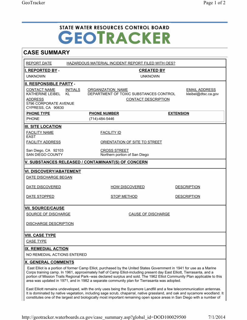
CASE SUMMARY
REPORT DATE HAZARDOUS MATERIAL INCIDENT REPORT FILED WITH OES?
I. REPORTED BY - UNKNOWN
CREATED BYUNKNOWN
II. RESPONSIBLE PARTY - CONTACT NAME KATHERINE LEIBEL
INITIALS KL
ORGANIZATION_NAMEDEPARTMENT OF TOXIC SUBSTANCES CONTROL
EMAIL ADDRESS [email protected]
ADDRESS 5796 CORPORATE AVENUECYPRESS, CA 90630
CONTACT DESCRIPTION
PHONE TYPE PHONE NUMBER EXTENSIONPHONE (714)-484-5446
III. SITE LOCATIONFACILITY NAME EAST
FACILITY ID
FACILITY ADDRESS
San Diego, CA 92103SAN DIEGO COUNTY
ORIENTATION OF SITE TO STREET
CROSS STREET Northern portion of San Diego
V. SUBSTANCES RELEASED / CONTAMINANT(S) OF CONCERN
VI. DISCOVERY/ABATEMENTDATE DISCHARGE BEGAN
DATE DISCOVERED HOW DISCOVERED DESCRIPTION
DATE STOPPED STOP METHOD DESCRIPTION
VII. SOURCE/CAUSESOURCE OF DISCHARGE CAUSE OF DISCHARGE
DISCHARGE DESCRIPTION
VIII. CASE TYPECASE TYPE
IX. REMEDIAL ACTIONNO REMEDIAL ACTIONS ENTERED
X. GENERAL COMMENTS East Elliot is a portion of former Camp Elliot, purchased by the United States Government in 1941 for use as a Marine Corps training camp. In 1961, approximately half of Camp Elliot-including present day East Elliott, Tierrasanta, and a portion of Mission Trails Regional Park--was declared surplus and sold. The 1962 Elliot Community Plan applicable to this area was updated in 1971, and in 1982 a separate community plan for Tierrasanta was adopted.
East Elliott remains undeveloped, with the only uses being the Sycamore Landfill and a few telecommunication antennas. It is dominated by native vegetation, including sage scrub, chaparral, native grassland, and oak and sycamore woodland. It constitutes one of the largest and biologically most important remaining open space areas in San Diego with a number of
Page 1 of 2GeoTracker
7/1/2014http://geotracker.waterboards.ca.gov/case_summary.asp?global_id=DOD100029500
Copyright © 2014 State of California
endangered and threatened wildlife species.
Munitions investigation and removals by the Army Corps of Engineers have been ongoing since the 1990s and work continues currently.
XI. CERTIFICATIONI HEREBY CERTIFY THAT THE INFORMATION REPORTED HEREIN
IS TRUE AND ACCURATE TO THE BEST OF MY KNOWLEDGE.
XII. REGULATORY USE ONLYLOCAL AGENCY CASE NUMBER 37970025
REGIONAL BOARD CASE NUMBER 400690 -- 5
LOCAL AGENCY
UNKNOWN
REGIONAL BOARD
CONTACT NAME JOHN P. ANDERSON
INITIALS JPA
ORGANIZATION_NAMESAN DIEGO RWQCB (REGION 9)
EMAIL ADDRESS [email protected]
ADDRESS 2375 NORTHSIDE DRIVE, SUITE 100SAN DIEGO, CA 92108-2700
CONTACT DESCRIPTION
PHONE TYPE PHONE NUMBER EXTENSIONFAX (619)-516-1994DIRECT LINE (619)-521-5894
Page 2 of 2GeoTracker
7/1/2014http://geotracker.waterboards.ca.gov/case_summary.asp?global_id=DOD100029500

Mission Trails Regional Park – Hazardous Materials/Unexploded Ordnance Review
Appendix B
Oil and Gas Site


Mission Trails Regional Park – Hazardous Materials/Unexploded Ordnance Review
Appendix C
Hazardous Waste Cleanup Site

Envirofacts
Facilty Registry Service Links
• Search
• FRS Facility Query• FRS EZ Search• Organization Search
• FRS Physical Data Model• FRS Geospatial Model• Contact Us• Facility Registry Service (FRS)
Home
FRS Facility Detail Report FRS
FROMEX PHOTO SYSTEMS7299 NAVAJO RDSAN DIEGO, CA 92119EPA Registry Id: 110002735611
FROMEX PHOTO SYSTEMS
© 2014 Microsoft Corporation © 2010 NAVTEQ © AND
300 yds
The facility locations displayed come from the FRS Spatial Coordinates tables. They are the best representative locations for the displayed facilities based on the accuracy of the collection method and quality assurance checks performed against each location. The North American Datum of 1983 is used to display all coordinates.
Environmental Interests
Information System Information System ID Environmental Interest Type Data Source Last Updated Date Supplemental Environmental InterestsRESOURCE CONSERVATION AND RECOVERY ACT INFORMATION SYSTEM CAD981640964 UNSPECIFIED UNIVERSE (N) RCRAINFO 06/27/2002
Additional EPA Reports:
MyEnvironment Enforcement and Compliance Site Demographics Facility Coordinates Viewer Environmental Justice Map Viewer Watershed Report
Standard Industrial Classification Codes (SIC)
No SIC Codes returned.Facility Codes and Flags
EPA Region:09Duns Number:
Congressional District Number:52Legislative District Number:4
HUC Code/Watershed:18070304 / SAN DIEGOUS Mexico Border Indicator:YES
Federal Facility:NOTribal Land:NO
Alternative Names
No Alternative Names returned.Organizations
Affiliation Type Name DUNS Number Information System Mailing AddressOWNER MUSICANT MYIA RCRAINFO View
National Industry Classification System Codes (NAICS)
Data Source NAICS Code Description PrimaryRCRAINFO 81292 PHOTOFINISHING
Facility Mailing Addresses
Affiliation Type Delivery Point City Name State Postal Code Information SystemOWNER 7299 NAVAJO RD SAN DIEGO CA 92119 RCRAINFO
REGULATORY CONTACT 7299 NAVAJO RD SAN DIEGO CA 92119 RCRAINFOFACILITY MAILING ADDRESS 7299 NAVAJO RD SAN DIEGO CA 92119 RCRAINFO
Contacts
Affiliation Type Full Name Office Phone Information System Mailing AddressREGULATORY CONTACT PHU M NGUYEN 6194639393 RCRAINFO View
Query executed on: JUL-01-2014
Page 1 of 1FRS Facility Detail Report | Envirofacts | US EPA
7/1/2014http://oaspub.epa.gov/enviro/fii_query_dtl.disp_program_facility?pgm_sys_id_in=CAD981...


Mission Trails Regional Park – Hazardous Materials/Unexploded Ordnance Review
Appendix D
Munitions and Explosives Detections (MEDs)


APPENDIX A
PHOTOGRAPHIC LOG
KEY TO PHOTOGRAPHIC LOG Photograph No. 1 Note Date 11/16/06 Time 1430 Latitude N32 49 10.7 (1) Longitude W117 06 07.8 Bearing (degrees) 260 (2) Previous Photo No. 55 (3) Sub-Area F-1
Field Photo Log Reference No. 217 (4)
JPEG File Name IMG_0217 (5) Notes (1) World Geodetic System 1984 (WGS84) datum (2) Magnetic compass bearing indicating direction to center of photograph
(3) Refers to number of photo in Appendix F, Photo Erosion Log, USACE, 1999. Ordnance and Explosives Long Term Monitoring Report for the Tierrasanta Community and the Murphy Canyon Naval Housing Area, San Diego, California. November
(4) Number of photograph as recorded in field notes and forms. (5) Name of photograph file contained in project files.
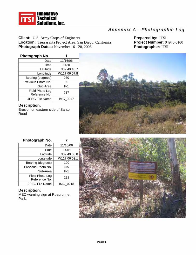
Appendix A – Photographic Log
Client: U.S. Army Corps of Engineers Prepared by: ITSI Location: Tierrasanta Project Area, San Diego, California Project Number: 04976.0100 Photograph Dates: November 16 - 20, 2006 Photographer: ITSI
Page 1
Photograph No. 1 Date 11/16/06 Time 1430
Latitude N32 49 10.7 Longitude W117 06 07.8
Bearing (degrees) 260 Previous Photo No. 55
Sub-Area F-1 Field Photo Log
Reference No. 217
JPEG File Name IMG_0217 Description: Erosion on eastern side of Santo Road
Photograph No. 2 Date 11/16/06 Time 1445
Latitude N32 49 06.8 Longitude W117 06 03.1
Bearing (degrees) 190 Previous Photo No. NA
Sub-Area F-1 Field Photo Log
Reference No. 218
JPEG File Name IMG_0218 Description: MEC warning sign at Roadrunner Park.
Appendix A – Photographic Log
Client: U.S. Army Corps of Engineers Prepared by: ITSI Location: Tierrasanta Project Area, San Diego, California Project Number: 04976.0100 Photograph Dates: November 16 - 20, 2006 Photographer: ITSI
Page 2
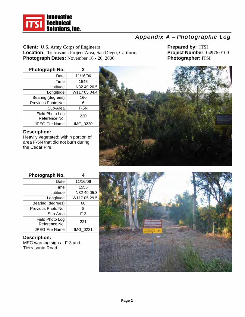
Photograph No. 3 Date 11/16/06 Time 1545
Latitude N32 49 20.5 Longitude W117 05 04.4
Bearing (degrees) 160 Previous Photo No. 6
Sub-Area F-5N Field Photo Log
Reference No. 220
JPEG File Name IMG_0220 Description: Heavily vegetated; within portion of area F-5N that did not burn during the Cedar Fire.
Photograph No. 4 Date 11/16/06 Time 1555
Latitude N32 49 05.3 Longitude W117 05 29.5
Bearing (degrees) 60 Previous Photo No. 8
Sub-Area F-3 Field Photo Log
Reference No. 221
JPEG File Name IMG_0221 Description: MEC warning sign at F-3 and Tierrasanta Road.

Appendix A – Photographic Log
Client: U.S. Army Corps of Engineers Prepared by: ITSI Location: Tierrasanta Project Area, San Diego, California Project Number: 04976.0100 Photograph Dates: November 16 - 20, 2006 Photographer: ITSI
Page 3
Photograph No. 5 Date 11/16/06 Time 1600
Latitude N32 49 05.3 Longitude W117 05 29.7
Bearing (degrees) 0 Previous Photo No. 7
Sub-Area F-3 Field Photo Log
Reference No. 222
JPEG File Name IMG_0222 Description: Good vegetation at F-3 and Tierrasanta Road. Area did not burn in the Cedar Fire
Photograph No. 6 Date 11/17/06 Time 0805
Latitude N32 49 58.6 Longitude W117 06 47.2
Bearing (degrees) 30 Previous Photo No. NA
Sub-Area F-8/F-9 Field Photo Log
Reference No. 223
JPEG File Name IMG_0223 Description: F-8/F-9; fully recovered from the Cedar Fire.
Appendix A – Photographic Log
Client: U.S. Army Corps of Engineers Prepared by: ITSI Location: Tierrasanta Project Area, San Diego, California Project Number: 04976.0100 Photograph Dates: November 16 - 20, 2006 Photographer: ITSI
Page 4
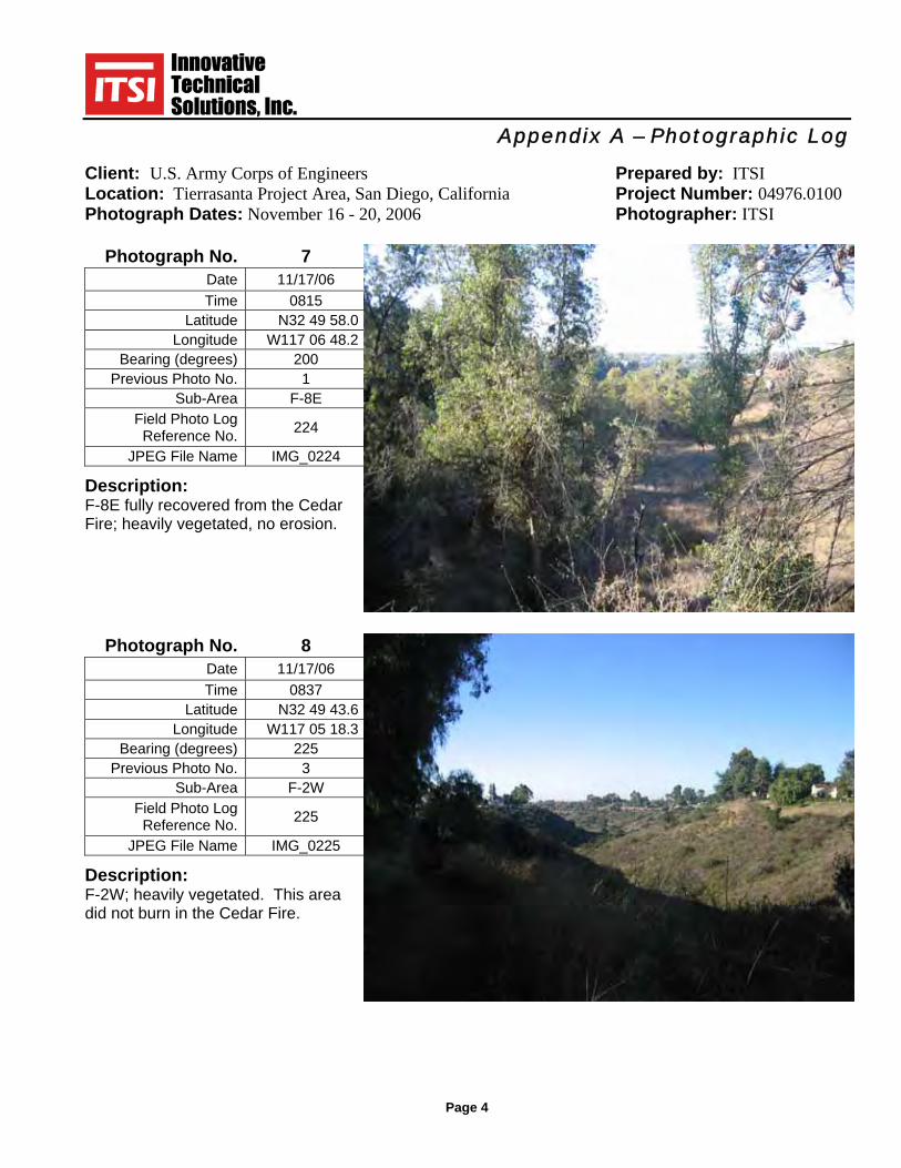
Photograph No. 7 Date 11/17/06 Time 0815
Latitude N32 49 58.0 Longitude W117 06 48.2
Bearing (degrees) 200 Previous Photo No. 1
Sub-Area F-8E Field Photo Log
Reference No. 224
JPEG File Name IMG_0224 Description: F-8E fully recovered from the Cedar Fire; heavily vegetated, no erosion.
Photograph No. 8 Date 11/17/06 Time 0837
Latitude N32 49 43.6 Longitude W117 05 18.3
Bearing (degrees) 225 Previous Photo No. 3
Sub-Area F-2W Field Photo Log
Reference No. 225
JPEG File Name IMG_0225 Description: F-2W; heavily vegetated. This area did not burn in the Cedar Fire.

Appendix A – Photographic Log
Client: U.S. Army Corps of Engineers Prepared by: ITSI Location: Tierrasanta Project Area, San Diego, California Project Number: 04976.0100 Photograph Dates: November 16 - 20, 2006 Photographer: ITSI
Page 5
Photograph No. 9 Date 11/17/06 Time 0853
Latitude N32 49 32.5 Longitude W117 04 56.1
Bearing (degrees) 290 Previous Photo No. 4
Sub-Area F-2W Field Photo Log
Reference No. 226
JPEG File Name IMG_0226 Description: F-2W; heavily vegetated. This area did not burn in the Cedar Fire.
Photograph No. 10 Date 11/17/06 Time 0853
Latitude N32 49 32.5 Longitude W117 04 56.1
Bearing (degrees) 315 Previous Photo No. 4
Sub-Area F-2W Field Photo Log
Reference No. 227
JPEG File Name IMG_0227 Description: F-2W, same location as Photograph 10. Minor vandalism to the MEC sign.

Appendix A – Photographic Log
Client: U.S. Army Corps of Engineers Prepared by: ITSI Location: Tierrasanta Project Area, San Diego, California Project Number: 04976.0100 Photograph Dates: November 16 - 20, 2006 Photographer: ITSI
Page 6
Photograph No. 11 Date 11/17/06 Time 0900
Latitude N32 49 32.3 Longitude W117 04 55.4
Bearing (degrees) 134 Previous Photo No. 5
Sub-Area F-2M Field Photo Log
Reference No. 229
JPEG File Name IMG_0229 Description: F-2M. Good vegetation; some evidence of burning; minor vandalism to sign.
Photograph No. 12 Date 11/17/06 Time 0910
Latitude N32 49 06.4 Longitude W117 05 45.4
Bearing (degrees) 195 Previous Photo No. 9
Sub-Area F-1 Field Photo Log
Reference No. 230
JPEG File Name IMG_0230 Description: F-1 from Tierrasanta. Heavily vegetated. This area did not burn in the Cedar Fire.

Appendix A – Photographic Log
Client: U.S. Army Corps of Engineers Prepared by: ITSI Location: Tierrasanta Project Area, San Diego, California Project Number: 04976.0100 Photograph Dates: November 16 - 20, 2006 Photographer: ITSI
Page 7
Photograph No. 13 Date 11/17/06 Time 0940
Latitude N32 49 06.4 Longitude W117 05 40.6
Bearing (degrees) 5 Previous Photo No. 10
Sub-Area F-2W Field Photo Log
Reference No. 231
JPEG File Name IMG_0231 Description: F-2W at southern end. Good vegetation; no evidence of burning.
Photograph No. 14 Date 11/17/06 Time 0958
Latitude N32 49 04.7 Longitude W117 06 03.0
Bearing (degrees) 182 Previous Photo No. 11
Sub-Area F-1 Field Photo Log
Reference No. 232
JPEG File Name IMG_0232 Description: F-1 from below Roadrunner Park. Heavily vegetated. This area did not burn in the Cedar Fire.
Appendix A – Photographic Log
Client: U.S. Army Corps of Engineers Prepared by: ITSI Location: Tierrasanta Project Area, San Diego, California Project Number: 04976.0100 Photograph Dates: November 16 - 20, 2006 Photographer: ITSI
Page 8
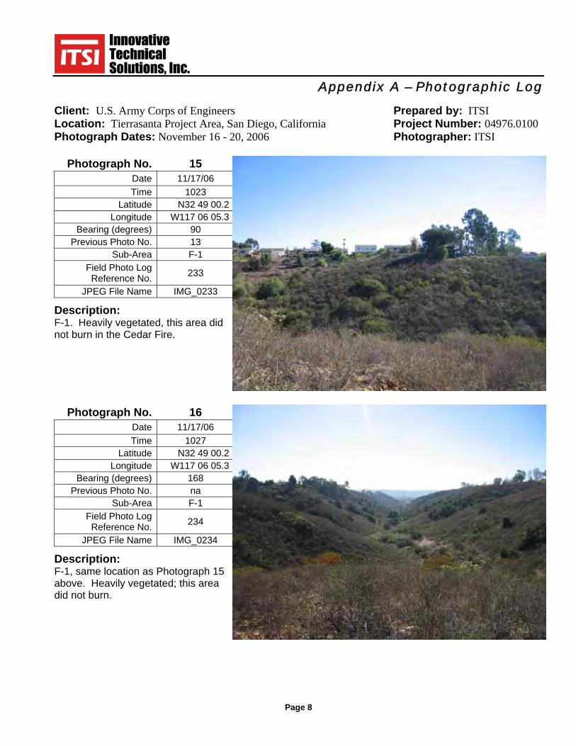
Photograph No. 15 Date 11/17/06 Time 1023
Latitude N32 49 00.2 Longitude W117 06 05.3
Bearing (degrees) 90 Previous Photo No. 13
Sub-Area F-1 Field Photo Log
Reference No. 233
JPEG File Name IMG_0233 Description: F-1. Heavily vegetated, this area did not burn in the Cedar Fire.
Photograph No. 16 Date 11/17/06 Time 1027
Latitude N32 49 00.2 Longitude W117 06 05.3
Bearing (degrees) 168 Previous Photo No. na
Sub-Area F-1 Field Photo Log
Reference No. 234
JPEG File Name IMG_0234 Description: F-1, same location as Photograph 15 above. Heavily vegetated; this area did not burn.
Appendix A – Photographic Log
Client: U.S. Army Corps of Engineers Prepared by: ITSI Location: Tierrasanta Project Area, San Diego, California Project Number: 04976.0100 Photograph Dates: November 16 - 20, 2006 Photographer: ITSI
Page 9
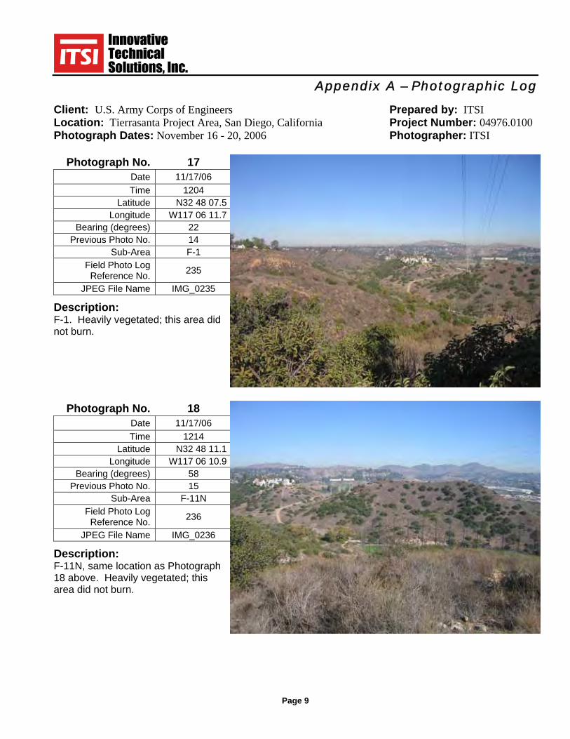
Photograph No. 17 Date 11/17/06 Time 1204
Latitude N32 48 07.5 Longitude W117 06 11.7
Bearing (degrees) 22 Previous Photo No. 14
Sub-Area F-1 Field Photo Log
Reference No. 235
JPEG File Name IMG_0235 Description: F-1. Heavily vegetated; this area did not burn.
Photograph No. 18 Date 11/17/06 Time 1214
Latitude N32 48 11.1 Longitude W117 06 10.9
Bearing (degrees) 58 Previous Photo No. 15
Sub-Area F-11N Field Photo Log
Reference No. 236
JPEG File Name IMG_0236 Description: F-11N, same location as Photograph 18 above. Heavily vegetated; this area did not burn.

Appendix A – Photographic Log
Client: U.S. Army Corps of Engineers Prepared by: ITSI Location: Tierrasanta Project Area, San Diego, California Project Number: 04976.0100 Photograph Dates: November 16 - 20, 2006 Photographer: ITSI
Page 10
Photograph No. 19 Date 11/17/06 Time 1222
Latitude N32 48 11.5 Longitude W117 06 14.3
Bearing (degrees) 190 Previous Photo No. 16
Sub-Area OA-1 Field Photo Log
Reference No. 237
JPEG File Name IMG_0237 Description: OA-1; F-11N and driving range in background heavily vegetated. Area did not burn.
Photograph No. 20 Date 11/17/06 Time 1226
Latitude N32 48 11.5 Longitude W117 06 15.9
Bearing (degrees) 156 Previous Photo No. 17
Sub-Area OA-1 Field Photo Log
Reference No. 238
JPEG File Name IMG_0238 Description: OA-1, most of area is fenced to protect vernal pools.

Appendix A – Photographic Log
Client: U.S. Army Corps of Engineers Prepared by: ITSI Location: Tierrasanta Project Area, San Diego, California Project Number: 04976.0100 Photograph Dates: November 16 - 20, 2006 Photographer: ITSI
Page 11
Photograph No. 21 Date 11/17/06 Time 1255
Latitude N32 48 05.7 Longitude W117 06 02.1
Bearing (degrees) 0 Previous Photo No. 18
Sub-Area F-1 Field Photo Log
Reference No. 239
JPEG File Name IMG_0239 Description: F-1 and driving range in background heavily vegetated. Area did not burn.
Photograph No. 22 Date 11/17/06 Time 1322
Latitude N32 50 26.9 Longitude W117 05 06.1
Bearing (degrees) 213 Previous Photo No. 20
Sub-Area C-3 Field Photo Log
Reference No. 240
JPEG File Name IMG_0240 Description: C-3 good vegetation, no evidence fo burn left.

Appendix A – Photographic Log
Client: U.S. Army Corps of Engineers Prepared by: ITSI Location: Tierrasanta Project Area, San Diego, California Project Number: 04976.0100 Photograph Dates: November 16 - 20, 2006 Photographer: ITSI
Page 12
Photograph No. 23 Date 11/17/06 Time 1326
Latitude N32 50 26.9 Longitude W117 05 06.1
Bearing (degrees) 251 Previous Photo No. 21
Sub-Area C-3 Field Photo Log
Reference No. 241
JPEG File Name IMG_0241 Description: North end of C-3 at Portobello Dr. Area burned in fire, fully recovered, heavily vegetated. Same location as 22.
Photograph No. 24 Date 11/17/06 Time 1344
Latitude N32 50 27.9 Longitude W117 05 23.2
Bearing (degrees) 13 Previous Photo No. 22
Sub-Area C-1 Field Photo Log
Reference No. 242
JPEG File Name IMG_0242 Description: C-1 at Portobello Dr. Area did not burn in fire, heavily vegetated.

Appendix A – Photographic Log
Client: U.S. Army Corps of Engineers Prepared by: ITSI Location: Tierrasanta Project Area, San Diego, California Project Number: 04976.0100 Photograph Dates: November 16 - 20, 2006 Photographer: ITSI
Page 13
Photograph No. 25 Date 11/17/06 Time 1352
Latitude N32 50 27.5 Longitude W117 05 23.9
Bearing (degrees) 242 Previous Photo No. 23
Sub-Area C-3 Field Photo Log
Reference No. 243
JPEG File Name IMG_0243 Description: C-3 at Portobello Dr. Area burned in fire, fully recovered, heavily vegetated.
Photograph No. 26 Date 11/17/06 Time 1406
Latitude N32 50 15.8 Longitude W117 05 40.8
Bearing (degrees) 230 Previous Photo No. 24
Sub-Area F-10N Field Photo Log
Reference No. 244
JPEG File Name IMG_0244 Description: F-10N. Area did not burn in fire, heavily vegetated.

Appendix A – Photographic Log
Client: U.S. Army Corps of Engineers Prepared by: ITSI Location: Tierrasanta Project Area, San Diego, California Project Number: 04976.0100 Photograph Dates: November 16 - 20, 2006 Photographer: ITSI
Page 14
Photograph No. 27 Date 11/17/06 Time 1442
Latitude N32 49 29.5 Longitude W117 04 34.9
Bearing (degrees) 230 Previous Photo No. 25
Sub-Area E-2 Field Photo Log
Reference No. 245
JPEG File Name IMG_0245 Description: E-2 at park entrance end of Clairmonte Mesa Blvd. Area burned in fire, fully recovered, good vegetation.
Photograph No. 28 Date 11/17/06 Time 1445
Latitude N32 49 29.5 Longitude W117 04 34.9
Bearing (degrees) 163 Previous Photo No. 26
Sub-Area E-2 Field Photo Log
Reference No. 246
JPEG File Name IMG_0246 Description: E-2. Same area as above, trails/roads shown.

Appendix A – Photographic Log
Client: U.S. Army Corps of Engineers Prepared by: ITSI Location: Tierrasanta Project Area, San Diego, California Project Number: 04976.0100 Photograph Dates: November 16 - 20, 2006 Photographer: ITSI
Page 15
Photograph No. 29 Date 11/17/06 Time 1447
Latitude N32 49 29.5 Longitude W117 04 34.5
Bearing (degrees) 69 Previous Photo No. 27
Sub-Area E-1 Field Photo Log
Reference No. 247
JPEG File Name IMG_0247 Description: E-1 at park entrance end of Clairmonte Mesa Blvd. Area burned in fire, fully recovered, good vegetation.
Photograph No. 30 Date 11/17/06 Time 1455
Latitude N32 49 29.9 Longitude W117 04 34.1
Bearing (degrees) 110 Previous Photo No. 28
Sub-Area E-2CB Field Photo Log
Reference No. 248
JPEG File Name IMG_0248 Description: E-2CB, hill in background. Same area as above.
Appendix A – Photographic Log
Client: U.S. Army Corps of Engineers Prepared by: ITSI Location: Tierrasanta Project Area, San Diego, California Project Number: 04976.0100 Photograph Dates: November 16 - 20, 2006 Photographer: ITSI
Page 16
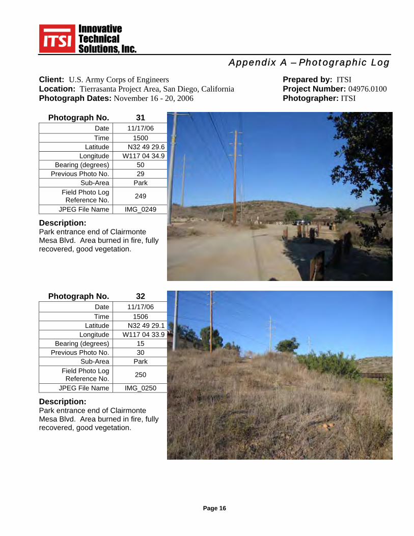
Photograph No. 31 Date 11/17/06 Time 1500
Latitude N32 49 29.6 Longitude W117 04 34.9
Bearing (degrees) 50 Previous Photo No. 29
Sub-Area Park Field Photo Log
Reference No. 249
JPEG File Name IMG_0249 Description: Park entrance end of Clairmonte Mesa Blvd. Area burned in fire, fully recovered, good vegetation.
Photograph No. 32 Date 11/17/06 Time 1506
Latitude N32 49 29.1 Longitude W117 04 33.9
Bearing (degrees) 15 Previous Photo No. 30
Sub-Area Park Field Photo Log
Reference No. 250
JPEG File Name IMG_0250 Description: Park entrance end of Clairmonte Mesa Blvd. Area burned in fire, fully recovered, good vegetation.
Appendix A – Photographic Log
Client: U.S. Army Corps of Engineers Prepared by: ITSI Location: Tierrasanta Project Area, San Diego, California Project Number: 04976.0100 Photograph Dates: November 16 - 20, 2006 Photographer: ITSI
Page 17
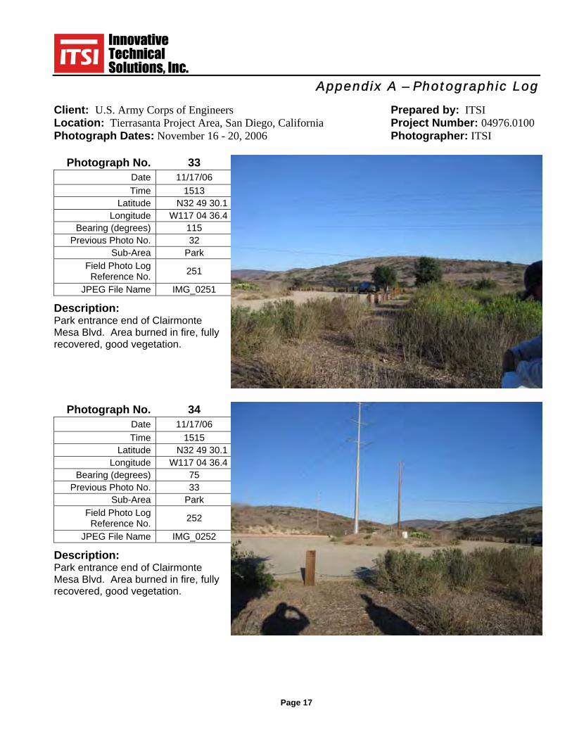
Photograph No. 33 Date 11/17/06 Time 1513
Latitude N32 49 30.1 Longitude W117 04 36.4
Bearing (degrees) 115 Previous Photo No. 32
Sub-Area Park Field Photo Log
Reference No. 251
JPEG File Name IMG_0251 Description: Park entrance end of Clairmonte Mesa Blvd. Area burned in fire, fully recovered, good vegetation.
Photograph No. 34 Date 11/17/06 Time 1515
Latitude N32 49 30.1 Longitude W117 04 36.4
Bearing (degrees) 75 Previous Photo No. 33
Sub-Area Park Field Photo Log
Reference No. 252
JPEG File Name IMG_0252 Description: Park entrance end of Clairmonte Mesa Blvd. Area burned in fire, fully recovered, good vegetation.

Appendix A – Photographic Log
Client: U.S. Army Corps of Engineers Prepared by: ITSI Location: Tierrasanta Project Area, San Diego, California Project Number: 04976.0100 Photograph Dates: November 16 - 20, 2006 Photographer: ITSI
Page 18
Photograph No. 35 Date 11/18/06 Time 0650
Latitude N32 48 07.0 Longitude W117 06 01.8
Bearing (degrees) 220 Previous Photo No. 19
Sub-Area F-11N Field Photo Log
Reference No. 253
JPEG File Name IMG_0253 Description: F-11N at driving range, area did not burn, good vegetation, no erosion.
Photograph No. 36 Date 11/18/06 Time 0707
Latitude N32 49 14.6 Longitude W117 04 37.6
Bearing (degrees) 22 Previous Photo No. 36
Sub-Area E-2 Field Photo Log
Reference No. 254
JPEG File Name IMG_0254 Description: E-2 in background. Park entrance end of Colina Dorada Dr. Area burned in fire, fully recovered, good vegetation. MEC sign in good condition.

Appendix A – Photographic Log
Client: U.S. Army Corps of Engineers Prepared by: ITSI Location: Tierrasanta Project Area, San Diego, California Project Number: 04976.0100 Photograph Dates: November 16 - 20, 2006 Photographer: ITSI
Page 19
Photograph No. 37 Date 11/18/06 Time 0738
Latitude N32 49 31.5 Longitude W117 04 31.4
Bearing (degrees) 350 Previous Photo No. 31
Sub-Area F-10A Field Photo Log
Reference No. 255
JPEG File Name IMG_0255 Description: F-10A, Area burned in fire, fully recovered, good vegetation. No erosion.
Photograph No. 38 Date 11/18/06 Time 0756
Latitude N32 49 27.9 Longitude W117 04 46.4
Bearing (degrees) 285 Previous Photo No. 35
Sub-Area F-2M Field Photo Log
Reference No. 257
JPEG File Name IMG_0257 Description: F-2M entrance at Rueda Dr. Area did not burn, good vegetation.
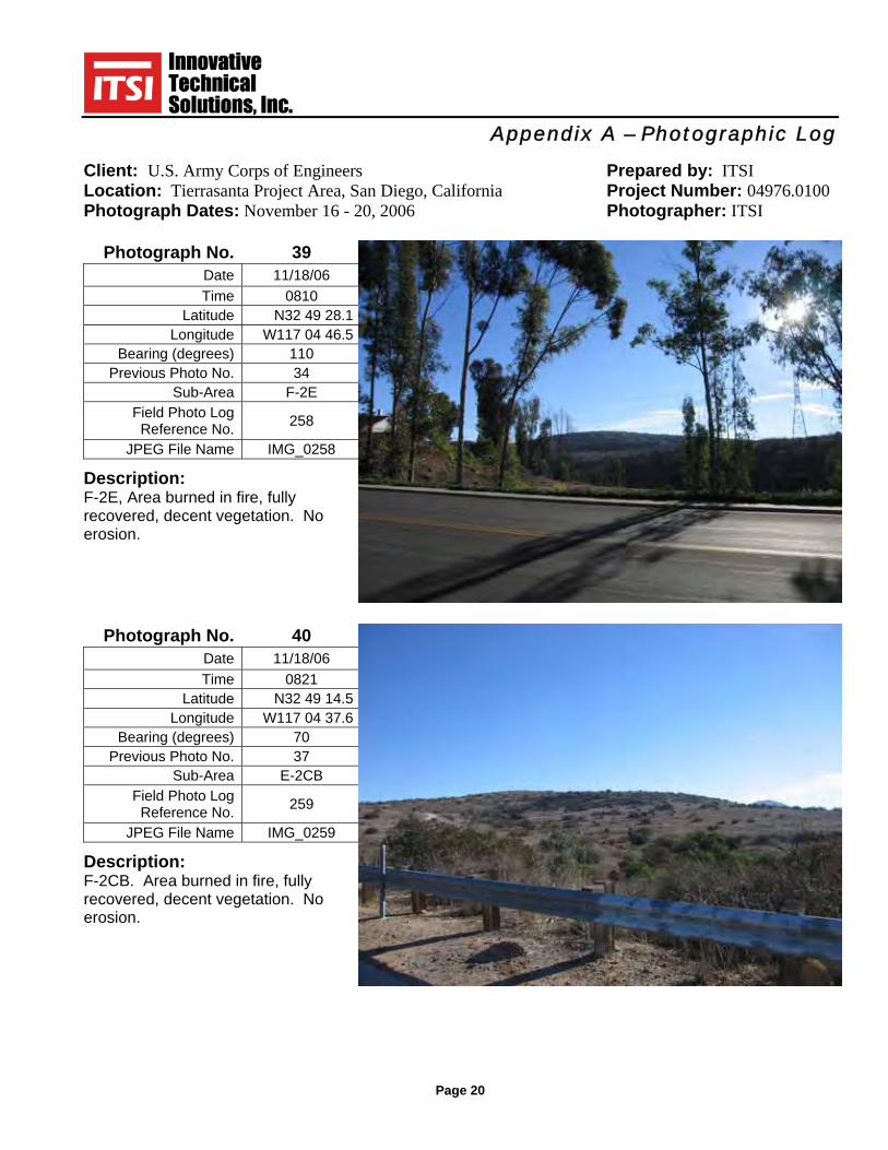
Appendix A – Photographic Log
Client: U.S. Army Corps of Engineers Prepared by: ITSI Location: Tierrasanta Project Area, San Diego, California Project Number: 04976.0100 Photograph Dates: November 16 - 20, 2006 Photographer: ITSI
Page 20
Photograph No. 39 Date 11/18/06 Time 0810
Latitude N32 49 28.1 Longitude W117 04 46.5
Bearing (degrees) 110 Previous Photo No. 34
Sub-Area F-2E Field Photo Log
Reference No. 258
JPEG File Name IMG_0258 Description: F-2E, Area burned in fire, fully recovered, decent vegetation. No erosion.
Photograph No. 40 Date 11/18/06 Time 0821
Latitude N32 49 14.5 Longitude W117 04 37.6
Bearing (degrees) 70 Previous Photo No. 37
Sub-Area E-2CB Field Photo Log
Reference No. 259
JPEG File Name IMG_0259 Description: F-2CB. Area burned in fire, fully recovered, decent vegetation. No erosion.
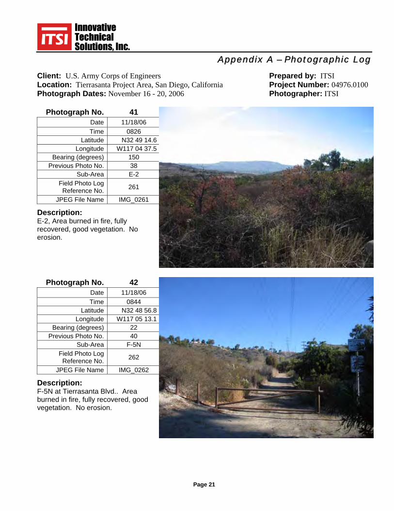
Appendix A – Photographic Log
Client: U.S. Army Corps of Engineers Prepared by: ITSI Location: Tierrasanta Project Area, San Diego, California Project Number: 04976.0100 Photograph Dates: November 16 - 20, 2006 Photographer: ITSI
Page 21
Photograph No. 41 Date 11/18/06 Time 0826
Latitude N32 49 14.6 Longitude W117 04 37.5
Bearing (degrees) 150 Previous Photo No. 38
Sub-Area E-2 Field Photo Log
Reference No. 261
JPEG File Name IMG_0261 Description: E-2, Area burned in fire, fully recovered, good vegetation. No erosion.
Photograph No. 42 Date 11/18/06 Time 0844
Latitude N32 48 56.8 Longitude W117 05 13.1
Bearing (degrees) 22 Previous Photo No. 40
Sub-Area F-5N Field Photo Log
Reference No. 262
JPEG File Name IMG_0262 Description: F-5N at Tierrasanta Blvd.. Area burned in fire, fully recovered, good vegetation. No erosion.

Appendix A – Photographic Log
Client: U.S. Army Corps of Engineers Prepared by: ITSI Location: Tierrasanta Project Area, San Diego, California Project Number: 04976.0100 Photograph Dates: November 16 - 20, 2006 Photographer: ITSI
Page 22
Photograph No. 43 Date 11/18/06 Time 0851
Latitude N32 48 42.1 Longitude W117 04 58.7
Bearing (degrees) 125 Previous Photo No. 39
Sub-Area F-5S Field Photo Log
Reference No. 263
JPEG File Name IMG_0263 Description: F-5S, Area burned in fire, fully recovered, good vegetation. No erosion.
Photograph No. 44 Date 11/18/06 Time 0927
Latitude N32 49 54.3 Longitude W117 06 07.2
Bearing (degrees) 150 Previous Photo No. 41
Sub-Area F-10E Field Photo Log
Reference No. 264
JPEG File Name IMG_0264 Description: F-10E at Tierrasanta Blvd.. Area burned in fire, fully recovered, good vegetation. No erosion.

Appendix A – Photographic Log
Client: U.S. Army Corps of Engineers Prepared by: ITSI Location: Tierrasanta Project Area, San Diego, California Project Number: 04976.0100 Photograph Dates: November 16 - 20, 2006 Photographer: ITSI
Page 23
Photograph No. 45 Date 11/18/06 Time 0949
Latitude N32 49 55.5 Longitude W117 05 54.6
Bearing (degrees) 180 Previous Photo No. 43
Sub-Area F-10E Field Photo Log
Reference No. 265
JPEG File Name IMG_0265 Description: F-10E. Area burned in fire, fully recovered, good vegetation. No erosion, prior location of Bike Track, no evidence left of track.
Photograph No. 46 Date 11/18/06 Time 1025
Latitude N32 49 53.6 Longitude W117 06 18.6
Bearing (degrees) 0 Previous Photo No. 44
Sub-Area F-7 Field Photo Log
Reference No. 266
JPEG File Name IMG_0266 Description: F-7. Location didi not burn, heavy vegetation. No increase in erosion from last review.

Appendix A – Photographic Log
Client: U.S. Army Corps of Engineers Prepared by: ITSI Location: Tierrasanta Project Area, San Diego, California Project Number: 04976.0100 Photograph Dates: November 16 - 20, 2006 Photographer: ITSI
Page 24
Photograph No. 47 Date 11/18/06 Time 1031
Latitude N32 49 51.2 Longitude W117 06 23.6
Bearing (degrees) 160 Previous Photo No. 45
Sub-Area F-7 Field Photo Log
Reference No. 267
JPEG File Name IMG_0267 Description: F-7. Area burned in fire, fully recovered, good vegetation. No erosion.
Photograph No. 48 Date 11/18/06 Time 1034
Latitude N32 49 51.2 Longitude W117 06 22.9
Bearing (degrees) 188 Previous Photo No. 46
Sub-Area F-7 Field Photo Log
Reference No. 268
JPEG File Name IMG_0268 Description: F-7. Area burned in fire, fully recovered, good vegetation. No erosion.

Appendix A – Photographic Log
Client: U.S. Army Corps of Engineers Prepared by: ITSI Location: Tierrasanta Project Area, San Diego, California Project Number: 04976.0100 Photograph Dates: November 16 - 20, 2006 Photographer: ITSI
Page 25
Photograph No. 49 Date 11/18/06 Time 1037
Latitude N32 49 51.1 Longitude W117 06 23.4
Bearing (degrees) 220 Previous Photo No. 47
Sub-Area F-7 Field Photo Log
Reference No. 269
JPEG File Name IMG_0269 Description: F-7. Area burned in fire, fully recovered, good vegetation. No erosion.
Photograph No. 50 Date 11/18/06 Time 1045
Latitude N32 49 46.4 Longitude W117 06 18.2
Bearing (degrees) 195 Previous Photo No. 48
Sub-Area F-6 Field Photo Log
Reference No. 270
JPEG File Name IMG_0270 Description: F-6. Area not burned in fire, heavy vegetation. No erosion.

Appendix A – Photographic Log
Client: U.S. Army Corps of Engineers Prepared by: ITSI Location: Tierrasanta Project Area, San Diego, California Project Number: 04976.0100 Photograph Dates: November 16 - 20, 2006 Photographer: ITSI
Page 26
Photograph No. 51 Date 11/18/06 Time 1156
Latitude N32 49 11.3 Longitude W117 06 12.0
Bearing (degrees) 70 Previous Photo No. 52
Sub-Area F-1 Field Photo Log
Reference No. 271
JPEG File Name IMG_0271 Description: F-1. Area did not burn in fire, better vegetation. Erosion improved.
Photograph No. 52 Date 11/18/06 Time 1203
Latitude N32 49 10.6 Longitude W117 06 12.1
Bearing (degrees) 70 Previous Photo No. 49
Sub-Area F-1 Field Photo Log
Reference No. 272
JPEG File Name IMG_0272 Description: F-1. Area did not burn in fire, better vegetation. Erosion improved. Same area as above.

Appendix A – Photographic Log
Client: U.S. Army Corps of Engineers Prepared by: ITSI Location: Tierrasanta Project Area, San Diego, California Project Number: 04976.0100 Photograph Dates: November 16 - 20, 2006 Photographer: ITSI
Page 27
Photograph No. 53 Date 11/18/06 Time 1205
Latitude N32 49 10.6 Longitude W117 06 12.1
Bearing (degrees) 45 Previous Photo No. 50
Sub-Area F-1 Field Photo Log
Reference No. 273
JPEG File Name IMG_0273 Description: F-1. Area did not burn in fire, better vegetation. Erosion improved.
Photograph No. 54 Date 11/18/06 Time 1207
Latitude N32 49 10.6 Longitude W117 06 12.1
Bearing (degrees) 22 Previous Photo No. 51
Sub-Area F-1 Field Photo Log
Reference No. 274
JPEG File Name IMG_0274 Description: F-1. Area did not burn in fire,better vegetation. Erosion improved. Same area as above.

Appendix A – Photographic Log
Client: U.S. Army Corps of Engineers Prepared by: ITSI Location: Tierrasanta Project Area, San Diego, California Project Number: 04976.0100 Photograph Dates: November 16 - 20, 2006 Photographer: ITSI
Page 28
Photograph No. 55 Date 11/18/06 Time 1212
Latitude N32 49 11.3 Longitude W117 06 12.1
Bearing (degrees) 125 Previous Photo No. 53
Sub-Area F-1 Field Photo Log
Reference No. 275
JPEG File Name IMG_0275 Description: F-1. Area did not burn in fire, better vegetation. Erosion improved.
Photograph No. 56 Date 11/18/06 Time 1217
Latitude N32 49 12.1 Longitude W117 06 12.0
Bearing (degrees) 70 Previous Photo No. 54
Sub-Area F-1 Field Photo Log
Reference No. 276
JPEG File Name IMG_0276 Description: F-1. Area did not burn in fire,better vegetation. Erosion improved. Same area as above.

Appendix A – Photographic Log
Client: U.S. Army Corps of Engineers Prepared by: ITSI Location: Tierrasanta Project Area, San Diego, California Project Number: 04976.0100 Photograph Dates: November 16 - 20, 2006 Photographer: ITSI
Page 29
Photograph No. 57 Date 11/18/06 Time 1313
Latitude N32 49 00.2 Longitude W117 05 11.0
Bearing (degrees) 280 Previous Photo No. 57
Sub-Area F-5N Field Photo Log
Reference No. 277
JPEG File Name IMG_0277 Description: F-5N. Area burned in fire, vegetation recovered. Road in foreground.
Photograph No. 58 Date 11/18/06 Time 1318
Latitude N32 49 02.3 Longitude W117 05 09.0
Bearing (degrees) 290 Previous Photo No. 58
Sub-Area F-5N Field Photo Log
Reference No. 278
JPEG File Name IMG_0278 Description: F-5N. Area burned in fire, vegetation recovered. Previous minor erosion on slope below house better, more vegetation.
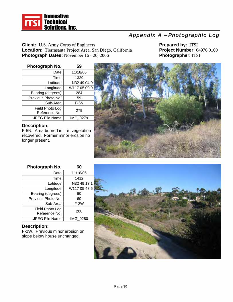
Appendix A – Photographic Log
Client: U.S. Army Corps of Engineers Prepared by: ITSI Location: Tierrasanta Project Area, San Diego, California Project Number: 04976.0100 Photograph Dates: November 16 - 20, 2006 Photographer: ITSI
Page 30
Photograph No. 59 Date 11/18/06 Time 1329
Latitude N32 49 04.9 Longitude W117 05 09.9
Bearing (degrees) 284 Previous Photo No. 59
Sub-Area F-5N Field Photo Log
Reference No. 279
JPEG File Name IMG_0279 Description: F-5N. Area burned in fire, vegetation recovered. Former minor erosion no longer present.
Photograph No. 60 Date 11/18/06 Time 1412
Latitude N32 49 13.1 Longitude W117 05 43.5
Bearing (degrees) 60 Previous Photo No. 60
Sub-Area F-2W Field Photo Log
Reference No. 280
JPEG File Name IMG_0280 Description: F-2W. Previous minor erosion on slope below house unchanged.
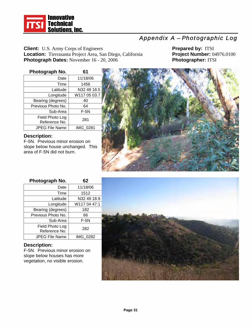
Appendix A – Photographic Log
Client: U.S. Army Corps of Engineers Prepared by: ITSI Location: Tierrasanta Project Area, San Diego, California Project Number: 04976.0100 Photograph Dates: November 16 - 20, 2006 Photographer: ITSI
Page 31
Photograph No. 61 Date 11/18/06 Time 1456
Latitude N32 49 18.5 Longitude W117 05 03.7
Bearing (degrees) 40 Previous Photo No. 64
Sub-Area F-5N Field Photo Log
Reference No. 281
JPEG File Name IMG_0281 Description: F-5N. Previous minor erosion on slope below house unchanged. This area of F-5N did not burn.
Photograph No. 62 Date 11/18/06 Time 1512
Latitude N32 49 18.9 Longitude W117 04 47.1
Bearing (degrees) 182 Previous Photo No. 66
Sub-Area F-5N Field Photo Log
Reference No. 282
JPEG File Name IMG_0282 Description: F-5N. Previous minor erosion on slope below houses has more vegetation, no visible erosion.

Appendix A – Photographic Log
Client: U.S. Army Corps of Engineers Prepared by: ITSI Location: Tierrasanta Project Area, San Diego, California Project Number: 04976.0100 Photograph Dates: November 16 - 20, 2006 Photographer: ITSII
Page 32
Photograph No. 63 Date 11/18/06 Time 1513
Latitude N32 49 18.9 Longitude W117 04 47.1
Bearing (degrees) 150 Previous Photo No. 65
Sub-Area F-5N Field Photo Log
Reference No. 283
JPEG File Name IMG_0283 Description: F-5N. Previous minor erosion on slope below houses not visible.
Photograph No. 64 Date 11/19/06 Time 0651
Latitude N32 49 49.4 Longitude W117 06 22.2
Bearing (degrees) 70 Previous Photo No. 67
Sub-Area F-7 Field Photo Log
Reference No. 284
JPEG File Name IMG_0284 Description: F-7. Previous minor erosion on slope has more vegetation, not visible erosion.
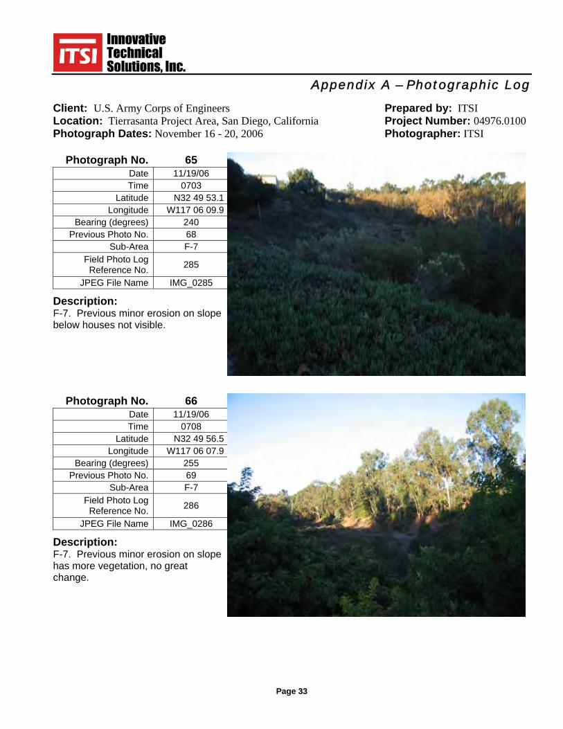
Appendix A – Photographic Log
Client: U.S. Army Corps of Engineers Prepared by: ITSI Location: Tierrasanta Project Area, San Diego, California Project Number: 04976.0100 Photograph Dates: November 16 - 20, 2006 Photographer: ITSI
Page 33
Photograph No. 65 Date 11/19/06 Time 0703
Latitude N32 49 53.1 Longitude W117 06 09.9
Bearing (degrees) 240 Previous Photo No. 68
Sub-Area F-7 Field Photo Log
Reference No. 285
JPEG File Name IMG_0285 Description: F-7. Previous minor erosion on slope below houses not visible.
Photograph No. 66 Date 11/19/06 Time 0708
Latitude N32 49 56.5 Longitude W117 06 07.9
Bearing (degrees) 255 Previous Photo No. 69
Sub-Area F-7 Field Photo Log
Reference No. 286
JPEG File Name IMG_0286 Description: F-7. Previous minor erosion on slope has more vegetation, no great change.

Appendix A – Photographic Log
Client: U.S. Army Corps of Engineers Prepared by: ITSI Location: Tierrasanta Project Area, San Diego, California Project Number: 04976.0100 Photograph Dates: November 16 - 20, 2006 Photographer: ITSI
Page 34
Photograph No. 67 Date 11/19/06 Time 0717
Latitude N32 49 53.8 Longitude W117 06 08.1
Bearing (degrees) 40 Previous Photo No. 70
Sub-Area F-10E Field Photo Log
Reference No. 287
JPEG File Name IMG_0287 Description: F-10E. Vegetation improved, no erosion.
Photograph No. 68 Date 11/19/06 Time 0729
Latitude N32 49 57.2 Longitude W117 05 57.5
Bearing (degrees) 120 Previous Photo No. 71
Sub-Area F-10E Field Photo Log
Reference No. 288
JPEG File Name IMG_0288 Description: F-10E. Vegetation improved, no erosion.

Appendix A – Photographic Log
Client: U.S. Army Corps of Engineers Prepared by: ITSI Location: Tierrasanta Project Area, San Diego, California Project Number: 04976.0100 Photograph Dates: November 16 - 20, 2006 Photographer: ITSI
Page 35
Photograph No. 69 Date 11/19/06 Time 0734
Latitude N32 50 00.5 Longitude W117 05 59.1
Bearing (degrees) 25 Previous Photo No. 72
Sub-Area F-10N Field Photo Log
Reference No. 289
JPEG File Name IMG_0289 Description: F-10N. Mulch put down on trail.
Photograph No. 70 Date 11/19/06 Time 0755
Latitude N32 49 45.3 Longitude W117 04 58.2
Bearing (degrees) 45 Previous Photo No. 73
Sub-Area F-10M Field Photo Log
Reference No. 290
JPEG File Name IMG_0290 Description: F-10E. Vegetation improved since fire, no erosion found.

Appendix A – Photographic Log
Client: U.S. Army Corps of Engineers Prepared by: ITSI Location: Tierrasanta Project Area, San Diego, California Project Number: 04976.0100 Photograph Dates: November 16 - 20, 2006 Photographer: ITSI
Page 36
Photograph No. 71 Date 11/19/06 Time 0801
Latitude N32 49 48.5 Longitude W117 05 01.3
Bearing (degrees) 310 Previous Photo No. 74
Sub-Area F-10E Field Photo Log
Reference No. 291
JPEG File Name IMG_0291 Description: F-10E. Area recovered from fire, good vegetation.
Photograph No. 72 Date 11/19/06 Time 0836
Latitude N32 50 03.4 Longitude W117 05 01.5
Bearing (degrees) 185 Previous Photo No. 75
Sub-Area C-5 Field Photo Log
Reference No. 292
JPEG File Name IMG_0292 Description: C-5. Vegetation improved, no erosion found.

Appendix A – Photographic Log
Client: U.S. Army Corps of Engineers Prepared by: ITSI Location: Tierrasanta Project Area, San Diego, California Project Number: 04976.0100 Photograph Dates: November 16 - 20, 2006 Photographer: ITSI
Page 37
Photograph No. 73 Date 11/19/06 Time 0840
Latitude N32 50 03.2 Longitude W117 05 03.3
Bearing (degrees) 10 Previous Photo No. 76
Sub-Area C-5 Field Photo Log
Reference No. 293
JPEG File Name IMG_0293 Description: C-5. Area recovered from fire, good vegetation.
Photograph No. 74 Date 11/19/06 Time 0858
Latitude N32 50 13.4 Longitude W117 05 03.9
Bearing (degrees) 190 Previous Photo No. 77
Sub-Area C-4 Field Photo Log
Reference No. 294
JPEG File Name IMG_0294 Description: C-4. Area recovered from fire, good vegetation.

Appendix A – Photographic Log
Client: U.S. Army Corps of Engineers Prepared by: ITSI Location: Tierrasanta Project Area, San Diego, California Project Number: 04976.0100 Photograph Dates: November 16 - 20, 2006 Photographer: ITSI
Page 38
Photograph No. 75 Date 11/19/06 Time 0900
Latitude N32 50 13.4 Longitude W117 05 03.9
Bearing (degrees) 40 Previous Photo No. 78
Sub-Area C-4 Field Photo Log
Reference No. 295
JPEG File Name IMG_0295 Description: C-4. Area recovered from fire, good vegetation.
Photograph No. 76 Date 11/19/06 Time 0906
Latitude N32 50 15.8 Longitude W117 04 57.1
Bearing (degrees) 35 Previous Photo No. 79
Sub-Area C-4 Field Photo Log
Reference No. 296
JPEG File Name IMG_0296 Description: C-4. Area recovered from fire, good vegetation.

Appendix A – Photographic Log
Client: U.S. Army Corps of Engineers Prepared by: ITSI Location: Tierrasanta Project Area, San Diego, California Project Number: 04976.0100 Photograph Dates: November 16 - 20, 2006 Photographer: ITSI
Page 39
Photograph No. 77 Date 11/18/06 Time 1034
Latitude N32 50 34.1 Longitude W117 04 57.0
Bearing (degrees) S30E Previous Photo No. na
Sub-Area C-2 Field Photo Log
Reference No. 215
JPEG File Name IMG_0215 Description: C-2. Area recovered from fire, good vegetation. (This photo is closeup of Photograph No. 48 from 2008 MTRP Recurring Review)
Photograph No. 78 Date 11/19/06 Time 0932
Latitude N32 49 49.5 Longitude W117 06 24.7
Bearing (degrees) 212 Previous Photo No. 81
Sub-Area F-6 Field Photo Log
Reference No. 297
JPEG File Name IMG_0297 Description: F-6. Area recovered from fire, good vegetation.

Appendix A – Photographic Log
Client: U.S. Army Corps of Engineers Prepared by: ITSI Location: Tierrasanta Project Area, San Diego, California Project Number: 04976.0100 Photograph Dates: November 16 - 20, 2006 Photographer: ITSI
Page 40
Photograph No. 79 Date 11/19/06 Time 0937
Latitude N32 49 45.9 Longitude W117 06 15.0
Bearing (degrees) 230 Previous Photo No. 80
Sub-Area F-6 Field Photo Log
Reference No. 298
JPEG File Name IMG_0298 Description: F-6. Area recovered from fire, good vegetation, no erosion.
Photograph No. 80 Date 11/19/06 Time 1008
Latitude N32 49 05.4 Longitude W117 06 13.0
Bearing (degrees) 58 Previous Photo No. 61
Sub-Area F-1 Field Photo Log
Reference No. 299
JPEG File Name IMG_0299 Description: F-1. Looking down large gully now repaired.
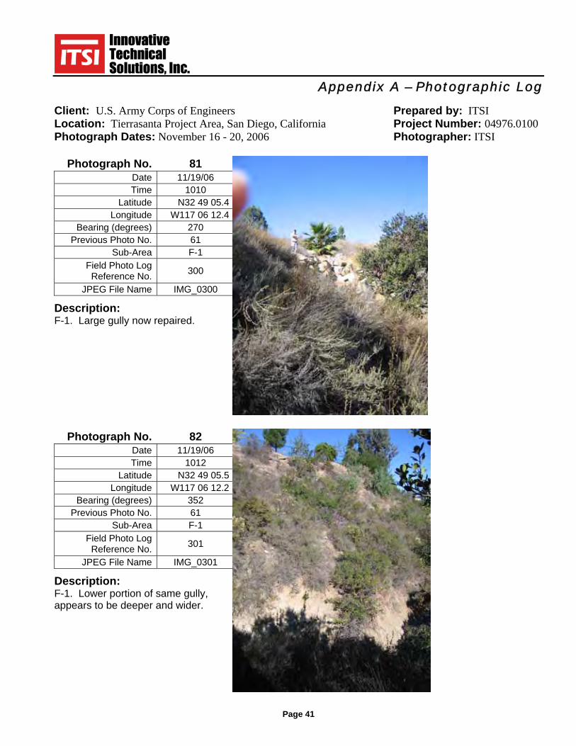
Appendix A – Photographic Log
Client: U.S. Army Corps of Engineers Prepared by: ITSI Location: Tierrasanta Project Area, San Diego, California Project Number: 04976.0100 Photograph Dates: November 16 - 20, 2006 Photographer: ITSI
Page 41
Photograph No. 81 Date 11/19/06 Time 1010
Latitude N32 49 05.4 Longitude W117 06 12.4
Bearing (degrees) 270 Previous Photo No. 61
Sub-Area F-1 Field Photo Log
Reference No. 300
JPEG File Name IMG_0300 Description: F-1. Large gully now repaired.
Photograph No. 82 Date 11/19/06 Time 1012
Latitude N32 49 05.5 Longitude W117 06 12.2
Bearing (degrees) 352 Previous Photo No. 61
Sub-Area F-1 Field Photo Log
Reference No. 301
JPEG File Name IMG_0301 Description: F-1. Lower portion of same gully, appears to be deeper and wider.

Appendix A – Photographic Log
Client: U.S. Army Corps of Engineers Prepared by: ITSI Location: Tierrasanta Project Area, San Diego, California Project Number: 04976.0100 Photograph Dates: November 16 - 20, 2006 Photographer: ITSI
Page 42
Photograph No. 83 Date 11/20/06 Time 1225
Latitude N32 49 15.2 Longitude W117 05 53.0
Bearing (degrees) NA Previous Photo No. na
Sub-Area na Field Photo Log
Reference No. 305
JPEG File Name IMG_0302 Description: MEC Display at Tierrasanta Library.
Photograph No. 84 Date 11/20/06 Time 1410
Latitude N32 49 08.0 Longitude W117 06 57.7
Bearing (degrees) 90 Previous Photo No. na
Sub-Area OA-4 Field Photo Log
Reference No. 303
JPEG File Name IMG_0303 Description: OA-4. Only erosional area in OA-4.
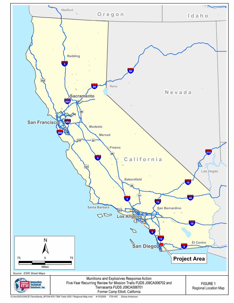
San Francisco
§̈¦5
UV99
UV99
§̈¦8
tu101
§̈¦5
§̈¦15
§̈¦80
§̈¦5
Project Area
Los Angeles
San Diego
Sacramento
Las Vegas
Fresno
San Bernardino
Modesto
Reno
Bakersfield
Santa Barbara
Medford
Merced
El Centro
Redding
§̈¦80
§̈¦40
§̈¦15
§̈¦5
§̈¦505
§̈¦15
§̈¦280
§̈¦680
§̈¦10
§̈¦515
tu101
tu101
UV14
UV58
UV152 UV33
C a l i f o r n i a
N e v a d a
I d a h oO r e g o n
Munitions and Explosives Response ActionFive-Year Recurring Review for Mission Trails FUDS J09CA006702 and
Tierrasanta FUDS J09CA006701Former Camp Elliott, California
FIGURE 1Regional Location Map
75 750
Miles
±Source: ESRI Street Maps
G:\ArcGIS\USACE\TierraSanta_MT\04-976 TSM Trails GIS\1 Regional Map.mxd 4/15/2009 ITSI-WC Eloise Anderson
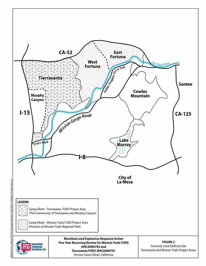
2004
/04-
975
La M
esa/
04-9
76 T
ierr
asan
ta-M
issi
on Tr
ails
/Mod
1/G
raph
ics/
Proj
ect A
reas
.ai
Munitions and Explosives Response Action
Five-Year Recurring Review for Mission Trails FUDS
J09CA006702 and
Tierrasanta FUDS J09CA006701
Former Camp Elliott, California
FIGURE 2
Formerly Used Defense SiteTierrasanta and Mission Trails Project Areas
LEGEND
Camp Elliott - Tierrasanta FUDS Project Area(The Community of Tierrasanta and Murphy Canyon)
Camp Elliott - Mission Trails FUDS Project Area(Portions of Mission Trails Regional Park)
Miss
ionGor
ge Road
San Diego River
MurphyMurphyCanyonCanyonMurphyCanyon
I-15
CA-52
TierrasantaTierrasantaTierrasanta
WestWestFortunaFortuna
EastEastFortunaFortuna
WestFortuna
EastFortuna
CA-125
Santee
I-8I-8I-8
LakeLakeMurrayMurray
LakeMurray
City ofLa Mesa
CowlesMountain
FatherJuniperoSe
rraTrail
Friars Road

2004
/04-
975
La M
esa/
04-9
76 T
ierr
asan
ta-M
issi
on T
rails
/Mod
1/G
raph
ics/
TS S
ub A
reas
.ai
FIGURE 3
Tierrasanta FUDS Project AreaOE Removal Action Sub-areas
Munitions and Explosives Response Action
Five-Year Recurring Review for Tierrasanta FUDS J09CA006701
Former Camp Elliott, California
Source: Environmental Chemical Corporation (ECC), 1995
Tierrasanta Open Space AreasIncluded in Tierrasanta FUDS Project Area
Murphy Canyon Naval Housing Area(Not included in the Tierrasanta FUDS Project Area)
N

24
60
11
9
Source: USACE Long Term Monitoring Report, 1999
s
Munitions and Explosives Response Action
Five-Year Recurring Review for Tierrasanta FUDS J09CA006701
Former Camp Elliott, California
2004
/04-
975
La M
esa/
04-9
76 T
ierr
asan
ta-M
issi
on T
rails
/Mod
1/G
raph
ics/
TS O
rdna
nce_
Eros
ion.
ai
FIGURE 4
Tierrasanta Ordnance andErosion Concerns
LEGEND
Park
TierrasantaProject Boundary
School
OrdnanceClearance Areas

LEGEND
NumberedPhotographLocation
Tierrasanta Project Boundary
Park
School
2004
/04-
975
La M
esa/
04-9
76 T
ierr
asan
ta-M
issi
on Tr
ails
/Gra
phic
s/TS
Pho
to L
ocs 0
108.
ai
FIGURE 5
Tierrasanta Photograph Locations
Source: USACE Long Term Monitoring Report, 1999
s
Munitions and Explosives Response Action
Five-Year Recurring Review for Tierrasanta FUDS J09CA006701
Former Camp Elliott, California
2223
76
71
8
70
3037
32
11
272829313334
474849
38,393
6159
58
42
4,579-81
51-5513
43
6082
785064
71
46 66
65
45
26
25
24
44,67
68,69
7
6
12
2135
17 18
1920
2
14
83
561
1516
57
364041
6263
9,10
74,75
72,73

#*#*
#*
#*
#*
#*
#*#*#*
#*#*
#*
#*
#* #*#*#*
#*#*#*#*#*#*
#*
FortunaMountain
Suycott W
ash
8
97
6
5
4
1
2 3
2423
22
2018
17161514
12
1110
2119
13
Munitions and Explosives Response ActionFive-Year Recurring Review for Mission Trails FUDS J09CA006702 and
Tierrasanta FUDS J09CA006701Former Camp Elliott, California
FIGURE 6Cedar Fire Footprint with
NTRP Ordnance Detection
3,000 3,0000
Feet
±Source: Digital Ortho Quarter Quads, La Mesa, 1995
Legend
#* MTRP Ordnance Detections
Tierrasanta FUDSProject Boundary
Mission Trails FUDSProject Boundary
Cedar Fire Footprint
G:\ArcGIS\USACE\TierraSanta_MT\04-976 TSM Trails GIS\1 Regional Map.mxd 4/14/2009 ITSI-WC Eloise Anderson

!(
!(
!(
!(
!(
!(
!(
!(
!(
!(!(!(
!(!(
!(
!(!(
!(
!(!(
!(!(
!(!(
!(!(
!(
!(
!(!(
!(
!(!(
!(!(
!(
!( !(!(
!(
!(
!(
!(!(
!(
!(
!(
!(
!(
!(
!(
!(!(!(!(
!( !(!(
!(
!(
!(!(
!(!(
!(
!(
!(
!(!(
!(!(
!(
!(
!(
!(
!(
!(!(
!(
!(!(
!(
!(
!(
!(
!(
!(
!(
!(!(
!(
Clairemont Mesa Blvd.
Tierrasanta Blvd.
SantosRd.
88u89u
6
9
8
7
5
4
3
2
1
87
21
22
20
86
85
84 7877
75
69
61
605958
57
56
55
5447
45
4443
42
41
2928
2726
25
24
2319
18
1716
15
14
13 1211
10
49u
72u76u
83u
82u
81u
80u
79u
74u
73u
71u
70u
66u65u
64u
63u
62u
53u
46u
40u
39u38u
37u 36u
35u
33u32u
31u30u
68u67u
52u51u
50u
48u
34u
Munitions and Explosives Response ActionFive-Year Recurring review for Tierrasanta FUDS J09CA006701
Former Camp Elliott, California
FIGURE 7MEC Warning Sign Locations,
Suggested Locations and Unconfirmed Locations
G:\ArcGIS\USACE\TierraSanta_MT\04-976 TSM Trails GIS\7 TS MEC Sign Locs.mxd 4/16/2009 ITSI-WC Eloise Anderson
Source: USGS 7.5 minute Quadrangle, La Mesa, 1966, Photorevised 1994
Legend
!( MEC Warning Sign Location
!( Suggested MEC Warning Sign Location
Tierrasanta FUDS Project Boundary
u Coordinates are unconfirmed. Plotted location is based on written description of location per e-mail of Jan Eby, dated 2/11/09.
2,000 2,0000
Feet
±

Five-Year Recurring Review Former Camp Elliott–Tierrasanta
San Diego, California
Figure 7 Data Sheet
Existing Sign LocationsFigure 7LocationNumber Latitude Longitude
1 N 332 48 7.4 W 117 6 12.2 Santos Rd
2 N 32 49 06.8 W 117 6 3.1 Road Runner Park
3 N 32 49 20.5 W 117 5 4.4 Rueda Dr, S side, at Zorita Ct
4 N 32 49 5.30 W 117 5 29.5 Tierrasanta Blvd, N side, between Rueda Dr and Tambor Rd
5 N 32 48 42.1 W 117 4 58.7 Tierrasanta Blvd, E end
6 N 32 48 58.0 W 117 5 2.5 Pediente Ct
7 N 32 48 56.8 W 117 5 13.1
Tierrasanta Blvd, N side, SDGE gate between Tambor Rd and Colina Dorada Dr
8 N 32 49 15.0 W 117 4 37.4 Colina Dorada Dr, N side, park entrance gate
11 N 32 49 44.29 W 117 4 35.52 Renovo Way, north end
14 N 32 50 2.08 W 117 4 46.55 Lugar Playa Catalina
14 N 32 50 1.81 W 117 4 46.38 Lugar Playa Catalina
16 N 32 50 19.46 W 117 4 47.73 Corte Playa Las Brisas
18 N 32 50 27.80 W 117 5 5.40 Portobello Dr
19 N 32 50 14.3 W 117 5 4.20 Avenida Playa Cancun, E side
20 N 32 49 27.5 W 117 4 45.0 Rueda Drive, E side, between Via Promesa and Palabra Circle
21 N 32 49 26.9 W 117 4 48.2 Rueda Drive, W side, opposite Palabra Circle
22 N 32 49 21.4 W 117 4 45.4 Colina Dorada Dr, S side, entrance gate under powerlines
23 N 32 50 11.9 W 117 5 2.3 Via Playa de Cortes, W side, opposite Corte Playa Laguna
25 N 32 49 59.9 W 117 5 8.1 Via Valarta, W side at church, opposite Corte Playa Laguna
26 N 32 49 49.2 W 117 4 57.8 Via Valarta, E side, between Colegio Dr and Via Dominique
27 N 32 49 46.9 W 117 4 59.1 Via Valarta, W side, near Via Dominique
28 N 32 49 33.0 W 117 4 56.2 Seda Drive, W side between CMB and Calle de Vida
29 N 32 49 32.3 W 117 4 55.42 Seda Drive, E side between CMB and Calle de Vida
30u N 32 49 35.9 W 117 5 11.23 Calle de Vida, between houses, near house # 4494, gate access
31u N 32 49 41.42 W 117 5 16.7 Promesa Drive Terminus
u – coordinates are unconfirmed. Sign locations are per Jan Eby email dated 2/11/09
Page 1 of 4

Five-Year Recurring Review Former Camp Elliott–Tierrasanta
San Diego, California
Figure 7 Data Sheet
Existing Sign LocationsFigure 7LocationNumber Latitude Longitude
32u N 32 49 32.03 W 117 5 25.6 Vivaracho Way, W end
33u N 32 49 35.01 W 117 5 21.12 Vivaracho Ct.
34u N 32 49 26.3 W 117 5 26.3 Cartulina Drive,W end off Rueda
35u N 32 49 25.55 W 117 5 29.83 Via del Cosira
36u N 32 49 22.82 W 117 5 29.7" Via del Cosira Ct
37u N 32 49 20.6 W 117 5 30.9 Cascajo
38u N 32 49 16.8 W 117 5 31.0 Valiente Ct, W end
39u N 32 49 16.3 W 117 5 26.1 Valiente Ct, E end
40u N 32 49 17.6 W 117 5 9.0 Tambor Ct
41 N 2 49 5.5 W 117 5 40.4 Tierrasanta Blvd, N side between Ducos and Rueda
42 N 32 49 53.8 W 117 6 8.1 Santo Rd, E side, between Antigua Blvd and CMB
43 N 32 49 48.6 W 117 6 19.2
Clairmont Mesa Blvd (CMB), N side, at W end of strip mall at intersection of CMB and Santos Rd
44 N 32 49 51.3 W 117 6 26.9 CMB, N side
45 N 32 49 46.5 W 117 6 17.8 CMB, S side, near strip mall
46u N 32 49 50.1 W 117 6 26.6 CMB, S side
47 N 32 49 57.3 W 117 6 18.8 Trail between Totuga Ct and Veracruz Ct.
48u N 32 49 54.9 W 117 6 19.7 Vera Cruz Ct.
49u N 32 49 57.0 W 117 6 17.3 Tortuga Ct
50u N 32 49 57.9 W 117 6 21.2 Carioca CT
51u N 32 49 59.9 W 117 6 18.5 Bravo Ct
52u N 32 50 1.7 W 117 6 21.2 Matador Ct
53u N 32 50 2.4 W 117 6 18.4 Guicho Ct
54 N 32 49 58.8 W 117 6 6.6 Santos Rd, W side, S of intersection with Antigua
55 N 32 50 8.9 W 117 6 27.6 Villa Montserate Park
56 N 32 50 7.3 W 117 6 29.9 Villa Montserate Park – burned sign - replace
58 N 32 50 20.2 W 117 6 21.3 La Morada Dr, W end culdesac
59 N 32 50 19.5 W 117 5 42.9 Villarica, S side, between Portobelo and Barcelona or Camino Playa Carmel
60 32 50 19.1 W 117 5 40.9 Villarica, N side, between Portobelo and Barcelona or Camino Playa Carmel
u – coordinates are unconfirmed. Sign locations are per Jan Eby email dated 2/11/09
Page 2 of 4

Five-Year Recurring Review Former Camp Elliott–Tierrasanta
San Diego, California
Figure 7 Data Sheet
Existing Sign LocationsFigure 7LocationNumber Latitude Longitude
61 N 32 49 6.8 W 117 5 45.6 Tierrasanta Blvd, S side, between Rueda and Ducos
62u N 32 49 54.4 W 117 5 45.9 La Cuenta Drive – N end terminus
63u N 32 48 55.8 W 117 5 58.9 La Cuenta Drive – At Baroque, W side
64u N 32 48 44.5 W 117 5 57.7 La Cuenta Drive – S end terminus
65u N 32 50 7.3 W 117 5 44.5 Camino Playa Portofina
66u N 32 50 8.6 W 117 5 47.4 Calle Mariselda terminus
67u N 32 50 13.0 W 117 4 46.5 Callejon Quintana
68u N 32 50 10.4 W 117 4 51.2 Belardo, between Callejon Quintana and Cam. Playa Catalina
69 N 32 49 44.9 W 117 5 16.8 CMB, S side, across from Rec Center
70u N 32 50 2.77 W 117 5 3.3 Corte Playa de Cortes
71u N 32 50 10.0 W 117 4 54.8 Corte Playa San Juan
72u N 32 49 53.3 W 117 5 55.9 Gabacho Drive entrance, between houses, near house # 10720
73u N 32 49 10.87 W 117 5 13.3 Pallon Way
74u N 32 50 21.7 W 117 5 46.1 Potobelo pocket park
75 N 32 50 27.5 W 117 5 25.6 Portobelo, S side between houses, near house # 10921
76u N 32 49 57.6 W 117 5 24.3 Avenida Playa Veracruz, S side, near Corte Playa Encino
77 N 32 50 9.8 W 117 4 49.4 Terraza Playa Catalina
78 N 32 50 10.3 W 117 4 47.2 Playa Catalina
79u N 32 50 11.2 W 117 4 44.2 Via Playa Los Santos
80u N 32 48 36.8 W 117 5 49.7 Viancha Dr, W side
81u N 32 48 36.0 W 117 5 48.3 Viancha Dr, E side
82u N 32 49 3.3 W 117 5 50.4 Baroque Ln
83u N 32 49 26.3 W 117 5 26.3 Cartulina, E side off Rueda between houses
87 N 32 49 59.8 W 117 5 59.4 Antigua Blvd, N side, near intersection with Santos Rd.
88 N 32 49 19.1 W 117 5 19.1 Cartulina, E side off Rueda between houses
89 N 32 49 19.0 W 117 5 20.2 Cartulina, W side off Rueda between houses
u – coordinates are unconfirmed. Sign locations are per Jan Eby email dated 2/11/09
Page 3 of 4

Five-Year Recurring Review Former Camp Elliott–Tierrasanta
San Diego, California
Figure 7 Data Sheet
Suggested Sign Locations Figure 7LocationNumber Latitude Longitude
9 N 32 49 22.57 W 117 4 44.38 Calle de Vida, N side space between houses, entrance to park
10 N 32 49 31.00 W 117 4 28.00 East end of wood bridge at Clairemont Mesa park entrance
12 N 32 49 46.97 W 117 4 41.72 Valdina Way
13 N 32 49 47.88 W 117 4 43.66 Tinasa Way
15 N 32 50 14.79 W 117 4 36.71 Corte Playa Catalina
17 N 32 50 21.94 W 117 4 50.19 Path to MTRP between Avenida Playa Cancun and Via Playa de Cortes
24 N 32 50 2.5 W 117 5 9.0 Via Valarta, E side, between Camino Playa Norte and Corte Playa Laguna
57 N 32 50 11.1 W 117 6 29.6 Villa Montserate Park
84 N 32 50 4.5 W 117623.0 North of parking lot for Vista Grande Elemenary School
85 N 32 49 45.1 W 117 6 33.9 Outlook Point terminus
86 N 32 49 39.8 W 117 6 43.5 Trail junction between Park Crest Ln and Lemonwood Ln
Page 4 of 4

CAMP ELLIOT (80000794) SIGN UP FOR EMAIL ALERTS
TIERRASANTA, CA SAN DIEGO COUNTYSITE TYPE: FUDS
SUPERVISOR: DOUGLAS BAUTISTAOFFICE: CLEANUP CYPRESS
SITES WITH NO OPERABLE UNIT
TRANSFER PARCELS - Auto-generated OU for transfer parcels
FOR AN INTERACTIVE MAP, CLICK ON AN IMAGE BELOWOVERVIEW: MAP VIEW:
Site Information
CLEANUP STATUSINACTIVE - NEEDS EVALUATION AS OF 7/1/2005
SITE TYPE: FUDS NATIONAL PRIORITIES LIST: NO ACRES: 30500 ACRES APN: NONE SPECIFIED CLEANUP OVERSIGHT AGENCIES:DTSC - SITE CLEANUP PROGRAM - LEAD
ENVIROSTOR ID: 80000794SITE CODE: SPECIAL PROGRAM: FUNDING: DERAASSEMBLY DISTRICT: 77SENATE DISTRICT: 39
Regulatory Profile
PAST USE(S) THAT CAUSED CONTAMINATIONNONE SPECIFIED
POTENTIAL CONTAMINANTS OF CONCERNEXPLOSIVES (UXO, MEC)
POTENTIAL MEDIA AFFECTEDNONE SPECIFIED
Site History
FROM THE CORPS PUBLIC GIS SYSTEM: Property Description - Camp Elliot originally consisted of approximately 30,500 acres acquired between 1941 and 1942. Approximately 28,000 acres were acquired in fee by Declarations of Taking, and 2,500 acres were withdrawn from Public Domain lands. The Mission Trails Regional Park was conveyed to the city of San Diego by quitclaim deed on 10 January 1964. This deed restricted the use of the 2,100 acre site to historic monument/public recreational purposes for 20 years. The East Elliot area was reported excess to the General Service Administration by the Navy in 1961 and disposed of by quitclaim deeds to private parties between 1973 and 1974. The parcels vary in size and the total area is approximately 3,200 acres. A landfill, operated by the county of San Diego, is located within the East Elliot area. The area north of Tierrasanta, Mission Trails, and East Elliot is still in use by DoD (primarily the Navy with some Marine Corps and Air Force activity) and encompasses approximately 15,500 acres. Activities include movement and simulated exercises by reserve units. Area D, approximately 1,800 acres, includes land parcels that are used by California Western University and University of California as campuses, and land parcels used for Naval housing projects. There were numerous highway easements granted through this area. Area G, approximately 2,900 acres, includes properties that were disposed of by quitclaim deeds to private parties between 1963 and 1964. Area H, approximately 400 acres, was originally land that was withheld from Public Domain, but later returned. This property is known or suspected to contain military munitions and explosives of concern (e.g., unexploded ordnance) and therefore may present an explosive hazard
Property History - The Navy obtained the site in 1941 for use as a training base for Marines until 1954. The property was transferred to the General Services Administration and then disposed of to private parties in the 1960s. Approximately 15,000 acres of land were declared excess and turned over to the General Service Administration for disposal in 1961. GSA disposed of various sections of the Former Camp Elliot on different dates through land swaps, grants, and sales. Because of the Former Camp Elliot's size, it was broken down into several general areas for study. hese areas include Tierrasanta, Mission Trails, East, Elliot, and Areas G, D and H. DoD still uses a large portion of the Former Camp Elliot.
Page 1 of 2Envirostor
7/1/2014http://www.envirostor.dtsc.ca.gov/public/profile_report.asp?global_id=80000794
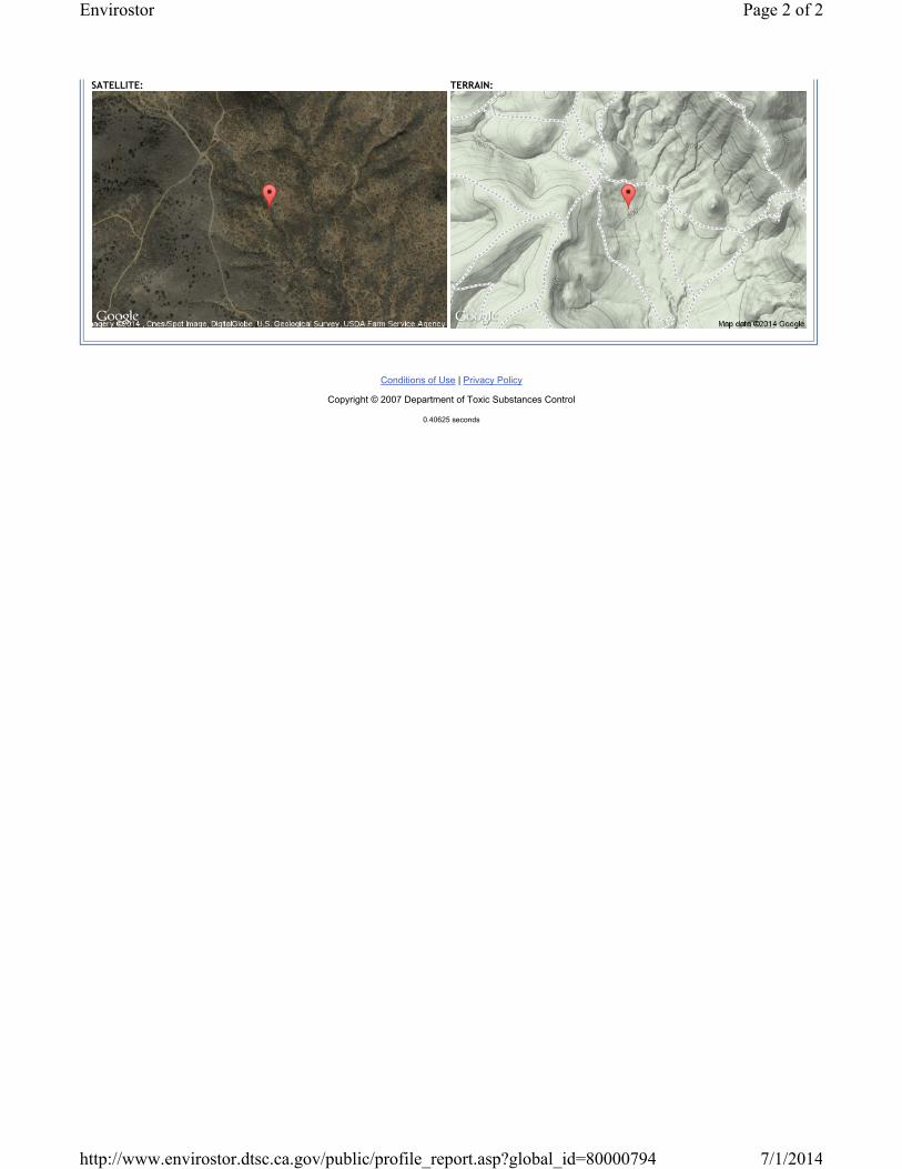
Conditions of Use | Privacy Policy
Copyright © 2007 Department of Toxic Substances Control
0.40625 seconds
SATELLITE: TERRAIN:
Page 2 of 2Envirostor
7/1/2014http://www.envirostor.dtsc.ca.gov/public/profile_report.asp?global_id=80000794

Mission Trails Regional Park – Hazardous Materials/Unexploded Ordnance Review