domestic submarine cable network (dscn) project - EMB ...
41
EIA Preparers: 2021 DOMESTIC SUBMARINE CABLE NETWORK (DSCN) PROJECT – REGION IV-B PROJECT DESCRIPTION FOR SCOPING (PDS) RHR Consulting Services, Inc.
-
Upload
khangminh22 -
Category
Documents
-
view
1 -
download
0
Transcript of domestic submarine cable network (dscn) project - EMB ...

EIA Preparers:
2021
DOMESTIC SUBMARINE CABLE NETWORK
(DSCN) PROJECT – REGION IV-B
PROJECT DESCRIPTION FOR SCOPING (PDS)
RHR Consulting Services, Inc.

Table of Contents Domestic Submarine Cable Network (DSCN) Project – Region IV-B
DSCN Project – Region IV-B | i
TABLE OF CONTENTS Table of Contents ................................................................................................................................... i
List of Tables .......................................................................................................................................... i
List of Figures ......................................................................................................................................... i
List of Attachments ................................................................................................................................ii
Project Information............................................................................................................................... 1
Project Fact Sheet ............................................................................................................................. 1
1 Project Description .................................................................................................................... 1-1
1.1 Project Background ............................................................................................................ 1-1
1.2 Project Location and Area .................................................................................................. 1-1
1.2.1 Segment Routes ......................................................................................................... 1-1
1.2.2 Landing Sites .............................................................................................................. 1-7
1.3 Project Components......................................................................................................... 1-11
1.3.1 Submarine Fiber Optic Cable (SFOC) ........................................................................ 1-11
1.3.2 Beach Manhole (BMH) ............................................................................................. 1-11
1.3.3 Heavy Equipment ..................................................................................................... 1-12
1.4 Project Size ....................................................................................................................... 1-14
1.5 Development Plan, Description of Project Phases and Corresponding Timeframes ........ 1-15
1.5.1 Cable Laying Methodology (Construction Phase) ..................................................... 1-15
1.5.2 Operation ................................................................................................................. 1-20
1.5.3 Decommissioning/Abandonment/Rehabilitation ..................................................... 1-20
1.6 Manpower........................................................................................................................ 1-21
1.7 Project Cost ...................................................................................................................... 1-21
ATTACHMENTS ................................................................................................................................ 1-22
LIST OF TABLES
Table 1-1. Project Size ...................................................................................................................... 1-14
Table 1-2. Project Cost per Site ........................................................................................................ 1-21
LIST OF FIGURES
Figure 1-1. Overview of the DSCN Segments within Region IV-B ....................................................... 1-1
Figure 1-2. Map showing the location of Segment 1 ......................................................................... 1-2
Figure 1-3. Map showing the location of Segment 2 ......................................................................... 1-3
Figure 1-4. Map showing the location of Segment 3 ......................................................................... 1-4

Table of Contents Domestic Submarine Cable Network (DSCN) Project – Region IV-B
DSCN Project – Region IV-B | ii
Figure 1-5. Map showing the location of Segment 4 ......................................................................... 1-5
Figure 1-6. Map showing the location of Segment 5 ......................................................................... 1-6
Figure 1-7. Map showing the location of Segment 23 ....................................................................... 1-7
Figure 1-8. Sketch Map of Landing Point and BMH in Brgy. Wawa, Pinamalayan, Oriental Mindoro 1-8
Figure 1-9. BMH and LP Location Overview ....................................................................................... 1-8
Figure 1-10. Sketch Map of Landing Point and BMH in Brgy. Lupac, Boac, Marinduque ................... 1-9
Figure 1-11. BMH and LP Location Overview ..................................................................................... 1-9
Figure 1-12. Sketch Map of Landing Point and BMH in Brgy. San Roque, Calatrava, Romblon ........ 1-10
Figure 1-13. BMH and LP Location Overview ................................................................................... 1-10
Figure 1-14. Submarine Fiber Optic Cable Details ............................................................................ 1-11
Figure 1-15. Dimension of Manhole 0 .............................................................................................. 1-12
Figure 1-16. MH0 Tapping Adaptor .................................................................................................. 1-12
Figure 1-17. Horizontal Directional Drilling (HDD) Rig...................................................................... 1-13
Figure 1-18. Cable Ship .................................................................................................................... 1-13
Figure 1-19. Remotely Operated Vehicle (ROV) ............................................................................... 1-13
Figure 1-20. Backhoe ....................................................................................................................... 1-14
Figure 1-21. Regional Boundary Map ............................................................................................... 1-15
Figure 1-22. Cable Floatation Method for Shore End Cable Laying .................................................. 1-16
Figure 1-23. Shore End Cable Work ................................................................................................. 1-18
Figure 1-24. Cable Burial and Protection (Inshore) .......................................................................... 1-19
Figure 1-25. Cable Lay (Waters below 200m depth) ........................................................................ 1-20
LIST OF ATTACHMENTS ATTACHMENT 1: NTC CERTIFICATION
ATTACHMENT 2: AUTHORIZED PROJECT REPRESENTATIVES
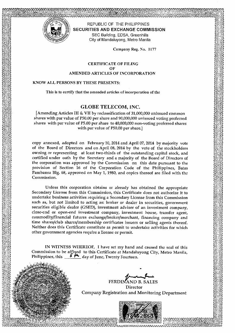
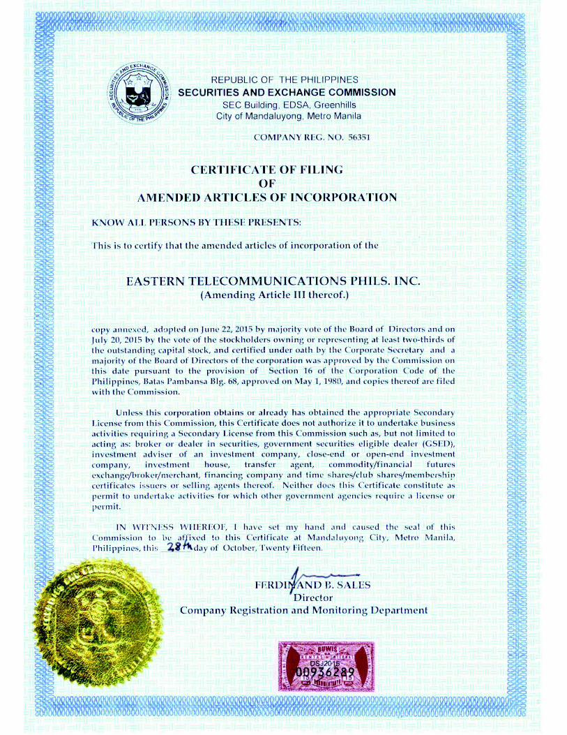
ATTACHMENT 3: SEC REGISTRATIONS

Project Information Domestic Submarine Cable Network (DSCN) Project – Region IV-B
DSCN Project Region IV-B |
PROJECT INFORMATION
PROJECT FACT SHEET
Name of Project: Proposed Domestic Submarine Cable Network (CDSCN) Project – Region IV-B
Proponent Name and Address:
Globe Telecom, Inc.
The Globe Tower, 32nd St., corner 7th Ave.,
Bonifacio Global City, Taguig
InfiniVAN Inc. (IVAN)
Unit 1710Hanston Square, No. 19 San Miguel Ave.
Ortigas Center, Pasig City
Eastern Telecommunications Philippines, Inc.
Telecom Plaza, 316 Se. Gil Puyat Ave.
Salcedo Village, Makati City
Authorized Representative/ Designation:
Joel R. Agustin
Senior Vice President – Globe Telecom, Inc.
Enrique G. Yu
President – IVAN
Albert L. Tuason
Head Network Planning, Engineering & Implementation - Eastern Telecommunications Philippines, Inc.
Project Location Segment 1
Brgy. Ilijan, Batangas City, Batangas to Brgy. Wawa, Pinamalayan, Oriental Mindoro
Segment 2
Brgy. Wawa, Pinamalayan, Oriental Mindoro to Brgy. Yapak, Boracay Island, Malay, Aklan
Segment 3:
Brgy. Talao-talao, Lucena City, Quezon to Brgy. Lupac, Boac, Marinduque
Segment 4:
Brgy. Lupac, Boac, Marinduque to Brgy. San Roque, Calatrava, Romblon
Segment 5:
Brgy. San Roque, Calatrava, Romblon to Brgy. Dumolog, Roxas City, Capiz
Segment 23:
Brgy. San Roque, Calatrava, Romblon to Brgy. Caranan, Pasacao, Camarines Sur

Executive Summary Domestic Submarine Cable Network (DSCN) Project – Region IV-B
DSCN Project – Region IV-B | 2
Components Submarine Fiber Optic Cable (SFOC), Transition Manhole
Project Length Segment 1: 107.207 km Total SFOC Length
Segment 2: 146.160 km Total SFOC Length
Segment 3: 56.414 km Total SFOC Length
Segment 4: 117.131 km Total SFOC Length
Segment 5: 172.619 km Total SFOC Length
Segment 23: 157.486 km Total SFOC Length

Project Description for Scoping Domestic Submarine Cable Network (DSCN) Project – Region IV-B
DSCN Project – Region IV-B | 1-1
1 PROJECT DESCRIPTION
1.1 PROJECT BACKGROUND
A consortium of telecommunication service providers plans to strengthen their network interconnectivity through the Domestic Submarine Cable Network (DSC) Project. This proposed cable network is composed of twenty-four (24) segments connecting various islands in the Philippines.
The network is the main transport of ICTSI which is extending from Luzon in the north, Visayas and down to Mindanao in the south. The CDSCN cable system will provide the connectivity within the Philippines.
Figure 1-1. Overview of the DSCN Segments within Region IV-B
1.2 PROJECT LOCATION AND AREA
1.2.1 SEGMENT ROUTES
1.2.1.1 SEGMENT 1
RPL INFORMATION
ILIJAN, BATANGAS PINAMALAYAN, ORIENTAL MINDORO
BMH Coordinates 13°37.797'N, 121°4.282'E BMH Coordinates 13°2.228'N, 121°29.643'E
LP Coordinates 13°37.792'N, 121°4.279'E LP Coordinates 13°2.227'N, 121°29.650'E
Segment 1 has a total SFOC length of 104.994 km. From the landfall in Brgy. Ilijan, Batangas City, Province of Batangas, the route goes southwest until it reaches the Landing Point in Brgy. Wawa, Municipality of Pinamalayan, Province of Oriental Mindoro.
Segment 1
Segment 2
Segment 3
Segment 4
Segment 5
Segment 23

Project Description for Scoping Domestic Submarine Cable Network (DSCN) Project – Region IV-B
DSCN Project – Region IV-B | 1-2
Figure 1-2. Map showing the location of Segment 1
1.2.1.2 SEGMENT 2
RPL INFORMATION
PINAMALAYAN, ORIENTAL MINDORO BORACAY ISLAND, MALAY, AKLAN
BMH Coordinates 13°2.228'N, 121°29.643'E BMH Coordinates 11°59.570'N,121°55.504'E
LP Coordinates 13°2.227'N, 121°29.650'E LP Coordinates 11°59.571'N, 121°55.516'E
Segment 2 passes through the Tablas Strait. Total SFOC length is 143.383 km. From the landfall in Brgy. Wawa, Municipality of Pinamalayan, Province of Oriental Mindoro, the route goes south until it reaches the Landing Point in Brgy. Yapak, Boracay Island, Municipality of Malay, Province of Aklan.
Project Description for Scoping Domestic Submarine Cable Network (DSCN) Project – Region IV-B
DSCN Project – Region IV-B | 1-3
Figure 1-3. Map showing the location of Segment 2
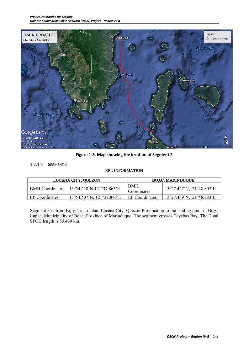
1.2.1.3 SEGMENT 3
RPL INFORMATION
LUCENA CITY, QUEZON BOAC, MARINDUQUE
BMH Coordinates 13°54.518’N,121°37.863’E BMH Coordinates
13°27.427’N,121°48.807’E
LP Coordinates 13°54.507’N, 121°37.876’E LP Coordinates 13°27.439’N,121°48.783’E
Segment 3 is from Brgy. Talao-talao, Lucena City, Quezon Province up to the landing point in Brgy. Lupac, Municipality of Boac, Province of Marinduque. The segment crosses Tayabas Bay. The Total SFOC length is 55.439 km.

Project Description for Scoping Domestic Submarine Cable Network (DSCN) Project – Region IV-B
DSCN Project – Region IV-B | 1-4
Figure 1-4. Map showing the location of Segment 3
1.2.1.4 SEGMENT 4
RPL INFORMATION
BOAC, MARINDUQUE CALATRAVA, ROMBLON
BMH Coordinates 13°27.427’N,121°48.807’E BMH-A Coordinates 12°37.230’N, 122°3.551’E BMH-B Coordinates 12°37.212’N, 122°3.542’E
LP Coordinates 13°27.439’N,121°48.783’E LP Coordinates 12°37.236’N, 122°3.555’E
Segment 4 has total SFOC length of 114.985 km that also crosses Tablas Strait. From the landfall in Brgy. Lupac, Municipality of Boac, Province of Marinduque, the route goes southwest until it reaches the Landing Point in Brgy. San Roque, Municipality of Calatrava, Province of Romblon. The landing site is a public domain and has direct access to the national highway.

Project Description for Scoping Domestic Submarine Cable Network (DSCN) Project – Region IV-B
DSCN Project – Region IV-B | 1-5
Figure 1-5. Map showing the location of Segment 4
1.2.1.5 SEGMENT 5
RPL INFORMATION
CALATRAVA, ROMBLON ROXAS CITY, CAPIZ BMH-A Coordinates 12°37.230’N, 122°3.551’E
BMH Coordinates 11°36.35187’N,122°45.34725’E BMH-B Coordinates 12°37.212’N, 122°3.542’E
LP Coordinates 12°37.236’N, 122°3.555’E LP Coordinates 11°36.37673’N,122°45.34675’E Segment 5 has a Total SFOC length of 169.788 km and crosses the Sibuyan Sea. From the landfall in Brgy. San Roque, Municipality of Calatrava, Province of Romblon, the route goes southwest until it reaches the Landing Point in Brgy. Dumolog, Roxas City, Province of Capiz. The landing point and BMH location is recommended by the MPDC of Calatrava since it within public domain and has no history of overflowing. Similarly, the landing site and BMH location in Roxas City, Capiz is also on public beach and public side of the road.

Project Description for Scoping Domestic Submarine Cable Network (DSCN) Project – Region IV-B
DSCN Project – Region IV-B | 1-6
Figure 1-6. Map showing the location of Segment 5
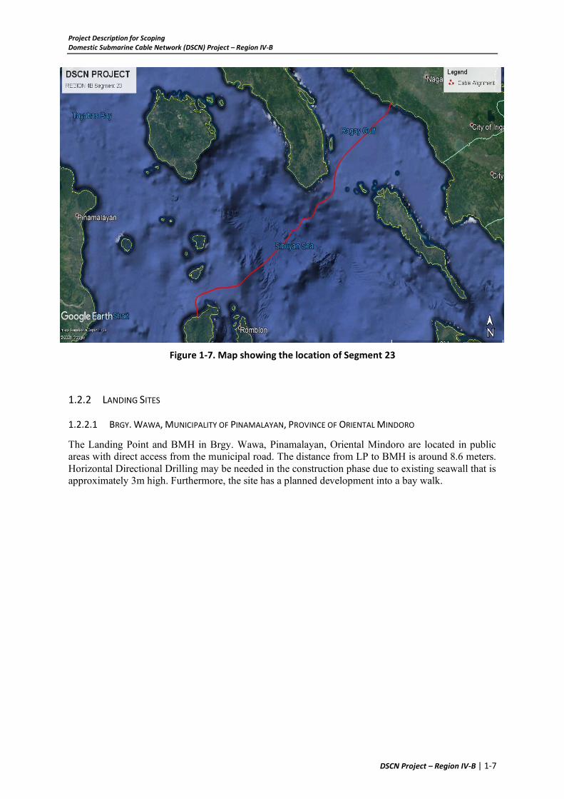
1.2.1.6 SEGMENT 23
RPL INFORMATION
CALATRAVA, ROMBLON PASACAO, CAMARINES SUR BMH Coordinates 12°37.230'N, 122°3.551'E BMH Coordinates 13°30.912'N, 123°01.102'E
LP Coordinates 12°37.236’N, 122°3.555’E LP Coordinates 13°30.864'N, 123°01.076'E
Segment 23 has a Total SFOC length of 157.486km and crosses Sibuyan Sea and Ragay Gulf. The route starts from Brgy. San Roque, Municipality of Calatrava, Province of Romblon going northeast until it reaches the landing point in Barangay Caranan, Municipality of Pasacao, Province of Camarines Sur.
The distance between BMH and LP is approximately 100m and are both in public domain. The BMH is situated on a vegetated area near the edge of the concrete main access road while the LP is situated on the beach with loose, coarse, gravelly sand, with a gravel fraction consisting of lithic and shell fragments ~20mm in diameter.
Project Description for Scoping Domestic Submarine Cable Network (DSCN) Project – Region IV-B
DSCN Project – Region IV-B | 1-7
Figure 1-7. Map showing the location of Segment 23
1.2.2 LANDING SITES
1.2.2.1 BRGY. WAWA, MUNICIPALITY OF PINAMALAYAN, PROVINCE OF ORIENTAL MINDORO
The Landing Point and BMH in Brgy. Wawa, Pinamalayan, Oriental Mindoro are located in public areas with direct access from the municipal road. The distance from LP to BMH is around 8.6 meters. Horizontal Directional Drilling may be needed in the construction phase due to existing seawall that is approximately 3m high. Furthermore, the site has a planned development into a bay walk.

Project Description for Scoping Domestic Submarine Cable Network (DSCN) Project – Region IV-B
DSCN Project – Region IV-B | 1-8
Figure 1-8. Sketch Map of Landing Point and BMH in Brgy. Wawa, Pinamalayan, Oriental Mindoro
Figure 1-9. BMH and LP Location Overview
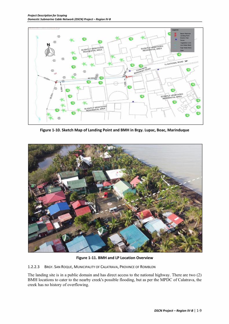
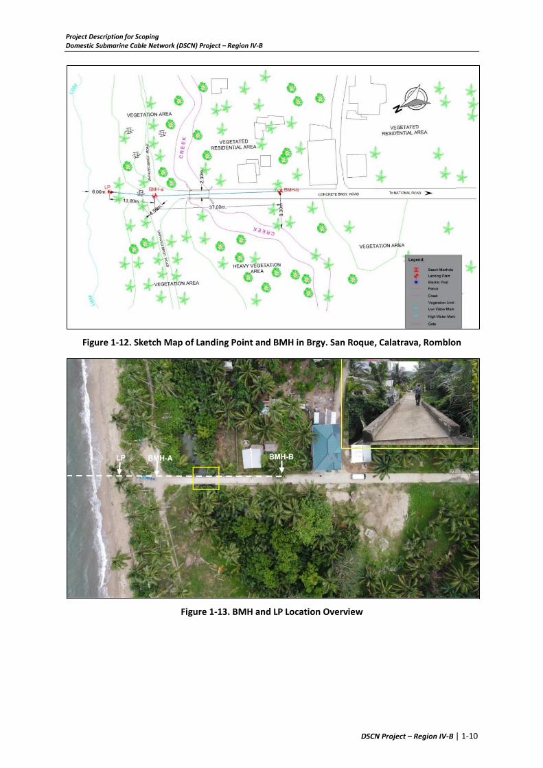
1.2.2.2 BRGY. LUPAC, MUNICIPALITY OF BOAC, PROVINCE OF MARINDUQUE
The BMH is located on a concrete barangay road which is 48.64m away from the Landing Point situated on a public beach area. A proposed sea wall project by Brgy. Boac is still waiting for approval.
Project Description for Scoping Domestic Submarine Cable Network (DSCN) Project – Region IV-B
DSCN Project – Region IV-B | 1-9
Figure 1-10. Sketch Map of Landing Point and BMH in Brgy. Lupac, Boac, Marinduque
Figure 1-11. BMH and LP Location Overview
1.2.2.3 BRGY. SAN ROQUE, MUNICIPALITY OF CALATRAVA, PROVINCE OF ROMBLON
The landing site is in a public domain and has direct access to the national highway. There are two (2) BMH locations to cater to the nearby creek's possible flooding, but as per the MPDC of Calatrava, the creek has no history of overflowing.
Project Description for Scoping Domestic Submarine Cable Network (DSCN) Project – Region IV-B
DSCN Project – Region IV-B | 1-10
Figure 1-12. Sketch Map of Landing Point and BMH in Brgy. San Roque, Calatrava, Romblon
Figure 1-13. BMH and LP Location Overview

Project Description for Scoping Domestic Submarine Cable Network (DSCN) Project – Region IV-B
DSCN Project – Region IV-B | 1-11
1.3 PROJECT COMPONENTS
1.3.1 SUBMARINE FIBER OPTIC CABLE (SFOC)
1.3.1.1 CABLE TYPES
The project will utilize three types of cable:
• Double armour (DA) cable for areas where water depths are shallower than 200m.
• Single armour (SA) cable has been used for intermediate water depths, 200m to around
1,000m.
• Lightweight (LW) cable where the seabed is deeper than around 1,000m.
Figure 1-14. Submarine Fiber Optic Cable Details
1.3.1.2 CABLE BURIAL
In order to mitigate the threats of anchoring and fishing to the cable system, cable burial is planned 200m water depths, where these activities are thought to occur, now or during the anticipated system design life. Burial also mitigates the effects of strong seawater currents, though complete protection is not always possible due to the effects of the currents on the seabed.
At cable crossings, the amount of cable to be surface laid with post-lay burial (PLB) either side of the existing cable, as recommended by ICPC, is 500m. Post-lay burial will be undertaken at a later stage to the target burial depth or up to the burial depth of the crossed cable if required. PLB is generally undertaken using Remote Operated Vehicle (ROV).
1.3.2 BEACH MANHOLE (BMH)
The Submarine Fiber Optic Cable shall be connected to the Manhole 0 (MH0). The MH0 provides a chamber of 1902 mm x 3402 mm situated above the high-tide level where the marine and land cables are connected.

Project Description for Scoping Domestic Submarine Cable Network (DSCN) Project – Region IV-B
DSCN Project – Region IV-B | 1-12
Figure 1-15. Dimension of Manhole 0
1.3.2.1 MH0 TAPPING ADAPTOR
The SFOC shall be connected to the existing Manhole 0 (MH0) using a Manhole Adaptor presented in the figure below. This shall provide proper anchorage and easier installation of the cables.
Figure 1-16. MH0 Tapping Adaptor
1.3.3 HEAVY EQUIPMENT
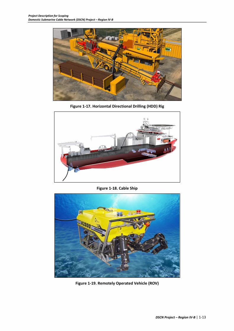
Heavy equipment to be used during construction are HDD Rig, Cable Ship, Backhoe, and ROV.
Project Description for Scoping Domestic Submarine Cable Network (DSCN) Project – Region IV-B
DSCN Project – Region IV-B | 1-13
Figure 1-17. Horizontal Directional Drilling (HDD) Rig
Figure 1-18. Cable Ship
Figure 1-19. Remotely Operated Vehicle (ROV)

Project Description for Scoping Domestic Submarine Cable Network (DSCN) Project – Region IV-B
DSCN Project – Region IV-B | 1-14
Figure 1-20. Backhoe
1.4 PROJECT SIZE
The total cable length for each segment is presented in the following table:
Table 1-1. Project Size
Segment Location Total SFOC Length SFOC Length w/in Regional Boundaries1
Segment 1 Brgy. Ilijan, Batangas City, Batangas to Brgy. Wawa, Pinamalayan, Oriental Mindoro
107.027 km Region 4B –72.214km Region 4A – 34.813km
Segment 2
Brgy. Wawa, Pinamalayan, Oriental Mindoro to Brgy. Yapak, Boracay Island, Malay, Aklan
146.160 km Region 4B – 144.110km Region 6 –2.05km
Segment 3
Brgy. Talao-talao, Lucena City, Quezon to Brgy. Lupac, Boac, Marinduque
56.414 km Region 4B –25.387km Region 4A – 31.027km
Segment 4 Brgy. Lupac, Boac, Marinduque to Brgy. San Roque, Calatrava, Romblon
117.131 km Region 4B - 117.131 km
Segment 5 Brgy. San Roque, Calatrava, Romblon to Brgy. Dumolog, Roxas City, Capiz
172.619 km Region 4B – 140.405km Region 6 –32.214km
Segment 23 Brgy. San Roque, Calatrava, Romblon to Brgy. Caranan, Pasacao, Camarines Sur
157.486 km Region 4B – 98.237km Region 4A – 31.572km Region 5 – 27.677
1 The length was determined using ArcGIS and a georeferenced NAMRIA Philippine Administrative Map as presented in Figure 1-21

Project Description for Scoping Domestic Submarine Cable Network (DSCN) Project – Region IV-B
DSCN Project – Region IV-B | 1-15
Figure 1-21. Regional Boundary Map
1.5 DEVELOPMENT PLAN, DESCRIPTION OF PROJECT PHASES AND CORRESPONDING
TIMEFRAMES
1.5.1 CABLE LAYING METHODOLOGY (CONSTRUCTION PHASE)
1.5.1.1 SHORE END (FROM MANHOLE TO 15M WATER DEPTH)
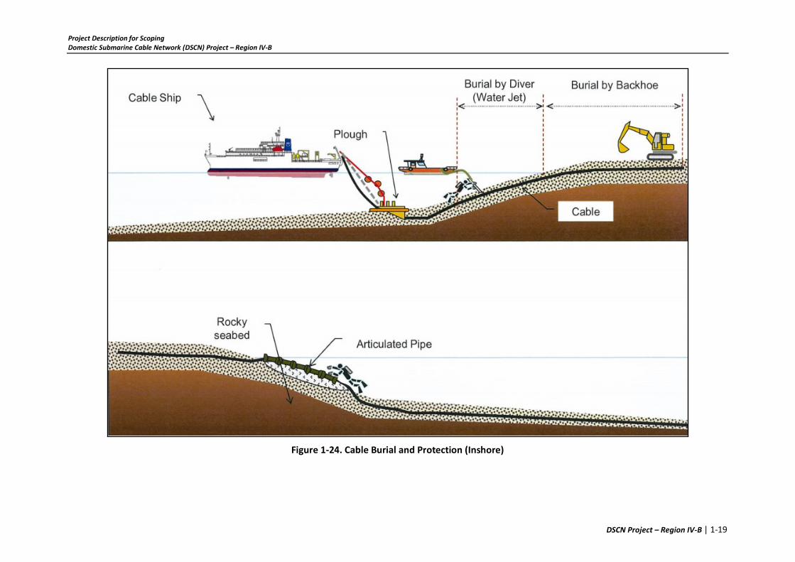
In general, the submarine cable will be pulled into the manhole by cable floatation method. The shore end cable will be fixed inside manhole and buried on the beach. On beach side, the trench from manhole to low water mark will be excavated prior the shore end landing operations. On arrival at the shore end landing site, the cable lay vessel shall approach to a pre-determined set-up point & held positioned to the 15m water depth off Baclayon landing site from shore. The cable end at the cable lay vessel will be sealed and connected to the pulling line. Diving team with their support boat and necessary diving gears shall be ready to assist the shore end landing operations. Once the vessel is in the correct position the cable pulling line shall be passed ashore by the support boat. The cable lay vessel will pay out the cable while attach the floats on the cable with certain interval, the pulling team will pull slowly from the shore through Backhoe / JCB, etc. under the instruction of the Beach Master at a controlled speed and tension.
As soon as sufficient cable is hauled ashore and secured on the beach, the divers shall remove the floats progressively from the shore to the cable lay vessel thus controlling the sinking of the cable to the seabed. Then the cable will be placed into the trench and pulled up to the Manhole. The cable armoring will be open and fixed inside manhole by an anchor plate. Before the trench is backfilled, articulated pipes will be installed on the submarine cable for protection it from external aggression. Then the trench will be backfilled and the beach will be restored to its original condition.

Project Description for Scoping Domestic Submarine Cable Network (DSCN) Project – Region IV-B
DSCN Project – Region IV-B | 1-16
From low water mark to 15m water depth, the submarine cable will be buried by diver using jetting tool. Diver will be deployed into the water with jetting burial machine with support from pump pontoon from the surface. The jetting machine will be oriented over the cable, the pump will be turned on and jetting start with great care on not to damage the cable during the operation.
Figure 1-22. Cable Floatation Method for Shore End Cable Laying
1.5.1.2 SHALLOW WATER INSTALLATION METHOD (FROM 15M TO 200M WATER DEPTH)
In general, the submarine cable will be buried by cable plough from 15m to 200m water depth, however if there is a rocky seabed or rough seabed which condition beyond the plough working limit detected during the survey, these areas will be designed as “surface lay”, for surface lay operation, please refer to above method statement water more than 200 meters deep. By burying the cable into the seabed, submarine cable will be fixed and protected from fishing and other external aggression activities.
Burial by Plough
The submarine cable is to be plough buried across the areas as defined in the Route Position list. The Plough burial is to be carried out from water depth range of 15 meters up to 200 meters. The maximum penetration into the seafloor is 1.5m. The depth of ploughing is controlled lowering (shallower burial) the skids relative to the plough chassis. The plough will be over boarded using an A‐Frame. The plough will be equipped with ultra‐short baseline (USBL) acoustic beacons, which allows the plough position to be calculated relative to the vessel position. Alternatively, the plough position can also be determined using “layback” calculations, based on tow tensions, water depth, and amount of tow wire paid out. Following the cable has been fixed inside manhole, the submarine cable will be loaded into the plough, then the plough will be launched from 15m water depth to the seabed. The plough will be towed by the cable lay vessel along the planned route with proper control of the tension on the cable as well as the tension on the tow wire. Plough recovery will be happened at the pre-determined location where the areas designed for surface lay operation or more than 200m water depth.
1.5.1.3 DEEP WATER INSTALLATION METHOD (BELOW 200M WATER DEPTH)
In the cable route where water depth is more than 200m, the submarine cable route is designed for “surface lay”. Cable will be paid out from the vessel stern chute, there will be no anchor, sinker or bolt as the cable will sink by itself. Submarine cable will not be “moved” since the bottom current is relatively low in deep water unless the drastic seabed movement for example earthquake. Meanwhile, the cable will be laid with certain residual tension which will prevent itself from moving partly.

Project Description for Scoping Domestic Submarine Cable Network (DSCN) Project – Region IV-B
DSCN Project – Region IV-B | 1-17
The key factor for the surface lay operation is the “slack control”, The term “slack” defines a ratio of excess cable length to distance. If slack is “too much”, the cable will form loop on the seabed, if it is “too small”, cable suspensions occur more often on the seabed. So, the accurate control of the slack will make the submarine cable infill the seabed profile well as the desired condition.
The slack is designed based on the marine survey result, by taking into consideration the cable type, seabed profile, seabed sediment and installation method into consideration. Prior the cable laying, a lay plan will be created according to the designed slack, so the Lay Plan indicates values for the lay variables of slack and ship speed against position on route. The Lay Plan is the control document for the cable lay, and is based on the latest Route Position List. This Lay Plan allows the cable to be laid as close as possible to the RPL route. The cable lay will be undertaken by a dedicated cable lay vessel, which has a powerful Dynamic Positioning (DP) capability integrated with a modern navigation system. These facilities allow both precise positioning on the planned route and accurate administration of the slack as recommended from the cable management system. The vessel's stern working feature allows all installation activities to be carried out on the aft deck. This includes cable laying and plough operations.
The vessel will normally be in dynamic position (DP) mode throughout the lay. An integrated DP system interfaces accurate positional information with vessel's propulsion & thruster systems. The system can automatically follow a preset course at a required speed (Track Follow Mode) or, alternatively, an operator can manually follow a visual course reference displayed on a monitor. Cable payout will be by a Linear Cable Engine (LCE). Based on the Lay Plan, the LCE will normally be operated on speed control so that the required slack is provided by varying the LCE payout speed to maintain the requisite correlation to the ship's speed. For positive slack, the LCE speed will exceed ship's speed, for negative slack it will be less than ship's speed. As-laid RPL will be updated for achieved slack after completion of lay.
Figure 1-22 to Figure 1-25 illustrates the abovementioned activities.

Project Description for Scoping Domestic Submarine Cable Network (DSCN) Project – Region IV-B
DSCN Project – Region IV-B | 1-18
Figure 1-23. Shore End Cable Work
Project Description for Scoping Domestic Submarine Cable Network (DSCN) Project – Region IV-B
DSCN Project – Region IV-B | 1-19
Figure 1-24. Cable Burial and Protection (Inshore)

Project Description for Scoping Domestic Submarine Cable Network (DSCN) Project – Region IV-B
DSCN Project – Region IV-B | 1-20
Figure 1-25. Cable Lay (Waters below 200m depth)
1.5.2 OPERATION
Once in place and connected, the cable system requires no intervention. Cable repair and maintenance may be required as a result of damage.
1.5.3 DECOMMISSIONING/ABANDONMENT/REHABILITATION
A full decommissioning plan will be developed near the end of the Project’s expected 25-year lifetime. The plan will be based on best practices at the time and with consideration of environmental and safety issues.

Project Description for Scoping Domestic Submarine Cable Network (DSCN) Project – Region IV-B
DSCN Project – Region IV-B | 1-21
1.6 MANPOWER
The manpower requirement for the construction and cable laying is estimated to be about 10 employees for the contractor, about 30 employees for the needed local labor and 40 cable ship crew. The personnel will be mostly composed of skilled laborers and operators of heavy equipment.
1.7 PROJECT COST
The estimated project cost per site is 5.1932 million pesos broken down as follows:
Table 1-2. Project Cost per Site
Item Description Cost
1 Survey and Engineering 750,000.00
2 Permit Application 500,000.00
3 Supply Materials 2,705,000.00
4 Shore End and Beach Works 1,238,200.00
Total Project Cost (PhP) 5,193,200.00

Attachments Domestic Submarine Cable Network (DSCN) Project – Region IV-B
ATTACHMENTS

Attachments Domestic Submarine Cable Network (DSCN) Project – Region IV-B
ATTACHMENT 1: NTC CERTIFICATION


Attachments Domestic Submarine Cable Network (DSCN) Project – Region IV-B
ATTACHMENT 2: AUTHORIZED PROJECT REPRESENTATIVES


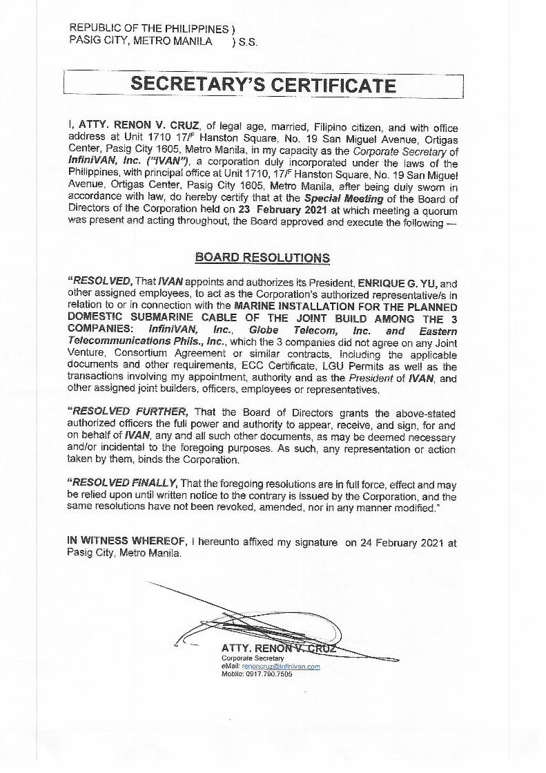


REPUBLIC OF THE PHILIPPINES)
MAKATI CITY ) S.S,
SECRETARY'S CERTIFICATE
I, BARBARA ANNE C. MIGALLOS, of legal age, Filipino, and with office address at7th Floor, Phinma Plaza, 39 Plaza Drive, Rockwell Center, Makati City, after having been swornto in accordance with law, hereby depose and say that:
1. I am the duly elected and incumbent Corporate Secretary of EASTERNTELECOMMUNICATIONS PHILIPPINES, lNC. (the "Corporation"), a corporation dulyorganized and existing in accordance with the laws of the Republic of the Philippines, and withprincipal office address at Telecom Plaza, 316 Sen. Gil J. Puyat Avenue, Salcedo Village,Makati City.
2. I hereby certify that at the special meeting of the Board of Directors of theCorporation held on 16 December 2019, at which meeting a quorum was present and votingthroughout, the following resolutions were unanimously approved and adopted:
"RESOLVED, as it is hereby resolved, that the Corporation's Co-
Coordinators, Ms. Aileen D. Regio and Ms. Hermelina T. Hizon be authorized,as each of them are hereby authorized, to represent the Corporation in securingall the necessary permits, licenses, registrations and the like from, in complyingwith the requirements and regulations of, and in other transactions which areoperational in nature, including the following:
a. Local governmentunits;b. Governmentagencies and offices, such as butnotlimitedtothesocial
Security System, Home Development Fund, Bureau of InternalRevenue, and Bureau of Customs;
c. Utility providers, and;d. Suppliers.
RESOLVED, FURTHER, that the Corporation's Co-Coordinators be furtherauthorized, as each of them is hereby further authorized, to sign, execute, anddeliver such applications and other documents, and to perform such acts necessaryor required, for the said purpose, with power to further delegate the foregoingpowers to any substitute as they may in their discretion name in writing."
3. Based on the records of the corporation, I hereby certify that the corporation'sCo-Coordinators have delegated to, and have authorized each of, the corresponding officersnamed below, as their substitutes, to represent the Corporation in securing the necessarypermits, licenses, registrations, and other documents/approvals for the construction andoperation of the Corporation's Domestic Submarine Cable Network Project from the relevantlocal government units, government agencies and private entities:
Name Position
Albert L. Tuason Head - Network Planning, Engineering &lmplementation
Wilfredo C. Manansala Head -lp and Inter-Carrier Network Services
r(

lN WITNESS WHEREOF,I have hereunto set my hand this llth day of June 2021 atMakati City.
IGALLOS
SUBSCRIBED AND SWORN to before me this llth day of June 2021, afflant exhibitingto me her Community Tax Certificate No. 26662699 issued on 4 January 2021 at Makati City,and her Passport No. P7148981A issued on 11 May 2018 at DFA NCR South, expiring on 10May 2028 bearing her photograph and signature, in accordance with Rule 11, Section 12 andRule IV Section 2 (b) of the 2004 Rules on Notarial Practice.
Doc.No.:fl; `
:::;#:..::i;; --Series of 2021.
R241 -etpiseccert (DSCN).16Dec2019SpclBrdMtgtocm406-jo
APPOINTMENT NO. M.219 (2021-2022)CDMMISSION EXPIRES ON DECEMBER 31. 2022
7th Flcor. The PHINMA Plaza, 39 Plaza Drlv®
pTE#oT8e!'392:'9:rhi¥£:I:ticfityl'/£/t£21lBP O.R. No.137579; Makati City; 1/4/2021
Attom®y's Ftoll No. 75398Admmed to the Philippino Bar, 24 July 2020

Attachments Domestic Submarine Cable Network (DSCN) Project – Region IV-B
ATTACHMENT 3: SEC REGISTRATIONS