Current Affairs Yearly Compilation - GS SCORE
78
Current Affairs Yearly Compilation Science & Technology Jan 2021 - Feb 2022 www.iasscore.in 65+ Topics Covered Covering all Science and Tech. Areas Recent Events and Developments Fused Static and applied dimensions Crisp Pointers for Prelims 65+ Cove Rece Crisp Fuse
-
Upload
khangminh22 -
Category
Documents
-
view
0 -
download
0
Transcript of Current Affairs Yearly Compilation - GS SCORE

Current AffairsYearly Compilation
Science &Technology
Jan 2021 - Feb 2022
www.iasscore.in
65+ Topics Covered
Covering all Science and Tech. Areas
Recent Events and Developments
Fused Static and applied dimensions
Crisp Pointers for Prelims
65+
Cove
Rece
Crisp
Fuse
As IAS prelims 2022 is knocking at the door, jitters and anxiety is a common emotion that an aspirant feels. But if we analyze the whole journey, these last few days act most crucial in your preparation. This is the time when one should muster all their strength and give the fi nal punch required to clear this exam. But the main task here is to consolidate the various resources that an aspirant is referring to.
GS SCORE brings to you, Prelims Sampoorna, a series of all value-added resources in your prelims preparation, which will be your one-stop solution and will help in reducing your anxiety and boost your confi dence. As the name suggests, Prelims Sampoorna is a holistic program, which has 360-degree coverage of high-relevance topics.
It is an outcome-driven initiative that not only gives you downloads of all resources which you need to summarize your preparation but also provides you with All India open prelims mock tests series in order to assess your learning. Let us summarize this initiative, which will include:
GS Score UPSC Prelims 2021 Yearly Current Affairs Compilation of All 9 Subjects
Topic-wise Prelims Fact Files (Approx. 40)
Geography Through Maps (6 Themes)
Map Based Questions
ALL India Open Prelims Mock Tests Series including 10 Tests
Compilation of Previous Year Questions with Detailed Explanation
We will be uploading all the resources on a regular basis till your prelims exam. To get the maximum benefi t of the initiative keep visiting the website.
To receive all updates through notifi cation, subscribe:
PRELIMS SAMPOORNA
https://t.me/iasscore
https://www.youtube.com/c/IASSCOREoffi cial/
https://www.facebook.com/gsscoreoffi cial
https://www.instagram.com/gs.scoreoffi cial/
https://twitter.com/gsscoreoffi cial
https://www.linkedin.com/company/gsscoreoffi cial/

Contents
INFORMATION 1. ........... 01-09TECHNOLOGY & COMMUNICATION
5G and fl ight Safety ....................................01
China launches Ziyuan-1 02E satellite .....02
Edge Computing ........................................03
C-DOT to start 6G technology ...................04
Launch of Artifi cial .....................................05Intelligence-powered grievance management application
India ranked under Top 10 in ...................06Global Cybersecurity Index 2020 Rankings
SPACE2. ......................... 10-43TECHNOLOGY & EVENTS
ISRO successfully puts three .....................10satellites into orbit on board the PSLV C-52
Unifi ed Geologic Map of the Moon ..........11
‘Vertical launch- Short Range ...................12Surface to Air Missile’ tested by DRDO
Gravitational Lensing .................................12
Gaganyaan Mission ....................................13
Samudrayaan Mission ...............................14
NASA successfully launches ......................15Landsat 9
ISRO demonstrates hack-proof ................16quantum communication
Chandrayaan-2 confi rms water ................16on Moon surface
James Webb Space Telescope ...................18
Parker Solar Probe (PSP) ...........................20
Imaging X-ray Polarimetry ........................21Explorer (IXPE): NASA’s new mission
Nauka, the Russian module ......................22for the International Space Station
China’s ‘artifi cial sun’ ................................22experimental fusion reactor set a new record
New ocean observation satellite ..............23of China
SpaceX’s Starship landing bodes .............24well for NASA’s Moon mission
NASA’s InSight lander ...............................25
Green Propulsion for India’s ....................26Human Space Mission ‘Gaganyaan’
PSLV-C51, the fi rst dedicated ....................27launch by NSIL
ISRO announces ‘Bhuvan’, an ..................29alternative to Google Maps
Stardust 1.0 .................................................29
NASA approved EUVST and .......................30EZIE missions
India successfully tests short-range ........31 ballistic missile ‘Pralay’
India successfully tests ..............................32nuclear-capable ballistic missile ‘Agni Prime’
Successful test of ‘Agni 5’ and ..................33its strategic importance
ABHYAS: High-speed Expendable ............34Aerial Target
Akash Prime Surface to Air missile ..........35
G-Surface-to-air missile, ............................35successfully fl ight-tested by DRDO
ICGS ‘Vigraha’ commissioned ..................36into Indian Coast Guard
DRDO develops Critical Near ....................37Isothermal Forging Technology for aero-engines
www.iasscore.in

www.iasscore.in 5
| SCIENCE & TECHNOLOGY
ISRO Joins Hands With ARIES ....................38To Maximise Utilisation Of Data From India’s Mission Aditya-L1
Algorithm for Aditya L1 mission ...............38
Government launches ...............................39NanoSniffer Explosive trace detector
India successfully test-fi res .......................40Helina, Dhruvastra anti-tank guided missiles
‘US warns India over S-400’ ......................41
‘DRDO achieves milestone in ....................42key quantum technology’
BIOTECHNOLOGY3. ....... 44-45
Salt-secreting Mangrove Species .............44genome Decoded by DBT-ILS
New high-yielding and ..............................45pest-resistant variety of soybean: MACS 1407
ALTERNATE4. ................. 46-66TECHNOLOGY
Laser Interferometer .................................46Gravitational-Wave Observatory (LIGO)
Blue Straggler .............................................48
Curb on Killer robots ..................................48
Ceramic membrane ...................................49
India’s First Indigenous Fuel ....................50Cell System
Hypersonic Technology .............................51
NTPC to set up India’s single ....................52largest solar park at Rann of Kutch
Drone-based drug delivery .......................52model: i-Drone
India’s fi rst Green Hydrogen ....................53Mobility Project
Aerial Seeding Campaign ..........................54
Centre releases India’s airspace ..............54map for drone operations
Privatization of Gamma-irradiation .........55 technology
Development of the Electrically ................56confi gured Nano-Channels
Detailed Project reports of ........................58LIDAR survey of forest areas released
Neutrino Oscillations induced ..................59by Space-time
New waste water treatment .....................60technology
CHIME telescope ........................................61
‘Whitest ever’ paint which can .................62refl ect 99% of sunlight
‘Square Kilometre Array, the ....................63world’s largest radio telescope’
‘L&T Construction 3D prints .....................63India’s fi rst building with reinforcement’
Manufactured sand (M-sand) ...................64
DEFENCE5. .................... 67-71TECHNOLOGY


www.iasscore.in 1
1INFORMATION TECHNOLOGY & COMMUNICATION
1
1 5G and fl ight Safety
Context: Several international airlines were cancelling fl ights into certain US airports over concerns the rollout of 5G mobile communication technology could interfere with some planes’ equipment.
C-band spectrum range is very close to the 4.2-4.4 GHz range in which radio or radar altimeters operate.
What is 5G Tecnology?
Currently being deployed in several countries around the world, 5G is the fi fth generation of mobile phone technology.
It could offer network speeds up to 100 times faster than what we’ve experienced with 4G.
What is the matter?
To ensure high speeds with the widest possible coverage, AT&T and Verizon had planned to generate 5G internet using something called C-band frequencies.
C-band frequency is a type of radio frequencies (or radio waves) between 3.7 and 3.98 gigahertz (GHz).
These frequencies are adjacent to those used by modern aircraft to measure altitude.
An important piece of an aircraft’s equipment, called a radio altimeter, operates on C-band frequencies between 4.2-4.4GHz.
Pilots rely on radio altimeters to land the plane safely, particularly when visibility is poor, for example, when the airport is surrounded by high mountains or when conditions are foggy.
The concern is that, due to the narrow gap between the frequencies of the 5G and the radio altimeters, the radio waves from 5G towers near airports could cause interference.
That is, people using 5G on their phones could inadvertently distort or damage the radio altimeter’s signal.
If this happens, even for a few seconds, it could mean the pilot doesn’t receive the correct information during landing.
It is for this reason that the US Federal Aviation Administration raised concerns.

www.iasscore.in2
PRELIMS SAMPOORNA | CURRENT AFFAIRS YEARLY COMPILATION 2021-22 |
Radar altimeters
The radio or radar altimeter is a very small, low-power radar system that operates in the 4.2-4.4 GHz frequency microwave C-band.
The high frequency of these altimeters enable aircraft makers to install small antennae that produce powerful signals that can be relayed quickly and accurately.
For all airborne vehicles — an aircraft, spacecraft, or even a missile — an altimeter is crucial to gauge the altitude and the distance covered.
Altimeters are of three main kinds:
barometric
laser
radio or radar altimeters
Most commercial passenger and cargo aircraft use a combination of all these altimeters along with a global positioning system (GPS) to determine their path, as well as factors such as:
height above sea level
presence of highrises, mountains, and other obstacles
the likely fl ying time
How other countries deal with the problems?
Other countries rolling out 5G are using C-band frequencies that overlap with or are close to those of radio altimeters, without any reported problems. For example,
In the UK, 5G goes up to 4GHz. Having no or few mountains around airports reduces the risk.
In the European Union, for example, 5G goes up to 3.8GHz. This could be a good option for US airports.
The best option, in the long run, would be to use a much higher band for 5G, such as 24GHz to 47GHz.
At these frequencies, data speeds are signifi cantly higher, although the coverage area of each cell will be much less.
2 China launches Ziyuan-1 02E satellite
Context: Recently, China has launched a new satellite with a camera capable of taking photos of the ground with a resolution of fi ve meters called “Ziyuan-1 02E” or “Five Meter 02 Optical Satellite”.
This is the 39th launch of the Longue Marche-4C rocket and the 403rd launch of the entire Long March series.
About the satellite
The Ziyuan-1 02E carries the same two imaging payloads:
a high-resolution visible and near-infrared camera
a hyperspectral imager, as well as a new long-wave infrared camera
The high-resolution camera will be able to produce images with resolutions of up to fi ve meters (5m) when operating in panchromatic mode.

www.iasscore.in 3
| SCIENCE & TECHNOLOGY
The satellite is also part of a China-Africa cooperation project called “Xiwang” (Hope) to popularize science among teenagers.
The satellite will work with the fi ve-meter optical satellite 01 and will reduce the revisiting time of Chinese territory from three days to two days.
Ziyuan (ZN) Series
Ziyuan (meaning Resource), is a series of remote-sensing satellites which China uses to acquire high-resolution images that can be used for surveying Earth resources, disaster management, and ecological and land use monitoring.
The fi rst Ziyuan satellite, Ziyuan-1 01, was launched in 1999 in a partnership between China and the Brazil.
Six of the nine Ziyuan satellites launched to date have been part of the China-Brazil Earth Resources Satellite (CBERS) program, with the other three – including Ziyuan-1 02E – being solely Chinese-operated.
Significance of the satellite
Be er understanding of geological environment: Images taken by the satellite duo will help engineers study China’s geological environment and search for minerals.
Helpful for other fi elds: People working in other fi elds such as transport, agriculture and disaster mitigation will also receive help through the images.
3 Edge Computing
Context: Siemens MindSphere and IBM forms partnership to target edge computing
What is Edge Computing?
Edge computing is computing that’s done at or near the source of the data, instead of relying on the cloud, one of a dozen data centers to do all the work.
It is a part of a distributed computing topology in which information processing is located close to the edge – where things and people produce or consume that information.
Applications
Autonomous and connected cars
Smart cities
Home automation
Multiplayer gaming

www.iasscore.in4
PRELIMS SAMPOORNA | CURRENT AFFAIRS YEARLY COMPILATION 2021-22 |
Benefits of Edge Computing
Privacy and security: Data may travel between different distributed nodes connected through the Internet, and thus requires special encryption mechanisms independent of the cloud. By keeping data at the edge it is possible to shift ownership of collected data from service providers to end-users.
Speed: Edge computing brings analytical computational resources close to the end users and therefore helps to speed up the communication speed. A well designed edge platform would signifi cantly outperform a traditional cloud-based system.
Effi ciency: Due to the proximity of the analytical resources to the end users, sophisticated analytical tools and Artifi cial Intelligence tools can run on the edge of the system. This placement at the edge helps to increase operational effi ciency.
4 C-DOT to start 6G technology
Context: Recently, the government asked the Center for the Development of Telematics (C-DOT) to start developing 6G and other future technologies to capture the global market in time.
What is 6G technology?
6G (sixth generation wireless) is a successor of 5G mobile technology.
It will be able to use higher frequencies than 5G networks and provide much higher power and much lower latency (delay).
One of the goals of the 6G internet will be to support single microsecond-latency connec ons (one microsecond delay in communication).
This speed of 1,000 times - or 1 / 1000th the latency - is more than one millisecond.

www.iasscore.in 5
| SCIENCE & TECHNOLOGY
It seeks to utilise the terahertz band of the frequency that is not currently in use.
Terahertz waves fall between infrared waves and microwaves into an electric spectrum.
These waves are tiny and fragile, but there is a large amount of free spectrum at the top which can allow for amazing data levels.
Progress in 6G
Samsung, Huawei, LG and other companies have started working on 6G technology.
Next-generation telecommunications (6G) technology is said to be 50 times faster than 5G and is expected to be introduced commercially between 2028-2030.
Current status of India’s telecom sector
The Department of Communications has embarked on the process of launching 5G commercials in India.
It has sought TRAI’s views on the base price of spectrum to be allocated for 5G services.
5G technology is expected to deliver downloads ten times faster than 4G and up to three times the effi ciency of spectrum.
5G high data download speeds are set at 20 gigabit per second (Gbps).
The Telecom Regulatory Authority of India (Trai) has recorded high-speed 4G speeds of about 20 megabit per second (Mbps) on the Reliance Jio network in the country.
Centre for Development of Telematics (C-DOT)
It was founded in 1984.
It is an independent Telecom R&D (Research and Development) center of DoT (Department of Telecom), Ministry of Communications.
It is a registered community under the Society Registration Act, 1860.
A registered government-funded institution consisting of the Department of Science and Industry (DSIR), the Department of Science and Technology.
Currently, C-DOT is working to achieve the goal of various Govt programs of India including Digital India, BharatNet, Smart Cities etc.
5 Launch of Artifi cial Intelligence-powered grievance management application
Context: An Artifi cial Intelligence (AI)-powered grievance management application, developed by the Ministry of Defence with the help of IIT-Kanpur is launched.
About the AI based grievance Application
This is the fi rst AI-based system developed to improve grievance redressal in the Government.
The AI tool developed as part of the initiative can understand the content of the complaint based on the contents therein. As a result, it can identify repeat complaints or spam automatically.
Categorization of complaint: Based on the meaning of the complaint, it can categorize complaints of different categories even when keywords normally used for such search are not present in the complaint.

www.iasscore.in6
PRELIMS SAMPOORNA | CURRENT AFFAIRS YEARLY COMPILATION 2021-22 |
Geographical analysis of complaints: It enables geographical analysis of complaints in a category including analysis of whether the complaint was adequately addressed or not by the concerned offi ce.
User-friendly: Easy user-friendly search enables the user to formulate his queries/categories depending on management requirements and seek performance results based on the query.
Significance of the application
The release of this application marks the introduction of AI-based innovations into governance and administration.
This project is the fi rst of its kind initiative of the Government for using AI, data science, and Machine Learning techniques in grievance redressal.
The success of this project in MoD will pave the way for the extension of this application across other Ministries.
CPGRAMS portal
CPGRAMS is an online web-enabled system over NICNET.
Developed by: It is developed by National Informatics Centre (NIC), in association with the Directorate of Public Grievances (DPG) and Department of Administrative Reforms and Public Grievances (DARPG).
The platform is based on web technology which primarily aims to enable submission of grievances by the aggrieved citizens from anywhere and anytime (24x7) basis to Ministries/Departments/Organisations who scrutinize and take action for speedy and favorable redress of these grievances.
Tracking grievances is also facilitated on this portal through the system-generated unique registration number.
6 India ranked under Top 10 in Global Cybersecurity Index 2020 Rankings
Context: India showed a signifi cant improvement in the GCI ranking by reaching 37 places upward. It is ranked 10th in the 4th edition of the Global Cybersecurity Index 2020 (GCI).
About the Global Cybersecurity Index 2020The index is released by the United Nations (UN) agency for information and communication technologies (ITU).
It was the 4th edition of the GCI ranking.
It measures the commitment of countries to cybersecurity at a global level.
Pillars : The GCI index is based on the countries commitment to 5 pillars namely: Legal, Technical, Organizational, Capacity development and Cooperation.
Key-findings of the index
Overall ranking : USA, UK, Saudi Arabia, and Estonia are ranked at top 3 positions, respectively, in the Index.
The UK and Saudi Arabia are placed in 2 nd position together.
The top rank in the GCI was secured by the US with a score of 100.

www.iasscore.in 7
| SCIENCE & TECHNOLOGY
In the Asia Pacifi c region, South Korea and Singapore ranked at the top with a score of 98.52, tied for the fourth spot globally.
The list featured China at the 33rd spot and Pakistan at the 79th spot in the GCI 2020 report.
India’s ranking : India ranked 10th in the Global Cybersecurity Index 2020 (GCI).
India also ranked 4th in the Asia-Pacifi c region.
In the last edition of the GCI in 2018, India was placed at the 47th spot.
India achieved a consolidated score of 97.5.
The score is based on 20 indicators under 5 pillars.
United Nations specialized agency for information and communication technologies
ITU is the United Nations specialized agency for information and communication technologies – ICTs.

www.iasscore.in8
PRELIMS SAMPOORNA | CURRENT AFFAIRS YEARLY COMPILATION 2021-22 |
It helps in allocating the global radio spectrum and satellite orbits, develop the technical standards that ensure networks and technologies seamlessly interconnect, and strive to improve access to ICTs to underserved communities worldwide.
ITU is committed to connecting all the world’s people wherever they live and whatever their means.
ITU brings the benefi ts of modern communication technologies to people everywhere in an effi cient, safe, easy, and affordable manner.
It also released the Global Cybersecurity Agenda.
Global Cybersecurity Agenda (GCA)
It was launched in 2007 by ITU.
Global Cybersecurity Agenda (GCA) is a framework for international cooperation aimed at enhancing confi dence and security in the information society.
The GCA is designed for cooperation and effi ciency, encouraging collaboration with and between all relevant partners and building on existing initiatives to avoid duplicating efforts.
Significance
It aims to raise awareness of the importance and different dimensions of the issue.
The GCI will help to promote further action towards secure digital ecosystems needed for recovery and growth.
It will also help address the growing cyber capacity gap between developed and developing countries by fostering knowledge, upskilling, and building competencies.
**********


www.iasscore.in10
2 SPACE TECHNOLOGY & EVENTS
1 ISRO successfully puts three satellites into orbit on board the PSLV C-52
Context: Recently, the Indian Space Research Organisation (ISRO) successfully launched its radar imaging satellite RISAT-1A which is codenamed EOS-4. It is also ISRO’s fi rst launch under the new chairperson S. Somanath.
The two co-passengers-INSPIREsat-1 and INS-2TD-were successfully separated from the PSLV in a predetermined sequence.
About RISAT-1A
The EOS-04 or Risat-1A, the fi fth fl ight in its Radar Imaging Satellite (RISAT) series, is a radar imaging satellite.
The Polar Satellite Launch Vehicle-C52 launched Risat-1A into a sun-synchronous polar orbit of 529km.
The primary instrument onboard is SAR-C. This stands for Synthetic Aperture Radar (in the so-called C band, with a frequency of 5.35 GHz).
It is a high-resolution, all-weather, multi-purpose imager for ocean, land and ice.
Application: The satellite is designed to provide high-quality images under all-weather conditions for applications such as
Agriculture
forestry and plantations
soil moisture and hydrology
fl ood mapping
The radar imaging satellite will also boost India’s border security by facilitating an additional eye in the sky.
Weight: about 1710 kg, the satellite generates 2280 W power and has a
Mission life: 10 years
INS-2TD
This is a technology demonstrator built by ISRO. It is a precursor to a follow-up joint mission between India and Bhutan, for the INS-2B joint satellite. Its payload is a thermal imaging camera, designed to help assess:

www.iasscore.in 11
| SCIENCE & TECHNOLOGY
land surface temperature
water surface temperature of wetlands/lakes
delineation of vegetation (what areas are crops? what are forests etc.?)
thermal inertia (temperature variation between day and night)
INSPIREsat-1
This is a student satellite developed by the Indian Institute of Space Science & Technology (IIST).
It has been built in association with the University of Colorado, USA.
Additional contributions have been provided by Nanyang Technological University, Singapore, and National Central University, Taiwan.
It has two scientifi c payloads on board to improve understanding of
dynamics of the Earth’s ionosphere
the Sun’s coronal heating process
Upcoming Launches
After RISAT-1A, three satellites OCEANSAT-3, INS-2B, ANAND will be launched aboard PSLV-C53 in March and Micro SAT onboard Small Satellite Launch Vehicle (SSLV) in April this year.
The launch of GSAT-24 which is a communication satellite is also scheduled during the fi rst quarter of 2022 aboard Arianespace’s Ariane 5.
2 Unifi ed Geologic Map of the Moon
Context: The fi rst-ever digital, unifi ed, global, geological map of the moon was released virtually by the United States Geological Survey (USGS), NASA and the Lunar Planetary Institute.
About the Map
The fi rst-ever digital, unifi ed, global, geological map of the moon was released virtually by the United States Geological Survey (USGS), NASA and the Lunar Planetary Institute.
The map is a ‘seamless, globally consistent, 1:5,000,000-scale geologic map’.
The mapped surface features of the moon included crater rim crests, buried crater rim crests, fi ssures, grabens, scarps, mare wrinkle ridges, faults, troughs, rilles, and lineaments.
How it was prepared?
The researchers built on the original digital renovation of the six maps comprising of the near, central far, east, west, north and south sides that was released in 2013.
The fi nal map consists of 43 geologic units across the entire lunar surface, broken down into groups based on characteristics like materials of craters, basins, terra, plains and volcanic units.
Data from NASA’s Apollo Missions were used to come up with the map.
Significance
The moon’s South Pole is especially interesting because the area is much larger than the North Pole and there could be a possibility of the presence of water in these permanently shadowed areas.

www.iasscore.in12
PRELIMS SAMPOORNA | CURRENT AFFAIRS YEARLY COMPILATION 2021-22 |
Further, the South Pole region also contains the fossil record of the early Solar System.
These present and future moon missions’ success can be further helped by the digital map of the moon.
The Chandrayaan 2, an active mission also targets the Lunar South Pole for exploration.
3 ‘Vertical launch- Short Range Surface to Air Missile’ tested by DRDO
Context: Recently, the Defence Research and Development Organisation (DRDO) tested the “vertical launch-short range surface-to-air missile”, successfully.
Key-points
India successfully fl ight-tested the air version of supersonic cruise missile (Vertical Launch Short Range Surface-to-Air Missile VL-SRSAM), BrahMos from a fi ghter aircraft off the Odisha coast.
BrahMos was test-fi red from a Sukhoi 30 MK-I aircraft.
BrahMos is a Joint Venture between India (DRDO) and Russia (NPOM) for the development, production and marketing of the supersonic cruise missile.
It is a potent offensive missile weapon system already inducted into the tri-services (Indian Army, Indian Navy and Indian Air Force) of the Indian Armed Forces.
About Vertical Launch – Short Range Surface to Air Missile (VL-SRSAM)
VL-SRSAM is a quick reaction surface-to-air missile that has been developed by DRDO.
It comprises features like mid-course inertial guidance through fi bre-optic gyroscope as well as active radar homing during terminal phase.
Missile has the capability of ‘lock on before launch (LOBL)’ and lock on after launch (LOAL).
As a result, it receives mid-course updates via datalink.
It seeks to replace “Barak 1 surface to air missile system” onboard Indian Navy warships.
The 8.4-metre BrahMos missile, the fastest in the world, has a fl ight range of 450 km (enhanced from 290 km following India’s entry in Missile Technology Control Regime) and carries a conventional warhead up to 300 kg.
This BrahMos missile is With high-precision and devastating power, it can cruise at the supersonic speed of Mach 2.8.
Defence Research & Development Organization(DRDO)
It is the Research & Development wing of the Ministry of Defence, with a vision to empower India with cutting-edge defence technologies.
It was established in 1958 after combining the Technical Development Establishment (TDEs) of the Indian Army and the Directorate of Technical Development & Produc on (DTDP) with the Defence Science Organiza on (DSO).
4 Gravitational Lensing
Context: NASA is planning to use the concept of gravitational lensing to study how star formation is distributed across the galaxies.

www.iasscore.in 13
| SCIENCE & TECHNOLOGY
The programme is called Targeting Extremely Magnifi ed Panchromatic Lensed Arcs and Their Extended Star Formation, or TEMPLATES.
AboutA gravitational lens can occur when a huge amount of matter creates a gravitational fi eld that distorts and magnifi es the light from distant galaxies that are behind it but in the same line of sight. The effect is like looking through a giant magnifying glass.
A gravitational lenses act like natural cosmic telescopes.
Smaller objects, like individual stars, can also act as gravitational lenses when they pass in front of more distant stars.
Benefit
It allows researchers to study the details of early galaxies too far away to be seen with current technology and telescopes.
5 Gaganyaan Mission
Context: The Gaganyaan mission, set to launch with three Indian astronauts as soon as 2023, will splash down near the Indian coast.
AboutNamed Gaganyaan, the fi rst human space mission to launch from Indian soil was initially set for August 2022, to mark 75 years of India’s independence but the coronavirus-induced pandemic forced a delay in its timeline.
A successful Gaganyaan mission will make India the fourth country in the world to launch a manned space fl ight. (Other successful nations are US, Russia, and China)
Objective: Gaganyaan’s objective is to demonstrate India’s capability to send humans to low earth orbit and bring them back to Earth safely.
Ongoing training
Four pilots selected for the mission are undergoing astronaut training in Russia. A training facility for astronauts is being set up in Bengaluru.
India has signed contracts with the Russian and French space agencies for supplies of some equipment.
Russia has started supplying space suits, crew seats, and viewports.
The supplies from CNES, the French space agency too have started, according to the government.
The spacecraft, which is being developed by the Indian Space Research Organisation (Isro), consists of a service module and a crew module, collectively known as the Orbital Module.
The Gaganyaan Orbital Module (OM) has two parts:
the Crew module (CM)
the Service module (SM)
Isro’s Geosynchronous Satellite Launch Vehicle GSLV Mk III, the three-stage heavy-lift launch vehicle, will be used to launch Gaganyaan as it has the necessary payload capability.

www.iasscore.in14
PRELIMS SAMPOORNA | CURRENT AFFAIRS YEARLY COMPILATION 2021-22 |
GSLV Mk III
GSLV Mk III is designed to carry 4 ton class of satellites into Geosynchronous Transfer Orbit (GTO) or about 10 tons to Low Earth Orbit (LEO).
The powerful cryogenic stage of GSLV Mk III enables it to place heavy payloads into LEO’s of 600 km altitude.
6 Samudrayaan Mission
Context: India’s ambition to send men to the deep sea in a submersible vehicle is likely to be a reality in 2021-22 with the ‘Samudrayaan’ project.
About Samudrayaan Mission
The Samudrayaan mission is India’s fi rst manned ocean mission, with the goal of sending men deep into the ocean in a submersible vehicle for deep-ocean exploration and rare mineral mining.
The mission will send three people to a depth of 6000 metres in the sea in a manned submersible vehicle called MATSYA 6000 for deep underwater studies.
Submarines have a maximum depth of roughly 200 metres.
The ‘Samudrayaan’ project is undertaken by the National Institute of Ocean Technology (NIOT).
It is developed in line with the ISRO’s ambitious ‘Gaganyaan’ mission of sending an astronaut to space by 2022.
It is a part of the Ministry of Earth Sciences’ pilot project for deep ocean mining for rare minerals (Deep Ocean Mission).
Cost: 200-crore
What is MATSYA 6000?
MATSYA 6000 is a manned submersible with a depth capacity of 6000 metres.
The MATSYA 6000 submersible vehicle can crawl for 72 hours on the seabed at a depth of 6 km.
At a depth of 6000 metres, the submersible will crawl at the deep bottom with 6-degree freedom utilising a battery-powered propulsion system for 4 hours.
The submersible was designed with 12-hour operational endurance and emergency endurance systems that can last up to 96 hours.
Need of the mission
Oceans, which encompass 70 per cent of the Earth’s surface, continue to play a crucial role in our lives.
Around 95 per cent of the deep ocean is yet to be explored.
Ocean is an important economic component for India - which is surrounded on three sides by seas and oceans.
Population: About 30 per cent of the country’s population is residing in coastal areas.
Economic activities: Fisheries and aquaculture, tourism, livelihoods, and blue trade all rely on the ocean.
Given the importance of the oceans, India launched its fi rst manned ocean mission, ‘Samudrayan,’ as part of its Deep Ocean Mission.

www.iasscore.in 15
| SCIENCE & TECHNOLOGY
International Sea Bed Authority (ISA)
The International Seabed Authority (ISA) is an intergovernmental body based in Kingston, Jamaica.
It was established to organize, regulate and control all mineral-related activities in the international seabed area beyond the limits of national jurisdiction, an area underlying most of the world’s oceans.
It is an organization established by the United Nations Convention on the Law of the Sea.
It has allocated India 75,000 sq. km site in Central Indian Ocean Basin (CIOB) for exploration of polymetallic nodules from seabed.
The estimated resource of polymetallic nodules is about 380 million tonnes, containing:
4.7 million tonnes of nickel
4.29 million tonnes of copper
0.55 million tonnes of cobalt
92.59 million tonnes of manganese
7 NASA successfully launches Landsat 9
Context: NASA has successfully launched an earth monitoring satellite Landsat 9 from Vandenberg Space Force Base in California.
BackgroundLandsat Program is a series of Earth-observing satellite missions.
These missions are jointly managed by
NASA
U.S. Geological Survey
This program is the world’s longest continuously-acquired collection of data of space-based moderate-resolution land remote sensing data.
The mission is to collect data on the forests, farms, urban areas and freshwater of our home planet, generating the longest continuous record of its kind.
Landsat data have contributed to our understanding of Earth in many ways — from measuring the speed of Antarctic glaciers, to tracking the use of water crop fi elds in the Western US, to monitoring deforestation in the Amazon rainforest.
About LANDSAT 9
LANDSAT 9 program is a partnership between NASA and Earth Resources Observation and Science Center, north of Sioux Falls.
The Landsat 9 joins Landsat 8 and these satellites will together collect images of Earth’s surface.
It will take 8 days to capture the whole Earth.
Focus: The main focus is repeating global observations for monitoring, understanding and managing Earth’s natural resources.
Landsat 9 aboard the two instruments- the Operational Land Imager 2 (OLI-2) and the Thermal Infrared Sensor 2 (TIRS-2).

www.iasscore.in16
PRELIMS SAMPOORNA | CURRENT AFFAIRS YEARLY COMPILATION 2021-22 |
OLI-2
OLI-2 is a push broom sensor that can see the light that we can’t see.
It captures sunlight refl ected off Earth’s surface and studies the visible, near-infrared, and short wave infrared portions of the spectrum.
TIRS-2
It is an instrument that has a four-element refractive telescope and photosensitive detectors that capture thermal radiation and help study the Earth’s surface temperature.
8 ISRO demonstrates hack-proof quantum communication
Context: Recently, Scientists from Ahmedabad-based Space Applications Centre and Physical Research Laboratory have successfully demonstrated Quantum Entanglement.
What is Quantum Communication?
Quantum communication is one of the safest ways of connecting two places with high levels of code and quantum cryptography that cannot be decrypted or broken by an external entity.
If a hacker tries to crack the message in quantum communication , it changes its form in such a manner that would alert the sender and would cause the message to be altered or deleted.
About this technology
Quantum computing refers to a new era of faster and more powerful computers, and the theory goes that they would be able to break current levels of encryption.
QKD works by using photons — the particles which transmit light — to transfer data.
QKD allows two distant users, who do not share a long secret key initially, to produce a common, random string of secret bits, called a secret key.
Using the one-time pad encryption this key is proven to be secure to encrypt and decrypt a message, which can then be transmitted over a standard communication channel.
Significance
The encryption is “unbreakable” and that’s mainly because of the way data is carried via the photon.
A photon cannot be perfectly copied and any attempt to measure it will disturb it. This means that a person trying to intercept the data will leave a trace.
The implications could be huge for cybersecurity, making businesses safer, but also making it more diffi cult for governments to hack into communication.
9 Chandrayaan-2 confi rms water on Moon surface
Context: The Imaging Infrared Spectrometer (IIRS) instrument on Chandrayaan-2 lunar orbiter has confi rmed the presence of hydroxyl ions (OH) and water molecules (H2O) on the surface of the moon.

www.iasscore.in 17
| SCIENCE & TECHNOLOGY
About Chandrayaan-2 mission
Chandrayaan-2 is an Indian lunar mission to explore the uncharted south pole of the celestial body by landing a rover.
Aim: To enhance understanding of the Moon, stimulate the advancement of technology, promote global alliances and inspire a future generation of explorers and scientists.
Mission coverage: This is a unique mission that aims at studying not just one area of the Moon but all the areas combining the exosphere, the surface as well as the sub-surface of the moon in a single mission.
The GSLV Mk-III is India’s most powerful launcher to date, and has been completely designed and fabricated from within the country.
Components:
This highly complex mission brought together an Orbiter, Lander and Rover with the goal of exploring the South Pole of the Moon.
Orbiter: The Orbiter will observe the lunar surface and relay communication between Earth and Chandrayaan 2”s Lander — Vikram.
Vikram Lander: The lander was designed to execute India's fi rst soft landing on the lunar surface.
Pragyan Rover: The rover was a 6-wheeled, AI-powered vehicle named Pragyan, which translates to “wisdom”in Sanskrit.
Why the South Pole was chosen?
The Lunar South pole is especially interesting because the lunar surface area that remains in shadow is much larger than that at the North Pole.
There could be a possibility of presence of water in permanently shadowed areas around it.
In addition, the South Pole region has craters that are cold traps and contain a fossil record of the early Solar System.
Key-Findings:
The new infrared spectrometer IIRS was designed to operate in the 0.8 to 5 μm range and mapped the lunar surface from a circular orbit of 100km from the Moon’s surface.
It has quantifi ed the amount of water molecules present on the lunar surface regions and distinguished parts of the moon which are water-rich and scant in hydration.
Earlier detection: Water was originally discovered by the Chandrayaan-1 mission, in 2008, but the low resolution of its mapper could not quantify between the OH and water molecules readings.
Two instruments-M3 instrument and MIP instrument on CHACE instrument, confi rmed the presence of water.
Source of water
Location of water: The data confi rmed that hydration exists on sunlit portions, permanently shadowed craters, and Polar regions.
The silicate rocks called plagioclase absorbed more water, while older highland rocks that rise above the surface showed weak signatures of hydration.
Proposed Theories regarding presence of water on Moon:
A number of theories have been proposed for the source of hydration on the moon, including-
Origins from within the Moon’s internal mantle processes of the past.

www.iasscore.in18
PRELIMS SAMPOORNA | CURRENT AFFAIRS YEARLY COMPILATION 2021-22 |
Water or ice-bearing comets could have crashed into the Moon millions of years ago, depositing water molecules.
The fi ndings of water within olivine melt inclusions or small crystallised bits of magma on the Moon also back this origin.
The initial data analysis from Indian Institute of Remote Sensing (IIRS) clearly demonstrates the presence of widespread lunar hydration and unambiguous detection of OH and H2O signatures between 29 degrees north and 62 degrees north latitude.
Space weathering
What is Space Weathering?
The most likely and widespread source of water is the interaction of the solar wind or charged solar particles with the surface of the Moon, in the absence of a protective atmosphere or magnetic fi eld.
This process is called space weathering.
This process is similar to weathering processes on Earth, there are weathering effects on atmosphere-less bodies exposed to the vacuum of space.
It can also alter refl ection and spectral readings and the optical properties of surfaces, sometimes resulting in incorrectly interpreted data.
10 James Webb Space Telescope
Context: James Webb Space Telescope (JWST) has been launched on 25th December 2021, from the French Guiana, on the northeast coast of South America, on the European Ariane 5 rocket.
Need of the launch (Background)
There has always been curiosity to know about the origin of universe, stars, planets and how they die.
This has led to the launch of large telescopes in space to observe light coming from objects, stars or galaxies which began its journey millions of years earlier.
Hubble space telescope was launched by NASA in 1990 and now, James Webb telescope was launched.
However, it is far better than its predecessor Hubble space telescope in the following ways-
It is 100 times more powerful, has more infrared resolution and sensitivity than Hubble space telescope.
It has a mirror surface area which is roughly six times larger than that of the Hubble Space Telescope, and so it has the ability to see some of the earliest objects to form after the big bang.
What is James Webb Space Telescope (JWST)?
JWST is a general-purpose observatory with a large aperture telescope optimised for infrared observa ons and a suite of state-of-the-art astronomical instruments capable of addressing many outstanding issues in astronomy.
It was named after former administrator of NASA James E. Webb.
It was launched as an international collaboration between NASA, ESA (European Space Agency) and the Canadian Space Agency.
It costs around $9.7 billion, and is billed as the next-generation space telescope (NGST).

www.iasscore.in 19
| SCIENCE & TECHNOLOGY
Key features of JWST are-
JWST will operate in an orbit around the Earth-Sun L2 Langrage point, ~ 1.5 million kilometres away from Earth.
This makes its operation, pointing and stability requirements much simpler in comparison with HST
It orbits around the Earth at an altitude of ~570 km above it.
The telescope and the instruments will operate at the extremely low temperature of -233°C, which prevents the instrument’s own infrared emission from overwhelming the signals from the astronomical targets
What is L2 point?
Lagrange Points are areas where gravity from the Sun and Earth balance the orbital motion of a satellite.
Putting a spacecraft at any of these points allows it to stay in a fi xed position relative to the Earth and Sun with a minimum amount of energy needed for course correction.
There are fi ve “Lagrange Points” in space.
L2 is short-hand for the second Lagrange Point.
James Webb Space Telescope (JWST) Observatory
The JWST observatory includes three main elements-
the Integrated Science Instrument Module (ISIM)
the Optical Telescope Element (OTE)
the Spacecraft Element which comprises the spacecraft bus and the sunshield

www.iasscore.in20
PRELIMS SAMPOORNA | CURRENT AFFAIRS YEARLY COMPILATION 2021-22 |
11 Parker Solar Probe (PSP)
Context: The Parker Solar Probe, launched by NASA, has become the fi rst spacecraft to fl y through the outer atmosphere of the Sun- ‘Corona’.
About Parker Solar Probe
NASA’s Parker Solar Probe is the fi rst-ever mission to “touch” the Sun.
It was launched on August 12, 2018 as part of NASA’s solar observation program.
The spacecraft, about the size of a small car, travelled directly through the Sun’s atmosphere --ultimately to a distance of about 4 million miles from the surface.
Solar shadow shield
The spacecraft is designed to endure the harsh environment near the Sun, where the incident solar intensity is approximately 520 times the intensity at Earth orbit, by the use of a solar shadow-shield.
The solar shield, at the front of the spacecraft, is made of reinforced carbon-carbon composite.
The spacecraft has a heat shield and cooling system designed to keep instruments from overheating in the extremely hot corona.
One of those instruments, the Solar Probe Cup (SPC), extends past the heat shield to collect electrically-charged particles from the plasma in the corona — electrons, protons, and the bare helium nuclei known as alpha particles — that make up the largest fraction of the solar wind.
Objectives
Parker Solar Probe has three detailed science objectives:
Trace the fl ow of energy that heats and accelerates the solar corona and solar wind.
Determine the structure and dynamics of the plasma and magnetic fi elds at the sources of the solar wind.
Explore mechanisms that accelerate and transport energetic particles.
Sun’s Corona
The Sun’s corona is the outermost part of the Sun’s atmosphere.
The corona is usually hidden by the bright light of the Sun’s surface. That makes it diffi cult to see without using special instruments.
It is hundreds of times hotter than the surface, reaching millions of degrees.
The corona is above the Sun’s lower atmosphere, which is called the chromosphere.
The corona emits ultraviolet, X-rays and consists of ionised gas at temperatures exceeding 2 million degrees Fahrenheit.
However, just 1,000 miles below, the surface, known as the photosphere, simmers at just 10,000 degrees Fahrenheit.
This mysterious difference in temperatures is called the coronal heating problem, which has remained a mystery for scientists.

www.iasscore.in 21
| SCIENCE & TECHNOLOGY
12 Imaging X-ray Polarimetry Explorer (IXPE): NASA’s new mission
Context: Recently, National Aeronautics and Space Administration (NASA) launched a new mission named Imaging X-ray Polarimetry Explorer (IXPE).
About Imaging X-ray Polarimetry Explorer (IXPE)
IXPE observatory is a joint effort of NASA and the Italian Space Agency.
It will study “the most extreme and mysterious objects in the universe – supernova remnants, supermassive black holes, and dozens of other high-energy objects.”
Its primary length is two years and the observatory will be at 600 kilometers altitude, orbiting around Earth’s equator.
It is expected to study about 40 celestial objects in its fi rst year in space.
It will complement other X-ray telescopes such as the Chandra X-ray Observatory and the European Space Agency’s X-ray observatory, XMM-Newton.
Significance
It will help observe polarized X-rays from neutron stars and supermassive black holes. By measuring the polarization of these X-rays, we can study where the light came from and understand the geometry and inner workings of the light source.
It will help scientists understand how black holes spin and their location in the past.
It will help unravel how pulsars shine so brightly in X-rays.
It will help learn what powers the jets of energetic particles that are ejected from the region around the supermassive black holes at the centers of galaxies.

www.iasscore.in22
PRELIMS SAMPOORNA | CURRENT AFFAIRS YEARLY COMPILATION 2021-22 |
13 Nauka, the Russian module for the International Space Station
Context: Russia has launched the Nauka, the biggest space laboratory launched by Russia to reach the International Space Station.
It was sent from the Baikonur Cosmodrome in Kazakhstan.
About the Nauka Module
Nauka means “science” in Russian.
It will replace the Pirs, a Russian module on the International Space Station (ISS) that was used as a docking port for spacecraft and as a door for cosmonauts to go out on spacewalks.
Nauka will be attached to the critical Zvezda module, which provides all of the space station’s life support systems and serves as the structural and functional center of the Russian Orbital Segment (ROS).
Nauka is 42 feet long and weighs 20 tonnes.
It was supposed to be launched as early as 2007, as per the ISS’s original plan. However, due to technical issues, the launch kept getting postponed.
It will serve as Russia’s main research facility on ISS.
The module will bring the oxygen generator, a spare bed, another toilet, and a robotic cargo crane built by the European Space Agency (ESA).
International Space Station
A space station is essentially a large spacecraft that remains in low-earth orbit for extended periods.
It is like a large laboratory in space and allows astronauts to come aboard and stay for weeks or months to carry out experiments in microgravity.
The ISS has been in space since 1998 and has been known for the exemplary cooperation between the fi ve participating space agencies that run it:
NASA (United States)
Roscosmos (Russia)
JAXA (Japan)
ESA (Europe)
CSA (Canada)
14 China’s ‘artifi cial sun’ experimental fusion reactor set a new record
Context: China’s ‘artifi cial sun’ EAST achieved a peak temperature of 288 million degrees Fahrenheit, which is over ten times hotter than the sun, for 20 second.
About China’s ‘artificial sun’ EAST
The Experimental Advanced Superconducting Tokamak (EAST) reactor is an advanced nuclear fusion experimental research device located at the Institute of Plasma Physics of the Chinese Academy of Sciences (ASIPP) in Hefei, China.

www.iasscore.in 23
| SCIENCE & TECHNOLOGY
The purpose of the artifi cial sun is to replicate the process of nuclear fusion, which is the same reaction that powers the sun.
The EAST is one of three major domestic tokamaks that are presently being operated across the country.
It fi rst became operational in 2006.
EAST has set several records for the duration of confi nement of exceedingly hot plasma.
The EAST project is part of the International Thermonuclear Experimental Reactor (ITER) facility, which will become the world’s largest nuclear fusion reactor when it becomes operational in 2035.
The project includes the contributions of several countries, including India, South Korea, Japan, Russia and the United States.
Working of EAST
The EAST Tokamak device is designed to replicate the nuclear fusion process carried out by the sun and stars.
Nuclear fusion is a process through which high levels of energy are produced without generating large quantities of waste.
For nuclear fusion to occur, tremendous heat and pressure are applied on hydrogen atoms so that they fuse together.
The nuclei of deuterium and tritium — both found in hydrogen — are made to fuse together to create a helium nucleus, a neutron along with a whole lot of energy.
Fuel is heated to temperatures of over 150 million degrees C so that it forms a hot plasma “soup” of subatomic particles. With the help of a strong magnetic fi eld, the plasma is kept away from the walls of the reactor to ensure it does not cool down and lose its potential to generate large amounts of energy.
The plasma is confi ned for long durations for fusion to take place.
Future aspects
The next goal for the scientists behind the experimental reactor is to maintain the high temperature for a long period of time.
15 New ocean observation satellite of China
Context: The Haiyang-2D (HY-2D) satellite, a new ocean observation satellite of China was launched from the Jiuquan Satellite Launch Centre in northwest China.
About the Haiyang-2D (HY-2D) satellite
The HY-2D is developed by the China Academy of Space Technology, and the carrier rocket by the Shanghai Academy of Spacefl ight Technology.
Function: China successfully sent the ocean-monitoring satellite into orbit as part of its effort to build an all-weather and round-the-clock dynamic ocean environment monitoring system which would provide early warning on marine disasters.
The satellite was launched by a Long March-4B rocket.

www.iasscore.in24
PRELIMS SAMPOORNA | CURRENT AFFAIRS YEARLY COMPILATION 2021-22 |
It is put in low earth orbit.
The HY-2D will form a constellation with the HY-2B and HY-2C satellites to build an all-weather and round-the-clock dynamic ocean environment monitoring system of high frequency and medium and large scale.
The constellation will support the country’s early warning and prediction of marine disasters, sustainable development and utilisation of ocean resources, effective response to global climate change as well as ocean research.
Long March-4B rocket
The Long March 4B also known as the Chang Zheng 4B, CZ-4B and LM-4B is a Chinese expendable orbital Launch vehicle.
It is a 3-stage rocket, used mostly to place satellites into low Earth orbit and sun-synchronous orbits.
It was fi rst launched on 10 May 1999, with the FY-1C weather satellite, which would later be used in the 2007 Chinese anti-satellite missile test.
16 SpaceX’s Starship landing bodes well for NASA’s Moon mission
Context: Serial number 15 (SN15), a prototype of the futuristic Starship rocket was able to launch and successfully land. It has heralded a new era in space exploration for NASA. Earlier the four previous prototypes of Starship had failed. The SN15 did not run into such problems.
About Serial number 15 (SN15) prototype
Privately developed: It is designed by Elon Musk’s company SpaceX, which is the fi rst private company to do so.
Reusable: The spacecraft is considered as a game-changer for space travel, as it is a fully reusable transportation system for crew and cargo to the Earth’s orbit, Moon and Mars.
It is full-scale, stainless steel, bullet-shaped rocketship.
Starship’s Prototype: Serial number 15 (SN15) is a prototype of the futuristic Starship rocket.
Starship is a spacecraft and super-heavy booster rocket.
tarship has been under development since 2012
It is a reusable transportation system for crew and cargo to the Earth’s orbit, Moon and Mars.
It has an ability to carry over 100 metric tonnes to the Earth’s orbit.
Advantages over other rockets
Replacement: Starship system is expected to replace SpaceX’s partially reusable Falcon rockets, which is partially reusable and currently in operation.
Satellite Orbits
1,000 km
35,768 kmHEO
MEO (ICO)
GEO (Inmarsat)
LEO(Globalstar, Irdium)
10,000 km

www.iasscore.in 25
| SCIENCE & TECHNOLOGY
Reduced cost : Starship can deliver satellites at lower marginal costs than Falcon vehicles.
It can ferry both cargo and crew to the International Space Station (ISS).
As it is reusable, it would reduce the cost of travelling to space by a hundredfold.
Large cargo : Starship is also expected to carry large amounts of cargo to the Moon.
Interplanetary: The spacecraft is being designed for carrying the crew and cargo for interplanetary missions as well.
Resistant : The Starship spacecraft will enter Mars’s atmosphere at a speed of 7.5 km per second.
It will be designed to withstand multiple entries.
First to mars: While no human being has set its foot on Mars yet.
SpaceX is planning the fi rst cargo mission to the red planet by 2022 and by 2024.
How it is supportive to NASA’s Artemis mission?
Successful bidder: SpaceX has been choosen to build a lander for NASA’s Artemis programme, which plans to send humans to the Moon.
SpaceX won it in a bidding war against traditional space giants, Amazon and Dynetics.
The present fl ight success supports it current Artemis bid.
Artemis Program
The Artemis Program is a NASA’s international human spacefl ight program.
It was launched in 2017 to return humans to the Moon, specifi cally at the lunar south pole region, by 2024.
It will be the fi rst crewed lunar mission after the Apollo program in 1972.
NASA aims to demonstrate new technologies, capabilities and business approaches which will ultimately be needed for the future exploration of Mars.
17 NASA’s InSight lander
Context: Nasa’s InSight lander has recorded over 500 quakes to date on Mars since its touchdown
About
NASA’s InSight lander has detected two strong, clear quakes originating in a location of Mars called Cerberus Fossae the same place where two strong quakes were seen earlier in the mission.
The planet doesn’t have tectonic plates like Earth, but it does have volcanically active regions that can cause rumbles.
These fi ndings support the idea that the planet is seismically active.
InSight Lander and its significance
NASA’s InSight lander opens a window into the “inner space” of Mars.
Its instruments peer deeper than ever into the Martian subsurface, seeking the signatures of the processes that shaped the rocky planets of the inner Solar System, more than four billion years ago.
www.iasscore.in26
PRELIMS SAMPOORNA | CURRENT AFFAIRS YEARLY COMPILATION 2021-22 |
InSight’s fi ndings are expected to shed light on the formation of Mars, Earth, and even rocky exoplanets.
The lander builds on the proven design of NASA’s Mars Phoenix lander.
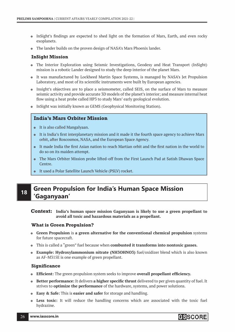
InSight Mission
The Interior Exploration using Seismic Investigations, Geodesy and Heat Transport (InSight) mission is a robotic Lander designed to study the deep interior of the planet Mars.
It was manufactured by Lockheed Martin Space Systems, is managed by NASA’s Jet Propulsion Laboratory, and most of its scientifi c instruments were built by European agencies.
Insight’s objectives are to place a seismometer, called SEIS, on the surface of Mars to measure seismic activity and provide accurate 3D models of the planet’s interior; and measure internal heat fl ow using a heat probe called HP3 to study Mars’ early geological evolution.
InSight was initially known as GEMS (Geophysical Monitoring Station).
India’s Mars Orbiter Mission
It is also called Mangalyaan.
It is India’s fi rst interplanetary mission and it made it the fourth space agency to achieve Mars orbit, after Roscosmos, NASA, and the European Space Agency.
It made India the fi rst Asian nation to reach Martian orbit and the fi rst nation in the world to do so on its maiden attempt.
The Mars Orbiter Mission probe lifted-off from the First Launch Pad at Satish Dhawan Space Centre.
It used a Polar Satellite Launch Vehicle (PSLV) rocket.
18 Green Propulsion for India’s Human Space Mission ‘Gaganyaan’
Context: India’s human space mission Gaganyaan is likely to use a green propellant to avoid all toxic and hazardous materials as a propellant.
What is Green Propulsion?
Green Propulsion is a green alternative for the conventional chemical propulsion systems for future spacecraft.
This is called a “green” fuel because when combusted it transforms into nontoxic gasses.
Example: Hydroxylammonium nitrate (NH3OHNO3) fuel/oxidizer blend which is also known as AF-M315E is one example of green propellant.
Significance
Effi cient: The green propulsion system seeks to improve overall propellant effi ciency.
Better performance: It delivers a higher specifi c thrust delivered to per given quantity of fuel. It strives to optimize the performance of the hardware, systems, and power solutions.
Easy & Safe: This is easier and safer for storage and handling.
Less toxic: It will reduce the handling concerns which are associated with the toxic fuel hydrazine.

www.iasscore.in 27
| SCIENCE & TECHNOLOGY
Lower cost : It requires a potentially shorter launch processing period and results in lowering costs.
Gaganyaan
This is an Indian crewed orbital spacecraft for the formative spacecraft of the Indian Human Spacefl ight Programme under ISRO.
The spacecraft is designed to carry three people.
The mission will have two unmanned fl ights and one human spacefl ight.
It will encircle Earth in a low-earth-orbit with an altitude of 300-400 km from earth.
GSLV Mk III (LVM-3 (Launch Vehicle Mark-3 )) the three-stage heavy-lift launch vehicle, will be used for the launch of Gaganyaan.
19 PSLV-C51, the fi rst dedicated launch by NSIL
Context: India’s Polar Satellite Launch Vehicle PSLV-C51 successfully launched Amazonia-1 along with 18 co-passenger satellites from Satish Dhawan Space Centre SHAR, Sriharikota.
What is Amazonia-1?
Amazonia-1 is the optical earth observation satellite of Na onal Ins tute for Space Research (INPE).
This satellite will provide remote sensing data to users for monitoring deforestation in the Amazon region and analysis of diversifi ed agriculture across the Brazilian territory.
Key-highlights of the launch
The 18 co-passenger satellites onboard PSLV-C51 includes four from IN-SPACe and fourteen from NSIL.
The fourteen satellites from NSIL carried were the commercial satellites from India (1) and USA (13).
This was the 78th launch vehicle mission from SDSC SHAR, Sriharikota.
The Launch Vehicle
Polar Satellite Launch Vehicle (PSLV) is the third genera on launch vehicle of India.
It is the fi rst Indian launch vehicle to be equipped with liquid stages.
After its fi rst successful launch in October 1994, PSLV emerged as the reliable and versatile workhorse launch vehicle of India.
PSLV-C51 is the 53rd fl ight of PSLV and 3rd fl ight of PSLV in ‘DL’ confi guration (with 2 strap-on motors).
Also, with this current launch, the total number of customer satellites from foreign countries placed in orbit by PSLV is 342 satellites from 34 countries.
About NSIL
PSLV-C51/Amazonia-1 is the fi rst dedicated commercial mission of New Space India Limited (NSIL), a Government of India company under Department of Space.
It was established in 2019 under the administrative control of Department of Space and the Company Act 2013.


www.iasscore.in 29
| SCIENCE & TECHNOLOGY
20 ISRO announces ‘Bhuvan’, an alternative to Google Maps
Context: In an attempt to compete with Google Maps, Indian Space Research Organisation (ISRO) has partnered with digital mapping and navigation technology solutions provider MapmyIndia to launch an Indian Maps alternative.
What are Indian map alternatives?
As part of this partnership, MapMyIndia’s end user maps, apps and services will now integrate with ISRO’s catalogue of satellite imagery and earth observation data.
MapMyIndia began in 1992 , with an aim to enhance India’s map-making capabilities.
MapmyIndia’s maps cover 7.5 lakh Indian villages, 7500+ cities at street and building-level, connected by 63 lakh kilometers of road network pan India and within cities.
The service would be a “privacy-centric” option, compared to “foreign map apps and solutions”.
It will enable ISRO and MapmyIndia to jointly identify and build a holistic geospatial portal utilising earth observation datasets, ‘NavIC’, Web Services and APIs (application programming interface) available in MapmyIndia, ‘Bhuvan’, ‘VEDAS’ and ‘MOSDAC’ geoportals.
Indian Regional Navigation Satellite System also known as NavIC (Navigation with Indian Constellation), is an indigenous navigation system, developed by ISRO.
Users will be able to see mapping data along with information about weather, pollution, agricultural output, land-use changes, fl ood and landslide disasters etc.
Geospatial Portals
Bhuvan is the national geo-portal developed and hosted by ISRO comprising geospatial data, services, and tools for analysis.
VEDAS (Visualisation of Earth observation Data and Archival System) is an online geoprocessing platform that uses optical, microwave, thermal, and hyperspectral EO data covering applications particularly meant for academia, research and problem solving
MOSDAC (Meteorological and Oceanographic Satellite Data Archival Centre) is a data repository for all the meteorological missions of ISRO and deals with weather-related information, oceanography, and tropical water cycles.
21 Stardust 1.0
Context: Stardust 1.0, a rocket powered by bio-derived fuel successfully took off from former military base in Maine.
What is Stardust 1.0?
Stardust 1.0 is a launch vehicle suited for student and budget payloads.
The rocket is 20 feet tall and has a mass of roughly 250 kg.
Payloads: The rocket can carry a maximum payload mass of 8 kg and during its fi rst launch carried three payloads. The payloads included:
a cubesat prototype built by highschool students
a metal alloy designed to lessen vibrations, which is developed by Kellogg’s Research Labs

www.iasscore.in30
PRELIMS SAMPOORNA | CURRENT AFFAIRS YEARLY COMPILATION 2021-22 |
a cubesat from software company Rocket Insights
Manufactured by: The rocket is manufactured by bluShift, an aerospace company based in Maine that is developing rockets that are powered by bio-derived fuels. Other rockets being developed by the company include
Stardust Gen. 2, Starless Rouge and Red Dwarf , which is a low-Earth orbit (LEO) vehicle and is designed to fl y a maximum payload of 30 kg.
First to be powered by biofuel
Stardust 1.0 became the fi rst commercial space launch powered by biofuel, which is non-toxic for the environment as opposed to traditionally used rocket fuels.
Though the biofuel used for the launch is not yet clear, but as per the reports it can be sourced from farms around the world.
Significance of the rocket
Cheaper and environment friendly: These rockets will help to launch small satellites called cubesats into space in a way that is relatively cheaper than using traditional rocket fuel and is less toxic for the environment.
22 NASA approved EUVST and EZIE missions
Context: NASA has approved two heliophysics missions to explore the Sun and the system that drives space weather near Earth.
The Extreme Ultraviolet High-Throughput Spectroscopic Telescope Epsilon
Led by: The EUVST Mission is led by the Japan Aerospace Exploration Agency (JAXA) , in partnership with other international organisations.
Launching: The EUVST is targeting a launch date in
It is a solar telescope that will study how the sun’s atmosphere releases solar wind and drives eruptions of solar material.
NASA’s hardware contributions to the mission include an intensifi ed UV detector and support electronics, spectrograph components, a guide telescope, software and a slip-jaw imaging system to provide context for the spectrographic measurement.
Budget: NASA’s budget to the whole mission is $55 million.
The principal investigator for the NASA contribution to EUVST is Harry Warren at the US Naval Research Laboratory in Washington.
The Electrojet Zeeman Imaging Explorer
Launched by: NASA has slated the mission for launch in June 2024.
The EZIE mission is made up of three Cubesats which will study electric currents in Earth’s atmosphere linking aurora to the Earth’s magnetosphere.
Magnetosphere
The magnetosphere is the region of space surrounding Earth where the dominant magnetic fi eld is the magnetic fi eld of Earth, rather than the magnetic fi eld of interplanetary space.
The magnetosphere is formed by the interaction of the solar wind with Earth’s magnetic fi eld.
www.iasscore.in 31
| SCIENCE & TECHNOLOGY
Budget: The total budget for the EZIE mission is $53.3 million.
The principal investigator for the mission is Jeng-Hwa (Sam) Yee at the Johns Hopkins University Applied Physics Laboratory in Laurel, Maryland.
Significance of the mission:
Understanding of the interconnected system: The missions will help understand the Sun and Earth as an interconnected system.
Helpful in prediction of important events: Understanding the physics that drive the solar wind and solar explosions – including solar fl ares and coronal mass ejections – could one day help scientists predict these events, which can impact human technology and explorers in space.
23 India successfully tests short-range ballistic missile ‘Pralay’
Context: Recently, the Defence Research and Development Organisation (DRDO) successfully test fi red the indigenously developed surface-to-surface missile ‘Pralay’, from Dr APJ Abdul Kalam Island off the coast of Odisha.
About the missile
Developed by: Defence Research Development Organisation (DRDO)
The missile is powered with a solid propellant rocket motor and many new technologies.
The solid-fuel, battlefi eld missile has a range of 150-500 kilometre and can be launched from a mobile launcher.
‘Pralay’ is a short-range, surface-to-surface missile with a payload capacity of 500-1,000 kg.
The missile guidance system includes state-of-the-art navigation system and integrated avionics.
The new missile followed the desired quasi ballistic trajectory and reached the designated target with high degree accuracy, validating the control, guidance and mission algorithms.
All the sensors deployed near the impact point across the eastern coast, including the down range ships, tracked the missile trajectory and captured all the events.
The missile is based on Prithvi Defence Vehicle from the Indian ballistic missile programme.
Significance of the development
Security on borders: ‘Pralay’ is India’s fi rst conventional ballistic missile and is an answer to any conventional missile attack from northern or western borders.
Strengthening of capacity: The missile development is signifi cant as India had no conventionally armed ballistic missile and was hampered by ‘No First Use’ nuclear policy.
This is a new generation surface-to-surface missile equipped with modern technologies and induction of this weapon system will give the necessary impetus to the armed forces
Important missiles (with Indian Army)
Prahaar: This is an indigenous short-range, solid propellant, road-mobile ballistic missile. And has a range of 150 km with a launch weight of 1,280 kg.
Nirbhay: This subsonic missile will help counter China along the Line of Actual Control and is capable of loitering and cruising at 0.7 Mach at a low altitude of 100 meters.

www.iasscore.in32
PRELIMS SAMPOORNA | CURRENT AFFAIRS YEARLY COMPILATION 2021-22 |
BrahMos: A sizable number of BrahMos missiles, a joint venture of India and Russia are already deployed in several strategic locations along the de-facto border with China in Ladakh and Arunachal Pradesh.
Brahmos: Supersonic Cruise Missile (Fastest cruise missile in the world)
Brahmos II: Hypersonic Cruise Missile
It also has the following missiles:
Astra: Air to Air Missile
Nirbhay: Subsonic Cruise Missile
Helina (Helicopter Launched Nag): Anti Tank Missile
Akash: Medium Range Surface to Air Missile
Trishul: Surface to Air Missile
Dhanush: Variant of the surface-to-surface or ship-to-ship Prithvi III missile
Shaurya: Hypersonic surface-to-surface tactical missile
Agni: Surface to Surface Ballistic Missile
Prithvi: Surface to Surface short range Ballistic Missile
24 India successfully tests nuclear-capable ballistic missile ‘Agni Prime’
Context: Recently, India successfully test fi red the nuclear-capable strategic Agni Prime missile off the coast of Odisha from Balasore.
Key-points
It is a two-stage canisterised missile with range capability between 1,000 and 2,000 km, weighs half of Agni III and has new kinds of propulsion and new guidance.
The new Agni P can be used to target enemy warships in the Indo-Pacifi c.
It can be transported across the length and breadth of the country, as per requirements.
It also comes with the technologies found in the 4000-kilometre range Agni-IV and 5000-kilometre range Agni-V.
Agni class of missiles are the mainstay of India’s nuclear launch capability which also includes the Prithvi short range ballistic missiles, submarine launched ballistic missiles and fi ghter aircraft.
The longest of the Agni series, Agni-V, an Inter-Continental Ballistic Missile (ICBM) with a range of over 5,000 km, has already been tested several times and validated for induction.
About Agni P
Agni-P is a new generation advanced variant of the Agni class of missiles.
It is a medium-range ballistic missile, developed by the Defence Research and Development Organisation (DRDO) as the successor of Agni-I and Agni-II missiles.
It is the sixth missile in the Agni (missile) series of ballistic missiles.
The missile can be either transported on a train or stored in a canister.

www.iasscore.in 33
| SCIENCE & TECHNOLOGY
Tests of Agni-P
First Test of Agni-P
DRDO successfully test fi red the fi rst Agni-P in June 2021, from Abdul Kalam Island.
The missile carried two multiple independently targetable reentry vehicles (MIRV).
It is a three-stage solid fuel missile, having the capability of a manoeuvrable re-entry vehicle (MaRV).
Second test of Agni-P
Second successful test was conducted in December 2021, from the coast of Odisha at Balasore.
It is a two-stage Agni-P missile and has been developed with new propulsion systems.
It is the smallest and lightest missile among the entire Agni series of ballistic missiles.
25 Successful test of ‘Agni 5’ and its strategic importance
Context: India successfully test-fi red ‘Agni-5’, a surface-to-surface ballistic missile, from APJ Abdul Kalam Island off Odisha coast.
Important facts about the missile
The successful test of Agni-5 is in line with India’s stated policy to have ‘credible minimum deterrence’ that underpins the commitment to ‘No First Use’.
The missile is already inducted into services and is operated by the Strategic Forces Command (SFC).
SFC is a key tri-services formation that manages and administers all the strategic forces and falls under the purview of the Nuclear Command Authority of India.
The successful testing of Agni-5 marked an important milestone in defence capabilities of India.
It uses a three-stage solid-fuelled engine, was carried out recently, signifying India’s defence capabilities.
The missile is capable of carrying nuclear warheads and can strike targets at ranges up to 5,000 km with a high degree of accuracy.
Nature
Canistered surface-to-surface ballistic missile
Canisterization reduces the time required for launch & improving storage & ability
Background
The fi rst test of the Agni-5 missile was carried out in April 2012. Last test was conducted around three years ago in 2018.
They are the mainstay of India’s nuclear launch capability.
How it puts India’s strategic stance in the region?
Strategic signaling: This test being conducted is being looked at strong strategic posturing towards China in the context of a 17-month long stand-off.
China’s capabilities : In the context of a test of nuclear-capable hypersonic glide vehicle conducted by China in August this year that circled the globe before speeding towards its target.

www.iasscore.in34
PRELIMS SAMPOORNA | CURRENT AFFAIRS YEARLY COMPILATION 2021-22 |
Nuclear Triad
A nuclear triad comprises land-based ICBM (inter-continental ballistic missile), SLBM ( INS Arihant) and strategic bomber aircraft (sukhoi-30 and Mirage-2000) .
These tests are a strong reminder to the adversaries about our capabilities.
Agni Missile Family The name Agni originates from the Sanskrit word for fi re and is taken in the context of Agni being one of the fi ve primary elements of Panch Mahabhutas.
Agni I: Range of 700-800 km
Agni II: Range more than 2000 km
Agni III: Range of more than 2,500 Km
Agni IV: Range is more than 3,500 km and can fi re from a road mobile launcher
Agni-V: The longest of the Agni series, an Inter-Con nental Ballis c Missile (ICBM) with a range of over 5,000 km
No-first use policy
India maintains the ‘Non-use of nuclear weapons against non-nuclear-weapon states’, the doctrine states that ‘in the event of a major attack against India, or Indian forces anywhere, by biological or chemical weapons, India will retain the option of retaliating with nuclear weapons.’
26 ABHYAS: High-speed Expendable Aerial Target
Context: The Abhyas High-speed Expendable Aerial Target (HEAT) has been successfully fl ight-tested by Defence Research and Development Organisation (DRDO) from the Integrated Test Range in Chandipur, off the Bay of Bengal coast in Odisha recently.
Key-points
The ABHYAS has been designed and developed by Aeronautical Development Establishment (ADE) of DRDO.
ADE is involved in the construction and development of state-of-the-art Unmanned Aerial Vehicles (UAV) and Aeronautical Systems and technologies to meet the needs of Indian Armed Forces (IAF).
It is a leading Aeronautical Systems Design laboratory under the
Features: To support a long-lasting aircraft at subsonic speed, it is powered by a gas turbine engine.
The vehicle is designed for fully automatic aircraft and its check-out is performed using a laptop- based Ground Control Station (GCS).
Based on Inertial Navigation System (INS) navigation and Flight Control Computer (FCC), it is installed with MEMS (Micro-Electro-Mechanical Systems) for guidance and control.
Utility: It will provide a realistic scenario that threatens the practice of weapons systems and will be used as a test target for various missile systems.
Other Recent Developments by DRDO
In October 2020, the DRDO conducted a successful fl ight test of the Supersonic Missile Assisted Release of Torpedo (SMART) from Wheeler Island off the coast of Odisha.

www.iasscore.in 35
| SCIENCE & TECHNOLOGY
In February 2021, India successfully test-fi red indigenously-developed anti-tank guided missile systems ‘Dhruvastra’ and ‘Helina’.
In June 2021, a new generation nuclear capable ballistic missile Agni-P (Prime) was successfully test-fi red by the DRDO.
In July 2021, DRDO launched the Man Portable Anti Tank Guided Missile (MPATGM) and the Akash-NG (New Generation).
In September 2021, the DRDO tested a new version of the Akash Missile – ‘Akash Prime’ – from the Integrated Test Range (ITR), Chandipur, Odisha.
27 Akash Prime Surface to Air missile
Context: The Defense Research and Development Organization (DRDO) successfully tested a new version of Akash Surface to Air missile Akash Prime from the Integrated Test Range at Chandipur, Odisha.
About Akash Prime (New Generation)
The Akash Prime is a medium-range mobile surface-to-air missile (SAM) system.
Developed by: DRDO
Produced by: Bharat Dynamics Limited (BDL)
Operational range: 27-30 km
Flight altitude: around 18 km
The new version is equipped with an indigenous active Radio Frequency (RF) seeker for improved accuracy, as compared to the existing Akash System.
It is a more reliable performer under a low-temperature environment at higher altitudes.
About Akash missile
The development of the Akash SAM was started by the DRDO in the late 1980s which is a part of the Integrated Guided Missile Development Programme.
Akash is primarily a Short Range Surface to Air Missile
This is built to provide air defense cover to the vulnerable areas.
AKASH Weapon System can engage Multiple Targets in Group Mode or Autonomous Mode.
It is a medium range nuclear capable supersonic missile.
The missile system can target aircraft up to 30 km away or at altitudes up to 18,000 mts.
It is in operational service with the Indian Army and the Indian Air Force.
28 G-Surface-to-air missile, successfully fl ight-tested by DRDO
Context: Defence Research & Development Organisation (DRDO) successfully fl ight-tested the New Generation Akash Missile (Akash-NG), a surface-to-air Missile from Integrated Test Range (ITR) off the coast of Odisha.

www.iasscore.in36
PRELIMS SAMPOORNA | CURRENT AFFAIRS YEARLY COMPILATION 2021-22 |
Key features of the Akash-NG missile
The missile system has been developed by Defence Research & Development Laboratory (DRDL), Hyderabad in collaboration with other DRDO laboratories.
It is a New Generation surface-to-air Missile.
The missile has high manoeuvrability to neutralise aerial threats.
The missile is objected to boost to Air Defence capabilities of the Indian Air Force.
To capture fl ight data, ITR deployed several Range stations like Electro-Optical Tracking System, Radar and Telemetry.
How it is different from the Akash Missile?
This missile is a successor to the Akash and Akash-1S series of missiles with improvements such as a Dual-pulse solid rocket motor, a canisterized launcher and an AESA Multifunction targeting radar to improve its probability of kill with a smaller ground operations and logistics footprint.
Akash Missile
The Akash missile system can target aircraft up to 50–80 km (31–50 mi) away, at altitudes up to 18,000m.
It has the capability to neutralise aerial targets like fi ghter jets, cruise missiles and air-to- surface missiles as well as ballistic missiles.
Akash fl ies at supersonic speed, reaching around Mach 2.5.
It has the capability to neutralise aerial targets like fi ghter jets, cruise missiles and air-to- surface missiles as well as ballistic missiles.
29 ICGS ‘Vigraha’ commissioned into Indian Coast Guard
Context: Recently, indigenously built ‘Vigraha’ ship has been commissioned into the Indian Coast Guard (ICG).
About the Vessel
The 98 meters’ offshore patrol vessel has been designed and built indigenously by Larsen & Toubro Ship Building Ltd.
It is fi tted with advanced technology Radars, Navigation and Communication Equipment, Sensor and Machinery capable of operating in tropical sea conditions.
The vessel is armed with a 40/60 Bofors gun and fi tted with two 12.7 mm Stabilised Remote Control Gun (SRCG) with Fire Control System.
The ship is also equipped with-
Integrated Bridge System (IBS)
Integrated Platform Management System (IPMS)
Automated Power Management System (APMS)
High-Power External Firefi ghting (EFF) system
The ship is designed to carry one Twin Engine Helicopter and four high-speed boats for Boarding Operation, Search and Rescue, Law Enforcement and Maritime Patrol.

www.iasscore.in 37
| SCIENCE & TECHNOLOGY
The ship will be based in Visakhapatnam in Andhra Pradesh.
It will operate on the eastern seaboard under the operational and administrative control of the Commander, Coast Guard Region (East).
30 DRDO develops Critical Near Isothermal Forging Technology for aero-engines
Context: Defence Research and Development Organisation (DRDO) has established the near isothermal forging technology to produce all the fi ve stages of high-pressure compressors (HPC) discs out of diffi cult-to-deform titanium alloy using its unique 2000 MT isothermal forge press.
About the Critical Near Isothermal Forging Technology
This technological breakthrough was achieved by the DRDO’s premier metallurgical laboratory, the Hyderabad-based Defence Metallurgical Research Laboratory (DMRL).
It involved developing complex titanium and nickel-based alloys that can withstand temperatures of more than 1,000 degrees Celsius
With this development, India has joined the league of limited global engine developers to have the manufacturing capabilities of such critical aero engine components.
DMRL has transferred the technology to M/s MIDHANI through a licensing agreement for technology transfer (LAToT) to meet the bulk production requirements.
It will be jointly produced and successfully supplied to the HAL, Bengaluru for fi tment into Adour engine that powers the Jaguar and Hawk aircrafts.
Apart from DMRL and HAL (E), various agencies such as MIDHANI, CEMILAC and DGAQA worked in unison to establish this crucial technology.
Significance
Like in any aero engine, the high value HPC drum assembly needs to be replaced after a specifi ed number of operations or in the case of damage which is quite large and expensive.
A HPC drum is a highly stressed sub-assembly and is also subjected to low cycle fatigue and creep at elevated temperatures.
The raw materials and forgings for the HPC drum are required to be of the highest quality which can meet the specifi ed combination of static and dynamic mechanical properties.
The methodology adopted by DMRL is generic in nature and can be tuned to develop other similar aero-engine components.
DRDO
DRDO is the R&D wing of Ministry of Defence.
It aims to empower India with cutting-edge defence technologies and a mission to achieve self- reliance in critical defence technologies and systems.
DRDO was formed in 1958 from the amalgamation of the then already functioning Technical Development Establishment (TDEs) of the Indian Army and the Directorate of Technical Development & Production (DTDP) with the Defence Science Organisation (DSO).

www.iasscore.in38
PRELIMS SAMPOORNA | CURRENT AFFAIRS YEARLY COMPILATION 2021-22 |
31 ISRO Joins Hands With ARIES To Maximise Utilisation Of Data From India’s Mission Aditya-L1
Context: One year before the proposed launch of India’s maiden solar mission — the Aditya L1 — Indian researchers plan to create a skilled community of solar scientists ready to use the scientifi c data which will emerge from the mission.
Aditya-L1 Support Cell (AL1SC)
As a fi rst step, the Aditya-L1 Support Cell (AL1SC) has been established at the Aryabhatta Research Institute of Observational Sciences (ARIES), which will primarily produce this required trained manpower.
An MoU in this regard was inked between ARIES and Indian Space Research Organisation (ISRO) earlier this year.
The Support Cell will be a one-stop online platform for students, faculty and researchers from colleges, universities and institutions in India to get free access to a sample of processed scientifi c data pertaining to the Sun.
All the data will be hosted at the Indian Space Science Data Centre (ISSDC) of ISRO with ARIES Cell acting as a manpower training centre.
Aditya L1mission
It is India’s fi rst solar mission.
Launch vehicle: Polar Satellite Launch Vehicle (PSLV) in XL
Led by ISRO, the mission aims to set up a space-based observatory to track the Sun and it is expected to be launched sometime in mid-2022.
The seven payloads (instruments) will study solar corona, solar emissions, solar winds and fl ares, Coronal Mass Ejections (CMEs), as well as capture images of the Sun.
32 Algorithm for Aditya L1 mission
Context: A novel algorithm for tracking the very fast accelerating Coronal Mass Ejections (CMEs) has been developed by a group of researchers under the lead of Aryabhatta Research Institute of Observational Sciences (ARIES).
AboutThe novel algorithm CIISCO
The newly developed algorithm is named CME Identifi cation in Inner Solar Corona (CIISCO).
It was jointly developed along with scientists from the Royal Observatory of Belgium.
It can track bubbles of gaseous matter associated with magnetic fi eld lines ejected from the Sun’s inside.
The newly developed algorithm has been successfully tracked these accelerating solar eruptions in the lower corona.
Signifi cance : It would help as a foundation in planning research of the lesser-known lower corona region of the Sun using Aditya L1.
www.iasscore.in 39
| SCIENCE & TECHNOLOGY
Coronal Mass Ejection (CME)
It is a signifi cant release of plasma and accompanying magnetic fi eld from the solar corona.
These ejections follow solar fl ares and are normally present during a solar prominence eruption.
The plasma is released into the solar wind.
The need
Due to limited technology of satellite and ground-based observatories in acquiring observations of CMEs from within the Sun’s interiors was diffi cult.
Space environment, Weather, and climate around Earth are governed by the Sun.
CMEs and the solar fl ares, solar energetic particles, high-speed solar winds pose a serious threat to most of Earth’s space-based services along with the Global Positioning System (GPS), radio, and satellite-based telecommunication and can cause power grid failure.
Aditya - L1
The Aditya-1 mission India’s fi rst mission to study the Sun.
The Aditya-1 mission is a 400kg class satellite carrying one payload, the Visible Emission Line Coronagraph (VELC).
It was planned to launch in 800 km low earth orbit and now will be inserted in a halo orbit around the L1, which is around 1.5 million km from the Earth.
A Satellite that is placed in the halo orbit around the Lagrangian point 1 (L1) of the Sun-Earth system will have the major advantage of continuously viewing the Sun without any occultation/ eclipses.
Aditya-1 was meant to observe only the solar corona.
The outer layer of the Sun which extends to thousands of km above the disc (photosphere) is termed the corona (6000K)
33 Government launches NanoSniff er Explosive trace detector
Context: The Ministry of Education launched NanoSniffer, a Microsensor based Explosive
Trace Detector (ETD) which is developed by NanoSniff Technologies, an IIT Bombay incubated startup.
What is the Nanosniffer?
Nanosniffer is the world’s fi rst Explosive Trace Detector by using microsensor technology.
Indigenous : NanoSniffer is a 100% Made in India product in every terms starting from research and development to its manufacturing.
Type of material: It detects all classes of military, conventional and homemade explosives.
NanoSniffer gives visible & audible alerts with sunlight-readable color display.
Patent : The core technology of NanoSniffer is patented in the U.S. & Europe.

www.iasscore.in40
PRELIMS SAMPOORNA | CURRENT AFFAIRS YEARLY COMPILATION 2021-22 |
How will it benefit?
NanoSniffer provides trace detection of a nano-gram quantity of explosives & delivers result in seconds.
This Home-grown Explosive trace detector device (ETD), NanoSniffer can detect explosives in less than 10 seconds.
The newly developed device would help in reducing our dependency on imported explosive trace detector devices.
It will also encourage indigenous institutions, startups and medium-scale industries to research & develop products. It’s a perfect example of lab to market product.
34 India successfully test-fi res Helina, Dhruvastra anti-tank guided missiles
Context: Joint User Trials for Helina (Army Version) and Dhruvastra (Air Force Version) Missile Systems have been carried out from Advanced Light Helicopter (ALH) platform in desert ranges.
About
Helina and Dhruvastra missile systems
The Helina (Army version) and Dhruvastra (Air Force variant) are third-generation variants of the Nag anti-tank guided missile system.
The missile systems have been designed and developed indigenously by Defence Research and Development Organisation (DRDO).
Features
They are based on the Lock on Before Launch (LOBL) fi re and forget Anti-Tank Guided Missiles
They can engage targets both in direct hit mode as well as top attack mode.
The system has all-weather day and night
Anti-tank guided missile (ATGM)
An anti-tank guided missile (ATGM), anti-tank missile, anti-tank guided weapon (ATGW), or anti-armor guided weapon is a guided missile.
It is primarily designed to hit and destroy heavily armored military vehicles.
India’s Anti-tank missiles:
DRDO Anti Tank Missile
Amogha missile
Nag missile
HELINA missile/Dhruvastra
SANT missile
Man-Portable Anti-tank Guided Missile (MPATGM)
Jasmine anti-tank missile - VEM technologies

www.iasscore.in 41
| SCIENCE & TECHNOLOGY
Nag missile
The Nag missile (Prospina- for the land-attack version), is an Indian missile with:
third-generation
all-weather
fi re-and-forget
lock-on after launch
anti-tank guided missile (ATGM)
the operational range of 500 m to 20 km
The Nag has fi ve variants
a land version, for a mast-mounted system
the helicopter-launched Nag (HELINA and Dhruvastra)
a “man-portable” version (MPATGM)
an air-launched version
Nag Missile Carrier (NAMICA) “tank buster”
Development of the Nag is part of the Integrated Guided Missile Development Program (IGMDP), run by the Defence Research and Development Organisation (DRDO).
35 ‘US warns India over S-400’
Context: The US has yet again warned India that it could face sanctions over it acquiring fi ve Russian Almaz-Antei S-400 Triumf self-propelled surface-to-air (SAM) systems for $5.5 billion.
What is S-400?
The S-400 is a mobile, surface-to-air missile system (SAM) designed by Russia.
It is a successor to the S-200 and S-300 air defence systems.
It integrates the 91N6E multi-function panoramic radar with a 600 km range, autonomous detection and targeting systems and launchers.
It can fi re four missile types with strike ranges of between 400 km and 40 km to provide multi- layered defence against incoming fi xed wing and rotary aircraft, unmanned aerial vehicles (UAVs) and ballistic missiles at altitudes of up to 30 km.
The S-400 is organised around the 30K6E administration system, with protection against jamming.
It can simultaneously locate 72 targets and track another 160 alongside, compared with PAC-3s 36 and 125 respectively.
Which countries have CAATSA imposed on them?
So far, the US has imposed CAATSA on Turkey and China for taking delivery of two S-400 systems each.
As part of the sanctions, the US removed Turkey, a NATO ally, from the F-35 joint strike fi ghter (JSF)
A White House statement declared that the F-35 cannot coexist with a Russian intelligence collection platform, as that can be used to learn about its advanced capabilities.

www.iasscore.in42
PRELIMS SAMPOORNA | CURRENT AFFAIRS YEARLY COMPILATION 2021-22 |
Why India chose the S-400?
Better option: India opted for the Russian S-400, believing it to be more effi cient, cheaper and above all, acquirable from a long-standing materiel supplier, that entail no political strings or strategic obligations.
Much ahead of THAAD: It is the most dangerous operationally deployed modern long-range SAM (MLR SAM) in the world, considered much ahead of the US-developed Terminal High Altitude Area Defense system (THAAD).
Multi-faceted: The S-400 system is operationally more versatile, accurate and multi-faceted in all aspects compared to its US rivals.
Infl exible protocols with US: Conversely, all defence purchases from the US are governed by a slew of infl exible protocols signed by Delhi and Washington over the past decade.
36 ‘DRDO achieves milestone in key quantum technology’
Context: The Defence Research and Development Organisation (DRDO) achieved a milestone in Quantum Key Distribution (QKD) technology that underwent maiden trials at two of its laboratories establishing highly secure communication.
What is Quantum Key Distribution (QKD)?
QKD is a secure communication method that uses cryptographic protocol involving components of quantum mechanics.
It is developed by Bengaluru-based Centre for Artifi cial Intelligence and Robotics (CAIR) and Defence Young Scientists’ Laboratory - Quantum Technology (DYSL-QT), Mumbai.
The technology enables two communicators to produce a random secret key known only to them and later it can be used to encrypt and decrypt messages.
The successful trial
The quantum communication using time-bin QKD technology was performed during the trials and the setup demonstrated validation of detection of a third party trying to gain knowledge of the communication.
As part of a successful trial, the technology was tested in real life conditions and performed well on all parameters.
As part of the test simulation, an entity trying to gain access to communication was also detected by the system.
What makes QKD unbreakable?
The security of QKD stems from the ability to detect any intrusion on the QKD transmission. Because of the unique and fragile properties of photons, any third party who tries to read or copy the photons in any way will change the photons’ state.
The change will be detected by the endpoints, alerting them that the key has been tampered with and must be discarded. A new key is then transmitted. Moreover, since the keys generated are truly random, they are protected from future hacking attempts.
Significance
The work being done on QKD technology at DRDO will be used to enable start-ups and small and medium enterprises in the domain of quantum information technologies.
The technology is expected to help defi ne standards and formulate crypto technology related policies that can use the QKD system in a unifi ed Cipher Policy Committee (CPC) framework in the country for more secure ‘key management’ for current and future military cryptographic systems.


www.iasscore.in44
3 BIOTECHNOLOGY
1 Salt-secreting Mangrove Species genome Decoded by DBT-ILS
Context: Scientists at the DBT-Institute of Life Sciences, Bhubaneswar have reported for the fi rst time a reference-grade whole genome sequence of a highly salt-tolerantand salt-secreting true-mangrove species, Avicennia marina.
About the salt secreting Mangroves
Mangroves are a unique group of species found in marshy intertidal estuarine regions and survive a high degree of salinity through several adaptive mechanisms.
Mangroves are important resources for the coastal region and are of great ecological and economic value.
They form a link between marine and terrestrial ecosystems, protect shorelines, provide habitat for a diverse array of terrestrial organisms.
Avicennia marina
Avicennia marina is one of the most prominent mangroves species found in all mangrove formations in India.
It is a salt-secreting and extraordinarily salt-tolerant mangrove species that grows optimally in 75% seawater and tolerates >250% seawater.
It is among the rare plant species, which can excrete 40% of the salt through the salt glands in the leaves, besides its extraordinary capacity to exclude salt entry to the roots.
The genome sequence
This study reports the assemblage of a 456.6 Mb of the estimated 462.7 Mb A. marina genome (98.7% genome coverage) in 31 chromosomes derived from 88 scaffolds and 252 contigs.
The percentage of genomes in gaps was 0.26%, thereby proving it to be a high-level assembly.
This study employed the latest genome sequencing and assembling technologies and identifi ed 31,477 protein-coding genes and a “salinome” consisting of 3246 salinity-responsive genes and homologs of 614 experimentally validated salinity tolerance genes.
The study reported identifi cation of 614 genes, including 159 transcription factors, which are homologous to the genes that were functionally validated for salinity tolerance in transgenic systems.
Significance of study
This study assumes signifi cance as agriculture productivity globally is affected due to abiotic stress factors such as limited water availability and salinization of soil and water.
www.iasscore.in 45
| SCIENCE & TECHNOLOGY
Availability of water is a signifi cant challenge to crop production in dryland areas.
The genomic resources generated in the study will pave the way for researchers to study the potential of the identifi ed genes for developing drought and salinity tolerant varieties of important crop species of the coastal region that is signifi cant for India with 7,500m of coastline and two major island systems.
Mangroves in India
India has about 3% of the total Mangrove cover in South Asia”
“Mangrove cover in the country has increased by 54 sq km (1.10%) as compared to the previous assessment.”
“The current assessment shows that mangrove cover in the country is 4,975 sq km [(1.2 million acres)], which is 0.15% of the country’s total geographical area.”
West Bengal has 42.45% of India’s mangrove cover, followed by Gujarat 23.66% and A&N Islands 12.39%.
Gujarat shows maximum increase of 37 sq km in mangrove cover.
2 New high-yielding and pest-resistant variety of soybean: MACS 1407
Context: Indian Scientists have developed a high-yielding and pest-resistant variety of soybean called MACS 1407.
About the new variety
Scientists developed MACS 1407 by using the conventional cross breeding technique.
The new variety gives 39 quintals per hectare making it a high yielding variety.
It is also resistant to major insect-pests like girdle beetle, leaf miner, leaf roller, stem fl y, aphids, white fl y and defoliators.
Its thick stem, higher pod insertion (7 cm) from ground, and resistance to pod shattering make it suitable even for mechanical harvesting.
MACS 1407 require an average 43 days for 50 % fl owering and take 104 days to mature from the date of sowing. It has white coloured fl owers, yellow seeds and black hilum.
Its seeds have 19.81 % oil content, 41 % protein content and show good germinability.
Where it can be grown?
This newly developed variety is suitable for cultivation in the states of Assam, West Bengal, Jharkhand, Chhattisgarh and North-Eastern states.
Its seeds will be made available to farmers for sowing during the 2022 Kharif season.
Soybean production in India
In 2019, India produced around 90 million tons of soybean.
India is striving to be among the world’s major producers of soybean.
It is widely cultivated as oil seeds as well as a cheap source of protein for animal feed and many packaged meals.
High-yielding, disease resistant varieties of the legume can help achieve this target.

www.iasscore.in46
4 ALTERNATE TECHNOLOGY
1 Laser Interferometer Gravitational-Wave Observatory (LIGO)
Context: A gravitational wave observatory has been set up in India in collaboration with LIGO. This project is expected to join the international network in a fi rst science run in 2025.
What is LIGO?
It is the world’s largest gravitational wave observatory and a wonder of precision engineering.
It comprises of two enormous laser interferometers located thousands of kilometres apart, each having two arms which are 4 km long.
It exploits the physical properties of light and of space itself to detect and understand the origins of Gravitational Waves (GW).
Sources of GW
Mergers of black holes or neutron stars, rapidly rotating neutron stars, supernova explosions and the remnants of the disturbance caused by the formation of the universe, the Big Bang itself, are the strongest sources.
There can be many other sources, but these are likely to be too weak to detect.
The study of GW offers a new way to map out the universe by using gravitational-wave astronomy.
LIGO detectors
Two LIGO detectors work as one unit to ensure a remarkable precision, which is needed to detect a signal as weak as a gravitational wave.
Its detector components are completely isolated and sheltered from the outside world.
Unlike optical or radio telescopes, it does not see electromagnetic radiation (e.g., visible light, radio waves and microwaves) because gravitational waves are not part of the electromagnetic spectrum.
It doesn’t need to collect light from stars; it doesn’t need to be round or dish-shaped like optical telescope mirrors or radio telescope dishes, both of which focus EM radiation to produce images.
LIGO Project at a global level
Two LIGO detectors are already operational in the U.S., at Livingston and Hanford.

www.iasscore.in 47
| SCIENCE & TECHNOLOGY
The Japanese detector, KAGRA, or Kamioka Gravitational-wave Detector, is expected to join the international network soon.
LIGO India
LIGO India will come up in Maharashtra, which will also have two arms of 4 km length.
The project aims to move one Advanced LIGO detector from Hanford to India.
This project is a collaboration between the LIGO Laboratory and three lead institutions in the IndIGO consortium: Institute of Plasma Research (IPR) Gandhinagar, Inter University Centre for Astronomy and Astrophysics (IUCAA), Pune and Raja Ramanna Centre for Advanced Technology (RRCAT), Indore.
It is an ultra-high precision large-scale apparatus, which is expected to show a unique “temperament” determined by the local site characteristics.
Significance of another detector in India
To locate gravitational waves : Observations from a new detector in a far-off position will help locate the source of the gravitational waves more accurately.
Identifi cation of new sources : New detector will increase the expected event rates, and will boost the detection confi dence of new sources (by increasing the sensitivity, sky coverage and duty cycle of the network).
Impact on Indian Science : The project will help Indian scientifi c community to be a major player in the emerging research frontier of GW astronomy. This major initiative will further inspire frontier research and development projects in India.
Impact on industry : The high-end engineering requirements of the project (such as the world’s largest ultra-high vacuum facility) will provide unprecedented opportunities for Indian industries in collaboration with academic research institutions.
Education and public outreach : A cutting edge project in India can serve as a local focus to interest and inspire students and young scientists. The project involves high technology instrumentation and its dramatic scale will spur interest and provide motivation to young students for choosing experimental physics and engineering physics as career options.
What is the technology being developed in India for LIGO India?
Some of it includes design and fabrication of ultra-stable laser, quantum measurement techniques, handling of complex control system for enforcing precision control, large-scale ultra-high vacuum technology, data analysis and machine learning.
This is not a complete list and the development of such indigenous technology is likely to result in many spin-offs for industry and research.
The dramatic improvement from LIGO-India would come in the ability of localizing GW sources in the sky.
What are Gravitational Waves?
These waves are ‘ripples’ in space-time caused by some of the most violent and energetic processes in the Universe.
The strongest gravitational waves are produced by catastrophic events such as colliding black holes, the collapse of stellar cores (supernovae), coalescing neutron stars or white dwarf stars, the slightly wobbly rotation of neutron stars that are not perfect spheres, and possibly even the remnants of gravitational radiation created by the birth of the Universe itself.

www.iasscore.in48
PRELIMS SAMPOORNA | CURRENT AFFAIRS YEARLY COMPILATION 2021-22 |
2 Blue Straggler
Context: Recently, Indian researchers found that half of the blue stragglers in their sample are formed through mass transfer from a close binary companion star. One third are likely formed through collisions of 2 stars, and the remaining are formed through interactions of more than 2 stars.
This was the fi rst-ever comprehensive analysis of blue stragglers.
About Blue straggler
Blue stragglers are a class of stars on open or globular clusters that stand out as they are bigger and bluer than the rest of the stars.
It is found in old star clusters and appears to be lagging behind most of the other stars in the cluster in its evolution toward a cooler, reddish state.
Blue stragglers tend to be strongly concentrated toward the centre of the cluster.
How the Blue stragglers are formed?
A bunch of stars born at the same time from the same cloud form a star cluster, as time passes, each star evolves differently depending on its mass. The most massive and bright stars evolve and move off the main sequence creating a bend in their track, known as the turnoff.
Stars above this bend or brighter and hotter stars are not expected in a cluster, as they leave the main sequence to become red giants. But some stars seem to be hotter than the turnoff of the parent cluster. These stars are indeed cluster members, and they were termed “Blue Stragglers”.
What does the Study says?
Researchers utilised the Gaia telescope with its excellent positional accuracy to select the blue stragglers in clusters and understand how many such stars there are, where they are and how they are formed.
Overall, they found that more than 54% of blue stragglers are formed through mass transfer from a close binary companion star, and 30% of the blue stragglers are likely formed through collisions of 2 stars.
Around 10-16% of the blue stragglers are formed through interactions of more than 2 stars.
Significance of the study
The study will help improve understanding of these stellar systems to uncover exciting results in studies of large stellar populations, including galaxies.
3 Curb on Killer robots
Context: For the fi rst time, a majority of the 125 nations that belong to an agreement called the Convention on Certain Conventional Weapons said they wanted curbs on killer robots.
About
Autonomous weapon systems – commonly known as killer robots means drones, guns and bombs that decide on their own, with artifi cial brains, whether to attack and kill.

www.iasscore.in 49
| SCIENCE & TECHNOLOGY
These systems are robots with lethal weapons that can operate independently, selecting and attacking targets without a human weighing in on those decisions.
Militaries around the world are investing heavily in autonomous weapons research and development.
The U.S. alone budgeted US$18 billion for autonomous weapons between 2016 and 2020.
Convention on Certain Conventional Weapons (CCW)
Convention on Certain Conventional Weapons or CCW, is also known as the Inhumane Weapons Convention.
Purpose : To ban or restrict the use of specifi c types of weapons that are considered to cause unnecessary or unjustifi able suffering to combatants or to affect civilians indiscriminately.
The Convention including three annexed protocols was adopted on 10 October 1980 and opened for signature on 10 April 1981 for the duration of one year. A total of 50 States signed the Convention, which entered into force on 2 December 1983.
Issues with autonomous weapons
The problem of misidentifi cation
undermine humanity’s fi nal stopgap against war crimes and atrocities
lack of accountability
legal and moral challenge
Shifting blame game
The problems of low-end and high-end proliferation (autonomous weapons could get into the hands of people outside of government control, including international and domestic terrorists)
4 Ceramic membrane
Context: Recently, Scientists at CSIR have developed a ceramic membrane with the help of a mixture of potter’s clay, stone dust and tea waste. The membrane developed could remove adsorptive dyes from wastewater.
About Ceramic membrane
A membrane is a selective barrier that allows some components to pass while other components remain retain in the liquid phase. Ceramic membranes are fabricated from inorganic materials such as alumina oxides, zirconia, and titania.
Ceramic membranes can be categorized according to their structure into porous or dense membranes.
Properties
They possess extremely high chemical, thermal, mechanical and physical stability.
They can withstand elevated temperatures, extremes of pH (0 to 14), and high operating pressures up to 10 bar They are characterized by a high abrasion resistance.
The used membrane could also be regenerated by heating at 400 degrees for 30 minutes, without much loss of effi ciency.
The membrane freshly formed is thermally stable and organic.

www.iasscore.in50
PRELIMS SAMPOORNA | CURRENT AFFAIRS YEARLY COMPILATION 2021-22 |
Significance
Ceramic membranes can withstand frequent cleaning, harsh operating environments and situations that require continuous fl ows of material.
They can also be regenerated over many cycles and used for separation of both aqueous and non- aqueous solutions.
These fi lters are especially useful in petrochemical processing, where it is not possible to use organic membranes.
It is capable of discolouring two commonly used dyes — methylene blue and Congo red — from water.
Issue
Ceramic membranes are costly as compared to polymer membranes.
5 India’s First Indigenous Fuel Cell System
Context: India’s fi rst indigenous High Temperature Fuel Cell System is developed by Council of Scientifi c and Industrial Research (CSIR) in partnership with Indian industries. The system is under India’s fl agship program named “New Millennium Indian Technology Leadership Initiative (NMITLI)”.
NMITLI
It seeks to catalyze innovation centred scientifi c and technological developments as a vehicle to attain for Indian industry a global leadership position, in selected niche areas.
It synergizes the best competencies of publicly funded R&D institutions, academia, and private industry.
About the Technology
The Fuel Cells developed are based on High Temperature Proton Exchange Membrane (HTPEM) Technology.
High Temperature Proton-Exchange-Membrane (HTPEM) is the core of the fuel cells running above 150 °C.
As in classical PEM fuel cells technology, Hydrogen is electrochemically split to proton and electron on anode.
Proton is transported through membrane to cathode while electricity is yielded in external circuit. At cathode protons recombine with electron and reacts further with Oxygen to water and heat.
The technology can achieve effi ciency approaching 90% calculated as combined yield of electricity and heat.
Benefits:
It is 5.0 kW fuel cell system, which generates power in a green manner using methanol / bio- methane, with heat and water as bi-products for further use.
It amounts to effi ciency greater than 70%, which otherwise may not be possible by other energy sources.
The fuel cell system will meet the requirement of effi cient, clean and reliable backup power generator for telecom towers, remote locations and strategic applications as well.
Fuel System development would replace Diesel Generating (DG) sets and help reduce India’s dependence on crude oil.

www.iasscore.in 51
| SCIENCE & TECHNOLOGY
6 Hypersonic Technology
Context: Recently, it has been reported that China tested a nuclear-capable hypersonic glide vehicle that circled the globe before speeding towards its target.
What is Hypersonic missile?
A hypersonic missile is a vehicle that achieves a speed fi ve times faster than the speed of sound, crossing Mach 5.
These missiles travel at a speed of around 6,115 km per hour, with a combination of technology and manoeuvrability of ballistic missiles and cruise missiles.
Technology Used: Most hypersonic vehicles primarily use scramjet technology, which is a type of Air Breathing propulsion System.
This is an extremely complex technology, which also needs to be able to handle high temperatures, making the hypersonic systems extremely costly.
Types of Hypersonic missile
There are two types of Hypersonic missiles:
Hypersonic cruise missiles: These are the ones that use rocket or jet propellant through their fl ight and are regarded as being just faster versions of existing cruise missiles.
Hypersonic Glide Vehicle (HGV): These missiles fi rst go up into the atmosphere on a conventional rocket before being launched towards their target.
Significance of Hypersonic missiles (over subsonic and supersonic weapons)
It will provide a nation with signifi cantly enhanced strike capabilities.
It can overcome the defences of a heavily defended target such as that of an aircraft carrier.
Development of hypersonic missiles and implication for India
Several countries, including the US, Russia and China, are developing hypersonic missiles.

www.iasscore.in52
PRELIMS SAMPOORNA | CURRENT AFFAIRS YEARLY COMPILATION 2021-22 |
Hypersonic technology developments, in the backdrop of growing US-China rivalry and a year- long standoff with Indian forces in eastern Ladakh, is certainly a threat for India’s space assets along with the surface assets.
The offence system operating at these speeds would mean a requirement to develop defence systems at these speeds.
7 NTPC to set up India’s single largest solar park at Rann of Kutch
Context: NTPC successfully commissioned Floating Solar parkat Rann of Kutch, Gujarat.
About the new solar park
Ministry of New and Renewable Energy (MNRE) gave a nod to NTPC to set up a 4750 MW renewable energy park at Rann of Kutch in Khavada, Gujarat.
This will be India’s largest solar park to be built by the largest power producer in the country.
NTPC Renewable Energy Ltd (NTPC REL), has been given the go-ahead by MNRE under Mode 8 (Ultra Mega Renewable Energy Power Park) of the Solar Park Scheme.
NTPC REL has plans to generate green hydrogen on a commercial scale from this park.
Solar Park Scheme
It is an initiative under the National Solar Mission.
The scheme aims to provide a huge impetus to solar energy generation by acting as a fl agship demonstration facility to encourage project developers and investors, prompting additional projects of similar nature, triggering economies of scale for costreductions, technical improvements, and achieving large scale reductions in greenhouse gas (GHG) emissions.
It would enable States to bring in signifi cant investment from project developers, meet their solar renewable purchase obligation (RPO) mandate, and provide employment opportunities to the local population.
The State will also reduce its carbon footprint by avoiding emissions equivalent to the solar park’s installed capacity and generation.
Other Floating Solar projects
NTPC has also commissioned India’s largest Floating Solar of 10 MW (ac) on the reservoir of Simhadri Thermal Power Plant, Andhra Pradesh.
An additional 15 MW (ac) would be commissioned by August 2021.
A 100 MW Floating Solar Project on the reservoir of Ramagundam Thermal Power Plant, Telangana is in the advanced stage of implementation.
8 Drone-based drug delivery model: i-Drone
Context: Recently, the Department of Health and Family Welfare introduced the Drone vaccine delivery model (Drone Response and Outreach in the Northeast).

www.iasscore.in 53
| SCIENCE & TECHNOLOGY
About the Drone vaccine delivery model
Developed by: the Indian Council of Medical Research (ICMR)
Aim: To ensure that life-saving drugs reach everyone even in hard and inaccessible areas of India.
The Drone is designed to overcome challenges by moving Unmanned Aerial vehicles (UAV) or drones to remote and hard-to-reach areas.
This is the fi rst time the “Make in India ‘drone has been used in South Asia to deliver the COVID vaccine over a distance of more than 15 kilometers.
Currently, a drone-based delivery project has been licensed to operate in Manipur and Nagaland, as well as in the Andaman and Nicobar Island unions.
Permission was granted to ICMR for research into the feasibility of delivering the Covid-19 vaccine using drones, in collaboration with IIT-Kanpur.
Significance
It will help to fi ll the gaps in existing vaccination methods and can be used to deliver important life-saving drugs, collect blood samples etc.
This technology can be used in critical situations. It can be a game changer in addressing challenges in health delivery, especially in the provision of health care in diffi cult areas.
9 India’s fi rst Green Hydrogen Mobility Project
Context: NTPC, Maharatna PSU under Ministry of Power has signed an MoU with UT of Ladakh and LAHDC to setup the country’s fi rst Green Hydrogen Mobility project.
About theMoU of theGreen Hydrogen Mobility Project
It is a step to ensure a carbon-free economy based on renewable sources and green hydrogen.
Leh is soon to become India’s fi rst city to implement a green hydrogen-based mobility project with zero-emission.
MoU will enable NTPC to help Ladakh develop a carbon-free economy based on renewable sources and green hydrogen.
The signing of the MoU was also marked with the inauguration of NTPC’s fi rst solar installations in Leh in form of solar trees and a solar carport.
NTPC has planned to ply 5 hydrogen buses, to start with, in the region and the company will be setting up a solar plant and a green hydrogen generation unit in Leh towards this end.
This would be zero-emission mobility in the true sense.
NTPC role in green hydrogen project
NTPC has been aggressively pushing for greening its portfolio and the green hydrogen project is another step towards achieving a low carbon footprint.
NTPC has also been promoting the usage of green hydrogen-based solutions in sectors like mobility, energy, chemical, fertilizer, steel, etc.
NTPC has recently revised its target of achieving 60GW renewables capacity by 2032, almost doubling the earlier target.

www.iasscore.in54
PRELIMS SAMPOORNA | CURRENT AFFAIRS YEARLY COMPILATION 2021-22 |
NTPC has commissioned India’s largest fl oating solar project of 10MW at Vishakhapatnam.
NTPC Ltd, India’s largest energy integrated company aims to build 60 GW Renewable Energy Capacity by 2032.
Currently, the state-owned power major has an installed capacity of 66 GW across 70 power projects with an additional 18 GW under construction.
10 Aerial Seeding Campaign
Context: Recently, “Hara Bhara”, India’s fi rst aerial seeding campaign in Telangana using the Seedcopter drone was launched.
Key- Points of Hara Bhara Campaign
This Hara Bhara campaign is started to accelerate the mission of reforestation by planting one billion trees using drones by 2030.
Drones are used to disperse seed balls over thin, barren, and empty forest lands to turn them into lush green abodes of trees in this project.
The ‘seedcopter’ which is a drone developed by Marut Drones is an aerial seeding solution for rapid and scalable reforestation.
What is Aerial Seeding technique?
Aerial seeding refers to a technique of plantation wherein seed balls are sprayed on the ground.
Seed balls are seeds covered with a mixture of clay, compost, char and other components.
Under this aerial devices are used, including planes, helicopters or drones.
11 Centre releases India’s airspace map for drone operations
Context: Ministry of Civil Aviation released India’s airspace map for drone operations.
AboutThe drone airspace map is an interactive map of India that demarcates the yellow and red zones across the country.
The airspace map may be modifi ed by authorized entities from time to time.
Anyone planning to operate a drone should mandatorily check the latest airspace map for any changes in zone boundaries.
The drone airspace map is freely available on the digital sky platform to all without any login requirements.
The map is available on DGCA’s digital sky platform at https://digitalsky.dgca.gov.in/home.
Green Zone
Green zone is the airspace up to 400 feet that has not been designated as a red or yellow zone; and up to 200 feet above the area located between 8-12 km from the perimeter of an operational airport.

www.iasscore.in 55
| SCIENCE & TECHNOLOGY
In green zones, no permission whatsoever is required for operating drones with an all-up weight upto500 kg.
Yellow Zone
Yellow zone is the airspace above 400 feet in a designated green zone; above 200 feet in the area located between 8-12 km from the perimeter of an operational airport and above ground in the area located between 5-8 km from the perimeter of an operational airport.
Drone operations in yellow zone require permission from the concerned air traffi c control authority – AAI, IAF, Navy, HAL etc. as the case may be.
Yellow zone has been reduced from 45 km earlier to 12 km from the airport perimeter.
Red Zone
Red zone is the ‘no-drone zone’ within which drones can be operated only after a permission from the Central Government.
Background
The drone airspace map comes as a follow-through of the liberalized Drone Rules, 2021released by the Central Government on 25 August 2021, the PLI scheme for drones released on 15 September 2021 and the Geospatial Data Guidelines issued on 15 Feb 2021.
All these policy reforms will catalyse super-normal growth in the upcoming drone sector.
Significance of the initiative
Drones offer tremendous benefi ts to almost all sectors of the economy. These include – agriculture, mining, infrastructure, surveillance, emergency response, transportation, geo-spatial mapping, defence, and law enforcement to name a few.
Drones can be signifi cant creators of employment and economic growth due to their reach, versatility, and ease of use, especially in India’s remote and inaccessible areas.
12 Privatization of Gamma-irradiation technology
Context: Gamma irradiation technology for food preservation is operational in the country in private, semi-government and government sector for irradiation of various products with private players and presently 26 Gamma Radiation Processing Plants are running in India.
The setting of food irradiation facilities in the Public-Private mode mitigates the huge quantum of post-harvest and storage losses of agricultural produce and food. This will result in national savings.
What is Gamma irradiation technology for food preservation?
Gamma irradiation technology is used for the preservation or shelf life extension by applying pre-determined radiation doses.
This technology is used to inhibit-
sprouting in bulbs and tubers
insect disinfestation of cereals, pulses, and grains

www.iasscore.in56
PRELIMS SAMPOORNA | CURRENT AFFAIRS YEARLY COMPILATION 2021-22 |
microbial decontamination (hyalinization) of dry spices etc.
Factors impacting the result of technology: post-irradiation storage, the time-lapse between
irradiation and distribution to users, and the total quantity of irradiated food products.
Sources of food irradiation
Gamma Rays: Cobalt 60
Electronic Beam
X-Ray
Advantages and Disadvantages of food irradiation
Advantages
Terminal Processing: Due to the penetration depth of the ionizing radiation, the products can be processed in fully sealed, fi nal packaging. This limits risk of contamination after the sterilization.
Cold Method/Temperature Independence: Radiation sterilization has no heat dependence and is effi cient at ambient temperature and sub-zero temperatures also. It is also compatible with temperature-sensitive materials, such as pharmaceuticals and the biological samples.
Chemical Independence: No volatile and toxic chemicals are needed for radiation. In the case of X-ray or e-beam irradiation, no end products which require disposal are generated during the procedure.
No residue: Radiation does not leave residue on the sterilized product.
Flexibility: Radiation can sterilize the products of any phase (gaseous, liquid, or solid materials).
Time effi ciency: The E-beam sterilization can be completed in seconds to minutes.
Sterility assurance level (SAL): Radiation treatment yields a high SAL of 10-6 or better, which ensures that less than one out of a million microorganisms survive the sterilization procedure.
Disadvantages
Instrumentation: The capital costs are high and specialization facilities are often needed. Gamma radiation requires a nuclear reactor; E-beam/X-ray radiation is generated by using electron beam accelerators.
Product Degradation: Radiation-based methods are not compatible with all the packaging materials and can cause its breakdown.
Radioactive material: Radiation sterilization requires handling and disposal of the radioactive material.
13 Development of the Electrically confi gured Nano-Channels
Context: Scientists have developed electrically confi gured nanochannels that can eliminate unwanted energy waste and promise wave-based computing.

www.iasscore.in 57
| SCIENCE & TECHNOLOGY
It was developed by S. N. Bose National Centre for Basic Sciences, an autonomous institute under the Department of Science and Technology (DST), Government of India.
About the Electrically configured Nano-channels
These channels are electrically reconfi gured parallel nanochannels.
Principal: They tune the behaviour of spin wavesinnano-structure elements.
What is Spin Wave?
A spin wave is a collective motion of a magnetic moment in magnetically ordered materials.
It is a propagating disturbance in the ordering of a magnetic material.
These low-lying collective excitations occur in magnetic lattices with continuous symmetry.
The spin wave plays an important role in spintronics as a carrier of spin current, that is, a fl ow of spin angular momentum.
What is Spintronics?
It is also known as spin electronics, or the study of the intrinsic spin of the electronand its associated magnetic moment.
In solid-state devices offer to harness electron spins.
Their collective precession can carry information encoded in its amplitude, phase, wavelength, and frequency without any physical motion of particles, eliminating unwanted energy waste and promising wave-based computing.
It is done through the anisotropy using the electric fi eld. This is technically called the principles of voltage-controlled magnetic anisotropy.
The spin-waves were effi ciently transferred through these nanochannels, and this could be switched ‘ON’ and ‘OFF’ and its magnitude altered by a meagre voltage.

www.iasscore.in58
PRELIMS SAMPOORNA | CURRENT AFFAIRS YEARLY COMPILATION 2021-22 |
14 Detailed Project reports of LIDAR survey of forest areas released
Context: The Detailed Project Reports (DPRs) of LiDAR-based survey of forest areas was released by the Ministry of Environment, Forest, and Climate Change released.
The study was conducted in ten states namely Assam, Bihar, Chhatisgarh, Goa, Jharkhand, Madhya Pradesh, Maharashtra, Manipur, Nagaland, and Tripura.
About the LIDAR survey of forest areas
The project study is awarded by WAPCOS, a PSU under the aegis of the Ministry of Jal Shakti.
The Detailed Project Reports (DPRs) were formed using the LiDAR technology.
The DPR’s were produced using LiDAR technology in which the 3-D(three-dimensional) DEM (Digital Elevation Model), imagery, and layers of the project areas are used.
Outcomes of the Study
WAPCOS with the participation of State Forest Departments identifi ed one major ridge inside a forest block in these states with average area of 10,000 ha selected in each State.
The areas have been selected for the preparation of Detailed Project Reports for planning and identifying locations and structures for construction of appropriate and feasible micro soil and water conservation structures consistent with site specifi c geography, topography and soil characteristics.
States/UTs identifi ed one major ridge inside a forest block with the criteria that area selected should have average rainfall of the state, and the area requires assisted natural generation which means the density of forests should be less than 0.4 or below, but should have reasonable potential to regenerate with the ANR interventions.
The sites that have been selected are ones which are slightly degraded, and the states have identifi ed these so that water and fodder augmentation projects, as well as afforestation, can be carried out in the identifi ed site.
Significance of study:
The project will help augment water and fodder in jungles areas. It will -
reduce human-animal confl ict
help in groundwater recharge
help local communities
state forest departments to use CAMPA funds
The project reports will help recommend the micro soil and water conservation structures consistent with site-specifi c geography, topography, and soil characteristics.
It will recommend different types of Soil & Water conservation structures such as Anicut, Gabion, Gully Plug, Mini percolation tank, Percolation Tank, Field bund, Sunken pond, Farm pond, etc.
These structures will help in catching the rainwater and prevent stream runoff, which will help in recharging Groundwater.
The study is highly accurate with around 90% of accuracy.

www.iasscore.in 59
| SCIENCE & TECHNOLOGY
What is LiDAR technology?
Lidar stands for Light Detection and Ranging.
It is a remote sensing method.
It uses light in the form of a pulsed laser to measure ranges (variable distances) to the Earth.
These light pulses—combined with other data recorded by the airborne system — generate precise, three-dimensional information about the shape of the Earth and its surface characteristics.
Application of Lidar system:
It allows scientists and mapping professionals to examine both natural and manmade environments with accuracy, precision, and fl exibility.
15 Neutrino Oscillations induced by Space-time
Context: A study conducted by the National Centre for Basic Sciences (SNBNCBS) shown that the geometry of space-time can cause neutrinos to oscillate.
The study was supported under the Department of Science & Technology (DST).
About Neutrinos and their oscillation
They are mysterious particles, produced copiously in nuclear reactions in the Sun, stars, and elsewhere.
Neutrinos interact very weakly.
They oscillate and different types of neutrinos change into one another.
The phenomenon of neutrino oscillations requires neutrinos to have tiny masses.
Probing oscillations of neutrinos and their relations with mass are crucial in studying the origin of the universe.
Findings of the study
The geometry of space-time can cause neutrino oscillations through quantum effects even if neutrinos are massless.
Einstein’s theory of general relativity says that gravitation is the manifestation of space-time curvature.
The neutrinos, electrons, protons, and other particles which are in the category of fermions show a certain peculiarity when they move in presence of gravity.
Space-time induces a quantum force in addition to gravity between every two fermions.
This force can depend on the spin of the particles and causes massless neutrinos to appear massive when they pass through matter, like the Sun’s corona or the Earth’s atmosphere.
Something similar happens for electroweak interactions, and together with the geometrically induced mass, it is enough to cause oscillation of neutrinos.
Space-time
S pace-time is a mathematical model which fuses the three dimensions of space and the one dimension of time into a single four-dimensional manifold.

www.iasscore.in60
PRELIMS SAMPOORNA | CURRENT AFFAIRS YEARLY COMPILATION 2021-22 |
Space time diagrams can be used to visualize relativistic effects, such as why different observers perceive differently where and when events occur.
16 New waste water treatment technology
Context: A new wastewater treatment technology is being developed that would reduce the high costs of existing technologies for handling oily wastewater generated at their source points.
About the technology
The new technology consists of an affordable electric fi eld-assisted membrane separation device for oily wastewater treatment.
It has been built with support from the Advanced Manufacturing Technologies programme of the Department of Science & Technology (DST).
This technology uses a combination of Electrocoagulation and Electrofl otation Enhanced Membrane Module (ECEFMM) techniques for waste water treatment.
So far, the separation technology running in different sectors for treating such oily wastewater involves the installation of an electrolytic cell or DAF followed by membrane unit.
However, installing two separate units requires a high footprint area compared to the present unit, where two-unit operations are being assimilated in a single unit.

www.iasscore.in 61
| SCIENCE & TECHNOLOGY
What is Electrocoagulation?
It is a broad-spectrum treatment technology that removes total suspended solids (TSS), heavy metals, emulsifi ed oils, bacteria and other contaminants from water.
This technique that uses electrical charge for changing the particle surface charge, allowing suspended matter to form aggregates.
What is Electroflotation?
Electrofl otation is the separation of suspended particles from water using hydrogen and oxygen bubbles generated by passing electricity through water.
Some of the Indian Government Steps
The Government has set a growth target for the manufacturing sector from 16% of GDP to reach 25% of GDP by 2025.
The National Manufacturing Policy and the emphasis on “Make in India” is a powerful strategy for economic development.
In accordance with this objective, DST has initiated this program for developing Advanced Manufacturing Technologies in October 2015.
Five thrust areas were selected for developing novel manufacturing technologies:
Nano materials & surfaces
Robotics & automation
Precision manufacturing
Manufacturing process of Pharmaceuticals Bio manufacturing
Advanced forming & near net shaped processing
17 CHIME telescope
Context: Canadian Hydrogen Intensity Mapping Experiment (CHIME) have assembled the largest collection of fast radio bursts (FRBs).
Researchers at the Pune-based Tata Institute for Fundamental Research (TIFR) and the National Centre for Radio Astrophysics (NCRA) achieved it.
About CHIME
Sta onary: It is a novel radio telescope that has no moving parts.
It is located in British Columbia, Canada.
First exploration : The telescope has detected more than 500 new fast radio bursts in its fi rst year of operation itself, between 2018 and 2019.
Tasks: It was originally conceived to map the most abundant element in the universe, that is Hydrogen.
CHIME has also discovered new “Fast Radio Bursts” and for monitoring many pulsars on a daily basis.
Working: This telescope is optimized to have a high “mapping speed”, which requires a large instantaneous fi eld of view (~200 square degrees) and broad frequency coverage (400-800 MHz).

www.iasscore.in62
PRELIMS SAMPOORNA | CURRENT AFFAIRS YEARLY COMPILATION 2021-22 |
The digitized signals collected by CHIME will be processed to form a 3-dimensional map of hydrogen density, which will be used to measure the expansion history of the universe.
What are fast radio burst (FRB)?
The fi rst FRB was spotted in 2007.
A fast radio burst (FRB) is a transient radio pulse of electromagnetic spectrum.
It blazes out from a fraction of a millisecond to a few milliseconds.
It is caused by some high-energy astrophysical process not yet understood.
Most FRBs are extragalactic.
The fi rst Milky Way FRB was detected by the CHIME radio telescope in April 2020.
18 ‘Whitest ever’ paint which can refl ect 99% of sunlight
Context: Engineers from Purdue University in the US have created the whitest paint yet.
About the whitest paint
Component: The whitest paint is made up of barium sulphate, which makes it more white.
Cooling: Buildings which will be coated with this paint may not require the need for air conditioning.
the paint can keep surfaces 19 degrees Fahrenheit cooler than their ambient surroundings at night
Electricity saver: The new paint if used to cover a roof area of 1,000 square feet, it may be able to get a cooling power of 10 kilowatts.
Equivalent: It may be the closest equivalent to the blackest black paint that is called “Vantablack” which is able to absorb up to 99.9 per cent of visible light.
How does the reflection works?
The light is made up of wavelengths of different colours Violet, Indigo, Blue, Green, Yellow, Orange and Red or VIBGYOR.
We can see something green because the fabric or material it is made up of is able to absorb all the colours except green. This means that the molecules of the fabric refl ect the green coloured wavelengths, which is what the eye sees.
The colour of any object or thing is determined by the wavelength the molecules are not able to absorb.
Whichever wavelength of colour is not absorbed by an object that will be the colour which eye sees.
The absorption and refl ection of light depends on how electrons are arranged in an atom (the building block of life, an atom is made up of electrons, protons and neutrons).
What makes the paint so white?
The paint’s high concentration of a chemical compound which is called barium sulfate makesit whiter.
Different sized particles of the chemical compound scatter different amounts of light.
A varying size of particles of the compound makes sure that the paint can scatter more of the light spectrum from the sun.
www.iasscore.in 63
| SCIENCE & TECHNOLOGY
19 ‘Square Kilometre Array, the world’s largest radio telescope’
Context: The Square Kilometre Array Observatory (SKAO) Council held its maiden meeting and approved the establishment of the world’s largest radio telescope.
Square Kilometre Array Observatory (SKAO)
SKAO is a new intergovernmental organisation dedicated to radio astronomy.
Headquarters: The United Kingdom.
Countries involved: At the moment, organisations from ten countries are a part of the SKAO. These include Australia, Canada, China, India, Italy, New Zealand, South Africa, Sweden, the Netherlands and the UK.
The proposed telescope
The telescope, proposed to be the largest radio telescope in the world, will be located in Africa and Australia whose operation, maintenance and construction will be overseen by SKAO.
The completion is expected to take nearly a decade at a cost of over £1.8 billion.
As per NASA, the telescope will accomplish its scientifi c goals by measuring neutral hydrogen over cosmic time, accurately timing the signals from pulsars in the Milky Way, and detecting millions of galaxies out to high redshifts.
Some of the questions that scientists hope to address using this telescope include:
the beginning of the universe
how and when the fi rst stars were born
the life-cycle of a galaxy
exploring the possibility of detecting technologically-active civilisations elsewhere in our galaxy
understanding where gravitational waves come from
About Radio telescopes
Unlike optical telescopes, radio telescopes can detect invisible gas and, therefore, they can reveal areas of space that may be obscured by cosmic dust.
Signifi cantly, since the fi rst radio signals were detected by physicist Karl Jansky in the 1930s, astronomers have used radio telescopes to detect radio waves emitted by different objects in the universe and explore it.
According to NASA, the fi eld of radio astronomy evolved after World War II and became one of the most important tools for making astronomical observations since.
20 ‘L&T Construction 3D prints India’s fi rst building with reinforcement’
Context: L&T Construction, the construction arm of the $21 billion technology, engineering & construction conglomerate, Larsen & Toubro, has 3D printed a G+1 (Ground plus one) building with reinforcement for the fi rst time in India.

www.iasscore.in64
PRELIMS SAMPOORNA | CURRENT AFFAIRS YEARLY COMPILATION 2021-22 |
AboutThe 3D printed building has a built up area of 700 sq. feet and is located at L&T Construction’s Kanchipuram facility.
It has been built with a special, in-house developed concrete mix using indigenously available regular construction materials.
The building was printed with both vertical reinforcement bars and horizontal distributors using welded mesh, that satisfy provisions in the Indian Codes and optimise the cost of construction.
Barring the horizontal slab members, the entire building structure was 3D printed ‘Cast in Situ’ at the job site in an ‘open to sky’ environment within 106 printing hours, using a fully automated 3D printer.
What is 3D Printing?
3D printing is a process, in which the material is printed under computer control to build a 3-dimensional product, typically layer by layer.
It is predominantly used in manufacturing industries to print rapid prototypes, complex shapes and small batch production using special polymers, metal alloys etc.
3D printing is the opposite of subtractive manufacturing which is cutting out / hollowing out a piece of metal or plastic with for instance a milling machine.
3D printing with concrete is still largely work in progress across the globe.
Significance of the new development
With the country aggressively pursuing the objective of creating 60 million houses under the Housing for All by 2022 programme, this achievement will certainly give a huge fi llip to the mass housing segment.
3D printing will not only accelerate the pace of construction, but also signifi cantly improve build quality.
21 Manufactured sand (M-sand)
Context: The Rajasthan government brought the much-awaited policy on manufactured sand (M-sand), giving industry status to the units producing it for construction work and reducing the dependence on bajri (riverbed sand).
What is manufactured sand (M-sand)?
Manufactured sand (M-Sand) is a substitute of river sand for concrete construction.
Produced from: Manufactured sand is produced from hard granite stone by crushing. The crushed sand is of cubical shape with grounded edges, washed and graded to as a construction material.
Size: The size of manufactured sand (M-Sand) is less than 4.75mm.

www.iasscore.in 65
| SCIENCE & TECHNOLOGY
Usage of manufactured sand:
To meet high demands: Manufactured sand is an alternative for river sand. Due to fast growing construction industry, the demand for sand has increased tremendously, causing defi ciency of suitable river sand in most part of the word.
Depletion of good quality river sand: Due to the depletion of good quality river sand for the use of construction, the use of manufactured sand has been increased. The Supreme Court had banned illegal mining on riverbeds in 2017.
To cut transportation cost: Another reason for use of M-Sand is its availability and transportation cost.
To cut construction cost: Thus, the cost of construction can be controlled by the use of manufactured sand as an alternative material for construction.
Easily available: Since manufactured sand can be crushed from hard granite rocks, it can be readily available at the nearby place, reducing the cost of transportation from far-off river sand bed.
Easy modifi cation: The other advantage of using M-Sand is, it can be dust free, the sizes of m-sand can be controlled easily so that it meets the required grading for the given construction.
Eco-Friendly: Usage of manufactured sand prevents dredging of river beds to get river sand which may lead to environmental disaster like ground water depletion, water scarcity, threat to the safety of bridges, dams etc. to make M-Sands more eco-friendly than river sand.
**********


www.iasscore.in 67
| SCIENCE & TECHNOLOGY
Classification of Missile
Missiles are generally classifi ed on the basis of their Type, Launch Mode, Range, Propulsion and Warhead.
Classification of Missiles
Type: Launch Mode: Range: Propulsion Warhead:
Cruise Missile
Ballistic Missile
Su r face -to -Su r face Missile
Surface-to-Air Missile
Surface (Coast)-to-Sea Missile
Air-to-Air Missile
Air-to-Surface Missile
Sea-to-Sea Missile
Sea-to-Surface (Coast) Missile
Anti-Tank Missile
Short Range Missile
Medium Range Missile
Intermediate Range Ballistic Missile
Intercontinental Ballistic Missile
Solid Propulsion
Liquid Propulsion
Hybrid Propulsion
Ramjet
Scramjet
Cryogenic
Conventional
Strategic
Cruise Missile: A cruise missile is an unmanned self-propelled (till the time of impact) guided vehicle that sustains fl ight through aerodynamic lift for most of its fl ight path and whose primary mission is to place an ordnance or special payload on a target. They fl y within the earth’s atmosphere and use jet engine technology. These vehicles vary greatly in their speed and ability to penetrate defences.Cruise missiles can be categorised by size, speed (subsonic or supersonic), range and whether launched from land, air, surface ship or submarine.
Depending upon the speed such missiles are classified as:
Subsonic cruise missile
Supersonic cruise missile
Hypersonic cruise missile
Subsonic cruise missile fl ies at a speed lesser than that of sound. It travels at a speed of around 0.8 Mach.
The well-known subsonic missile is the American Tomahawk cruise missile. Some other examples are Harpoon of USA and Exocet of France.
DEFENCE TECHNOLOGY

www.iasscore.in68
PRELIMS SAMPOORNA | CURRENT AFFAIRS YEARLY COMPILATION 2021-22 |
Supersonic cruise missile travels at a speed of around 2-3 Mach i.e.; it travels a kilometre approximately in a second. The modular design of the missile and its capability of being launched at different orientations enable it to be integrated with a wide spectrum of platforms like warships, submarines, different types of aircraft, mobile autonomous launchers and silos. The combination of supersonic speed and warhead mass provides high kinetic energy ensuring tremendous lethal effect. BRAHMOS is the only known versatile supersonic cruise missile system which is in service.
Hypersonic cruise missile travels at a speed of more than 5 Mach. Many countries are working to develop hypersonic cruise missiles. BrahMos Aerospace is also in the process of developing a hypersonic cruise missile, BRAHMOS-II, which would fl y at a speed greater than 5 Mach.
Ballistic Missile: A ballistic missile is a missile that has a ballistic trajectory over most of its fl ight path, regardless of whether or not it is a weapon-delivery vehicle. Ballistic missiles are categorised according to their range, maximum distance measured along the surface of earth’s ellipsoid from the point of launch to the point of impact of the last element of their payload. The missile carry a huge payload. The carriage of a deadly warhead is justifi ed by the distance the missile travels. Ballistic missiles can be launched from ships and land based facilities. For example, Prithvi I, Prithvi II, Agni I, Agni II and Dhanush ballistic missiles are currently operational in the Indian defence forces.
On the basis of Launch Mode:
Surface-to-Surface Missile: A surface-to-surface missile is a guided projectile launched from a hand-held, vehicle mounted, trailer mounted or fi xed installation. It is often powered by a rocket motor or sometimes fi red by an explosive charge since the launch platform is stationary.
Surface-to-Air Missile: A surface-to-air missile is designed for launch from the ground to destroy aerial targets like aircrafts, helicopters and even ballistic missiles. These missiles are generally called air defence systems as they defend any aerial attacks by the enemy.
Surface (Coast)-to-Sea Missile: A surface (coast)-to-sea missile is designed to be launched from land to ship in the sea as targets.
Air-to-Air Missile: An air-to-air missile is launched from an aircraft to destroy the enemy aircraft. The missile fl ies at a speed of 4 Mach.
Air-to-Surface Missile: An air-to-surface missile is designed for launch from military aircraft and strikes ground targets on land, at sea or both. The missiles are basically guided via laser guidance, infrared guidance and optical guidance or via GPS signals. The type of guidance depends on the type of target.
Sea-to-Sea Missile: A sea-to-sea missile is designed for launch from one ship to another ship.
Sea-to-Surface (Coast) Missile: A sea-to-surface missile is designed for launch from ship to land based targets.
Anti-Tank Missile: An anti-tank missile is a guided missile primarily designed to hit and destroy heavily-armoured tanks and other armoured fi ghting vehicles. Anti-tank missiles could be launched from aircraft, helicopters, tanks and also from shoulder mounted launcher.
Classification of Missile
Missiles are generally classifi ed on the basis of their Type, Launch Mode, Range, Propulsion, Warhead and Guidance Systems.
Type:
Cruise Missile
Ballistic Missile

www.iasscore.in 69
| SCIENCE & TECHNOLOGY
Lunch Mode:
Surface-to-Surface Missile
Surface-to-Air Missile
Surface (Coast)-to-sea Missile
Air-to-Air Missile
Air-to-Surface Missile
Sea-to-Sea Missile
Sea-t-Surface (Coast) Missile
Anti-Tank Missile
Range:
Short Range Missile
Medium Range Missile
Intermediate Range Ballistic Missile
Intercontinental Ballistic Missile
Propulsion:
Solid Propulsion
Liquid Propulsion
Hybrid Propulsion
Ramjet
Scramjet
Cryogenic
Warhead:
Conventional
Strategic
Guidance Systems:
Wire Giodamce
Command Cuidance
Terrain Comparison Guidance
Terrestrial Guidance
Inertial Guidance
Beam Rider Guidance
Laser Guidance
RF and GPS Reference
Short &Long RangeBalllistic Missiles

www.iasscore.in70
PRELIMS SAMPOORNA | CURRENT AFFAIRS YEARLY COMPILATION 2021-22 |
On the basis of Launch Mode:
Surface-to-Surface Missile: A surface-to-surface missile is a guided profectile launched from a hand-held, vehicle mounted, trailer mounted or fi xed installation. It is often powered by a rocket motor or sometimes fi red by an explosive charge since the launch platform is stationary.
Surface-to-Air Missile: A surface-to-air missile is designed for launch from the ground to destroy aerial targets like aircrafts, helicopters and even ballistic missile. These missiles are generally called air defence systems as they defend any aerial attacks by the enemy.
Surface (Coast)-to-Sea Missile: A Surface (Coast)-to-Sea Missile is designed to be launched from land to ship in the sea as targets.
Air-to-Air Missile: An Air-to-Air Missile is launched from an aircraft to destroy the enemy aircraft. The missile fl ies at a speed of 4 Mach.
Air-to-Surface Missile: An Air-to-Surface Missile is designed for launch from military aircraft and strikes ground targets on land, at sea or both. The missiles are basically guided via laser guidance infrared guidance and optical guidance or via GPS signals. The type of guidance depends on the type of target.
Sea-to-Sea Missile: Sea-to-Sea Missile is designed for launch from one ship to another ship.
Sea-to-Surface (Coast) Missile: A Sea-to-Surface (Coast) Missile is designed for launch from ship to land based targets.
Anti-Tank Missile: An Anti-Tank Missile is a guided missile primarily designed to hit and destroy heavily-armoured tanks and other armoured fi ghting vehicles. Anti-tank missiles could be launched from aircraft, helicopters, tanks and also from shoulder mounted launcher.
On the basis of Range:
This type of classifi cation is based on maximum range achieved by the missiles. The basic classifi cation is as follows.
Short Range Missile
Medium Range Missile
Intermediated Range Ballistic Missile
Intercontinental Ballistic Missile
On the basis of Type:
Cruise Missile: A cruise missile is an unmanned self-propelled (till the time of impact) guided vehicle that sustains fl ight through aerodynamic lift for most of its fl ight path and whose primary mission is to place an ordnance or special payload on a target. They fl y within the earth’s atmosphere and use jet engine technology. These vehicles vary greatly in their speed and ability to penetrate defences Cruise missile can be categorised by size speed (subsonic or supersonic), range and whether launched from land, air, surface ship or submarine.
Depending upon the speed such missiles are classifed as:
Subsonic cruise missile
Supersonic cruise missile
Hypersonic cruise missile

www.iasscore.in 71
| SCIENCE & TECHNOLOGY
Subsonic cruise missile fl ies at a speed lesser than that of sound. It travels at a speed of around 0.8 Mach. The well-known subsonic missile is the American Tomahawk cruise missile. Some other examples are Harpoon of USA and Exocet of France.
Supersonic cruise missile travels at a speed of around 2-3 Mach i.e., it travels a kilometre approximately in a second. The modular design of the missile and its capability of being launched at different orientations enable it to be integrated with a wide spectrum of platforms like warships, submarines, different types of aircraft, mobile autonomous launchers and silos. The combination of supersonic speed and warhead mass provides high kinetic energy ensuring tremendous lethal effect. BRAHMOS is the only known versatile supersonic cruises missile system which is in service.
Hypersonic cruise missile travels at a speed of more than 5 mach. Many countries are working to develop hypersonic cruise missiles. BrahMos Aerospece is also in the process of developing a hypersonic cruise missile. BRAHMOS-II, which would fl y at a speed greater than 5 Mach.
Ballistic Missile: A ballistic missile is a missile that has a ballistic trajectory over most of its fl ight path, regardless of whether or not it is a weapon-delivery vehicle. Ballistic missiles are Categorised according to their range, maximum distance measured along the surface of earth’s ellipsoid from the point of lauch to the point of impact of the last element of their payload. The missile carry a huge payload. The carriage of a deadly warhead is justifi ed by the distance the missile travels. Ballistic missiles can be launched from ships and land based facilities. For example, Prithvi i, Prithivi II, Agni I, Agni II and Dhanush ballistic missiles and currently operational in the Indian defence forces.
Subsonic and SupersonicSruise Missile
**********