Changing women's roles, changing environmental knowledges: evidence from Upper Egypt

Find These Stories in This Report:
12 The First-Choice Woods of Essex
22 Why The Rappahannock Runs So Muddy Above Tappahannock
25 “Showboat’s A-Coming...”
27 Rural Historic Districts in Essex County
42 Changing Tides, Changing Times
50 The Rappahannock, In the Beginning
And More!
ECCA Works to Preserve, Protect, Retain and Enhance the Farms, Forests, Fisheries, Wildlife Habitat and Other Productive Natural Resources of Essex County on Virginia’s Middle Peninsula
2013 Report
Essex County Countryside Alliance

2 3www.essexcca.com
Thank You to Our Generous Corporate Sponsors
Supporter – $250
Patron – $500
Conservator – $2500
Steward – $1500
Virginia Valley Water Systems Eric and Cindy Ecklesdafer
804-445-0044
Lawrence F. (Larry) ShefferCertified General Real
Estate AppraiserResource Associates, Inc.
Manakin-Sabot
804-719-9024
540-538-5111
13-ECA-006_CorpSponsor-7-19.indd 1 8/15/13 11:09 AM
For ten years, VCCE has provided guidance to landowners on easement terms,
professional resources (attorneys, appraisers, and accountants), land trust negotiation
and acceptance, and tax credit registration and sale. We offer assistance throughout the
entire process and do not collect a fee until you receive money from the tax credit sale.
Baird Farms Brooke’s Bank Cloverfield Farms Thomas Farms
Elmwood
Greenfield Farm
Otterburn Farm
Rosemount
VCCE Assists Landowners at the Earliest Stages of the Easement Process
VCCE is grateful to have worked with the following Essex County properties:
To contact VCCE, please call Todd Hochrein at 434.953.8105 or email [email protected] 5th Street SE, Suite 202, Charlottesville, Virginia 22902
44
Essex CountyCountryside Alliance
2013 Report
Table of Contents
Leader in Tax Credit Projects. . . . . . . . . 4
Tax Benefits. . . . . . . . . . . . . . . . . . . . . 6
Letter from the President . . . . . . . . . . . 10
The First-Choice Woods of Essex. . . . . 12
Friends of the Rappahannock Rainscape Retrofits Program. . . . . . . . 17
Exploring the Upper Rappahannock River . . . . . . . . . . . . . 18
Why The Rappahannock Runs So Muddy Above Tappahannock. . . . . . . 22
“Showboat’s A-Coming...” . . . . . . . . . . 25
Rural Historic Districts in Essex County. . . 27
Komfustian Odes. . . . . . . . . . . . . . . . 31
Essex Memories – Part 1 . . . . . . . . . . 32
ECCA 2012 Fall Meeting . . . . . . . . . . 34
ECCA 2013 Fall Meeting . . . . . . . . . . 35
County Map/Easement Chart . . . . . 36-37
Benefits of Land Conservation in Virginia . . . . . . . . . . . . . . . . . . . . 38
Changing Tides, Changing Times . . . . 42
The Rappahannock In The Beginning . . . .50
Hoskins Creek: A Personal Story. . . . . 56
ECCA Financial Report . . . . . . . . . . . 66
ECCA New Board Member: Mac Garrett . . . . . . . . . . . . . . . . . . . 67
Rising Tides or Climate Change . . . . . 68
Roster of Donors . . . . . . . . . . . . . . . . 70
May Board Meeting. . . . . . . . . . . . . . 71
The ECCA 2013 Report is published by The Essex County Countryside Alliance
ECCA Officers:President: Peter C. Bance
Vice President: Robert W. Baylor, Jr.Treasurer: Tripp TaliaferroSecretary: Robert Allen
Directors:Walker Box
Hylah H. BoydBetty Jo Butler
Prue DavisSuzanne Derieux
Frances EllisCharlotte Frischkorn
Muscoe Garnett, IIIMac GarrettJay HundleyFlip Sasser
David TaliaferroHill Wellford
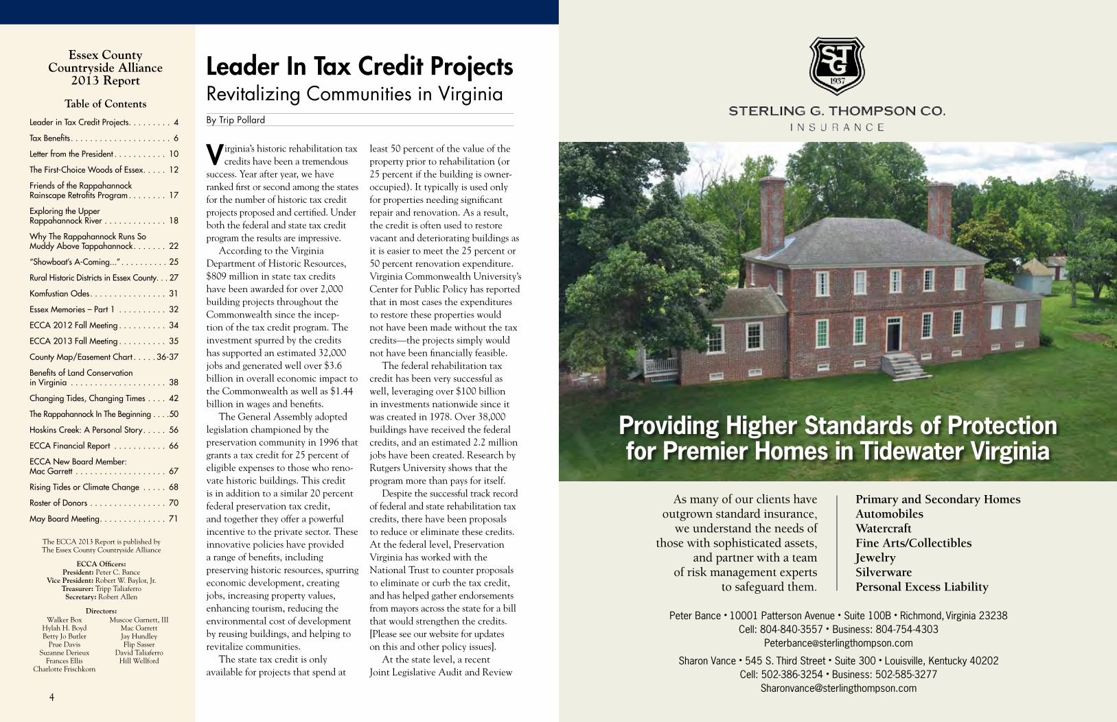
Leader In Tax Credit Projects Revitalizing Communities in VirginiaBy Trip Pollard
Virginia’s historic rehabilitation tax credits have been a tremendous
success. Year after year, we have ranked first or second among the states for the number of historic tax credit projects proposed and certified. Under both the federal and state tax credit program the results are impressive.
According to the Virginia Department of Historic Resources, $809 million in state tax credits have been awarded for over 2,000 building projects throughout the Commonwealth since the incep-tion of the tax credit program. The investment spurred by the credits has supported an estimated 32,000 jobs and generated well over $3.6 billion in overall economic impact to the Commonwealth as well as $1.44 billion in wages and benefits.
The General Assembly adopted legislation championed by the preservation community in 1996 that grants a tax credit for 25 percent of eligible expenses to those who reno-vate historic buildings. This credit is in addition to a similar 20 percent federal preservation tax credit, and together they offer a powerful incentive to the private sector. These innovative policies have provided a range of benefits, including preserving historic resources, spurring economic development, creating jobs, increasing property values, enhancing tourism, reducing the environmental cost of development by reusing buildings, and helping to revitalize communities.
The state tax credit is only available for projects that spend at
least 50 percent of the value of the property prior to rehabilitation (or 25 percent if the building is owner-occupied). It typically is used only for properties needing significant repair and renovation. As a result, the credit is often used to restore vacant and deteriorating buildings as it is easier to meet the 25 percent or 50 percent renovation expenditure. Virginia Commonwealth University’s Center for Public Policy has reported that in most cases the expenditures to restore these properties would not have been made without the tax credits—the projects simply would not have been financially feasible.
The federal rehabilitation tax credit has been very successful as well, leveraging over $100 billion in investments nationwide since it was created in 1978. Over 38,000 buildings have received the federal credits, and an estimated 2.2 million jobs have been created. Research by Rutgers University shows that the program more than pays for itself.
Despite the successful track record of federal and state rehabilitation tax credits, there have been proposals to reduce or eliminate these credits. At the federal level, Preservation Virginia has worked with the National Trust to counter proposals to eliminate or curb the tax credit, and has helped gather endorsements from mayors across the state for a bill that would strengthen the credits. [Please see our website for updates on this and other policy issues].
At the state level, a recent Joint Legislative Audit and Review
Primary and Secondary HomesAutomobilesWatercraftFine Arts/CollectiblesJewelrySilverwarePersonal Excess Liability
Providing Higher Standards of Protection for Premier Homes in Tidewater Virginia
Peter Bance • 10001 Patterson Avenue • Suite 100B • Richmond, Virginia 23238 Cell: 804-840-3557 • Business: 804-754-4303
Sharon Vance • 545 S. Third Street • Suite 300 • Louisville, Kentucky 40202Cell: 502-386-3254 • Business: 502-585-3277
As many of our clients have outgrown standard insurance,
we understand the needs of those with sophisticated assets,
and partner with a team of risk management experts
to safeguard them.
66
Trip Pollard is a Preservation Virginia Board Trustee, Co-chair of Public Policy Committee
and Senior Attorney and Leader of the Land and Community Program at the Southern Environmental Law Center. Article originally published in Preservation Virginia’s Historic Ventures, Spring 2013; volume 11, number 1.
Commission (JLARC) study of the effectiveness of various tax credits highlighted the historic rehabili-tation tax credit as an example of a credit that is accomplishing the intended goal. Despite the credit’s success, there were suggestions that the rehabilitation tax credit might be reduced or eliminated during the 2013 General Assembly session to generate more funds for transportation.
A bill was introduced that would require all tax credits to be reenacted or eliminated every five years, which would create uncertainty and have a chilling effect on rehabilitation deals, since they often take years to develop. Preservation Virginia countered these threats, and we are grateful to all of you who responded to our alerts. We are pleased to report that the transpor-tation funding bill ultimately approved by the General Assembly did not touch the rehabilitation tax credits and that the bill to sunset tax credits was defeated.
The preservation community should continue to champion these credits. The General Assembly
has created a Joint Subcommittee to Evaluate Tax Preferences, and the first meeting on April 2, 2013 focused on both the historic rehabilitation tax credit and the land preservation tax credit. It certainly is appropriate—and necessary—for government officials and the public to evaluate the effectiveness of such credits. Preservation Virginia will use the opportunity to further educate legislators about the many benefits and the strong track record of Virginia’s rehabilitation tax credit, and we encourage you to do so as well.
We’ve got a great story to tell.
Tax BenefitsBy Todd Hochrein
There are some excellent tax benefits that can be gained from doing a conservation easement in 2013.
There are two significant tax benefits. One, Virginia will provide a landowner with a Virginia Income Tax Credit equal to 40 percent of the easement value. These credits can be sold for cash soon after the easement is completed. Two, the IRS will allow the landowner an income-tax deduction for 100 percent of the easement value. The deduction is limited each year to 50 percent of the taxpayer’s adjusted gross income. If the taxpayer is a qualifying farmer (more than half of his/her gross income is from farming or timbering), up to 100 percent of the gross income can be deducted. Whatever isn’t used in year one is carried forward for up to fifteen years, or until the full easement value has been used up.
Let’s do an example. Say you have a 200-acre farm. The land is currently worth $4,000 per acre. An appraiser determines the value, after the easement, is $2,400 per acre. What you gave up with the easement is $1,600 per acre x 200 acres = $320,000.
Easement value = $320,0001) Virginia Credit = $128,000 (40 percent of the
Todd is based in Charlottesville and has been working in land
conservation for 10 years. When he isn’t working, he likes to spend time with his family—preferably at the beach, in the mountains, or on a river.
easement value). If you sell your credit, you can expect to net 75–80 percent after broker and transfer fees. This would be a cash payment to you of approximately $100,000. This payment may be taxable at the IRS level, depending upon your tax situation and when you sell the credit.
2) IRS tax deduction = $320,000. If your adjusted gross income is $80,000 a year, you can deduct $80,000 each year for four years. If you are in the 20 percent tax bracket, this will save you $16,000 ($80,000 x 20 percent) each year for the next four years. That’s a total savings of $64,000 in IRS payments.
The IRS tax deduction is supposed to decrease next year. The Virginia Tax Credit has been around for over ten years but may change based on legislative amendments by the General Assembly. Because everyone’s tax situation is different, you should consult with your tax professionals prior to placing an easement on your property.
Your Land, Your Brand
We’re committed to helping your farm land stay that way.
Tappahannock, VA646 Richmond Hwy
804-443-4374
Wakefield, VA10489 General Mahone Hwy
757-899-3232
Toano, VA7761 Richmond Road
757-566-1750
Ashland, VA11053 Leadbetter Road
804-358-6776

8
SALES • SERVICE • PARTS • FINANCING
10450 SucceSS StreetAShlAnd, VA
804-798-150011204 GenerAl MAhone hwy
wAkefield, VA
757-899-5959
Proudly Serving Agriculture
Since 1941
Hoober Is Your Full Line Case IH Dealer Dedicated To Your Parts, Service, Precision Farming And Product Needs
✔ Case IH Tractors From 30 To 600 HP ✔ Case IH Axial-Flow Combines ✔ Case IH Patriot Sprayers ✔ Case IH Pivot Transport Planters ✔ Case IH Tillage Tools ✔ Case IH Hay Tools ✔ Case IH Scout Utility Vehicles ✔ Case Skidsteers
T o g e T h e r W e S e r v e B y S e r v ic e W e g r o W
FormerLY CAvALIer INTerNATIoNAL
ASHLANDASHLAND
WAKEFIELDWAKEFIELD
Serving eaStern virginia

10 1110
Letter From the President
Dear Friends,Now in its seventh year and with a board of seventeen members, ECCA is still very active on a
number of fronts. We currently have 140 paying members and another 150 names on our mailing
list. We are continuing to grow, both in the number of members and in the amount of acres under
easement.During their meeting on June 28, the Virginia Outdoors Foundation accepted an additional
4,254 acres to be placed under easement in Essex County by the end of 2013, and hope to
announce more at their October meeting. This increase will be approximately 27%, raising our
total to over 20,000 acres, an impressive amount for a county with just north of 11,000 people
and 164,972.54 acres.In his article in this year’s magazine, John Page Williams notes the fact that during the four
centuries since 1608, the Rappahannock River Valley has seen a 100-fold increase in the human
population, from 2,200 to 220,000. Accordingly, a number of the articles herein are devoted to
what is perhaps our greatest asset, our Rappahannock River.
Should it be disturbing that rising sea and salinity levels are changing the very make up of the
river water, in slow motion? How will it affect farming, rare plants, ducks, geese, fish, our fresh
water marshes, and so on?Development in the Rappahannock watershed contributes to the decline in our water quality.
This impending development is best contained by conservation easements. We do have a compre-
hensive plan in place, and I feel that we have one of the best boards of supervisors in Virginia.
That being said, board members retire and the mindset of the new board members is unknown.
We do know, however, that a conservation easement is in perpetuity.
In the May 15th edition of the Northern Neck News, a notice for an application appeared, to
build a community pier off of Fones Cliff in Richmond County. This pier, which would extend
220 feet into the Rappahannock, forms a T-shaped 552-foot dock, parallel to the River, and
meant to accommodate 46 boats. This pier, and the ensuing boat traffic, would forever change
the upper Rappahannock. Many thanks to those of you who have written to the Virginia Marine
Resources Commission (VMRC) board to stop the building of this pier. Our letter to VMRC on
ECCA Stationary is on the opposite page.
Our large number of writers, photographers, and chart makers, diligently work to make the
ECCA the successful preservation group it is today. Please thank all who help us when you see
them, including our corporate sponsors who make this magazine possible.
We look forward to seeing you on September 20th at the Fall ECCA meeting at Walker Box’s
beautiful Brooke’s Bank.
Sincerely,
On the Cover Sunrise on Hoskins Creek (photo by Howard W. Reisinger, Jr.); bald eagle at rest (photo by Hill B. Wellford); James Adams Floating Theatre (photo courtesy of The Mariners’ Museum, Newport News, VA); Hubert Phipps, Tayloe Emory and Peter Bance (photo by Susan Bance); Glencairn (photos courtesy of Susan Bance).
The Essex County Countryside Alliance serves to promote and protect the rural character of Essex County – preserving farms, forests, natural and historic resources – for the benefit of future generations.
c/o Betty Jo Butler • 748 Tidewater Trail • Supply VA • 22436
May 23rd, 2013 Marine Resources Commission Habitat Management Division 2600 Washington Avenue, 3rd Floor Newport News, Virginia 23607 Re: Application of Terrell W. Bowers to Construct a Community Pier on the Rappahannock River in Richmond County To the Commissioners: This letter is submitted in opposition to the application of Terrell W. Bowers for authorization to construct a community pier for the Rappahannock Cliffs Subdivision on the Rappahannock River at TM 5 Parcel 10 in Richmond County. The pier is described as 6 feet in width, 220-‐feet long with a 552-‐foot T-‐head that would accommodate 46 boat slips. We urge the Marine Resources Commission to reject the application. The construction of the proposed pier would forever alter and destroy one of Virginia most scenic areas and unspoiled stretches of the Rappahannock. The unique nature of the Fones Cliffs area cannot be overstated: -‐ This is an area, which the Audubon Society has identified as the “most pristine” of the major tributaries of the Chesapeake Bay. Because it hosts hundreds of species of migratory birds, it has been designated an Important Bird Area (IBA) with global significance by Audubon. -‐ It has been described as a “National Treasure” by the Center for Conservation Biology because it is considered to be one of the most important Bald Eagle nesting and habitat areas in the entire Chesapeake Bay region. -‐It has also been described as a “Treasured Landscape” by the United States Fish & Wildlife Service and lies in the heart of USF&G’s Rappahannock River Valley Natural Resource Concentration Area. -‐ It has similarly been identified by National Geographic as a treasured landscape of the Chesapeake Bay because of its scenic beauty, wildlife habitat, and historical significance. -‐The importance of preserving the natural beauty and unspoiled characteristics of this property has been recognized by Senators Mark Warner and Jim Webb and by Congressmen Jim Moran and Robert Wittman in appropriation measures and in press releases which have emphasized the scenic and conservation value of this property. Mr. Bowers’ proposed construction of a community pier cannot be reconciled with the Commonwealth’s interest and with the interests of area residents in preserving this important stretch of the Rappahannock. It is ironic that Mr. Bowers’ own marketing materials regarding this project recognize the unique beauty, wildlife habitat, and conservation value of the property which his project would do much to destroy. This is simply not an area of the Rappahannock that is suitable for a community pier where multiple power boats and jet skis would be a common occurrence. We hope the Commission will also take notice that there is already a public Ianding, Carters Wharf, which is a short distance up river from Mr. Bowers’ proposed pier location. Carters Wharf provides ample access to the river for members of the public and to any potential owner of Bowers’ property. State Route 622 which is the road that affords access to Carters Wharf is in close proximity to the access road to the Bowers’ tract. In fact, the access road to the Bowers’ tract actually branches off State Route 622. Hence, Mr. Bowers cannot make a credible contention that his proposed pier is necessary to provide access for his property owners to the river. For the foregoing reasons, we respectfully urge that the Commission reject the application for a community pier by Terrell W. Bowers. Sincerely, Peter C. Bance President Board Members Robert Allen Robert W. Baylor Jr. Hylah Boyd Walker Box Betty Jo Butler
Prue Davis Frances Ellis Charlotte Frischkorn Muscoe Garnett Mac Garrett
Jay Hundley Phillip Sasser Jr. Tripp Taliaferro Hill Wellford
Essex County Countryside Alliance
Officers: Peter C. Bance, President • Robert W. Baylor, Jr., Vice President Tripp Taliaferro, Treasurer • Robert J. Allen, Secretary
Directors: Hylah H. Boyd • George Walker Box • Betty Jo L. Butler • Margaret H. Davis • Suzanne Derieux • Frances H. Ellis • Charlotte Frischkorn • Muscoe Garnett, III •
Mac Garrett • James H. Hundley • Phillip Sasser Jr. • David Taliaferro • Hill B. Wellford

12 13www.essexcca.com
By Edward Wright Haile
The First-Choice Woods of Essex
Eastern Virginia has an out -standing natural resource in
its native forest. The hills and swamps of Essex, with no encour-agement at all, sprout trees that are first-choice species for many undertakings. Back in the days when the local product had to serve and commercial imports were rare and expensive, local craftsman were happy to discover they had only to go a short ways out the back door to meet all their wood needs.
Ash, hickory, and oak served for horse halters and wagons. Sweet gum that grows here like a weed was and is the very best short tool handle. Long handles favored hickory. There is no better fence post anywhere on earth than locust, unless cedar. Red cedar that is. Actually dead red cedar. You should wait for a cedar tree to die and weather away to the heart. Once dead, like our bones, it is wellnigh immortal. I am tempted to bet anybody fifty dollars I could find fencepost locust or dead cedar within minutes on foot anywhere in Essex. Locust is fast-growing. Cedar is slow. You can take your choice. Also first pick for pier pilings.
Neither, though, gets very big without getting confused. The big trunks are folded and cleft as if several saplings were growing together in a colony. The Indians used locust for archery bows. I haven’t had much success with that. Our bamboo, laminated, should be first choice there. Cedar is still used to make a cedar chest because it naturally repels moths. The sapling is the first choice of many for a Christmas tree. Personally I rate other species higher (not a religious observation).
Fence rails used to be chestnut. Up until the blight of a hundred
years ago. When the tree disap-peared, the distinctive chestnut rail fence of the Virginia countryside went with it. The last ones could be seen here into the 1950s. The remnant mound where the rails once criss-crossed is today is called a fence worm, seen snaking many a furlong through the woods. If you still want the historic look, try using peeled sassafras. I am told it does well as long as it clears the ground. Another fifty-dollar bet for availability. Sassafras doesn’t grow much bigger around than a fence rail, so at most it is riven in two, never quartered. Sassafras root, with its distinctive root beer flavor, used to be marketed as a tea stock until it was outlawed as a carcin-ogen. It seems if you drank a few tubfuls you might be at risk. Well, then, stick to the leaves. The fresh green mitten-shape leaf makes an excellent energy snack any time of a hot day. Sassafras is unique in that it doesn’t need to be replanted. The roots are interconnected. When a trunk is removed, the root system picks a spot to send up another one for you.
Ours is not a maritime province. Nevertheless our hills contain nautical lumber, namely, white oak, locust again, and heart pine. More about them later. But you can build a boat out of local lumber, just not quite first-class boat lumber. The Indians made dugout canoes of local poplar and cypress. Fast-growing poplar and slow-growing cypress are easily worked, soft species. The poplar choice was obvious. There is not a straighter, taller tree in the forest. The ancient Powhatan fashioned a single log into a vessel up to fifty feet long. It could have been even longer if they had used many of the trees I see
within a mile of my house. Another thing about poplar. The branches grow out straight and then turn up at a right angle. Curious.
The only practical disadvantage I see in a dugout canoe, properly hollowed and shaped, is that it is hard to cartop. In the water, though, it handles beautifully, better than your ABS and fiber-glass. Safer too.
Notice I have not mentioned our most important cultivated species, loblolly pine. That’s because it has small virtue. It is first-class wood for nothing. Kind of a shame, and ironical, but the value of loblolly is that it produces more cellulose per acre than any other species. Fast-growing, eight-foot groves, thinned at fifteen years or so. A rapid-rotation money crop. It’s fair to say loblolly, well selected, does a good job as clapboard. I think the best thing about the loblolly, despite its exalted commer-cial status, is in the living grove, in the soughing sound the wind makes over the mature treetops and for the majestic silence, winter or summer, when the air falls still. We should use loblolly groves for churches.
Actually, local Southern red oak is the fastest growing local tree,

15www.essexcca.com14
if standing alone. It cannot compete with loblolly in crowded plantation conditions. And for that matter, fast-growing wood is inferior lumber anyway. A farm is an excellent source of food and fodder, but a tree farm is an excellent producer of inferior lumber. It’s all rapid growth and regardless (almost regardless) of species it is third rate.
Before I discuss the main act—native building lumber—I’ll mention that the furniture species, walnut and cherry, are well represented in all three magiste-rial districts, flats to forest. I once heard that good gunstock walnut orchards of an acre or two are planted by the Amish to be harvested after two generations to pay inheritance taxes. The trees are auctioned off individually. Well, walnut seems to love our soils.
White oak is first-choice basket material. The withes are split from the sapwood of a three or four-inch sapling, the sole case I know of of sapwood being superior to heartwood for a given use.
And then there’s the Pavlonia. If you haven’t heard of it perhaps just as well. A trash species that suddenly turned solid gold twenty-odd years ago. Ask your county agent. I don’t want to get into the subject. No, it is the number one species for Japanese bridal trous-seaux, I was told at eighth hand.
Everybody’s got a persimmon around the yard somewhere. It’s nicknamed American ebony and is harvested for driver golf clubs. Use it anywhere you need something sturdy and pretty.
And so on. The main act is buildings, barns, homes. Wood of any species is disappearing from contempo-rary construction. So this is an historical perspective survey. However, since we all live here, and the woods are as abundant as they’ve ever been, and most land-owners being generous folk, a do-it-yourself builder has a wide-open opportunity and might profit from the below.
Nowadays to the extent we use wood at all, we use pine for framing and oak for flooring. That is precisely backwards to the older practice. The strength of mortise-and-tenon pegged oak framing rivals steel. In fact it is more fire-hardy than steel. Steel buckles in a fire. White oak hardens in heat, and has to burn all the way through to fail. Many a charred oak survivor has been reframed and had a new life. Peg construction versus nails? Everybody knows nails are only as strong as they are tight. A wooden peg, on the other hand, lose or tight, retains all its strength to hold a tenon
tongue-and-groove (domestic) and face nailed with cut nails. No toe-nailing, please.
Poplar was choice for trim, window sashes, doors, and heart poplar makes a very nice plank for exterior sheathing.
By the way, there are many grades of lumber, but the important ones are two: sapwood and heartwood, all species. Sapwood is the newer, living, outer, lighter-colored rings, always iffy for exterior use. One must seek out heartwood to obtain the whole virtue of a given species. Another grading is rate of growth, with growth rings a dozen or more to the inch preferred, known as slow growth. But such is a commonplace around the county. Just not at Lowe’s. Funny thing though. I have never understood why one oak or pine trunk, dead and lying on the forest floor, will keep a sound heart whereas another apparently in the same condition, maybe lying side by side, will be rotted out hollow.
Most folks imagine centuries ago, when original forests were still uncut, the trees were big around as well as tall, like sequoias. They were tall, all right, but mostly two or three feet thick (diameter breast height), like our fifty and sixty year olds. The reason was slow growth, meaning, and I’ve counted, thirty and upwards annual rings to the inch.
Beech makes a fine step tread. So does hickory. White oak is preferred to red oak for framing, and either will do for a step tread. But here again, spruce pine was favored as in flooring, even though there are no seams in stair steps. They are always made of a single breadth of plank.
There are four native Essex pine species: spruce pine (q.v.), loblolly or pinus taeda, rosemary or pinus echinata, and white. Forget white pine for all purposes, but some people think the echinata is a sort of superior loblolly. Maybe, but I don’t think it was much used in the past. It makes an awfully impressive year-round shade in the churchyards. A fifth species,
in a mortise until it is literally shredded apart, a titanic undertaking. It’s like building a house out of roll bars. The trick with oak is timing. When it’s green, rip it to size. In stage two, dry to all appearance, dress it and build with it using ordinary tools. Third stage, about a year after harvest, it starts turning hard as iron. Just be done by then or upgrade your drill bits.
So much for framing, but why did the oldtimers here use pine for flooring? The sawmill name is spruce pine, taxonomically pinus virginiana; consid-ered as a trash tree on tree farms. It often grows with a sinuous bend, just like a Florida palm, with all the greenery at the top. When you rip it at the sawmill, it usually has dozens of pinhole knots of tough little twigs that died off as the tree gained height. All the same, the heart of it served as colonial-era flooring. If you know of a big one, hurry, because they tend to blow down. The virtue is in the resinous heart. It is all but impervious to moisture, hence the plank does not expand and contract with the seasons, or allow the floor to crack open, as they used to say. Remember, in the old days there was no climate control. (Or out of control, for that matter.) But oak, red or white, doesn’t work. Unless you have a thermostat regulating indoor temperature and humidity, it opens and shuts almost audibly, depending on winter or summer. Colonial oak flooring is an oxymoron. It’s why sensible oak flooring is a narrow plank.
It’s also a fact that heart pine is explosively flam-mable. However, a floor is the least flammable of shapes. It was either laid over seam battens (commercial) or
17www.essexcca.com16
long-leaf yellow pine, or p. palustris, is making a comeback in southeastern Virginia but I do not believe it will thrive here.
As for roofing, the very first choice then and now is bald cypress. Sadly, it fails the fifty-dollar bet because when you cut this breath-takingly magnificent giant you must plant its replacement and so far nobody has (except me, that is). But it was/is just as much native here at home as it is anywhere. The big local groves today are in the Dragon in Middlesex, King and Queen, and Gloucester. Planted it will begin producing a shingle or shake, under good growing conditions, after twenty years. Cypress is superior to other highly rot-resistant species—local red cedar, locust, west-coast cedar—for one big fat reason. It soaks up moisture; it waterlogs in no time. Think of it this way: All wood roofing is dry in hot weather. In cold weather, when we used to build fires, evaporation was at a minimum so that cypress shingles were saturated from rain and snow and grew cold-weather mosses at precisely the time of year they were called on to be fireproof. All those other species are durable on a roof precisely because they absorb little or no water and remain the year-round explosively flammable. Tell that to the “colonial” wood shake salesman. Also, shakes may be a fashionable rustic “colonial” look, but cypress is easily worked and the old timers always planed it to a proper shingle. All the same, when it comes to roofing, wood takes a back seat to metal and slate.
These are only the main wood species. What about black gum, and holly, and maple? Hornbeam, river birch, hackberry, mountain laurel, sycamore, dogwood? All are inexhaustibly common, but I’ll leave them to the experts, except to say the next time you visit The Mariners’ Museum, in Newport News, observe the Crabtree collection. These are the finest ship models in the world. The wood? Our own native holly, the best carving wood anywhere.
In sum, our native woods are very rich at the same time that it is a good rule of thumb anywhere to use native species in local construction for all but the most intensely specific tasks. Wood produced in a given climate is generally the best behaved and most durable in that climate. The exceptions here are slow-growth Douglas fir and various nautical lumber species such as mahogany and teak. Pressure-treated loblolly pine, a local wood but artificially enhanced, and expensive, is a tough competitor with the best for outdoor projects. Just make sure it is slow-growth or it will check and warp almost before your eyes.
The alder is a common bush in our swamps. West Coast alder grows larger and is a choice species for smoking salmon but our local variety came up short in a few experiments. Others may have more luck, but until then we have the hickories.
I am told the Tappahannock pecan trees are dying of old age.
Red maple is as abundant as any tree in Essex. And that introduces another first-choice wood use: autumn colors. With a goodly bit of moisture in the ground through summer and fall, our maples do extremely well for the calendar trade. But almost as vivid is the sweet gum, producing green, orange, red, and a purple so deep you could call it black, often all on the same tree. The best solid red, and the earliest leaf to turn, is the work of the unrelated black gum, a swamp lover. Its rival in crimson is none other than poison ivy. The red oak performs, in rare years, with the most delicate and deep dusky reds imaginable, the best often being shown by the tiniest saplings with their oversized leafage. The most delicious caramel yellow anywhere is the common hickory, all sizes. Tall poplars in a grove create canyons of pale yellow that seem to shine with their own light, cathedrals that once a year might rival the pines as sanctuaries.
The rich history of the Rappa-hannock River has roots as deep
as the many gardens that have highlighted the region for more than 400 years. For generations, the traditions of landscaping beauty have passed along from family to family and have now become an honored feature for most river homes. As more and more families move into our area, the land is developed to mimic the “traditions” of our neighbors. Despite the seem-ingly aesthetic value of many of these landscaping traditions, they can be a significant threat to the health of our river.
Polluted rainwater runoff is the primary driver for the degrading health of the Rappahannock River. Rain takes in excess chemicals and nutrients from hard surfaces and even lawns, flushing them into the river. These pollutants then fuel algae blooms and dead zones, removing the oxygen that is vital to support most of the river’s aquatic
life. Oftentimes, homeowners are providing this fuel inadvertently with the intention of “greening” the garden or lawn. A healthy lawn or garden doesn’t always need fertilizers; a simple way to find out what it might need is to have a soil test performed. Contact your local county extension agent for more information on soil testing in your area.
To continue to reduce the volume of storm water runoff that returns to the river, unfiltered, the Friends of the Rappahannock follow this three-way approach to landscaping: slow it down, spread it out, and soak it in. Steps homeowners can take to follow this approach include disconnecting the downspouts from the storm-water collection system or ditches. Heavy storm events such as Tropical Storm Lee can ream out streams, creating sediment pollutions and even costly damage to properties. Other ideas include utilizing rain barrels;
a fifty-five-gallon rain barrel can handle a one-inch rain that flows off ninety square feet of roof top. This water can be incredibly useful for gardening in the drier periods of a Rappahannock River summer. Friends of the Rappahannock are also providing technical guidance for home owners to install rain gardens. While rain gardens can look like green spaces with trees, bushes, and flowering plants, they are actually powerful natural filters. By amending soils and planting vegetation in a way that is condu-cive to infiltration, rain gardens can capture 623 gallons of water during a one-inch rain from a roof top of 1000 square feet. That can add up to 25,000 gallons per year.
Please visit our website www.riverfriends.org for more informa-tion about our Rainscapes Retrofit Program, or just stop by the Friends of the Rappahannock office at June Parker Marina, Tappahannock, tel. 804-443-3448.
Friends of the Rappahannock Rainscape Retrofits ProgramBy Richard C. L. Moncure Jr.
Richard C. L. Moncure, Jr. has spent a lifetime fishing and farming along the Rappahannock. Now working as the
Tidal Rappahannock River Steward for the Friends of the Rappahannock, he lives with his wife, Jessica, and his son, Tripp, at Simonsons in Richmond County where they grow or catch most of what they eat.
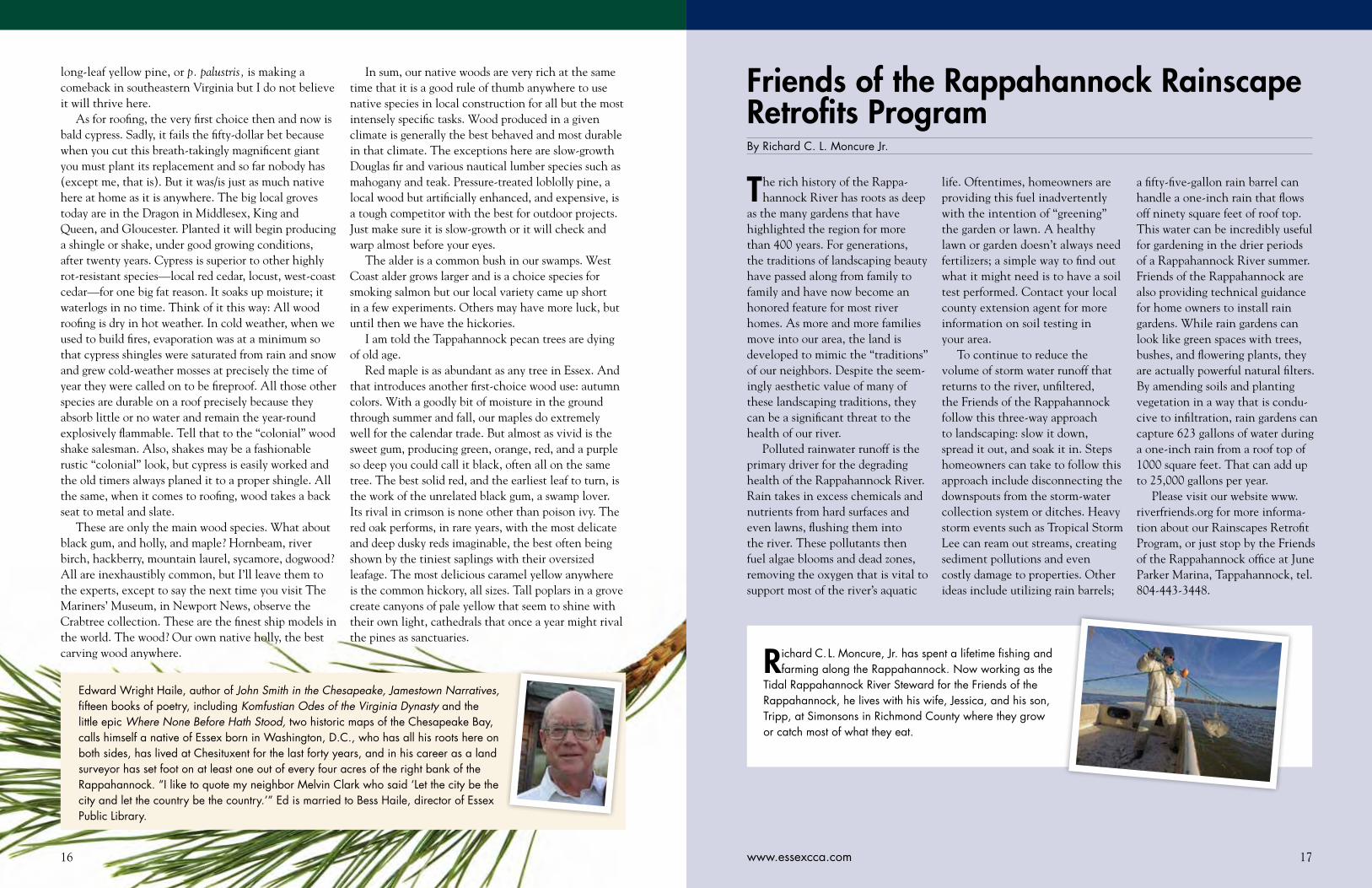
Edward Wright Haile, author of John Smith in the Chesapeake, Jamestown Narratives, fifteen books of poetry, including Komfustian Odes of the Virginia Dynasty and the little epic Where None Before Hath Stood, two historic maps of the Chesapeake Bay, calls himself a native of Essex born in Washington, D.C., who has all his roots here on both sides, has lived at Chesituxent for the last forty years, and in his career as a land surveyor has set foot on at least one out of every four acres of the right bank of the Rappahannock. “I like to quote my neighbor Melvin Clark who said ‘Let the city be the city and let the country be the country.’” Ed is married to Bess Haile, director of Essex Public Library.
18 19www.essexcca.com
A hardcore sailing friend of mine once remarked that he had traveled “a long way” up the Rappa-
hannock River in Virginia. I assumed he meant at least as far as Tappahannock, where the 50-foot-high Route 360 bridge marks the end of the line for a lot of sailboats. But no, he meant Urbanna. Urbanna! I answered with a snort. You can practically see the Bay from Urbanna! You barely got started. To be sure, it’s a great little town with a long maritime history, but the Rappahannock is navigable all the way to Fredericks-burg. Why not farther? Right in character, he replied, “Well, the wind dies there. Why would anyone want to go farther?”
Well . . . okay. Everyone cruises on his or her own terms, and, to be fair, my friend is no slouch; he’s put a lot of Chesapeake miles under his pretty little sloop. But for others—powerboaters and sailboaters who don’t mind firing up the iron genny when necessary,
there’s a lot of Rappahannock to explore beyond Urbanna.
I remembered that conversation last December as I explored part of the Rappahannock between Tappahannock and Port Royal in my trusty 17-foot Boston Whaler, First Light, with friends Jim Rogers and Bill Portlock. Jim is a Richmond businessman and vice-chairman of the Chesapeake Bay Foundation’s Board of Trustees. Bill is a longtime friend and colleague on the CBF staff, who also happens to be a superb photogra-pher (indeed, the photos accompanying this article are his). Bill lives near the Rappahannock, in Sparta, Va., and prowls it often in his own 17-foot Whaler.
This section of the Rappahannock is special to me because a much-loved family friend introduced me to it way back in the 1950s—after he’d built a small cabin on the north shore at Leedstown—and took me fishing for largemouth bass along its creeks. Ever since, I’ve
found as many excuses as possible to visit this stretch of the river. It’s an easy two-hour drive from my house near Annapolis to the launch ramp at the Leedstown Campground. On this day, First Light and I ran a mile upriver to pick up Jim at the home of a mutual friend on the south side, in Essex County.
A Treasured Landscape The Rappahannock’s watershed drains a broad swath of land from the eastern slopes of the Blue Ridge Moun-tains through central Virginia to the Chesapeake Bay, so it carries plenty of fresh water seaward. This particular 30-mile stretch, from Port Royal down to Tappahan-nock, is the midsection of the river’s tidal portion, with low land along its floodplain, a fertile valley between ridges that are 100 to 150 feet above sea level.
As is true on other long tidal rivers throughout the Chesapeake watershed, the Rappahannock here flows through a long series of looping meanders before widening out significantly at Tappahannock and adopting a comparatively straighter southeasterly path. In the twisty upper reaches, the current accelerates on the curves, chewing into the land and creating steep banks—as well as adjoining deep water. On the insides of those same turns, it slows, allowing sediment to settle out and collect in broad marshes and wooded swamps.
The water is nearly fresh at Port Royal but grows progressively brackish downriver. Several large creeks—especially Occupacia, Cat Point and Mount Landing—contribute additional fresh water from the ridges that parallel the big river’s main stem. The combination of fresh and salt water, strong currents, marshes and deep water close to shore gives this part of the river a rich biological community of plants, fish, birds and mammals. Combine that with fertile floodplain soils, and it is no surprise that this region has served humans well for several thousand years. Archaeologists have documented multiple cultures of Native people before Captain John Smith and his crew came exploring up the Rappahannock in August 1608. English settlers staked claims along the river beginning in the second half of the 17th century, and many of today’s local families trace their ancestry to them.
Two features in this section of the river stand out spectacularly. These are Fones and Horse-head cliffs, where the twisty river has cut into the ridges on the sides of the valley, exposing high sandstone bluffs, many of them deeply divided by densely wooded ravines. Over the centuries, these bluffs have played
key roles in both the human and the natural history of the river.
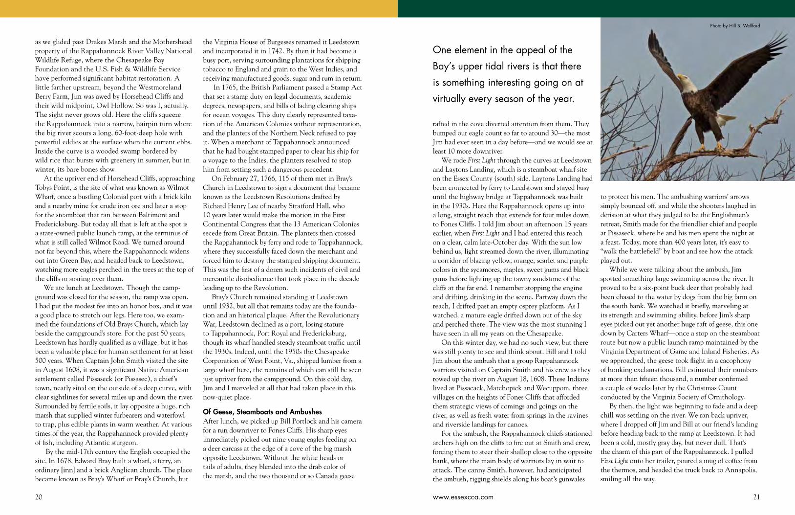
Eagles and PatriotsThat combination of histories provides a great perspec-tive for exploring this section of the Rappahannock in a sturdy, trailerable skiff with shallow-water capabilities. Though Jim Rogers is an experienced racing and cruising sailor who knows the lower Rappahannock well, he had never visited this part of the river. On this chilly but calm day in early December, it didn’t hurt that he is also an experienced waterfowl hunter who is used to prowling around outdoors in all weather. We bundled up appropriately, carried food and stainless thermoses of coffee to keep our internal fires lit, and, to keep windchill and windburn to a minimum, kept First Light cantering at moderate speeds instead of galloping flat out.
One element in the appeal of the Bay’s upper tidal rivers is that there is something interesting going on at virtually every season of the year. Springtime brings spawning rockfish, white perch, American and hickory shad, catfish, and two species of river herring. In summer, the river’s shallows teem with juvenile fish that make its great blue herons and ospreys fat and happy, while the marshes burst with seed-bearing plants like wild rice, rice cut-grass, smartweed and tearthumb. Fall brings blackbirds and then waterfowl, while the hardwood trees along the river turn to blazing colors. Winter brings concentrations of Canada geese and bald eagles.
Many of the latter are juveniles in their first four years of life, moving down from northern birthplaces to spend a relatively milder winter roosting and feeding here. This section of the Rappahannock is actually a critically important piece of habitat for the eagles of the Atlantic coast. Bill Portlock has counted them each winter since the late 1990s for the Center for Conservation Biology at the College of William and Mary and the Virginia Society of Ornithology. Over that time, his count along a prescribed 35-mile course has ranged between 150 and an astounding 370 birds (the latter in a year when the large winter eagle roosts on the Potomac’s midsection were frozen). The two sets of cliffs are especially important for them as roosting habitat.
Jim and I didn’t find anything close to those numbers as we headed upriver in the morning, “only” a dozen or so. Geese were another story; just upstream from Leedstown, we jumped several thousand of them
Exploring the Upper Rappahannock RiverBy John Page Williams Reprinted by permission from Chesapeake Bay Magazine.
Photo ©Bill Portlock
20 21www.essexcca.com
as we glided past Drakes Marsh and the Mothershead property of the Rappahannock River Valley National Wildlife Refuge, where the Chesapeake Bay Foundation and the U.S. Fish & Wildlife Service have performed significant habitat restoration. A little farther upstream, beyond the Westmoreland Berry Farm, Jim was awed by Horsehead Cliffs and their wild midpoint, Owl Hollow. So was I, actually. The sight never grows old. Here the cliffs squeeze the Rappahannock into a narrow, hairpin turn where the big river scours a long, 60-foot-deep hole with powerful eddies at the surface when the current ebbs. Inside the curve is a wooded swamp bordered by wild rice that bursts with greenery in summer, but in winter, its bare bones show.
At the upriver end of Horsehead Cliffs, approaching Tobys Point, is the site of what was known as Wilmot Wharf, once a bustling Colonial port with a brick kiln and a nearby mine for crude iron ore and later a stop for the steamboat that ran between Baltimore and Fredericksburg. But today all that is left at the spot is a state-owned public launch ramp, at the terminus of what is still called Wilmot Road. We turned around not far beyond this, where the Rappahannock widens out into Green Bay, and headed back to Leedstown, watching more eagles perched in the trees at the top of the cliffs or soaring over them.
We ate lunch at Leedstown. Though the camp-ground was closed for the season, the ramp was open. I had put the modest fee into an honor box, and it was a good place to stretch our legs. Here too, we exam-ined the foundations of Old Brays Church, which lay beside the campground’s store. For the past 50 years, Leedstown has hardly qualified as a village, but it has been a valuable place for human settlement for at least 500 years. When Captain John Smith visited the site in August 1608, it was a significant Native American settlement called Pissaseck (or Pissasec), a chief’s town, neatly sited on the outside of a deep curve, with clear sightlines for several miles up and down the river. Surrounded by fertile soils, it lay opposite a huge, rich marsh that supplied winter furbearers and waterfowl to trap, plus edible plants in warm weather. At various times of the year, the Rappahannock provided plenty of fish, including Atlantic sturgeon.
By the mid-17th century the English occupied the site. In 1678, Edward Bray built a wharf, a ferry, an ordinary [inn] and a brick Anglican church. The place became known as Bray’s Wharf or Bray’s Church, but
the Virginia House of Burgesses renamed it Leedstown and incorporated it in 1742. By then it had become a busy port, serving surrounding plantations for shipping tobacco to England and grain to the West Indies, and receiving manufactured goods, sugar and rum in return.
In 1765, the British Parliament passed a Stamp Act that set a stamp duty on legal documents, academic degrees, newspapers, and bills of lading clearing ships for ocean voyages. This duty clearly represented taxa-tion of the American Colonies without representation, and the planters of the Northern Neck refused to pay it. When a merchant of Tappahannock announced that he had bought stamped paper to clear his ship for a voyage to the Indies, the planters resolved to stop him from setting such a dangerous precedent.
On February 27, 1766, 115 of them met in Bray’s Church in Leedstown to sign a document that became known as the Leedstown Resolutions drafted by Richard Henry Lee of nearby Stratford Hall, who 10 years later would make the motion in the First Continental Congress that the 13 American Colonies secede from Great Britain. The planters then crossed the Rappahannock by ferry and rode to Tappahannock, where they successfully faced down the merchant and forced him to destroy the stamped shipping document. This was the first of a dozen such incidents of civil and mercantile disobedience that took place in the decade leading up to the Revolution.
Bray’s Church remained standing at Leedstown until 1932, but all that remains today are the founda-tion and an historical plaque. After the Revolutionary War, Leedstown declined as a port, losing stature to Tappahannock, Port Royal and Fredericksburg, though its wharf handled steady steamboat traffic until the 1930s. Indeed, until the 1950s the Chesapeake Corporation of West Point, Va., shipped lumber from a large wharf here, the remains of which can still be seen just upriver from the campground. On this cold day, Jim and I marveled at all that had taken place in this now-quiet place.
Of Geese, Steamboats and AmbushesAfter lunch, we picked up Bill Portlock and his camera for a run downriver to Fones Cliffs. His sharp eyes immediately picked out nine young eagles feeding on a deer carcass at the edge of a cove of the big marsh opposite Leedstown. Without the white heads or tails of adults, they blended into the drab color of the marsh, and the two thousand or so Canada geese
rafted in the cove diverted attention from them. They bumped our eagle count so far to around 30—the most Jim had ever seen in a day before—and we would see at least 10 more downriver.
We rode First Light through the curves at Leedstown and Laytons Landing, which is a steamboat wharf site on the Essex County (south) side. Laytons Landing had been connected by ferry to Leedstown and stayed busy until the highway bridge at Tappahannock was built in the 1930s. Here the Rappahannock opens up into a long, straight reach that extends for four miles down to Fones Cliffs. I told Jim about an afternoon 15 years earlier, when First Light and I had entered this reach on a clear, calm late-October day. With the sun low behind us, light streamed down the river, illuminating a corridor of blazing yellow, orange, scarlet and purple colors in the sycamores, maples, sweet gums and black gums before lighting up the tawny sandstone of the cliffs at the far end. I remember stopping the engine and drifting, drinking in the scene. Partway down the reach, I drifted past an empty osprey platform. As I watched, a mature eagle drifted down out of the sky and perched there. The view was the most stunning I have seen in all my years on the Chesapeake.
On this winter day, we had no such view, but there was still plenty to see and think about. Bill and I told Jim about the ambush that a group Rappahannock warriors visited on Captain Smith and his crew as they rowed up the river on August 18, 1608. These Indians lived at Pissacack, Matchopick and Wecuppom, three villages on the heights of Fones Cliffs that afforded them strategic views of comings and goings on the river, as well as fresh water from springs in the ravines and riverside landings for canoes.
For the ambush, the Rappahannock chiefs stationed archers high on the cliffs to fire out at Smith and crew, forcing them to steer their shallop close to the opposite bank, where the main body of warriors lay in wait to attack. The canny Smith, however, had anticipated the ambush, rigging shields along his boat’s gunwales
Photo by Hill B. Wellford
One element in the appeal of the
Bay’s upper tidal rivers is that there
is something interesting going on at
virtually every season of the year.
to protect his men. The ambushing warriors’ arrows simply bounced off, and while the shooters laughed in derision at what they judged to be the Englishmen’s retreat, Smith made for the friendlier chief and people at Pissaseck, where he and his men spent the night at a feast. Today, more than 400 years later, it’s easy to “walk the battlefield” by boat and see how the attack played out.
While we were talking about the ambush, Jim spotted something large swimming across the river. It proved to be a six-point buck deer that probably had been chased to the water by dogs from the big farm on the south bank. We watched it briefly, marveling at its strength and swimming ability, before Jim’s sharp eyes picked out yet another huge raft of geese, this one down by Carters Wharf—once a stop on the steamboat route but now a public launch ramp maintained by the Virginia Department of Game and Inland Fisheries. As we approached, the geese took flight in a cacophony of honking exclamations. Bill estimated their numbers at more than fifteen thousand, a number confirmed a couple of weeks later by the Christmas Count conducted by the Virginia Society of Ornithology.
By then, the light was beginning to fade and a deep chill was settling on the river. We ran back upriver, where I dropped off Jim and Bill at our friend’s landing before heading back to the ramp at Leedstown. It had been a cold, mostly gray day, but never dull. That’s the charm of this part of the Rappahannock. I pulled First Light onto her trailer, poured a mug of coffee from the thermos, and headed the truck back to Annapolis, smiling all the way.

22 23www.essexcca.com
That pronouncement is humbling for anyone who pays attention
to the health of the land along the Rappahannock and the water in the river. And it makes people who have never thought much about those resources angry, as in, “What do you mean that it’s my fault the river is muddy?” The truth is, though, that ever since the day that band of Rappahannock warriors ambushed Captain John Smith and his crew under Fones Cliffs (August 19, 1608, according to Edward
Wright Haile), we have been busy tinkering with the land that drains into the river, and thus with the river itself.
In those four centuries of tinkering—harvesting trees; clearing land and cultivating it in many ways (including deep plows); building villages, towns, and cities; more recently, supplying those municipalities with the services we now consider essential, including roadways, solid waste disposal, and wastewater treatment; burning fossil
fuels for transportation and electric power; and most of all, multiplying over and over and over—we have achieved many amazing feats, but we have irrevocably changed the Rappahannock and the lands around it. And we have to take responsibility for those changes.
Now don’t get angry. That’s not an accusation, or a suggestion that we should (or could) put the land and water back the way they were in Smith’s time. But it does mean that we have to pay attention to the
Why The Rappahannock Runs So Muddy Above TappahannockBy John Page Williams
changes, figure out how to protect and enhance the value of the positive ones we’ve made, and work out how to reverse the (mostly unintentional) destructive ones.
Let’s take population first. Archaeologists and historians estimate that the native population of the Rappahannock watershed in 1608 was around 2,200 people. That figure includes everyone from the Moraughtacund people on the lower river to the Mannahoac in the Piedmont above today’s
What is the most invasive species in Essex County? Nope, it’s not blue catfish or Kudzu vine. It’s the critter that walks upright on its hind feet and created Pogo, the famous comic-strip possum, who once declared that “We have met the enemy, and he is us.”
Fredericksburg. Now compare that number with the current population of the whole Rappahannock water-shed today: around 220,000, still sparse when compared with Northern Virginia but about a hundred times the population along the river and its tributaries when Smith visited. In fact, the population of Essex County alone was 11,205 in 2011. That’s five times the 1608 total, in just one still-rural county.
Think what that increase means in terms of trees cut; land cleared; wetlands filled; roads and highways paved; parking lots, malls, businesses, and houses built; vehicles coming and going; and airplanes flying overhead. Add producing or bringing in food and dealing with the waste of nearly a quarter-million people. The reason the Rappahannock isn’t the same river it was in 1608 is because the land around d it isn’t the same. In fact, it’s not the same river it was in 1940, within the living memory of some of Essex County’s elders. At least half of the watershed’s population growth has occurred within their lifetimes, and it is still accelerating.
The inevitable results of these activities are too much nitrogen, phosphorus, and sediment going into the river, filling creeks and harbors while overfertilizing the water so that greedy algae cells can bloom and die, while the associated decay bacteria suck the oxygen out of the water, especially in slow-moving creeks and the lower river’s deeper waters. Meanwhile, the algae cells and the sediment
block out the light that the river’s underwater grasses need to grow and reproduce. This overenriching process, called eutrophication, has been known to scientists for many years, but we, the public, are only just learning how we make it happen and how it damages the waters we love.
So what to do about it? There’s no simple remedy. If there were, we’d have put it to work long ago. An important part of the solution lies in the truly exceptional conser-vation practices that many Essex farmers apply to their land. They set an important example for everyone else in the watershed. Meanwhile, the Essex County Countryside Alliance and its partners are working hard to preserve as much of Essex County’s healthy natural land as possible. Another solution lies in the sophisticated Enhanced Nutrient Removal (ENR) systems now being installed in the sewage treatment plants around the Rappahannock watershed.
Unfortunately, a lot of the problem is more complicated because it is so widespread: how all of us operate our homes and businesses, and how well our local, state, and federal government agencies team up to finance and operate programs such as envi-ronmental site design that reduce the effects of urban and suburban stormwater runoff and the usually invisible pollution of groundwater by septic tanks. These problems hit uncomfortably close to home. Pogo’s maxim holds true now more than ever.
Photo ©Bill Portlock

25www.essexcca.com24
The powerless, flat-bottomed, two-story vessel, 132-feet long and 34 feet wide, was pulled into harbor by a tugboat, while on the showboat’s deck, a six-piece orchestra played a medley of popular tunes to help stir up interest for the night’s performance.
Interest throughout the entertainment-starved rural area was already high, having been fueled by posters and handbills distributed by an advance man and, of course, by the central telephone operator Gerline Passagaluppi, who had informed every family through party lines of the showboat’s arrival. As the floating barge made its slow way upriver from its last stop in Urbanna, wharves and river banks were lined with young and old hoping to catch sight of the long-awaited entertainers.
On the steamboat dock in Tappahannock to greet the performers an assortment of vendors stood ready to replenish the showboat’s necessary supplies: fresh produce purveyors; the ice man; boys carrying jugs of fresh water. All were rewarded with two tickets for that night’s performance. Director Charles Hunter never wanted to play to a half-empty house, and he sometimes pulled up anchor and moved to another location when the crowds weren’t sufficient.
The plays performed during the years 1914 through 1940 were an ever-rotating group of melodramas that featured comic characters such as a blackface comedian; a G-string, or old man, such as “Uncle Sam,” with a squeaky voice and a goatee; a “Toby,” or smart country rube; a
villain; a hero, and the glamorous ingénue, always played by Beulah Hunter, James Adams’s beautiful sister.
The titles promised more than the plays themselves delivered: Nice Girls Don’t, Over the Hills to the Poorhouse, Why Girls Walk Home, The Rent’s Due, Sally from Shanghai, Saintly Hypocrites and Honest Sinners, Don’t Lie to Your Wife, and the favorite, Smiling Through. Although good always triumphed over evil in the plays, strict Methodists and Baptists often had conversations with themselves before they bought tickets, which were priced at 25 cents each, or 35 cents for a reserved seat. Children’s tickets were 15 cents. For an extra 15 cents, one could attend a concert after the show. Those unable to afford admission to
“Showboat’s A-Coming ...”By Marty Glenn Taylor Photos Courtesy of The Mariners’ Museum, Newport News, Virginia
Virginia has committed to an extensive (and complex) Watershed Implementation Plan (WIP) to deal with all of these problems, in coordination and cooperation with the other Chesapeake Bay states (Maryland, Pennsylvania, New York, West Virginia, and Delaware), the District of Columbia, and the US Environmental Protection Agency. Each jurisdiction and its localities—Essex County included—have specific goals to meet every two years until 2025, all focused on restoring the health of the Chesapeake ecosystem to specific, scientifically determined levels.
We’ve already been at this cleanup business for thirty years, and we’ve made important progress, in spite of the fact that until 2010, we operated mostly on a voluntary basis. In the process, though, we have learned an important lesson about human nature: good inten-tions are valuable, but when the challenge gets really difficult, we have to mix in some hard mandates to reach our goals. Now we’ve imposed strict deadlines on ourselves—with penalties for failure—to get the job done. Getting there—to a truly healthy Chesapeake and Rappahannock—will require all of us to educate ourselves about the problems and the solutions, and to act, not
Even high-quality wild places like Fones Cliffs, across the Rappahannock in Richmond County, aren’t immune from human tinkering. Part of the land on top of the Cliffs has been logged, and there is a plan to build a 45-home development on another, along with a long community pier in a treacherous reach of that river that experiences strong winds and powerful currents. It takes the deepest kind of human wisdom to avoid unintended consequences like bank ero-sion that damage the river and the lands around it. Photo ©Bill Portlock
only on our own properties but as citizens of a democracy, at all of its levels of government.
The promise is a river restored to a lot of its former richness, with abundant crabs, oysters, rockfish, speckled and gray trout, redfish, shad, herring, white and yellow perch, and eels. What is a waterway like that worth to Essex County?
Despite that hundred-times population growth ratio, we have made progress, and we have very good tools to get the job done. Hooray for Essex County’s all-star
farm community and the ECCA, but there’s more to do. Let’s finish the job!
To learn more about the world- class science behind the Bay cleanup, visit the website of the Chesapeake Bay Program Partnership at www.chesapeakebay.net.
To learn more about how you can make a difference in Essex County, visit the websites of the Friends of the Rappahannock (www.riverfriends.org) and the Chesapeake Bay Foundation (www.cbf.org).
John Page Williams, the Chesapeake Bay Foundation’s Senior Naturalist, has spent most of his life exploring and running CBF field trips on the Chesapeake
and its tributaries. For the past eight years, he has led CBF’s partnership with the National Park Service and the Chesapeake Conservancy to establish this first all-water National Historic Trail. In the process, he has written a richly-illustrated book about Capt. Smith’s Trail for the National Geographic Society and a compre-hensive online boater’s guide to the trail for the Park Service and the Conservancy (www.smithtrail.net, www.cbf.org/johnsmith).
In early September sometime in the 1920s or ’30s, the steamboat wharf in Tappahannock was a
flurry of activity as townspeople and country folk gathered to welcome the James Adams Floating
Theater, a barn-like hulk of a boat bringing actors and musicians to perform for a five-night run.
27www.essexcca.com26
the play would usually wait on the wharf until time for the concert.
Between acts, while candy was being sold, there were song-and-dance numbers and comic vaudeville routines. Long time Kinsale resident Edna Sanford Douglas remembers one such skit that regularly was performed at Kinsale: Two hotel guests approached the Chinese cook to inquire what they were having for dinner:
“Nice flied labbit,” the cook answered.
The next night the couple made the same inquiry. Again, the cook replied, “Nice flied labbit.”
The third night, upon receiving the same reply, they asked, “Where are you getting all these rabbits?”
With this, the cook marched off stage and threw at the couple’s feet a dead black cat.
Edna also remembers that someone from the community was hired to sit in the audience and laugh.
Showboats were popular as early as the 1800s on the Kentucky and Mississippi Rivers and later, the Ohio River, but it was not until the 1920s that the noted novelist Edna Ferber investigated this unusual form of entertainment and wrote her novel Show Boat, which became nationally known.
Rural Historic Districts in Essex CountyBy Hylah Haile Boyd
The Essex County Countryside Alliance is proposing that three distinct areas in Essex receive Rural Historic
District designation from the Virginia Department of Historic Resources. Essex County is one of the nation’s most historically significant localities. It abounds with an array of buildings, landscapes, and archaeological resources, representing over three centuries of European settlement, layered atop 10,000 years of Native American habitation.
A Rural Historic District is a geographic area with a significant concentration of buildings and structures, roads and waterways, cultural and historic landscapes and natural features. It is recognition that the area is histori-cally unique. RHD designation does not restrict property use at all. There are no state or national rules, restrictions, or regulations attached. A tangible benefit is that improve-ments to those structures that contribute to the historic fabric of the district—generally houses, barns, or any buildings 50 years or older—on the properties included in the RHDs qualify for 25% state and 20% federal tax credits (45¢ - combined - on the $). This is significant and a real incentive to preserve existing historic, or merely old, buildings in the county. Unfortunately, Essex has lost many of its oldest buildings, but a great many have survived to lend character to the area.
The areas under consideration for RHD designation are: 1) Occupacia-Rappahannock. This historic area is
characterized by its flat, alluvial, productive farmlands and notable architectural buildings. Many farms have retained their original acreage and buildings representing three centuries of agricultural practices. Documented Native American settlements exist along the sites of abandoned Colonial churches and towns offering archaeological potential.
2) Millers Tavern. This central area of Essex along King’s Highway features a remarkable number of eighteenth-century gambrel-roof structures. Many sites include surviving outbuildings and intact rural and forested landscape features. It is home to several mill sites.
3) Dragon Run and Swamp. This low-lying area forms the headwaters of the Piankatank River. Unique landscape features include cypress swamps and six mill sites. Many notable eighteenth and nineteenth-century farm complexes exist intact.
There is a noticeable deficit of rural historic districts in the Tidewater region of Virginia, although many potential eligible areas still exist. Nowhere is history more evident than in Essex. The county can benefit economically from an increased focus on under-documented historic resources (county stores, vernacular buildings, ante-bellum and postbellum African American history, native American resources, and the region’s maritime history). Existing new research on these histories, together with tax credits, will foster additional investment in historic buildings and, in turn, act as a local economic stimulus. Historical documentation can increase opportunities for small-scale, tourism-related businesses that are compatible with preserving the rural character of the county.
Rural Historic District designation allows hundreds of buildings and structures that would not be eligible for individual listings on state and national registers to be recognized as “contributing” elements and, as such, they become eligible for historic tax credits. This documentation meets Essex County’s goals for both community development and economic development by stimulating cultural tourism, farmland preservation, and building rehabilitation.
ECCA is working with the Virginia Department of Historic Resources, through the Cost Share Survey and Planning program, and Essex County to produce the historic documentation for RHDs that has economic development benefits for the entire community. Extensive research is being done to document, not only the historical structures and landscapes in the area, but the relationships among the many intertwined and overlapping layers of history. Public input and participation in the research is vital to the project. The Dovetail Cultural Resources Group from Fredericksburg, with professional architectural historians and archaeologists on staff, is carrying out the extensive research and documentation effort.
Before an area actually becomes a Rural Historic District and is listed in the Virginia Landmarks Register (VLR) and/or the National Register of Historic Places (NRHP), it has to go through a two-step process. The first step involves reconnaissance-level documentation of the area under consideration and evaluation by DHR’s Evaluation Team. This is done to determine if the area is potentially eligible for listing in the VLR and/or the
A fter moving to Essex in 1979, Marty Glenn Taylor worked in education and
advancement at RCC, St. Margaret’s School, and Stratford Hall Plantation. Before this, she taught English at VCU and U-R. She is the author of The River Me, a collection of vignettes about growing up in the waterfront village of Morattico, and currently is writing a similar book about Essex County.
Ferber researched showboating on the James Adams Floating Theater when it was docked in Bath County, North Carolina, and subse-quently wrote the novel, which was first published in 1926 as a serial in the Woman’s Home Companion.
In that same year when Ferber’s book appeared, Jerome Kern and Oscar Hammerstein visited the showboat and wrote the immortal music to Ziegfield’s production of the play based on the novel, which opened December 27, 1927. Ferber set her novel on the Mississippi on a boat named the Cotton Blossom, but she always credited Adams’s showboat and the background information provided by director and star Charles Hunter as her inspiration. Show Boat is recognized as being the first racially integrated musical.
The boat itself suffered many perils during its twenty-seven years
of operation along the rivers of the Chesapeake Bay and Albemarle Sound, North Carolina. It sank at least four times and was finally sold at auction for $6,000 in 1941 to Nina Howard of Maryland, who operated it for a few years but was unable to make a profit. As other entertainment became available even to rural areas, a more sophisti-cated audience found the old plays sentimental and ridiculous. Yet thanks to Edna Ferber, at least one floating theater survives in story and song to remind us of this bygone era.
SourcesC. Richard Gillespie, The James Adams Floating Theater. Tidewater Publishers, 1991.
www.steamboatamuseum.com This museum in Irvington has a model of the Adams floating theater.
www.nchistoricsites.org Interview with Edna Sanford Douglas (April 2013).

28 29www.essexcca.com 29
")623
")622
")620
")642
")683
£¤360
E s s e xE s s e x
K i n g a n d Q u e e nK i n g a n d Q u e e n
Miller's TavernProposed Historic Landscape
Essex County
Legend
Proposed Historic LandscapeRoadHighwayCounty Boundary
0 1.2 Miles
This map is for general referenceand display purposes only.Created by Dave Morton - VOF 6/19/2013
Data Sources: Aerial Imagery - VGIN 2009 ©; County Boundaries - US Census 2012; Roads - VDOT/VGIN 2012;
Adam's Spring
Fountain Run
Beaver's Hill
Cherry Walk
Woodlawn
Beulah Baptist Church
Elton
Retreat Shelba
St. Paul’s Episcopal Church Miller's
Tavern
Mt. Zion Church
£¤17
E s s e xE s s e x
W e s t m o r e l a n dW e s t m o r e l a n d
C a r o l i n eC a r o l i n e
R i c h m o n dR i c h m o n d
K i n g G e o r g eK i n g G e o r g e
K i n g a n d Q u e e nK i n g a n d Q u e e n
Occupacia-Rappahannock River Proposed Historic Landscape
Essex County
Legend
Proposed Historic LandscapeCounty BoundaryRoute 17
0 3 Miles
This map is for general referenceand display purposes only.Created by Dave Morton - VOF 6/21/2013
Data Sources: Aerial Imagery - VGIN 2009 ©; County Boundaries - US Census 2012; Roads - VDOT/VGIN 2012;
O
Port Micou
Kinloch
Elmwood
Vauter’s ChurchWheatland Brooke’s Bank
GlencairnEdenettaRose Mount
Linden
Blandfield
Oakalona
Kendale

30 31www.essexcca.com
NRHP. Field study and preparation of all materials must be consistent with the procedures established by the National Park Service, a department of the U.S. Department of the Interior. The research team is currently working to identify important archaeological and architectural resources and study the county’s rich Colonial history and how it is intertwined with the history in of Native Americans and African Americans. As part of the documentation effort, digital images are taken of select properties, site plan are sketched and topographic maps for each property are made. Once this information is recorded, and research about the significant historic themes is complete, a “Preliminary Information Form” is prepared. The Preliminary Information Form is used by DHR’s Evaluation Team to review the area under consideration and a make a recom-mendation about the potential eligibility of the district for listing on the VLR and/or the NRHP.
If DHR recommends the area as potentially eligible, the Preliminary Information Form is presented at a quarterly meeting of the State Review Board for their consideration. If the board determines if the area is eligible for register listing, then the second step—a formal nomi-nation—will be completed. The formal nomination will officially designate the areas as significant and will result in listing to the Virginia Landmarks Register and the National Register of Historic Places. As part of the formal nomination process, each property in the district will be recorded and evaluated to determine if it contributes to the historic integrity of the area. In general, buildings and structures built or moved within the past fifty years are considered as non-contributing. However, because RHDs are significant concentrations of sites, the boundaries are usually drawn to include the greatest number of historic resources that contribute to the significance of the district. As such, a number of non-contributing resources could be included in the historic district boundaries.
The Millers Tavern area is the first area to have the PIF completed. To quote from the document, “The proposed district is representative of a rural landscape in western Essex County. The area is distinctly demar-cated by historic roadways that border a landscape that reflects the phases of local development from the mid-eighteenth century through the present. Miller’s Tavern is a unique cluster of buildings, structures, landscape features, and sites that exemplify the evolution of a rural Tidewater community.” On April 25, 2013, DHR’s Evaluation Team evaluated the area as potentially eligible for listing on the VLR and/or the NRHP in the areas of architecture and agriculture for its “unique
cluster of buildings, structures, landscape features, sites, agricultural fields, creeks, and dense forests that exem-plify the evolution of a rural Tidewater community.”
The PIF for the Occupacia-Rappahannock area is complete and ready for review by DHR’s Evaluation Team. Initial surveys show the survival of a substantial number of “contributing” elements. Its rich maritime history along with its largely uninterrupted rural landscape and colonial era buildings are major contributing factors.
The Dragon Run PIF is also complete and ready for review by DHR. Preliminary information indicates that the boundaries are proving hard to define, and it is possible that several small areas, such as Dunnsville, will be recognized.
For further information about the National Register program please see DHR’s website at: http://www.dhr.virginia.gov/.
To paraphrase another quote from the Preservation Alliance of Virginia, now Preservation Virginia: “ ‘You don’t know what you have until it is gone’ is the common lament that, for many Virginians, captures the loss of old homes, fence rows, barns and country stores. Many of Virginia’s historic resources have disappeared in recent years due to the tide of new development. Others have been lost through abandonment and neglect. Some communities, though, have recognized their ‘special places’ and have taken the step of establishing rural historic districts. Establishing rural historic districts has been an invaluable first step for communities that want to celebrate their past while planning for their future.”
Born and raised in Minor, Virginia, Hylah Haile Boyd became aware of the beauty in nature,
growing up at Elton Farm. She has dedicated years of selfless work and attention to conservation in Virginia. Hylah received the Garden Club of Virginia’s de Lacy Gray’s Award for conserva-tion in 1999 and the Garden Club of America’s Cynthia Pratt Laughlin Medal for conservation in April 2002.
from
KOMFUSTIAN ODES of the Virginia DynastyA Selection of Poems by Edward Wright Haile
THE LOWLY GROUNDHOG
A dog will tear the throat strings from a groundhog
just like a flaw peels off a perfectly good plank.
He digs a road right to his burrow bed,
and plucks him from it, yea, high over head.
Or comes at him invisible and panting,
full speed across the stubble, the wrong light slanting.
One dog pulls on his shoulder, one his shank.
Little he has to say, but gives a leap,
carves up somebody’s face, then seems to sleep.
If he were left now to the best of ruses,
and somewhere else made use of that same hounddog,
he doesn’t always go cash in his bruises.
k
SEPTEMBER TYRANNIS
Catch some creature in the middle of his road,
present him with a problem of moral scope,
and if he listens, weighs, and condescends
uncompromised, disinterested, and cold
his judgment, it is apt to be as sound
as that of any deep philosopher,
however inarticulate his reason.
But when that same statistic, if you will,
does so in cases where his interest lies,
watch him contract his brows and clench his hands,
and draw that signal argument across
that cancels all consideration else
and murders every sense of fairness, yes,
the Rule of Self. And if the tyrant Self
somehow becomes a tyranny of state,
observe how quickly foolishness and ruin
almost mechanically are magnified.
k
SPRAWL
I ambled down a country lane
cut off at a plastic house.
Dead in every window pane,
it rose and gleamed among the cows.
Turfs of brilliant grass were laid
out in a gash of perfect grade
into a sloping pasture, made
by a slow sympathetic blade.
It seemed a monument to cost
abandoned while its owners tried
to gain it, and either it was lost
or I was and the countryside.
Or why the pouring of such plenty,
starting up another quilt
out in these brambles, when so many
cities are already built?
A half-erected redwood fence,
a sandbox and some empty swings
in staring sun, to which a sense
of solitude and silence clings,
a scurf of pathetic vanity,
must be the rim of sanity.
I read the warnings in the lawn,
regained my track and ambled on.
k

32 33www.essexcca.com32
It was over thirty-five years ago when Mrs. E. A. deBordenave,
during Historic Garden Week, oversaw the brochure for the Tour of Historic Tappahannock, April 23, 1975.
The brochure’s description of tour location number 6 read: “Built in 1939 by Mr. and Mrs. Raymond B. Wallace, this shingled house has had several rooms added by the present owners, Mr. and Mrs. Gordon Lewis. It is a charming home with many attractions, such as books, pictures, old furniture, and many objects of interest for the Civil War buff.”
I lived there, on Duke Street, for almost five years. Gordon Lewis and my mother, Martha Latane Wallace, were devoted first cousins. On a cold, Sunday after-noon in December we heard about “Pearl Harbor” for the first time in that Duke Street home. No one knew what it was, or that the event would eventually take us
that Dr. Charles Bryan, a good friend and retired leader of the Virginia Historical Society, wrote me about the Captain William Latane burial: “It was one of the Civil War’s most poignant, not to mention iconic, moments.”
My first memory of this Essex County citizen, Allen Douglas Latane, was his role as clerk of the Essex County Court, Commonwealth of Virginia. Unlike some of his reserved Latane cousins, he was the most winsome and congenial of that family. His professional history included decades of publishing the Rappahannock Times, and continuing to write a front-page column for that newspaper after selling it to George Clanton. He loved writing, singing in the St. John’s Church choir, bird hunting, listening to Eddie Cantor and baseball on radio, and playing golf, which reminds me of a story (see box on previous page).
About Mr. Latane’s writing: in Mr. Latane’s obituary, the Richmond
Raymond B. Wallace Jr., a former CEO and retired history teacher,
has served as a trustee of the Virginia Retirement System for ten years. Contact him at [email protected].
Essex Memories—Part 1By Raymond B. Wallace Jr.
away from there—all so long ago.
This is where my affinity for the town of Tappahannock was nourished. It was a wholesome, safe, friendly, comfort zone, where I began in the late 1930s. Then there was Allen
Douglas Latane, my grandfather, the personification of a loyalty
and love for a place called Essex County, Virginia. I was a small child when the significance of the Latane name was introduced to me in a curious fashion. It was the engraving of the Burial of Latane that hung over my grand-parents’ mantle at the Customs House; the engraving was in a state of disrepair, faded, and silver-fish damaged, along with other blemishes. I am reminded
Ray Jr. and sister, Martha Gordon Wallace, playing in front of the Anderton home, now St. Margaret’s School.
Above, Allen Douglas Latane, Essex Courthouse Office, mid 1930s. At right, A.D. Latane, his 1935 Chevrolet and grandson Raymond B. Wallace, Jr., near the bottom of Prince Street. Riverside Hotel is in the background.
Preacher, Clerk Interrupted Twice in GameThe Rev. M. F. Roberts, pastor of Beale Memorial Baptist Church, and A. D. Latane, Clerk of Essex County Court, were playing golf Saturday afternoon only to have it interrupted twice in the interest of romance and matrimony. Sheriff S. S. Newbill came on the course to tell the clerk that a young couple, John Schools, 18, and Miss Pansy Lee, 17, was anxious to obtain a marriage license. The Clerk’s office is supposed to be closed on Saturday afternoons, but not wishing to stop the young couple from their proposed plans Mr. Latane went back to his office. There he found the couple’s parents, complying with the State law governing marriage of minors. The license was duly issued.
The golf game was resumed. Two holes had been played, when the course was again invaded, this time by the young couple themselves and their attendants. They were searching for the parson to perform the marriage ceremony.
It was agreeable to all parties concerned for the marriage to be solemnized right then and there. A grove of locust trees on the course was selected as the most appropriate place, and because the trees afforded some shelter from a blistering sun. The marriage ceremony was performed, the couple went on their way with a blessing, and the golf game continued without further interruption.
—Richmond News Leader
Times Dispatch reported that “in addition to his newspaper writing, Mr. Latane wrote and published several books of sentimental poetry.” I think he was simply rural and romantically southern that way.
His obituary of friend and brother-in-law James Meriwether Lewis, born at Mannsfield in Essex County, was typical: “He (Lewis) was loved and revered by men and women in all walks of life … he took upon his shoulders the burden of sharing with others their sorrows and troubles.” My older brother, Allen, had memories of visiting Cousin Jim’s office in the rear of the Lewis home looking out on the Rappahannock River.
Our Essex childhoods were magi-cally free. The only exceptions were not being allowed near the busy construction of the DAW Theater (Doar-Atkinson-Wallace) and not being allowed to go down the steep stairs below the first basement level of the Latane’s Customs House.
Roaming, playing up and down Water Lane, particularly in the magnificent frontage of great Aunt Virgie and Uncle Covey Anderton’s home just across the street was magical. During the week, Aunt Virgie would go out on her dock and catch fish for Uncle Covey’s lunch. This existence seemed simply nirvana—not a bad start to life.
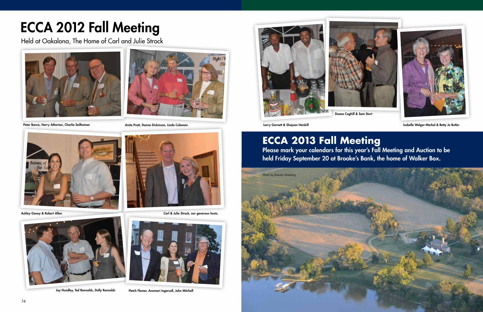
34 35www.essexcca.com
Peter Bance, Harry Atherton, Charlie Seilheimer Anita Pratt, Danna Dickinson, Linda Coleman
ECCA 2012 Fall Meeting Held at Oakalona, The Home of Carl and Julie Strock
Fletch Flemer, Annmari Ingersoll, John MitchellJay Hundley, Ted Rennolds, Dolly Rennolds
Carl & Julie Strock, our generous hosts.
Larry Garnett & Shajuan Heiskill
Ashley Ganey & Robert Allen
Isabelle Welger-Merkel & Betty Jo Butler
Duane Coghill & Sam Sturt
ECCA 2013 Fall MeetingPlease mark your calendars for this year’s Fall Meeting and Auction to be held Friday September 20 at Brooke’s Bank, the home of Walker Box.
Photo by Brenda Gladding

36 37www.essexcca.com
Town ofTappahannock
Rappahannock River
Route 17
Rout
e 36
0
Miller's Tavern
Loretto
Champlain
Caret
Center Cross
Dunnsville
Protected Lands 2013Essex County, Virginia
0 2 4 61Miles
Rappahannock River Valley National Wildlife Refuge
VA Department of Forestry
Middle Peninsula Chesapeake Bay Public Access Authority
Land Protected by Private Landowners
Data for the map provided by Essex County, the Virginia Department of Conservation &Recreation's protected lands database, Virginia Outdoors Foundation & The Nature Conservancy.
Watershed Unit:Dragon Run Watershed in Essex County
5Although this data has been used by the Middle Peninsula Planning DistrictCommission (MPPDC), no warranty, expressed or implied is made by the MPPDCas to the accuracy or application of the database and related materials, nor shallthe fact of distribution constitute any such warranty; and no responsibility isassumed by the MPPDC in connection herewith.This map was created June 2013 by MPPDC staff (CRCM).
This map production is a product of the MPPDC Technical AssistanceProgram and was funded by Virginia's Coastal Zone ManagementProgram of the Department of Environmental Quality through Grant #NA11NOS4190122 Task 44 of the National Oceanic and AtmosphericAdministration, Office of Ocean and Coastal Resources Management,Under the Coastal Zone Management Act of 1972, as amended.
Essex County's Additional Protected Parcels June 2012-June 2013
Protected Lands reported to PDC as of June 2013
Lands Protected in Previous Map Updates:
Protected Lands 2013 Essex County, Virginia
Erosion at Fones Cliff.
Acres underCounty Easement Total Acres % in Easement
Clarke 21,138.84 113,036.62 18.70%
Albemarle 85,165.28 462,469.68 18.42%
Rappahannock 30,216.99 170,604.53 17.71%
King and Queen 19,852.44 202,406.08 9.81%
Essex 15,833.22 164,972.54 9.60%
Westmoreland 7,429.61 146,674.97 5.07%
Richmond 6,134.18 122,534.21 5.01%
King George 5,689.30 115,199.82 4.94%
Middlesex 3,182.83 83,391.87 3.82%
Lancaster 2,558.78 85,209.47 3.00%
Northumberland 3,664.00 123,071.81 2.98%
Caroline 6,252.06 340,812.27 1.83%
Gloucester 1,769.29 138,630.18 1.28%
Mathews 432.90 54,835.11 0.79%
Photo by Susan Bance
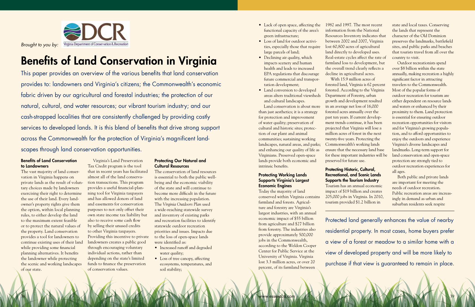
38 39www.essexcca.com
Benefits of Land Conservation to LandownersThe vast majority of land conser-vation in Virginia happens on private lands as the result of volun-tary choices made by landowners exercising their right to determine the use of their land. Every land-owner’s property rights give them the option, within local planning rules, to either develop the land to the maximum extent feasible or to protect the natural values of the property. Land conservation provides a tool for landowners to continue existing uses of their land while providing some financial planning alternatives. It benefits the landowner while protecting the scenic and working landscapes of our state.
Virginia’s Land Preservation Tax Credit program is the tool that in recent years has facilitated almost all of the land conserva-tion transactions. This program provides a useful financial-plan-ning tool for Virginia taxpayers and has allowed donors of land and easements for conservation purposes to not only offset their own state income tax liability but also to receive some cash flow by selling their unused credits to other Virginia taxpayers. Providing this incentive to private landowners creates a public good through encouraging voluntary individual actions, rather than depending on the state’s limited funds to finance the preservation of conservation values.
Protecting Our Natural and Cultural ResourcesThe conservation of land resources is essential to both the public well-being and the economic viability of the state and will continue to become more difficult in the future with the increasing population. The Virginia Outdoors Plan used a wide-reaching statewide survey and inventory of existing parks and recreation facilities to identify statewide outdoor recreation priorities and issues. Impacts due to the loss of open-space lands were identified as:• Increasedrunoffanddegraded
water quality;• Lossoftreecanopy,affecting
ecosystems, temperatures, and soil stability;
• Lackofopenspace,affectingthefunctional capacity of the area’s green infrastructure;
• Lossoflandforoutdooractivi-ties, especially those that require large parcels of land;
• Decliningairquality,whichimpacts scenery and human health and leads to increased EPA regulations that discourage future commercial and transpor-tation development;
• Landconversiontodevelopedareas alters traditional viewsheds and cultural landscapes.Land conservation is about more
than just aesthetics; it is a strategy for protection and improvement of water quality; preservation of cultural and historic sites; protec-tion of our plant and animal communities; sustaining working landscapes, natural areas, and parks; and enhancing our quality of life as Virginians. Preserved open-space lands provide both economic and intrinsic benefits.
Protecting Working Lands Supports Virginia’s Largest Economic EnginesToday the majority of land conserved within Virginia contains farmland and forests. Agricul-ture and forestry are Virginia’s largest industries, with an annual economic impact of $55 billion from agriculture and $27 billion from forestry. The industries also provide approximately 500,000 jobs in the Commonwealth, according to the Weldon Cooper Center for Public Service at the University of Virginia. Virginia lost 3.3 million acres, or over 20 percent, of its farmland between
Benefits of Land Conservation in VirginiaThis paper provides an overview of the various benefits that land conservation
provides to: landowners and Virginia’s citizens; the Commonwealth’s economic
fabric driven by our agricultural and forestal industries; the protection of our
natural, cultural, and water resources; our vibrant tourism industry; and our
cash-strapped localities that are consistently challenged by providing costly
services to developed lands. It is this blend of benefits that drive strong support
across the Commonwealth for the protection of Virginia’s magnificent land-
scapes through land conservation opportunities.
Protected land generally enhances the value of nearby
residential property. In most cases, home buyers prefer
a view of a forest or meadow to a similar home with a
view of developed property and will be more likely to
purchase if that view is guaranteed to remain in place.
1982 and 1997. The most recent information from the National Resources Inventory indicates that between 2002 and 2007, Virginia lost 60,800 acres of agricultural land directly to developed uses. Real-estate cycles affect the rate of farmland loss to development, but the overall trend clearly reflects a decline in agricultural acres.
With 15.9 million acres of forested land, Virginia is 62 percent forested. According to the Virginia Department of Forestry, urban growth and development resulted in an average net loss of 16,000 forested acres annually over the past ten years. If current develop-ment trends continue, it has been projected that Virginia will lose a million acres of forest in the next twenty-five years. Protecting the Commonwealth’s working lands ensure that the necessary land base for these important industries will be preserved for future use.
Protecting Historic, Cultural, Recreational, and Scenic Lands Supports the Tourism IndustryTourism has an annual economic impact of $19 billion and creates 205,000 jobs in Virginia. In 2010, tourism provided $1.2 billion in
state and local taxes. Conserving the lands that represent the character of the Old Dominion preserves the landmarks, battlefield sites, and public parks and beaches that tourists travel from all over the country to visit.
Outdoor recreationists spend over $8 billion within the state annually, making recreation a highly significant factor in attracting travelers to the Commonwealth. Most of the popular forms of outdoor recreation for tourism are either dependent on resource lands and waters or enhanced by their proximity to them. Land protection is essential for ensuring outdoor recreation opportunities for visitors and for Virginia’s growing popula-tion, and to afford opportunities to enjoy the outdoors and experience Virginia’s diverse landscapes and landmarks. Long-term support for land conservation and open-space protection are strongly tied to outdoor recreation experiences for all ages.
Both public and private lands are important for meeting the needs of outdoor recreation. Public recreation areas are increas-ingly in demand as urban and suburban residents seek respite
Brought to you by:
41www.essexcca.com40
through enjoyment of open spaces. Conserved private land is impor-tant, not only in providing much of the hunting opportunity east of the Blue Ridge, but also in main-taining scenic vistas and serving as buffer lands around major park and recreation areas.• “Landconservation...
enhances the natural beauty of the Commonwealth for everyone,” said Natural Resources Secretary Doug Domenech. “It also increases conservation tourism and historic preservation.”
• “Virginiaisapremierdestina-tion for tourists from around the nation and the world, thanks to our legacy of renowned historic sites, including those connected with the American Civil War,” said Governor McDonnell. “When we preserve battlefields, we strengthen an important revenue generator in Virginia—heritage tourism—while also keeping historic lands protected.”
Protecting Local Economic Values through Land ConservationStudies demonstrate that open spaces can boost the value of neighboring commercial proper-ties. Businesses seeking an area in which to locate report that quality of life is a major factor in their decision making, and cultural and recreational open spaces are important components in creating that quality of life.
Protected land generally enhances the value of nearby residential property. In most cases,
in a watershed begins to decline when that watershed is covered by more than 10 percent of impervious surface. When impervious surface areas within the watershed are between 10 and 25 percent, streams become impacted by runoff pollution. Between 25 percent and 60 percent of impervious surface areas leave streams “damaged,” and when above 60 percent, impervious cover streams are considered “severely damaged.”
The Cost of a Clean Bay: Assessing Funding Needs Throughout the Watershed, a 2003 report from the Chesapeake Bay Commission, noted that the services provided by natural systems in retaining and filtering pollutants cannot be underestimated, from either an environmental or economic perspective. A study of urban tree loss in the DC metropolitan region by the American Forests organization calculated the pollu-tion control benefits provided by its existing urban forest. The metropolitan DC area’s trees remove twenty million pounds of pollutants from the air each year, a benefit worth $50 million annually. The ability of trees to absorb storm water, lessen erosion, and reduce flooding was also analyzed. Urban trees were estimated to retain 949 million cubic feet of water. If these trees were lost and replaced by impervious surfaces, building equivalent retention facilities would cost the region $4.7 billion.
Costs of Not Conserving Open-Space LandA number of localities have calcu-lated the fiscal impacts associated with different types of land use
The condition of the landscape has a direct and
highly significant impact on water quality. A naturally
vegetated landscape provides the greatest benefits for
water quality. Undeveloped lands, especially forests,
filter both surface water and groundwater.
home buyers prefer a view of a forest or meadow to a similar home with a view of developed property and will be more likely to purchase if that view is guaranteed to remain in place. Recognizing this concept, many local governments strongly support land conservation, understanding that protected, undeveloped land generates more direct tax revenue than the services it requires, and that residential development typically brings in less revenue than it costs to provide support services. In addition, the increased value of properties near preserved lands means increased revenue to localities from perma-nent protection of green space.
A locality’s property tax revenues are reduced very little by conservation easements. A report by the Middle Peninsula Planning District Commission indicates tax revenue losses due to conserva-tion easements averaged only 0.26 percent of the annual budget for localities within that region. For localities that have adopted use-value assessment programs where revenues from eligible land are
already lower, the effect of ease-ments is no loss in revenue.
Protecting Water Quality through Land ConservationThe condition of the landscape has a direct and highly signifi-cant impact on water quality. A naturally vegetated landscape provides the greatest benefits for water quality. Undeveloped lands, especially forests, filter both surface water and groundwater. Developed lands are predominantly impervious. [paved] surfaces like sidewalks, buildings, and parking that do not allow water to filter directly into the ground. Water that cannot soak into the ground flows over the land surface, eventually ending up in a waterway.
The amount of impervious surface in a watershed directly affects the amount of runoff, influencing surface water quality in streams. Not only does an impervious surface accelerate stream erosion and degrade water quality of surface waters or streams, it blocks or diverts water from infil-trating the soil to recharge ground water. The Center for Watershed Protection reports that stream quality
and found that increased growth brings new area residents who require services—roads, sewage and water-supply infrastructure, fire and police services, schools, libraries, etc.—that increase local government costs at a level greater than the additional local revenue they contribute. “While it is true that an acre of land with a new house generates more total revenue than an acre of hay or corn, this tells us little about a community’s bottom line” (American Farmland
schools for the children in housing developments plus other municipal costs may be much greater than the tax and nontax revenue that residential lands provide.
A 2012 study in Albemarle County, Virginia, found that, for every dollar of local revenue generated, the public costs for residential and institutional (hospitals, libraries, churches) development range from $1.29 to $1.59, a negative ratio. Commercial and industrial uses have a positive ratio, around $0.50 in costs for every dollar of revenue generated, and farmland generates even greater surplus revenue at $0.20 in costs for every dollar of revenue generated. However, the revenue-cost ratios associated with residential properties create a net deficit for Albemarle County, and for most other localities.
SummaryThis paper outlines the many benefits of land conservation afforded to Virginia’s citizens and localities. Through increased revenues generated by agriculture, forestry, tourism, and outdoor recreation, land conservation enhances Virginia’s largest indus-tries and supports local economies. Conserved open lands also save localities the ongoing costs associated with support-service infrastructure and ensure sustain-able working landscapes into the future. As an additional benefit, conserved lands can protect water quality, offsetting costs for managing storm water and protecting drinking water supplies.
The Chesapeake Bay
Commission noted that the
services provided by
natural systems in
retaining and filtering
pollutants cannot be
underestimated, from
either an environmental
or economic perspective.
Trust, 2010). Increased population density in a locality eventually requires increasingly complex public services that increase per capita costs.
Since the cost to a locality to provide services to undeveloped land is relatively low, a net posi-tive tax cash flow is achieved. Conversely, the costs to provide
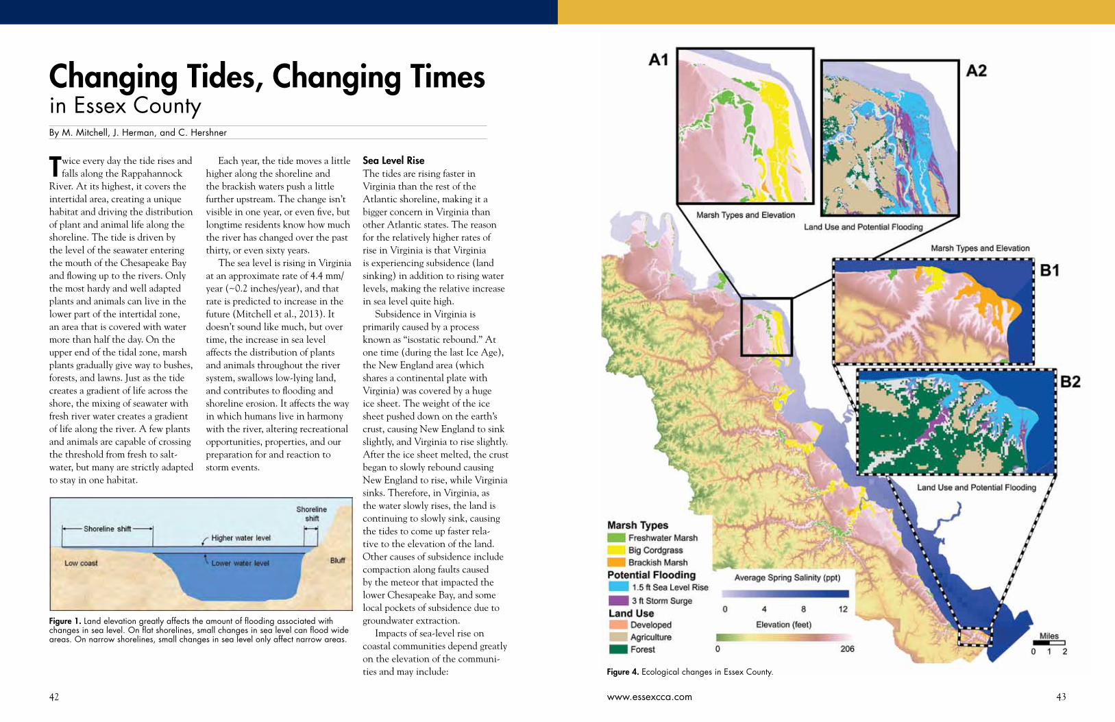
42 43www.essexcca.com
Twice every day the tide rises and falls along the Rappahannock
River. At its highest, it covers the intertidal area, creating a unique habitat and driving the distribution of plant and animal life along the shoreline. The tide is driven by the level of the seawater entering the mouth of the Chesapeake Bay and flowing up to the rivers. Only the most hardy and well adapted plants and animals can live in the lower part of the intertidal zone, an area that is covered with water more than half the day. On the upper end of the tidal zone, marsh plants gradually give way to bushes, forests, and lawns. Just as the tide creates a gradient of life across the shore, the mixing of seawater with fresh river water creates a gradient of life along the river. A few plants and animals are capable of crossing the threshold from fresh to salt-water, but many are strictly adapted to stay in one habitat.
Each year, the tide moves a little higher along the shoreline and the brackish waters push a little further upstream. The change isn’t visible in one year, or even five, but longtime residents know how much the river has changed over the past thirty, or even sixty years.
The sea level is rising in Virginia at an approximate rate of 4.4 mm/year (~0.2 inches/year), and that rate is predicted to increase in the future (Mitchell et al., 2013). It doesn’t sound like much, but over time, the increase in sea level affects the distribution of plants and animals throughout the river system, swallows low-lying land, and contributes to flooding and shoreline erosion. It affects the way in which humans live in harmony with the river, altering recreational opportunities, properties, and our preparation for and reaction to storm events.
Changing Tides, Changing Timesin Essex CountyBy M. Mitchell, J. Herman, and C. Hershner
Figure 1. Land elevation greatly affects the amount of flooding associated with changes in sea level. On flat shorelines, small changes in sea level can flood wide areas. On narrow shorelines, small changes in sea level only affect narrow areas.
Sea Level RiseThe tides are rising faster in Virginia than the rest of the Atlantic shoreline, making it a bigger concern in Virginia than other Atlantic states. The reason for the relatively higher rates of rise in Virginia is that Virginia is experiencing subsidence (land sinking) in addition to rising water levels, making the relative increase in sea level quite high.
Subsidence in Virginia is primarily caused by a process known as “isostatic rebound.” At one time (during the last Ice Age), the New England area (which shares a continental plate with Virginia) was covered by a huge ice sheet. The weight of the ice sheet pushed down on the earth’s crust, causing New England to sink slightly, and Virginia to rise slightly. After the ice sheet melted, the crust began to slowly rebound causing New England to rise, while Virginia sinks. Therefore, in Virginia, as the water slowly rises, the land is continuing to slowly sink, causing the tides to come up faster rela-tive to the elevation of the land. Other causes of subsidence include compaction along faults caused by the meteor that impacted the lower Chesapeake Bay, and some local pockets of subsidence due to groundwater extraction.
Impacts of sea-level rise on coastal communities depend greatly on the elevation of the communi-ties and may include: Figure 4. Ecological changes in Essex County.

44
1. Exacerbation of storm surges, coastal flooding, and resultant loss of property;
2. Increased shoreline erosion;3. Saltwater intrusion into drinking water aquifers and
septic fields;4. Reduced capacity for some storm water systems;5. Increased potential for some wastewater system
overflows;6. Reduced capacity for stormwater absorption into the
groundwater system resulting in longer ponding or increased overland flows;
7. Loss of ecosystems, including: tidal freshwater systems, barrier islands, bay islands, coastal dunes and shallow water habitats.Higher elevation communities (such as Essex) may
experience more shoreline erosion, saltwater intrusion, and loss of coastal ecosystem than direct flooding. However, there are low-elevation areas of Essex County that are likely to be inundated by rising tides.
The June Parker marina on the north end of Tappahannock is one low area that is often inundated by high tides. Currently, water creeps up onto the parking areas of the marina during spring tides each month. Within fifty years we expect this to become a daily event.
The floodplain is typically considered to be the area flooded by the 100-year storm (or where there is a 1 percent chance of flooding in any given year). Approximately 10 percent of Essex County (16,807 acres) is located within the floodplain (National Oceanic and Atmospheric Administration [NOAA] Coastal County Snapshots). Essex County currently
has little development within the floodplains (they are predominately marsh). However, according to NOAA’s Flood Exposure Snapshot for Essex County (NOAA Coastal County Snapshots), about 15 percent of the population lives in the floodplain. Of the new develop-ment (2001–2006), 14 percent occurred within the floodplain.
What does it mean to live in the 100-year flood-plain? It means that over the lifetime of a typical mortgage (30 years), there is a 26 percent chance that the property will be flooded. Over a ten-year time span (a reasonable length of home ownership), there is a 10 percent chance that the property will be flooded. As the sea level rises, the floodplain will expand, increasing flood frequency and threatening new development and agriculture lands.
Marsh MigrationEssex County has beautiful shorelines, fringed with marshes and filled with birds and aquatic life. Tidal marshes are one of the most productive habitats on earth and contribute to productivity throughout the river. Marshes provide homes for young fish, offering food and protection from predators. In turn, those fish provide food for other fish, forming the basis of the recreational and commercial fisheries in the Chesa-peake Bay. Although capable of using other habitats, blue crabs use marshes throughout their life. The contribution of marshes to blue crab populations is well documented and the connection has been used to set economic “values” for marshes. Marshes are also home to many species of birds, some of whom nest in the
45www.essexcca.com
marshes and are therefore dependent on the continued presence of marshes in the landscape.
Currently, approximately 14 percent of land in Essex County (23,191 acres) is wetlands, which are estimated to result in approximately $181,000 in revenue (NOAA Coastal County Snapshots). As with most coastal localities, the majority of the wetlands are tidal marshes that are located in the floodplain, putting them at risk from rising water levels. Although marshes can easily handle temporary flood events (and can even help protect the upland from flooding by absorbing floodwaters) their ability to cope with rising water levels is more tenuous.
As water rises, the change in water level redistrib-utes the marsh plants, moving the low marsh plants into the high marsh and the high marsh plants further inland. In an area of low elevation and without bulk-heads or revetments, it is possible for the marshes to “migrate” or move inland, keeping pace with the rise in sea level. In areas with barriers to migration (e.g., tall hills, bluffs, shoreline erosion protection structures) the marsh must either keep pace with the rising water by accreting sediment (catching and holding sediment and marsh peat), or drown.
The question throughout Virginia is whether our marshes will be able to keep pace with the rate of sea-level rise. Research on the York River (Mitchell et al., 2011), indicates that at least some of the marshes are not keeping pace with the sea level. Marshes at the midpoint of the York River (where the banks are too high to allow for migration) have converted from half high marsh and half low marsh to entirely low marsh. This suggests that the high marsh was covered with too much water to maintain high marsh plants and the low marsh plants expanded to fill the entire area. If the remaining low marsh cannot keep pace with the rising tide, the marshes will eventually drown and disappear.
The marshes along Hoskins Creek at the southern end of Tappahannock are one area in which the change in the marsh community, driven by the rising sea level, should become obvious. The Hoskins Creek marsh community at the Route 17 bridge is dominated by the tall, common reed grass, phragmites australis. Longtime residents of the area will remember the efforts to eradicate this invasive plant with herbicides many years ago. Those efforts ultimately failed as the reeds re-established themselves across the entire marsh surface. The sea-level rise may ultimately accomplish what herbicides failed to do. Phragmites does not
survive in the lowest parts of the intertidal range, and the marshes in Hoskins Creek are among those that are not keeping pace with the rising sea level. This means that slowly but surely the phragmites in Hoskins Creek is finding itself lower and lower in the intertidal zone, and ultimately it will be replaced by native plants that can tolerate daily submersion by tides. Eventually, many years in the future, even these plants will give way to rising tides and the entire area will transition to shallow mud flats.
The conversion of high marsh to low marsh changes the dominant height of the plants, which primarily affects the ability of the marsh to serve as habitat for birds. In brackish and saltmarshes, the high marsh plants tend to be shorter than the low marsh plants, so the overall shift is toward taller plants. In freshwater marshes, the high marsh plants tend to be shorter than low marsh plants, so the overall shift is toward shorter plants. This reduces the amount of cover provided by the marsh plants.
Over the past fifty years there have been notice-able shifts in the bird community in response to the changing system. Overall, there have been declines in duck populations, which predominately feed on aquatic plants and animals, and increases in goose populations, which often feed in agricultural fields (Mid-Atlantic Regional Assessment Team [MARA], 2000). One duck species, the canvasback, has adapted to changing conditions by shifting from eating marsh plants to eating clams (MARA, 2000), but not all species have the ability to adapt.
Birds that rely on tall freshwater marsh plants for shelter, such as the king rails and least bitterns, have small and declining populations, due in part to the loss of marsh habitat (Wilson and Watts, 2010). Projections indicate that three feet of sea-level rise could decrease populations by 48 percent (Wilson and Watts, 2010). Birds that rely on saltmarshes are at even higher risk, with populations of clapper rails, Virginia rails, willets, marsh wrens, and seaside sparrow predicted to decline approximately 75 percent with three feet of sea-level rise (Wilson and Watts, 2010). Black rails and salt-marsh sparrows, which breed in high marsh, salt-marsh habitats, are projected to essen-tially disappear, declining by 90–99 percent (Wilson and Watts, 2010).
In the Rappahannock River system sediment comes from several sources. It is carried downstream from eroding lands in the watershed. It also enters the river
Intertidal or Underwater Storm Flooding Dry Land
Roads (ft.) 15,440 64,132 5,028,726
Developed land (acres) 106 76 3,279
Agricultural land (acres) 58 507 44,033
Forested land (acres) 179 340 92,885
Marshes (acres) 6,598 1,450 16,218
Table 1: This table shows the amount of land covered with water in Essex County with a rise in sea level of 1.5 feet, predicted to occur 40–60 years in the future. The second column shows the additional amount of land covered by water during a storm that created a 3-foot storm surge. The third column shows the amount of land dry land remaining during a storm event follow-ing sea-level rise.
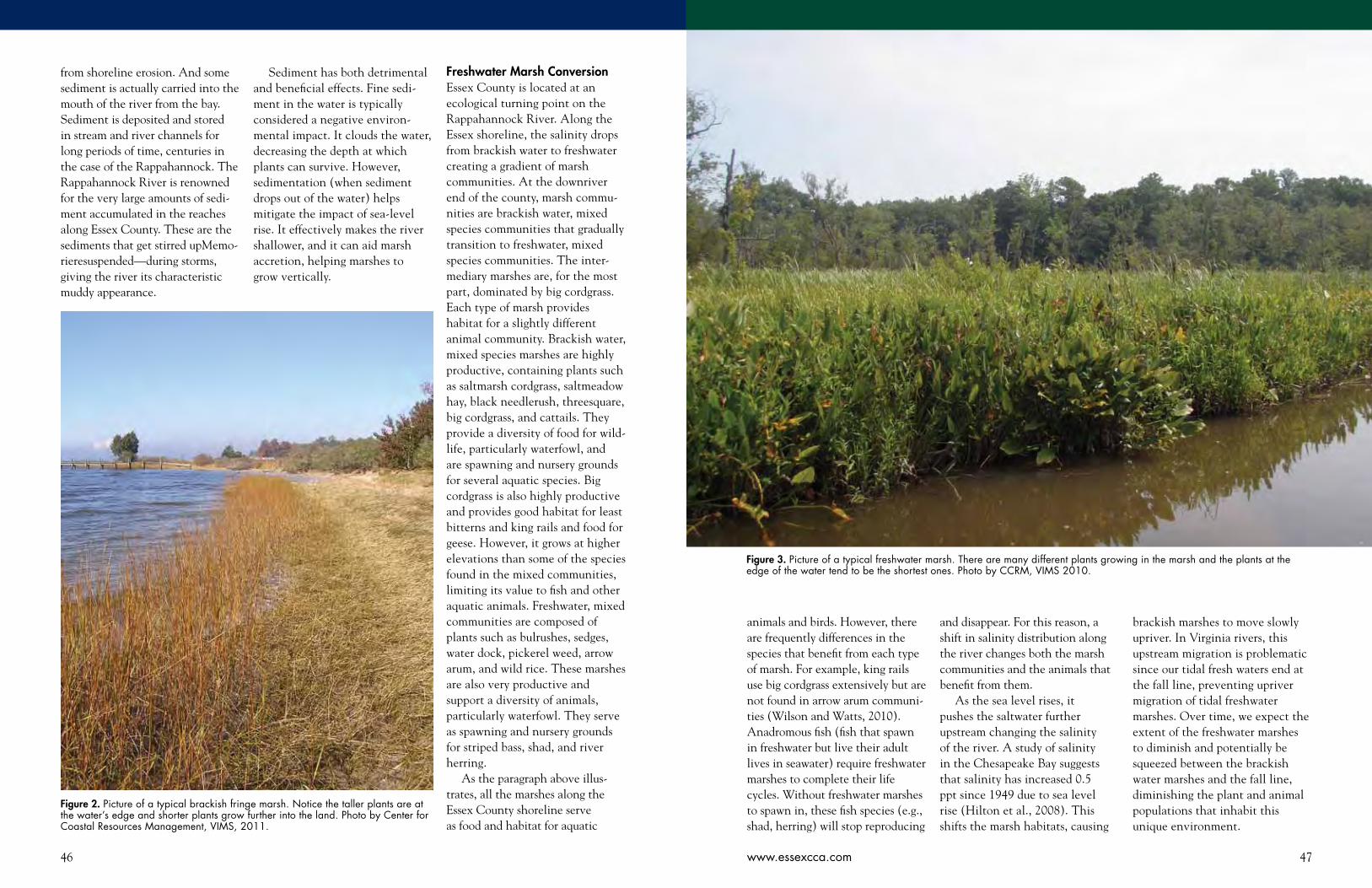
46 47www.essexcca.com
from shoreline erosion. And some sediment is actually carried into the mouth of the river from the bay. Sediment is deposited and stored in stream and river channels for long periods of time, centuries in the case of the Rappahannock. The Rappahannock River is renowned for the very large amounts of sedi-ment accumulated in the reaches along Essex County. These are the sediments that get stirred upMemo-rieresuspended—during storms, giving the river its characteristic muddy appearance.
Sediment has both detrimental and beneficial effects. Fine sedi-ment in the water is typically considered a negative environ-mental impact. It clouds the water, decreasing the depth at which plants can survive. However, sedimentation (when sediment drops out of the water) helps mitigate the impact of sea-level rise. It effectively makes the river shallower, and it can aid marsh accretion, helping marshes to grow vertically.
animals and birds. However, there are frequently differences in the species that benefit from each type of marsh. For example, king rails use big cordgrass extensively but are not found in arrow arum communi-ties (Wilson and Watts, 2010). Anadromous fish (fish that spawn in freshwater but live their adult lives in seawater) require freshwater marshes to complete their life cycles. Without freshwater marshes to spawn in, these fish species (e.g., shad, herring) will stop reproducing
and disappear. For this reason, a shift in salinity distribution along the river changes both the marsh communities and the animals that benefit from them.
As the sea level rises, it pushes the saltwater further upstream changing the salinity of the river. A study of salinity in the Chesapeake Bay suggests that salinity has increased 0.5 ppt since 1949 due to sea level rise (Hilton et al., 2008). This shifts the marsh habitats, causing
brackish marshes to move slowly upriver. In Virginia rivers, this upstream migration is problematic since our tidal fresh waters end at the fall line, preventing upriver migration of tidal freshwater marshes. Over time, we expect the extent of the freshwater marshes to diminish and potentially be squeezed between the brackish water marshes and the fall line, diminishing the plant and animal populations that inhabit this unique environment.
Figure 3. Picture of a typical freshwater marsh. There are many different plants growing in the marsh and the plants at the edge of the water tend to be the shortest ones. Photo by CCRM, VIMS 2010.
Figure 2. Picture of a typical brackish fringe marsh. Notice the taller plants are at the water’s edge and shorter plants grow further into the land. Photo by Center for Coastal Resources Management, VIMS, 2011.
Freshwater Marsh ConversionEssex County is located at an ecological turning point on the Rappahannock River. Along the Essex shoreline, the salinity drops from brackish water to freshwater creating a gradient of marsh communities. At the downriver end of the county, marsh commu-nities are brackish water, mixed species communities that gradually transition to freshwater, mixed species communities. The inter-mediary marshes are, for the most part, dominated by big cordgrass. Each type of marsh provides habitat for a slightly different animal community. Brackish water, mixed species marshes are highly productive, containing plants such as saltmarsh cordgrass, saltmeadow hay, black needlerush, threesquare, big cordgrass, and cattails. They provide a diversity of food for wild-life, particularly waterfowl, and are spawning and nursery grounds for several aquatic species. Big cordgrass is also highly productive and provides good habitat for least bitterns and king rails and food for geese. However, it grows at higher elevations than some of the species found in the mixed communities, limiting its value to fish and other aquatic animals. Freshwater, mixed communities are composed of plants such as bulrushes, sedges, water dock, pickerel weed, arrow arum, and wild rice. These marshes are also very productive and support a diversity of animals, particularly waterfowl. They serve as spawning and nursery grounds for striped bass, shad, and river herring.
As the paragraph above illus-trates, all the marshes along the Essex County shoreline serve as food and habitat for aquatic
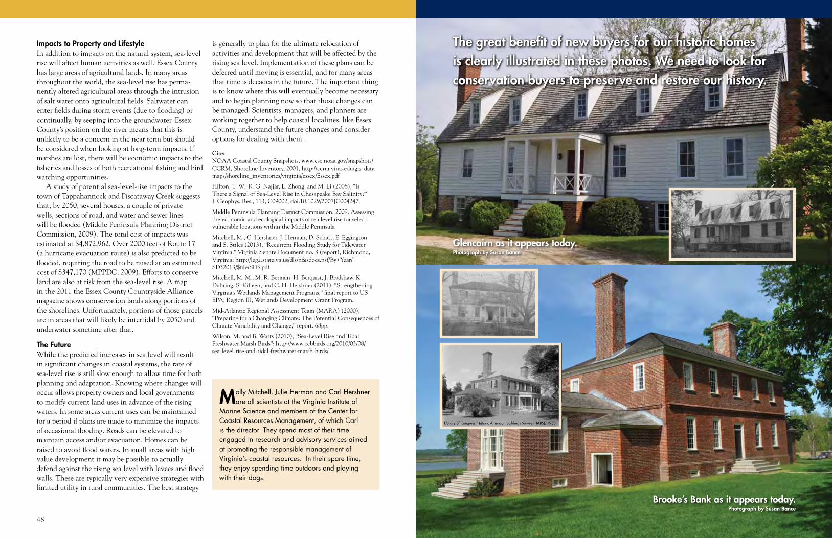
48 49www.essexcca.com
Impacts to Property and LifestyleIn addition to impacts on the natural system, sea-level rise will affect human activities as well. Essex County has large areas of agricultural lands. In many areas throughout the world, the sea-level rise has perma-nently altered agricultural areas through the intrusion of salt water onto agricultural fields. Saltwater can enter fields during storm events (due to flooding) or continually, by seeping into the groundwater. Essex County’s position on the river means that this is unlikely to be a concern in the near term but should be considered when looking at long-term impacts. If marshes are lost, there will be economic impacts to the fisheries and losses of both recreational fishing and bird watching opportunities.
A study of potential sea-level-rise impacts to the town of Tappahannock and Piscataway Creek suggests that, by 2050, several houses, a couple of private wells, sections of road, and water and sewer lines will be flooded (Middle Peninsula Planning District Commission, 2009). The total cost of impacts was estimated at $4,872,962. Over 2000 feet of Route 17 (a hurricane evacuation route) is also predicted to be flooded, requiring the road to be raised at an estimated cost of $347,170 (MPPDC, 2009). Efforts to conserve land are also at risk from the sea-level rise. A map in the 2011 the Essex County Countryside Alliance magazine shows conservation lands along portions of the shorelines. Unfortunately, portions of those parcels are in areas that will likely be intertidal by 2050 and underwater sometime after that.
The FutureWhile the predicted increases in sea level will result in significant changes in coastal systems, the rate of sea-level rise is still slow enough to allow time for both planning and adaptation. Knowing where changes will occur allows property owners and local governments to modify current land uses in advance of the rising waters. In some areas current uses can be maintained for a period if plans are made to minimize the impacts of occasional flooding. Roads can be elevated to maintain access and/or evacuation. Homes can be raised to avoid flood waters. In small areas with high value development it may be possible to actually defend against the rising sea level with levees and flood walls. These are typically very expensive strategies with limited utility in rural communities. The best strategy
is generally to plan for the ultimate relocation of activities and development that will be affected by the rising sea level. Implementation of these plans can be deferred until moving is essential, and for many areas that time is decades in the future. The important thing is to know where this will eventually become necessary and to begin planning now so that those changes can be managed. Scientists, managers, and planners are working together to help coastal localities, like Essex County, understand the future changes and consider options for dealing with them.
Cite:NOAA Coastal County Snapshots, www.csc.noaa.gov/snapshots/CCRM, Shoreline Inventory, 2001, http://ccrm.vims.edu/gis_data_maps/shoreline_inventories/virginia/essex/Essex.pdf
Hilton, T. W., R. G. Najjar, L. Zhong, and M. Li (2008), “Is There a Signal of Sea-Level Rise in Chesapeake Bay Salinity?” J. Geophys. Res., 113, C09002, doi:10.1029/2007JC004247.
Middle Peninsula Planning District Commission. 2009. Assessing the economic and ecological impacts of sea level rise for select vulnerable locations within the Middle Peninsula
Mitchell, M., C. Hershner, J. Herman, D. Schatt, E. Eggington, and S. Stiles (2013), “Recurrent Flooding Study for Tidewater Virginia.” Virginia Senate Document no. 3 (report), Richmond, Virginia; http://leg2.state.va.us/dls/h&sdocs.nsf/By+Year/SD32013/$file/SD3.pdf
Mitchell, M. M., M. R. Berman, H. Berquist, J. Bradshaw, K. Duhring, S. Killeen, and C. H. Hershner (2011), “Strengthening Virginia’s Wetlands Management Programs,” final report to US EPA, Region III, Wetlands Development Grant Program.
Mid-Atlantic Regional Assessment Team (MARA) (2000), “Preparing for a Changing Climate: The Potential Consequences of Climate Variability and Change,” report. 68pp.
Wilson, M. and B. Watts (2010), “Sea-Level Rise and Tidal Freshwater Marsh Birds”; http://www.ccbbirds.org/2010/03/08/sea-level-rise-and-tidal-freshwater-marsh-birds/
Molly Mitchell, Julie Herman and Carl Hershner are all scientists at the Virginia Institute of
Marine Science and members of the Center for Coastal Resources Management, of which Carl is the director. They spend most of their time engaged in research and advisory services aimed at promoting the responsible management of Virginia’s coastal resources. In their spare time, they enjoy spending time outdoors and playing with their dogs.
Library of Congress, Historic American Buildings Survey (HABS), 1933.
The great benefit of new buyers for our historic homes is clearly illustrated in these photos. We need to look for conservation buyers to preserve and restore our history.
Brooke’s Bank as it appears today.Photograph by Susan Bance
Glencairn as it appears today.Photograph by Susan Bance
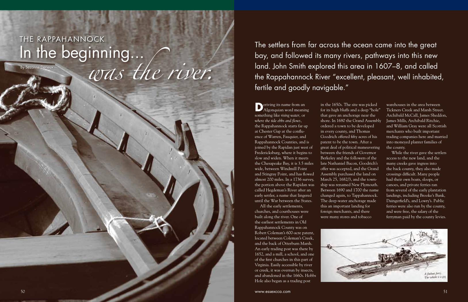
50
In the beginning...
50
was the river. Deriving its name from an
Algonquian word meaning something like rising water, or where the tide ebbs and flows, the Rappahannock starts far up at Chester Gap at the conflu-ence of Warren, Fauquier, and Rappahannock Counties, and is joined by the Rapidan just west of Fredericksburg, where it begins to slow and widen. When it meets the Chesapeake Bay, it is 3.5 miles wide, between Windmill Point and Stingray Point, and has flowed almost 200 miles. In a 1736 survey, the portion above the Rapidan was called Hegdeman’s River after an early settler, a name that lingered until the War between the States.
All the early settlements, churches, and courthouses were built along the river. One of the earliest settlements in Old Rappahannock County was on Robert Coleman’s 600-acre patent, located between Coleman’s Creek, and the back of Otterburn Marsh. An early trading post was there by 1652, and a mill, a school, and one of the first churches in this part of Virginia. Easily accessible by river or creek, it was overrun by insects, and abandoned in the 1660s. Hobbs Hole also began as a trading post
By Suzanne Derieux
The settlers from far across the ocean came into the great bay, and followed its many rivers, pathways into this new land. John Smith explored this area in 1607–8, and called the Rappahannock River “excellent, pleasant, well inhabited, fertile and goodly navigable.”
in the 1650s. The site was picked for its high bluffs and a deep “hole” that gave an anchorage near the shore. In 1680 the Grand Assembly ordered a town to be developed in every county, and Thomas Goodrich offered fifty acres of his patent to be the town. After a great deal of political maneuvering between the friends of Governor Berkeley and the followers of the late Nathaniel Bacon, Goodrich’s offer was accepted, and the Grand Assembly purchased the land on March 25, 1682/3, and the town-ship was renamed New Plymouth. Between 1690 and 1700 the name changed again, to Tappahannock. The deep-water anchorage made this an important landing for foreign merchants, and there were many stores and tobacco
warehouses in the area between Tickners Creek and Marsh Street. Archibald McCall, James Sheddon, James Mills, Archibald Ritchie, and William Gray were all Scottish merchants who built important trading companies here and married into moneyed planter families of the county.
While the river gave the settlers access to the new land, and the many creeks gave ingress into the back county, they also made crossings difficult. Many people had their own boats, sloops, or canoes, and private ferries ran from several of the early plantation landings, including Brooke’s Bank, Daingerfield’s, and Lowry’s. Public ferries were also run by the county, and were free, the salary of the ferryman paid by the county levies.
www.essexcca.com 51
THE RAPPAHANNOCK
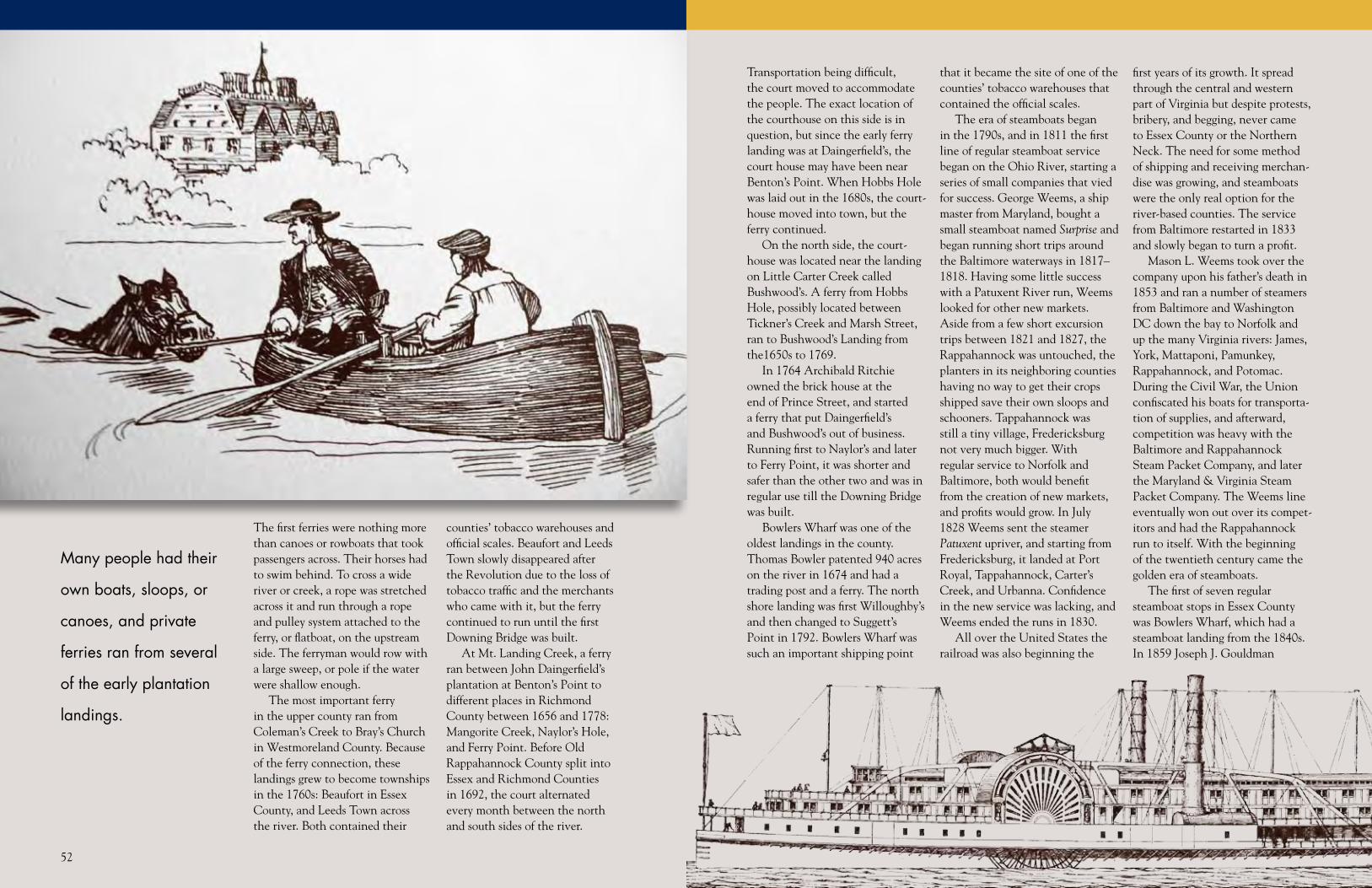
5252
The first ferries were nothing more than canoes or rowboats that took passengers across. Their horses had to swim behind. To cross a wide river or creek, a rope was stretched across it and run through a rope and pulley system attached to the ferry, or flatboat, on the upstream side. The ferryman would row with a large sweep, or pole if the water were shallow enough.
The most important ferry in the upper county ran from Coleman’s Creek to Bray’s Church in Westmoreland County. Because of the ferry connection, these landings grew to become townships in the 1760s: Beaufort in Essex County, and Leeds Town across the river. Both contained their
counties’ tobacco warehouses and official scales. Beaufort and Leeds Town slowly disappeared after the Revolution due to the loss of tobacco traffic and the merchants who came with it, but the ferry continued to run until the first Downing Bridge was built.
At Mt. Landing Creek, a ferry ran between John Daingerfield’s plantation at Benton’s Point to different places in Richmond County between 1656 and 1778: Mangorite Creek, Naylor’s Hole, and Ferry Point. Before Old Rappahannock County split into Essex and Richmond Counties in 1692, the court alternated every month between the north and south sides of the river.
Transportation being difficult, the court moved to accommodate the people. The exact location of the courthouse on this side is in question, but since the early ferry landing was at Daingerfield’s, the court house may have been near Benton’s Point. When Hobbs Hole was laid out in the 1680s, the court-house moved into town, but the ferry continued.
On the north side, the court-house was located near the landing on Little Carter Creek called Bushwood’s. A ferry from Hobbs Hole, possibly located between Tickner’s Creek and Marsh Street, ran to Bushwood’s Landing from the1650s to 1769.
In 1764 Archibald Ritchie owned the brick house at the end of Prince Street, and started a ferry that put Daingerfield’s and Bushwood’s out of business. Running first to Naylor’s and later to Ferry Point, it was shorter and safer than the other two and was in regular use till the Downing Bridge was built.
Bowlers Wharf was one of the oldest landings in the county. Thomas Bowler patented 940 acres on the river in 1674 and had a trading post and a ferry. The north shore landing was first Willoughby’s and then changed to Suggett’s Point in 1792. Bowlers Wharf was such an important shipping point
that it became the site of one of the counties’ tobacco warehouses that contained the official scales.
The era of steamboats began in the 1790s, and in 1811 the first line of regular steamboat service began on the Ohio River, starting a series of small companies that vied for success. George Weems, a ship master from Maryland, bought a small steamboat named Surprise and began running short trips around the Baltimore waterways in 1817–1818. Having some little success with a Patuxent River run, Weems looked for other new markets. Aside from a few short excursion trips between 1821 and 1827, the Rappahannock was untouched, the planters in its neighboring counties having no way to get their crops shipped save their own sloops and schooners. Tappahannock was still a tiny village, Fredericksburg not very much bigger. With regular service to Norfolk and Baltimore, both would benefit from the creation of new markets, and profits would grow. In July 1828 Weems sent the steamer Patuxent upriver, and starting from Fredericksburg, it landed at Port Royal, Tappahannock, Carter’s Creek, and Urbanna. Confidence in the new service was lacking, and Weems ended the runs in 1830.
All over the United States the railroad was also beginning the
first years of its growth. It spread through the central and western part of Virginia but despite protests, bribery, and begging, never came to Essex County or the Northern Neck. The need for some method of shipping and receiving merchan-dise was growing, and steamboats were the only real option for the river-based counties. The service from Baltimore restarted in 1833 and slowly began to turn a profit.
Mason L. Weems took over the company upon his father’s death in 1853 and ran a number of steamers from Baltimore and Washington DC down the bay to Norfolk and up the many Virginia rivers: James, York, Mattaponi, Pamunkey, Rappahannock, and Potomac. During the Civil War, the Union confiscated his boats for transporta-tion of supplies, and afterward, competition was heavy with the Baltimore and Rappahannock Steam Packet Company, and later the Maryland & Virginia Steam Packet Company. The Weems line eventually won out over its compet-itors and had the Rappahannock run to itself. With the beginning of the twentieth century came the golden era of steamboats.
The first of seven regular steamboat stops in Essex County was Bowlers Wharf, which had a steamboat landing from the 1840s. In 1859 Joseph J. Gouldman
Many people had their
own boats, sloops, or
canoes, and private
ferries ran from several
of the early plantation
landings.

55www.essexcca.com54
bought the residue of Thomas Bowler’s old plantation and kept a store and the wharf. The property descended to his son-in-law Robert Milton Neale, who improved the wharf and built an oyster business. Gouldman’s grandson Robert Gouldman Neale ran a store, post office, oyster canning factory, vegetable cannery, and hotel here from 1892 to his death in 1936.
This wharf had the longest walk of any on this river—over 1000 feet. There were iron rails running all the way to the end, and the Gouldmans and Neales used trolleys to move goods back and forth from the ships to the store. The great storms of the 1930s did major damage to this wharf, and with the end of steamboat traffic, the Bowlers Wharf complex began to die. Today there is no trace of a landing that thrived for 300 years.
Bowlers Wharf was special for one other reason: it had a light-house. Bowler’s Rock, considered a hazard to navigation, had a lightship by 1835 that was burned by the Confederacy in 1861. The Union placed another near the rock in 1864, which was replaced
by a screw pile lighthouse in 1868. This was a small cottage-style building atop iron flanges that screwed into the river bottom. It was carried off by the ice during the winter of 1918–9 and replaced by a buoy and bell.
The next stop was Wares, a wharf built and run by Robert Lowry Ware and his family from the 1870s to the 1930s. He also had a post office, started in 1874, and a store at nearby Dunnsville.
The steamboat would then hop across the river and land at Wellfords and then head for Tappahannock. When the Patuxent landed in Tappahannock in 1828, the site was probably the ferry landing owned by Lawrence Muse, located below the custom’s house on Prince Street. Several wharves have been built along the river shore between Prince and Queen Streets, and the remains of the wharf there now are those of the one built in 1934 after the great storm had destroyed an earlier one.1 The structures on it were torn off and sunk in the river in the mid-1960s. Just to the left of this ruined wharf is the twentieth-
century ferry landing.2
From Tappahannock the steamer would run to Naylors and then back to Blandfield, which was a farmer’s landing, not one of the major stops. Then it ran upriver to Carters Wharf on the north side and back to Essex County for Laytons. This was also a farmer’s landing, and served a local saw mill. Facing each other on opposite shores, Laytons and Leeds Town had deteriorated into nothing more than a few houses and a wharf, nothing like the thriving Revolutionary towns they had been.
After Leeds Town, the last big stop in Essex County was Saunders Wharf. William Hawkins patented land here in the late seventeenth century, and the family owned the property, which they called Society Hill, until the early nineteenth century. John Saunders bought the farm from the heirs of William Gray in 1844 and renamed it Wheatland. He was probably the builder of this wharf, sending his furs and crops up to Baltimore and buying goods from merchants to sell in his store at Loretto. Saunders ran one of the most successful stores in
Suzanne Derieux was born, raised, and currently resides in Tappahannock, VA. She graduated from St. Margaret’s School in
Tappahannock and Mary Washington College in Fredericksburg. She is a professional genealogist, and can be often found doing research in the Essex County Courthouse. She has co-compiled (with Wesley Pippenger) two books on Essex County Cemeteries: Volume 1 – County Church Cemeteries and Volume 2 – Tappahannock Cemeteries. In her spare time, she enjoys refereeing women’s lacrosse and field hockey at the high school and collegiate level.
upper Essex County right up until the Civil War, although his debts to Baltimore merchants caused the family to lose the property to foreclosure in the 1870s. His son Walton bought it, and it has remained in the family through various branches.
This wharf is the only survivor of dozens because it was built into the shore. The channel of the river swings wide around Drake’s Marsh, so no long pier was needed. The channel here is 50+ feet deep, and the current is very fast. This was the last real stop in Essex County, as Port Micou was a farmer’s landing and silted up too badly to be used on a regular basis. The steamboats opened the counties along the rivers to the outside world in ways sailing ships never did. Besides carrying crops that gave farmers new markets, new prices, and new competition, they also provided a regular means of travel. Local merchants would go down to Norfolk or take the overnight boat to Baltimore to buy and sell and be back in a day or two. Almost all the goods that came into Essex County, from the colonial days until the 1930s came by boat from Norfolk or Baltimore. Extremely poor roads in the state did not improve until after World War I motorized traffic made improvement necessary. With improved roads came more automobiles, and steamboat traffic, run more or less on a schedule, began to decline in favor of driving freedom. The great storm of 1933 helped by destroying eighteen of thirty wharfs on this river.3 Harsher rules and fire regulations put some steamboats out of business. The final Rappahannock River run from
Baltimore to Fredericksburg was made on September 11, 1937, by the steamer Anne Arundal.
The building of the Downing Bridge, which opened the Northern Neck to the rest of Virginia, was what really made the Baltimore-Fredericksburg run archaic. Too wide to be bridged until the twentieth century, the first bridge over the lower Rappahannock was opened on February 17, 1927, running from Tappahannock to the Northern Neck. It was named for state Senator Thomas J. Downing (1867–1927), a major backer of the project. It was replaced by the second Downing Bridge, dedicated December 28, 1963, and named after state Senator Thomas Nelms Downing (1919–2001), grandson of Thomas J. Downing. The second bridge over the lower river is the Robert O. Norris Jr. Bridge at White Stone, which replaced the Senora ferry. It was conceived in the 1930s, started in 1954, and finished in 1957. It is 9,985 feet long and has a 110-foot clearance at mean high tide. Four workers were killed in its construction, and there have been two known fatal accidents. It was named for state Senator Norris, who introduced the bill for the bond issue to build it. It operated as a toll bridge until 1976.
The Rappahannock was the
road settlers used to come here and was their lifeline back to the old world. It gave them protec-tion, food, the ability to market their crops, and receive payment. It took them to new places and brought them back. It let invading armies in and took them away. When twentieth-century tech-nology conquered it and allowed it to be crossed, the river became a playground. The Rappahannock is our history and our future. It is a part of our daily lives that we hardly notice, yet without it, we would not be who we are.
1 Tappahannock was the only landing in Essex County that the Adams Floating Theatre would visit, performing here from 1914 to 1918 and from 1920 until her last run in 1940. In 1934 the theater had to put up at the landing in Hoskins Creek because of the storm damage.
2 The platform out in the river is what remains of the Esso wharf, where ships would attach lines and pump oil to tanks on the shore, located where Atkins Park is now.
3 This storm, now called the Chesapeake-Potomac Hurricane, was formed on August 17, 1933, and dissipated on August 26. It caused $27.2 million damage (around $7 billion in 2010 money) and between eighteen and thirty deaths. The state hardest hit was Virginia because the center of the storm passed directly over Norfolk as a category 1. The tidal surge was six to nine feet above normal. Wind gusts ranged from 60 to 130 mph.
The need for some method of shipping and receiving merchandise was growing, and steamboats were the only real option for the river-based counties.

56 57www.essexcca.com
HistoryI would be remiss not to begin with a brief history of Hoskins Creek. The creek’s written history may well go back to the very first explo-rations of Capt. John Smith, who sent a shallop to explore the Rappa-hannock River in 1608. The fullest account of this voyage, related in Samuel Purchas’ 1625 edition of Purchas Pilgrimes, describes crossing the Rappahannock after a visit to the Moraughtacund Indians in what is known today as the Northern Neck and sending
Anas Todkill, as a part of a hostage exchange, into a little creek. Todkill went ashore there and was repelled by a shower of arrows from an ambush of angry Indians. As a child, my parents alleged this event occurred nowhere other than in Hoskins Creek. Some claim, with perhaps more authority, that the creek vaguely referenced by Capt. Smith is more likely to have been Piscataway Creek, just a few miles down the river from Tappahan-nock. However, a compelling case can be made for either creek,
and, true to my childhood under-standing, I would like to believe this landing indeed took place in Hoskins Creek.
The importance of Hoskins Creek from the earliest written records of the area is underscored by references to this creek on very old maps from the seventeenth and eighteenth centuries, and also by the fact that the new English settlers named the creek for Bartholomew Hoskins. Mr. Hoskins, although he did not live in this area, was a wealthy
Hoskins Creek: A Personal StoryBy Howard W. Reisinger, Jr.
landowner and the first to patent land in the Tappahannock area. These early maps consistently show Hoskins Creek as defining the southern boundary of the Native American community of “Toppahannock.” But this is recent history. Native Americans of the Powhatan confederation elected to locate near the water, and it is logical to assume that the waterway we know today as Hoskins Creek played an important role in the lives of these Native Americans long before recorded history.
The creek was a deep natural harbor that could shelter working ships from the fearful storms that frequently and suddenly swept with destructive force across the broad reaches of the Rappahannock. The photograph to the left shows schooners loading lumber near the present Hoskins Creek bridge into the town of Tappahannock. (They lie near the site where the Captain Thomas currently docks.)
Deep-water creeks formed formidable barriers to transporta-tion in the colonial era. While one could cross creeks by canoe or small boat, the necessity of
spanning creeks with a bridge was evident. In time, bridges would be built across Hoskins Creek. The most prominent is the bridge in Tapphannock which today carries a tremendous amount of traffic. It is from this bridge that many travelers passing through Tappahannock receive their only view of Hoskins Creek. This bridge also serves as a vital link in an emergency evacua-tion system, and its absence would compromise evacuation via Route 17/360.
Moving to Hoskins Creek: The Beginning of a Long RelationshipWhen I was six years old, my family moved to the banks of Hoskins Creek in Tappahannock from my childhood home at old Belle Mount farm in Richmond County, situated on a high bluff overlooking the “flats” and the distant, gleaming Rappahannock. I have witnessed many changes on and along the creek since that date.
I realize now that we were in a sense pioneers in this part of town. While two or three houses existed on or near Hoskins Creek at the end of Water Lane, our house was
among the very first to be located on Jeannette Drive, a newly laid out street in Tappahannock through what once was Wright property. The street was configured to follow the contours of the creek from Water Lane along the top of a steep bank. The creek was swift and deep, with a strong tidal current, so my parents quickly warned me of its dangers and the need to respect its potentially lethal waters.
Today, when visiting the landscaped banks that descend to the creek behind the houses of Jeannette Drive, it is hard to envision the untouched “wilder-ness playground” this same area presented to a small child of six years. It was a veritable jungle play-ground to me and my young friends, replete with large vines hanging from the tall trees beside the creek. Playing here, it was very easy for my child’s mind to conjure up a game of “Tarzan,” swinging from the trees over the thick undergrowth.
CommerceI am certain the sixteenth-century English settlers were not long in discovering the value of the deep,
When I was asked to write an article on Hoskins Creek for this magazine, it suddenly dawned on me with something of a shock that I now have lived on this creek for more than sixty years, longer than anyone alive today. My family moved from rural Richmond County to a new home beside the creek in 1949 when my parents decided it would be advantageous for me to begin my education in Essex County. I was six years old.
Working schooners lying near the lower bridge on Hoskins Creek. Photo courtesy of The Mariners’ Museum, in the photo collection of the Essex County Museum and Historical Society.
Hoskins Creek in 1936, appearing much the same as it did when my family moved to Jeannette Drive in 1949. Note the lack of settlement. Detail from a photo courtesy of Lowery’s Restaurant.
Hoskins Creek as it appears today. Aerial photo by Howard W. Reisinger, Jr.
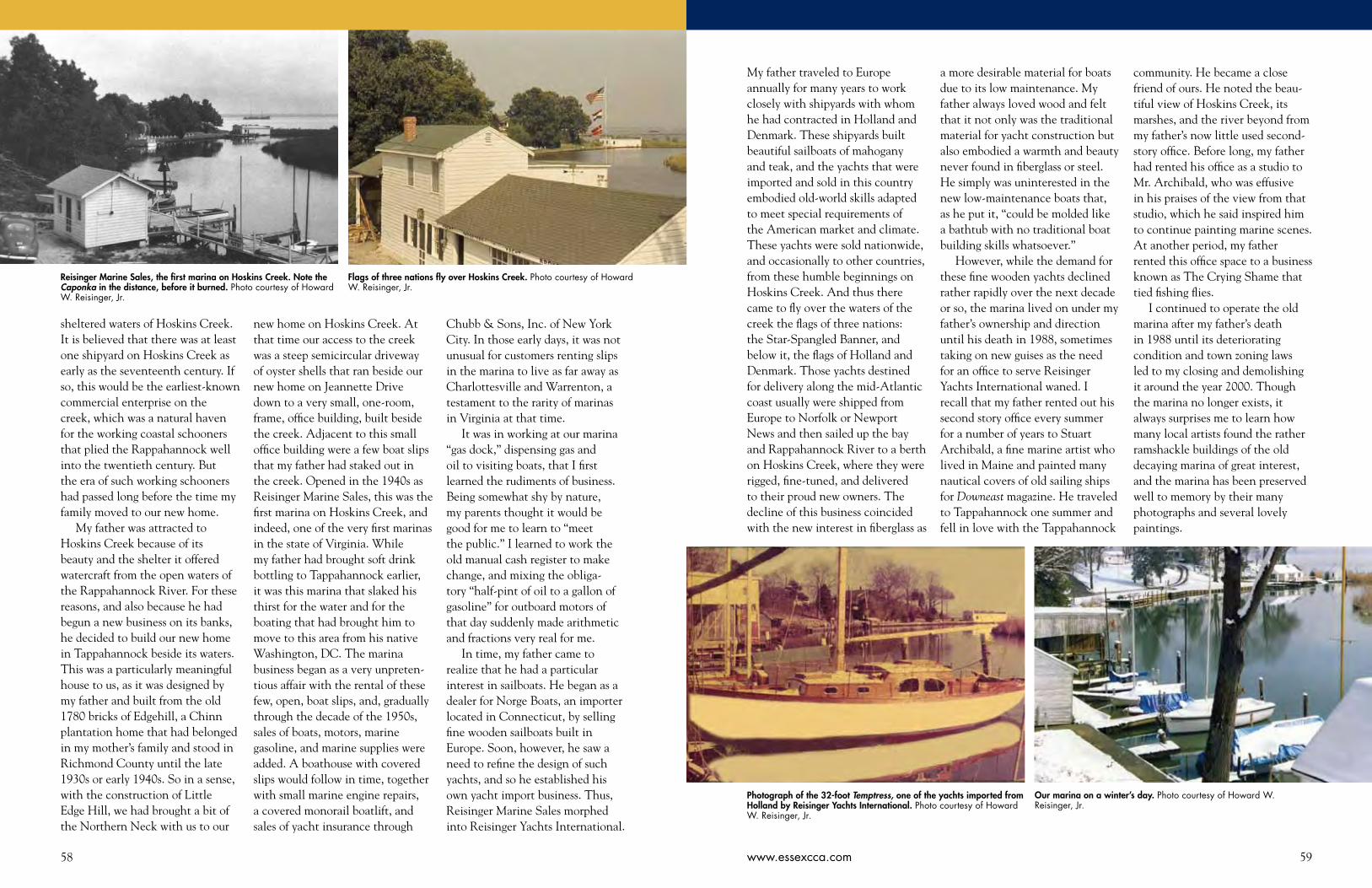
58 59www.essexcca.com
sheltered waters of Hoskins Creek. It is believed that there was at least one shipyard on Hoskins Creek as early as the seventeenth century. If so, this would be the earliest-known commercial enterprise on the creek, which was a natural haven for the working coastal schooners that plied the Rappahannock well into the twentieth century. But the era of such working schooners had passed long before the time my family moved to our new home.
My father was attracted to Hoskins Creek because of its beauty and the shelter it offered watercraft from the open waters of the Rappahannock River. For these reasons, and also because he had begun a new business on its banks, he decided to build our new home in Tappahannock beside its waters. This was a particularly meaningful house to us, as it was designed by my father and built from the old 1780 bricks of Edgehill, a Chinn plantation home that had belonged in my mother’s family and stood in Richmond County until the late 1930s or early 1940s. So in a sense, with the construction of Little Edge Hill, we had brought a bit of the Northern Neck with us to our
new home on Hoskins Creek. At that time our access to the creek was a steep semicircular driveway of oyster shells that ran beside our new home on Jeannette Drive down to a very small, one-room, frame, office building, built beside the creek. Adjacent to this small office building were a few boat slips that my father had staked out in the creek. Opened in the 1940s as Reisinger Marine Sales, this was the first marina on Hoskins Creek, and indeed, one of the very first marinas in the state of Virginia. While my father had brought soft drink bottling to Tappahannock earlier, it was this marina that slaked his thirst for the water and for the boating that had brought him to move to this area from his native Washington, DC. The marina business began as a very unpreten-tious affair with the rental of these few, open, boat slips, and, gradually through the decade of the 1950s, sales of boats, motors, marine gasoline, and marine supplies were added. A boathouse with covered slips would follow in time, together with small marine engine repairs, a covered monorail boatlift, and sales of yacht insurance through
Chubb & Sons, Inc. of New York City. In those early days, it was not unusual for customers renting slips in the marina to live as far away as Charlottesville and Warrenton, a testament to the rarity of marinas in Virginia at that time.
It was in working at our marina “gas dock,” dispensing gas and oil to visiting boats, that I first learned the rudiments of business. Being somewhat shy by nature, my parents thought it would be good for me to learn to “meet the public.” I learned to work the old manual cash register to make change, and mixing the obliga-tory “half-pint of oil to a gallon of gasoline” for outboard motors of that day suddenly made arithmetic and fractions very real for me.
In time, my father came to realize that he had a particular interest in sailboats. He began as a dealer for Norge Boats, an importer located in Connecticut, by selling fine wooden sailboats built in Europe. Soon, however, he saw a need to refine the design of such yachts, and so he established his own yacht import business. Thus, Reisinger Marine Sales morphed into Reisinger Yachts International.
My father traveled to Europe annually for many years to work closely with shipyards with whom he had contracted in Holland and Denmark. These shipyards built beautiful sailboats of mahogany and teak, and the yachts that were imported and sold in this country embodied old-world skills adapted to meet special requirements of the American market and climate. These yachts were sold nationwide, and occasionally to other countries, from these humble beginnings on Hoskins Creek. And thus there came to fly over the waters of the creek the flags of three nations: the Star-Spangled Banner, and below it, the flags of Holland and Denmark. Those yachts destined for delivery along the mid-Atlantic coast usually were shipped from Europe to Norfolk or Newport News and then sailed up the bay and Rappahannock River to a berth on Hoskins Creek, where they were rigged, fine-tuned, and delivered to their proud new owners. The decline of this business coincided with the new interest in fiberglass as
a more desirable material for boats due to its low maintenance. My father always loved wood and felt that it not only was the traditional material for yacht construction but also embodied a warmth and beauty never found in fiberglass or steel. He simply was uninterested in the new low-maintenance boats that, as he put it, “could be molded like a bathtub with no traditional boat building skills whatsoever.”
However, while the demand for these fine wooden yachts declined rather rapidly over the next decade or so, the marina lived on under my father’s ownership and direction until his death in 1988, sometimes taking on new guises as the need for an office to serve Reisinger Yachts International waned. I recall that my father rented out his second story office every summer for a number of years to Stuart Archibald, a fine marine artist who lived in Maine and painted many nautical covers of old sailing ships for Downeast magazine. He traveled to Tappahannock one summer and fell in love with the Tappahannock
community. He became a close friend of ours. He noted the beau-tiful view of Hoskins Creek, its marshes, and the river beyond from my father’s now little used second-story office. Before long, my father had rented his office as a studio to Mr. Archibald, who was effusive in his praises of the view from that studio, which he said inspired him to continue painting marine scenes. At another period, my father rented this office space to a business known as The Crying Shame that tied fishing flies.
I continued to operate the old marina after my father’s death in 1988 until its deteriorating condition and town zoning laws led to my closing and demolishing it around the year 2000. Though the marina no longer exists, it always surprises me to learn how many local artists found the rather ramshackle buildings of the old decaying marina of great interest, and the marina has been preserved well to memory by their many photographs and several lovely paintings.
Reisinger Marine Sales, the first marina on Hoskins Creek. Note the Caponka in the distance, before it burned. Photo courtesy of Howard W. Reisinger, Jr.
Photograph of the 32-foot Temptress, one of the yachts imported from Holland by Reisinger Yachts International. Photo courtesy of Howard W. Reisinger, Jr.
Flags of three nations fly over Hoskins Creek. Photo courtesy of Howard W. Reisinger, Jr.
Our marina on a winter’s day. Photo courtesy of Howard W. Reisinger, Jr.
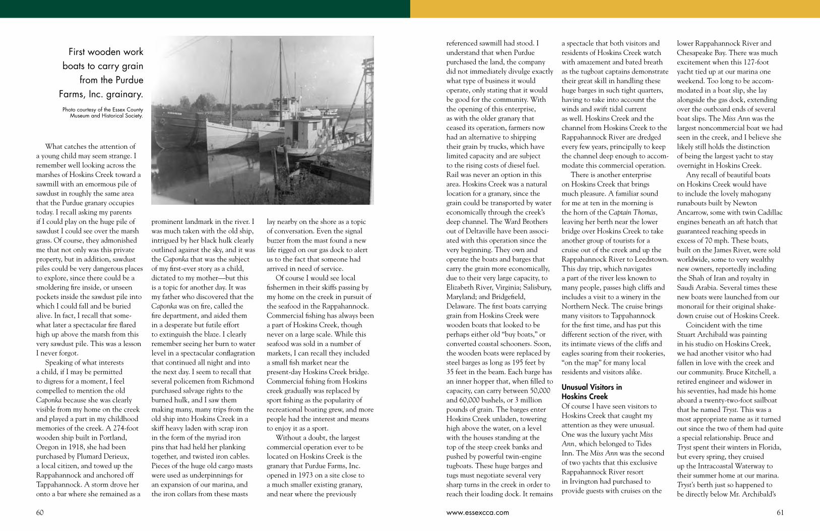
60 61www.essexcca.com
What catches the attention of a young child may seem strange. I remember well looking across the marshes of Hoskins Creek toward a sawmill with an emormous pile of sawdust in roughly the same area that the Purdue granary occupies today. I recall asking my parents if I could play on the huge pile of sawdust I could see over the marsh grass. Of course, they admonished me that not only was this private property, but in addition, sawdust piles could be very dangerous places to explore, since there could be a smoldering fire inside, or unseen pockets inside the sawdust pile into which I could fall and be buried alive. In fact, I recall that some-what later a spectacular fire flared high up above the marsh from this very sawdust pile. This was a lesson I never forgot.
Speaking of what interests a child, if I may be permitted to digress for a moment, I feel compelled to mention the old Caponka because she was clearly visible from my home on the creek and played a part in my childhood memories of the creek. A 274-foot wooden ship built in Portland, Oregon in 1918, she had been purchased by Plumard Derieux, a local citizen, and towed up the Rappahannock and anchored off Tappahannock. A storm drove her onto a bar where she remained as a
prominent landmark in the river. I was much taken with the old ship, intrigued by her black hulk clearly outlined against the sky, and it was the Caponka that was the subject of my first-ever story as a child, dictated to my mother—but this is a topic for another day. It was my father who discovered that the Caponka was on fire, called the fire department, and aided them in a desperate but futile effort to extinguish the blaze. I clearly remember seeing her burn to water level in a spectacular conflagration that continued all night and into the next day. I seem to recall that several policemen from Richmond purchased salvage rights to the burned hulk, and I saw them making many, many trips from the old ship into Hoskins Creek in a skiff heavy laden with scrap iron in the form of the myriad iron pins that had held her planking together, and twisted iron cables. Pieces of the huge old cargo masts were used as underpinnings for an expansion of our marina, and the iron collars from these masts
lay nearby on the shore as a topic of conversation. Even the signal buzzer from the mast found a new life rigged on our gas dock to alert us to the fact that someone had arrived in need of service.
Of course I would see local fishermen in their skiffs passing by my home on the creek in pursuit of the seafood in the Rappahannock. Commercial fishing has always been a part of Hoskins Creek, though never on a large scale. While this seafood was sold in a number of markets, I can recall they included a small fish market near the present-day Hoskins Creek bridge. Commercial fishing from Hoskins creek gradually was replaced by sport fishing as the popularity of recreational boating grew, and more people had the interest and means to enjoy it as a sport.
Without a doubt, the largest commercial operation ever to be located on Hoskins Creek is the granary that Purdue Farms, Inc. opened in 1973 on a site close to a much smaller existing granary, and near where the previously
First wooden work boats to carry grain
from the Purdue Farms, Inc. grainary.
referenced sawmill had stood. I understand that when Purdue purchased the land, the company did not immediately divulge exactly what type of business it would operate, only stating that it would be good for the community. With the opening of this enterprise, as with the older granary that ceased its operation, farmers now had an alternative to shipping their grain by trucks, which have limited capacity and are subject to the rising costs of diesel fuel. Rail was never an option in this area. Hoskins Creek was a natural location for a granary, since the grain could be transported by water economically through the creek’s deep channel. The Ward Brothers out of Deltaville have been associ-ated with this operation since the very beginning. They own and operate the boats and barges that carry the grain more economically, due to their very large capacity, to Elizabeth River, Virginia; Salisbury, Maryland; and Bridgefield, Delaware. The first boats carrying grain from Hoskins Creek were wooden boats that looked to be perhaps either old “buy boats,” or converted coastal schooners. Soon, the wooden boats were replaced by steel barges as long as 195 feet by 35 feet in the beam. Each barge has an inner hopper that, when filled to capacity, can carry between 50,000 and 60,000 bushels, or 3 million pounds of grain. The barges enter Hoskins Creek unladen, towering high above the water, on a level with the houses standing at the top of the steep creek banks and pushed by powerful twin-engine tugboats. These huge barges and tugs must negotiate several very sharp turns in the creek in order to reach their loading dock. It remains
a spectacle that both visitors and residents of Hoskins Creek watch with amazement and bated breath as the tugboat captains demonstrate their great skill in handling these huge barges in such tight quarters, having to take into account the winds and swift tidal current as well. Hoskins Creek and the channel from Hoskins Creek to the Rappahannock River are dredged every few years, principally to keep the channel deep enough to accom-modate this commercial operation.
There is another enterprise on Hoskins Creek that brings much pleasure. A familiar sound for me at ten in the morning is the horn of the Captain Thomas, leaving her berth near the lower bridge over Hoskins Creek to take another group of tourists for a cruise out of the creek and up the Rappahannock River to Leedstown. This day trip, which navigates a part of the river less known to many people, passes high cliffs and includes a visit to a winery in the Northern Neck. The cruise brings many visitors to Tappahannock for the first time, and has put this different section of the river, with its intimate views of the cliffs and eagles soaring from their rookeries, “on the map” for many local residents and visitors alike.
Unusual Visitors in Hoskins CreekOf course I have seen visitors to Hoskins Creek that caught my attention as they were unusual. One was the luxury yacht Miss Ann, which belonged to Tides Inn. The Miss Ann was the second of two yachts that this exclusive Rappahannock River resort in Irvington had purchased to provide guests with cruises on the
lower Rappahannock River and Chesapeake Bay. There was much excitement when this 127-foot yacht tied up at our marina one weekend. Too long to be accom-modated in a boat slip, she lay alongside the gas dock, extending over the outboard ends of several boat slips. The Miss Ann was the largest noncommercial boat we had seen in the creek, and I believe she likely still holds the distinction of being the largest yacht to stay overnight in Hoskins Creek.
Any recall of beautiful boats on Hoskins Creek would have to include the lovely mahogany runabouts built by Newton Ancarrow, some with twin Cadillac engines beneath an aft hatch that guaranteed reaching speeds in excess of 70 mph. These boats, built on the James River, were sold worldwide, some to very wealthy new owners, reportedly including the Shah of Iran and royalty in Saudi Arabia. Several times these new boats were launched from our monorail for their original shake-down cruise out of Hoskins Creek.
Coincident with the time Stuart Archibald was painting in his studio on Hoskins Creek, we had another visitor who had fallen in love with the creek and our community. Bruce Kitchell, a retired engineer and widower in his seventies, had made his home aboard a twenty-two-foot sailboat that he named Tryst. This was a most appropriate name as it turned out since the two of them had quite a special relationship. Bruce and Tryst spent their winters in Florida, but every spring, they cruised up the Intracoastal Waterway to their summer home at our marina. Tryst’s berth just so happened to be directly below Mr. Archibald’s
Photo courtesy of the Essex County Museum and Historical Society.

62 63www.essexcca.com 63www.essexcca.com
upstairs studio. With an artist’s eye, Mr. Archibald observed Tryst not only by day but also at night with the cabin lights streaming through her portholes. He thought a night portrait of Tryst would be a very fine gift to give to his new nautical friend. What a disappointment and shock he had when, upon presenta-tion, Mr. Kitchell frowned and told him in no uncertain terms that he could not accept the painting. But why? Mr. Archibald inquired, now wounded by this rebuff. Mr. Kitchell explained that the night scene of Tryst was “mournful” and “Tryst wouldn’t like it.” The attrac-tive painting hangs in my house today.
Because I had had since child-hood an interest in airplanes, I found another visitor to Hoskins Creek dear to my heart. The US Department of the Interior had a small plane on floats that made trips to our area to perform a census of waterfowl. What a thrill it was to me, on several occasions, to see the small plane circle our house and land right in the narrow but straight stretch of Hoskins Creek in front of our marina! The plane taxied over to the gas dock, refueled with marine gas, and then took off again on this same stretch of water, skimming our neighbor’s boathouse as it rose into the sky. How I would have loved to have been taken for a ride in that plane! But it was not to be, though my father once was lucky enough to be invited for a short flight.
Recreational Use of the CreekSeeing the huge recreational activity of millions of boats on the water today, it is difficult to believe that it was not always so. In fact, in the early days of colonial America,
through the nineteenth century, and into the twentieth, widespread recreational boating as we know it did not exist. Sure, there were the occasional pleasure craft, but recreational boating principally was limited to the wealthy who belonged to exclusive and expen-sive yachting clubs, or to those persons fortunate enough to have property on the water and a place to tie up a boat behind their home.
With World War II over, and middle-class affluence on the rise, the recreational marine industry was ripe to explode. An entire industry would arise to meet the new interest. I already have mentioned our marina. There would be at least one other marina on Hoskins Creek over time, as well as a “boatel.” For those not owning property on the water, not only did the marina provide a place to moor one’s boat; it also offered a place to buy a boat, purchase marine fuel, have a marine engine repaired, or have a boat hauled out for maintenance.
In many ways, my early life parallels the tremendous growth of recreational boating, and I feel very fortunate to have observed this entire evolution literally from my back door on Hoskins Creek. Paddle boats from skiffs to row boats to canoes to kayaks; power-boats from inboards to outboards to stern drives to runabouts to cruisers; sailboats from simple centerboard sailboats to racing sailboats to cata-marans to luxurious keel cruising yachts—Hoskins Creek has been a part of them all.
I still remember my first boat. It was an eight-foot pram that I rowed and sculled vigorously from the marina in exploration of the twists and turns of the creek near
my home. This was wonderful exercise, particularly when I had to return home against the strong tidal currents flowing in the creek. Soon I was hankering for the help of a small outboard motor. This came in the form of an ancient little 1½ horsepower Sea King outboard motor that my father had taken in trade for a new Johnson. Truth be known, this smallest of outboard motors had already reached the end of its life when it was given to me. Nonetheless, it was a source of pride to me that I could “fiddle with it” and get it to start and run when no one else could. But alas! The reciprocating water pump used to cool this engine was of very poor design, and even I could not overcome the propensity of this pump to quit, leaving the motor hot and steaming, and me to row home.
My first sailboat was indeed a special and very unexpected surprise. One Christmas morning I was to find under the Christmas tree in the living room a beautiful 8' 9", all-mahogany, lapstrake sailing pram. This small sailboat, known as a Bateka, was built in Germany by Abeking & Rasmussen as a tender for their Concordia yawls. The first sail had to be on that very Christmas day of light winds and unseasonably warm weather. My father and I launched my very own little sailboat in Hoskins Creek for a sail to the channel marker in the middle of the Rappahannock River and back home. Although I would own and sail other boats over the years ahead, many much faster and more luxurious, this little pram has always held a special place in my heart.
Although my father loved boating and was in the boat busi-ness, my mother, Sally (Chinn)
Reisinger, always had an innate fear of the water, perhaps in part because she had never learned to swim, and because, as a child, she had come close to drowning at Wellford’s Wharf. I know that she was much concerned when I ventured upon the waters of Hoskins creek alone, at first in a small skiff and later in sailboats. Yet, she knew that she would be unable to deny me these natural pleasures of living on Hoskins Creek. To this end, she wrote me a short poem that expresses so well both the happiness sailing brought me, and her fears and concerns as a mother. (See poem, right.)
Water sports were a natural development of pleasure boating, from water skiing to fishing to wake boarding to jet skis. Hydroplane racing was extremely popular at one time in this area, attracting huge crowds of spectators and boats from near and far to compete.
My father’s love of sailing soon inspired him to promote the sport in Tappahannock and Essex County. In particular, he wanted to introduce the local youth to sailing, which was virtually unknown locally in the 1940s and ’50s. For the joy of teaching these young people to sail, he purchased several plywood Moth sailboats, inex-pensive, but fun to sail and good training boats.
My father may have turned a hobby into a business, but he never forgot that boating was fun. As a member of Fishing Bay Yacht Club in Deltaville, he raced sailboats often on the bay, winning a number of trophies. He was eager to bring the excitement of this competition to Tappahannock. Sailboat racing reached its peak in Tappahannock on Hoskins Creek when a number
I’ve grown used to the sight of a boy and his boat,A boy and his boat that were meantTo be one together in all sorts of weatherComrades, in perfect content.With his hand on the tiller, the spray in his faceAnd his heart fairly bursting with pride,He sails down the stream with the wind on the beamAs the marsh banks slip by his side.Oh there’s joy in the hour, there’s joy in the dayAnd the world is invitingly fair,And the sail reaches high to the blue of the skyAs the breezes ripple his hair.Life’s a song unsung, his spirit is youngAnd confidence is his mate.He can weather the storm, weather the calm.He is master of his fate.It’s hard to turn back when just getting the knackOf the run, the tack and the reach,But time runs out and he’s coming aboutTo head for home and the beach.I watch from the bank as he comes into viewAnd hope that some day to learnTo bridle my fears, dispel all my tears,Just pray for his safe return.
of cruising sailboats came from as far away as Deltaville to participate in a race down the Rappahannock. The prize for the winner was to have one’s name, and the name of the winning yacht, engraved on a perpetual trophy, a sterling silver Paul Revere bowl.
My father always managed to have fun with boats. I recall a Christening ceremony that he devised, wherein a champagne toast was raised to the boat, which in turn was introduced to Neptune and to the north, south, east, and west winds.
As boating became more popular, a yacht club was built on Hoskins Creek. Although I can not recall much nautical activity associ-ated with this club, I do remember
it as a fun place where I first shyly and hesitantly approached members of the opposite sex to learn to dance. Adults enjoyed many cocktail parties at this club on Hoskins Creek, and they surely were not shy.
The Virginia Department of Game and Inland Fisheries began a project of building public boat-launching ramps to serve those who kept boats on trailers at home and needed a place to launch them. The department selected Hoskins Creek as one of the two sites in Tappahannock for a ramp.
As boat traffic on the creek, as elsewhere, exceeded anything ever imagined, safety dictated regulations and controls. Thus the US Coast Guard and the
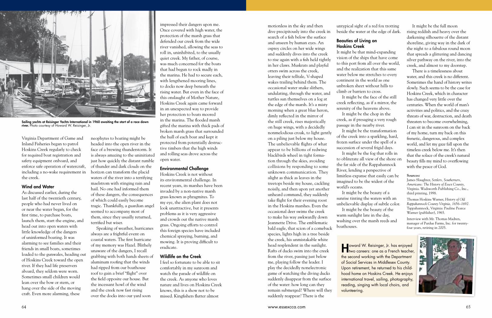
64 65www.essexcca.com
Virginia Department of Game and Inland Fisheries began to patrol Hoskins Creek regularly to check for required boat registration and safety equipment onboard, and enforce safe operation of watercraft, including a no-wake requirement in the creek.
Wind and WaterAs discussed earlier, during the last half of the twentieth century, people who had never lived on or near the water began, for the first time, to purchase boats, launch them, start the engine, and head out into open waters with little knowledge of the dangers of uninformed boating. It was alarming to see families and their friends in small boats, sometimes loaded to the gunwales, heading out of Hoskins Creek toward the open river. If they had life preservers aboard, they seldom were worn. Sometimes small children would lean over the bow or stern, or hang over the side of the moving craft. Even more alarming, these
neophytes to boating might be headed into the open river in the face of a brewing thunderstorm. It is always amazing to the uninitiated just how quickly the distant rumble of thunder and dark clouds on the horizon can transform the placid waters of the river into a terrifying maelstrom with stinging rain and hail. No one had informed them of these dangers, the consequences of which could easily become tragic. Thankfully, a guardian angel seemed to accompany most of them, since they usually returned, terrified but wiser.
Speaking of weather, hurricanes always are a frightful event on coastal waters. The first hurricane of my memory was Hazel. Blithely unaware of the dangers, I recall grabbing with both hands sheets of aluminum roofing that the winds had ripped from our boathouse roof to gain a brief “flight” over the field opposite our house. But the incessant howl of the wind and the creek now fast rising over the docks into our yard soon
motionless in the sky and then dive precipitously into the creek in search of a fish below the surface and unseen by human eyes. An osprey circles on her wide wings and suddenly dives into the creek to rise again with a fish held tightly in her claws. Muskrats and playful otters swim across the creek, leaving their telltale, V-shaped wakes trailing behind them. The occasional water snake slithers, undulating, through the water, and turtles sun themselves on a log at the edge of the marsh. It’s a misty morning when a great blue heron, dimly reflected in the mirror of the still creek, rises majestically on huge wings, with a decidedly nonmelodious croak, to light gently on a piling just below my house. The unbelievable flights of what appear to be billions of redwing blackbirds wheel in tight forma-tion through the skies, avoiding collisions by responding to some unknown communication. They alight as thick as leaves in the treetops beside my house, cackling noisily, and then upon yet another unheard command, they suddenly take flight for their evening roost in the Hoskins marshes. Even the occasional deer swims the creek to make his way awkwardly down Jeannette Drive. The emblematic bald eagle, that scion of a comeback species, lights high in a tree beside the creek, his unmistakable white head resplendent in the sunlight. Rafts of ducks swim into the creek from the river, passing just below me, playing follow the leader. I play the decidedly nonelectronic game of watching the diving ducks suddenly disappear from the surface of the water: how long can they remain submerged? Where will they suddenly reappear? There is the
impressed their dangers upon me. Once covered with high water, the protection of the marsh grass that defended our creek from the wide river vanished, allowing the seas to roll in, uninhibited, to the usually quiet creek. My father, of course, was much concerned for the boats that had begun to rock madly in the marina. He had to secure each, with lengthened mooring lines, to docks now deep beneath the rising water. But even in the face of this onslaught of Mother Nature, Hoskins Creek again came forward in an unexpected way to provide her protection to boats moored in the marina. The flooded marsh gifted the marina with thick pads of broken marsh grass that surrounded the hull of each boat and kept it protected from potentially destruc-tive timbers that the high winds and rolling seas drove across the open water.
Environmental ChallengeHoskins Creek is not without its environmental challenge. In recent years, its marshes have been invaded by a non-native marsh grass known as phragmites. To my eye, the alien plant does not look unattractive, but it presents problems as it is very aggressive and crowds out the native marsh grass. Ongoing efforts to control this foreign species have included chemical spraying, burning, and mowing. It is proving difficult to eradicate.
Wildlife on the CreekI feel so fortunate to be able to sit comfortably in my sunroom and watch the parade of wildlife on the creek. As anyone who loves nature and lives on Hoskins Creek knows, this is a show not to be missed. Kingfishers flutter almost
untypical sight of a red fox trotting beside the water at the edge of dark.
Beauties of Living on Hoskins CreekIt might be that mind-expanding vision of the ships that have come to this port from all over the world, and the realization that this same water below me stretches to every continent in the world as one unbroken sheet without hills to climb or barriers to cross.
It might be the face of the still creek reflecting, as if a mirror, the serenity of the heavens above.
It might be the chop in the creek, as if presaging a very rough passage in the nearby river.
It might be the transformation of the creek into a sparkling, hard, frozen surface under the spell of a succession of several frigid days.
It might be the fog that rolls in to obliterate all view of the shore on the far side of the Rappahannock River, lending a perspective of limitless expanse that easily can be imagined to be the widest of the world’s oceans.
It might be the beauty of a sunrise tinting the waters with an unbelievable display of subtle color.
It might be the beauty of the warm sunlight late in the day, washing over the marsh reeds and boathouses.
It might be the full moon rising reddish and heavy over the darkening silhouette of the distant shoreline, giving way in the dark of the night to a fabulous round moon that spreads a glittering and dancing silver pathway on the river, into the creek, and almost to my doorstep.
There is a timelessness about water, and this creek is no different. Sometimes the hand of history writes slowly. Such seems to be the case for Hoskins Creek, which in character has changed very little over the centuries. When the world of man’s activities and politics, and the crazy threats of war, destruction, and death threaten to become overwhelming, I can sit in the sunroom on the back of my home, turn my back on this frenetic, dangerous, and complex world, and let my gaze fall upon the timeless creek below me. It’s then that the solace of the creek’s natural beauty fills my mind to overflowing with the peace of God.
Sources:James Slaughter, Settlers, Southerners, Americans: The History of Essex County, Virginia. Wadsworth Publishing Co., Inc., third printing, 1998.
Thomas Hoskins Warner, History of Old Rappahannock County Virginia, 1656–1692. Tappahannock, Virginia: Pauline Pearce Warner (publisher), 1965.
Interview with Mr. Thomas Madren, manager of Purdue Farms, Inc. for twenty-four years, retiring in 2005.
Sailing yachts at Reisinger Yachts International in 1960 awaiting the start of a race down river. Photo courtesy of Howard W. Reisinger, Jr.
Howard W. Reisinger, Jr. has enjoyed two careers: one as a French teacher,
the second working with the Department of Social Services in Middlesex County. Upon retirement, he returned to his child-hood home on Hoskins Creek. He enjoys international travel, sailing, photography, reading, singing with local choirs, and volunteering.

66 67www.essexcca.com
ECCA Welcomes New Board Member
Mac Garrett is the newest board member
of the ECCA. Over the years he has served
Essex County in a variety of roles including
serving as the Commonwealth’s Attorney.
SBW: You have diligently served Essex County and your community for so many years. You could be quietly enjoying retirement. What prompted you to accept a board position for the ECCA?MG: Retirement means working at a variety of jobs without pay. I was glad to join the ECCA board as it is an exceptionally fine group of people. With Peter Bance at the helm, the ECCA board has led the drive toward maintaining Essex as a rural county by promoting land easements. The individuals who have voluntarily pledged their property to restrictions to prevent develop-ment help preserve the rural character of the county and they deserve praise for their actions.
An important role for ECCA is to continue to educate the public about the benefits of preserving open space. Growth will take place in the future and we citizens need to make informed decisions as to the direction of growth while maintaining a balance with nature, with our historical past, and with the scenic views with which we are blessed to have in Essex County. All of us have to be stewards of our land, county, commonwealth, and nation. We have to act now and set examples for future generations. Groups like ECCA have to go “retro” and appreciate and protect what has been done in the past. An example is how ECCA is backing the establishment of historic districts in Essex County. Some people think of lobbyist as having a bad influence, but it is necessary to get the words of preservation and conservation on the minds of the public and all levels of government officials. Think of the influence of ECCA as education—not lobbying. Get active—don’t retire, get involved.
SBW: What is your favorite natural spot in Essex County?MG: Other than sitting on my front porch in my rocking chair watching the vicious humming birds doing their dance against the backdrop of the pasture, farm fields,
and distant woods, I would say a special spot would be on the Rappahannock River. This spot is on a spit of land with the river on one side and a winding creek heading inland with both marshes and hard wood swamps where I have seen eagles, geese, ducks, deer and many other wildlife and bird species.
SBW: What do you think makes Essex County unique?MG: Essex County is a special place as it is a combi-nation of blends. Old historic homes, farms, and buildings make us yearn for yesteryear; yet, we can choose to own a house on the golf course. Houses in Tappahannock have restaurants, shops, banks, river access, schools and pharmacies within walking distances. There are activities for everyone: youth and adult athletics, hunting and fishing, art groups, civic clubs, churches and a river which can be viewed, bathed in, and partied on. The greatest fascination is the people of all walks of life who truly make Essex a wonderful place to live.
SBW: What would you hope that Essex County looks like 100 years from now?MG: One hundred years from now I would hope that much of the county would look similar to today. I challenge county officials to keep economic growth clustered in specific areas, not scattered helter-skelter, and similarly, suburban development contained in such a way as to preserve large tracts of farmland and woodland thus keeping the county rural.
By Susan Butler Walters
ECCA Board Reports
FinancialBy Trip Taliaferro, Treasurer
The last year has been a period of measured growth and continued
support within our membership. This support has allowed you Directors to continue our pursuit of foundation grants, continue improving efficiencies within our core education mission, with recent focus on launching three designated Rural Historic Districts within our great county in partnership with the
Essex County Board of Supervisors. As part of this effort, the ECCA has received $3,250 in donations specifically targeted for the [$8,000] total initiative cost. Please consider making an additional contribution to help your Board with Rural Historic Districts effort.
None of this would be possible with the continued support and generous donations provided by our membership over the past year. In 2013, we have received $14,687.03 in individual member
donations and $5,850 from corporate donations. Our corpo-rate sponsors are the primary offset to our annual meeting and annual magazine costs, while the individual donors provided the vital funding for our educational programs and literature. In closing, thank you once again for your generosity in these tough economic times. Your donations allow the Board to focus on our mission; we look forward to seeing you at our annual meeting.
Thank you to Hubert Phipps and Tayloe Emory for the helicopter ride and the opportunity to take aerial photographs in our efforts to protect and preserve Fones Cliff.

68 69www.essexcca.com
Climate change is a phenomenon that can be defined as changes in climate (eg. temperature, precipita-
tion and wind) that can be measured over an extended period of time. Although temperature, precipitation and wind are considered the three direct factors attributing to climate change, as they change they have countless anthropogenic and ecological indirect impacts:•WaterResourcesmaybecomestressedasthe
frequency of droughts increase; also the frequency and intensity of flooding events may increase.
• Agriculturemaybeatincreasedriskofheatstressas well as pest outbreaks and weeds; also changes in crop yield may prevail.
• Biodiversitymaybeimpactedbyshiftsinspeciedistribution and/or loss of species and habitats.
• Forestsareatincreasedriskofinsectoutbreaks,forest fires, and intrusion of invasive species.
• CoastalEcosystemsmayexperienceincreasedcoastal erosion and risk of pollution due to inun-dated infrastructure [as a result of sea level rise as well as storm events]; increased rates of saltwater intrusion into freshwater resources may also occur.
• AquaticSystemsmaylosenearshorehabitatsandcoastal wetlands as sea level rises; shifts in specie ranges and distributions may occur.
• PublicHealthmaybeexposedtomoreheatrelatedstress, an increase in vector borne illnesses (ie. West Nile); and reduced summer air quality due to increased production of ground level ozone may impact public health.
• Transportationandroadaccessmaybecomelimited as the frequency of flooded roads may occur due to sea level rise and intense storms; also this will increase the maintenance costs of impacted/damaged roads.
Middle Peninsula Planning District Commission:Rising Tides or Climate ChangeThis report was completed in 2010 with funds from the Virginia Coastal Management Program.
estimates of sea level rise, due to variable discrepancies amongst the scientific models being utilized.
Consequently, due to the unbiased geographic nature of climate change, the Middle Peninsula will experience both ecologic and anthropogenic impacts (Figure 1). Therefore to understand these implications the Middle Peninsula Planning District Commission (MPPDC), funded through the Virginia Coastal Zone Management (CZM) Program, has began a three year endeavor to specifically assess and discuss the economic and ecologic impacts of climate change. Working closely with member localities and a variety of stakeholder groups, year one of this project has focused on the collection, assessment and analysis of potential ecologic (ie. wetlands, conserved lands, etc) and anthropogenic (ie. personal property, public property, etc) impacts of climate change, particularly due to sea level rise. Additionally an economic and ecological impact assessment of sea level rise in select locations within the Middle Peninsula was conducted.
In February 2009, a Climate Change Advisory Workgroup, consisting of appointed county representa-tives and stakeholders groups, including transportation, sanitation, public health, recreation, science research, planners, and local businesses, was established. The Workgroup was tasked with identifying critical anthro-pogenic and ecological impacts of climate change
and sea level rise to their respective sector as well as to the region. A series of monthly meetings with the Workgroup pin pointed specific impacts of concern which were then able to be mapped and assessed using GIS (Geographic Information System).
Since LIDAR data for the Middle Peninsula is not currently available, GIS provided a format for assessing sea level rise impacts using elevation/topographic data. MPPDC assessed economic and ecological impacts of a 1ft sea level rise by 2050. Please note that these estimates may be considered conserva-tive, especially as recent reports highlight accelerated rates of climate change.
To access the impacts, the number of structures (eg. homes, business, onsite disposal systems, roads and shoreline hardening) and the amount of wetland acres inundated by sea level rise were quantified for select areas of the Middle Peninsula. Cost estimates were then collected in order to calculate the total long term impact costs of sea level rise. The table below depicts the total long term impact costs counties may endure as sea level continues to rise.
This document is a consortium of selected areas within the Middle Peninsula that highlight the economic and ecological impacts of sea level rise. This document also begins to pose pertinent questions that local governments will need to consider concerning public health, safety and welfare.
Figure 1. Climate change will ultimately impact both ecological and anthropogenic dynamics.
Table 1. Total (i.e. anthropogenic costs plus ecological costs) long-term impact costs of select areas within the Middle Peninsula.
• Infrastructure(publicandprivate)maybeimpacted if located within floodplains or low lying coastal areas, causing insurance premiums to increase; loss of private and public infrastructure due to sea level rise (loss of private and public investments) may also occur.
• EmergencyResponsemayhavetoredefineserviceareas and services as roads become flooded due to sea level rise and/or storm events; also there may be increased demands for services related to extreme weather events.According to the Intergovernmental Panel on
Climate Change (IPCC), Virginia temperatures are estimated to increase by 3°F in the winter, spring and summer, and increase 4°F in the fall, while precipita-tion is estimated to increase by 20% in all seasons by 2100. The National Wildlife Federation predicts that within the Upper Tidewater Region (where the Middle Peninsula is located), sea level will rise 11.2 inches by 2050 and 27.2 inches by 2100. However, other reports document variations in quantitative
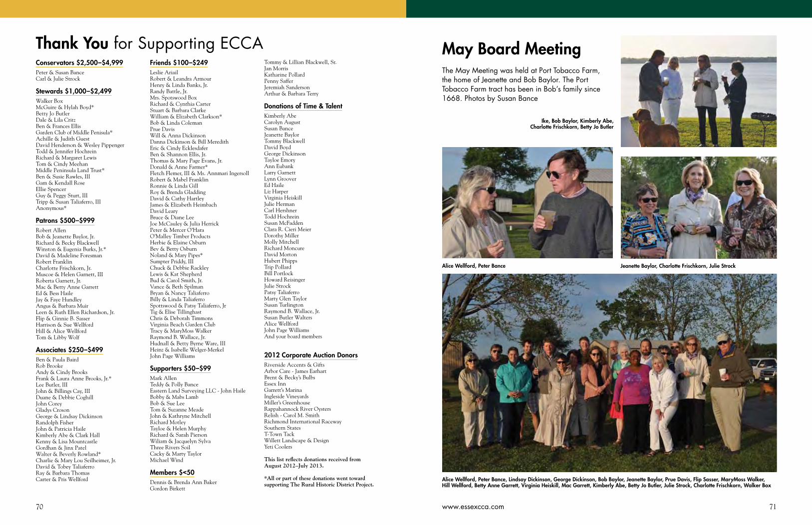
70 71www.essexcca.com
Conservators $2,500–$4,999Peter & Susan Bance Carl & Julie Strock
Stewards $1,000–$2,499Walker Box McGuire & Hylah Boyd*Betty Jo ButlerDale & Lila CritzBen & Frances Ellis Garden Club of Middle Penisula*Achille & Judith GuestDavid Henderson & Wesley PippengerTodd & Jennifer HochreinRichard & Margaret LewisTom & Cindy MeehanMiddle Peninsula Land Trust* Ben & Susie Rawles, IIIGam & Kendall RoseEllie SpencerGuy & Peggy Sturt, IIITripp & Susan Taliaferro, IIIAnonymous*
Patrons $500–$999Robert AllenBob & Jeanette Baylor, Jr.Richard & Becky BlackwellWinston & Eugenia Burks, Jr.*David & Madeline ForesmanRobert FranklinCharlotte Frischkorn, Jr.Muscoe & Helen Garnett, IIIRoberta Garnett, Jr.Mac & Betty Anne GarrettEd & Bess HaileJay & Faye HundleyAngus & Barbara MuirLeen & Ruth Ellen Richardson, Jr.Flip & Ginnie B. SasserHarrison & Sue WellfordHill & Alice WellfordTom & Libby Wolf
Associates $250–$499Ben & Paula BairdRob BrookeAndy & Cindy BrooksFrank & Laura Anne Brooks, Jr.*Lee Butler, IIIJohn & Billings Cay, IIIDuane & Debbie CoghillJohn CoreyGladys CrosonGeorge & Lindsay DickinsonRandolph FisherJohn & Patricia HaileKimberly Abe & Clark HallKenny & Lisa MountcastleGordhan & Jinx PatelWalter & Beverly Rowland*Charlie & Mary Lou Seilheimer, Jr.David & Tobey TaliaferroRay & Barbara ThomasCarter & Pris Wellford
Friends $100–$249Leslie AriailRobert & Leandra ArmourHenry & Linda Banks, Jr.Randy Battle, Jr.Mrs. Spotswood BoxRichard & Cynthia CarterStuart & Barbara ClarkeWilliam & Elizabeth Clarkson*Bob & Linda ColemanPrue Davis Will & Anna DickinsonDanna Dickinson & Bill MeredithEric & Cindy EcklesdaferBen & Shannon Ellis, Jr.Thomas & Mary Page Evans, Jr.Donald & Anne Farmer*Fletch Flemer, III & Ms. Annmari IngersollRobert & Mabel FranklinRonnie & Linda GillRoy & Brenda GladdingDavid & Cathy HartleyJames & Elizabeth HeimbachDavid LearyBruce & Diane LeeJoe McCauley & Julia HerrickPeter & Mercer O’HaraO’Malley Timber ProductsHerbie & Elaine OsburnBev & Betty OsburnNoland & Mary Pipes*Sumpter Priddy, IIIChuck & Debbie RackleyLewis & Kat ShepherdBud & Carol Smith, Jr.Vance & Beth SpilmanBryan & Nancy TaliaferroBilly & Linda TaliaferroSpottswood & Patsy Taliaferro, JrTig & Elise TillinghastChris & Deborah TimmonsVirginia Beach Garden Club Tracy & MaryMoss WalkerRaymond B. Wallace, Jr.Hudnall & Betty Byrne Ware, IIIHeinz & Isabelle Welger-MerkelJohn Page Williams
Supporters $50–$99Mark AllenTeddy & Polly BanceEastern Land Surveying LLC - John Haile Bobby & Mabs LambBob & Sue LeeTom & Suzanne MeadeJohn & Kathryne MitchellRichard MotleyTayloe & Helen MurphyRichard & Sarah PiersonWiliam & Jacquelyn SylvaThree Rivers SoilCacky & Marty TaylorMichael Wind
Members $<50Dennis & Brenda Ann BakerGordon Birkett
Tommy & Lillian Blackwell, Sr.Jan MorrisKatharine PollardPenny SafferJeremiah SandersonArthur & Barbara Terry
Donations of Time & TalentKimberly AbeCarolyn AugustSusan BanceJeanette BaylorTommy BlackwellDavid BoydGeorge DickinsonTayloe EmoryAnn EubankLarry GarnettLynn GrooverEd HaileLiz HarperVirginia HeiskillJulie HermanCarl HershnerTodd HochreinSusan McFaddenClara R. Cieri MeierDorothy MillerMolly MitchellRichard MoncureDavid MortonHubert PhippsTrip PollardBill PortlockHoward ReisingerJulie StrockPatsy TaliaferroMarty Glen TaylorSusan TurlingtonRaymond B. Wallace, Jr.Susan Butler WaltersAlice WellfordJohn Page WilliamsAnd your board members
2012 Corporate Auction DonorsRiverside Accents & GiftsArbor Care - James EarhartBrent & Becky’s BulbsEssex InnGarrett’s MarinaIngleside VineyardsMiller’s GreenhouseRappahannock River OystersRelish - Carol M. SmithRichmond International RacewaySouthern StatesT-Town TackWillett Landscape & DesignYeti Coolers
This list reflects donations received from August 2012–July 2013.
*All or part of these donations went toward supporting The Rural Historic District Project.
Thank You for Supporting ECCA May Board MeetingThe May Meeting was held at Port Tobacco Farm, the home of Jeanette and Bob Baylor. The Port Tobacco Farm tract has been in Bob’s family since 1668. Photos by Susan Bance
Alice Wellford, Peter Bance, Lindsay Dickinson, George Dickinson, Bob Baylor, Jeanette Baylor, Prue Davis, Flip Sasser, MaryMoss Walker, Hill Wellford, Betty Anne Garrett, Virginia Heiskill, Mac Garrett, Kimberly Abe, Betty Jo Butler, Julie Strock, Charlotte Frischkorn, Walker Box
Jeanette Baylor, Charlotte Frischkorn, Julie Strock
Ike, Bob Baylor, Kimberly Abe, Charlotte Frischkorn, Betty Jo Butler
Alice Wellford, Peter Bance
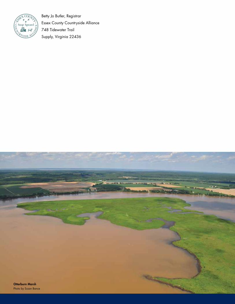
Betty Jo Butler, Registrar
Essex County Countryside Alliance
748 Tidewater Trail
Supply, Virginia 22436
Photo by Susan BanceOtterburn Marsh
Copyright © 2022 FDOKUMEN