British Academy / Honor Frost Foundation
30
10-11 Carlton House Terrace London SW1Y 5AH +44(0) 207 969 5200 thebritishacademy.ac.uk British Academy / Honor Frost Foundation Small Research Grants Final reports received 2019-20 May 2020
-
Upload
khangminh22 -
Category
Documents
-
view
0 -
download
0
Transcript of British Academy / Honor Frost Foundation
10-11 Carlton House TerraceLondon SW1Y 5AH
+44(0) 207 969 5200thebritishacademy.ac.uk
British Academy / Honor FrostFoundation Small Research GrantsFinal reports received 2019-20May 2020
10-11 Carlton House TerraceLondon SW1Y 5AH
+44(0) 207 969 5200thebritishacademy.ac.uk
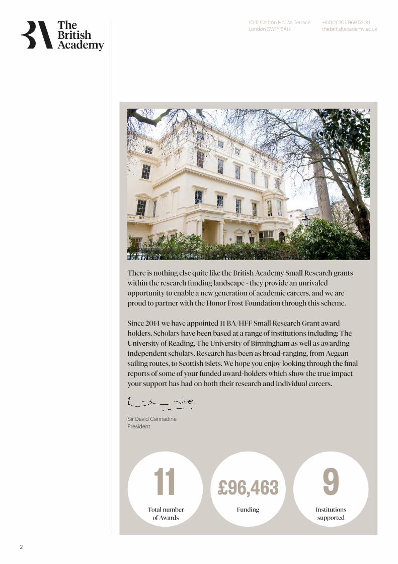
2
Total number of Awards
Funding Institutions supported
£96,463 911
There is nothing else quite like the British Academy Small Research grantswithin the research funding landscape - they provide an unrivaledopportunity to enable a new generation of academic careers, and we areproud to partner with the Honor Frost Foundation through this scheme.
Since 2014 we have appointed 11 BA/HFF Small Research Grant awardholders. Scholars have been based at a range of institutions including: TheUniversity of Reading, The University of Birmingham as well as awardingindependent scholars. Research has been as broad-ranging, from Aegeansailing routes, to Scottish islets. We hope you enjoy looking through the finalreports of some of your funded award-holders which show the true impactyour support has had on both their research and individual careers.
Sir David CannadinePresident
10-11 Carlton House TerraceLondon SW1Y 5AH
+44(0) 207 969 5200thebritishacademy.ac.uk
3
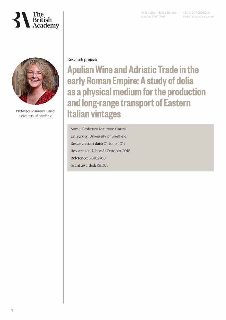
Professor Maureen CarrolUniversity of Sheffield
Name: Professor Maureen Carroll
University: University of Sheffield
Research start date: 01 June 2017
Research end date: 31 October 2018
Reference: SG162763
Grant awarded: £9,085
Research project:
Apulian Wine and Adriatic Trade in the early Roman Empire: A study of dolia as a physical medium for the production and long-range transport of Eastern Italian vintages

10-11 Carlton House TerraceLondon SW1Y 5AH
+44(0) 207 969 5200thebritishacademy.ac.uk
4
Account of research carried outPreparation of travel, accommodations, permissions: June 2017 Carroll: Travel toVagnari/Gravina to take samples from dolia (stored in the Soprintendenza), tophotograph, and measure the dolia; to take samples of 14 locally made Roman tiles;assist with the Palermo team taking local clay samples; museum visit Brindisi: July 2017Montana, Randazzo: Travel to Vagnari/Gravina to take local clay samples and takereceipt of dolia and tile sherds: July 2017 Montana, Randazzo: Fabric analysis, testfiring, chemical analysis of sherds, writing report: September 2017-January 2018) Stern,Steele: Residue analysis of sherds, writing report: January-April 2018 Carroll: Library(British School at Rome) and museum study of Italian publications, sites and artefactassemblages, including Pompeii and Ostia; library study in other national researchinstitutions in Rome (eg. German Archaeological Institute) for Adriatic material;museum visit to Split: during Easter break March/April 2018 Writing up research forpublication (Carroll, with contributions from scientists), production of drawings andmaps (illustrator): August-October 2018.
Advances in knowledge or understandingThis innovative and interdisciplinary project utilises archaeological and scientificmethods to explore the poorly understood historical and economic context of Roman wine production in eastern Italy and the role of bulk maritime trade in this commodity in connecting communities across the Adriatic. It focuses on the specialized ceramic vats (dolia) of enormous capacity of 1000 litres and more that were used to ferment and store wine for export that have been found at eastern Italian sites, including the Roman imperial estate at Vagnari excavated by the applicant, as well as in dolia stores and warehouses on the eastern Adriatic coast and as cargo containers detectable on Adriatic shipwrecks of the first and second centuries A.D. Exploring these containers and assessing their significance in Roman commerce will offer a valuable perspective on the producers of Italian wines and the maritime trade networks on the Adriatic sea that linked them with distributors and consumers.
The scientific work I am proposing is highly specialised, and I am reliant on experts to conduct this particular aspect of the project research. Both science teams are also very keen on refining their methodologies, expanding their range of materialexamined, and contributing to the project and publications. My colleagues from theUniversity of Bradford, Dr. Stern and Dr. Steele, are researching the identification ofwine as a developing area of interest in archaeological science. The survival of tartaricacid in ceramic vessels is taken as an indicator of the presence of wine, as it showsthat grapes were present (in the form of juice). They will do an analysis for tartaricacid which is a marker for wine, as they have established a well recognised methodfor this (HPLC-MSMS).
© The British Academ
y
10-11 Carlton House TerraceLondon SW1Y 5AH
+44(0) 207 969 5200thebritishacademy.ac.uk
5
My colleagues from the University of Bradford, Dr. Stern and Dr. Steele, are researching the identification of wine as a developing area of interest in archaeological science. The survival of tartaric acid in ceramic vessels is taken as an indicator of the presence of wine, as it shows that grapes were present (in the form of juice). They will do an analysis for tartaric acid which is a marker for wine, as they have established a well recognised method for this (HPLC-MSMS). The Bradford team will also conduct a test for syringic acid, which is a derivative of the red colour pigments in red wine, and this is taken as an indication of red wine rather than white. The pitch analysis (conventional GC-MS) they will conduct will determine whether the source is pine or birch or other genus, shedding light on the Roman methods of storing and preserving wine in repeatedly used containers. The Palermo team, Prof. Montana and Ms. Randazzo, are specialists in soil geochemistry, especially in Italian regions. The Vagnari dolia fabric appears, to the naked eye, to contain frequent volcanic particles, but Vagnari is not located near volcanoes; these vessels may therefore come from specialist manufacturers quite distant from the site. Thin sections of sherds from the fabric of the hypothetically imported dolia at Vagnari will be made and compared to thin sections of Roman tile made locally at Vagnari. Moreover 5 representative samples of local raw materials will be taken and test fired for comparison. Each sample will also be also submitted to chemical analysis (ICP-OES + ICP-MS 61 elements). The Palermo colleagues are very interested in cooperating with this archaeometric study to clarify:1) the compatibility with local and/or raw materials available; 2) the centre of production (particularly if the dark inclusions in the ceramics should prove to bde of non-local volcanic origin).
Project SummaryThis innovative and interdisciplinary project utilises archaeological and scientific methods to explore the poorly understood historical and economic context of Roman wine production in eastern Italy and the role of bulk maritime trade in this commodity in connecting communities across the Adriatic. It focuses on the specialized ceramic vats (dolia) of enormous capacity of 1000 litres and more that were used to ferment and store wine for export that have been found at eastern Italian sites, including the Roman imperial estate at Vagnari excavated by the applicant, as well as in dolia stores and warehouses on the eastern Adriatic coast and as cargo containers detectable on Adriatic shipwrecks of the first and second centuries A.D. Exploring these containers and assessing their significance in Roman commerce will offer a valuable perspective on the producers of Italian wines and the maritime trade networks on the Adriatic sea that linked them with distributors and consumers.
© The British Academ
y
10-11 Carlton House TerraceLondon SW1Y 5AH
+44(0) 207 969 5200thebritishacademy.ac.uk
6
Publications- Infant Health and Death in Roman Italy and Beyond. Portsmouth, R.I.: Journal of Roman Archaeology, Supplementary Volume 96, 2014 (with E.-J. Graham)- Spirits of the Dead. Roman Funerary Commemoration in Western Europe. Oxford: Oxford University Press, 2006- Earthly Paradises. Ancient Gardens in History and Archaeology. London: British Museum Press, 2003- Commemorating Military and Civilian Families on the Danube Limes, in L. Vagalinski and N. Sharankov (eds.), Limes XXII. Proceedings of the XXIInd International Congress of Roman Frontier Studies held in Ruse, Bulgaria, September 2012 (Bulletin of the National Archaeological Institute 42), Bulgarian Academy of Sciences: Sofia, 501-509- Vagnari 2012: New work in the vicus by the University of Sheffield, in A.M. Small (ed.), Beyond Vagnari. New Themes in the Study of Roman South Italy. Bari: Edipuglia, 2014, 79-88- Infant Death and Burial in Roman Italy, Journal of Roman Archaeology 24, 2011, 99-120
AudiencesI envisage 2 peer-reviewed papers, possibly in Antiquity and/or the Journal of Archaeological Science. Appropriate conferences at which the research (or preliminaryresults) could be presented would be the Roman Archaeology Conference, the European Association of Archaeologists conference, The International Symposium onArchaeometry. The Oxford Roman Economy Project also hosts regular conferencesand colloquia, and this research fits very well within the general themes of OXREP. I would offer the topic as guest speaker to the Classical Association (I am already on their list of ‘bookable’ speakers for local branches, but with other topics). I regularly aminvited to speak in departments of Archaeology throughout the UK and abroad, andthe research would be offered as a proposed topic in those contexts.
Future plans and other outcomesMy research involves cooperating with the Soprintendenza Archeologica della Puglia(Taranto/Bari/Gravina), with which I have had an excellent working relationship since2011; working in the library at the British School at Rome, where I have been BalsdonFellow and Hugh Last Fellow, as well as a regular visiting scholar; visiting the MuseoArcheologico Provinciale Francesco Ribezzo, Brindisi; visiting the archaeological sitesof Pompeii and Ostia; and visiting the Archaeological Museum, Split.
© The British Academ
y
10-11 Carlton House TerraceLondon SW1Y 5AH
+44(0) 207 969 5200thebritishacademy.ac.uk
7
Dr John Peter CooperUniversity of Exeter Name: Dr John Peter Cooper
University: University of Exeter
Research start date: 01 May 2018
Research end date: 31 December 2019
Reference: SRG\171201
Grant awarded: £9,690
Research project:
The Boat Builders and Users of Zanzibar: Nautical Technology and Maritime Identity in a Changing World
10-11 Carlton House TerraceLondon SW1Y 5AH
+44(0) 207 969 5200thebritishacademy.ac.uk
8
Account of research carried outThe research primarily identified and recorded surviving vernacular wooden watercraft technologies in East Africa, specifically in Zanzibar. It documented the building of one type vessel, determined the range and variety of vessels constructed, recorded their operating environments, and assessed how this ‘traditional’ practice is maintained despite the changing context in which they are built and used. Zanzibar is a historic hub of regional maritime activity where large wooden sailing ‘dhows’ continue to be seen in the Dhow Harbour of Stone Town. Despite the persistence of wood-based sailing-boat technologies in East Africa, limited research had previously been conducted in the region, and what little had published is limited in scope, is dominated by culture-historical notions of classification, diffusion and evolution, is functionalist in its approach, and promotes imperialist discourses of primitiveness and inferiority, with a tendency towards historical narratives rather than a focus on materials and technology.
Our research focused around a number of key activities and approaches. Afterconducting a thorough literature review we (Cooper, Blue and PhD studentAlessandro Ghidoni) travelled to Unguja, the main island of Zanzibar, in late July2018. Prior to travel we established contact withpeople who were to become ourkey Zanzibari colleagues, including the head of the Antiquities service in Zanzibar,Mr Abdullah Ali. Mr Abdullah was able to initiate meetings with key contacts andprovide access to primary building and operational sites. As per our proposal thefieldwork methodology was as follows:
i. Meetings with local experts and organisations in order to identify mechanisms by which to deepen co-operation with local communities, and enable a more inclusive approach to future phases of the research;ii. Interviews with local experts and community leaders to gather primary data on maritime activity and changing practice on the island. This included boat builders and users, and fishing people, and aimed at learning about their perspectives on the material culture, as well as the meaning and role of boats in society, past and present. Boat builders were asked about craft, process, materials, choice, adaptation, function etc., as well as comparing their vessels with others on the island and over time. Interviews were semi-structured and open-ended; notes were taken using notepads, voice-recorders and a video camera (subject to consent). Practice was also observed and documented (both fishing and, to a much greater degree, boat building), again through note-taking, photography and video recording of sequences and methods.iii. A number of boat building locations, largely located on beaches alongside areas of extensive maritime activity, were visited. One area of building in particular, just outside of Stone Town, was targeted for regular visits, and almost a complete sequence of build of a ngwanda—a type of fishing and transport boat—was documented.iv. A visual assessment of extant boat types was undertaken, taking measurements and photographs, and noting distinctive features.v. The recording of selected ‘archetypal’ vessels using boat-survey methods and 3D photogrammetry, was also accomplished.vi. Fishing communities were interviewed about current practice and change over time, noting spatial and temporal variety in techniques and tools.
© The British Academ
y
10-11 Carlton House TerraceLondon SW1Y 5AH
+44(0) 207 969 5200thebritishacademy.ac.uk
9
Visits to the following locations were undertaken:• Kinazini - where the ngwanda building was documented and the chief boat builder Mr Hamdan extensively interview, along with other boat builders at this site. This site was visited on multiple occasions.• Maruhubi – an Omani palace historic site and adjacent waterfront, where extensive boat building and beaching and fishing activity was documented in a variety of ways and on a number of occasions. Boats were recorded using photogrammetry; builders of both log based and plank based boats were interviewed; a huge variety of fishing activity was documented; sail making was recorded; net drying and sail drying noted; etc.• Mkokotoni – a beach landing-site where we noted and documented by photography the variety of boat types and on a second visit interviewed a crew of a ngalawa.• Nungwi – at beach on the very north of the island where boatbuilding was documented on a number of occasions and boat builders interviewed.• Kivunge – where a log was being fashioned to build a ngalawa outrigger boat – we were only able to document with photographs as the builder was unavailable• Mazizini – where a variety of boats were noted and a sailed mchoro was documented and a mashua boat captain and builder was interviewed• Shangani – an archaeological site where a small number of boats moored in the creek were identified. Boats were photographed and basic documentation was undertaken.• Bububu beach – next to a palace, where variety of boats beached were documented with photography.• Stone Town harbour and beaches – general observations were made around the boating activity of Zanibar’s capital Stone Town – access to the Dhow harbour was regrettably not permitted, but we were able to document vessels under sail.• Kizingo – a beach landing site close to Stone Town was visited on one occasion and the variety of boats noted.• Kinazini port – to the south of Kinazini, where a variety of boat types were noted and a jahazi owner interviewed and the boat documented.
All of the above was conducted in collaboration with Tanzanian collaborator Julius Ogotu (maritime archaeologist (M.A. London); University of Dar es Salaam), and with the help of Mr. Abdullah Ali. Their local knowledge and language was clearly critical to achieving the project goals and was invaluable with regards to translation assistance. The project also laid the groundwork for future work by honing future research objectives and methodologies. Over the course of our research we met on two occasions with colleagues from the University of Dar es Salaam, which lead to a successful application to the AHRC/GCRF fund to extend similar research to the community of Bagamoyo, coastal Tanzania in 2019-2020, under the ‘Rising from the Depths: Utilising Marine Cultural Heritage in East Africa’, call based out of the University of Nottingham.
© The British Academ
y
10-11 Carlton House TerraceLondon SW1Y 5AH
+44(0) 207 969 5200thebritishacademy.ac.uk
10
Advances in knowledge or understandingAdvances in knowledge and understanding were made in the following areas:• The range and variety of wooden watercraft in coastal Unguja was identified, assessed and documented in detail through close observation, ethnographic interview, photography and 3D-photogrammetry of representative vessels. Very little of this documentation work has been done previously, either in detail or in range of vessels captured.• The linguistic (Swahili) terminology used for boat types, parts, building tools and practices was gathered, complementing and expanding existing published works in this regard.• A clear understanding of the boat-building process for a ngwanda, as well as a clearer appreciation of the conceptualisation processes of an individual builder, were documented in detail. This allowed new ethnographic insights into key themes and concepts of nautical archaeology around hull conception, form and execution, as well as a straight forward documentation of a construction process itself.• A preliminary understanding of the economic, planning and social forces influencing the boatbuilding industry was reached, and further developed within the GCRF Funded Bahari Yetu, Urithi Wetu project that this British Academy funded project made possible.
Project SummaryThe project succeeded in establishing a picture of the range and type of vernacular wooden watercraft under construction today in Zanzibar, as well as the socio-economic context within which they operate. It also engaged closely with builders to understand the cognitive and planning processes involved in the construction of certain wooden watercraft without written plans, thus contributing valuable ethnographic insights into nautical archaeological debates around the craft and concept of watercraft construction. The project was crucial in enabling the applicants to prepare a successful application for a subsequent Arts & Humanities Research Council Global Challenges Research Fund grant as part of the Rising from the Depths programme. This enabled the researchers to extend their research to the port town of Bagamoyo, on the other side of the Zanzibar Channel, as part of the Bahari Yetu, Urithi Wetu project, in collaboration with the University of Dar Es Salaam. This project (ending June 2020)looked at ways of instrumentalising maritime cultural heritage for the benefit of localcommunities. Media interest: participation by John P Cooper in a documentary programme about the historic slave trade in Bagamoyo by ITV East Africa; coverage of the Bagamoyo exhibition by South African Television.
PublicationsThe following publications are in preparation:1) Blue, L., Cooper, J.P., Ghidoni, A., Ichumbaki, E., Vernacular watercraft of the Zanzibar Channel, Tanzania: tradition, innovation and context. International Journal of Nautical Archaeology.2) Blue, L., Cooper, J.P., Ghidoni, A., Building a ngwanda: Concept and sequence in the construction of a Zanzibari plank-built fishing boat. International Journal of Nautical Archaeology.
© The British Academ
y
10-11 Carlton House TerraceLondon SW1Y 5AH
+44(0) 207 969 5200thebritishacademy.ac.uk
11
AudiencesThe non-academic audiences to which the research was relevant are:1) Maritime heritage workers and maritime heritage policymakers in mainland Tanzania and Zanzibar—the Ministry of Natural Resources and Tourism; the Ministry of Livestock and Fishing: the Ministry of Information, Culture, Arts and Sports; the Tanzania Forestry Services Agency2) Museums with a maritime dimension: the National Museum of Tanzania; the House of Wonders Museum, Zanzibar; the Peace Memorial Museum, Zanzibar.3) Schools, community members and SADC ministers who attended the March 2020 Bahari Yetu Urithi Wetu exhibition in Bagamoyo.
The watercraft survey of Zanzibar, both in terms of ethnographic interviews and recording of material culture, has fed directly into the field research, findings, products and (impending) recommendations of the ongoing Bahari Yetu, Urithi Wetu project. These include recommendations to government policy-makers and other-sector stakeholders about the value and underlining economic ‘health’ of the use of vernacular watercraft in the region as fishing and transport vessels—to be presented to Tanzanian government and other stakeholders (e.g. tourism) in a workshop at the University of Dar Es Salaam, scheduled for June 2020 (though probably postponed due to the COVID-19 pandemic). Insights gained through the British Academy funded research in Zanzibar gave the researchers the insights necessary to prepare a community exhibition in Bagamoyo, mainland Tanzania, in March 2020 that celebrated the maritime heritage of the region. This was visited by around 300 schoolchildren, the labour and youth ministers of the 16-member SADC bloc of nations, and senior figures from the University of Dar Es Salaam. The latter are now in discussion with the government about taking over the heritage building in which the exhibition was held with a view to turning into a research institute and maritime heritage museum. None of this would have been possible without the initial impetus provided by the British Academy/Honor Frost Foundation small grant, which allowed the investigators to engage with the relevant stakeholders and Tanzanian partners and prepare for a Rising from the Depths grant.
Future plans and other outcomesThe research has already enabled the investigators to win AHRC/GCRF funding for the already outlined Bahari Yetu, Urithi Wetu project. This would not have been possible had we not met our future University of Dar Es Salaam partners and planned this subsequent project during our visit to Dar Es Salaam as part of the Zanzibar project. The timing was very serendipitous. It allowed a valuable introduction to both investigators to the ethnographic fieldwork in the region, and provides the platform, insights and contacts necessary to follow on from the first Bahari Yetu Urithi Wetu project with a second one: we are receiving indications that a new call will follow.
The most important contacts made were with academic colleagues Elgidius Ichimbaki and Elinza Mjema of the Archaeology and Heritage department of the University of Dar Es Salaam: we hope that future funding applications will build on these newly established relationships. We also established close relations with Mr Abdullah Ali of the Department of Museums and antiquities of Zanzibar, which will enable future collaboration there.
© The British Academ
y

10-11 Carlton House TerraceLondon SW1Y 5AH
+44(0) 207 969 5200thebritishacademy.ac.uk
12
Dr Mantha ZarmakoupiUniversity of Birmingham Name: Dr Mantha Zarmakoupi
University: University of Birmingham
Research start date: 31 March 2018
Research end date: 30 March 2019
Reference: SG171611
Grant awarded: £10,000
Research project:
Tracing Aegean maritime routes:underwater survey around Levitha,Kinaros and Maura (central Aegean Sea)
10-11 Carlton House TerraceLondon SW1Y 5AH
+44(0) 207 969 5200thebritishacademy.ac.uk
13
Account of research carried outThe survey will be conducted in the period of two weeks by a team of ten people: eight divers - including the two co-applicants - and two supporting technicians/skippers. In addition, two zodiacs as well as a support boat will be used for the survey. The first day will be dedicated to travel. The team of ten people and the two zodiacs will be transported from the port of Piraeus to the island of Amorgos (there is no tourist boat connection to Levitha, Kinaros and Maura), where the team will meet the support boat. The team will then board the support boat and the zodiacs will be attached to it in order to travel to Levitha. The support boat will be first based at the southwest coast of Levitha, where the four shipwrecks have been reported. Two days will be dedicated to the documentation of the reported shipwrecks at Levitha and four days for surveying the area in order to find additional shipwrecks. Two days will be dedicated for surveying Maura, which is located to the west of Levitha and is significantly smaller than the other two islands. Four days will be dedicated for surveying Kinaros, further to the west ofMaura and Levitha. The survey will be conducted by diving teams of two (four diving teams) using underwater scooters. It is estimated that eight dives will be conducted per day (two by each diving team). Underwater photogrammetry techniques will be used for the documentation of the shipwrecks and their finds. GIS technology will be employed for the mapping of the shipwrecks. The documentation of the shipwrecks and their finds will be catalogued in a database that will enable the quantification and statistical analysis of the finds. The database will be made available online after the end of the project. The last day will be dedicated to traveling back to Athens.
Advances in knowledge or understandingThe islands Levitha, Kinaros and Maura operated as stepping stones in the maritimeconnections between Asia Minor and the Cyclades - and from there to mainland Greece. Literary sources indicate that they are located at the intersection of important sailing routes of the Aegean (Arnaud 2005, 223-227), and local fishermen and sponge-divers have given information about shipwrecks in this area. No underwater survey has ever been conducted, however, in order to trace these maritime routes. This project will be the first to study this unexplored area in order to shed light on the trade connections of the central Aegean. By conducting an underwater survey of this area, the project will locate and map the shipwrecks around the islands. Four shipwrecks have been reported to the Ephorate of Underwater Antiquities, one of which was briefly investigated by the Ephoreia. The ship carried a mixed Punic and Aegean cargo of the fourth century BCE, which bears some similarities to the cargo of the Porticello shipwreck (Eiseman and Ridgway 1987, 37-51). The cargo of the ship is an unprecedented discovery, as this kind of cargo has never been found in the Aegean before. But is this cargo exceptional, or does its discovery merely point to the lack of systematic surveys in the region? The systematic survey of the Phournoi archipelago, led by coapplicant Dr. George Koutsouflakis (2015-2016), has recovered 45 shipwrecks dating from the Archaic to the Byzantine period. A number of cargos discovered in the shipwrecks of the Phournoi archipelago were also documented for the first time in the Aegean. Like Levitha, Kinaros and Maura, the island of Phournoi lies along a major sailing route of the Aegean but presents little archaeological interest above sea level. However, information by local fishermen and sponge divers led to the discovery of 45 shipwrecks around Phournoi within two seasons of underwater survey - a shipwreck graveyard, as it has been called - doubling the number of known shipwrecks in Greece since 1974, the date that the Ephorate of Underwater Antiquities was founded.
© The British Academ
y
10-11 Carlton House TerraceLondon SW1Y 5AH
+44(0) 207 969 5200thebritishacademy.ac.uk
14
Drawing on the exemplary methodology of the Phournoi survey that systematically investigated a promising area, the proposed project focuses on a demonstrably resource-rich area: the islands Levitha, Kinaros and Maura. While the Phournoi archipelago survey investigated a major North-South sailing route of the Aegean, the proposed survey will investigate a major East-West sailing route and, in doing so, elucidate the trade connections between Asia Minor and mainland Greece. It is clear that the systematic survey proposed here, tightly focused on this unexplored area, will expand our understanding of trade and maritime routes in the Aegean exponentially.
The project’s main objective is therefore to provide concrete information about one of the major maritime routes of the central Aegean and, together with the Phournoi Project, pave the way for the study of ancient maritime trade in this region and its wider socio-economic and art histories, which has largely suffered by the lack of systematic data collection. It is envisaged that on the basis of the results of this first fieldwork season the co-applicants will prepare a follow-up 3-year project in order to investigate the most important shipwrecks found during the survey.
Project SummaryThis project will be the first of its kind to study in a concrete way the maritime connections of ancient Greece with Asia Minor, through an investigation of previously unexplored shipwrecks in the central Aegean. The project team will conduct an underwater survey around the islands Levitha, Kinaros and Maura in order to shed light on the wider socio-economic and art histories of this region, which has largely suffered by the lack of systematic data collection. Although the islands Levitha, Kinaros and Maura are located at the intersection of main sailing routes of the Aegean, connecting Asia Minor with the Cyclades and mainland Greece, their maritime connections have never been investigated until now. A preliminary exploration of a reported shipwreck in the region has shown that the islands served as stepping stones in the maritime connections between the eastern and western Mediterranean. By conducting the first systematic underwater survey in this area, this project will be the first to study the central Aegean in the context of its broader maritime network.
PublicationsThe preliminary results of the survey will be first published in the “Archaiologikon Deltion” (Archaeological Report) as well as in a peer-reviewed research journal, specifically the Journal of Maritime Archaeology. The results of the survey will be presented at the Classical Association Annual Conference in 2019, the Annual Meeting of the Archaeological Institute of America in January 2019, the Annual Conference of the Greek Ephorate of Underwater Antiquities in Athens in 2019 as well as Seventh International Congress on Underwater Archaeology (IKUWA 7) in Helsinki in 2020. Furthermore, an article in the major public journal, Archaeology,will complement and further disseminate the research to the wider public. This is likely to lead to social media outputs, such as interviews.
Registered Charity No. 233176
© The British Academ
y

10-11 Carlton House TerraceLondon SW1Y 5AH
+44(0) 207 969 5200thebritishacademy.ac.uk
15
MONOGRAPH Navigation and Commercial Transportation in South Euboean Gulf (6th cent. B.C. - 14th cent. A.D.) (forthcoming 2018)
ARTICLES - “Hellenistic Bronze Sculptures from the Aegean Sea. Recent Discoveries (1994-2009)”, in Power and Pathos, Bronze Scuplture of the Hellenistic World, edited by J.M. Daehner and K. Lapatin, 72-81. Los Angeles: Getty Publications (2015) (coauthored with A. Simosi). - “Roman North African amphorae in the Aegean: the evidence of the shipwrecks”, in Per terram – per mare, edited by St. Demesticha, 3-22. Uppsala: Astrom (2015) (co-authored with X. Argiris). - “Ancient Shipwrecks and Cargoes in the South Euboean Gulf”, in To archaiologiko ergo Thesalias kai Stereas Helladas 3, edited by A. Mazarakis-Ainian, 875-88. Volos: Ministry of Culture and Tourism, University of Thessaly (2012) (in Greek with short summary in English; co-authored with X. Argiris) - “A Classical Shipwreck off the Island of Polyaigos”, Enalia 11 (2012), 110-129 (in Greek with short summary in English; co-authored with H. Spondylis) - “Underwater Survey in the South Euboean Gulf (2006-2008)”, Enalia 11 (2012), 40-69 (in Greek with short summary in English; co-authored with X. Argiris, Chr. Papadopoulou, I. Sapountzis).
AudiencesA website will be created in order to present the project and make accessible its results to the academic community as well as the wider public.
Future plans and other outcomesThe collaboration with the Greek Ephorate of Underwater Antiquities (EUA) is essential for the conduction of the project, as the EUA is the prime authority responsible for the documentation, study and preservation of underwater antiquities in Greece. Since the foundation of EUA in 1976, our knowledge of Greece’s underwater cultural heritage has greatly improved. Furthermore, Dr. George Koutsouflakis, who is Director of the Department of Underwater Archaeological Sites, Monuments and Research at EUA, has led exemplary underwater surveys in the Euboean Gulf as well as at the Phournoi archipelago. Dr. Koutsouflakis’s experience in studying areas that present little archaeological interest above sea level will complement the PI’s own experience in investigating the underwater remains and trade connections of historical sites, such as Delos. The collaboration with such an accomplished partner ensures the success of the project.
© The British Academ
y

10-11 Carlton House TerraceLondon SW1Y 5AH
+44(0) 207 969 5200thebritishacademy.ac.uk
16
Dr Duncan GarrowUniversity of Reading Name: Dr Duncan Garrow
University: University of Reading
Research start date: 01 April 2017
Research end date: 01 October 2018
Reference: SG162537
Grant awarded: £9,998
Research project:
Islands of stone: excavating the earliest‘crannogs’ in Scotland
10-11 Carlton House TerraceLondon SW1Y 5AH
+44(0) 207 969 5200thebritishacademy.ac.uk
17
Account of research carried outThe proposed 2017 fieldwork will last two weeks (15-29 July 2017), one week to evaluate each site. The fieldwork team will consist of Duncan Garrow and Fraser Sturt (directors) plus six additional excavators/surveyors. Evaluation:1. Clearance of vegetation cover with petrol strimmer and shears (Day 1)2. Excavation of trench (approx. 7 x 2m) from the centre to the edge of the islet (Days 2-5)3. Core taken from loch bed to assess environmental and dating potential (Day 3)4. Recording of archaeological remas (including photogrammetry) and on-site environmental sampling (Days 4-5)5. Backfilling and reinstatement of turf/vegetation (Day 6)
Post-excavation:6. Excavated material (pottery, quartz, macrobotanics, charcoal) and pollen sent for specialist analysis by Mike Copper, Hugo Anderson-Whymark, Julie Jones, Ceren Gabukcu and Michael Grant (Aug-Dec 2017)7. Assessment of core material for palaeoenvironmental reconstruction and dating: lithology, stratigraphy, XRF, pollen, diatoms, tephra, chironomids, palaeosecular variation. To be analysed by Fraser Sturt, Michael Grant, Pete Langdon, BOSCORF, Chuang Guan (Aug-Dec 2017)8. Submission of NRCF application for radiocarbon dates, if suitable (Oct 2017)9. Submission of Discovery and Excavation in Scotland report (Nov 2017)10. Preparation and submission of stratigraphic report to SAIR (Jan-May 2018)11. Preparation and submission of Antiquity article for publication (May-Jun 2018
If this evaluative season of work is successful, it is our intention to submit a muchlarger funding application to undertake a wider programme of work focused on theidentification, excavation and contextualisation of Neolithic crannog sites acrossthe Outer Hebrides.
Advances in knowledge or understandingThese sites are hugely significant. We have assembled a group of people withwide-ranging expertise that is directly relevant to the project in order to ensure thatwe are able to deliver the best possible results and interpretation. As a group theywill be able to: (1) advise us on best practice in terms of the excavation of theseunusual sites, (2) provide us with access to local, regional and national networksof expertise, and (3) deliver the best possible specialist reports on the Neolithicmaterial culture we are likely to find.
© The British Academ
y
10-11 Carlton House TerraceLondon SW1Y 5AH
+44(0) 207 969 5200thebritishacademy.ac.uk
18
Project SummaryCrannogs are a geographically widespread and undeniably intriguing category of archaeological site. Unusually, this one site type was constructed in many differentperiods of Scotland’s prehistoric and historic past – most scholars consider them to have been built, used and re-used from the Late Bronze Age to the medieval period. Hugely significantly, our recent underwater survey of several sites on the Isle of Lewis, Outer Hebrides confirmed that the origins of some of these sites in fact lie 3000 years earlier, in the Neolithic (c. 3700 BC). Over 400 crannog sites are recorded in Scotland, and many more no doubt lie undetected. The Outer Hebrides represent a particular hotspot in their distribution,with 150 potential sites identified across the island chain. Mostly unexcavated, it is possible that many of these are also in fact Neolithic. Eilean Domnhuill, North Uist– identified as the first clearly Neolithic islet settlement in the 1980s but unpublished and thus far often ignored as an ‘anomaly’ within crannog studies – adds further weight to this suggestion. The newly discovered Lewis sites are extremely impressive – massive piles of rock (c. 15m across) constructed within what would have been lochs in the Neolithic, their monumental scale is comparable with local stone-built passage tombs of the same date. Recent underwater survey identified worked timbers indicating that the mound structures were revetted; stone causeways out to two of them were also observed. Substantial quantities of pottery and quartz have been found on the loch beds around them. The preservation of ceramics – some vessels complete, many largely intact – is perhaps unique within the British Neolithic. However, since previous work has been non-intrusive, many unanswered questions remain. We still do not have a good understanding of what these new crannogs actually are, how and why they were built, or how similar they are to each other and to their later counterparts.Excavation is a priority if these questions are to be answered.
The proposed 2017 project will see trial excavation of the two most promisingsites(Loch Bhorgastail and Loch Langabhat). On each site, we will dig a single, targeted trench to identify any architectural components and sample any associated occupation deposits exposed; we will also establish the environmental and dating potential of the associated loch bed sediments.
Our main research questions are:- Were these settlements like their later equivalents or a new kind of (ritual?) site?- Does any architecture survive? What buildings and/or other features can be detected?- What practices were carried out on the islets and how do these relate to the substantial quantities of material recovered from the loch beds nearby?
If these Neolithic artificial islands were settlements, they transform our understanding of social relations at that time – what drove people to isolate themselves from the rest of the community in such a dramatic way shortly after the region was first settled on a substantial scale? Alternatively, if they are specialised, occasional-use sites, what purpose did they fulfil and what roles did they play alongside other monuments? Could they have been meeting/feasting places or venues for other ritual practice, perhaps even including burial These new sites have the potential to transform our understanding both of the British Neolithic and of this key site type. It is vitally important that we understand them.
© The British Academ
y
10-11 Carlton House TerraceLondon SW1Y 5AH
+44(0) 207 969 5200thebritishacademy.ac.uk
19
Publications- Garrow, D. & F. Sturt 2017 [in press]. Neolithic Stepping Stones: excavation and survey at three Neolithic and Bronze Age settlement sites in Guernsey, South Uist and the Isles of Scilly (St Martin’s), 2008-2014. Oxford: Oxbow.- Garrow, D., Griffiths, S. Anderson-Whymark, H., & Sturt, F. 2017 [in press]. Stepping stones to the Neolithic? Radiocarbon dating the Early Neolithic on islands within the ‘western seaways’ of Britain. Proceedings of the Prehistoric Society 83.- Bradley, R., Rogers, A., Sturt, F., Watson, A., Coles, D., Gardiner, J. and Scott, R. 2016. Maritime Havens in Earlier Prehistoric Britain. Proceedings of the Prehistoric Society 82, 1-35.- Anderson-Whymark, H., Garrow, D. and Sturt, F., 2015. Microliths and maritime mobility: a continental European-style Late Mesolithic flint assemblage from the Isles of Scilly. Antiquity 89, 954-971.- Sturt, F., Garrow, D. and Bradley, S. 2013. New models of North West European Holocene palaeogeography and inundation. Journal of Archaeological Science 40, 3963-3976.- Garrow, D. & Sturt, F. 2011. Grey waters bright with Neolithic argonauts? Maritime connections and the Mesolithic-Neolithic transition within the ‘western seaways’ of Britain, c. 5000-3500 BC. Antiquity 85, 59-72.
Audiences1. Journal article (5000 words) to be submitted to ‘Antiquity’. Springboarding off from our multiple combined survey methods paper (to be submitted to ‘Journal of Archaeological Science’ in Dec 2016), this paper will outline the character of this new site type and highlight the international significance of our findings, combining the results of both 2016 (underwater) and 2017 (dry land) fieldwork seasons to achieve the highest possible impact.2. Full survey/excavation report (c. 25,000 words) to be submitted to ‘Scottish Archaeological Internet Reports’ (peer-reviewed, open access, internet-based publication).3. Short report to be submitted to ‘Discovery and Excavation in Scotland’.4. Update existing University of Southampton project webpages, twitter feed and blog.5. Talk on the project at Stornoway Museum during 2017 season (building on successful previous event in July 2016)6. Academic conference papers where appropriate (we have already been invited to speak on the project at Oxford and Belfast)7. Follow-on feature for BBC4’s ‘Digging for Britain’ (our 2016 season will feature in the autumn 2016 series; the producers have expressed interest in featuring any 2017 follow-up work as well)8. Archives and reports deposited with HER, Canmore and ADS
Future plans and other outcomes- Journal articles- Discovery and Excavation in Scotland report- Report to the British Academy/Honor Frost Foundation- Digital resource (ADS deposit of data and reports)- Website and blog posts
© The British Academ
y
10-11 Carlton House TerraceLondon SW1Y 5AH
+44(0) 207 969 5200thebritishacademy.ac.uk
20
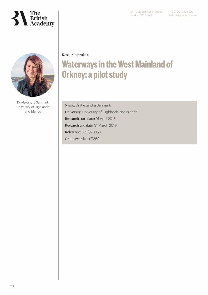
Dr Alexandra SanmarkUniversity of Highlands
and Islands
Name: Dr Alexandra Sanmark
University: University of Highlands and Islands
Research start date: 01 April 2018
Research end date: 31 March 2019
Reference: SRG\170858
Grant awarded: £7,360
Research project:
Waterways in the West Mainland ofOrkney: a pilot study
10-11 Carlton House TerraceLondon SW1Y 5AH
+44(0) 207 969 5200thebritishacademy.ac.uk
21
Account of research carried outIn order to fulfil the aims set out in the application, a background mapping exercisewas first conducted of all available georeferenced maps from the National MapLibrary of Scotland. These included Mckenzie’s coastal charts of 1750, James Dorret’s 1750 land maps and the series of OS maps from the 1830s. Together with recent aerial photography surveys these allowed a targeting of potential infilled stream and lochs for further investigation. Field work consisted of both remote geophysical sensing and collecting ground truth information using targeted coring. The geophysical methods adopted was direct current electrical resistivity tomography (ERT) as this has proven successful in identifying similar palaeochannels in other landscapes (Bates and Bates, 2016). Ground truth coring was conducted using a hand auger with sampling in the soft sediments down to over 2m depth. The core material was recorded in the field and sub-samples preserved at key intervals in the sections for further laboratory analysis. Location information and high-resolution topographic details of each field site were recorded using ground-based GNSS and also with airborne imagery and topographic mapping using drones.
Laboratory study included the assessment of selected samples for their containedmicrofossils. Samples for assessment were broken up by hand into small pieces,placed in ceramic bowls and dried in an oven. After drying a small quantity of sodium carbonate was added (to facilitate the removal of the clay fraction). The sediment mix was immersed in hot water and left to soak overnight. The sediment was then washed through a 75 micron sieve with hand-hot water, the resulting residue being returned to the bowl for drying. Once thoroughly dry the residue was transferred to plastic labelled bags for storage and further examination that included sieving using a nest of >500, >250 and >150 sieves. Microfossils from each grade were then picked by sprinkling a small amount of residue onto a tray and examining it under a binocular microscope. A detailed recording of the microfossil species was finally undertaken and is presented as semi-quantitative indications. A terrain model was manipulated using ArcGIS (v. 10.4, ESRI) with methodology for producing stream flow analysis following the work of Tarboton et al. (1991) and a final stream network using an ordering proposed by Strahler (1952). Wetland areas are prone to flooding as identified on the OS 1830 maps have been identified, and changes in topography examined, thus establishing the slope ofland across the area (for results see Online report figures 3a and 3b). The slope hasbeen divided into four categories, namely, 0-0.1 degree, 0.1 to 1 degree, 1-5 degree,and greater than 5 degree. The majority of the project area is less than 5 degreeslope with the main drainage axis showing slopes of less than 1 degree. Two pertinent transects have been drawn across the landscape as identified from the stream network, namely the main stream channel from the Loch of Harray through the Loch of Banks over to the Loch of Boardhouse and down to Birsay and the eastern branch from the Loch of Harray up to the Loch of Sabiston (for profiles along these transects see, Online report Figures 4a and 4b).
Coring was carried out along a transect across the lowest part of the landscape near to the Loch of Harray (See Appendix A in online report for the logs of individual cores). Eighteen cores were acquired through a sequence that showed peat at the surface underlain by silty sands, grey silts and boulder clay. Refusal of the core was typically at the bedrock surface within 1m of the present day landscape surface apart from at the centre of the transect near to the Burn of Hackland where the river has cut a channel
© The British Academ
y
10-11 Carlton House TerraceLondon SW1Y 5AH
+44(0) 207 969 5200thebritishacademy.ac.uk
22
over 2m deep into the landscape and infilled the sides with sand and soft muds (Online report: Figures 6a and 6b). Further to the north, a second investigation of the main channel was made to the west of Tounga and to the east of Warth Farm. At this point the river is crossed by a shallow ford and a small stone footbridge.
The river-cut bank sections to the west and east of the burn were logged andelevations measured for the heights of bedrock surface (Online report: Figure 7).The section to the west showed almost no glacial till on top of the bedrock surfacehowever the section to the east showed a typical thickness of approximately 1m oftill (Online report: see photo, Figure 7c).
The final core section was taken across the northern end of the Loch of Banks andextended up the gentle hill slope to the east of the loch (Online report: Figures 8aand 8b). Again, at this location a deep peat sequence was observed at the surfacetowards the loch which thinned to the east and eventually was absent up-slopeonto the agricultural land. At the centre of the transect the peat was underlain bygrey clay with a base of silt and stone typical of the weathered till sequence abovethe bedrock surface. The results of the direct current electrical resistivity tomography survey conducted along a line across the low ground (projected low point) between the Loch of Banks and the Loch of Broadhouse is shown (Online report: Fig. 9). Apparent resistivity variation between less than 10 ohm.m and over 100 ohm.m were recorded. The zones of low resistivity (or its inverse high conductivity) were coincident with modern field drains and no clear channel section could be seen on the cross section. Samples have been selected and sent off for radiocarbon dating, but the results have not yet been received.
Advances in knowledge or understandingThis section starts with a detailed discussion of the result for each surveyed section,followed by analysis of the place-name evidence, and finally the overall conclusions of the project.
Dounby TransectThis transect (Online report: Figure 5) exhibited only a thin sequence of sediments overlying the deposits interpreted as weathered till. Weathered till was located in the base of most boreholes and was overlain by a thin sequence of silts with organic remains in them. The exception to this pattern is found in DT-BH14/15 where dark grey silts were found at the base of the augured sequence. The sediments in the base of these boreholes may be sediments trapped in small pockets on the till surface. No sediments interpreted as lake or pond sediments were found in this transect and running water (river) sediments were not found. Microfossil analysis of BH1 showed plant debris, megaspores and insect remains together with the crustacea cladocerans and ephippia. A single freshwater ostracod species was recognised, namely, Cypria ophtalmica.
Tounga BridgeThis interesting site exhibits the results of downcutting by the river into the underlying till and bedrock sediments (Online report: Figure 7). Till exists overlying bedrock belowalluvium to the east while to the west the till is absent and the bedrock is only overlain by alluvium/colluvium. It is noted that the bedrock surface is approximately 1.5m higher on the west. This evidence implies that the erosion of the cutting in which the
© The British Academ
y

10-11 Carlton House TerraceLondon SW1Y 5AH
+44(0) 207 969 5200thebritishacademy.ac.uk
23
modern river lies predates the deposition of the till. In such a low-lying environment the situation of this bluff or cut bank area could be significant as it sits on a wide bend in the palaeo- and present river setting. ArcGIS was used to further analyse the topographic significance of the location by conducting a visibility analysis (line of sight) from the top of the bank near to Warth Farm (see Online report: Figure 10, for results). It is interesting to note that downvalley and across the Loch of Harray there is clear line of sight to the Watch Stone located at the necking of the Brodgar peninsula where the Loch of Stennes and Loch of Harray meet. This could perhaps represent something similar to the ‘defence system’ identified along the Roskilde Fjord, based on the warth/vord and bavne (beacon) names (Crumlin Pedersen 2010, 129-31 and fig. 5.12). The Watch Stone is interesting in this context, although the name is likely to be Victorian, it seems plausible that it may have been used for navigation purposes. There are a number of other Neolithic standing stones that seem to have served this function (Tom Muir, pers. comm. 15 May 2019). Even if the Watch Stone is of Neolithic date, it may have served this purpose in the Norse period.
Twatt TransectThis transect exhibits a deeper sequence of sediments than that at Dounby. Up to 1.7m of sediments are present in places and they exhibit characteristics of a range of different environments of deposition including lake/pond sediments as well as occasional thin bands of sand indicative of moving water. Interestingly boreholes in the wetter parts of the transect (TW-BH7/13) encountered dense sand deposits with stones that were difficult to drill through and may represent moving water fluvial sediments deposited in the deeper parts of the basin.
Core analysis of the plant debris and microfossils in BH4 identified two types of cold/cool ostracod indicator species, namely Ilyocypris gibba and Cytherissa lacustris within the grey clays at 1.4 to 1.5m depth. In BH5 a further indicator species was identified that is commonly found in late Pleistocene sequences but known to have become extinct by the Holocene suggesting that the freshwater lake that was present subsequently become silted up. BH9 and BH15 only contained plant material, insect remains, some green algae and crustacea. No ostracods were observed as key identifiers of environment. Electrical Resistivity Tomography (ERT) The ERT transect was located at a position designed to intersect any possible enhanced or cut channel through the higher ground between the Loch of Banks and the Loch of Boardhouse. Typically, such channels are infilled following disuse with material that has a different electrical signature to the surrounding soils and bedrock. Along the line decreased resistivity was recorded at both ends in association with modern drainage ditches but no cut feature was noted elsewhere. Analysis of the first OS maps and interpretation of current aerial photographs for the low-lying landscapes north of the Loch of Harray suggest that prior to the improvements in drainage a network of channels interlinked a series of shallow lochs. Over time these lochs have been infilled with silt to leave only the larger Loch of Sabiston and Loch of Banks today. The stream channel gradients throughout the area do not exceed 1 degree which is well within the haulage possibilities for shallow draft vessels. The use of portages in Norse society is well established. It is mentioned in many sagas where kings, such as Olaf Haraldsson and Sverre Sigurdsson, are said to have moved their fleets considerable distances and even across mountain passes (Larsson 2007, 163). Gunilla Larsson, who has recreated a number of Viking Age ships with boat builders and also sailed them, has shown how frequently portages were used. She has also demonstrated that the ships were light enough to be pulled
© The British Academ
y
10-11 Carlton House TerraceLondon SW1Y 5AH
+44(0) 207 969 5200thebritishacademy.ac.uk
24
on rollers over rather large distances, even up inclines (Larsson 2007, 163; pers. comm. 15/5/19). The place names in the investigated area are interesting in view of the results as well as existing landscape features. Moving north from the Loch of Stennes: Tufta in Skaebrae township is located where according to the OS map (Online report: Fig. 1c), drainage ditches for watery area of Orr Shun run into Harray Loch. There is also a second Tufta/Tufter, between Twatt and Boardhouse Loch (Marwick 1970, 79). Marwick derives these names from Old Norse tupt pl. tuptir ‘an old house or building site’, i.e. the usual meaning in Orcadian names. In Scandinavia, however, a link has been postulated between the place name and the word tofte (‘rowers seat’ or ‘thwart’), so that the farm may have been obliged to provide one rower for the leidang ship (the coastal defence levy) (Porsmose 1987 and Ole Crumlin Pedersen in an e-mail of 13/07/08). It is moreover interesting that in Hordaland in western Norway a connection between tofte with snekkja/skipa, two different names for longships, and Stylegar also cites skipreidetufti, in which the term is linked with the skipreide district which had to provide a ‘fully equipped ship to the levy fleet’ (Stylegar 2003, 10, 13). This points to Old Norse tupt, pl. tuptir being used of boathouse foundations, which could suggest that the ‘Tufta’ name in these two locations in Skeabrae and Twatt may indicate places where boats were drawn up and housed. In addition, the name Orr Shun itself is suggestive of water, as it could be translated as ‘Grouse Tarn’, from Old Norse orri and tjörn (Heggstad et al 1975, 327, 439).
The township of Skeabrae/Skaebrae is noteworthy as the first element of this name could be derived from Old Norse skeið (‘fast warship’) it would be very significant for the nearby name ‘Tufta’ already discussed. However, it is usually thought to be derived from Old Norse for a race-track where horse races were held (Marwick 1970, 80). Warth, to west of the Loch of Sabiston and the Loch of Banks, discussed above: This name is likely to have been part of signal arrangements, (if not defensive) in the postulated waterway system between Dounby and Twatt. It may be very relevant that the Warth farm is located at the narrowing of the channel indicated (Online report: Fig. 9), which is where a track goes across the putative waterway to the mill situated at the outflow from Loch of Sabiston. There is a Wart near the Brig of Waith, which is exactly where a warning beacon or signal would prove helpful to seamen navigating the narrow, and shallow channel between the Loch of Stennes and the open waters of the Bay of Ireland. Previous surveys in the Loch of Stennes and Bay of Ireland to the should of the Brig of Waith show that this channel would have been open and navigable from at least 4ka (Bates et al., 2016). According to Clouston, Wart is a ‘shore name’ and he suggests that it indicates ‘an ancient mustering place for the local levies’ (Clouston 1933, 15).
Wattle is a farm on the north banks of Boardhouse Loch, with a name of great significance: Old Norse veizla (a technical term for food renders to a lord, and the name one of the Orkney scats, i.e. wattle). Marwick notes that this had possibly been a farm ‘with the obligation of providing provender for the Norse earls when resident in Birsay’ (Marwick 1970, 59) and it may have been located in this position for the collection of food obligations from the surrounding estates in Birsay and Harray for transmission to the earldom seat on the Brough of Birsay (Crawford 2006, 37). If this was indeed the case, the method of transport for the collection of food renders across the watery route from Dounby to Twatt and then across Boardhouse Loch must have been a vitally important part of the earldom organization of food supplies. In summary, it is possible that in the Norse period there was a network of waterways that crossed the West Mainland making it possible to cut through using a boat. It can be envisaged that boats entered the Loch of Stennes via the Brig of Waith, and then moved into the Loch of
© The British Academ
y

10-11 Carlton House TerraceLondon SW1Y 5AH
+44(0) 207 969 5200thebritishacademy.ac.uk
25
Harray across the Ness of Brodgar (and the Watch Stone). From the northern point of Harry Loch, it is possible that boats could continue up to the current lochs of Sabiston and Banks. A short portage can be envisaged from the northern tip of the Loch of Banks to the Loch of Boardhouse. At the northern end of the Loch of Boardhouse, close to Wattle, a stream leads northwest to Birsay. This potential thoroughfare through the West Mainland of Orkney has significance for the interpretation of the farm names in this area and may well explain the location of the staðir farms around the lochs, originally Earldom farms granted out to members of the earl’s retinue (Crawford, 2006, 31-33 and Fig.3).
Project SummaryThis purpose of the study was to investigate the existence of navigable waterways in the West Mainland of Orkney, Scotland, in the Norse period (AD 790-1350). In the parish of Harray, a Norse farm named Houseby is found. Farms with this name are known from Scandinavia and Orkney and are usually situated by major water routes. An inspection of the oldest geographically referenced maps for the parish suggests that in the past significant waterways across wetlands may have extended north from the Loch of Harray towards Houseby in an area close to the power centre of the Norse Earldom at Birsay, in the neighbouring parish. The project tested this hypothesis using landscape reconstructions and further study of place-names. Specific objectives included geophysical analysis of abandoned river channels due to water course re-alignments and core sampling of silted-up lochs. Comparison of the landscape reconstructions with place names of significance allowed interpretation of possible routeways along navigable waters by shallow-draught Viking-Age vessels and provided the potential for re-drawing the map of Norse Orkney. This means that it may have been possibleto transport produce from estates in the parishes of Harray and Sandwick through thewaterways to the power centre at Birsay. This methodology could be useful to other parts of Orkney, and elsewhere, in understanding more about communication via navigable lochs and waterways through the Norse period.
Publications1) A fieldwork report has been produced by Richard Bates, Martin Bates, Barbara Crawford and Alex Sanmark (see https://www.uhi.ac.uk/en/t4-media/one-web/university/research/institute-for-northern-studies /The-Norse-Waterways-of-West-Mainland-Orkney.pdf). Here, maps presenting possible waterways through the West Mainland of Orkney are available. These maps will be also be part of the two forthcoming journal articles.2) A co-authored article (by Richard Bates, Martin Bates, Barbara Crawford and Alex Sanmark) is in production for the Journal of Wetland Archaeology (Taylor and Francis). As soon as the radiocarbon dates have been received, this article can be finalised and submitted. This article examines the methodology, research results and how these results can be used for further research.3) A second article by Alexandra Sanmark and Barbara Crawford is also in production. In this article, the wider implications of the completed research are examined, and examines the implications of the reconstruction of the Old Norse landscape, and a new version of the map of Norse Orkney will be presented. This article will shortly be submitted to the Journal of Scottish Name Studies (after initial discussion with Editor Dr Simon Taylor).4) Alex Sanmark and Barbara Crawford will be presenting the results at forthcoming
© The British Academ
y
10-11 Carlton House TerraceLondon SW1Y 5AH
+44(0) 207 969 5200thebritishacademy.ac.uk
26
conferences, starting with The Global North: Spaces, Connections, and Networks before 1700, which takes place 12-15 August 2019 in Stockholm (see https://www.medeltid.su.se/Arrangemang/program.htm).
AudiencesThe results of this project are of great interest to a wide range of audiences. In the first instance, the local community in Orkney are keen to hear more about this work. As stated in the application, Barbara Crawford and Alex Sanmark have both published academic articles on the Norse landscape of Orkney, and these research results have been presented at public seminars in Orkney, and also referred to in the monthly column in the Orcadian (the local newspaper) run by Institute for Northern Studies staff. The research results from this project will be presented by Sanmark to the local community in October 2019 (see below for further details). This project will also be of interest to the Orkney tourist guides, who regularly take tourists round the West Mainland of Orkney (where the UNESCO World Heritage sites are also located). These guides will now have new and additional information about Viking-age and Norse Orkney to add to their tours, which can be used to provide tourists with a greater understanding of this period of history. The Institute for Northern Studies runs the Scottish Tourist Guide Association (STGA) Orkney Green badge courses, as well as regular CPD courses for guides, and the project research results will be included in future iterations of these courses. The results will naturally also be of interest to the academic community, both researchers and students, and will be included in the teaching of the Institute for Northern Studies MLitt in Viking Studies. It will moreover benefit scholars of the Viking Age, as well as those with working with landscape andwetland archaeology, as well as place-name experts. in short, the interdisciplinary nature of the research makes it relevant for a range of academic audiences, hence the forthcoming articles in two very different journals (see Publications below).
Future plans and other outcomesThe results of this project are very encouraging as the initial hypothesis, built mainly on studies of place-names and maps, was confirmed by the fieldwork. As demonstrated by the project title, this was a pilot study and further the fieldwork in this area of the West Mainland of Orkney is envisaged. This new work would extend to the area north/northwest of the zone surveyed so far, as further waterways may have been in place there. If this is found to be the case, this part of Orkney would have been even easier to access, thus leading to further reinterpretation of the landscape and the roles and purposes of the farms and estates within it. This project can also be used a springboard for further work in other areas, where similar work can be envisaged (see Further projects below). In the course of this project contacts have been made with Dr Gunilla Larsson of Uppsala University, who has carried out extensive work on reconstructing prehistoric and medieval waterways in Sweden, with particular focus on the Viking Age. There are some highly striking parallels between Orkney, Sweden and also other parts of Scandinavia, which merit further study. Larsson has also worked with boat builders, specialsing in the reconstruction of Viking Age boats and ships, and these contacts will be used for future projects, as they have detailed knowledge of the navigability of these vessels in shallow waterways. During this project, contacts have also been made with members of the local population in Orkney, some of whom have detailed insight into the landscape and traditional naming of landscape features. They will be further consulted in any future project in Orkney.
© The British Academ
y
10-11 Carlton House TerraceLondon SW1Y 5AH
+44(0) 207 969 5200thebritishacademy.ac.uk
27
Dr Roberta TomberIndependent Scholar Name: Dr Roberta Tomber
University: Independent Scholar
Research start date: 01 August 2017
Research end date: 01 August 2019
Reference: SG163419
Grant awarded: £10,000
Research project:
The maritime context of Nani Rayan:overseas port in Kutch, Gujarat
10-11 Carlton House TerraceLondon SW1Y 5AH
+44(0) 207 969 5200thebritishacademy.ac.uk
28
Account of research carried outIndian Ocean archaeology is now established as a discipline, uniting diachronic studies of East and West that offer a tableau by which to explore questions of the transmission of technology and ideas, frequently through trade. Coastal regions are of particular importance as loci where external and regional spheres intersect, with the maritime setting informing on both the individual site and its wider context.
Relations between India and the West during the Early Historic and Early Medieval periods are key to understanding the development of the Indian Ocean. However, the archaeological data is uneven, with a bias towards south India; critically few excavated sites have examined the relationship between these two chronological horizons.
This fieldwork project focuses on the site of Nani Rayan in Kutch, Gujarat. By refining its location and investigating its cultural sequence Nani Rayan can be placed within its broad maritime environment. Most sites previously explored in this region are Harappan, but surface finds collected over the past 20 years by a local physician (Vasa 2011; personal inspection) indicate that Nani Rayan had an occupation spanning between the 1st BCE and the 9th CE. The site can potentially fill an important chronological gap within the region. Late Roman and West Asian ceramics, and a Byzantine coin, are present; these imported finds suggest that its role as an overseas port with links to the West was established by at least the 5th century.
The village of Nani Rayan, north of Mandvi, is located around the silted Rukmavati river. Exactly how the ancient site related to the then extant river is uncertain, but resolving this through satellite images, targeted coring and consideration of the river further upstream would clarify the role the river played in the formation of the site, and how the sea and river-port were linked. Attempts have been made to equate Nani Rayan with Minnagara, a port mentioned in the mid-1st century CE Periplus Maris Erythraei (Irani 2002), but viewed within a regional context its location does not seem to match the Periplus’ description. However, unravelling the relationship between the site and river is essential for assessing its identification with Minnagara, or indeed for understanding its role in the landscape.
Cultural deposits extend beyond the silted riverbed and throughout the village, covering an area of c. 1.5 x 1.1km. Most of the village is cultivated with shallow crops, but uncultivated areas exist. Magnetometry and surface scatters will be used to select 2-3 areas suitable for sondage to determine the cultural sequence and to suggest when in the sequence overseas contacts may have been established.
Through geophysics, sedimentology and excavation this project will refine the location and establish a preliminary sequence for the site at Nani Rayan. In doing so it will advance our understanding of Kutch during the Early Historic and Early Medieval periods and situate Nani Rayan in reference to other coastal sites. The finds, particularly the pottery and coins, will contextualise the maritime connections with other regions of India and further afield. Within this framework, Nani Rayan’s role in overseas trade will be elucidated.
© The British Academ
y
10-11 Carlton House TerraceLondon SW1Y 5AH
+44(0) 207 969 5200thebritishacademy.ac.uk
29
Advances in knowledge or understandingThe fieldwork described here will be undertaken in collaboration with the Department of Archaeology, Maharaja Sayajirao University of Baroda, Vadodara, Gujarat. Within India, this department is acknowledged as foremost in scientific approaches to archaeology and have a strong record of excavation in conjunction with the Archaeological Survey of India. They have frequently collaborated with foreign scholars in fieldwork.
Prior to fieldwork a desk-top assessment using Google Earth and satellite imageswill be conducted in the UK. A three-week field season will take place at Nani Rayan, between October 2017 and March 2018, depending on when in the crop cycle the appropriate permits and visas are issued. Before the field season the geoarchaeologist will spend a week in Baroda reviewing local publications relevant to the area. The field season will comprise targeted coring to determine the relationship between the silted river and the cultural deposits. Magnetometry will be conducted in key areas of the site in order to select 2-3 significant locations for small scale (1.5m x 1.5m) excavation. The recovered artefacts will be recorded, in line with standard fieldwork methodology.
Post-excavation work on the geophysical results and pottery will progress on site with the assistance of students from MS Baroda and the other team members (see below). After the excavation an additional week of post-excavation analysis will take place at Baroda University. Non-ceramic finds and ecofacts will be recovered and their study organised as required.
In addition to publication, results will be presented at the European Association forSouth Asian Archaeologists in Barcelona (July 2018). This will provide our primaryIndian collaborator with the opportunity to present at an international conferenceand discuss the work with a wide range of scholars.
The fieldwork will take place in year 1; the second year will be devoted to finalisingthe publication.
Project SummaryThis project explores the maritime trade of the Indian Ocean through the site atNani Rayan, near Mandvi, Gujarat. Its rich surface finds demonstrate connectionswith the Roman world and West Asia from at least the 5th century CE, althoughIndian finds suggest it was occupied between the 1st BCE and the 9th CE. Thisproject will investigate the relationship between the cultural deposits and the nowsilted Rukmavati riverbed on which the ancient port would have been centred.Through geophysical investigation, including targeted coring and a widerconsideration of the landscape, the ancient site location will be examined in orderto understand how the site developed and functioned as a port. Magnetometrywill be used to select 2-3 small areas suitable for excavation, the finds from whichwill provide a cultural sequence. By locating and defining the site it will be possibleto evaluate its published equation with Minnagara of the 1st century CE PeriplusMaris Erythraei, but more significantly its role in Indian Ocean trade.
© The British Academ
y
10-11 Carlton House TerraceLondon SW1Y 5AH
+44(0) 207 969 5200thebritishacademy.ac.uk
30
PublicationsResearch results will be presented by Mr Prathapchandra and one of the British team members at the European Association for South Asian Archaeologists (July 2018, Barcelona). This is the main forum in Europe for South Asian Archaeology and therefore will provide a wide audience. The SG will cover Mr Prathapchandra’s costs; the UK member will seek funding elsewhere. At least one refereed jointly authored article will be published, depending on the results, in either The International Journal of Nautical Archaeology, South Asian Studies or both.
AudiencesN/A
Future plans and other outcomes- Conference presentation- Peer-reviewed journal article
© The British Academ
y