Demographic change, institutional settings, and labor supply
Upload
khangminh22Category
view
0download
0
1
www.sheltercluster.org
AREA-BASED APPROACHES IN URBAN SETTINGSCompendium of Case StudiesMAY 2019 edition
URBAN SETTLEMENTS WORKING GROUP

2
ACKNOWLEDGEMENTS
this document was coordinated and overseen by the Global Shelter Cluster’s (GSC) Urban Settlements Working Group and with the support of dG-eCHo.
this current iteration of this Compendium of case studies includes case studies from the following organisations: • ACted• American Red Cross• Care international UK• Catholic Relief Services • Feinstein international Centre at tUFtS University• Global Communities• Habitat for Humanity international• Humanitarian openStreetMap team (Hot)• iMPACt initiatives• international Federation of Red Cross and Red Crescent Societies (iFRC) • JointIDPProfilingService(JIPS)• Kenya Red Cross Societyz• Massachusetts institute of technology (Mit)• nepal Red Cross Society (nRCS)• norwegian Refugee Council• Project Concern international• SoLidARitÉS inteRnAtionAL• Shelter Projects 2011 – 2012 • United nations High Commissioner for Refugees (UnHCR)• United nations Human Settlements Programme (Un-Habitat)
ThisreportwasproducedwiththesupportoftheaboveagenciesandspecificthankstoAmeliaRule,AndreaQuaden,AnnaHirschHolland,AusdeBertrand, BrettMoore, CatherineSherwood, CharmaleeJayasinghe,DanielMutinda,DavidHumphries,DavideNicolini,DonalReilly,ElaSerdaroglu,GiuliaFrontini,GiovannaFederici,IbrahimSuada,JamesSchell,JeninaAllia,JessicaSadyeWolff,JimDiFrancesca,LoraVicariot,LouiseThaller,LucaPupulin,ManualVega-Cuberos,MarioFlores,MhairiO’Hara,MiguelUrquia,NadiaCarlevaro,NankiChawla,PankajKumarSingh,RichardEvans,RudraAdhikari,RyanSmith,SamerSaliba,TomCorsellis,TulioMateo,WillCragin,YantisaAkhadi,ZeynepBalcioglu,andZiggyGarewal.
Projectmanagers:JamesSchell,MohamedHilmi,SekiHiranoAnalysisandexecutivesummary;ElizabethParker,VictoriaMaynardGraphic design: Sneha MalaniCopyeditor: James Schell
Links:Urban settlement Working GroupFor reference literature see Area-basedApproachesChannel,Humanitarianlibrary
Source: CRS

3
this compendium was made possible through the support of eU humanitarian aid
About eU Civil Protection and Humanitarian Aid: the european Union and its Member States are the world’s leading donor of humanitarian aid. Relief assistance is an expression of european solidarity with people in need all around the world. it aims to savelives,preventandalleviatehumansuffering,andsafeguardtheintegrityandhumandignityofpopulationsaffectedbynaturaldisasters and man-made crises. the european Commission ensures rapid and effective delivery of eU relief assistance through its two main instruments: civil protection and humanitarian aid. through its civil protection and humanitarian aid operations department(ECHO),theEuropeanCommissionhelpsover120millionvictimsofconflictanddisasterseveryyear.WithheadquartersinBrusselsandaglobalnetworkoffieldoffices,theCommission’scivilprotectionandhumanitarianaidoperationsdepartmentprovidesassistancetothemostvulnerablepeopleonthebasisofhumanitarianneeds.Formoreinformation,pleasevisit the european Commission’s website .
ThisdocumentcovershumanitarianaidactivitiesimplementedwiththefinancialassistanceoftheEuropeanUnion.Theviewsexpressedhereinshouldnotbetaken,inanyway,toreflecttheofficialopinionoftheEuropeanUnion,andtheEuropeanCommission is not responsible for any use that may be made of the information it contains.
Source: CRS/ismail Ferdous

4
EDITORIAL Affectedcommunitiesdonotperceivetheirrecoveryinsectoralterms,butfromaholistic,multi-sectoralperspective.Whilstsectoralapproachesandtechnicalexpertiseremainimportantingredientsinhumanitarianresponseandrecovery,understandingthe holistic needs of affected communities require improved sectoral and stakeholder collaboration. Applying an area based / settlement-basedapproach,which“advocatesforassistancethatconsidersthewholepopulationaffectedbyacrisis,livinginaspecificgeographicareainneedofmulti-sectoralsupportbyworkingwithmultiplestakeholders”,contributestothisachievingholistic understanding and program logic.
Areabased/Settlement-basedapproachesdefine“anarea,ratherthanasectorortargetgroup,asaprimaryentrypoint”.Thisapproachcanbeparticularlyappropriateifresidentsinanaffectedareafacecomplex,inter-relatedandmultisectoralneeds.Whilstthisapproachisrecognisedasoneofmany,itsstrengthisrealisedthroughbuildingadeeperunderstandingoftheaffectedpopulations’holisticneedsandcomplexcontexts,andbybuildingonexistingcommunitycohesionandcapacity,governancestructures,marketsandservicedeliverymechanisms.
Inrecentyears,thisapproachhasgainedtractionamonghumanitarianactorsseekingtoprovidemoreeffectiveresponsestocrisisaffected populations and pave the way for recovery. the increasing application of this approach builds on experiences of urban and regional planners working on community renewal through ‘area-based initiatives’ in poor and vulnerable locations since the 1960sand1970s.ThiswasreinforcedbytheInter-AgencyStandingCommittee’scallin2010fora“paradigmshiftinhumanitarianassistanceinurbanareas,basedonacommunity-based-ratherthan-anindividualorhouseholdapproach”.Morerecently,theHabitatIIIsummit,theGlobalAllianceforUrbanCrises,InterAction,andstrategypapersbyOFDA,ECHO,andUNHCRhaveacknowledgedandpromotedtheseapproaches.However,whilsthumanitariananddevelopmentagenciesareincreasinglyapplyingthisapproach,itoccursinarathersporadicnatureandisyettoreachscaleandberecognisedas‘atoolinthetoolbox’bythe overall humanitarian system.
Tosupporttheadoptionofthisapproach,theUrbanSettlementsWorkingGroup(USWG)wasestablishedinMay2017.Co-chairedbyCatholicReliefServices,ImpactInitiativesandInterAction,undertheauspicesoftheGlobalShelterCluster,akeyobjectiveoftheUSWGistoidentifyandpromotebestpracticeandlessonslearntfromexistingpractices.Withover60organisationsengaged,theUSWGprovidesaplatformtobringtogetherglobalclusters,implementingagencies,donorsandacademicstoresearch,discuss and operationalize these approaches in humanitarian assistance. this publication represents a key output and important milestoneoftheUSWG,consolidatingcurrentpractices,identifyingcommonchallenges&constraintsandprovidingoperationalguidance.
the USWG would like to thank the numerous agencies who have contributed to this compendium. We hope this publication will serve as a useful point of reference for organisations applying a settlement-based approach to response and recovery.
Overall,theapproachrequiresfurtherresearch,applicationandevaluationtocreateaninformedevidencebasetoinfluencechangeacrossthetraditionalhumanitarianresponsemechanisms.Lookingahead,theUSWGwillcontinuetochampionthisapproachinglobalandregionaldiscussions,developaccessibleguidanceandtoolswhereveritcanaddvalueandcountonhumanitarian and development communities’ continued support.
GSC Urban Settlement WG co-convenersCatholic Relief Services, IMPACT Initiatives and InterAction
Source: Unicef/noorani

5
EDITORIAL…………………………………………………………………………………………………………………………….…….....................................4
INTRODUCTION AND ANALYSIS1. What is this document about?..................................................................................................................................................................................62. What are area-based approaches? ………………………………………………………………………………………….……......................................93. Reasons for adopting area-based approaches ………………………………………………………………………….……........................................104. What do area-based approaches look like in practice?………………………………………………………………………........................................11 5. What can we learn from the case studies?……………………………………………………………………….……....................................................126. How can area based approaches be improved?……………………………………………………………………….……...........................................13
CASE STUDIES
CITY LEVEL SCALEC1Ar-Raqqa,Syria/Ar-Raqqa Area Based Assessment………………………………………………………………………………..............................15C2DaresSalaam,Tanzania/Open Mapping for Flood Resilience…………………………………………………………..…......................................17C3Jakarta,Indonesia/Enhancing Capacity within Disaster Management Agencies through Open Exposure Data.........................................19C4Mosul,Iraq/ Settlement Based Coordination following the Mosul Offensive....................................................................................................21C5Various,SriLanka/Disaster Resilient City Development Strategies for Sri Lankan Cities...............................................................................23C6Aleppo,Syria/Multi-sector prioritisation to rehabilitee conflict-affected neighbourhoods.............................................................................25C7GovernoratesofErbil,DuhokandSulaymaniyah,Iraq/Urban Profiling in Erbil, Kurdistan Region of Iraq......................................................29C8RoxasCity,Panay,Pontevedra,Estancia;Philippines/Post-Yolanda Support for Safer Homes and Settlements...........................................32
DISTRICT/BOROUGH SCALED1 Afghanistan / Supporting the response to urban displacement in eastern Afghanistan……………………….................................................35D2Maiduguri,Nigeria/ Application of Local Area Based Coordination mechanisms for Cholera Response………………................................38D3Mogadishu,Somalia / Tri-cluster support in response to the 2011 famine and conflict………………………….....………….............................40D4Kabul,Afghanistan / Kabul Area Shelter and Settlements…………………………………………………………………...........................................42
NEIGHBOURHOOD SCALEN1Bangui,CentralAfricanRepublic/Support to settlement-based response and recovery planning…………….....……....................................45N2Kampala,Uganda/Partnering with Kampala Capital City Authority on refugees and migrant integration……………..................................47N3Nairobi,Kenya/ Building Resilience in Urban informal settlements through innovation and partnerships……………................................51N4Tripoli,Lebanon/Supporting urban rehabilitation for Syrian Refugees and Host Communities…………………….…...................................54N5BeirutandMountLebanon,Lebanon/Lebanon Refugee Crisis response…………………...…………………….....….....…................................57N6Tripoli,Lebanon/‘El Hay’ Integration multi-scale interventions for vulnerable populations.…………….....….....….......................................59N7 Colombia / Legalisation of Urban Settlements………………………………………………………………...............................................................62N8Portmore,Jamaica / BRACED: Disaster Risk Reduction in Vulnerable Urban settlements.……………….....….....…......................................66N9Port-au-Prince,Haiti / Neighbourhood Revitalisation in Simon Pelé, Port-au-Prince.……………….....….....…................................................67N10Port-au-Prince,Haiti / Neighbourhoods Approach to Urban Disaster in Ravine Pintade.……………….....….....….........................................70N11Port-au-Prince,Haiti / Applying the neighbourhood approach.……………….....….....…........…….....….....…...................................................73N12Port-au-Prince,Haiti/ LAMIKA – Integrated neighbourhoods approach to recovery and reconstruction in Port-au-Prince......................75N13Port-au-Prince,Haiti / The neighbourhood approach to ‘build back better’ in Christ Roi…........……...….....................................................78N14BarrioMio,Guatemala / The neighbourhoods Approach for Emergency Response and Urban Resilience...…...........................................81N15Kabul,Mazar-e-Sharif,Kandahar,HeratandJalalabad;Afghanistan / Community-Led Infrastructure Programme.........................................84N16Tacloban,Philippines / Typhoon Haiyan Recovery Program in Tacloban City…………………………………...................................................86N17 Istanbul,Turkey / Innovative Local Solutions to Migration Crisis………………………………...........................................................................88
Source: oCHA/Audrey Janvier
CONTENTS

6
INTRODUCTION1. What is this document about?
this Compendium is a pioneering collection of case studies describing area-based approaches to urban challenges (2010-2019). the casestudiesweresourcedfrommultipleagencies,collectedbytheUrbanSettlementsWorkingGroupoftheGlobalShelterCluster,co-chairedbyCatholicReliefServices,IMPACTInitiativesandInterAction.ThecasestudiesdocumentedhereareinresponsestobothhumanitariancrisesanddevelopmentalchallengesandfromamixofcontextssuchasrapidonsetNaturaldisasters,Conflictinduced crisis and effects of Rapid urbanisation. the case studies are organised in three sections according to the administrative scaleofproject/initiative.FromCitylevelscale(C)toDistrict/Boroughscale(D)andtoNeighbourhood/wardlevel(N).
Thematrixbelowisalogkeyinformationaboutthecasestudieswhichmayguidethereadertofindthecasestudytheywishtolearn from.From thematrixonecanseewhichcombinationofmulti sectorial interventionswere implemented, suchasShelter,WASH,Health,ProtectionDRR,Urbanplanning,EarlyRecovery,Livelihoods,InfrastructureandPsychosocialsupportandincludesexperiences which focused around multi-sectorial assessments and coordination. the period of the projects/ initiatives varies in duration from a few months (for multi-sectoral assessment/action planning) to several years (including implementation across multiple sectors and scales).
Theterm ‘area-basedapproaches’ isusedto includeawide-rangeofapproachesdescribed inpolicy,practiceandacademiaas‘area-based’, ‘settlement-based’or ‘neighbourhood-based’ for thiscompendiumproject / initiative includedhereareone thathasthe characteristics of area-based approaches:multisectoral, multi-stakeholder, geographically targeted, and consider the wholepopulationwithin that location (furtherdefined inSection twoandFigure1).Whilst the focusof thecompendium isarea-basedapproachesundertakeninurbanareas,area-basedapproachesremainequallyapplicableinper-urbanandruralareaswithhighlevelsofcomplex,inter-relatedandmulti-sectoralneeds.Thisintroductorychapterisbasedonanalysisofthesecasestudiesinthiscompendium supported by a review of existing literature on the topic by subject matter experts.
See table 1 and Figure 3 for more detailed information on each case-study.
CITY LEVEL SCALE
C1Ar-Raqqa,Syria/Ar-Raqqa Area Based Assessment
2017-2019
Nonespecified ReACH + partners
C2DaresSalaam,Tanzania/Open Mapping for Flood Resilience
2015-2019 Project based
coordination
‘Humanitarian openStreetMap team (Hot) + partners/DfID,The
C3
Jakarta,Indonesia/Enhancing Capacity within Disaster Management Agencies through Open Exposure Data
2016-2019 Project based
coordination
Humanitarian openStreetMap team + partners/ USAid/oFdA
C4Mosul,Iraq/Settlement Based Coordination following the Mosul Offensive
2017-2018
Cluster systemUnHCR/ioM/CRS/nRC
C5
Various,SriLanka/Disaster Resilient City Development Strategies for Sri Lankan Cities
2012-2014
Project Unit (including a Steering Committee)
Un-Habitat + partners
C6
Aleppo,Syria/Multi-sector prioritisation to rehabilitee conflict-affected neighbourhoods
2017
three-sector taskforce
UnHCR + partners
IconsSource:Kiddo;Symbolon;AndreasVögelefromTheNounProject
Cas
e S
tudy
num
ber
Rap
id u
rban
izat
ion
She
lter
Mul
ti-se
ctor
ial a
sses
smen
t
Mul
ti-se
ctor
ial c
oord
inat
ion
WA
SH
Hea
lth
ear
ly R
ecov
ery
dR
R
Urb
an p
lann
ing
infra
stru
ctur
e
Pro
tect
ion
Live
lihoo
ds
Psy
cho-
soci
al
Confl i
ct
nat
ural
dis
aste
r
Year(s)
type of crisis Multi-sectorial support
type and Scale of
Coordination
implementing
or lead agency /
donor
Location(city,
country)/ title
Table 1: Case studies summary table

7
C7
GovernoratesofErbil,DuhokandSulaymaniyah,Iraq/Urban Profiling in Erbil, Kurdistan Region of Iraq
2015-2016
ProfilingSteeringCommittee,technical Working Group facilitated and supported by the JointIDPProfilingService (JiPS)
JointIDPProfilingService (JiPS) + partners /dfid
C8
RoxasCity,Panay,Pontevedra,estancia; Philippines / Post-Yolanda Support for Safer Homes and Settlements
2014-2015 Homeowners’
associationsUn-Habitat
Cas
e S
tudy
num
ber
Rap
id u
rban
izat
ion
She
lter
Mul
ti-se
ctor
ial a
sses
smen
t
Mul
ti-se
ctor
ial c
oord
inat
ion
WA
SH
Hea
lth
ear
ly R
ecov
ery
dR
R
Urb
an p
lann
ing
infra
stru
ctur
e
Pro
tect
ion
Live
lihoo
ds
Psy
cho-
soci
al
Confl i
ct
nat
ural
dis
aste
r
Year(s)
type of crisis Multi-sectorial support
type and Scale of
Coordination
implementing
or lead agency /
donor
Location(city,
country)/ title
CITY LEVEL SCALE CONTINUED
DISTRICT/BOROUGH SCALE
d1
Afghanistan / Supporting the response to urban displacement in eastern Afghanistan
2017+neighbourhood
committees
norwegian Refugee
Council
d2
Maiduguri,Nigeria / Application of Local Area Based Coordination mechanisms for Cholera Response
2017
Local area
coordination group
(primarily (i)nGos)
Solidarites
international (Si) and
CRS
d3
Mogadishu,Somalia / Tri-cluster support in response to the 2011 famine and conflict
2011-2013
tri-cluster
coordinationVarious(14partners)
d4Kabul,Afghanistan / Kabul Area Shelter and Settlements
2008-2010
Community
councils
(gozar shuras)
ACted/ USAid/
oFdA
NEIGHBOURHOOD SCALE
n1
Bangui,CentralAfricanRepublic/ Support to settlement-based response and recovery planning
2017
Urban-level working group inclusive of local and international actors
AGoRA (iMPACt and ACted) and CUF/UCLG / eCHo
n2
Kampala,Uganda/Partnering with Kampala Capital City Authority on refugees and migrant integration
2017-2018
Government (Kampala Capital City Authority (KCCA))
international Rescue Committee and iMPACt initiatives
n3
Nairobi,Kenya/ Building Resilience in Urban informal settlements through innovation and partnerships
2008-2020
Community committees
Kenya Red Cross Society
n4
Tripoli,Lebanon/ Supporting urban rehabilitation for Syrian Refugees and Host Communities
2015-2018+
neighbourhood committees
CARe international Lebanon and Akkarouna/BPRM(USA Gov)
n5BeirutandMountLebanon,Lebanon / Lebanon Refugee Crisis response
2015-2016
Community focal point networks and committees
ACted
n6
Tripoli,Lebanon/‘El Hay’ Integration multi-scale interventions for vulnerable populations
2016-2018
Nonespecified
Solidarites international + partners /Lebanon HumanitarianFund,managed by oCHA

8
Cas
e S
tudy
num
ber
Rap
id u
rban
izat
ion
She
lter
Mul
ti-se
ctor
ial a
sses
smen
t
Mul
ti-se
ctor
ial c
oord
inat
ion
WA
SH
Hea
lth
ear
ly R
ecov
ery
dR
R
Urb
an p
lann
ing
infra
stru
ctur
e
Pro
tect
ion
Live
lihoo
ds
Psy
cho-
soci
al
Confl i
ct
nat
ural
dis
aste
r
Year(s)
type of crisis Multi-sectorial support
type and Scale of
Coordination
implementing
or lead agency /
donor
Location(city,
country)/ title
NEIGHBOURHOOD SCALE CONTINUED
n7Colombia / Legalisation of Urban Settlements
2013-2016+
‘Government led’ UnHCR and partners
n8Portmore,Jamaica/BRACED: Disaster Risk Reduction in Vulnerable Urban settlements
2015-?
Community committees
Habitat for Humanity LAC
n9Port-au-Prince,Haiti / Neighbourhood Revitalisation in Simon Pelé, Port-au-Prince
2010-2017
Haiti Shelter Cluster,localmunicipality authorities,lineministries.
Habitat for Humanity international
n10
Port-au-Prince,Haiti/Neighbourhoods Approach to Urban Disaster in Ravine Pintade
2010-2011
Clustersystem,neighbourhood committee (andfivezonalcommittees)
Global Communities (then CHF International),ProjectConcern international /USAid/oFdA
n11Port-au-Prince,Haiti/Applying the neighbourhood approach
2011-2017
Project based coordination
extracted from Shelter Projects U.5 / A.10
n12
Port-au-Prince,Haiti/LAMIKA – Integrated neighbourhoods approach to recovery and reconstruction in Port-au-Prince
2013-2017
Project based coordination
American Red Cross + partners
n13
Port-au-Prince,Haiti/ The neighbourhood approach to ‘build back better’ in Christ Roi
2013-2017
Solidarites international + partners/ eU
n14
BarrioMio,Guatemala/ The neighbourhoods Approach for Emergency Response and Urban Resilience
2012+ Project based coordination
Project Concern international + partners / USAid/oFdA
n15
Kabul,Mazar-e-Sharif,Kandahar,HeratandJalalabad;Afghanistan / Community-Led Infrastructure Programme
2015-2016
Community development Councils,GozarAssemblies
Un-Habitat
n16Tacloban,Philippines/Typhoon Haiyan Recovery Program in Tacloban City
2013-2015
neighbourhood Committees
Catholic Relief Services (CRS) + partners / USAid/oFdA
n17Istanbul,Turkey/ Innovative Local Solutions to Migration Crisis
2016online platform (data management)
Feinstein international Centre at tUFtS University + partners

9
2. What are area-based approaches?
DefinitionArea-based approaches provide multi-sectoral support and work with multiple stakeholders,consideringthewholepopulationlivinginaspecificgeographicareawithhighlevelsofneed(seeFigure1).
CharacteristicsMulti-sectoralsupportcanincludeinterventionsinsectorssuchashealth,education,housing,livelihoods,socialsafetynets,waterandsanitation.Notallneedswillbemet,butallindividualsinthetargetareawillreceivealevelofsupportappropriatetotheirrelativeneeds(suchasaccesstoimprovedpublicspaces,informationortraining).
Multi-stakeholderreferstoactiveengagementofnumerous,diversestakeholdergroupspresentinthetargetarea,includinglocalgovernment,civilsociety, internationalhumanitariananddevelopmentactors,theprivatesectorandtheaffectedcommunity(seebelow).
Area-based approaches consider the whole population of an area,whichincludesallaffectedpeopleregardlessoftheirlegalstatus,orriskcategoryorassociatedgroups.(Sphere2018).Thewholepopulationalsoincludeslong-termresidentswhocouldhave been affected in different ways. Providing a degree of assistance to the whole population in an area can be described as an ‘inclusive’ approach .
Specific geographic areas with high levels of need can be delineated by physical, social or administrative boundaries (or acombinationoffactors)andvaryinscalefromneighbourhoods,throughwardsanddistricts,tothewholetownorcity(seeFigure3).
Common attributes of area-based approaches Learningfromthecasestudiesincombinationwiththeexistingliterature,area-basedapproachesaremorelikelytobesuccessfulifthey:
Source:AdaptedfromParker&Maynard(2015)
Multi-sectoralEducationHealthHousingLivelihoodsWater & SanitationSocial safety nets
Physical boundariesSocial boundariesAdministrative
Specific geographic areas with high needs
Multi-StakeholderLocal government
Civil society Host community
DonorsHumanitarian actorsDevelopment actors
ResidentsMigrants
Displaced PopulationsRefugees
ReturneesHosts
Consider the whole population
Area-basedapproaches
Figure 1: Characteristics of area-based approaches

10
• are people-centred and includemeaningful, early andongoing engagement with all impacted population groups in the target area;
• include the active participation of all stakeholders relevant to the context. the type of stakeholder and thelevelofengagementwillvarybutcouldincludelocal,regional and national government, civil society, faith-basedorganisations,diaspora,academiaandtheprivatesector;
• are based on multi-sectoral, multi-agency assessments ;
• are used selectively and focus on areas with a high concentration of needs;
• are linked to wider city or regional plans and policies (across multiple sectors and scales);
• address immediate needs while focusing on longer-term outcomes and impacts (including the transfer of roles and responsibilities to local actors);
• allow sufficient time to build relationships and bring together multiple stakeholders;
• adopt iterative, flexible and adaptive approaches to programme design, management, funding andcoordination;
• work with, and build on existing systems of local governance and service delivery;
• monitor and evaluate multi-agency contribution to change rather than solely single-agency attribution of outputs to outcomes.
3. Reasons for adopting area-based approaches
Policymakers and donors are calling for a paradigm shift in humanitarian response in urban areas as the complexities of urban crises require a greater understanding of urban systems, collaboration with local government, and interventions across multiple sectors and scales. if well designed and implemented area-based approaches can:
• create “a ‘platform’which brings together a diversity ofactors with different capacities to discuss the collective response”;
• “complement existing governance systems andaccommodate the multi-sector and multi-stakeholder approachthatcitiesandtownsrequire”;
• reduce the creation or reinforcement of tensions and inequalitiesand“contributetoimprovingsocialcohesion”
• effectively focus resources and “enhance clarity andunderstanding of how best to coherently provide multi-sectoralassistance”.
However, if poorly designed and implemented, area-basedapproaches can: increase inequalities between the target area and surrounding areas; create an unnecessary distraction from underlying social, economic or institutional problems;shift responsibility onto local stakeholders when national or international action is required; be costly to implement and an ineffective use of resources; take a long time to deliver; lead to a disconnect between local plans and wider city or regional plans, become highly politicised; and be difficult tomonitorand evaluate .
Figure 2: How are area-based approaches different from other approaches?
Source: Authors
individuals or households
Communities of interest - such as schools or workplaces
Area-based approaches
Systems/infrastructure-roads,water,telecommunications
Markets (not location specific)
Institutions (not location specific)
Advocacy (not location specific)

11
4. What do area-based approaches look like in practice?
different scales and stages of area-based approachWithintheprogrammesdetailedinthecasestudies,therewerethreedifferentscalesofarea-basedapproach,including:1. City scale2. District,Bourgh3. Ward or neighbourhood scale
Comparison with other approaches
Humanitarian organisations have traditionally provided assistance to individuals or households in need, or tocommunitiesassociatedwithaparticularlivelihood(e.g.fishingcommunities ) or services (such as schools or health centres). Intheseapproachesindividualsorhouseholdsareidentifiedaccordingtoasetofspecificcriteriaofneedorvulnerability.For example, people facing unique protection risks, andgroups at risk of discrimination and social exclusion due to theirethnicity,nationality,caste,indigenousgroup,orreligiousor political affiliation, their tenure situation, displacementstatus, informal settler status or renter status; the locationofdwellings thataredifficult toaccess, inhazardousareas,insecure areas, urban settlements or informal settlements;and their vulnerability and status within society. Area-based approaches define “anarea, rather thana sector or targetgroup, as themain entry point” – an approachwhich canbe particularly appropriate if the residents in a particular area ofacityhavehighlevelsofcomplex,inter-relatedandmulti-sectoral needs.
Alternative approaches to delivering assistance in urban areas include (also see Figure 2): • systems-based approaches – supporting the
rehabilitation of critical infrastructure and improved access for vulnerable groups;
• market-based approaches – working through or supporting the recovery of local markets;
• institution-based approaches – such as providing urban planning support to local government or creating a network of community-based organisations;
• advocacy-based approaches–forexample,challengingpolicies which limit access to services for vulnerable groups.
deciding which approach is most appropriate depends on the mandateandcapacityoftheassistingorganisationand“theproportionofthepopulationthatneedsassistance,thetypeofprogrammecontemplated, trade-offsbetween targetingcostandtargetingaccuracy,andthefeasibilityoftargetingoptions”.Area-based approaches should not necessarily be prioritised over other ways of targeting or coordinating assistance. in fact, they aremost likely to be successful when supportedby,andlinkedto,interventionsthatrestoreorstrengthencity-widemarkets,institutionsorsystems.
Figure3:Area-BasedApproachScales

12
Programmes that adopted Approach 1 (city scale) or Approach 2(district,wardorneighbourhoodscale)typicallyfollowedafive-stageprocess:
1. initiation2. Assessment and data collection3. Analysis and planning4.Official(orunofficial)approvalofthePlan5. implementation and monitoring
this process is similar to a typical urban planning process undertaken by cities and has a greater emphasis on the built environment(e.g.housing,infrastructureetc.). In the programmes which worked at a district, ward orneighbourhood scale (Approach 2) typically one agency (and partners) worked through each of the 5 stages sequentially – as part as of one programme (for example case studies 4 in Mogadishu and 10 in Port-au-Prince). However, inthe programmes working at a city scale (Approach 1) the stages were more distinct – typically with different agencies responsible for each stage (for example case studies 23 in erbil or 27 in Aleppo). this highlights that when working at a cityscalespecialiststaff,equipmentandprocessesmayberequired to complete each stage (due to the more complex andspecialistnatureofthework)andthatsufficienttimeandfunding needs to be allowed.
Approach 3 followed a four-stage process:1. initiation2. Assessment and data collection3. establish Community Centre(s)4. implementation and monitoring (e.g. running Community Centres)
In parallel to the two final stages, an outreach programmewas implemented that identified smaller target areas forintervention, engaged the community through committeesand carried out training (see case study 14 in Afghanistan).
Type and scale of area-based coordination models
All the programmes included coordination throughout all stages. A key part of coordination is establishing a multi-sectoral coordination body – see stage 1 (initiation). the majority of the district, ward or neighbourhood scale casestudies- approaches 2 and 3- in both a humanitarian and developmental context, established new, or worked withexisting,CommunityCommittees(forexamplecasestudies10inPort-au-Prince,14and16inAfghanistan,19inTaclobanand 24 in tripoli). A variety of other coordination mechanisms were adopted based on the scale of intervention (e.g. city or sub-city),typeofapproach(approach1,2or3),context(e.g.developmentalorhumanitarian),typeofcrisis,orpopulationaffected (e.g. displaced or non-displaced). different coordination mechanisms included:• City level working group / coordination body
establishing and supporting an Urban Working Group – led by local government/the Mayor and key humanitarian agencies and inclusive of local and international actors (seecasestudies1inBanguiand6inKampala).
• Municipal level / sub-city coordination body or cluster task forces. including experiences of establishing a three-sector taskforce. in Aleppo (case study 27) the
shelter sector set up and led a three-sector taskforce (Shelter,WASH and Early Recovery), led by the threenational sector coordinators in close collaboration with national and local government and sub-national sector coordinators. in Mogadishu (case study 4) tri-Cluster coordination (Shelter,WASH, Health) was established,facilitatedbyaspecificTri-Clustercoordinator.
• One agency-led coordination. Coordinating with, orvia, existing humanitarian Clusters – typically with onehumanitarianagencycoordinatingactivitiesinaspecificarea and acting as a link between Clusters and partners active on the ground (see case studies 9 and 10 in Port-au-Prince and 22 in Mosul), including the creation ofcommunity resource centres.
5. What can we learn from the case studies?
Achievements
Keyachievementsidentifiedinthecasestudiesincluded:• Multi-sector, multi-agency assessment, planning,
coordination and implementation led to: shared prioritisation and planning; better communication between partners; faster response to evolving needs; moreefficient implementation;andbetter linksbetweenhumanitarian and development interventions and actors (for example case studies 4 in Mogadishu and 22 in Mosul).
• High levels of engagement with all relevant stakeholders helped to: develop consensus around a shared response plan; demonstrate impartiality and respect;ensurenokeyinfluencerswereleftbehind;buildthe capacity of local actors; and create and/or strengthen relationships between communities and government (for example case studies 24 in tripoli and 27 in Aleppo).
• the use of participatory tools and approaches for community-basedassessment,mapping,actionplanning,settlement planning, coordination, implementation andmonitoring helped to: build trust; generate ownership; strengthen community cohesion; efficiently identifyneeds; manage expectations; and work with communities to solve complex problems (see case study 10 in Port-au-Prince).
Challenges
the case studies highlighted the following challenges to implementing area-based programmes:• Targeting:Definingboundariesandfocusingassistance
on specific (high profile) areas created tensions withresidents in surrounding areas and a risk that they would notreceivesupport(seecasestudy1inBangui).
• Stakeholder engagement: the number and complexity of stakeholders led to difficulties: mapping all thestakeholders(especiallyastheirinfluencechangedovertime); clarifying the relationship between sector-based and area-based coordination structures; agreeing where to work and which agency should lead; synchronising the implementation of programmes at different scales (e.g. individual,householdorcommunity-level)andatdifferenttimes (for example case studies 4 in Mogadishu and 22 in Mosul).

13
Linking between scales: Coordinating smaller-scale plans and interventions with wider city and national government initiatives – for example incorporating smaller-scale projects into city development plans or integrating national- or city-government plans into community-based planning (see case study 19 in tacloban).
Other challenges identified in the case studies, which alsoincluded challenges associated with many humanitarian and development initiatives: the poor quality of existing housing and/or infrastructure; lack of clarity around land ownership andtenure;broadergender,cultural,governance,economicorsecurityissues;lackofmandate,capacity,and/orfundingof local actors; the diversity and mobility of urban populations; and limitations caused by funding conditions or cycles.
Enabling contexts
Accordingtothecasestudies,area-basedapproachesweremore likely to be successful in contexts where:
• they had sufficient funding as well as donor supportfor the multi-sectoral working group, assessment andresponseplan(forexamplecasestudies1inBanguiand10 in Port-au-Prince);
• there was an existing multi-sectoral coordination system or culture (see case study 4 in Mogadishu);
• communities were less transient and more cohesive (see case study 6 in Kampala);
• local government was supportive and area-based programmes were aligned with government policies and plans (see case study 19 in tacloban).
Scaling up
the case studies included examples of scaling-up area-based approaches through:
•pilot projects in specific areas to demonstrate results,develop standard tools and develop the capacity of partners prior to replicating the approach in other areas (for example case studies 7 in Colombia and 13 in Guatemala);•starting multi-sectoral coordination with just two to three core sectors,thenaddingadditionalsectorsandprogrammesonce a system and culture of multi-sectoral coordination had been established (see case study 4 in Mogadishu).
6. How can area-based approaches be improved?
Area-based approaches can be a useful methodology for working in cities (or areas of cities) with high levels of complex, inter-relatedandmulti-sectoral needs.Asoutlinedin section two of this introduction, area-based approachesare best implemented when they adhere to a set of common characteristics or attributes. Within the framework of these characteristics area-based approaches can be further strengthened if they:
1. are based on multi-sectoral, multi-agency assessments and focus on areas with high levels of complex, inter-related and multi-sectoral need.
2. are people-centred and include meaningful engagement with the whole population in the target area. this can include establishing community committees and the use of participatory tools and approaches for community-basedassessment,mapping,actionplanning,settlementplanning,implementationandmonitoring.
3. include the active participation of all stakeholders relevant to the particular context. the type of stakeholder and their level of engagement will vary but could include local, regional and national government, civilsociety, faith-based organisations, diaspora, academiaand the private sector. Stakeholder engagement can include: stakeholder mapping (including relationships between actors and existing decision-making/approvals processes); establishing multi-sectoral working groups tocoordinateactivitiesinspecificareas(potentiallywithseparate but connected working groups operating at different scales); mechanisms to coordinate and share decisionmaking,andengagementwithlocalgovernment(potentiallyaslead,orco-leadoftheworkinggroup).
4. are linked to wider city or regional plans and policies (across multiple sectors and scales). For example,ensuring neighbourhood plans are aligned with city planning processes, and city plans align with regionalstrategies. Area-based approaches can link with wider plans for the city by complimenting area-based approaches with other types of interventions (such as institutional support and advocacy – see Figure 2) and extending support to surrounding communities (such as protection,healthandcashforworkprogramming).
5. work with, and build on existing systems of local governance and service delivery to address short-term needs while focusing on longer-term outcomes and impacts. this can include supporting local actors and authorities to define priorities and deliver publicservices in the longer-term (rather than engaging in direct implementation) and the development, communicationand implementation of clear exit strategy (including the roles and responsibilities of different stakeholders).
6. have sufficient funding(includingdonorsupport),staff with adequate experience and expertise in urban environments (specific areas of expertise requiredincludedcommunityengagement,landtitling,settlementplanning,shelterandengineering),andallow sufficient time to build relationships and trust and bring together multiple stakeholders.
7. adopt iterative, flexible and adaptive approaches to programme design, management, funding andcoordination inorder to respond tochanges incontext,shifting priorities or new emergencies when operating in complex operating environments.
8. monitor and evaluate multi-agency contribution to change rather than single-agency attribution of outputs to outcomes.
Keyissueswhichwouldbenefitfromfurtherresearchinclude:the context/enabling environment, such as what factorsin the context help or hinder area-based approaches; the outcomes and impacts of area-based programmes (at different scales and over time); and comparing the efficiency and effectiveness of area-based approaches to other approaches(thosetargetingindividuals,households,marketsor systems etc.).
14
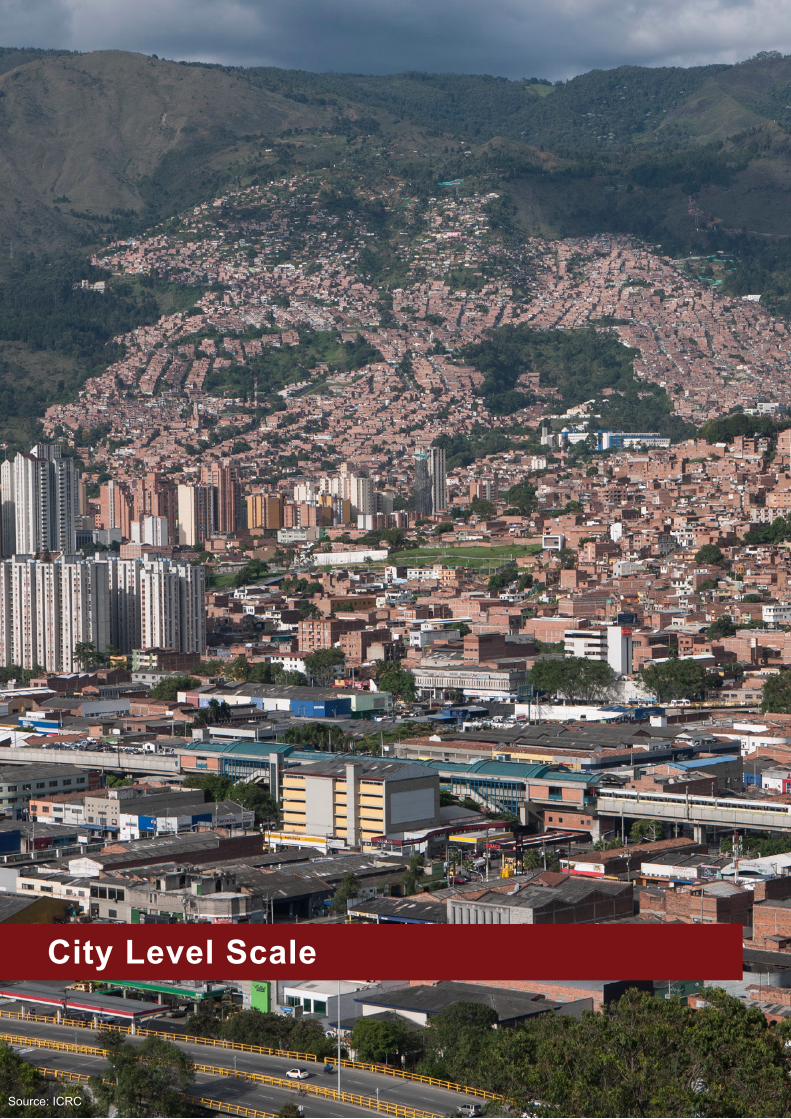
City Level Scale
Source: iCRC

15
Ar-Raqqa, Area Based Assessment
Urban Centre: Ar-Raqqa,Syria
Project timeframe: october 2017 - current
type of project:AreaBasedAssessment
Coordination framework: informing multiple humanitarian actors responding to idP returnees and host populations in Ar-Raqqa
Agency Submitting the case study: iMPACt initiatives/ReACH and north east Syria inGo forum
ConteXt
Ar-Raqqacity,withanestimatedpopulationof279,000priorto its takeoverby ISIL inearly2015,was fullyevacuated inOctober 2017 following intense conflict.Despite high levelsof contamination andwidespread destruction, and an initialreluctance of humanitarian actors to provide services in order to reduce thepull factor for returnees, largenumbersof civilians have returned to the city – which commenced in November 2017, immediately following the offensive. Thecity faces the prospect of major structural impediments to servicedeliverycoupledwithfluctuatingpopulationsinneedas people continue to return and move around the city.
AsofMarch2018,thecity’spopulationisestimatedat100,000–150,000,anddespiteafluidandvolatilesecuritysituation,responseactivitieshave increased.Todate, such responseactivitieshavebeenundertakenby localauthorities,NGOs,stabilization actors as well as mine clearance actors.
However, there remains a lack of up-to-date, consolidatedand detailed information on the current situation in the city as well as theongoing response.Further, accessandsecuritychallengespersist,anditwilllikelytakemonthsbeforelarge-scale humanitarian response can reach affected populations.
PROJECTAPPROACH/OVERVIEW
A number of contributing factors exist which called for a detailedArea BasedAssessment ofAr-Raqqa. Since 2014until late2017,nohumanitarianactionwasoccurringwithinthe city, resulting in significant information gaps for allsectors throughout thecity.Sincea levelofaccess returns,humanitarian actors have been operating with limited capacity to conduct in-depthassessments, compoundedbysecurity and logistical challenges. Any assessment activities undertakentherefore,needtobeascollaborativeaspossibleto ensure sufficient data is available to inform a growingresponse.
The Ar-Raqqa Area Based Assessment, undertaken byReACH in partnership with the Syria neS forum aimed to provide a comprehensive overview of the situation across the city,includingmoredetailedandgranularassessmentsattheneighbourhood-level.Duetoafluctuatingsecuritycontext,
the methodology and tools utilised throughout the Area BasedAssessment requiredadegreeof flexibility, resultingin different information gathered depending on the available access.
to provide both a macro city overview and more detailedanalysis in targeted locations, theArea BasedAssessmentwas undertaken divided into three distinct phases. including: Phase I:Returns,PopulationandAccessMapping;Phase II: Service and infrastructure mapping and damage assessment; Phase III: neighbourhood level needs assessment and service access mapping.
SteP 1Populations,returnsandaccessObjective: provide clarity on commonly accepted neighbourhood boundaries, provide regular updates onnumber of permanent returnees and temporary visitors to thecity,aswellasaccessconstraintsandrestrictions.Methodology: neighbourhood-level remote Ki interviews with Key informants living in the city or visiting regularly.Outputs: monthly neighbourhood-level maps with populationfigures,routes,andkeyfindings
SteP 2Services; infrastructure and damageObjective: mapping and assessment of basic services and infrastructure; detailed damage assessment. Methodology: neighbourhood-level remote Ki interviews and participatory mapping with sectoral experts living in the city or visiting regularly.Outputs: sectoral service overviews; comprehensive damage atlas.
SteP 3needs assessment and access to servicesObjective: full assessment of needs and analysis of access to services at the neighbourhood-level. Methodology: Key informant (Ki) interviews with a minimum of3perneighbourhood,and2FGDsperneighbourhood(one female, one male) including participatory mappingexercises with community residents and sectoral experts.Tools, indicators and methodology designed in collaboration with humanitarian actors: Whole of Syria Clusters, NES INGO Forum, NES ISWG Focal Points,individual nGos implementing or planning to implement in the city.
C1

16
KeY FindinGS
Overall findings of the Area Based Assessments highlighted that:• Ar-Raqqa city residents have been spontaneously
returning to the city since November 2017, initiallyconcentratedinAmmarIbnYaser/Ma’amoun(Meshlab),tishrine (Rmelah) and areas along the euphrates river. Households have now returned to areas across the city.
• The number of households is greatest where damage is relatively less severe. neighbourhoods in the centre andnorthhaveextensivedamageandsignificantUXOcontamination,andconsequentlyremainlesspopulatedthan areas adjacent to the euphrates river and on the city’s periphery.
• Population numbers are highest in neighbourhoods with a greater number of functioning services. this likely reflects two trends: households prefer to returnto areas where goods and services are more easily accessible,whilegovernmentalandprivateactors(suchas bakery owners) prefer to provide such services in more populated areas.
• UXO contamination is a reported barrier to movement in both sparsely-populated neighbourhoods and in areas with more households, such as Furat.damaged roads are barriers to movement in nearly all neighbourhoods.
• Movement within some neighbourhoods remains challenging. Movement by foot is difficult in centralneighbourhoods, which have extensive damageand significant UXO contamination. Access to theseneighbourhoods with large vehicles is also extremely difficult,limitinghouseholds’accesstocriticalgoodsandservices,suchastruckedwater.
• With regards to services, some servicesoperate on a more local level than others: > Education: Households do not commonly travel elsewhere to access schools, even when insufficientin their own neighbourhood, as a result, populationsin neighbourhoods without education services more likely to remain absent from education. > Health: A small number of neighbourhoods act as hubs for healthcare, with people travelling acrossthe city to reach often overcrowded services. Access remains a challenge for many residents in many neighbourhoods due to road blockages and UXos. > Markets and cash: there remains a preference for residents to remain within their own neighbourhood to obtain goods, which as predominantly sufficient.Residents do also travel to nearby neighbourhoods to access other goods, and reported less access barriers– however the main issue was reports as residents’ purchasing power.
ContACt
• nanki Chawla: [email protected]• Will Cragin: [email protected]
KEYACHIEVEMENTS
• Findings from the initial assessment identified a seriesofimmediatepriorityneedsinrelationtoshelter,WASH,education,NFIsandaccesstomarkets
• ABA findings were informed decisionmaking in several domains, including: a. Operational:AssessmentfindingswereusedbyNGOstoassistwiththeirindividualplanningandprogramming,as well as field operations- neighbourhoods’profiles serve as a guide for working in each area. b. Coordination: The clear identification of gapswithin and between neighbourhoods enables outputs to be used by neS Forum and neS iSWG to assist with nGo response coordination. c. Strategic:AreaBasedAssessmentfindingsprovidedan overview of the city highlights priority needs and key messages for actors outside of northeast Syria.
• The initial Area Based Assessment exercise was wellreceived by humanitarian actors and as such, REACHis in the process of undertaking iterative updates to monitoring ongoing needs.
• Building on the areabasedassessment, detailed actormapping (4W) is in progress. Overall needs, serviceprovision, 4W mapping and response priorities will beconsolidated to create an initial gap analysis and further inform response priorities
MAin CHALLenGeS
• Access challenges remained throughout the data collection as a UXOs, road blockages and (?), whichhampered various data collection activities.
• ensuring input from stabilization actors has been challenging due to their lack of participation in the neS sector system and data sharing concerns around interaction with actors with political objectives
• ensuring direct input from the United nations has been challenging due to the fragmented coordination structure inNESandfirewallbetweenUNandINGOs
C1

17
Open Mapping for Flood Resilience in Dar es Salaam, Tanzania
ConteXt
dar es Salaam has been listed as the fastest growing city in Africa by theAfricanDevelopmentBank,withapopulationofover 5 million and growing at an estimated 6% per year. this rapid and unbridled growth causes problems for its residents inahostof(interconnected)areas,fromalackofaccesstobasicservices(potablewater,electricity,accesstohealthcareandeducation)to increasedvulnerabilitytonaturalhazards,suchasflooding.Largepartsofthecityconsistofslums,or“unplannedsettlements”.
One of the problems is large-scale annual flooding. Whenthesearrive, life inDaresSalaamcomes toastandstill. InslumareassuchasTandale,roadsbecomeimpassableanddeep mud makes even a short walk to school impossible. Hospitals are closed, and businesses halt their operations,affecting the livelihoods of thousands of people. these impacts are prevalent in the unplanned and informal settlements that abound in the city, costingDar esSalaamsignificant resources in emergency response, damage toinfrastructure, and loss in income and livelihoods, to namebut a few. By helping communities collect their own dataon residential areas, roads, streams, floodplains, and otherrelevantfeatures,residentsbecomemoreawareofrisksandare better able to mitigate them.
despite the importance of quality open geospatial data for decision making, developing countries like Tanzania lacksufficientincentivesforcommercialmapproviderstodevelopquality data. Maps that are produced remotely are often inaccurate,outdated,orcontaininsufficientdatafordecisionmakers to plan and make decisions in the event of disasters. Accesstoanduseofdetailed,up-to-datemapshasbecomevitaltoimprovedisasterplanningandresponseinflood-proneareasofthecity,andtoenhanceitscapacitytocopewithandadapt to the impacts of shocks and stressors.
InDaresSalaam, likeRamani Huria and DataZetu, theteamfrom Humanitarian openStreetMap team (Hot) in tanzania has obtained knowledge of and level of integration with local communities and administrative structures. this provides effective input to policy making across sectors - from the national level,down to thevery lowest “Shina” level,wherea handful of houses has their own local contact person for all matters big and small.
PROJECTOVERVIEW
Employing an area-based approach at the ward level, themain administrative level within the five municipalities thatmakeupgreaterDaresSalaam,allowedHOTtoformlong-lastingandconstructiverelationshipswiththesecommunities,and has led to a much improved understanding among all projectpartnersoftheseareas,downtothelowestleveloftheShinaboundariesandtheirlocalleaders,thewajumbe.
“FloodResilienceinDaresSalaam”,knownlocallyas“RamaniHuria” (Swahili for “DarOpenMap”), isacommunity-basedmappingprojectinDarEsSalaam,Tanzania.UnderfundingfromDfIDandtheWorldBank,theprojecttrainsteamsoflocaluniversity students and community members from throughout dar es Salaam to use openStreetMap to create sophisticated andhighlyaccuratemapsof themost flood-proneareasofthe city.
Atthesametime,HOT’sparticipatorymappingapproachhasbeenemployedbyDataZetu,or“OurData”,aPEPFARandMillennium Challenge Corporation (MCC) initiative focusing on providing accessible, actionable data to local people. Inpartnership with Data Zetu, the HOT Tanzania team haveconducted community mapping in dar es Salaam and Mbeya which has uncovered unprecedented data on hyperlocal boundariescalledShina.ShinaaresubdivisionsofSubwards,which are divisions of Wards and are the most granular level of community administration that exists in tanzania. Shina maps,whicharethefirstoftheirkind,willallowlocalleaderstoleverageinformationatamicrolevel.Teamedwiththefielddata collection undertaken to better understand local health facilities,healthproviderswillbeabletoimproveservicessuchasaccesstomaternalhealthcareandHIVsupportinitiatives.
Since the actual mapping is performed together with inhabitants andcommunitymembersof thewards,and incollaborationwith local university students from Ardhi University and UniversityofDaresSalaam(UDSM),theprojectalsobringsawareness of the need for services, and how having dataandmapscanhelpcommunitiesadvocate for these,basedon a better understanding of their own environment and the constraints they face.
Urban Centre:DaresSalaam,Tanzania
Project timeframe: 2015 - 2019
type of project: Mapping; disaster risk reduction; resilience Agency submitting the case study: Humanitarian openStreetMap team
Left:HouseholdreportsofexperiencedfloodingintheMsimbazi basin
C2

18
PARtneRSHiPS
• Government at all levels, such as theNationalBureauof Statistics (NBS), Disaster Management Department(DMD),DaresSalaammunicipality,andwardleaders.
• RamaniHuriaisaninitiativeoftheWorldBankfundedbythe UK department for international development (dfid) inpartnershipwithHumanitarianOpenStreetMapTeam,TanzaniaRedCross,ArdhiUniversityandtheCityofDares Salaam.
• DataZetuisaninitiativeofIREXfundedbyMCC-PEPFARand implemented in coordination with a consortium of partners including Hot.
ACHIEVEMENTS
• trained over 500 students and almost 500 community membersindatacollection,mappingandothertechnicalskills.
• Mapped every building in greater dar es Salaam (approximately950,000buildings,hometoanestimated5-6M people).
• Produced detailed mapping for over 24 wards of dar es Salaam. this data is being put to use in a wide range
ofurbanplanning,publichealth,anddisaster responsescenarios.
LeSSonS LeARnt
• the process of open/participatory mapping in a single platform like openStreetMap can be a powerful tool to unitecommunities,NGOs,andgovernmentagenciesinaddressingacommonchallenge,suchasflooding.
• open community maps can inform broader resilience-building efforts and foster new collaboration among humanitarian and development actors working in the area.
• the impact of open data toward resilience does not happen overnight. Participatory mapping involves building trust, both among community members andgovernment stakeholders in using citizen generated data sources.
• open source software is a powerful component in community-based approaches to resilience. emphasizing use of locally-available devices for data collection and free an open source software tools, which contributeto increased cost effectiveness and post-project sustainability.
ContACt
http://ramanihuria.org/
tanzania Urban Resilience Program: http://www.worldbank.org/en/programs/tanzania-urban-resilience-program http://www.hotosm.org
To implement an open citiesmapping project, seeour guide: http://www.opencitiesproject.org/guide/
Community member and Shina leader collect data on access to maternal health services from local residents in dar es Salaam using opendataKit
Asha Mustapher, a HOT supervisor, chairing a communityworkshop in Mbeya region to explain the importance of Shina mapping for improving health services
C2
19
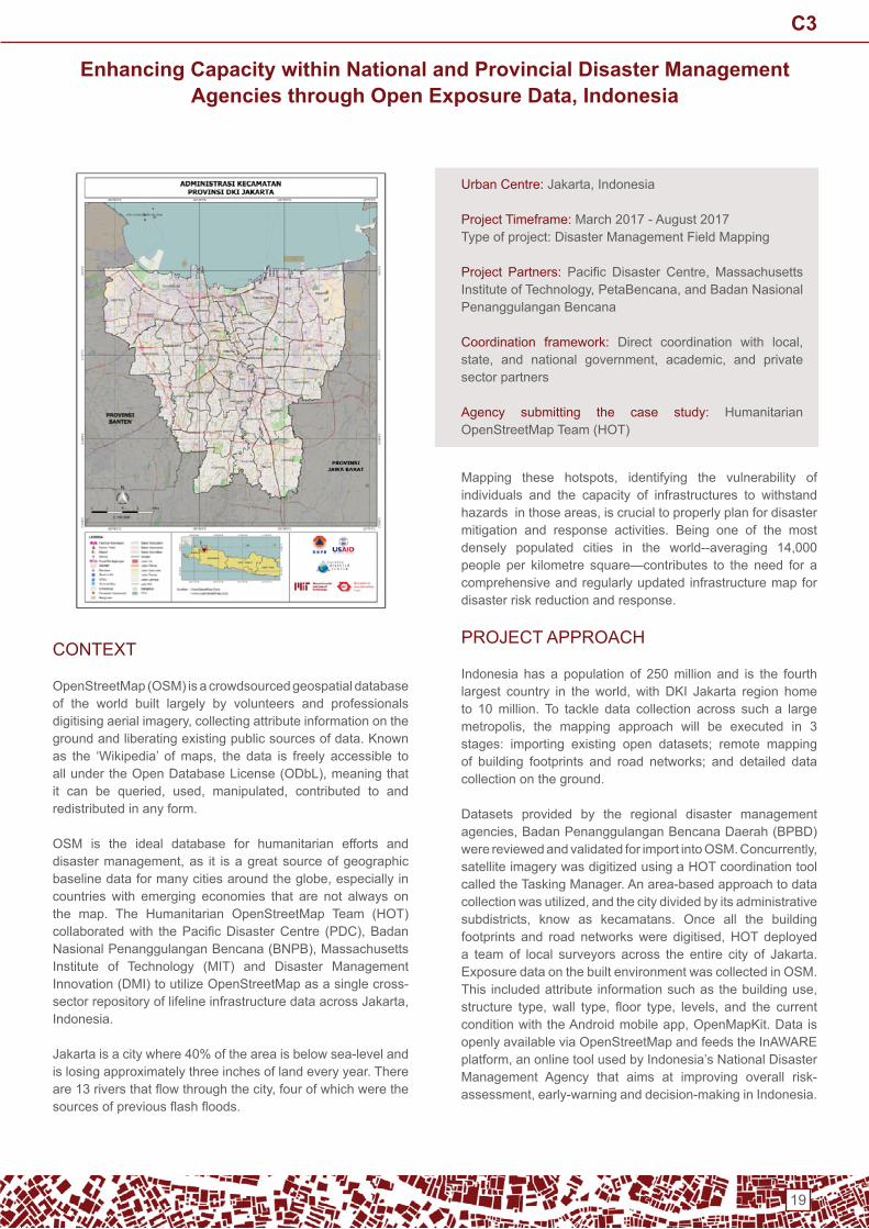
Enhancing Capacity within National and Provincial Disaster Management Agencies through Open Exposure Data, Indonesia
ConteXt
openStreetMap (oSM) is a crowdsourced geospatial database of the world built largely by volunteers and professionals digitisingaerialimagery,collectingattributeinformationontheground and liberating existing public sources of data. Known as the ‘Wikipedia’ ofmaps, the data is freely accessible toallundertheOpenDatabaseLicense(ODbL),meaningthatit can be queried, used, manipulated, contributed to andredistributed in any form.
oSM is the ideal database for humanitarian efforts and disastermanagement,as it isagreatsourceofgeographicbaselinedataformanycitiesaroundtheglobe,especiallyincountries with emerging economies that are not always on the map. the Humanitarian openStreetMap team (Hot) collaboratedwith thePacificDisasterCentre (PDC),BadanNasionalPenanggulanganBencana(BNPB),Massachusettsinstitute of technology (Mit) and disaster Management innovation (dMi) to utilize openStreetMap as a single cross-sectorrepositoryoflifelineinfrastructuredataacrossJakarta,indonesia.
Jakarta is a city where 40% of the area is below sea-level and is losing approximately three inches of land every year. there are13riversthatflowthroughthecity,fourofwhichwerethesourcesofpreviousflashfloods.
Mapping these hotspots, identifying the vulnerability ofindividuals and the capacity of infrastructures to withstand hazardsinthoseareas,iscrucialtoproperlyplanfordisastermitigation and response activities. Being one of the mostdensely populated cities in the world--averaging 14,000people per kilometre square—contributes to the need for a comprehensive and regularly updated infrastructure map for disaster risk reduction and response.
PRoJeCt APPRoACH
indonesia has a population of 250 million and is the fourth largest country in theworld, withDKI Jakarta region hometo 10 million. to tackle data collection across such a large metropolis, the mapping approach will be executed in 3stages: importing existing open datasets; remote mapping of building footprints and road networks; and detailed data collection on the ground.
datasets provided by the regional disaster management agencies,BadanPenanggulanganBencanaDaerah(BPBD)werereviewedandvalidatedforimportintoOSM.Concurrently,satellite imagery was digitized using a Hot coordination tool called the tasking Manager. An area-based approach to data collectionwasutilized,andthecitydividedbyitsadministrativesubdistricts, know as kecamatans. Once all the buildingfootprints and road networkswere digitised,HOT deployeda team of local surveyors across the entire city of Jakarta. exposure data on the built environment was collected in oSM. This includedattribute informationsuchasthebuildinguse,structure type, wall type, floor type, levels, and the currentconditionwiththeAndroidmobileapp,OpenMapKit.Dataisopenly available via openStreetMap and feeds the inAWARe platform,anonlinetoolusedbyIndonesia’sNationalDisasterManagement Agency that aims at improving overall risk-assessment,early-warninganddecision-makinginIndonesia.
Urban Centre:Jakarta,Indonesia
Project timeframe: March 2017 - August 2017type of project: disaster Management Field Mapping
Project Partners: Pacific Disaster Centre, MassachusettsInstituteofTechnology,PetaBencana,andBadanNasionalPenanggulanganBencana
Coordination framework: Direct coordination with local,state, and national government, academic, and privatesector partners
Agency submitting the case study: Humanitarian openStreetMap team (Hot)
C3

20
the project aimed to not only collect vital lifeline infrastructure data,buttoalsoworktowardsdevelopingasimplestreamlineddata collection method that can easily be replicated and implemented for future mapping projects. A key focus of the project is to strengthen and expand the openStreetMap volunteercommunityinJakarta,toincreasepublicawarenessand participation so that the data can be understood, andcontinuetobeupdated,forusebythedisastermanagementagency in indonesia.
PRoJeCt oUtCoMeS And oUtPUtS
• Hiring and training of Local Citizens in oSM and Associated tools
• CollaborationwithNational and LocalGovernment, theindonesian disaster Management Agency
• data Collection of Key Lifeline infrastructure in oSM• DataCollectionofAdministrativeBoundariesinOSM• data Collection of evacuation Routes and Shelters in
oSM• integration of oSM data into the inAWARe disaster
Management Platform• Building Capacity to Access and Apply Data through
ContinuedTrainingWorkshopswithGovernmentBodies• Promoting the Sustainability of the data through Scale-
Up Plans for the Rest of the Country in Collaboration with the Government and Universities
KEYACHIEVEMENTS
• Strong Support and Collaboration from indonesia’s disaster Management Agency
• RegistrationofanISBNfortheProductionandPublicationof an Atlas of our Work
MAin CHALLenGeS
• Requirement of Local Association for the Processing of a Surveying Letter
• LackofCooperationfromVillageLeadersDuetoLackofSurveying Permit
KeY LeSSonS LeARnt
• the process of open/participatory mapping in a single platform like openStreetMap can be a powerful tool to unite communities, NGOs, and government agenciesin addressing disaster management challenges. All partners including citizens and universities were vital to the implementation and success of the project.
• open community maps can inform broader resilience-building efforts and foster new collaboration among humanitarian and development actors working in the area,outsideofimmediateprojectstakeholders.
• the impact of open data toward resilience does not happen overnight. Participatory mapping involves building trust,bothamongcommunitymembersandgovernmentstakeholders in using citizen generated data sources.
• open source software is a powerful component in community-based approaches to resilience. We emphasize use of locally-available devices for data collectionandfreeanopensourcesoftwaretools,whichcontribute to increased cost effectiveness and post-project sustainability.
ContACt FormoreinformationontheInAWAREproject,pleasevisit:https://wiki.openstreetmap.org/wiki/Hot_- _PdC_inAWARe_indonesia_Project_(Surabaya_%26_Jakarta)
or contact Yantisa Akhadi ([email protected]) and Mhairi o’Hara ([email protected]) to learn more.
Toimplementanopencitiesmappingproject,see:http://www.opencitiesproject.org/guide/
Key Possible valuesmanmade pumping station
building pumping station
name <name>
addr:full <address>
addr:city <city>
operator <operator name>
pump:unit <number of total pumps>
elevation <elevation in metres above sea level>
capacity:pump <the capacity of a filled pipe (l/s)>
building: levels <number of building levels>
building: structure confined_masonry (Rangka beton bertulang), steel_frame (Rangka baja), wood_frame (Rangka kayu), bamboo_frame (Rangka bambu)
building: walls brick (Bata), concrete (Beton), wood (Papan kayu), bamboo (Bambu), glass (Kaca)
building:floor ground (Tanah), wood (Papan kayu), cement (plester/Semen), tekhel (Tegel), ceramics (Keramik)
building: roof tile(Genteng),tin(Seng),asbestos(Asbes),concrete(Beton)
access: roof yes(Ada),no(Tidakada)
building: condition poor(Buruk),good(Baik)
backup_generator yes(Ada),no(Tidakada)
source Hot_inAWAReSurvey_2017
Sample lifeline infrastructure feature collected using the open mapping methodology
C3

21
Iraq Shelter and NFI ClusterMosul Offensive - Settlement Based Coordination
Urban Centre: east and West Mosul
Project timeframe: october 2017 – January 2018
type of project: Coordination – principally Shelter and nFi Project partners: Shelter / nFi Cluster Partners
Coordination framework: oCHA led idP
Agency submitting the case study: UnHCR
ConteXt
on the 16 October 2016, the military offensive to retakeMosulcitystarted,withmilitaryengagement50Kmfromthecity centre on all sides. the city originally had a population of2.5millionalthoughbythetimetheoffensivestarted,it isestimatedthatover1millionhadalreadyfled.ThecityissplitbytheRiverTigrisintotheleftbank,EastMosulandtheoldcity on the right bank and the West.
AlthoughtheEastpartofthecitywaseventuallytakenfirst,initially gains were made in the surrounding villages around the whole circumference of the city. Residents were fleeing from all sides and new areas were also being taken in the South and West as well as the East almost on a daily basis.
TheShelterandNFICluster,ledbyUNHCRandco-chairedbyNRC,wasresponsibleforfirst-lineassistanceinthe‘newlytaken’ areas and for idPs seeking sanctuary away from the fiercestfighting.Forthosewhodidnotgototheformalcamps,assistance was provided at household level – predominately life-saving NFIs including cooking equipment and fuel as it waswinter,withtemperaturesconsistentlybelow10degreesduring the day and colder at night.1
the coordination was challenging and unwieldy due to the myriad of needs, security concerns and the constantlychanging access to beneficiaries and fluid nature of thosewho stayed out of the camps. Access was possible one day; denied the next. the population was very mobile and moved where it was safest but also in search of assistance.
Toaidcoordination, incollaborationwithotherClusters, theShelter / nFi Cluster implemented a settlement-based coordination structure.
tHe ‘WedGeS’
it was clear that over the next 2-3 months access would improve slowly as the military actors converged on the city andthenpauseattheheavilyfortifiedcitylimits.1 Mosul Humanitarian Response Situation Report no. 10 (28 november - 4 december 2016) https://www.humanitarianresponse.info/sites/www.humanitarianresponse.info/files/documents/files/ochairaqmosulhumanitariansituationreport10_0.pdf
oCHA had already created a new coordination ‘zone’ for the cityitselfandsoasshowninthemapopposite,thecitywasomitted and fivewedgeswere created –W1–W5, for theperi-urban.
Main vehicle arteries and rivers made natural boundaries for thecreationofthefivewedges.The wedge shapes allowed the same areas to be maintained as the frontlines moved towards the city.
immediately dividing the vast areas and needs into the distinct areas of responsibilities aided the Coordination team as staff could focus on the different settlements within their wedge and start to drill down into the 4Ws and assessment reports coming from numerous sources.
distinct and agreed settlements of responsibility allowed better coordination and clearer lines of communication between partners on the ground and the Coordination team in erbil and dahouk.
Agencies were asked to step forward to assist in the coordination of settlements in the wedges and act as focal pointsandfieldlevelcoordinators.Thefollowingwasagreed:Wedge 1: Shelter / nFi ClusterWedge 2:UNHCRfromitsDahoukofficeWedge 3: Shelter / nFi ClusterWedge 4: People in need (Pin) Wedge 5: dRC/nRC/ioM
N.B:Nowedgedirectlywestofcityasareaisverysparselypopulated without roads.
C4

22
ROLESANDRESPONSIBILITIESOFFoCAL PointS
Although formal toRs (see comment in lessons learnt) were not published, the focal agencies undertook the followingbroad roles:• Acting as key link between the Cluster and the partners
active on the ground;• Settingupcommunicationstructures(Skype,WhatsApp,
Google docs) between the key actors in the area;• Consolidateandfilterneedsreportsfromvarioussources
and share with the group, flagging key issues to theCluster;
• Share assessments, provide overview of settlements,highlighting gaps and areas of duplication;
• Provide induction to new partners wishing to work in the area and making links with authorities and other partners.
OUTCOMESOFSETTLEMENTBASEDCooRdinAtionintroducing the settlement-based coordination model for the Mosul response resulted in:
• Better communication between the Coordination Teamand partners on the ground;
• Faster response to evolving needs;• Bettergeographicalfocusforthepartners;• More communication and coordination between the
partners and understanding about the gaps and needs of the population;
• More integrated programming as better awareness of the needs and who’s working where;
• Easier identification of settlements which were leastserved or not served at all;
• Allowed key Cluster team to pull-back and provide broader coordination support;
CHALLenGeS And SHoRtCoMinGS
the main challenges of implementing a settlement-based coordination model for the Mosul Response was:
• Partners already had settlements where they were working and so agreeing on how to divide the settlements onceprojectshadstartedwasdifficult, timeconsumingand at times acrimonious;
• Some partners were hesitant to step forward and take theleadincoordinationduetoalackofconfidenceandfamiliarity with the concept;
• Some partners did not promptly follow-up on commitments leaving gaps and uncertainty;
• Followinglongdaysinthefield,reportingbackimmediatelyto the Cluster on achievements was not necessarily a priority. this hampered real-time coordination when assistance was life-saving;
• Security was always an issue and so sharing planned interventions widely in advance went against many agency protocols;
• opportunistic agencies that gained access to an area would distribute regardless of agreements, whichfrustrated partners and so made them less inclined to follow the settlement-based coordination model.
Map shows the breakdown of Wedge 2 and exactly where partners were working.
Asthefieldlevelcoordinatorsnowhaddefinedareastowork,they were able to coordinate with the individual partners to defineexactlywheretheywereworkingandbringthemtogetherfor field level coordination meetings. Not only were theseplatforms used to fill in gaps and eliminate duplications,theywerealsousedtodiscussaccessissues(checkpoints),best practice for distributions and joint resources for a more integrated approach.
KeY LeSSonS LeARnt
• Settlement-based coordination models clearly aid all stakeholders and provide an easy to understand framework for communicating needs, plans andachievements;
• Allows services to be provided in an integrated manner to meet all needs and cuts across ‘silo’ architecture of Cluster system;
• the more agencies that coordinate on the ground and at peer to peer level themore responsive and flexibleactivities can become;
• Unless resources are provided, theCluster’s role is tofacilitate and introduce the framework but once set-up the responsibilityformakingitworkinthefieldlieswiththepartners;
• Partners need encouragement to get involved with coordination due to a lack of understanding of the process,reluctancetobeseentobetakingcontrolandlackofunderstandingfromdonorsandhead-offices;
• Inrapidchangingcontexts,coordinationmodelsneedtobeflexible2 and may have a limited lifespan before a new model is needed. the Cluster has to recognise this and constantly be one step ahead.
• A formal toR for the agencies acting as focal points for settlementswerenotfinalisedinthiscaseasthesituationwasveryfluidandwasclearly temporary.However, forlonger term agreements a toR is recommended.
ContACt
For more information contactRichard evans [email protected],[email protected] and Ryan Smith [email protected]
How to Adapt Humanitarian Coordination to the Complexities of Urban Areas? http://fscluster.org/sites/default/files/documents/humanitarian_responses_in_urban_areas_-_hnpw_side_event_report_iasc-gfsc-gauc.pdf
C4

23
Disaster Resilient City Development Strategies for Sri Lankan Cities
Urban Centre:Batticaloa,Ratnapura,KalmunaiandBalangodaCouncilAreas,Mannar,VavuniyaandMullaitivuintheNorthernProvince and Akkaraipattu in the eastern Province
Project timeframe: January 2012 – March 2013 (Phase i) and April 2013 – March 2014 (Phase ii)
type of project: Vulnerability assessment and DRR outlinesplanning
Coordination framework: University of Moratuwa, UrbanDevelopmentAuthority(UDA),MinistriesofLocalGovernmentandDisasterManagement,MunicipalCouncils/UrbanCouncil,nGos and Communities
Agency submitting the case study: Un-Habitat
ConteXt
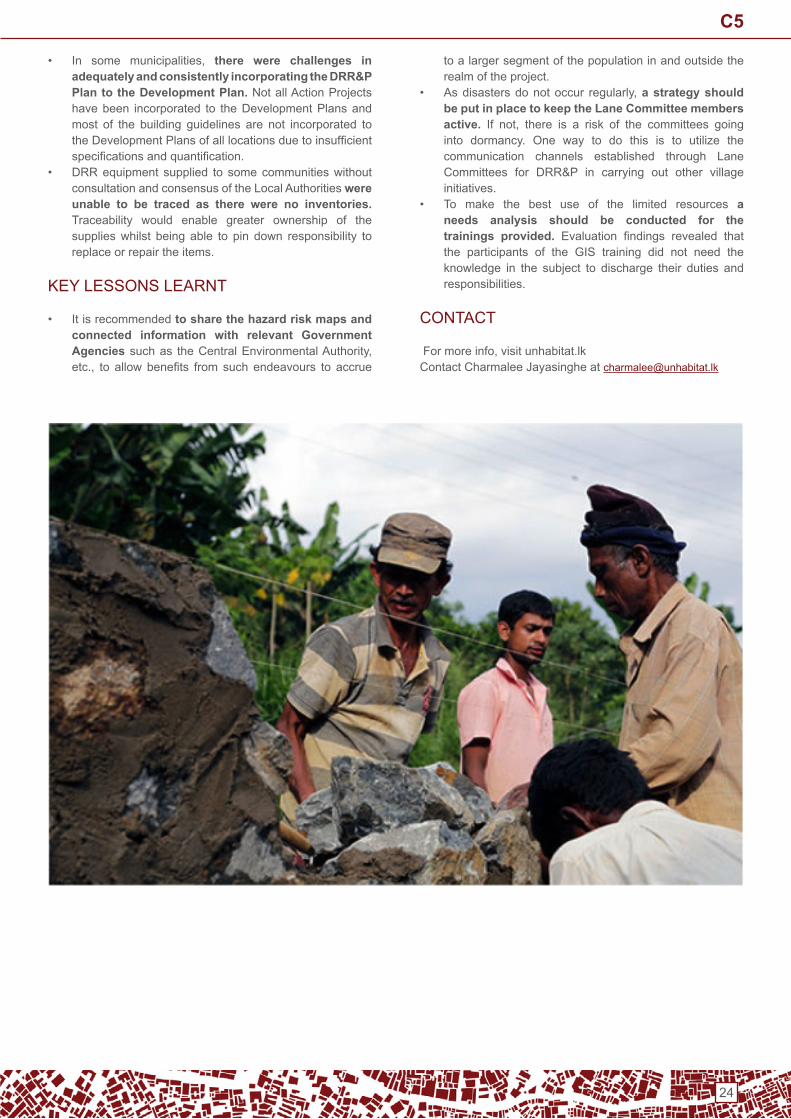
WiththeendofthethreedecadesofconflictinSriLanka,thenorthern and eastern Provinces are now undergoing rapid economicdevelopment, especially in termsof infrastructureand housing. At the same time, these provinces are alsohighly vulnerable to natural disasters, particularly cyclones,floods, lightning strikes and strong wind events. Despitethesedevelopments,statemechanismsparticularlyatLocalGovernment levels have taken a more reactive approach. their focuswasmoreonpostdisasteremergencyresponse,rescueactivities, relief work and evacuation of the affected. Thisproject shifted the focus and emphasized on strengthening the capacities of the communities in the disaster-prone areas to adapt to the disaster and mitigate the risks as much as possible.
PRoJeCt APPRoACH
the project was implemented by Un-Habitat in partnership with the Urban Development Authority, Ministry of LocalGovernment and Provincial Councils and the disaster Management Centre to prepare land use plans and development plans incorporating disaster Risk Reduction (dRR) features.
the selected MCs/UC were supported in assessing vulnerability, preparing Disaster Preparedness Plans anddeveloping building guidelines. A Project Unit was set up in each selected MC/UC anda Steering Committee was established to enhance coordination and provide linkages to other similar projects especially those funded under enhanced Humanitarian Response initiative / AusAid.
Un-Habitat and the University of Moratuwa provided technicalinputsintheareasofHazard,VulnerabilityandRiskAssessments and Strategic town Planning. Communities were linked to local authorities and empowered though increased awareness on dRR. Community-based disaster Response teams were trained and worked closely with local authorities (LAs) to implement disaster Risk Reduction Preparedness Plans.
PRoJeCt oUtCoMeS And oUtPUtS
• Formulation of Disaster Risk Reduction and Preparedness Plans for the selected LAs that are aligned to the City Land Use Plans and City development Plans that have also been revised and updated through this project.
• Introducing Disaster Risk Reduction (DRR) into the building guidelines based on dRR risk assessments.
• Establishing City Disaster Preparedness Committees (CDPC) and Community-based Disaster Response Teams ensuring women’s representation.
• Implementing Disaster Mitigation Pilot Projects with a scope of city-wide upscaling under the city development plans.
KEYACHIEVEMENTS
• this is the first time in the history of UDA that community views have been incorporated to urban planning process using participatory methodology,bridgingthegapthatexistedbetweentheLAs,decisionmakers and the communities.
• the project activities promoted closer integration among the Institutions due to the opportunity to convene a series of meetings and consultations during its implementation.
• Foundation has been laid down by the Project to achieve its primary goal of establishing sustainable disaster resilient cities thanks to the comprehensive setofDRR&PPlansthatincludeStrategicDirectionsandAction Projects.
MAin CHALLenGeS And oUtCoMeS
• the communication gap noticed between the Lane Committees (a network of community-based disaster Response teams) in some municipal councils (MCs) was a significant negative impact andmay disrupt themaintenance of the Action Project implemented and the continuity of the strategic action deliverables.
C5
24
• In some municipalities, there were challenges in adequately and consistently incorporating the DRR&P Plan to the Development Plan. not all Action Projects have been incorporated to the development Plans and most of the building guidelines are not incorporated to theDevelopmentPlansofalllocationsduetoinsufficientspecificationsandquantification.
• dRR equipment supplied to some communities without consultation and consensus of the Local Authorities were unable to be traced as there were no inventories. traceability would enable greater ownership of the supplies whilst being able to pin down responsibility to replace or repair the items.
KeY LeSSonS LeARnt
• it is recommended to share the hazard risk maps and connected information with relevant Government Agenciessuchas theCentralEnvironmentalAuthority,etc., to allow benefits from such endeavours to accrue
to a larger segment of the population in and outside the realm of the project.
• Asdisastersdonotoccur regularly,a strategy should be put in place to keep the Lane Committee members active. If not, there is a risk of the committees goinginto dormancy. one way to do this is to utilize the communication channels established through Lane Committees for DRR&P in carrying out other villageinitiatives.
• to make the best use of the limited resources a needs analysis should be conducted for the trainings provided. Evaluation findings revealed thatthe participants of the GiS training did not need the knowledge in the subject to discharge their duties and responsibilities.
ContACt
Formoreinfo,visitunhabitat.lkContact Charmalee Jayasinghe at [email protected]
C5

25
Multi-sector prioritization exercise for the rehabilitation of conflict-affected neighbourhoods in Aleppo city, Syria
Urban Centre:Aleppocity’s106neighbourhoods,prioritizing9including 3 pilot neighbourhoods
Project timeframe: January – April 2017 (prioritization phase)
type of project:Coordination,jointmulti-sectoralneighbourhoodprioritisation
Project partners:Shelter,WashandEarlyRecoverySectors
Coordination framework: Shelter Sector-led together with theWASHandEarlyRecoverySectors, in collaborationwithnationalandlocalauthorities(HighReliefCommittee,sectors’related Ministries and Administrations at Governorate level).
Agency submitting the case study:UNHCR,asGlobalShelterCluster co-lead.
ConteXt
In the first 6 year of the Syrian conflict, the city ofAleppounderwent numerous frontline shifts and changes in control areas.Duringmostof2016,theeasternpartofAleppo(roughlyhalfofthecity),wascompletelybesieged.InNovember2016,the Government of Syria launched an offensive against the opposition held areas of eastern Aleppo. one month of heavy aerial bombing resulted in the government forces taking control of all 31 previously besieged neighbourhoods; internally displacing approx. 150’000 people and evacuating approx. 35’000 remaining rebel combatants to idleb (oCHA SHF,January2017).SinceJanuary2017,peoplehavebeenreturningtotheirneighbourhoods,residingintheirhomesorwith friends or families.
Inmost of theseneighbourhoods, aswell frontlineareas intheformerlywesternpart,thebuiltenvironment(housingandpublic)andbasicpublicinfrastructures(watersupply,sewageand electricity) have been massively damaged. Following the recapture ofAleppo city, the Governorate rapidly produceda listof15priorityneighbourhoods, to receivehumanitarianassistance and launch the rehabilitation process, withoutconsulting the sectors or humanitarian agencies. the Shelter Sector coordinator proposed to the Governorate and the High Relief Committee to review this list in consultation with humanitarian stakeholders. this case study explains the process that was undertaken by the Governorate and the Syria Shelter Sector to jointly revise the list of priority neighbourhoods and plan the intervention accordingly.
PROJECTAPPROACH/OVERVIEW
InJanuary2017,theShelterSectorinSyrialaunchedajointinitiativewiththeWASHandEarlyRecovery(ER)Sectors,inpartnershipwithlocalauthorities,tosupportacomprehensivecoordinated and planned neighbourhood level response. the objective was to facilitate and coordinate the rehabilitation of
the newly accessible and damaged areas, by promoting amulti-sectorapproach,throughaneighbourhoodprioritizationmethodology.
The project aimed at defining shared priorities betweenpartnersandthegovernment,todraftacommonplaninlinewithhumanitarianprinciples,advocatingforneed-basedandcapacity-basedconsiderations, toensureamore integratedandefficientresponse,andsupportsustainablereturns.This joint exercise identified short and long-term prioritiesenabling a phased response, thus anticipating the futuretransition between humanitarian and development responses. the follow-up and long-term objective of this pilot initiative was to draft an inclusive and convergent rehabilitation plan in pilot neighbourhoods,followingajointassessmentandcombiningShelter, WASH and ER specific priorities, while integratingarea- based methodologies. this would then constitute a base to repeat the prioritization process in order to target the rehabilitation of the adjacent affected neighbourhoods of Aleppocity,proceedingaphased-approach.
this case study will focus on the prioritization phase that took place from January to April 2017,andthatwasrolledout in 5 main steps as follows (see following page):
C6
26
SteP 1
Multi-sectortaskforce,January2017InJanuary2017, thesheltersectorsetupa3-sector taskforce togetherwith theWASHandERsectors, inorder toassess theregained neighbourhoods and launch a joint prioritization exercise in consultation with the government. the taskforce was led by thethreenationalsectorcoordinators, inclosecollaborationwiththeirsector’sfieldfocalpoint(orsub-nationalcoordinators)andinclusive of all active sector’s partners.
SteP 2
ExpertPanelDiscussion(EPD),February2017InFebruary2017, thetaskforceorganizedanExpertPanelDiscussion inorder torapidlycollectdataonthestateofAleppocityneighbourhoods,bybringingtogetherhumanitarianactorspresentinthefieldandlocalgovernmentrepresentatives.TheEPDledbythethreesectors,includedexpertsfromAleppoGovernorate(CityCouncil,TechnicalOffice,WaterandSewageFoundation),UN,INGOsandNNGOsrepresentativesactiveinAleppo.Theseexpertsassessedthe106neighbourhoodsofAleppocity,though14pre-establishedvulnerabilityindicators(primary,secondaryandtertiarycriteria).TheresultoftheEPDallowedlistingandmappingthemostvulnerableneighbourhoods,basedonaseverityscaleanalysis.Asetofmapswasdeveloped,mappingeachindicatorandoverlappingallonafinaloverallvulnerabilitymap,allowingtovisuallycomparethegovernoratelistof15priorityneighbourhoodswiththeir actual severity and damage status.
SteP 3
ShelterspecificPrioritization,February2017Following the EPD, a shelter specific prioritization methodology was developed by the shelter sector in order to define theneighbourhoods most suited for durable shelter interventions with a comprehensive and phased rehabilitation perspective. Four extracriteriaweredefinedasqualifierindicatorstoidentifyneighbourhoodssuitablefordurableshelterinterventions,suchasnewlyaccessible neighbourhoods, proximity to functioning areas, availability/means of transport and proximity to former frontline, anddefinedasqualifierindicators.Asecondanalysiswasdonefocusingonfeasibilityandpotentialityconcerns,includingshelter,WASHand eR acceptable values for their individual programs. it resulted in a list of 10 priority neighbourhoods most suitable for durable rehabilitation(asafirstphase).
SteP 4
Governmentworkshop,March2017InMarch,the3-sectortaskforceorganizedaworkshoptopresenttheresultsandoutcomesofboththeEPDandshelterspecificprioritizationtotheHighReliefCommittee,therelevantMinistries,Directorates,LocalAdministrations(bothNationalandGovernoratelevel),andtheSyndicateorEngineers.Theoutcomeoftheworkshopwasacommonagreementonalistof9priorityneighbourhoods,asafirstbatch,suitablefordurablerehabilitation.Outof these9neighbourhoods,andbasedontheagreementofaconvergentapproach,3weredefinedaspilot;requestingacomprehensiveresponseplantobedraftedbythetask-forceincooperationwithlocalauthorities,andinconsultationwithinternationalandnationalpartners;asanexampleofacoordinatedmulti-sectorneighbourhoodslevelresponse.MainstrategicdirectionsforShelter,WashandERinterventionsinprioritizedneighbourhoods(bothemergencyanddurable) were discussed and agreed on during the workshop.
SteP 5
Preparationofneighbourhoodlevelassessments,April2017Theweekfollowingtheworkshop,theresultsweresharedandendorsedbyallsectors’partners.Aspecialmeetingalloweddefiningareaofresponsibilitiesforeach12shelterpartnersactiveinAleppo,endorsedbytheauthorities,inordertofacilitateapprovalsandaccessforpartners,andavoidoverlapsandgapsinthefutureresponse.TheShelterSectortogetherwiththeSyndicate of engineers developed a tool for rapid structural assessment and UnHabitat was selected to support the sector collecting the data and mapping the damage of all 9 priority-neighbourhoods. Structural neighbourhood level assessments were launched in November2017bythesectorandUNHabitat,throughtheEngineersfromtheSyndicateandincollaborationwiththeTechnicalOfficeof the Governorate.
C6

27
neXt StePS: update on the project since May 2017
• Neighbourhoods level rapid structural assessments: the launch of the assessments was postponed and duration prolonged, due to negotiations with theSyndicate,delayintheagreementapprovalandlackoffunding. Itwasfinally completed in January2018 inallpriority-neighbourhoods. At the time of writing (February 2018),UNHabitatisfinalizingthemappingofthedamage.
• Partners’ interventions and convergent approach: SinceApril2017,sectors’partnersand localauthoritieshave coordinated their response to answer to the most urgent needs in all 9 neighbourhoods, and focusedtheir interventions in the three pilot ones, through aconvergent approach agreed on by all three sectors. to date humanitarian actors are addressing both short-term and long-term priorities and shelter partners are launching durable shelter rehabilitation interventions. However,theresponsecouldnotbeupscaled,aspartnershad to include rural Aleppo in their priorities areas for interventions, as itwas regained by theGovernment afew month after the workshop.
PRoJeCt oUtPUtS
• Establishment of a three-sector taskforce, to lead theprioritization process and response plan.
• Development of urbanmulti-sector and shelter specificprioritization’s methodologies.
• Mapping: set vulnerability and prioritization maps.• Agreement on a common list of 9 priority-neighbourhoods
for a coordinated multi-sector integrated rehabilitation response. Agreement on a three-sector convergent approach in 3 pilot neighbourhoods. Agreement on extra neighbourhoods to receive shelter emergency response.
• development of rapid structural assessment tool together withthesyndicateofengineersand localauthorities, tomap damage at neighbourhood level.
• Launch of rapid structural assessment in 9 neighbourhoods covering approx. 6’600 buildings (benefitting approx.33’500 families/175’000 individuals).
KEYACHIEVEMENTS
• Common approach and common plan. the participatory initiative allowed for a shared prioritization and planning across sectors resulting in a joint understanding of the context and response priorities. It also helped defineprioritiesbasedonneedsandexistingcapacities,ensuring a more targeted and efficient planning. All actors,both humanitarians and local authorities, coordinatedtheireffortswithasamestrategy inmind.Furthermore,oCHA used the prioritization results to fund allocations and requested partners to engage with the sectors as a condition for funding.
• A coordinated response in 9 neighbourhoods and three- sectors convergent approach in the 3 pilot ones enabled actors to coordinate and focus their interventions where most needed, avoiding gaps andoverlaps, and speeding the rehabilitations. In a year,mostofthebasicneedsininfrastructuressuchaswater,sewage and electricity were reinstated in the prioritized neighbourhoods(especiallyinthe3pilotones),allowingfamilies to return to their neighbourhoods (approx. 300’000 returnees). Moreover, to date, approx. 63’000individuals benefitted from debris removal, and 25’000received shelter support.
• Strong engagement of the authorities both at Governorateandnationallevel,aswellasthecivilsocietysuch as the Engineer Syndicate, enabling cooperationand consultation to reach a common agreement. the collaboration helped the authorities define a responseplan, prioritize and focus their interventions in affectedneighbourhoods with the most potential for returns.
• Engagement of shelter sector partners. the 12 international and national shelter partners in Aleppo engaged & endorsed the prioritization process.negotiation through the sector facilitated access and interventions and allowed to jointly define area ofresponsibilities to coordinate the response.
• Achievement of multi-sectoral coordinated area-based approach. the three-sector partnership provided an integrated methodology both for the prioritization and the response planning. the taskforce encouraged the use of a more comprehensive and area-based approach to rehabilitation, raising the awareness of both thehumanitarian partners and local authorities.
• A phased methodology: Both the prioritization andassessment processes developed can be repeated to integrate new priorities (change of situation), integrateother sectors criteria or launch a following phase.
Shelterspecificprioritization
Mapping indicators
C6

28
MAin CHALLenGeS
• Working in conflict-area. the instability of the situation and ongoing conflict makes it challenging to plan onthe long-run and often difficult to complete long-terminterventions, such a durable shelter rehabilitations.Securityconstraints,severecontrol,presenceofUXOsordebris,preventsfromaccessingcertainareasorbuildings,hindering the launch of assessments or projects.
• Quality and source of information. information gathering and quality of the information, while notalwaysbeingabletoaccessareas,aremainchallenges.the instability and fast changing situation often makes information rapidly obsolete, especially considering thelimitedunderstandingofthereturnmovement,scaleanddisplacement dynamic.
• Collaboration with government. Complicated procedures with heavy security measures hampers approvals for access, staff displacement aswell as fororganizingmeetingorworkshops.Access to “sensitive”documents and information sharing often requires long procedures.
• Coordination / Number of actors: Difficulties tocoordinate all actors (humanitarian and authorities) and take into account their specific agendas and priorities,to achieve shared prioritization and a common plan. Complex negotiations with the authorities, especiallywhen not allowing nnGos and inGos to participate in certain government workshops. Although the number of humanitarian actors is limited and the capacity of local partners is low if considering the massive needs.
• Rapid structural Assessments: Agreement on assessment procedure with the syndicate and UnHabitat delayed the process. the responsibility of the engineers as well as their technical capacity was for some inconsistent and partners did not have the dedicated resource to support and follow-up.
• Ensuring common plan in the long run: Challenge to ensure all sectors have enough funding to complete their interventions. (the limited funding of the eR sector could only cover the removal of debris). new priorities: after a couple of month rural Aleppo became a priority area for humanitarian actors, as emergency needs
KeY LeSSonS LeARnt
• Engagement of all actors and coordination: the participation of all concerned actors during all steps of the process is key to ensure an inclusive and endorsed sharedprioritization,aswellasacoordinatedandefficientresponse.Coordinationthroughdedicatedcoordinators,consultation and participatory workshops are crucial when dealing with many actors in an urban context. A multi-sector taskforceor jointcommittee, including localauthorities,isrequiredtocoordinateandfollow-upontheresponse.
• Use of multi-sector neighbourhood approach: Rehabilitation in urban areas requires a multi-sector comprehensive approach (including, as a minimum,the main three relevant sectors), through sharedprioritization to inform decision- making and strategic responseplanning,usingneighbourhoodsassettlement-units for assessment and planning. there is a need to advocate for area-based approach & neighbourhoodlevel methodologies, combining prioritization methods,assessments tools and mapping
• Phasing and adaptability to situation change: Prioritization, assessment and response planningmethodologiesshouldbereplicable,enablephasingandflexibilityinordertoberesponsivetochangeofsituations,shift in priorities or new emergencies. Phasing enables short,mediumand long-termconcerns tobe integratedin a longer-term planning perspective, adapting theresponsetothemainneedsandexistingcapacities,whileinitiating the transition toward development/stabilisation.
• The role of humanitarian actors in urban neighbourhood rehabilitation? Understanding the role of humanitarian actors in urban rehabilitation is key to appropriate and informed planning. Besidesproviding life-saving assistance, they can support localactorsandauthoritiesindefiningprioritiesandinformeddecision making, while avoiding raising expectationon targets they might not be able to meet. Particularly in urban settings, humanitarian aid should not be asubstitute for government provision of public services andinfrastructures.Smartprioritization,targetingbasedon needs, feasibility and potential for returns within acomprehensiveandlong-termplanningperspective,willlater facilitate the transition to early recovery and then development phases.
ContACt
• Global Shelter Cluster, UNHCR: Miguel Urquia ([email protected]),
davide nicolini ([email protected])• Former and present Shelter Sector Coordinator in Syria:
nadia Carlevaro ([email protected]) and Pankaj Kumar Singh ([email protected])
C6

29
Urban Profiling in Erbil, Kurdistan Region of Iraq
Urban Centre: Urban areas in the erbil Governorate Project timeframe: September 2015 to August 2016
type of project: Collaborativeprofilingexerciseco-leadbyUnHCR and the erbil Refugee Council
Coordination framework: A collaborative approach was taken in designing and implementing the profilingexercise,withaProfilingSteeringCommitteeoverseeingthe process and contributing at different stages. Partners included Government and Governorate bodies (Joint Crisis CoordinationCentre,KurdistanRegionStatisticsOffice,Governorate Statistics Offices, and the Erbil RefugeeCouncil),humanitariananddevelopmentactors(UNHCR,UN-Habitat,OCHA,UNFPA,andIOM),representativesofthese participated in a technical Working Group facilitated andsupportedbytheJointIDPProfilingService(JIPS)
Agency submitting the case study: Joint IDP ProfilingService (JiPS)
ConteXt
Erbil Governorate, with a total population of 2.01 millionpeople,hoststhecapitaloftheKurdistanRegionofIraq.Thegovernorate,liketherestoftheKurdistanRegion,hasbeendeeply affected by recent waves of displacement resulting from theconflicts inSyriaand the restof Iraq,aswellasapervasive financial crisis affecting the public and privatesectors of its economy. erbil Governorate has taken in Syrian refugees over the last 5 years. this displaced population has arrivedasadirectconsequenceoftheviolentconflictinSyriaor due to the economic opportunities that erbil offered. When thisinfluxstarted,theKurdistanRegionofIraqenjoyedrelativestability and economic progress. People seeking refuge thus entered a benign and even welcoming environment with both the Kurdistan Regional Government (KRG) and host community willing to support them.
Thesituationchangedin2014,giventheevolvingsecurityandeconomic dynamics in the Kurdistan Region of iraq resulting from both the islamic State’s violent entry into iraq and the economic downturn. the deteriorating security situation caused by the islamic State’s take-over of large portions of westernandnorthernterritoriesinIraq,includingthecountry’ssecondlargestcity,Mosul,unleashedaseveredisplacementcrisis within iraq. of the 3.4 million people internally displaced inthecountry,around1.5millionarenowinthegovernoratesof the Kurdistan Region. this resultant 30% increase in population in just 2 years has put the region’s authorities under immense strain, particularlywith respect to theprovisionofpublicservices.Coupledwiththis,thecurrentconflictinIraqhas also negatively impacted the economic outlook for the country, including theKurdistanRegion.Foreign investmenthasdrasticallydecreased,traderouteshavebeendisruptedand the dynamics within the labour market have been altered dramaticallyafterthelargeinflowofpeopleintotheworkforce.Takentogether,conflict,displacement,andaweakeconomyare negatively impacting government function, householdresilience,privatesectorsurvival,andpublicservicesprovisionintheKurdistanRegionofIraq,includingErbilGovernorate.Solutions to redress the situation must come from a holistic analysis taking into account all the dynamics outlined above. Thisprofilingexercise,hence, takesplacewithinacomplexenvironment,affectedbymanylayersofexternalandinternalshocks.
Whyaprofiling?While a significant amount of information was available onidPs and refugees residing in camps in the Kurdistan Region of Iraq (KRI), lesswas knownabout those residing outsideof camps,particularly inurbanareas.Furthermore,mostofthe existing strategies to mitigate the effects of displacement focused on addressing the needs of either the idP or refugee populations,while theneedsof thehost communities livingalongside these displaced groups received much less attention. However, the local communities and authoritieswere deeply affected by the waves of displacement resulting from theconflicts inSyriaand the restof Iraq.By2016 theurban population in erbil Governorate had increased by 25%, in Duhok Governorate by 31% and in SulaymaniyahGovernorate by 15% due to the displacement.
This combined with the pervasive financial crisis greatlyexacerbated the strains already placed on local communities. Inthiscontext,theGovernorateauthoritiesinErbil,DuhokandSulaymaniyah together with Un partners decided to conduct studies comparing population groups (IDPs, refugees, andhost communities) in different urban areas to inform longer term planning for the Kurdistan Regional Government authorities as well as the humanitarian and development community.
PROJECTOVERVIEW
the overall objective for all exercises was to provide the Kurdistan Regional Government (KRG) and humanitarian and development actors with an evidence-base for comprehensive responses to the displacement situation in the three KRi Governorates of Erbil, Duhok and Sulaymaniyah. Thiswas to be achieved through an area-based analysis of the displacement situation in areas with high concentrations of displaced populations living out of camps in urban settings.
C7

30
PROJECTOVERVIEW(Continued)
Thespecificobjectiveswere:• To provide demographic profiles disaggregated by
gender,age,anddisplacementstatus(i.e.refugees,IDPsand host communities) in the targeted areas;
• Toprovideprofilesofurbanareaswithhighconcentrationof out-of-camp displaced populations;
• To analyse the capacities, vulnerabilities and copingmechanisms of the population in these areas;
• to analyse the relationships between displaced and host populations;
• to analyse the resilience of urban areas in relation to the availability and limitations of services;
to provide a dataset available to the KRG and humanitarian / development community.
A collaborative approach was taken in designing and implementingeachprofilingexercise,withaProfilingSteeringCommittee comprising all relevant partners jointly overseeing the process and contributing at different stages.
In addition to this, a TechnicalWorking Groupmade up ofrepresentatives from the respective Governorate bodies,StatisticsOffices, andUNHCRwas established to lead thetechnicalwork,withsupportfromJIPSthroughouttheprocess.
The Statistics Offices administered the household surveyswhile the Governorate authorities and UnHCR organised the qualitative data collection.
PRoJeCt oUtCoMeS And oUtPUtS
TheurbanprofilingexercisesinErbil,DuhokandSulaymaniyahcombined quantitative and qualitative methods to explore• the diversity within each target group by different types
ofurbanareas,and• the differences as well as similarities between groups by
location.
Methods used included: A sample-based household survey of approximately 1,200 households in each Governorate
targeting IDPs, refugees and host communities. Theprofilingproducedabasicdemographicprofileofthegroupsdisaggregated by sex, age, location and diversity focusingon livelihoods, community cohesion, education and futureintentions ; Focus group discussions with the host community and a desk review of already collected qualitative data with the displaced populations to complement the survey on the topic of social cohesion and inter- group relations and perceptions ; and Key informant interviews and a desk review focusing on availability and capacity of services in targeted urban areas.
An area-based methodology was developed for the exercises,whichallowedforacomparativeanalysisnotonlybetween population groups but also between certain types of urban areas/geographic strata with the highest concentration of displaced populations.these comprised the following areas:• InErbil:ErbilDistrictCentre,ErbilDistrictPeripheryand
selected towns.• InDuhok:high-densitydistricts,medium-densitydistricts
and low-density districts. • In Sulaymaniyah: Sulaymaniyah District Centre,
Sulaymaniyah District Periphery, as well as Kalar andKifri district Centres.
•KEYACHIEVEMENTS
• More targeted responses: Theprofilingresultsprovidedan evidence-base necessary to improve targeting of cash- based interventions as well as urban planning projected by Un and nGo partners.
• Improved and shared understanding and data: the profiling results helped to better understand the impactof displacement on different population groups in various urbanareasinKRI.Inaddition, localauthoritiesaswellas the humanitarian and development community all agreed upon and welcomed the profiling results. Thisenabled each actor to improve their interventions and led to a shared understanding of the urban dimension of displacement as well as its impact on the host communities.
C7

31
• Two-way capacity building: the Kurdistan Region Statistical Offices and local statistics offices had asignificantroleincarryingouttheprofilingprocess(e.g.pertaining to mapping, data collection and preliminaryanalysis). this combined with the collaborative nature of the profiling exercise led to significant technicalcapacity sharing between the Governorate authorities,includingtheStatisticalOffices,andthehumanitariananddevelopment agencies involved.
• A locally owned process: the collaborative character of the profiling exercise enabled local ownership ofthe process. This ensured that the profiling approachwasadequately tailored to the specific context of eachGovernorate,ensuringtherelevanceoftheresults.
MAin CHALLenGeS
• the methodology sought to combine information on the pressure on or demand for city services with the needs of the displaced populations. this would have required very strong secondary or administrative data on the availability and capacity of infrastructure and services in order to create the link. While the methodology was able to draw comparisons between the needs and situations ofpopulationgroups (IDPs,SyrianRefugees,andhostcommunities) by typology, it was not able to overlaythe information on the infrastructure and services to provide urban planners and local authorities with the full scope of information they required for their area- based interventions.
KeY LeSSonS LeARnt
• Creating a productive capacity sharing process was a valuable asset to the exercise overall. in this process, Governorate authorities, including therespectiveStatisticsOffices,constitutedkeypartnersofthe profiling and shared their technical capacities withthe humanitarian and development community. though time-intensive,thecapacitybuiltthroughouttheexerciseenabledtheStatisticsOfficestoreplicatetheprocessinother Governorates after the pilot exercise in the erbil Governorate, demonstrating a lasting impact of theprocess.
• How to develop and tailor area-based methodologies to profiling exercises was a key lesson learnt for JIPS and the partners involved. An area-based approach was decided upon in order to address the following research questions elicited from the partners of the exercise during the scoping mission to erbil: > to which degrees are different areas able to absorb and accommodate the displaced populations and address the general economic crisis? Which types of areas are more under strain and why? > What is the diversity within the population groups? Within the idP population great socio-economic differences are expected; is the diversity within/between the target populations more observable by location than the differences by population group alone?
• In other words an area-based approach was understood as a way to capture diversity linked to location rather than only population group. The aim was to capture intra-group diversity and cross-group similarities. this was of interest because of two main reasons expressed by partners: >expectation/recognition of diversity within the target population (especially the IDP population),meaning that partners did not want to group these populations only as one homogeneous category. >Findings captured by location would be more operational when it came to recommendations and responses.
• How the area-based approach translated into a methodology in Erbil? The area-based approach took the form of the following two methodology elements: >Survey stratified by location: The household surveysample was to be stratified not only by populationgroup (i.e. IDPs, refugees and locals) but alsobased on different characteristics indicating cross-group diversity (e.g. different socio-economic characteristics) linked to location of residence. >the aim was to capture diversity within target groups and similarities across groups based on socio-economic characteristics linked to location (thus going beyond only targetgroupbelongingastheonlydefiningcharacteristic).
neighbourhood-level information on infrastructure and service delivery: the household survey giving us information ‘about/from the people’ was to be complemented with a neighborhood level analysis of the services in the targeted areas. this information about services provided and the degree of pressure on these services would be collected via key information interviews and/or desk review.• The aim was to capture the service and infrastructurecapacity of different areas to address the needs of its residents (i.e. instead of only looking at reported access to services by the population we would also know the availability and capacity of services).
ContACt
Access to the full report,summary of the process and datasets are available online on HdX or the dynamic Analysis and Reporting tool,[email protected] for more info.
C7

32
Post-Yolanda Support for Safer Homes and Settlements, Philippines
ConteXt
In2013,TyphoonHaiyan(locallyknownasYolanda)damagedover 1 million houses and affecting 1.47 million families across 14provincesinthePhilippines,including130,688householdsinCapizand153,480inIloilo.UN-HabitatlaunchedthePost-Yolanda Support for Safer Homes and Settlements project in these provinces with the primary goal of capacitating Yolanda-affected communities as well as local governments in rebuilding homes and communities through a community-driven approach called the People’s Process. Under the People’sProcess,thecommunityledandmanagedtheprojectwith technical assistance and monitoring from Un-Habitat and the project was implemented through community contracting with legally organized homeowners’ associations (HoAs). this wasthefirstUN-HabitatprojecttousethePeople’sProcessinthePhilippines,followingprevioussuccessfulimplementationinothercountries,notablyinIndonesia,theMaldives,andSriLanka after the 2004 indian ocean tsunami.
PRoJeCt APPRoACH
the project process involved 13 components as follows: 1. Selection of partner communities2. Community damage assessment and mapping3. Formation of the Un-Habitat project team4. Community orientation on project parameters and
people’s process5. Community action planning6. design development of permanent core shelters and
community infrastructure7. in-depth individual house and family assessments8. Community contracting9. Project implementation, including both community
strengthening interventions and shelter and infrastructure construction
10. Partnership building11. Shelter and community infrastructure turnover12. Monitoring and evaluation including construction
monitoring, toolbox meetings, community reporting,familyjournalingandfinancialmonitoring.
13. Final turnover activities
PRoJeCt oUtPUtS
• 28 communities underwent damage assessments• 660 permanent houses built with WASH facilities• 323 semi-skilled artisans and 31 foremen trained• 54 community infrastructure projects completed• 4,594 households trained and their houses assessed
KEYACHIEVEMENTS
• The Emergence of a Cohesive Community Partnership: Communities adjacent to one another worked hand in hand in shelter and infrastructure construction and operated under one purchase committee to lower the cost ofconstructionmaterials,resultinginamoreharmoniousrelationship between them.
• Raising Awareness through Public-Private Partnership: this project opened the door for public-private partnerships between the LGUs and the homeowners’ associations. the LGUs discovered their role in the development of community associations in their areas.
• Rising from the Slums: the People’s Process did not only act as a framework in building houses in partner communities,butthelessonslearntfromitarecontinuallybeing used in solving problems in the community.
• Financial Management through Transparent Leadership: through numerous trainings and encouragement, homeowners’ associations officersgained confidence in handling the finances of theircommunity. The officers also gained the trust of thecommunity members through regular updates and transparent auditing.
• Capacity Building through Teaching DRR Techniques: the reach of the project was larger than originally planned thanks to the housing assessment guiders. Knowledge on building back better was disseminated to more people because of the training provided by these trained volunteers.
Urban Centre: Roxas City and the municipalities of Panay and PontevedrainCapiz,andthemunicipalityofEstanciainIloilo.
Project timeframe: 1 April 2014 to 30 June 2015
type of project: Strengthening community capacity in self-recovery of shelter and community facilities
Coordination framework: department of Social Welfare and Development (DSWD), Housing and Urban DevelopmentCoordinating Council (HUDCC), Social Housing and FinanceCorporation (SHFC), 28 homeowners’ associations, localgovernment units (LGUs),UnitedArchitects of thePhilippines(UAP),Association of Structural Engineers of the Philippines(ASEP),BaseBahay,Inc.,BDOFoundation,Inc
Agency submitting the case study: Un-Habitat
C8

33
KEYACHIEVEMENTS(Continued)
• Additional Community Infrastructure through Construction Management: Community savings played a big role in the implementation of community infrastructure projects. Several communities were able to add to what was funded by Un-Habitat through their savings from the shelter component of the project.
• Communities on the Rise through Empowerment: Throughouttheproject,womenwerealwaysatthefrontand centre. From plain homemakers, they have beentransformed into laymen experts in shelter construction who,accordingto them,can identifymaterialsbysight,readperspectivesandshelterplans,aswellasoverseeother construction projects in the future.
MAin CHALLenGeS
the main challenges and shortcomings of the project revolved around the financial aspects and the delayed timing of theprocuration of funds and construction materials. to mitigate these, arrangements were made with major suppliers orbuilders like asking for one-month credit line and conducting turn-key arrangements. the prices of the materials were lowered using the homeowners’ haggling skills,maximizingmaterial usage, and minimizing waste. There were alsochallenges with financial management but these wereovercome through regular auditing, closemonitoring of thecommunities’finances,andregularmeetingswithcommunitiesfor fund updates.
KeY LeSSonS LeARnt
• Potential for public-private partnerships. Mainly due toalackofcoordination,potentialimprovementthroughLGU intervention was not tapped for a very long time. Projects like these can serve as an eye-opener for stakeholders regarding the roles of LGUs and private actors in the development of their communities.
• Tapping into local community procurement skills. the homeowners’ associations’ haggling and procurement skills, which translated to savings, enabled additionalinfrastructure projects for their communities.
• Purchasing of construction materials available in the market and employing the locally trained builders. in theend,theprojectwas30%cheaperasitoptimizedtheavailableresources,injectedcashintothelocaleconomysince themoney remains in thecommunity, resulted infasterconstructionandemploymentcreation,generatedlivelihoodopportunities for the affectedpopulation, andeven improved skill levels of the community.
ContACt
For more information visit unhabitat.org.ph Contact Jenina Allia at [email protected]
C8

34
District/Borough Scale
Source: CRS/Mikel Larraza Álvarez

35
Supporting the response to urban displacement in eastern Afghanistan
ConteXt
Since the beginning of 2016, over 1 millionAfghans havereturned to Afghanistan from Pakistan, including around750,000 undocumented returnees. The majority returnedbetweenJulyandOctober2016,butfamiliescontinuetoarrive.Thereareno receptioncamps, so familiesaredisplaced inurbanareas,rentingroomsorstayingwithextendedfamilyinover-crowdedshelters,andinsomecasesinstallingmakeshiftshelters on private land. Some extremely vulnerable families are left in the openwith no shelter at all, heightening theirexposure to the elements, disease, and other protectionconcerns.Displacementtrackingislimited:theintendedfinaldestinationsofreturneesisrecordedattheirpointofentry,butnotconsistentlyfollowedup.Thismakesitdifficulttolocateand assess humanitarian needs, and most humanitarianagencies are relying on local community elders to locate the returnee household – an incomplete and unreliable method for tracking the unassisted returnees.
Theinfluxofreturnees(ontopofon-goingIDParrivals)meansthat local services including schools, healthcare, andwaternetworks are overstretched. Access to life-saving assistance is also limited by insufficient humanitarian funding andagencies,andsecuritychallenges.Moreover,lackofservicemapping and inadequate local-level coordination, combinedwith complex procedures and poor information dissemination to communities, means that people lack information andawareness on how to access humanitarian assistance even where it is available. Since most returnees and many idPs intend to settle in their areas of arrival, there is a need fordurable solutions; however,most assistance is one-off andunsustainable, isnotconnectedto longer-termdevelopmentinitiatives,andinvolves littleornoconsultationwithaffectedcommunities.
nRC is developing an area-based Urban displacement and Out of Camps (UDOC) approach, drawing on CampManagement methodologies, to ensure that displacement-affected communities are protected and able to access life-saving assistance and durable solutions for their recovery.
Theapproachtargetsareasofhighdisplacement,andprovidescommunitieswithinformationtoaccessassistance,identifiesandrefersthemostvulnerablewithinthesecom-munities,createsstructuresforcommunitymobilizationandself-management,andsupportslocalizedarea-levelcoordi-nation of humanitarian and recovery response activities. it does this primarily through the mechanisms of Community Centres,MobileOutreachTeams,andrepresentativeNeigh-bourhood Committees.
PRoJeCt oUtPUtS
The project is new and still in development, but with thefollowing outputs so far: (as of end July 2017)• 8 Community Centres established • Over 400 information sessions on humanitarian
assistance procedures and services• 51 Neighbourhood Committees formed and trained,
comprising 276 members• Localised service mapping and service directories,
and more than 90 coordination meetings held,involving local authorities, service providers, andneighbourhood Committees
• 1,324 referrals of vulnerable households (comprising 8,051 individuals) to services including cash for food,shelter,andprotection
Urban Centre: 8 (sub-) urban districts with high numbers of idPs and returning refugees
Project timeframe: on-going since January 2017
type of project: Urban displacement and out of Camps (UdoC)
Coordination framework: engagement in and support to local coordination (local authorities and nGos) and coordination alsoatnationalandregionallevelwithClusters,UNagencies,provincialauthorities,andlineministries.
Agency submitting the case study: norwegian Refugee CouncilPhoto 1
Photo 2
D1
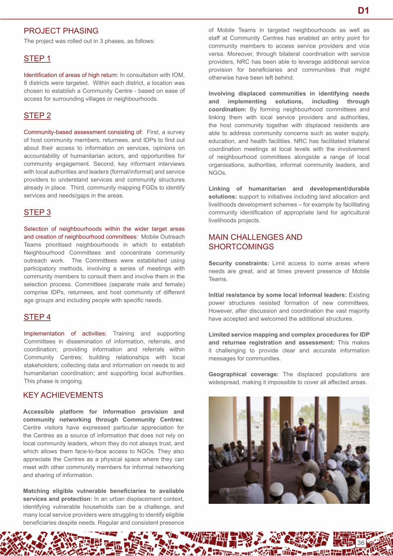
36
of Mobile teams in targeted neighbourhoods as well as staff at Community Centres has enabled an entry point for community members to access service providers and vice versa.Moreover, through bilateral coordinationwith service providers,NRChasbeenabletoleverageadditionalserviceprovision for beneficiaries and communities that mightotherwise have been left behind.
Involving displaced communities in identifying needs and implementing solutions, including through coordination: By forming neighbourhood committees andlinking them with local service providers and authorities,the host community together with displaced residents are able toaddresscommunityconcernssuchaswatersupply,education,andhealth facilities.NRChas facilitated trilateralcoordination meetings at local levels with the involvement of neighbourhood committees alongside a range of local organisations, authorities, informal community leaders, andnGos.
Linking of humanitarian and development/durable solutions: support to initiatives including land allocation and livelihoods development schemes – for example by facilitating community identification of appropriate land for agriculturallivelihoods projects.
MAin CHALLenGeS And SHoRtCoMinGS
Security constraints: Limit access to some areas where needs are great, and at times prevent presence of Mobileteams.
Initial resistance by some local informal leaders: existing power structures resisted formation of new committees. However,afterdiscussionandcoordinationthevastmajorityhave accepted and welcomed the additional structures.
Limited service mapping and complex procedures for IDP and returnee registration and assessment: this makes it challenging to provide clear and accurate information messages for communities.
Geographical coverage: the displaced populations are widespread,makingitimpossibletocoverallaffectedareas.
KEYACHIEVEMENTS
Accessible platform for information provision and community networking through Community Centres: Centre visitors have expressed particular appreciation for the Centres as a source of information that does not rely on localcommunityleaders,whomtheydonotalwaystrust,andwhich allows them face-to-face access to nGos. they also appreciate the Centres as a physical space where they can meet with other community members for informal networking and sharing of information.
Matching eligible vulnerable beneficiaries to available services and protection:Inanurbandisplacementcontext,identifying vulnerable households can be a challenge, andmany local service providers were struggling to identify eligible beneficiariesdespiteneeds.Regular and consistent presence
SteP 1
Identificationofareasofhighreturn:InconsultationwithIOM,8districtsweretargeted.Withineachdistrict,alocationwaschosen to establish a Community Centre - based on ease of access for surrounding villages or neighbourhoods.
SteP 2
Community-based assessment consisting of:First,asurveyofhostcommunitymembers,returnees,andIDPstofindoutabout their access to information on services, opinions onaccountability of humanitarian actors, and opportunities forcommunity engagement. Second, key informant interviewswith local authorities and leaders (formal/informal) and service providers to understand services and community structures alreadyinplace.Third,communitymappingFGDstoidentifyservices and needs/gaps in the areas.
SteP 3
Selection of neighbourhoods within the wider target areas and creation of neighbourhood committees: Mobile outreach teams prioritised neighbourhoods in which to establish neighbourhood Committees and concentrate community outreach work. the Committees were established using participatory methods, involving a series of meetings withcommunity members to consult them and involve them in the selection process. Committees (separate male and female) comprise IDPs, returnees, and host community of differentagegroupsandincludingpeoplewithspecificneeds.
SteP 4
implementation of activities: training and supporting Committees in dissemination of information, referrals, andcoordination; providing information and referrals within Community Centres; building relationships with local stakeholders; collecting data and information on needs to aid humanitarian coordination; and supporting local authorities. this phase is ongoing.
Photo 3
PRoJeCt PHASinGTheprojectwasrolledoutin3phases,asfollows:
D1

37
KeY LeSSonS LeARnt
Area-based approaches require a narrow geographical focus: the Community Centres have a catchment population of tens or (in the more densely populated districts) even hundredsofthousandsofpeople,whichistoolargeforanarea-basedapproach.Assuch,itwasnecessarytotargetsmallerneighbourhoods within the wider catchment areas of the Community Centres to focus the mobile outreach and community mobilization elements of the work. each Community Centre could then function as a central ‘hub’ for coordination within and between the multiple neighbourhood structures in the vicinity.
Neighbourhood selection depends on local understanding and experience: identifying and prioritising neighbourhoods in which to focus the area-based approach was only possible oncefieldstaffhadgainedadeepunderstandingofthewiderareas. this was after several weeks conducting information dissemination and outreach in many neighbourhoods surroundingtheCommunityCentres,aswellasconsultationwith local authorities and informal community leaders. the staff were then able to select neighbourhoods according to the following criteria: significant number and needs ofdisplaced households; social cohesion among residents; small enough area for community representatives to be known by most people in the neighbourhood; acceptable security risks; and acceptance by local leadership.
Service mapping should be a priority from the beginning and throughout the project: development of detailed and localised service mapping and directories should take place at the outset of the project and be updated on a regular basis following development of relationships with service providers – this is essential to allow useful information dissemination and referrals. outreach teams must be well trained on all procedures relevant to humanitarian assistance and
referrals in order to adequately advise community members.
NEXTSTEPS:TOWARDSDURABLESOLU-tionS
As the situation of returnees stabilizes and governmental and non- governmental schemes for durable solutions are developed,theprojectwillcontinuetorunCommunityCentresto support such initiatives. the Centres will provide a physical base for communication with communities, communitymobilization,andcoordination–aswellasprovidingaplatformfor the provision of a range of different integrated services – such as legal counselling, psychosocial support, and skill-buildingactivities.Meanwhile,NeighbourhoodCommitteeswillbe encouraged and supported to take increasing responsibility tomanageproblemsandsolutionsintheirneighbourhoods,incoordination with authorities and other stakeholders.
PHoto CAPtionS
Photos taken by Jim Huylebroek:• Photo 1: Women’s neighbourhood Committee members
use a problem tree to analyse the root causes of the community problem they have prioritised for solving
• Photo 2: A member of the outreach team meets displaced community members in the Community Centre to give them information on services and conduct referrals
• Photo 3: Community members meet to select members of their neighbourhood Committee
ContACt
Formoreinformation,contact:AnnaHirschHolland,[email protected] or GiovannaFederici,[email protected]
D1

38
Application of Local Area Based Coordination mechanisms for Cholera Response in Maiduguri, Nigeria
ConteXt
InMay2013,theGovernmentofNigeria declared a State of Emergency in the NE states of Yobe, Borno and Adamawa inresponsetotheongoingmilitantIslamicmovementofBokoHaram. Since then more than 1.8 million individuals have been displaced, of whom 1.4 million are in Borno.1 in Borno,many have sought safety inMaiduguri MetropolitanCouncil, where an estimated 811,000 IDPs now reside.2 Others have fled to adjacent communities in Jere, Gubio,Magumeri and Kaga Local Government Areas (LGAs). Approximately32%ofIDPsinBornoStatehavefoundrefugein camps,while themajority (68%)havesettledwithinhostcommunities.Theongoingconflicthasresultedinwidespreaddisruption of agricultural, market and livelihood activities.Frequent, cyclical displacement has resulted in the loss of key assets, the interruption of livelihoods, and the erosion of resilience mechanisms for IDPs, while the high prevalence of hosting has also resulted in the depletion of host populations’ limited resources.
Local coordination issues in North-eastern Nigeria are typically not addressed adequately at the State level and are often not being taken up by the local-level cluster mechanisms. Asa result, local area coordination (LAC) groups ledby implementing partners began to form in late 2016 inresponsechallengesatthefieldlevel..ThesegroupsexistattheLGA,wardandsub-wardlevelscoveringareasrangingbetween 10s and 100s km2 dependent on the concentration ofneedandhumanitarianactors..AsofJuly1,2017,theUNand INGOsagreed to formalizeLGAcoordination inBorno,Yobe and Adamawa states. the Humanitarian Country team endorsed this formalization and agreed that inGos will be the lead agencies for coordination at the LGA-level.
Meetings provide an opportunity to locally coordinate assessments and access to services for existing actors and to assist new actors to target appropriately. the engagement of LACs varies greatly with some providing a forum for regular programupdatesandotherundertaking jointfieldvisitsandassessment and together developing action plans to address either chronic or acute needs.
PRoJeCt APPRoACH
TheLACintheMunaCorridor,eastofMaiduguricitycenter(MM¬¬C)inBornoState,isco-ledbySolidarteInternational(SI) and CRS. Muna Corridor, an area covering around30km2, is the first place in which CRS began LAC andstarted out as a WASH-only group in response to gaps and duplications on the ground that were not easily coordinated through the regional WASH coordination structure. As other sectors recognised the importance of coordinating at the local level, thegroup became multi-sectoral incorporating food securityandlivelihoods,shelterandhealthactors.Meetingsare held monthly and sometimes include local government. .
During the week of August 21st, 2017 several suspectedcholera cases were reported in Muna Garage idP Camp (MGC),whichislocatedwithintheMunaCorridorandfallingwithin the LAC coverage area. the LAC co-leads immediately responded to the suspected cases by closely coordinating WASH activities in the Muna Corridor. The first phaseincludedidentificationofacontrolzonearoundMunaGarageidP Camp. All actors performing WASH activities in the area wereinvitedtoaninitialcoordinationmeeting,duringwhichacurrent map of Muna Corridor actors was used to guide the discussion about adequate coverage of all potentially affected locations.
The LAC co-leads confirmed each actor had capacity to immediately implement cholera hygiene promotion activities within their assigned geographies & receivedcommitments from actors with additional capacity to cover unassigned geographies or support other actors. Several actors indicated their hygiene promoters needed training,specifically around cholera symptoms, prevention andappropriatecareseekingbehaviours.Inresponse,CRSandoxfam committed to offering two trainings within the next two days.
The LAC group also initiated planning in the event that the additional suspected cholera cases were confirmed, with afocusonincreasedhygienepromotion,waterandsanitationactivities,anddistributionofNFIhygienekits.Aspartofthis,
Urban Centre: Muna Corridor, Maiduguri, Nigeria(covering Muna Garage idP camp
Project timeframe: August - September 2017
type of project: Coordination,WASHCholeraResponse
Project partners:SI,CRS,LACparticipants
Coordination framework: inGo-led LAC at the Local GovernmentArealevel,endorsedbyHCT
Agency submitting the case study: CRS
D2

39
ReFeRenCeS
1. IOM DTM Round XV Report March 2017 https://nigeria.iom.int/sites/default/files/dtm_reports/01%20DTM%20Nigeria%20Round%20XV%20Report%20March%202017.pdf
2. FEWSNETFoodSecurityOutlookFebruary-May2017,http://www.fews.net/west-africa/nigeria/food-security-outlook/
february-2017
ContACt
FormoreinformationcontactAusdeBertrand,[email protected]
CRS immediately began to provide information management support,gatheringdatafromtheLACactorsinordertomapwaterpoints,locationsofsuspectedcholeracases,andothersignificantpoints.
On August 26th, MSF reported two confirmed and threesuspectedcholeradeaths,makingitnecessarytofinalizeandimplementtheseadditionalactivities.Atthispoint,coordinationactivitiesbecamehyper-local,focusingoncoordinationwithinMuna Garage idP Camp where the cholera cases/deaths occurred.Throughout the entire camp, actors committed toensuring complete door-to-door hygiene promotion coverage. Usingsatelliteimagery,theLACco-leadsworkedwithactorstodividethecampintoninezones,witheachoffourWASHactors taking responsibility for hygiene promotion in two or more zones. Within the areas of the camp where suspected choleracasesandsuspected/confirmedcholeradeathswerereported,actorscoordinatedlatrinerehabilitation,desludging,and chlorination activities as well. during this phase all actors providedtheLACleadswithdailyactivityupdates,whichwerecirculated within the group.
Moving out across the broader control zone actors were able to contribute according to their available skills and resources to work in complementarity, with SI providing an on-calldisinfection services throughout the area, CRS activatingemergency funds to rehabilitate infrastructure where needed and the Government and other local actors increasing coverage of community mobilisation for hygiene promotion.
KeY LeSSonS LeARnt
• the LAC leads were able to quickly coordinate a response to the cholera outbreak due to the pre-existing LAC network.
• LAC TORs should be formalized, in conjunction with and buy-in from implementing organizations,thelocalandstategovernment,sectorcoordinators,andOCHA;the toR should include standard operating procedures for secondary emergencies that occur in the area of responsibility.
• Local and state government should be included as soon as possible in coordination efforts.
• Having Information Management specialist staff present was crucial to the process.
• Having a Program Manager who could focus on the response as the highest priority was essential.
• In addition to having 3Wmaps, which all LAC groupsareaimingtodevelop,itwouldhavebeenusefultohavewater and sanitation infrastructure mapped in advance.
• Using maps at meetings and collaborating with actors to improve maps may help habituate actors to leveraging these tools to improve coverage validation in the future.
• Asking actors to establish their geographical boundaries of operation by easily identifiable natural orman-madefeatures, such as streams or roads, may facilitategeographic coverage in urban areas.
D2

40
Tri-cluster support in response to the 2011 famine and conflict in Mogadishu
SUMMARYOVERVIEW
the tri-Cluster project is a coordinated group of 16 projects implemented by 14 partners across the sectors of shelter,WASHandhealth.ZonaKinMogadishuwaschosenasthetarget area as it had the densest concentration of internally displaced Persons (idPs) and was the least likely idP settlement to be evicted once Mogadishu stabilised and developed. the project goal was to improve the protection for displacedpeoplelivinginZonaKthroughimprovedsettlementplanning and the provision of integrated services from multiple sectors
ConteXt
Mogadishu has hosted displaced people from conflictssince1991.However,asdroughtworsenedinlate2010andfamine approached in early 2011,more andmore Somaliswere driven away from rural areas to Mogadishu looking for assistance and safety. displacement was compounded by the ongoingconflictinSomalia.
UponarrivalinMogadishu,theInternallyDisplacedPersons(idPs) settled on any unoccupied land. this process of self-settlement meant that there was no site planning. Services suchaswater and sanitation, andaccess to the100or sosettlements were sporadic. As the number of sites closer to the centre of town reduced and asAl-Shabaab’s influencelessened, many IDPs settled into the area which becameknownasZonaK.Zona K’s mixed ownership, between the government, theuniversityandsomeprivateindividuals,meantthatitwasoneoftheleastlikelysitestobeevicted.Bytheendof2012,thesitecoveredanareaofover3km2withanestimated70,000IDPs living in make-shift shelters called Buuls (traditionalSomali thatched shelter). these were constructed by the idPs themselves from scavenged materials and items received from humanitarian organisations.
Any attempt to coordinate settlements in Mogadishu would have directly interfered with the economic relationship between the host population and the IDPs.As a result, noformal camp coordination mechanism was established.
PROJECTOVERVIEW
AsaresponsetotheinfluxofIDPsintoMogadishu,athree-phase strategy was developed in July 2011:• Provide all displaced people with a non-food item
packages• Provide transitional shelter solutions• Provide site planning to improve living conditions and
access to other basic services such as WASH and health.
the shelter coordination did not advocate the creation of new settlements for the idPs. this strategy was attempted inPuntland,butwasnotverysuccessful.Instead,theClusteradvocated that organisations should provide humanitarian assistance to the locations where idPs had self-settled. this has been the approach in Somaliland and Puntland where the conditions and access are more favourable. the mechanics that control the creation of new camps were deemed too complex and unpredictable to encourage new sites.
UndertheumbrellaoftheTri-Clustertherewerefiveshelterprojects,withatotalvalueofUS$4million.Thefirstprojectfocused on mapping the existing settlement, producingsettlement plans, and creating access roads and stormdrainage. this mapping was followed by consultations with the beneficiary community and landowners to ensure thatpeople would not be evicted once work was completed.
one organisation chose to work through long-standing partner organisations while the other contracted the work to local construction companies. Where possible the implementing organisations followed the site plans, but they were oftenforced to deviate from them. Reasons for this included the needtoaccommodatenewdemandsfromstakeholders,theconstruction of new permanent structures that had been built after the initial mapping, and the need to accommodate alarger population.
Once the shelters were completed, two local organisationsprovided non-food items, including blankets, kitchen sets,jerry-cans and fuel-efficient stoves. Beneficiary lists wereprovidedbythemainshelterpartners,anddistributionswereundertaken once the shelters were handed over.
Urban Centre:Mogadishu,Somalia
Project timeframe: 2011 – 2013
type of project:Tri-clustercoordination,supportingshelter,nFi and WASH emergency response
Coordination framework: tri-cluster coordination system developedwithshelter,WASHandhealth.
Agency submitting the case study: extracted from Shelter Projects2011–2012,RefU.9/A.28
D3

41
CooRdinAtion
Effectivecoordinationwascrucialforsuccess,astherewere16projectsoperatinginaveryconcentratedarea.Inaddition,thereweremanyactorswhowerealreadyworkinginZonaK.Therefore,adedicatedTri-Clustercoordinatorwasbroughtinto act as a focal point for the 16 projects. initially there was reluctance from some of the implementing partners to work under the same umbrella. the WASH and health partners did notwanttowaitforthemappingprocesstobecompleted,andwantedtoimplementprojectsimmediately,regardlessoftheoutput from the planning phase.
Over a series of meetings, the importance of coordinatingactivities was emphasised and a plan was developed where some activities could be carried out at the same time as the mapping. Coordination and communication was needed with the local authorities ensured that they were aware of theproject and its implications, and that theyapproved thetemporary development plans. As the final shelter solutionwas semi-permanent (5 to 10 year lifespan), the urbanplanningundertakenaspartof theTri-Cluster,will influencethe development of this part of the city. Access roads created now,willbethemainroadsforyearstocome.
KEYACHIEVEMENTS
• Regular coordination meetings achieved a common understanding of aims and objectives amongst all partners
• By integrating services the project was able to actmoreefficiently toprovideshelter,access towaterandsanitation and basic health services.
• Settlement planning has enabled organisations to have better access and the beneficiaries have an enhancedsense of community. displaced people were involved in thedevelopmentof context-specificplanningstandardswhich helped manage expectations.
MAin CHALLenGeS
• Underestimation of the impact of other projects funded through other sources active in the same project area.
• Although eviction is unlikely in the short-term, there isno clear ownership of land and so displaced people are vulnerable to the Somali ‘gatekeepers’.
• A weak community structure combined with the fact that many people were already settled within the settlement meant that it was not always possible to follow site plans and meet minimum standards.
> Communal spaces have been eroded by an increaseinthenumbersofpeoplelivinginZonaK.
> As the sectors work at different levels (shelter withhouseholds,WASHwithgroupsoffivefamiliesper latrine and health with the whole community) synchronising activities required complex work plans.> Mapping all the stakeholders in the process was difficult,andtheirinfluencechangedovertime.>Theprojecthadahighprofile,puttingimplementing partners under pressure to produce resultsquickly,compromisingplanningandconstruction quality.> the tri-Cluster coordinator took on many of the camp management and camp coordination duties.
LeSSonS LeARnt
• the tri-Cluster project was expanded for 2013 to include education and protection focused projects. it was planned for an additional shelter agency to join the existing two partners,and3,000-4,000moreshelterswereplanned.once the framework and common understanding on coordination was created, it became feasible to addadditional sectors and projects.
• the tri-Cluster approach came about because the Humanitarian Coordinator considered that shelter,WASH and health were the most pressing needs for the idPs. At the time there was surprise that other sectors were not also included in a multi-sectorial approach. However, the coordination of just threesectors was difficult enough, and in retrospect thepresence of additional partners and targets may have reduced the effectiveness of the entire intervention.
• Generally, once an organisation secured funding, thefocus was immediately on implementing as quickly as possible in order to meet project targets. to combat this “tunnel vision” amongst organisations, thesuccessful multi-agency approach invested heavily in communication and consultation. this always takes time.
• Starting with just 3 sectors enabled a culture of coordination to be ingrained. only once the coordination was working with a few key partners was it possible to expand to the full array of humanitarian services.
ContACt
Formoreinformation,refertothe2011-2012ShelterProjectsU.9 / A.28
D3

42
Kabul Area Shelter and Settlements (KASS)
ConteXt
the project was designed to cope with the dramatic increase in the population size of Kabul which was estimated to be increasing at a rate of 15% per year since 1999. Part of this was due to the high number of returns from Pakistan and iran (around 5 million of the 8 million estimated had returned by this time) and idPs displaced because of increasing insecurity in other parts of the country and in part due to general trends towards urbanisation.
the needs were multiple and the target districts were devoid of basic services.
ACted worked in two districts: one was an old settlement which was densely populated and the other a brand new site earmarked for development. Both were located on theoutskirts of Kabul city, far from markets and employmentopportunities.
neither district was included in the Master Plan of the city. the local governance structures which existed were consequently marginalised,neitherincludedinruralprogrammesnorurban.Land planning and land tenure was a persistent issue (across thecountry,notjustKabul).
At thetime, therewasnourban-basedhumanitarianshelterprogram by the international community in Afghanistan since the2002 to2004emergencyassistance,unlike rural.
PRoJeCt APPRoACH
Inorder todealwith themultipleneeds, theproject tookanintegrated, multi-sectoral approach to resettlement and re-integration based on lessons learned from previous shelter programmes for returnees which took a sectoral based approach and ended up being un-sustainable because they didn’t meet the needs and people abandoned the sites.
the project adopted an area-based approach,workingwith local and traditional authorities where they existed and setting up community councils where they didn’t and linked these authorities in with Kabul Municipality.
PRoJeCt oUtPUtS
• Shelter, water, sanitation facilities, hygiene awareness, improved environment, jobs, vocational training.
• the project also set up community councils (gozar shuras) in targeted areas to enable communities to prioritize their needs and enhance communication mechanism with relevant authorities, respond to localneeds for public services and liaise with government officialsonurbanissues.
• Parcel identification and mapping to facilitate certificationofcustomarylandtitlesandresolutionofland
KEYACHIEVEMENTS
Successful example of LRRD: the first time such a largeemergency type shelter and settlements improvement project was linked with the broader city development strategy and planning.
Urban Centre: Kabul, Afghanistan, covering 2 Districts ofKabul12,16(totalprogrammecovered4districtswithCareand CHF)
Project timeframe: 2008 - 2010
type of project:Integrated,area-basedshelterandsettlementprogramme linking emergency type shelter and settlement programme with the broader city development strategy and planning
Project partners: ACted
Coordination framework: Mayor’s Office, municipaldepartments,localandtraditionalgovernanceorganisations,oFdA
Agency submitting the case study: ACted
D4
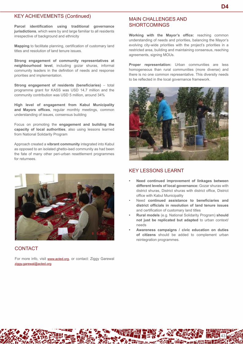
43
KEYACHIEVEMENTS(Continued)
Parcel identification using traditional governance jurisdictions,whichwerebyandlargefamiliartoallresidentsirrespective of background and ethnicity
Mappingtofacilitateplanning,certificationofcustomarylandtitles and resolution of land tenure issues.
Strong engagement of community representatives at neighbourhood level, including gozar shuras, informalcommunity leaders in the definition of needs and responsepriorities and implementation.
Strong engagement of residents (beneficiaries) – total programme grant for KASS was USD 14,7 million and thecommunitycontributionwasUSD5million,around34%
High level of engagement from Kabul Municipality and Mayors offices, regular monthly meetings, commonunderstandingofissues,consensusbuilding
Focus on promoting the engagement and building the capacity of local authorities, also using lessons learnedfrom national Solidarity Program
Approach created a vibrant community integrated into Kabul as opposed to an isolated ghetto-ised community as had been the fate of many other peri-urban resettlement programmes for returnees.
MAin CHALLenGeS And SHoRtCoMinGS
Working with the Mayor’s office: reaching common understandingofneedsandpriorities,balancingtheMayor’sevolving city-wide priorities with the project’s priorities in a restrictedarea,buildingandmaintainingconsensus,reachingagreements,signingMOUs.
Proper representation: Urban communities are less homogeneous than rural communities (more diverse) and there is no one common representative. this diversity needs tobereflectedinthelocalgovernanceframework.
KeY LeSSonS LeARnt
• Need continued improvement of linkages between different levels of local governance: Gozar shuras with districtshuras,Districtshuraswithdistrictoffice,DistrictofficewithKabulMunicipality
• need continued assistance to beneficiaries and district officials in resolution of land tenure issues andcertificationofcustomarylandtitles
• Rural models (e.g. national Solidarity Program) should not just be replicated but adapted to urban context/needs
• Awareness campaigns / civic education on duties of citizens should be added to complement urban reintegration programmes.
ContACt
Formore info,visitwww.acted.org,orcontact:[email protected]
D4

44
Neighbourhood Scale
Source: CRS

45
Support to settlement-based response and recovery planning in Bangui
Urban Centre:Bangui,coveringfourneighbourhoodsofBangui(Fondo,GbayaNdombiaIandII,BlocSara(BangaSaraIandIIaswellasPotoSouma)andtheCitéBoeing
Project timeframe: February – July 2017
type of project:SettlementBasedAssessmentandplanning,support to local authorities
Project partners:IMPACT,CUF/UCLG,ACTED(AGORA)Coordination framework: Humanitarian Country Team, insupportoflocalauthoritiesandOCHA,NGOsandotherrelevanthumanitarian actors
Agency submitting the case study: IMPACT, on behalf of theAGoRA initiative
ConteXt
Since 2013, a major political-military crisis has beenaffecting the Central African Republic (CAR) and its capital Bangui,withwide-spreadviolenceand insecurity,persistentcommunal tensions and population movements. this crisis has generatedmassive needs among affected populations,withrisingpovertyanddecliningeconomicactivity,destructionof housing and infrastructure and disruption of basic services.
thanks to the recent political transition and the hopes for futurestability,theproportionofinternallydisplacedpersonshas declined steadily since 2016, with increasing level ofreturns to certain regions, including over 20,000 peoplereturning to Bangui in 2016 and 2017. Within this contextof stabilisation of Bangui and returns, humanitarian anddevelopment actors have upscaled their programs to support affectedpopulationsinBanguiandenableapeacefulreturnand reintegration. Despite this increase in focus, thereremainedalimitedunderstandingofdisplacementdynamics,neighbourhood-level vulnerabilitiesandcapacities,andverylimited engagement of local authorities and local actors within the neighbourhoods of return.
PRoJeCt APPRoACH
AGORA, a newly launched joint initiative of IMPACT andACTED,inpartnershipwithCitésUniesFrance(CUF)/Unit-edCitiesandLocalGovernment (UCLG),conductedapilotproject to support amore integrated and efficient responseto the returns inBangui, through settlement based assess-ments and response plans. this approach was piloted in four neighbourhoodsofBanguiandCite’Boeing,with fundingoftheEuropeanUnion,through: the establishment of an urban-level Working group inclusive oflocalandinternationalactors,the implementation of a settlement-based assessment and of settlement-basedresponseplans, and a capacity building component in support of local author-ities in partnership with UCLG/CUF.
PRoJeCt oUtPUtS
• Assessment and Settlement-based Response Plan report at this link.
• Lessons learned document available here.
KEYACHIEVEMENTS
• Strong engagement of community representatives at neighbourhood level,includingneighbourhoodMayors,civil society representatives and informal community leadersinthedefinitionofneedsandresponsepriorities
• High level of engagement from humanitarian actors,including INGOs, key UN Agencies (UNHCR, OCHA,UNDP, etc.), and Clusters in the development of theresponse plan and the coordination through the urban Working Group.
• Settlement-based assessments and response plans enabled a shared prioritisation and planning across sectors / clusters and between international / local actors, resulting ina jointunderstandingof thecontextand of response priorities.
• Focus on promoting the engagement and building the capacity of local authorities,alsousingamunicipality-to-municipality peer support scheme through CUF and UCLG.
• The settlement-based assessment findings and thesubsequent response plan was used by donors for funding allocation and prioritisation.Specificdonors(EU,HumanitarianFundandothers)requestedpartnersto engage in the urban Working Group as a condition for fundingtoensureBangui-levelprogramsarecoordinatedthrough the urban Working Group.
• the urban working group and the settlement-based response plan were a good practice to link humanitarian and development response.Short,medium-andlong-termprioritieswereidentifiedthroughajointprioritisationprocess,enablinglinkagesbetweenlocalandinternationalactors on the one hand and development/stabilisation and humanitarian actors on the other hand.
N1
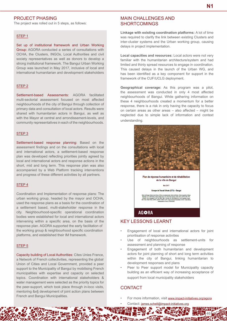
46
SteP 1
Set up of institutional framework and Urban Working Group: AGoRA conducted a series of consultations with OCHA, the Clusters, INGOs, LocalAuthorities and civilsociety representatives as well as donors to develop a stronginstitutionalframework.TheBanguiUrbanWorkingGroupwaslaunchedinMay2017, inclusiveof localandinternational humanitarian and development stakeholders
SteP 2
Settlement-based Assessments: AGoRA facilitated multi-sectorial assessment focused on most affected neighbourhoodsofthecityofBanguithroughcollectionofprimary data and consultation of local actors. Results were shared with humanitarian actors in Bangui, as well aswiththeMayoratcentralandarrondissement-levels,andcommunity representatives in each of the neighbourhoods.
SteP 3
Settlement-based response planning: Based on theassessment findingsandon theconsultationswith localand international actors, a settlement-based responseplanwasdevelopedreflectingpriorities jointlyagreedbylocal and international actors and response actions in the short, mid and long term. This response plan was alsoaccompanied by a Web Platform tracking interventions and progress of these different activities by all partners.
SteP 4
Coordination and implementation of response plans: the urbanworkinggroup,headedby themayorandOCHA,used the response plans as a basis for the coordination ofa settlement based, multi-stakeholder response in thecity. Neighbourhood-specific operational coordinationbodies were established for local and international actors intervening within a specific area, on the basis of theresponse plan. AGoRA supported the early facilitation oftheworkinggroup&neighbourhoodspecificcoordinationplatforms,andestablishedtheirIMframework.
SteP 5
Capacity building of Local Authorities:CitesUniesFrance,aNetworkofFrenchcollectivities,representingtheglobalUnionofCitiesandLocalGovernment, providedapeersupporttotheMunicipalityofBanguibymobilisingFrenchmunicipalities with expertise and capacity on selected topics. Coordination with international stakeholders &water management were selected as the priority topics for thepeer-support,whichtookplacethroughin-locovisits,mentoring&x§developmentofjointactionplansbetweenFrenchandBanguiMunicipalities.
PRoJeCt PHASinGTheprojectwasrolledoutin5steps,asfollows:
MAin CHALLenGeS And SHoRtCoMinGS
Linkage with existing coordination platforms: A lot of time was required to clarify the link between existing Clusters and inter-clustersystemsand theUrbanworkinggroup,causingdelays in project implementation.
Local capacities and resources: Local actors were not very familiar with the humanitarian architecture/system and had limited and thinly spread resources to engage in coordination. This caused delays in the launch of the Urban WG, andhas been identified as a key component for support in theframework of the CUF/UCLG deployment.
Geographical coverage: As this program was a pilot,the assessment was conducted in only 4 most affected neighbourhoods of Bangui. While gathering information onthese 4 neighbourhoods created a momentum for a better response,thereisariskinonlyhavingthecapacitytofocuson certain areas as other areas – also affected – might be neglected due to simple lack of information and context understanding.
KeY LeSSonS LeARnt
• engagement of local and international actors for joint prioritisation of response activities
• Use of neighbourhoods as settlement-units for assessment and planning of response
• engagement of both humanitarian and development actors for joint planning of short and long term activities within the city of Bangui, linking humanitarian todevelopment responses and plans
• Peer to Peer support model for Municipality capacity buildingasanefficientwayof increasingacceptanceofsupport from local municipality stakeholders
ContACt
• Formoreinformation,visitwww.impact-initiatives.org/agora
• Contact: [email protected]
N1

47
Area Based Approach in Kampala: Partnering with Kampala Capital City Authority on refugees and migrant integration
ConteXt
Uganda is home to over 1.3 million refugees1 and asylum seekers,primarilyfromSouthSudan,theDemocraticRepublicoftheCongo,Burundi,andSomalia,makingitoneofthetopfiverefugee-hostingcountriesintheworld.2
Atthesametime,Ugandaisrapidlyurbanisingwithrefugeesand host community members alike residing in low income informal settlements. Kampala’s population is currently 1.75 million and the city is growing annually by nearly four – five percent. This growth occurs predominantly withinKampala’s low income and/or informal areas and among the city’s significant poor population. Approximately 32percent of Kampala’s residents reside in low income informal settlements.3
the refugee population of Kampala has nearly doubled since 2012,withasignificant increase in thepastyear.Accordingto the Uganda Office of the Prime Minister (OPM), as ofSeptember 2017 Kampala hosts 98,300 refugees from 25countries.4 this represents nearly double the 2012 estimated numberof50,646.5 the rate of refugee arrivals to Kampala exceeds the rate of urbanisation of the city (although at a smallerscale),meaningthatanincreasingpercentageofthecity population will be refugees in the short-term.
The lack of specific data regarding the refugee populationin Kampala to date has resulted in relatively inefficienthumanitarian programs that struggle to reach what is effectively a hidden population. international and local nGos were largely reliant on anecdotal information regarding A.) where refugees live,B.) thedemographicsof refugeepopulations,and C.) the quality and access to services afforded refugees in Kampala.
Urban Centre: Kampala,Uganda
Project timeframe: 2017 - 2018
type of project: Context analysis; area based assessments; planning and coordination; support to municipal authorities
Agency submitting the case study: international Rescue Committee and iMPACt initiatives
Further,asrefugeenumbersinKampalahavebeenrelativelylowincomparisontothecity’soverallpopulation,cityplanningby the Kampala Capital City Authority (KCCA) has not focusedon refugee issues todate.However,afteroutreachfrom international humanitarian agencies such as the InternationalRescueCommittee(IRC)andIMPACT,thereisincreasingrecognitionbyKCCAofficialsofthechallengeandopportunity of the refugee presence in the city and a desire to incorporate refugees into future city plans. the update of the KCCA2014-2019plan,whichcurrentlyemphasizesacitythatis“hospitableandwelcomingto…newcomersandresidents”and reinforces KCCA’s efforts to promote social cohesion and well-beingofallpeopleresidinginthecity,1 provides a unique opportunity for KCCA to include refugees in its future plans as itstrivestomakeKampalasafe,inclusive,andmoreresilient,forthebenefitofallofitsresidents.
PROJECTOVERVIEW
Since2016,multipleinternationalandlocalNGOshaveworkedtogether with KCCA to generate data on the displacement situation in Kampala and use this data to improve coordination and project planning under the leadership of KCCA. this effort includes inputs from the iRC and iMPACt. WithregardstotheIRC,inputsincludedconductinganurbancontext analysis of displacement in Kampala, engagementof KCCA, and an initial convening of humanitarian anddevelopment stakeholders to discuss how to improve long-term refugee response within the city.
1 UnHCR Factsheet for Uganda. July 2017. Available at: https://reliefweb.int/sites/reliefweb.int/files/resources/UNHCR%20Uganda%20Factsheet%20July%202017.pdf. Accessed 2 January 2018.2 UnHCR Global trends: Forced displacement in 2016 report. 2017. Available at: http://www.unhcr.org/5943e8a34.pdf. Accessed 3 January 2018.3 ibid.4StatementsmadebyOPMduringtheUrbanPractitionerWorkshop.Otherfiguresareslightlyhigher.5Monteith,W.andLwasa,S.(2017)Theparticipationofurbandisplacedpopulationsin(in)formalmarkets:contrastingexperiencesinKampala,Uganda.IIED. 6 Kampala Capital City Authority (2014) Strategic Plan 2014/15 – 2018/19. Available at: https://www.kcca.go.ug/uploads/KCCA_StRAteGi_PLAn_2015-2016.pdf. Accessed 2 January 2018.
N2

48
WithregardstoIMPACT,inputsincludedtheimplementationoftheAGORAinitiativeinKampala,inpartnershipwithKCCAandNRC,inordertogeneratecriticaldataonninelowincomeinformal settlements within the city and the needs of residents within them. data points include the percentage of residents ofeachsettlementwhoare refugees, the typesof servicesavailable to these communities and how they access these services, and the specific vulnerabilities that refugees facein relation to host community members residing in the same area.
the data and coordination from both the iRC and iMPACt’s efforts have resulted in:• Greater understanding of the displacement situation for
all relevant stakeholders• the initiation of a formal coordination platform organized
by KCCA• Joint scoping for ongoing technical support to KCCA• Joint planning for future humanitarian projects within
Kampala
PRoJeCt PRoCeSS
July2017–December2017:Tosupporttheproject,theIRCimplemented the following steps:• Conducted an urban context analysis, using the IRC’s
Urban Context Analysis toolkit: Guidance note for Humanitarian Practitioners to analyse the underlying political, social, economic, service delivery, and spatialdynamics that impact displaced populations and host communities living in Amman and Kampala.
• engaged in dialogue with the municipal authority to inform their understanding of displaced residents within their city, identifying mutual priorities between thehumanitarian sector and the municipality while focusing on areas for meaningful collaboration.
• Hosted an urban practitioner workshop, titled FromResponse to Resilience, in September 2017. Theworkshop was attended by international, national, andlocal stakeholders active within the city, including civilsocietyorganizations(CSOs),humanitarianNGOs,localand national government representation, developmentagencies,UNagencies,andprivatesectoractors.
• Providedrecommendations toKCCAbasedonfindingsfrom the current response to displacement within the city. Based on these recommendations, the IRC, IMPACT,KCCA and other nGos entered into discussions on potential programmatic relationships around an area based approach.
January 2018 – present: Building on a strong relationshipestablished with KCCA, and with the support of ECHO,IMPACT, as part of an interagency AGORA initiative, isundertaking a series of activities within the framework of the partnership with KCCA:
SteP 1Prioritize & delineate crisis affected neighborhoods:KCCA and IMPACT have identified and prioritizednine specific vulnerable neighbourhoods in Kampala.The selection reflects KCCA’s strategic priorities forurban intervention,prevalenceofstructuralandsocialvulnerabilities,aswellasthegeographicconcentrationof refugee populations in some areas.
SteP 2Undertake comprehensive neighborhood-based assessments:KCCAand IMPACT, inpartnershipwithotherhumanitarianactors,undertakescomprehensiveassessments in identified neighbourhoods.Assessmentsidentifyvulnerablepopulations,responseand resource gaps, providing an overview percommunity.Specificassessmentsinclude:1. Service provision mapping (Key informant interviews with service providers)2.Vulnerabilityassessments(householdsurveys)3. Actor mapping to identify local service actors and exogenous aid actors (key informant interviews with community leaders and focus groups discussions)The assessment findings are supporting evidence-basedprogramming forKCCA, development partnersand humanitarian actors to strategy urban programming.
SteP 3develop neighborhood-level - and city level response plans: Informed by assessments findings, IMPACT issupporting KCCA to undertake a series of consultations and workshops to develop response plans. Relevant stakeholders, including localcivilsocietyandcitizens,service providers, government departments and localauthorities,nationalNGOs,UNAgencies,ClustersandinGos are involved in the planning phase in order to: 1. Highlight priority needs and propose interventions to address both humanitarian needs and longer term development/resilience priorities. 2.Identifyinternationalactorswithresources,expertiseand link with local actors to support vulnerable populations
SteP 4Support the establishment of the Kampala Coordination Forum for Migration: iMPACt is supporting KCCA and key humanitarian actors to establish and facilitate a Working Group to support the development of the response plans and the municipal-level coordination and information management.
SteP 5Strengthen capacity of KCCA through peer to peer municipal support: Leveraging a global partnership withUnitedCities andLocalGovernment, IMPACT issupporting support KCCA through fostering links with municipal authorities from other countries. To date,an exchange visit to several european countries with aKCCAdelegation has been undertaken, generatinglearnings for both KCCA and european Local Authority Counterparts.
N2
49
KCCA CooRdinAtion
In April 2018, KCCA hosted a migration dialogue withAmbassadors; Heads of Un agencies; Heads of international Organizations; technical officers from relevant GovernmentMinistries,DepartmentsandAgencies;andmembersof theprivate sector. the purpose of the dialogue included• Link humanitarian programming to long-term development
goals of the city;• Strengthen coordination, sustainability, and impact of
multi-stakeholder responses to urban displacement;• Understand the needs and preferences of urban displaced
persons; and• ensure that displaced and marginalized residents are
included in public services.Following the dialogue and the processes of the iRC and IMPACT, all relevant stakeholder are currently involved injoint planning for program delivery and further technical and institutional support within Kampala – including the establishment of the Kampala Coordination Forum for Migration.
KEYACHIEVEMENTS Greater understanding of the displacement situation for all relevant stakeholders. ThedatageneratedbytheIRC,IMPACTandKCCAhasidentifiedsomeoftheurbanneigh-bourhoodsofgreatestneedsandthespecificnatureofneedwithinthoseneighbourhoods.Forexample,through700keyinformantinterviews,approximately2000householdsurveysandcomplementaryfocusgroupdiscussions,theareabasedassessmentidentifiedthatcertainsettlementshostagreaternumber of refugees. Humanitarian actors may better target their interventions based on this information.
• Caseload and economic vulnerabilities: Refugees represent 6% of the total population in the target neigh-bourhoods. national households are doing slightly better offeconomicallyspeakingthanrefugees,butnonethe-less share the belief that refugees are wealthier. As a consequence,refugeestendtobechargedmoretoac-cess basic services and amenities such as accommoda-tionandhealth,beingchargedmoremoneyorfrequent-ly asked for bribes. Access to work for refugees is a little moredifficultthanfornationalswithequivalentlevelofeducationandincome,duetolanguagebarriersandto the fact than the slum population (including potential employers),tendtolackawarenessonrefugees’rightstowork.20%ofrefugeesreportnothavingarefugeeID,therefore not formally registered. there is a slight corre-lation between the level of wealth and perceived ability toaccessservicesandtheregistrationstatus,registeredrefugees doing slightly better off than their counterparts who report not being formally registered.
• Access to services: Refugees enjoy the right to access to samebasicservicesasnationalsinUganda,andthislawisverifiedinthereality.However,refugeesaremoreatrisk
ofbeingaskedforbribes,anddonotenjoythesamelevelof information on the availability of services than nationals. Access to education for refugee children is lower than nationals,anditisevenmorethecaseforrefugeeswhohave arrived in Kampala recently (less than 2 years ago). Regardinghealthandwaterandsanitation,challengestoaccess services are quite similar between the two groups.
• Trends for social integration and resettlements: the majority of refugees in Kampala have been here for more than 5 years, and report they came straightto Kampala without going to through the settlements. there are little intentions of return to the country of origin, and thus, refugees tend to emphasize theirefforts to better integrate within the socio-economic fabric of the city. Social cohesion between refugees and nationalsisnotamajorconcern,whilebothgroupsreportcriminality as an issue affecting the whole community.
• Assistance: Refugees report receiving little or no assistance from aid groups. Most of the support gotten in caseoffinancialburdenisobtainedthroughtheirsocialnetwork, through occasional help from relatives, whilenationals have an easier access to formal credit. Bothnationals and refugees report a need for assistance,although the type of assistance preferred varies slightly between the two groups. Refugees emphasize primarily theneed for foodand rent,while national puteducation higher on the agenda. When it comes to the mode of assistance, all residents tend to reportdirect cash assistance or a combination of cash and in kind assistance as their preferred mode of support.
• Formal coordination of humanitarian services under local leadership. the initiation of a formal coordination platformorganizedbyKCCA,aswellasgreatertechnicalcapacity for KCCA to address the needs of displaced and marginalized residents within Kampala. While KCCA had no previous plans on how to manage displacement and extend their services to displaced residents prior theproject,theIRCandIMPACThassinceworkedwithKCCA on how best to plan for the continued arrival of refugees,basedonthedatageneratedthroughourjointefforts. Leveraging these recommendations,KCCAhascommitted to taking a leadership role in the refugee response within Kampala and taking steps to integrate refugeesintothecity’ssocial,cultural,andeconomicfabric.
• An agreed way forward among stakeholders from different constituency groups.Basedontheproject’ssuccess, key actors involved have agreed to pursueactions that promote better access to information,prioritise the safety of vulnerable populations while mitigatingtheriskstheyface,andbeginningtoorientnewresidents to coordinated services offered by the city’s variouspublic,private,andcivilsocietyserviceproviders.A key component will be the successful implementation of an area based approach within a Kampala settlement that hosts a high number of displaced residents.
N2

50
Supporting KCCA in the development of its urban refu-gees municipal strategy:WithsupportfromIMPACT,KCCAis developing its municipal strategy for refugees integration and inclusive service delivery. this strategy will serve as a guiding framework for intervention for all stakeholder involved in the urban displacement and refugee response in Kampala,incorporatingreliableinformationonhumanitari-an needs and key policy priorities for Kampala’s long-term development. the development of this municipal strategy will beevidence-grounded,mobilisingtheresultsofAGORA’sassessment. the development and implementation of these municipal strategies will be informed and supported by other municipalities who have gave through similar challenges and successfully implemented a locally-led response for hosting refugees.
MAin CHALLenGeS
• So much analysis, so little funding: not all refugee-hosting vulnerable urban neighborhoods have been covered by the assessment.
• International versus local mandates: More national nGos than international nGos are active in the refugee response in Kampala, while there is little interactionbetween those and international actors and public authorities alike.
• How much coordination is too much coordination?
KEYACHIEVEMENTS
• It’snotjustthedatayouhave,butwhoyoushareitwith• It’snotjustthecoordination,buthowandwholeadsitand
how sustainable you make it• Intheprocessofworkingwithalocalauthority,youneed
to dedicate time and flexibility to account for the localgovernance system. Longer term approaches should be preferred to short-term initiatives.
• All the coordination in the world doesn’t go far without funding
• NeedtoinfluenceALLstakeholders
ContACt
Louise thaller – iMPACt initiatives: [email protected] Saliba – international Rescue Committee: [email protected]
N2

51
Building Resilience in urban informal settlements through innovation and partnerships, Kenya
Urban Centre: Nairobi,Kenya
Project timeframe: 1st october 2016 to 30th September 2020
type of project: Urban Resilience building/disaster Risk management
Agency submitting the case study: Kenya Red Cross Society
ConteXt
escalation of informal settlements is a clear indication of population growth in Nairobi, Kenya. These informalsettlements are overcrowded, under-served and insecure,mainly hosting relative newcomers to the city; only 20% of nairobi’s residents below 35 years are believed to have been born in the city. Although the informal settlements only cover6%ofthecityground,it isestimatedthat60%ofthepopulation now live in these informal settlements. the lack of structure and infrastructure in the informal settlement predisposes Nairobi to a myriad of health threats, disasterrisksandahighriskofcrime,firesandindustrialaccidents.
Informal settlements are located throughout the city, oftennear areas with employment opportunities such as industrial zones or gated communities/high-end estates. Many of the settlements are located close to or on top of existing and former industrial sites, meaning that the residents arefrequently exposed to toxic and chemical waste.
Access to clean drinking water and safe sanitation is limited. Systemsfordrainageandwastedisposalaresubstandard,iftheyexistatall,whichleavespeopleevenmorevulnerabletothe spread of water-borne diseases. the informal settlements are primarily located along riverbanks prone to landslides. Air pollutionisalsowidespread,bothindoorsandoutdoors.Mostpeople use solid fuels for cooking which cause emissions of unhealthy fumes. In addition, the traffic and industriespollute the outdoor air. the consequences of living in such an environment are high incidences of respiratory infections and an increased risk of airborne communicable diseases.
the Kenyan Government does not recognise residents living in the informal settlements as living there legally and as such, these residents are live in constant fear of beingevicted (somedonothavea ruralplace to return to),haveno access to justice system and/or basic services. due to poverty,unemploymentandothersocioeconomicchallengesthe informal settlements foster a breeding ground for drugs and substance abuse (due to frustrations), SGBV, violenceincludingriseofgangs,prostitutionandotherillegalorharmfulpractices.
this especially affects the young people in the informal settlements, a majority of whom are out-of-school and/orunemployed. to survive they tend to engage in gangs and/or other criminal acts.
the population in the informal settlements tend to live in “safezones”groupedintribal/ethnicitylines.Astheinformalsettlements cover large areas and include a vast variety of people it is an easy place to be overlooked. Persons with disabilities or other chronic health conditions are often excludedfromsocialactivitiesasarepersonslivingwithHIV/AidS and persons with various Mental Health issues. At the same time they also face stigmatization as does individuals fromtheLGBTcommunity,ofwhomanumberisfindingtheinformalsettlementtheideallivingplace.Finally,theinformalsettlements host a vast majority of illegal refugees who have no access to any services and live in their own ethnic group.
the diversity and exclusion among residents in the informal settlementsgenerateslackoftrust,whichfurtheraffectstheabilities to create healthy interpersonal relationships and foster communication issues. the informal settlements lack social and cultural structures resulting in an increase in individualism which further worsens the status of social cohesion. this is further exacerbated by the high population movement. Overall, this contributes to a feeling of lack of belonging,insecurity amongst others. it has also led to erosion of some of the important ethics/morals including lack of understanding and respect.This, toabigextent, has contributed to someof the social related challenges including crime, sex work,SGBV,substanceanddruguseandmental illnesseswithinthe informal settlement.
Linked to above, over the years, the Kenya Red CrossSociety (KRCS) has been responding to disasters that affect communities living in the informal settlements. these disastersrangefromfires,floods,collapsingbuilding,diseaseoutbreaks and conflict. Some of these disasters are linkedto environmental degradation and climate change. evidence showsthatthehumanandeconomiclosses,particularlydueto climate change will continue to grow.
N3

52
Recently,therehavebeennewchallengeswithintheinformalsettlement that could affect the communities’ resilience if not addressed. these include increased cases of non-communicable diseases, crime cases and ReproductiveHealth Rights issues such as Sexual and Gender Basedviolence (SGBV). KRCS recognises the need to shift fromshort term responses/solutions to some these community challenges to having community led sustained long term solutions. it will do so by working differently with communities in order to build their resilience to disasters.
TheKenyaRedCrossisoneofthefirstnationalsocietiestopilot the iFRC Framework for Community Resilience (FCR) that was developed in 2014 in the urban setting and use it to inform an Urban Resilience programme. Guided by a ‘Road Map to community Resilience’ that was developed by iFRC and which is implemented in four stages that focus on engaging and connecting, understanding communities riskand resilience, taking action for resilience and learning, acommunityledassessmenttoidentifycommunityexposures,vulnerabilities and challenges was done. the approach requires the national society to work differently focusing more onhavinganaccompanying,enablingandconnectingroletothe communities rather than the utilizing the service provider approach.
As per the approach, KRCS conducted assessments in 6selected informal settlements in nairobi to understand risk and vulnerability and thereafter develop actions for resilience using a participatory approach.
PROJECTOVERVIEW
KRCS started working on urban programming in 2008 on DisasterRiskReductionfocusingonfiresafety.From2012–2016 KRCS has been implementing an Urban Risk Reduction (URR) project in seven informal settlements in nairobi. the projecthadfivekeyoutcomes;Raisingawarenessonexistingrisks, mitigating risks, preparing the community to respondtofrequentdisastersaffectingthem,buildingthecapacityofKRCS staff and volunteers to respond to community disasters and advocating and building partnerships with the Government and other partners. the present project will build on this foundation and continue to raise awareness on health and disaster risks but will now also focus on engaging the youth in amoreproductiveandsustainableway,acknowledgingthatthey are tomorrow’s leaders and thus need to be engaged in creating change/enhancing resilience in the community. the project further seeks to strengthen partnerships with the private sector and other like-minded organizations as well as to explore innovative approaches to address urban challenges.
this project looks at building on successes made in the previous Urban Risk Reduction (URR) project as well as to buildonthehealthinterventions,strengtheningthecapacitiesoftheCommunityBasedDisasterResponseTeams(CBDRTs)and forming new partnerships that contribute to building the resilience of communities living within the informal settlements in nairobi. the project design was informed by assessments conducted using the Roadmap to resilience approach which is a step-by-step guide in implementing a resilience project.
the assessments informed the current level of community resilience as per the six characteristics of a resilience and community develop action plans to strengthen their resilience. the action plans were divided into interventions which communities were able to conduct with their internal resources and intervention that they would require external support. the project is therefore supporting some of the interventions where community require support that fall within the mandate of the Red Cross and looking at linking the community with government and private sector on a humanitarian diplomacy approachonsupportofsomeoftheinterventionsidentified.the project implementation phases are indicated below
SteP 12008 – 2011: introduction of disaster Risk reduction focusing on fire safety. This included the formationof community based disaster response unites which created an entry of the community to the project activities
SteP 22012 – 2016: the project evolved into a broader urban risk reduction initiatives which applies a multi hazard approach
SteP 32017 - 2022: Urban resilience initiatives to build on efforts made from the fire safety to the urban riskreduction phases. this includes the formation of community resilience committees who will oversee the community based disaster response units established in earlier phases
PRoJeCt oUtCoMeS And oUtPUtS
the development objective and long-term results to which the project seeks to achieve is:
To improve the overall well-being of urban communities in Kenya by building their resilience against potential disasters.
Thedevelopment objective relates to the national situation,the Kenya Vision 2030 and the Sustainable DevelopmentGoals (SdGs) and sets the overall framework for the holistic andmulti-sectorapproachtoaddressingrisks,vulnerabilitiesand needs. Many factors outside the scope of interventions will be contributing to the achievements.
All proposed activities are interrelated and part of the comprehensive community based integrated approach with the aim of ensuring safer and more resilient target communities the approach combines mutually supportive project elements which collectively contribute to achieving a common project objective. Activities under this action are highly interlinked and all contribute to building of community’s resilience through several deliverable areas (outputs) that contribute to three outcomes.
N3
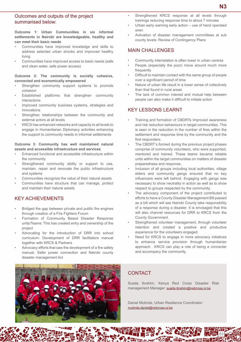
53
outcomes and outputs of the project summarised below:
Outcome 1: Urban Communities in six informal settlements in Nairobi are knowledgeable, healthy and can meet their basic needs• Communities have improved knowledge and skills to
address selected urban shocks and improved healthy living
• Communities have improved access to basic needs (safe andcleanwater,safepoweraccess)
Outcome 2: The community is socially cohesive, connected and economically empowered• Strengthen community support systems to promote
cohesion• established platforms that strengthen community
interactions• Improved community business systems, strategies and
innovations• Strengthen relationships between the community and
external actors at all levels• KRCS has enhanced networks and capacity to all levels to
engage in Humanitarian diplomacy activities enhancing the support to community needs in informal settlements
Outcome 3: Community has well maintained natural assets and accessible infrastructure and services• enhanced functional and accessible infrastructure within
the community• Strengthened community ability or support to use,
maintain, repair and renovate the public infrastructureand systems
• Communities recognize the value of their natural assets• Communities have structure that can manage, protect
and maintain their natural assets
KEYACHIEVEMENTS
• Bridgedthegapbetweenprivateandpublicfireenginesthrough creation of a Fire Fighters Forum
• Formation of Community Based Disaster Responseunits/teams: this has created entry and ownership of the project
• Advocating for the introduction of dRR into school curriculum: development of dRR facilitators manual togetherwithKRCS&Partners
• Advocacyeffortsthatsawthedevelopmentofafiresafetymanual, Safer power connection and Nairobi countydisaster management Act
• Strengthened KRCS response at all levels through trainings reducing response time to about 7 minutes
• Urban early warning early action – use of hand operated siren
• Activation of disaster management committees at sub county levels: Review of Contingency Plans
MAin CHALLenGeS
• Community interrelation is often lower in urban centres• People (especially the poor) move around much more
frequently• Difficulttomaintaincontactwiththesamegroupofpeople
overasignificantperiodoftime• nature of urban life result in a lower sense of collectively
than that found in rural areas• the lack of common interest and mutual help between
peoplecanalsomakeitdifficulttoinitiateaction
KeY LeSSonS LeARnt
• TrainingandformationofCBDRTsImprovedawarenessand risk reduction behaviours in target communities. this isseeninthereductioninthenumberoffireswithinthesettlement and response time by the community and the firstresponders.
• TheCBDRT’sformedduringthepreviousprojectphasescompriseofcommunityvolunteers,whoweresupported,mentored and trained. these teams became reliable units within the target communities on matters of disaster preparedness and response.
• Inclusionofallgroupsincludinglocalauthorities,villageelders and community gangs ensured that no key influencerswere left behind.Engagingwith gangswasnecessary to show neutrality in action as well as to show respect to groups respected by the community.
• the advocacy component of the project contributed to effortstohaveaCountyDisasterManagementBillpassedas a bill which will see nairobi County take responsibility of a response during a disaster. it is envisaged that this will also channel resources for dRR to KRCS from the County Government.
• Strengthenedvolunteermanagement,throughvolunteerretention and created a positive and productive experience for the volunteers engaged.
• need for KRCS to engage in more advocacy initiatives to enhance service provision through humanitarian approach . KRCS can play a role of being a connecter and accompany the community.
ContACt
Suada Ibrahim, Kenya Red Cross Disaster Riskmanagement Manager: [email protected]
DanielMutinda,UrbanResilienceCoordinator:[email protected]
N3

54
Supporting urban rehabilitation for Syrian Refugees and Host Communities in Tripoli
Urban Centre: Tripoli,Lebanon,covering5neighbourhoodsofTripoli(AbouSamra,Mankoubin,Shalfeh,Shok,WadiNahle)Project Timeframe: 3 year programme, September 2015–August2018(YearI,II,II)
type of project: Neighbourhood Based Approach, shelter,WASH,protectionandcommunityparticipation
Project partners: CAREInternationalLebanon(CILProfile)andAkkarouna(NGOProfile)
Coordination framework: UnHCR Shelter working group
Agency submitting the case study: CAREInternationalUK,onbehalf of CiL
ConteXt
UN-Habitat estimates 72,211 refugees are in urban Tripoli, which is about a quarter of the city’s population living in high density neighbourhoods. tripoli is a highly vulnerable city in Lebanon, with residents exposed to poverty, poor living conditions, a lack of sufficient public services, and a built environment which poses threats to residents. tripoli is ill-equipped to house the increase in population. With a poor local economy(over57%offamiliesliveinpoverty),andalackofadequatesanitationandhousinginitspoorneighbourhoods,Tripoli’slivingconditionsposesignificantproblemsforSyrianrefugees and host communities alike.
two main problems face the communities with few livelihood opportunities; refugees can only afford sub-standard housing: a Caritas study showed averaged rents in Tripoli were 92% of average earnings of a refugee adult. Many Syrian families are falling into arrears on rent and property owners cannot afford to invest in maintaining dwellings to an adequate livingstandard.Secondly,protection concerns, particularly for women and children are rising from multiple sources. CARE’s M&E research found that up to 76% of Syrian refugees in the neighbourhoods where CARE operates lack valid residence permits,andmostareunawareand/or afraid to obtain civil status documents meaning that marriages,births,etc.areinirregularstatus.Allthisincreasestheir vulnerability for abuse and exploitation, especially forwomen.
CARE International Lebanon (CIL) with its local partner Akkarouna, focus their work in these vulnerable areas in urban Tripoli, as identified in coordinationwith theShelterWorkingGroup,peeragencies,anditsinternalassessments.TheprogrammeisfundedbyBPRM.
PROJECTOVERVIEW
InPhases I and II ofBPRM funding,CARE developed its urban, community-based approach to improve the living conditions of refugees and host communities with a focus on shelter and WASH. Phase I & II has generated learning on best practices in urban settings, including a set ofstandard operating procedures (SOPs) for neighbourhood approaches, as well as management and implementationtools for technical and socio-economic assessments. Phase III includes a greater focus on neighbourhood committees as a vehicle for community participation and linkages to social services based on beneficiary requests for a more activecommunity role.CARE’s rehabilitation approach concentrates on specificvulnerable neighbourhoods in inner Tripoli. the rehabilitation programme targets Syrian refugees and Lebanese host communities, bringing a focus on whole streets and specific buildings as well as individual household support, to serve Syrian and host communities alikewithconflict-sensitiveand “donoharm”methods.Theshelter project targets dwellings and apartments whose conditions pose environmental or protection risks to their inhabitant including leakingroofs, lackofwindowsordoors,inadequate WASH facilities, and access to electricity andhot water. the selection of housing unit is done using a well- developed technical assessment and beneficiary selectiontool to determine socio-economic and shelter condition. In buildings, upgrades to individual units will be based onvulnerabilitycriteriaforSyrianrefugeesandhostcommunities,andupgradestothecommonareaswhichbenefitallresidents.
Community engagement and capacity building is provided by working with community committees and through information outreach and door to door peer to peer trainings on topics such as early marriage, GBV, tenants’rights,andconflict resolution.Thecommitteesare linked tothe local authorities to build a more sustainable relationship and dialogue to improve local governance and development in the longer term.
N4

55
PRoJeCt PHASinG
Theprojectwasrolledoutin6steps,eachyeartheprocessisrepeated and improved. the steps are as follows:
PRoJeCt oUtPUtS
• Eachyear,500 rehabilitated Housing Units in Tripoli are finalised, 15 buildings have improved access orcirculation,and5communitylevelupgradinginterventionsare completed.
• 20 community committees will have been developed over the 3 year period, theywill have benefited fromnumerous capacity building and protection trainings and a series of educational theatre will have taken place within the communities.
• Initial Rapid Assessment of Urban tripoli’s vulnerable neighbourhoods available here : link
• Forthcoming: Lessons learnt and recommendations for sustainable urban interventions
KEYACHIEVEMENTS
this approach accomplishes a number of transformative effects by creating:• Needs and capacities within each neighbourhood
are highlighted and engaged through the assessment process, the establishment of community committeesand the action planning at neighbourhood level.
• A critical mass of rehabilitation is achieved, so thatthe general neighbourhood conditions are improved including a significant number of housing units, raisingthe standards of the housing stock in these tripolitan neighbourhoods.
• the security of tenure is improved for some of the most vulnerable households in the neighbourhoods and landlords benefit from improved services on theirproperty.
• A shared interest and social cohesion among residents is built upon through a shared vision for a safer built environment through improved relationships via the neighbourhood committees between residents andcommunitystakeholders(municipalofficials,religiousleaders,etc.);and
• Greater awareness and concern for protection of residents, including women and children are developed across the community and mitigating measures are identifiedand implementedatmultiplescales (fromstreetscape,toapartmentstoGBVawarenesstraining)to improve these risks.
SteP 1Scoping study of the urban neighbourhoods in tripoli in February 2015: Involvingdelineatingboundaries,meetingslocalauthorities,stakeholders,community.Neighbourhoodswere selected based on needs, access, and% of refugeinflux into the area, and condition of accommodation andserviceprovision,allincoordinationwiththeshelterworkinggroup.
SteP 2neighbourhood-based assessments: After individual neighbourhoods were selected a baseline blanket assessment was carried out of nearly 3000 housing units looking at shelter conditions, socio-economic vulnerability,and housing and community level protection issues. Simultaneously buildings are also assessed for communal space upgrades.
SteP 3Selection of rehabilitation works: the baseline is analysed andtheresultsareweightedtoallowaprecisebeneficiaryselection based on shelter and WASH needs and vulnerability. Separate housing units are selected for rehabilitation and where relevant the apartment buildings themselves are selected for upgrade work focusing on improving safety and reducing protection issues, especially linked to poorly litentrances and dilapidated stairwells.
SteP 4Community level planning: Community committees are set up including existing community and women’s groups. Committees undertake action planning in the community focusing on protection and environmental issues and receive protection training. through consultation with the wider community, community level interventions are identifiedsuchasimprovedaccess,improveddrainageorlightingatstreet level.
SteP 5implementation: detailed bills of quantities are developed and three different contractors are selected from the area to workontheHU’sinbatches,ideallywithexperienceinthespecificneighbourhoods.Theyarealsorequiredtohirelocallabour to ensure there is capacity building and livelihood opportunitiesinthearea.MOU’saresignedwiththelandlord,beneficiariesandCARE’slocalpartnerAkkarouna.
SteP 6Community protection outreach and training: As part of the urban programme field officers and protection staff workwith the landlord on contracts with their tenants to ensure they agree not to evict the families living in the units to be upgraded. the committees work with the local partner and social mobilisers from the ministry of social affairs to develop local protection capacity and to carry out community outreach and peer to peer trainings on protection issues.
N4

56
ContACt
Formoreinformation,contact:[email protected]
KeY LeSSonS LeARnt
• Adapt specific SOPS and Minimum standards to the specifichousingneedsandoperationalcontext.
• Engagement of local and international actors to ensure good coordination and coverage of vulnerable neighbourhoods.
• Use of neighbourhood committees to develop action planning skills, to raise awareness about protectionissues and to understand conflict resolution linked tothe implementation of housing and neighbourhood rehabilitation.
• Working with local partners allows engagement of both humanitarian and development actors to ensure short and long term view points as well as local knowledge and connections with communities and authorities.
• An integrated approach of shelter, WASH and protection allows a more comprehensive project which can improvemultipleaspectsof thebeneficiaries livingconditions.
MAin CHALLenGeS And SHoRt CoMinGS
• Shelter standards: the shelter standards for rehabilitation developed at the national level were not applicable to the context of inner tripoli. the existing housingwassofarbelowminimumstandardsthatspecificminimum standards were needed to be cost effective.
• Security of tenure: the landlords in the host communities are often as socioeconomically vulnerable as the refugees, they are dependent on the rent theyreceive and therefore cannot reduce or freeze rents as a conditionofbenefittingfromtheupgrades.
• Local capacities and resources: Local partners and local staff have strong capacity in development projects butlesssoinhumanitarianprojects,whichinvolvehighlytechnical projects at scale with tight M&E and qualitycontrol requirements. Additionally the local authorities have little capacity to engage with the project and ensure longevity and sustainability.
• Geographical coverage/ scale: the project will rehabilitate 1500 Housing units by the end of 2018 and build the capacity of 20 local committees. this will make
N4

57
Lebanon Refugee Crisis response
Urban Centre: Lebanon
Project timeframe: 2015 - 2016
type of project: Settlements-based approach to disaster responseProject partners: ACted
Coordination framework: Cluster system; direct meetings with governmentofficials;neighbourhoodfocalpoints
Agency submitting the case study: ACted
ConteXtLebanon suffered from structural inefficiencies even priorto the Syrian conflict. An estimated 87.7% of Lebanon’spopulation in 2015 was urban, and there was a significantheterogeneitybe-tweenrural,urbanandperi-urbanareasinterms of institutional service delivery and governance within the country.Thiswas further exacerbated by the conflict inLebanon and the political fractionalization that brought the country to a standstill.
TheinfluxofSyrianrefugeesintosuchacontextdramaticallydeteriorated the living conditions for both refugees and host populations alike. the crisis increased population density in Lebanonfrom400to520personsperkm2,especiallyinurbanareas,leadingtourbancongestion,competitionoverhousing,increasing pressures on existing resources and tensions between host populations and refugees. this situation was particularly constrained in Beirut and Mount Lebanon, withonly a limited number of informal settlements in the area. Most refugees inBeirut andMount Lebanon (92%) residedinrentedapartmentsorhouses,although thecomparativelyhigh cost of living meant that many refugee families were only able to afford sub-standard or overcrowded accommodation. An assessment by the organization in the target areas showedthat23%ofhouseholdsinBeirutand59%inMountLebanon lacked basic facilities and were in need of urgent rehabilitations.
PROJECTAPPROACH/OVERVIEW
the objective of this project was to provide immediate community-driven WASH and Shelter support to the most vulnerable Syrian populations and their host communities in BeirutandMountLebanon.the organization used a holistic neighbourhood approach across delineated zones in dense urban areas. Shelter rehabilitations and upgrades were provided to 207 and 499 households respectively, along with improvements to waterand sanitation facilities. Campaigns on hygiene promotion andhousing, landandproperty rightswerealsoconducted.Community-wide projects were implemented to improve service delivery such as water and solid waste management.
Three key phases:• August 2015: neighbourhood-level social and shelter
mapping, establishment of focal point networks andcommittees,andcapacitybuilding
• November 2015: Beneficiary-led voucher-basedemergency shelter and WASH upgrades to sub-standard shelters completed
• March 2016: Rehabilitation of occupied shelters units completed
in order to support vulnerable populations without formal rental contracts, landlordsandtenantswereaskedtosignaleaseagreement in order to participate in the project. the organiza- tion also provided sessions on hygiene promotion and legal adviceonHousing,LandandProperty(HLP)issuesthroughthis intervention. this included training for local committee members as well as campaigns in targeted neighbourhoods. Participants of these campaigns received information on how toobtaina leaseagreement,obligationsofeachparty,howto avoid legal trouble; including advice on handing over of the rentedpremises,guaranteeingagainsthiddendefectsuponmove-out and against eviction following end of lease, andadvice on conducting major repairs and maintenance to avoid unexpected costs upon lease termination.
Coordinationin addition to conducting coordination through the local sector working group meetings in Beirut, the organizationliaised with local nGos conducting other shelter projects by sharing ben- eficiary lists to avoid overlaps, as well as byreferring cases between agencies to avoid gaps in coverage. the organization also liaised with nGos conducting other protection and WASH projects in the target area to share ideas on the NeighbourhoodApproach used, and in somecases, other INGOs attended the organization’s forums tolearn more about this approach.
N5

58
PRoJeCt oUtPUtS
• 706 households (3,751 individuals) assisted withshelter repairs (499 shelter upgrades and 207 shelter rehabilitations)(IncludingLebaneseandSyrianfamilies,with a minority of Palestinian and other minorities)
• 2,745 households attended hygiene promotion sessions (Lebanese,SyrianandPalestinianhouseholds)
• 35,700individualsattendedHLP awareness sessions• 25 focal points and committee members trained• establishment of a roster of 14 skilled workers• 1,222‘man-days’ofconstructionactivities.•KEYACHIEVEMENTS
• enhanced local technical skills and sense of ownership• Raised awareness about HLP rights and obligations
and improved landlord-tenant relationships• Served as a platform for information sharing between
community members and municipalities• the Neighbourhood Approach used to implement
this project relied on beneficiary involvement in the development and delivery of all activities,atboththecommunity and household levels. Following the mapping oflocalstakeholdersandidentificationofrepresentativecommunitystakeholders,consultationswereheldtoreviewproposed selection criteria for household level assistance and identify key challenges of target communities to be addressed through small-scale emergency projects. Following consultations, stakeholders committed toimproving their neighbourhood and able to act as focal pointsoftheircommunitywereidentified.
• At the community level the project provided a catalyst for change, combined with continued communityengagement and capacity building trainings to highlight needssuchasHLP,protection,hygienepromotion,conflictresolution, participatory planningand community-basedsolutions. the project helped to identify engagement opportunities for better responses in the future. For example, the committee in one of the neighbourhoodswas able to solve a 10-year problem related to solid waste management by relying on the initiative of the community and planning opportunities that were generated during this project.
• HLP considerations and significant improvement in tenant- landlord relationships, since both partiesbecame more aware of their rights and responsibilities.
MAin CHALLenGeS And SHoRtCoMinGS
Security issues in accessing certain areas: Such risks imposed restrictions on the selections of beneficiarycommunities. the rapidly evolving security context in Lebanon required the organization to increase engagement with neighbourhood focal points and local municipalities. daily monitoring of shelter activities also contributed to stronger relationships with benefi- ciaries. However, in many othervulnerable areas where other INGOs faced difficulties forgainingaccessduetosocio-politicalissues,theorganizationwas able to successfully implement the project through its engagement with local authorities.
Land ownership issues and insecure tenure agreements: Some of the targeted households had no proof of ownership. GiventhecomplexcontextinLebanon,thiswasawidespreadissue. Close collaboration with the Municipality was needed for verificationsofownership.Additionally,veryoftenonlyverbalagreements existed between landlord and tenants, withoutany rental contract. this was tackled through prolonged negotiations between both parties to clarify the terms of the housing arrangement and to sign a lease agreement.
The organization could not identify sufficient empty shelters in the target communities to be rehabilitated,andforthesmallnumberidentifiedlandlordsrefusedtosignrental agreements binding them to keep the shelters empty until potentialevictionsoccurred.Givensuchacontext, theorganizationmodified itsstrategy,andcapacitated the focalpoints to rapidly respond to evictions by providing housing to beneficiaries in alternative houses within the sameneighbourhood,aswellasconductingemergencyreferralstootheragenciesworkingintheareas,untilamorepermanenthousingsolutioncouldbeidentified.
KeY LeSSonS LeARnt
Stimulating local livelihoods.Thebeneficiary-ledapproachwas largely successful in stimulating the local economy and empowering beneficiaries in implementing their ownrehabilitations.Thefinalassessmentfoundthatthetargetof490man-days of labourwas greatly surpassed,with 1,222man- days created through these works.
The organization was aware that not all target households would have sufficient technical skills. the organization wasawarethatnotalltargethouseholdswouldhavesufficienttechnical skills to conduct such upgrades.As a result, theteamidentifiedskilledworkersfromtheneighbourhoods,andhouseholds were able to utilize these workers to complete theirupgrades.Inaddition,30%ofbeneficiarieswerefoundto have conducted further home improvements at their own expense.
Maintaining community ties and livelihoods. one of the key learnings from previous programming was that geographicallyspread-outshelterworks,especiallyforemptyshelters, created a problem for evicted beneficiaries byforcing them to move to a new neighbourhood and severing ties with their communities and threatening their livelihoods. The neighbourhood approach was specifically designed toovercome this.
N5

59
“El Hay”: integrated multi-scale intervention for the vulnerable population of Tripoli, Lebanon
Urban Centre:Neighbourhood ofQobbe,Tripoli, Lebanon – inparticulartheareasofChaarani,Rahbet,OldQobbe.
Project timeframe: november 2016 – January 2018 (13 months) – for the component of the program funded by the Lebanon Humanitarian Fund (LHF)
type of project: neighbourhood approach transitioning from emergency to development including mainly the following sectors: Shelter,WaSH,Energy,SocialCohesion
Project partners: SoLidARitÉS inteRnAtionAL (Si)
Coordination framework:MunicipalityofTripoli,UN-Habitat
Agency submitting the case study: SoLidARitÉS inteRnAtionAL (Si)
ConteXt
the Syrian crisis which started in 2011 has led to the displacement of over 5 million refugees.1 over 1 million2fledtoLebanon,aneighbouringcountrywithalongcommonhistorywithSyria.Theprotractedconflict inSyriahas forced thesefamilies to remain in Lebanon longer than they initially hoped.
in a heavy historical context (linked in particular to the common troubled history of Lebanon and Syria as well as thesettlementofPalestinianrefugees,creationofcampsandcivilwar),thisprotractedcrisishasfacedmultiplechallengesfromhighhumanitarianneeds to intensificationof structuraldifficulties.Thishas,inparticular,steered83%oftherefugeepopulation to settle outside of informal settlements, veryoften in urban settings and in particular in highly dense and vulnerable neighbourhoods.
Tripoli,thesecondbiggestcityofthecountry,hasbeenchosenby many refugees as it offers a cheap rental housing stock that they could afford: sub-standard buildings often located in thepoorneighbourhoodspreviouslyaffectedbywar(conflictbetween Tabbaneh & Jabal Mohsein in particular). There,the needs are numerous and affect both host and refugee communities: deficient WaSH infrastructure, damagedbuildings,structuralunemployment,drugabuseandtensionsleading to insecurity.
PROJECTAPPROACH/OVERVIEW
After a few years of implementation of emergency shelter rehabilitation resulted in build a strong knowledge of urban dynamics, SI started to develop a larger multi-sectorialapproach. the vision of the programme was that the structural
needs mentioned above could only be tackled through a multi-year,multi-scaleapproachinvolvingthelocalauthoritiesand
the communities (as well as local partners).To reach this objective, a transition was necessary: from 1nGo/1 main sector to a coordinated approach.
the project funded by the Lebanon Humanitarian Fund (LHF) managed by oCHA over a one year period offered the possibility to:• Continue covering the most pressing needs with
emergency intervention (in particular shelter rehabilitation),
• enlarge the scope of intervention to other sectors (Social cohesion,Energy,WaSH–SolidWastemanagement),
• Build a stronger relation with the community and inparticular build trust through the realisation of visible activitiesina“short”timeframe,
• Build the way forward through the collaboration withUN- Habitat in their profiling exercise to identify moreprecisely the structural needs that would require longer term intervention.
1 From“101facts&figuresontheSyrianRefugeeCrisis”,NasserYassin,AUB,March20182EstimationofUNHCR-registeredrefugeesincountryin2017,thefigureof1.5millioniscommonlyusedtoincludethenon-registeredrefugees.
N6

60
PRoJeCt PHASinG
This LHF project (in yellow in the graph below), made itpossible to implement activities in a phased manner.
PRoJeCt oUtPUtS
At the end of the project the following outputs were achieved:• 203 housing unitsrehabilitatedensuringprivacy,access
tobasicservices(water,sanitationandelectricity),safetyandweatherproofing.All 203householdsalso receivedhygiene promotion sessions;
• 30 buildings hosting 135 households have seen their common areas upgraded (safe staircases, improvedaccessibilityandroofweatherproofing...);
• 3 public spaces were rehabilitated: including, inparticular,thecreationofasmallbasketballfield;
• Realisation of 4 murals in the community;• 5 access points were enhanced: asphalting of road,
restoration of stairs and pathways eased access in the area.
• 75 streetlights were upgraded: replacement of HPS bulbsbyLEDlight,additionofsolarpanelsorbatteriestocover for black-outs at night;
• Installation of over 50 bins & dumpsters in thecommunity to facilitate waste collection;
• 4 events to raise awareness on improved solid-waste management:promotionofrecycling,reductionofwasteproduction and better hygiene practices.
After the end of the project the following behaviours have been noted:• Self-organisation of mini “cleaning campaigns” by
residents in connectionwith the firm in charge of solidwaste collection in the area;
• Maintenance of public spaces.
SteP 1Identification and selection of sub-neighborhoods ofintervention.
SteP 2Initial community engagement and identification of focalpoints.
SteP 3ParticipationtotheprofilingexercisewithUN-Habitat.
SteP 4Utilisation of the data to pre-select sites for intervention.
SteP 5Modificationoftheforeseenprocurementprocess.
SteP 6implementation of activities at household level and building level
SteP 7implementation of activities at neighborhood level: public space,streetlighting
the main project phases were
Map of intervention in the area
N6

61
KEYACHIEVEMENTS
• Implementation of activities in the neighbourhood while the profiling exercise was being conducted: this helped manage tensions and expectations in the community.
• Strong coordination with the profiling exercise: Si team members participated in the data collection required for UN-Habitat’s profiling which contributedto build internal trust and understanding of the data collected. this facilitated the use of the data directly in the project implementation: the pre-selection of buildings andidentificationofdarkareaswithinSIproject(requiringstreetlights)werebasedonUN-Habitatprofilingfindings.
• Selection of 3 sub-neighbourhoods (instead of 1): the neighbourhood identified was actually composedof multiple sub-neighbourhoods with sometimes very different urban patterns (from one that was part of the old city with narrow stairs to one more structured with large avenues) and different community dynamics. 3 of them were selected which allowed to adapt activities depending on needs but also to still be able to implement activities if some tensions were appearing in another neighbourhood.
• Public spaces are keys to restore social cohesion, dignity and pride of the inhabitants. At the end of the project,themainhighlightsmentionedbyinhabitantsarethe public spaces created, mentioning that they haveattracted residents from outside the area.
• Use of noble materials:forthepublicspaces,arabesquetiles were used. they were the symbol of a cultural identity aswellasasignof“wealth”thatwasveryappreciatedbyresidents.
• Objectives were reached thanks to the conjunction of activities of different sectors. For example: additional dumpsters combined with hygiene sessions and renovated public spaces that the residents would want to maintain (arabesque tiles) ensured that these public spaces would be maintained clean by the residents.
MAin CHALLenGeS
• Lack of public space: the initial hope was to create large public spaces. However the public land in the selected area was finally very reduced which is oftenthe case in the region. this led to re-formulate the public space intervention around main circulations: in areas wherepublicspacesareinexistent,thestreets(andthestairs in this case) are the placeswhere peoplemeet,exchange and live together.
• Committees: Tomaintainitsgovernanceoveritsterritory,the government of Lebanon refuses to include Syrian refugees in assemblies that would have a decision-making capacity. it was consequently complicated to create committees that would represent the full population of the area. it was therefore decided to work through a network of focal points of all nationalities present and who would be consulted at required times to ensure that the intervention would respect the will of all groups in the community.
• Revision of procurement strategy: Si predominantly worked with a pool of small contractors. these contractors were unfortunately not accepted in the area and residents required that the people from the area would be hired. Whilemaintainingitscompetitiveprocessofselection,SIfinallyshifteditsapproachtolargercontractorstowhomsome quota of recruitment from the area were imposed.
LeSSonS LeARnt
• Neighbourhood borders are not well defined in Lebanon and trying to define them might create tensions: at the beginning of the project, a phaseof delineation of the area to target was launched,implicating field assessment, contact with localleaders. Recommendation were not to try to identify “neighbourhoods” per say, as the boundaries wereactuallyblurry,andtheywereafraid thatbuildinguponthese “artificial borders” could create tensions in thefuture. the recommendation was to select an area even if itdidn’tmatchexactlytoaspecificartificialneighbourhoodidentity.
• Time required for neighbourhood selection: this initial work generally takes longer than expected but is key to start building necessary relationships for the good development of activities later on.
• Mapping of authorities: A good mapping of the different relationships between the different levels of local authorities (ministry, municipality...) would have savedtime in execution with some time lost in validation process for intervention.
ContACt
Formoreinformation,contact:LoraVicariot,ShelterAdvisorSI, lvicariot@solidarités.org
N6

62
Legalisation of Urban Settlements in Colombia
ConteXt
Prolonged forced displacement is one of the major negative effectsof thearmedconflict inColombiaon thepopulation,exposing the displaced populations to precarious and marginalized living conditions. UnHCR has been working in ColombiatosupportpeopleaffectedbyconflictandisworkinginothercountriesintheregionsuchasEcuador,Venezuela,andBrazil.
Addingtothenationalpopulationmovements,therehasbeenan influx of Venezuelan families and Colombian returneessince 2016. As of February 2017 and according to officialfigures, there are 7,333,133 displaced persons (IDPs) inColombia.50%ofthemhavefledto30citiesinthecountry,mainly in areas that consist of informal urban settlements where there are high rates of vulnerability related to security conditions,aswellasdifficultiesincomprehensiveaccesstothe restorationof their rights. Ifno interventions takeplace,the proportion of households in precarious conditions by 2020willbe17%(CONPES091,2015).Forthisreason,localintegration continues to be a huge challenge in guaranteeing the rights for displaced persons.
PROJECTOVERVIEW
UnHCR has been promoting a comprehensive vision of solutions for the displaced population by strengthening its national strategy in urban areas and by responding to (i) high concentrationsofdisplacedpopulations,(ii)limitedwillingnessto return, (iii) the rural emphasis on the implementation ofthe Peace Accord and (iv) the persistence of a long-term displacement situation.this comprehensive solutions policy includes the legalization of settlements with high concentrations of displaced population and the promotion of institutional presence in these areas,with the aim of reducing the risks faced by idPs and host communities.
It also takes into account, that one of the most commonelements of these settlements (although not in the case of Cúcuta) is the strong presence of armed groups that control the subdivision and sale of land, housing, and provision ofpublic services among others.
UnHCR’s national Strategy has three objectives:1. to promote the development of a public policy that
achieves the comprehensive management of urban settlements as an integral part of solutions for displaced population. this vision includes legalization as an open door to guarantee rights.
2. to advance the methodology of legalization in urban settlements prioritized with high concentrations of displaced populations in coordination with competent entities.
3. to consolidate strategic alliances with relevant institutions, development actors and academia, as partof the strategy to transfer legalization processes and ensure responsible disengagement.
UNHCR’s Intervention in 2017 is based on four components:the process to advance in legalization was established by a national decree (1077 of 2015). this framework sets out 4 legal components in which UnHCR´s interventions are adjusted according to the conditions of each settlement and the possibility of generating alliances.UnHCR has established a basic route of intervention that takes into account the 4 components defined in the legalframework and a transverse approach of protection that ensures the ongoing analysis of the risks and the security conditionsof thesettlements;aswellasthe identificationoflessonslearnedinordertoinfluencepublicpolicyinsolutions.InthecaseofCúcuta,themunicipalplanningoffice,togetherwithUNHCRandGIZ,gatheredadditional basichouseholdinformationtocreatea“socialprofiledocument”tosupportthelegalization process.
Urban Centre: Urban Settlements in Colombia
Project timeframe: 2016 - 2018
type of project: informal urban settlements legalization approach
Project partners:UNHCR,UNDP,inter-/nationalorganisations(GIZ,FundaciónTechoMioHabitatDignoandothersdependingon the implementation cases) and landowners
Coordination framework: Government Led Agency submitting the case study: UnHCR
Aqueducts and sewage works in the Manuela Beltránneighbourhood (after legalization).
N7
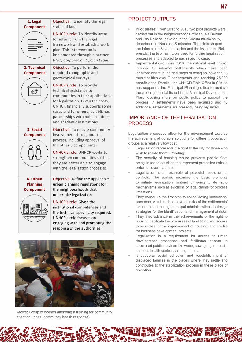
63
PRoJeCt oUtPUtS
• Pilot phase: From 2013 to 2015 two pilot projects were carriedoutintheneighbourhoodsofManuelaBeltránandLasDelicias,situatedintheCúcutamunicipality,department of norte de Santander. the pilots shaped theInformedeSistematizaciónandtheManualdeRef-erencia,thetwomaintoolsusedforfurtherlegalisationprocessesandadaptedtoeachspecificcase.
• Implementation: From2016, the national level projectincluded 30 informal settlements which have been legalizedorareinthefinalstepsofbeingso,covering13municipalities over 7 departments and reaching 25’000 beneficiaries.Parallel,theUNHCRFieldOfficeinCúcutahassupported theMunicipalPlanningoffice toachievethe global goal established in the Municipal development Plan, focusing more on public policy to support theprocess: 7 settlements have been legalized and 18 additional settlements are presently being legalized.
iMPoRtAnCe oF tHe LeGALiSAtion PRoCeSS
Legalization processes allow for the advancement towards the achievement of durable solutions for different population groups at a relatively low cost.• Legalization represents the right to the city for those who
wishtoresidethere–“rooting”.• the security of housing tenure prevents people from
being linked to activities that represent protection risks in order to cover that need.
• Legalization is an example of peaceful resolution of conflicts. The parties reconcile the basic elementsto initiate legalization, instead of going to de factomechanisms such as evictions or legal claims for process limitations.
• Theyconstitutethefirststeptoconsolidatinginstitutionalpresence,whichreducesoverallrisksofthesettlements’inhabitants,enablingmunicipaladministrationstodesignstrategiesfortheidentificationandmanagementofrisks.
• they also advance in the achievements of the right to housing,facilitatetheprocessesoflandtitlingandaccesstosubsidiesfortheimprovementofhousing,andcreditsfor business development projects.
• Legalization is a requirement for access to urban development processes and facilitates access to structuredpublicserviceslikewater,sewage,gas,roads,schools,healthcentres,amongothers.
• it supports social cohesion and reestablishment of displaced families in the places where they settle and contributes to the stabilization process in these place of reception.
Above: Group of women attending a training for community attention unites (community health response).
1.LegalComponent
Objective:Toidentifythelegalstatusofland.
UNHCR'srole:Toidentifyareasforadvancinginthelegalframeworkandestablishaworkplan.ThisinterventionisimplementedthroughapartnerNGO,CorporaciónOpciónLegal.
2.TechnicalComponent
Objective:Toperformtherequiredtopographicandgeotechnicalsurveys.
UNHCR'srole:Toprovidetechnicalassistancetocommunitiesintheirapplicationsforlegalization.Giventhecosts,UNHCRfinanciallysupportssomecasesandforothers,establishespartnershipswithpublicentitiesandacademicinstitutions.
3.SocialComponent
Objective:Toensurecommunityinvolvementthroughouttheprocess,includingapprovaloftheother3components.
UNHCR'srole:UNHCRworkstostrengthencommunitiessothattheyarebetterabletoengagewiththelegalizationprocesses.
4.UrbanPlanning
Component
Objective:Definetheapplicableurbanplanningregulationsfortheneighbourhoodsthatundertakelegalization.
UNHCR'srole:Giventheinstitutionalcompetencesandthetechnicalspecificityrequired,UNHCR'srolefocusesonengagingwithandpromotingtheresponseoftheauthorities.
N7

64
KEYACHIEVEMENTS–inManuelaBeltranandLas delicias:
• Individual titles issuance: In both neighbourhoods,approximately700titles,outofwhich300toIDPs.
• Proportion of households with access to public services: almost100%inManuelaBeltránand70%inLasDelicias(municipality is presently working on aqueducts in Las delicias).
• Community infrastructure: UnHCR supported the construction of a sports centre and a community centre inLasDelicias,andalibraryandacommunitycentreinManuelaBeltrán.Additionally,thecommunityinManuelaBeltránhasmanagedanewsportcentrewiththesupportof national and regional governments as a result of community empowerment from previous strengthening processes.
• Road infrastructure: the municipalities commenced a new project aiming to the complete the pavement in both neighbourhoods.
• Water and Sanitation: A governmental project is underway to improve WASH infrastructures within the houses of familiesinManuelaBeltrán.
KEYACHIEVEMENTS–overall national project • elaboration of a methodology for the settlement
legalization: A central tool was developed, carefullyelaborated and contextualised for the community. it is the roadmap which (i) allows the follow up and monitoring of the implementation progress, (ii) enablesparallel decisionmaking and (iii) facilitates information,discussions and – if needed – revision of the strategy by the stakeholders. implementing the methodology requires good prioritisation of action lines, strategic alliancesand working in networks of key institutional actors and strategic allies. this methodology is now a reference tool which is being used by other organizations.
• Housing, Land and Property: integrating land title issueswithintheframeofnationallawsandregulations,providing juridical advice and assistance to all involved actorsbytheauthorities(MinisterioPúblico),andcreatinganexchangeplatformforallinvolvedactors,tofacilitatetheir coordinated actions throughout the process (Comité de impulso). An important achievement for the cases ofManuelaBeltránandLasDelicias inCúcutawastheindividual titling of properties for the displaced population. Ofthenearly700titlesinprocessofdelivery,about300correspond to displaced families.
• Economic activities: the legalization and titling of landhasadirecteffectoneconomicdevelopment:First,families are more willing to invest in their houses with formal land titles knowing that they can stay there on the longterm;Second,familiescanimprovetheir livelihoodproductivitythankstoformalpublicservices,andalanddeed can facilitate access to credit to improve productive activities; Finally, strengthening productive units has inturnapositiveeffectonthequalityofthehouses,sincethe income can be used to improve the homes.
• Attention to the younger generations: typically 16-21 years old have a low school attendance rate and are more exposed to precarity. A component of the project supportsthemthroughflexiblemethodologies,combiningpsycho-socialsupport,helptodefinetheirownlifeprojectand helping return to school.
MAin CHALLenGeS
• Building anexus of Humanitarian and Development challenges: Simultaneously responding to urgent short-term necessities and forging longer term community identity, empowerment and consolidation. This is atransversal effort combining psycho social support,judicialadvice,formulationoflegalbases&toolsaswellasspatialplanningandtechnicalsupport,anditbecomeschallenging regarding the number of key actors involved.
• Achieve sustainability of the legalization processes: In the case of municipal government change, isimportant to ensure that the line of work in legalization of settlements remains incorporated in the following Municipal Development Plan, and that it has sufficientresources for its implementation.
• Facilitate increasing community participation in the processes of settlement legalization. UNHCR, togetherwiththemunicipalMayor’soffice,hasestablishedtrainingspaces for leaders on the legalization procedure, andtodayGIZhasjoinedthisinitiative.
KeY LeSSonS LeARnt
• Community empowerment is key to allow a self-sustaining and durable settlement process: Strengthening and supporting the community through the provision of juridical assistance and training on rights eligibilityandcommunityleadership,andsimultaneouslydeveloping legalisation and de-alienation processes.
• Livelihoods and economic activity should be promoted: implementing income generating strategies allows the creation and reinforcement of local productive units and the institutional articulation of public-private actors.
Above: Cultural activities with younger generations (Rumbos de Paz Project)
N7

65
KeY LeSSonS LeARnt
• Public spaces and assets have a key role in the making of a community. they materialise quality spaces for meeting, exchanging, training and free time activitiesand they strengthen the community’s organisational capacities,senseofownershipandidentity.Theirlocationmustthereforebeclearlystudiedanddefined,andtheirequipmentandmaintenancemustbeofficially inscribedin the municipal duties.
• A truly peaceful culture depends on its capacity to solve conflicts within the community. Considerable effortmust thusbemade to facilitateconflict resolutionprocesses, both selecting and reinforcing pre-existingcommunitymechanisms,butalsocompleting themwithpertinent institutional initiatives.
• A space for institutional coordination to manage progress in legalization processes is essential: a meeting pointforthecommunities,privateowners(incaseswherethey exist), and authorities (can act as a guarantor to
support process).• Identify and strengthen the elements leading to a
durable integration: in addition to all the immediate benefits provided by the settlement legalizationprocesses,itisimportanttoexplorefurtheropportunities,suchasthepossibilitiesforbeneficiariestobecomelandowners.
• Legalization is an integral process which cannot be reduced to the sole application of a norm and the activation of a legal procedure: it implies and closely depends on otherelements,suchascommunitystrengthening,localeconomic development, the construction of communityinfrastructures and institutional coordination.
ContACt
UnHCR Geneva: Miguel Urquia ([email protected]) UnHCR Colombia: [email protected]: www.unhcr.org / www.acnur.org
N7

66
BRACED program: Disaster Risk Reduction in Disadvantaged Urban Settlements. Portmore, Jamaica
ConteXt
Portmore,Jamaica,rankshighamongtheareasatgreatestrisk of disaster. Threats include flooding, earthquakes, anddestructivewind speeds. It is a highly populated area,withvulnerabilities including uncontrolled urban expansion leading leadstoinformalsettlements,lowqualityhousing,inadequateaccess to water and sanitation, and weak communitystructures.
PROJECTOVERVIEW
Habitat for Humanity Latin America and the Caribbean have beenimplementingadisasterriskreductionpilot-BRACED(BuildingResilienceAndCapacitiesForEmergingDisasters)inthemunicipalityofPortmore,Jamaica,since2015.Communities plagued by insecure land tenure tend to have poorhousing stock, poorphysical infrastructure, high crimerates and relatively high levels of illiteracy. this demotivates the community from making improvements which increases their vulnerability over time.Theprogramwasaimedatmitigatinghousing&settlementsrelated disaster risks (thus reducing vulnerabilities and increasing capacities) in some of the urban communities most prone to natural disasters by working both at community and household levels.the conventional approach of focusing only on physical infrastructure improvements and using outside technical professionalsandstaffalienatesthecommunity, ignoresthereal issues, and creates improvements that are short livedbecause they are not integrated or sustainable.
PRoJeCt APPRoACH
the project is based on an innovative and inclusive neighbourhood approach that included socio-economic and physicalquestions, theprojectusedparticipatoryprocessestoworkwithmembersfromthetargetcommunity,including:• PHASt (Participatory Hygiene and Sanitation
transformation).• A participatory design of project components.• And participatory implementation of project activities.• Participatory approaches permeated all aspects of the
project,including:• Community mapping.• Leadership roles in the project.• Using community members to create and vet all
publications.
PROJECTACHIEVEMENTS
the project worked at different levels:• Household level: safe and healthy housing.• Community level: reinforcing capacities of the capacity of
communitymembers through training,empowermentofgroups and advocacy activities.
• Settlement level: formalize the neighbourhoods (secure
landtenure),deliverurbanneighbourhoodredevelopmentplans and build/improve community infrastructure.
• Municipal level: through public-private partnerships.• national level: Advocating for changes in the process of
landregularization,makingitmoreaffordable(timeandcost).
PRoJeCt PHASinG
LeSSonS LeARnt
• Atthehouseholdlevel,theprojectisshowingthatsecuringland tenure increases families’ interest in investing in theirhousesbecausetheyfeelmoreconfidentaboutnotbeingevictedfromtheirplots,andbecausethelandisamarketable asset that can provide access to credit.
• At thecommunity level, the formalizationof communityland improves access to infrastructure investments, asthe government is now able to provide public services denied to informal settlements, such as water piping,electricity and drainage.
• the minds of the community members had to be transformed from thinking of their community as second rate and their conditions as marginal to envisioning their community as uplifted and their properties as valuable.
• Somecommunitymemberswereengagedintheproject,called ‘mapping and verification assistants’, creatingmaps of all the plots within the community and recording names of owners and tenants. this active involvement was very well received by the community.
• Capacitybuildingandparticipatory techniquesoutlined,increases the strength, stability and self-reliance ofhouseholds living in precarious settlements, ultimatelymaking them more resilient to disaster.
SteP 1 Participatory needs assessment and risk analysis: enu-meration(georeferencedsurveysdatacollection,PASSA(Participatory Approach for Safe Shelter Awareness). GiS analysis
SteP 2Awareness raising and construction of social capital,participatory design. Creation of local committees. Training on the project’s various components, creationof local committees, identification of micro-projects.Community-led creation of a neighbourhood map
SteP 3Participatoryimplementation.Demonstrationsofresilient,low-cost interventions such as housing reinforcements,dry toilets and garbage receptacles, community micro-projects,andthereinforcementofcollectiveandindividualcapacities. Formalization of community land and improved access to infrastructure investments.
N8
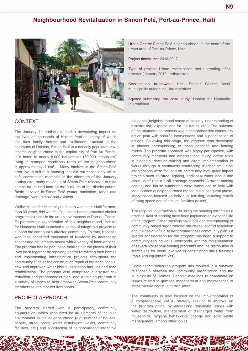
67
Neighbourhood Revitalization in Simon Pelé, Port-au-Prince, Haiti
ConteXt
the January 12 earthquake had a devastating impact on the lives of thousands of Haitian families, many of whichlost their family, homes and livelihoods. Located in thecommuneofDelmas,Simon-Peléisadenselypopulatedlow-income neighbourhood in the capital city of Port Au Prince. It is home to nearly 8,000 households (30,000 individuals)living in cramped conditions (area of the neighbourhood is approximately 1 km²). Many families in the Simon-Pelé area live in self-built housing that did not necessarily utilize safe construction methods. in the aftermath of the January earthquake,manyresidentsofSimon-Pelérelocatedtoninecamps on unused land on the outskirts of the district courts. Basic services in Simon-Pelé (water, sanitation, roads anddrainage) were almost non-existent.
Whilst Habitat for Humanity had been working in Haiti for more than30years,thiswasthefirsttimeithadapproachedshelterprogram solutions in the urban environment of Port-au-Prince. Topromote the revitalization of this neighbourhood,Habitatfor Humanity Haiti launched a series of integrated projects to supporttheearthquake-affectedcommunity.Todate,Habitat’swork has benefitted thousands of residents by addressingshelter and settlements needs with a variety of interventions. the program has helped these families put the pieces of their livesbacktogetherbyrepairingand/orretrofittingtheirhomesand implementing infrastructure projects throughout the communitysuchastheconstruction/repairofdrainagecanals,newandimprovedwaterkiosks,sanitationfacilitiesandroadrehabilitation. the program also comprised a disaster risk reductionandpreparednessplan,anda trainingprogram ina variety of trades to help empower Simon-Pele community members to attain better livelihoods.
PRoJeCt APPRoACH
the program started with a participatory community enumeration, which accounted for all elements of the builtenvironment in the neighbourhood (e.g. number of houses,people, street posts, water distribution kiosks, communityfacilities, etc.) and a collection of neighbourhood intangible
elements(neighbourhoodsenseofsecurity,understandingofdisasterrisk,expectations for the future,etc.).Theoutcomeof the enumeration process was a comprehensive community actionplanwith specific interventionsandaprioritizationofactions. Following this stage, the program was developedin phases corresponding to these priorities and funding cycles.Theprogramapproachwashighlyparticipative,withcommunity members and organizations taking active roles in planning, decision-making and direct implementation ofworks through a community contracting mechanism. initial interventions were focused on community-level quick impact projects suchas street lighting, additionalwater kiosksandclean-up of rain run-off drainage channels. A street-naming contest and house numbering were introduced to help with identificationofneighbourhoodareas.Inasubsequentphase,interventionsfocusedonindividualhousing,includingretrofitof living space and sanitation facilities (toilets).
Trainingsonconstructionskillsusingthehousingretrofitsasapracticalfieldoflearninghavebeenimplementedalongthelifeof the program. other trainings have included strengthening of community-basedorganizationalstructures,conflictresolutionand the design of a disaster preparedness community plan. of special consideration for the program has been a support to communityandindividuallivelihoods,withtheimplementationof several vocational training programs and the distribution of starter kits for those involved in construction skills trainings (tools and equipment kits).
Coordination within the program has resulted in a renewed relationship between the community organization and the Municipality of delmas. Periodic meetings to coordinate on issues related to garbage management and maintenance of infrastructure continue to take place.
the community is now focused on the implementation of a comprehensive WASH strategy seeking to improve on the program gains, by addressing remaining issues withwater distribution, management of discharged water fromhouseholds, hygiene behavioural change and solid wastemanagement,amongothertopics.
Urban Centre:SimonPeléneighbourhood,intheheartoftheurbanareaofPort-au-Prince,Haiti
Project timeframe: 2010-2017
type of project: Urban revitalization and upgrading after disaster (January 2010 earthquake)
Coordination framework: Haiti Shelter Cluster, localmunicipalityauthorities,lineministries.
Agency submitting the case study: Habitat for Humanity international
N9
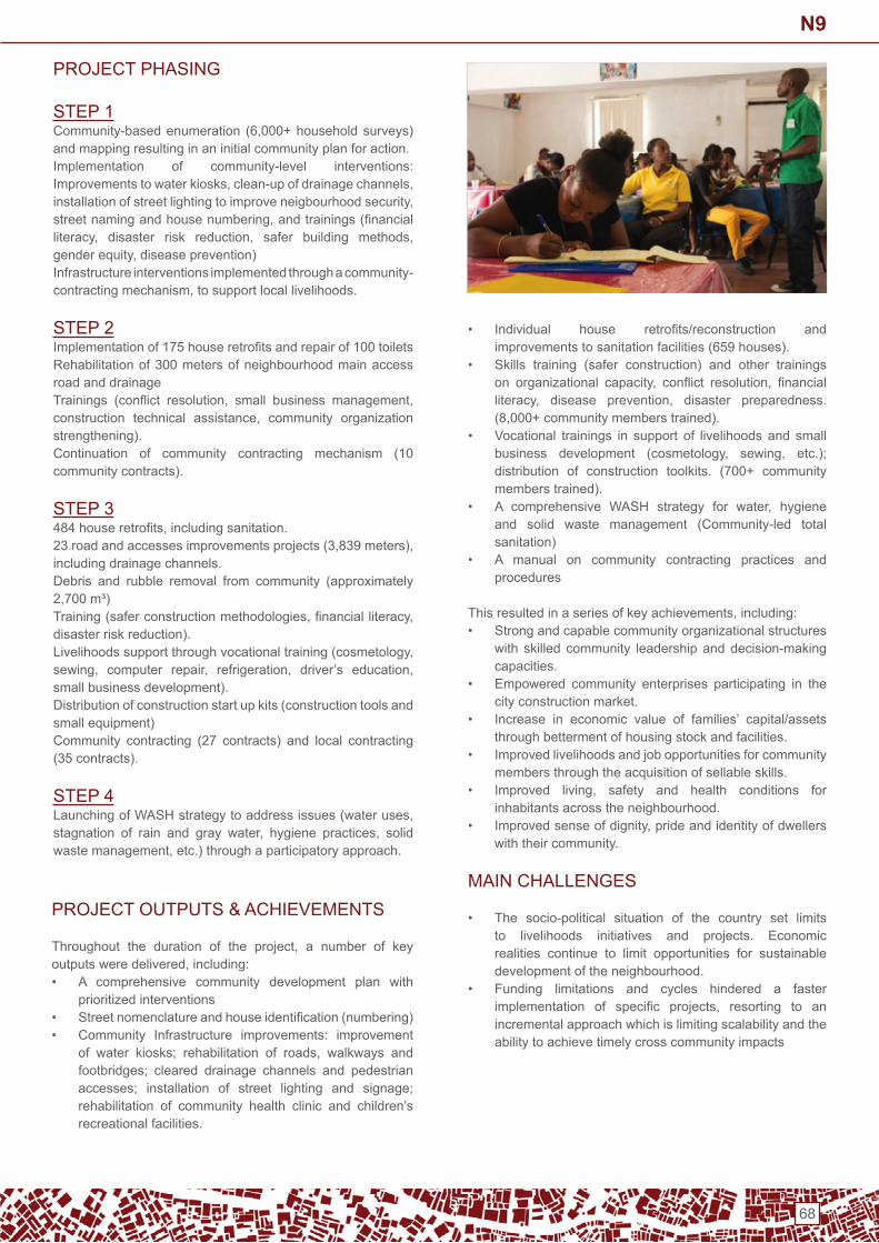
68
PRoJeCt PHASinG SteP 1Community-basedenumeration (6,000+householdsurveys)and mapping resulting in an initial community plan for action. implementation of community-level interventions: Improvementstowaterkiosks,clean-upofdrainagechannels,installationofstreetlightingtoimproveneigbourhoodsecurity,streetnamingandhousenumbering,andtrainings(financialliteracy, disaster risk reduction, safer building methods,genderequity,diseaseprevention)infrastructure interventions implemented through a community-contractingmechanism,tosupportlocallivelihoods.
SteP 2Implementationof175houseretrofitsandrepairof100toiletsRehabilitation of 300 meters of neighbourhood main access road and drainageTrainings (conflict resolution, small business management,construction technical assistance, community organizationstrengthening).Continuation of community contracting mechanism (10 community contracts).
SteP 3484houseretrofits,includingsanitation.23roadandaccessesimprovementsprojects(3,839meters),including drainage channels.debris and rubble removal from community (approximately 2,700m³)Training(saferconstructionmethodologies,financialliteracy,disaster risk reduction).Livelihoodssupportthroughvocationaltraining(cosmetology,sewing, computer repair, refrigeration, driver’s education,small business development).distribution of construction start up kits (construction tools and small equipment)Community contracting (27 contracts) and local contracting (35 contracts).
SteP 4LaunchingofWASHstrategytoaddressissues(wateruses,stagnation of rain and gray water, hygiene practices, solidwastemanagement,etc.)throughaparticipatoryapproach.
• Individual house retrofits/reconstruction andimprovements to sanitation facilities (659 houses).
• Skills training (safer construction) and other trainings on organizational capacity, conflict resolution, financialliteracy, disease prevention, disaster preparedness.(8,000+communitymemberstrained).
• Vocational trainings in support of livelihoods and smallbusiness development (cosmetology, sewing, etc.);distribution of construction toolkits. (700+ community members trained).
• A comprehensive WASH strategy for water, hygieneand solid waste management (Community-led total sanitation)
• A manual on community contracting practices and procedures
Thisresultedinaseriesofkeyachievements,including:• Strong and capable community organizational structures
with skilled community leadership and decision-making capacities.
• empowered community enterprises participating in the city construction market.
• increase in economic value of families’ capital/assets through betterment of housing stock and facilities.
• improved livelihoods and job opportunities for community members through the acquisition of sellable skills.
• Improved living, safety and health conditions forinhabitants across the neighbourhood.
• Improvedsenseofdignity,prideandidentityofdwellerswith their community.
MAin CHALLenGeS
• the socio-political situation of the country set limits to livelihoods initiatives and projects. economic realities continue to limit opportunities for sustainable development of the neighbourhood.
• Funding limitations and cycles hindered a faster implementation of specific projects, resorting to anincremental approach which is limiting scalability and the ability to achieve timely cross community impacts
PROJECTOUTPUTS&ACHIEVEMENTS
Throughout the duration of the project, a number of keyoutputsweredelivered,including:• A comprehensive community development plan with
prioritized interventions• Streetnomenclatureandhouseidentification(numbering)• Community infrastructure improvements: improvement
of water kiosks; rehabilitation of roads, walkways andfootbridges; cleared drainage channels and pedestrian accesses; installation of street lighting and signage; rehabilitation of community health clinic and children’s recreational facilities.
N9

69
KeY LeSSonS LeARnt
• Working with established urban communities takes time andprior investments,asconfidenceandtrustbetweenhumanitarian agency and community organizational structures need to be developed. neighbourhood revitalization is a long-term proposition.
• Highly participatory processes result in better outputs and outcomes,ascommunityembracesandtakesownershipof their own decision-making.
• Coordination with local authorities is key in order to validate and empower community and ensure sustainability of interventions that require maintenance and support from line ministries and municipalities.
• Systemic,sustainablechange involvesnot justphysicalinterventions in elements of the built environment, butalso support to income generation (livelihoods) and to the processofacommunityidentifyingitselfandfindingtheirplace in the city with an enhanced sense of dignity and inclusion
ContACt
Mario Flores, Director of Field Operations, Disaster RiskReductionandResponse,[email protected]
N9

70
Neighbourhood Approach to Urban Disaster in Ravine Pintade, Haiti
ConteXt
Inthewakeofthe2010earthquake,largenumbersofHaitianswere displaced due to severe damage to their homes. in one neighbourhood (Katye inCreole)knownasRavinePintade,ninetypercentoftheresidents,oraround2,000peopleweredisplaced. The 16-acre settlement, located in the heart ofPort-au-Prince,isbuiltonasteepslopethatsufferedseveredamage during the earthquake, and, when combined withthedamagetoroadsandlargeamountsofrubble,wasmadeinaccessible in the aftermath.
Evenbeforetheearthquakestruckhowever,RavinePintadefaced a host of problems. the location on a hillside increased vulnerability to floods and landslides, and poor planning,construction practices, and public infrastructure meant thatinternally displaced persons (idPs) would be vulnerable to future displacement in the event of other natural disasters. Many of the households did not have access to adequate water and sanitation infrastructure, and households spenta significant amount of money on bottled water. The areawas considereda “red zone,”with high levels of crimeandgang-related activity; there was very poor infrastructure for access for more vulnerable individuals including the elderly and disabled; and there were complex land title issues that complicated planning for reconstruction.
In order to quickly start neighbourhood reconstruction,minimizerelianceontheuseofcamps, jump-start recovery,and address other longer-term issues,Global Communitiesand PCI, with funding and technical input from USAID’sOFDA, created the Katye Neighbourhoods ImprovementProgram. Katye utilized a “neighbourhood” or “settlements”approach that aimed to combine humanitarian assistance with immediate activities that would lay a foundation for recovery and longer-term development.
it emphasized coordination of many activities including: integrated, multisector activities at the neighbourhood levelrather than only at the broader inter-cluster level; strong community participation, enlisting the community in helping
to re- plan and build a safer and healthier neighbourhood; reconfiguringandupgradinginfrastructurewithabroadercityplanning perspective; incorporating disaster risk reduction measures to mitigate common hazards; and programming tomeetongoingimmediateneedsinprotection,WASH,andhealth (including addressing an outbreak of cholera).
PROJECTOVERVIEW
the goal of the Katye program was to meet the basic humanitarian needs of earthquake-affected, displacedhouseholdsbyprovidingsafe,habitableneighbourhoodsandcreating conditions for the upgrading of essential services. earthquake recovery activities under Katye thus included the following major components: community mobilization; settlementplanningandshelter;water,sanitationandhygiene;protection; and health.
Community mobilisationKatye staff encouraged community engagement on every level throughouttheentirecourseoftheproject,includingthroughparticipatory mapping and planning. A planning committee was established for Ravine Pintade as well five relativelyautonomous zonal committees (with 5-7 elected or designated leaders),representingtheuniqueneedsofeachofthezones.Theprojectalsoemployedacommunitymobilizationmanager,sixexperiencedmobilizers,andfivecommunityfacilitators,allof whom created essential linkages between the community and the Katye project team.
Settlement planning and shelterSettlement planning was highly participatory with community membersinvolvedineverystepoftheprocess,frommappingand enumeration to supervision of final construction andthe placement of shelters, and in all levels of decision-making. other important elements of settlement planning included the negotiation of concessions by land owners to find more space for community infrastructure, and the useof consensus verification of land ownership in situationswhere documentation was lacking. the Katye approach also integrated site protection for disaster risk reduction with
Urban Centre: Port-au-Prince, Haiti, the neighbourhood ofRavine Pintade
Project timeframe: February 2010 – January 2011
type of project: Settlements-based approach to disaster response
Project partners: GlobalCommunities(thenCHFInternational),Project Concern international (PCi)
Coordination framework: Cluster system; direct meetings with governmentofficials
Agency submitting the case study: Project Concern international (PCi) and Global Communities
N10

71
humanitarianassistancethroughrubbleclearance, terracingand retaining walls, storm drainage, footpaths, andrehabilitatedstreets.Forshelter,Katyereliedon transitionalunits including one story transitional shelters, two-storytransitionalshelters,andtemporaryrelocation.
Water, sanitation and hygieneA key element of the Katye approach was the integration of improvementsinwaterandsanitationinfrastructure,aswellasafocusonthe“software”oftheseimprovementstoencourageadoption of healthful hygiene and sanitation behaviours. Specifically,Katyeusedcommunity-centredprogramming toestablishwaterpoints, septic tanks forwastemanagement,and a rainwater catchment system; trainings on sanitation systems, water treatment, water storage, hand washing,and other essential WASH behaviours were conducted as needed,andwatercommitteesformed.Thebroadercontextof water and sanitation infrastructure in the municipal area wasconsideredinthedesignoflocalWASHsystems,andacommunity-based program for the purchase and provision of lower cost clean water was established.
ProtectionProtection activities focused on ensuring that the needs of vulnerable populations were met in the short term and considered in discussions on long term recovery. the project addressedtrauma,physicalhealthandwellbeing,andworkedtoincreaseschoolattendanceandvocationaltraining,provideneighbourhood safe spaces and improve site conditions. the project focused on mainstreaming protection mechanisms into the community rehabilitation and planning process to ensure sustained reduction of vulnerability.
HealthKatye operated an emergency clinic staffed entirely by Haitian nationals, supported by trained community health workersthatprovided freebasichealth, lab testing,andcounsellingservices.Overthecourseoftheproject,Katyetrainedaclinic-based Urban Health Committee to supervise and support clinicoperations,aswellasestablishmeansforsustainability,andparticipatedinbroadereffortsatdiseaseprevention,e.g.cholera.
PRoJeCt oUtPUtS
immediate support for humanitarian needs while laying the foundation for recovery. Activities included rubble removal,improved water systems, solar lighting to promote publicsafety, the construction of retaining walls, improvementsto access and egress, the provision of health services, thecreationofprotectivespaces,anongoingresponsetocholera,and the building of one- and two-story shelters that could be formalized into more permanent housing.
KEYACHIEVEMENTS
• High impact at neighbourhood level: Almost 2,000peoplebenefitedfromKatye,including574familieswhohad previously lived in the settlement and others on the south side of the ravine and surrounding areas. over 97% ofthehousingstockwasreinstated,allowingfamiliestomove back into the neighbourhood.
• Accurately mapping the neighbourhood: Using enumeration and participatory mapping exercises,residents were able to provide critical information about their neighbourhood including existing risks, propertyownership/occupation, and key infrastructure, e.g.underground drainage lines. data on infrastructure and services was made available to local authorities for their continued use at the municipal level.
• Community consensus on ownership/tenure: Following community consensus verification exercises,many people received documentation about their rights to landforthefirsttime,avitalcomponenttolongtermrecovery.
• Disaster risk reduction measures: dRR interventions suchasretainingwalls,drainageinfrastructureandwiderfootpaths were integrated into broader site planning to build the resilience of the community to future disasters while simultaneously addressing its immediate needs. technical experts helped residents to implement measures,reducingtheriskthatthecommunitywouldbedisplaced in the future.
• Achievement of a multi-sectoral approach: Katye provided a holistic and integrated response by including freecommunityhealthcare,trainingprograms,protectioninitiatives, water and sanitation (WASH) programs,choleraprevention,andinfrastructureimprovements,andwas able to incorporate perspectives on a broad range of community matters into longer-range planning.
• Services provided to surrounding communities: the project extended many of its non-infrastructure related interventions (e.g. protection, health, cash-for-workprogramming)toamuchbroadersurroundingarea,whichhelped to mitigate tensions with adjacent neighbourhoods not receiving the same degree of support as Ravine Pintade.
KeY LeSSonS LeARnt
• Planning for recovery is possible – and usually more effective – in the early stages of a crisis.Byengagingcommunities in all aspects of the project and building their capacity, integrating site protection andmitigationinfrastructure,andworkingcloselywithlocalauthorities,itis possible to set the groundwork for the post-emergency phases. In fact, neighbourhood or settlements-based approaches can facilitate recovery planning by encouraging the type of community engagement that enables better, more inclusive immediate and futureplanning, limiting the time thatpeoplespend incamps,reducing the likelihood of the re-creation of high-risk,informal settlements, restoring social networks at theneighbourhood level, facilitating the rapid restorationofbasic services, and enabling the time, resources andexpertise to tackle the immediate and long-term needs at once.
N10

72
• Community engagement is key. By working directlywith the community, not only can needs be mostefficiently identified,butalsoasenseofownershipcanbecreated,buildingtrustandhelpingalleviateproblemsthat arise during implementation. In Katye, this provedespeciallyimportantindealingwithland-rightsissues,aproblem that could not have been resolved on a house-by-housebasis,andinthecreationofadditionalspaceforcommunity infrastructure.
• There is a need for a broad number of experts with specific skills. Beyond those knowledgeable aboutrubbleremovalandshelterconstruction,programsneedadequatestaffwhounderstandurbanplanning,landtitle,communityengagement,andcivilengineering.
• Close coordination between agencies is essential. ForaprogramlikeKatyetosucceed,organizationsmustwork in different sectors simultaneously. Where common road, sewer, orwater infrastructureexists, coordinationbetween implementing agencies and governments becomes essential. the same is true for long-term planning; all agencies working on a neighbourhood must work together to ensure contiguous infrastructure is compatibleandthatallkeyneedsaremet.Relatedtothis,sector-level or cluster-level coordination mechanisms should be complemented by area- based coordination.
• Resolving issues around differing approaches from the outset can be useful. the neighbourhood approach often requires that agencies with different areas of specializationwork closely together, and integrate theirmethodologies and principles as they relate to many aspects of programming. In the case of Katye, theserelationshipsweremanaged successfully, yet often “onthefly;”theprojectwouldhavebenefittedfromgeneratinga consensus on many aspects of the approach at the outset.
• Having a donor that enables neighbourhood-based approaches is critical: Katye benefited from bothfunding and technical inputs that promoted the overall approach of the program. Many donors limit funding for interventions that are considered appropriate for “emergencyresponse”or“development,”yetfewcurrentlyprovide funding to respond to emergencies in a way that lays a foundation for longer- term recovery.
ContACt
Project Concern International:JimDiFrancesca,[email protected]
Global Communities:DavidHumphries,[email protected]
neighbourhood approach to urban disaster
N10

73
Applying the neighbourhood approach in Port-au-Prince, Haiti
Urban Centre:Port-au-Prince,Haiti
Project timeframe: 2010 - 2012
type of project:Recovery,rentalsupportcashgrants
Agency submitting the case study: extracted from Shelter Projects U.5 / A.10
SUMMARY
In October 2010, ten months after the Haitian earthquake,a humanitarian organisation began a project to close a small camp of around 200 families. Families were given rental support cash grants to cover the costs of renting accommodation for one year and to support the transition from camps to their new accommodation. the project succeeded in its aims and became a test case for a much wider programme of rental support.
Promoted by a small number of organisations, the rentalsupport approach relied on donors’ willingness to take a risk onaproject- typewith fewprecedents.Bymid-2011, rentalsupport cash grants had become a key part of the return strategyandbyNovember2012over23,000householdshadreceived grants.
early indications are that rental support cash grants have been successful. A survey of households that have completed their year of rental subsidy found that all of the respondents (90% of the total caseload) had been able to organise their own housing for the foreseeable future. none had returned to camps or moved to informal settlements.
ConteXt
the Haiti earthquake of January 2010 caused massive loss of lifeanddamagedordestroyed180,000houses.
Responses generally took one of three forms following the distribution of non-food items in the initial emergency phase:
• t-shelters: this was the main response by many organisations. transitional shelters (t-shelters) were built using basic frames which could later be adapted into more permanent structures.
• Yellow House repair: Buildings were assessed byengineersandclassifiedasGreen (safe),Yellow (toberepaired) or Red (to be demolished).
• Permanent housing reconstruction: Rebuilding irreparably damaged houses. the lack of buildable space in densely- populated urban areas and complex issues over land rights meant that the three main responses would only benefitthosewithlandrightsorthosewhoownedhouses.
those displaced in camps overwhelmingly did not own either landorhousingbeforetheearthquake.Consequently,onlyaquarter of t-shelters built went to Haitians who were living in camps. not only did this mean that camp populations were being reduced at a slow rate but it proved almost impossible to close camps completely. if only a small proportion of a camp had a durable solution available for them it wasn’t long before the empty plots in the managed camps were taken by others moving in from spontaneous settlements.
Camps were not only bad for the displaced people but they also prevented occupied public spaces from being rehabilitated. In this context someHaitianofficials began suggesting thatdisplaced people should be paid to leave camps. these proposals were dropped due to protection concerns as it would be impossible to verify if the families had found a durable solution.However,interestinproperlyplannedrentalsupportcash grants grew and presentations were made to donors to encourage adopting the approach
PRoJeCt APPRoACH
Rental support was closely combined with the neighbourhood approach to reconstruction. the concept of the neighbourhood approachisthatprojectssuchasrubbleclearance,rebuilding,water, sanitation and livelihoods programming should bejoined together across sectors and that agencies create a coordinated and efficient response supporting families tomove fromcamp to community.AsofDecember 2012, thisgoalhadnotbeenfullyrealized,buteffortswerebeingmadeto take a more holistic approach.
this approach minimises the possibility of families “rebounding” back into camps. For example, “rebounding”could be caused by a lack of employment opportunities or extremely poor sanitation standards in the neighbourhoods to which people return.
tHe 16/6 PRoGRAM
The16/6program, ledby theHaitiangovernment, targetedincome regeneration in sixteen neighbourhoods coupled with the closure of six camps.
N11

74
the programme focus on neighbourhoods meant that livelihoods grants were not allocated to families leaving the camps. Instead, a targeted livelihoods program wasimplemented,aimedatsupportingneighbourhoodbusinessesto start-up or expand in order to offer those returning real income generation opportunities. the grants were available to anyone with a business idea and not restricted to those returning from camps.
the 16/6 programme relied heavily on the use of rental support cash grants to offer all families living in camps a realistic housing option
RentAL SUPPoRt
Rental support projects differed between agencies but largely followed the same pattern:
• Registration:Emphasisonobtainingaccuratebeneficiarylists through other health or distribution activities, incollaboration with Haitian authorities
• Protection and assistance: Identification of vulnerablefamilies who qualify for additional help
• Beneficiary communication: Facilitation of informedchoicesbybeneficiariesusingwiderangeofmulti-mediaand face-to- face communications
• Choosing a housing option: Either T-Shelter, Yellow-house repair or rental support cash grant
• Choosing a rental property: Family chooses a property (independently assessed for safety) and negotiates the rent
• Cash grant transferred: The year’s rental cost of US$500 is transferred directly to the landlord and the family receives the money left over
• Campclosure:FamiliesaregivenaUS$25cashgranttohelp in transporting their possessions to their new home
• Surprisevisit:AgencyawardsaUS$125bonustofamiliescontinuing to live in their chosen rental accommodation following a surprise visit made a few months later.
InadditiontotheUS$650grantcosts,therelocationofone
household incurred an additional US$ 350 in programmingcosts,makingatotalcostofthereturnofonehouseholdrisetoaroundUS$1,000.Programmingcostsincludebeneficiaryregistration, communication of activities and protectionactivities such as providing two-years rental for vulnerable families.
PROJECTCONCERNS&SAFEGUARDS
there have been vigorous discussions around the appropriateness of a rental support approach as a durable solution. Some of the key concerns and corresponding safeguards were:• Cash distributions can act as a pull-factor to camps:
Announcements about rental support programs were madepubliclyonlyafteraccuratebeneficiary listsweremade. negligible pull-factors were noted.
• Rental properties may not meet minimum standards: All rental properties were assessed for safety and sanitation issues. the emphasis was therefore on moving people out of the much worse conditions in camps.
• Cashgrantswouldinflaterents:Rentsweremonitoredbyorganisations using the prices agreed between families and landlords. Rents had not risen by the end of 2012.
LeSSonS
• Rental support could have been implemented earlier if it had been considered or picked up by other donors.
• Betterlinkstolivelihoodsprogrammescouldbemadetofurther support families to continue to cover rental costs themselves in the future.
• the neighbourhood approach offers more chances for better coordination between sectors and organisations as well as between emergency and development actors.
• Theapproachhasbeenpopularwiththegeneralpublic,particularly as it emphasises beneficiaries’ rights toactively choose where to live. Haitian politicians have been keen to promote and be involved in rental support programs.
ContACt
For more information, refer to the2011-2012 Shelter Projects U.5 / A.10
N11

75
LAMIKA: Applying the integrated neighbourhood approach to disaster recovery and reconstruction in Port-au-Prince
ConteXt
The physical, economic and social impacts of the January2010 earthquake on survivors were overwhelming: loss of housing and assets, long-term displacement, reducedaccesstolabouropportunitiesandessentialservices,furtherenvironmentaldegradation, increasedprices,anddisruptionto social norms and networks. Vulnerability to new shocksincreasedandresiliencedecreased,asdemonstratedbythecholera outbreak in late 2010.
Priortotheearthquake,oneoutoffourHaitianslivedinthedenselypopulatedcapitalcityofPort-au-Prince,wheremuchof the destruction centred. damage was especially acute in the neighbourhoodofCarrefourFeuilles,aresidentialareanorthof downtown Port-au-Prince comprised primarily of one-story single-family homes and other self-built structures and public pathways. Construction standards and land use regulation had not been enforced, resulting in poorly constructedhouses built on unstable hillsides in or near steep slopes and ravines,whichweretheonlymeansforwaterrun-offduringtherains.Basicurbanservicessuchascleanwater,latrines,drainage and waste disposal were either limited or non-existent,contributingtotheoverallvulnerabilitytohazardslikeepidemics, flash flooding and landslides.Therewas limitedandunevenhealthcareprovisionacrossCarrefourFeuilles,and market opportunities were limited because of the poor road network and little access to credit.
PROJECTOVERVIEW
AmericanRedCross’sLAMIKAprogram(anacronymfor“ABetter Life in My Neighbourhood” in Creole), provided theresidents of Carrefour Feuilles with healthy and secure living spaces, while also enhancing community and householdresilience. Community members were the primary drivers of LAMIKA, collaboratingwith theAmericanRedCross in theproject design process to ensure their most pressing needs were addressed. LAMiKA positioned community members as leaders in their own recovery. this community input guided the designofLAMIKAinthreepillars:(i)communitymobilization,(ii) economic strengthening and (iii) physical renewal.
An integrated neighbourhood approach recognizes that every socialoreconomicinterventionhasaspatialcomponent,andlikewise,anyphysicalinterventionhasasocialandeconomiccomponent. LAMiKA was designed so that activities across sectors would complement one another for comprehensive and cost- effective programming, which also ensured long-term sustainability that can only be achieved with a holistic approach and robust local participation. this approach not only integratesprogrammingacrosssectors,butatdifferentscales from the individual to the household up through the municipal and national level. LAMiKA was closely aligned with the Government of Haiti’s strategy for reconstruction,which prioritized returning displaced residents to their neighbourhoods. the program created positive incentives for returnbyrenewingneighbourhoods,addressinginfrastructureneeds and establishing spaces for community participation and decision making. Since the Haitian Red Cross (HRC) wasa key partner in LAMIKA, the neighbourhood recoveryinterventions were designed to link to the organizational mandate and community services of HRC.
LAMiKA also incorporated key cross-cutting themes into the design and implementation of all three pillars. these included youth engagement, women’s empowerment, risk reductionand environmental preservation. In addition, LAMIKA’sreliance on community feedback continued during program implementation through a robust Community engagement and Accountability system.
Urban Centre: Port-au-Prince (Carrefour Feuilles neighborhood)Project timeframe: november 2011 – September 2017
type of Project: integrated and multi-sectoral neighborhood approach to disaster recovery and reconstruction (basic infrastructure,communitymobilization,disasterriskreduction,healthandhygiene,housing,livelihoods)
Project Partners:AmericanRedCross,BuildChange,GlobalCommunities,HaitianRedCross,MercyCorps
Agency submitting the case study: American Red Cross
N12

76
The LAMIKA three-pillar design is as follows:
Pillar 1: Community Mobilization – American Red CrossObjective: To enhance the knowledge, attitudes, practicesand social engagement of the community and the capacity of service providers.Planned Outcomes:• Strengthened referral networks/service providers that
support community health/WatSan interventions.• increased capacity of the target communities to respond
to the health risks resulting from emergencies.• improved positive behaviour change in target population
through community-based health, disaster riskmanagement and environmental interventions.
• increased health and safety measures against multi-hazards in schools through awareness-building and training activities in a wide variety of areas.
Pillar2:EconomicStrengthening–MercyCorps, fundedbyAmerican Red CrossObjective: Toenhancelocalmarketsandhouseholdeconomy,providing opportunities for income and asset security.Planned Outcomes:• Increasedanddiversifiedsourcesoflivelihoodsthrough
viable (demand-driven) income-generation activities.• enhanced income-generating opportunities through
vocational or business skills development.• improved access to markets through creation of linkages
between buyers and sellers in target communities.• Increased access to micro-finance and grants to
encourage local entrepreneurs, micro- and small-sizedbusiness development.
Pillar3:PhysicalRenewal–GlobalCommunitiesandBuildChange,fundedbyAmericanRedCrossObjective:To improveaccessanduseofappropriate land,housing,servicesandinfrastructure.Planned Outcomes:• increased number of public buildings and associated
water and sanitation facilities to applicable standards in the intervention area.
• increased number of structurally sound houses and water and sanitation facilities to applicable standards.
• Improved community infrastructure such as roads,walkways and public spaces.
PROJECTOUTPUTSANDACHIEVEMENTS
Community Mobilization• taught disaster preparedness and health and hygiene
practices tomore than5,000students in17schools toprevent the spread of diseases like cholera.
• Provided disease-prevention education in the area along withdistributingmorethan18,000mosquitonetsdoor-to-doortohelpcombatmalaria,dengue,chikungunyaandZika,andnearly500,000condomstofightthespreadofHIVandothersexuallytransmitteddiseases.
• Created eight Community intervention teams trained in firstaidand lightsearchandrescueandequippedwithdisaster response supplies such as bullhorns, shovelsandfirstaidkits.
• Worked to reduce the incidence and mitigate the consequences of gender-based violence.
Economic Strengthening• More than 450 Haitian small businesses and
entrepreneurs received training on business planning,negotiation, marketing, accounting and more, helpingthe neighbourhood’s existing businesses and aspiring entrepreneurs.
• improved access to credit for households and local businesses.
• encouraged new business creation by supporting the formation of village savings and loans associations to teach residents how to save, and to facilitatemember-financed loans. Sixty-seven associations were formedandaccruedmorethan$100,000USDinsavings.
• Createdmorethan1,900short-termconstructionjobs.• More than 200 youth completed vocational training
programsandinternships,helpingthemdeveloprelevantskillstofindjobsandstartsmallbusinessesthatbenefittheir families and communities.
Physical Renewal• Upgraded infrastructure and implemented large-scale
constructionworks, includingravineclearing tomitigateflooding;roadandpedestrianwalkwayimprovements;theconstruction of public spaces to promote social cohesion.
• Repaired and expanded (retrofitted) homes.More than500familiesbenefittedfromsaferhomesthatcanbetterwithstand future disasters.
• In coordination with the government, relocated campdwellers and ravine dwellers to safe housing.
• Addressedlandtenureissuesviaacommunityverificationapproach,negotiationandagreementswithowners.
• two health clinics and six schools that serve more than 2,000studentswerereconstructedorrepaired.
• designed and installed over 300 solar-powered street lights; preventing crime and extend the hours during which residents can travel and conduct business in the neighbourhood.
• Constructed a neighbourhood water system including a borehole,sixwaterkiosksandmorethan2,000metersofwaterlines,servingmorethan5,000residents.
• trained more than 250 residents and builders in safe construction methods
Gary Calixte/American Red Cross
N12

77
• Participatory Planning. Participatory planning is a practical and critical tool for urban programs, and thefoundation for an integrated neighbourhood approach. In theprogramstart-upphase,quickworkshopsshouldbeconductedtojumpstartimplementation.Then,moreindepth planning with the participation of diverse members of the community and key stakeholders should be done ata laterstage,and theprogramadjustedaccordingly.implementers should ask questions around the broader issuesaboutproperty,influencinglandtenure,communityrepresentationandownershipof the final product oncethe program ends.
• Local Authorities as a Key Partner. Local authority engagement is as important as community engagement. Localauthoritiescanbepositiveandinfluentialactorsinthe community. the reverse is also true; if local authorities are not appropriately consulted and informed, lack ofengagement could limit the program’s success.
• Local Institutional Capacity. Strengthening local institutional capacity, creating a sense of ownershipamong key stakeholders and receiving commitment to continue the key project activities are critical to ensuring the sustainability of urban programs. LAMiKA put special emphasis on reinforcing the capacity of HRC as an auxiliary to the Haitian government. HRC provides critical health and disaster response/preparedness services to communities. Reinforcing their capacity to effectively respond to health crises and natural disasters makes national systems more accountable to communities and improves program sustainability. In addition, includingthebeneficiarypopulationasHRCvolunteersincreasestheir involvement in program progress, and particularlyprovides youth a means to be more active participants.
• Social Mobilization – Timing. the social mobilization component of an integrated neighbourhood program is the initial entry point into the community, but shouldnot be implemented too far in advance of any economic strengthening or physical infrastructure programming or else the community may become disenfranchised. Small community action projects should be implemented early in the program to ensure smooth community relations and tangible linkages between all pillars.
• Iterative Timelines: integrated program timelines are driven by complex operating environments. When setting projecttimelines,iterativetimelinesshouldbecreatedthatfactorinprojectexpectationsversusrealtimecompletion,setting up concurrent planning and implementation processes, adaptivemanagement solutions at the fieldand headquarters levels, and space for review andreflection.
• A Narrow or Wide Scale? Program geographic scale should be chosen carefully to ensure program success. Widebeneficiaryreachmaynotmeanbetterprogramming.Whileabroadscalemayimpactmorepeople,itmayalsorequireadditionaltransportation,resourcesandsupport,which requiresmore time andmoney, all ofwhich canimpacttimeline,qualityandsustainability.
• Transition and Sustainability Planning. to promote sustainability, a program needs to be transitionedstrategically and collaboratively. All key stakeholders in the intervention area should be leveraged to create exit plans, hold groups accountable or responsible for anactivity and build the capacity of any local partners to assume project activities once the program ends.
LeSSonS LeARnt
American Red Cross’s work in Carrefour Feuilles is only a portion of the total housing and infrastructure work it has accomplished in Haiti since 2010. the American Red Cross has provided shelterandneighbourhoodrecoverysupportformorethan22,000familiesacrossHaiti.
N12

78
The Neighbourhoods Approach to ‘build back better’ in Christ Roi, Haiti
ConteXt
the earthquake in January 2010 destroyed a large part of the metropolitan area of Port-au-Prince, crushing notonly homes (over one million homeless) but also public infrastructureandbuildings.Afterafirstemergencyphasetorelievethevictimsandtoclearthestreetsfromtherubbles,an intense reconstruction phase began. the density of the conurbation, the complexityof thedynamics involvedand the precariousness of many neighbourhoods led to a certain wake-up call: reconstruction had to be made in the framework of the urban complexity and therefore through an integrated approach for which the neighbourhood scale was chosen.
Christ-Roi is a neighbourhood at the heart of Port-au-Prince facing numerous challenges. Some of them are direct consequences of the earthquake (destruction of houses andbuildings),whileothersareduetofailinginfrastructures(roadnetwork, drainage, instability of the ravine...)whichwere exacerbated by the disaster. the population is exposedtomajorenvironmentalrisks,suchasfloodingandlandslides,especiallyinthevicinityoftheravine.Sanitaryconditions and access to drinking water are precarious at bothhouseholdandneighbourhoodlevels(publicdrainage,waste collection).
The PARAQ (Neighbourhood Reconstruction anddevelopment Support Programme) fund of the european Unionwaslaunchedtwoyearsaftertheearthquake,whenhalf a million persons still lived in over 800 camps in and aroundPort-au-Prince.ThePARAQplacedurbanplanningand development at the heart of reconstruction programmes and,bydoingthis, launchedadiscussiononurbanisationwith Haitian institutions. SoLidARitÉS inteRnAtionAL was one of the operators of this large programme, andimplemented its project in Christ-Roi between 2013 and 2017.
PROJECTOVERVIEW
• Before PARAQ: SOLIDARITÉS INTERNATIONAL hadalready worked in Christ-Roi during the relief phase. in 2012,itconductedaprofilingexercisewiththecommunityto develop strategic axes of intervention.
• ThePARAQprogramme:Thispreliminarywork laid thegroundwork for the PARAQ project implemented byProjectTimeframe:3yearprogramme,September2015–August SoLidARitÉS inteRnAtionAL in Christ-Roi. the project
• Si worked with four other international organisations: Entrepreneurs du Monde, GRET, Build Change andFondation Architectes de l’Urgence (FAU). they adopted an integrated approach to cover the different needs of the district. The activities were structured around fivecomponents: institutional implication, urban planningand infrastructures, housing, sanitation and economicdevelopment.
Urban Centre: neighbourhood of Christ-Roi in Port-au-Prince, Haiti Project timeframe: PARAQ programme:January 2013 – August 2017 (56 months)
type of project: neighbourhood-based approach (post-disaster) integratingmainly:WaSH,livelihoods,shelter,community&authoritiesparticipation
Project partners: SOLIDARITES INTERNATIONAL,Entrepreneurs du Monde, GRET, Build Change andFondation Architectes de l’Urgence.
Coordination framework: Local authorities: Port-au-PrinceCityCouncil,MinistryofPublicWorks,Transportand Communication (MTPTC), Direction Nationale del’eau et de l’Assainissement (dinePA)
Agency submitting the case study: SoLidARitÉS inteRnAtionAL (Si)
Christ Roi boundary Map Ravine nicolas before the works
N13

79
• over 500 residents made aware of seismic construction techniques;
• 218 households connected to 11 sanitation systems;• Support to over 150 small traders
KEYACHIEVEMENTS
• Coherent urban reconstruction project: the project had a real leverage effect on the area, thanks to theparticipatory development plan built with the population and validated by institutional actors. it was also decided to avoid a scattering of infrastructure activities throughout the neighbourhood; instead, the project focused on“compound” projects, responding simultaneously toseveral development issues, and possibly playing a“triggering”role.Forexample,theinterventiononRavinenicolas was linked to the sanitation and housing sets of activities: the houses that were reconstructed were located along the ravine and could technically benefitfrom sanitation systems.
• Community participation has produced realistic and relevant information reflecting the functioningand organisation of the neighbourhood. the community reflection that led to the urban study in 2012 and thedevelopment plan in 2013 made it possible to analyse the functioning of the neighbourhood in its various aspects(physical,geographical,economic,politicalandsocial) on the basis of the reflections produced by theinhabitantsofthedistrict.Itthusgavethelatteran“urbanexpertise”role.
• Solid and well-thought community approach at the heart of the project:Theteamsreflecteduponthebestway to work with the community well before starting the activities. the community approach implemented in the project was not only a mean, but a full-fledgedcomponent of activities. Roles and responsibilities between the different project teamswere well defined.All communication between the project teams and inhabitants had to go through or be validated by a team dedicated to the community approach, made up ofseveral community mobilisers. this transversal position gave it a certain independence and legitimacy to take and direct decisions that were discussed during coordination meetings.
• Opening the consultation process to all the inhabitants of the neighbourhood: Si teams invited all residents in the neighbourhood to participate in the workshops for the elaboration of the development plan. the idea was to avoid falling into a dynamic where discussions and decisions made for the neighbourhood would be concentrated in the hands of a small of group of leadersconfinedtoacommunityplatform.
• The respect of institutions’ roles and responsibilities: for infrastructureworks, theMTPTCwasdesignatedasthe contracting authority and Si as delegated project manager. Memoranda of Understanding were signed betweenSIandtheMTPTC,orSIandtheCityCouncil;these protocols made it possible to integrate the project into the legal processes of neighbourhood reconstruction.
SteP 1
(before PARAQ): neighbourhood study to identify strategic development axes: Si and FAU teams conducted an urban study between August and november 2012. this was done through a series of community mapping workshops and surveys. it aimed at providing a thorough diagnosis of the functioning and organisation of the neighbourhood as well as development strategies.
SteP 2
Participatory development plan at operational level: At the beginning of PARAQ, over 110 inhabitants from allbackgrounds took part in 30 workshops to draw the details of the development plan. each workshop had a different theme linked to the urban issues identified during the diagnosisphase(step1).Haitianinstitutions,involvedfromtheoutset,provided technical and political support to the entire process. the participants proposed a consensual urban intervention strategy and action plan. All the implicated institutions participated in the final workshop with the population,during which they decided upon the priority projects to be implemented.
SteP 3
Presentation of the development axes to the institution:the results of the development plan and its axes and priority projects were presented in September 2013 to the technical committee headed by the inter-ministerial Committee for territorial Planning (CiAt) composed of the authorities responsible for spatial planning and development. the plan was approved by this technical committee.
SteP 4
Concertation with institutions: All technical studies and assessmentswerejointlyanalysedwithinstitutions,especiallytheMinistryofPublicWorks,TransportandCommunications(MTPTC), Port-au-Prince City Council and the Nationaldirection of drinking Water and Sanitation (dinePA). each of the different stages of urban and operational planning were discussed, amended and validated by these institutions incharge.
SteP 5
implementation: the scheduled activities were implemented.
PRoJeCt oUtPUtS
• 1 development plan and 1 sanitation plan to frame future interventions in the neighbourhood, based on acommunity consultation process, in collaboration withpublic authorities;
• 514 linearmetersof improvementworkson the ravine,constructionofamulti-sportsfield;
• 60 reconstructed or upgraded housing units;• 54builderscertifiedbyBuildChange;
N13

80
MAin CHALLenGeS
• Importanceoflandissues:SImitigatedHousing,LandandPropertiesrisks(absenceofcadaster,illegaloccupationofland,lackofclearguidelinesfrommunicipalornationalauthorities...) by working tightly with the City Council for it to deal with the land owners directly and to obtain construction permits.
• High level of dependence on individualities to ensure continuity of engagement with government: the issue of people and their goodwill can play a role in institutional relations and good dialogues. the sustained involvement of theCityCouncil in the first yearsof theprojectwasprobably due to the motivation and professionalism of its technicians,especiallyitsmanagers.
• Focusingtheinterventiononafewbig“strategic”/impactfulprojects may raise some frustrations from inhabitants in areasthatdonotbenefitfromtheseprojectsatall.
KeY LeSSonS LeARnt
• A way to bring together the urban development approach andthehumanitarianapproach,whicharetwodifferentmechanisms, must be found. This implies for NGOsto adjust their intervention to the appropriate scale (neighbourhood, specific area, etc.) and to be able tointegratethedifferentsectors,actorsandtemporalities.
• in order for an urban development project to make sense, it is necessary to prioritise and privilege thecommoninterestovertheprivateorindividualinterests,structuringactivities,large-scaleprojectsthatcaninfusedevelopment. the scattering of activities will not be enough to give an area a development boost.
• it is important to have a good knowledge of the prerogatives of public authorities (“mapping” of
processes). Authorisation procedures can be unclear and administrative issues may be new to them, which cansignificantlyslowdownthehandlingofcases.
• the roles and responsibilities of each party during major works must be formalised. In the case of the project,the Memoranda of Understanding that were signed reaffirmedtheroleoftheStatewhilebringingittofaceitsresponsibilities.
• Awaymustbefoundtoestablishanofficialdialoguewiththecommunity,whateverformittakes.Contextplaysanessential role and needs to be studied with the help of social engineering experts (national and international) to reflectonthecommunityapproachanddecideontheroleand legitimacy of a committee (compared with existing local governance).
• ThetriangularrelationshipbetweenNGOs,thecommunityand institutions set up within the framework of the project wasa ticket for success.Formerlyalmost, if not totallyabsent from the neighbourhoods with a very dense informalfabric,theCityCouncilandtheMTPTCresumedtheir functions and ensured a continuous presence in Christ Roi during the project. Links were created between institutional representatives and residents. Si placed itself attheheartofthisrelationship,andplayedakeyroleintheir rapprochement by linking institutional aspirations and directives with community needs and wishes.
• the management and maintenance of the public spaces createdmustbeconsideredandanticipated,whethertheyare managed by the community or by public authorities.
ContACt
Formoreinformation,contact:LoraVicariot,ShelterAdvisorSI,lvicariot@solidarités.org
Construction and reinforcements with wooden framing
N13

81
Barrio Mio: Using the Neighbourhoods Approach for Emergency Response and Urban Resilience in Guatemala
ConteXt
Astheworldurbanizes,anincreasingnumberofhouseholdsare living in high-risk and informal settlements prone to a wide arrayofdisasterssuchasfloods,earthquakes,hurricanes,andoutbreaksofdisease,aswellashighratesofcrime,gender-based violence, malnutrition, economic exploitation, andlimited access to basic services and livelihood opportunities. Whendisasters happen, emergency responses often fail tolayanadequatefoundationforrecovery,makeeffectiveuseof existing urban resources and infrastructure to provide quickassistancetoaffectedhouseholds,providemeaningfulopportunitiesforaffectedcommunitiestoshapetherecovery,or provide linkages with existing longer-term strategies to provide social housing.
According to the HABITAT III report for Guatemala, theurbanization process in Guatemala is just beginning. With an annual urban growth rate of 3.3%, mainly due tointernal migration (urban area), the country is estimated toreach a total urban population of 75% by 2030 (currently 52%), with the arrival ofmore than 6million inhabitants inthemainurbancenters.Asinmanyareasoftheworld,thesetrendsareparticularlysignificanton theoutskirtsofpoliticaland financial capital cities, where there is a rapid rise inpopulation growth in newly settled areas. Guatemala City and theMancomunidadGranCiudaddelSur,whichencompassessixmunicipalitiesintheDepartmentofGuatemala(Amatitlan,Mixco, San Miguel Petapa, Santa Catarina Pinula, VillaCanalesandVillaNueva),mirrorsmanyofthesechallenges.Guatemala City, with its 2.1 million inhabitants, currently faces the enormous challenge of responding adequately to the complex configuration of unplanned city growth, including the more than 800 informal settlements that have formed on its slopes.
Similarly, the majority of communities within the Mancomunidad are informal and lack the basic services and necessary infrastructure to promote safe and healthy communities.Majorrisksidentifiedinallofthesemunicipalitiesinclude mudslides, landslides, flooding, fire, earthquakes, storms, and volcanic activity. one demonstrative example ofurbanriskexposureisSantaCatarinaPinula,where31%ofsettlementsreachingatotalof3,190hectares,coveringabout989hectares,arefoundonhillsideswithslopesbetween20°andgreaterthan45°.
Barrio Mio, which means “my neighborhood” in Spanish,is a partnership between PCI and USAID’s Office of Foreign Disaster Assistance that began in 2012 to develop scalable methodologies for upgrading high risk informal urban settlements into safer, heathier, and moreresilient neighborhoods. The strategy, based on the “Neighborhood Approach,” brings together a broad range of stakeholders—from women, men, children,youth,theelderlyandpersonswithdisabilitiesindangerouscommunities,tobanks,municipalities,ministries,theprivatessector,universities,andlocalorganizations—toidentifyurbanrisks and resources and develop collaborative strategies to increase urban resilience.
BarrioMio,whichstartedinthemunicipalityofMixco,hasnowscaled to 7 municipalities and has the support of over 40 partners.TheMinistryofCommunications,InfrastructureandHousing in Guatemala has now signed an agreement to use the “NeighborhoodApproach” asabasis for urbandisasterresponse and as a national strategy for upgrading high risk informal settlements throughout Guatemala.
Urban Centre: Seven municipalities within the department of Guatemala,includingGuatemalaCity(Guatemalamunicipality),and the six municipalities that comprise the Mancomunidad Gran Ciudad del Sur (Villa Nueva, Villa Canales,Amátitlan,SantaCatarinaPinula,MixcoandSanMiguelPetapa)
Project timeframe: Phase one: october 2012-March 2015; phase two: April 2015-April 2017; Phase three: June 2017 - Present
type of project: Urban upgrading and dRR based on the neighborhood Approach
Project partners: Project Concern international (PCi) with support from over 40 partners on the ground.
Coordination framework:Directcoordinationwith local,state,and national government, academic, and private sectorpartners.
Agency submitting the case study: Project Concern international (PCi)
N14

82
KEYACHIEVEMENTS
Through Barrio Mio, PCI developed and demonstratedneighborhood Approach methodologies for upgrading high risk informal settlements, and built the capacity of partners– including government, municipalities, local organizations,privatesector,anduniversities–toworktogethertoimplementand scale them. examples of these strategies include:
• Constructing innovative urban water and sanitation infrastructure;
• Reinforcing housing construction to reduce vulnerability to disaster (including with support from partnerBuildChange)andconstructingurbanmitigationinfrastructure;
• Generating neighborhood and household level strategies to improve urban health and protection of vulnerable populations;
• Reinforcing the social and economic empowerment of women in urban areas;
• improving urban planning and zoning,andgeneratinginclusive strategies to move households to safer land;
• developing plans to extend lower cost loans to families living in unsafe areas so they can afford safer housing;
• engaging communities and collecting data through participatory enumeration.
Similarly,PCIisbuildingthecapacityofthesesamepartnersto use the neighborhood Approach to collectively respond to crises in urban areas. For example:
• Using GIS and other tools for integrated disaster assessments, designed to inform decisionmaking of abroad range of partners in immediate disaster response and recovery strategies;
• Reducing reliance on camps and green fieldconstruction through hosting and utilization of available housing stock in emergencies, including with vouchersand other forms of assistance from the public and private sectors;
• Using community mobilization for engagement at all levels of the emergency response;
• Linking disaster response strategies to longer-term urban planning and land use assessments;
• Strengthening the mainstreaming of protection in disaster response;
• Linking banks, micro-finance institutions, ministries and other partners to examine strategies to utilize low ornocostfinancingtofacilitaterecovery.
PRoJeCt PHASinGTheprojectwasrolledoutin3phases,asfollows:
SteP 1
PCi adapted its previous work with the neighbourhoods Approach as a means of emergency response to the challenge of convening communities, government agencies, NGOs,private companies, and universities to generate scalablestrategies to upgrade high risk urban informal settlements into safer, healthier, andmoreprosperousneighbourhoods.Theproject demonstrated risk reduction and upgrading strategies at the community-level, and conducted capacity building ofcommunity,municipal,andnationallevelpartners.BarrioMiodemonstrated a broad range of upgrading strategies, fromparticipatory enumeration and community mobilization, toconstruction of water and sanitation infrastructure. Upgrading activitiesincludedretrofittinghouses,installingretainingwallsandotherriskmanagementinfrastructure,theestablishmentof systems to reduceenvironmental contamination,and theimplementation of strategies for women’s social and economic empowerment. Strategies were replicated by local partners in other communities.
SteP 2
PCIexpandedBarrioMiotofiveadditionalmunicipalities and laid the groundwork to scale the model to a wider context. the focus of the second phase was capacity-building for the neighbourhoods Approach as the basis for urban humanitarian assistance and DRR. PCI built the capacity of community,municipal and national level public and private partners in urban risk management, upgrading, integrated emergencyresponse,and theuseofdata fordecisionmaking inurbancontexts. PCi partnered with banks and other institutions to develop financial products designed to increase access tosafe land and housing in high risk informal settlements. With itspartnerBuildChange,BarrioMiodemonstratedstrategiesforhousingretrofittinginearthquakeproneareasandscaledits economic and social empowerment methodologies for women to 72 communities.
SteP 3
Consolidate the gains of the first two phases, expand to aseventh municipality&supportpartnerstoscaletheapproachnationally. Key activities include: • Supporting public and private sector partners in their
efforts to use the neighborhood Approach as a framework for settlement upgrading and to respond and recover from urban emergencies;
• Creating sustainable platforms to promote cross-sectoral partnerships;
• Providing technical assistance to the Government of Guatemala and its partners as they dedicate resources to theupgradingofhighrisk,informalsettlements;
• informing policies and practices that reinforce livelihoods in high risk neighborhoods;
• Pursuing efforts to scale retrofitting of houses withinnovative financing models; and supporting efforts inCentralAmericainurbanriskmanagement,togetherwithGOAL,Honduras.
N14

83
MAin CHALLenGeS And SHoRtCoMinGS
• Continuityof engagementwithgovernment, particularlyatthemunicipallevel,canbechallengingduetoelectoralcycles. PCi has mitigated somewhat against this through a range of new strategies including work with municipal associations.
• the capacity and political will of local partners to dedicate adequate resources has been inconsistent.
KeY LeSSonS LeARnt
• By engaging communities and public and privateinstitutions and helping them to identify their incentives forparticipationinurbanriskreduction,highriskinformalsettlements can be upgraded at relatively low cost. PCi
studies of the comparative cost of reactive emergency responses in urban areas of Guatemala versus proactive risk reduction found that it is more than 5 times less expensive to upgrade neighborhoods than it is to respond tourbandisasters,hostdisplacedhouseholdsincamps,and develop reactive housing solutions for them.
• integrating primary and secondary data on trends associated with urban vulnerability, and tailoring theanalysis of that data to different stakeholders with varied information needs, can help to align a broad range ofpartners behind urban risk management strategies.
• The upgrading of urban infrastructure and services,suchasbasicwaterandsanitationservices, inexistingneighbourhoods is possible without displacing households intheprocess;further,itisoftenpreferable(andpossible)to find safe housing solutions in urban areas in theaftermathofadisaster(e.g.hostingarrangements,usingexisting housing stock, reclaiming land, etc.), enablingcommunities to stay in or near by their neighborhoods of origin, and thus avoiding long-term encampment or“greenfield”construction.
• Buildingthecapacityoflocalpublicandprivatepartnersin the neighbourhoods Approach as a means of urban upgrading and risk management gives partners the tools,motivation,andskills toapplysimilarapproachesto integrated disaster response in future crises, thusbetter meeting on-the-ground needs while also laying a foundation for recovery.
ContACt
Formoreinfo,visitwww.pciglobal.org,orcontact:[email protected]
N14

84
Community-Led Urban Infrastructure Programme in Afghanistan
ConteXt
In Afghanistan, urban poverty and social exclusion are onthe rise and half of the Afghan population is expected to be living in cities by 2050. to be able to make cities functioning andcapableofmanagingsuchexpectedrapidurbangrowth,strengthening institutional capacity of municipal governance is essential. Un- Habitat’s long-term engagement in Afghanistan has given it a unique and strong relationship with communities and government and following successful experiences in other people-centred projects, the Community-led Urbaninfrastructure Programme (CLUiP) was implemented with a focus on addressing the urgent needs of the urban communities with large numbers of internal displaced Persons (idPs) and other vulnerable households with very low incomes. to avoid neglecting the needs of host communities and newcomers and to support communities with priorities as identified bythem,theprogrammeusedanarea-basedandparticipatoryapproach called the People’s Process.
PROJECTOUTPUTS&OUTCOMES
• Over 350,000 people in 145 communities includingreturnees, demobilized combatants, IDPs and low-incomehouseholdsweremobilizedandbenefitted fromthe programme
• 145maleCDCs,135femaleCDCs,and29mixed-genderGozarAssemblieswereestablishedthroughparticipatory,democratic and inclusive elections in provinces
• 146 sub-projects successfully completed including 295 kmofroads,302kmofdrainage,and9kmofcanals.
• 25female-specificprojectsimplemented• 318,860labour/dayscreatedbyCLUIPsub-projects,156
staff hired under skills development in target settlements and1,712participantsinvocationaltrainings.
KEYACHIEVEMENTS
• increased community solidarity and local governance in target CdCs
• increased solidarity and sustainable peace in clusters of Community development Councils (mixed-gender Gozar Assemblies)
• target urban communities have increased skills and opportunitiesthroughvocationaltrainingprograms,localjob creation from CLUiP programme and improved inter-city solidarity
MAin CHALLenGeS
• the challenging security and political situation has affected both the time plan and the implementation of the project during the whole programme period. it has additionallyaffectedthepossibilitiestoconducttrainings,supervision,monitoringandevaluationinsomeprovinces.
• Many communities have a lack of trust in the future which affects the mobilisation process and amount of community contribution.
• Topographic constraints such as steep slopes with more than 25% leaning affect the concrete phase and special measurements were taken. there was also a lack of capacity in existing connecting drainage network; water,telephoneorpowerlinesonsiteswhichchallengedthe completion of the infrastructure sub-projects.
• Cultural barriers and security constraints were faced by women which in some cases influenced thepossibilities of the progress of work and decision-making process.
KeY LeSSonS LeARnt
• it is important to take actions in parallel sequence. Mobilizing communities to highlight their problems and clearing the community contribution in the initial stage of mobilization enabled engineers to start the technical survey early in the process and take a leading role in the project design based on the communities’ sub-project proposals.
• National-staff-led approach rather than an ‘international- dominated’ approach ensures that programme implementation can proceed even in the face of challenging security contexts. it also means programme implementation is cost effective and the funds are used to build local capacities and skills for the long-term transformation of the country.
Urban Centre: Kabul,Mazar-e-Sharif, Kandahar,Herat andJalalabad
Project timeframe: April 2015 – March 2016
type of project: Community-based settlement upgrading project
Coordination framework: independent directorate of Local Governance (idLG) / deputy Ministry of Municipalities (DMM),MinistryofUrbanDevelopmentandHousing(MUDH),Ministry ofMartyrs&Disabled&PublicAffairs and Labour(MoLSAMd) and local municipalities
Agency submitting the case study: Un-Habitat
N15

85
KeY LeSSonS LeARnt (Continued)
• there is a need for more formalised dispute/complaint resolution mechanisms to ensure effective communication of issues faced locally.
• the interest of stakeholders for sub-projects tends to be on physical construction works which are normally male-dominated. Inthemixedgenderexchangevisits,female social organisers and a higher representation of women among the staff was successful to support female CdCs and sub-projects.
• the programme has shown to strengthen the relationship between the communities and the government through the creation of jobs and provision of vocational training that led to more initiatives.
SteP 1
CommunityIdentificationandAwarenessbuilding:Identificationofcommunitiesandclustersoffamilieswithinthosecommunities,together with awareness raising on the concept of CdCs. At the same time Un-Habitat works with Municipal and Municipal district levelofficialsandMABmemberssothattheybecomepartnersintheprocess.
SteP 2
establishment of CdCs and GAs: CdCs members are elected and where possible mixed gender CdCs formed. the CdC is then registered with the municipality. initial meetings are held to discuss communities’ problems and resources. Gozar Assemblies will be formed from representatives of male and female members of CdCs to address common problems that are faced by a number of CdCs. A sub-committee consisting of only female members is established to implement female project at GA-level.
SteP 3
Preparation of the Community Action Plan (CAP):TheCDCs,GAsandGozarFemalesub-committeesthendevelopCommunityAction Plans at Community and Gozar level which identify activities which can be done by the community members themselves and activities for which they need Un-Habitat’s support.
SteP 4
Preparation of Project Proposals: detailed physical as well as socio-economic surveys are carried out for infrastructure projects andforcommunityidentifiedsocial,healthoreconomicdevelopmentproposals.TheproposalsarebudgetedandthenendorsedbytheCDCsandGAs.Communitycontractsarethenprepared.Whereverpossible,communitymemberswillbeemployedforthe implementation of infrastructure projects.
SteP 5
implementation of the Project by the Community Members: the agreed projects are then implemented either directly by the community members or though contractors which they hire with technical support provided by Un-Habitat. the implementation process,includingphysicalandfinancialprogressismonitoredbyUN-Habitat.Oncetheprojectiscompletedajointevaluationbycommunitymembersisundertaken,thefindingsofwhicharediscussedbytheCDCsandGAstosharethelessonslearned.
ContACt
Visit:unhabitat.afContact:[email protected]
N15

86
Typhoon Haiyan Recovery Program in Tacloban City
Urban Centre: Tacloban, covering 24 neighbourhoods oftacloban (17 in Sagkahan and 7 in Anibong)
Project timeframe: december 2013 – december 2015
type of project: integrated assistance to typhoon-affected families to live in resilient communities
Project partners: Tacloban City Government, PhilippinesStatisticsAuthority,AllHandsVolunteers
Coordination framework:Localauthoritiesviasectoralgroups,nGos and other relevant humanitarian actors
Agency submitting the case study: Catholic Relief Services (CRS)
ConteXt
Super Typhoon Haiyan (local nameYolanda)made its firstlandfallonNovember8,2013withaspeedof384km/h.Haiyanisthestrongesttropicalcycloneonrecord,causingpowerfulstormsurgesup to6meters.Theofficialdeath tollwentupto6,201people.TaclobanCityinLeyteisland,comprisedof138barangays(administrativeneighbourhoods),experiencedwidespread destruction and loss of life. there were an estimated 20,000 families living in informal settlementsthroughout the city that were severely affected. infrastructure damage was severe.
Prior to typhoonHaiyan, theGovernmentof thePhilippinesdesignated “No Build/Dwell Zones” for areas deemedhazardous.However,manyoftheinformalsettlementsrestinthese vulnerable areas. the city government began planning for large relocationsites in thenorthofTacloban,but thoseplans take years to be completed. the proposed resettlement locationsarefarfromthecitycentre,whichcreatedproblemsfor families in accessing livelihoods and essential services.
PRoJeCt APPRoACH
In close collaboration with the local government, CRSimplementedanintegratedprojectaddressingshelter,water,sanitation, hygiene, protection and disaster risk reduction.the results were safer and more resilient neighbourhoods withinTaclobancity.Specificneighbourhoodswereidentifiedfollowingsixsteps(Fig.1)thathelpedmapimpacts,needsandstakeholders before start-up. neighbourhood committees were engaged and the subsequent planning was a participatory process taking place in a series of sessions.
Despite the many interests, the overall enabling urbanenvironment in tacloban included:• willingness of people to repair on-site or move out to safer
locations,• availabilityofhostsandapartmentrentalunits,• supportive local government, and functioning cash
transfer system already known by population
All these conditions favoured the development of an owner- driven approach, thus requiring each household and neighbourhood to take an active role in their recovery. the shelter options included on-site repair or reconstruction,landorapartment rentalsubsidies,andhost familysupport.the settlement assistance achieved improved rain water drainage, repaired municipal water systems, reconnectedhousehold water taps, built community infrastructure anddrilled evacuation plans.
initially challenging due to the extent of social mobilisation needed at start-up, this urban intervention attained acomprehensive improvement that fostered a stronger sense ofplace,betterqualityoflifeinthesettlement,accountabilityand ownership.
PRoJeCt oUtPUtS
• Pintakasi: A review of shelter/wash delivery methods in post-disaster recovery interventions.
• extending impact:Factorsinfluencinghouseholdstoadopthazard-resistant construction practices in post-disaster settings.
• evaluation document available upon request. KEYACHIEVEMENTS
Typhoon-affected families achieved their preferred shelter solution either in their original settlement or other of their choice. 3,297 solutions were completed, including1,104repairs,594newconstructions,383landrentals,1,573apartment rentals,and384host families.1,132householdscompleted or repaired their latrines. Four transitional relocation sites were established for families willing to move out of hazardous areas.
Increased awareness on Build Back Safer (BBS) construction techniques, following key Shelter Clustermessaging.
Figure1-Nobuildanddwellzoneswereidentifiedbut not enforced by authorities.
N16

87
KEYACHIEVEMENTS(Continued)
High level commitment to DRR from neighbourhoods and Tacloban City government. the project assisted 17 barangays from old Road Sagkahan to submit their Contingency Plans the Tacloban City DRR Office with anupdated constituents’ master list to facilitate evacuation planning.Incomplement,households also had increased DRR awareness as they took part of two typhoon evacuation drills totestearlywarningsystems,communicationandevacuationprocedures.4,000peoplejoinedtheevents.
Strong engagement of neighbourhood authorities to operate and maintain the WASH infrastructure built.
Improvement of overall settlement quality through:• the recovery of vacant spaces or buildings to improve
overall settlement quality, thus avoid irregular use ornew dwellers. 14 small projects took place including six basketballcourts,threebarangayhalls,adaycarecentre,alearningcentre,repairedseawalls,andinstalledstreetlights.
• Improving the drainage network. 1,386 linear metersof household greywater drainage, 7,176 linearmetersof drainage, and 1,257 squaremeters of pathwaywasconstructed or repaired.
• Placement of solid waste collection bins. 55 bins were placed across the affected neighbourhoods.
• increasing access to water facilities. 295 individual water tapswereinstalledinSagkahan,and10communalwaterpoints in Anibong.
Improved dignity and access to services thanks to the recovery of civil documents. 2095 households recovered at leastonecivildocument(birthcertificate,marriagecertificate,etc.) facilitating access other services such as school admission,healthinsurance,etc.
MAin CHALLenGeS And SHoRtCoMinGS:
Concerns over the long-term occupation of land and apartments. Landlords were hesitant about how they could ensure that the households would leave the land once the rentalcontractexpired.Inaddition,mosthouseholdsintheNoDwellZonealsohadthesameconcernofwhattheywoulddoafter the two-year subsidy expired.
Various projects from the city and national government affected the target areas. the department of Public Works and Highways presented plans for a tidal embankment and road widening that would negatively impact several components,suchasthecommunityinfrastructureandoneofthe transitional relocation sites.
Lengthy processes to access basic services. Processes to ensure electrical network and water service required paperwork and 3 different approvals before the utility company could process the connection. despite CRS’ best efforts to communicate deadlines and facilitate the processes, it wasnot possible to control the delays.
KeY LeSSonS LeARnt:
• Embrace urban complexity but plan accordingly. Urban households have more complex and diverse needs,thusitisimportanttoaddressthemwithmultipleoptions for solutions. this is likely to require substantial skills and resources to communicate and execute in the field.
• Negotiate and align with long-term government plans. Leverage assistance framework to agree with authorities on adequate solutions.
• Develop and communicate a clear exit strategy. engage local authorities and relevant stakeholders to define long-term solutions. Inform and empowerhouseholds and stakeholders about the processes.
• Invest in community participation, capacity building. Suchefforts generate sustainedownership, recognitionand leadership.
• Nurture constructive relationships between stakeholders. establish means of communication; conduct regular stakeholders’ meetings. this will facilitate coordination during and after the project ends.
ContACt:
For more info, visit www.crs.org/stories/typhoon-haiyan- anniversary-shelter-success,[email protected]
MAP IMPACT OFHAZARDS
ASSESS FORMAL AND INFORMAL NETWORKS AND STAKEHOLDERS
LINK WITH POPULATION/AREA
IDENTIFICATION OF FEASIBLE & ACCEPTABLE SOLUTIONS
GOVERNMENT GUIDANCE & ALIGNMENT FOR
SUSTAINABLE SOLUTIONS
MAP NON PHYSICAL VULNERABILITIES(TENURE, RISK OF
EVICTION)
COMPREHENSIVE ASSESSMENT OF
POPULATION’S NEEDS
Figure3-Basketballcourtsandplaygroundforbarangays52and51,spacespreviouslyusedforinformaltentsand
junkyard.
N16
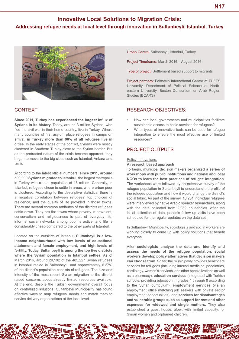
88
Innovative Local Solutions to Migration Crisis:Addressing refugee needs at local level through innovation in Sultanbeyli, Istanbul, Turkey
Urban Centre:Sultanbeyli,Istanbul,Turkey
Project timeframe: March 2016 – August 2016
type of project: Settlement based support to migrants
Project partners: Feinstein international Centre at tUFtS University, Department of Political Science at North-eastern University, Boston Consortium on Arab RegionStudies(BCARS)
ConteXt
Since 2011, Turkey has experienced the largest influx of Syrians in its history.Today,around3millionSyrians,whofledthecivilwarintheirhomecountry,liveinTurkey.Wheremany countries of first asylumplace refugees in camps onarrival, in Turkey more than 90% of all refugees live in cities.Intheearlystagesoftheconflict,SyriansweremostlyclusteredinSouthernTurkeyclosetotheSyrianborder.Butastheprotractednatureofthecrisisbecameapparent,theybegantomovetothebigcitiessuchasIstanbul,Ankaraandizmir.
Accordingtothelatestofficialnumbers,since 2011, around 500,000 Syrians migrated to Istanbul,thelargestmetropolisinTurkeywitha total populationof 15million.Generally, inIstanbul,refugeeschosetosettleinareas,whereurbanpooris clustered.According to the descriptive statistics, there isa negative correlation between refugees’ top choices of residence, and the quality of life provided in those towns.there are several common attributes of the districts refugees settledown.Theyarethetownswherepovertyisprevalent,conservatism and religiousness is part of everyday life,informal social networks among poor is active, and life isconsiderably cheap compared to the other parts of istanbul.
Located on the outskirts of Istanbul,Sultanbeyli is a low-income neighbourhood with low levels of educational attainment and female employment, and high levels of fertility. Today, Sultanbeyli is among the top five districts where the Syrian population in Istanbul settles. As of March2016,around20,192of the485,227Syrianrefugeesin Istanbul reside in Sultanbeyli, and approximately 6.27%of the district’s population consists of refugees. the size and intensity of the most recent Syrian migration to the district raised concerns about already limited resources available. At the end, despite the Turkish governments’ overall focuson centralized solutions, SultanbeyliMunicipality has foundeffective ways to map refugees’ needs and match them to service delivery organizations at the local level.
RESEARCHOBJECTIVES:
• How can local governments and municipalities facilitate sustainable access to basic services for refugees?
• What types of innovative tools can be used for refugee integration to ensure the most effective use of limited resources?
PRoJeCt oUtPUtS
Policy innovations:A research based approachTobegin,municipaldecisionmakersorganized a series of workshops with public institutions and national and local NGOs to learn the best practices of refugee integration. the workshops were followed by an extensive survey of the refugeepopulationinSultanbeylitounderstandtheprofileofthe refugee population and how it would change the district’s socialfabric.Aspartofthesurvey,10,281individualrefugeeswereinterviewedbynativeArabicspeakerresearchers,alongwith the data collected from 2,032 households. After theinitial collection of data, periodic followup visits havebeenscheduled for the regular updates on the data set.
InSultanbeyliMunicipality,sociologistsandsocialworkersareworkingcloselytocomeupwithpolicysolutionsthatbenefiteveryone.
After sociologists analyse the data and identify and assess the needs of the refugee population, social workers develop policy alternatives that decision makers can choose from.Sofar,themunicipalityprovideshealthcareservicesforrefugees(includinginternalmedicine,paediatrics,cardiology,women’sservices,andotherspecializationsaswellasapharmacy),education services (integrated with turkish schools,providingeducationingrades1through8accordingto the Syrian curriculum), employment services (via an employmentofficematching jobseekerswithprivatesectoremploymentopportunities),andservices for disadvantages and vulnerable groups such as support for rent and other expenses for widowed and single mothers. they also established a guest house, albeit with limited capacity, forSyrian women and orphaned children.
N17

89
Establishing an online platformthe municipality established a sophisticated software package, to capture and share the information on refugees systematically. In the software, each and everyrefugeefamilylivinginSultanbeylihasaprofilepagewiththeirdemographicinformation,andthelistoftheirneedsinorderof urgency. the aim of the system is affective coordination of services: to understand who is living in Sultanbeyli, identify their needs, and match them with NGOs and civil society organizations that can help meet those needs. the system captures the demographic information of refugee families (familysize,numberofkids,educationlevels,disabilitystatusetc.) along with their national registration numbers given by theDirectorateGeneralforMigrationManagement(DGMM),and uses the data to match the refugees in need with the service delivery organizations.
Cooperation and coordination among stakeholdersAs well as an online platform, the municipality has alsoestablished a physical space, a coordination centre for the refugees. the centre serves as a multipurpose complex: in the five-story building, refugees can benefit from widevarieties of services – from healthcare to vocational classes and psycho-social support- provided for them for free.
More importantly, the centre brings together all the national institutions and non-governmental organizations working in refugee assistance. the dGMM recently opened a branch in the 5th floor of the centre, so that refugees inSultanbeyli can complete their official registration withouttaking a long commute to the main registration bureau located attheotherendofIstanbul.Thecentrealsohasofficespacesfor the nGos and the civil society organizations operating in thedistrict, so that theycanallwork in coordinationandcollaborate on projects.
MAin CHALLenGeS
Restrictive legal frameworkDespite all the good work done by the municipality, it isimportant to note that Sultanbeyli Municipality operates under the Municipality Law (No: 5393), which sets governmentalrestrictions for limiting the municipalities’ ability to carry out direct service provision.
Ensuring justiceGiven the fact that the host population of Sultanbeyli is also sufferingfromimpoverishedlivingconditions,itisverycriticalfor the municipality to minimize the perceptions that the aid is disproportionately distributed between the host community and the refugees. ContACt
Formoreinformation,contact:ZeynepBalcioglu,[email protected]
N17

90
URBAN SETTLEMENTS WORKING GROUP
Copyright © 2022 FDOKUMEN